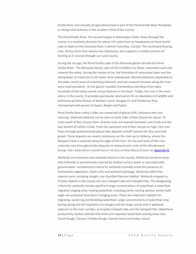
SECTION 1: Pend Oreille COUNTYpendoreilleco.org/.../2015/08/Section-1_Pend-Oreille-County.pdf · 18...
18
18 | Page Pend Oreille County S ECTION 1: Pend Oreille COUNTY D ESCRIPTION OF P END O REILLE C OUNTY Just as the Rocky Mountains plunge into the United States on their majestic march from British Columbia, a western range called the Selkirk Mountains, runs in close parallel down into Idaho and Washington. This rugged spur offers exposed segments of the North American Continent and the Kootenay Arc, tectonic plates that began colliding over a billion years ago, and provides exceptional year-round settings for a variety of recreational opportunities. This lesser range is home to bighorn sheep, elk, moose, deer, bear, cougar, bobcats, mountain caribou, and several large predatory birds such as bald eagles and osprey. Not far from where these Selkirk Mountains end, Pend Oreille County begins its association with the Pend Oreille River. Pend Oreille County is a relatively small county that looks like the number “1” set in the northeast corner of the State of Washington. Pend Oreille County is 66 miles long and 22 miles wide. British Columbia is across the international border to the north. Spokane County and the regional trade center, the City of Spokane, lie to the south. Idaho’s Bonner and Boundary counties form the eastern border, and Stevens County, Washington forms the western border. (For a map of Pend Oreille County, see Appendix A) Encompassing more than 1400 square miles, most of Pend Oreille County takes the form of a long, forested river valley. This area, known as the Okanogan Highlands, is unique since it is the only area in the country where plant and animal species from both the Rocky Mountain Region and the Cascade Mountain region can be found. Pend Oreille County ranks 25 th in size compared to Washington’s other 39 counties. There are fifty five lakes, 48 creeks and numerous wetlands dotting the natural meadows, the forested foothills and the mountains. There are seventy mountain peaks within our county borders, the highest of which is Gypsy Peak (7309’). Several of the peaks are the endpoints of interstate hiking trails and offer exceptional vistas into Idaho and Canada. Nestled within these forests and mountains are the Cusick Flats and other sections of the county with areas of specific agricultural land use. The county is predominantly a hilly to mountainous terrain on both sides of the Pend Oreille River as it flows north through the entire county but for the very southern 10 miles of the county. This southern area is headwaters of the Little Spokane River with the watershed divide running roughly east-west from Newport to the Sacheen Lake area. The southerly regions of the county, along with the Pend Oreille River lowlands, have historically been the easily accessible, low elevation areas and are best suited for human settlement. All of the major towns in the county are located along the Pend
Transcript of SECTION 1: Pend Oreille COUNTYpendoreilleco.org/.../2015/08/Section-1_Pend-Oreille-County.pdf · 18...

18 | P a g e P e n d O r e i l l e C o u n t y
SECTION 1: Pend Oreille COUNTY
DESCRIPTION OF PEND OREILLE COUNTY Just as the Rocky Mountains plunge into the United States on their majestic march from
British Columbia, a western range called the Selkirk Mountains, runs in close parallel
down into Idaho and Washington. This rugged spur offers exposed segments of the
North American Continent and the Kootenay Arc, tectonic plates that began colliding
over a billion years ago, and provides exceptional year-round settings for a variety of
recreational opportunities. This lesser range is home to bighorn sheep, elk, moose, deer,
bear, cougar, bobcats, mountain caribou, and several large predatory birds such as bald
eagles and osprey.
Not far from where these Selkirk Mountains end, Pend Oreille County begins its
association with the Pend Oreille River. Pend Oreille County is a relatively small county
that looks like the number “1” set in the northeast corner of the State of Washington.
Pend Oreille County is 66 miles long and 22 miles wide. British Columbia is across the
international border to the north. Spokane County and the regional trade center, the
City of Spokane, lie to the south. Idaho’s Bonner and Boundary counties form the
eastern border, and Stevens County, Washington forms the western border. (For a map
of Pend Oreille County, see Appendix A)
Encompassing more than 1400 square miles, most of Pend Oreille County takes the form
of a long, forested river valley. This area, known as the Okanogan Highlands, is unique
since it is the only area in the country where plant and animal species from both the
Rocky Mountain Region and the Cascade Mountain region can be found. Pend Oreille
County ranks 25th
in size compared to Washington’s other 39 counties. There are fifty
five lakes, 48 creeks and numerous wetlands dotting the natural meadows, the forested
foothills and the mountains. There are seventy mountain peaks within our county
borders, the highest of which is Gypsy Peak (7309’). Several of the peaks are the
endpoints of interstate hiking trails and offer exceptional vistas into Idaho and Canada.
Nestled within these forests and mountains are the Cusick Flats and other sections of
the county with areas of specific agricultural land use.
The county is predominantly a hilly to mountainous terrain on both sides of the Pend
Oreille River as it flows north through the entire county but for the very southern 10
miles of the county. This southern area is headwaters of the Little Spokane River with
the watershed divide running roughly east-west from Newport to the Sacheen Lake
area. The southerly regions of the county, along with the Pend Oreille River lowlands,
have historically been the easily accessible, low elevation areas and are best suited for
human settlement. All of the major towns in the county are located along the Pend
19 | P a g e P e n d O r e i l l e C o u n t y
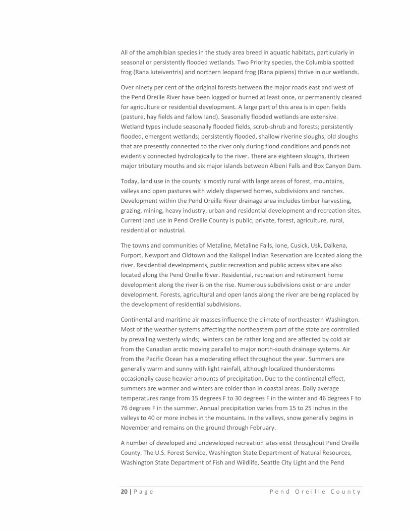
Oreille River and virtually all agricultural land is part of the Pend Oreille River floodplain
or along creek bottoms in the southern third of the county.
The Pend Oreille River, the second largest in Washington State, flows through the
county in a northerly direction for about 155 miles from its headwaters at Pend Oreille
Lake in Idaho to the Columbia River in British Columbia, Canada. The northward-flowing
river, fed by more than twenty-two tributaries, also supports a modest amount of
farming as it courses through our rural county.
During the ice age, the Pend Oreille Lobe of the Missoula glacier formed the Pend
Oreille River. The Missoula Glacier, part of the Cordillera Ice Sheet, extended south and
covered the valley. During the retreat of ice, the formation of recessional lakes and the
laying down of materials in still water were widespread. Alluvial sediments deposited on
the wide, nearly level of undulating lakebeds, and low outwash terraces along the river,
were most prevalent. As the glacier receded, tremendous overflows from lakes
hundreds of feet deep carved unique features in the basin. Today, the river is the main
artery in the county. It provides spectacular sanctuaries for an abundance of wildlife and
buttresses pristine forests of Western Larch, Douglas Fir and Ponderosa Pine,
interspersed with groves of Aspen, Maple and Poplar.
Pend Oreille River valley’s sides are comprised of glacial drift, colluvium and rock
outcrops. Dolomite bedrock can be seen on both sides of Box Canyon for about .75
miles south of Box Canyon Dam. Granite rocks are exposed between Lost Creek and the
east branch of LeClerc Creek. From the upstream end of Box Canyon to Tiger, the river
flows through predominantly glacial lake deposits of buff-colored silt, fine sand and
gravel. These deposits are nearly continuous on the river up to Dalkena, where the
Newport Fault is exposed along the edge of the river. On the east bank of the river,
materials vary from glacial lake deposits to metavolcanic rocks of the Windermere
Group. FOR A MORE SPECIFIC DESCRIPTION OF THE SOILS OF PEND OREILLE COUNTY SEE Appendix B.
Wetlands are extensive and relatively diverse in the county. Wetlands are those areas
intermittently or permanently covered by shallow surface water or saturated with
ground water. Jurisdictional criteria for wetlands normally entail the presence of
hydrophytic vegetation, hydric soils and wetland hydrology. Wetlands within the
riparian zone, including sloughs, are classified Riparian Habitat. Wetlands mapped as
Priority Habitat in the county are near Calispell Lake and Calispell Flats. The designating
criteria for wetlands include significant large concentrations of waterfowl; a waterfowl
migration staging area; nesting waterfowl, including cavity-nesting species; winter bald
eagle use and great blue Heron foraging areas. These are important habitats for
migrating, wintering and breeding waterfowl. Large concentrations of waterfowl stop
during spring and fall migrations on sloughs and the larger ponds and in wetlands
adjacent to the river corridor, principally Calispell Lake and the Calispell Flats. Waterfowl
productivity studies indicate that there are important waterfowl nesting areas near
Cusick Sough, Tacoma-Trimble Slough, Everett Island and Indian Island.
20 | P a g e P e n d O r e i l l e C o u n t y
All of the amphibian species in the study area breed in aquatic habitats, particularly in
seasonal or persistently flooded wetlands. Two Priority species, the Columbia spotted
frog (Rana luteiventris) and northern leopard frog (Rana pipiens) thrive in our wetlands.
Over ninety per cent of the original forests between the major roads east and west of
the Pend Oreille River have been logged or burned at least once, or permanently cleared
for agriculture or residential development. A large part of this area is in open fields
(pasture, hay fields and fallow land). Seasonally flooded wetlands are extensive.
Wetland types include seasonally flooded fields, scrub-shrub and forests; persistently
flooded, emergent wetlands; persistently flooded, shallow riverine sloughs; old sloughs
that are presently connected to the river only during flood conditions and ponds not
evidently connected hydrologically to the river. There are eighteen sloughs, thirteen
major tributary mouths and six major islands between Albeni Falls and Box Canyon Dam.
Today, land use in the county is mostly rural with large areas of forest, mountains,
valleys and open pastures with widely dispersed homes, subdivisions and ranches.
Development within the Pend Oreille River drainage area includes timber harvesting,
grazing, mining, heavy industry, urban and residential development and recreation sites.
Current land use in Pend Oreille County is public, private, forest, agriculture, rural,
residential or industrial.
The towns and communities of Metaline, Metaline Falls, Ione, Cusick, Usk, Dalkena,
Furport, Newport and Oldtown and the Kalispel Indian Reservation are located along the
river. Residential developments, public recreation and public access sites are also
located along the Pend Oreille River. Residential, recreation and retirement home
development along the river is on the rise. Numerous subdivisions exist or are under
development. Forests, agricultural and open lands along the river are being replaced by
the development of residential subdivisions.
Continental and maritime air masses influence the climate of northeastern Washington.
Most of the weather systems affecting the northeastern part of the state are controlled
by prevailing westerly winds; winters can be rather long and are affected by cold air
from the Canadian arctic moving parallel to major north-south drainage systems. Air
from the Pacific Ocean has a moderating effect throughout the year. Summers are
generally warm and sunny with light rainfall, although localized thunderstorms
occasionally cause heavier amounts of precipitation. Due to the continental effect,
summers are warmer and winters are colder than in coastal areas. Daily average
temperatures range from 15 degrees F to 30 degrees F in the winter and 46 degrees F to
76 degrees F in the summer. Annual precipitation varies from 15 to 25 inches in the
valleys to 40 or more inches in the mountains. In the valleys, snow generally begins in
November and remains on the ground through February.
A number of developed and undeveloped recreation sites exist throughout Pend Oreille
County. The U.S. Forest Service, Washington State Department of Natural Resources,
Washington State Department of Fish and Wildlife, Seattle City Light and the Pend

21 | P a g e P e n d O r e i l l e C o u n t y
Oreille Public Utility (PUD), have created recreation sites, as have a handful of private
enterprises. Approximately 60 percent of Pend Oreille County is in public ownership.
Pend Oreille County residents and visitors have a variety of outdoor nature
opportunities and recreation use in the mountains through all seasons of the year
because of public land. In the past decade, the county, especially the southern part, has
experienced continued population growth, becoming a bedroom community to the
nearby City of Spokane. With those changes, the Little Spokane River Watershed and
the Pend Oreille River corridor, prominently private lands, have become more urban
and suburban in nature, reducing opportunity for public recreation areas, open space
and wildlife migration corridors.
Federal 58.1%
State 3.7%
Tribal 1.6%
Local Gov't/other 2.1%
Private 34%
Figure 1: Land Ownership in Pend Oreille County

22 | P a g e P e n d O r e i l l e C o u n t y
HISTORY OF PEND OREILLE COUNTY
Pend Oreille County, lying in the extreme northeast corner of Washington, is rich in
scenic beauty, natural resources, and dispersed recreational opportunities. The Pend
Oreille River (pronounced “pond o ray”), flows north through almost the entire length of
the county, and has always been noteworthy for its beauty and usefulness. The first
Europeans known to have canoed down the Pend Oreille River were members of David
Thompsons’s party in 1810.The “Great Mapmaker” and his band of explorers halted
their excursion when they reached the sheer cliffs and raging waters of Metaline Falls.
Well before 1810, however, Kalispel and other Native Americans fished all along the
Pend Oreille River, and traveled its coursing flows with great skill. Their ancestors
enjoyed fishing and river travel in what is now Pend Oreille County one thousand years
before the intrepid explorers paddling with David Thompson even put an oar in the
water.
Long before the Poles, Germans and Norwegians toppled trees, before the fur traders
and the “Black Robes,” Salish-speaking tribes lived in harmony with the treasures of the
Pend Oreille Basin. Change came from the east and cultures one with the land fell victim
to the musket and blade. Soon there were plows, draft horses, and the dreams of
pilgrims and immigrants coming for this land and its uncommon diversity of natural
wonders.
Although white settlement was well underway in the Inland Northwest by 1885, it was
just beginning in Pend Oreille River Basin. Many of the first trailblazers to arrive in the
region of the Pend Oreille built homes and worked farms in the Calispell Valley. This
area was attractive to cattlemen because it held the finest natural meadows in the
territory. By late 1888, the Calispell Valley was home to about 200 white settlers, 1000
head of stock, a cheese factory, a sawmill, two stores, a post office and a weekly mail
route. By 1891, a number of homesteads flourished near the present site of Newport. In
1889 Washington became a state.
The Great Northern Railroad reached Newport in 1892, and the following year the
railroad built its main line through Newport to the Puget Sound. In 1907, the Idaho &
Washington Northern Railroad came into the Pend Oreille Basin. With the coming of the
railroad, the down-river country to the north developed rapidly. From 1896 to 1910, a
host of pioneers came to the Pend Oreille Valley because Newport was a convenient
location for transfers between the steamboats on the Pend Oreille River and the
railroad. After the settlers began to arrive, the occupational mainstays of the county
were logging, mining, farming and other natural resource related-industries. All seemed
to be going well until the Great Fire in 1910. Lives were lost. Hundreds were without
homes. In eight hours, the inferno scorched nearly one hundred sections of land, and, if
valued at today’s prices, caused the loss of over fifty million dollars’ worth of timber.
However, the undaunted and industrious residents rebuilt their communities, and in
June of 1911, Pend Oreille County became a county in its own right. There were fires in

23 | P a g e P e n d O r e i l l e C o u n t y
1953 and 1973 and devastating floods in 1948 and 1997. The last of the once booming
lumber mills closed in 1960 leaving only thirty dairy farms providing most of the income
to the county. As milk supports fell through the floor, the number of dairies dwindled
and the last dairy operation in the county closed in 1996. Nonetheless, in the 1980s,
timber-related industries returned in the form of a whole log chip mill and the Ponderay
Newsprint Company. The population of Pend Oreille County grew fifty percent in the
period from 1970 to 1991. Population increases were reduced somewhat by out
migration, but that trend reversed in the 1990s. In the late 1990s, due to economic
downturn and welfare reform, growth in the County slowed and has been climbing, but
at a more gradual rate.
Towns and communities along the west side of the Pend Oreille River, from the
Canadian border to the Albeni Falls Dam, include Metaline Falls, Metaline, Ione, Tiger,
Cusick, Usk, Dalkena, Newport and Oldtown. The community of Furport is located on the
east side of the river. All of these towns have populations of less than 500 with the
exception of Newport, which has a population of 2140. The second largest populated
town is Ione, with a population of 445. The population in Pend Oreille County is 13,100
with seventy two percent of the population living in unincorporated areas.
The current population of Metaline Falls is 240. The community suffered financial
hardships after the closing of the primary employers of the town; the mines in 1975 and
the cement plant in 1990. The mine has since reopened but only temporarily. The
town’s scenic beauty and nearby U.S. Forest Service (USFS) campgrounds attract many
visitors to the area. The Cutter Theater is the focal point of the community, drawing
people to the region. The historic Washington Hotel still operates and the town has two
restaurants, a bakery and an art gallery.
The town of Metaline currently has a population of around 175 with about 70 homes,
two restaurants, post office, gas station/convenience store and a scenic town park. In
1995, the town of Ione had a population of over 500 residents. After the town’s sawmill,
the primary employer, closed in 1995, the population decreased. Several business and
services are still located in the downtown area of Ione and a scenic park is located along
the Pend Oreille River. Several USFS campgrounds and other recreational activities
attract people to the area.
As mentioned earlier, Ione is the second largest town in Pend Oreille County. Its location
right on the Pend Oreille River surrounded by Forest Service make it a scenic destination
point popular with outdoor recreationists. Ione has a grocery store, a newer community
building and library, a large community riverfront park and a fairly good-sized
downtown business area. It also hosts the starting point of the popular Lion’s Club train
rides that take place throughout the summer and fall.
Little remains of the community of Tiger, south of Ione. The area is sparsely populated,
with a general store and a real estate company. The old Tiger Store is now the Tiger
Historical Center, open during the summer only. Nothing remains of the former
community of Lost Creek along the Pend Oreille River, and the Blueslide area is now

24 | P a g e P e n d O r e i l l e C o u n t y
occupied by Blue Slide Resort. A boat launch and several homes occupy the site of the
old town of Ruby. A David Thompson memorial marker and viewpoint are located about
one mile north of Ruby.
The former site of the settlement of Jared was purchased by the Fourth Memorial
Church in Spokane and is now the home of the Riverview Bible Conference, which is a
retreat and conference facility for the church. The buildings that once housed the tavern
and restaurant still exist at the site, along with the original motel units and a number of
new buildings.
Cusick has a population of about 210. Cusick has many historic structures, evidence of
the former booming community. In the mid-1980s, new sidewalks, and a community
center including a library and city hall were built. A new boat launch facility was built in
1997. The Pend Oreille County Fairgrounds are located west of Cusick.
Usk has several businesses including the Inn at Usk (the historic Usk Hotel), the Usk Bar
and Grill and Keo’s Corner, which has been in business since 1934. Keo’s Corner offers a
boat launch, camping, RV hookups and a general store. The Ponderay Newsprint
Company, just south of Usk, began operating in 1989 and is the largest private employer
in Pend Oreille County. The wooden pilings, which were built in the river at Usk in the
early 1920s are historic remnants of past logging and sawmill operations in the area. The
Kalispel Tribal offices are also maintained on the Kalispel Indian Reservation just north
of Usk on the east side of the river. The Kalispel Indian Reservation is also home to a
large Pow-Wow Grounds and the beautiful, newly built Camas Wellness Center, which
boasts indoor recreational and wellness facilities (exercise equipment, weight room,
gymnasium, several swimming pools, meeting rooms and medical and dental offices).
The once-thriving sawmill town of Dalkena now consists of a church, fire station, a few
homes west of the railroad tracks, and scattered farms along the Pend Oreille River. The
old horse barn and remains of the foundations of the burner, planer and the well house
by the river are the only remains of the former lumber mill in Dalkena. The community
church along the highway was originally a bunkhouse with a saloon below.
The quiet little community of Furport has several homes situated on both sides of
LeClerc Road and a number of farms in the vicinity. The community also hosts a
volunteer fire district and the Skookum Grange Hall.
Newport has remained the most stable community in Pend Oreille County. Businesses
have come and gone, but the population within the incorporated city limits of nearly
2200 has gradually grown since 1910’s. Newport has a variety of businesses and
services, many of which have been in the community for 50 years or more. Newport is
the County Seat and home to the Hall of Justice, the County Courthouse, Sheriff’s Office
and Jail. Newport has the County’s only hospital, nursing home, assisted living center
and funeral home. THE NEWPORT MINER newspaper started in Newport in 1897. The
Great Northern depot, built in 1920, is now the office of Stimson Lumber Company. The
Idaho and Washington Northern Railroad (I&WNRR) depot, built in 1907, now houses
the Pend Oreille County Historical Museum.

25 | P a g e P e n d O r e i l l e C o u n t y
Oldtown’s (Idaho) population is approximately 180 residents. The population rises to
about 500 when one includes the nearby, unincorporated residential area. The town has
about 30 small businesses and a City Hall. The closure of the Crown Pacific Mill in 1996
along with several other mills in the area, has depressed Oldtown’s economy. Tri-Pro
Cedar bought the Crown Pacific Mill around the year 2000.
Between the towns, on level land in the river valley, are hay meadows and pastures.
There are many private residential subdivisions along the Pend Oreille River as well as
the lakeshores in Pend Oreille County. 4600 acres of Kalispel Indian Reservation lands
stretch for 10 miles along the east side of the Pend Oreille River. These lands support
isolated residential development, grazing, some timber harvesting, hay production and
collection of the camas plant.
North of the Kalispel Indian Reservation, along the east side of the river, is land known
as the Flying Goose Ranch. Bonneville Power Administration purchased the Flying Goose
Ranch in 1992 for transfer to the Tribe. The Tribe is implementing a 10-year restoration
plan to reproduce lost riparian forest and wetlands, and enhance existing uplands. A
small section of Reservation land is located on the west side of the river just north of
Cusick. This area supports small light-industrial development; a new rest stop/visitor
center has been built, future plans include a café inside the visitor center building.
The current economy of Pend Oreille County depends upon a variety of economic
sectors including forest products, agriculture, tourism, and government agencies.
Ponderay Newsprint and Ponderay Valley Fiber in Usk are the larger, private employers
in Pend Oreille County. The main crops raised on agricultural lands along the river are
small grains and hay. Recent downturns in the economy and timber prices have greatly
influenced the population of the County.
PE N D OR E I L L E R I V E R A N D US K B R I D G E

26 | P a g e P e n d O r e i l l e C o u n t y
“Pend Oreille
County is the
8th fastest
growing
county in the
State of
Washington.”
Figure 2: Total Population and Annual
Growth Rate
THE PEOPLE OF PEND OREILLE COUNTY A large percentage of the following information was taken directly from the
Northeastern Washington Trends website. This web site produces and compiles
information for the Tri-County area which includes Pend Oreille County, Stevens County
and Ferry County; three counties that have very similar economies and natural
resources. Whenever possible, information specific to Pend Oreille County is referenced
in this plan. In some instances, however, the only information available pertains to all
three counties in the Tri-County area and this is noted in the text.
POPULATION GROWTH Population growth reveals much about a community. Popular communities experience
high rates of growth, bringing wanted economic benefits. In many cases, however,
growth can also lead to concerns over traffic, the environment, and essential services
such as education. Locations experiencing slow rates of population growth, or even
depopulation, may face fiscal difficulties and a downward
spiral of further population loss, especially of their youth. In
2011 the population of Pend Oreille County was 13,100. Since
1981, the county has grown by 4,424 people. The
State of Washington had a population of 6,817,770 in
2012 and has grown by 2,588,492 people (61%) since
1981. Over the entire time period measured by this
indicator, Pend Oreille County has experienced wider
fluctuations in its growth rate than the State of
Washington. In 2012, Pend Oreille County grew at a
faster rate than the State of Washington (.77) and
faster than Spokane (.62). It is the 8th
fastest growing
county in the State.
RESIDUAL NET MIGRATION AND RESIDUAL NET MIGRATION
AS A SHARE OF TOTAL POPULATION There is more to the Pend Oreille County population than a simple tally of its numbers.
Net migration offers a deeper look at the number of residents by examining the flow of
people who have moved into or out of the county. To understand migration, one must
first understand its calculation. Population change is the amount by which the
population grows or shrinks from one year to the next. Natural increase is calculated by
subtracting the number of deaths from the number of births.

27 | P a g e P e n d O r e i l l e C o u n t y
Figure 3: Residual Net Migration and Residual Net
Migration as a Share of Total Population
So, residual net migration is essentially the number left over when the natural increase
is removed. In other words, residual net migration = (population in latter year -
population in earlier year) - (births - deaths). In a sense, net migration is a measure of
the popularity of a community or region. In rapidly growing communities, net migration
contributes more to population growth than the natural increase component. In
communities losing population, it will likely be negative. The trend of net migration is an
important one for Pend Oreille County because it helps businesses, planners,
developers, and local leaders have a deeper
understanding of the composition of their county's
population. Often, population growth stemming from
in-migration will bring different demands for goods
and services than that from natural increase. Take,
for example, public education. Population growth due
to natural increase will ultimately bring a demand for
public school seats. The same demand may not
happen with population growth from net migration.
Knowing this composition should give community
leaders a better tool in predicting and meeting the
community's needs. This indicator measures
population gain or loss due to migration in and out of
Pend Oreille County. WA State is offered as a
benchmark. Data come from Washington's Office of
Financial Management.
Over time, residual net migration as a share of total population for Pend Oreille County
area and Washington have not followed the same trend. In 2011, the share of residual
net migration for Pend Oreille County equaled 0.19%, a 80% decrease from 1980. The
highest level of residual net migration occurred in 1991, at 5.9%.
In 2011, Washington's level of residual net migration as a share of total population
equaled .07%, an 97% decrease from 1980's value of 2.8%. 1980 also had the highest
level of residual net migration for the 30 year time period.
POPULATION OF AGE GROUPS Age distribution can indicate a lot about a population, such as birth and death rates,
emigration or immigration, and how developed the area is. Population size distributed
by age group also offers more precise information about these three counties than does
the median age of the population. This trend presents four age groups: 0-17, 18-34, 35-
64, and 65 and up. Sometimes, these data are presented in what is known as a
population pyramid.

28 | P a g e P e n d O r e i l l e C o u n t y
Figure 4: Share of Population by Age
Groups
Different age groups express different preferences about goods and
services that are important to the private sector. The size of different
age groups, especially of the young and the old, holds
consequences for government programs. The size of the young
adult population (18-34) is viewed by many as important for the
cultural life and innovation of a community. Since the size of
the age groups is largely predictable, a trend analysis of age
cohorts carries great interest for many parties.
In 2011, the largest age group in Pend Oreille County was in the
35-64 category, with about 45.6% of the population. The share of
this group has increased from 32.2% in 1980. The second largest
share is youth (0-17), at 21.3%, down from 32.3% since 1980.
The third largest share consists of those aged 65+, at 19.5%. The share of this group
has increased since 1980, when it stood at 12.1%. The smallest group consists of those
aged 18-34, with 13.6% of the 2011 population.
The age divisions of Pend Oreille County show significant departures from those of the
state. However, the county's youth category has been fairly close to Washington's. The
65 and over age group in the county is about 6 percentage points larger of a share than
in the state. The 18-34 age category is about 10 percentage points smaller in the county
than in the state, and the 35-64 category is 5 percentage points larger in the county
than in the state.
POPULATION PROJECTIONS
According to the Washington State Office of Financial Management in their 2012
projections the population of Pend Oreille County will increase by the following
numbers:
Table 1 Population Projections
Period Change Births Deaths Migration Total
2010-2015 288 674 666 280 13,289 2015-2020 403 740 804 467 13,692 2020-2025 285 779 935 441 13,977 2025-2030 152 780 1065 437 14,129 2030-2035 200 779 1187 428 14,149 2035-2040 -33 791 1242 418 14,116

29 | P a g e P e n d O r e i l l e C o u n t y
Figure 5: Per Capita Personal Income
PER CAPITA PERSONAL INCOME Per capita personal income represents all sources of income - wage & salary,
investments & rents, proprietors' income, pensions, transfer payments and other
sources - divided by total population. The total per capita
personal income reflected here represents income
before the payment of income, estate, and gift taxes. Per
capita personal income serves as a key measure of
economic success of a region. As an average, however, it
does not measure the distribution of income among the
population.
The private sector uses this metric in firm relocation,
capital allocation, and real estate decisions. Additionally,
personal income can be an indicator of consumer
demand, and can represent consumer purchasing power.
Rising per capita personal income can signal an improving
economy. Government agencies often use the measure to establish the need for certain
programs or grants. Both Washington State and the US serve as benchmarks for this
measure. Data come from the Washington Regional Economic Analysis Project and are
expressed in nominal terms. That is, no attempt is made to adjust for inflation.
In nominal terms, per capita personal income Pend Oreille County has grown by 171%,
rising from $10,544 in 1987 to $28,559 in 2011. Per capita personal income at the state
level has increased 172% rising from $16,090 in 1987, to $43,787 in 2011.
EDUCATION LEVELS A workforce and citizenry that has training and education beyond high school is
essential for the economic progress and civic life of a community. The education
provided by either two- or four-year institutions helps secure a workforce for local firms
to compete globally. Instruction at the higher education level also confers added
earning power to those who receive it, especially to those who go on to earn degrees.
The additional knowledge acquired during this process further enriches public life by
giving greater analytical tools and specialized knowledge. This participation rate is
defined as those residents of Ferry, Pend Oreille, and Stevens Counties who are
attending either two- or four-year public institutions, regardless of where in the state of
Washington the schools are located. It is expressed as a ratio of those residents of the
population ages 17 and over. The measure is shown for the three counties combined
(Tri-County) as well as separately for each individual county.
30 | P a g e P e n d O r e i l l e C o u n t y
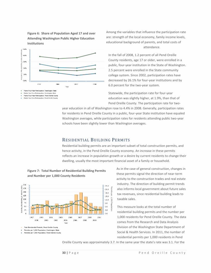
Figure 6: Share of Population Aged 17 and over
Attending Washington Public Higher Education
Institutions
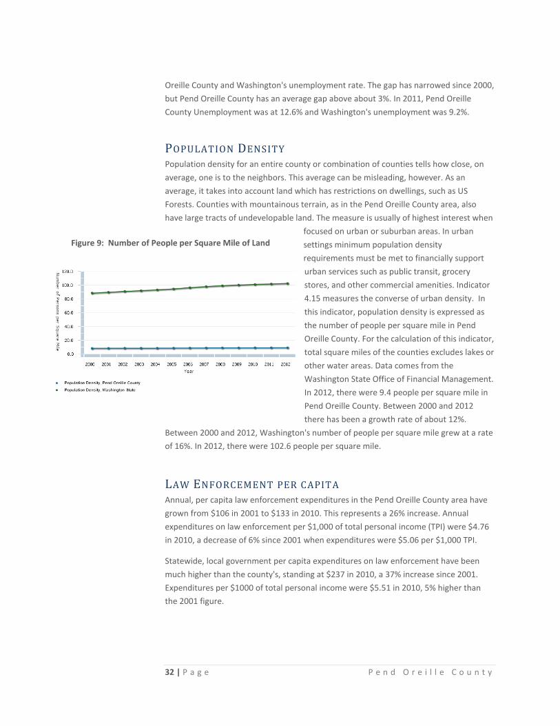
Figure 7: Total Number of Residential Building Permits
and Number per 1,000 County Residents
Among the variables that influence the participation rate
are: strength of the local economy, family income levels,
educational background of parents, and total costs of
attendance.
In the fall of 2008, 1.2 percent of all Pend Oreille
County residents, age 17 or older, were enrolled in a
public, four-year institution in the State of Washington.
2.5 percent were enrolled in the State community
college system. Since 2002, participation rates have
decreased by 26.1% for four-year institutions and by
6.0 percent for the two-year system.
Statewide, the participation rate for four-year
education was slightly higher, at 1.9%, than that of
Pend Oreille County. The participation rate for two-
year education in all of Washington rose to 4.4% in 2008. Generally, participation rates
for residents in Pend Oreille County in a public, four-year State institution have equaled
Washington averages, while participation rates for residents attending public two-year
schools have been slightly lower than Washington averages.
RESIDENTIAL BUILDING PERMITS Residential building permits are an important subset of total construction permits, and
hence activity, in the Pend Oreille County economy. An increase in these permits
reflects an increase in population growth or a desire by current residents to change their
dwelling, usually the most important financial asset of a family or household.
As in the case of general construction, changes in
these permits signal the direction of near-term
activity to the construction trades and real estate
industry. The direction of building permit trends
also informs local government about future sales
tax revenues, since residential building leads to
taxable sales.
This measure looks at the total number of
residential building permits and the number per
1,000 residents for Pend Oreille County. The data
comes from the Research and Data Analysis
Division of the Washington State Department of
Social & Health Services. In 2011, the number of
residential permits per 1,000 residents in Pend
Oreille County was approximately 3.7. In the same year the state's rate was 3.1. For the

31 | P a g e P e n d O r e i l l e C o u n t y
Figure 8: Unemployment Rate
state and county, the rates represent a decline of 58% and 68%, respectively, since
2007. In absolute terms, 48 building permits were issued in 2011; a decrease of 67%
from the high of 147 in 2007.
UNEMPLOYMENT RATE The unemployment rate measures the portion of the population that currently does not
have a job but are actively seeking work in Pend Oreille County. As one of the two
components of the "misery" index, the unemployment rate measures a local economy's
success (or failure) in matching jobs with the available workforce. (Inflation is the other
component of the so-called "misery" index.) Contrary to popular belief, the
unemployment rate is not calculated using unemployment insurance (UI) claims. There
are several reasons for that, most importantly because UI claims only count those who
filed for claims and who are eligible to do so. It leaves out those who are unemployed
but do not bother to file for UI or who are still unemployed
after their UI runs out. Rather, the government uses
information collected in the Current Population Survey
(CPS), a monthly sample survey conducted by the US
Census Bureau consisting of in-home and phone
interviews of roughly 60,000 households across the
country. The CPS has been conducted by the US
government every month since 1940.
The CPS's sole purpose is to glean employment
information that is used to determine the share of the
population that fall into one of three categories:
employed, unemployed, and not in the labor force. Those
who have a job are employed. Those who do not have a
job and are available and actively looking for work are
considered to be unemployed. Those who do not fall into either of those two categories
are not in the labor force (an example would be a retired individual or a homemaker, i.e.
people not looking for work). Active duty military and institutionalized individuals are
not included in these categories.
This indicator looks at the share of the population in Pend Oreille County who are
unemployed as calculated by the CPS and provided by the Washington State
Employment Security Department. The indicator is expressed as an annual average.
Economists have generally regarded a 4-5% unemployment rate as one that reflects a
fully employed workforce characterized by moderate wage growth that is matching
gains in labor productivity. In light of the recent recession, some economists think that
this "natural" rate of employment now lies in the 5-6% range.
The paths of Pend Oreille County and Washington's Unemployment have closely
followed over time. From 1990-1999, there was a large gap (above 8-5%) between Pend
32 | P a g e P e n d O r e i l l e C o u n t y
Figure 9: Number of People per Square Mile of Land
Oreille County and Washington's unemployment rate. The gap has narrowed since 2000,
but Pend Oreille County has an average gap above about 3%. In 2011, Pend Oreille
County Unemployment was at 12.6% and Washington's unemployment was 9.2%.
POPULATION DENSITY Population density for an entire county or combination of counties tells how close, on
average, one is to the neighbors. This average can be misleading, however. As an
average, it takes into account land which has restrictions on dwellings, such as US
Forests. Counties with mountainous terrain, as in the Pend Oreille County area, also
have large tracts of undevelopable land. The measure is usually of highest interest when
focused on urban or suburban areas. In urban
settings minimum population density
requirements must be met to financially support
urban services such as public transit, grocery
stores, and other commercial amenities. Indicator
4.15 measures the converse of urban density. In
this indicator, population density is expressed as
the number of people per square mile in Pend
Oreille County. For the calculation of this indicator,
total square miles of the counties excludes lakes or
other water areas. Data comes from the
Washington State Office of Financial Management.
In 2012, there were 9.4 people per square mile in
Pend Oreille County. Between 2000 and 2012
there has been a growth rate of about 12%.
Between 2000 and 2012, Washington's number of people per square mile grew at a rate
of 16%. In 2012, there were 102.6 people per square mile.
LAW ENFORCEMENT PER CAPIT A Annual, per capita law enforcement expenditures in the Pend Oreille County area have
grown from $106 in 2001 to $133 in 2010. This represents a 26% increase. Annual
expenditures on law enforcement per $1,000 of total personal income (TPI) were $4.76
in 2010, a decrease of 6% since 2001 when expenditures were $5.06 per $1,000 TPI.
Statewide, local government per capita expenditures on law enforcement have been
much higher than the county's, standing at $237 in 2010, a 37% increase since 2001.
Expenditures per $1000 of total personal income were $5.51 in 2010, 5% higher than
the 2001 figure.

33 | P a g e P e n d O r e i l l e C o u n t y
Figure 10: Local Government Expenditures for Law
Enforcement per Capita and per $1000 of Total Personal
Income
Pend Oreille County spent $186 per capita on law
enforcement in 2011. The increase from 2001 was
63%. Pend Oreille County spent $6.13 per $1,000 in
2010, an increase of 16% since 2001.
Statewide, local government per capita
expenditures on law enforcement have been
much higher than the county's, standing at
$229 in 2011, a 37% increase since 2001.
Expenditures per $1,000 of total personal
income were $5.16 in 2011, 2% higher than
F A N L A K E

34 | P a g e P e n d O r e i l l e C o u n t y
CONCLUSIONS
Pend Oreille County has an incredibly rich and diverse store of scenic
natural resources that make it a wonderful place to live and a popular
destination spot for tourists. It has a high percentage of rivers, lakes and
wetlands as well as towering forests and abundant wildlife which give it
great potential for attracting additional visitors and residents. Planning for
parks and recreation should take full advantage of these assets.
Because of its location in relation to surrounding regional attractions many
visitors drive through Pend Oreille County on their travels. This is another
opportunity to attract tourist’s attention and encourage them to stay for a
few additional days or even eventually locate their residences to our
County.
The climate of Pend Oreille County provides beautiful four season
opportunities for recreation. More winter recreation opportunities should
be promoted.
Soils of Pend Oreille County are extremely erodible and planning for
outdoor recreation areas and activities should keep this in mind. Costs for
erosion control and repairs for resource damage may be higher than
average.
There are rich historical and cultural resources in the County that also
provide basis for interpretive and outdoor education opportunities. Non-
consumptive wildlife viewing and wildlife photography are fast growing
areas of interest.
Another popular activity is visiting historical sites. This county, and more
specifically, Pend Oreille County Park, with its old growth forest would be
an excellent location for a turn of the century logging camp living history
facility.
Pend Oreille County is the 8th
fastest growing county in the State of
Washington and this population growth is predicted to continue. Planning
efforts should be made to accommodate this increasing population. With
growth come problems of traffic, over-crowding and resource damage and
these need to be factored into maintenance and replacement costs.
Spokane, Spokane Valley, Post Falls and Coeur d’Alene are also growing
and as recreation areas to the south become more crowded people will be
driving further north into Pend Oreille County for a more natural and
uncrowded recreational experience.
The average household income levels are relatively low and poverty levels
of the county are relatively high. Proper parks and recreation planning will
attract the tourism dollar, entice new residents, improve the regional
economy and provide jobs for local residents.
35 | P a g e P e n d O r e i l l e C o u n t y
Sixty-five percent of the population of Pend Oreille County consists of
people over 35. Many people are moving to the County to retire.
Activities for seniors and facilities for disabled should play a big part in
planning for parks and recreational opportunities in the County.
Population density in Pend Oreille County is low. Many people live in
pristine, rural settings and have recreational opportunities on their own
properties (hunting, fishing, hiking, etc.) Parks and Recreation planning
must provide unique recreation opportunities and events that provide
social interaction.
The numbers of young people are low and student numbers in local
schools are steadily declining. Most young people leave the county to find
jobs as soon as they graduate from high school. As the economy of the
county improves and more jobs are available, this part of the population
will be able to stay within the county and not be forced to leave to follow
the jobs.
The crime rate in Pend Oreille County is on the rise. Planning should
include adequate monies for enforcement, protection of facilities,
maintenance and surveillance.
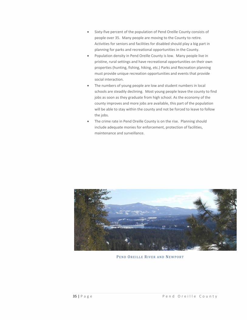
PE N D OR E I L L E R I V E R A N D N E W P O R T