SeaDAS SeaWiFS Data Analysis System e-mail:[email protected].
13
SeaDAS SeaWiFS Data Analysis System http:// seadas.gsfc.nasa.gov/
-
Upload
jason-allen-fox -
Category
Documents
-
view
225 -
download
0
Transcript of SeaDAS SeaWiFS Data Analysis System e-mail:[email protected].

Sea
DA
SSeaDAS provides user-friendly software for:
• processing• displaying• analyzing data
Data sets supported:• SeaWiFS• OCTS• MOS• CZCS• MODIS• OSMI• AVHRR SST data• SeaWiFS-format OZONE and MET ancillary data
Introduction to SeaDAS

Sea
DA
SSystem Configuration
Platforms• Silicon Graphics• SUN UltraSPARC• PC
Operating Systems• IRIX 6.5• Solaris 2.6 - 2.8• Red Hat Linux 7.0 - 7.3
Suggested Hardware• 192 MB memory• 9 GB hard drive
Sea
DA
SSoftware Configuration
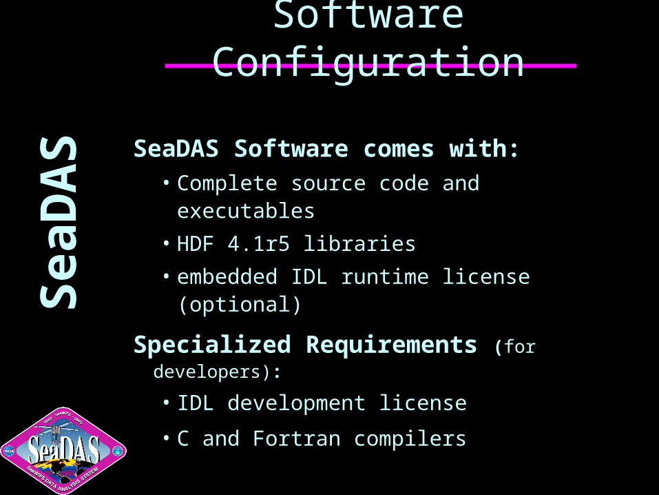
SeaDAS Software comes with:• Complete source code and executables
• HDF 4.1r5 libraries
• embedded IDL runtime license (optional)
Specialized Requirements (for developers):
• IDL development license
• C and Fortran compilers

Sea
DA
SSeaDAS Main Menu
TutorialsProgramsCommand modeFAQ
SeaWiFS l1agen l1bgen msl12, 0 l3bin smigen browse bl1map bl2map bl3map l1atol0 coccobloomCZCS l1aczcs l2czcs exczcs ring glint coccobloomOCTS l1bocts msl12,1MOS msl12,2
seadispregisterl2chksubscenergczcsexczcschkczcsring
Overviewancqc
sddemosdwfontsdqfontsetlutxcd

Sea
DA
SDisplaying Data
Program: Seadisp
Tutorials SeaWiFSSeaWiFS L0MODIS OCTS/NASDAOCTS/SeaDASCZCS/SeaDASCZCS/DAACCZCS/SEAPAKMOSAVHRR SSTSeaDAS MappedHDFFlat FileGIF & TIFFTrue ColorBand List
LoopingProjectionSpin L3 BinnedScatter PlotBathymetryMultiple BandsBand ShiftArithmetic BandUser DefinedOutputL2 FlagsCopy GraphicsModify ColorsPaint ColorColor LUT
Change Color Table

Sea
DA
SMODIS Display Support
• Geolocation
• Level-1A
• Level-1B
• Level-2• OCL2, OCL2A, OCL2B, 28L2
• Level-3• Binned• Mapped

Sea
DA
SLoading Data
Interactive Mode
• Widget-based• Displays a number of windows simultaneously

Sea
DA
SDisplay Features
Coastline and Zoom
RescaleRoamZoomSpreadsheetRead & ProfileRlineGridCoastlineLandmaskVector OverlayContourHistogramShip TrackColor BarAnnotateGraphicsColor LUTOutputRefresh
RescaleColor BarGridCoastlineLandmaskGraphics

Sea
DA
SDisplaying MODIS Data

Sea
DA
SDisplaying MODIS Flags
Sea
DA
SDownload and Support
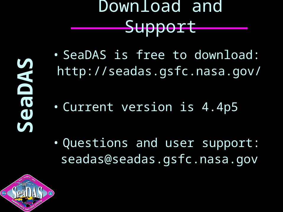
• SeaDAS is free to download:http://seadas.gsfc.nasa.gov/
• Current version is 4.4p5
• Questions and user support:[email protected]

Sea
DA
SThe 2003 NASA Software of the Year
The SeaWiFS Data Analysis System
by Gene Carl Feldman, Charles McClain, GSFC, Karen Baith, consultant, Mark Reubens, Xiao-Long Wang, Gary Fu, Bryan Franz, SAIC
"The SeaWiFS Data Analysis System (SeaDAS) maximizes NASA's investment in Earth remote sensing, delivering data to the user community in a timely manner with the tools to consistently and accurately manipulate the data. SeaDAS provides data display, processing, and analysis support. SeaDAS was designed to identically reproduce all the standard products, including levels 1, 2, and 3 (raw telemetry counts to level 3 global mapped geophysical products), generated by the SeaWiFS Project Office (SPO), while providing users, through open source development, the flexibility of customized processing by adjusting processing parameters or selecting alternative processing methods. SeaDAS is in use at over 500 sites in over 50 nations."