scenic byway part 2
67
GUIDE TO THE SHAWANGUNK MOUNTAINS SCENIC BYWAY AND REGION
Transcript of scenic byway part 2
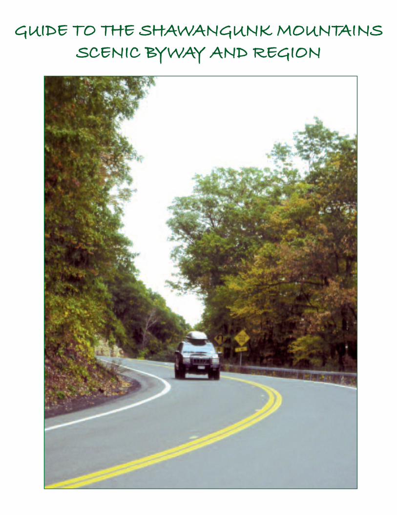
GUIDE TO THE SHAWANGUNK MOUNTAINSSCENIC BYWAY AND REGION
G-2
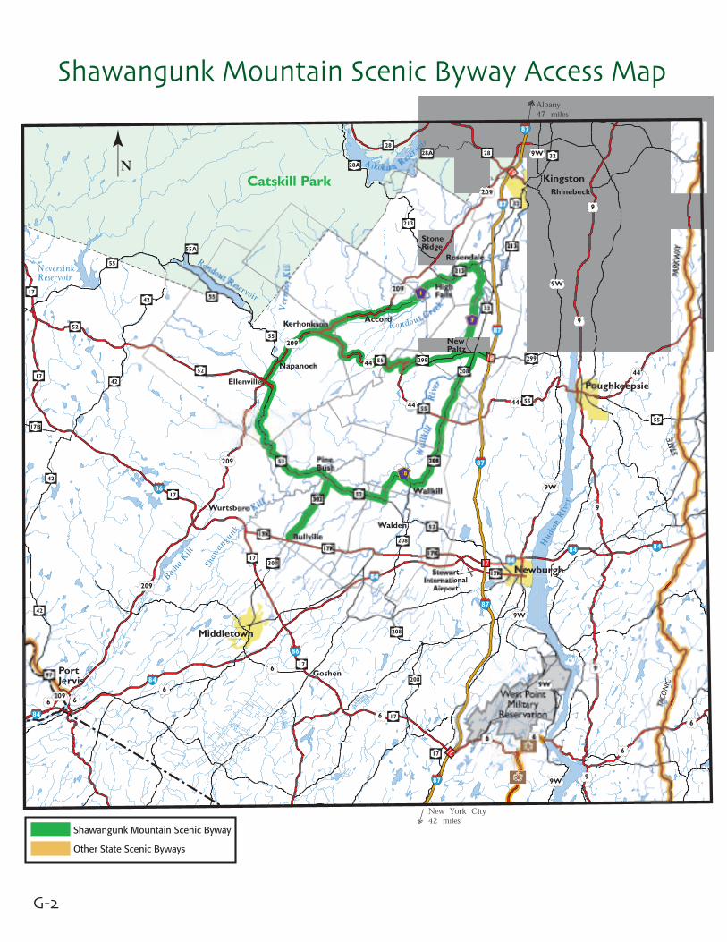
Shawangunk Mountain Scenic Byway Access Map
Shawangunk Mountain Scenic Byway
Other State Scenic Byways

G-3
How To Get HereLocated in the southeast corner of the State, in southern Ulster and northern Orangecounties, the Shawangunk Mountains Scenic Byway is within an easy 1-2 hour drive forpeople from the metro New York area or Albany, and well within a day’s drive for folksfrom Philadelphia, Boston or New Jersey.
Access is provided via Interstate 84, 87 and 17 (future I86) with Thruway exits 16-18 allgood points to enter.
At I-87 Exit 16, Harriman, take Rt 17 (I 86) to Rt 302 and go north on the Byway.
At Exit 17, Newburgh, you can either go Rt 208 north through Walden into Wallkill, or Rt 300 north directly to Rt 208 in Wallkill, and you’re on the Byway.
At Exit 18, New Paltz, the Byway goes west on Rt. 299.
At Exit 19, Kingston, go west on Rt 28, south on Rt 209, southeast on Rt 213 to (a) righton Lucas Turnpike, Rt 1, if going west or (b) continue east through High Falls.
If you’re coming from the Catskills, you can take Rt 28 to Rt 209, then south on Rt 209as above, or the Thruway to Exit 18.
From Interstate 84, you can exit at 6 and take 17K to Rt 208 and north to Wallkill, or atExit 5 and then up Rt 208. Or follow 17K across to Rt 302.
From Rt 17, you can enter Rt 209 at Exit 113 by Wurtsboro or at Exit 119 onto Rt 302.
From the Upper Delaware Scenic Byway Route 97 in Port Jervis, you can take Rt 209northeast to the Shawangunk Region.
The other State Byways in our area are indicated on our Access Map (opposite page).
G-4
18
17
87
87
87
87
87
8484
84
209
209
209
209
209
209
17K
17K17K
17K17K
9W
9W
17
17
52
52
52
52
52
52
52208
208
208
208
208
208
208
32
32
32
32
44
44
44
44
44
55
55
55
55
5555
55
55
5555A
299
299299
213
213
213
213
213
213
213
213
302
302
302
211
211 416
7
7
7
7
7
7
7
7
1
1
918
14
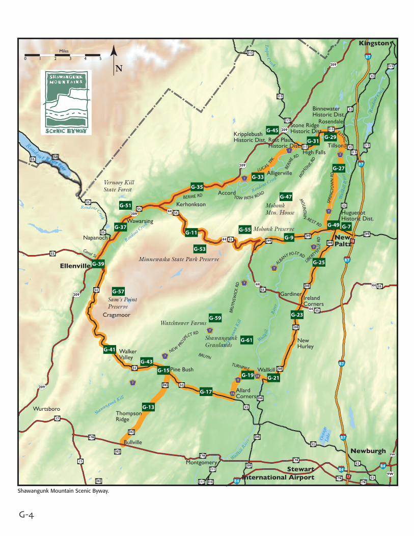
Shawangunk Mountain Scenic Byway.

G-5
Guide ContentsThe Bisect Route: Page
Main Street New Paltz G-7Route 299 West to Routes 44/55 G-9Routes 44/55 West to Route 209 G-11
The Loop, (counterclockwise):Route 302 from Bullville to Pine Bush G-13Main Street in Pine Bush G-15Route 52 East to Route 14 North G-17Routes 14/9 North, East on Route 18 G-19Wallkill in the Town of Shawangunk G-21North on Route 208 to Ireland Corners G-23Continue on Route 208 to New Paltz G-25Springtown Road to Route 213 G-27Main Street, Rosendale G-29West on Route 213 to High Falls G-31Southwest on Route 1, Lucas Turnpike G-33Route 209 and the Hamlet of Accord G-35Kerhonkson, Wawarsing and Napanoch G-37The Village of Ellenville G-39Route 52 Over the Mountains G-41Walker Valley to the Shawangunk Kill G-43
In The Region
Stone Ridge, Rest Plaus and Kripplebush Historic Districts G-45Mohonk Mountain House National Historic Landmark G-47Huguenot Street National Historic Landmark District G-49Vernooy Kill State Forest G-51Minnewaska State Park Preserve G-53The Mohonk Preserve G-55Sam’s Point Preserve G-57Watchtower Farms G-59Shawangunk Grasslands National Wildlife Refuge G-61
Farm markets in the Byway Region G-62Places to Eat in the Byway Region G-64Places to Stay in the Byway Region G-67
G-6
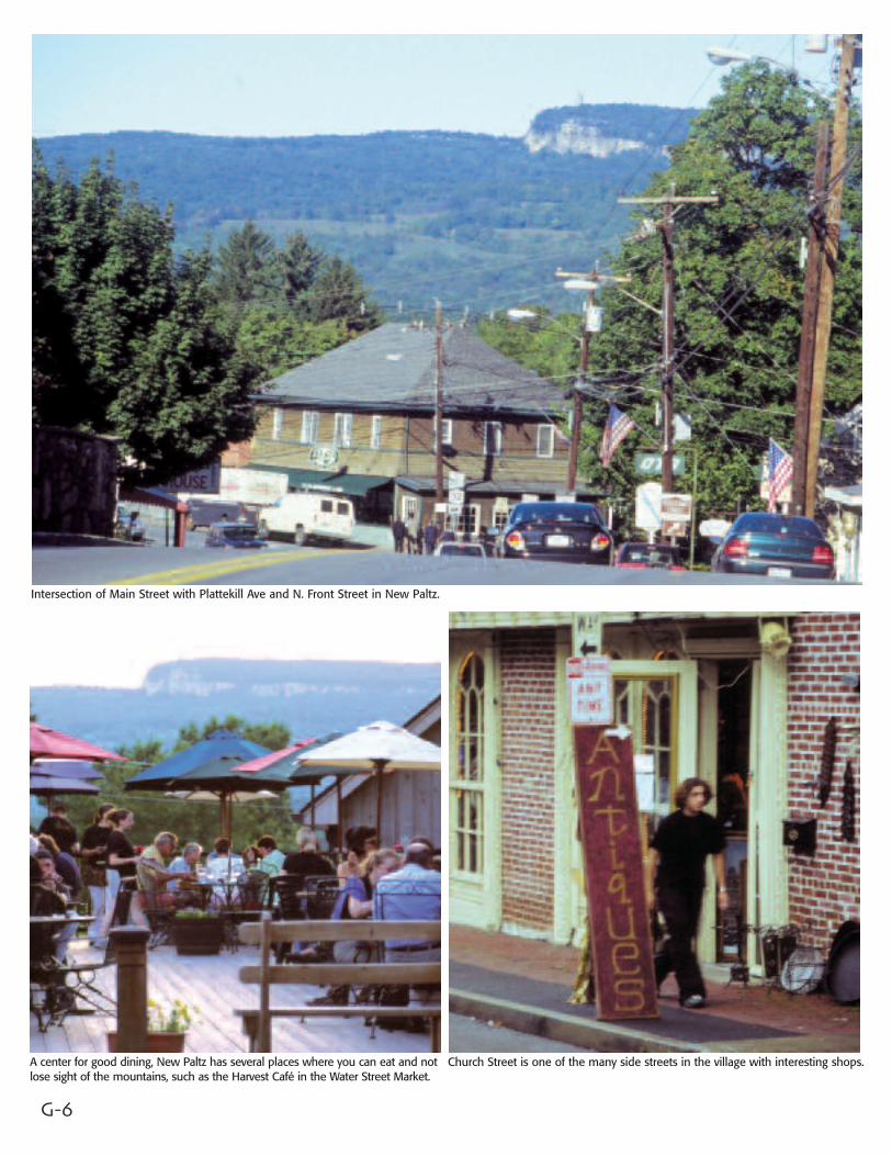
Intersection of Main Street with Plattekill Ave and N. Front Street in New Paltz.
A center for good dining, New Paltz has several places where you can eat and notlose sight of the mountains, such as the Harvest Café in the Water Street Market.
Church Street is one of the many side streets in the village with interesting shops.
G-7
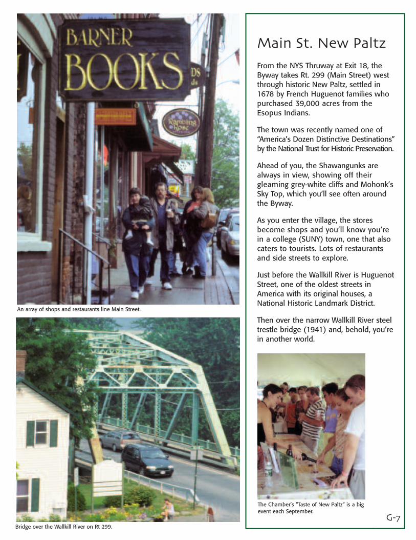
Main St. New PaltzFrom the NYS Thruway at Exit 18, theByway takes Rt. 299 (Main Street) westthrough historic New Paltz, settled in1678 by French Huguenot families whopurchased 39,000 acres from theEsopus Indians.
The town was recently named one of“America’s Dozen Distinctive Destinations”by the National Trust for Historic Preservation.
Ahead of you, the Shawangunks arealways in view, showing off theirgleaming grey-white cliffs and Mohonk’sSky Top, which you’ll see often aroundthe Byway.
As you enter the village, the storesbecome shops and you’ll know you’rein a college (SUNY) town, one that alsocaters to tourists. Lots of restaurantsand side streets to explore.
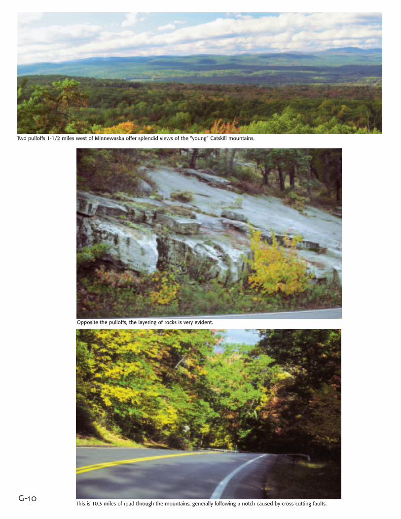
Just before the Wallkill River is HuguenotStreet, one of the oldest streets inAmerica with its original houses, aNational Historic Landmark District.
Then over the narrow Wallkill River steeltrestle bridge (1941) and, behold, you’rein another world.
An array of shops and restaurants line Main Street.
Bridge over the Wallkill River on Rt 299.
The Chamber’s “Taste of New Paltz” is a bigevent each September.

G-8
One of the most classic views in the Shawangunks, on the north side of Route 299.
At Rt. 299 and Yankee Folly Road, a variety of apples suited to the“Pick Your Own” trade.
Pumpkin pickers take to the fields at the Wallkill View Farm Market.Fields on the north side of Rt. 299 and Butterville Rd. are still in hay for horses.Photo by Ralph Aiello
Going west on Rt. 299, the farmland of the valley gradually gives way to theforested foothills of the shawangunks. Photo by Ralph Aiello

G-9
Route 299 West to Routes 44/55Rich farmland, mostly in corn, stretchesacross the Wallkill floodplain a mile wide.Red farm buildings and a white housenest under tall maples, as if arranged bya landscape photographer.
Bonticou Crag is to the north, then the4-1/2 mile escarpment of Mohonk andSky Top, the Trapps, Near Trapps, theBayards and Millbrook Mountain.
On the south is the Wallkill View FarmMarket, started out of a pickup truck bythe Ferrante family in 1974. The mean-dering Wallkill provides irrigation in thedry summer months. Across the road,grain and hay are grown by WatchtowerFarms for their livestock.
At Yankee Folly Road, we come to theJenkins-Luekens Orchards, in the applebusiness for over 50 years. Beyond therolling orchards, views of the ridge andSky Top. Then woods again on bothsides, with the ridge ahead of us, as wecome to Rts 44/55 in the town ofGardiner.
Just west of the bridge, farmland stretches across the Wallkill Valley along Rt 299.
Old barn doors at Jenkins-Luekens Orchards on Rt. 299 at Yankee Folly Road.
On south side of Rt. 299 and Butterville Rd., post-agricultural fields still offer great scenery.
Opposite the pulloffs, the layering of rocks is very evident.
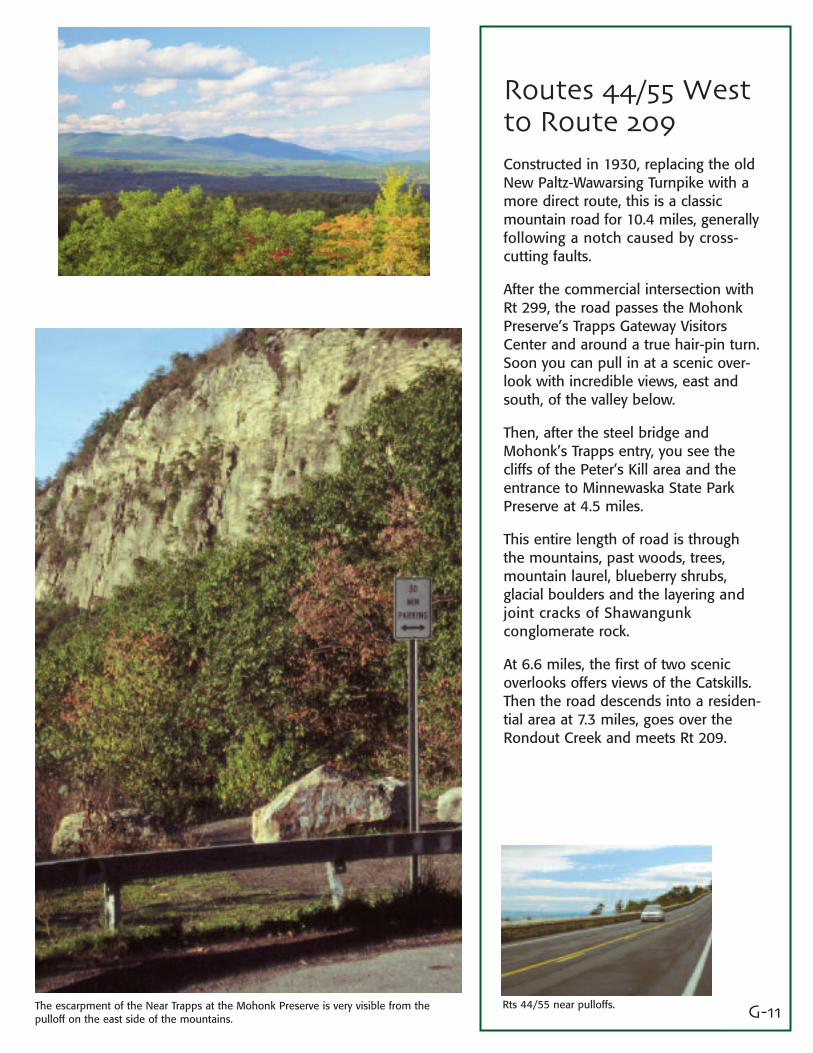
G-10This is 10.3 miles of road through the mountains, generally following a notch caused by cross-cutting faults.
Two pulloffs 1-1/2 miles west of Minnewaska offer splendid views of the “young” Catskill mountains.
G-11
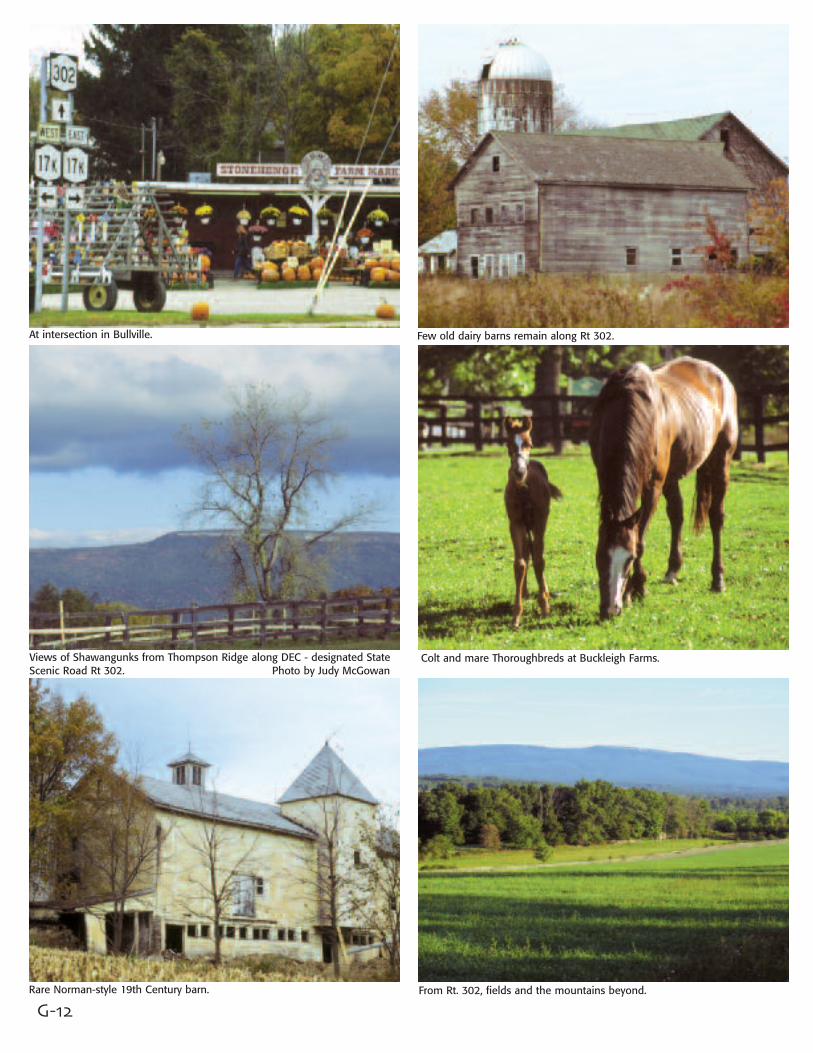
Routes 44/55 Westto Route 209Constructed in 1930, replacing the oldNew Paltz-Wawarsing Turnpike with amore direct route, this is a classicmountain road for 10.4 miles, generallyfollowing a notch caused by cross-cutting faults.
After the commercial intersection withRt 299, the road passes the MohonkPreserve’s Trapps Gateway VisitorsCenter and around a true hair-pin turn.Soon you can pull in at a scenic over-look with incredible views, east andsouth, of the valley below.
Then, after the steel bridge andMohonk’s Trapps entry, you see thecliffs of the Peter’s Kill area and theentrance to Minnewaska State ParkPreserve at 4.5 miles.
This entire length of road is throughthe mountains, past woods, trees,mountain laurel, blueberry shrubs, glacial boulders and the layering andjoint cracks of Shawangunk conglomerate rock.
At 6.6 miles, the first of two scenicoverlooks offers views of the Catskills.Then the road descends into a residen-tial area at 7.3 miles, goes over theRondout Creek and meets Rt 209.
Rts 44/55 near pulloffs.The escarpment of the Near Trapps at the Mohonk Preserve is very visible from thepulloff on the east side of the mountains.
G-12
At intersection in Bullville. Few old dairy barns remain along Rt 302.
Views of Shawangunks from Thompson Ridge along DEC - designated StateScenic Road Rt 302. Photo by Judy McGowan
Colt and mare Thoroughbreds at Buckleigh Farms.
Rare Norman-style 19th Century barn. From Rt. 302, fields and the mountains beyond.
G-13
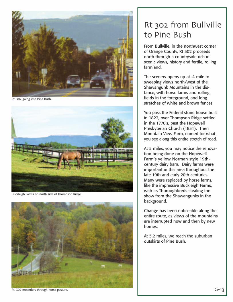
Rt 302 from Bullvilleto Pine BushFrom Bullville, in the northwest cornerof Orange County, Rt 302 proceedsnorth through a countryside rich inscenic views, history and fertile, rollingfarmland.
The scenery opens up at .4 mile tosweeping views north/west of theShawangunk Mountains in the dis-tance, with horse farms and rollingfields in the foreground, and longstretches of white and brown fences.
You pass the Federal stone house builtin 1822, over Thompson Ridge settledin the 1770's, past the HopewellPresbyterian Church (1831). ThenMountain View Farm, named for whatyou see along this entire stretch of road.
At 5 miles, you may notice the renova-tion being done on the HopewellFarm’s yellow Norman style 19th-century dairy barn. Dairy farms wereimportant in this area throughout thelate 19th and early 20th centuries.Many were replaced by horse farms,like the impressive Buckleigh Farms,with its Thoroughbreds stealing theshow from the Shawangunks in thebackground.
Change has been noticeable along theentire route, as views of the mountainsare interrupted now and then by newhomes.
At 5.2 miles, we reach the suburbanoutskirts of Pine Bush.
Rt. 302 going into Pine Bush.
Buckleigh Farms on north side of Thompson Ridge.
Rt. 302 meanders through horse pasture.
G-14
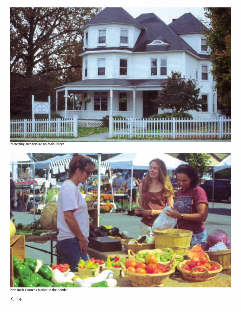
Interesting architecture on Main Street.
Pine Bush Farmer’s Market in the hamlet.
G-15
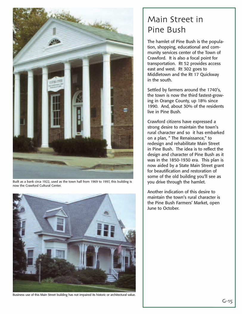
Main Street inPine BushThe hamlet of Pine Bush is the popula-tion, shopping, educational and com-munity services center of the Town ofCrawford. It is also a focal point fortransportation. Rt 52 provides accesseast and west. Rt 302 goes toMiddletown and the Rt 17 Quickway in the south.
Settled by farmers around the 1740’s,the town is now the third fastest-grow-ing in Orange County, up 18% since1990. And, about 30% of the residentslive in Pine Bush.
Crawford citizens have expressed astrong desire to maintain the town’srural character and so it has embarkedon a plan, “ The Renaissance,” toredesign and rehabilitate Main Streetin Pine Bush. The idea is to reflect thedesign and character of Pine Bush as itwas in the 1850-1930 era. This plan isnow aided by a State Main Street grantfor beautification and restoration ofsome of the old building you’ll see asyou drive through the hamlet.
Another indication of this desire tomaintain the town’s rural character isthe Pine Bush Farmers’ Market, openJune to October.
Built as a bank circa 1922, used as the town hall from 1969 to 1997, this building isnow the Crawford Cultural Center.
Business use of this Main Street building has not impaired its historic or architectural value.
G-16
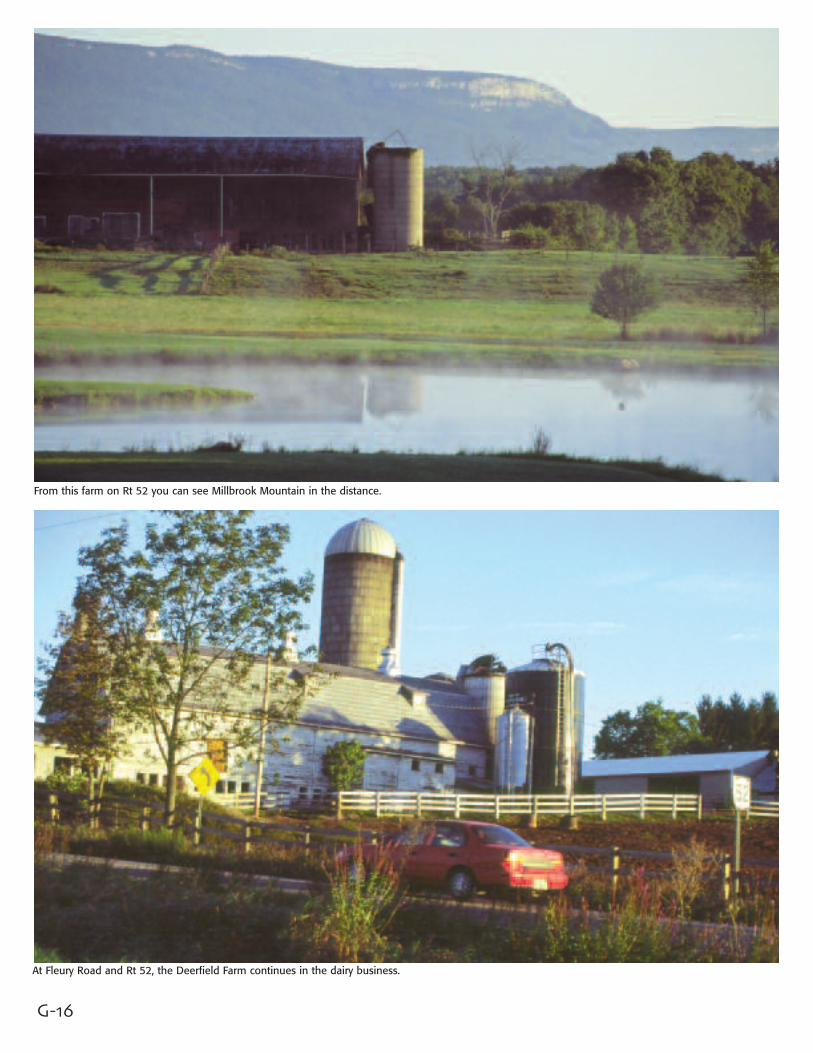
From this farm on Rt 52 you can see Millbrook Mountain in the distance.
At Fleury Road and Rt 52, the Deerfield Farm continues in the dairy business.
G-17
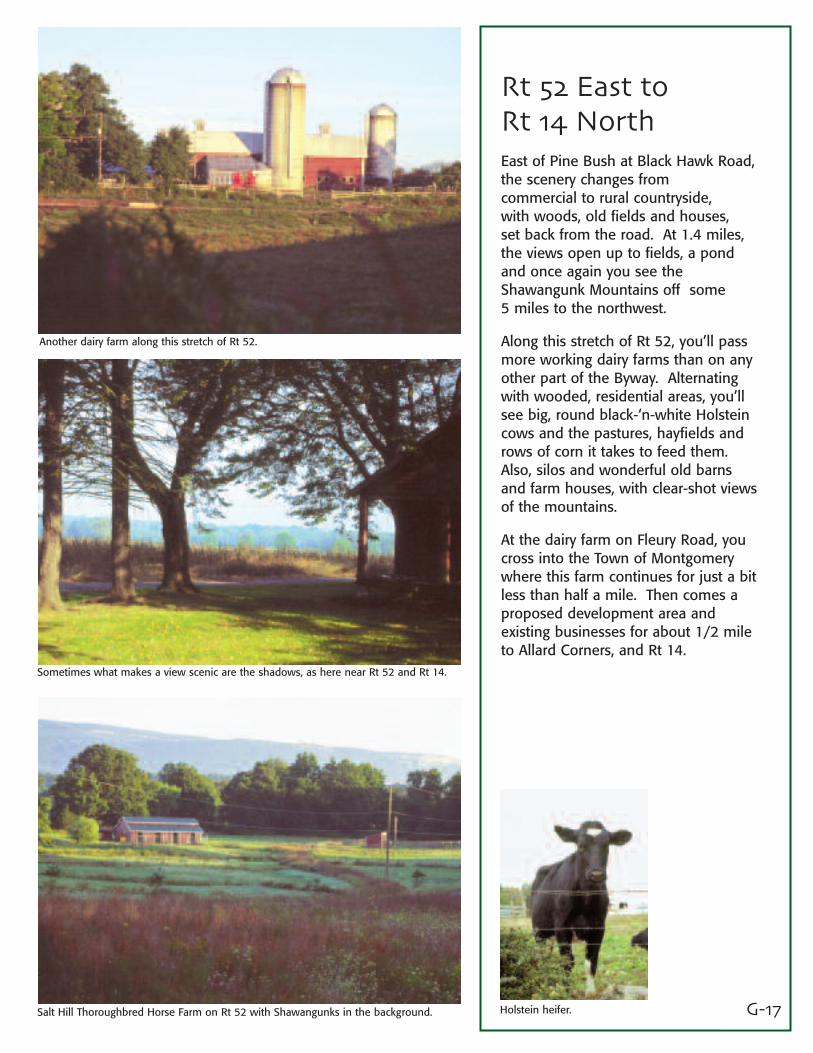
Rt 52 East toRt 14 NorthEast of Pine Bush at Black Hawk Road,the scenery changes from commercial to rural countryside, with woods, old fields and houses, set back from the road. At 1.4 miles,the views open up to fields, a pondand once again you see theShawangunk Mountains off some 5 miles to the northwest.
Along this stretch of Rt 52, you’ll passmore working dairy farms than on anyother part of the Byway. Alternatingwith wooded, residential areas, you’llsee big, round black-‘n-white Holsteincows and the pastures, hayfields androws of corn it takes to feed them.Also, silos and wonderful old barnsand farm houses, with clear-shot viewsof the mountains.
At the dairy farm on Fleury Road, youcross into the Town of Montgomerywhere this farm continues for just a bitless than half a mile. Then comes aproposed development area andexisting businesses for about 1/2 mileto Allard Corners, and Rt 14.
Another dairy farm along this stretch of Rt 52.
Sometimes what makes a view scenic are the shadows, as here near Rt 52 and Rt 14.
Salt Hill Thoroughbred Horse Farm on Rt 52 with Shawangunks in the background. Holstein heifer.
G-18
Along Rt 18, old farm fields are a beautiful sight.
Fine horses have taken over fields along Rt 9 where cows once grazed.
The stone house of Andries Graham (1736) on Rt 14.
G-19
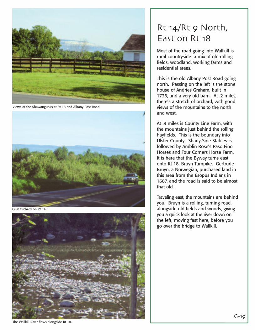
Rt 14/Rt 9 North,East on Rt 18Most of the road going into Wallkill isrural countryside: a mix of old rollingfields, woodland, working farms andresidential areas.
This is the old Albany Post Road goingnorth. Passing on the left is the stonehouse of Andries Graham, built in1736, and a very old barn. At .2 miles,there’s a stretch of orchard, with goodviews of the mountains to the northand west.
At .9 miles is County Line Farm, withthe mountains just behind the rollinghayfields. This is the boundary intoUlster County. Shady Side Stables isfollowed by Amblin Rose’s Paso FinoHorses and Four Corners Horse Farm.It is here that the Byway turns eastonto Rt 18, Bruyn Turnpike. GertrudeBruyn, a Norwegian, purchased land inthis area from the Esopus Indians in1687, and the road is said to be almostthat old.
Traveling east, the mountains are behindyou. Bruyn is a rolling, turning road,alongside old fields and woods, givingyou a quick look at the river down onthe left, moving fast here, before yougo over the bridge to Wallkill.
Views of the Shawangunks at Rt 18 and Albany Post Road.
Crist Orchard on Rt 14.
The Wallkill River flows alongside Rt 18.

G-20
The Wallkill River Bridge.
Baking apple pie at Shawangunk Day.
In a tractor pulling contest, you try to keep your front wheels on the ground.
G-21
Wallkill in the Townof ShawangunkAfter the bridge, the Byway makes aright onto Bona Ventura Avenue, themain street through this unincorporatedvillage. The road then bears left on Route 208, going north.
In 1870, the arrival of the Wallkill ValleyRailroad, with its ice-cooled cars,prompted many creameries to beestablished adjacent to depots. Milkshipped from the valley in the after-noon was in New York City householdsby the following morning. This drewmany farmers into dairying.
John G. Borden built the BordenCondensery here in 1881. In his plant,whole milk was reduced in mass byevaporation to make condensed milk.Many may know “Elsie”, the Bordencow. The Borden Home Farm was asmall village itself, occupying lands justsoutheast of Route 208.
Over the years, agriculture in the areahas become more diversified, and thetown has recently experienced a surgein population growth. And yet, as thetraveler will observe, it has retainedmuch of its rural culture and farmingtraditions.
The library is designed on the lines of the old stone houses found in the valley.
Many beautiful, well-kept old homes line Bona Ventura Avenue at 3rd Street.
Gift and antique shop in Wallkill’s business area.
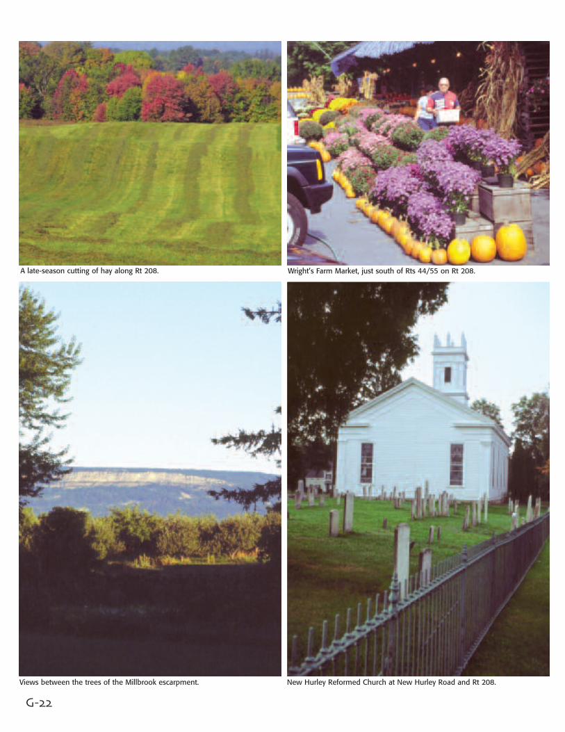
G-22
A late-season cutting of hay along Rt 208.
Views between the trees of the Millbrook escarpment.
Wright’s Farm Market, just south of Rts 44/55 on Rt 208.
New Hurley Reformed Church at New Hurley Road and Rt 208.
G-23
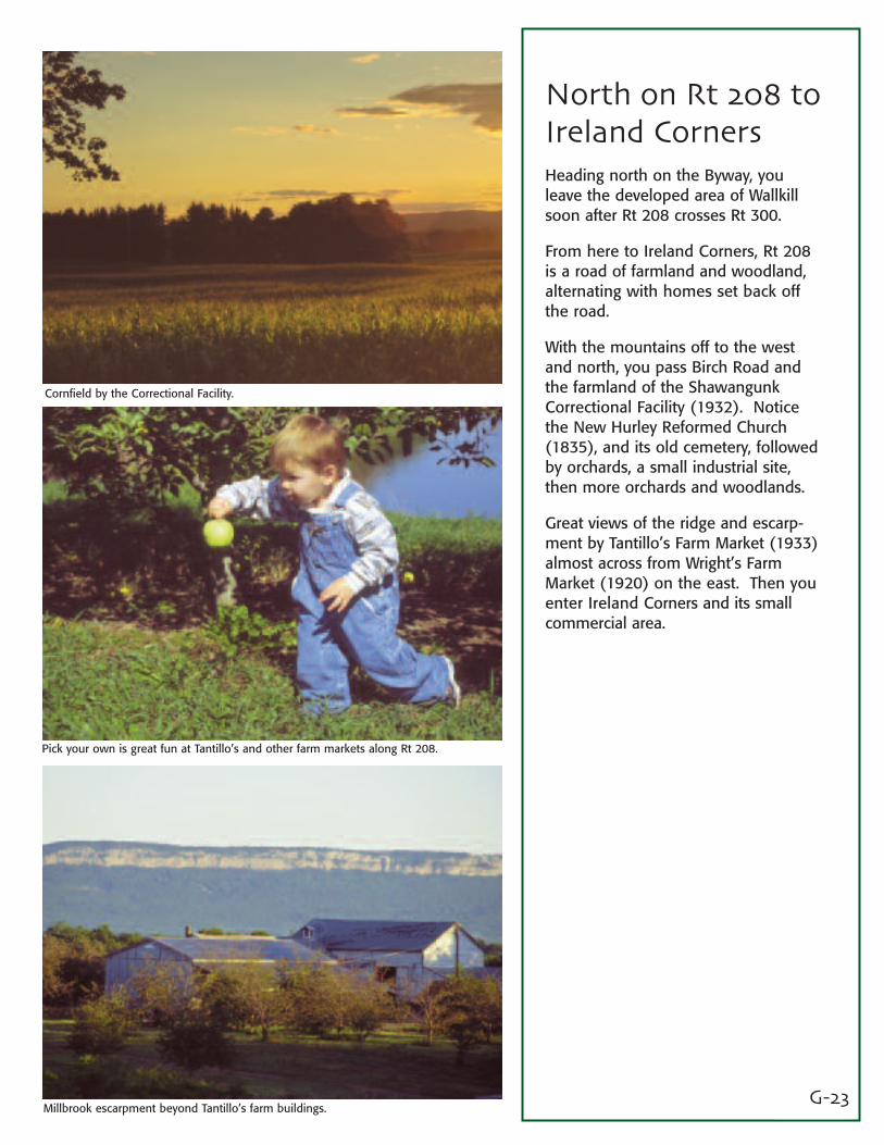
North on Rt 208 toIreland CornersHeading north on the Byway, youleave the developed area of Wallkillsoon after Rt 208 crosses Rt 300.
From here to Ireland Corners, Rt 208is a road of farmland and woodland,alternating with homes set back offthe road.
With the mountains off to the westand north, you pass Birch Road andthe farmland of the ShawangunkCorrectional Facility (1932). Noticethe New Hurley Reformed Church(1835), and its old cemetery, followedby orchards, a small industrial site,then more orchards and woodlands.
Great views of the ridge and escarp-ment by Tantillo’s Farm Market (1933)almost across from Wright’s FarmMarket (1920) on the east. Then youenter Ireland Corners and its smallcommercial area.
Cornfield by the Correctional Facility.
Pick your own is great fun at Tantillo’s and other farm markets along Rt 208.
Millbrook escarpment beyond Tantillo’s farm buildings.
G-24
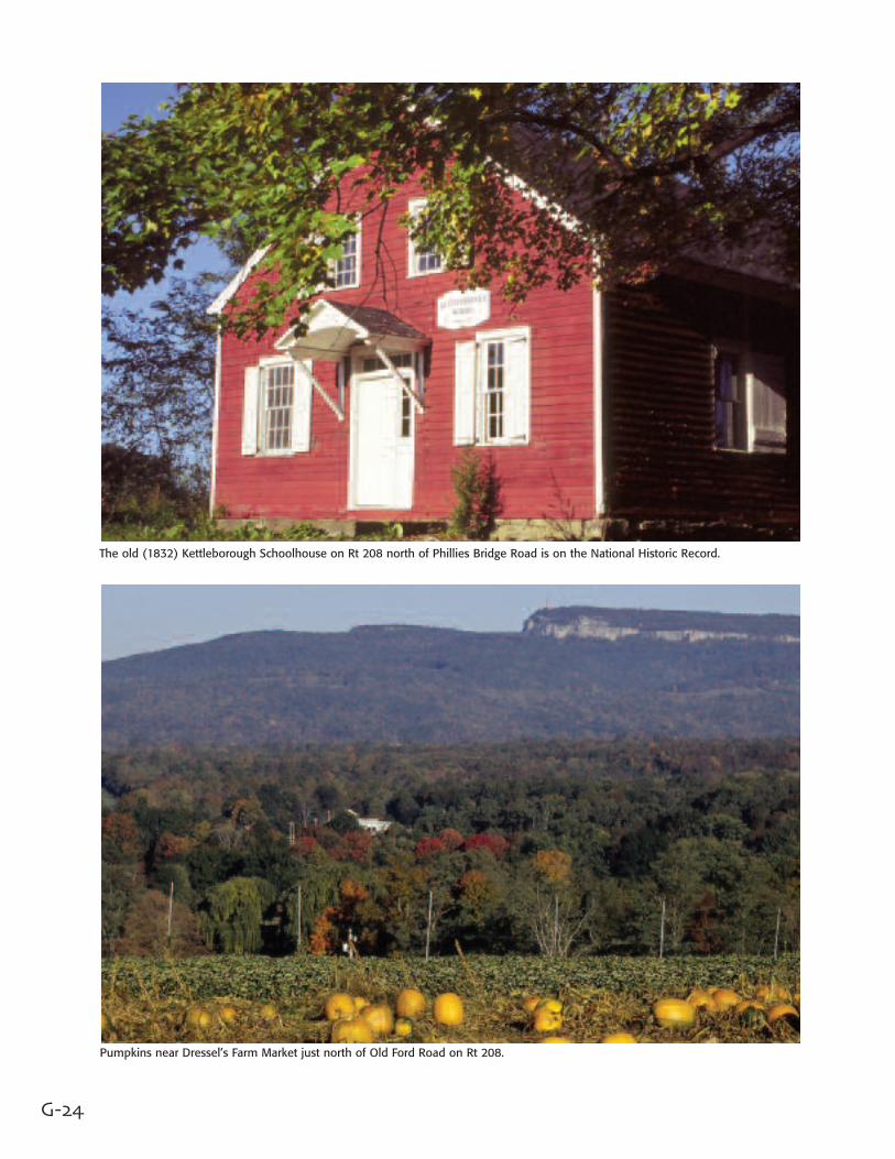
The old (1832) Kettleborough Schoolhouse on Rt 208 north of Phillies Bridge Road is on the National Historic Record.
Pumpkins near Dressel’s Farm Market just north of Old Ford Road on Rt 208.

G-25
Continue on Rt 208to New PaltzFrom Ireland Corners, it’s only 1/2 mileand you’re in the country again.A stretch of old fields, woods and ruralcountryside with houses back from theroad. Then orchards, with viewsthrough the trees during the winter ofthe mountains to the west.
After Phillies Bridge Rd, where acommunity farm is located, you passKettleborough Schoolhouse(1832),the John A. LeFevre House (1772) followed by more old fields and ruralcountryside.
At Old Ford Road, the landscape opensup with perhaps one of the most awe-some views of the mountains and theescarpment west/north that you’ll seealong the Byway. You may feel likeyou want to stop, turn around, go backand pass it again, this time slower.
There’s another under-appreciatedview of the ridge at the VFW parkinglot just outside New Paltz. You passthe SUNY playing fields and enter thevillage of New Paltz.
Bonticou Crag from Rt 208 viewed past the VFW parking lot.SUNY New Paltz campus.
Apples are the major crop along Rt 208.
G-26
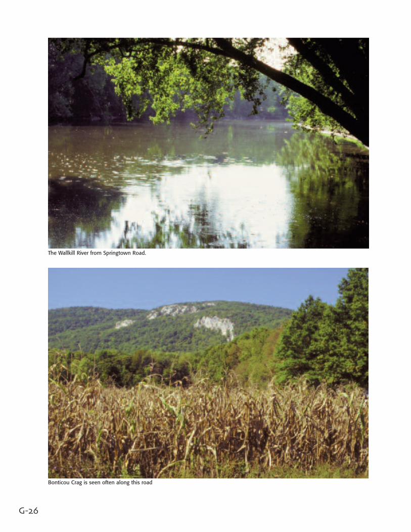
The Wallkill River from Springtown Road.
Bonticou Crag is seen often along this road
G-27
Springtown Road to Rt 213From Rt 208 into New Paltz, the Bywayturns left on Rt 299 (Main Street),crosses over the Wallkill and makes thefirst right onto Rt 7, Springtown Road.In the early 19th century, the mainroute south from Kingston was alongthis road. Herds of cattle and sheeppassed through here on their way tomarket in New York City andPhiladelphia.
That white rock summit and cliff scarpbeyond the corn fields is Bonticou Crag,rising 1,200 feet above sea level.
Most of Springtown travels throughalternating sections of farmland, woodsand residential areas, with the Wallkillmeandering parallel to the road, in theearly sections.
The Wallkill Valley Rail Trail crosses theroad here. Then more farmland andsoon the Million Dollar Farm, whichboards horses. Look across the roadhere for the Crag.
Then, DEC’s Fishing Access Site, thestone house built by Benjamin DuBoisin 1775, more farmland and rural coun-tryside past River Road. Soon we seethe start of the residential hamlet ofTillson, named after Timothy Tillson,(1738-1800) who moved here after hisservice in the Revolution.
The Byway turns and descends, passingthe Early Decorated Gothic Architectureof St. Peter’s Church, over RondoutCreek to Rt 213.
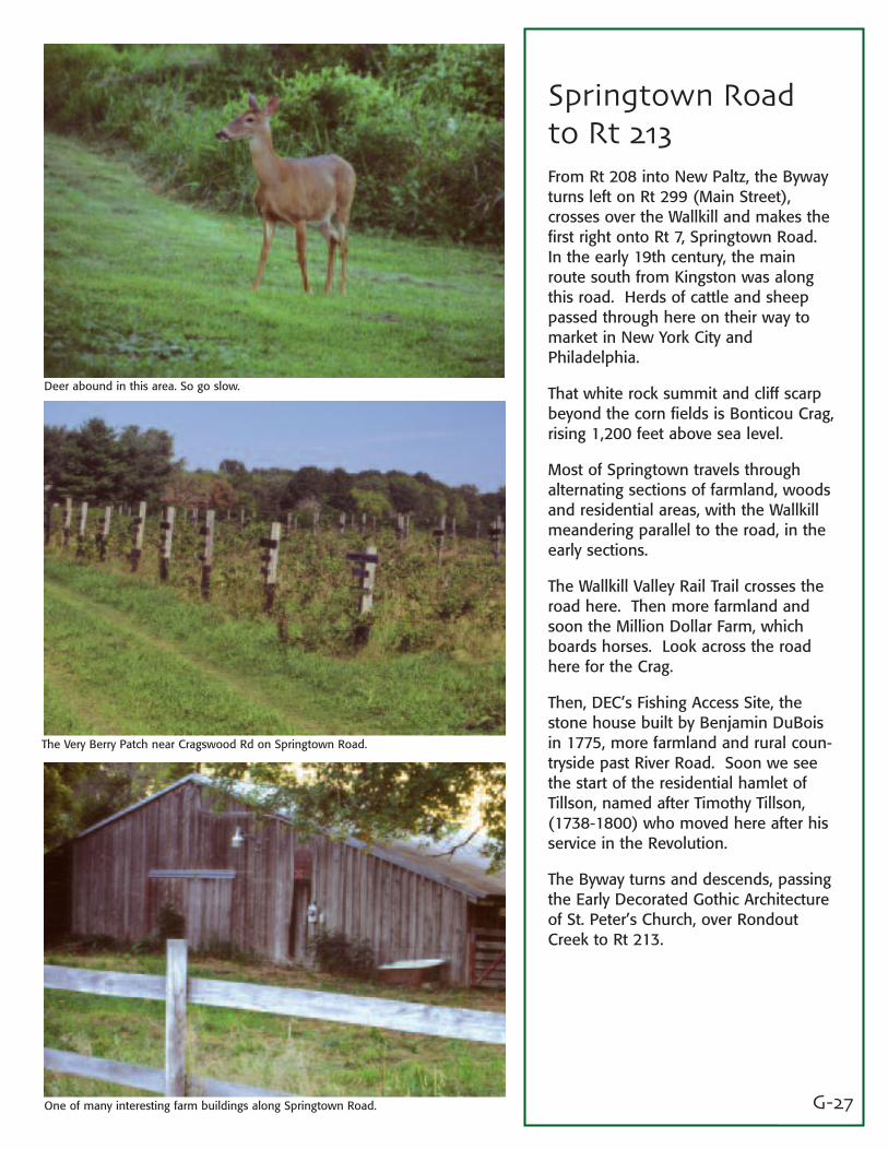
Deer abound in this area. So go slow.
The Very Berry Patch near Cragswood Rd on Springtown Road.
One of many interesting farm buildings along Springtown Road.
G-28
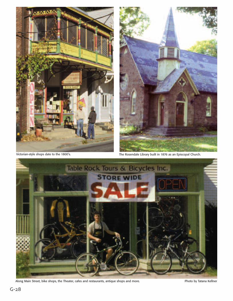
Victorian-style shops date to the 1800’s. The Rosendale Library built in 1876 as an Episcopal Church.
Along Main Street, bike shops, the Theater, cafes and restaurants, antique shops and more. Photo by Tatana Kellner
G-29
Main Street inRosendaleAfter crossing Rondout Creek, the Bywayturns left on Rt 213 and heads towardHigh Falls, passing at one mile the SnyderEstate Natural Cement Historic District.
For a short but worthwhile detour, turnright on Rt 213 and you’re on MainStreet, Rosendale. The D&H Canal ranthrough here 1828-1898, just behind thestores on the north side of the street. Atone time, the canal passed through theentire width of the town on its way tothe Rondout Creek. Locks raised thewater level 101 feet.
Two railroads served the town; theOntario and Western, and the WallkillValley Railroad. The O&W ran throughthe Rondout Valley, and the Wallkillwent down to Montgomery.
In 1844, the town was established primarily because of the cement industry.There were about 20 companies workingin this area, employing more than 5,000men, producing almost half the naturalcement in the U.S.
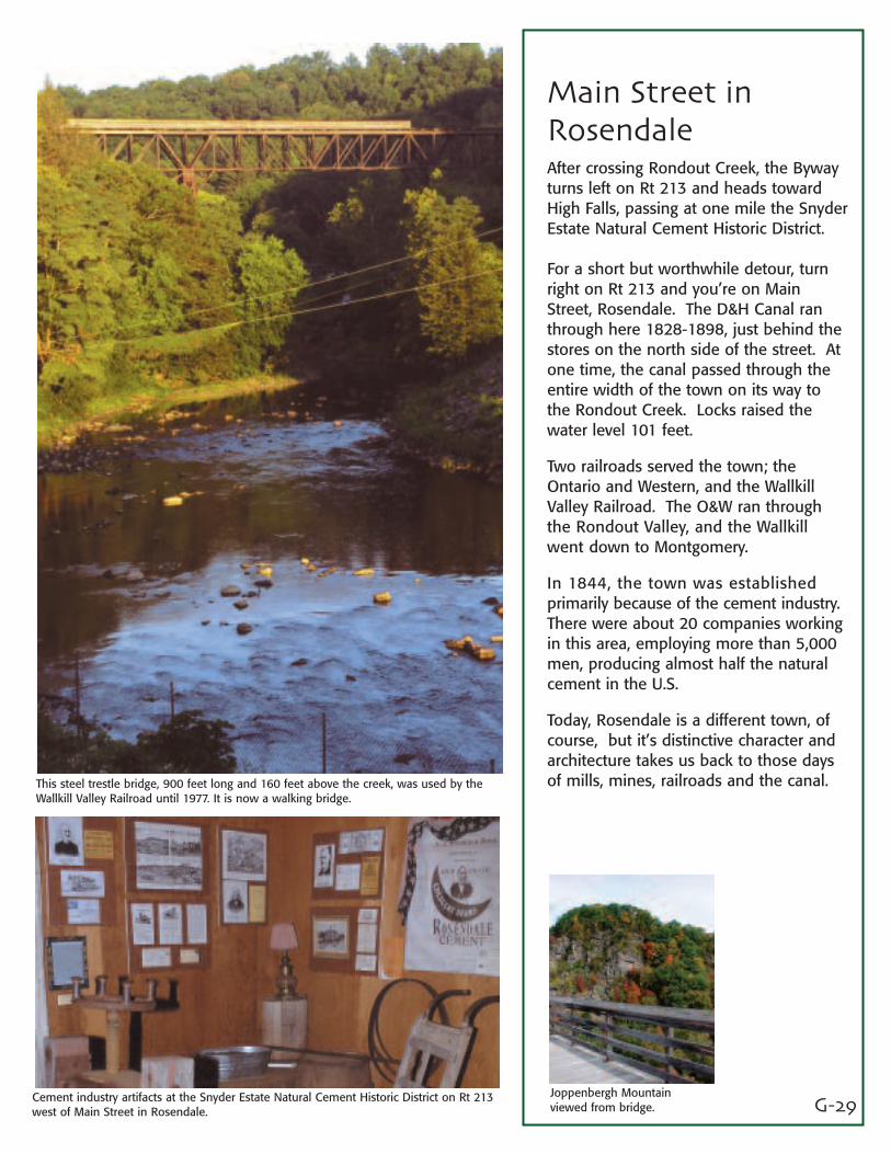
Today, Rosendale is a different town, ofcourse, but it’s distinctive character andarchitecture takes us back to those daysof mills, mines, railroads and the canal.This steel trestle bridge, 900 feet long and 160 feet above the creek, was used by the
Wallkill Valley Railroad until 1977. It is now a walking bridge.
Joppenbergh Mountainviewed from bridge.
Cement industry artifacts at the Snyder Estate Natural Cement Historic District on Rt 213west of Main Street in Rosendale.
Built for canal workers, this is now a four-star restaurant in High Falls on Rt 213.
G-30
Trestle bridge on Rt 213 over Rondout Creek.
D&H Canal Museum just off Rt 213 in High Falls has artifacts from 1825-98. Five Locks Walk is a good way to admire the canal stonework.
G-31
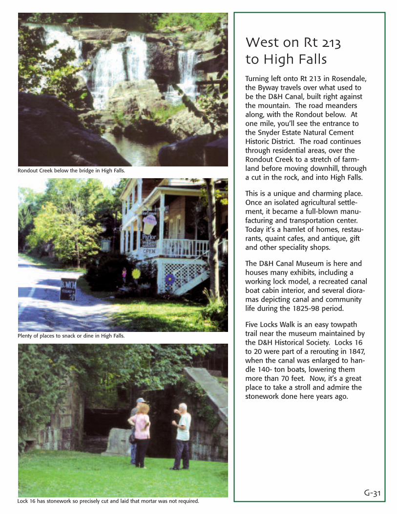
West on Rt 213to High FallsTurning left onto Rt 213 in Rosendale,the Byway travels over what used tobe the D&H Canal, built right againstthe mountain. The road meandersalong, with the Rondout below. Atone mile, you’ll see the entrance tothe Snyder Estate Natural CementHistoric District. The road continuesthrough residential areas, over theRondout Creek to a stretch of farm-land before moving downhill, througha cut in the rock, and into High Falls.
This is a unique and charming place.Once an isolated agricultural settle-ment, it became a full-blown manu-facturing and transportation center.Today it’s a hamlet of homes, restau-rants, quaint cafes, and antique, giftand other speciality shops.
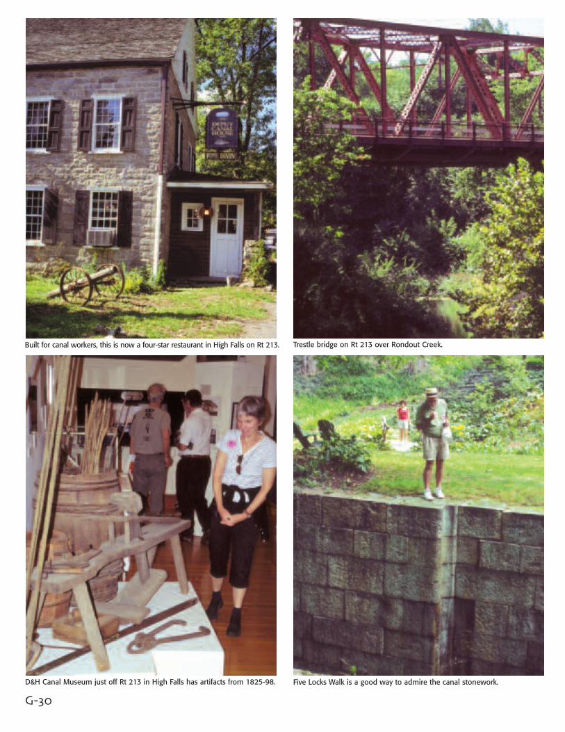
The D&H Canal Museum is here andhouses many exhibits, including aworking lock model, a recreated canalboat cabin interior, and several diora-mas depicting canal and communitylife during the 1825-98 period.
Five Locks Walk is an easy towpathtrail near the museum maintained bythe D&H Historical Society. Locks 16to 20 were part of a rerouting in 1847,when the canal was enlarged to han-dle 140- ton boats, lowering themmore than 70 feet. Now, it’s a greatplace to take a stroll and admire thestonework done here years ago.
Rondout Creek below the bridge in High Falls.
Plenty of places to snack or dine in High Falls.
Lock 16 has stonework so precisely cut and laid that mortar was not required.
G-32
Along Lucas Trpk we now see Sky Top from the north across these farm fields.
One of numerous farm buildings along Lucas Tpke.
G-33
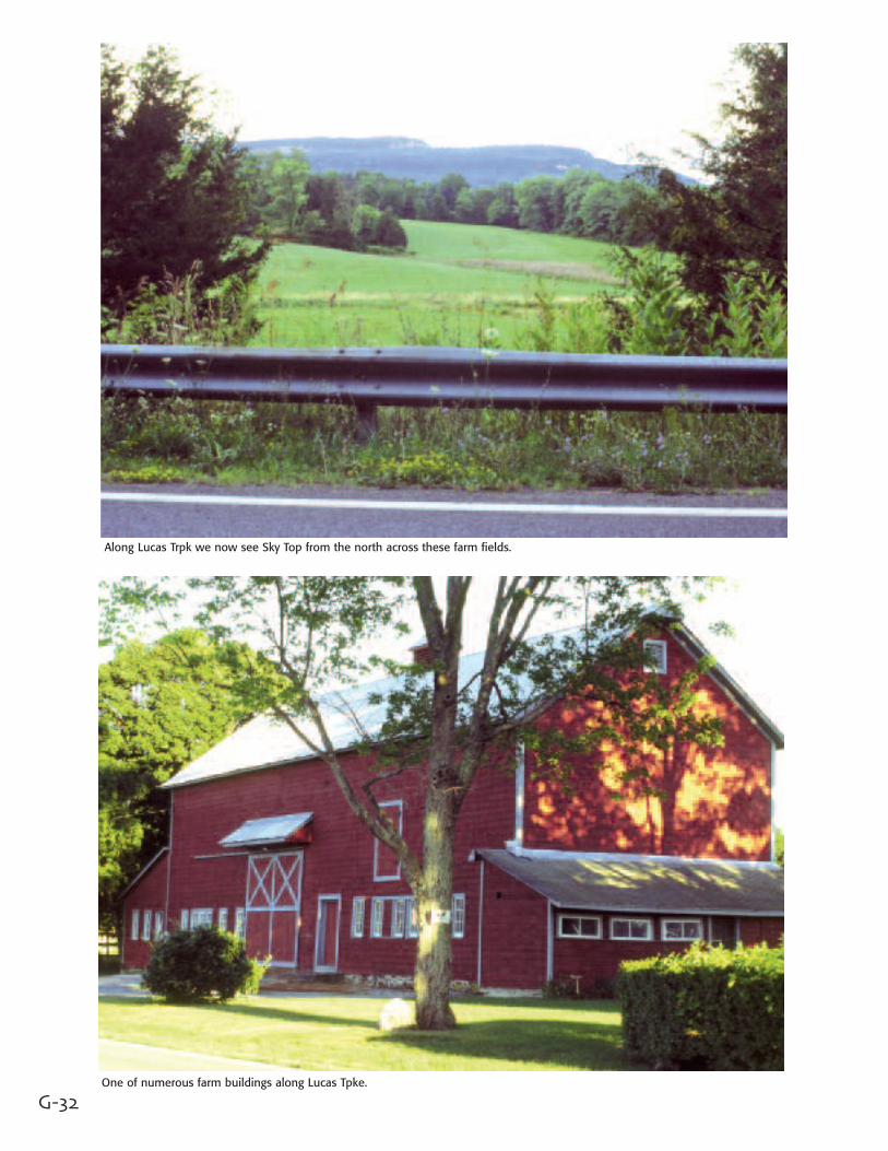
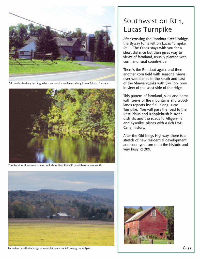
Southwest on Rt 1,Lucas TurnpikeAfter crossing the Rondout Creek bridge,the Byway turns left on Lucas Turnpike,Rt 1. The Creek stays with you for ashort distance but then gives way toviews of farmland, usually planted withcorn, and rural countryside.
There’s the Rondout again, and thenanother corn field with seasonal viewsover woodlands to the south and eastof the Shawangunks with Sky Top, nowin view of the west side of the ridge.
This pattern of farmland, silos and barnswith views of the mountains and wood-lands repeats itself all along LucasTurnpike. You will pass the road to theRest Plaus and Kripplebush historicdistricts and the roads to Alligervilleand Kyserike, places with a rich D&HCanal history.
After the Old Kings Highway, there is astretch of new residential developmentand soon you turn onto the historic andvery busy Rt 209.
Silos indicate dairy farming, which was well established along Lucas Tpke in the past.
The Rondout flows near Lucas until about Rest Plaus Rd and then moves south.
Farmstead nestled at edge of mountains across field along Lucas Tpke.
G-34
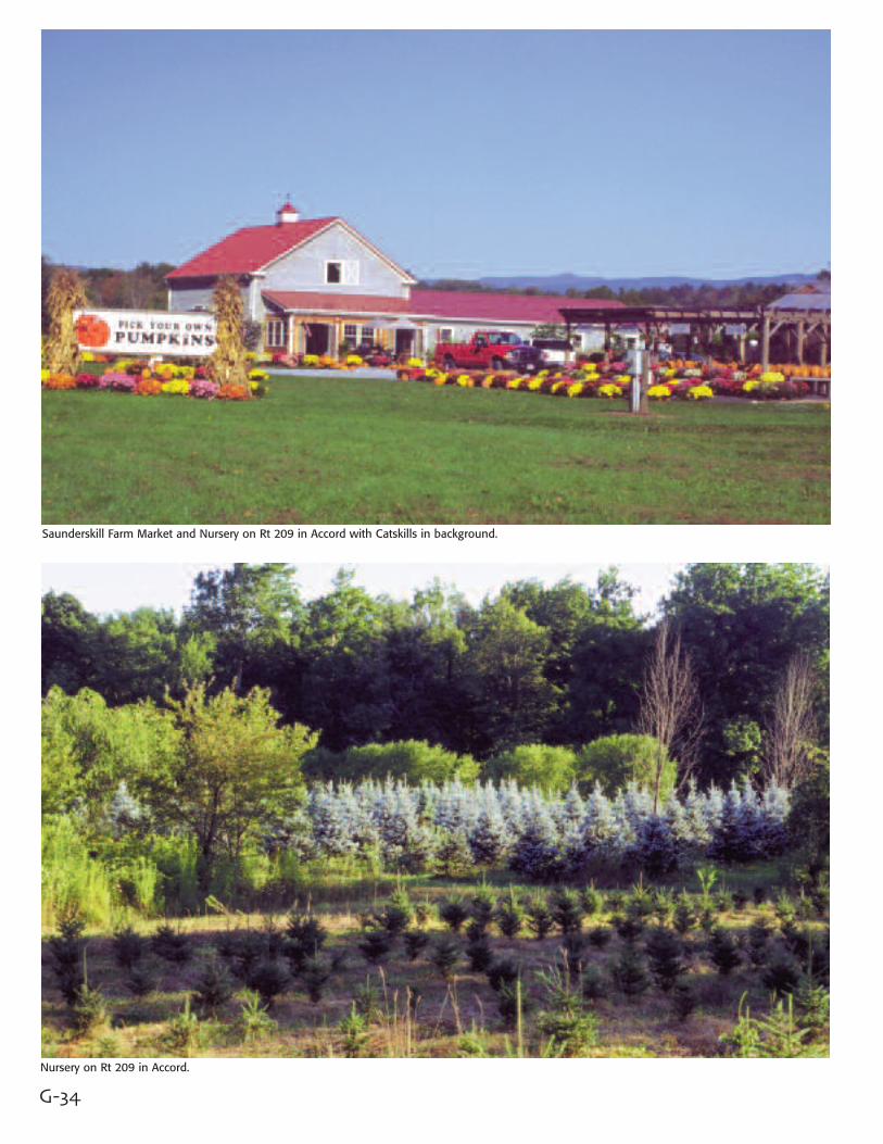
Saunderskill Farm Market and Nursery on Rt 209 in Accord with Catskills in background.
Nursery on Rt 209 in Accord.

G-35
Rt 209 and theHamlet of AccordCradled within the geological forma-tion known as the Port Jervis trough,Rt 209 follows an ancient NativeAmerican trail and is claimed to bethe oldest roadway in the UnitedStates. It was built by the Dutch,perhaps about 1710, for carryingcopper ore, mined near the DelawareWater Gap to the Hudson River, andwas called the Old Mine Road.
Today, this is a busy road and theByway enters off Lucas Tpke in a com-mercial area. Soon, you’ll see theRondout Creek off to the left, follow-ing the road for a distance, as youenter Accord.
Leave the Byway route a bit by goingleft on Main Street and over the littlebridge. Stop in to see the pottery atStone Window Gallery or travel to theTown parking area, where there aregood views of the Catskills. It’s agood starting point to hike the D&HHeritage Corridor.
Back on the old Mine Road, travelingsouth, the Byway goes through a sec-tion along the Rondout with good fer-tile soil for vegetables, past the newly-built Saunderskill Nursery with theCatskills behind, the old RochesterReformed Church, and then a mix ofcommercial and residential sections.
Antique cars celebrate History Day in Accord.
Brinton Baker of Stone Window Gallery on Main Street in Accord.
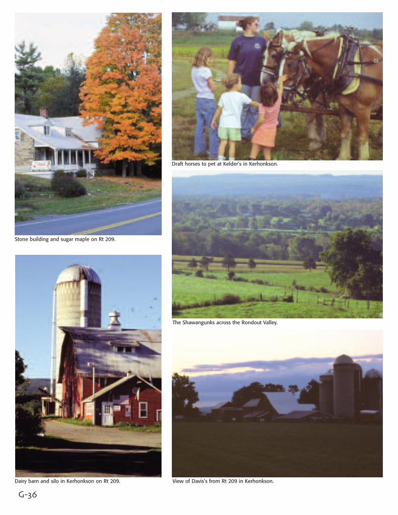
G-36
Stone building and sugar maple on Rt 209.
Dairy barn and silo in Kerhonkson on Rt 209.
Draft horses to pet at Kelder’s in Kerhonkson.
The Shawangunks across the Rondout Valley.
View of Davis’s from Rt 209 in Kerhonkson.

G-37
Kerhonkson,Wawarsing andNapanochThe Byway continues on Rt 209 fromAccord to Ellenville, a distance of about15 miles, parallel to the Rondout andthe old canal. Over time, the road hasbeen rerouted here and there, but itscorridor still exhibits the various uses …agricultural, residential and small busi-ness … which the road has served overthe centuries.
The most scenic of these is the farm-land, with expansive views of theShawangunks and sometimes Sky Topoff in the distance.
The Kelder Farm and Market has a par-ticularly active agritourism enterprise inKerhonkson. You can pick your own, getlost in the corn maze, and in the Fall seeHudson Valley draft horses at work theold way.
Then you come to the 450-acreArrowhead Farm, with its big dairy barnand silos. It has been in the Davis familysince 1911, and plans are now beingmade for a future with Boer goats andagrotourism.
Soon the Byway reaches the intersectwith Rts 44/55, where a sign declaresthat this portion of the road is theClayton “Peg-Leg” Bates MemorialHighway, named after the famous tap-dancing Kerhonkson resident.
The pattern of mixed land uses contin-ues through Wawarsing and Napanoch.All along the way, beyond or betweenbusinesses, you’ll see views of theShawangunks.
Across farm fields along Rt 209 north of the Shawangunks.
Pumpkins growing along Rt 209 for Burd’s Farm Market.
At Kelder’s on Rt 209, these draft horses move with power and beauty.
G-38
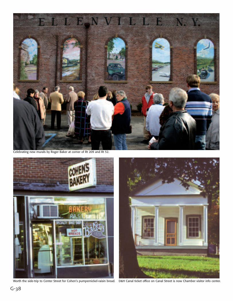
Celebrating new murals by Roger Baker at corner of Rt 209 and Rt 52.
Worth the side-trip to Center Street for Cohen’s pumpernickel-raisin bread. D&H Canal ticket office on Canal Street is now Chamber visitor info center.
G-39
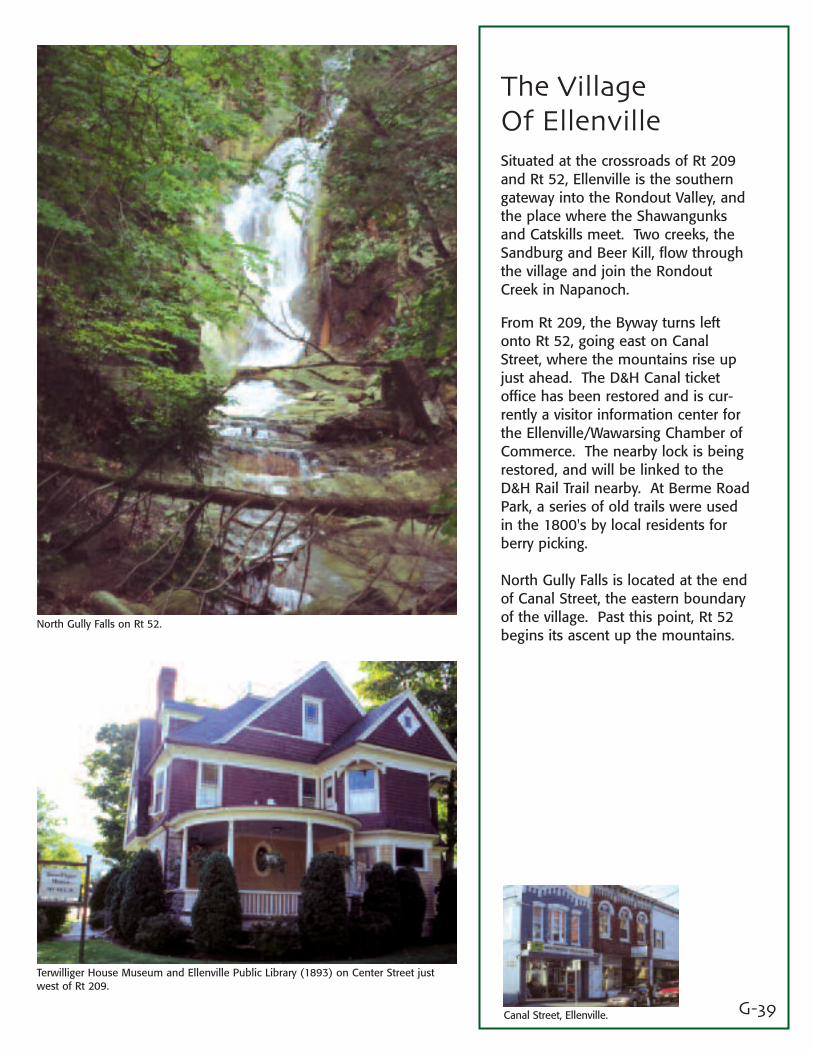
The VillageOf EllenvilleSituated at the crossroads of Rt 209and Rt 52, Ellenville is the southerngateway into the Rondout Valley, andthe place where the Shawangunksand Catskills meet. Two creeks, theSandburg and Beer Kill, flow throughthe village and join the RondoutCreek in Napanoch.
From Rt 209, the Byway turns leftonto Rt 52, going east on CanalStreet, where the mountains rise upjust ahead. The D&H Canal ticketoffice has been restored and is cur-rently a visitor information center forthe Ellenville/Wawarsing Chamber ofCommerce. The nearby lock is beingrestored, and will be linked to theD&H Rail Trail nearby. At Berme RoadPark, a series of old trails were usedin the 1800's by local residents forberry picking.
North Gully Falls is located at the endof Canal Street, the eastern boundaryof the village. Past this point, Rt 52begins its ascent up the mountains.
North Gully Falls on Rt 52.
Terwilliger House Museum and Ellenville Public Library (1893) on Center Street justwest of Rt 209.
Canal Street, Ellenville.
G-40
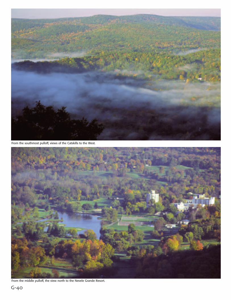
From the southmost pulloff, views of the Catskills to the West.
From the middle pulloff, the view north to the Nevele Grande Resort.
G-41
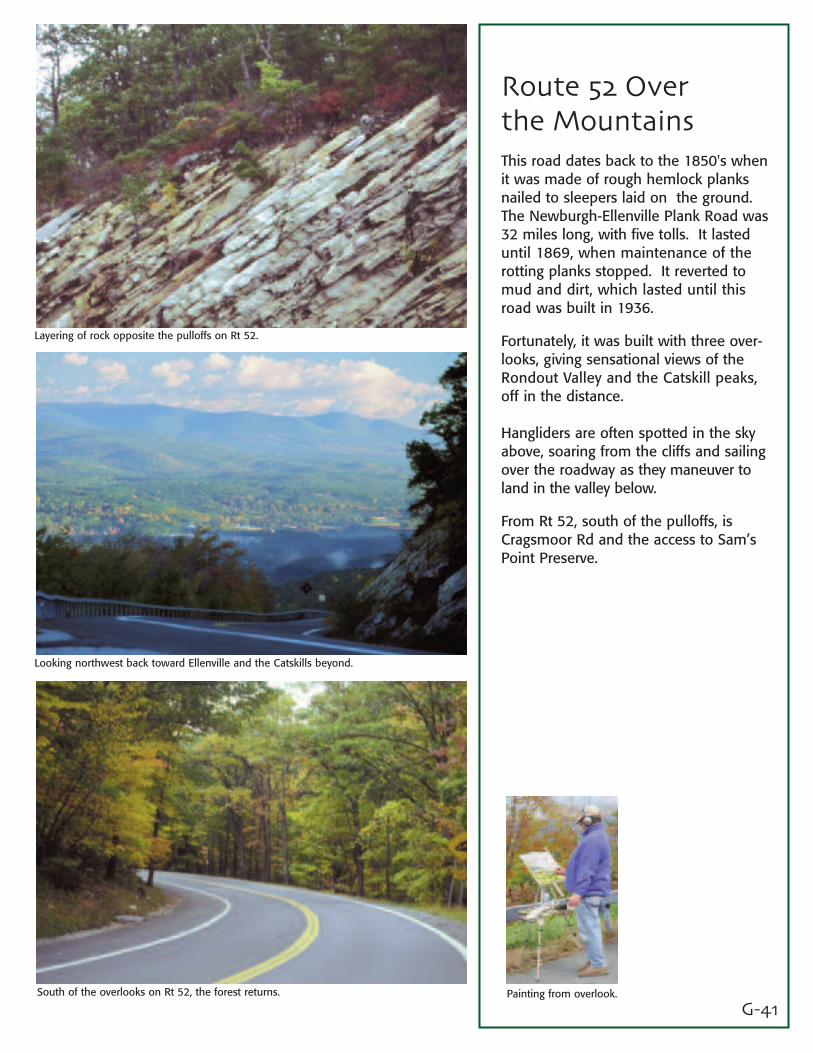
Route 52 Overthe MountainsThis road dates back to the 1850's whenit was made of rough hemlock planksnailed to sleepers laid on the ground.The Newburgh-Ellenville Plank Road was32 miles long, with five tolls. It lasteduntil 1869, when maintenance of therotting planks stopped. It reverted tomud and dirt, which lasted until thisroad was built in 1936.
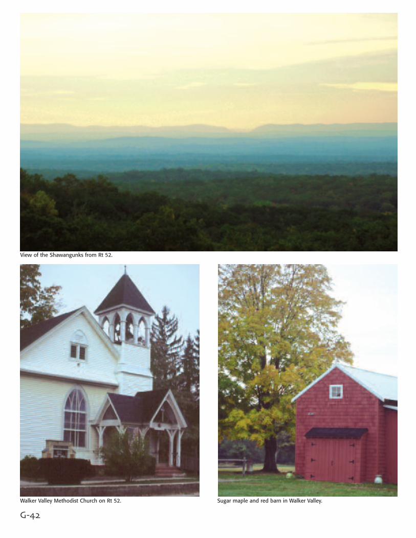
Fortunately, it was built with three over-looks, giving sensational views of theRondout Valley and the Catskill peaks,off in the distance.
Hangliders are often spotted in the skyabove, soaring from the cliffs and sailingover the roadway as they maneuver toland in the valley below.
From Rt 52, south of the pulloffs, isCragsmoor Rd and the access to Sam’sPoint Preserve.
Layering of rock opposite the pulloffs on Rt 52.
Looking northwest back toward Ellenville and the Catskills beyond.
South of the overlooks on Rt 52, the forest returns. Painting from overlook.
G-42
View of the Shawangunks from Rt 52.
Walker Valley Methodist Church on Rt 52. Sugar maple and red barn in Walker Valley.
G-43
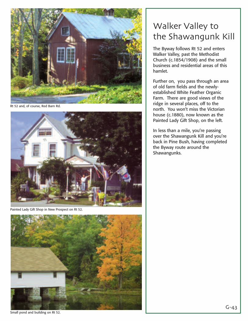
Walker Valley to the Shawangunk KillThe Byway follows Rt 52 and entersWalker Valley, past the MethodistChurch (c.1854/1908) and the smallbusiness and residential areas of thishamlet.
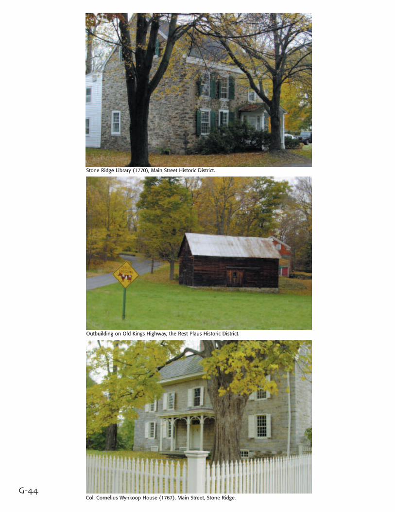
Further on, you pass through an areaof old farm fields and the newly-established White Feather OrganicFarm. There are good views of theridge in several places, off to thenorth. You won’t miss the Victorianhouse (c.1880), now known as thePainted Lady Gift Shop, on the left.
In less than a mile, you’re passingover the Shawangunk Kill and you’reback in Pine Bush, having completedthe Byway route around theShawangunks.
Rt 52 and, of course, Red Barn Rd.
Painted Lady Gift Shop in New Prospect on Rt 52.
Small pond and building on Rt 52.
G-44
Stone Ridge Library (1770), Main Street Historic District.
Outbuilding on Old Kings Highway, the Rest Plaus Historic District.
Col. Cornelius Wynkoop House (1767), Main Street, Stone Ridge.
G-45
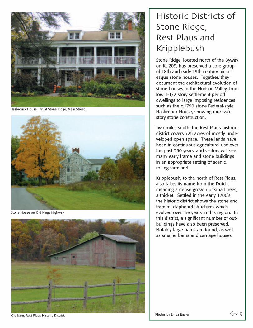
Historic Districts ofStone Ridge, Rest Plaus andKripplebushStone Ridge, located north of the Bywayon Rt 209, has preserved a core groupof 18th and early 19th century pictur-esque stone houses. Together, theydocument the architectural evolution ofstone houses in the Hudson Valley, fromlow 1-1/2 story settlement perioddwellings to large imposing residencessuch as the c.1790 stone Federal-styleHasbrouck House, showing rare two-story stone construction.
Two miles south, the Rest Plaus historicdistrict covers 725 acres of mostly unde-veloped open space. These lands havebeen in continuous agricultural use overthe past 250 years, and visitors will seemany early frame and stone buildingsin an appropriate setting of scenic,rolling farmland.
Kripplebush, to the north of Rest Plaus,also takes its name from the Dutch,meaning a dense growth of small trees,a thicket. Settled in the early 1700's,the historic district shows the stone andframed, clapboard structures whichevolved over the years in this region. Inthis district, a significant number of out-buildings have also been preserved.Notably large barns are found, as wellas smaller barns and carriage houses.
Hasbrouck House, Inn at Stone Ridge, Main Street.
Stone House on Old Kings Highway.
Old barn, Rest Plaus Historic District. Photos by Linda Engler
The Mountain House is a turreted seven-story architectural delight that stretches nearly an eighth of a mile along Lake Mohonk.
G-46Gazebos offer a natural perch for viewing. Dazzling perennial gardens offer a contrast to the natural forested landscape.
G-47
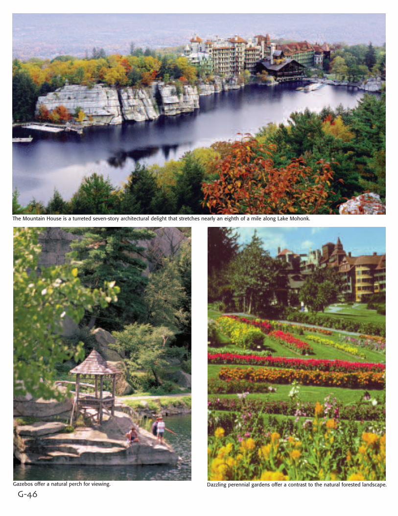
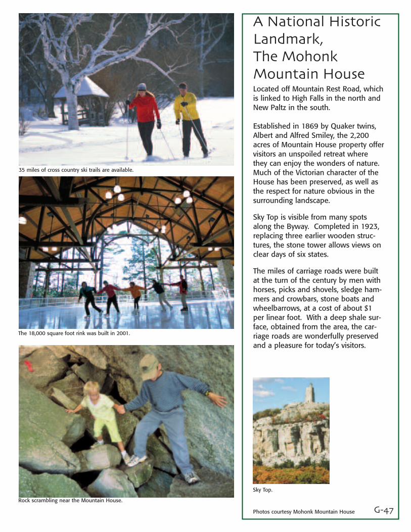
A National HistoricLandmark, The Mohonk Mountain HouseLocated off Mountain Rest Road, whichis linked to High Falls in the north andNew Paltz in the south.
Established in 1869 by Quaker twins,Albert and Alfred Smiley, the 2,200acres of Mountain House property offervisitors an unspoiled retreat wherethey can enjoy the wonders of nature.Much of the Victorian character of theHouse has been preserved, as well asthe respect for nature obvious in thesurrounding landscape.
Sky Top is visible from many spotsalong the Byway. Completed in 1923,replacing three earlier wooden struc-tures, the stone tower allows views onclear days of six states.
The miles of carriage roads were builtat the turn of the century by men withhorses, picks and shovels, sledge ham-mers and crowbars, stone boats andwheelbarrows, at a cost of about $1per linear foot. With a deep shale sur-face, obtained from the area, the car-riage roads are wonderfully preservedand a pleasure for today’s visitors.
35 miles of cross country ski trails are available.
The 18,000 square foot rink was built in 2001.
Rock scrambling near the Mountain House.
Sky Top.
Photos courtesy Mohonk Mountain House
G-48
Bevier - Elting House, c.1690
Freer House, c.1720
1717 French Church, rebuilt 1972.

G-49
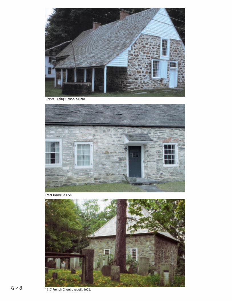
Huguenot StreetNational HistoricLandmark DistrictLocated just east of the Wallkill River offRt 299, Huguenot Street is one of theoldest streets in America with its originalhouses. It is the site of six stone houses,the earliest dating back to the late seven-teenth century. Along with a 1705 fortand a reconstructed 1717 French churchand burial ground, they're a cherishedheritage of the twelve French Huguenotfamilies who settled here in what wasthen a Dutch colony.
Escaping religious and political persecu-tion, the Huguenots first found refuge inPaltz on the Rhine River and then inwhat is now Kingston, NY. They followedthe fertile land down the Wallkill valley,settling nearly 40,000 acres, which theyowned in common.
Their first homes were crude shelters.These were gradually replaced with sturdy stone structures, heavily timberedwith massive beams, reminiscent of thearchitecture of their French homeland.Inside, visitors see jambless fireplaces,stone cellar kitchens and a Dutch wallbed, as well as a wealth of period andheirloom furnishings.
Jean Hasbrouck House, 1721.
Many homes include period furnishings.
DuBois Fort, 1705.
Re-enactors
Photos courtesy Huguenot Historical Society.
G-50
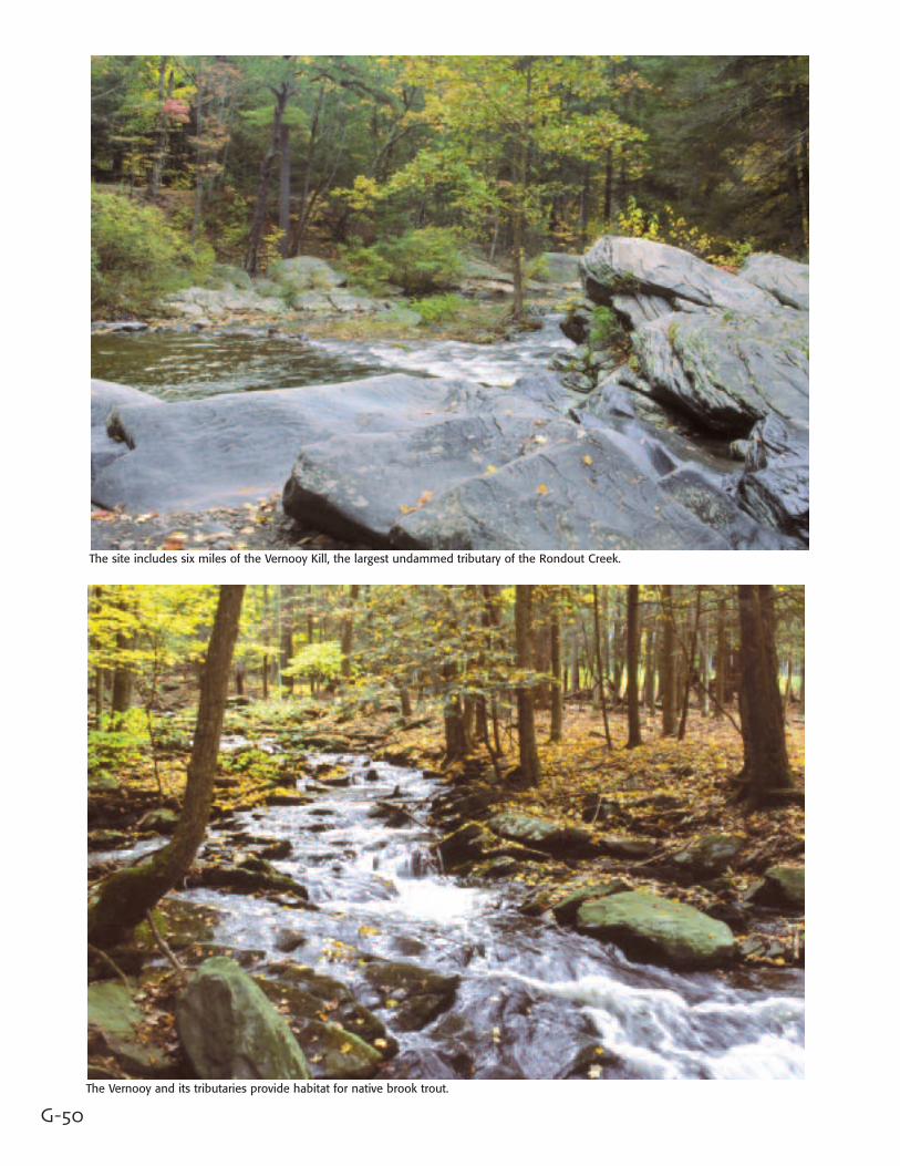
The site includes six miles of the Vernooy Kill, the largest undammed tributary of the Rondout Creek.
The Vernooy and its tributaries provide habitat for native brook trout.
G-51
In The Region:
Vernooy KillState ForestAccess to this new state forest from theByway is at Lundy Road and Rt 209 inWawarsing.
Formerly the Lundy Estate, it was con-veyed to the State by the Open SpaceInstitute and the Trust for Public Land.It will be managed by the DEC concur-rently with the adjoining Sundown WildForest of the Catskill Forest Preserve.
The 3,688-acre unit will be managed asa reforestation area and will providehabitat for a variety of upland wildlifespecies, including the protected easterntimber rattlesnake.
This tract is the largest parcel of animportant corridor linking theShawangunks to the Catskills. It hasthe potential to accommodate a rerouteof the Long Path (perhaps along theVernooy Kill) that would eliminatemiles of road hiking. In addition,hunting, fishing, trapping, mountainbiking, horseback riding, snowmobiling,cross-country skiing and camping willbe permitted.
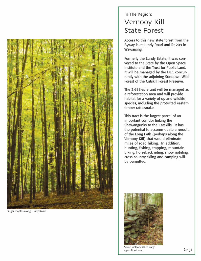
Sugar maples along Lundy Road.
Stone wall attests to earlyagricultural use.
G-52
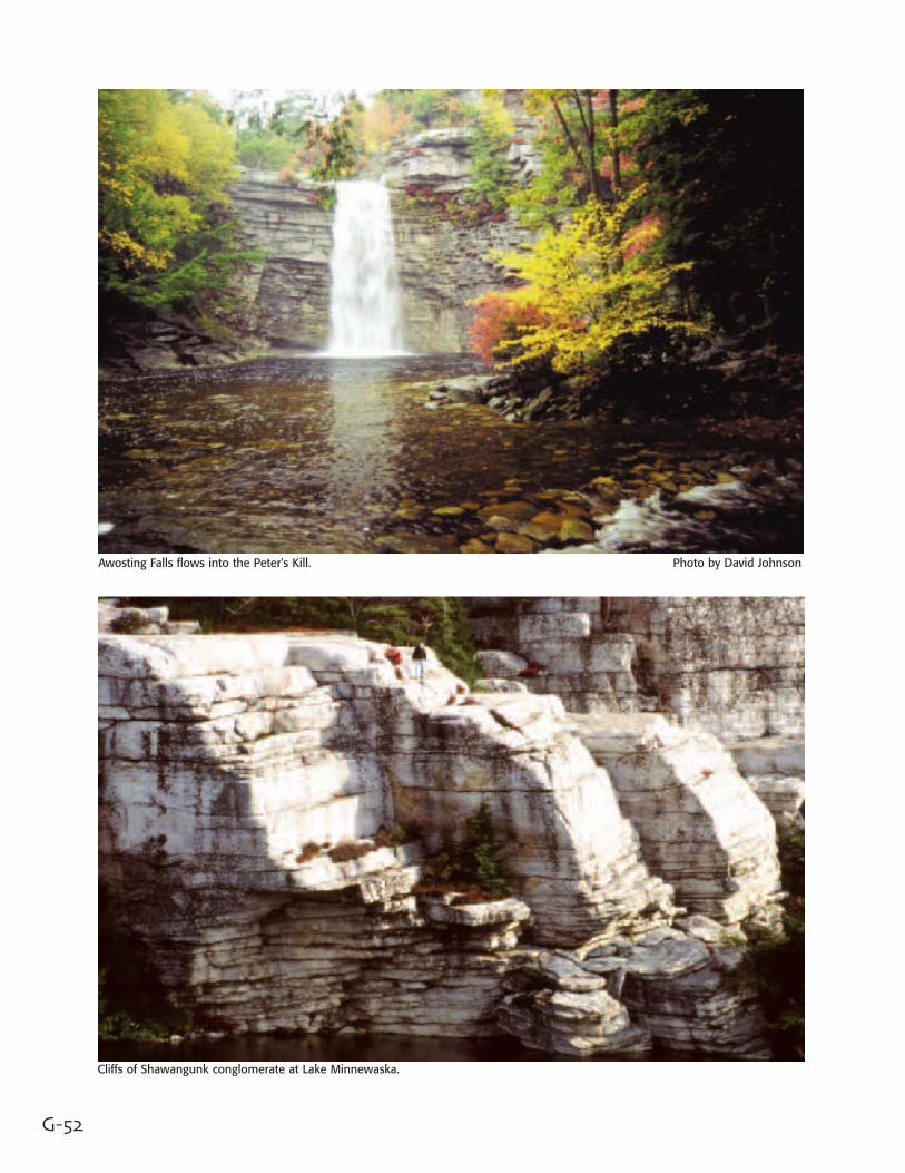
Awosting Falls flows into the Peter's Kill. Photo by David Johnson
Cliffs of Shawangunk conglomerate at Lake Minnewaska.
G-53
In The Region:
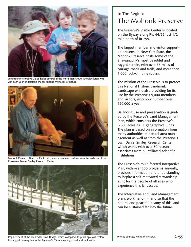
Minnewaska StatePark PreserveWith access from the Byway on Rts44/55, Minnewaska State Park Preserveis best understood by realizing that itis both a State Park and a Preserve. Itscharge is to serve the recreationalneeds of the public and still preservethe unique features which make thissuch a special place.
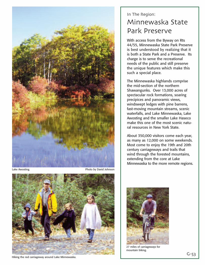
The Minnewaska highlands comprisethe mid-section of the northernShawangunks. Over 13,000 acres ofspectacular rock formations, soaringprecipices and panoramic views,windswept ledges with pine barrens,fast-moving mountain streams, scenicwaterfalls, and Lake Minnewaska, LakeAwosting and the smaller Lake Hasecomake this one of the most scenic natu-ral resources in New York State.
About 350,000 visitors come each year,as many as 12,000 on some weekends.Most come to enjoy the 19th and 20thcentury carriageways and trails thatwind through the forested mountains,extending from the core at LakeMinnewaska to the more remote regions.
Photo by David JohnsonLake Awosting.
Hiking the red carriageway around Lake Minnewaska.
27 miles of carriageways formountain biking.
G-54
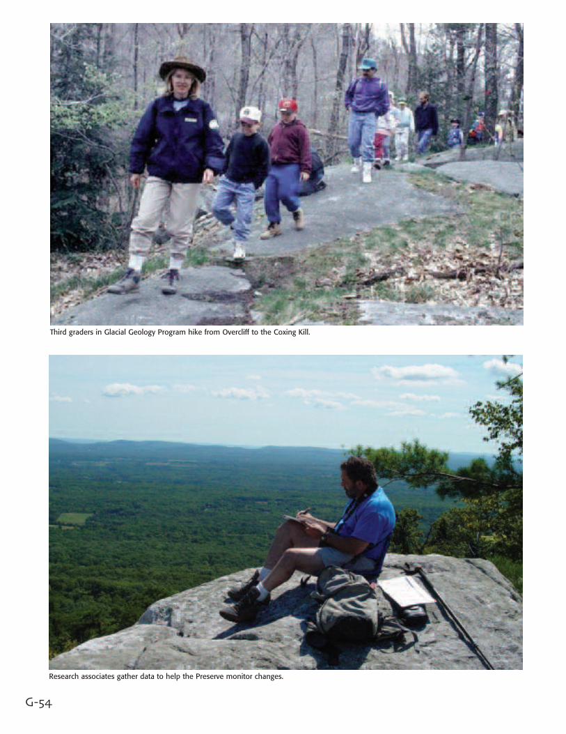
Third graders in Glacial Geology Program hike from Overcliff to the Coxing Kill.
Research associates gather data to help the Preserve monitor changes.
G-55
In The Region:
The Mohonk PreserveThe Preserve’s Visitor Center is locatedon the Byway along Rts 44/55 just 1/2mile north of Rt 299.
The largest member and visitor support-ed preserve in New York State, theMohonk Preserve hosts some of theShawangunk’s most beautiful andrugged terrain, with over 65 miles ofcarriage roads and trails, and more than1,000 rock-climbing routes.
The mission of the Preserve is to protectthis National Historic LandmarkLandscape while also providing for itsuse by the Preserve's 9,000 membersand visitors, who now number over150,000 a year.
Balancing use and preservation is guid-ed by the Perserve’s Land ManagementPlan, which considers the Preserve’s6,500 acres as 11 geographical units.The plan is based on information frommany authorities in natural area man-agement as well as from the Preserve’sown Daniel Smiley Research Center,which works with over 50 researchassociates from 30 affiliated scientificinstitutions.
The Preserve’s multi-faceted InterpretivePlan, with over 200 programs annually,provides information and understandingto inspire a self-motivated stewardshipethic for the people of all ages whoexperience this landscape.
The Interpretive and Land Managementplans work hand-in-hand so that thenatural and peaceful beauty of this landcan be sustained far into the future.
Volunteer Interpretive Guide helps several of the more than 6,000 schoolchildren whovisit each year understand the fascinating mysteries of nature.
Mohonk Research Director, Paul Huth, shows specimen red fox from the archives of thePreserve’s Daniel Smiley Research Center.
Replacement of the old Cedar Drive Bridge, which collapsed 40 years ago, will restorethe largest missing link in the Preserve’s 65-mile carriage road and trail system.
Photos courtesy Mohonk Preserve.
G-56
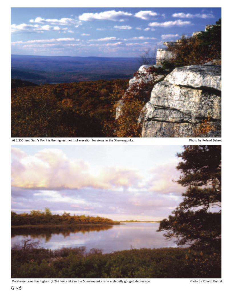
At 2,255 feet, Sam’s Point is the highest point of elevation for views in the Shawangunks. Photo by Roland Bahret
Maratanza Lake, the highest (2,242 feet) lake in the Shawangunks, is in a glacially gouged depression. Photo by Roland Bahret
G-57
In The Region:
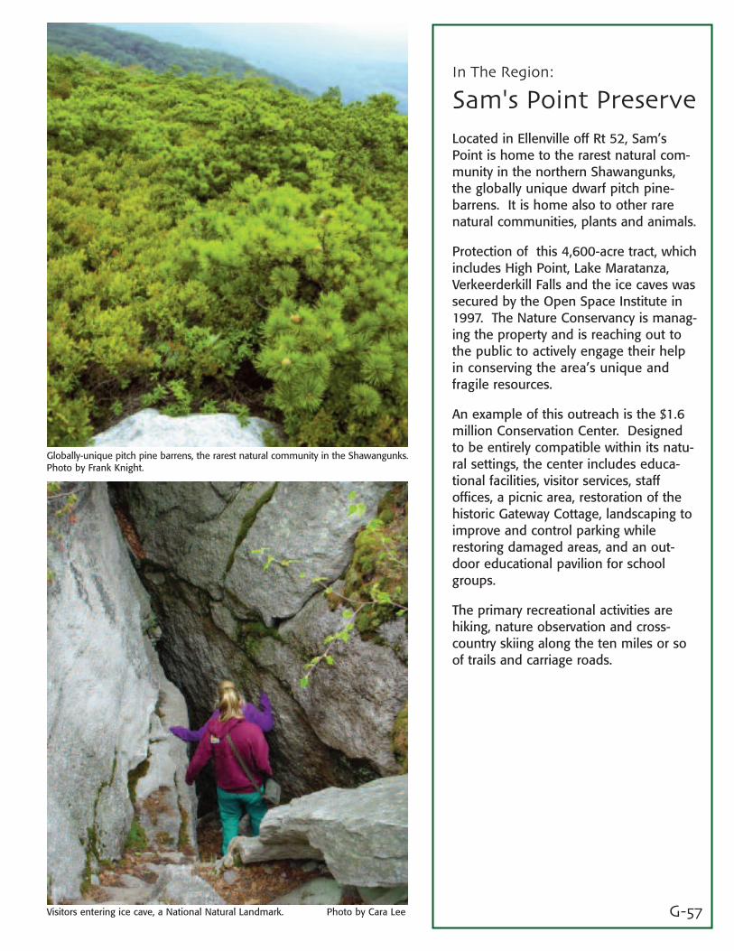
Sam's Point PreserveLocated in Ellenville off Rt 52, Sam’sPoint is home to the rarest natural com-munity in the northern Shawangunks,the globally unique dwarf pitch pine-barrens. It is home also to other rarenatural communities, plants and animals.
Protection of this 4,600-acre tract, whichincludes High Point, Lake Maratanza,Verkeerderkill Falls and the ice caves wassecured by the Open Space Institute in1997. The Nature Conservancy is manag-ing the property and is reaching out tothe public to actively engage their helpin conserving the area’s unique andfragile resources.
An example of this outreach is the $1.6million Conservation Center. Designedto be entirely compatible within its natu-ral settings, the center includes educa-tional facilities, visitor services, staffoffices, a picnic area, restoration of thehistoric Gateway Cottage, landscaping toimprove and control parking whilerestoring damaged areas, and an out-door educational pavilion for schoolgroups.
The primary recreational activities arehiking, nature observation and cross-country skiing along the ten miles or soof trails and carriage roads.
Visitors entering ice cave, a National Natural Landmark. Photo by Cara Lee
Globally-unique pitch pine barrens, the rarest natural community in the Shawangunks.Photo by Frank Knight.
G-58
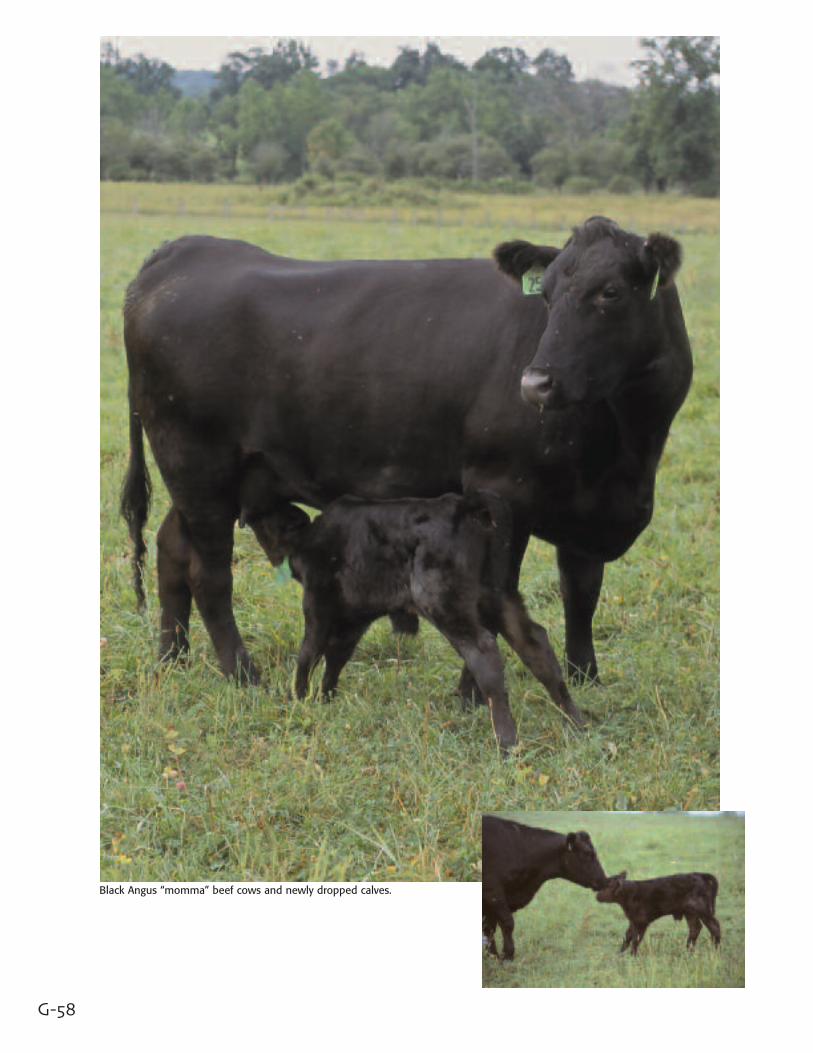
Black Angus “momma” beef cows and newly dropped calves.
G-59
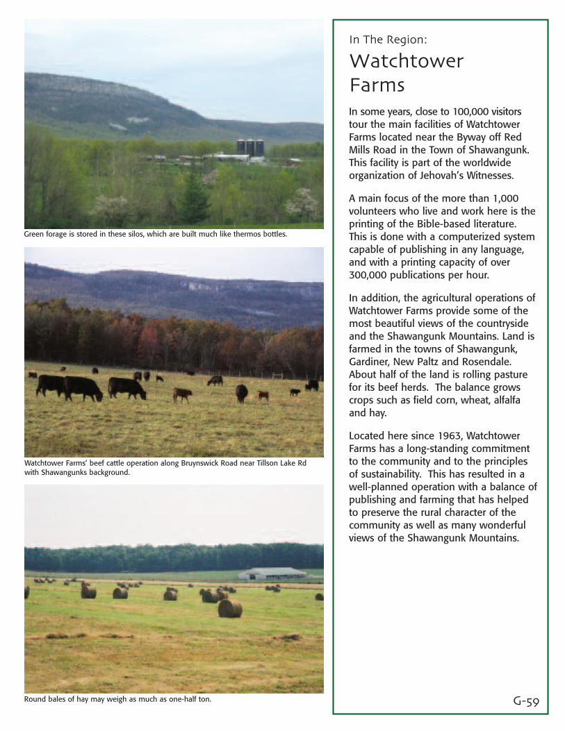
In The Region:
WatchtowerFarmsIn some years, close to 100,000 visitorstour the main facilities of WatchtowerFarms located near the Byway off RedMills Road in the Town of Shawangunk.This facility is part of the worldwideorganization of Jehovah’s Witnesses.
A main focus of the more than 1,000volunteers who live and work here is theprinting of the Bible-based literature.This is done with a computerized systemcapable of publishing in any language,and with a printing capacity of over300,000 publications per hour.
In addition, the agricultural operations ofWatchtower Farms provide some of themost beautiful views of the countrysideand the Shawangunk Mountains. Land isfarmed in the towns of Shawangunk,Gardiner, New Paltz and Rosendale.About half of the land is rolling pasturefor its beef herds. The balance growscrops such as field corn, wheat, alfalfaand hay.
Located here since 1963, WatchtowerFarms has a long-standing commitmentto the community and to the principlesof sustainability. This has resulted in awell-planned operation with a balance ofpublishing and farming that has helpedto preserve the rural character of thecommunity as well as many wonderfulviews of the Shawangunk Mountains.
Green forage is stored in these silos, which are built much like thermos bottles.
Watchtower Farms’ beef cattle operation along Bruynswick Road near Tillson Lake Rdwith Shawangunks background.
Round bales of hay may weigh as much as one-half ton.
G-60
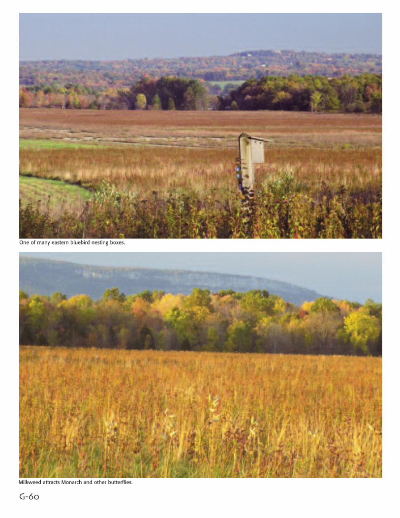
One of many eastern bluebird nesting boxes.
Milkweed attracts Monarch and other butterflies.
G-61
In The Region:
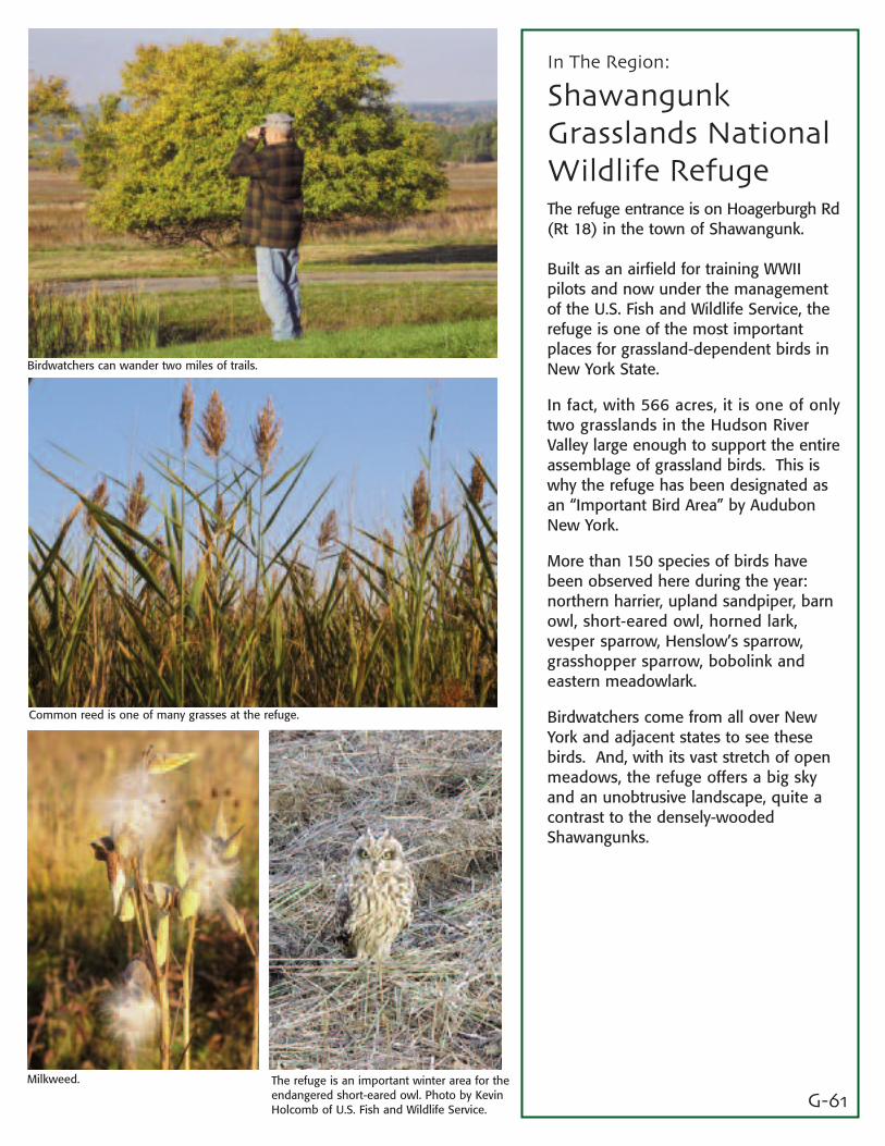
ShawangunkGrasslands NationalWildlife RefugeThe refuge entrance is on Hoagerburgh Rd(Rt 18) in the town of Shawangunk.
Built as an airfield for training WWIIpilots and now under the managementof the U.S. Fish and Wildlife Service, therefuge is one of the most importantplaces for grassland-dependent birds inNew York State.
In fact, with 566 acres, it is one of onlytwo grasslands in the Hudson RiverValley large enough to support the entireassemblage of grassland birds. This iswhy the refuge has been designated asan “Important Bird Area” by AudubonNew York.
More than 150 species of birds havebeen observed here during the year:northern harrier, upland sandpiper, barnowl, short-eared owl, horned lark, vesper sparrow, Henslow’s sparrow,grasshopper sparrow, bobolink andeastern meadowlark.
Birdwatchers come from all over NewYork and adjacent states to see thesebirds. And, with its vast stretch of openmeadows, the refuge offers a big skyand an unobtrusive landscape, quite acontrast to the densely-woodedShawangunks.
Birdwatchers can wander two miles of trails.
Common reed is one of many grasses at the refuge.
Milkweed. The refuge is an important winter area for theendangered short-eared owl. Photo by KevinHolcomb of U.S. Fish and Wildlife Service.
G-62
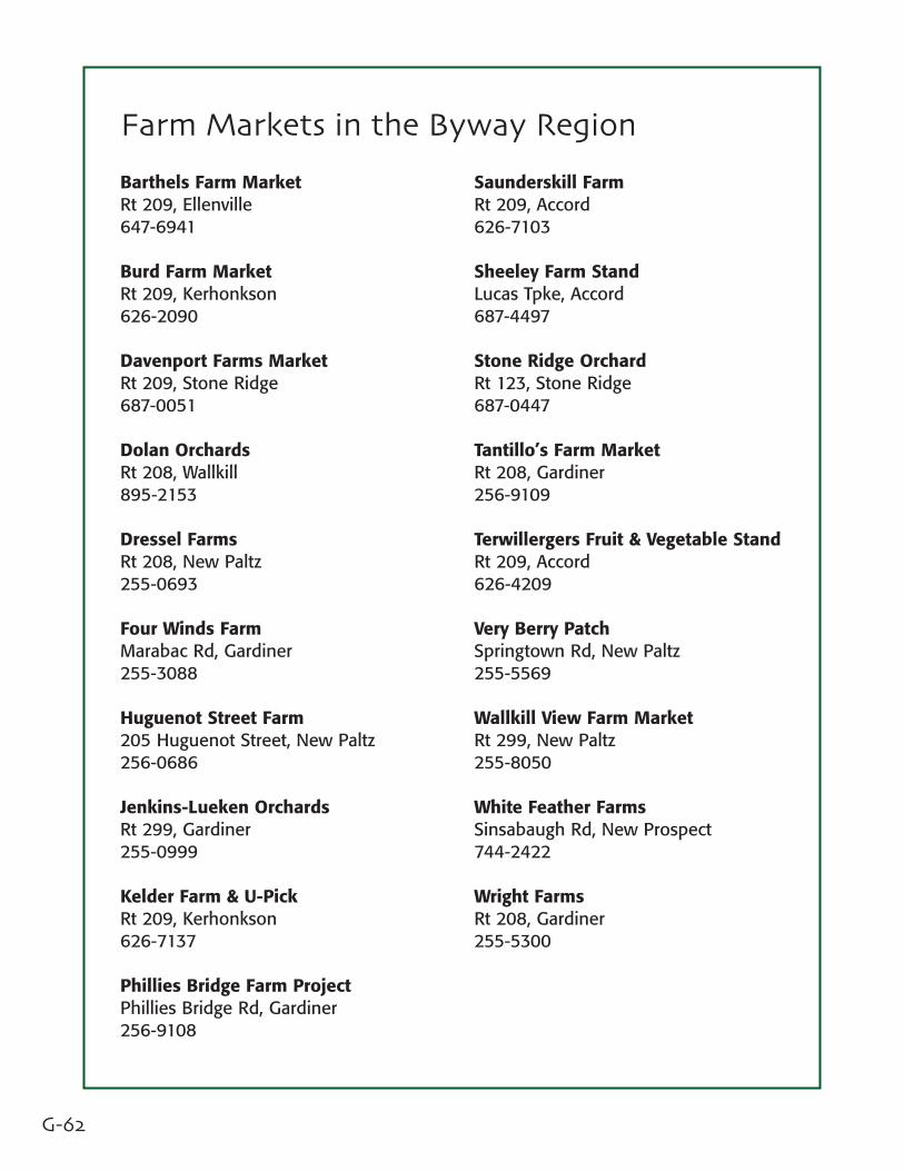
Barthels Farm MarketRt 209, Ellenville647-6941
Burd Farm MarketRt 209, Kerhonkson626-2090
Davenport Farms MarketRt 209, Stone Ridge687-0051
Dolan OrchardsRt 208, Wallkill895-2153
Dressel FarmsRt 208, New Paltz255-0693
Four Winds FarmMarabac Rd, Gardiner255-3088
Huguenot Street Farm205 Huguenot Street, New Paltz256-0686
Jenkins-Lueken OrchardsRt 299, Gardiner255-0999
Kelder Farm & U-PickRt 209, Kerhonkson626-7137
Phillies Bridge Farm ProjectPhillies Bridge Rd, Gardiner256-9108
Saunderskill FarmRt 209, Accord626-7103
Sheeley Farm StandLucas Tpke, Accord687-4497
Stone Ridge OrchardRt 123, Stone Ridge687-0447
Tantillo’s Farm MarketRt 208, Gardiner256-9109
Terwillergers Fruit & Vegetable StandRt 209, Accord626-4209
Very Berry PatchSpringtown Rd, New Paltz255-5569
Wallkill View Farm MarketRt 299, New Paltz255-8050
White Feather FarmsSinsabaugh Rd, New Prospect744-2422
Wright FarmsRt 208, Gardiner255-5300
Farm Markets in the Byway Region
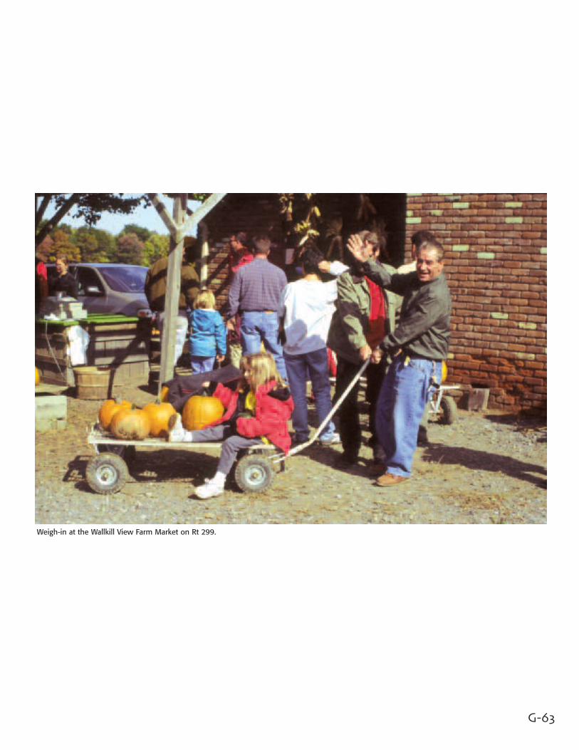
Weigh-in at the Wallkill View Farm Market on Rt 299.
G-63
G-64
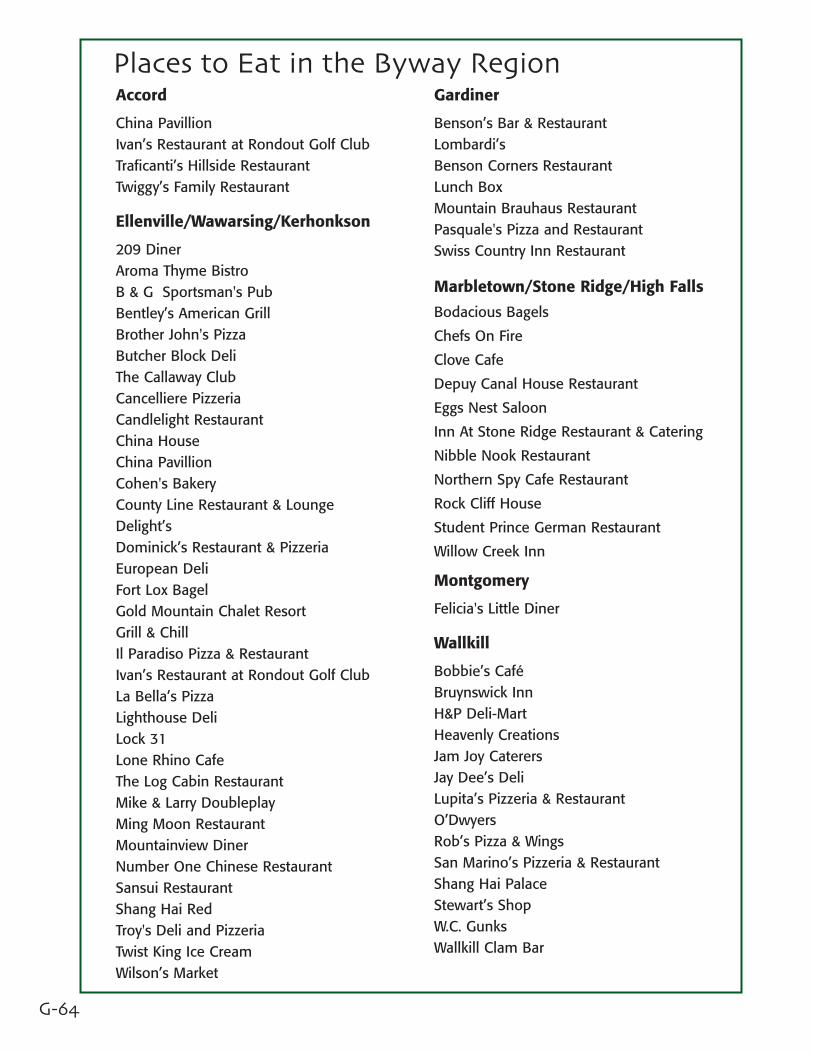
Places to Eat in the Byway RegionAccord
China PavillionIvan’s Restaurant at Rondout Golf ClubTraficanti’s Hillside RestaurantTwiggy’s Family Restaurant
Ellenville/Wawarsing/Kerhonkson
209 DinerAroma Thyme BistroB & G Sportsman's PubBentley’s American GrillBrother John's PizzaButcher Block DeliThe Callaway ClubCancelliere PizzeriaCandlelight RestaurantChina HouseChina PavillionCohen's BakeryCounty Line Restaurant & LoungeDelight’sDominick’s Restaurant & PizzeriaEuropean DeliFort Lox BagelGold Mountain Chalet ResortGrill & ChillIl Paradiso Pizza & RestaurantIvan’s Restaurant at Rondout Golf ClubLa Bella’s PizzaLighthouse DeliLock 31Lone Rhino CafeThe Log Cabin RestaurantMike & Larry DoubleplayMing Moon RestaurantMountainview DinerNumber One Chinese RestaurantSansui RestaurantShang Hai RedTroy's Deli and PizzeriaTwist King Ice CreamWilson’s Market
Gardiner
Benson’s Bar & RestaurantLombardi’sBenson Corners RestaurantLunch BoxMountain Brauhaus RestaurantPasquale's Pizza and RestaurantSwiss Country Inn Restaurant
Marbletown/Stone Ridge/High Falls
Bodacious Bagels
Chefs On Fire
Clove Cafe
Depuy Canal House Restaurant
Eggs Nest Saloon
Inn At Stone Ridge Restaurant & Catering
Nibble Nook Restaurant
Northern Spy Cafe Restaurant
Rock Cliff House
Student Prince German Restaurant
Willow Creek Inn
Montgomery
Felicia's Little Diner
Wallkill
Bobbie’s CaféBruynswick InnH&P Deli-MartHeavenly CreationsJam Joy CaterersJay Dee’s DeliLupita’s Pizzeria & RestaurantO’DwyersRob’s Pizza & WingsSan Marino’s Pizzeria & RestaurantShang Hai PalaceStewart’s ShopW.C. GunksWallkill Clam Bar
G-65
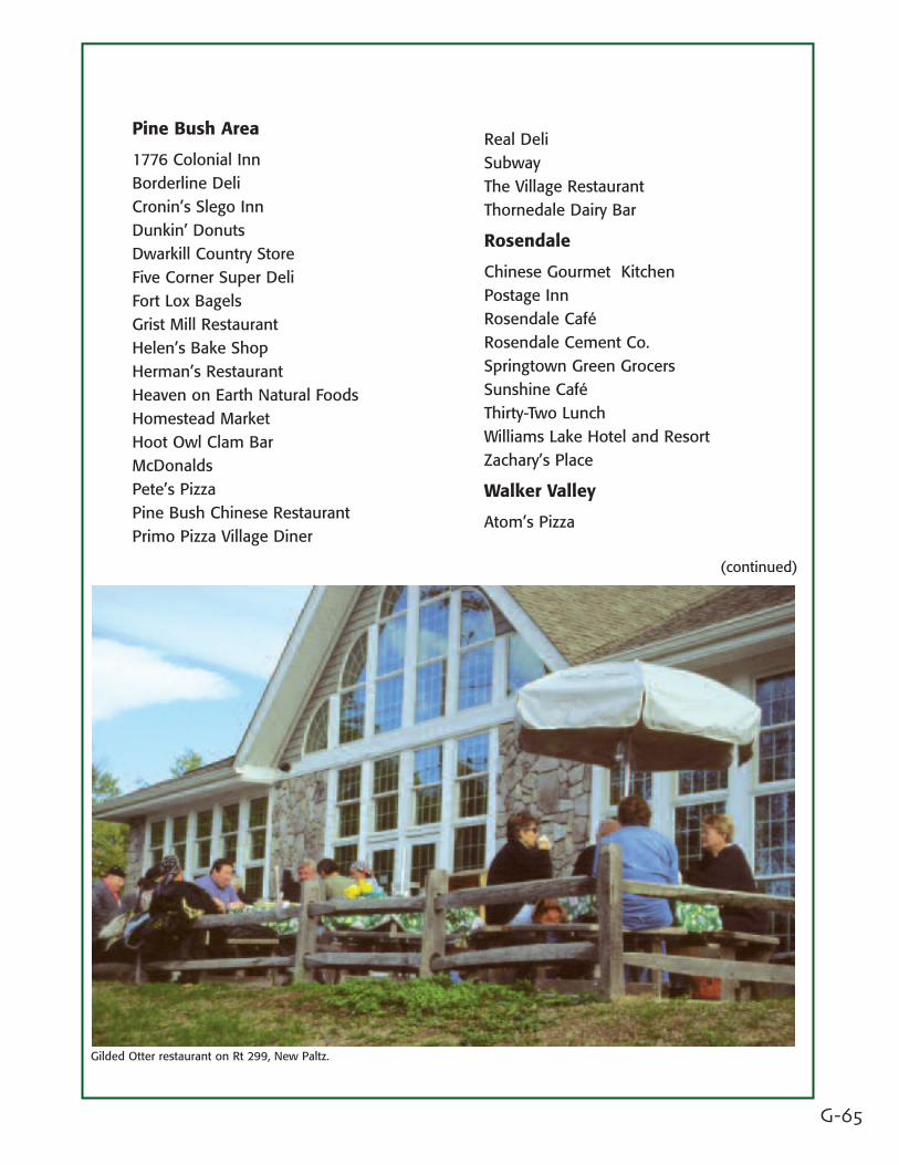
Gilded Otter restaurant on Rt 299, New Paltz.
Pine Bush Area
1776 Colonial InnBorderline DeliCronin’s Slego InnDunkin’ DonutsDwarkill Country StoreFive Corner Super DeliFort Lox BagelsGrist Mill RestaurantHelen’s Bake ShopHerman’s RestaurantHeaven on Earth Natural FoodsHomestead MarketHoot Owl Clam BarMcDonaldsPete’s PizzaPine Bush Chinese RestaurantPrimo Pizza Village Diner
Real DeliSubwayThe Village RestaurantThornedale Dairy Bar
Rosendale
Chinese Gourmet KitchenPostage InnRosendale CaféRosendale Cement Co.Springtown Green GrocersSunshine CaféThirty-Two LunchWilliams Lake Hotel and ResortZachary’s Place
Walker Valley
Atom’s Pizza
(continued)
G-66
Places to Eat in the Byway Region
New Paltz
Anatolia
Austrian Village Restaurant
Bacchus
Barnaby’s
The Bakery
Beso Restaurant & Bar
China Buffet
China House
College Diner
Convenient Deli
Cookies & Creme
Gadaleto’s Seafood Restaurant
Gilded Otter Brewing Company
Gourmet Pizza
Great Wall Kitchen
Harvest Cafe
Hoffman’s Deli
Hokkaido Japanese Restaurant
Huguenot Street Public House
Italian Supreme Restaurant & Pizzeria
LaBella Pizza
Last Stand
LaStazione Italian Restaurant
Lemon Grass Thai Restaurant
Locust Tree Restaurant
Main Course
Main Street Bistro
McGillicuddy’s Restaurant & Tap Room
Moon Light Cafe
My Hero Pizzeria
Neko Sushi & Restaurant
New Paltz Indian Restaurant
Oasis Cafe
Pasquale's Pizza and Restaurant
Plaza Diner
P&G’s Restaurant
Rino's Pizza
Rocco's
Starbucks
Stewart’s Shop
Tommy C’s Deli
Toscani's Restaurant & Piano Bar
Village Pizza
Village Tearoom and Restaurant
Yanni Restaurant & Cafe
G-67
Places to Stay in the Byway Region
Ellenville/Wawarsing
Catskill Mountain House
Chelsea Motel
Colonial Motel
Gold Mountain Chalet Resort
Mountain View Cabins
Nevele Grande Hotel
Spring Glen Campgrounds
Village Motel
Gardiner
Country Meadows Bed & Breakfast
Minnewaska Lodge
Yogi Bear’s Jellystone Park Campground
Marbletown
Bakers Bed & Breakfast
Sparrow Hawk Bed & Breakfast
New Paltz
87 Motel
Econolodge
Rodeway Inn
Lefevre House B&B
Mohonk Mountain House
New Paltz Hostel
Super 8 Motel
Moon Dance Ridge B&B
Inn at Orchard Heights
Mountain Meadows B&B
Rochester
Hudson Valley Resort & Spa
Pine Grove Dude Ranch
Rondout Valley Campground
Rosendale
Captain Schoonmaker Bed & Breakfast
High Falls Motel
Williams Lake Resort
Pine Bush Area
Harvest Inn Motel
Celtic Pines Farm Bed & Breakfast
Walker Valley
Jeronimo’s Resort & Conference Center
Wallkill
Abada & Jackson Bed & Breakfast
Audrey’s Farm House Bed & Breakfast
Pine Acres Camp
Rhinehardt House Bed & Breakfast
Scofide’s Cottages
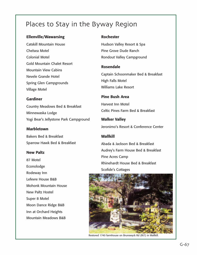
Restored 1740 farmhouse on Brunswyck Rd (Rt7) in Wallkill.