Saudi Space Geodesy (SSG): Road Map for...
30
Saudi Space Geodesy (SSG): Road Map for Fundamental Station By: Attieh Alghamdi King Abdulaziz City for Science and Technology (KACST), Riyadh Saudi Arabia Presented in Space Geodesy Workshop, Matjiesfontein, South Africa Nov. 2007 Riyadh-SLR Saudi Arabia 12 y e ars
Transcript of Saudi Space Geodesy (SSG): Road Map for...

Saudi Space Geodesy (SSG):
Road Map for Fundamental Station
By: Attieh Alghamdi
King Abdulaziz City for Science and Technology (KACST), Riyadh Saudi Arabia
Presented inSpace Geodesy Workshop, Matjiesfontein, South Africa
Nov. 2007
Riyadh-SLR
Saudi Arabia
12 y
ears

Riyadh-SLR Manager
Program Sector Coordinator
Maintenance Sector Coordinator
Operation Sector Coordinator
Operator Electrical Eng.
Mechanical Eng.
Operator
Operator
Operator
Operator
Operator
SLR Program
Microcosm Program
Lunar LRProgram
LIDARProgram
Technician
South African Coorponation
Morning Shift
AfternoonShift
NightShift
12 y
ears

Space Geodesy STAFF
17 LIDAR Specialist --------------------
16 Lunar LR --------------------
15 For → Microcosm Program Salman Al-ghamdi
14 For → SLR program & Ganet Abdullah Al-ghamdi
13 Program Sector Coordinator Sami Al-Juhani
12 Operator Naeef Al Sayeed
11 Operator Bander Al Aqeel
10 Operator Alex
9 Operator Beby
8 Operator Sultan Al-masowd
7 Operator Saud Al-harkan
6 Operation Sector Coordinator Eng. Khalid S. Al-ghamdi
5 Technician Mohammed Al-Sultan
4 Mechanical Eng. Dany
3 Electrical Eng. Roy
2 Maintenance Sector Coordinator Abdulaziz Ben Shiehwyyn
1 Space Geodesy Manager Dr. Attieh A Al-ghamdi
NO Position Name
12 y
ears

Schematic diagram of Riyadh-SLR system: An Overall view
Electronic Workshop
Mechanical Workshop
12 y
ears

Satellite laser ranging data procedure at Riyadh-SLR
Riyadh-SLR STATION AT
SOLAR VELLEGE
SLR BUILDINGAT SOLAR VELLEGE
NASA-CDDISDATA STORE
Internet
IRV’ S DATA FOR STATION POSITION
ON SITE ANALYSIS
NORMAL POINT FORMAT DATA
12 y
ears

Applications
� MANY GEODTIC PARAMETERS CAN BE DETERMINEDWE MEASURE THE TIME OF FLIGHT OF PHOTON
� WE ARE ABLE TO DETERMINE:- ROTATION OF THE EARTH- TECTONIC MOTION- THE ORBIT OF SATELLITES- OUR OWN POSITION RELATIVE TO EARTH’S CENTER OF
GRAVITY TO MANY APPLICATIONS OF SLR
12 y
ears

“ Riyadh-SLR ” CONTRIBUTION TO EARTH SCIENCE
� Riyadh-SLR with the rest global Satellite Laser Ranging (SLR) network: have evolved into a powerful source of data for studies of the solid Earth and its ocean and atmospheric systems
� Riyadh-SLR with the rest global Satellite Laser Ranging (SLR) network: provides precise orbit determination for spaceborne radar altimeter missions mapping the ocean surface (which are used to model global ocean circulation), for mapping volumetric changes in continental ice masses, and for land topography
� Riyadh-SLR with the rest global Satellite Laser Ranging (SLR) network: provides a means for subnanosecond global time transfer, and a basis for special tests of the Theory of General Relativity
12 y
ears

Riyadh-SLR Contributions
� SLR SUPPORTS DIRECT SENSING OF SURFACE ELEVATIONS
� SLR CONTRIBUTES TO SEA AND ICE LEVEL MONITORING
� SLR Measures the Long Term Dynamics of the Solid Earth, Oceans and Atmosphere
12 y
ears
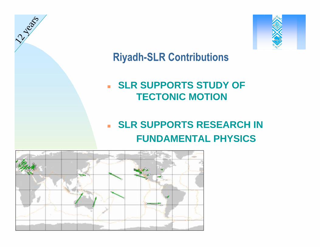
� SLR SUPPORTS STUDY OF TECTONIC MOTION
� SLR SUPPORTS RESEARCH INFUNDAMENTAL PHYSICS
Riyadh-SLR Contributions
12 y
ears

SLR OPERATIONS ARE STEADILY IMPROVING
� SLR data yield has improved through:· Real-time data processing,· Satellite pass interleaving,· System upgrades,· Additional operating, and· Additional Satellites.
12 y
ears

12 y
ears

12 y
ears
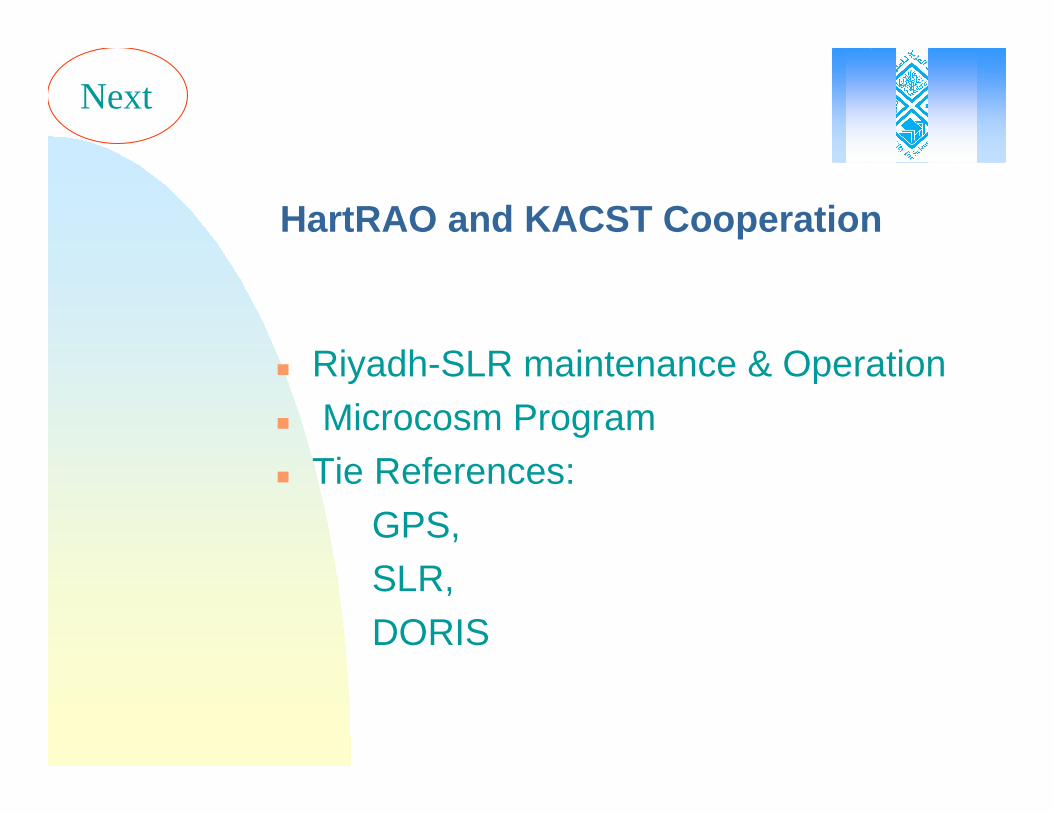
HartRAO and KACST Cooperation
� Riyadh-SLR maintenance & Operation
� Microcosm Program� Tie References:
GPS, SLR,
DORIS
Next

SAUDI SPACE GEODESY PROGRAM
� Satellite Laser Ranging (SLR)� Luner Laser Ranging (LLR)� Doppler Orbitography and Radio-positioning
Integrated by Satellite (DORIS)� Navigations
GPSGalilleoGLONASS
Next

Collaboration Sectors (in Riyadh-SLR) with HartRAO
Program Maintenance Operation
Operation Training Maintenance Training
Laser Upgrade Collaboration
Commun. Solution
Microcosm ProgramTraining
LIDARProgramTraining
Lunar LRProgramTraining
Radar Instillation
Next
Project with South Africa
Started in 2004 and will be installed in Riyadh-SLR soon

Collaboration Time Frame
SLR Conference at KACST Collaboration
LASER Upgrade Collaboration
LUNAR Pro. Training & Project Collaboration
LIDAR Pro. Training & Project Collaboration
MICROCOSM Pro. Training Collaboration
SLR Program Training Collaboration
SLR RADAR Installation Collaboration
Communication solution Collaboration
Operation Training Collaboration
Telescope Inspection Collaboration
Riyadh-SLR Electronic Log-Book Collaboration
Site Survey Collaboration
12
11
10
98765432112
11
10
9876543217654321
201020092008TITLE OF EVENTS

MicroCosm analysis Program
� Microcosm Program has been installed in KACST main Offices in Riyadh last month
� There going to be a training in Feb. 2008 on microcosm program in Riyadh for both SA’s staff
(This will be arranged later)
Next

Riyadh-SLR System Development
PURPOSE� To finesse system works to avoid catastrophic failures,
minimise downtime, and therefore cost of ownership.
� To provide KACST with a state-of-the-art KHz SLR system, and therefore, a technology transfer.
� To involve KACST engineers in system development
� System (HP1000, Continuum YG501, ContravesMPACS, EOS CAMAC timing system, WeatherTronicsmets etc) becoming difficult to reliably maintain due to component age and limited spares availability.
� To categorise component failures according to their impact on the system and budget.
Next

Major challenges facing KACST at present
� How to migrate the system to the modern KHz regime (higher productivity, millimetre accuracy).
� How to build internal expertise necessary for controlling the project, from a technical point of view.
� How to avoid catastrophic failures from occurring in the elderly system that’s currently operational.
� How to transfer system knowledge to KACST personnel.
Next

SYSTEM SCHEMATIC
Indicates PC for control functions
Indicates peripheral devices
Indicates network control device
TDS (Telescope& Dome System)PCControl, status, pointing, tracking
Internet machine
PC
Router
MetsPC
RGG (embedded PC)KHz Signal gating, queue handling, epoch, interpolator, collision control etc
GPS Timing Receiver
Receiver
Laser
SBC(Java PC)Event handler, signal attenuation, optical path controls etc
A032 Timer(s)
T/R system
Broadband connection
˚C%
mB Operator PC:Scheduling, user feedback, system control
KACST’sRadarsystem
Next

Glossary
� A032-ET Of-the-shelf event timer, product of Technical University of Riga, Latvia.� Brashear new name for Contraves Goerz Corp, Pittsburgh PA, telescope/mount and
MPACS manufacturer� Cable wrap long cables for transmitting power and signal across an axis. (Another way
is to use slip rings.)� Collision where a shot is to be transmitted within n microseconds of the gate being
opened for an expected return.� LAN local Area Network� MCP Micro-Channel Plate (detector - multiple-stop)� RGG Range Gate Generator (KHz sampling and control device)� SBC Single Board Computer (PC controller for the A032-ET timers and T/R
system)� SLR Satellite Laser Ranging� SPAD Single Photon Avalanche Diode (detector – single stop)� TBD To Be Determined� TDS Telescope & Dome System� TLR Terrestrial laser ranging

KACST- IGN Agreement
The object of this Agreement is to define the mutual responsibilities of
the King Abdulaziz City for Science and Technology(KACST),and
the Institut Géographique National (IGN),
for the establishment and maintenance of a DORISorbitography station in the premises of the King Abdullah City
for Science and Technology (KACST), Saudi Arabia.
Doppler Orbitography and Radio-positioning Integrated by Satellite
(DORIS)
Next

Doppler Orbitography and Radio-positioning Integrated by Satellite
(DORIS)
� Centre National d'Etudes Spatiales (CNES) and the InstitutGéographique National (IGN), IGN is responsible for the installation and the maintenance of the DORIS orbitography network.
� uplink radio system whose main goals are the precise determination of the orbit of low altitude satellites, and the precise positioning of ground beacons.
� It is composed of on-board satellite receivers and of a dense, permanent network of transmitting stations distributed evenly throughout the world.
� Each DORIS station is composed of the following elements: beacon;an external antenna; an Uninterrupted Power Supply unit; a weather station measuring temperature, pressure and humidity; cables and accessories.
Next

Galileo Project
Riyad
h-SL
R
DORIS Project

NextSCHEMATIC DIAGRAM OF
THE LIDAR ROOM

Table 1 Table 2
6.4 m
Inside View Front view
Side View
Upper view
4 m 2X1.25 m
2X1.25 m
Next

LASER5-600 mJ
1064 nm
5 ns pulse width
10-30 Hz
Faraday
LL
SHG
TPTTHG
OPO
GENERATOR
BEAM BLOCK
PEROSCOPE
ALIGNMENT PRISM ON TRANSLATION RAIL
RECEIVER
COLLECTOR
(TELESCOPE)CELECTRON
F=3190
F/11 (SCHMIDT-CASSEGRAIN)
CORRECTOR PLATE IS AR/AR FOR ALL WAVELENGTHS)
CAMERA
SUN SHUTTERSPATIAL FILTER
CHOPPERDete
ctor 1
@ 15
72 nm
Detecto
r 2 @
355 n
m
Detecto
r 3 @
1064
Detecto
r 4 @
532 n
m
Spectral FilterAttenuator
PIN for 532 nm
PIN for 355 nm
PIN for 1572 nm
PIN
for
1064
nm
Next

SPECIFICATIONS
Laser:equipped with modulized laser system to ease the laser maintenance.
Our Nd:YAG laser has5-600 mJ @ 1.064 , 5ns pulse width,ppr 10-30 Hz
SHG @ 0.532 , 200 mJTHG @ 0.355 , 150 mJOPO @ 1.572 , 35 Mj
Telescopetype Celestron C14, F=3190, F/11, Schmidt-Cassegrain
ReceiverPMT detector for 1.064 SPAD detector for 0.532 SPAD detector for 0.355 AD PIN detector for 1.572
Next

�SOFTWAREAdvanced software driver to give the user more control over the printing quality
�THE CONTROL SYSTEMThe control system is operated by a PC computer under a window environment
�RADAR SYSTEMRadar system for Aircraft Safety, a standard marine radar is adapted
�ROOM DESIGNThe LIDAR system is housed in a room with fixed range window at zenith.
Continued…...

Thank you
![Welcome [geodesy.hartrao.ac.za]geodesy.hartrao.ac.za/pastevents/workshop3/johan.pdf · • Modular Precision Angular Control System ... Post upgrade tests revealed that MOBLAS- ...](https://static.fdocuments.net/doc/165x107/5b1d48c77f8b9a0b2c8bf455/welcome-modular-precision-angular-control-system-post-upgrade-tests.jpg)