RUSHMOOR BOROUGH COUNCIL Agenda 24 May... · which will be held in Room at the the Concorde Council...
140
RUSHMOOR BOROUGH COUNCIL DEVELOPMENT MANAGEMENT COMMITTEE Wednesday, 24th May, 2017 at 7.00 p.m. To: VOTING MEMBERS Cr. B.A. Thomas (Chairman) Cr. J.H. Marsh (Vice-Chairman) Cr. D.B. Bedford Cr. D.M.T. Bell Cr. R. Cooper Cr. P.I.C. Crerar Cr. Sue Dibble Cr. Jennifer Evans Cr. D.S. Gladstone Cr. C.P. Grattan Cr. A.R. Newell NON-VOTING MEMBER Cr. M.J. Tennant - Cabinet Member for Environment and Service Delivery (ex officio) STANDING DEPUTIES Cr. S.J. Masterson Cr. P.F. Rust
Transcript of RUSHMOOR BOROUGH COUNCIL Agenda 24 May... · which will be held in Room at the the Concorde Council...

RUSHMOOR BOROUGH COUNCIL
DEVELOPMENT MANAGEMENT COMMITTEE
Wednesday, 24th May, 2017 at 7.00 p.m.
To:
VOTING MEMBERS
Cr. B.A. Thomas (Chairman) Cr. J.H. Marsh (Vice-Chairman)
Cr. D.B. Bedford Cr. D.M.T. Bell Cr. R. Cooper
Cr. P.I.C. Crerar Cr. Sue Dibble Cr. Jennifer Evans
Cr. D.S. Gladstone Cr. C.P. Grattan Cr. A.R. Newell
NON-VOTING MEMBER
Cr. M.J. Tennant - Cabinet Member for Environment and Service Delivery (ex officio)
STANDING DEPUTIES
Cr. S.J. Masterson Cr. P.F. Rust


Mr. Chairman, Ladies and Gentlemen,
You are hereby summoned to a Meeting of the Development Management Committee which will be held in the Concorde Room at the Council Offices, Farnborough on Wednesday, 24th May, 2017 at 7.00 p.m. for the transaction of the business set out below. Yours faithfully,
A.E. COLVER Head of Democratic Services
Council Offices Farnborough 16th May 2017
Enquiries regarding this Agenda should be referred to Marion Young,
Administrative Assistant, Democratic Services (Tel: (01252) 398827 or e-mail: [email protected])
A full copy of this agenda can be found at the following website:
http://www.rushmoor.gov.uk/9543
A g e n d a 1. Declarations of interest –
All Members who believe they have a disclosable pecuniary interest in any matter to be considered at the meeting may not participate in any discussion or vote taken on the matter and if the interest is not registered, it must be disclosed to the meeting. In addition, Members are required to leave the meeting while the matter is discussed.
1

2. Minutes –
To confirm the Minutes of the Meeting held on 26th April, 2017 (copy attached).
Items for decision
3. Planning applications –
To consider the Head of Planning’s Report No. PLN1714 on
planning applications recently submitted to the Council (copy attached with a copy of the index appended to the agenda).
4. Appointments to Standing Consultation Group –
To appoint the Chairman or Vice-Chairman and one representative
from each of the political groups to the Standing Consultation Group. 5. Appointments to Development Monitoring Groups –
(1) Farnborough Town Centre – To appoint the Chairman or Vice-Chairman and the three Empress Ward Councillors to the Farnborough Town Centre Development Monitoring Group set up by the Committee during the 2008/09 Municipal Year (2) North Town – Aldershot – To appoint the Chairman or Vice-Chairman and the three North Town Ward Councillors to the North Town Development Monitoring Group. (3) Wellesley – Aldershot Urban Extension – To appoint the Chairman or Vice-Chairman and the three Wellington Ward Councillors to the Wellesley Development Monitoring Group.
Items for information
6. Queensgate report –
To receive the Head of Planning’s Report No. PLN1715 (copy attached).
2

7. Wellington Centre report –
To receive the Head of Planning’s Report No. PLN1716 (copy attached).
8. Appeals progress report –
To receive the Head of Planning’s Report No. PLN1717 (copy attached) on the progress of recent planning appeals.
9. Planning (Development Management) summary report for the quarter
January – March 2017 and for the financial year 2016-2017
To receive the Head of Planning’s Report No. PLN1718 (copy attached) which updates on the Performance Indicators for the Development Management Section of Planning, and the overall workload of the Section for the period 1st January to 31st March 2017 and provides summary figures for the financial year 2016-2017.
----------
3

Index to Development Management Committee Agenda 24th May 2017
Report No. PLN1714
Item No.
Reference Number
Address Recommendation Page No.
1 16/00837/FULPP The Crescent Southwood Business Park Summit Avenue Farnborough
For Information 14
2
16/00981/FULPP Aldershot Bus Station 3 Station Road Aldershot
For Information 15
3
17/00241/ADJ Hartland Park Bramshot Lane Fleet For Information 15
4
17/00264/FULPP Building 4.2 Frimley Business Park Frimley Camberley
For Information 16
5
17/00348/FULPP Farnborough Business Park Templer Avenue Farnborough
For Information 16
6
17/00075/FULPP 122 Hawley Lane Farnborough Grant 17
7
17/00222/COUPP 9 Bridge Road Farnborough Grant 48
8
17/00246/FULPP 201 Weybourne Road, Aldershot Refuse 58
9
17/00332/ADJ Guillemont Park Minley Road Blackwater
Objection 76
10
17/00351/FUL Kings Moat Car Park Westmead Farnborough
Grant 91
4

Agenda item 1
Development Management Committee 24th May 2017
Head of Planning
Declarations of interest
Name: Cllr ______________________________________________________ N.B. A declaration is not required for items that appear either in Section D of the Planning Report or the Appeals Progress Report as such items are for noting only.
Agenda Item No.
Planning Application No.
Application Address
Reason
5


DEVELOPMENT MANAGEMENT COMMITTEE
Meeting held on Wednesday, 26th April, 2017 at the Council Offices, Farnborough at 7.00 p.m. Voting Members
Cr. B.A. Thomas (Chairman)
Cr. J.H. Marsh (Vice-Chairman)
Cr. Mrs. D.B. Bedford Cr. D.M.T. Bell Cr. R. Cooper
Cr. P.I.C. Crerar Cr. Sue Dibble Cr. Jennifer Evans
a
Cr. D.S. Gladstone Cr. C.P. Grattan Cr. A.R. Newell
Non-Voting Member
a Cr. M.J. Tennant (Cabinet Member for Environment and Service Delivery) (ex officio)
Apologies for absence were submitted on behalf of Crs. D.S. Gladstone and M.J. Tennant. Cr. S.J. Masterson attended as standing deputy in place of Cr. D.S. Gladstone.
86. DECLARATIONS OF INTEREST – There were no declarations of interest.
87. MINUTES –
The Minutes of the Meeting held on 29th March, 2017 were approved
and signed by the Chairman.
88. TOWN AND COUNTRY PLANNING ACT, 1990 (AS AMENDED) - TOWN AND COUNTRY PLANNING (GENERAL DEVELOPMENT PROCEDURE) ORDER, 1995 - DEVELOPMENT APPLICATIONS GENERALLY –
RESOLVED: That
(i) planning permission/consent be refused in respect of the following applications as set out in Appendix “A” attached hereto for the reasons mentioned therein:
* 16/01009/FULPP (Old School Studios, 40 Lynchford Road,
Farnborough);
6

17/00022/FULPP (No. 24 Northbrook Road, Aldershot); (ii) the applications dealt with by the Head of Planning, where
necessary in consultation with the Chairman, in accordance with the Council’s Scheme of Delegation, more particularly specified in Section “D” of the Head of Planning’s Report No. PLN1710, be noted;
(iii) the current position with regard to the following applications be
noted pending consideration at a future meeting:
16/00837/FULPP (The Crescent, Southwood Business Park, Summit Avenue, Farnborough);
16/00981/FULPP (Aldershot Bus Station, No. 3 Station Road, Aldershot);
17/00075/FULPP (No. 122 Hawley Lane, Farnborough); 17/00241/ADJ (Hartland Park, Bramshot Lane, Fleet)
* The Head of Planning’s Report No. PLN1710 in respect of this application was amended at the meeting
89. REPRESENTATIONS BY THE PUBLIC –
In accordance with the guidelines for public participation at meetings, the
following representation was made to the committee and was duly considered before a decision was reached:
Application No. Address Representation In support of
or against the application
17/00022/FULPP
(24 Northbrook Road, Aldershot)
Mr. M. Young
Against
90. ENFORCEMENT AND POSSIBLE UNAUTHORISED DEVELOPMENT –
(i) 44 Gravel Road, Farnborough –
RESOLVED: That the Committee note the Head of Planning’s Report No. PLN1711 (as amended at the meeting).
(ii) The Beehive, No. 264 High Street, Aldershot –
RESOLVED: That the Committee note the Head of Planning’s Report No. PLN1711 (as amended at the meeting).
7

91. APPEALS PROGRESS REPORT –
The Committee received the Head of Planning’s Report No. PLN1712
concerning the following new appeal:
Application No. Description 16/00957/TPOPP Against refusal to grant consent to fell a sweet
chestnut tree which is subject to a TPO at No. 9 Leopald Avenue, Farnborough. Whilst consent was granted for crown reduction of the tree, its removal was refused. It was noted that the appeal would be dealt with by written representations.
RESOLVED: That the Head of Planning’s Report No. PLN1712 be noted.
The Meeting closed at 7.55 p.m. .
B.A. THOMAS CHAIRMAN
----------
8

Development Management Committee 26th April 2017
Appendix “A”
Application No. & Date Valid:
16/01009/FULPP 29th November 2016
Proposal: Partial demolition, redevelopment and extension of existing building to facilitate change of use from offices (Use Class B1(a)) to 48-bed care home (Use Class C2), with associated access, landscaping and infrastructure works at Old School Studios 40 Lynchford Road Farnborough Hampshire
Applicant: Headington Capital Ltd
Reason for Refusal:
1 It has not been satisfactorily demonstrated that the
proposals justify loss of the visible and significant 'Victorian Range' section of the Building of Local Importance (a non-Listed Heritage Asset) which has aesthetic value and historic interest. Furthermore, it has not been demonstrated satisfactorily that the proposed replacement development is of sufficient quality to outweigh the loss of the 'Victorian Range'. The retention and repair of the 'Victorian Range' building has not been satisfactorily explored. The proposals thereby fail to meet the requirements of the Council's adopted 'Buildings of Local Importance' Supplementary Planning Document and are contrary to Rushmoor Core Strategy Policies CP2, saved Local Plan Policy ENV28 and Government Policy and Practice Guidance.
INFORMATIVE 1 THE FOLLOWING PLANS & DOCUMENTS WERE
CONSIDERED IN MAKING THIS DECISION:- Macallan Penfold Drawing Nos.L.001 Rev.A, S.001 Rev.A, S.002 Rev.A, S.003 Rev.A, S.004 Rev.A, P.001 Rev.A, P.002 Rev.A, P.003 Rev.A, P.004 Rev.A, P.005 Rev.A, P.006 Rev.A, P.007 Rev.A, P.008 Rev.A, P.009 Rev.A, P.010 Rev.A, P.011 Rev.A, P.012 Rev.A, & P.013 Rev. A; Marvin & Partners Limited Site Survey Drawing No.14/4359 (colour and monochrome versions); Macallan Penfold Design & Access Statement; ACD Environmental Arboricultural Impact Assessment & Methods Statement and Tree Landscape Planting Ltd.
9

Bat Report and Preliminary Ecological Appraisal; Roy Pontifex Ltd. Asbestos Survey Reports; Vail Williams Development Viability Report; GPE Preliminary Contamination Survey; Energy Performance Certificates for existing building; and Supplemental Supporting Statement (and attachment) received 25 Apr 2017.
Application No. & Date Valid:
17/00022/FULPP 10th January 2017
Proposal: Demolition of detached garage and erection of two-storey side extension including integral garage at 24 Northbrook Road Aldershot Hampshire GU11 3HE
Applicant Mr Andy Rigg
Reason for Refusal:
1 The proposed extension, by reason of its size, mass, design and appearance, would be out of character with its surroundings, would be of poor design and would have an adverse impact upon the adjoining residential properties in terms of their outlook and amenity. The proposal would thereby be contrary to Policy CP2 of the Rushmoor Core Strategy and saved Policy H15 of the Rushmoor Local Plan Review.
10

Agenda Item 3
Development Management Committee 24th May 2017
Head of Planning Report No.PLN1714
Planning Applications
1. Introduction 1.1 This report considers recent planning applications submitted to the Council,
as the Local Planning Authority, for determination. 2. Sections In The Report 2.1 The report is divided into a number of sections: Section A – FUTURE Items for Committee – Pages 14 to 16
Applications that have either been submitted some time ago but are still not ready for consideration or are recently received applications that have been received too early to be considered by Committee. The background papers for all the applications are the application details contained in the Part 1 Planning Register.
Section B – For the NOTING of any Petitions – Page 16 Section C – Items for DETERMINATION – Pages 17 to 96
These applications are on the Agenda for a decision to be made. Each item contains a full description of the proposed development, details of the consultations undertaken and a summary of the responses received, an assessment of the proposal against current policy, a commentary and concludes with a recommendation. A short presentation with slides will be made to Committee.
Section D – Applications ALREADY DETERMINED under the Council’s adopted scheme of Delegation – Pages 97 to 124
This lists planning applications that have already been determined by the Head of Planning, and where necessary with the Chairman, under the Scheme of Delegation that was approved by the Development Management Committee on 17 November 2004. These applications are not for decision and are FOR INFORMATION only.
2.2 All information, advice and recommendations contained in this report are
understood to be correct at the time of publication. Any change in circumstances will be verbally updated at the Committee meeting. Where a recommendation is either altered or substantially amended between preparing the report and the Committee meeting, a separate sheet will be circulated at the meeting to assist Members in following the modifications proposed. This sheet will be available to members of the public.
11

3. Planning Policy 3.1 Section 38(6) of the Town and Country Planning Act 1990 (As amended)
requires regard to be had to the provisions of the development plan in the determination of planning applications. This comprises the Rushmoor Plan Core Strategy (October 2011), the Hampshire Minerals and Waste Plan adopted October 2013, saved policies of the Rushmoor Local Plan Review (1996-2011) and saved policy NRM6 of the South East Plan.
3.2 Although not necessarily specifically referred to in the Committee report, the
relevant development plan will have been used as a background document and the relevant policies taken into account in the preparation of the report on each item. Where a development does not accord with the development plan and it is proposed to recommend that planning permission be granted, the application will be advertised as a departure and this will be highlighted in the Committee report.
4. Human Rights 4.1 The Human Rights Act 1998 (the Act) has incorporated part of the European
Convention on Human Rights into English law. All planning applications are assessed to make sure that the subsequent determination of the development proposal is compatible with the Act. If there is a potential conflict, this will be highlighted in the report on the relevant item.
5. Public Speaking 5.1 The Committee has agreed a scheme for the public to speak on cases due to
be determined at the meeting (Planning Services report PLN0327 refers). Members of the public wishing to speak must have contacted the Meeting Co-ordinator in Democratic Services by 5pm on the Tuesday immediately preceding the Committee meeting. It is not possible to arrange to speak to the Committee at the Committee meeting itself.
6. Late Representations 6.1 The Council has adopted the following procedures with respect to the receipt
of late representations on planning applications (Planning report PLN 0113 refers):
a) All properly made representations received before the expiry of the final
closing date for comment will be summarised in the Committee report. Where such representations are received after the agenda has been published, the receipt of such representations will be reported orally and the contents summarised on the amendment sheet that is circulated at the Committee meeting. Where the final closing date for comment falls after the date of the Committee meeting, this will be highlighted in the report and the recommendation caveated accordingly.
12

b) Representations from both applicants and others made after the expiry of the final closing date for comment and received after the report has been published will not be accepted unless they raise a new material consideration which has not been taken into account in the preparation of the report or draws attention to an error in the report.
c) Representations that are sent to Members should not accepted or allowed to influence Members in the determination of any planning application unless those representations have first been submitted to the Council in the proper manner (but see (b) above).
d) Copies of individual representations will not be circulated to members but where the requisite number of copies are provided, copies of individual representation will be placed in Members’ pigeonholes.
e) All letters of representation will be made readily available in the Committee room an hour before the Committee meeting.
7. Financial Implications 7.1 There are no direct financial implications arising from this report. However, in
the event of an appeal, further resources will be put towards defending the Council’s decision. Rarely, and in certain circumstances, decisions on planning applications may result in the Council facing an application for costs arising from a planning appeal. Officers will aim to alert Members where this may be likely and provide appropriate advice in such circumstances.
Keith Holland Head of Planning Background Papers
- The individual planning application file (reference no. quoted in each case) - Rushmoor Core Strategy (2011) - Rushmoor Local Plan Review (1996-2011)[Saved policies] - Current government advice and guidance contained in circulars, ministerial
statements and the National Planning Practice Guidance (NPPG) - Any other document specifically referred to in the report. - Regional Spatial Strategy for the South East, policy NRM6: Thames Basin
Heaths Special Protection Area. - The National Planning Policy Framework. - Hampshire Minerals and Waste Plan (2013). - Draft Submission Rushmoor Local Plan, June 2017.
13

Development Management Committee 24th May 2017
Report No. PLN1714
Section A
Future items for Committee Section A items are for INFORMATION purposes only. It comprises applications that have either been submitted some time ago but are still not yet ready for consideration or are recently received applications that are not ready to be considered by the Committee. The background papers for all the applications are the application details contained in the Part 1 Planning Register.
Item
Reference
Description and address
1
16/00837/FULPP
Comprehensive redevelopment of the site comprising demolition of existing buildings and site clearance and erection of 159 residential units (Use Class C3) (comprising 9 X 1-bedroom flats, 27 X 2- bedroom flats, 26 X 2-bedroom houses, 2 X 3- bedroom flats, 79 X 3-bedroom houses & 16 X 4- bedroom houses), associated parking and servicing, hard and soft landscaping, public amenity space and play areas, formation of vehicular access onto Southwood Road and other associated works
The Crescent Southwood Business Park Summit Avenue Farnborough
An extension of time for the consideration of the application until 31 May 2017 has been agreed. Amended plans are being prepared by the applicants seeking to address issues raised by consultees relating to the internal layout design of the proposed development. It remains too early to present this application to Committee.
14

2 16/00981/FULPP Demolition of existing bus station and re- development of site with the erection of a mixed use building comprising three ground floor commercial units with flexible use falling within Use Classes A1, A2, A3, A4, A5 or laundrette (sui generis); and upper floor residential use (Use Class C3) comprising 32 market residential flats (18 X 1-bedroom, 12 X 2- bedroom & 2 X 3-bedroom units) with associated on- site servicing and parking areas
Aldershot Bus Station 3 Station Road Aldershot Hampshire
The Council has recently agreed to an extension of time for the determination of this application until 20 June 2017 to allow time for proposals for improvements to the adjoining Station forecourt to be more certain in terms of both design and timescales, and thereby to address representations lodged in respect of this planning application.
3 17/00241/ADJ Consultation from Hart District Council in respect of Hybrid Planning Application (part full, part outline) for a residential-led mixed use redevelopment comprising 1. Outline planning application with means of access (in part) to be determined (all other matters reserved for subsequent approval), for the erection of up to 1,500 dwellings (Use Class C3); a local centre including residential (Use Class C3 within the up to 1,500 dwellings) and up to 2,655m2 (GEA) of retail, commercial and/or community floorspace (Use Classes A1 to A5, B1, D1 and D2); a primary school (Use Class D1); drainage works including balancing ponds; on and off-site SANG mitigation; creation of landscaping, open space and ecological habitats; car and cycle parking; demolition of existing buildings; site clearance; earthworks; site remediation; provision of utilities infrastructure; off- site highway works; and all other ancillary and enabling works. 2 Full planning application for the erection of 189 dwellings (Use Class C3); access; drainage works including balancing ponds; creation of landscaping, open space and ecological habitats; car and cycle parking; earthworks; demolition of existing buildings; site remediation; provision of utilities infrastructure; off-site highway works; and all other ancillary and enabling works.
15

Hartland Park Bramshot Lane Fleet
This application has only recently been received and consultations are underway.
4 17/00264/FULPP Erection of a three storey Use Class B1/B2/B8 building with associated car parking and landscaping works
Building 4.2 Frimley Business Park Frimley Camberley
This application has only recently been received and consultations are underway.
5 17/00348/FULPP Erection of a new car showroom with ancillary offices to be used for the sale and display of motor vehicles; an associated workshop for the repair, servicing and maintenance of motor vehicles together with associated car and cycle parking, access/highway works, drainage, bin store, landscaping, plant and ancillary works. Farnborough Business Park Templer Avenue Farnborough Hampshire
This application has only recently been received and consultations are underway.
Section B
Petitions Item
Reference
Description and address
There are no petitions to report
16

Development Management Committee 24th May 2017
Item 6 Report No.PLN1714
Section C The information, recommendations and advice contained in this report are correct as at the date of preparation, which is more than two weeks in advance of the Committee meeting. Because of these time constraints some reports may have been prepared in advance of the final date given for consultee responses or neighbour comment. Any changes or necessary updates to the report will be made orally at the Committee meeting.
Case Officer David Stevens
Application No. 17/00075/FULPP
Date Valid 26th January 2017
Expiry date of consultations
25th April 2017
Proposal Erection of new storage & distribution warehouse with ancillary offices, entrance gatehouse, parking and landscaping (Use Class B8) following demolition of all existing buildings on site
Address 122 Hawley Lane Farnborough
Ward Cherrywood
Applicant Fenwicks Limited
Agent Lyons + Sleeman + Hoare Ltd.
Recommendation GRANT subject to completion of s106 Planning Obligation
Description & Relevant Planning History The site measures approximately 3.3 hectares and has an irregular shape. It is bounded to the south-east by the M3 motorway where the east-bound slip-road leaves at Junction 4. At this point the motorway and junction are elevated to bridge Hawley Road, a railway line and the River Blackwater. To the south-west the site has a 160 metre frontage on Hawley Lane (B3272 : a classified County Distributor Road) between the M3 motorway bridges and where the road crosses Cove Brook at Hawley Bridge; and opposite the Brookside Park mobile home park. Hawley Lane becomes Hawley Road a few properties beyond Hawley Bridge. The site has two existing vehicular entrances from Hawley Lane located centrally on the road frontage, only one is currently in use. To the west, the site is bounded by Cove Brook, with residential properties at Ashbury Drive and a pumping station beyond. The site is bounded to the north-east by the Guildford to Reading railway line, with wood/grassland and the Blackwater River at Hawley Meadows beyond. The boundary between Rushmoor and Surrey Heath Borough (and between Hampshire and Surrey) traverses Hawley Meadows partly following the line of the River. To the north-west the application site abuts woodland and the boundary of Rushmoor with Hart District. This land is between the railway line and the Brook and is only accessible from an informal path on the east bank of Cove Brook outside the boundary fence of the application site. Outline planning permission was granted in February 1961 (ref.FAU2308 refers) for “Use of approximately 7.75 acres of land for the erection of a building of 99,000 sq.ft. to serve as a
17

warehouse and distribution depot for foodstuffs with ancillary office and garage accommodation.” This permission did not impose any conditions restricting the use of the site, hours of use, delivery hours, or the nature and extent of ancillary activities. The detailed planning permission followed in September 1961 (ref.FAU2308/1 refers). The premises were also subject to approval of significant extensions to provide cold storage with planning permissions FAU4625 and FAU5074 dated August 1969 and July 1970 respectively, again no restrictive conditions were imposed. In October 2015 the Council issued a Certificate of Lawfulness for the proposed use of the existing ground floor large and small cold stores as Film Studios falling within Use Class B1 (light industrial use). This was on the basis that it is permitted development for up to 500 sq.m of floorspace within the building. A large part of the site is occupied by a single B8 warehouse building sited parallel with the rear (railway) boundary of the site. The front elevation of this building facing Hawley Lane has loading bays adjoining a large concrete hard-surfaced vehicle manoeuvring and lorry parking apron that extends all the way to the road frontage. The south-east end of the building nearest to the motorway boundary contains some ancillary offices/staff facilities and has a car parking area. Further ancillary offices adjoin the cold-store extension at the north end of the main building. There is a separate detached vehicle maintenance building at the north-west end of the site. A roadway runs around the rear of the building. There are various ancillary facilities and buildings around the site, including gatehouse buildings, fuel storage tanks, generators and other plant. The site is enclosed with 3 metre high security fencing. The existing buildings have a gross external floor area of 14,100 sqm. The original warehouse building dating from the early 1960’s is mainly brick-built (although metal clad on the front elevation) with a multiple ridged roof reaching a maximum height of 9.5 metres. The 1971 cold-store and office extension is taller, with a maximum height of approximately 12.3 metres and is entirely clad with profiled steel panels. The ancillary maintenance building is of brick construction and has a ridge height of approximately 7.3 metres. Overhead electricity power lines run from Hawley Lane straddling the west boundary of the site adjoining Cove Brook. Although there were, until quite recently, some trees adjoining the east side of Cove Brook and also within the boundary of the site collectively providing screening of the site from Ashbury Drive, most of this screen has been removed by the electricity company to provide clearance from the power lines. A pair of large Oak trees on the highway verge at the western edge of the Hawley Lane site frontage, adjoining Hawley Bridge, are subject to a Tree Preservation Order (No.401). The proposals the subject of the current application are for the demolition of all of the existing buildings at the site and the erection of a new replacement warehouse building of an overall gross external floorspace of 16,080 sqm, include two-storey ancillary offices of 1,692 sqm. The layout of the proposed re-development is similar to the existing site layout. The proposed building would be closer to the Motorway boundary and terminate short of the extent of the existing building at the west end. The proposed new warehouse building would be rectangular measuring 204.3 metres long by 71 metres deep, and a maximum height of 18.1 metres above ground level. The ancillary office element would project a further 16.2 metres from the north-west elevation, but with a reduced building depth of 51.6 metres and a lower maximum height of 9.2 metres above ground level. There would be no new vehicle maintenance workshop provided and the space previously occupied by the existing maintenance building (and the western extremity of the existing cold store extension) would be used to provide a car park with 160 spaces. The proposed ancillary offices would be located at this end of the building. The existing vehicular entrances on Hawley Lane and the existing lorry manoeuvring, parking and loading dock apron would be retained and re-used. The existing security gatehouse would be replaced with a new structure.
18
The building would be clad with pre-coloured metal composite panels and would have a concealed shallow-pitched roof with translucent roof-lights. The proposed ancillary offices would be similarly finished with curtain-wall glazing incorporated. It is indicated that the panel colouring would be graded progressively lighter with height. In the light of the existing planning use of the site unrestricted by planning conditions, the applicants request that the proposed development is similarly permitted on an unrestricted basis. The application is accompanied by a Planning, Design & Access Statement, Transport Statement and Framework Travel Plan (amended versions received 30 March 2017), Phase 1 Geo-Environmental Assessment Report, Flood Risk Assessment & Drainage Strategy, Ecological Appraisal & Phase 1 Bat Survey Report, and an Energy Strategy Report. Contained with the Planning, Design & Access Statement are details of a neighbourhood consultation exercise undertaken on behalf of the applicants in November 2016. The applicant is seeking to prepare a s106 Planning Obligation with Hampshire County Council to secure the implementation of a full Travel Plan, payment of Travel Plan approval and monitoring fees (a total of £16,500), and provision of a surety mechanism to ensure implementation of the Travel Plan. The Council formally confirmed in April 2017 that the current proposals did not require an Environmental Impact Assessment; 17/00077/SCREEN refers. Consultee Responses RBC Transportation Strategy Officer
No highway objection.
HCC Highways Development Planning
No objection subject to a condition; and subject to the applicant entering into a s106 Planning Obligation to secure the submission and implementation of a full Travel Plan, payment of Travel Plan approval and monitoring fees, and provision of a surety mechanism to ensure implementation of the Travel Plan.
Environment Agency Objection : The site is located within Flood Zone 2 with the
edge of the site located partially within Flood Zone 3 defined as having a high probability of flooding. The Flood Risk Assessment (FRA) submitted with the application does not provide a suitable basis for an assessment to be made of the flood risk arising from the proposed development. In particular, the submitted FRA fails to demonstrate:- 1.The loss of floodplain storage within the 1% annual probability (1 in 100 year) flood extent with an appropriate allowance for climate change caused by the proposed development can be mitigated for. 2.That the appropriate allowances for climate change have been considered for this development proposal using the latest guidance to ensure that flood risk is not increased. 3.The proposed development has been designed to ensure
19

that the stability of the ground/bank in the area of the replacement building is acceptable to ensure no increase in flood risk. [Officer Note: the applicant’s agents are in contact with the EA to seek to resolve their objections]
Natural England No objection subject to conditions. Environmental Health No objections subject to conditions and informatives,
including:- - a condition requiring the submission of a Service Yard Management Plan for prior approval of the LPA; - a condition requiring Construction Environmental Management Plan; - conditions 56EH and 57H re contaminated land; and - condition 26CN re construction hours.
Lead Local Flood Authorities No objections subject to condition.
Hampshire County Council as Lead Local Flood Authority has provided comments in relation to the above application as our statutory consultee role in relation to: Surface water drainage for major developments Surface Water Drainage : We have reviewed the following information in relation to the planning application: - Flood Risk Assessment The general principles for the surface water drainage proposals are acceptable, we would recommend that further information on the proposals be submitted as part of a more detailed design phase. - Infiltration testing to BRE365 should be undertaken to confirm the infiltration rates assumed within the drainage calculations. These calculations should then be re-submitted with the actual infiltration rates included.
The Blackwater Valley Countryside Partnership
No response received during the consultation period, thereby presumed to have no objections.
Ecologist Officer No objection subject to conditions. Aboricultural Officer No objection subject to conditions. Scottish & Southern Energy No objections, but provides information on the location of
electricity lines in the vicinity of the application site. Hampshire Fire & Rescue Service
No objections, but provides generic fire safety/precautions advice.
Southern Gas Network (Formerly TRANSCO)
No response received during the consultation period, thereby presumed to have no objections. [Officer Note: there is a gas main in proximity to the site, however this is located on the far side of the adjoining
20

railway lines.] Network Rail No objections, but provides guidance on their expectations
for the conduct of works adjoining railways:- The developer/applicant must ensure that their proposal, both during construction and after completion of works on site, does not: - encroach onto Network Rail land - affect the safety, operation or integrity of the company's railway and its infrastructure - undermine its support zone - damage the company's infrastructure - place additional load on cuttings - adversely affect any railway land or structure - over-sail or encroach upon the air-space of any Network Rail land - cause to obstruct or interfere with any works or proposed works or Network Rail development both now and in the future [Officer Note: these are the standard requirements of Network Rail for developments to be conducted by neighbours adjacent to railway infrastructure. The applicants are aware of these requirements.]
Planning Policy No planning policy objections and support the regeneration
of the site for the proposed use. South East Water No response received. Surrey Heath Borough Council Acknowledge receipt of consultation : substantive response
to follow. At the time of writing this report no substantive response has been received.
Thames Water No response received. Hart District Council No objections. Highways Agency No objections. Neighbours notified In addition to posting a site notice and press advertisement, 96 individual letters of notification were sent to properties in Hawley Lane (including Brookside Park), Hawley Road and Ashbury Drive. Neighbour comments The neighbour notification period expired on 20 February 2017. At the time of writing this report, a total of three representations have been received, comprising objections from the occupiers of 43 Ashbury Drive and 3 Fox Villas, Hawley Road; and a letter indicating no objections received from the occupiers of 4 Brookside Park. 3 Fox Villas, Hawley Road Objection : This site is majority used as a distribution hub.
21

Occasionally the site is used for sales to the public which I understand to be against the permitted usage of the site. The local infrastructure is not designed to handle the additional traffic caused by these events and this leads to gridlock, thus more idling traffic and in turn air pollution, congestion and a reduction in road safety. If this is approved these events will happen. The emergency services rely on this road to access the A30/A331.
43 Ashbury Drive, Blackwater Objection : Change to contemporary Class B8 high-volume
storage is a significant change of use for the site. The change will have a detrimental impact to the local amenity value through higher volumes of traffic on roads that are not suitable in width, standard or condition. Loss of light, view, noise and light pollution, wildlife habitat and flood/drainage risk to the locality are increased. All impacts of the proposed development should be appropriately mitigated as conditions of any approval. The site is within flood zone 2 and insufficient measures are proposed for the management of rain and grey water in extreme conditions. Although hard standing areas would be reduced the building footprint and flood risk have increased even with modern water system efficiencies. The geo-environmental assessment is flawed; pollutants continue to seep into Cove Brook. The new volume of large articulated vehicles and cars will severely impact the roads especially when considered together with new housing developments approved locally. Weight restrictions on the road to the north will constrain heavy vehicle access to Hawley Lane south. This is an important and busy access route that has the potential to cause huge traffic disruption on the single carriageway as heavy, long vehicles turn in and out of the site at busy times. The "Highways and Transport" section of the application makes erroneous and sweeping claims that are not backed up with any evidence. The proposed building elevation is too high, blocks daylight and has an unsightly high visual impact. It is requested that the proposed length and high projection of the building be reduced at the northern end. It is noted that whilst the floor area has increased by 14% the useable building volume has increased significantly more, which would be to the detriment of the local amenities. The sparse screening that presently exists has historically been neglected by the site owner and even removed in places despite requests from neighbours. The application does not include sufficiently detailed landscaping proposals. The maintenance of approved landscaping must be a condition of planning permission being granted and documented in such a way as to be enforceable in perpetuity. The type and colour of the cladding must be as visually neutral as attainable for the situation.
22

Details of signage have not been provided. The out of date plans of boundaries submitted give a misleading impression of proximity to the neighbours. The signage on the north side of the warehouse will only be visible to visitors once they are on the site. Signage however will be visible and a source of light pollution to neighbours if illuminated. It should be a condition of planning consent to install un-illuminated north facing signage and at a lower level. [Officer Note: the display of advertisement signage is a separate area of planning control. It is not possible to impose restrictions on the display of advertisement signage in the context of this application] There should be restrictions imposed on the use of the site to prohibit any significant volume of obnoxious or hazardous products being stored. [Officer Note: the existing use of the site is unrestricted in this respect. However separate hazardous Substances Consent would be required from the Council should the operators of the site at any time wish to handle and store for distribution any significant quantities of noxious or hazardous materials] The operating times of the facility should also be restricted to normal office hours minimising low frequency noise from heavy vehicle engines, other general operational noise and light pollution that cause nuisance.
4 Brookside Park, Hawley Lane
Support : it will make the area look smart.
Policy and determining issues The adopted Rushmoor Core Strategy (2011) identifies the site as being part of a Key Employment Site and land subject to fluvial flood risk. Both the adjoining railway line and Cove Brook are identified as ‘green corridors’. The section of Hawley Meadows located within Rushmoor beyond the railway line adjoining the north-east boundary of the site is designated as Countryside outside the built-up area and a Site of Importance for Nature Conservation (SINC). The sections of Hawley Meadows located within the jurisdiction of the neighbouring local authorities (Hart DC and Surrey Heath BC) are similarly designated. Core Strategy Policies SS1 (The Spatial Strategy), CP1 (Sustainable Development Principles), CP2 (Design & Heritage), CP3 (Sustainable Construction), CP4 (Surface Water Flooding), CP8 (Supporting Economic Development), CP10 (Infrastructure Provision), CP15 (Biodiversity) and CP16 (Reducing & Managing Travel Demand) are relevant. Whilst the Core Strategy has introduced a number of new policies that replace specific Local Plan policies, a number of Local Plan policies continue to be 'saved' and remain in use. In this respect, saved Local Plan Policies ENV5 (green corridors), ENV13 (trees), ENV14 (impact on water environment), ENV16 (general development criteria), ENV21 & 22 (access for people with disabilities), ENV41-44 (flooding & surface water run-off), ENV48 (environmental pollution and noise) and TR10 (general highways criteria) remain relevant to the consideration of this application. The Council’s adopted 'Car and Cycle Parking Standards' (2012) Supplementary Planning
23

Document; and the advice contained in the National Planning Policy Framework and Planning Practice Guidance are also relevant. The main determining issues are considered to be the principle of the proposals, the visual impact upon the character and appearance of the area, the impacts on amenity of adjoining and nearby neighbours, impact on trees and landscaping, highways considerations, impact on wildlife, sustainability, surface water drainage and flooding issues, and access for people with disabilities. Commentary 1. Principle – The proposals seek to make more efficient use of existing property within the Farnborough urban area. The proposed development is clearly seeking to make more efficient use of previously developed land, which, within reason, continues to be a clear objective of both Government planning guidance in the NPPF and local planning policy. The site is identified as a Key Employment Site (KES) where Policy CP8 of the Core Strategy applies. It is also identified as a Locally Important Employment Site in draft Policy PC3 of the emerging Rushmoor Local Plan. These policies seeks to protect the site against loss to non-B-class employment uses. Further, the policies encourage the improvement and regeneration of such sites. The supporting information with the current application explains that the proposals arise from the need to replace the existing building and facilities that, due to their age, layout, design and restricted height, are unable to operate effectively and efficiently to modern requirements. Furthermore, the existing building fabric is deteriorating, incurring increasingly expensive repairs and maintenance. It is considered that the proposed replacement of the site with a new Use Class B8 storage and distribution facility is to be welcomed and is supported in principle by adopted Development Plan policies and Government planning policy and guidance. Indeed, the proposals would retain improved B-Class employment use on an allocated Key Employment Site, therefore the proposal is in conformity with Core Strategy Policies SS1 (The Spatial Strategy) and CP8 (Supporting Economic Development). The Key Employment Study identifies that that for the wider Hawley Lane KES (which this site is located within), the presence of 'non-B class' uses over the long term could undermine the core focus and function of the site. Therefore, it is considered appropriate to impose a condition restricting the nature of the uses permitted to those sought and prohibiting any form of retail sales taking place from the units including in the form of ancillary trade counters. Furthermore, since permitted development rights now exist for the conversion of B8 storage and distribution properties into residential units, it is also considered appropriate to remove these permitted development rights from this site should the proposed replacement B8 building be implemented. The submitted Phase 1 Geo-Environmental Assessment Report identifies the potential for contamination, and a number of pollutant linkages, to be present that could pose a risk to future site users and to construction workers. The risk is assessed as being low to moderate. The report recommends that an intrusive site investigation be undertaken to determine and quantify any contamination present and to determine geo-physical properties in order to inform foundation and other build considerations. Environmental Health would agree with this recommended course of action and it is therefore considered that the site is capable of re-development in principle on this issue and that this matter can be dealt with using the appropriate standard conditions.
24

Although the applicants have requested that permission be granted for the proposed development unrestricted by planning conditions on account of the existing long-standing unrestricted planning use of the site, it is not considered appropriate to accede to this request without due consideration. The existing planning use and development of the site was permitted at a time when planning conditions were not extensively used, business practices were very different; and planning practice and guidance are now also very different. Furthermore, it is considered that, if implemented, the proposed re-development would mark a new chapter in the use and operation of the site. Whilst due account should be taken of the existing unrestricted use in considering whether or not to impose planning conditions, it is considered entirely appropriate for the Council to do so to deal with matters that the Planning system should, and are now expected to, address. The applicant has been provided with a copy of the suggested conditions set out at the end of this report for their information and comment as they consider necessary. An update in this respect will be made to the Committee at the meeting. Subject to all usual relevant development control issues being satisfactorily addressed in detail; and subject to the conditions indicated, the proposals are therefore considered acceptable in principle. 2. Visual Impact - The appropriate test for the consideration of impact upon the character and appearance of the area is whether or not the proposed development would cause material visual harm to the character and appearance of the area as a whole. Impacts on character of an area due to noise and pollution are matters for management and are subject to controls under other legislation. As such they are not considered as matters affecting character and/or appearance. Impact on character and appearance is assessed in the context of whether, and to what extent, a proposed development would be visible from publicly accessible locations. Since the site is already developed this forms part of the established visual character of the area and, indeed, it clearly has an existing visual impact on its surroundings. The site is within a designated employment area and is a site already occupied by large commercial buildings of utilitarian appearance. The existing buildings are of a design, and use of external materials that are now showing their age and the site is clearly in need of regeneration. The proposed new building footprint and orientation is essentially the same as the existing, although it will be slightly closer to the railway line and motorway boundaries. The proposed building would also be notably taller and of modern design. Accordingly, especially in respect of the significant additional building height, it is considered the proposed development is likely to have an increased visual impact on its surroundings. In this respect, the question to consider is whether or not these increased visual impacts would cause material harm to the visual character and appearance of the area in planning terms. Furthermore, if visual harm were to arise, whether it is possible to reduce or mitigate those impacts. The vicinity of this application site is somewhat unusual, since it is a long-established commercial site located within, but on the margin of, the built-up area such that the surroundings are disparate in character. The site forms part of one of the Borough’s Key Employment Sites, which is urban development comprising a number of large utilitarian commercial buildings adjoining the railway and fronting Hawley Lane. However, land to the east of the railway line boundary of the application site is countryside at Hawley Meadows. There is also another area of private land that is countryside adjoining the north end of the site that comprises low-lying scrubby woodland located between the railway line and Cove Brook to the rear of Ashbury Drive. Ashbury Drive is a conventional urban residential housing
25

development built in the 1970’s. A variety of both older and newer predominantly residential properties are located fronting Hawley Road within the urban area. The Brookside Park mobile home site also has a distinct character and appearance of its own within the urban area. The vicinity is not particularly tranquil : even within the adjoining countryside areas out of sight of urban development noise from motorway traffic and the railway is a constant reminder that the location is on the margins of the urban area. At night there is also significant light spillage and sky glow from nearby roads and urban development, including from the application site, that is visible from the adjoining countryside areas. In its overall context, the majority of the site is visible from publicly accessible locations, at some distance in the form of glimpses, especially if people are on the move and passing by the site. The use of significant external lighting makes the site more noticeable when in use during the hours of darkness. In its urban context, the site is most readily visible from the Hawley Lane frontage. Whilst the site is also readily visible from the informal path running between Cove Brook and the application site boundary, this appears to exist simply to provide access to inspect the banks of the watercourse and the adjoining overhead power lines : it is not a through-route. This is not considered to be a significant public viewpoint. The site is also publicly visible from vehicles using the adjacent motorway slip road and train passengers on the adjoining railway. Although screened to an extent by trees along Cove Brook and in rear gardens and the houses themselves, the site is visible from the Ashbury Drive development. Public views of the application site, in the form of the rear elevations of the existing buildings, are limited from adjoining countryside areas. The nearest public viewpoints adjoin the public footpath on the far side of the Blackwater River within Hawley. The footpath and the river pass through a densely wooded area from which views of the site are. The main land area of Hawley Meadows is some distance to the north-west and the footpath is a section of the Blackwater Valley Path that traverses the. The strip of land between the railway and the river, measuring approximately 30 metres wide, is densely vegetated and unlikely to be visited by the public. The proposed replacement warehouse building would be between approximately 5.8 and 8.6 metres taller than the existing building, and sited nearer to the Motorway. The scale, height, building proportions and design would be similar to other commercial buildings in the vicinity. The most noticeable visual change would be in the views of the site from Hawley Lane, where the main extent of the elevation facing the road would be doubled in height and of a more modern design than the existing building. The proposed increase in height would make it more readily visible from the adjoining elevated Motorway slip-road. The existing building is approximately the same height as the slip road, the proposed building would be approximately 6 metres taller than the parapet railings on this adjoining structure. The increased height of the building would also be more noticeable from Ashbury Drive. The taller rear elevation of the proposed building would render the building potentially more visible to people using the Blackwater Valley Path traversing the adjoining section of Hawley Meadows. Whereas the existing building is not of uniform height, the proposed building would be. The increased height would be seen from those positions along the footpath where there are clearings and gaps in the trees and vegetation surrounding the river and footpath. The proposed building would have significantly increased bulk. It is considered that it would be possible, as suggested by the applicants, to disguise the shape, bulk and height of the proposed building with different coloured external cladding materials. It is considered that the perceived mass and bulk of the proposed building in the landscape could be effectively minimised. Whilst the applicants mention the possibility of a
26

future occupier of the building wishing to use a colour scheme and display signage relating to their corporate identity, it is considered that the sensitive location of this site requires a more considered approach, especially in respect of the rear elevation facing Hawley Meadows. For example, the upper parts of the elevations could be finished with cladding sheets with lighter colours that would offer much reduced contrast with the sky. The length of the elevations could be broken up with blocks or wedges of different colours. It is also considered that the extent and type of external lighting to be used should be carefully designed to minimise light spillage. These matters can be controlled by suitably worded planning conditions. The display of advertising signage is subject to an entirely separate control regime within the planning legislation such that it is not possible to impose conditions in granting a planning permission to restrict or remove rights for the display of signage. Nevertheless, proposals for advertising signage requiring consent would be considered on their merits, including in terms of their impact upon amenity. Although resulting in significant changes in the visual appearance of the site, subject to conditions, it is considered that the proposed development would have an acceptable visual impact upon the character and appearance of the area as a whole. 3. Impact on Neighbours - The application site has different neighbours on each side and, as such, the potential impacts are also different. Furthermore, it is also material to take into account the impacts on neighbours already arising from the existing unrestricted long-established development and use of the site in planning terms, since this sets the base-position from which this issue must be considered. The nearest residential neighbours (in Ashbury Drive) are on the opposite side of Cove Brook from the application site and benefit to a degree from screening provided by trees on their side of the Brook and, in some cases, in their rear gardens. Some of these trees are covered by Tree Preservation Orders. Whilst the screening effect is by no means complete and, further, minimal screen planting currently exists, or could be provided, within the application site opposite these neighbouring properties due to the overhead power lines, it is considered that the visual impact of the existing buildings at the application site as seen from these properties is softened. The corner of the closest of these nearby dwellings (No.49 Ashbury Drive) would be approximately 37 metres from the nearest corner of the new warehouse building, at this point it would be 5.8 metres higher than the existing building. The rear elevation of No.49 would be approximately 50 metres from the side of the proposed ancillary which would be 9.2 metres high, 2.8 metres lower than the corresponding portion of the existing building. No.47 Ashbury Drive is the next nearest neighbour and would have a more oblique relationship with the corner of the tallest section of the proposed building at an increased building-to-building distance of 43 metres. The rear elevation of No.47 would face the proposed car park and have a similar (50 metre) separation from the side of the proposed ancillary offices. Nos.45, 43, 41 and 39 Ashbury Drive have progressively larger and more oblique building-to-building separations from both the tallest portion of the proposed new building and the attached ancillary office element in excess of the range of 50-60 metres. It is considered that the impact on these properties would improve as a result of the removal of the existing maintenance workshop and the northernmost 30 metre section of the existing cold store extension. No.66 Ashbury Drive is almost at right-angles to the proposed warehouse building and the side elevation would be approximately 58 metres from the tallest portion of the proposed building.
27

Brookside Park mobile home park is on the opposite side of Hawley Lane. Apart from the increased height of the proposed building by 8.6 metres, it is considered that the impact of the proposed development would not change from that of the existing facility. The existing vehicular entrances in Hawley Lane would be retained in use and the area between the proposed building and the road boundary would continue to be used as the loading docks and lorry parking and manoeuvring area for the site. In terms of separation distances, the nearest mobile home would be approximately 58 metres from the south-west corner of the proposed building. All other mobile homes would be separated an increasing distance from the proposed building of up to in excess of approximately 110 metres. Notwithstanding the increased height of the proposed building, due to a combination of the degree of separation and the orientation of the proposed building to the east of the nearest neighbouring properties, it is not considered that there would be any material and harmful loss of sunlight/daylight arising from the proposed development. No high-level windows are to be provided in the proposed building and/or any such windows to be provided with the ancillary offices are sufficiently separated from neighbours not to give rise to any material and undue loss of privacy due to overlooking. It is not considered that there are any other nearby residential neighbours in the vicinity of Ashbury Drive not specifically mentioned previously in this report that would be materially and harmfully affected by proposal. Both the Highways Agency (whom manage the adjoining Motorway) and Network Rail have responded to consultation in respect of this application to raise no objections to the proposals. Vehicular access to the site will remain as before, whilst the Transport Assessment concludes that there would be likely to be minimal additional vehicle generation as a result of the proposal. The nearest residents are on Ashbury Drive and on Brookside Park across Hawley Lane. There are currently no restrictions operating hours with regards access to the site and the applicant has requested that the existing unrestricted use be retained. There were a number of noise complaints received by the Council’s Environmental Health Team during the 1990s relating to activities taking place in the service yard. However, any such issues appear to have been resolved and Environmental Health has not received any complaints regarding service yard noise for approximately 20 years. Nonetheless, it is considered that this coincides with the site being operated less intensively than previously. The site has the potential to be operated more intensively again in the future. Whilst the area is subject to relatively high levels of background road traffic noise from the M3 motorway and B3272 Hawley Lane/Road, the potential for noise from the service yard and vehicles visiting the site on nearby residents remains, particularly during night-time hours when background noise levels are reduced. Notwithstanding the request from an objector that the site only operate during daytime office hours, it is considered that imposing such a restriction would be unreasonable and inappropriate given the long-standing lawful use of the site unrestricted in hours of operation. If, as seems very likely, it is intended that night time deliveries would occur, it is recommend that a Noise Management Plan be sought to be implemented whilst the site is operating. This should detail physical measures to be installed as part of the development to help minimise possible noise and other disturbance from vehicles, as well as operational and management measures to ensure activities do not lead to excessive noise. This can be secured by planning condition and is an approach that has been adopted with planning applications for similar regeneration proposals for historically unrestricted commercial premises in the
28

Borough. It allows continued flexibility in the hours of operation of the site free from direct restriction on operating hours provided that the operator is able to minimise any noise impact, particularly during anti-social hours. Separate Environmental Health legislation would continue to protect against statutory nuisance. The demolition and construction phases of the development could potentially cause disturbance if not properly controlled. It would be appropriate for the Council to impose a condition restricting the hours of work on site. Particular issues with noise, vibration and dust emissions could occur when the existing foundation slabs are broken up and removed, or if ground conditions dictate that piledriving is needed for the new foundations. Environmental Health therefore recommend that a condition be imposed to require the submission for approval of a detailed Construction Environmental Management Plan prior to commencement of works. This should adequately address how noise, vibration and dust will be minimised during development works. Given the large scale of the proposed re-development it would, in any event, be usual for the Council to require the submission of a detailed Construction Management Plan to deal with all of the impacts of the construction phase of the development, including those environmental issues identified by the Environmental Health Team. It is considered that this matter can be adequately addressed through imposition of a suitably-worded planning condition. Light pollution is a further matter raised by an objector. However the use of external lighting at the site is another aspect of the unrestricted use of the site that is long-standing and, indeed, necessary for health and safety reasons 4. Impacts on trees and landscaping - The application site is predominantly hard-surfaced and covered by the existing buildings, such that there is little space or scope for landscape planting. There are a few existing trees along the boundary of the site adjoining Cove Brook opposite Ashbury Drive properties that are the remnants of a more continuous belt of trees possibly planted for screening purposes, although much of this previous screen was actually located on private land outside the site and, as such, outside the ownership and control of the applicants. It is indicated that these remnants would be retained. However much of this belt was removed a few years ago by the electricity company operating the overhead power lines that straddle this boundary of the site. This constraint clearly compromises the ability for the applicants to provide new screen planting along this site boundary of any height. Nevertheless, the applicants indicate that they would wish to provide landscape planting to the Cove Brook boundary of the site. There would also be scope for provision of some landscape planting on the railway boundary of the site to soften the edges of the proposed development with these ‘Green Corridors’ as required by saved Local Plan Policy ENV5. The TPO trees located just outside the site adjoining Hawley Bridge would be unaffected by the proposed development The Council’s Arboricultural Officer raises no objections to the proposals. Subject to appropriate tree protection measures being employed to ensure the retention of those trees that remain within the site it is considered that the proposals are acceptable having regard to saved Local Plan Policy ENV13. 5. Highway considerations - Current Government planning policy and guidance requires that refusal of planning proposals on highway grounds should only be raised where severe harm would arise. The proposals
29

have been considered by both the Hampshire County Council Highways Development Control Team and Rushmoor’s Transport Strategy Officer. Amended plans and a revised Transport Statement and Draft Travel Plan were submitted on 30 March 2017 to address their initial comments. No objection is raised by both these consultees as a result of the consideration of the amended plans and details in this respect. Access: The existing entrance to the site would be retained and used for vehicular and non-vehicular site access to the development site. These have good visibility splays onto Hawley Lane (B3272) and are constructed to the appropriate dimensions for use by articulated goods vehicles. Given the low forecast increase in traffic movements it is considered that the continued use of the existing access arrangements with new gatehouse is acceptable. Internal Site Layout: The Council’s Transportation Strategy Officer confirms that the internal layout of the site as amended by the current proposals is has acceptable dimensions and geometry. Impact on the local highway network: The proposal would result in a replacement of the existing buildings with a new building with 14% additional floorspace overall than the existing. A Transport Statement has been submitted with the application that demonstrates to the satisfaction of HCC Highways that the traffic generation potential of the proposed development would not be materially different from the potential traffic generation that could occur with the use of the site as existing : there would only be a modest increase. As a result it is not considered that a Transport Contribution can be justified. Since it has been demonstrated that the site access would continue to operate effectively, HCC Highways consider that the proposal would not result in any material adverse impact on the local highway network. Parking: The proposal is for a replacement storage and distribution use falling within Use Class B8. It is proposed to retain the existing lorry parking, loading/unloading docks and manoeuvring apron. 160 car parking and 32 bicycle spaces are shown to be provided for employees. Eight disabled parking bays form part of this parking provision and are located immediately adjoining the proposed ancillary offices. These parking provisions meet the Council’s adopted Parking Standards for a B8 use of the scale proposed. Framework Travel Plan: A Framework Travel Plan (version received on 30 March 2017) has been submitted in support of the application, which aims to promote sustainable transport choices and to reduce the impact of the development on local roads. This is considered acceptable by the County Council. The Framework Travel Plan includes a range of measures to encourage non-car based travel to and from the site and includes targets and monitoring mechanisms to ensure its success. The implementation of the Framework Travel Plan, and the development of a Full Travel Plan once the site becomes occupied, can be secured through the legal agreement that is in preparation between the applicants and the County Council. There is also a requirement for a Travel Plan monitoring fee to be paid to the County Council so that the effectiveness of the plan can be monitored and reviewed. This fee can also be secured by the Planning Obligation. Construction Management: As previously mentioned, a development scheme of this scale has the potential to impact adversely on the local highway network during the construction period. Accordingly, HCC Highways has requested Subject to the satisfactory completion of the s106 Planning Obligation it is considered that the proposals are acceptable in highways terms.
30

6. Impact upon Wildlife – The development proposed would be on a brownfield site in the existing built up area that does not include any areas of nature conservation value. Nevertheless, the submitted Ecology Report identifies a number of protected species that may cross the site in order to gain access to adjoining land and recommends appropriate mitigation and avoidance measures, including measures to be adopted for the duration of the construction period. These are considered satisfactory and this matter can be dealt with by condition. Hawley Meadows is one of the Council’s Suitable Alternative Natural Green Spaces (SANGS) providing mitigation for the impact of residential development on the nature conservation interests and objectives of the Thames Basin Heaths Special Protection Area (SPA). The ability of a SANGS to mitigate or avoid adverse impact upon the SPA relies upon the land having and maintaining a natural character. Whilst it is considered that the proposed development would have a visual impact upon Hawley Meadows, it is considered that this would be localised to the immediate vicinity of the application site and, as such, the overall value, natural character and appearance and mitigating function of the SANGS would not be materially and adversely affected by the proposed development. Hawley Meadows is designated as a Site of Importance for Nature Conservation (SINC). This is a local nature conservation designation and this land is so identified because of its aquatic habitat, flora and fauna. The SINC comprises water meadows adjoining the River Blackwater at its confluence with Cove Brook. Accordingly, Natural England identifies potential impacts arising from the application site and proposed re-development relating to water quality due to potential discharge of sediment and/or pollutants into the adjoining and nearby river channels during the demolition, site clearance and construction phases of the proposed development; and also from the operation of the site as a storage and distribution depot thereafter. In this respect Natural England request that conditions be imposed; firstly to require the submission for approval and subsequent implementation of a detailed construction method statement to include full details of the means by which the works will avoid water quality impacts downstream, which should also be consistent with Environment Agency pollution prevention guidelines. Secondly, Natural England notes that it is proposed that foul water drainage from the site be connected into the existing mains sewerage system. It is requested that a condition be imposed that this must be adhered to in order to ensure no significant negative pollution impacts in the water environment. Subject to the imposition of appropriately worded conditions it is considered that the proposed development would have an acceptable impact upon wildlife. 7. Surface Water Drainage and Flooding Issues - Core Strategy Policy CP4 requires all new buildings and the development of car parking and hard standings to incorporate Sustainable Drainage Systems (SUDS). In this case, the majority of the site as existing is already hard-surfaced and surface water drainage arising from these areas is discharged directly into Cove Brook. However there will be an on-going need (as identified in the previous section of this report) to ensure that surface water discharges arising from hardstandings do not contain pollutants in the interests of pollution control and nature conservation. Nevertheless, the policy requires improvements be made to reduce and control surface water discharges off-site. Accordingly, a Drainage Strategy has been submitted with the application which sets out in framework form how the surface water drainage of the site would be achieved meeting these objectives. The Hampshire County Council Lead Local Flood Authority raises no objections to the submitted Drainage Strategy subject to a condition requiring the submission of details of the system to be installed and
31

how this would be maintained. The site is located between two main river watercourses that are, at one point only approximately 200 metres apart. The application site is almost entirely within Flood Zone 2 with the railway boundary margin of the site just within Zone 3. Accordingly the land is at intermediate to high risk of fluvial flooding and the application is accompanied by a Flood Risk Assessment (FRA). This indicates measures to be taken to protect the development from the possibility of flooding. Furthermore, it is noted that the vulnerability classification for the site is not changed as a result of the proposed development since the use of the site remains the same. It is also demonstrated that the proposed development would not put adjoining land at increased risk of flooding. However, having considered at the Flood Risk Assessment (FRA) submitted in support of the application, the Environment Agency have raised a technical objection to the proposal on the basis that the conclusions of the submitted FRA do not appear to take into account the impact of climate change. The applicants say that it does and are liaising with the EA to seek to overcome their objections. It is considered that this is a matter of detail that can be resolved and, accordingly, subject to the EA confirming that their technical concerns have been addressed, it is considered that the proposals would be acceptable having regard to Rushmoor Core Strategy Policy CP2 and saved Local Plan Policies ENV41-43. 8. Sustainability - Policy CP3 requires applicants to demonstrate how they have incorporated sustainable construction standards and techniques into the development to achieve, subject to viability, t BREEAM ‘very good’ standard in respect of new non-residential buildings; and also how the development would help to deliver the Energy Opportunities Plan. In this case the application is accompanied by an Energy Strategy Report that sets out how the proposed development would incorporate thermal insulation, efficient energy usage and minimise water consumption such that it would be able to achieve BREEAM ‘Very Good’ standard. However, following the Royal Assent of the Deregulation Bill 2015 (on 26 March 2015) the government's current policy position is that planning permissions should no longer be granted requiring or subject to conditions requiring compliance with any technical building standards such as BREEAM. This is other than for those areas (such as Rushmoor) where Councils have extant policies referring to the attainment of such standards. In the case of Rushmoor this means that the Council can require energy performance in accordance with BREEAM ‘Very Good’ standard or equivalent as set out in policy CP3 of the Rushmoor Core Strategy. Such measures may be secured by way of condition and on this basis no objection is raised to the proposal in terms of Policy CP3. 9. Access for People with Disabilities – Insofar as the proposed new building would be a workplace, the proposed development takes account of the need for the new building to be accessible by people with disabilities including wheelchair users. Level threshold doors are specified and the proposed employee car park area contains a number of disabled parking bays. This is considered to be entirely satisfactory and, in any event, is a matter considered separately under the Building Regulations. It is considered that the proposals would provide acceptable facilities for people with disabilities. Conclusions -
32

It is considered that the proposed development would be acceptable in principle. It would have no material and harmful impacts upon the visual character and appearance of the area and the amenities of neighbours, subject to the consideration and approval of appropriate external materials and finishes, landscaping, and controls over operations on the site to address any potential noise issues. The highway aspects of the proposal are acceptable subject to a Travel Plan to manage traffic generation and parking demand. Subject to the Environment Agency withdrawing their technical objection to the submitted Flood Risk Assessment it is considered that the proposals would be acceptable in terms of flood risk and surface water drainage. Furthermore, subject to appropriate conditions, the proposals are considered acceptable having regard to impacts upon wildlife, trees and sustainability. It is finally considered that adequate provision would be made for people with disabilities. Overall, therefore, although the applicants have requested that the development be granted planning permission on an unrestricted basis, the proposals are considered acceptable subject to conditions. Full Recommendation It is recommended that subject to:
(a) the completion of a satisfactory s106 Planning Obligation between the applicants and Hampshire County Council to be submitted to Rushmoor Borough Council by 26 June 2017 to secure £16,500 for the implementation, evaluation and monitoring of the Travel Plan; and
(b) the Environment Agency confirming they have no objections to the proposals the Head of Planning in consultation with the Chairman be authorised to GRANT planning permission subject to the following conditions and informatives:- However, in the event that a satisfactory s106 Planning Obligation is not received by 26 June 2017 the Head of Planning, in consultation with the Chairman, be authorised to refuse planning permission on the grounds that the proposal: (a) does not secure the satisfactory implementation, evaluation and monitoring of a Travel Plan to the detriment of the safety and convenience of highway users contrary to Core Strategy Policies CP1 & CP16 and saved Local Plan Policy TR10; and (b) it has not been satisfactorily demonstrated that adequate measures would be taken to protect the development from the possibility of flooding and that the proposed development would not put adjoining land at increased risk of flooding contrary to Rushmoor Core Strategy Policy CP2 and saved Local Plan Policies ENV41-43. 1 The development hereby permitted shall be begun before the expiration of three years
from the date of this permission. Reason - As required by Section 91 of the Town and Country Planning Act 1990 as
amended by Section 51 of the Planning and Compulsory Purchase Act 2004. 2 The permission hereby granted shall be carried out in accordance with the following
approved drawings – Lyons+Sleeman+Hoare Architects Drawing Nos.P-001, P-002, P-003, P-004, P-005, P-006, P-101A, P-102A, P-103A, P-104A, P-201, P-202, P-301, P-302, P-401, P-402; Maltby Surveys Ltd 16/234/100/A to E REV.A & 16/234/300A to E; Lyons+Sleeman+Hoare Architects Planning, Design & Access Statement; Jubb Transport Statement March 2017; Jubb FrameworkTravel Plan March 2017; Jubb Flood Risk Assessment & Drainage Strategy; Geo-Environmental Assessment; Lindsay Carrington Ecological Services Ecology Appraisal & Bat Survey; and Applied Energy Energy Strategy Report.
33

Reason - To ensure the development is implemented in accordance with the
permission granted. 3 Notwithstanding the indications of external finishing and surfacing materials shown on
the approved plans, no works shall start on site until a schedule and/or samples of the external finishing and surfacing materials to be used in the development have been submitted to, and approved in writing by, the Local Planning Authority. The Development shall be completed and retained in accordance with the details so approved.
Reason - To ensure satisfactory external appearance, especially in respect of the
sensitive location of the site on the edge of the built-up area adjoining countryside. * 4 Construction or demolition work of any sort within the area covered by the application
shall only take place between the hours of 0800-1800 on Monday to Fridays and 0800-1300 on Saturdays. No work at all shall take place on Sundays and Bank or Statutory Holidays.
Reason - To protect the amenities of neighbouring residential properties and to
prevent adverse impact on traffic and parking conditions in the vicinity. 5 Notwithstanding the provisions of the Town and Country Planning (Use Classes)
Order 1987 (or any other Order revoking or re-enacting that Order) the primary use of the development hereby permitted shall be for storage and distribution (Use Class B8) and for no other purpose, including any other purpose within Class B8, without the prior permission of the Local Planning Authority. For the avoidance of doubt the development hereby permitted shall not be used for any form of retail or trade sales of goods.
Reason - To protect the amenities of neighbouring residential properties and to
prevent adverse impact on traffic and parking conditions in the vicinity. 6 With the exception of the siting of any receptacles for refuse disposal, no display or
storage of goods, materials, plant, or equipment shall take place other than within the building.
Reason - To protect the visual amenities of the area and in the interests of ensuring
the retention of adequate parking and vehicle manoeuvring and loading/unloading space on site.
7 No sound reproduction equipment, conveying messages, music, or other sound which
is audible externally outside the site shall be installed on the site without the prior written consent of the Local Planning Authority.
Reason - To protect the amenity of neighbouring property. 8 Prior to occupation or use of any part of the development hereby approved, details of
satisfactory provision for the storage and removal of refuse from the premises shall be submitted to and approved in writing by the Local Planning Authority. The development shall be carried out and retained in accordance with the details so approved.
34

Reason - To safeguard the amenities of the area. * 9 The development hereby permitted shall not be occupied and brought into use until
the car, cycle and lorry parking facilities, and vehicle manoeuvring spaces have been provided, marked and made available as shown on the approved plans. The parking facilities shall be thereafter retained solely for parking purposes and made available to occupiers & visitors to the development at all times for their intended purposes.
Reason - To ensure the provision and availability of adequate off-street parking for the
proposed development. 10 No works shall start on site until details of all screen and boundary walls, fences,
hedges or other means of enclosure have been submitted to and approved in writing by the Local Planning Authority. The development shall be completed and retained in accordance with the details so approved.
Reason - To safeguard the amenities of neighbouring property.* 11 No works shall start on site until a fully detailed landscape and planting scheme (to
include, where appropriate, both landscape planting and ecological enhancement) has been submitted to and approved in writing by the Local Planning Authority. The development shall be completed and retained in accordance with the details so approved.
Reason - To ensure the development makes an adequate contribution to visual
amenity.* 12 All planting, seeding or turfing comprised in the approved details of landscaping shall
be carried out in the first planting and seeding season following the occupation of the buildings or the practical completion of the development, whichever is the sooner.
Reason - To ensure the development makes an adequate contribution to visual
amenity. 13 No works pursuant to this permission shall commence until there has been submitted
to and approved in writing by the Local Planning Authority: - i. a desk top study carried out by a competent person documenting all previous
and existing uses of the site and adjoining land, and potential for contamination, with information on the environmental setting including known geology and hydrogeology. This report should contain a conceptual model, identifying potential contaminant pollutant linkages.
ii. if identified as necessary; a site investigation report documenting the extent,
scale and nature of contamination, ground conditions of the site and incorporating chemical and gas analysis identified as appropriate by the desk top study.
iii. if identified as necessary; a detailed scheme for remedial works and measures
shall be undertaken to avoid risk from contaminants/or gas identified by the site investigation when the site is developed and proposals for future maintenance and monitoring, along with verification methodology. Such scheme to include nomination of a competent person to oversee and implement the works.
35

Where step iii) above is implemented, following completion of the measures identified in the approved remediation scheme a verification report that demonstrates the effectiveness of the remediation shall be submitted for approval in writing by the Local Planning Authority.
Reason - To ensure that the site is safe for the development permitted and in the
interests of amenity and pollution prevention.* 14 In the event that unforeseen ground conditions or materials which suggest potential or
actual contamination are revealed at any time during implementation of the approved development it must be reported, in writing, immediately to the Local Planning Authority. A competent person must undertake a risk assessment and assess the level and extent of the problem and, where necessary, prepare a report identifying remedial action which shall be submitted to and approved in writing by the Local Planning Authority before the measures are implemented.
Following completion of measures identified in the approved remediation scheme a
verification report must be prepared and is subject to approval in writing by the Local Planning Authority.
Reason - To ensure that the site is safe for the development permitted and in the
interests of amenity and pollution prevention 15 No works or activity shall start on site until a Noise Management Plan specifying the
detailed provisions/measures to be made for the control of noise emanating from the site has been submitted to and approved in writing by the Local Planning Authority. The approved means and mesures of noise management shall be implemented in full before commencement of use/occupation of the site and thereafter retained in operation at all times.
Reason - To protect the amenities of nearby residential neighbours. 16 Details of all external plant or equipment (including air conditioning units) to be
installed with the development hereby permitted shall be submitted to the Local Planning Authority for consideration and approval prior to installation and use. Subsequently, no further external plant or equipment (including air conditioning units) shall be installed and operated at the site without the prior written consent of the Local Planning Authority.
Reason - To safeguard the character of the area and the amenities of nearby
residents. 17 No works shall start on site until the existing trees and hedges which are to be
retained have been adequately protected from damage during site clearance and works in accordance with details which have first been submitted to and approved in writing by the Local Planning Authority and which shall include stout exclusion fencing located outside the perimeter of canopy spread.
Reason - To preserve the amenity value of the retained tree(s)and shrubs.* 18 Before any construction works commence on site, details of all external lighting to be
installed within the site and/or on the exterior of the building hereby permitted shall be submitted to and approved by the Local Planning Authority. The submitted details
36

shall indicate the purpose/requirement for the lighting proposed and specify the intensity, spread of illumination and means of controlling the spread of illumination (where appropriate). The external lighting proposals as may subsequently be approved shall be implemented solely in accordance with the approved details and retained thereafter solely as such unless otherwise first agreed in writing by the Local Planning Authority. With the exception of lighting identified and agreed as being necessarily required solely for maintaining the security of the site/building during night-time hours, no other external lighting shall be used/operated during night-time hours (2300 to 0700 hours daily) unless otherwise first agreed in writing by the Local Planning Authority.
Reason - In the interests of the amenities of nearby residential properties and the
adjoining countryside; and to ensure that there is no unnecessary use of lighting at the site.
19 Prior to the commencement of development a Construction Management Plan to be
adopted for the duration of the demolition, site clearance and construction period shall be submitted to and approved in writing by the Local Planning Authority. The details required in this respect shall include:
(a) the provision to be made for the parking and turning on site of operatives and
construction vehicles during construction and fitting out works; (b) the arrangements to be made for the delivery of all building and other materials
to the site, including construction servicing/delivery routes; (c) the means and methods to prevent the pollution and ensure the water quality of
the adjoining and nearby watercourses and environment; (c) the provision to be made for any storage of building and other materials on site; (d) measures to prevent mud from being deposited on the highway; (e) measures to prevent and suppress dust emissions from the site (e) the programme for construction; and (f) the protective hoarding/enclosure of the site. Such measures as may subsequently be approved shall be retained at all times as
specified until all construction and fitting out works have been completed. Reason - In the interests of the safety and convenience of adjoining and nearby
residential properties, pollution prevention, and the safety and convenience of highway users.
20 Prior to the first occupation of the development hereby permitted, details of measures
to achieve the energy performance standards in accordance with BREEAM 'Very Good' standard or equivalent for the development hereby permitted shall be submitted to and approved in writing by the Local Planning Authority. Such details as may be approved shall be implemented in full prior to the first occupation of the development and retained in perpetuity.
Reason - To reflect the objectives of Policy CP3 of the Rushmoor Core Strategy. 21 Notwithstanding the submitted indications for the proposed surface and foul water
drainage of the site, prior to the commencement of development means, measures and details as appropriate of the surface and foul water drainage systems for the site to:-
37

(a) incorporate Sustainable Drainage Systems (SUDS) into the new built development; and
(b) prevent pollution of the water courses and wider environment as a result of surface water discharges from the vehicle parking, turning and loading/unloading areas at the site; and
(c) show/confirm the connection of all foul drainage arising from the development into the existing mains sewerage system
shall be submitted to and approved in writing by the Local Planning Authority. Such
details as may be approved shall be implemented in full prior to the first occupation of the newly built residential units and retained in perpetuity.
Reason - To reflect the objectives of Policy CP4 of the Rushmoor Core Strategy and
in the interests of pollution prevention and water quality. * 22 Site clearance and works to implement the permission hereby permitted shall be
undertaken in accordance with the recommendations of the Lindsay Carrington Ecological Services Ecological Appraisal & Phase 1 Bat Survey Report submitted with the application. If bats or other protected species are found to be present at the site, no works shall continue and the applicant shall notify Natural England for advice and appropriate licencing prior to the re-commencement of any works at the site.
Reason - In the interests of biodiversity and to ensure that protected and other wildlife
species are not adversely impacted as a result of the proposed development. 23 The development hereby permitted shall comprise no more than 16,080 square
metres of gross external floorspace unless with the prior written permission of the Local Planning Authority.
Reason - To accord with the proposals as submitted and in order that the Local
Planning Authority can consider the planning implications of any increase in floorspace that may be proposed either as an extension or by internal installation of mezzanine floor areas.
24 There shall be no sub-division and occupation of the development hereby permitted
by more than one occupier. Reason - To accord with the proposals as submitted and in order that the Local
Planning Authority can consider the planning implications of sub-division in the interests of the amenities of nearby residential neighbours and the safety and convenience of highway users.
25 Notwithstanding the provisions of the Town and Country Planning (General Permitted
Development) (England), Order 2015 (or any Order revoking and re-enacting that Order), no development falling within Class P of Part 3 of Schedule 2 shall be carried out without the prior permission of the Local Planning Authority.
Reason - To ensure the continued provision of adequate employment generating
commercial development within the Borough; to protect the amenities of neighbouring residential properties; and prevent adverse impact on traffic and parking conditions in the vicinity.
Informatives
38

1 INFORMATIVE - REASONS FOR APPROVAL- The Council has granted permission
because:-
It is considered that the proposed development would be acceptable in principle. Further, it would have no material and harmful impacts upon the visual character and appearance of the area and the amenities of neighbours, subject to the consideration and approval of appropriate external materials and finishes, landscaping, and controls over operations on the site to address any potential noise issues. The County Highways Officer is satisfied that the highway aspects of the proposal are acceptable subject to a Travel Plan to manage traffic generation and parking demand to be secured with a s106 Planning Obligation. Subject to the Environment Agency withdrawing their technical objection to the submitted Flood Risk Assessment it is considered that the proposals would be acceptable in terms of flood risk and surface water drainage subject to conditions. Furthermore, subject to appropriate conditions, the proposals are considered acceptable having regard to impacts upon wildlife, trees and sustainability. It is finally considered that adequate provision would be made for people with disabilities. Overall, therefore, although the applicants have requested that the development be granted planning permission on an unrestricted basis, the proposals are considered acceptable subject to conditions. The proposals are thereby considered acceptable having regard to Policies SS1, CP1, CP2, CP3, CP4, CP8, CP10, CP15 & CP16; and saved Local Plan Policies ENV5, ENV13, ENV16, ENV21 & 22, ENV41 - 44, ENV48 & TR10.
It is therefore considered that subject to compliance with the attached conditions, and taking into account all other material planning considerations, including the provisions of the development plan, the proposal would be acceptable. This also includes a consideration of whether the decision to grant permission is compatible with the Human Rights Act 1998.
2 INFORMATIVE - This permission is subject to a planning obligation under Section 106
of the Town and Country Planning Act 1990 (as amended). 3 INFORMATIVE - The applicant is reminded that the premises should be made
accessible to people with disabilities, including wheelchairs users, in accordance with the recommendations in BS 5810: 1979 - Access for the Disabled to Buildings, Clauses 6 and 10. There may also be a requirement to provide disabled access in accordance with Approved Document M of the Building Regulations 19991 (as amended) - Access for Disabled People. Please contact the Access Officer at Rushmoor Borough Council.
4 INFORMATIVE - Your attention is specifically drawn to the conditions above marked *.
These condition(s) require the submission of details, information, drawings etc. to the Local Planning Authority BEFORE ANY WORKS START ON THE SITE or, require works to be carried out BEFORE THE COMMENCEMENT OF THE USE OR FIRST OCCUPATION OF ANY BUILDING. Failure to observe these requirements will result in a contravention of the terms of the permission and the Council may take enforcement action to secure compliance.
5 INFORMATIVE - The applicant's attention is drawn to the provisions of the Workplace
(Health, Safety, and Welfare) Regulations 1992 and the Approved Code of Practice and Guidance.
39
6 INFORMATIVE - No materials produced as a result of site preparation, clearance, or development should be burnt on site. Please contact the Council's Environmental Health Team for advice.
7 INFORMATIVE - It is a legal requirement to notify Thames Water of any proposed
connection to a public sewer. In many parts of its sewerage area, Thames Water provides separate public sewers for foul water and surface water. Within these areas a house should have two connections. The connection to the public foul sewer will carry waste from toilets, sinks and washing machines, etc. The connection to the public surface water will receive rainwater from roofs and surface drains. On occasions customers or their builders connect drains to the wrong public sewer, or water fittings or appliances to the wrong drain. The result of misconnections can have serious effects:1) If a foul sewer is connected to a public surface water sewer this may result in foul sewage entering the watercourse and causing a pollution.2) If a surface water connection is made to a public foul sewer, when a separate surface water system or soakaway exists, this may cause overloading of the public foul sewer at times of heavy rain. This can lead to sewer flooding of properties within the locality. In both instances it is an offence to make the wrong connection. If you are in any doubt Thames Water provides a service which can help identify the location of the nearest appropriate public sewer. To obtain further information on making a connection to the public sewer or the location of the appropriate public sewer please contact 0845 9200800.
8 INFORMATIVE - Desk top studies and site investigation reports dealing with Land
Contamination should be prepared in accordance with guidance in Contaminated Land Research Report Nos. 2 & 3 and BS10175: 2001. Assessment and remediation of Land Contamination should be carried out in accordance with DEFRA and Environment Agency's 'Model Procedures for the Management of Land Contamination CLR11'.
9 INFORMATIVE - The applicant is advised that during the demolition and construction
phases of the development measures should be employed to contain and minimise dust emissions, to prevent their escape from the development site onto adjoining properties. For further information, please contact the Council's Environmental Health Team.
10 INFORMATIVE - The applicant is recommended to achieve maximum energy
efficiency and reduction of Carbon Dioxide emissions by: a) ensuring the design and materials to be used in the construction of the building are consistent with these aims; and b) using renewable energy sources for the production of electricity and heat using efficient and technologically advanced equipment.
11 INFORMATIVE - In the UK all species of bats are protected under Schedule 5 of the
Wildlife and Countryside Act 1981 (as amended) and under Schedule 2 of the Conservation (Natural Habitats & c) Regulations 2004. Other species are also subject to statutory protection. The grant of planning permission does not supersede the requirements of this legislation and any unauthorised works would constitute an offence. If bats or signs of bats, or any other protected species, are encountered at any point during development then all works must stop immediately and local Natural England office and Rushmoor Borough Council must be informed.
12 INFORMATIVE - The applicant is advised to follow good practice in the demolition of
the existing building on site including the re-use of all material arising from demolition
40

as part of the redevelopment wherever practicable. Please contact Les Murrell, Strategy Co-ordinator (Sustainability) at Rushmoor Borough Council on 01252 398538 for further information.
13 INFORMATIVE - The applicant is requested to bring the conditions attached to this
permission to the attention of all contractors working or delivering to the site, in particular any relating to the permitted hours of construction and demolition; and where practicable to have these conditions on display at the site entrance(s) for the duration of the works.
14 INFORMATIVE - The Local Planning Authority's commitment to working with the
applicants in a positive and proactive way is demonstrated by its offer of pre-application discussion to all, free of charge, and assistance in the validation and determination of applications through the provision of clear guidance regarding necessary supporting information or amendments both before and after submission, in line with the National Planning Policy Framework.
15 INFORMATIVE - The applicant is reminded that separate Advertisement Consent will
be required for the display of signage for the development hereby permitted. Please contact the Council's Planning Dept. for advice in respect of this matter.
41

42

43

44

45

46

47

Development Management Committee 24th May 2017
Item 7 Report No.PLN1714
Section C The information, recommendations and advice contained in this report are correct as at the date of preparation, which is more than two weeks in advance of the Committee meeting. Because of these time constraints some reports may have been prepared in advance of the final date given for consultee responses or neighbour comment. Any changes or necessary updates to the report will be made orally at the Committee meeting.
Case Officer Mark Andrews
Application No. 17/00222/COUPP
Date Valid 4th April 2017
Expiry date of consultations
26th April 2017
Proposal Change of use of existing cafe/restaurant (Use Class A3) to include a take-away (Use Class A5) both of which to be open to customers Monday - Friday 0700 - 2300 hours, Saturdays 0700 - 0000 hours and 0800 - 2230 hours Sundays/Public Holidays together with an additional window in side extension
Address 9 Bridge Road Farnborough Hampshire GU14 0HT
Ward Cove And Southwood
Applicant Mr A SARILMAZ
Agent Mr ALI AY
Recommendation GRANT
Description
This site is located on a corner plot on the south side of Bridge Rd within the Cove one-way system. The site is opposite the Total petrol filling station and close to the junction with Anchor Meadow. The premises comprises a two storey, brick built detached property with restaurant/café on the ground floor and a flat above (9A bridge Rd).
The Development Management Committee granted planning permission in February 2010 (ref 09/00711/COU) for the change the use of the premises from retail (Use Class A1 – formerly Oxfam) to a restaurant/café (Use Class A3) with an external extract flue on the south elevation. The hours approved by this application were 0730 – 1700 Monday – Sunday, including public holidays. Planning permission was granted in January 2013 (ref 12/00869/COUPP) and September 2015 (ref 15/00515/FUL) for the erection of a single storey side extension, covered stairway to first floor, new shop front and decking to front of property with associated works. Both permissions have not been fully implemented.
The current proposal seeks to amend the front elevation of a single storey side extension approved under ref 15/00515/FUL in September 2015.
48

The only physical change would be the insertion of an enlarged glazed window in the front elevation. It is proposed that the extended part of the building would accommodate a takeaway servery. The proposal would allow the change of use of the premises from a restaurant/café (Use Class A3), to a mixed use comprising a restaurant/café and takeaway (Use Class A5). The application also seeks to vary the hours, which the premises will open to customers to Monday - Friday 0700 - 2300 hours, Saturdays 0700 - 0000 hours and 0800 - 2230 hours Sundays/Public Holidays.
Consultee Responses
Environmental Health No objection, subject to conditions
Transportation Strategy Officer No objection
Neighbours notified
In addition to posting a site notice, 4 individual letters of notification were sent to properties in Bridge Road. The neighbour notification period for this application expires on 22nd May 2017. Any further representations received will be reported at the meeting.
Neighbour comments
At the time of writing, letters of objection have been received from occupiers of 50 Ambleside Close Farnborough, 196 Chesterfield Road Ashford Middlesex, 10 Crawley Wood Close Camberley, 6 Derwent Close Farnborough, 98a Fernhill Road Farnborough, 10 Griffon Close Farnborough, 10 & 16 Highfield Road Farnborough, 109 Rectory Road Farnborough, 27 Southern Way Farnborough, 8 Tamworth Drive Fleet, 27 The Lawns Farnborough and 6 Thirlmere Close.
Objections have been made on the following grounds;
• The opening hours are excessive and will exacerbate existing noise issues in thearea;
• The takeaway would encourage people to hang about and they would likelycongregate on the decking outside the premises;
• Customer arriving by car late in the evening would disturb residents by slamming cardoors and car radio noise;
• The proposed hours conflict with Rushmoor’s responsibilities regarding health andwellbeing;
• The introduction of a takeaway service will exacerbate existing parking issues in thearea;
• The proposal would exacerbate odour issues already associated with the premises;• The area does not need another takeaway outlet;• This proposal would have a negative impact on the local residents;• Customers of the takeaway may discard litter;• The introduction of another takeaway service would be to the detriment of other local
takeaways and would damage the reputation of the area;• Customers using the decking area late in the evening would disturb local residents;• Kebab shops are typically aimed at those seeking late night food after drinking
sessions, these people are rarely in the state of mind to put their litter in bins , whichcauses environmental and visual problems the following day;
• The area should be residential after 1700 hours;
49

• The proposal would increase traffic in the area;• The parking in the area is inadequate to cope with such a use;• This is a residential area;• Kebab shops are typically noisy, rowdy and not suitable for areas where people live;• A town centre location should be sought;• This proposal will bring some unsavoury people to the area;• A neighbouring resident is soon to begin cancer treatment and having recently lost
their partner, this proposal would give rise to undue stress;• This proposal may devalue nearby property values [Officer Note: this is not a material
planning consideration];• The premises should stay as a café;• This is a village in Hampshire and not the Costa Del Sol;• With RBC allowing an historic building (the Tumbledown Dick) to be demolished for a
McDonalds within 2 miles of another McDonalds, at the same time complaining aboutobesity in the borough, there is no argument for this to go ahead [Officer Note; TheTumbledown Dick public house was not demolished];
• The proposal would make nearby residents feel unsafe when they go out in theevening;
• It will be very intimidating walking past large numbers of drunken young men andwomen who will likely congregate outside the takeaway;
• Even if the chairs on the decking are removed, people are still likely to use it;• Longer opening hours will result in more local disturbance;• The owner appears to have neglected consideration of the impact of extended
opening hours on the local area; and• The proposed opening hours are too late and quite unfair to local residents.
Policy and determining issues
The site is located within the built up area as defined in the Rushmoor Core Strategy and saved Rushmoor Local Plan Review 1996-2011. As such, Core Strategy Policies CP1 (sustainable development principles), CP2 (design and heritage) and CP16 (reducing and managing travel demand) are relevant to the consideration of the current proposals; and saved Local Plan Policies ENV17 (smaller sites), S3 (alterations to shop fronts) and S5 (Class A3, A4 and A5 uses).
Advice contained in the national Planning Policy Framework (NPPF) is also relevant.
The relevant determining issues are considered to be:-
1. The principle of residential development;2. Impact on the character and amenity of the area;3. Impact on residential amenity; and4. Highway considerations;
Commentary
Principle -
The site is located within the defined built up area, where there is a presumption in favour of development. In this regard, there no policy objection to the introduction of such a use in this location and subject to the proposal not resulting any significant demonstrable harm to the
50

amenity of neighbouring properties or on highway safety (see below), it is considered that the principle of the proposal is acceptable. Impact on the character and amenity of the area - The surrounding area is of mixed character with numerous commercial and retail properties, a number of takeaways a public house and residential houses and flats. It is considered that provided that the hours of opening are consistent with other similar businesses and that appropriate measures are taken to control noise and odours, there would be no significant adverse impact upon the character and general amenity of the area. The enlarged window to the proposed servery is the only external alteration to the scheme approved under ref 15/00515/FUL. It is considered to have an acceptable impact on the visual character of the property and the area and is therefore acceptable in this regard. Impact on residential amenity – The existing restaurant café has been open since 2009. Environmental Health has been consulted and comments that they have not received any noise or odour complaints regarding this site for a number of years and the last odour complaint was in November 2013, which has since been resolved. Environmental Health further comment that the proposed opening hours until 00:00 on Saturdays is not appropriate given the proximity to adjacent residential properties and recommends revised opening hours to 2300 Monday to Saturday and 2230 on Sundays and public holidays. These hours would be consistent with the nearby Vujon Indian restaurant at 56 Cove Road and the Golden House Chinese takeaway at 46-48 Cove Road, which both close at 2300 hours. Environmental Health further considers restricting the use of the outside decking area to 2200 hours to be appropriate. The application for the takeaway does not propose a home delivery service and in order to protect neighbouring amenity, it is considered appropriate to impose a condition restricting its introduction. The application indicates that the proposed takeaway will either serve fish and chips or kebabs, both of which are characterised by having high odour concentrations and grease content. There may therefore be a need to upgrade the kitchen extraction system in order to deal with odours that the current extraction was not previously designed for. In the absence of any supporting information demonstrating whether the existing system is suitable, it is considered appropriate to impose a pre-commencement condition requiring suitable details of the means of suppressing and directing smells and fumes from the premises.
Subject to the above and the imposition of condition discussed, it is considered that the proposal would adequately protect the amenity of nearby residents and is therefore acceptable in this regard. Highway consideration - The property currently benefits from the use of three off-road parking spaces and these would be retained as part of this proposal. The Council’s Transportation Strategy Officer has been consulted on this application and confirms that there is no highway objection to this proposal. This is on the basis that traffic generation associated with the existing use, will not be materially different in highway terms from the existing use. Any additional trips associated with the later opening times and additional takeaway use, would take place at a time when
51

there will be less conflict with peak levels of traffic in the area and pressure on surrounding parking will be at a reduced rate. It is noted that no home delivery service would be offered and as previously stated, this can also be controlled by way of condition. In light of the above, the proposal is considered acceptable in terms of parking and highway safety. Conclusion - It is considered that the proposal is acceptable in principle and would not adversely affect the visual amenity or the character of the area, residential amenity or highway safety. The proposal accords with Policies CP1, CP2 and CP16 of the Rushmoor Core Strategy and saved Policies ENV17, S1, S3 and S5 of the Rushmoor Local Plan and relevant sections of the National Planning Policy Framework. Full Recommendation It is recommended that subject to no new substantial or material matters being raised as a result of the neighbour notification period (expiring on 22nd May 2017), the Head of Planning in consultation with the Chairman be authorised to GRANT planning permission subject to the following conditions and informatives:- 1 The development hereby permitted shall be begun before the expiration of three years
from the date of this permission. Reason - As required by Section 91 of the Town and Country Planning Act 1990 as
amended by Section 51 of the Planning and Compulsory Purchase Act 2004. 2 The permission hereby granted shall be carried out in accordance with the following
approved drawings - Site Location Plan at 1:1250, 088.15/06 & 088.15/07 Reason - To ensure the development is implemented in accordance with the
permission granted 3 The use hereby permitted shall not be open to customers outside the following times: 0700 - 2300 Mondays to Saturdays and 0800 - 2230 on Sundays and public holidays. Reason - To safeguard the amenities of neighbouring occupiers. 4 The use of the decking area to the front of the premises shall not be open to
customers outside the following times: 0700 - 2200 Mondays to Saturdays and 0800 - 2200 on Sundays and public holidays. Reason - To safeguard the amenities of neighbouring occupiers. 5 No works shall start on site/the use hereby approved shall not commence, until further
details of the means of suppressing and directing smells and fumes from the premises have been submitted to and approved in writing by the Local Planning Authority. These details shall include further information in respect of the carbon filter unit proposed and details of the recommended dwell time for gases in the stream for the
52

type of cooking that is proposed. The development shall be carried out in accordance with the details so approved and thereafter retained.
Reason - To safeguard the amenities of neighbouring property.* 6 Unless otherwise agreed in writing by the Local Planning Authority, no home delivery
service shall be operated from these premises. In the interests of residential amenity and highway safety. 7 Construction or demolition work of any sort within the area covered by the application
shall only take place between the hours of 0800-1800 on Monday to Fridays and 0800-1300 on Saturdays. No work at all shall take place on Sundays and Bank or Statutory Holidays.
Reason - To protect the amenities of neighbouring residential properties and to
prevent adverse impact on traffic and parking conditions in the vicinity.
Informatives
1 INFORMATIVE - REASONS FOR APPROVAL- The Council has granted permission because it is considered that the proposal is acceptable in principle and would not adversely affect the visual amenity or the character of the area, residential amenity or highway safety. The proposal accords with Policies CP1, CP2 and CP16 of the Rushmoor Core Strategy and saved Policies ENV17, S1, S3 and S5 of the Rushmoor Local Plan and relevant sections of the National Planning Policy Framework.It is therefore considered that subject to compliance with the attached conditions, and taking into account all other material planning considerations, including the provisions of the development plan, the proposal would be acceptable. This also includes a consideration of whether the decision to grant permission is compatible with the Human Rights Act 1998.
2 INFORMATIVE - The applicant is reminded that under the provisions of the Food
Safety Act 1990 there is a requirement to register all food premises with the Local Authority at least 28 days before the commencement of any business operations. The applicant must therefore contact the Head of Environmental Health for advice.
3 INFORMATIVE - Your attention is specifically drawn to the conditions marked *.
These condition(s) require the submission of details, information, drawings etc. to the Local Planning Authority BEFORE WORKS START ON SITE or, require works to be carried out BEFORE COMMENCEMENT OF USE OR FIRST OCCUPATION OF ANY BUILDING. Development started, carried out or occupied without first meeting the requirements of these conditions is effectively development carried out WITHOUT PLANNING PERMISSION. The Council will consider the expediency of taking enforcement action against any such development and may refer to any such breach of planning control when responding to local searches. Submissions seeking to discharge conditions or requests for confirmation that conditions have been complied with must be accompanied by the appropriate fee.
4 INFORMATIVE – The Local Planning Authority’s commitment to working with the
applicants in a positive and proactive way is demonstrated by its offer of pre-application discussion to all, and assistance in the validation and determination of applications through the provision of clear guidance regarding necessary supporting
53

information or amendments both before and after submission, in line with the National Planning Policy Framework.
54

55

56

57

Development Management Committee 24th May 2017
Item 8 Report No.PLN1714
Section C The information, recommendations and advice contained in this report are correct as at the date of preparation, which is more than two weeks in advance of the Committee meeting. Because of these time constraints some reports may have been prepared in advance of the final date given for consultee responses or neighbour comment. Any changes or necessary updates to the report will be made orally at the Committee meeting.
Case Officer Chris Jones
Application No. 17/00246/FULPP
Date Valid 31st March 2017
Expiry date of consultations
22nd May 2017
Proposal Extend the existing two storey residential building to create additional residential accommodation providing 4 x 1 bedroom apartments
Address 201 Weybourne Road Aldershot Hampshire GU11 3NE
Ward Rowhill
Applicant Mr Archer
Agent Becky Bostrom
Recommendation REFUSE
Description The property is on the south side of Weybourne Road, adjacent to the junction of Eggars Hill and Boxalls Lane. There is a parking area at the rear, entered from an unmade road (Old Lane). The property was originally constructed as a bungalow. In June 2002, planning permission was granted for alterations to roof height and installation of dormer windows to the side elevation to facilitate conversion of the loft space to living accommodation (02/00244/FUL). In July 2004 planning permission was granted for the conversion of the property into two flats (04/00447/COU). Although the owner did not apply to have the flats given individual postal numbers and they have not been rated separately for Council Tax purposes, the applicant has indicated that the conversion was carried out in 2006. The Case Officer for the current application recalls visiting the premises in 2008, at which time the premises were in use as two flats. The existing building is off-set to one side towards the railway embankment on the eastern boundary and there is a substantial area of lawn and shrubs between the building and Old Lane to the west. The proposal wouldo add an L-shaped two-storey extension to the building to provide 4 additional one bedrooms flats on the site. The extension would appear to be a self-contained building, linked to the main building at the southern end, forming a courtyard between the existing and proposed structures. The upper floor accommodation would be in the roof-space, with three dormers on the western facing roof-slope and one on the eastern slope, facing the courtyard. The parking area at the rear of the site would be expanded to
58

create 10 parking spaces. Provision for cycle storage would be provided with refuse and recycling bin storage alongside. Amended plans have been received which reduce the size of the footprint of the building and make some corrections to the layout. Consultee Responses Transportation Strategy Officer No Objection Environmental Health No Objection, subject to conditions Community - Contracts Manager
No Objection
Network Rail No Objection Neighbours notified In addition to posting a site notice and press advertisement, 5 individual letters of notification were sent to properties in Old Lane and Weybourne Road. Neighbour comments Letters of objection have been received from the occupiers of 1, 2, 3 and 4 and 207 Weybourne Road, on the grounds that Old Lane, an un-adopted road, is of unsuitable width and construction to accommodate the additional traffic that would result from the proposal, to the detriment of highway safety and leading to additional maintenance costs, which would have to be borne by all of the residents adjoining and responsible for the upkeep of Old Lane; that insufficient parking would be provided for the occupants and visitors to the existing and proposed dwellings; that the proposal would overlook and would result in a loss of privacy at the adjoining and nearby properties; and that the proposal could result in the exacerbation of existing flooding problems resulting from surface water running from Eggars Hill and Weybourne Road down into Old Lane and towards the playing fields to the south when the existing road drains cannot cope with heavy rainfall. Notification has been sent to the neighbours regarding the amended plans and Members will be updated in respect of any additional comments that may be made. Policy and determining issues The site is located on the edge of the built-up area as defined on the Rushmoor Core Strategy proposals map, the adjoining section of railway embankment and the playing fields at the end of Old Lane being designated as countryside. Relevant policies are considered to be Policies CP1 (Sustainable Development Principles), CP2 (Design and Heritage), CP3 (Renewable Energy and Sustainable Construction) CP4 (Surface Water Flooding), CP12 (Open Space, Sport and Recreation), CP13 (Thames Basin Heaths SPA), CP16 (Reducing and Managing Travel Demand) of the Rushmoor Core Strategy, together with saved Policies ENV17 (General Development Criteria), H8 (Conversions to flats , H14 (Amenity Space) and OR4/OR4.1 (Provision of Public Open Space). The Government's Technical Housing Standards - Nationally Described Space Standard
59

and the National Planning Policy Framework/Practice Guidance is also relevant. Commentary Principle- The site is located within the built-up area and the principle of additional residential development is considered to be acceptable, subject to normal development control criteria. Impact upon Character and Amenity of the Area - The site is in a prominent location, being quite visible when approached from the north along Eggars Hill and from the west along Weybourne Road. While these roads are characterised by relatively closely spaced dwellings, the application property is unusual in that it is of a chalet bungalow design contained within a relatively large site and provides a pleasant focal point for this area, contributing positively to the street scene and the character of the area. The proposed extensions to the building would respect the design and character of the existing building, but they are substantial in nature and would more than double the size of the building. The extension would substantially reduce the amount of open space around the building, which would change from a relatively small building in larger landscaped site to a substantial building with relatively little landscaping, dominated at the rear by an enlarged, hard surfaced car-parking area. It is therefore considered that the proposal as originally submitted would have an adverse impact upon the street scene and the character of the area, contrary to Policy CP2 of the Rushmoor Core Strategy. In response to these concerns, the applicant has submitted amended plans in an attempt to overcome them. The plans show the footprint of the building reduced by 13%, reducing the width and depth of the extension by 0.74m and 0.81m respectively, and adjusting the pitch of the roof. At its closest point to the boundary with Old Lane, the distance would be increased from 3.5m to 3.8m and the distance from the front of the building to Weybourne Road would be increased from 6.7 to 7.2m. However, it is considered this reduction does not result in a material change to the balance of building to landscaped setting and the concerns about the impact upon visual amenity and the character of the area remain. Impact Upon Neighbours - The only residential property that directly adjoins the site is 1 Old Lane, with the existing building being located approximately 14m away from the boundary with this property. Due to the angled line of this boundary, the proposed extension would be separated from this boundary by between 16m and 18m. With this separation, it is considered that the proposal would have little impact upon the light and outlook of the occupiers of this property. The new windows in the southern elevation of the enlarged building would have a similar relationship to this adjoining property as the existing windows and would not face towards any private garden area. Given the separation, it is considered that the proposal would not have such a material impact upon the privacy of this property that would warrant refusal of planning permission. The main area where the proposal could impact upon the amenity of 1 Old Lane is through the extension of the existing parking area towards the boundary with the railway line, where it would extend alongside the rear garden of this property, and may result in additional disturbance through the vehicle manoeuvring that may be required to use this compact parking area. 207 Weybourne Road is located on the opposite side of Old Lane from the proposed extension, which would be visible from its side facing windows. There would be a separation of approximately 14m between the proposed extension and the flank wall of this property and it is considered that this separation would be sufficient to create an acceptable relationship with this property in terms of light and outlook. The proposed
60

extension would include three dormer windows facing towards this property, the northernmost being directly opposite first-floor windows. This window would serve a bathroom and would be fitted with obscure glazing, which is considered to be sufficient to create a satisfactory relationship. The other two dormers would serve a landing and the lounge of the rear-most flat, which would face across Old Lane towards the rear garden of 207 Weybourne Road. Given the separation between the proposed window and the garden of No.207 and the well vegetated boundary of the latter, it is considered that no substantial loss of privacy would occur at this property, and indeed, no objection was raised on this ground by its occupiers. It is considered that the proposal would have little impact upon the amenity of the other properties in Old Lane, due to the separation. Within the site, the main impact of the proposal upon the occupiers of the existing flats would be a significant reduction in the amount of available amenity space through the construction of the building and parking area, plus some impact on amenity due to the use of the car parking area, which would include a turning area outside the lounge window of the ground floor flat. Amenity of Occupants - The scheme as originally proposed featured three one-bedroom, two-person flats and one one-bedroom one-person unit, each of which would have a floor areas of 50 sq m and 37 sq m respectively in compliance with the Government's "Technical housing standards - nationally described space standard" for one bedroom units and emerging Local Plan Policy DE2. The amended plans show the floor areas in Units 1 and 2 reduced to 46sq m and 39.2 sq m respectively. Although now shown as one-bedroom one-person units, it is considered that the bedroom in Unit 1 could accommodate a double bed since it meets the minimum requirements in terms of floor area and width as set out in Technical Housing Standards.. It is considered that it should therefore be treated as a 1-bedroom two-person unit, in which case, its floor area would be 4 sq m below the standard recommended in the Government guidance. The bedroom in Unit 2 satisfies the minimum width requirement for a double bedroom but would fall just below the floor area required for a double bed- 9 sq m instead of 11 sq m. Nevertheless, the room could accommodate a double bed and, having regard to the layout of the unit, it is likely that it would be occupied by a couple, in which case its floor area would be 10.8 sq m below the area that the Government's recommended standards require. The floorspace figure on the amended plans indicates that the floor area of Unit 4 would remain at 37 sq m although this is difficult to reconcile with the reduced overall dimensions of the building. Measurements scaled from the submitted plans indicate that the internal floor area would be reduced to 35.5 sq m, which would also be below the minimum standard for a one-person one-bedroom unit as set out in the Technical Housing Standards and emerging Policy DE2. It is concluded that the proposal would not provide a satisfactory living environment in this respect. The scheme would provide little in the way of private amenity space for the proposed occupants, the enlargement of the parking area would remove some of the space at the rear of the building which is available to the current occupiers. It is considered that this also weighs against the scheme. The Head of Environmental Health recommends that a condition be imposed requiring details of a scheme of sound insulation be submitted to protect the occupiers of the new flats from railway noise. The proposal would make satisfactory provision for the storage and removal of refuse and
61

recyclables. Highways Considerations- The development would consist of two two-bedroom units and four one bedroom units, which according to the Car and Cycle Parking Standards SPD would require 8 spaces plus two visitor spaces. The proposal demonstrates that 10 spaces can be provided within the site and the application includes a series of vehicle tracking diagrams which satisfactorily demonstrate the parking layout to be adequate. The proposal shows a cycle store which will accommodate the requirement for 6 cycles and should be secure, weatherproof and accessible. A refuse store is shown at the entrance to the site which will be within the maximum range of 25m from where a refuse freighter can get access. Concerns have been raised that too much additional residential development could lead to implications on the use of Old Lane (an unmade road), for which maintenance costs are shared amongst the existing users. As this proposal will only bring a further 4 x 1 bedroom properties to the site (a potential increase of 4 x 3.7 daily multi modal trips - ref Transport Contributions SPD) it is considered that the proposal is unlikely to have a significantly detrimental effect on the condition of the road surface. (Responsibility for the maintenance and upkeep of the road is not considered to be a planning matter.) The Transportation Strategy Officer considers that that Old Lane is of sufficient width to accommodate the additional vehicle movements and that sight lines at the junction with Weybourne Road are sufficient to give safe access to and from the public highway. The proposed development would be expected to generate more multi-modal trips than the existing use but there is no relevant highway improvement scheme in the published Transport improvement list so a transport contribution is not required. Moreover, having regard to Central Government advice prohibiting the levying of contributions in respect of residential schemes of 10 units or fewer, it would not be possible to require such a contribution, even if a scheme was available. Railway Safety - The site adjoins the London Waterloo to Alton railway line and Network Rail were therefore consulted. They have raised no objection to the proposals but makes comments on a number of areas that are mainly relate to construction and maintenance and have been passed on to the applicant. They have also indicated which species of trees and shrubs are suitable for planting alongside railway lines and the need for appropriate fencing along the boundary. These matters could be dealt with by planning condition. Public Open space - Policy CP12 and saved Policy OR4 requires that all new residential developments provide public open space and Saved Policy OR4.1 allows for this provision to be made off-site in accordance with the Council's Interim Advice Note on Public Open Space, subject to an appropriate financial contribution. However, having regard to Central Government advice prohibiting the levying of contributions in respect of residential schemes of 10 units or fewer, it would not be possible to require such a contribution. Accordingly, no contribution has been sought.
62

Surface Water Drainage & Flood Risk - Policy CP4 requires that developments including buildings and car parks incorporate Sustainable Urban Drainage Systems. Although the application contains no specific information regarding this, it appears that this could be dealt with by means of a planning condition. Objectors have noted that there are existing surface water flooding issues surrounding run-off from the adjoining public highway in the event of heavy rainfall, which then runs down Old Lane towards the playing fields to the south. The application site is a little higher than the level of Old Lane and the construction of additional buildings on the site would not impede, constrict or redirect the flow of water. It is considered that provided that the building and enlarged car park are provided with an appropriate Sustainable Urban Drainage Systems, or equivalent, there should be no additional floodwater entering Old Lane from the site and the proposal would have a neutral impact upon any existing problems. Energy Efficiency - Policy CP3 requires that all new residential developments meet the requirements of Code Level 4 of the Code For Sustainable Homes. However, following the Royal Assent of the Deregulation Bill 2015 (26 March 2015) the government's current policy position is that planning permissions should not be granted requiring or subject to conditions requiring compliance with any technical housing standards for example the Code for Sustainable Homes, other than for those areas where authorities have existing policies. In Rushmoor's case this means that energy performance in accordance with Code Level 4 as set out in policy CP3 of the Rushmoor Core Strategy can be required. Such measures may be secured by way of condition and on this basis no objection is raised to the proposal in terms of policy CP3. Impact upon the Thames Basin Heaths Special Protection Area - The Rushmoor Thames Basin Heaths Special Protection Area Interim Avoidance and Mitigation Strategy is now in place. This comprises two elements. Firstly the provision of Suitable Alternative Natural Greenspace (SANG) at Hawley Meadows in order to divert additional recreational pressure away from the Thames Basin Heaths Special Protection Area (TBHSPA) and secondly the provision of a range of Strategic Access Management and Monitoring Measures to avoid displacing visitors from one part of the TBHSPA to another and to minimize the impact of visitors on the TBHSPA. A contribution of £16156 towards SPA avoidance and mitigation and access management at Hawley Meadows SANG mitigation scheme (comprising £14560 SANG & £1596 SAMM contributions is required to mitigate the impact of the proposal on the TBHSPA. At the time of writing a satisfactory Planning Obligation not been received to secure this, and it is considered that the proposal would adversely affect the SPA or its wildlife, contrary to Policy CP13 of the Rushmoor Core Strategy. A deadline of 24 May 2017 has been set for the completion of the Obligation and should a satisfactory Planning Obligation be received prior to the Committee meeting, Members will be updated accordingly. Other Matters- Some of the objectors have queried whether the applicant has a legal right to use Old Lane to provide access to the highway for additional properties and have stated that they will investigate further to see whether they can collectively prevent the use of the access to accommodate further properties. While this is largely a private legal matter between the
63

parties concerned, the query was put to the applicant, who has responded to the effect that the Title of 201 Weybourne Road pre-dates 1-4 Old Lane and it was the subdivision of the land that provided the extra dwellings. As in most legal interruptions where legal access-ways are established but not registered with the Land Registry, the adjacent property served and using the access-way is deemed to have in -part Possessory Title and has part share of its maintenance. The applicants have submitted an amended location plan which includes Old Lane in a blue line, to indicate that it will provide access to the public highway. As this access already serves the two flats and has does so since 2006, there is no reason for withholding planning permission on this ground. Conclusion - It is concluded that the proposal, by reason of the restricted size of the plot, the footprint/siting of the proposed building and the lack of adequate space around the proposed building would be an unacceptably cramped, poorly contrived and incongruous form of development which would relate poorly and unsympathetically to its surroundings and would be detrimental to the street scene and the character of the area. Furthermore, amended plans submitted to address these concerns have resulted in units which fall below the minimum recommended internal dimensions in the Governments standards, which is considered to be indicative of an overdevelopment of the site. Full Recommendation It is recommended that permission be REFUSED for the following reasons: 1 The proposed development, by reason of the restricted size of the plot, the
footprint/siting of the proposed building and the lack of adequate space around the proposed building would be an unacceptably cramped, poorly contrived and incongruous form of development which would relate poorly and unsympathetically to its surroundings and would be detrimental to the street scene and the character of the area. The units would provide a poor living environment for future occupants by reason of their restricted internal dimensions and the lack of useable and private open space. The proposal would therefore constitute an unacceptable overdevelopment of the site contrary to the provisions of Rushmoor Core Strategy Policies CP1 and CP2 and saved Local Plan Policies ENV13 and ENV17; the Council's adopted "Housing Density and Design" and "Sustainable Design and Construction" Supplementary Planning Documents, April 2006, the Technical Housing Standards - Nationally Described Space Standard and the National Planning Policy Framework/Practice Guidance.
2 The proposal fails to provide mitigation for the impact of the development on the
Thames Basin Heaths Special Protection Area in accordance with the Council's Interim Avoidance and Mitigation Strategy and is therefore contrary to Policy CP13 of the Rushmoor Core Strategy.
Informatives
1 INFORMATIVE – The Local Planning Authority’s commitment to working with the applicants in a positive and proactive way is demonstrated by its offer of pre-application discussion to all, and assistance in the validation and determination of applications through the provision of clear guidance regarding necessary supporting
64

information or amendments both before and after submission, in line with the National Planning Policy Framework.
65

66

67
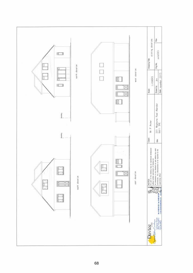
68

69

70

71

72

73

74

75

Development Management Committee 24th May 2017
Item 9 Report No.PLN1714
Section C The information, recommendations and advice contained in this report are correct as at the date of preparation, which is more than two weeks in advance of the Committee meeting. Because of these time constraints some reports may have been prepared in advance of the final date given for consultee responses or neighbour comment. Any changes or necessary updates to the report will be made orally at the Committee meeting.
Case Officer Sarita Jones
Application No. 17/00332/ADJ
Date Valid 6th April 2017
Expiry date of consultations
3rd May 2017
Proposal Consultation from Hart District Council in respect of the demolition of the existing office buildings. Comprehensive redevelopment of the site for the construction of 323 residential dwellings along with internal roads, open space, landscaping and associated infrastructure with existing access from the Minley Road
Address Guillemont Park Minley Road Blackwater Camberley Surrey GU17 9QG
Ward
Applicant Hart District Council
Agent
Recommendation RAISE OBJECTION
Description The site is located within Hart District, bordering Rushmoor Borough. The site comprises approximately 10.3 hectares, and contains an office campus originally occupied by Sun Microsystems. The three office buildings on the site are vacant, and have been since 2011. They are on the eastern side of the site with associated car parking providing some 1,350 spaces to the west. Vehicular access is from a roundabout leading to junction 4a of the M3 and the A327 Minley Road. The site has a well-established landscaped character which gives it a sylvan appearance. Dwellings within Pinewood Park lie to the north of the site. Guillemont Junior School and its playing fields lie to the east of the site and benefits from an established line of trees along its boundaries. Sun Park Phase I lies to the south east of the site. This comprises a development of 150 dwellings which straddles the boundaries of Hart and Rushmoor. This development is at an advanced stage of construction with all the dwellings in Rushmoor having been completed. Vehicular access for this development is from Sandy Lane. The M3 lies to the south east. Hawley Woods lies to the west which is a designated Site of Special Scientific Interest and is a component part of the Thames Basin Heaths Special Protection Area. The site has a varied planning history comprising applications to Rushmoor and
76

consultations from Hart. The most relevant applications are set out below. Outline planning permission for a mixed scheme comprising 2 hectares of housing, 1000 sq m of food retail and a leisure/fitness club (3700 sq m) with access directly onto Sandy Lane was refused in January 1997, 96/00547/OUT on the grounds that it had not been demonstrated that the proposed retail store would not have adversely affected the retail vitality and viability of the Sandy Lane/Fernhill Road shopping parade, the increased traffic generation would have had an adverse impact on existing residents and the school by virtue of increased noise, disturbance and pollution and the provision of the new access would have resulted in the unacceptable loss of trees along the site frontage onto Sandy Lane. Objection was also made to the consultation from Hart on these grounds, 96/00556/ADJ. The redevelopment of the former Guillemont Barracks site was envisaged in two phases. The first phase, which was entirely within Hart, was granted outline planning permission in July 1997 for 29,740 sq m of B1 floorspace with access from Minley Road, our reference 96/00043/ADJ. Reserved matters approval was subsequently granted which proposed three, 3 storey buildings our reference 98/00589/ADJ. The Old Minley Road was closed except for controlled access by buses, cyclists and pedestrians. Rushmoor did not raise objection to either consultation from Hart. These permissions were implemented and represents the current situation on site. In January 1999 outline planning permission was granted by Rushmoor and Hart for the second phase comprising 13,000 sq m of B1 office buildings with access from Minley Road, parking and landscaping, 98/00087/OUT and 98/00041/OUT. In February 2001 reserved matters approval for two office buildings, three storey in height, with associated access and car parking was granted pursuant to this outline permission, 00/00769/REM. This was commenced but not completed. This relates to Phase I Sun Park. In January 2015, planning permission, 14/00014/FUL, was granted on appeal for the demolition of the existing part built structures and erection of 150 dwellings, construction of internal roads, provision of open space, school parking area, landscaping and associated infrastructure, formation of a new access onto Sandy Lane and closure of the existing access from the Minley Road roundabout except for emergency vehicles. Hart granted permission for this development in November 2014. Both permissions are subject to a section 106 legal agreement which precludes vehicular access from the site, the subject of the current consultation, through Phase I Sun Park. In September 2015 Rushmoor was consulted by Hart in respect of a screening opinion, 15/01955/EIA, pursuant to the Town & Country Planning (Environmental Impact Assessment) Regulations 2011 as amended for the redevelopment of the existing office site with 320 dwellings. Rushmoor did not object to this proposal, 15/00706/ADJ, provided that any planning application submitted would be accompanied by a Flood Risk Assessment, a Transport Assessment (note no vehicular access onto Sandy Lane), a Foul Sewage/Surface Water and Utilities Assessment, Ecological Assessments including an assessment under the Habitats Regulations and associated Thames Basin Heaths Special Protection Mitigation Strategy, a Noise Impact Assessment and a Sustainability Appraisal all fully assessing the impact of the proposed development on Rushmoor. In September 2015 Hart issued a screening opinion advising that the proposal was not EIA development for the purposes of the regulations. The current consultation from Hart is in relation to the demolition of the existing office buildings and the comprehensive redevelopment of the site for the construction of 323 residential dwellings along with internal roads, open space, landscaping and associated
77

infrastructure with existing access from the Minley Road. The scheme will provide 39 one bedroom, 129 two bedroom, 123 three bedroom and 32 four bedroom dwellings with a total of 925 parking spaces, of which 773 are to be allocated and 152 unallocated/visitor spaces. Whilst eight blocks of flats are proposed, the majority of the development comprises detached, semi-detached and terraced housing. The site layout is determined by three arterial roads through the site. Open space, including an attenuation pond, is proposed at the northern end of the site adjacent to the common boundaries with Pinewood Park and Dartford Rise. Whilst emergency, pedestrian and cycle access are proposed into Phase I Sun Park, no vehicular access is shown. It is noted that pedestrian links are proposed from the open space at the northern end of the site to join the existing track which leads into Hawley Woods. The submission to Hart included a planning statement, an office market report, an ecological impact assessment, a transport assessment including travel plan, a contamination assessment, a sustainability assessment, a tree survey, a design and access statement, an ecology report/impact assessment, a landscape management plan and a flood risk assessment. Consultee Responses Planning Policy raises objection to the consultation Transportation Strategy Officer advises that the size of the scheme is such that it falls
to Hampshire County Council Highways to consider its impact on the strategic network and Hart's Highways Development Engineer to consider the internal layout and operation of the development in highway terms.
Ecologist Officer raises no objection to the consultation Environment Agency views awaited HCC Highways Development Planning
views awaited
Surface Water Drainage Consultations
views awaited
Environmental Health recommends a condition to protect amenity Neighbours notified As this is a consultation the publicity requirements for this proposal fall to be undertaken by Hart District Council. Neighbour comments No comments have been received by Rushmoor in respect of publicity associated with this proposal. Policy and determining issues The site lies wholly within the administrative control of Hart District Council and is allocated
78

for B-class employment use in the adopted Hart Local Plan. However, since the submission of the planning application, Hart Council has published a Draft Hart Local Plan "Strategy and Sites" document, covering the period 2011 - 2032 (April 2017). This Plan is at a relatively early stage of preparation, but nevertheless, gives an indication of the direction of travel for planning policy in Hart District, based on national policy and guidance and an up to date evidence base. Policy SS1: Spatial Strategy: Scale and Distribution of Growth, sets out that development consistent with the broad spatial framework therein will be supported. This includes the identification of Sun Park for housing development. Policy MG3: Housing-led, identifies strategic sites to meet development needs for new homes. Criterion d) refers to the allocation of Sun Park for residential development. In terms of general principles applying to the redevelopment of the sites listed in Policy MG3, of note is that proposals must ensure that infrastructure is provided. In particular, the policy states that: "Developers must engage with relevant infrastructure providers to ensure the implementation of a bespoke infrastructure delivery plan for the development." Policy SC4 Sun Park, allocates 10.3 hectares of brownfield land for development to include approximately 320 dwellings (of which 40% should be affordable), on site amenity space and SPA mitigation. It envisages that delivery on the site will be from 2020/21 onwards, subject to satisfying various criteria (summarised below): o Vehicular access to the junction of the A327 Minley Road and J4a of the M3 Motorway; o Mitigation of any significant negative impact of local or strategic road network; o Provision of safe and convenient pedestrian and cycle linkages to adjoining development; o Avoiding areas with the highest probability of flooding; o No residential development within 400m of the TBHSPA; o Protection of areas of established woodland; o Avoidance, mitigation or offsetting of adverse impacts on biodiversity; o Respecting amenity of existing and future residents. Policy SC7: Self and Custom Build Homes, seeks 5% of the proportion of developable plots to be set aside for self and custom build on strategic housing allocations. Policy ED1: New Employment and Policy ED2: Safeguarding Employment Land and Premises (for B-class uses) set out the strategy for protecting strategic and locally important employment sites in Hart District, in line with the findings of the joint Employment Land Review 2016. Land at Sun Park does not form part of the future supply of employment land in Hart District. In respect of infrastructure to support new development, the draft Strategy and Sites document notes that; "All development, regardless of size and scale, places additional demands on services and facilities which will affect their ability to meet the needs of the community. Timely delivery of necessary infrastructure that support and mitigates the impact of new development is therefore essential to support our Spatial Strategy." (Paragraph 393)
79

Policy I1: Infrastructure, deals with securing appropriate on and off-site infrastructure to support new development. Again, the supporting text notes that applicants for planning permission will need to demonstrate that existing, planned and/or committed infrastructure is sufficient to accommodate new development proposals. Whilst the supporting text in the Local Plan suggests that a draft of the Infrastructure Delivery Plan is available on Hart Council's web site, at the time of writing, it is not accessible. As the site is wholly within Hart, the Rushmoor Core Strategy is not determinant in relation to this consultation The main issues for consideration in responding to this consultation are therefore the impact of the proposal on Rushmoor with particular reference to loss of employment land, impact on the character of the area, impact on the amenities of adjoining residents/occupiers, housing, infrastructure provision, nature conservation, highway matters and flood risk. Commentary Loss of employment land The Planning Policy and Conservation Manager has been consulted on this application and advises that in respect of employment land: “Joint Employment Land Review Rushmoor also forms a Functional Economic Area (FEA) with Hart and Surrey Heath. Again, to help inform the new Rushmoor Local Plan, the three authorities commissioned a joint Employment Land Review (ELR), which determines the available supply of employment land, assesses future requirements for B-class employment space, and seeks to balance supply and demand thereby guiding the appropriate policies and allocations required in respective Local Plans. Some specific references in the ELR are relevant to the assessment of this planning application. In respect of office vacancy levels in the FEA, paragraph 4.16 notes that; "The current availability of office floorspace in the HRSH amounts to around 116,999 sqm, representing a vacancy rate of 14.1% of available stock. However, It is important to note that circa 26,500sqm of this vacant floorspace is located at Guillemont Park (see Appendix 1: Site H10) where pre application advice has been sought from Hart District Council for a residential scheme of circa 320 dwellings. If a residential scheme is progressed, approved and subsequently implemented at this site then the office vacancy rate in the FEA could reduce further." With regard to market segments for offices, paragraph 6.14 states that; "Commercial agents note that the market has gone full circle and that there is an oversupply of larger office buildings, in part a result of the redevelopment of surplus MOD land in the 1980s onwards for office parks with large floorplate accommodation. The structural changes to the economy and rationalisation of the ICT and telecoms industry that previously occupied a number of these buildings (e.g. Sun Microsystems at Guillemont Park) has resulted in demand for such premises reducing, whilst the supply available to the market is relatively high."
80

In terms of balancing supply and demand, paragraph 8.25 notes that in respect of qualitative factors; "There is an oversupply of dated second hand stock in the FEA, and also of large footprint Grade A accommodation that was originally constructed as campus sites for single occupiers. An example of the latter is Guillemont Park (26,400 sqm) which is a Grade A office campus in close proximity to junction 4a of the M3 that was constructed for a single occupier (Sun Microsystems). The site has been marketed for office use for a substantial period with no interest and is now being promoted for residential development through the emerging Hart Local Plan. Therefore, this office floorspace may not contribute towards meeting future needs. However, the sale of the former Nokia Campus (28,000 sqm) in Farnborough to BMW indicates that there is some (albeit limited) demand for large HQ office campus environments that are priced competitively." Office Market Report, March 2017 (Knight Frank) The Office Market Report submitted alongside the planning application notes that the Sun Park buildings continue to provide a poor "fit" with modern occupier requirements - being too large/too inflexible, too bespoke, and too isolated. In notes that successful office products in the current market provide closer proximity to a greater choice amenities, shopping and leisure; easily accessible from a variety of transport modes; including rail, flexible to a full range of unit sizes; and ready for immediate occupation. Sun Park's buildings do not provide these elements. It is clear from the evidence presented above that Guillemont Park is not critical to meeting future employment (growth) needs in the FEA. On this basis, the principle of its loss from B-class employment use is not objected to.” Impact on the character of the area As existing the site is occupied by three large office buildings and car parking in a landscaped setting. The buildings are in a good state of repair and the site is well maintained, despite being vacant. As with Sun Park Phase I the proposal will fundamentally change the character of the site by virtue of its use, layout and built form. However the development will be seen in the context of the residential development Sun Park Phase I and given the predominantly residential character of the surrounding area this degree of change is not considered to be unacceptable in this location and as such no objection is raised to the consultation in this regard. Impact on the amenities of adjoining residents/occupiers The closest Rushmoor residents/occupiers to the development are located at Pinewood Park to the north and Guillemont Junior School and Dartford Rise to the east. The proposed open space area at the northern end of the site provides a buffer between the proposed housing and residents/occupiers at Pinewood Park and Guillemont Junior School. It is considered that the proposed separation distances that are to be retained between proposed/existing dwellings and the school and the retention of existing trees particularly in proximity to the site boundaries are sufficient to ensure that appropriate levels of occupational privacy are maintained for adjoining residents/occupiers. As such no objection is raised to the proposal in this regard. With regard to residents in Dartford Rise, it is noted that the residents that adjoin the common boundary with the application site in Dartford Rise are within Hart. Given the intervening development between the site and residents in Rushmoor, it is considered
81

that the development would not have a material impact on Rushmoor residents in Dartford Rise. Additional cycle/footpath links are proposed from the development into Sun Park Phase I. It is recognised that there are approved pedestrian/cycle links from the site into Sun Park Phase I. Whilst there will be additional activity associated with these movements, it is considered that they would not give rise to levels of activity or disturbance which would be unacceptable in either the existing/approved and proposed residential environments and as such no objection is raised to the proposal in this regard. There is significant potential for noise and vibration arising from the demolition and construction phases of the development to impact on nearby residential properties and on Guillemont Junior School. Environmental Health has been consulted on this application and seeks a condition which secures a comprehensive Construction Method Statement to be submitted and approved by Hart prior to any works commencing. This should set out the measures to be employed to minimise noise, vibration and dust at all times, in accordance with best practice. In particular, it is considered important to see details of how the existing foundations will be broken up and what type of piling will be required for the proposed dwellings. Subject to the imposition of this condition, which is intended to deal with by way of informative, no objection is raised to the consultation in this regard. Housing Rushmoor forms a housing market area (HMA) with Hart and Surrey Heath. As part of the process of preparing the new Rushmoor Local Plan (anticipated adoption: summer 2018), Hart, Rushmoor and Surrey Heath Councils commissioned a joint Strategic Housing Market Assessment (SHMA). This identifies the number of homes and the mix of housing that will be required to meet anticipated future housing need within the Hart, Rushmoor and Surrey Heath HMA between 2014 and 2032. The 2016 version of the SHMA identifies that the objectively assessed housing need for the HMA is 1,200 dwellings per annum, with 382 dwellings per annum required in Hart. It is accepted that the development would contribute to meeting the identified housing needs of Hart District and the wider housing market area by making use of a brownfield site. As such no objection is raised to the consultation in this regard. Infrastructure provision Rushmoor is concerned about the potential impact of the proposal upon the infrastructure of its Borough, particularly in terms of health provision and schools. The applicant has failed to provide detailed evidence of the impact of the development on existing infrastructure and community facilities and has failed to explain fully how it will mitigate these impacts. The Hart planning policy framework set out above makes it clear that Sun Park is a strategic allocation for residential development. It requires developers to engage with relevant infrastructure providers to ensure the implementation of a bespoke infrastructure delivery plan for the development. The Planning Statement accompanying the application deals with a number of issues in support of the application, but does not mention infrastructure until the last three paragraphs (one of which simply restates the National Planning Policy Framework). The other two paragraphs are reproduced here: "The following potential infrastructure improvements have been identified for this application
82

to provide for the local community. These include: o On-site open space provision o Financial contribution towards education provision o Financial contribution towards community facilities o Financial contribution towards highway improvements and/or sustainable transport measures o Financial contribution of the Council's SANG Land at Bramshot Lane to mitigate effects upon the SPA (7.134) It should be noted that the final contribution levels will be negotiated during the application determination process. The applicant would welcome further discussion with HDS on specific projects that any contributions would relate to and their respective costs at an early stage." (7.135) With regard to education provision the applicant has not presented any analysis of the education requirements arising from the proposal. Using the local education authority's (LEA) formula for forecasting school places from new housing developments (0.3 primary pupils per dwelling), as summarised within the Hampshire School Places Plan (paragraph 7.2), Rushmoor anticipates that the development could generate a need for 97 additional primary school places. For secondary school provision, from the LEA's model for forecasting school places from new housing developments (0.21 secondary pupils per dwelling), Rushmoor anticipates that the development could generate a need for 68 secondary school places. Whilst the applicant states that a financial contribution would be made towards off-site primary and secondary school provision, the principle, timing and sum of such a contribution have yet to be agreed with Hampshire County Council. In addition, the applicant has failed to provide detailed information as to the capacity and feasibility of expanding existing primary and secondary schools that will likely serve the site. In the absence of information in this regard, given the potential cumulative impact arising from the nearby concurrent Hartland Village proposal for 1,500 new homes, Rushmoor is concerned that the development will place undue pressure upon the Borough's primary and secondary schools. With regard to health care provision the applicant's Planning Statement does not mention that any discussions have taken place with the North East Hampshire and Farnham Clinical Commissioning Group (CCG) in terms of the development's contribution to local healthcare provision. Moreover, the Statement makes no mention of contributions towards healthcare provision. The applicant has also failed to disclose whether any discussions with Hampshire County Council have taken place in respect of its statutory public health duty. Having regard to the above comments objection is raised to the proposal in this regard. Nature conservation with particular reference to the Thames Basin Heaths Special Protection Area Whilst the entire site lies within five kilometres of the Thames Basin Heaths Special Protection Area (SPA), a small proportion of the site (at the southern entrance on Ively Road) is located within 400 metres of the SPA. Natural England considers that any increase in population within five kilometres of the SPA can have an adverse impact upon the ecological integrity of the SPA and that it is not possible to avoid such an impact if a development is located within 400 metres of it.
83

Rushmoor Borough Council and Hart District Council (together with Natural England and nine other local authorities affected by the SPA) are members of the Thames Basin Heaths Joint Strategic Partnership (JSP). In 2009, the JSP agreed a Delivery Framework to encourage a consistent approach to the protection of the SPA from the effects of development. It states that Suitable Alternative Natural Greenspace (SANG) should be provided to attract new residents away from the SPA and that suitable access management and monitoring should be put in place. This approach is reflected within Policy CP13 of the Rushmoor Core Strategy (adopted in 2011) and Policy NE1 of the emerging Rushmoor Local Plan. It is noted that no built form is proposed for the part of the site which is located within 400 metres of the SPA. However, Rushmoor is concerned that deliverable SANG is not currently in place. The applicant states that 'It is the intention to provide off-site mitigation capacity through utilising Land at Bramshot Lane SANG' to mitigate the impacts of the development. However, the detailed arrangements for securing mitigation against this emerging SANG have yet to be established and as such objection is raised to the consultation in this regard On a general note, given that the one of the purposes of providing mitigation is to divert recreational activity away from the SPA, the provision of footpaths as part of the development which link into existing track which provides direct pedestrian access onto the SPA seems at odds with the objectives of providing mitigation. The Council's Ecologist has been consulted on this application and he advises that he has no record of protected species beyond those in the ecology report. The site has also been subjected to extensive ecological survey work, although the bat survey work is due to be updated so any ecological mitigation and enhancement may need to be updated to reflect this further information. Subject to the proposed mitigation/enhancement in the ecology report being implemented in full he raises no objection to the consultation in this regard. Highway matters There is no vehicular access from the site into Rushmoor except for emergency purposes. The submitted Transport Assessment states that the proposed residential development would generate some 416 fewer two way movements in the morning peak hour and 292 fewer two way movements in the evening peak hour when compared to the traffic generation which potentially could result from the existing development on the site. Junction capacity assessments have been undertaken at the Sun Park access/A327 Minley Road/M3 Northbound junction 4a On and Off slip road roundabout, A327 Minley Road/Minley Road roundabout and the A327 Minley Road/M3 westbound junction 4a On and Off slip road roundabout. The assessments demonstrate that i the "2020 + committed development + proposed development" scenario the junctions are anticipated to operate within their theoretical capacity and perform better than in the "2020 + committed development + extant use" scenario. The Transportation Strategy Officer advises that the size of the scheme is such that it falls to Hampshire County Council Highways to consider its impact on the strategic network and Hart's Highways Development Engineer to consider the internal layout and operation of the development in highway terms. On this basis he raises no objection to the consultation. The views of the County Highway Authority in relation to Rushmoor are awaited and an update will be given to the meeting.
84

Flood risk The application is accompanied by a flood risk assessment and drainage strategy. Given the proximity of the site to Rushmoor, part of the site is also included within the Rushmoor Strategic Flood Risk Assessment (area adjacent to Pinewood Park). The submitted documents confirm that the built development footprints are situated within Flood Zone 1 ie defined as land assessed as having less than 1 in 1,000 annual probability of river or sea flooding (<0.1%). However parts of the site are located within Flood Zones 2 and 3 which would be more susceptible to flooding. To mitigate for this risk, a SUDS scheme is proposed, which includes permeable paving, cellular storage tanks and attenuation basins, to provide treatment and management of surface water run-off up to and including run off arising from the 1 in 100 year plus 40% climate change storm. The Environment Agency and Hampshire Lead Local Flood Authority have been consulted on this application and any views received will be updated at the meeting Conclusion There is no objection to the principle of the proposal and it is accepted that the site is unlikely to be developed for employment uses. However, as summarised above, the applicant has failed to provide detailed evidence through an Infrastructure Delivery Statement of how the impacts of the proposed development in respect of education and health care will be mitigated appropriately. Furthermore it has not satisfactorily demonstrated how the development will mitigate its impact on the Thames Basin Heaths Special Protection Area. Having regard to the above Rushmoor raises objection to the consultation. Full Recommendation Subject to any views received from Hampshire County Council as County Highway Authority and Lead Local Flood Authority and the Environment Agency raising matters not previously considered it is recommended that OBJECTION is raised to the consultation for the following reasons: 1 The applicant has failed to provide detailed evidence through an Infrastructure
Delivery Statement of how the impacts of the proposed development in respect of education and health care will be mitigated appropriately. Hence, it fails to demonstrate how planned or committed infrastructure is sufficient to accommodate the requirements associated with the development proposed.
2 The applicant intends to provide off-site mitigation capacity through utilising Land at
Bramshot Lane Suitable Alternative Natural Greenspace (SANG)' to mitigate the impacts of the development in relation to the Thames Basin Heaths Special Protection Area. However, the detailed arrangements for securing mitigation against this emerging SANG have yet to be established and as such Rushmoor is concerned that deliverable SANG is not currently in place.
Informatives
1 INFORMATIVE – The Local Planning Authority’s commitment to working with the
applicants in a positive and proactive way is demonstrated by its offer of pre-application discussion to all, and assistance in the validation and determination of applications through the provision of clear guidance regarding necessary supporting information or amendments both before and after submission, in line with the National Planning Policy Framework.
85

2 INFORMATIVE – In the event that planning permission is granted Hart District Council
is requested to impose a condition seeking a comprehensive Construction Method Statement to be submitted and approved prior to any works commencing. This should set out the measures to be employed to minimise noise, vibration and dust at all times, in accordance with best practice. In particular, details of how the existing foundations will be broken up and what type of piling will be required for the proposed dwellings should be included. Non-percussive methods should be used at all times if possible. The applicant should fully justify the need for percussive methods if these need to be used, and provide details of suitable monitoring to be installed at the site boundary that will alert site personnel when the levels of noise and vibration appropriate prescribed trigger levels.
86

87

88

89

90

Development Management Committee 24th May 2017
Item 10 Report No.PLN1714
Section C The information, recommendations and advice contained in this report are correct as at the date of preparation, which is more than two weeks in advance of the Committee meeting. Because of these time constraints some reports may have been prepared in advance of the final date given for consultee responses or neighbour comment. Any changes or necessary updates to the report will be made orally at the Committee meeting.
Case Officer Sarita Jones
Application No. 17/00351/FUL
Date Valid 26th April 2017
Expiry date of consultations
17th May 2017
Proposal Continued use of informal leisure land as a hard surfaced 58 spaced pay and display car park to operate 24 hours a day, 7 days a week
Address Kings Moat Car Park Westmead Farnborough Hampshire GU14 7SU
Ward Empress
Applicant Rushmoor Borough Council
Agent
Recommendation GRANT
Description
The site is within Farnborough town centre. It comprises a surfaced pay and display car park with 58 spaces of which 3 are to disabled standard. There are existing lockable bollards at the entrance/exit into the access road. The car park is open to the public on a 24 hour basis. To the west of the access road there is a private car park which serves Dukes Court, a development of 24 flats on the opposite side. The access road links into Westmead close to the service area for the Asda supermarket.
In 2007 temporary planning permission for a period of three years was granted for a car park comprising 58 spaces, of which 3 were designated as disabled spaces, to be open to the public between 8am and 6pm daily, 07/00737/RBC3PP. This permission was implemented.
In 2011 temporary planning permission for the continued use of the pay and display car park was granted for a further period of three years, to be open to the public between 8am and 6pm daily, 11/00046/TEMPP. This permission was implemented.
In 2014 planning permission was granted for the continued use of the pay and display car park on a 24 hour basis for a further period of 3 years, 14/00195/RBC3PP. This permission was implemented.
91

The current proposal seeks permission for the continued use of the pay and display car park on a 24 hour basis for a further period of 3 years. Consultee Responses Environmental Health raises no objection to the proposal. Transportation Strategy Officer raises no objection to the proposal. Planning Policy raises no objection to a temporary permission. Neighbours notified In addition to posting a site notice, 36 individual letters of notification were sent to properties/premises in Dukes Court, Pinehurst Avenue, Queensmead and Westmead Neighbour comments The site notice/neighbour notification period expires on 17 May 2017. At the time of the preparation of this report no representations have been received. Any representation subsequently received will be updated at the meeting. Policy and determining issues The site is located within Farnborough town centre just outside the shopping core. As such policies SS1 (The Spatial Strategy), SP4 (Farnborough town centre), CP1 (Sustainable Development Principles), CP2 (Design and Heritage), CP12 (Open Space, Sport and Recreation) and CP16 (Reducing and Managing Travel Demand of the Rushmoor Core Strategy and "saved" policies TC1 (Policies for Aldershot and Farnborough Town Centres & North Camp District Centre), TC4 (Town centre development outside the core), ENV17 (General Development and Design Criteria), ENV21-22 (Adequate access and facilities/external areas) and ENV48 and 52 (Environmental Pollution and Noise) of the Rushmoor Local Plan Review are relevant to the consideration of this proposal as are the Supplementary Planning Documents on Farnborough town centre 2007 and the accompanying prospectus May 2012, Farnborough Civic Quarter Masterplan June 2015, Planning Contributions - Transport April 2008 and Car and Cycle Parking Standards, March 2012 and the advice contained in the National Planning Policy Framework and associated Planning Practice Guidance are also relevant. The main determining issues are: (i) the acceptability of the continued use of the site as a car park; (ii) impact on neighbours; and (iii) highway matters. Commentary The acceptability of the continued use of the site as a car park The Planning Policy and Conservation Manager advises that: "The site lies within an area covered by Core Strategy Policy SP4 (Farnborough Town Centre), the emerging Rushmoor Local Plan Policy SP2 (Farnborough Town Centre), the
92

Farnborough Town Centre SPD, Farnborough Prospectus and more recently the Farnborough Civic Quarter SPD. These policies and guidance are supportive of development proposals that maintain the vitality and viability of Farnborough town centre and contribute to the strategy of revitalising the town centre. More specifically the Farnborough Civic Quarter SPD sets detailed proposals for the redevelopment of this area as part of the wider Civic Quarter redevelopment. The temporary continued use of the land as a car park would allow for the future redevelopment of the site in-line with Local Plan Policy and guidance objectives and most specially the Farnborough Civic Quarter SPD proposals. The previous informal use of the area as amenity space has already been lost, on a temporary basis, through the granting on planning permissions for use of the land as a car park from 2007. The Civic Quarter SPD outlines proposals for an enhanced central amenity space surrounded by development, including a block on part of the application site. In conclusion, there is no planning policy objection to the continued temporary use of the land as a car park." Having regard to the views of the Planning Policy and Conservation Manager and to ensure that the Council's long term objectives for the redevelopment of this part of Farnborough town centre are not prejudiced by the permanent use of this land for car parking, no objection is raised to the continued use of the land as a car park subject to permission being granted for a temporary period of 3 years. Impact on neighbours The closest residents are on the upper floors of Dukes Court some 5 metres to the north of the site. The car park is currently open to the public on a 24 hour basis and has operated as such for some time without complaints concerning noise nuisance. Any issues arising from any anti-social behaviour may be addressed using the Council's powers under anti-social behaviour legislation/regulations as appropriate once the development becomes operational should any problem become apparent. Similarly any issues arising from illegal parking could also be dealt with in this way in liaison with Hampshire Police. Highway matters The access and egress arrangements for the car park remain as previously approved. The Council's Transportation Strategy Officer is satisfied that the continued use of the car park will not have an unacceptable impact on the highway network and an acceptable pedestrian route is maintained into the town centre. In conclusion the development is considered to be an acceptable short term measure to provide car parking to serve the town centre in advance of the redevelopment of the site and is not considered to conflict with the Council's long term objectives for this part of Farnborough town centre. Full Recommendation Subject to no adverse comments being received as a result of the publicity/neighbour notification requirements by 17 May 2017 raising matters which have not been previously considered, the Head of Planning in consultation with the Chairman be authorised to GRANT planning permission subject to the following conditions and informatives:
93

1 The use hereby permitted shall be discontinued and the land restored to its former
condition on or before 3 years from the date of this permission unless the Local Planning Authority shall have previously permitted the use for a further period.
Reason - To ensure that the long-term objectives for the redevelopment of
Farnborough town centre are not prejudiced by the permanent use of this land as car parking.
2 Unless agreed in writing by the Local Planning Authority, the permission hereby
granted shall be carried out in accordance with the following approved drawings - KMoatCP_17 1:1250 and 1:500
Reason - To ensure the development is implemented in accordance with the
permission granted
Informatives
1 INFORMATIVE – The Local Planning Authority’s commitment to working with the applicants in a positive and proactive way is demonstrated by its offer of pre-application discussion to all, and assistance in the validation and determination of applications through the provision of clear guidance regarding necessary supporting information or amendments both before and after submission, in line with the National Planning Policy Framework.
2 INFORMATIVE - REASONS FOR APPROVAL - The Council has granted permission
because the development is considered to be an acceptable short term measure to provide car parking to serve the town centre in advance of the redevelopment of the site and is not considered to conflict with the Council's long term objectives for this part of Farnborough town centre. It is therefore considered that subject to compliance with the attached conditions, and taking into account all other material planning considerations, including the provisions of the development plan, the proposal would be acceptable. This also includes a consideration of whether the decision to grant permission is compatible with the Human Rights Act 1998.
94

95

96

Section D
The following applications are reported for INFORMATION purposes only. They relate to applications, prior approvals, notifications, and consultations that have already been
determined by the Head of Planning and where necessary, in consultation with the Chairman, in accordance with the Council’s adopted Scheme of Delegation.
If Members wish to have more details about the decision on any of the applications on this list please contact David Stevens (01252 398738) or John W Thorne (01252 398791)
in advance of the Committee meeting.
Application No 16/00814/CONDPP
Applicant: Savoy Estates Ltd
Decision: Conditions details approved
Proposal: Submission of details pursuant to Condition Nos.2 (external materials), 3 (surfacing materials), 4 (means of enclosure details), 5 (levels), 6 (external lighting details), 13 (landscaping), 15 (SUDS drainage system details), 16 (construction management plan), and 21 (highway works details) of planning permission 14/00706/FULPP allowed on appeal by the Inspector's decision letter dated 21 April 2016
Address Site Of The Ham And Blackbird 281 Farnborough Road Farnborough Hampshire
Decision Date: 03 May 2017
Ward: Empress
Application No 16/00947/COND
Applicant: Mr Jack Johnson
Decision: Permission Granted
Proposal: Submission of details part pursuant to condition 28 (contamination validation report) of hybrid outline planning permission 12/00958/OUT dated 10th March 2014 in relation to Maida Zone A plots 115-122, 202- 203, 137, 159-169, 175-196 and 218-228 (amended description)
Address Zone A - Maida Aldershot Urban Extension Alisons Road Aldershot Hampshire
Decision Date: 27 April 2017
Ward: Wellington
97

Application No 17/00003/FUL
Applicant: Mr Sergio Andreou & Mrs Victoria Andreo
Decision: Permission Granted
Proposal: Permitted Development: Continued use of dwelling house (Use Class C3) as Small House in Multiple Occupation (Use Class C4)
Address 8 Windsor Road Farnborough Hampshire GU14 6QZ
Decision Date: 12 May 2017
Ward: Knellwood
Application No 17/00021/FULPP
Gisborne Property Investments LtdApplicant:
Decision: Permission Granted
Proposal:
Address
Class O Permitted Development conversion of existing office block to form
twelve residential flats (Use Class C3) comprising 8 X 1-bedroom and 4 X
2-bedroom units
Alexandra House 1 Queens Road Farnborough Hampshire GU14 6DJ
Decision Date: 10 April 2017
Ward: St Mark's
98

Application No 17/00027/FULPP
Applicant: Mr Jan Mandozai & Mr Mohammed Chou
Decision: Permission Granted
Proposal:
Address
Decision Date: 10 April 2017
Ward: Rowhill
Application No 17/00029/FULPP
Britel Fund Trustees LtdApplicant:
Decision: Permission Granted
Proposal:
Demolition of two-storey outbuilding at rear of site, external alterations and change of use of main building from Care Home to provide 5 self contained flats, with parking spaces and amenity space at rear
Address
Grasmere House 33 Cargate Avenue Aldershot Hampshire GU11 3EW
Decision Date: 19 April 2017
Ward: St Mark's
Application No 17/00051/FULPP
Salesian CollegeApplicant:
Decision: Permission Granted
Proposal:
Erection of a part three storey, part second floor front extension, a three storey side extension and enclosure/reroof of existing atrium
Address
Warwick House (to Be Known As Old Warwick House) 1 Aerospace Boulevard Farnborough Hampshire GU14 6XW
Decision Date: 10 April 2017
Ward: St Mark's
Erection of single storey extension to existing groundsman store building
Salesian College Playing Fields Park Road Farnborough Hampshire
99

Application No 17/00069/FULPP
Applicant: Mr Sam Sandhu
Decision: Permission Granted
Proposal: Installation of new shop front, together with a second floor extension and external rear staircase to facilitate the change of use of first and second floor accommodation to 2 x studios and 1 x 1-bedroom flat
Address 36 Union Street Aldershot Hampshire GU11 1EW
Decision Date: 03 May 2017
Ward: Wellington
Application No 17/00077/SCREEN
Applicant: Fenwicks Limited
Decision: Environmental Assessment Not Required
Proposal: EIA SCREENING OPINION: Erection of new storage & distribution warehouse with ancillary offices, entrance gatehouse, parking and landscaping (Use Class B8) following demolition of all existng buildings on site
Address 122 Hawley Lane Farnborough Hampshire GU14 9AY
Decision Date: 10 April 2017
Ward: Cherrywood
Application No 17/00082/FULPP
Applicant: SAP Group Propertys Ltd
Decision: Permission Granted
Proposal: Erection of front extension to provide additional production area; conversion of two existing windows to doors and re-cladding of exterior of ancillary offices to match cladding of proposed extension; and erection of external fire escape staircase on north-west side elevation
Address Unit 2 106 Hawley Lane Farnborough Hampshire GU14 8EQ
Decision Date: 12 April 2017
Ward: Cherrywood
100

Application No 17/00084/FULPP
Applicant: Mr & Mrs Nicholas Ratcliffe
Decision: Permission Granted
Proposal: Conversion of outbuilding for ancillary living accommodation together with the erection of single storey front extension, with balcony above, front dormer, formation of rear gable roof and retention of dormer and western extension
Address 21 Pirbright Road Farnborough Hampshire GU14 7AB
Decision Date: 25 April 2017
Ward: Knellwood
Application No 17/00093/FULPP
Applicant: Mr Nick Knight
Decision: Permission Granted
Proposal: Erection of a single storey rear extension with rooms in roof
Address 56 Chingford Avenue Farnborough Hampshire GU14 8AD
Decision Date: 26 April 2017
Ward: Empress
Application No 17/00097/CONDPP
Applicant: Knight Frank Investment Management
Decision: Conditions details approved
Proposal: Submission of details to comply with condition 4 (refuse strategy) attached to planning permission 15/00813/FULPP dated 22 December 2015 in respect of the erection of an extension to existing shopping centre to provide two retail units to include external display areas to front, alterations to the external appearance of existing tower feature, creation of rear service yard with access from Hawthorn Road and alterations to existing car park layout and landscaping
Address Proposed Extension To Princes Mead Westmead Farnborough Hampshire
Decision Date: 12 May 2017
Ward: Empress
101

Application No 17/00098/FULPP
Applicant: Mr & Mrs Gayathri & Thiyagaraja Suman
Decision: Permission Granted
Proposal: Enlargement of ground floor window in northern elevation and insertion of adjacent door to facilitate the formation of a second retail unit
Address 62 Redan Road Aldershot Hampshire GU12 4ST
Decision Date: 10 May 2017
Ward: North Town
Application No 17/00100/COND
Applicant: Mr Rod Scott
Decision: Conditions details approved
Proposal: Approval of details pursuant to condition 8 (Sustainable Urban Drainage System)), in respect of planning permission 15/00965/FUL (for erection of three bedroom bungalow)
Address 174 Woburn Avenue Farnborough Hampshire GU14 7HE
Decision Date: 24 April 2017
Ward: Knellwood
Application No 17/00118/FUL
Applicant: Mr Sergio Andreou
Decision: Permission Granted
Proposal: Conversion of 3-bedroom house (Use Class C3) into a 5-bedroom house in multiple occupation (Use Class C4)
Address 8 High View Road Farnborough Hampshire GU14 7PU
Decision Date: 12 May 2017
Ward: Empress
Application No 17/00131/TPOPP
Applicant: Mr Snook
Decision: Permission Granted
Proposal: One Oak (part of group W1 of TPO 365) as per attached plan, remove to ground level. One group of three Oaks (part of group G10 of TPO 365) as per attached plan, canopy reduction to Southwest aspect by no more than 3 metres and lift canopy to no more than 8 metres from ground level.
Address 9 Pinewood Crescent Farnborough Hampshire GU14 9TP
Decision Date: 10 April 2017
Ward: St John's
102

Application No 17/00134/FULPP
Applicant: Mr Anayatuallah Mir & Mrs Gabriela Szab
Decision: Permission Granted
Proposal: Change of use of first floor from office and storage use to two bedroom flat by extension and conversion
Address 42 Station Road Aldershot Hampshire GU11 1HT
Decision Date: 21 April 2017
Ward: Wellington
Application No 17/00142/REVPP
Applicant: c/o Agent
Decision: Permission Granted
Proposal: Minor Material Amendment: Variation of conditions 2 and 3 attached to planning permission 16/00495/FULPP for the erection of an electricity substation dated 11th August 2016, to provide an updated scheme of replacement tree planting.
Address Electricity Substation Hope Grant's Road Wellesley Aldershot Hampshire
Decision Date: 11 April 2017
Ward: Wellington
Application No 17/00144/FULPP
Applicant: Mr Dominik Bogusz
Decision: Permission Granted
Proposal: Erection of single storey side and single storey rear extensions
Address 52 Harvey Road Farnborough Hampshire GU14 9TW
Decision Date: 03 May 2017
Ward: St John's
103

Application No 17/00145/REVPP
Applicant: Mr Vipan Lal
Decision: Permission Granted
Proposal: Variation of conditions 3 (surfacing), 4 (boundary treatment), 5 (bin storage), 7 (landscaping), 8 (provision of parking), 9 (SUDS), 12 (cycle parking) and 13 approved plans attached to planning permission 16/00054/REVPP dated 5 May 2016 to allow for use of approved surface materials in other areas, provision of new fencing, revised bin and cycle storage facilities, revised landscaping proposals, changes to parking layout/drainage and internal/external alterations to dwellings.
Address Proposed Development Site At 1 To 2 Kenilworth Road Farnborough Hampshire
Decision Date: 13 April 2017
Ward: St John's
Application No 17/00147/CONDPP
Applicant: Natta Homes
Decision: Conditions details approved
Proposal: Submission of details pursuant to condition Nos.3 (external materials), 4 (surfacing materials), 6 (levels details), 8 (means of enclosure details), 11 (landscaping scheme), 14 (details of new vehicular access construction), 16 (site investigation), 17 (SUDS drainage details), 19 (bat survey), and 20 (operatives parking & turning on-site during construction period) of planning permission 16/00263/FULPP dated 10 June 2016
Address 31 Reading Road Farnborough Hampshire GU14 6NH
Decision Date: 26 April 2017
Ward: St Mark's
Application No 17/00148/ADVPP
Applicant: Mr Tom Williams - First Wessex
Decision: Permission Granted
Proposal: Display of replacement non-illuminated wall-mounted sign over entrance to building and two replacement free-standing signs on either side of entrance gates
Address Parsons House Ordnance Road Aldershot Hampshire GU11 2DU
Decision Date: 12 April 2017
Ward: Wellington
104

Application No 17/00154/LBCPP
Applicant: Farnborough Air Sciences Trust (FAST)
Decision: Permission Granted
Proposal: LISTED BUILDING CONSENT : installation of thermal insulation in roof of Annexe and replacement of existing concrete tile roof covering with fibre-cement slates
Address Trenchard House - G1 85 Farnborough Road Farnborough Hampshire GU14 6TF
Decision Date: 12 April 2017
Ward: Knellwood
Application No 17/00156/CONDPP
Applicant: Messrs Suneet Jain, Jan Mandozai & Moh
Decision: Conditions details approved
Proposal: Submission of details pursuant to Condition No.18 (energy performance details) of planning permission 15/00970/FULPP dated 5 February 2016
Address 24 - 26 Church Lane East Aldershot Hampshire GU11 3BT
Decision Date: 12 April 2017
Ward: Manor Park
Application No 17/00157/CONDPP
Applicant: Ayyaz Homes Limited
Decision: Conditions details approved
Proposal: Submission of details pursuant to Condition No.13 (energy performance details) of planning permission 16/00331/FULPP dated 23 June 2016
Address 65 North Lane Aldershot Hampshire GU12 4QF
Decision Date: 12 April 2017
Ward: North Town
Application No 17/00159/NMAPP
Applicant: Mr A Clements
Decision: Permission Granted
Proposal: NON-MATERIAL AMENDMENT : render finish to side and rear elevations of approved dwelling instead of facing brick finish approved by planning permission 16/00552/FULPP dated 6 September 2016
Address 12 Herrett Street Aldershot Hampshire GU12 4ED
Decision Date: 10 April 2017
Ward: Aldershot Park
105

Application No 17/00160/FULPP
Applicant: Penny
Decision: Permission Granted
Proposal: Removal of conservatory and erection of single storey side and rear extensions
Address 5 Alma Square Farnborough Hampshire GU14 6AD
Decision Date: 02 May 2017
Ward: St Mark's
Application No 17/00161/TPOPP
Applicant: Mr James Whittell
Decision: Permission Granted
Proposal: One Oak Tree (part of group G33 of TPO 439A) remove 4 metres from the top of the crown and 2 metres off the sides remove dead wood and the lowest stem which is overhanging the neighbour's garden. One Holly Tree (part of group G33 of TPO 439A) remove 3 metres off the top of the crown and sides trimmed to tidy up longer branches
Address 6 Church Road East Farnborough Hampshire GU14 6QJ
Decision Date: 13 April 2017
Ward: Knellwood
Application No 17/00162/TPOPP
Applicant: Ms B.M Robinson
Decision: Permission Granted
Proposal: One Oak Tree (part of group G32 of TPO 439A) remove 4 metres off the top of the crown and 2 metres off the sides and remove dead wood and also ivy from the trunk
Address 4 Church Road East Farnborough Hampshire GU14 6QJ
Decision Date: 13 April 2017
Ward: Knellwood
106

Application No 17/00165/TPOPP
Applicant: Mr Andrew Brading
Decision: Permission Granted
Proposal: Five Oaks (part of group G4 of TPO 374) overhanging 25 Manor Road, crown lift to give no more than 6 metres ground clearance and also the removal of no more than 3 metres off the side. The removal of one branch from the first Oak on the right which is pushing another tree over
Address 14 Hilder Gardens Farnborough Hampshire GU14 7BQ
Decision Date: 26 April 2017
Ward: Knellwood
Application No 17/00168/FULPP
Applicant: Mr Adem Coskun
Decision: Permission Granted
Proposal: Erection of rear extension at the second floor level with new separate entrances for shop and flat
Address 93 Victoria Road Aldershot Hampshire GU11 1JE
Decision Date: 24 April 2017
Ward: Manor Park
Application No 17/00171/TPO
Applicant: Mrs Carol Fox
Decision: Permission Granted
Proposal: One Oak (T26 of TPO 360) reduce main protruding branch by no more than 2.5 metres. Two Scots Pines (T24 and T25 of TPO 360) crown reduce by no more than 1 metre
Address 71 Horn Road Farnborough Hampshire GU14 8RL
Decision Date: 20 April 2017
Ward: West Heath
107

Application No 17/00172/TPOPP
Applicant: Mrs Beryl Norris
Decision: Permission Granted
Proposal: Two Maples (T1 and T2 of TPO 230) crown reduce by no more than 2 metres
Address Highgate Court 119 Highgate Lane Farnborough Hampshire GU14 8AA
Decision Date: 25 April 2017
Ward: Empress
Application No 17/00183/FULPP
Applicant: Mr D Clifford & Miss H. Warner
Decision: Permission Granted
Proposal: Erection of a single storey front extension part single storey and part storey rear extension
Address 23 Anglesey Road Aldershot Hampshire GU12 4RF
Decision Date: 20 April 2017
Ward: North Town
Application No 17/00185/TPO
Applicant: Mr Maurice Stacey
Decision: Permission Granted
Proposal: One Scots Pine (T52 of TPO 439A) reduce side limbs by no more than 3 metres to rebalance crown and remove lowest limb as per submitted photograph. Also remove stump of dead Scots Pine by driveway entrance
Address 82 Guildford Road East Farnborough Hampshire GU14 6QE
Decision Date: 26 April 2017
Ward: Knellwood
Application No 17/00188/TPOPP
Applicant: Mrs Samantha Tyler
Decision: Permission Granted
Proposal: One Beech (T3 of TPO 410) reduce height by no more than 3 metres. Crown thin by no more than 15% and lift canopy to no more than 4.5 metres from ground level
Address 30 Howard Drive Farnborough Hampshire GU14 9TQ
Decision Date: 03 May 2017
Ward: St John's
108

Application No 17/00189/FULPP
Applicant: Mr & Mrs Bloor
Decision: Permission Granted
Proposal: Erection of single storey front and rear extensions
Address 8 Ambleside Close Farnborough Hampshire GU14 0JY
Decision Date: 10 April 2017
Ward: Cove And Southwood
Application No 17/00191/FULPP
Applicant: Mr & Mrs Clarkson
Decision: Permission Granted
Proposal: Erection of a single storey rear extension
Address 305 Farnborough Road Farnborough Hampshire GU14 8AX
Decision Date: 10 April 2017
Ward: Empress
Application No 17/00195/FULPP
Applicant: Mr D Guymer
Decision: Permission Granted
Proposal: Erection of a first floor side extension
Address 12 Palmerston Close Farnborough Hampshire GU14 0RL
Decision Date: 02 May 2017
Ward: Cove And Southwood
Application No 17/00198/ADVPP
Applicant: Iveco Retail Ltd
Decision: Permission Granted
Proposal: Display of internally-illuminated fascia sign on front elevation of building above service bay door No.1
Address 4 Chancerygate Way Farnborough Hampshire GU14 8FF
Decision Date: 03 May 2017
Ward: Cherrywood
109

Application No 17/00199/TPO
Applicant: Christine Phair
Decision: Permission Granted
Proposal: One Oak (T2 of TPO 365) reduce height by no more than 4 metres, reduce sides by no more than 3 metres and crown lift to no more than 5 metres from ground level
Address 12 Maple Avenue Farnborough Hampshire GU14 9UR
Decision Date: 03 May 2017
Ward: St John's
Application No 17/00200/COND
Applicant: Mr Eric & Mrs Yvonne Hardwick
Decision: Conditions details approved
Proposal: Submission of details pursuant to Condition Nos.5 (communal aerial details), 9 (SUDS drainage details), 14 (landscaping scheme) and 18 (means of closure of existing vehicular access details) of planning permission 16/00929/FULPP dated 26 January 2017
Address 137 - 139 Alexandra Road Farnborough Hampshire
Decision Date: 03 May 2017
Ward: Knellwood
Application No 17/00201/FUL
Applicant: Mr & Mrs Hatcher
Decision: Permission Granted
Proposal: Demolition of existing garage and conservatory and erection of a two storey front and side extension
Address 22 McNaughton Close Farnborough Hampshire GU14 0PX
Decision Date: 19 April 2017
Ward: Cove And Southwood
110

Application No 17/00203/FULPP
Applicant: Davies Blunden & Evans Solicitors
Decision: Permission Granted
Proposal: Erection of dormer roof extension on rear roof slope and installation of rooflights in front roof slope to facilitate conversion of roof space into additional office accommodation
Address 43 - 45 Victoria Road Farnborough Hampshire GU14 7PD
Decision Date: 03 May 2017
Ward: Empress
Application No 17/00212/NMAPP
Applicant: Marston's Plc
Decision: Permission Granted
Proposal: NON-MATERIAL AMENDMENT : installation of a pergola and alterations to landscaping approved with planning permission 16/00544/FULPP dated 25 October 2016
Address Southwood Summit Centre 1 Aldrin Place Farnborough Hampshire GU14 0NZ
Decision Date: 12 April 2017
Ward: Cove And Southwood
Application No 17/00213/NMAPP
Applicant: JLT Pension Trustees Limited Malcom
Decision: Permission Granted
Proposal: NON-MATERIAL AMENDMENT : Amendments to elevations and roof, including removal of a chimney stack, from scheme approved with planning permission 16/00490/FULPP dated 11 August 2016
Address 2 Clockhouse Road Farnborough Hampshire
Decision Date: 03 May 2017
Ward: Empress
111

Application No 17/00215/FULPP
Applicant: Mr Fabian Roberts
Decision: Permission Granted
Proposal: Erection of single storey rear extension and formation of dormer window to rear
Address 40 Collingwood Farnborough Hampshire GU14 6LX
Decision Date: 25 April 2017
Ward: Knellwood
Application No 17/00216/TPOPP
Applicant: Mrs Shelagh Gurrie
Decision: Permission Granted
Proposal: One Oak (T3 of TPO 352) crown reduce by no more than 1.5 metres
Address 58 Marlborough View Farnborough Hampshire GU14 9YA
Decision Date: 09 May 2017
Ward: St John's
Application No 17/00217/TPOPP
Applicant: Mr Stuart Meads
Decision: Permission Granted
Proposal: One Oak (T4 of TPO 352) crown reduce by no more than 2 metres
Address 57 Marlborough View Farnborough Hampshire GU14 9YA
Decision Date: 09 May 2017
Ward: St John's
Application No 17/00219/FULPP
Applicant: Cyan Power Limited As Agent For William
Decision: Permission Granted
Proposal: Variation of condition 7 of Planning Consent No 00332/7 dated 27th September 1982 to allow installation of a mezzanine floor
Address Unit 11 Christy Estate Ivy Road Aldershot Hampshire GU12 4TX
Decision Date: 09 May 2017
Ward: North Town
112

Application No 17/00220/REVPP
Applicant: Miss Tatjana Harris
Decision: Permission Granted
Proposal: Relief of condition 10 of planning permission RSH07363 dated 28th February 1991 (Erection of 18 four bedroom dwellings, 8 three bedroom dwellings, 41 two bedroom dwellings, 8 one bedroom dwellings together with roads and associated infrastructure) to allow the erection of boundary fencing
Address 18 Howard Drive Farnborough Hampshire GU14 9TQ
Decision Date: 20 April 2017
Ward: St John's
Application No 17/00221/FULPP
Applicant: Mr Abi Bahadur-Gurung
Decision: Permission Granted
Proposal: Erection of a two storey rear extension and single storey front extension
Address 52A Cambridge Road Aldershot Hampshire GU11 3JY
Decision Date: 09 May 2017
Ward: Rowhill
Application No 17/00223/FULPP
Applicant: Mr James Griffin
Decision: Permission Refused
Proposal: Erection of a two bedroom bungalow with associated car parking and vehicular access from Victoria Road
Address Land To The Rear Of 79 - 79A Victoria Road Farnborough Hampshire
Decision Date: 10 May 2017
Ward: Empress
113

Application No 17/00225/TPOPP
Applicant: Mr Andrew Milligan
Decision: Permission Granted
Proposal: One Oak located on right side boundary (part of group G20 of TPO 435A) lift canopy to no more than 8 metres from ground level and shape back canopy on western aspect by no more than 3 metres to suitable laterals and remove dead, dying and dangerous material. One Beech located on right side boundary (part of group G20 of TPO 435A) fell and replace nearby.
Address 205 Sycamore Road Farnborough Hampshire GU14 6RQ
Decision Date: 11 May 2017
Ward: Knellwood
Application No 17/00227/FULPP
Applicant: Mr & Mrs Faulkner
Decision: Permission Granted
Proposal: Erection of first floor front extension
Address 100 West Heath Road Farnborough Hampshire GU14 8QY
Decision Date: 11 April 2017
Ward: West Heath
Application No 17/00229/CONDPP
Applicant: Marston's PLC
Decision: Conditions details approved
Proposal: Submission of details pursuant to Condition No.5 (landscaping scheme details) of planning permission 16/00544/FULPP dated 25 October 2016
Address Southwood Summit Centre 1 Aldrin Place Farnborough Hampshire GU14 0NZ
Decision Date: 12 April 2017
Ward: Cove And Southwood
114

Application No 17/00235/FULPP
Applicant: Mr Simon Bydlinski
Decision: Permission Granted
Proposal: Erection of a two storey side and rear extension following the removal of existing detached garage
Address 97 Prospect Road Farnborough Hampshire GU14 8LA
Decision Date: 04 May 2017
Ward: Empress
Application No 17/00236/REVPP
Applicant: Mrs Anita O'Brien
Decision: Permission Granted
Proposal: Removal of Condition 6 attached to planning permission 08/00654/FUL dated 4th December 2008 for the erection of attached 3-bedroom house with detached garage, to allow the retention of a partial garage conversion for use as domestic ancillary living accommodation
Address 13A Marshall Close Farnborough Hampshire GU14 8RY
Decision Date: 05 May 2017
Ward: West Heath
Application No 17/00237/ADVPP
Applicant: Ashley Hotels Farnborough Ltd
Decision: Permission Granted
Proposal: ADVERTISEMENT CONSENT : Display of four non-illuminated fascia signs to elevations of the building above first-floor window level; and non-illuminated 3 metre high free-standing totem sign near boundary of site facing the Clockhouse Roundabout
Address Max House 2 Victoria Road Farnborough Hampshire GU14 7GX
Decision Date: 03 May 2017
Ward: Empress
115

Application No 17/00242/FULPP
Applicant: Mr & Mrs Warden
Decision: Permission Granted
Proposal: Erection of single storey front, side and rear extensions and formation of pitch roof over garage
Address 34 Sidlaws Road Farnborough Hampshire GU14 9JN
Decision Date: 19 April 2017
Ward: Fernhill
Application No 17/00243/PDCPP
Applicant: Ms Cecilia White
Decision: Development is Lawful
Proposal: Lawful Development Certificate: Erection of a single storey side extension
Address 62 Fellows Road Farnborough Hampshire GU14 6NX
Decision Date: 21 April 2017
Ward: Knellwood
Application No 17/00245/SCREEN
Applicant: Grainger Plc
Decision: Environmental Assessment Not Required
Proposal: EIA SCREENING OPINION: Redevelopment of land to provide up to 180 dwellings, circa 13.9ha of Suitable Alternative Natural Greenspace (SANG) and associated infrastructure including sustainable urban drainage.
Address Blandford House And Malta Barracks Development Site Shoe Lane Aldershot Hampshire
Decision Date: 05 May 2017
Ward: St Mark's
Application No 17/00254/FUL
Applicant: Miss B Berthebaud
Decision: Permission Granted
Proposal: Replacement of existing wooden front bay window, rear window and front door with Upvc
Address Flat 1 24 Queens Road Aldershot Hampshire GU11 3JD
Decision Date: 19 April 2017
Ward: Rowhill
116

Application No 17/00256/FUL
Applicant: Mr A Robertson
Decision: Permission Granted
Proposal: Erection of a single storey side/rear extension and a two storey rear extension
Address 48 Connaught Road Aldershot Hampshire GU12 4RN
Decision Date: 27 April 2017
Ward: North Town
Application No 17/00258/COND
Applicant: Jack Johnson
Decision: Conditions details approved
Proposal: Submission of details pursuant to condition 16 (affordable housing strategy) of part reserved matters 16/00757/REMPP dated 7th March 2017 (Corunna B1 & B2).
Address Zone B - Coruna Aldershot Urban Extension Alisons Road Aldershot Hampshire
Decision Date: 09 May 2017
Ward: Wellington
Application No 17/00260/FULPP
Applicant: Mr OSMAN KOK
Decision: Permission Refused
Proposal: Erection of a first floor side and rear extension
Address 146 North Lane Aldershot Hampshire GU12 4QN
Decision Date: 10 May 2017
Ward: North Town
Application No 17/00263/REV
Applicant: Mr S Kennedy
Decision: Permission Granted
Proposal: Variation of Condition 9 attached to planning permission 05/00297/FUL (erection of 24 dwellings) dated 05 January 2006 to allow the erection of a single storey rear extension and insertion of two ground floor windows and door with canopy over within the side facing elevation
Address 4 Goddards Close Farnborough Hampshire GU14 9GU
Decision Date: 21 April 2017
Ward: Fernhill
117

Application No 17/00265/FULPP
Applicant: Mr Bhardwaj
Decision: Permission Granted
Proposal: Erection of single storey ground floor front and rear extension
Address 7 Tay Close Farnborough Hampshire GU14 9NB
Decision Date: 26 April 2017
Ward: West Heath
Application No 17/00266/FULPP
Applicant: Mr & Mrs Harris
Decision: Permission Granted
Proposal: Erection of a two storey side extension
Address 23 Chestnut Avenue Aldershot Hampshire GU12 4AU
Decision Date: 12 May 2017
Ward: Aldershot Park
Application No 17/00267/FULPP
Applicant: Mrs Bailey
Decision: Permission Granted
Proposal: Erection of a single storey side extension
Address 382 Pinewood Park Farnborough Hampshire GU14 9LJ
Decision Date: 26 April 2017
Ward: Fernhill
Application No 17/00269/REXPD
Applicant: Mr Gird
Decision: Prior approval is NOT required
Proposal: Erection of a single storey rear extension measuring 4 metres from the original rear wall, 2.8 metres to the eaves and 2.8 metres in overall height
Address 11 Field Road Farnborough Hampshire GU14 9DJ
Decision Date: 24 April 2017
Ward: Fernhill
118

Application No 17/00270/COND
Applicant: Aspire Defence Services Ltd - FAO Mr Da
Decision: Conditions details approved
Proposal: Submission of details pursuant to condition 4(i) and 4(ii) of LISTED BUILDING CONSENT 17/00047/LBC2 for: replacement of roof coverings to match existing
Address Garrison Church Of St Michael And St George Queens Avenue Aldershot Hampshire
Decision Date: 24 April 2017
Ward: Wellington
Application No 17/00274/REV
Applicant: Mr P Tarbitten
Decision: Permission Granted
Proposal: Removal of condition 4 of planning permission RSH06062 dated 6th April 1989 to allow the retention of the conversion of the garage to habitable room
Address 3 Northbrook Road Aldershot Hampshire GU11 3HE
Decision Date: 27 April 2017
Ward: Manor Park
Application No 17/00280/FUL
Applicant: Mr And Mrs Bennett
Decision: Permission Granted
Proposal: Erection of a single storey rear extension
Address 23 Fellows Road Farnborough Hampshire GU14 6NU
Decision Date: 26 April 2017
Ward: Knellwood
Application No 17/00281/FULPP
Applicant: Mr Bruce Dyson
Decision: Permission Granted
Proposal: Erection of a single storey side extension under existing first floor
Address 51 Whetstone Road Farnborough Hampshire GU14 9SX
Decision Date: 02 May 2017
Ward: St John's
119

Application No 17/00283/REXPD
Applicant: Mr And Mrs Boothman
Decision: Prior Approval Required and Granted
Proposal: Erection of a single storey rear extension measuring 3.6 metres from the original rear wall, 2.4 metres to the eaves and 3.5 metres in overall height
Address 137 Chapel Lane Farnborough Hampshire GU14 9BH
Decision Date: 05 May 2017
Ward: Fernhill
Application No 17/00284/COU
Applicant: The Rotary Club Of Farnborough
Decision: Permission Granted
Proposal: Use of land for siting of portable disabled toilet at Farnborough Rotary Access Garden
Address Cove Green Allotments Prospect Road Farnborough Hampshire
Decision Date: 27 April 2017
Ward: Empress
Application No 17/00288/FULPP
Applicant: Mr & Mrs Davey
Decision: Permission Granted
Proposal: Demolition of existing garage and erection of a two storey side extension
Address 2 Belmont Close Farnborough Hampshire GU14 8RU
Decision Date: 03 May 2017
Ward: West Heath
Application No 17/00291/HCC
Applicant: WENDY AGOMBAR
Decision: No Objection
Proposal: HAMPSHIRE COUNTY COUNCIL CONSULTATION: Re-surface the existing grass area with tiger mulch, and to erect a new fence and gate with intercom system at Cove County Infant School, Fernhill Road, Farnborough GU14 9DP
Address Cove County Infant School Fernhill Road Farnborough Hampshire GU14 9DP
Decision Date: 25 April 2017
Ward: West Heath
120

Application No 17/00292/FUL
Applicant: Mr R Weguelin
Decision: Permission Granted
Proposal: Demolition of existing lean to and conservatory and erection of a single storey side and rear extension
Address 70 Ship Lane Farnborough Hampshire GU14 8BH
Decision Date: 03 May 2017
Ward: Empress
Application No 17/00293/FULPP
Applicant: B & A Watkins & Wood
Decision: Permission Granted
Proposal: Erection of a single storey rear extension
Address 80 St Michaels Road Aldershot Hampshire GU12 4JW
Decision Date: 02 May 2017
Ward: Manor Park
Application No 17/00294/CONDPP
Applicant: Fishron Farnborough Limited
Decision: Conditions details approved
Proposal: Submission of details pursuant to Condition No.1 (energy performance details) of planning permission 16/00194/REVPP dated 31 May 2016
Address Development Site At 27 And Adjacent Land Victoria Road Farnborough Hampshire
Decision Date: 08 May 2017
Ward: Empress
Application No 17/00297/PDCPP
Applicant: Mrs Anne Burgato
Decision: Development is Lawful
Proposal: Certificate of Lawfulness for Proposed Development: Formation of a hipped to gable and dormer within rear roof elevation and two sky light windows within the front roof elevation
Address 20 Jubilee Road Aldershot Hampshire GU11 3QF
Decision Date: 02 May 2017
Ward: Manor Park
121

Application No 17/00298/FULPP
Applicant: Mr & Mrs Briggs
Decision: Permission Granted
Proposal: Erection of a two storey rear extension and reduction in length of existing garage
Address 134 Ship Lane Farnborough Hampshire GU14 8BJ
Decision Date: 10 May 2017
Ward: Empress
Application No 17/00300/FULPP
Applicant: Mr & Mrs P Champion
Decision: Permission Granted
Proposal: Erection of two storey front extension with dormer, two storey side extension with dormer and single storey side extension
Address West Heath Cottage 33 St Johns Road Farnborough Hampshire GU14 9RL
Decision Date: 03 May 2017
Ward: St John's
Application No 17/00302/FUL
Applicant: Mrs L Ujszaszi
Decision: Permission Granted
Proposal: Formation of a dormer window to rear
Address 7 Chingford Avenue Farnborough Hampshire GU14 8AB
Decision Date: 12 May 2017
Ward: Empress
Application No 17/00306/PDCPP
Applicant: Mr & Mrs Stone
Decision: Development is Lawful
Proposal: Certificate of lawfulness for proposed development: Formation of an "L" shaped dormer within rear roof elevation and two roof lights within front roof elevation to facilitate room in roof
Address 6 Yetminster Road Farnborough Hampshire GU14 6QY
Decision Date: 10 May 2017
Ward: Knellwood
122

Application No 17/00307/FUL
Applicant: Mr Bonnici
Decision: Permission Granted
Proposal: Erection of outbuilding to rear
Address 28 Mount View Aldershot Hampshire GU11 3LN
Decision Date: 03 May 2017
Ward: Rowhill
Application No 17/00311/FULPP
Applicant: Mr & Mrs S Stone
Decision: Permission Granted
Proposal: Erection of a single storey rear and side extension following removal of existing extension
Address 6 Yetminster Road Farnborough Hampshire GU14 6QY
Decision Date: 10 May 2017
Ward: Knellwood
Application No 17/00320/NMAPP
Applicant: Wickes Building Supplies
Decision: Permission Granted
Proposal: NON MATERIAL AMENDMENT : amendments to scheme approved by planning permission 14/00203/FUL dated 30 June 2014 (and subject to amendments approved by 15/00563/REVPP dated 28 October 2015, 16/00539/NMAPP dated 2 August 2016 and 16/00653/NMAPP dated 23rd September 2016) comprising the addition of a new timber rail along northern footpath, Dunelm trolley park, bollards, omission of small parcel of landscaping and addition of new timber fence along boundary to side of Dunelm unit
Address 13 Invincible Road Farnborough Hampshire GU14 7QU
Decision Date: 03 May 2017
Ward: Empress
123

Application No 17/00329/FUL
Applicant: Mr Wildey
Decision: Permission Granted
Proposal: Erection of first floor side extension
Address 19 Wilton Court Farnborough Hampshire GU14 7EL
Decision Date: 12 May 2017
Ward: Knellwood
Application No 17/00331/NMA
Applicant: Mr P Davey
Decision: Permission Granted
Proposal: Non material amendment to planning application 16/00090/FULPP dated 29 April 2017 to allow amendments to the approved external building materials
Address 61 Tongham Road Aldershot Hampshire GU12 4AR
Decision Date: 28 April 2017
Ward: Aldershot Park
Application No 17/00342/NMAPP
Applicant: Mr S Sandhu
Decision: Permission Granted
Proposal: Non-material amendment to application 15/00019/FULPP for the erection of garages to rear gardens dated 3rd March 2015 to allow a change of layout and materials of the driveway
Address 99 - 101 Brighton Road Aldershot Hampshire GU12 4HN
Decision Date: 25 April 2017
Ward: Aldershot Park
Application No 17/00347/NMA
Applicant: Mr K Rann
Decision: Permission Granted
Proposal: Non-material amendment to application 15/00682/FULPP dated 26 October 2015 for the erection of single storey rear extension to allow a change in roof style to a flat roof with lantern
Address 114 Fernhill Road Farnborough Hampshire GU14 9DR
Decision Date: 24 April 2017
Ward: West Heath
124

Agenda Item 6
Development Management Committee 24th May 2017
Head of Planning Report No. PLN1715
Phase 9 Queensgate Farnborough
1. Introduction The Queensgate residential redevelopment is in its last phase. The purpose of this report is to seek authority to vary the terms of the legal agreement relating to affordable housing 2. Background In March 2017 planning permission 16/00961/FULPP was granted for the erection of 80 dwellings (27 one bed, 52 two bed and 1 three bed apartments) with associated car parking, bin and cycle storage, landscaping and footpath improvements. This permission was subject to a legal agreement which secured: - 35% affordable housing provision within the site in accordance with the agreed plan and phasing schedule; - financial contributions towards open space and SPA mitigation as set out above; - fitting out and maintenance in perpetuity of the communal spaces/play area shown on the submitted plans prior to the occupation of any residential unit; - allocation and linkage by freehold ownership in perpetuity of parking spaces to individual dwellings in accordance with an agreed schedule. 3. Proposed amendments to the legal agreement The planning permission secured the provision of 28 affordable housing units. The developer has exchanged contracts with Thames Valley Housing to be the Registered Affordable Housing Provider on this site. Thames Valley Housing have reviewed the completed section 106 agreement and advised that some of the provisions made therein do not satisfy their lenders requirements for securitisation purposes. The main amendments relate to the Mortgagee in Possession clause and any subsequent references to the Mortgagee There is also a request to vary the agreement to delete clause 4.5 on the grounds of duplication of clause 4.2. It is also proposed to include a clause that states that the 2012 agreement for the wider Queensgate site would not apply to Phase 9. The justification for this is that:
125

“The proposed clause 25 is required as it is our understanding that the S106 Agreement dated 27 July 2012 is still subsisting and binding on the site (and is noted on your client’s current title at C24). The S106 Agreement already contains affordable housing provisions and financial contribution requirements - therefore this carve out is required.” 4. Planning considerations The Head of Housing has been consulted on the proposed changes in relation to the mortgagee in possession clauses and the deletion of clause 4.5. She advises that mortgagee in possession clauses can cause problems for RP funders and is satisfied that the proposed changes will not affect the delivery of affordable housing on this site. Clause 4.5 is a duplication of clause of 4.2 and as such no objection is raised to this amendment. The 2012 section 106 agreement does include the application site, notwithstanding it relates to a different form and use of development which would require a separate reserved matters submission if the development approved under the 2012 permission were to be implemented. In the interests of clarity there is no objection to the proposed clause as requested. 5. Recommendation That the request to vary the existing 106 agreement with a deed of variation as outlined above be AGREED subject to the Council’s costs to be paid by the applicant Keith Holland Head of Planning Contacts: Keith Holland – tel.no. 01252 398790 [email protected] Sarita Jones – tel.no. 01252 398792 [email protected]
126

Agenda Item 7
Development Management Committee 24th May 2017
Head of Planning Report No. PLN1716
Wellington Centre Site, Wellington Centre, Aldershot 1. Introduction Further to the decision by the Development Control Committee in March 2017 to refuse planning permission (16/00905/FULPP) for: “Proposed residential development involving erection of extensions above both the existing Boots shop and the Wellington Centre multi-storey car park comprising a total of 43 dwelling units (15 x 1-bedroom, 25 x 2-bedroom and 3 x 3-bedroom units), to include construction of new building access cores, elevational alterations to the multi-storey car park and alterations to the entrance of Victoria House” the applicants have indicated that they intend to lodge an appeal to the Planning Inspectorate. In this respect they have advised that they wish to submit a draft s106 Agreement to the Inspector in order to address those reasons for refusal that relate to s106 contributions. There is a general duty imposed upon all involved in the appeal process to act reasonably and to seek to resolve matters of dispute where possible. 2. Background In March 2017 planning permission was refused for the proposed development for the following reasons:- 1 The proposal, by virtue of its design, external appearance, height, scale, mass
and bulk, would have a detrimental impact on the visual character and appearance of the town centre and on short-, medium- and long-distance views from its surroundings, including from the neighbouring Aldershot West Conservation Area. The proposal would thereby fail to contribute positively to the regeneration of Aldershot Town Centre and does not satisfy the requirements of adopted Rushmoor Core Strategy Policies SP3, CP1 and CP2; saved Local Plan Policies ENV16 and ENV35; and the Council's adopted "Aldershot Town Centre Prospectus" Supplementary Planning Document (SPD) (January 2016). The proposal is furthermore contrary to the clear requirements for high quality design set out in the National Planning Policy Framework and Planning Practice Guidance.
2 In the absence of a s106 Planning Obligation, the proposal fails to make
provision for an appropriate Special Protection Area Mitigation and Avoidance contribution towards suitable accessible natural green space, or strategic access management measures in order to address the impact of the proposed development upon the nature conservation interest and objectives of the
127

Thames Basin Heaths Special Protection Area. The proposal is thereby contrary to the requirements of Policies CP13 and CP15 of the Rushmoor Core Strategy adopted October 2011.
3 In the absence of a s106 Planning Obligation, the proposal does not make
provision for public open space in accordance with the requirements of Policies CP11 and CP12 of the adopted Rushmoor Core Strategy, saved Local Plan Policies OR4 and OR4.1; and the Council's continuing Interim Advice Note (dated August 2000 and updated July 2006) "Financial Contributions towards Provision of Open Space in Association with New Housing Development".
4 In the absence of a s106 Planning Obligation, the proposals do not make
provision for an appropriate Transport Contribution to address the impact of the proposed development on local highways infrastructure as required by Policies CP16 and CP17 of the adopted Rushmoor Core Strategy adopted October 2011 and saved Local Plan Policy TR10; and the Council's adopted "Planning Contributions : Transport" Supplementary Planning Document, April 2008.
The matters relating to Reasons for Refusal Nos.2, 3 and 4 can be resolved by the applicants offering the appropriate financial contributions with a s106 Legal Agreement. The applicants have approached the Solicitor to the Council to request that work be undertaken with the Council to produce a draft s106 Agreement seeking to address Reason for Refusal Nos.2, 3 and 4. Authority is sought from the Development Management Committee for the Head of Planning in consultation with the Solicitor to the Council prepare the necessary draft s106 Agreement to address these matters. Undertaking this work would not affect the Council’s position in relation to Reason for Refusal No.1 as set out above, but would remove the need for the Council to defend Reasons for Refusal Nos.2, 3 and 4 with the appeal proceedings. As was set out in the Committee Report presented to the Committee at the 29 March 2017 meeting, as any planning permission that may be granted on this site could take some time to build-out once implemented, there is also a need (as recommended by the District Valuer in assessing the applicants Financial Viability Assessment submitted with the application) for the s106 Agreement to be subject to a financial re-assessment clause. This would ensure that the applicant/developer does not benefit from any improvement in the market value of the scheme that could justify provision of affordable housing or an equivalent financial contribution in the event that completion of the proposed development were to be protracted. This matter was the subject to discussions with the applicants and their solicitors prior to the refusal of the application and it is considered essential that this clause should remain to ensure compliance with the requirements of Rushmoor Core Strategy Policy CP6 (Affordable Housing).
128

3. Recommendation Members are asked to give authority to complete a legal agreement to address the impacts of the development as identified in Reason for Refusal Nos.2, 3 and 4 as set out in this report. Furthermore, that the legal agreement includes an appropriate financial viability re-assessment clause for the reasons re-stated in this report. Keith Holland Head of Planning Contacts: Keith Holland – tel.no. 01252 398790 [email protected] David Stevens – tel.no. 01252 398738 [email protected]
129

Agenda Item 8
Development Management Committee 24th May 2017
Planning Report No. PLN1717
Appeals Progress Report
1. Appeal Decisions 1.1 Appeal against an Enforcement Notice in respect of the unauthorised change
of use from a care home with ancillary garage and store to a 14-bedroom House in Multiple Occupation and a one bedroom house at: Grasmere House, 33 Cargate Avenue, Aldershot (15/00043/HMO).
1.2 The owner of the property appealed on the grounds that planning permission
should be granted for the use and that the time period given for compliance was too short. It was considered under the written representations procedure and a decision was issued on 11 April 2017.
1.3 The Council’s reasons for issuing the Enforcement Notice were:
The unauthorised development intensifies the use of the property, which has been identified as a Building of Local Importance and is located within the Cargate Avenue Conservation Area, and is provided with inadequate and unsatisfactory on-site parking to meet its functional needs in a vicinity of limited on-street parking opportunities. The continuation of the unauthorised use would thereby be likely to result in increased noise and disturbance to neighbours and to attract indiscriminate, dangerous and obstructive parking in the streets nearby to the detriment of the safety and convenience of highway users and an increase in on-street car parking to the detriment of the character and amenity of the Cargate Avenue Conservation Area. The proposal. is thereby unacceptable contrary to the NPPF and adopted Rushmoor Core Strategy Policies CP1, CP2 and CP16; and The proposal fails to make provision for an appropriate Special Protection Area Mitigation and Avoidance contribution towards the suitable accessible natural green space, or strategic access management measures in order to address the impact of the proposed development upon the nature conservation interest and objectives of the Thames Basin Heaths Special Protection Area. The proposal is thereby contrary to the requirements of Policies CP13 and CP15 of the Rushmoor Core Strategy adopted October2011.
1.4 The Inspector found that the unauthorised use of the building as a House in
Multiple Occupation did not in itself adversely affect the character of the Conservation Area or the exterior appearance of the Locally Listed building. While he acknowledged that the proposed use may result in some overspill parking on the roads, since on-street parking is already a feature of the surrounding roads, this would not adversely affect the character of the
130

surrounding Conservation Area. In the absence of any evidence to demonstrate otherwise, he accepted the appellants contention that the residents of the House in Multiple Occupation being elderly are less likely to own cars, and therefore that subject to a condition requiring provision of parking spaces within the site, the surrounding roads could accommodate any additional parking, based upon what he had seen during his site visit. The Inspector stated that he had not been provided with any evidence of dangerous or obstructive parking or that if such parking occurred, it was related to the unauthorised use.
1.5 The Inspector did not agree that the use of the premises as a House in
Multiple Occupation would have an adverse effect upon residential amenity through intensification of use when compared with the authorised use of the premises as a care home. In short, the Inspector concluded that the Appeal proposal was acceptable in terms of those matters raised in the Council’s first reason for issuing the Enforcement Notice.
1.6 The Inspector agreed with the Council that in the absence of any means of
addressing the impact of the proposal upon the Thames Basin Heaths Special Protection Area the appeal should fail and be dismissed. He rejected the appellants suggestion that the matter could be dealt with by a planning condition and agreed with the Council that such matters should be dealt with via the Council’s Thames Basin Heaths Special Protection Area Avoidance and Mitigation Strategy. He agreed that if he should find the appeal proposal to be acceptable in all other respects, the appeal should be dismissed, and the Appellants could then make a further request for an allocation of SPA mitigation capacity prior to submission of a planning application.
1.7 The Inspector considered that the time period for compliance of Six Months
given for complying with the requirements of the Notice was reasonable. 1.8 On a procedural matter, the Inspector noted that while the appellants
statement initially indicated that that the detached outbuilding at the rear of the site had been occupied for more than 10 years as an independent dwelling and was therefore lawful, the appellant had withdrawn this claim in his final comments. He concluded that it was not therefore necessary for an appeal under ground (d) to be considered.
Decision – Appeal DISMISSED and the Enforcement Notice UPHELD 2. Recommendation 2.1 It is recommended that the report be NOTED. Keith Holland Head of Planning
131

Agenda Item 9
Development Management Committee 24th May 2017
Directorate of Community and Environment
Planning Report No. PLN1718
Planning (Development Management) summary report for the quarter Jan-Mar 2017 and for the financial year 2016-2017
1. Introduction 1.1 The purpose of this report is to update Members on the position with respect
to Performance Indicators for the Development Management Section of Planning, and the overall workload of the Section. This report covers the quarter from 1st January to 31st March 2017 and provides summary figures for the financial year 2016-2017.
2. Planning Applications 2.1 The three tables below set out figures relating to Major, Minor and ‘Other’
planning applications for the first quarter. We are required to provide the government with statistical returns in relation to these categories. It should be noted that the returns required by government do not include a number of application types including applications for certificates of lawfulness, applications for prior approval for larger householder extensions, certificates of lawful development, applications for the approval of details pursuant to conditions and applications to fell or carry out works to TPO trees. These applications however constitute a significant source of demand on our service numbering 86 cases in the quarter and are included in the total figures reflecting workload set out at 3.1 below.
Major and small scale major Applications determined within 13 weeks/PPA target
2015/2016 Total
Applications in quarter
Jan/Mar 2017 Government Target
2016/2017 Total
85% 11* 100% 60% 94% Whilst 5 of the 11 applications were determined after the 13 week period, all were the subject of agreed extensions of time by the applicants and therefore recorded as in time for government returns. Minor (Non householder) Applications determined within 8 weeks
2015/2016 Total
Applications in quarter
Jan/Mar 2017 Government Target
2016/2017 Total
78.5% 22 91% 65% 75.7% Whilst 4 of the 22 applications were determined after the 13 week period, two were the subject of agreed extensions of time by the applicants and therefore recorded as in time for government returns. ‘Other’ (Including Householder) Applications determined within 8 weeks
2015/2016 Total
Applications in quarter
Jan/Mar 2017 Government Target
2016/2017 Total
84.9% 88 96.6% 80% 95.4%
132

2.2 The following table sets out figures relating to appeals allowed against the authority’s decision to refuse permission.
% of appeals allowed against the authority’s decision to refuse
2015/2016 Total
2016/2017 Total
Government Target
Jan/Mar 2017
Appeal Decisions
44% 20% 40% max 100% 3 3. Workload 3.1 This section deals with workload demand on the Development Management
Section in the past three months and the full year. Departmental Work Demand Jan-Mar 2017
Applications Submitted (All types)
Pre-Application Cases
Incoming Telephone Calls
Applications Determined (All types)
Appeals Submitted
262 127 2680 216 0 Departmental Work Demand Apr 2016-Mar 2017
Applications Submitted (All types)
Pre-Application Cases
Incoming Telephone Calls
Applications Determined (All types)
Appeals Submitted
1066 701 10474 973 4
3.2 The following graphs present the time period being taken to determine different types of application.
Major and small-scale majors Total 11
3.3 Performance with regard to Major applications remains buoyant with all eleven cases either determined within the statutory 13 week period or the subject of agreed extensions of time.
0
1
2
3
4 6 9 11 13 15 17 18 21 55Weeks to Decision
Decision in Weeks
133

Minor (Non householder) applications Total 22
3.4 This second graph illustrates the determination times for minor applications,
91% of which were determined within the statutory date.
‘Other’ (Including Householder) applications Total 88
3.5 This third graph shows that in the final quarter of this financial year the majority of householder applicants have continued to receive decisions in the third and fourth weeks after their validation date.
3.6 The following graphs represent the determination times for the same categories of application over the full financial year 2016-17.
Major and small-scale majors Total 33
0
5
10
4 5 6 7 8 11 20 21Weeks to Decision
Decision in Weeks
0
20
40
0 1 2 3 4 5 6 7 8 9 12Weeks to Decision
Decision in Weeks
0
2
4
6
4 5 6 7 8 9 10 11 12 13 15 17 18 21 24 46 55 86Weeks to Decision
Decision in Weeks
134

Minor applications Total 107
‘Other’ (Including Householder) applications Total 416
4. Fee Income 4.1 The total amount of planning fee income received for the quarter was £93,568.
4.2 The total amount of planning fee income received for the year was £437,310.
5. Section 106 contributions 5.1 Information in this section relates to financial contributions secured by way of section 106 planning obligations.
0
20
40
3 4 5 6 7 8 9 10 11 12 13 15 16 18 20 21 22 29 62Weeks to Decision
Decision in Weeks
-100
0
100
200
0 1 2 3 4 5 6 7 8 9 10 11 12 13 22 46 86
Weeks to Decision
Decision in Weeks
135

Section 106 contributions received
Jan-Mar 2017
Apr 2016- Mar 2017
Contributions received (Rushmoor and Hampshire) apportioned as set out below~ £1,755,814.60
£3,401,462.70
Open Space (specific projects set out in agreements) £380,007.00
£583,979.37
SANGS a) Hawley Meadows * b) Southwood II c) Rowhill
a) £813,538.11 b) £287,430.00 c) £2,990.00
a) £1,234,864.36 b) £381,680.00 c) £169,000.00
SAMM* a) Hawley Meadows b) Southwood II c) Rowhill d) Wellesley Woodland
a) £89,077.29 b) £31,452.00 c) £327.24 d) £0
a) £135,158.99 b) £41,765.00 c) £18,511.24 d) £12,768.00
Transport (specific projects set out in agreements)* £74,570.37 £821,298.93
~This figure also includes monitoring charges, interest and receipts for the Farnborough Airport Community Environmental Fund. *Contributions relating to the Hawley Meadows SANG. SAMM contributions and Transport are paid to Hampshire County Council. 5.2 Eleven new undertakings/legal agreements were signed in the period
January-March 2017. A total of 35 were signed in the year. 6. Comment on workload for this quarter and year 6.1 This fourth quarter saw sustained application levels and fee income with the
number of applications received exceeding 1000 for the second year in succession. Total income in the form of planning fees has exceeded the yearly estimate of £350,000 by approximately £87,000.
6.2 The New Homes Bonus grant for 2016-17 was £1,994,435.00. Rushmoor
expects to receive £1,450,000 in the financial year 2017-18. 6.3 Charges for pre-application discussions and meetings commenced on 1st
February 2017, one month into the last quarter. There were recorded total receipts of £5,155.96 (February and March 2017). If this continued on a pro-rata basis it would imply potential receipts £30,935.76 for a full twelve month period. Two points of relevance should be noted.
• These receipts are subject to VAT at 20% meaning the actual receipt from a householder charge of £35.00 is £29.17, a minor development charge of £200.00 is £166.67 and a Major development charge of £600.00 is £500.00.
• During the quarter when charges were introduced, the level of pre-application cases fell from the established level of 200-250 per quarter, to 127. This may be evidence of a deterrent effect on demand as a result of charging.
136

7. Wellesley
7.1 Progress on the first residential phases of Wellesley continues and Maida Development Zone A is at an advanced stage of construction. There have been 152 practical completions, of which 137 units are now occupied. 37 of the occupied units provide affordable housing.
7.2 A Reserved Matters Application for 277 dwellings on part of Corunna Zone B was approved in March 2017 (phases B1 and B2). The Corunna Development Zone is located to the west of Maida on the opposite side of Queen’s Avenue and has now been cleared of buildings. Various pre-commencement and pre-occupation details have been submitted and are being processed in order to enable works to start on site.
7.3 At the time of issuing the Reserved Matters approval for Corunna, and following the completion of a 5th Deed of Variation to the Wellesley s106 legal agreement (to update the Affordable Housing Strategy), a revised Reserved Matters scheme for the Gunhill Development Zone was also approved. This zone will deliver 107 residential units.
7.4 Grainger will shortly be submitting a Reserved Matters Application for 116 dwellings at McGrigor Zone D. This zone is located directly north of the Cambridge Military Hospital Zone C and consent has previously been granted for the demolition of various buildings in this zone in preparation for redevelopment.
8. Recommendation 8.1 That the report be NOTED
Keith Holland Head of Planning Contact: John W Thorne 01252 398791 BACKGROUND PAPERS: There are no background papers.
137