Robotics and Sensor Networks: Coverage, Localization and Mobility Robotics and Sensor Networks:...
35
Robotics and Sensor Networks: Coverage, Localization and Mobility Kostas Bekris March 29, 2005 COMPASS project meeting
-
Upload
bertina-jordan -
Category
Documents
-
view
227 -
download
0
Transcript of Robotics and Sensor Networks: Coverage, Localization and Mobility Robotics and Sensor Networks:...
Robotics and Sensor Networks:
Coverage, Localization and Mobility
Robotics and Sensor Networks:
Coverage, Localization and Mobility
Kostas Bekris
March 29, 2005COMPASS project meeting
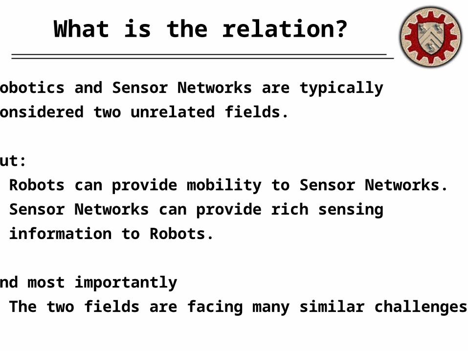
What is the relation?
Robotics and Sensor Networks are typically
considered two unrelated fields.
But:
• Robots can provide mobility to Sensor Networks.
• Sensor Networks can provide rich sensing
information to Robots.
and most importantly
• The two fields are facing many similar challenges.
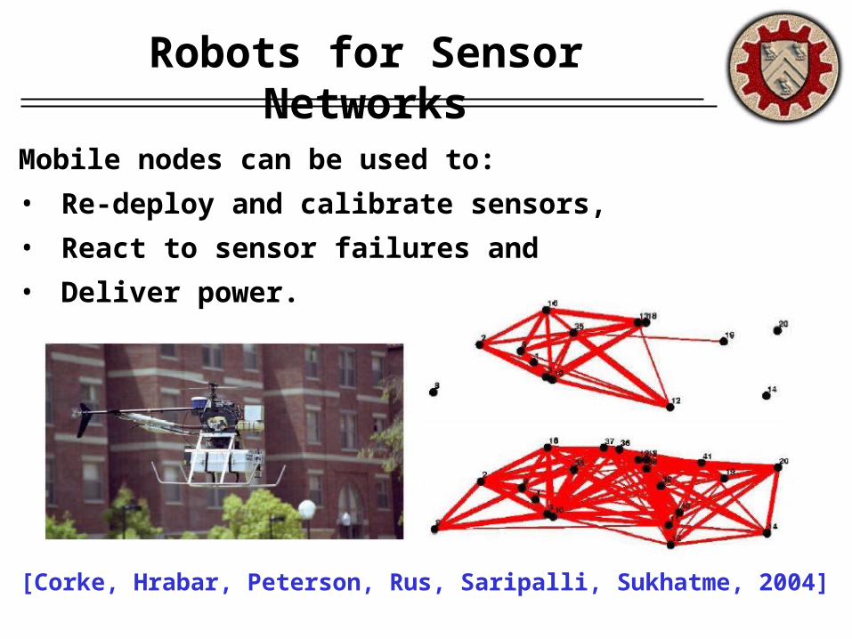
Robots for Sensor Networks
Mobile nodes can be used to:
• Re-deploy and calibrate sensors,
• React to sensor failures and
• Deliver power.
[Corke, Hrabar, Peterson, Rus, Saripalli, Sukhatme, 2004]
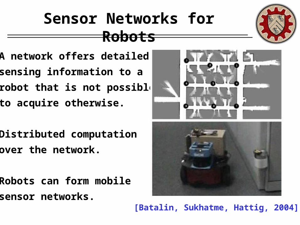
Sensor Networks for Robots
A network offers detailed
sensing information to a
robot that is not possible
to acquire otherwise.
Distributed computation
over the network.
Robots can form mobile
sensor networks.[Batalin, Sukhatme, Hattig, 2004]
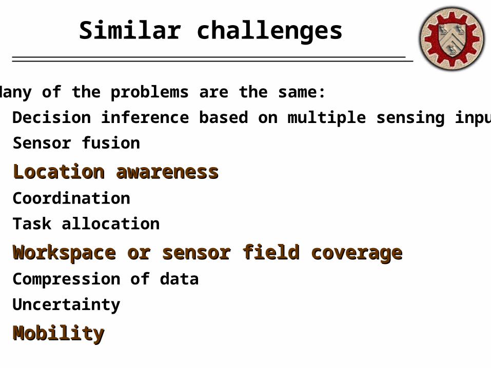
Similar challenges
Many of the problems are the same:
• Decision inference based on multiple sensing inputs
• Sensor fusion
• Location awarenessLocation awareness• Coordination
• Task allocation
• Workspace or sensor field coverageWorkspace or sensor field coverage• Compression of data
• Uncertainty
• MobilityMobility
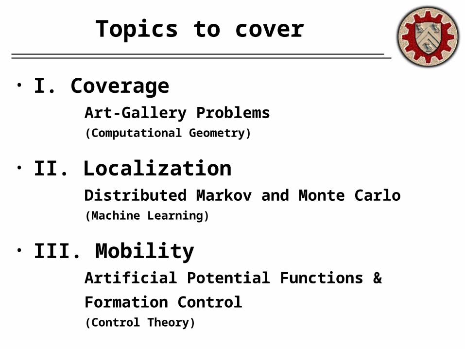
Topics to cover
• I. CoverageArt-Gallery Problems(Computational Geometry)
• II. LocalizationDistributed Markov and Monte Carlo(Machine Learning)
• III. MobilityArtificial Potential Functions &
Formation Control(Control Theory)

I. Coverage
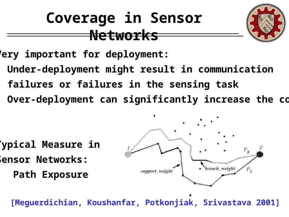
Coverage in Sensor Networks
Very important for deployment:
• Under-deployment might result in communication
failures or failures in the sensing task
• Over-deployment can significantly increase the cost
Typical Measure in
Sensor Networks:
Path Exposure
[Meguerdichian, Koushanfar, Potkonjiak, Srivastava 2001]
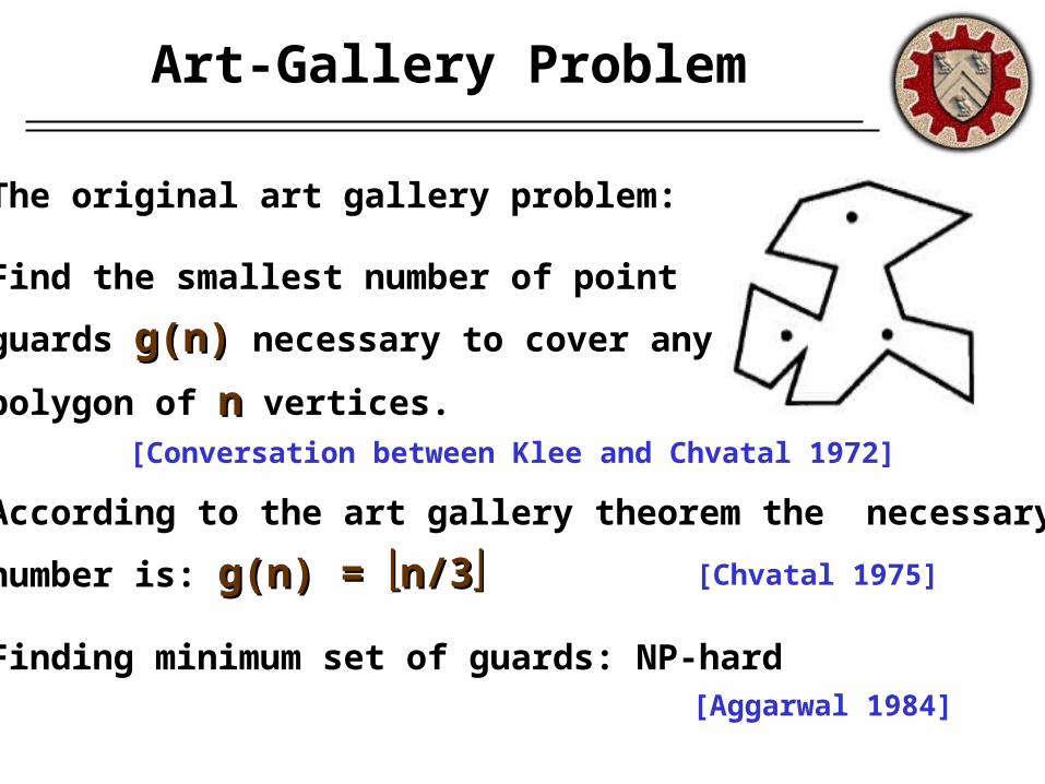
Art-Gallery Problem
The original art gallery problem:
Find the smallest number of point
guards g(n)g(n) necessary to cover any
polygon of nn vertices.
According to the art gallery theorem the necessary
number is: g(n) = g(n) = n/3n/3
Finding minimum set of guards: NP-hard
[Conversation between Klee and Chvatal 1972]
[Chvatal 1975]
[Aggarwal 1984]
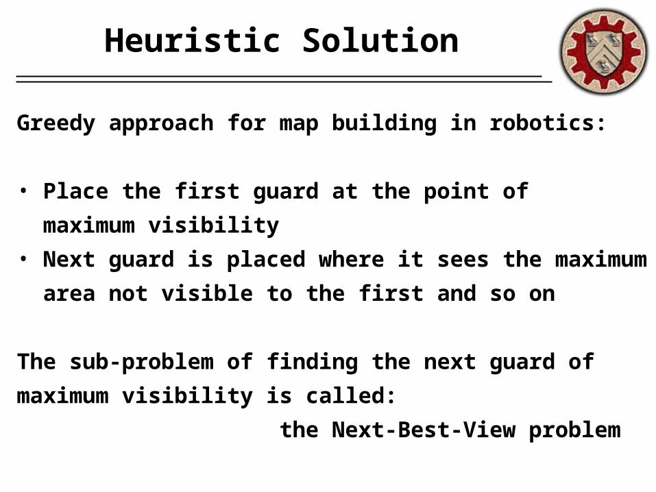
Heuristic Solution
Greedy approach for map building in robotics:
• Place the first guard at the point of
maximum visibility
• Next guard is placed where it sees the maximum
area not visible to the first and so on
The sub-problem of finding the next guard of
maximum visibility is called:
the Next-Best-View problem
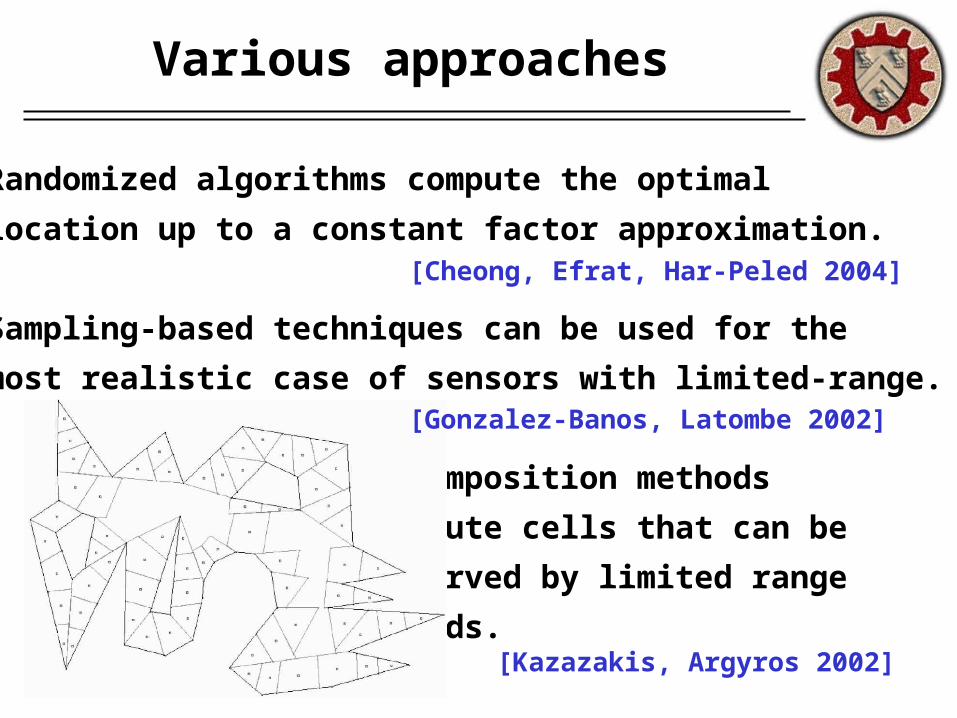
Various approaches
Randomized algorithms compute the optimal
location up to a constant factor approximation.
Sampling-based techniques can be used for the
most realistic case of sensors with limited-range.
Decomposition methods
compute cells that can be
observed by limited range
guards.
[Cheong, Efrat, Har-Peled 2004]
[Kazazakis, Argyros 2002]
[Gonzalez-Banos, Latombe 2002]
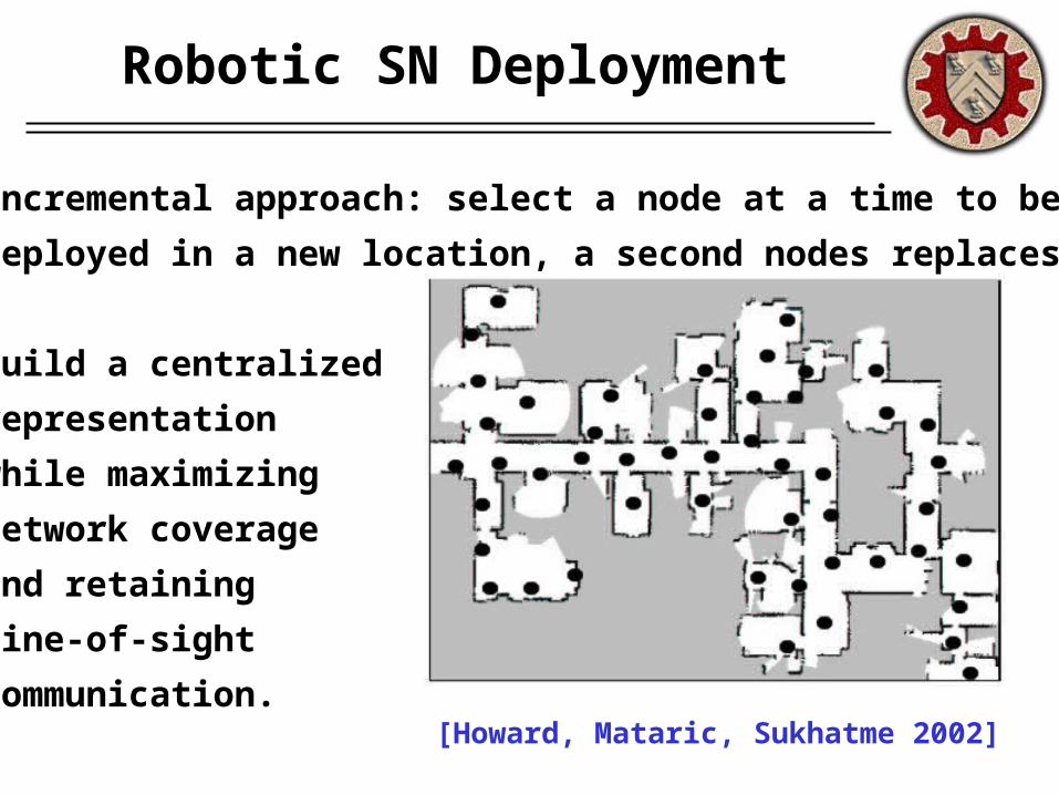
Robotic SN Deployment
[Howard, Mataric, Sukhatme 2002]
Incremental approach: select a node at a time to be
deployed in a new location, a second nodes replaces it
Build a centralized
representation
while maximizing
network coverage
and retaining
line-of-sight
communication.
II. Localization
Data for SN self-localization
• Received Signal Strength: for known transmission
power, the propagation loss is measured to estimate
the distance based on a propagation model.
• Time-of-arrival or time-difference-of-arrival: The
propagation time can be directly translated into
distance based on signal propagation speed.
• Angle-of-arrival: Systems estimate the angle at
which signals are received.
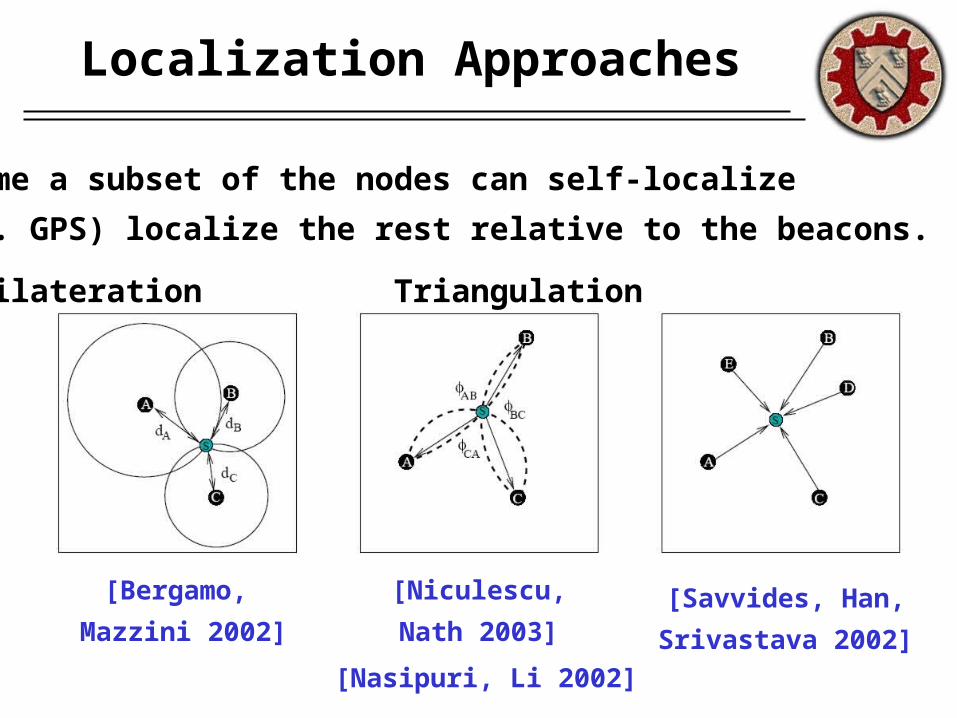
Localization Approaches
[Bergamo,
Mazzini 2002]
Assume a subset of the nodes can self-localize
(e.g. GPS) localize the rest relative to the beacons.
Trilateration Triangulation MLE
[Niculescu,
Nath 2003]
[Nasipuri, Li 2002]
[Savvides, Han,
Srivastava 2002]
Uncertainty in Robotics
[Fox, Burgard, Kruppa, Thrun: A probabilistic approach
to collaborative multi-robot localization, 2000]
Robots, like nodes of sensor networks, have to be
aware of their location.
Typical sensors in robotics: sonar, laser, cameras.
Problem: inherent uncertainty in sensor measurements
Probabilistic/bayesian techniques proven successful
in dealing with uncertainty and providing robustness.
Markov Localization
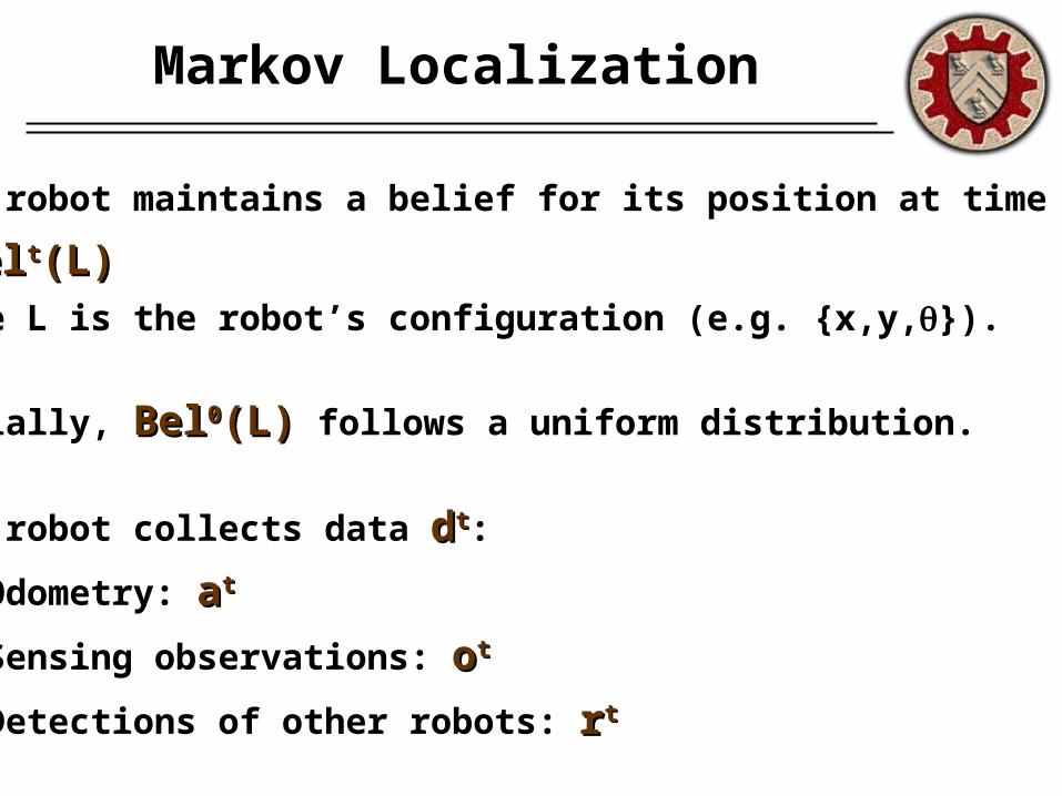
Each robot maintains a belief for its position at time t
BelBeltt(L)(L)where L is the robot’s configuration (e.g. {x,y,}).
Initially, BelBel00(L)(L) follows a uniform distribution.
Each robot collects data ddtt:
(a) Odometry: aatt
(b) Sensing observations: oott
(c) Detections of other robots: rrtt
Updating the distribution
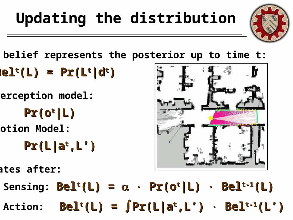
The belief represents the posterior up to time t:
BelBeltt(L) = Pr(L(L) = Pr(Ltt|d|dtt))
Perception model:
Pr(oPr(ott|L)|L)Motion Model:
Pr(L|aPr(L|att,L’) ,L’)
Updates after:
(1) Sensing: BelBeltt(L) = (L) = Pr(o Pr(ott|L) |L) Bel Belt-1t-1(L)(L)
(2) Action: BelBeltt(L) = (L) = Pr(L|aPr(L|att,L’) ,L’) Bel Belt-1t-1(L’) (L’) dL’ dL’
Multi-Robot Case
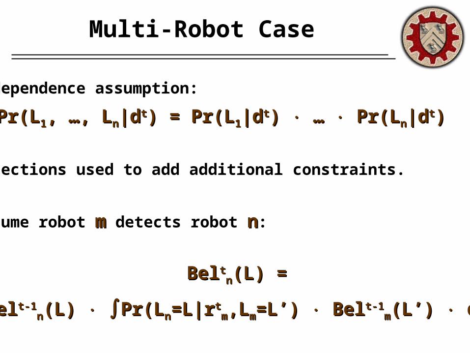
Independence assumption:
Pr(LPr(L11, …, L, …, Lnn|d|dtt) = Pr(L) = Pr(L11|d|dtt) ) … … Pr(L Pr(Lnn|d|dtt) )
Detections used to add additional constraints.
Assume robot mm detects robot nn:
BelBelttnn(L) = (L) =
BelBelt-1t-1nn(L) (L) Pr(LPr(Lnn=L|r=L|rtt
mm,L,Lmm=L’) =L’) Bel Belt-1t-1mm(L’) (L’) dL’ dL’
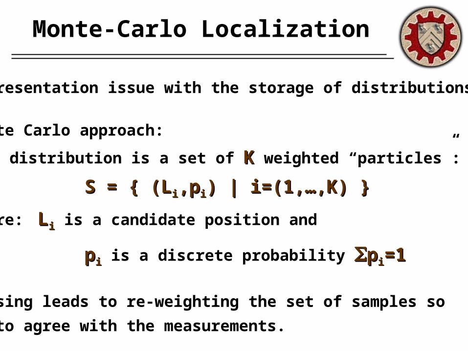
Monte-Carlo Localization
Representation issue with the storage of distributions
Monte Carlo approach:
A distribution is a set of KK weighted “particles”:
S = { (LS = { (Lii,p,pii) | i=(1,…,K) } ) | i=(1,…,K) }
where: LLii is a candidate position and
ppii is a discrete probability ppii=1=1
Sensing leads to re-weighting the set of samples so
as to agree with the measurements.
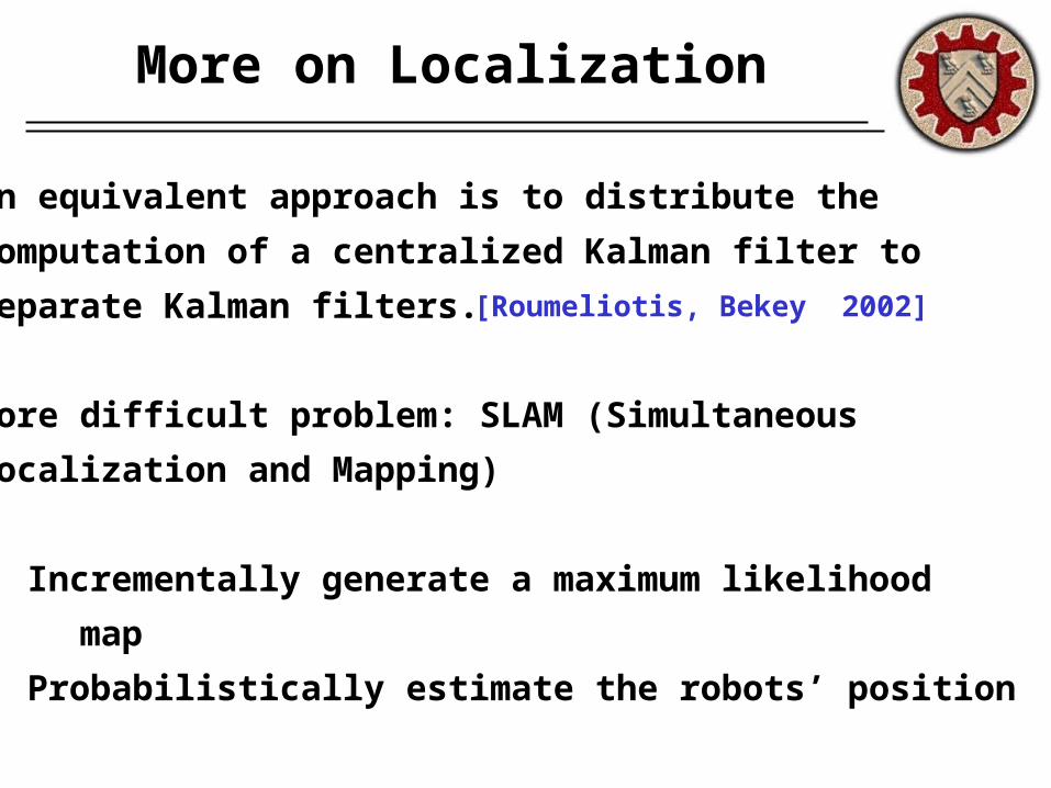
An equivalent approach is to distribute the
computation of a centralized Kalman filter to
separate Kalman filters.
More difficult problem: SLAM (Simultaneous
Localization and Mapping)
• Incrementally generate a maximum likelihood
map
• Probabilistically estimate the robots’ position
More on Localization
[Roumeliotis, Bekey 2002]
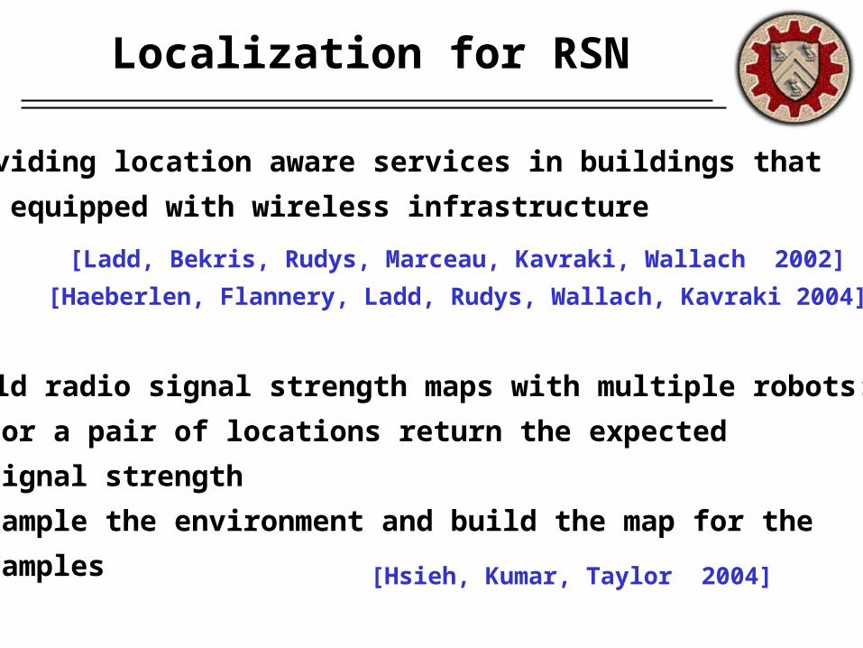
Providing location aware services in buildings that
are equipped with wireless infrastructure
Build radio signal strength maps with multiple robots:
• For a pair of locations return the expected
signal strength
• Sample the environment and build the map for the
samples
Localization for RSN
[Hsieh, Kumar, Taylor 2004]
[Ladd, Bekris, Rudys, Marceau, Kavraki, Wallach 2002]
[Haeberlen, Flannery, Ladd, Rudys, Wallach, Kavraki 2004]
III. Mobility
Why mobility?
• Synoptic sensing implies either over-deployment
(impractical – you cannot have sensor everywhere)
or mobility
• Mobility allows the system to focus sensing where
it is needed, when it is needed
• The initial deployment of static nodes cannot deal
with all possible changes in the environment
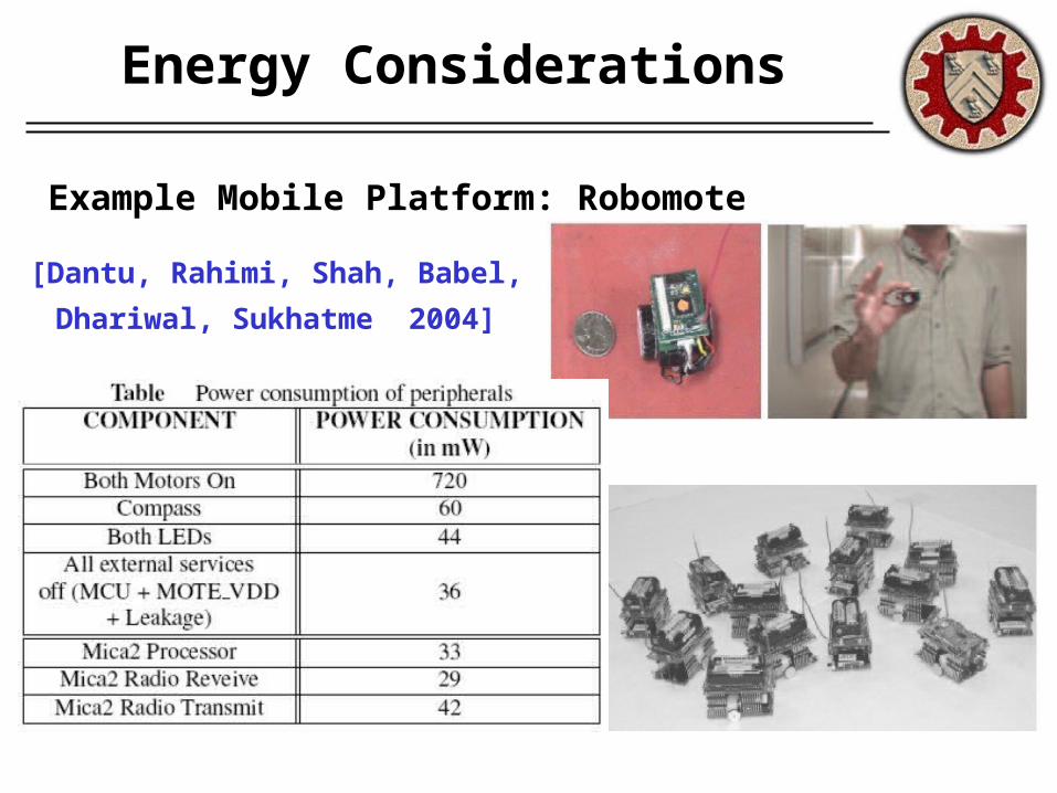
Energy Considerations
[Dantu, Rahimi, Shah, Babel,
Dhariwal, Sukhatme 2004]
Example Mobile Platform: Robomote
Goal of navigation approaches
Navigational strategies for SN should not have
extensive sensing and computational requirements.
They should take advantage of the distributed nature
of such networks.
Computationally or memory expensive approaches
are also not appropriate.
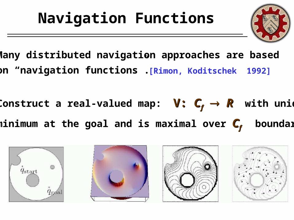
Navigation Functions
Many distributed navigation approaches are based
on “navigation functions”.
Construct a real-valued map: V: V: CCff RR with unique
minimum at the goal and is maximal over CCff boundary.
[Rimon, Koditschek 1992]
Navigation Functions
Then the robot at position pp can move according to:
where dd is an arbitrary dissipative vector-field.
Under additional requirements NFs guide the robot to
the goal without hitting local minima.
In the multi-robot case, each robot can act as an
obstacle in the potential function of other robots.
(p,p’) = -(p,p’) = -V(p) + d(p,p’)V(p) + d(p,p’)
[Dimarogonas, Zavlanos, Loizou, Kyriakopoulos 2003]
Source Gradient Climbing
A mechanism in the environment may be inducing
an environmental gradient field (light, sound source).
APFs are used for locating the source with multiple
robots.
If a robot measures the gradient only in the direction of
motion then it can only find minima along a line.
An APF enforces the team to stay close and eventually
the source will be found. [Ogren, Fiorelli, Leonard 2004]
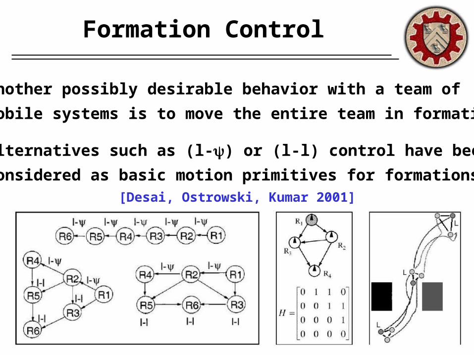
Formation Control
Another possibly desirable behavior with a team of
mobile systems is to move the entire team in formation.
Alternatives such as (l-) or (l-l) control have been
considered as basic motion primitives for formations. [Desai, Ostrowski, Kumar 2001]
Conclusion
Our interest
Interested in networks that have the ability to adapt
the location of their nodes
- not necessarily with autonomous mobility –
to solve problems that might require node relocation
Do not assume mobility is easily available and
inexpensive as it is typically considered in robotics
Take into account the cost of mobility and apply it only
when it is necessary for the application
Sampling-Based Motion Planners
An improvement over potential functions in typical
robotic applications.
They sample the configuration space of robots and
construct lower-dimensional representations
(e.g. graph structures).
They solve path planning problems on the graph
structures.
Issues to consider
• Can we apply the SBMP framework to deal with
adaptive sensor network problems?
• Can we have distributed SBMP?
• Can SBMP plan not just for motion but for other tasks,
such as sensing and communication?
• Can we take into consideration the fact that different
tasks have different energy costs?

Questions??
THE END