Road Safety in Addis Ababa - National Association of City ... · Road Safety in Addis Ababa...
20
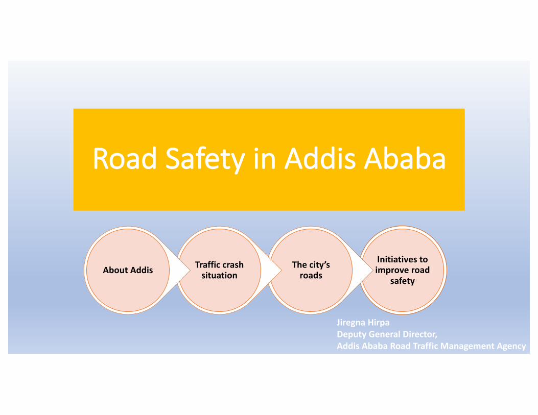
Road Safety in Addis Ababa Initiatives to improve road safety The city’s roads Traffic crash situation About Addis Jiregna Hirpa Deputy General Director, Addis Ababa Road Traffic Management Agency
Transcript of Road Safety in Addis Ababa - National Association of City ... · Road Safety in Addis Ababa...
RoadSafetyinAddisAbaba
Initiativestoimproveroad
safety
Thecity’sroads
TrafficcrashsituationAboutAddis
JiregnaHirpaDeputyGeneralDirector,AddisAbabaRoadTrafficManagementAgency

http://www.newgeography.com/content/003203-the-evolving-urban-form-addis-abeba
• Hasapopulationofabout4milandlessthanhalfamillionvehiclepopulation
• Facingroadtrafficchallenges• Inacitywithavehiclepopulationoflessthanhalfamillennium,morethan450peoplearebeingkilled
• Pedestriansarethemostaffectedroaduserswithmorethan86%offatalities
• Morethan58%causedbycommercialvehicles• Concentratedonmajorroads
Addis Ababa
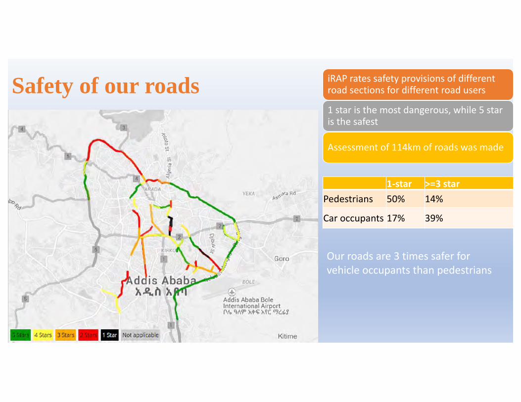
Safety of our roads
1-star >=3starPedestrians 50% 14%
Caroccupants 17% 39%
iRAPratessafetyprovisionsofdifferentroadsectionsfordifferentroadusers
1staristhemostdangerous,while5staristhesafest
Assessmentof114kmofroadswasmade
Ourroadsare3timessaferforvehicleoccupantsthanpedestrians

• Fatalcrashesareconcentratedonthemajorroads
• Fatalcrasheshappenwheremajorroadspassthroughhighpedestrianactivityareassuchasterminals
• Highdensityoffatalcrashesarefoundtobeindowntown
• ThereisaninitiativeforneighborsafetyimprovementaspartofBIGRSsupporttoimprovesafety
Fatalcrashlocationsinthecity
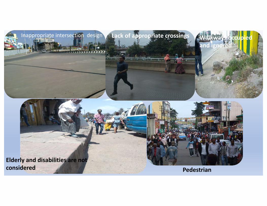
Inappropriateintersectiondesign Lackofappropriatecrossings Walkwaysoccupiedandignored
Elderlyanddisabilitiesarenotconsidered Pedestrian
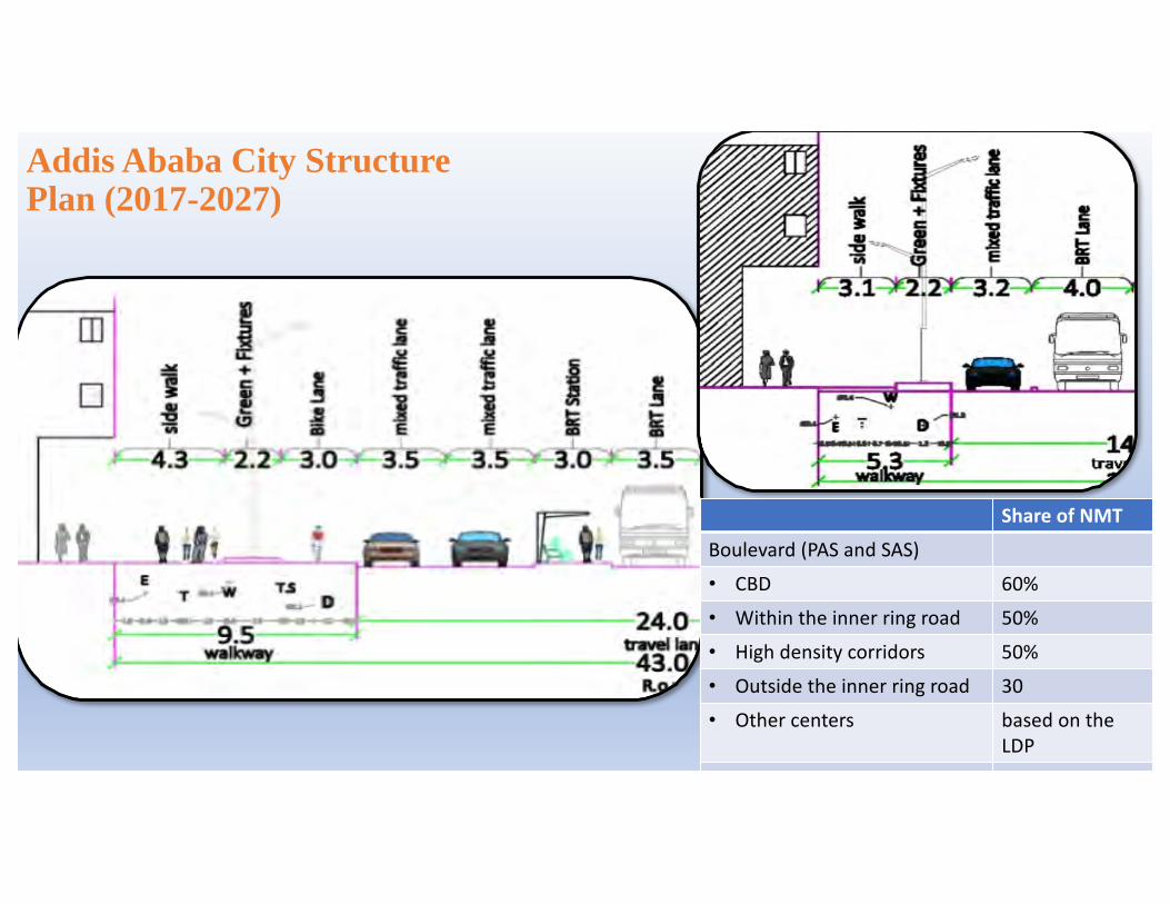
Addis Ababa City Structure Plan (2017-2027)
ShareofNMTBoulevard(PASandSAS)• CBD 60%• Withintheinnerringroad 50%• Highdensitycorridors 50%• Outsidetheinnerringroad 30• Othercenters basedonthe
LDPExpressway 30%
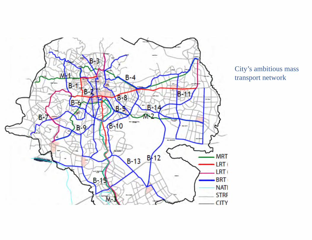
City’s ambitious mass transport network

LRT,realized
BRTPLANNED
34.25Km(North-Southline16.9kmandEast- Westline17.35km)
15BusRapidTransit(BRT)linesareproposed
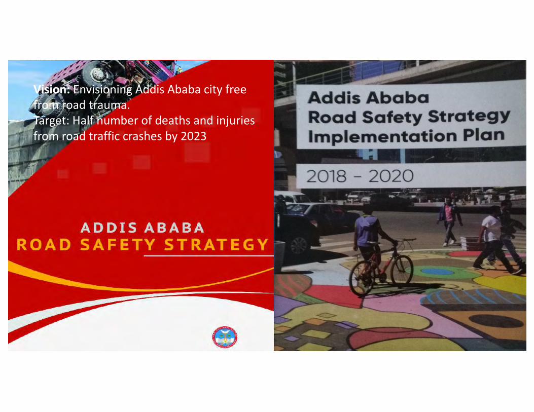
Vision:EnvisioningAddisAbabacityfreefromroadtrauma.Target:Halfnumberofdeathsandinjuriesfromroadtrafficcrashesby2023
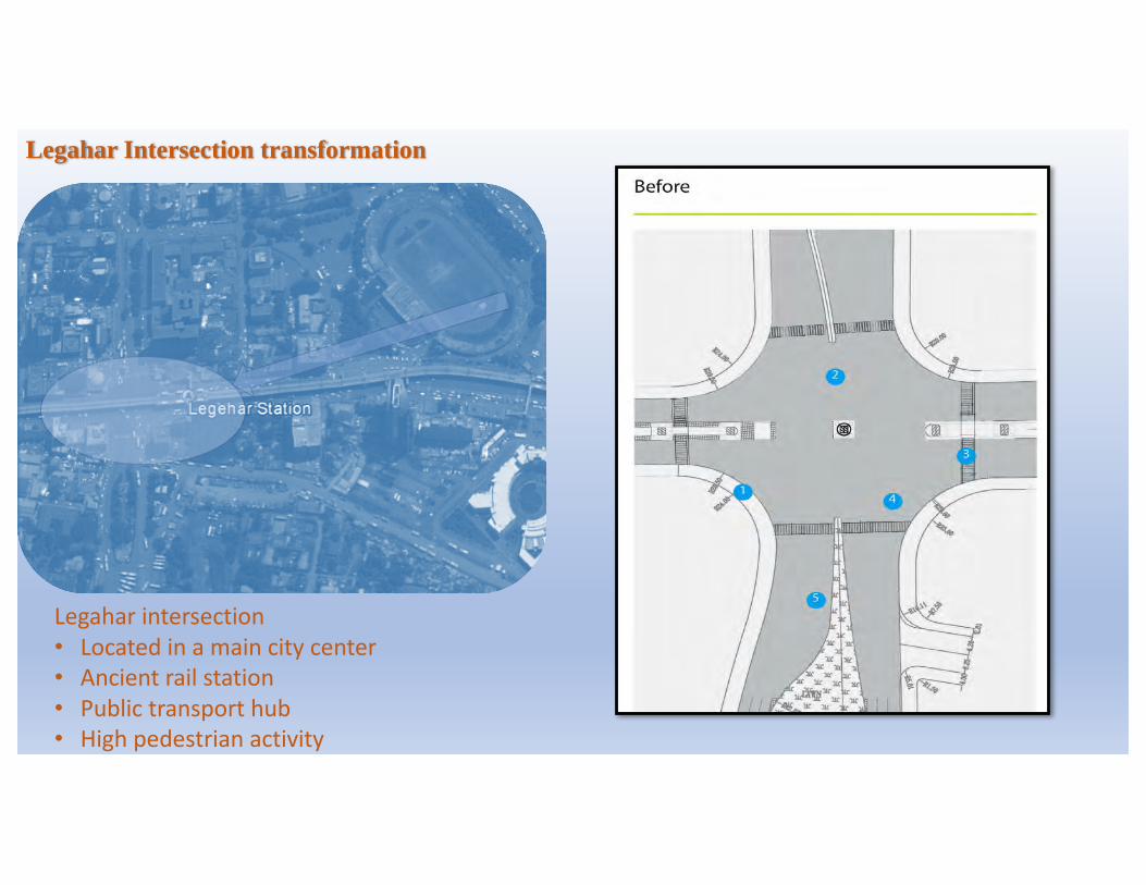
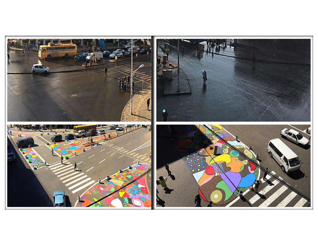
Legahar Intersection transformation
Legahar intersection• Locatedinamaincitycenter• Ancientrailstation• Publictransporthub• Highpedestrianactivity
2
Large turning radii that allow for gradual instead of sharper turning encourage motorists to speed.
Long crossing distances leave pedestrians vulnerable and can be particularly challenging for those with impaired mobility to cross.
Recessed crosswalks that are not aligned with pedestrian desire lines encourage jaywalking.
Misalignment of lanes creates bottlenecks and congestion.
Underutilized road space creates confusion for motorists and makes movement less predictable.
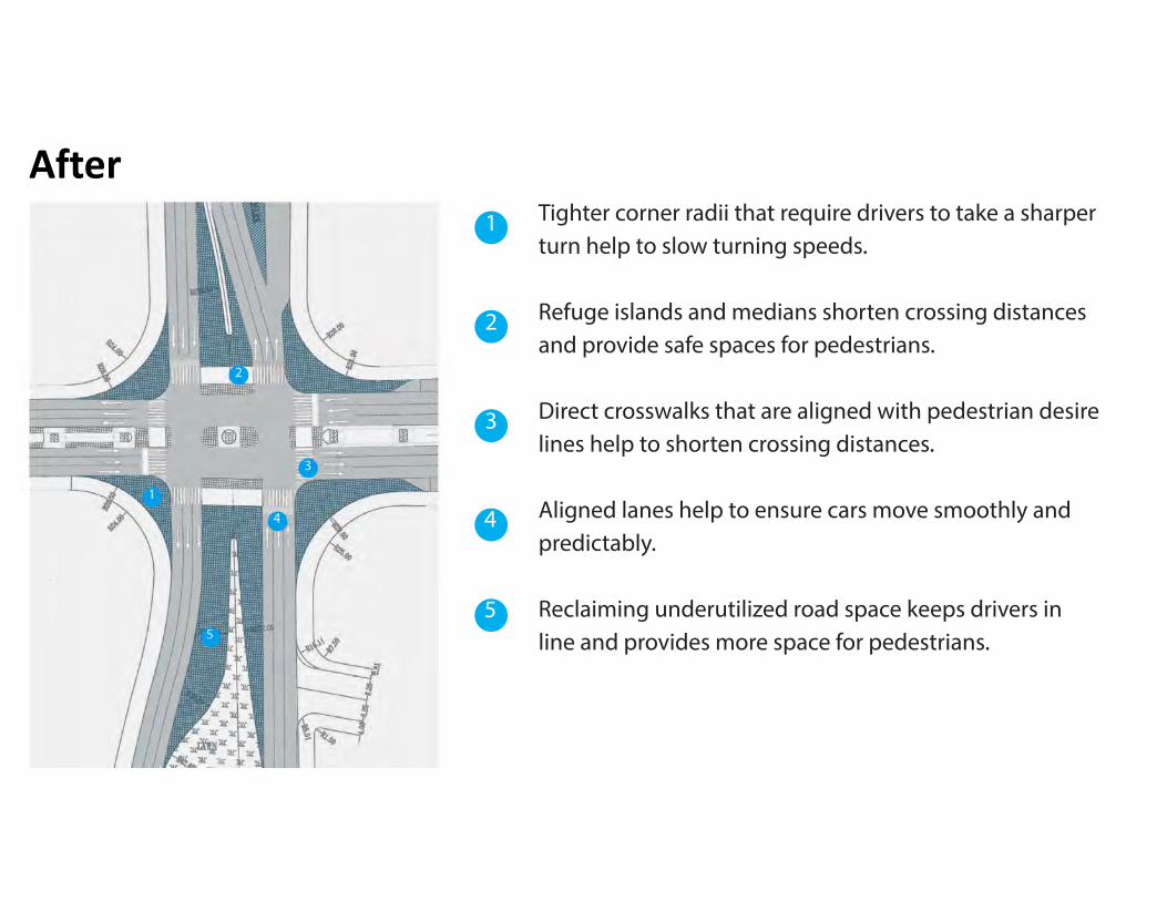
Tighter corner radii that require drivers to take a sharper turn help to slow turning speeds.
Refuge islands and medians shorten crossing distances and provide safe spaces for pedestrians.
Direct crosswalks that are aligned with pedestrian desire lines help to shorten crossing distances.
Aligned lanes help to ensure cars move smoothly and predictably.
Reclaiming underutilized road space keeps drivers in line and provides more space for pedestrians.
1 1
3
2
3
4
5
4
5
After
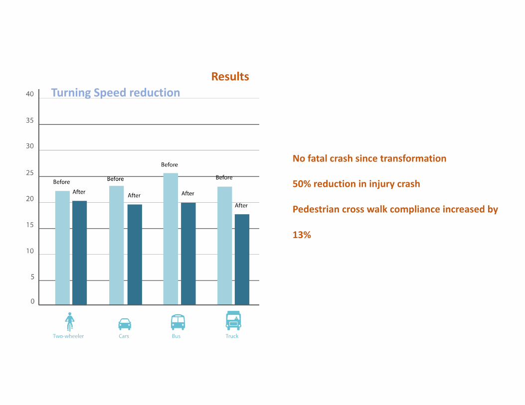
ResultsTurningSpeedreduction
Nofatalcrashsincetransformation
50%reductionininjurycrash
Pedestriancrosswalkcomplianceincreasedby
13%
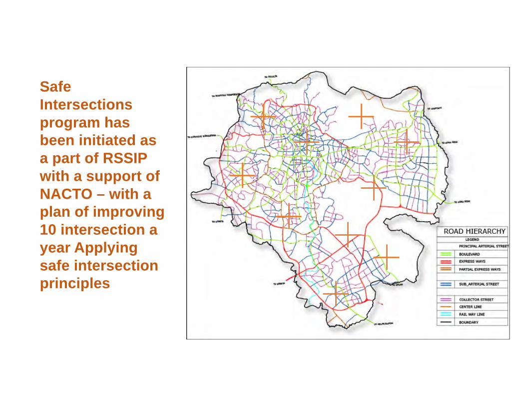
Safe Intersections program has been initiated as a part of RSSIP with a support of NACTO – with a plan of improving 10 intersection a year Applying safe intersection principles
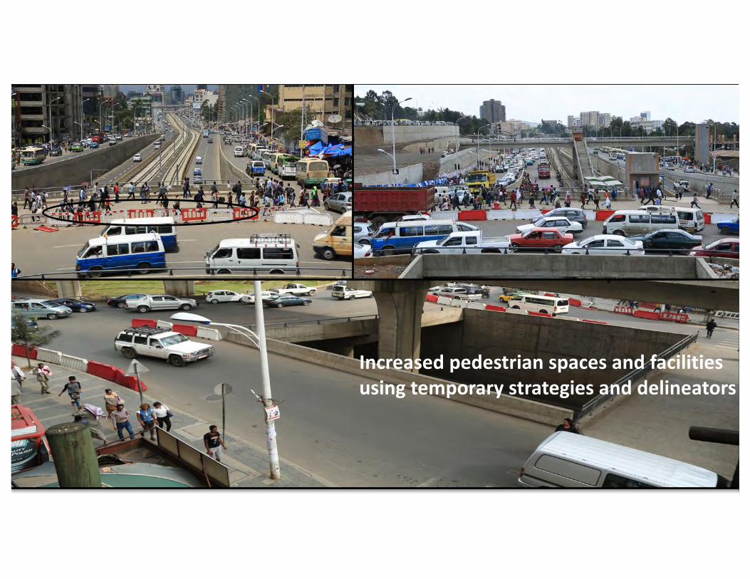
Increasedpedestrianspacesandfacilitiesusingtemporarystrategiesanddelineators
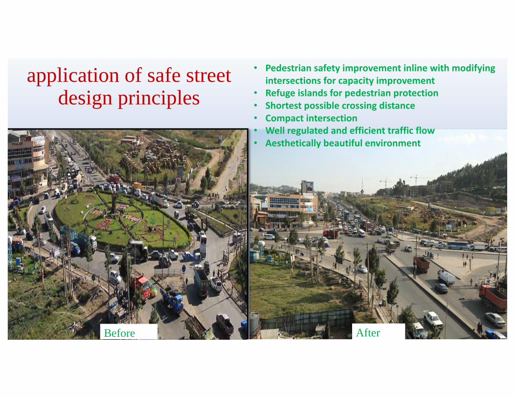
application of safe street design principles
• Pedestriansafetyimprovementinlinewithmodifyingintersectionsforcapacityimprovement
• Refugeislandsforpedestrianprotection• Shortestpossiblecrossingdistance• Compactintersection• Wellregulatedandefficienttrafficflow• Aestheticallybeautifulenvironment
Before After
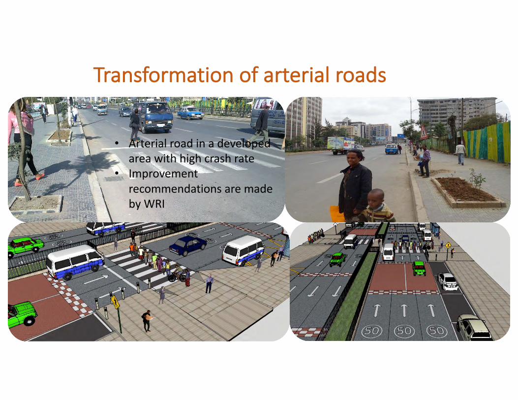
Transformationofarterialroads
• Arterialroadinadevelopedareawithhighcrashrate
• ImprovementrecommendationsaremadebyWRI
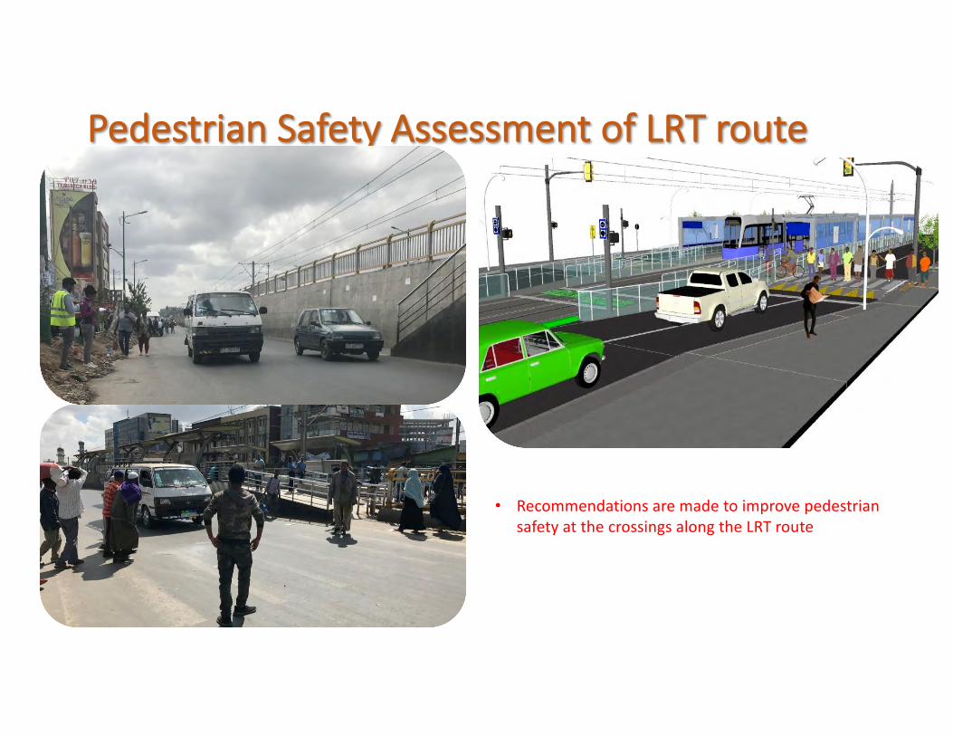
PedestrianSafetyAssessmentofLRTroute
• RecommendationsaremadetoimprovepedestriansafetyatthecrossingsalongtheLRTroute
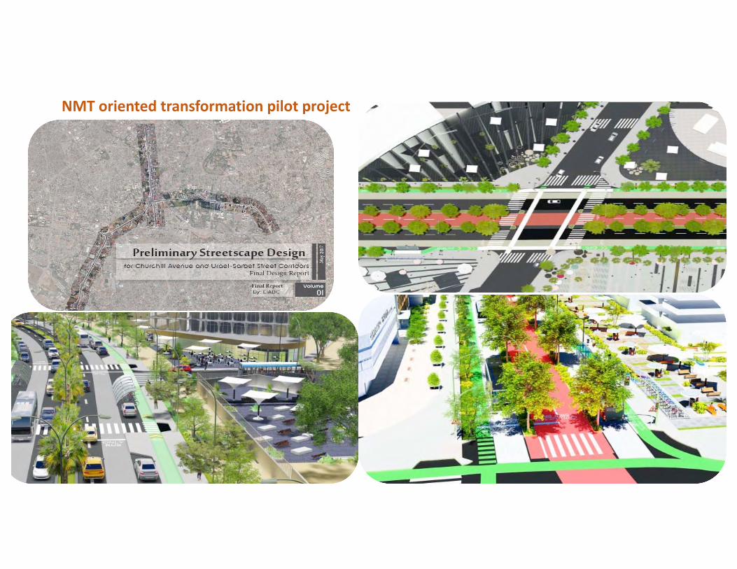
NMTorientedtransformationpilotproject
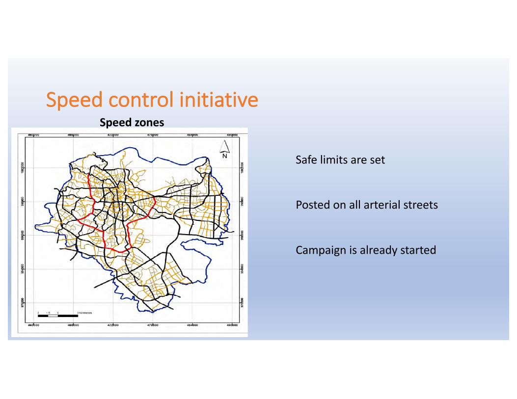
Speedcontrolinitiative
Safelimitsareset
Postedonallarterialstreets
Campaignisalreadystarted
Speedzones