RESPONSE BRIEF OF THE PUBLIC UTILITY COMMISSION OF TEXAS
229
CAUSE NO. D-1-GV-11-000324 CITY OF KERRVILLE, KERRVILLE § IN THE DISTRICT COURT PUBLIC UTILITY BOARD, AND § CITY OF JUNCTION, § Plaintiffs, § § vs. § OF TRAVIS COUNTY, TEXAS § PUBLIC UTILITY COMMISSION § OF TEXAS, § Defendant § 98 JUDICIAL DISTRICT th RESPONSE BRIEF OF THE PUBLIC UTILITY COMMISSION OF TEXAS GREG ABBOTT Attorney General of Texas DANIEL T. HODGE First Assistant Attorney General BILL COBB Deputy Attorney General for Civil Litigation BARBARA B. DEANE Chief, Environmental Protection and Administrative Law Division DAVID PREISTER Chief, Environmental Protection Section JOHN R. HULME Assistant Attorney General State Bar No. 10258400 DAVID L. GREEN Assistant Attorney General State Bar No. 24037776 Environmental Protection and Administrative Law Division P. O. Box 12548 Austin, Texas 78711-2548 Telephone: 512-463-2012 Fax: 512-320-0911 ATTORNEYS FOR PUBLIC UTILITY COMMISSION OF TEXAS June 17, 2011
Transcript of RESPONSE BRIEF OF THE PUBLIC UTILITY COMMISSION OF TEXAS

CAUSE NO. D-1-GV-11-000324
CITY OF KERRVILLE, KERRVILLE § IN THE DISTRICT COURT
PUBLIC UTILITY BOARD, AND §
CITY OF JUNCTION, §
Plaintiffs, §
§
vs. § OF TRAVIS COUNTY, TEXAS
§
PUBLIC UTILITY COMMISSION §
OF TEXAS, §
Defendant § 98 JUDICIAL DISTRICTth
RESPONSE BRIEF OF THE PUBLIC UTILITY COMMISSION OF TEXAS
GREG ABBOTT
Attorney General of Texas
DANIEL T. HODGE
First Assistant Attorney General
BILL COBB
Deputy Attorney General
for Civil Litigation
BARBARA B. DEANE
Chief, Environmental Protection and
Administrative Law Division
DAVID PREISTER
Chief, Environmental Protection Section
JOHN R. HULME
Assistant Attorney General
State Bar No. 10258400
DAVID L. GREEN
Assistant Attorney General
State Bar No. 24037776
Environmental Protection and
Administrative Law Division
P. O. Box 12548
Austin, Texas 78711-2548
Telephone: 512-463-2012
Fax: 512-320-0911
ATTORNEYS FOR PUBLIC UTILITY
COMMISSION OF TEXAS
June 17, 2011

i
TABLE OF CONTENTS
Index of Authorities . . . . . . . . . . . . . . . . . . . . . . . . . . . . . . . . . . . . . . . . . . . . . . . . . . . . . iv
I. Statement of the Nature of the Case . . . . . . . . . . . . . . . . . . . . . . . . . . . . . . . . . . . . 1
II. Statement of Facts . . . . . . . . . . . . . . . . . . . . . . . . . . . . . . . . . . . . . . . . . . . . . . . . . . 1
A. LCRA sought a CCN amendment to approve a Competitive Renewable
Energy Zones (“CREZ”) transmission line. . . . . . . . . . . . . . . . . . . . . . . . . . 1
1. Competitive renewable energy zones and the Legislative
mandate to develop CREZ transmission infrastructure. . . . . . . . . . . 2
2. The PUC’s designation of the CREZ, the CREZ transmission
plan, and the selection of the transmission providers. . . . . . . . . . . . . 3
B. LCRA notified affected parties about the various proposed routes for
the McCamey D to Kendall CREZ line. . . . . . . . . . . . . . . . . . . . . . . . . . . . . 4
1. LCRA reached out to affected communities before the CCN
application was filed. . . . . . . . . . . . . . . . . . . . . . . . . . . . . . . . . . . . . . 4
2. LCRA’s CCN application . . . . . . . . . . . . . . . . . . . . . . . . . . . . . . . . . 5
C. More than 1,000 interested persons participated in the CCN proceeding.
. . . . . . . . . . . . . . . . . . . . . . . . . . . . . . . . . . . . . . . . . . . . . . . . . . . . . . . . . . . . 8
D. SOAH heard evidence on LCRA’s application and proposed a route for
the line.. . . . . . . . . . . . . . . . . . . . . . . . . . . . . . . . . . . . . . . . . . . . . . . . . . . . . 9
1. Considerations in routing the line. .. . . . . . . . . . . . . . . . . . . . . . . . . 10
2. Routing the line around the Kimble County airport near the City
of Junction.. . . . . . . . . . . . . . . . . . . . . . . . . . . . . . . . . . . . . . . . . . . . 11
3. The ALJs recommended a route. . . . . . . . . . . . . . . . . . . . . . . . . . . . 13
E . After considering the evidence, the ALJs’ proposal, and the parties’
arguments, the PUC decided what route to certificate. . . . . . . . . . . . . . . . 13

ii
III. Summary of the Argument .. . . . . . . . . . . . . . . . . . . . . . . . . . . . . . . . . . . . . . . . . . 16
IV. Argument and Authorities . . . . . . . . . . . . . . . . . . . . . . . . . . . . . . . . . . . . . . . . . . . 17
A. Standard of review . . . . . . . . . . . . . . . . . . . . . . . . . . . . . . . . . . . . . . . . . . . 17
1. Substantial evidence standard. .. . . . . . . . . . . . . . . . . . . . . . . . . . . . 17
2. Arbitrary-and-capricious standard. . . . . . . . . . . . . . . . . . . . . . . . . . 19
3. Abuse of discretion. . . . . . . . . . . . . . . . . . . . . . . . . . . . . . . . . . . . . . 20
B. In routing the transmission line, the PUC weighs the evidence relating
to a range of relevant statutory factors . . . . . . . . . . . . . . . . . . . . . . . . . . . . 20
C. The PUC properly chose route Link Y11 after considering the record
evidence and providing all affected parties the opportunity to examine
witnesses and present evidence. (Responds to Point of Error No. 1.) . . . . 23
1. Substantial evidence supports the PUC’s decision to chose Link
Y11. . . . . . . . . . . . . . . . . . . . . . . . . . . . . . . . . . . . . . . . . . . . . . . . . . 24
2. The adjusted Link Y11 the PUC certificated is not a new link. . . . . . 27
3. The PUC’s Order was made through lawful procedure and was
made in compliance with all laws and regulations. . . . . . . . . . . . . . 30
D. The PUC legally changed findings of facts and conclusions of law from
the proposal for decision. (Responds to Point of Error No. 2) . . . . . . . . . 32
E. The PUC did not disregard its “prudent avoidance” policy. (Responds
to Point of Error No. 3). . . . . . . . . . . . . . . . . . . . . . . . . . . . . . . . . . . . . . . . 36
1. The PUC’s route selection was not arbitrary and capricious or an
abuse of discretion. . . . . . . . . . . . . . . . . . . . . . . . . . . . . . . . . . . . . . 37
2. Substantial evidence supports the PUC’s route selection. .. . . . . . . 39
F. The PUC did not disregard the community values statutory factor.
(Responds to Point of Error No. 4) .. . . . . . . . . . . . . . . . . . . . . . . . . . . . . . 40

iii
V. Conclusion and Prayer . . . . . . . . . . . . . . . . . . . . . . . . . . . . . . . . . . . . . . . . . . . . . . 41
CERTIFICATE OF SERVICE . . . . . . . . . . . . . . . . . . . . . . . . . . . . . . . . . . . . . . . . . . . . . 43

iv
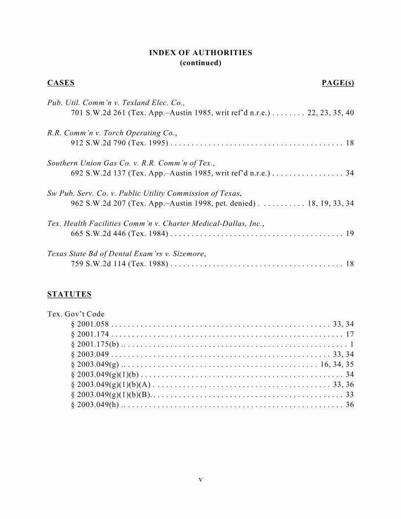
INDEX OF AUTHORITIES
CASES PAGE(s)
Anderson v. R.R. Comm’n,
963 S.W.2d 217 (Tex. App.—Austin 1998, pet. denied) . . . . . . . . . . . . . . . . . . . 17
ASAP Paging, Inc. v. Pub. Util. Comm’n,
213 S.W.3d 380 (Tex. App.–Austin 2006, pet. denied) . . . . . . . . . . . . . . . . . 18, 19
Citizens Against Landfill Location v. Tex. Comm’n on Envtl. Quality,
169 S.W.3d 258 (Tex. App–Austin 2005, pet. denied) . . . . . . . . . . . . . . . . . . . . . 34
City of El Paso v. Pub. Util. Comm’n,
883 S.W.2d 179 (Tex. 1994) .. . . . . . . . . . . . . . . . . . . . . . . . . . . . . . . . . . . . . . . . 19
City of Frisco v. Tex. Water Rights Comm’n,
579 S.W.2d 66 (Tex. Civ. App. 1979, writ. ref. n.r.e.) . . . . . . . . . . . . . . . . . . . . . 30
Chocolate Bayou Water Co. and Sand Supply
v. Texas Natural Resource Conservation Commission,
124 S.W.3d 844 (Tex. App.–Austin 2003, pet. denied). . . . . . . . . . . . . . . . . . 27, 28
Downer v. Aquamarine Operators, Inc.,
701 S.W.2d 238 (Tex. 1985) . . . . . . . . . . . . . . . . . . . . . . . . . . . . . . . . . . . . . . . . . 20
Dunn v. Pub. Util. Comm’n,
246 S.W.3d 788 (Tex. App.–Austin 2008, no pet.) . . . . . . . . . . . . . . . . . . 18, 19, 23
Flores v. Employees Ret. Sys. of Tex.,
74 S.W.3d 532 (Tex. App.–Austin 2002, pet. denied). . . . . . . . . . . . . . . . . . . . . . 32
Hammack v. Public Utility Comm’n,
131 S.W.3d 713 (Tex. App.–Austin 2004, pet. denied) . . . . . . . . . . . 18, 19, 21, 22
Pedernales Elec. Co-op., Inc. v. Pub. Util. Comm’n,
809 S.W.2d 332 (Tex. App.–Austin 1991, no writ) .. . . . . . . . . . . . . . . . . . . . 30, 31
Pub. Util. Comm’n v. Gulf States Utils. Co.,
809 S.W.2d 201 (Tex. 1991) . . . . . . . . . . . . . . . . . . . . . . . . . . . . . . . . . . . . . . . . . 17
v
INDEX OF AUTHORITIES
(continued)
CASES PAGE(s)
Pub. Util. Comm’n v. Texland Elec. Co.,
701 S.W.2d 261 (Tex. App.–Austin 1985, writ ref’d n.r.e.) . . . . . . . . 22, 23, 35, 40
R.R. Comm’n v. Torch Operating Co.,
912 S.W.2d 790 (Tex. 1995) . . . . . . . . . . . . . . . . . . . . . . . . . . . . . . . . . . . . . . . . . 18
Southern Union Gas Co. v. R.R. Comm’n of Tex.,
692 S.W.2d 137 (Tex. App.–Austin 1985, writ ref’d n.r.e.) . . . . . . . . . . . . . . . . . 34
Sw Pub. Serv. Co. v. Public Utility Commission of Texas,
962 S.W.2d 207 (Tex. App.–Austin 1998, pet. denied) . . . . . . . . . . . 18, 19, 33, 34
Tex. Health Facilities Comm’n v. Charter Medical-Dallas, Inc.,
665 S.W.2d 446 (Tex. 1984) . . . . . . . . . . . . . . . . . . . . . . . . . . . . . . . . . . . . . . . . . 19
Texas State Bd of Dental Exam’rs v. Sizemore,
759 S.W.2d 114 (Tex. 1988) . . . . . . . . . . . . . . . . . . . . . . . . . . . . . . . . . . . . . . . . . 18
STATUTES
Tex. Gov’t Code
§ 2001.058 . . . . . . . . . . . . . . . . . . . . . . . . . . . . . . . . . . . . . . . . . . . . . . . . . . . . 33, 34
§ 2001.174 . . . . . . . . . . . . . . . . . . . . . . . . . . . . . . . . . . . . . . . . . . . . . . . . . . . . . . . 17
§ 2001.175(b) .. . . . . . . . . . . . . . . . . . . . . . . . . . . . . . . . . . . . . . . . . . . . . . . . . . . . . 1
§ 2003.049 . . . . . . . . . . . . . . . . . . . . . . . . . . . . . . . . . . . . . . . . . . . . . . . . . . . . 33, 34
§ 2003.049(g) .. . . . . . . . . . . . . . . . . . . . . . . . . . . . . . . . . . . . . . . . . . . . . . 16, 34, 35
§ 2003.049(g)(1)(b) . . . . . . . . . . . . . . . . . . . . . . . . . . . . . . . . . . . . . . . . . . . . . . . . 34
§ 2003.049(g)(1)(b)(A) . . . . . . . . . . . . . . . . . . . . . . . . . . . . . . . . . . . . . . . . . . 33, 36
§ 2003.049(g)(1)(b)(B). . . . . . . . . . . . . . . . . . . . . . . . . . . . . . . . . . . . . . . . . . . . . . 33
§ 2003.049(h) .. . . . . . . . . . . . . . . . . . . . . . . . . . . . . . . . . . . . . . . . . . . . . . . . . . . . 36

vi
INDEX OF AUTHORITIES
(continued)
STATUTES PAGE(s)
Public Utility Regulatory Act (PURA)
Tex. Util. Code
§§ 11.001-66.017 . . . . . . . . . . . . . . . . . . . . . . . . . . . . . . . . . . . . . . . . . . . . . . . . . . . 2
§ 12.202. . . . . . . . . . . . . . . . . . . . . . . . . . . . . . . . . . . . . . . . . . . . . . . . . . . . . . . . . 30
§ 15.001 . . . . . . . . . . . . . . . . . . . . . . . . . . . . . . . . . . . . . . . . . . . . . . . . . . . . . . 17, 35
§ 37.054 . . . . . . . . . . . . . . . . . . . . . . . . . . . . . . . . . . . . . . . . . . . . . . . . . . . . . . . . . . 6
§ 37.056 . . . . . . . . . . . . . . . . . . . . . . . . . . . . . . . . . . . . . . . . . . . . . 10, 20, 22, 36, 42
§ 37.056(a) . . . . . . . . . . . . . . . . . . . . . . . . . . . . . . . . . . . . . . . . . . . . . . . . . . . . . . . 20
§ 37.056(c) . . . . . . . . . . . . . . . . . . . . . . . . . . . . . . . . . . . . . . . 5, 6, 10, 20, 21, 35, 38
§ 37.056(c)(1) . . . . . . . . . . . . . . . . . . . . . . . . . . . . . . . . . . . . . . . . . . . . . . . . . . . . 20
§ 37.056(c)(2). . . . . . . . . . . . . . . . . . . . . . . . . . . . . . . . . . . . . . . . . . . . . . . . . . . . . 20
§ 37.056(c)(4) . . . . . . . . . . . . . . . . . . . . . . . . . . . . . . . . . . . . . . . . . . . . . . . . . . 4, 20
§ 39.904(g) .. . . . . . . . . . . . . . . . . . . . . . . . . . . . . . . . . . . . . . . . . . . . . . . . . . . . . . . 4
§ 39.904(g) - (n) . . . . . . . . . . . . . . . . . . . . . . . . . . . . . . . . . . . . . . . . . . . . . . . . . . . . 2
§ 39.904(g)(2) . . . . . . . . . . . . . . . . . . . . . . . . . . . . . . . . . . . . . . . . . . . . . . . . . . . . . 3
§ 39.904 (h) . . . . . . . . . . . . . . . . . . . . . . . . . . . . . . . . . . . . . . . . . . . . . . . . . . . . . . 20
RULES
16 Tex. Admin. Code
§ 22.52. . . . . . . . . . . . . . . . . . . . . . . . . . . . . . . . . . . . . . . . . . . . . . . . . . . . . . . . . . . 6
§ 22.71 . . . . . . . . . . . . . . . . . . . . . . . . . . . . . . . . . . . . . . . . . . . . . . . . . . . . . . . 30, 31
§ 22.262(a) . . . . . . . . . . . . . . . . . . . . . . . . . . . . . . . . . . . . . . . . . . . . . . . . . . . . 32, 35
§ 25.101 . . . . . . . . . . . . . . . . . . . . . . . . . . . . . . . . . . . . . . . . . . . . . . . . 10, 21, 36, 38
§ 25.101(a)(1)(B) . . . . . . . . . . . . . . . . . . . . . . . . . . . . . . . . . . . . . . . . . . . . . . . . . 4, 6
§ 25.101(a)(3). . . . . . . . . . . . . . . . . . . . . . . . . . . . . . . . . . . . . . . . . . . . . . . . . . . . . 37
§ 25.101(b)(3). . . . . . . . . . . . . . . . . . . . . . . . . . . . . . . . . . . . . . . . . . . . . . . . . . . . . 37
§ 25.101(b)(3)(B) .. . . . . . . . . . . . . . . . . . . . . . . . . . . . . . . . . . . . . . . . . . . . . 4, 6, 21
§ 25.101(b)(3)(B)(i)-(ii) . . . . . . . . . . . . . . . . . . . . . . . . . . . . . . . . . . . . . . . . . . . 5, 35
§ 25.101(b)(4). . . . . . . . . . . . . . . . . . . . . . . . . . . . . . . . . . . . . . . . . . . . . . . . . . . . . 37
§ 25.174 . . . . . . . . . . . . . . . . . . . . . . . . . . . . . . . . . . . . . . . . . . . . . . . . . . . . . . . 3, 20
§ 25.174(d)(2) . . . . . . . . . . . . . . . . . . . . . . . . . . . . . . . . . . . . . . . . . . . . . . . . . . . . 20

vii
INDEX OF AUTHORITIES
(continued)
OTHER AUTHORITIES PAGE(s)
Act of July 20, 2005, 79th Leg. 1st C.S. ch. 1, 2005 Tex. Gen. Laws 1, 2. . . . . . . . . . . . . 2
Tex. Public Util. Comm’n, Rulemaking Relating to Renewable Energy Amendments,
Project No. 31852 (Dec. 15, 2006) (Order Adopting § 25.174 as Approved at
the December 1 Open Meeting), and the selection of transmission service
providers to build the needed CREZ transmission lines. 16 Tex. Admin. Code
§ 25.216. . . . . . . . . . . . . . . . . . . . . . . . . . . . . . . . . . . . . . . . . . . . . . . . . . . . . . . . . . 3
Tex. Pub. Util. Comm’n, Rulemaking Proceeding to Amend PUC Substantive Rules
Relating to the Selection of Transmission Service Providers Related to
Competitive Renewable Energy Zones and Other Special Projects, Project No.
34560, (June 19, 2008) (Order Adopting 16 Tex. Admin. Code § 25.216). . . . . . . 3
Tex. Pub. Util. Comm’n, Commission Staff’s Petition for Designation of Competitive
Renewable Energy Zones, Docket No. 33672 (Aug. 15, 2008) (Order). . . . . . . . . . 3
Tex. Util. Code, Application of LCRA Transmission Services Corporation to Amend
its Certification of convenience and Necessity for the Proposed McCamey D
to Kendal to Gillespie 345-KV CREZ Transmission Line in Schleicher, Sutton,
Menard, Kimble, Mason, Gillespie, Kerr, and Kendal Counties, Docket No.
38354 (Jan. 24, 2011) (Order). . . . . . . . . . . . . . . . . . . . . . . . . . . . . . . . . . . . . . . . . 3

Tex. Util. Code, Application of LCRA Transmission Services Corporation to1
Amend its Certification of convenience and Necessity for the Proposed McCamey D to
Kendal to Gillespie 345-KV CREZ Transmission Line in Schleicher, Sutton, Menard,
Kimble, Mason, Gillespie, Kerr, and Kendal Counties, Docket No. 38354 (Jan. 24, 2011)
(Order).
The administrative record in this case was filed on May 17, 2011. By stipulation of the2
parties under TEX. GOV’T CODE § 2001.175(b), land owner and citizen comments letters and e-mails and responses to them, and motions to intervene and responses to them, were not includedin the record filed with the court. The stipulation allows parties to request that the PUCsupplement to add individual items that would otherwise have been included in theadministrative record. The PUC is to file a supplement, if necessary, by August 1, 2011. Stipulation to Administrative Record filed May 5, 2011. Documents in the AR will be cited as“AR, Box ___ Binder __, Item ___” for filings; “[Party name] Ex. ___” for exhibits; and “TR,Vol. ____” for transcripts.
1
The Public Utility Commission of Texas (“PUC” or “Commission”) responds to the
brief filed by plaintiffs City of Kerrville, Kerrville Public Utility Board, and City of Junction
(“Plaintiffs”).
I. Statement of the Nature of the Case
This is an administrative appeal of the PUC’s final order in Docket No. 38354. The1
case involves the substantial-evidence rule review of a contested-case decision amending the
certificate of convenience and necessity (“CCN”) of LCRA Transmission Services
Corporation (“LCRA”) to include a new transmission line. 2
II. Statement of Facts
A. LCRA sought a CCN amendment to approve a Competitive RenewableEnergy Zones (“CREZ”) transmission line.
LCRA sought this CCN amendment to route a CREZ electric transmission line
(McCamey D to Kendall) that LCRA had been selected to build in an earlier PUC docket.
This line is a “priority” part of the plan for building transmission infrastructure to bring

Act of July 20, 2005, 79th Leg. 1st C.S. ch. 1, 2005 Tex. Gen. Laws 1, 2. 3
2
power from the existing and planned wind farms in West Texas and the Panhandle to
population centers in North and Central Texas and the Houston area.
1. Competitive renewable energy zones and the Legislative mandate to
develop CREZ transmission infrastructure.
Previously, the Texas Legislature revised the Public Utility Regulatory Act (PURA),
TEX. UTIL. CODE §§ 11.001-66.017, to ensure that the state’s renewable energy goals would
be met and alleviate transmission capacity problems. The areas most favorable to wind
energy production are in West Texas, but the sparse population there cannot use all that
energy; much of the wind energy produced there must be transmitted to other parts of state.
Limited transmission capacity in West Texas and between West Texas and the metropolitan
areas in Central and North Texas and the Houston area restricts the amount of wind energy
that could be transported to other areas. The problem increased as more wind farms were
developed. Transmission utilities sought assurances that new wind farms would be
developed before building the additional transmission capacity, while the wind developers
sought greater certainty that additional transmission facilities would be in operation by the
time new wind farms were completed.
The Legislature enacted SB 20 to address this problem. It added PURA § 39.904(g) -3
(n). SB 20 required the PUC to designate competitive renewable energy zones where the
conditions are most favorable for wind generation and to develop and implement the CREZ

The PUC adopted detailed rules governing the designation of the CREZ. 16 Tex.4
Admin. Code § 25.174; Tex. Public Util. Comm’n, Rulemaking Relating to Renewable EnergyAmendments, Project No. 31852 (Dec. 15, 2006) (Order Adopting § 25.174 as Approved at theDecember 1 Open Meeting), and the selection of transmission service providers to build theneeded CREZ transmission lines. 16 Tex. Admin. Code § 25.216; Tex. Pub. Util. Comm’n,Rulemaking Proceeding to Amend PUC Substantive Rules Relating to the Selection ofTransmission Service Providers Related to Competitive Renewable Energy Zones and OtherSpecial Projects, Project No. 34560, (June 19, 2008) (Order Adopting 16 Tex. Admin. Code§ 25.216).
Tex. Pub. Util. Comm’n, Commission Staff’s Petition for Designation of Competitive5
Renewable Energy Zones, Docket No. 33672 (Aug. 15, 2008) (Order).
Proposal for Decision, AR, Box 3, Binder 9, Item 412 at 9 (“PFD”) (Attachment C).6
3
Transmission Plan to build the necessary transmission lines to bring energy from the CREZ
to population centers. See PURA § 39.904(g)(2).
2. The PUC’s designation of the CREZ, the CREZ transmission plan, and
the selection of the transmission providers.
In response, the PUC undertook a massive effort to implement the CREZ transmission
mandate. The PUC analyzed the costs and benefits of wind generation and wind generators’4
financial commitment to Texas; designated the zones where the generation facilities would
be concentrated; and ultimately adopted a plan for construction of $4.93 billion in CREZ
transmission infrastructure. 5
Under the PUC’s plan, certain projects were designated as “priority” lines that should
be constructed first. One priority line is the McCamey D to Kendall transmission line at issue
in this case. ERCOT identified the McCamey D to Kendall line as a line needed to alleviate
current congestion in the electric grid, as well as meet the need for CREZ transmission
capacity.6

Originally, the project at issue in this case was to include an additional line from7
Kendall to Gillespie. But in December 2010 the PUC determined that the Kendall to Gillespie that LCRA had included as part of the same CCN application need not be built, as the need couldbe met with a more cost-effective alternative. Order at 3 (FOF 3).
Tex. Util. Code § 37.056(c)(4); Former 16 Tex. Admin. Code § 25.101(b)(3)(B). (168
Tex. Admin. Code § 25.101 (2006) (Tex. Pub. Util. Comm’n), repealed 36 Tex. Reg. 3182(2011) (All cites to § 25.101 are to the prior version.).
The various alternative routes for the lines ranged from approximately 128 miles to 1669
miles. See LCRA Application at 11, Admin R. Binder 16.
4
After determining which new transmission lines were needed, the PUC selected the
providers best able to build the CREZ lines. PURA § 39.904(g). These providers finance
and build the lines and recover their investment and operating costs through transmission
rates that the PUC sets. A major transmission utility in Central Texas, LCRA was selected
to build several CREZ lines, including the McCamey D to Kendall line.7
B. LCRA notified affected parties about the various proposed routes for theMcCamey D to Kendall CREZ line.
In the next phase of the CREZ transmission plan, providers filed applications for a
certificate of convenience and necessity (“CCN”) that would determine the routes for the
lines.
1. LCRA reached out to affected communities before the CCN application
was filed.
Once selected to build the McCamey D to Kendall CREZ transmission line, LCRA
studied potential routes. LCRA hired an environmental consultant to develop a8
comprehensive environmental assessment of the line’s potential impact. Owing to the length
of the line, and the sensitivity of the hill country through which it must pass, the study was9

See AR, Box 4, Binder 16, Items 1 - 3 at 11-12 (LCRA Application).10
See Order at 5 (FOF 20); See AR, Box 4, Binder 16, Items 1 - 3 at 23-28 (LCRA11
Application).
Id.12
Id.13
See AR, Box 4, Binder 16, Items 1 - 3 at 25-28 (LCRA Application).14
§ 25.101 (b)(3)(B)(i)-(ii); PURA § 37.056(c).15
Order at 4-5 (FOF 10-15), Attachment B (PUC Order). 16
5
complex and exhaustive. To obtain community input, LCRA held 20 open houses10
throughout the study area. Thousands of landowners and local governments were notified11
of the open houses, and they were generally well attended. These open houses provided12
landowners and local governments an opportunity to learn about the potential routes for the
line and how they might be affected. The open houses also enabled LCRA to hear the
landowners’ and local governments’ concerns.13
Many interested parties indicated that they preferred routing along I-10 as much as
possible. PUC rules require the consideration of routing lines along existing right-of-ways14
to avoid undisturbed land. And I-10 is the largest right-of-way through the study area.15
2. LCRA’s CCN application.
When LCRA applied to the PUC to add the line to its certificate, LCRA provided
notice to potentially affected parties as PUC rules require. Land owners, local16

Order at 4 -5 (FOF 10 - 14); see PURA §§ 37.056(c) & 37.054; 16 TEX. ADMIN. CODE17
§§ 25.101 (b)(3)(B), 25.101(a)(1)(B), 22.52.
Order at 5 (FOF 15).18
Order at 4 (FOF 5).19
See LCRA Application at 23, Admin R. Binder 16.20
See AR, Box 4, Binder 16, Items 1 - 3 at 14 - 16 & Attachment 8 at 7, 54. (LCRA21
Application).
6
governments, and neighboring utilities who might be affected by the proposed routes and
links were notified. LCRA also published notice in local newspapers. 17 18
LCRA’s application proposed over 161 different links or segments that could be
combined into different routes. As PUC rules required, LCRA designated a “preferred”
route. Although the application listed 60 alternative routes, comprised of various
combinations of the proposed links, those proposed links could be combined to form even
more routes — over 20,000 different routes were possible. LCRA’s “preferred” route was19
based on the utility’s analysis and the information available when it filed the application, and
best met the statutory and regulatory criteria. But LCRA stated that any of the proposed
routes would meet those criteria.20
The potential routes fell geographically into several general categories: (1) a general21
central corridor that ran through the central portion of the hill country and affected more
undisturbed lands (this includes LCRA’s preferred route); (2) a general northern corridor
(referred to as the “P-lines”) including longer lines and followed an existing transmission line
to some extent; and (3) a general southern corridor that primarily followed I-10 and largely

See AR, Box 4, Binder 16, Items 1 - 3 at 21 (LCRA Application).22
See AR, Box 4, Binder 16, Items 1 - 3 at 29 - 31 and Attachment 3; AR, Binders 16 -23
24 (LCRA Application).
See AR, Box 4, Binder 16, Items 1 - 3 at Attachment 6 & 52 - 58 (LCRA Application).24
See AR, Box 4, Binder 16, Items 1 - 3 at Attachment 6 at 2 (LCRA Application); AR,25
Binders 16 - 24.
AR, Box 2, Binder 1, Item 8 at 6 (SOAH Order No. 1) (Emphasis added).26
7
avoided the undisturbed portions of the hill country. The application contained detailed22
maps of the links in the 60 alternative routes and links to the PUC’s interchange (for filings23
in the matter) and links to LCRA’s website (for detailed maps from the CCN application).24
LCRA’s application notice stated in bold-type that
any one of the proposed routes or a new combination of route segments
filed in the application may be selected by the Commission . . . [and] the
Commission may modify the proposed routes and segments into different
configurations than those proposed, so long as they affect only noticed
landowners.25
Thus, the notice explained that the PUC was not required to pick a route from those in
LCRA’s application. As the long as the selected route only impacts noticed landowners, the
PUC could assemble the links in the application into different configurations, and also could
modify or move specific links that are proposed. The ALJs acknowledged this in their Order
No. 1:
[LCRA] has stated that any one of the routes proposed would meet the
statutory and regulatory criteria. It is the duty of the ALJs and, ultimately, the
Commission to choose the route that best meets those criteria. Any proposed
route, or any combination of properly noticed proposed links, could be
selected. 26

AR, Box 4, Binder 16, Attachment 8, pgs. 7-10 (LCRA Application).27
Id.28
PFD at 4.29
8
All of the links in MK63, the route the PUC ultimately adopted, were proposed in the
application. The assembly of those links into MK63 is one of many potential routes, or
combinations of links, included in LCRA’s Exhibit 26. Attachment D. As Plaintiffs note,
the ALJs requested this exhibit during the SOAH proceeding. Some of the routes listed in
Exhibit 26 were included in LCRA’s application, and some were developed thereafter by
individual intervenors, PUC staff, or even the ALJs themselves. The Exhibit 26 chart
includes a variety of information regarding these potential routes, including (Line 2 on Page
1) the number of habitable structures within 500 feet of the right of way centerline for each
line (including MK63). Attachment D.
Although the PUC altered some links in MK63, all of the links that are at issue in this
suit were included in LCRA’s CCN application. Link Y11, the link incorporated in MK63
that runs south of the Junction airport, was included in three of the specific routes set forth
in the application. The links that run along I-10 north of Kerrville were included in eight27
of the specific routes proposed in the application, including two routes that received
significant discussion, MK 32 and 33.28
C. More than 1,000 interested persons participated in the CCN proceeding.
Around 1,100 individuals and entities intervened in the PUC proceeding. They29
included individuals, groups of individuals with aligned interests such as neighborhood

PFD at 4.30
PFD at 4. 31
9
associations, cities, counties, a public utility board, environmental groups, and state
agencies. Intervenor Clear View Alliance was a group of hundreds of individual30
landowners that advocated for a route running along I-10 and Hwy 277 that would entirely
avoid cutting through the Texas Hill Country. Others intervenors included the Tierra Linda
homeowners association (opposed to routing of the line through their subdivision, in the area
north of Kerrville and I-10) and the P-Line Intervention group (opposed to the northern “P-
line” routes near their properties). Plaintiffs City of Kerrville, the Kerrville Public Utility
Board and City of Junction, and intervenor Kerr County also intervened in the PUC
proceeding. The Texas Parks and Wildlife Department and the Texas Historical Commission
intervened to represent their interests in the line routing.
D. SOAH heard evidence on LCRA’s application and proposed a route for theline.
After the PUC referred LCRA’s application to the State Office of Administrative
Hearings (SOAH), SOAH conducted an evidentiary hearing on the merits. Over thirty parties
appeared and actively participated by questioning witnesses, presenting evidence, and raising
objections. At the hearing, LCRA presented eleven witnesses. Intervenors presented 17631
witnesses (129 landowners and 47 experts). Cross-examination of witnesses took six and
half days. Over 60 post-hearing briefs (initial and reply) were filed.

Order at 13-16, 20-21; PFD at 42-65.32
Order at 8-10; PFD at 32-38. “The project area reflects overall a medium to high level33
of aesthetic value for the region. The eastern portion of the study area, located in the HillCounty, is within an area of the state noted for its scenic beauty and characterized by impressivetopographical relief, vegetation and wildflowers, abundant wildlife and plateaus.” Order at 9(FOF 40).
Order at 13 (FOF 77), 18-19; PFD at 71-76.34
Order at 18-19; PFD at 71-76.35
Order at 5-6; PFD at 17-25.36
Order at 7-8; PFD at 26-31.37
Texas Parks and Wildlife Department’s Old Tunnel Wildlife Management Area38
(OTWMA) includes a bat colony of up to three million Brazillian free-tail bats and threethousand cave myotis. The OTWMA has nature trail and offers educational programs for
10
1. Considerations in routing the line.
In accordance with the standards set forth in PURA § 37.056 and 16 TEX. ADMIN.
CODE § 25.101, the SOAH ALJ heard evidence and argument on the routing of the line.
Evidence addressed relevant factors including:
• Environmental impacts, including habitat fragmentation and endangered
species concerns;32
• Aesthetic values, “the subjective perception of natural beauty in the landscape
and attempts to define and measure an area’s scenic qualities.” 33
• Possible use of existing right of way, particularly along I-10, instead of other
routes that would cut through the Hill Country;34
• Proximity to habitable structures and the PUC’s “prudent avoidance” policy;35
• Landowner and community impacts;36
• Avoiding recreational and park areas, including the Old Tunnel Wildlife37
Management Area and Fort McKavett State Historical Site; and 38 39

visitors. Order at 7 (FOF 33-35). The PUC determined the line should avoid the OTWMA bat
colony. Order at 7 (FOF 35).
Fort McKavett, in Menard County, owned and operated by the Texas Historical39
Commission, is one of the best preserved and most intact examples of a fort from the TexasIndian Wars. Order at 7- 8 (FOF 36-37). The PUC determined that transmission towers of up to180 feet in height would directly and negatively impact views from the fort, and wouldnegatively impact its character, isolation, and the overall appeal of the site. Order at 8 (FOF 37).
Order at 17-18; PFD at 66-71. 40
See AR, LCRA Application at 35-37 and Attachments 6-7, Binders 16-24.41
See LCRA Application Attachments 6 at 55, Admin R. Binders 16-24.42
11
• Engineering constraints and the cost of the various options.40
The PUC ultimately weighed the evidence and these factors to decide which of the many
possible routes best met the criteria in light of the particular facts.
2. Routing the line around the Kimble County airport near the City of
Junction.
Routing the line near the City of Junction posed certain difficulties because an airport
sits just north of I-10 and there is a floodplain south of I-10. South of the floodplain is a
more-populated area of Junction. Airports require structure height limitations for safety41
purposes and flooding can effect transmission reliability. LCRA studied this problem area,
and proposed a link along I-10 near Junction that ran just south of I-10 and the airport (Link
Y11) and an alternative link that swept north of I-10 and the airport (Link Y8). LCRA42
believed it would be difficult to route the line through the constraints south of the airport and
stay along I-10, unless it were buried, which would add significantly ($54 million) to its cost.
Property owners north of the airport (including some members of the Clear View Alliance

See, e.g., AR, Binder 14, LCRA Ex. 14 (rebuttal testimony of Symank).43
See, e.g., AR, CVA direct testimony of McIllwain Admin R. Binder 12 (CVA Ex. 7);44
CVA direct testimony of McGavran, Admin R. Binder 12 (CVA Ex. 6).
E.g., AR, Binder 23, CVA Ex. 7 (direct testimony of McIllwain), AR, Binder 12, CVA45
Ex. 7 (direct testimony of McGavran), AR. Binder 12, (CVA Ex. 6) (rebuttal testimony ofSymank Exhibits 5-9, AR, Binder 28, LCRA Ex. 14.
AR, Binder 28 at 36-38 and Exhibits 5-9; AR, Binder 28 LCRA Ex. 14 (rebuttal46
testimony of Symank); AR, Binder 12, CVA 7(direct testimony of McIllwain); AR, Binder 12,CVA Ex. 6 (direct testimony of McGavran).
12
(“CVA”)) argued that the route could be built overhead south of the airport, thus avoiding
undeveloped lands north of I-10.
At the SOAH hearing on the merits, LCRA argued that the link north of the airport
would be a better choice because of the multiple engineering constraints immediately south
of I-10 (i.e., aviation approach and flooding), and because placing the line underground
would be very expensive. CVA disagreed and argued that the line could be safely routed43
overhead south of the airport on Link Y11. In particular, LCRA and CVA disagreed on the44
interpretation of FAA safety regulations regarding how aviation slopes limit the height of
transmission structures. Both LCRA and CVA offered extensive testimony on the airport
issue, focusing on the safety and reliability concerns involved with routing the line south of
the airport. The safety and reliability concerns involved the particular height of the45
transmission towers at distances south of the end of the airport runway, and where and how
the towers could be built in the floodplain of the North Llano River. The combination of46
these safety and reliability concerns posed significant challenges.

Kerrville is located approximately 50 miles east of the City of Junction on I-10.47
Statement of Position by City of Junction, Attachment H to Plaintiffs’ Brief; see PFD48
at 4 (two cities that participated most actively were Kerrville and Fredricksburg).
PFD at 2.49
13
Although routing around the Junction airport was a major focus of the SOAH hearing,
the City of Junction — the only plaintiff whose substantial rights would be impacted by the
airport-routing decision — did not participate at all in the hearing. It presented no47
evidence, and did not file a brief discussing the evidence presented by others. Its sole
participation in the SOAH proceeding was the submission of a short position statement that
is not evidence.48
3. The ALJs recommended a route.
The ALJs recommended that the PUC adopt the PUC Staff’s MK15 route.49
Attachment C (Proposal for Decision). Staff’s MK15 paralleled I-10 for much of its length,
but used the northern link around the Junction Airport rather than a southern route paralleling
I-10 that CVA favored. Staff’s MK15 route also did not parallel I-10 near Kerrville, and
instead used links that took the line from Kendall through the hill country several miles north
of I-10 (and through the Tierra Linda subdivision). Attachment E is a map showing the
ALJs’ proposed route.
E . After considering the evidence, the ALJs’ proposal, and the parties’arguments, the PUC decided what route to certificate.

See Open Meeting Tr. (Jan. 20 2011) (Attachment F to Plaintiffs’ Brief); LCRA letter50
to PUC Commissioners at Ex. B (January 19, 2011), Admin. R. Binder 10, Item 454.
See Open Meeting Tr. (Jan. 20 2011) at pgs. 62-64 (Attachment F to Plaintiffs’ Brief).51
14
The PUC considered the ALJ routing recommendation reflected in the PFD by
reviewing the evidence presented at the hearing, and discussing LCRA’s application in two
open meetings in January 2011. At the open meetings, the PUC addressed the parties’
arguments about the airport routing — including whether, and how, Link Y11 could safely
and reliably be built overhead south of the airport. CVA continued to argue that the line
could be routed overhead south of the airport. LCRA explained its concerns regarding safety
and reliability, and continued to disagree with CVA on the interpretation of FAA safety
regulations regarding how aviation slopes limit the height of transmission structures. At the
second open meeting, responding to CVA’s position and questions raised by the parties and
the Commissioners at the initial open meeting, LCRA representatives explained that although
Link Y11could not safely be built overhead where CVA proposed, Link Y11 could be built
overhead, on noticed properties, if it were shifted a short distance (about 1,200 feet from
Link Y11 in its application) to the south. Immediately before the second meeting, LCRA50
filed a letter with the PUC demonstrating these concepts and explaining how it could build
the line.
Chairman Smitherman noted that the PUC was not taking evidence at the meeting.
Only evidence that had been introduced at the SOAH hearing was considered, but the PUC
did consider argument as to how to route the line around the airport. 51

Order at 2. 52
Order at 24 (Ordering paragraph No. 2).53
Order at 2. 54
15
Upon review of the PFD and re-weighing of the evidence in the record, the PUC
selected a route (MK 63) that differed from the ALJ’s recommended route in only two major
areas. First, the PUC routed the line along the I-10 right-of-way north of Kerrville rather
than taking it several miles further north through the hill country and the Tierra Linda
subdivision. Second, in the area around the Junction airport, the PUC opted for a southern
route near I-10 (Link Y11) rather than using the longer northern bypass around the airport
(Link Y8). The PUC Order states that the line should be built overhead south of the airport52
using Link Y11, routed “as far south as safely and reliably possible using overhead
construction while still affecting only noticed landowners.” 53
In light of its final routing determination, the Commissioners changed several of the
ALJ’s proposed findings of fact and conclusions of law in the PFD, and explained the
reasons for the changes in the Order.54

16
III. Summary of the Argument
In routing transmission lines, the PUC considers a range of often-competing factors
(environmental integrity, historical and aesthetic values, recreational and park areas, and
community values) as well as the cost of the alternative routes and engineering constraints.
With the McCamey D to Kendall CREZ line, the Commission weighed a substantial body
of evidence on all these concerns that was developed in a contested-case hearing before
SOAH. Plaintiffs had an opportunity to present evidence for or against potential routes at
this hearing.
Upon review of the SOAH judges’ proposed route, the Commission decided the best
balancing of the competing concerns was to run the line along I-10 from Kendall to Junction.
Here the PUC appropriately substituted its judgment for the ALJs’ on two sections of the
line’s route — around the Junction Airport, and in the area north of Kerrville. TEX. GOV’T
CODE § 2003.049(g) gave the PUC the authority to make changes to the ALJs’ PFD to reflect
this. Under this special statutory provision, the PUC (unlike many other state agencies) has
broad power to change findings of fact and conclusions of law to reflect its own weighing
of the evidence and the proper application of the law and Commission policy.
The decision to use Link Y11 to run the line south of the Junction airport, as that
segment could safely and reliably be built overhead, was based on the record evidence from
the SOAH hearing. The City of Junction — the only Plaintiff whose substantial rights could
be impacted by the routing around this airport — did not participate at all in the hearing or
offer evidence on the routing. It received all the process it was due. The PUC appropriately

17
considered argument regarding the evidence presented at SOAH in its later open meeting
discussions.
Substantial evidence supports the PUC’s routing decision. It did not disregard
community values, or its “prudent avoidance” policy regarding impacts on habitable
structures, in routing the line along I-10 north of Kerrville.
IV. Argument and Authorities
A. Standard of review
As in any case, Plaintiffs bear the burden of proof. For an administrative appeal of
the PUC’s order in a contested case, that means that plaintiffs must show reversible error in
the order; the substantial-evidence rule described in Section 2001.174 of the APA controls.
See Anderson v. R.R. Comm’n, 963 S.W.2d 217, 219 (Tex. App.—Austin 1998, pet. denied);
Tex. Util. Code § 15.001; Tex. Gov’t Code § 2001.174. That rule is very deferential to the
agency, but the deference owed varies depending on the type of error alleged. Complaints
in this case invoke the substantial-evidence standard, the arbitrary-and-capricious standard,
and abuse of discretion.
1. Substantial evidence standard.
When reviewing an agency’s fact finding, a court uses the deferential substantial-
evidence standard. It prohibits a court from substituting its judgment for the agency’s as to
the weight of evidence. Pub. Util. Comm’n v. Gulf States Utils. Co., 809 S.W.2d 201, 211
(Tex. 1991). (“A court that is reviewing purely factual administrative findings … may
determine only whether substantial evidence supports those findings.”).
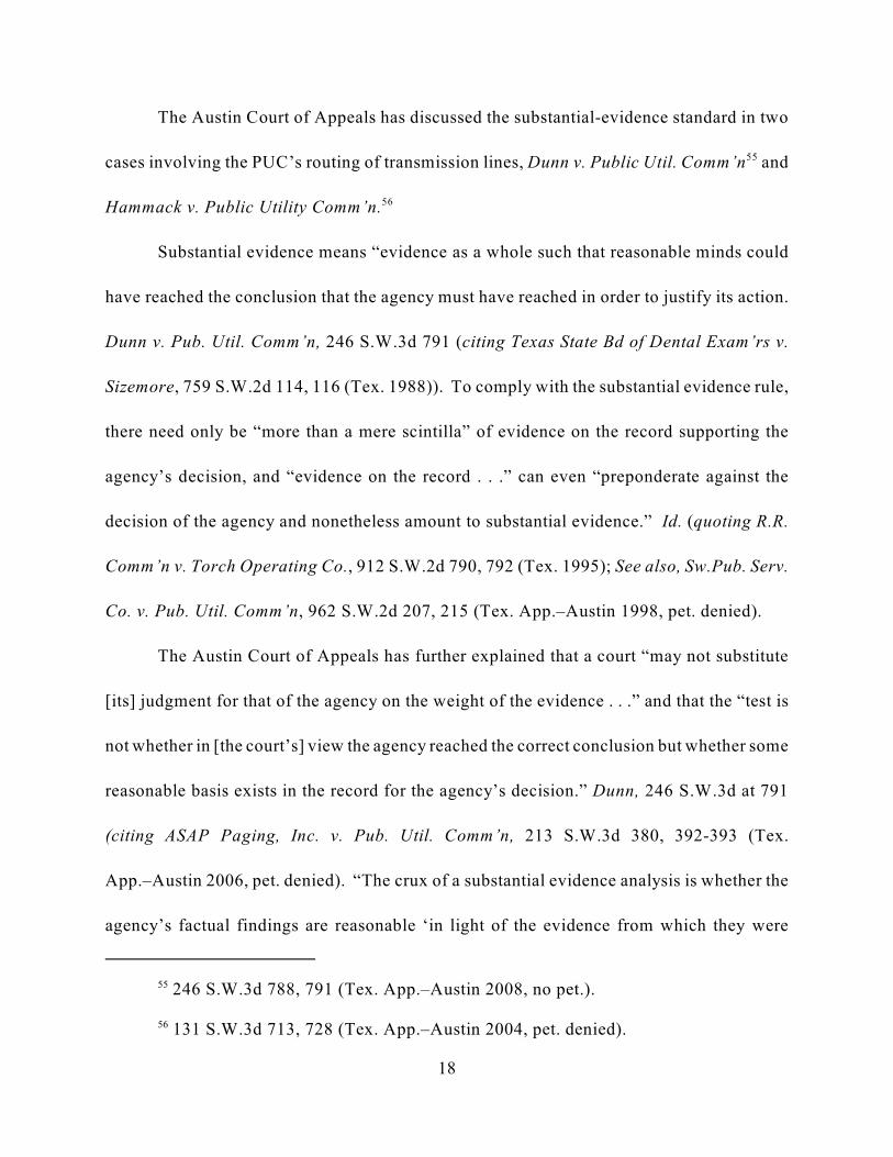
246 S.W.3d 788, 791 (Tex. App.–Austin 2008, no pet.).55
131 S.W.3d 713, 728 (Tex. App.–Austin 2004, pet. denied).56
18
The Austin Court of Appeals has discussed the substantial-evidence standard in two
cases involving the PUC’s routing of transmission lines, Dunn v. Public Util. Comm’n and55
Hammack v. Public Utility Comm’n.56
Substantial evidence means “evidence as a whole such that reasonable minds could
have reached the conclusion that the agency must have reached in order to justify its action.
Dunn v. Pub. Util. Comm’n, 246 S.W.3d 791 (citing Texas State Bd of Dental Exam’rs v.
Sizemore, 759 S.W.2d 114, 116 (Tex. 1988)). To comply with the substantial evidence rule,
there need only be “more than a mere scintilla” of evidence on the record supporting the
agency’s decision, and “evidence on the record . . .” can even “preponderate against the
decision of the agency and nonetheless amount to substantial evidence.” Id. (quoting R.R.
Comm’n v. Torch Operating Co., 912 S.W.2d 790, 792 (Tex. 1995); See also, Sw.Pub. Serv.
Co. v. Pub. Util. Comm’n, 962 S.W.2d 207, 215 (Tex. App.–Austin 1998, pet. denied).
The Austin Court of Appeals has further explained that a court “may not substitute
[its] judgment for that of the agency on the weight of the evidence . . .” and that the “test is
not whether in [the court’s] view the agency reached the correct conclusion but whether some
reasonable basis exists in the record for the agency’s decision.” Dunn, 246 S.W.3d at 791
(citing ASAP Paging, Inc. v. Pub. Util. Comm’n, 213 S.W.3d 380, 392-393 (Tex.
App.–Austin 2006, pet. denied). “The crux of a substantial evidence analysis is whether the
agency’s factual findings are reasonable ‘in light of the evidence from which they were

19
purportedly inferred.’ . . . . It ‘does not mean a large or considerable amount of evidence, but
rather such relevant evidence as a reasonable mind might accept as adequate to support a
conclusion’ of fact.” Hammack, 131 S.W.3d at 725 (citations omitted). See also, Sw. Pub.
Serv. Co., 962 S.W.2d at 215. Put succinctly, a “court may not determine the correctness
of the agency’s findings.” Sw.Pub. Serv. Co., 962 S.W.2d at 215.
Finally, this Court must “presume that the PUC’s order is supported by substantial
evidence, and the [Plaintiffs] have the burden to demonstrate otherwise.” Dunn, 246 S.W.3d
at 791 (citing ASAP Paging, Inc. v. Pub. Util. Comm’n, 213 S.W.3d 380, 392 (Tex.
App.–Austin 2006, pet. denied)); See also Sw. Pub. Serv. Co., 962 S.W.2d at 215.
2. Arbitrary-and-capricious standard.
The arbitrary-and-capricious standard applies in this case to the allegations that the
PUC disregarded its “prudent avoidance” policy and community values when routing the
line. An agency acts arbitrarily and capriciously when the agency fails to consider a factor
the Legislature required it to consider, or considers an irrelevant factor. City of El Paso v.
Pub. Util. Comm’n, 883 S.W.2d 179, 184 (Tex. 1994). The Texas Supreme Court has
recognized the narrowness of the arbitrary-and-capricious standard of review when applied
to agency decisions: “[W]e do not think that the legislature intended it to be interpreted as
a broad, all-encompassing standard for reviewing the rationale of agency actions.” Tex.
Health Facilities Comm’n v. Charter Medical-Dallas, Inc., 665 S.W.2d 446, 454 (Tex.
1984).

The only issue in Docket No. 38354 was the routing of the McCamey D to Kendall57
line. Need for the transmission line, normally considered under PURA § 37.056(a) when thePUC reviews an application for a new transmission line, was not an issue. Under PURA andPUC rules the need for a CREZ transmission line is assumed in a CCN proceeding. PURA§ 39.904 (h) (“In considering an application for a certificate of public convenience and necessityfor a transmission project intended to serve a competitive renewable energy zone, thecommission is not required to consider the factors provided by Sections 37.056(c)(1) and (2).”;16 Tex. Admin. Code § 25.174(d)(2) (“A CCN application for a transmission project intended toserve a CREZ need not address the criteria in PURA §37.056(c)(1) and (2).” ).
20
3. Abuse of discretion.
Plaintiffs also allege the prudent avoidance determination constitutes an abuse of
discretion. Abuse of discretion occurs when the agency acts in an arbitrary or unreasonable
manner without reference to any guiding rules or principles. See Downer v. Aquamarine
Operators, Inc., 701 S.W.2d 238, 241-42 (Tex. 1985) (describing abuse of discretion by a
court).
B. In routing the transmission line, the PUC weighs the evidence relating to arange of relevant factors.
The statutory standard that the PUC applies in routing a transmission line is set forth
in PURA § 37.056(c). Because the need for the line is not an issue with a CREZ line, the57
standard is in PURA § 37.056(c)(4):
§ 37.056. Grant or Denial of Certificate
***
(c) The commission shall grant each certificate on a nondiscriminatory
basis after considering: . . . .
(4) other factors, such as:
(A) community values;

§ 25.101(b)(3)(B) Routing: An application for a new transmission line shall address the58
criteria in PURA §37.056(c) and considering those criteria, engineering constraints, and costs,the line shall be routed to the extent reasonable to moderate the impact on the affectedcommunity and landowners unless grid reliability and security dictate otherwise. The followingfactors shall be considered in the selection of the utility’s preferred and alternate routes unless aroute is agreed to by the utility, the landowners whose property is crossed by the proposed line,and owners of land that contains a habitable structure within 300 feet of the centerline of atransmission project of 230 kV or less, or within 500 feet of the centerline of a transmissionproject greater than 230 kV, and otherwise conforms to the criteria in PURA §37.056(c):
(i) whether the routes utilize existing compatible rights-of-way, including the useof vacant positions on existing multiple-circuit transmission lines;
(ii) whether the routes parallel existing compatible rights-of-way;
(iii) whether the routes parallel property lines or other natural or cultural features;and
(iv) whether the routes conform with the policy of prudent avoidance.
16 TEX. ADMIN. CODE § 25.101. The PUC recently amended rule 25.101, effective May 25,2010. The prior version of the rule applied to this proceeding. The above-quoted language didnot change.
131 S.W.3d 713 (Tex. App.–Austin 2004).59
21
(B) recreational and park areas;
(C) historical and aesthetic values;
(D) environmental integrity; . . . .
PURA § 37.056(c).
The PUC’s Sub. Rule 25.101 describes more specifically some of the considerations
the PUC may take into account when routing transmission lines.58
In Hammack v. Public Utility Comm’n, the Austin Court of Appeals discussed how59
the PUC applies the statutory standards in routing transmission lines, and how courts review
those decisions. In Hammack, landowners argued that PURA required the PUC to follow
existing right-of-ways in routing the line, but the Austin Court of Appeals rejected that
In Hammack, the PUC considered routings along existing rights of way — although60
not statutorily required to do so — and rejected them. Id., n.9 (“The Commission adopted theALJ’s proposal for decision discussing the routes paralleling existing rights of way andconcluding that the routes exiting the north side of the Coleto Creek Power Plant were properlydiscounted. The northern routes contained a greater number of wetlands, stream crossings,
vegetation clearing, and residences within 200 feet of the proposed centerline.”).
701 S.W.2d 261 (Tex. App.– Austin 1985, writ. ref’d n.r.e.). 61
22
argument. The court explained that PURA set out the factors the PUC could consider in
deciding where to route a transmission line. And the PUC necessarily has broad discretion
in applying the often-competing factors in routing: “This Court has recognized that some of
the factors may compete, so that the Commission may, in some cases, be required to ‘adjust
or accommodate the competing policies and interests involved.’ Thus, to implement these
broad factors in any particular case, the Commission ‘must necessarily decide what they mean
in those circumstances.’” Id. 60
Hammack cited Public Utility Comm’n v. Texland Electric Co., where the Austin61
Court of Appeals explained (in a case involving the need for a new generation plant) the
latitude necessarily afforded the PUC in applying the PURA § 37.056 factors. The court
noted that, to implement such broad legislative objectives, the PUC “must necessarily decide
what they mean in those circumstances; and because some of them obviously compete inter
se, the agency may in some cases be required to adjust or accommodate the competing
policies and interests involved. . . .” Texland, 701 S.W.2d at 266. No one factor controls
over any other: “None of the statutory factors is intended to be absolute in the sense that any
one shall prevail in all possible circumstances. In making these sometimes-delicate

23
accommodations, the agency is required to exercise its ‘expertise’ to further the overall public
interest.” Id. at 267. See also Dunn v. Public Util. Comm’n, 246 S.W.3d at 795 (“We will not
substitute our judgment for that of the PUC on whether the mere potential of an environmental
integrity issue should outweigh the PUC’s findings of fact on such other statutory factors.”)
(citing Texland.).
Because the factors compete, no one route is the optimal choice for every factor. Such
was the case with the McCamey D to Kendall line. Environmental integrity recommended
against a non-I-10 routing that would cut through the Texas hill country, fragment habitat, and
also could put line close to environmental and cultural resources such as the Old Tunnel
Wildlife Area and Fort McKavett. Routing the line along the I-10 right-of-way avoided those
concerns, but meant that the line would be closer to relatively more habitable structures.
The PUC’s Order extensively discusses all the competing factors (including impacts
on the environment, aesthetics, recreational areas and cultural resources, and habitable
structures, as well as cost and engineering concerns) that were involved in this line routing
decision. Attachment F sets forth some of the key findings. Substantial evidence supports
these findings. Plaintiffs barely attempt to argue otherwise. The PUC weighs the evidence
relating to these competing factors and makes the routing decision, and a reviewing court does
not substitute its judgment for the PUC’s on the weight of the evidence.
C. The PUC properly chose Link Y11 after considering the record evidence andproviding all affected parties the opportunity to examine witnesses andpresent evidence. (Responds to Point of Error No. 1.)

Frank McIllwain is a professional engineer who has over 12 years of airport design62
experience and is currently a Senior Project Manager in the aviation practice group of anengineering consulting firm. AR, Box 4, Binder 12, CVA Ex. 7, Attachment FOM-1(Directtestimony of McIllwain) Edward McGavaran is a professional electrical engineer, who has over26 years of professional engineering experience, including years of professional experience in therouting of transmission lines. AR, Box 4, Binder 12, CVA Ex. Ex. 6 at EGM-1(Direct testimonyof McGavaran.
AR, Box 4, Binder 12, CVA Ex. 7 at 6 (lines 18 - 19), 8, (lines 27 - 30), and 10 (Lines63
21 - 25).(direct testimony of McIllwain ).
AR, Box 4, Binder 12, CVA Ex. 7 at 6 (lines 18 - 19) (direct testimony of McIllwain).64
24
1. Substantial evidence supports the PUC’s decision to chose Link Y11.
The record, reviewed under the proper standard, reveals that substantial evidence
supports the PUC’s approval of the modified Link Y11 section of the route near Junction.
Evidence regarding the safety and reliability issues involved with the use of Link Y11 was
introduced at the SOAH hearing by CVA and LCRA.
CVA was the most vocal Intervenor opposed to routing the line north of the Junction
airport and through undisturbed areas of the hill country. Two CVA witnesses, Frank
McIllwain and Edward McGavran, testified that the line could be safely routed along Link
Y11.62
Frank McIllwain testified in detail about FAA safety requirements if the line was
routed overhead along Link Y11 south of the airport. Mr. McIllwain discussed FAA
regulations, how he calculated the allowable height and width of structures near the airport,
and that the lines could be built at an acceptable height on Link Y11. Specifically, he stated63
that “it is possible to construct a transmission line on Link Y11 in the location proposed by
LCRA if the height in a defined area of the construction does not exceed 61 feet.” Mr.64

AR, Box 4, Binder 12, CVA Ex. 7 at 7 (lines 16-19) (direct testimony of McIllwain).65
AR, Box 4, Binder 12, CVA Ex. 7 at 8 (lines 27-31).(direct testimony of McIllwain).66
AR, Box 4, Binder 12, CVA Ex. 7 at 8 ( lines 27-31) (direct testimony of McIllwain) 67
& Attachments FOM-3 and FOM-6.
AR, Box 4, Binder 12, CVA Ex. 6 at 20 (lines 27 - 29) (direct testimony of McGavran).68
AR, Box 4, Binder 12, CVA Ex. 6 at 21 (lines 9-10) (direct testimony of McGavran.)69
25
McIllwain further testified that the safe height of the line increases as it is moved further south
of the airport. At two nearby points further south of the airport a transmission structure could
be 73 feet or as high as 86 feet above ground level. He also stated that “[t]he further south,65
and away from the runway, the proposed transmission line is located, the structures can be
taller . . .” and that a “location 100 feet further south will allow for construction at an
[aboveground level] that is 5 feet higher than the calculations . . .” and a “location that is 500
feet further south will allow for construction at an [aboveground level] that is 25 feet
higher.” Mr. McIllwain attached exhibits to his testimony, including maps and diagrams,66
that show the approach to the airport and that taller structures can be used as the line is moved
further south. See Attachment G.67
CVA’s other witness, Edward McGavaran, also testified that the line could be safely
routed overhead along Link Y11 and in compliance with FAA regulations. He stated that68
while the FAA would object to the lines being routed exactly as LCRA proposed, the CVA
“came up with two viable alternatives.” Those two alternatives were: 1) to “build a short69
group of H-frame structures no more than 60 feet tall,” or 2) “to locate the line on the south

AR, Box 4, Binder 12, CVA Ex. 6 at 20-21(CVA Ex. (direct testimony of McGavran)70
Application LCRA, Attachment 3, AR, Binders 16-24, LCRA Ex. 21 (SOAH hearing71
also shows corrections that were made to the original property maps after LCRA filed itsapplication).
Application LCRA, Attachment 3, AR, Binders 16-24.72
Application LCRA, Attachment 4, Figure 4-1f, Admin. R. Binders 16-24.73
AR, Binder 28, LCRA Ex. 14, (rebuttal testimony of Curtis Symank); AR, Binder 28,74
LCRA Ex. 15 (rebuttal testimony of William Griffin, 28.
26
side of the Llano River to gain more distance and get a lower profile for the line as it falls
down into the Llano River area.”70
Further evidence comes from LCRA’s application, which was admitted into evidence
at SOAH. It includes detailed maps showing the constraints of links and the property lines
of noticed landowners. See Attachment G. Maps have redlines depicting the proposed71
routes, outer-lying blue lines showing the “notification corridor limit from centerline to
identify directly affected parties,” and yellow lines depicting parcel boundaries. Other72
detailed maps also showed the flood plain south of the airport and I-10, and other
environmental constraints. These maps enabled the SOAH judges and the Commissioners73
to visualize the constraints of the airport, I-10 and the floodplain, and the extent of noticed
landowners’ properties.
LCRA also had two witnesses, Curtis Symank and William Griffin, who offered
rebuttal testimony to the CVA testimony on the airport issue and whether and how the line
could be routed overhead along Link Y11. Their testimony includes maps of the approach74

AR, Binder 28, LCRA, Ex. 5-9, LCRA Ex. 14. (rebuttal testimony of Curtis Symank).75
AR, Binder 33, Vols. J-Q, (hearing transcript at pgs. 153-255, 280-334, 359-401,534-76
542, 1177-1467).
Id.77
27
to the airport and floodplain maps of the Llano River south of the airport. Mr. Griffin75
agreed that the line could be constructed further south from an aviation viewpoint.76
Testimony from Mr. Symank and Mr. Griffin on the airport issue and the maps attached to
their testimony, provided the Commissioners with evidence regarding the constraints around
the airport and the feasibility of constructing the line south of the airport.77
2. The adjusted Link Y11 the PUC certificated is not a new link.
The PUC adjusted and did not adopt a new link south of the airport. The Austin Court
of Appeals has recognized that flexibility is required when permitting transmission lines. That
Court found that “due to the fluid nature of [CCN] proceedings, it is necessary to make
accommodations as the proceedings progress,” and that the PUC may make changes when
routing lines, so long as the properties are still in the area that was a part of the applicant’s
study. Hammack, 131 SW.3d at 728. Also, notice is considered sufficient if the line is
ordered to be located only on noticed properties. See Chocolate Bayou Water Co. & Sand
Supply v. Texas Natural Res. Conservation Comm’n, 124 S.W.3d 844, 850 (Tex. App.–Austin
2003, pet. denied); See also Hammack, 131 SW.3d at 728. In the Chocolate Bayou case, the
Court found that even if a “ permit does vary from the notice and the application” . . . the
court’s task “is not to analyze these differences, but to determine whether appellants had

Commission Order at 24, Ordering paragraph No. 2.78
See AR, Binders 16-24, LCRA Ex. 5-9, Application LCRA, Attachments 3 and 4,79
(rebuttal testimony of Curtis Symank; AR Binder 28 (LCRA Ex. 14).
28
sufficient notice that their interests were at risk.” Chocolate Bayou Water Co., 124 S.W.3d
at 850. Further, that court stated that “[i]f appellants had notice that their interests were at
risk, the appropriate method for addressing those concerns would have been through the
normal administrative process of a contested-case hearing.” Id. Because the PUC certificated
a route that is only around a thousand feet from Link Y11 as shown on LCRA’s map and only
on noticed properties, no new route was created. Instead, the PUC reasonably adjusted the
proposed line on a noticed link.
The Order shows that all the PUC did was reasonably adjust proposed Link Y11 south
of the airport. See Attachment H (Kimball County Airport findings from the Order). The
Order requires that in the vicinity south of the airport, LCRA shall “move link Y11 as far
south as safely and reliably possible using overhead construction while still affecting only
noticed landowners.” Based on the evidence in the record, the extent of those noticed78
properties is only a couple of thousand feet from the exact point of proposed Link Y11 in the
CCN application and does not extend near any habitable structures. This gives the LCRA79
a narrow band within which to move the line south of the Junction airport, understanding at
the same time that LCRA cannot get too near the southern line of the landowners’ properties
or it will affect other non-noticed landowners. Although the LCRA has not determined the
exact location of the line yet, testimony from CVA witnesses show that a placement only

See Application LCRA, Attachment 3, sheet 16, AR, Binder 16; LCRA, Ex. 14 Ex. 5 -80
9. (rebuttal testimony of Curtis Symank), AR, Binder 28 (LCRA Ex. 14); AR, Binder 12, CVAEx. 7 at Attachments FOM-3 and FOM-6 (direct testimony of McIllwain).
Application LCRA, Attachment 8, 2, AR Binder 16 (Emphasis added).81
The City of Junction’s position statement does not qualify as evidence and could not be82
used as a basis of the PUC’s Order. Statement of Position by City of Junction (Attachment H toPlaintiffs’ Brief).
29
about 1,000 feet from the exact point in the CCN application would provide sufficient room
to safely construct the line in an overhead configuration.80
The necessary flexibility in certificating the transmission lines was also built into
LCRA’s description of the proposed transmission line in its application and notice. LCRA’s
application notice contains the following statement in bold-type: “any one of the proposed
routes or a new combination of route segments filed in the application may be selected
by the Commission . . . and that the Commission may modify the proposed routes and
segments into different configurations than those proposed, so long as they affect only
noticed landowners.” Thus, contrary to Plaintiffs’ argument, the PUC’s adjustment of Link81
Y11 is the same route that was proposed by LCRA in its application.
Even with notice of the proceeding, including notice that “the [Commission] may
modify the proposed routes and segments,” the City of Junction filed a position statement and
letter in the proceedings (neither of which is evidence), but otherwise failed to participate.82
In contrast, other intervenors, mainly CVA, actively participated in the hearing and presented
pointed testimony on the airport routing — and even testimony on the specific issue of
moving the line further south of the airport in order to increase the height of the lines. The

16 Tex. Admin. Code § 22.71.83
See Tex. Util. Code § 12.202.84
30
appropriate forum for arguing that the line should not have been routed south of the airport
was at the administrative hearing. None of the Plaintiffs participated in litigating the airport
issue, and it is too late for the Plaintiffs to now make that argument in this court.
3. The PUC’s Order was made through lawful procedure and was made in
compliance with all laws and regulations.
Although the ALJ at SOAH drafts a proposal for decision, the PUC makes the final
decision at an open meeting. The evidence the PUC considers is limited to that properly
admitted, but PUC rules allow persons to file written materials relating to any proceeding
before the Commission, and the PUC often provides “the public with a reasonable83
opportunity to appear before the commission and to speak on [issues] under the jurisdiction
of the commission” by allowing persons to speak at the open meetings. Nonetheless, just84
as trial counsel may argue to a jury what facts may be found from the evidence presented,
parties before the PUC may argue what fact findings and policy determinations should be
made based on evidence presented to the PUC. And “the thought processes or motivations
of an administrator are irrelevant in the judicial determination” of whether an agency order
was properly decided. Pedernales Elec. Co-op., Inc. v. Pub. Util. Comm’n, 809 S.W.2d 332,
342 (Tex. App.–Austin 1991, no writ) (citing City of Frisco v. Tex. Water Rights Comm’n,
579 S.W.2d 66, 72 (Tex. Civ. App.– Austin 1979, writ. ref’d n.re.)). The determination the

Open Meeting Tr. at 62 (Jan. 13, 2011) (Attachment C to Plaintiffs’ Brief).85
Id.86
31
court should make is “whether the agency order is reasonably sustained by appropriate
findings and conclusions that have support in the evidence.” Id.
Even if the thought processes of the Commissioners were relevant to this court’s
review, Plaintiffs draw the wrong conclusion from Chairman Smitherman’s statements at the
open meetings. Although the Chairman specifically stated that the evidentiary record was
closed and that comments made at the open meetings are “not evidence,” Plaintiffs presume
that the PUC improperly treated comments as evidence. Commissioner Smitherman stated
“The record is closed in this case . . . We’re looking at the record. We’ve got maps and stacks
of documents up here, which is what we will be relying upon. There is an opportunity for you
to express your point of view, but it is technically not part of the record.” Again at the85
second open meeting, Chairman Smitherman warned an Intervenor that “[w]e’ve got to be
careful here, because, you know, that’s not testimony.” The Chairman’s statements show86
that while the Commissioners allowed the parties to make comments, the only evidence
considered was that in the record.
Even though Chairman Smitherman’s comments reflect that the PUC limited evidence
to that provided at the SOAH hearing, Plaintiffs try to characterize open meeting arguments
as evidence. The PUC did listen to comments of an LCRA engineer at the open meeting and
reviewed a letter filed by LCRA, but PUC rules allow parties to file letters so that parties can
advocate their position through writings. 16 TEX. ADMIN. CODE § 22.71. In fact, the City of

Open Meeting Tr. at pgs. 46, 57 (Jan. 20, 2011) (Attachment F to Plaintiffs’ Brief).87
Tex. Gov’t Code § 2001.058.88
16 Tex. Admin. Code § 22.262(a).89
32
Junction filed a similar letter that advocated its position to the Commission prior to the open
meetings and, as shown through the transcript of the open meetings, the Commissioners read
Junction’s filing, wanted to hear further from Junction further, but no representatives from
Junction appeared at the open meetings.87
Contrary to Plaintiffs’ claims, any “extra-evidentiary comments” are permissible
argument, and those arguments and Commissioners’ thought processes and motivations are
irrelevant to this judicial review. The City of Junction, which failed to attend the open
meetings, received all the process it was due.
D. The PUC legally changed findings of facts and conclusions of law from theproposal for decision. (Responds to Point of Error No. 2)
Plaintiffs incorrectly describe the PUC’s authority to change the ALJ’s proposed
finding of fact or conclusion of law because Plaintiffs cite the wrong statute. Plaintiffs cite
to section 2001.058 in the Administrative Procedure Act, but the applicable statute is TEX.88
GOV’T CODE § 2003.049. Curiously, however, Plaintiffs correctly cite to the Commission’s
rule even though it adopts the correct statutory standard. Plaintiffs’ reliance on Flores v.89
Employees Retirement System is also incorrect because that case applies Section 2001.058 of
the APA, which does not apply to the PUC.

Tex. Gov’t Code § 2003.049 (g) (1) (A) & (B).90
Plaintiffs’ brief at 18.91
33
The applicable statute, TEX. GOV’T CODE § 2003.049, allows the PUC to change the
ALJ’s findings if the ALJ “did not properly apply or interpret applicable law, commission
rules or policies, or prior administrative decisions; or . . . issued a finding of fact that is not
supported by a preponderance of the evidence.” If there was ever any doubt that Section90
2001.058 has no application to the PUC, it was put to rest in Southwestern Public Service Co.
v. Public Util. Comm’n. In that case, the Austin Court of Appeals held that Section
§ 2001.058 of the APA does not apply to the PUC, and explained the difference between that
section and TEX. GOV’T CODE § 2003.049, which does apply. The court stated that “rather
than imposing the general restrictive APA section 2001.058 on Commission proceedings
heard by SOAH, the legislature created a specific provision for such proceedings . . .” and
reasoned that “section 2003.049(g) allows the Commission to assume an original fact finding
role.” Sw. Pub. Serv. Co, 962 S.W.2d at 213. The Court also explained that in performing
this original fact finding role, “the Commission may evaluate the evidence put before the ALJ
at a SOAH hearing and determine whether the ALJ’s findings are supported by a
preponderance of the evidence.” Id.
Because they apply the wrong statute, Plaintiffs incorrectly state that “ALJs are
independent fact finders . . .” and that the “agency’s role is more akin to an appellate court
reviewing an agency decision under the substantial evidence rule–deference is to be given to
the factfinder.” Again, the Southwestern Public Service Co. case directly refutes Plaintiffs’91

34
argument. While a review under Section 2001.058 “strongly resembles an appellate scope of
review, the preponderance of the evidence standard in section 2003.049(g)(1)(b) is not so
deferential.” Sw. Pub. Serv. Co. at 214. In explaining why the legislature has allowed a lesser
standard of review for the Commission’s decisions, the court reasoned that: “Public utility
matters are typically complex. They often involve objective evidence that is more conducive
to review on the record . . .” and, put quite simply, “section 2003.049(g) allows the
Commission to substitute its judgment for the ALJ’s on questions of fact.” Id.
The PUC complied with the applicable statute in this case. It reviewed the evidence
that was properly in the record and determined what weight to afford that evidence. In
weighing the evidence in the record, the Commission was allowed to “accept part of the
testimony of one witness and disregard the remainder.” Southern Union Gas Co. v. R.R.
Comm’n, 692 S.W.2d 137, 138 (Tex. App.–Austin 1985, writ ref’d n.r.e.). The Commission
was also “free to weigh the conflicting evidence” of parties “as [it] deemed appropriate, and
the Commission, as the final judge of the validity and credibility of expert testimony, [could]
accept or reject all or part of a witness’s conclusions.” Citizens Against Landfill Location v.
Tex. Comm’n on Envtl. Quality, 169 S.W.3d 258, 266–67 (Tex. App–Austin 2005, pet.
denied). The PUC weighed and combined the evidence entered by LCRA, CVA, and other
parties. That evidence provided the Commission with its reasons for changing several of the
ALJs’ findings in the PFD, and ordering that the line be routed along Link Y11 south of the
airport. Although the law allows the Commission to review and weigh the record evidence,
and “substitute its judgment for that of the ALJ’s,” this court, under the substantial evidence

T EX. UTIL. CODE § 15.001.92
Commission Order at 2.93
See Commission Order at pg. 24, ordering provisions No. 2. 94
35
rule, is not allowed to change the Commission’s findings if there is more than a scintilla of
evidence to support them. 92
In addition to the authority to re-weigh evidence, the PUC may change an ALJ’s
finding if the ALJ “did not properly apply or interpret applicable law, commission rules or
policies, or prior administrative decisions.” TEX. GOV’T CODE § 2003.049(g)(1)(A); 16 TEX.
ADMIN. CODE § 22.262(a). As discussed above, the PUC must weigh a number of factors
when determining where a line is to be routed. See 16 TEX. ADMIN. CODE §
25.101(b)(3)(B)(i)-(ii); see also TEX. UTIL. CODE § 37.056(c). The PUC’s judgment when
weighing those factors cannot be substituted by a trial court’s judgment. Dunn, 246 S.W.3d
at 794 (citing, Pub. Util. Comm’n v. Texland Elec. Co., 701 S.W.2d 261, 267 (Tex.
App.–Austin 1985, writ ref’d n.r.e.)). In routing the line north of the airport and through
undisturbed lands, the Commission weighed the applicable legal factors, and determined that
the ALJs had not correctly applied or interpreted the applicable law and policies of the
Commission, and found that “it [was] more desirable to parallel or closely follow Interstate
10 (I-10) rather than cutting through less developed land.” The Commission then corrected93
the ALJs’ misapplication of law and policy, and ordered that the line be routed along I-10 and
south of the airport.94

Commission Order at 2.95
Id.96
36
The PUC’s Order explicitly stated its reasons for changing the findings from the PFD.
At the top of page 2, the Commission stated that it “has chosen MK63, as modified by this
Order, rather than the Staff’s M15 Modified because the Commission finds in the area around
Junction and Kerrville, it is more desirable to parallel or closely follow Interstate 10 (I-10)
rather than cutting through less developed land . . .” and “that I-10 is a more compatible right-
of-way for paralleling purposes than the alternative paralleling opportunities available.” The95
Commission went on to state the findings of facts that had been added, modified or deleted
based on that specific reasoning provided. The Commission’s Order is clear — it changed the
findings of fact because it found that the line should be routed along existing right-of-ways
rather than through undeveloped land, and that I-10 was the most suitable right-of-way for the
line within the study area.96
E. The PUC did not disregard its “prudent avoidance” policy. (Responds to
Point of Error No. 3).
One of the factors the PUC considers when routing a transmission line is its policy of
“prudent avoidance” — that is, the impact of possible routes on habitable structures. Though
PURA § 37.056 does not use the term “prudent avoidance,” PUC Rule 25.101 lists whether
the alternatives comply with the policy of “prudent avoidance” as one factor to be considered
in routing transmission lines. The rule defines “prudent avoidance” as “[t]he limiting of

PUC rules define “Habitable structures” as “Structures normally inhabited by humans97
or intended to be inhabited by humans on a daily or regular basis. Habitable structures include,but are not limited to, single-family and multi-family dwellings and related structures, mobilehomes, apartment buildings, commercial structures, industrial structures, business structures,churches, hospitals, nursing homes, and schools.” 16 TEX. ADMIN. CODE § 25.101(a)(3).
37
exposures to electric and magnetic fields that can be avoided with reasonable investments of
money and effort.” 16 TEX. ADMIN. CODE § 25.101(a)(4). 97
1. The PUC’s route selection was not arbitrary and capricious or an abuse
of discretion.
Plaintiffs’ prudent avoidance argument is fatally flawed in two fundamental respects:
first, it mischaracterizes the PUC’s prudent avoidance policy, and, second, it wrongly elevates
that policy (as mischaracterized) to be the controlling factor in transmission line routing.
Under the case law, PURA, and the applicable PUC rule, impacts on habitable structures is
only one factor that the PUC weighs in the particular circumstances.
First, the PUC’s “prudent avoidance” policy does not require it to select one of the
routes that has the least impact on habitable structures. This is obvious from looking at the
very language from the PUC rule that Plaintiffs quote in their brief: prudent avoidance is “the
limiting of exposures to electric and magnetic fields that can be avoided with reasonable
investments of money and effort.” (Emphasis added). The highlighted language shows the
PUC’s policy is to weigh the cost of limiting exposures (that is, routing a line away from
habitable structures) against the associated cost. This language gives the PUC broad
discretion in determining whether a particular route represents a reasonable accommodation
of the desire to avoid habitable structures and the cost of doing so. Just because a route

38
impacts more habitable structures than some alternatives does not mean that route does not
comply with the prudent avoidance policy. That any particular route would cost more to build
that others impacting as many or fewer habitable structures does not mean that route does not
comply.
And as for the cost of the MK63 route the PUC chose, Plaintiffs have their facts
wrong: its estimated cost was not $360 million, as this figure includes the $54 million cost to
build Link Y11 underground that was avoided by shifting that link slightly to the south.
Deducting this amount produces a figure close to the average cost for LCRA’s proposed
routings ($297 million) Plaintiffs cite in their brief.
Second, avoiding habitable structures when economically feasible is only one of many
competing concerns listed in the PUC’s CCN rule that the PUC must factor into the mix when
routing a line. That rule spells out in greater detail the factors (such as cost and engineering
constraints) that the PUC considers. Nothing in that rule even suggests, as Plaintiffs argue,
that avoiding habitable structures must trump all other concerns. PURA § 37.056(c) and PUC
Rule 25.101 set out other considerations. The PUC’s Order includes an extensive explanation
of all the competing factors. Attachment F.
Nor was the PUC’s route selection an abuse of discretion. The PUC weighed the
relevant factors in selecting MK63. That decision was not “completely unreasonable” just
because the selected route impacted more habitable structures than some of the other routing
options that Plaintiffs would have preferred.

See, e.g., Tr. 402 (all routes using existing links comply with PUC’s routing criteria). 98
Attachment D (LCRA Exhibit 26 listing the segments constituting MK63). 99
The figure reflected on Exhibit 26 includes the cost to build Link Y11 underground,100
which was not authorized under the PUC’s order.
39
2. Substantial evidence supports the PUC’s route selection.
Contrary to Plaintiffs’ contention, there is substantial evidence supporting the PUC’s
findings that the selected route MK 63 complied with the prudent avoidance policy (FOF
125). In this finding, the PUC determined that, given its cost, MK 63 represented a
reasonable investment of money and effort to limit exposure to electric and magnetic fields.
There is supporting record evidence of habitable structures in the vicinity of MK 63, and that
route’s cost. Likewise, substantial evidence supports the specific finding that the alternative
routes also met the prudent avoidance policy (FOF 126). Attachment I (prudent avoidance98
findings from Order).
Though MK63 was not listed in LCRA’s application, this route is a compilation of
individual links, including Y11 south of the Junction Airport, that were included in that
application. Just because the MK63 route that the PUC ultimately chose was not one of the99
60 numbered routes submitted in LCRA’s application package does not mean, as Plaintiffs
contend, that there is no record evidence regarding the habitable structures near this route.
There is–LCRA’s Exhibit 26 (Attachment D) is one example of such evidence– it lists the
number of habitable structures within 500 feet of the center of the right of way for route
MK63 and numerous other possible routes. It also lists the cost of MK 63 and alternative100

40
routes. Link Y11 incorporated in MK63, built as the PUC ordered, will be located in a
floodplain. Maps in evidence show that there are no habitable structure in this vicinity. E.g.,
Attachment E. Here again, Plaintiffs’ real complaint is about the PUC’s weighing of the
evidence, and that the PUC did not adopt their preferred route.
The order plainly shows the PUC did not disregard impacts on habitable structures in
making its decision, and substantial evidence supports its associated findings. The PUC’s
order should be affirmed on this point of error.
F. The PUC did not disregard the community values statutory factor. (Responds
to Point of Error No. 4).
Plaintiffs’ community values argument fails because it rests on the same incorrect
assumption as its prudence avoidance argument. No one factor trumps all others when PUC
considers a CCN application. Texland, 701 S.W.2d at 267. Community values is only one
of the concerns that the PUC weighs in making a line-routing decision. The PUC
appropriately decided, based on the evidence, that routing the line through the developed I-10
right-of-way, rather cutting a new path through the hill country, was the appropriate
interpretation of community values. Plaintiffs’ claim that avoiding developed areas was the
most important community values consideration is based on a mischaracterization the LCRA’s
survey results. The chart (Attachment G to Plaintiffs’ brief) that Plaintiffs rely upon to argue
that avoiding habitable structures was the controlling concern does not support their argument.
At many of the open houses for which survey results are listed, the largest number of
attendees ranked something other than routing the line away from residences as the first
41
priority; the largest number at many open houses ranked distance from residences as second,
third, or even less important.
But regardless of what these surveys may show, ultimately it is the PUC’s job to weigh
the evidence and select the best route. The surveys may provide useful information, but do
not dictate the one criteria that controls the final selection. Transmission lines routing is not
decided based on survey results. Nor does the testimony of some public officials and business
against routing the line through developed areas mean that PUC could not, after weighing all
the evidence on all the competing factors (including environmental concerns), route the line
along I-10 through developed areas. The Legislature has charged with PUC with making
these routing decisions, applying the factors set forth in PURA § 37.056.
Plaintiffs’ “community values” argument is, by and large, a rehash of its baseless
complaint that the PUC ignored its prudent avoidance policy in routing the line. The PUC
may have placed a different weight on proximity to habitable structures as a community value
than Plaintiffs would have liked. But the Court does not substitute its judgment on the weight
of the evidence for PUC’s. The PUC’s order should be affirmed on this point.
V. Conclusion and Prayer
For the foregoing reasons, the PUC respectfully requests that its final Order in Docket
No. 38354 be affirmed in all respects.

42
Respectfully submitted,
GREG ABBOTT
Attorney General of Texas
DANIEL T. HODGE
First Assistant Attorney General
BILL COBB
Deputy Attorney General for Civil Litigation
BARBARA B. DEANE
Chief, Environmental Protection and
Administrative Law Division
DAVID PREISTER
Chief, Environmental Protection Section
/s/ John R. Hulme
JOHN R. HULME
Assistant Attorney General
State Bar No. 10258400
DAVID L. GREEN
Assistant Attorney General
State Bar No. 24037776
Environmental Protection and
Administrative Law Division
P.O. Box 12548, Capitol Station
Austin, Texas 78711-2548
Tel: (512) 475-4229
Fax: (512) 320-0911
ATTORNEYS FOR THE
PUBLIC UTILITY COMMISSION OF TEXAS

43
CERTIFICATE OF SERVICE
I hereby certify that a true and correct copy of this document was filed electronically
in compliance with Travis County Local Rule 15.3.3. This document was served on all
counsel who are deemed to have consented to electronic service. Local Rule 15.5.1. Parties
who have not consented to electronic service were served by certified mail, return receipt
requested, or hand delivery as indicated below.
/s/ John R. Hulme
Georgia N. Crump
Eileen McPhee
Lloyd Gosselink Rochelle & Townsend,
P.C.
816 Congress Avenue, Suite 1900
Austin, Texas 78701
Tel: (512) 322-5800
Fax: (512) 472-0532
Attorneys for City of Kerrville,
Kerrville Public Utility Board, and the
City of Junction
Robert Henneke
Kerr County Attorney
Kerr County Courthouse
700 Main Street, Building BA103
Kerrville, TX 78208
Tel: (830) 792-2220
Fax: (830) 792-2228
Attorney for Kerr County
William T. Medaille
Associate General Counsel
Fernando Rodriguez
Associate General Counsel
Lower Colorado River Authority
P.O. Box 220
Austin, Texas 78767-0220
Telephone: (512) 473-3354
Facsimile: (512) 473-4010
R. Michael Anderson
Joe N. Pratt
Bickerstaff Heath Delgado Acosta LLP
3711 S. MoPac Expressway
Building One, Suite 300
Austin, Texas 78746
Tel: (512) 472-8021
Fax: (512) 320-5638
Attorneys for LCRA Transmission
Services Corporation

44
J. Kay Trostle
Smith Trostle LLP
707 West Avenue, Suite 202
Austin, Texas 78701
Tel: (512) 494-9500
Fax: (512) 494-9505
Attorney for P-Line Intervention
Association
Shawn P. St. Clair
McGinnis, Lochridge & Kilgore
600 Congress Avenue, Suit 2100
Austin, Texas 78701
Tel: (512) 495-6071
Fax: (512) 505-6371
Attorney for Preston Interests, Ltd,
Rafter Ranch, LP, Saba Ranch
Partners, and W & W Legacy Wildlife
Investments, LLC
Thomas K. Anson
Strasburger & Price, LLP
600 Congress Avenue, Suite 1600
Austin, TX 78701
Tel: (512) 499-3608
Fax: (512) 536-5718
Attorney for Six Mile Ranch and
Vander Stucken Ranch
Jefferson E. “Jeb” Boyt
Assistant Attorney General
Office of the Attorney General
Environmental Protection and
Administrative Law Division
P. O. Box 12548
Austin, Texas 78711-2548
Tel: (512) 475-4200
Fax: (512) 320-0167
Attorney for Texas Historical
Commission
Linda Secord
Assistant Attorney General
Office of the Attorney General
Environmental Protection and
Administrative Law Division
P. O. Box 12548
Austin, Texas 78711-2548
Tel: (512) 463-2012
Fax: (512) 457-4635
Attorney for Texas Parks and Wildlife
Department
Frederick Loren Henneke
513 Earl Garrett
Kerrville, TX 75028
Tel: (830) 257-9788
Fax: (830) 215-2372
Attorney for Tierra Linda Ranch
Homeowners Association

45
Edward D. (“Ed”) Burbach
(512) 542-7070
(512) 542-7270 (fax)
Robert F. Johnson III
State Bar No. 10786400
(512) 542-7127
(512) 542-7327 (fax)
Gardere Wynne & Sewell LLP
600 Congress Avenue, Suite 3000
Austin, Texas 78701
Attorneys for Trey Whichard, Kerry
Brent Scott Trust (4C Ranch), and
Kimberly Frances Hirmas
Shannon K. McClendon
Devon B. McGinnis
Webking McClendon, P.C.
1301 Nueces Street, Suit 200
Austin, Texas 78701
Tel: (512) 651-0515
Fax: (512) 651-052
Attorneys for Alliance for A3,
McGinley L- Ranch, and AC Ranch I,
Ltd., Charlie Nicholas and AC Ranch
III, Ltd. (AC Ranches)
Bradford Bayliff
Susan Gentz
Casey, Gentz & Bayliff, L.L.P.
98 San Jacinto Blvd., Suite 1400
Austin, Texas 78701
Tel: (512) 480-9900
Fax: (512) 480-9200
Attorneys for the Intervenors Bill
Neiman and Earnest Broughton
(Intervenenors Formerly Represented
by CVA)
Catherine Webking
Webking McClendon, P.C.
1301 Nueces Street, Suit 200
Austin, Texas 78701
(512) 651-0515
(512) 651-052 (fax)
Attorney for the Intervenors Gillespie
County and the City of Fredericksburg

APPENDIX
Statutes & Rules.. . . . . . . . . . . . . . . . . . . . . . . . . . . . . . . . . . . . . . . . . . . . . . . . . . . . . Tab A
P.U.C. Order. . . . . . . . . . . . . . . . . . . . . . . . . . . . . . . . . . . . . . . . . . . . . . . . . . . . . . . . Tab B
Proposal for Decision.. . . . . . . . . . . . . . . . . . . . . . . . . . . . . . . . . . . . . . . . . . . . . . . . . Tab C
LCRA’s Exhibit # 26. . . . . . . . . . . . . . . . . . . . . . . . . . . . . . . . . . . . . . . . . . . . . . . . . . Tab D
McCamey D - Kendall – Gillespie Exhibit 26 Routes. . . . . . . . . . . . . . . . . . . . . . . . . . Tab E
Excerpts from PUC Order regarding Competing Factors
in Transmission Line Routing.. . . . . . . . . . . . . . . . . . . . . . . . . . . . . . . . . . . . . . Tab F
Selected Maps. . . . . . . . . . . . . . . . . . . . . . . . . . . . . . . . . . . . . . . . . . . . . . . . . . . . . . . Tab G
Excerpts from PUC Order regarding the Kimble County Airport. . . . . . . . . . . . . . . . Tab H
Excerpts from PUC Order regarding “prudent avoidance”. . . . . . . . . . . . . . . . . . . . . . Tab I

47

TAB A

Tex. Gov't Code
Sec. 2001.058. HEARING CONDUCTED BY STATE OFFICE OF ADMINISTRATIVE HEARINGS.
(e) A state agency may change a finding of fact or conclusion of law made by the administrative law judge, or may vacate or modiJY an order issued by the administrative judge, only if the agency detennines:
(1) that the administrative law judge did not properly apply or interpret applicable law, agency rules, written policies provided under Subsection (c), or prior administrative decisions; (2) that a prior administrative decision on which the administrative law judge relied is incorrect or should be changed; or (3) that a technical error in a finding of fact should be changed. The agency shall state in writing the specific reason and legal basis for a change made under this subsection.
Sec. 2003.049. UTILITY DIVISION.
(g) Notwithstanding Section 2001.058, the cOimnission may change a finding of fact or conclusion of law made by the administrative law judge or vacate or modify an order issued by the administrative law judge only if the commission:
(1) detennines that the administrative law judge: (A) did not properly apply or interpret applicable law, cOimnission rules or policies, or prior administrative decisions; or (B) issued a finding offact that is not supported by a preponderance of the evidence; or
(2) determines that a commission policy or a prior administrative decision on which the administrative law judge relied is incorrect or should be changed.
(h) The commission shall state in writing the specific reason and legal basis for its determination under Subsection (g).
Sec. 2001.174. REVIEW UNDER SUBSTANTIAL EVIDENCE RULE OR UNDEFINED SCOPE OF REVIEW.
If the law authorizes review of a decision in a contested case under the substantial evidence rule or ifthe law does not define the scope of judicial review, a court may not substitute its judgment for the judgment of the state agency on the weight of the evidence on questions committed to agency discretion but:
1

(I) may affirm the agency decision in whole or in part; and (2) shall reverse or remand the case for further proceedings if substantial rights of the appellant have been prejudiced because the administrative findings, inferences, conclusions, or decisions are:
(A) in violation of a constitutional or statutOlY provision; (B) in excess of the agency's statutory authority; (C) made through unlawful procedure; (D) affected by other enor oflaw; (E) not reasonably supported by substantial evidence considering the reliable and probative evidence in the record as a whole; or (F) arbitrmy or capricious or chm'acterized by abuse of discretion or clearly unwananted exercise of discretion.
Tex. Util. Code
Sec. 12.202. PUBLIC PARTICIPATION.
(a) The commission shall develop and implement policies that provide the public with a reasonable opportunity to appear before the commission and to speak on any issue under the jurisdiction of the commission.
(b) The commission shall comply with federal and state laws related to program and facility accessibility.
(c) The commission shall prepare and maintain a written plml that describes how a person who does not speak English may be provided reasonable access to the commission's progrmlls and services.
Sec. 37.053. APPLICATION FOR CERTIFICATE.
(a) An electric utility or other person that wants to obtain or amend a certificate must submit an application to the cOlmnission.
(b) The applicant shall file with the commission evidence the commission requires to show the applicant has received the consent, franchise, or pennit required by the proper municipal or other public authority.
Sec. 37.054 NOTICE AND HEARING ON APPLICATION.
(a) When an application for a certificate is filed, the commission shall: (1) give notice of the application to interested parties; and (2) ifrequested:
(A) set a time and place for a hearing; and
2

(B) give notice of the hearing. (b) A person or electric cooperative interested in the application may intervene at
the hearing.
Sec. 37.056. GRANT OR DENIAL OF CERTIFICATE.
(a) The commission may approve an application and grant a certificate only if the commission finds that the certificate is necessary for the service, accommodation, convenience, or safety of the public.
(b) The commission may: (I) grant the certificate as requested; (2) grant the certificate for the construction of a pOliion of the requested system, facility, or extension or the partial exercise of the requested right or privilege; or (3) refuse to grant the certificate.
(c) The commission shall grant each certificate on a nondiscriminatory basis after considering:
(I) the adequacy of existing service; (2) the need for additional service; (3) the effect of granting the celiificate on the recipient of the certificate and any electric utility serving the proximate area; and (4) other factors, such as:
(A) community values; (B) recreational and park areas; (C) historical and aesthetic values; (D) environmental integrity; (E) the probable improvement of service or lowering of cost to consumers in the area if the certificate is granted; and (F) to the extent applicable, the effect of granting the certificate on the ability of this state to meet the goal established by Section 39.904(a) of this title.
Sec. 39.904. GOAL FOR RENEWABLE ENERGY.
(g) The commission, after consultation with each appropriate independent organization, electric reliability council, or regional transmission organization:
(1) shall designate competitive renewable energy zones throughout this state in areas in which renewable energy resources and suitable land areas are sufficient to develop generating capacity from renewable energy tecimologies;
3

(2) shall develop a plan to construct transmission capacity necessary to deliver to electric customers, in a manner that is most beneficial and costeffective to the customers, the electric output from renewable energy technologies in the competitive renewable energy zones; and (3) shall consider the level of financial commitment by generators for each
competitive renewable energy zone in determining whether to designate an area as a competitive renewable energy zone and whether to grant a certificate of convenience and necessity.
(h) In considering an application for a certificate of public convenience and necessity for a transmission project intended to serve a competitive renewable energy zone, the commission is not required to consider the factors provided by Sections 37.056(c)(I) and (2).
16 Tex. Admin. Code
Sec. 22.52
(a) Notice in electric licensing proceedings. In all electric licensing proceedings except minor boundary changes, the applicant shall give notice in the following ways:
Sec. 22.71
(I) Applicant shall publish notice once of the applicant's intent to secure a certificate of convenience and necessity in a newspaper having general circulation in the county or counties where a certificate of convenience and necessity is being requested, no later than the week after the application is filed with the commission. This notice shall identifY the commission's docket number and the style assigned to the case by the Central Records Division. In electric transmission line cases, the applicant shall obtain the docket number and style no earlier than 25 days prior to making the application by filing a preliminary pleading requesting a docket assignment. The notice shall identify in general terms the type of facility if applicable, and the estimated expense associated with the project. The notice shall describe all routes without designating a preferred route or otherwise suggesting that a particular route is more or less likely to be selected than one of the other routes.
U) Filing deadlines for documents addressed to the cOimnissioners. (I) Except as provided in paragraph (2) of this subsection, all documents from paliies addressed to the commissioners relating to any proceeding that
4

Sec. 22.262
has been placed on the agenda of an open meeting shall be filed with the cOlmnission filing clerk no later than seven days prior to the open meeting at which the proceeding will be considered provided that no party is prejudiced by the timing of the filing of the documents. Documents that are not filed before the deadline and do not meet one of the exceptions in paragraph (2) of this subsection, will be considered untimely filed, and may not be reviewed by the commissioners in their open meeting preparations. (2) The deadline established in paragraph (I) of this subsection does not apply if:
(A) The documents have been specifically requested by one of the commissioners; (B) The pmiies are negotiating and such negotiation requires the late filing of documents; or (C) Good cause for the late filing exists. Good cause must clearly appear from specific facts shown by written pleading that compliance with the deadline was not reasonably possible and that failure to meet the deadline was not the result of the negligence of the pmiy. The finding of good cause lies within the discretion of the commISSIOn. (3) Documents filed under paragraph (2) of this subsection shall be served on all pmiies by hand delivery, facsimile transmission, or by overnight courier delivery
(a) Commission Action. The commission may change a finding of fact or conclusion of law made by the administrative law judge or vacate or modify an order issued by the administrative law judge only if the commission:
(\) determines that the administrative law judge: (A) did not properly apply or interpret applicable law, commission rules or policies, or prior administrative decisions; or (B) issued a finding of fact that is not supported by a preponderance of the evidence; or
(2) determines that a cOlmnission policy or a prior administrative decision on which the administrative law judge relied is incorrect or should be changed.
(b) Reasons to Be in Writing. The commission shall state in writing the specific reason and legal basis for its determination under subsection (a) of this section.
5
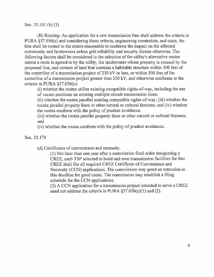
Sec. 25.101 (b) (3)
(B) Routing: An application for a new transmission line shall address the criteria in PUM §37.056(c) and considering those criteria, engineering constraints, and costs, the line shall be routed to the extent reasonable to moderate the impact on the affected community and landowners unless grid reliability and security dictate otherwise. The following factors shall be considered in the selection of the utility's alternative routes unless a route is agreed to by the utility, the landowners whose property is crossed by the proposed line, and owners of land that contains a habitable structure within 300 feet of the centerline of a transmission project of 230 kV or less, or within 500 feet of the centerline of a transmission project greater than 230 kV, and otherwise conforms to the criteria in PURA §37.056(c):
(i) whether the routes utilize existing compatible rights-of-way, including the use of vacant positions on existing mUltiple-circuit transmission lines; (ii) whether the routes parallel existing compatible rights-of-way; (iii) whether the routes parallel property lines or other natural or cultural features; and (iv) whether the routes confoTIn with the policy of prudent avoidance. (iii) whether the routes parallel property lines or other natural or cultural features; and (iv) whether the routes conform with the policy of prudent avoidance.
Sec. 25.174
(d) Certificates of convenience and necessity. (1) Not later than one year after a commission final order designating a CREZ, each TSP selected to build and own transmission facilities for that CREZ shall file all required CREZ Certificate of Convenience and Necessity (CCN) applications. The commission may grant an extension to this deadline for good cause. The commission may establish a filing schedule for the CCN applications. . (2) A CCN application for a transmission project intended to serve a CREZ need not address the criteria in PUM §37.056(c)(I) and (2).
6

TAB B

PUC DOCKET NO. 38354 SOAD DOCKET ),,"0. 473-10-5546
APPLICATION OF LCRA TRANSMISSION SERVICES CORPORATION TO AMEND ITS CERTIFICATE OF CONVENIENCE AND NECESSITY FOR THE PROPOSED MCCAMEY D TO KENDALL TO GILLESPIE 345-KV CREZ TRANSMISSION LINE IN SCHLEICHER, SUTTON, MENARD, KIMBLE, MASON, GILLESPIE, KERR, AND KENDALL COUNTIES
§ § § § § § § § § § §
ORDER
OF TEXAS
This Order addresses the application ofLCRA Transmission Services Company to amend
its certificate of convenience and necessity (CCN) to include a new competitive-renewable
energy-zone (CREZ) double-circuit 345-kV transmission line from the new McCamey D station,
to be located in Schleicher County, to the existing Kendall station, located in Kendall County.
On December 16, 2010, the State Office of Administrative Hearings (SOAH)
administrative law judges CALJs) issued a proposal for decision (PFD) recommending that
LCRA's application be granted. The ALJs recommended that the Commission adopt Staff's
MKI5 Modified route. However, based upon a weighing of the applicable factors set out in
PURA § 37.056 and P.U.C. SUBST. R. 25.101, the Commission determines that route MK63, as
modified by this Order, better balances the factors of PURA1 § 37.056 and P.U.C. SUBST. R.
25.101. Consequently, the Commission adopts the PFD, including findings of fact and
conclusions oflaw, except to the extent the PFD is inconsistent with this Order.
I Public Utility Regulatory Act, TEX. UTIL. COOE ANN. §§ 11.001 - 66.016 (Vernon 2007 & Supp. 2009) (PURA).
3 (.2'7 /

PUC Docket No. 38354 Order Page 2 oU8 SOAH Docket No. 473-10-5546
I. Discussion
The Commissi!ln has chosen route MK63, as modified by this Order, rather than Staff's
MKI5 Modified because the Commission finds in the area around Junction and Kerrville, it is
more desirable to parallel or closely follow Interstate 10 (1-10) rather than cutting through less
developed land. Particularly, in this study area, the Commission finds that 1-10 is a more
compatible right-of-way for paralleling purposes than the alternative paralleling opportunities
available. To reflect that the Commission has chosen a modified version of route MK63 rather
than Staff's MKI5 Modified, findings off act 27,28,29,31,111,112,118,130, and 139 have
been deleted, findings offact 24-26, 30,33,48,49,55,83,92,93,94,.100,108,113-117,120,
122-125, and 144 have been modified, findings of fact 52a and 118a have been added, and
conclusions of law 9 and 10 have been modified.
The Commission has modified MK63 in the vicinity immediately south of the Kimball
County Airport by moving link Yl1 as far south as safely and reliably possible using above
ground construction while still affecting only noticed landowners. Additionally, the Commission
has substituted links c 14c and c 18aa for links Y22 and Y22a in order to reduce the number of
habitable structures affected as the line approaches the Kendall station. To address the
modifications the Commission made to route MK63, findings offact 159-161 were added.
In the PFD, the ALJs recommended that monopoles be used in areas with denser
populations. The Commission therefore finds that it is reasonable for LCRA to use monopoles
within the City of Kerrville and extending to the limits of its extraterritorial jurisdiction, and
within the City of Junction and extending one mile beyond its municipal limits, as those cities'
boundaries exist as of January 20, 2011. Because of concerns regarding the aesthetic impacts of
the project within the cities of Junction and Kerrville, it is also reasonable for LCRA to work
with both the cities of Junction and Kerrville and affected landowners within each of those cities
to reach agreement on the material and type of structure used, as well as the spacing and height
of the structures. To reflect the Commission's decision to use monopoles in and around
Kerrville and Junction, as weB as the Commission decision that LCRA shall work with the cities
of Junction and Kerrville and affected landowners within each of those cities regarding the
aesthetic impact of the project, finding offaet 31a has been added.

PUC Docket No. 38354 Order Page 3 of28 SOAH Docket No. 473-10-5546
Finding off act 157 has been deleted, as it was unnecessary, and finding of fact 158 was
added to reflect the Commiss;on's decisions regarding recommendations and comments made t'l
the Texas Parks and Wildlife Department. Finally, finding of fact 134 was modified as it
contained language which was unnecessary.
To reflect corrections the AUs made after the issuance of the proposal for decision,
findings of fact 58 and 59 have been deleted, and finding off act 103 has been modified.2
The Commission adopts the following findings of fact and conclusions of law:
II. Findings of Fact
Procedural History. Notwe. Jurisdiction. and Protect Background
1. LCRA Transmission Services Corporation is a non-profit corporation providing service
under Certificate of Convenience and Necessity (CCN) No. 30110.
2. On July 28, 2010, LCRA filed an application with the Public Utility Commission of
Texas to amend its CCN to include the McCamey D-to-Kendall-to-Gillespie competitive
renewable-energy-zone (CREZ) 345-kV transmission line project. The two lines that
comprised this project, McCamey D-to-Kendall, and Kendall-to-Gillespie, were
identified by ERCOT in its CREZ transmission optimization study (CTO study), and
originally assigned to LCRA to construct as a priority project in Commission Staff's
Petition for the Selection' of Entities Responsible for Transmission Improvements
Necessary to Deliver Renewable Energy from Competitive Renewable Energy Zones,
Docket No. 35665, Order on Rehearing (May 15,2009).
3. On December I, 2010, the Commission determined that the Kendall-to-Gillespie portion
of the transmission line would be replaced with a cost-effective alternative that does not
require the construction of a transmission line between the Kendall and Gillespie
substations at this time.
4. LCRA's double-circuit McCamey D-to-Kendall preferred route and each of the other 59
proposed alternative McCamey D-to-Kendall routes extend from LCRA's approved
, Letter tTom the Wendy K. L. Harvel, Administrative Law Judge, to Stephen Journesy, Director of Commission Advising and Docket Management (Jan. 5, 2011).
3

PUC Docket No. 38354 Order Page 4 008 SOAR Docket No. 473-10-5546
McCamey D station (to be renamed Big Hill station), located in northern Schleicher
County, to the existing Kendall station in western Kendall County. The alternative
McCamey D-to-Ke.ndall routes proceed generally in a northwesterly to southeasterly
direction, in multiple varied corridors. This line may be located in portions of Schleicher,
Menard, Mason, Sutton, Kimble, Kerr, Gillespie, and Kendall counties, depending on the
route selected.
5. LCRA filed 60 alternative routes. The links in the application can be combined to form
over 20,000 different forward progressing routes.
6. Typic.al structure heights are expected to be approximately 105-185 feet above the ground
surface, depending on the type of structures used.
7. LCRA will install two 345-kV circuits on the transmission line.
8. LCRA will build and own the new McCamey D (Big Hill) station for the project, which
station will accommodate both the project proposed in this docket and another of its
CREZ priority projects (Twin Buttes-to-McCamey D 345-kV line), as well as another
CREZ project of South Texas Electric Cooperative, Inc. (McCamey C-to-McCamey D
345-kV line) and future wind generation interconnect facilities to be constructed and
owned by Electric Transmission Texas at the collection stations associated with the
McCamey D station.
9. LCRA owns the existing Kendall station, at which additional equipment will be installed
to accommodate the terminstion of the new 345-k V transmission lines for this project.
10. Written direct notice of the application was mailed on July 28, 2010, to each owner of
land whose property would be directly affected by the proposed transmission line.
11. Written direct notice was mailed to several directly-affected landowners whose names
had not appeared on LCRA's original list
12. On July 28,2010, LCRA also mailed written direct notice of the application to additional
area landowners who might be affected by various potenti~ routing configurations
described in the application and LCRA's direct testimony.
PUC Docket No. 38354 Order Page 5 of28 SOAH Docket No. 473-10-5546
13. Written notice was mailed on July 28, 2010 to the municipalities of Boerne, Comfort,
Eldorado, Sonora, Menard, Junction, Mason, Harper, Fredericksburg, Ingram, and
Kerrville, and to county officials of Schleicher, Sutton, Menard, Kimble, Mason,
Gillespie, Kerr, and Kendall counties.
14. Written notice was mailed on July 28, 2010, to nine neighboring utilities providing
electric utility service, specifically Bandera Electric Cooperatiye, Central Texas Electric
Cooperative, Pedemales Electric Cooperative, Southwest Texas Electric Cooperative,
Inc., American Electric Power Texas North Company, Cap Rock Energy Corporation,
City of Fredericksburg, Kerrville Public Utility Board, and City of Mason.
15. Notice of the application was published in the following newspapers: San Angelo
Standard Times, Eldorado Success, Junction Eagle, Mason County News, Boerne Star
and Record, Fredericksburg Standard, Comfort News, San Antonio Express-News, Austin
American-Statesman, Devil's River News, Kerrville Daily Times, Menard News &
Messenger, West Kerr Current, and Harper News.
Material Deflclencles
16. No material deficiencies exist in the application.
CREZ PrioritY Transmission Plan
17. The application is for a CREZ priority project.
18. The project will accomplish the intended results for the CREZ priority project between
the McCamey D and Kendall stations.
19. In addition, the project will also provide increased transmission support to meet growing
needs in Central Texas and the Hill Country.
Communltv Values
20. To address and consider community values, LCRA conducted 20 public meetings on
May 4, 2009, May 5, 2009, May 7, 2009, May 11,2009, May 12,2009, and May 14,
2009. In addition, LCRA conducted public meetings on February 15 and February 16,
17, 18,22,23, and 24, 2010.

PUC Docket No. 38354 Order Page 60f28 SOAH Docket No. 473-10-5546
21. LCRA considered expressions of community values in a review of the questionnaires,
letters, meetings, phone calls, an j other public input it has received. LCRA received
additional information about community values at the technical conference held on
September 1, 2010, and at the settlement conferences it held on September 20, 21,
and 22, 2010.
22. Based on input from the open houses and throughout the proceeding, strong community
values included: avoiding the Texas Hill Country; reducing the . effect of the line on
habitable structures, particularly in developed areas; reducing the effect on rural
residential subdivisions; and building the line with monopoles.
23. The community values of avoiding habitable structures in developed areas and avoiding
the Hill Country are competing values.
24. MK.63 parallels roadways for much of its distance, thereby avoiding much of the Hill
Country.
25. Where MK63 parallels 1-10, it does not cut a new path through the heart of the Hill
Country. 1-10 has already cut through the area and MK.63 will not cut an entirely new
corridor through the area.
26. MK.63 parallels right-of-way (ROW) for over 59 percent ofits length.
27. Deleted.
28. Deleted.
29. Deleted.
30. MK.63 as modified by this Order provides the best balance between the community
values of avoiding the Hill Country and avoiding habitable structures and cities.
3 1. Deleted.
31a. It is reasonable for LCRA to use monopoles within the City of Kerrville and extending to
the limits of its extraterritorial jurisdiction, and within the City of Junction and extending
one mile beyond its municipal limits, as those cities' boundaries exist as of
January 20, 2011. It is also reasonable for LCRA to work with both the cities of Junction

PUC Docket No. 38354 Order Page 7 arlO' SOAH Docket No. 473-10-5546
and Kerrville and affected landowners within each of those cities to reach agreement on
the materhl and type of structure used, as well as the spacing and height of the structures.
Recreational and Park Areas
32. Avoiding parks and recreational areas was a consideration in designing the routes
proposed in the application. PBS&J reviewed U.S. Geological Survey topographic maps,
Texas Department of Transportation (TxD01) county highway maps and federal, state,
and local maps, the Texas Parks and Wildlife Department's (TPWD) "Texas Outdoor
Recreation Inventory," the Texas Outdoor Recreation Plan, recent aerial photography,
and conducted a limited field reconnaissance.
33. MK13 and Staff MKIS Modified each have one park or recreation area located within
1,000 feet of the centerline. MK32 and MK33 run within 1,000 feet of six and seven
parks or recreation areas, respectively. MK63 has 7 parks or recreation areas located
within 1,000 feet of the centerline.
34. TPWD is the owner and operator ofthe 16.1 acre Old Tunnel Wildlife Management Area
(Old Tunnel WMA), located in Kendall County. The Old Tunnel WMA is comprised of
an abandoned railroad tunnel and includes a bat colony of up to three million Brazilian
free-tailed bats and three thousand cave myotis. The Old Tunnel WMA includes nature
trails for hiking and bird watching, educational programs, bat watching, and guided
nature tours. TPWD estimates that 21,324 visitors visited the Old Turmel WMA to watch
bats emerge from the tunnel. TPWD estimates the annual economic benefit to the region
of at least $748,000.
35. The line should avoid the Old Tunnel WMA bat colony.
36. The Texas Historical Commission (THC) owns and operates the Fort McKavett State
Historic Site in Menard County, Texas (Fort McKavett), one of the best preserved and
most intact examples of a fort from the Texas Indian Wars. The fort is a State Historic
Site, as well as a National Historic District listed on the National Register of Historic
Places. Fort McKavett is part of TPWD's Great Texas Wildlife Trails, as well as the
THC's Texas Forts Trail. The Fort McKavett State Historical Site is also designated a
riparian conservation area.
'7

PUC Docket No. 38354 Order Page 8of28 SOAR Docket No. 473-t0-5546
37. For defensive reasons, Fort McKavett was built between 75 and 100 feet above the
surrounding terrain. Transmission towers of up to 180 feet in height may be easily
visible from the grounds of the fort. The towers would range from 1.18 miles (link
bl6b), 1.26 miles (links ZI and Z2), and 1.55 miles (link bl7b) from the fort. The fort
remains isolated from modern development, with pristine views in all directions; the view
from the fort is much as it was in the mid-nineteenth century. The fort hosts living
history events, star parties, Boy Scout functions, and visitor tours throughout the year.
Transmission towers of up to 180 feet in height would directly and negatively impact
those view sheds from the fort, and would likewise negatively impact the fort's historic
character, its isolation, and the overall appeal of the site.
38. Camp Sol Mayer is a 300-acre Boy Scout camp with 18 permanent buildings. Link bl7b
would cross the southwest comer of the camp, passing near several camping areas and
near where the camp's horses are maintained. ROW clearing for the transmission line on
the southwest portion of the camp would eliminate many trees that are along the western
boundary line and the San Saba River. The camp would also be impacted by links ZI
and Z2, which are both in close proximity to the camp.
Aesthetics
39. "Aesthetics" refers to the subjective perception of natural beauty in the landscape and
attempts to define and measure an area's scenic qualities. Aesthetic values considered
from a public standpoint in the environmental assessment and alternative route analysis
(EA) include topographical variation, prominence of water in the landscape, vegetation
variety, diversity of scenic elements, degree of human development or alteration, and
overall uniqueness of the scenic environment compared to the larger region.
40. The project area reflects overall a medium to high level of aesthetic value for the region.
The eastern portion of the study area, located in the Hill Country, is within an area of the
state noted for its scenic beauty and characterized by impressive topographical relief,
vegetation and wildflowers, abundant wildlife, and plateaus. The presence of various
large creeks and rivers present some viewscapes of high aesthetic value. There are also a
number of designated routes or trails, and scenic overlooks and rest areas, within the
study area that emphasize the Hill Country's natural beauty and other unique attractions.

PUC Docket No. 38354 Order Page 90(28 SOAH Docket No. 473-10-5546
41. The level of hwnan impact to the study area is relatively high, due to the extensive
agricultural and oil and gas operations, the development of numerous cities, and the
development of rural subdivisions.
42. All of the 60 primary alternative routes for the project have some amount of ROW within
the foreground visual zone of U.S. and state highways, in part a direct result of the
deliberate inclusion of alternative routes paralleling U.S. and state highways.
43. A large nwnber of parks and recreation areas are located within the study area. Only a
small portion of the routes' ROW would be located within the foreground visual zone of
parks and recreation areas.
44. The alternative routes that follow all or portions of 1-10 will be much more visible to
more people than any of the alternative routes away from 1-10.
45. Construction of the project will likely have both temporary and permanent negative
aesthetic impacts, including views of ongoing construction, the cleared ROW, and the
transmission facilities.
46. Wherever monopole structures are approved, LCRA will have the flexibility in design to
deploy both steel and spun concrete poles where appropriate for each to produce a cost
effective result.
47. Both lattice towers and monopoles will fit within a 100-foot ROW, which is as narrow as
the ROW for a double-circuit 345-kV transmission line can be made.
48. MKI3 has a length of 8.46 miles visible from U.S. and State highways. Staff MKI5
Modified would be visible for a length of 49.11 miles from U.S. and State highways.
MK33 has a length of 157.87 miles that would be visible along U.S. and State highways.
MK63 will be visible for a length of 86.24 miles from U.S. and State highways.
49. MK33 has the highest visibility from parks or recreation areas with a length of 10 miles
visible from state parks and recreation areas. MKI3 is visible for a length of 4.24 miles
from state parks and recreation areas. Staff MK15 Modified is visible for a length of 4.43
miles from parks or recreation areas. MK63 is visible for a length of 8.12 miles from
parks or recreation areas.

PUC Docket No. 38354 Order Psg_tO 0(28 SOAH Docket No. 473-10-5546
50. The aesthetic impact of the line is largely a function of who is viewing it from where.
51. The central project area contains large !'acts of relatively unfragrnented and undeveloped
land. The natural beauty of this part of the project area includes scenic vistas, meadows,
and oak-lined creeks and riv.ers.
52. I-lOis a means of transportation across the state, where aesthetically pleasing views are
incidental. Travelers and anyone in the proximity of I-lOin the project area will see
commercial development including gas stations, convenience stores, chain and fast-food
restaurants, strip malls, traffic - including heavy tractor-trailers, car lots, power lines,
roadways - including feeder roads, and all of the development associated with small
towns, larger municipalities, and cities like San Antonio. It is far more likely that a
345-kV line will be lost in the visual foreground along 1-10 than if it were run along a
central or northern route through what is undoubtedly the aesthetically pleasing and
relatively undeveloped Texas Hill Country.
52a. The Commission finds that in this study area, following 1-10 along MK63 is a more
compatible right-of-way for paralleling purposes than the alternative paralleling
opportunities available.
Archeological and Cultural Resources
53. Much of the study area has a high probability of containing previously unrecorded
cultural resource sites. PBS&J's cultural resources evaluation was based on known data
regarding sites in the area, the density of the sites, and the National Register of Historic
Places (NRHP) and State Archaeological Landmark potential for the sites.
54. Of the 60 primary alternative routes evaluated for the project, 54 cross one or more
recorded historic or prehistoric sites, with four routes crossing at least 15 or more sites.
All 60 routes have additional recorded historic or prehistoric sites within 1,000 feet of the
ROW centerline, with numbers ranging between six and 46 sites. Of the primary
alternative routes, 22 cross one NRHP-Iisted or determined eligible site, and the other 38
cross no such sites. Exactly half of the primary alternative routes have ROW centerline
within 1,000 feet of one or more additional NRHP-Iisted or determined eligible sites,
ranging from one to six sites, and the other 30 have none. The number of recorded
JD

PUC Docket No. 38354 Order PageU of28 SOAR Docket No. 473-10-5546
historical and archaeological sites within 1,000 feet of the centerline of the routes varies
from eight to 70 sites.
55. There are 22 known or recorded historical or archeological sites either crossed or located
within 1,000 feet of the centerline on MK63.
56. Mitigation and construction practices are available to reduce or eliminate impacts to
cultural resources sites. LCRA planned appropriately for addressing any sites
encountered during construction.
57. None of the route segments proposed in this case cross Fort McKavett.
58. Deleted.
59. Deleted.
60. Routes, parallel to 1-10 include commercial and residential development normally
associated with proximity to an interstate highway system. Historical and cultural sites in
these areas are more likely to have been disturbed than those in the central and northern
project areas.
General. Survevs. and Mitigation
61. LCRA's consultant, PBS&J, examined a wide range of environmental information in its
EA, which was researched and analyzed through a variety of methods and by
representatives of various environmental disciplines.
62. LCRA represents that all routes presented in the application (and all segments that form
those routes) provide environmentally acceptable alternatives.
63. LCRA's preferred route (MKJ3) was ranked first from an ecological standpoint in the
EA.
64. LCRA avoided specific known occupied habitat locations in the process of delineating
preliminary route links and alternative routes.
65. LCRA has undertaken a permitting process under Section 10 of the Endangered Species
Act with the U.S. Fish and Wildlife Service (USFWS) to consider impacts to federally
listed species and their habitat.
II

PUC Docket No. 38354 Order Page 12008 SOAR Docket No. 473-10-5546
66. Animal species potentially occurring along the proposed transmission routes include, but
are not limited to, the federally listed (endangered) black-capI'ld vireo and golden
cheeked warbler, and the state-listed (threatened) zone-tailed hawk, bald eagle, Texas
tortoise, and Texas homed lizard.
67. The EA lists all threatened or endangered species of potential occurrence in the study
area based on information from USFWS, TPWD, and TPWD's Natural Diversity
Database (TXNDD).
68. Once a route is selected, LCRA will account for the location of endangered or threatened
species on individual landowners' property or additional known occupied habitat by
routing adjustments, construction procedures and techniques, and mitigation. LCRA
shall consult with the USFWS for known occupied or potential habitat for endangered
species.
69. LCRA will use a habitat conservation plan (HCP) development and Endangered Species
Act Section lO(a) permitting process that is ongoing with the USFWS.
70. Prior to construction, an assessment will be made to verifY whether any habitat for
endangered or threatened species is present along the route that is approved. LCRA will
seek a permit from USFWS to take endangered species habitat.
71. Different techniques are available to accommodate all federally-listed endangered species
identified in the study area. If a route passes through an area containing plant species
composition and configuration favorable to a protected species, or if known individuals
of the species are in the area, LCRA will adjust the route in minor ways to avoid higher
quality blocks of habitat; transmission towers will be placed in existing openings to limit
further clearing for ROW access; and permits will be sought for appropriate clearing
permissions along with possible mitigation.
72. LCRA will undertake mitigation projects to protect the habitats of warbler, vireo and
other species.
I.J-

---------------------------
PUC Docket No. 38354 Order Page 130(28 SOAH Docket No. 473-10-5546
Fragmentation and Oak Wilt
73. Wildlife habitat throughout the study are!! is fragmented by land use impacts such as
roads, brush clearing associated with ranching and agricultural activities, pipelines,
electric distribution lines, and other activities nonnally engaged in by landowners in the
study area.
74. The project will not jeopardize the continued existence of the warbler or vireo.
75. Staff concluded that any route selected in this case will affect the environmental integrity
of the study area.
76. Due to lack of access to private property, the absence of TXNDD records at a specific
site within the project area does not mean that the species does not occur there. Most
TXNDD records are gathered from publicly accessible lands, such as parks and wildlife
management areas and highway ROW. Most of the impacted project area consists of
privately owned ranch land. Endangered species and their habitat on private lands may
not be reflected in TXNDD records due to the lack of access and state laws governing the
collection and dissemination of biological information from private lands.
77. Major highway ROW comprises the largest corridors of habitat fragmentation in the
project area, particularly the 1-10 corridor. Avoiding additional fragmentation of wildlife
habitat is one of the most important environmental considerations for the project. Land
fragmentation, and its consequence, is one of the greatest statewide challenges to wildlife
management and conservation in Texas.
78. The portion of the project area north of 1-10 contains some of the largest blocks of
unfragmented wildlife habitat on the Edwards Plateau.
79. The 1-10 corridor is fragmented to a much greater extent than the central routes or
northern routes.
80. MK!3 and all of the links contributing to the central routes cut through the middle
section of lands managed by the Doss-Harper Wildlife Management Association.
Landowners who are members of the Doss-Harper Wildlife Management Association
manage their wildlife resources in a cooperative that helps them overcome some of the
13

PUC Docket No. 38354 SOAH DockeiNo. 473-10-5546
Order Page 14 of28
inefficiencies common to land fragmentation. MK13 would run through the center of the
Doss-Harper WMA for appnximately 12 miles.
81. Additional fragmentation of wildlife habitat is expected to spread oak wilt disease. Oak
wilt .is caused by a fungus that clogs water-conducting vessels in infected oak trees,
causing them to wilt and die. Oak wilt can be spread through the roots of oak trees. Oak
wilt can also be spread much greater distances by sap-feeding beetles that carry spores
from infected trees and deposit them on ''wounds'' in uninfected trees. Once a new tree is
infected, the disease will spread through root contact to other nearby trees at a rate of
approximately 75 feet per year.
82. The central portion of the Hill Country is currently impacted by very little oak wilt. Oak
trees in the project are susceptible to oak wilt as a result of cutting and pruning necessary
to clear and maintain the ROW. It is estimated that approximately 700 to 1,600 live oaks
per mile will be removed and another 200-500 live oa.1{s per mile will need to be pruned.
83. The selection ofMK13 or a central or northern route is expected to spread oak wilt more
than a route that uses the 1-10 corridor such as MK32, MK33, MK63, or Staff MK15
Modified.
Warbler and Vireo
84. Potential habitat for the vireo and warbler is likely to be encountered along most of the
routes. Data provided by Loomis Partners, Inc. documents that all of the routes cross
potential warbler habitat. There are known occurrences of the vireo and warbler along or
near segments proposed as part of route altematives for the project.
85. Without ground inspection of particular ecological areas, it is difficult to impossible to
determine the presence of suitable habitat for vireo. Vireo habitat consists of patchy
shrubs interspersed with open areas and cannot be identified by aerial photography.
86. Inhabited vireo habitat occurs throughout the area and along most, if not all, routes. It is
unlikely that potential habitat and actual vireo can be avoided as part of the certification
process.
1/

-- --,- -,----------
PUC Docket No. 38354 Order Page 15 oU8 SOAH Docket No. 473-10-5546
87. Based on the Commission's past practices and the work of utilities with USFWS,
accc'nmodations for vireo can be made through structure placement, ROW clearance,
and other forms of mitigation.
88. Due to species composition and configuration, it is possible to identifY and map potential
warbler habitat with some accuracy through certain types of aerial photography.
Attempts can then be made to minimize and avoid potential habitat.
89. Warbler populations are not inconsistent with either existing or newly-constructed
transmission line ROW.
90. Transmission line projects in Texas have been successfully constructed through known
occupied habitat for warbler and vireo.
91. The project will have some acceptable impact on the vireo and warbler. LCRA can
institute avoidance and mitigation efforts to minimize any impact on these species.
Creeks. Streams and Rivers
92. Length parallel to streams and rivers is a highly significant environmental factor. MKl3
has 1.34 miles parallel to rivers and streams. MK32 and MIG3 parallel 1.93 and 1.82
miles, respectively. Staff MKI 5 Modified parallels streams and rivers for 2.46 miles.
The P-line routes range between 3.49 and 3.73 miles. MK 63 parallels streams and rivers
for 2.84 miles.
93. StaffMK15 Modified and MK32 have two river crossings. MK13 and MK33 have four
river crossings. MK22, MK23, and MK24 have five river crossings each. MK63 has 4
river crossings.
94. MKI3 and MK33 have 144 and 143 stream crossings, respectively. MK32 has 154
stream crossings. Staff MK1S Modified has 160 stream crossings. MK22, MK23, and
MK24 cross between 186 and 190 streams each. MK63 has 142 stream crossings.
95. Creek and river crossings can be spanned by the line in a manner that is technically
feasible and minimally disruptive of natural resources in the surrounding area. For
construction near rivers and creeks, LCRA will implement appropriate erosion control
measures as described in sections 1.5, 5.1.2, 5.1.3, and 5.1.4 of the EA. LCRA will also
/5'

PUC Docket No. 38354 Order Page 16 oUS SOAH Docket No. 473-10-5546
develop and implement a storm water pollution prevention plan (SWPPP) to prevent
silting of bodies of water, including creeks, rivers, and springs. The SWPPP wi)! be in
effect during all phases of construction and until re-growth is achieved.
96. TPWD strongly recommends that the project avoid any adverse impacts to ecologically
significant stream segments (ESSS).
97. All of the route options would cross at least one ESSS and many of the routes will cross
more than one ESSS, some at more sensitive locations than others.
98. LCRA expects no adverse impact to ESSSs in light of LCRA's proposals for spanning
creeks and other measures that are intended to be minimally disruptive of natural
resources in the surrounding area.
99. All routes using links b21c or z4, b33 or zS, b34, or b3Sa, will cross the James River
ESSS, and the majority of central routes use one of these links. All routes that use links
b44, bSOb, b52, or 03 would cross the Pedemales River ESSS (most of the routes use one
of these links). MK13 crosses both the James River on link b33 and the Pedemales River
on link bSOb.
100. Staff MKI5 Modified, MK63, MK32, and MK33 do not cross the James or Pedemales
Rivers. These routes contain a single ESSS crossing-the Fessenden Branch crossing on
link b29d, which is at a previously disturbed location, because the stream is already
crossed by 1-10.
101. Potential impacts to mussel species are expected to be minimal. LCRA's construction
techniques are adequate to deal with potential impacts to mussel species.
102. Although LCRA can safely span creeks and streams, due to potential risks to mussel
sanctuaries, karstic formations, and ESSS, the P-Iines, MK13, and central routes are less
attractive from an environmental perspective than routes that parallel 1-10.
Old Tunnel WlI£t and Bat Issues
103. The Eckert James River Bat Cave Preserve is located on MKI3, with one of the largest
known concentrations of breeding Mexican free-tailed bats located near links b34 and
b36.

PUC Docket No. 38354 Order Page 17 ons SOAH Docket No. 473-10-5546
104. The Old Tunnel WMA also has a bat colony located near links A3 and 04. Based on
observed flight patterns, the bats at Old Tunnel WMA are expected to fly into the area of
the line.
lOS. For link A3 and 04 structure designs, all conductor-to-conductor and conductor-to-tower
clearances are well above the recommended clearance of 60 inches, minimizing the risk
of electrocution to bats.
106. Although there is no evidence regarding bat collisions with the existing 138-kV line near
Old Tunnel WMA, there is some scientific evidence that suggests that power lines pose
some risk to birds and bats due to subsonic, ultrasonic and ambient noise, and
electromagnetic radiation.
Goal for Renewable Energv
107. The project is necessary to deliver renewable energy generated in the CREZ.
Engineering Constraints
108. MK63 will be constructed in new areas and parallel to existing ROW. New easements
will vary from an estimated minimum easement width of 100 feet to an estimated
maximum easement width of 160 feet, and these widths are sufficient for all LCRA
structure types.
109. LCRA will design and construct the proposed transmission line to meet nationally
recognized guidelines and specifications, including the applicable version of the National
Electrical Safety Code, as well as established regional electric system planning criteria to
address various categories of contingency conditions and applicable PUC rules, in order
to operate the proposed transmission line in a safe and reliable manner.
110. The Kimble County Airport presents a significant engineering constraint when routing to
the south.
111. Deleted.
112. Deleted.
113. Link YII, as filed, is south of the airport, and is part of MK33. It would be located
approximately 1,200 to 1,800 feet from the south end ofthe airport's runway.
11

PUC Docket No. 38354 Order Page 18 oe2S SOAH Docket No. 473-10-5546
114. Link YII, as filed, would run through a flood plain north of the Llano River.
115. Link Yll can be moved to the southern Iim:t of noticed property owners.
116. LCRA cannot build a safe and reliable transmission line along link Yll as filed using
above-ground construction.
117. Because of the engineering constraints, link Yll as filed would have to be built
underground at the cost of $54 million for one-half mile, and is prohibitively expensive.
118. Deleted.
118a. Link YII, when moved to the southern limit of noticed property owners, can be built
safely and reliably at a reasonable cost above-ground.
Costs, Compatible ROW. and Prudent AvoIdance
119. LCRA's estimated transmission line costs for all routes range from $251.8 million to
$406.8 million.
120. LCRA's preferred route would cost approximately $266.4 million. MK33 would cost
approximately $406.8 million. StaffMKl5.Modified is estimated to cost $302.3 million.
MK63 is estimated to cost $360.5 million. The cost of MK63, as modified in this Order,
will not include the cost of under grounding along link YII, which costs were included in
MK63 as filed.
121. The lower cost ofMK13 does not outweigh the benefits associated with paralleling more
ROW.
122. MK63 parallels compatible ROW for more than 59 percent of its length and avoids much
ranch land located in the central part of the study area
123. MK 63 uses links b84 and b86 along which one landowner has consented to the line.
124. MK63 affects 134 habitable structures.
125. MK63 complies with the Commission's policy on prudent avoidance.
126. LCRA's proposed alternative routes reflect reasonable investments of money and effort
in order to limit exposure to electric and magnetic fields (EMF).

PUC Docket No. 38354 Order Page 190(28 SOAH Docket No. 473-10-5546
127. The project design incorporates, where technically feasible, optimal phasing
arrangements and ground clt'lII'ance heights that result in lower EMF levels, which is
consistent with prudent avoidance from an engineering perspective.
128. The EMF levels from this project are within the range of the fields that people can
experience every day in nonnal living and working enviromnents and are substantially
below the EMF exposure limits adopted by recognized international organizations.
129. Based on the current scientific research, there is no reliable scientific basis to conclude
that exposure to power frequency EMF from the line will cause or contribute to adverse
health effects in people or animals.
Alternative Routes with Less Imoact
130. Deleted.
131. LCRA identified landowner-proposed route modifications.
132. LCRA made some modifications before filing the application.
\33. As part of LCRA~s analysis of landowner-proposed segment modifications not
incorporated into LCRA's proposed routes, whether proposed by the landowner before or
after the CCN application filing, LCRA has provided estimates of the modified route
length and cost associated with each of these modifications. This infonnation facilitates
the Commission's consideration of these landowner proposals.
\34. These landowner-requested routing adjustments mapped and reviewed in LCRA's
attachment 13 (as supplemented) are generally longer and generally require more angle
structures than LCRA's filed routes in those respective locations. These requested
adjustments are generally in the same land uselhabitat types as the filed routes in those
locations and they are feasible adjustments from an enviromnental standpoint.
135. These routing adjustments affect only noticed landowners in a potentially different
manner than shown in LCRA's proposed routes and may add length and cost.
136. No landowner has offered financial contribution relating to alternative routes or route
modifications.
/9

PUC Docket No. 38354 Order Page 20 0(28
SOAH Docket No. 473-10-5546
137. The Bannwolf modification would reroute link 04 from a northern property boundary
thr('ugh the middle of the property belong to Mr. and Mrs. N-:Ilce.
138. The Bannwolfmodification is not adopted.
13 9. Deleted.
Proposed Modifications to CREZ Order
140. LCRA proposes to use bundled Cumberland conductor (2 x 1926.9 aluminum conductor
steel-supported/trapezoidal wire (ACSSffW)) instead of the bundled Merrimack
conductor (2x1433 ACSSffW) that ERCOT assumed in its CTO study.
141. Staff and ERCOT recommend the use of the bundled Cumberland conductor.
142. LCRA's proposed modification to use the bundled Cumberland conductor is approved.
Cost DlscreDanc/es
143. ERCOT estimated the overnight cost for the project at $257.56 million and 137 miles in
length.
144. LCRA's estimated cost for MK63 is $360.5 million.
145. LCRA's estimates include costs not contemplated by ERCOT, including endangered
species habitat mitigation, longer routes, complex terrain, constrained paths, and
capitalized interest.
146. LCRA' s estimated construction costs are higher due to maneuvering equipment in rugged
terrain and drilling foundations in harder geologic substrates typical in the Hill Country
area.
147. LCRA's estimated costs are reasonable even though they vary from ERCOT's estimate.
TPWD Comments and Recommendations
148. TPWD provided comments and recommendations regarding the project in a letter dated
September 24, 2010 (TPWD letter) and through the testimony of four TPWD witnesses.
149. The TPWD letter and evidence addressed issues related to ecology and the environment.
TPWD did not consider other factors that the Commission and utilities must consider and

PUC Docket No. 38354 Order PageZl oUS SOAH Docket No. 473-10-55%
balance in CCN applications, including the numerous routing criteria that involve direct
effects on people.
150. TPWD concluded that construction of any of the proposed routes would require almost
entirely new ROWand take significant amounts of existing wildlife habitat.
151. TPWD concluded that routes MK32 and MK33 would have the least adverse impact on
. fish and wildlife resources.
152. TPWD owns and operates the 16.1 acre Old Tunnel WMA in Kendall County, Texas,
located within 500 feet of links A3 and 04, the latter of which is par! of proposed route
MK 22. TPWD opposes all routes that use links A3 or 04 because of the expected
negative impact to the public benefits of Old Tunnel WMA, and the Old Tunnel bat
colony.
153. Once the Commission approves a route, LCRA can access private property and perform a
survey of the area, and if permits are necessary, apply for and comply with all permit
conditions.
154. LCRA does not have access to private property prior to the selection of a route.
155. No requirement exists for a particular methodology for assessment of endangered species
for the examination by the Commission of the environmental-integrity factor. The
Commission's acceptance of the known-habitat analysis is not prohibited by any
regulatory requirements.
156. LCRA must comply with all applicable environmental laws and regulations governing
erosion control, endangered species, storm water prevention, and all other environmental
concems.
157. Deleted.
158. This order addresses only those TPWD recommendations and comments for which there
is record evidence.
Modifications to MK63
159. It is appropriate for LCRA to build the project using route MK63, as modified by this
Order.
~I

_._-------------
PUC Docket No. 38354 Order Page 22 oU8 SOAH Docket No. 473-10-5546
160. In the vicinity immediately south of the Kimball County Airport, it is appropriate for
LCRA to move link YII as far south as safely and reliably possible using overhead
construction while still affecting only noticed landowners. It is not appropriate for this
modification to Yll to affect LCRA's ability to safely and reliably operate the line or the
safe use of the Kimball County Airport.
161. In the area approaching the Kendall station, it is appropriate that links c 14c and c 18aa
shall be used rather than links Y22 and Y22a.
m. Conclusions of Law
1. LCRA is an electric utility as defined in Public Utility Regulatory Act (PURA) §§ 11.004
and 31. 002(6).
2. The Commission has jurisdiction over this matter pursuant to PURA §§14.001, 32.001,
37.05\,37.053,37.054,37.056, and 39.203(e).
3. LCRA filed its CREZ CCN application in this docket on July 28, 20 I 0, in conformance
with the Commission's standard CREZ CCN application form and the Commission's
orders in P.U.C. Docket Nos. 33672 and 35665. LCRA's application has met the filing
requirements set forth in P.U.C. SUBST. R. § 25.216(g)(2) and (3).
4. LCRA provided proper notice of the application in compliance withPURA §37.054 and
P.U.C. PROC. R. 22.52(a).
5. LCRA's application is sufficient under P.U.C. SUBST. R. 25.216(g)(2) and (3).
6. LCRA' s notice of its application was adequate.
7. SOAH exercised jurisdiction over this docket pursuant to PURA § 14.053 and TEX. GOy't
CODE ANN. §2003.049.
8. This docket was processed in accordance with the requirements of PURA and the
Administrative Procedure Act, TEX. GOy'T CODE ANN. Chapter 2001.
9. LCRA is entitled to approval of the application, as described in the findings of fact, using
MK63 as modified by this Order, taking into consideration the factors set out in PURA
§ 37.056 and P.U.C. SUBST. R. 25.101.

PUC Docket No. 38354 Order Page 23 of28 SOAH Docket No. 473-10-5546
10. MK63, as modified by this Order, complies with all aspects of PURA § 37.056 and
P.U.C. SUBST. R. 25.101, including the Commission's policy of prudent avoidance.
II. The project, as a CREZ transmission project identified in Docket No. 35665, is exempt
under PURA §§ 39.203(e) and 39.904(h) and P.U.C. SUBST. R. 25.174(d)(2) from the
requirement of proving that the construction ordered is necessary for the service,
accommodation, convenience, or safety of the public and need not address the adequacy
of existing service, the need for additional service, the effect of granting the certificate on
the recipient of the certificate and any electric utility serving the proximate area, and the
probable improvement of service or lowering of cost to consumers in the area if the
certificate is granted.
12. The proposed project is consistent with the Commission's goals for the CREZ program
and P.U.C. SUBST. R. 25.174 in that it provides (I) long-term cost effective solutions
consistent with the Final Order in Docket No. 37928, and (2) transmission facilities
consistent with ERCOT's recommendations to be constructed as soon as possible to
relieve existing and growing constraints in delivering wind generation and placed in
service.
13. The project is consistent with and in furtherance of the goals and mandates of PURA
§ 39.904.
14. Pursuant to P.U.C. SUBST. R. 2S.174(d)(lO), the level of financial commitment by
generators is sufficient under PURA § 39.904(g)(3) to grant LCRA's application for a
CCN in this docket.
IV. Ordering Paragraphs
In accordance with these fmdings of fact and cOI)c1usions of law, the Commission issues
the following orders:
I. LCRA's CCN is amended and LCRA's application to build a new 345-kV double-circuit
transmission lines that extend from the McCamey D switching station to the Kendall
switching station is approved.

PUC Docket No. 38354 Order Page 24 0(28 SOAH Docket No. 473-10-5546
2. LCRA shall build the project using route MK63, as modified by this Order. LCRA shall,
in the vicinity immediately south of the Kimball County Airport, move lin':' Yll as far
south as safely and reliably possible using overhead construction while still affecting only
noticed landowners. This modification to YII shall not affect LCRA's ability to safely
and reliably operate the line, nor shall it affect the safe use of the Kimball County
Airport. Additionally, as the route approaches the Kendall station, LCRA shall use links
c 14c and c 18aa rather than links y22 and y22a.
3. LCRA shall be permitted to monopole if it is more cost effective. In addition, LCRA
shall endeavor to use the monopole structures in situations where the right-of-way is
extremely constrained, the right-of-way could disproportionately affect a particular
landowner, or the cost of the right-of-way acquisition is extremely high.
4. LCRA shall use monopoles within the City of Kerrville and extending to the limits of its
extraterritorial jurisdiction, and within the City of Junction and extending one mile
beyond its municipal limits, as those cities' boundaries exist as of January 20, 2011.
LCRA shall work with both the cities of Junction and Kerrville and affected landowners
within each of those cities to reach agreement on the material and type of structure used,
as well as the spacing and height of the structures. Where the municipality and a
landowner disagree as to these issues, the landowner's views shall prevail over the
municipality.
S. LCRA shall cooperate with directly affected landowners to implement minor deviations
in the approved route to minimize the impact of the project Any minor deviations in the
approved route shall only directly affect landowners who were sent notice of the
transmission line in accordance with P.U.C. PROC. R. 22.S2(a)(3) and shall directly affect
only those landowners that have agreed to the minor deviation, excluding public rights
of-ways. Any agreed minor deviations shall not delay the project beyond its Commission
required completion date, nor shall any minor deviation add any significant cost to the
project.
6. LCRA TSC shall be permitted to deviate from the approved route in any instance in
which the deviation would be more than a minor deviation, but only if the following two

PUC Docket No. 38354 Order Page 25 of28 SOAH Docket No. 473-10-5546
conditions are met. First, LCRA TSC shall receive consent from all landowners who
would be affected by the deviation regardless of whether the affected landowner received
notice of or participated in this proceeding. Second, the deviation shall result in a
reasonably direct path towards the terminus of the line and not cause an unreasonable
increase in cost or delay the project. Unless these two conditions are met, this paragraph
does not authorize LCRA TSC to deviate from the approved route except as allowed by
the other ordering paragraphs in this Order.
7. LCRA shall implement erosion control measures as appropriate. LCRA shall return each
affected landowner's property to its original contours and grades unless otherwise agreed
to by the landowner or landowners' representatives. LCRA shall not be required to
restore original contours and grades where necessary to ensure the safety or stability of
the project's structures or the safe operation and maintenance of the line.
8. In the event LCRA or its contractors encounter allY archaeological artifacts or other
cultural resources during construction of the project, LCRA shall cease work immediately
in the vicinity of the resource and report the discovery to the THC and take action as
directed by the THC.
9. LCRA shall foHow the procedures outlined in the following pUblications for protecting
raptors: Suggested Practices for Avian Protection on Power Lines, The State of the Art in
2006, Avian Power Line Interaction Committee (APLIC), 2006 and the Avian Protection
Plan Guidelines published by APLlC in April 2005.
10. LCRA shall install bird diverters at all river crossings.
II. LCRA shall use best management practices to minimize the potential impact to migratory
birds and threatened or endangered species.
12. LCRA shall comply with the requirements of the Migratory Bird Treaty Act in
connection with construction and maintenance of the project.
13. Once a route is selected, LCRA shall perform a survey of the area, and if permits are
necessary, apply for and comply with all permit conditions. LCRA shall account for the
location of endangered or threatened species on individual landowners' property or
additional known occupied habitat by routing adjustments, construction procedures and

PUC Docket No. 38354 Order Page 26 oU8 SOAH Docket No. 473-10-5546
techniques, and mitigation. LCRA shall consult with the USFWS for known occupied or
potential habitat for endangered sp!)cies.
14. LCRA shall use a habitat conservation plan development process and Endang~red
Species Act Section 10(a) permitting process that is ongoing with the USFWS.
15. LCRA shall undertake mitigation projects to protect the habitats of warbler, vireo and
other species, and shall institute avoidance and mitigation efforts to minimize impact on
these species.
16. LCRA shall minimize the amount of flora and fauna disturbed during construction of the
project, except to the extent necessary to establish appropriate ROW clearance for the
transmission line. LCRA shall re-vegetate using native species considering landowner
preferences and avoid adverse environmental impacts to sensitive plant and animal
species and their habitats as identified by TPWD and USFWS.
17. LCRA shall exercise extreme care to avoid affecting non-targeted vegetation or animal
life when using chemical herbicides for controlling vegetation within the ROWand that
such herbicide use comply with rules and guidelines established in the Federal
Insecticide, Fungicide and Rodenticide Act and with the Texas Department of
Agriculture regulations.
18. For construction near rivers and creeks, LCRA shall implement appropriate erosion
control measures as described in sections 1.5,5.1.2,5.1.3, and 5.1.4 of the EA. LCRA
shall also develop and implement a storm water pollution prevention plan (SWPPP) to
prevent silting of bodies of water, including creeks, rivers, and springs. The SWPPP will
be in effect during all phases of construction and until re-~wth is achieved.
19. LCRA shall comply with all applicable environmental laws and regulations governing
erosion control, endangered species, storm water prevention, and all other environmental
concerns.
20. LCRA shall update the reporting of this project on their monthly construction progress
report prior to the start of construction to reflect fmal estimated cost and schedule in
accordance with P.U.C. SUBST. R. 25.83(b). In addition, LCRA shall provide final
construction costs, with any necessary explanation for cost variance, after completion of

PUC Docket No. 38354 Order Page 27 on8 SOAH Docket No. 473-10-5546
construction and when all charges have been identified. LCRA shall file in Project No.
37858 information pursuant to P.U.C. SU'lST. R. 25.216(f) and the order in Docket No.
37928.
21. LCRA shall engage in discussions with the Texas Department of Transportation and use
its best efforts to reach agreement with the Department to use state right-of-way along the
proposed project where it parallels 1-10. These discussions shall not unreasonably delay
the completion of this project and, in any event, if agreement has not been reached on or
before September 1, 20 II, then LeRA shall proceed with construction on the proposed
project.
22. All other motions, requests for entry of specific fmdings of fact and conclusions of law,
and any other requests for general or specific relief, if not expressly granted, are denied.
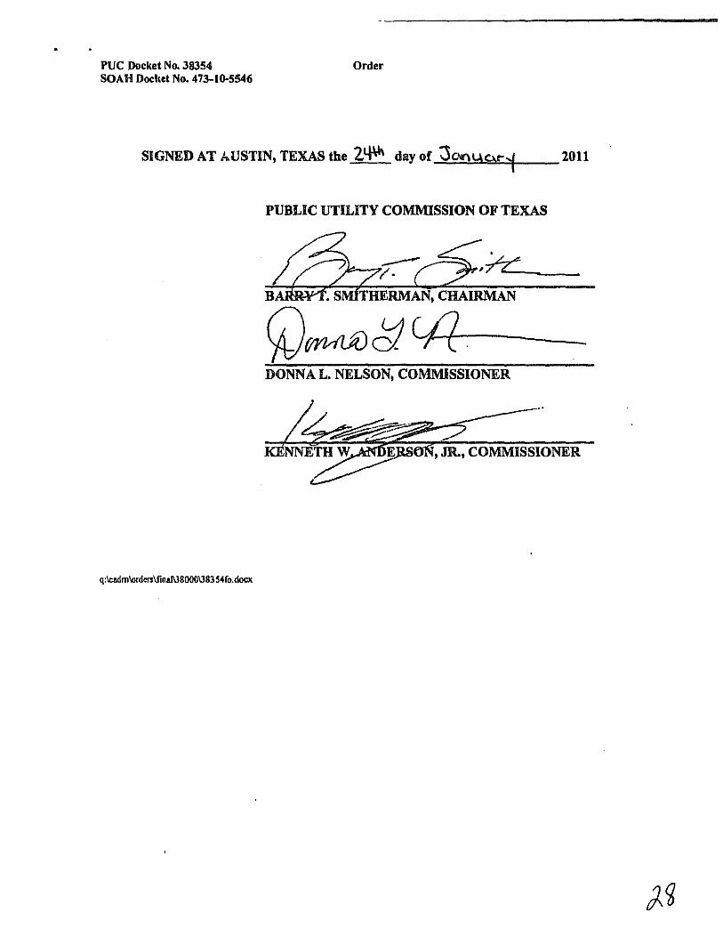
PUC Docket No. 38354 Order SOAH Docket No. 473-I()'S546
SIGNED AT AUSTIN, TEXAS the 2tf\11 day of 0C.Ir"IUCV"i 2011
PUBLIC UTILITY COMMISSION OF TEXAS
DONNA L. NELSON, COMMISSIONER
E , JR., COMMISSIONER
q:lcadmlorderslfinal\l8000138354ro,docx

TAB C
State Office of Administrative Hearings
Cathleen Parsley Chief Administrative Law Judge
December 16,2010
, ~?
(; ,~
"'I.-;;;~\ \:"1 /' 0'
.,('!. ~, .
<' -',:. TO: Stephen Journeay, Director
Commission Advising and Docket Management William B. Travis State Office Building
Courier Pick-.1m
1701 N. Congress, 7th Floor Austin, Texas 78701
RE: SOAH Docket No. 473-10-5546 PUC Docket No. 38354
Application of LCRA Transmission Services Corporation to Amend its Certificate of Convenience and Necessity for the Proposed Mccamey D to Kendall to Gillespie 345-kV CREZ Transmission Line in Schleicher, Sutton, Menard, Kimble, Mason, Gillespie, Kerr, and Kendall Counties
Enclosed is a copy of the Proposal for Decision (PFD) in the above-referenced case. Please file-stamp and return a copy to the State Office of Administrative Hearings
. for our records.
Please place this case on an open meeting agenda for the Commissioners' consideration. The jurisdictional deadline in this case is January 24, 20 II. It is my understanding that you will be notirying me and the parties of the open meeting date, as well as the deadlines for filing exceptions to the PFD, replies to the exceptions, and requests for oral argument.
Enclosure
Wendy Ie . Harvel Administmlive law Judge
xc: All Parties of Record
300 Wellt 15'" Street Suite S02 AU5tin. TcltiU) 78701/ P,o. Bo", 13025 Austin. Texas 78711~302S 512.-175.-1993 (Main) 512.475.3445 {Docketing) 512.-I75.4994lFax)
www.soah.slllte.tx.us
000001
SOAH DOCKET NO. 473-10-5546 PUC DOCKET NO. 38354
APPLICATION OF LCRA § BEFORE THE STATE OFFICE TRANSMISSION SERVICES § CORPORATION TO AMEND ITS § CERTIFICATE OF CONVENIENCE AND § NECESSITY FOR THE PROPOSED § MCCAMEY D TO KENDALL TO § OF GILLESPIE 345-KV CREZ § TRANSMISSION LINE IN § SCHLEICHER, SUTTON, MENARD, § KIMBLE, MASON, GILLESPIE, KERR, § AND KENDALL COUNTIES § ADMINISTRATIVE HEARINGS
PROPOSAL FOR DECISION
I. SUMMARY OF CASE AND RECOMMENDATIONS ................................................ I II. PROCEDURAL HISTORY, NOTICE, AND JURISDICTION .................................. 3 III. THE PARTICIPANTS .................................................................. , .................................. 4 IV. PROJECT BACKGROUND ............................................................................................ 7 V. PRELIMINARY ORDER ISSUES ............................................................................... 12
A. Preliminary Order Issne No. 1 ............................................................................ 12
B. Preliminary Order Issue No. 2 ............................................................................ 12
C. Preliminary Order Issue No. 3 ............................................................................ 14
D. Preliminary Order Issue No. 4 ............................................................................ 14
E. Preliminary Order Issue No. 5 ............................................................................ 16
F. Preliminary Order Issne No. 6 ............................................................................ 17
I. The Effect of Granting the Certificate on LCRA TSC and Any Electric Utility Serving the Proximate Area ......................................... 17
2. Community Values ................................................................................. 17
a. Texas Hill Country ...................................................................... 18 b. Habitable structures ................................................................... 20 c. Cities ............................................................................................. 21 d. Other Community Values .......................................................... 24 e. Monopoles .................................................................................... 25
000000002

SOAH DOCKET NO. 473-10-5546 PUC DOCKET NO. 38354
TABLE OF CONTENTS PAGE 2
3. Recreation and Park Areas .................................................................... 26
a. Old Tunnel Wildlife Management Area ................................... 26 b. Fort McKavett ............................................................................. 28 c. Camp Sol Mayer ......................................................................... 30 d. Tierra Linda Ranch .................................................................... 30 e. Flat Rock Ranch .......................................................................... 31
4. Cultural, Aesthetic, and Historical Values ........................................... 32 a. Aesthetic Values .......................................................................... 32 b. Cultural, Historic, and Archeological Sites .............................. 38
5. Environmental Integrity ......................................................................... 42
a. Background ................................................................................. 42 b. Discussion .................................................................................... 51 c. Conclusion ................................................................................... 65
6. The Effect of Granting the Certificate on the Ability of this State to Meet the Goal Established by Section 39.904(a) .................................. 66
7. Engineering Constraints ......................................................................... 66
a. Kimble County Airport and Llano River Floodplain .............. 66
i. Links b19b and bl9c, North of the Airport .................. 66 ii. Link Yll, South of the Airport ...................................... 68 iii. Intervenors' and Staff's Arguments ............................. 69 iv. Analysis ............................................................................ 70
b. P-Line Concerns .......................................................................... 70
8. Costs, Using Existing Compatible ROW, and Prudent Avoidance .... 71
u. Tension Between Cost, Paralleling ROWand Prudent Avoidance ..................................................................................... 71
b. Best Balance or Cost, Paralleling, and Prudent Avoidance .... 74 c. EMF .............................................................................................. 76
G. Preliminary Order Issne Nos. 7 and 8 ................................................................ 77
1. Alternative Routes Evaluated by LCRA TSC ...................................... 78 2. Routing Adjustments Evaluated by LCRA TSC ................................. 82
000000003

SOAH DOCKET NO. 473-10-5546 PUC DOCKET NO. 38354
TABLE OF CONTENTS PAGE 3
H. Preliminary Order Issue No. 9 ............................................................................ 83
I. Prelimiuary Order Issue No. lO .......................................................................... 84
.J. Supplemental Preliminary Order Issue No. l ................................................... 85
l. TPWD Participation ............................................................................... 85 2. TPWD's Recommendations on Routing ............................................... 86 3. TPWD's Recommendations for Surveying the Project Area and
Mitigation of Environmental Impact .................................................... 87
VI. CONCLUSION ............................................................................................................... 90 VII. FINDINGS OF FACT ..................................................................................................... 92 VIII. CONCLUSIONS OF LAW .......................................................................................... 108
Attachment A
000000004

SOAH DOCKET NO. 473-10-5546 PUC DOCKET NO. 38354
APPLICATION OF LCRA § BEFORE THE STATE OFFICE TRANSMISSION SERVICES § CORPORATION TO AMEND ITS § CERTIFICATE OF CONVENIENCE AND § NECESSITY FOR THE PROPOSED § MCCAMEY D TO KENDALL TO § OF
GILLESPIE 345-KV CREZ § TRANSMISSION LINE IN § SCHLEICHER, SUTTON, MENARD, § KIMBLE, MASON, GILLESPIE, KERR, § AND KENDALL COUNTIES § ADMINISTRATIVE HEARINGS
PROPOSAL FOR DECISION
I. SUMMARY OF CASE AND RECOMMENDATIONS
LCRA Transmission Services Corporation's (LCRA TSC or Company) proposed routes for
this Project can be divided into four groups: routes that parallel US Highway 277 and 1-10 for all or
a significant portion of their length (MK32, MK33); routes that parallel 1-1 0 for a portion of their
length butdo not parallel Highway 277 (Staffs MK15, MKI5, MK61. MK62); routes that run more
in the center ofthe study area (MK 13 (LCRA TSC's preferred route) and numerous others); and the
northern routes, called "P-Lines" that parallel a portion of a 138-kV transmission line (MK22,
MK23, MK24).
The routes that parallel Highway 277 and 1- \0 are superior environmentally but affect more
habitable structures than the central routes. They are also more expensive. The central routes affect
fewer habitable structures and are some of the least costly routes proposed, but they cut through
undeveloped land in the Texas Hill Country, parallel little existing right-of-way (ROW). and are
much poorer environmentally. The P-Line routes are disfavored by LCRA. StatI, and the Texas
Parks and Wildlife Department (TPWD). They are longer than many of the routes, perform poor
environmentally, and are expensive. Although they parallel an existing I 38-kV transmission line.
that line is on wooden pole, H frame structures. Much ofthe easement under that line has significant
000000005

SOAH DOCKET NO. 473-10-5546 PUC DOCKET NO. 38354
PROPOSAL FOR DECISION PAGE 2
shrubbery and growth, and is not a ROW that is as compatible with a 34S-kV line as 1-10. For those
reasons, the P-Lines are not recommended.
The AUs recommend the selection Starf's MKIS. It parallels highways for much of its
length, performs better environmentally than routes such as the preferred route MK 13 that runs
through the center of the study area, is more cost-etTective than the routes that parallel Highway 277
before turning east at 1-10, and affects fewer habitable structures than the 1-10 routes that run
through Kerrville. Staff's MKIS also runs north of the Kimble County Airport. Construction along
1-10 to the south of the airport would require underground construction, costing $S4 million for a
one-half mile portion of the line to be buried, which makes routes paralleling 1- I 0 through the City
of Junction cost-prohibitive.
Clear View Alliance's (CVA) proposed route, MK33, is the best route environmentally. It
parallels existing highway ROW for almost its entire length. It is, however, the most expensive
route at $406.8 million because it is long, using Highway 277 to move south from the McCamey D
substation all the way to 1-10 before turning east. [t also includes a $S4 million cost to bury the line
south of the Kimble County Airport. Were the cost of MK33 not so great, it would be the best
routing option proposed, and the AUs would recommend it. MK32, which deviates from MK33 at
Junction to run north of the airport, is more cost-effective at $349.3 million, but it is still on the
upper-end of all routes in terms of cost. MK32 is also an attractive option. With the understanding
that cost is a significant factor in the Commission's route selection process, the AUs recommend
Staff's MKIS, which parallels [-10 for much of its length but diverts around Junction, with an
estimated cost of$302.3 million. While Staff's route is still more expensive than the preferred route,
which is estimated to cost $266.4 million, it is well within the range of all tiled routes. Staff's route
parallels 1-10 for much of its length, while avoiding the cities of Junction and Kerrville and avoids
more habitable structures due to the deviation around Kerrville.
Staff's MK IS does, however, atTect the Tierra Linda Ranch subdivision. Tierra Linda is a
rural subdivision that has a pipeline easement running through it. Staff's MK IS parallels the
pipeline easement roughly through the middle of the subdivision. The atTected property owners in
000000006

SOAH DOCKET NO. 473·10·5546 PUC DOCKET NO. 38354
PROPOSAL FOR DECISION PAGE3
the subdivision participated in the hearing, as did the homeowners' association and property owners
who are not directly affected by the line but live in the subdivision. Tierra Linda is opposed to the
line running through its subdivision. The alternative to running the line through Tierra Linda is to
use either the preferred route, which is poor environmentally, and opposed by numerous intervenors,
use a P·Line route, which is disfavored by Statf, LCRA TSC. and TPWD, or continue to parallel
1·10 through Kerrville, affecting more habitable structures, including 17 that appear to be in the
ROW. None of these choices near the termination point are good, and this Proposal for Decision
(PFD) lays out the options to permit the Commission to decide. The ALJs recommend Staffs
MK 15 because it atfects fewer habitable structures and does not have any habitable structures within
the ROW. One promising alternative to Staffs MKI5, however, is MK62. This route is the same as
Staffs MKI5 except that it continues along \·10 though Kerrville rather than turning north from
1·10, through Tierra Linda. If the Commission determines MK62 to be the better option, it carries
the environmental and aesthetic advantages of paralleling 1·10 for a greater length.
II. PROCEDURAL HISTORY, NOTICE, AND JURISDICTION
The Commission has jurisdiction to adjudicate this case pursuant to Public Utility Regulatory
Act (PURA) §§ 14.001,32.001,37.001,37.051,37.053,37.054, 37.056, 37.057, 39.203, 39.904, and
P.U.C. SUBST. R. 25.101,25.174, and 25.216. SOAH has jurisdiction to conduct a hearing on the
merits and to prepare a proposal for decision pursuant to PURA § 14.053 and certain portions of the
Administrative Procedure Act, TEX. GOV'T CODE ANN. §§ 2003.021(b)(2) and 2003.049. The
Commission's jurisdiction over this docket and the issues raised and addressed herein were not
challenged by any party. Jurisdiction is fully addressed in the Findings of Fact and Conclusions of
Law.
000000007

SOAH DOCKET NO. 473-10-5546 PUC DOCKET NO. 38354
PROPOSAL FOR DECISION
m. THE PARTICIPANTS
PAGE4
Over 1,100 persons and entities intervened in this proceeding. The intervenors included
individuals, aligned groups, cities, counties, a public utility board, environmental groups, and state
agencies. At the final prehearing conference, over 40 parties appeared and participated. At the
hearing on the merits, over 30 parties actively participated by questioning witnesses, presenting
evidence, and raising objections. The large groups ofintervenors included CV A, Tierra Linda, and
P-Line, although many of the individual intervenors from Tierra Linda are not considered to be
directly afTected landowners because their properties are more than 500 feet from the centerline, they
intervened individually and as part of the homeowners' association. The two cities that participated
most actively in the hearing were the City of Kerrville and the City of Fredericksburg, working with
Kerr County, the Kerrville Public Utility Board (KPUB), and Gillespie County, respectively. State
agency participation included TPWD, which intervened as well as providing a comment letter. The
Texas Historical Commission (THC) also intervened and participated in the hearing. CV A was a
group formed of hundreds of intervenors who all advocate for the line to be routed along Highway
277 and 1-10, away from the central routes and parallel to existing paved highway. CVA included
intervenors along almost every proposed link, and included individuals who live along [-10 who, as
part of the group, advocate for the line to be built parallel to the highway, through or close to their
properties, rather than through land in the central part of the study area.
Parties affected by the lines that would have run between Kendall and Gillespie and the
P-Lines south of the Gillespie substation also participated. They included the Fredericksburg River
Road intervenors, the Sharpes, the Fosters, and the A304 intervenors. Those intervenors advocated
for a route other than the P-Lines.
StafT participated actively as well, supporting a modified MK 15 (StaffMK 15), which Staff
asserts best balances the factors to be considered in routing a new transmission line. Staff opposed
the use of the P-Lines and agreed that the line should be routed parallel to existing highway as much
as possible while still considering cost and choosing a route that was more cost-effective than
paralleling Highway 277 and [-10 for the maximum length at the maximum cost.
000000008

SOAH DOCKET NO. 473-10-5546 PUC DOCKET NO. 38354
PROPOSAL FOR DECISION PAGES
In addition to the groups listed above, numerous individuals participated in the hearing either
pro se or through counsel. Some people had testimony admitted into the record but did not
participate thereafter. Others filed statements of position and did not question witnesses but observed
the entire hearing and tiled brieting. The level of participation in the case and the professionalism of
all involved enabled the hearing to proceed efticiently.
The chart below illustrates the routes opposed, supported, and any alternate preferences
stated by the majority of the participating parties. I
Route Preferences by Party'
e e one !! M one --~ :.:Zl .. ~
] - 1: .. on ;;'" ~ ]
... :.:" ~ :.: .... .., ... .... .., ;;;:3 ..,u .... .... .... .... .., 0::' U E.
~ ;; :.: ~ :.: :.: :.: ~= ;; .. ci ..: I:: ~?t on ;; ;; ;; ;; ;:~ on ... " ~-d .., ... w ... '" '" . :.: :.: ~ 0
~ ;; ;; "";; ~~
I These tables are taken from the Alliance for A3 Updated Attachment I. For convenience, LCRA TSC Ex. 26 is attached to the PFD as Attachment A.
, Routes are derived from LCRA TSC Ex. 26, which is attached to Ihe PFD as Attachment A. This chart does not include the Segrest routes because the Segrest parties no longer support them. (t also does not include Staffs alternate route that was proposed only if the Kendall to Gillespie project was built.
J The Alliance for A3 has changed "StaffMKI5" from "Opposes" to "Alternate Preference" since the writing of their reply brief.
000000009

SOAH DOCKET NO. 473-10-5546 PUC DOCKET NO. 38354
PROPOSAL FOR DECISION
Route Preferences by Party'
C' C' ~
~ ... .... ... .. ] ... '" ~ N t g .... ..,
" ~ .... ....
U t ~ ~ e ...: l::
'" '" .!! ~ .., - -- ~ ~ rIl ~ ~ ~ ~
PAGE6
!!lE' ",C' ~.!! - ~ ~'" ... .... .., ~ ... ."U .... .., .., e] =;;l
~ ~ ~ ~ ... :Q~ ~ ~ -1l ~.,; .... = ~~ "':a
~~
, Schaerfer Ranch supports "MK33 (the '27711·10 Route') ifit can be constructed without any underground portions in the vicinity of the Kimble County Airport." Schaeffer Ranch supports Staff MK 15 "in the event that the Commission detennines that the 277/I~ 10 Route is too expensive to adopt"
, Stonehenge "apposes any route which includes Link cDb and supports MK61 or MK62." Initial Brief of Stonehenge Properties, LP, at 1.
000000010

SOAH DOCKET NO. 473-10-5546 PUC DOCKET NO. 38354
PROPOSAL FOR DECISION
Route Prererences by Party'
C- C- ~ e ~ N .. ... ~ .. '" ~ ~
~
~ ~ N .., :;: .... ....
u ~ ~ ~ e -< I:: ::0 '" '" .. .., ~
~
Iii ~ ~
~ :.d ::0 ::0 :;:
IV. PROJECT BACKGROUND
PAGE7
"'c-",c- ~-
~S ~ 1:: :;:'" ~ .. " N .., .,.V .... .., .., ;~ ,,;,
~ ~ ~ ..... ::0 :;: ::o~ $~
~,,; .... '" :;:~ '" .• :A'g
::0:;:
The overall Commission Competitive Renewable Energy Zone (CREZ) process that led to
the Proposed Project in the Application consisted of the (I) Commission's selection of the CREZ
areas (PUC Docket No. 33672), (2) the selection of the transmission plan to support the movement
of wind energy from those areas (PUC Docket No. 33672), and (3) the Commission's selection of
000000011

SOAH DOCKET NO. 473-10-5546 PUC DOCKET NO. 38354
PROPOSAL FOR DECISION PAGE 8
transmission service providers to implement the transmission plan (PUC Docket Nos. 36146, 35665,
and 37928).6
The need for the CREZ Transmission Plan (CTP) projects, including the endpoints for the
new transmission lines, was established in Docket No. 33672. In Docket No. 35665, Order on
Rehearing (issued May 15,2009, Conclusion of Law No. 10), the Commission found that the CREZ
transmission projects are exempt from addressing the need criteria in PURA § 37 .056{c)(l) and (2).
More recently, in Docket No. 37928, Order on Rehearing (issued February 25, 20 I 0, Conclusion of
Law No. 12), the Commission re-stated that the CREZ transmission projects are exempt from
addr~ssing the need criteria in PURA § 37.056(c)(I) and (2).7
In Docket No. 33672, the Commission analyzed and considered three critical ERCOT studies
of transmission plans for various wind generation levels and analyzed wind generation impact on
ERCOT ancillary service requirements. As a result, the Commission identified tive specific
geographic areas as "Competitive Renewable Energy Zones." The Commission also examined four
scenarios of wind generation that could be installed in these CREZ areas and considered a set of
transmission plans for each of the scenarios to be implemented. After the Commission selected the
so-called "Scenario 2" and its associated transmission plan as the most appropriate level of wind
generation and transmission capacity to implement the CREZ goals, this resulted in the identification
of over 100 transmission projects to be constructed. Based on its CREZ Transmission Optimization
(CTO) study results, ERCOT determined that this set of projects will maintain curtailment of wind
generation below 2.3 percent.s
6 Commission SlUff's Petition/or Designation qfCompetitive Renewable Energy Zones. Docket No. 33672, Order on Rehearing (October 7, 2008); Issues Relaled 10 De/aull Projecls Severedfrom No. 35665, Docket No. 36146, Order (November 6,2008); Commission Staff's Pelition/or the Selection of En/ilies Responsible for Transmission [mprovemenls Necessary to Deliver Renewable Energy from Competitive Renewable Energy Zones, Docket No. 35665, Order on Rehearing (May 15,2009); Priorily Projecls Severed/rom Dockel No. 37902, Docket No. 37928, Order on Remand (February 25,2010); LCRA TSC Ex. 6, at II.
7 LCRA TSC Ex. I at 20; LCRA TSC Ex. 6 at 9.
" LCRA TSC Ex. 6 at 12-13.
000000012

SOAH DOCKET NO. 473-10-5546 PUC DOCKET NO. 38354
PROPOSAL FOR DECISION PAGE 9
Included in the Commission-approved transmission plan were 13 system improvements Ihat
the Commission determined to be of high priority (Priority Projects). These projects were
designated as Priority Projects because, in addition to facilitating the CREZ goals, these projects are
critical in relieving current congestion that is hampering the delivery of existing generation to the
ERCOT grid. One of these Priority Projects, the McCamey D to Kendall 345-kV double-circuit
transmission line, has been identified by ERCOT on several occasions (most recently on September
24, 20 I 0) as a critical element to the performance of the overall CTP.9
The Commission's goal throughout the CREZ process was to ensure delivery to customers of
the energy generated by renewable resources in the CREZ in a manner that is most beneficial and
cost-etfective to the customers.
The electric customers include all electric consumers within the ERCOT region including
those located in the Hill Country as well as the broader Central Texas area. 10
Staff initiated Docket No. 35665 to select the TSPs to construct the non-default CREZ
projects. The Proposed Project includes two ofthe system improvements listed in the CTP selected
in Docket No. 33672. LCRA TSC was ordered to build these two projects by the Commission in
Docket No. 35665. Specifically, in the Order on Rehearing in Docket No. 35665 (May 15, 2009),
the Commission lists the Proposed Project (composed of two CREZ Priority Projects) which is the
subject of this CCN Application. The Commission later affirmed this assignment to LCRA TSC
when it severed the 13 CREZ priority projects into Docket No. 37928, forthe purpose ofspecitically
assigning the 13 CREZ priority projects (February 25, 20 I 0). In so doing, the Commission
emphasized that the severance is "necessary to facilitate the processing ofthe [priority project CCN
applications] most expeditiously." LCRA TSC's Proposed Project is included in Ordering
Paragraph No. I and associated Attachment B of Docket No. 37928. 11
'LCRA TSC Ex. 6 at 13; LCRA TSC Ex. 13, Ex. SO-IR.
10 LCRA TSC Ex. 6 at 14.
" LCRA TSC Ex. 6 at 14-15.
000000013

SOAH DOCKET NO. 473-10-5546 PUC DOCKET NO. 38354
PROPOSAL FOR DECISION PAGE 10
ERCOT's CTO Study assumed 137 miles of transmission line for the project. This is
reasonably consistent with the range of overall route length indicated in LCRA TSC's proposed
alternative routes. Due to the critical nature of the McCamey D to Kendall 345-kV double-circuit
transmission line to the overall CTP performance, route length was an important factor affecting the
routing options recommended by LCRA TSC in this CCN Application for the transmission line
section connecting the McCamey D and Kendall endpoints. For this project, excessive length will
detrimentally affect the ability of the transmission line to perform the function assigned it by
ERCOT in its CTO Study. \2
The endpoints for project were identified by ERCOT, specified in the CTO Study report as
are required to meet the cost-effectiveness of the overall CTP, and approved by the Commission in
its Final Order in Docket No. 33672. 13
The McCamey D Station is an appropriate endpoint because it is a necessary switching
station to connect transmission lines in the immediate area from and to other locations. Also, the
McCamey D Station is located in an area near a CREZ and provides effective and efficient service as
a CREZ hub to interconnect wind generation facilities. The McCamey D Station is also part of an
approved Certificate of Convenience and Necessity (CCN) (i.e., the Twin Buttes to McCamey D
single-circuit double-circuit-capable 345-kV transmission line approved in Docket No. 37778).14
The existing Kendall station provides excellent CREZ transmission line endpoints for
integrating the bulk power delivery transmission lines into the load-serving network. As ERCOT
explained in the CTO Study, "each ofthe plans developed as part ofthis study has been evaluated on
how cost-effectively it is able to collect wind from the five CREZ areas and move that generation to
load centers." There are no other stations in the immediate area of each of these stations that provide
this level of existing infrastructure. 15
" LCRA TSC Ex. 6 at 16.
13 LCRA TSC Ex. 6 at 10.
"LCRA TSC Ex. 6 at 10-11.
15 LCRA TSC Ex. 6 at II.
000000014

SOAH DOCKET NO. 473-10-5546 PUC DOCKET NO. 38354
PROPOSAL FOR DECISION PAGE II
LCRA TSC's Proposed Project does not include the 50 percent series compensation project
identified in the CTP for the McCamey D to Kendall 345-kV transmission line. Per the Final Order
in Docket No. 37928, that project will be constructed by Electric Transmission Texas (Em.
Because the length and location of the McCamey D to Kendall 345-kV transmission line is also an
important factor related to the series compensation, LCRA TSC will timely communicate the routing
results 0'1' the Proposed Project to both ERCOT and ETT.16
With the exception of certain combinations of transmission line routes addressed below, both
portions of the Proposed Project in LCRA TSC's CCN Application (i.e., McCamey D to Kendall,
and Kendall to Gillespie) meet the requirements of the ERCOT CTO Study and comply with the
Order on Rehearing in PUC Docket Nos. 35665 and 37928 for constructing CREZ-related facilities.
Consistent with the Commission's goals for the CREZ program and P.U.C. SUBST, R. 25.174,
LCRA TSC's Proposed Project provides: long-term, cost-effective solutions that are consistent with
the Final Order in Docket No. 37928; transmission facilities that are consistent with specifically
associated ERCOT recommendations in the Commission-approved CTP; and transmission facilities
that are constructed and placed in service as soon as possible to alleviate existing and growing
constraints in delivering wind generation from West Texas to loads in ERCOT. 17
LCRA TSC's proposed station designs at McCamey D and Kendall will be of the high
reliability configurations required for terminations ofCREZ transmission lines, such as a ring bus or
breaker-and-a-halfarrangement designated in the CTO Study."
On December I, 20 I 0, the Commission determined that the Kendall to Gillespie portion of
the transmission line would be replaced with a cost-effective alternative that does not require the
construction of a transmission line between the Kendall and Gillespie substations at this time. 19
", LCRA TSC Ex. 6 at 16-17; see also LCRA TSC Ex. 5 at 6.
11 LCRA TSC Ex. 6 at 17; see also LCRA TSC Ex. 1 at 7; LCRA TSC Ex. 2 at 10. 28-29. 31.
"LCRA TSC Ex. 5 at 14-15.
II) Proceeding 10 Determine Whether to A/odify the CREZ Transmission Plan, Docket No. 38577, Final Order
000000015

SOAH DOCKET NO. 473-10-5546 PUC DOCKET NO. 38354
PROPOSAL FOR DECISION PAGE 12
Therefore, this PFO does not address the routing issues between those substations.· However, most
orthe links originally filed between those two substations could also be used if the Commission
determined to route the transmission line along any of the P-Lines. Because the ALJs recommend
against all the P-Lines, none of the links from Kendall to Gillespie are recommended.
V. PRELIMINARY ORDER ISSUES
A. Preliminary Order [ssne No.1
Is LCRA TSC's Application to amend its CCN adequate? Does the Application contain an adequate number of reasonably differentiated alternative routes to conduct a proper evaluation?
[n Order No.5, the ALJs concluded that the Application was materially sufficient. As part of
the evidence concerning material sufficiency, Staff concurred that the Application contains an
adequate number of reasonably differentiated routes for the Commission's evaluation.20 LCRA TSC
provided 60 primary alternative routes for the MK Project."!
LCRA TSC's Application provided an adequate number of routes and otherwise complies
with all applicable statutory and regulatory requirements. Several parties (Settler'S Ridge,
Fredericksburg River Road Intervenors, and the Fosters) filed motions challenging the adequacy of
the routes proposed in the Application.22 These motions were denied by the ALJs in Order Nos. 5,
7, and 10, respectively.
B. Preliminary Order Issne No.2
Did the notice provided by LCRA TSC comply with P.U.C. PROC. R. 22.52(a)?
(December I, 2010).
20 PUC StalTEx. 2 at 19; PUC SlaITEx. I at 18-19. There are at least 100 possible routes (using noticed links) for the KG Project and at least 20,000 possible routes (using noticed links) for the MK Project. LCRA TSC Ex. 2 at 27.
" LCRA TSC Ex. 9 at 32. LCRA TSC designated the Kendall to Gillespie lines as the KG Project and the McCamey 0 to Kendall lines as the MK Project.
"See Docket No. 38354, Settler's Ridge Motion on Route Adequacy (Aug. II, 2010), Interchange Item No. 684; Fredericksburg River Road Intervenors' Motion on Route Adequacy (Aug. 23, 2010), Interchange Item No. 880; Motion for Review of the Adequacy of Routes Proposed Herein (Sept 3, 20 I 0), Interchange Item No. 1743.
000000016

SOAH DOCKET NO. 473-10-5546 PUC DOCKET NO. 38354
PROPOSAL FOR DECISION PAGE 13
In accordance with P.U.C. PROC. R. 22.52, LCRA TSC provided notice to directly affected
landowners, utilities, city governments, and county governments on July 28. 2010;23 re-mailed
notice to certain landowners for whom the original notice was returned to LCRA TSC on or before
August 17,2010. or for whom LCRA TSC subsequently learned of different ownership ofa directly
affected property;14 provided notice by publication in newspapers having general circulation in the
counties where the CCN is being requested on August 5 and 13, 20 I 0;25 provided copies of the
Application and the Environmental Assessment and Alternative Route Analysis (EA) compiled for
this project to representatives ofTPWD,26 andheldpublicopen houses on May 4, 5, 7, II, 12, and
14,2009 and February 16,17, 18,22,23, and 24, 2010.27
On August 20, 20 I 0, Staff filed Comments in Response to Order No. I. In the Comments,
Staff reviewed LCRA TSC's Affidavit of Notice and Supplemental Affidavit of Notice as well as its
Publishers Affidavits and found them sufficient and compliant with the notice provisions set out in
P.U.C. PROC. R. 22.52(a) and Order No. 1.28 On August 23, 2010, the AUs issued Order No.5,
which found the Application sufficient and free of any material deficiencies. LCRA TSC has
complied with the requirements ofP.U.C. PROC. R. 22.52(a)(I)-(4).
ChiRoss Intervenors argued that notice was improperly served upon them because they are
not traditional directly affected landowners under P.U.C. PROC. R. 22.52(a)(3). LCRA TSC argued,
however, that the Commission's rules present the minimum notice required; nothing in the rules
preclude the noticing of additional property owners in order to provide the Commission with
tlexibility in its selection ofa final route.29 Recognizing this fact, the AUs issued Order No. 16
finding that either the AUs or the Commission could approve a route on noticed property that is not
" LCRA TSC Ex. 4
241d.
25 'd.
" [d.
"LCRA TSC Ex. 2 at 13-14.
" Comments in Response to Order No. I On Compliance With Notice Requirements (Aug. 20, 2010). Interchange Item No. 822.
,'l LCRA TSC Ex. 12 at 7.
000000017

SOAH DOCKET NO. 473-10-5546 PUC DOCKET NO. 38354
PROPOSAL FOR DECISION PAGE 14
directly affected by a proposed route, and that absent a stipulation, the AUs would not grant a
motion to dismiss on grounds that the project would not directly affect an intervenor's property.
C. Preliminary Order Issue No_ 3
Does the Application meet the filing requirements set forth in P.U.C. SUBST. R. 25.216(g)(2) and (3)?
In Order No.5, the AUs found that the Application is sutlicient and contains no material
deficiencies. No party has challenged the sutliciency of this ruling. LCRA TSC's Application has
met the filing requirements set forth in P.U.C. SUBST. R. 25.2 I 6(g)(2) and (3).
D. Preliminary Order Issue No.4
Did LCRA TSC submit the CCN application in compliance with the Orders in Docket Nos_ 37928 and 36802 designating it as a CREZ Priority Transmission Plan facility? If not, should the Commission revoke the designation awarded to LCRA TSC and select another entity for the CREZ Priority Transmission Plan facility at issue in this docket pursuant to P.U.C. SUSST. R. 25.216(1)(1)?
The Application was submitted in compliance with Docket No. 35665 designating it as a
CREZ Priority Transmission Line Project that was tiled in accordance with the sequence of filing
ordered in Docket Nos. 3680 I and 36802.30
LCRA TSC's proposed double-circuit or double-circuit-capable 345-kV transmission lines
between the McCamey D and Kendall stations are a part of the ERCOT CREZ Transmission Plan
ordered by the PUC in Docket No. 33672. 31 The lines are "priority projects" designated as such by
the PUC because they help to relieve congestion restricting existing wind generation in addition to
JO Staff Ex. 2 at 13.
1I Docket No. 33672. Order on Rehearing (October 7, 2008) at 39-47 (FOF 117-178) 48 (COL 6-7), and 49 (Ordering Paragraph 2). Double-circuit-capable structures will be constructed for the McCamey D to Kendall and Kendall to Gillespie CREZ projects. As required by the CREZ Transmission Plan (CTP) the McCamey D to Kendall CREZ Project will be built as a double-circuit line while the CTP calls for the Kendall to Gillespie CREZ Project to be constructed initially as a single-circuit project with a second circuit to follow sometime in the future.
000000018

SOAR DOCKET NO. 473-10-5546 PUC DOCKET NO. 38354
PROPOSAL FOR DECISION PAGE 15
perfonning the CREZ function of supporting the development of new wind generation.]2 In Docket
No. 35665, the PUC ordered LCRA TSC to build the McCamey D to Kendall and Kendall to
Gillespie lines.'] As stated by the PUC in its Order in Docket No. 3566534 and its Order of Referral
and Preliminary Order in this docket,'5 PURA Sections 39.203(e) and 39.904(h) exempt CREZ
facilities from CCN requirements addressing need, adequacy of existing service, effects on the
applicant or other utilities, and probable improvement of service or lowering of cost to customers.36
In addition to CREZ-related benefits, the line is intended to benefit the general area of their
location by providing increased transmission support to meet growing needs in the Central Texas
and Hill Country areas. l7 Meeting increasing transmission needs in the Hill Country region was a
benefit cited by ERCOT in its CTO Study.3s
30 Id. at 42 (FOF 136).
J] Docket No. 35665, Order on Rehearing (May 15, 2009) at p. 50 (FOF 120).
HId. at p. 60 (COL 10).
JS Order of Referral and Preliminary Order at 7-9.
\6 TEX. UTILITIES CODE §§ 39.203(e) and 39.904(h).
J1 LCRA TSC Ex. 6 at 26.
JB lei. at 29-30.
000000019

SOAH DOCKET NO. 473·10-5546 PUC DOCKET NO. 38354
E. Preliminary Order Issue No.5
PROPOSAL FOR DECISION PAGE 16
Will completion of the project proposed hy LCRA TSC in this docket accomplish the intended result for the CREZ project designated as "McCamey D to Kendall to Gillespie 345-kV Transmission Line Project" in the CREZ Transmission Plan and ordered by the Commission in Docket Nos. 37928 and 36802?
The Application will accomplish the intended results for the CREZ pnonty project
designated in the CREZ CTO and ordered by the Commission in Docket Nos. 35665, 37928, and
36802.39 In Docket No. 33672, Ihe Commission found that certain lines are critical to relieve the
congestion that is hampering the delivery of existing wind-powered energy to the grid and
designated them as priority projects.40 In an effort to relieve this congestion, the Commission
specifically required LCRA TSC to build new, double-circuit 345-kV line running from the
McCamey D Station to the Kendall Station and then a double-circuit-capable, single-circuit 345-kV
line from the Kendall Station to the Gillespie Station.41
A number of intervenors asserted that the need for the project is not demonstrated and that a
transmission line owned by NextEra, the Horse Hollow Generation Tie, LLC (HHGT) could provide
a substitute for the Project. On September 24, 20 10, ERCOT submitted a letter summarizing the
study that it had conducted at request of the Commission regarding the need for the MK to KG
Iines.42 ERCOT's study concluded that (a) the MK portion of the project has no viable alternative
and must remain part of the CREZ transmission plan; (b) the HHGT is not a viable alternative to the
MK CREZ priority transmission line, and (c) the KG project could potentially be avoided with a less
expensive alternative of installing certain infrastructure improvements.43 In Order No. 12, the ALJs
held that, unless directed otherwise by the Commission, they would not consider the issue of
whether the HHGT line could be used in the place of the MK Project because (I) that is an issue of
.w PUC Staff Ex. 2 at \3; Staff Ex. I at II.
~o Docket No. 33672, Commission Staff's PetitionJor Designation alCompetitive Renewable Energy Zones, Order on Rehearing (Oct. 7, 2008) at 12.
41 LCRA TSC Ex. I, Attachment I {EAJ at 1-5.
"LCRA TSC Ex. 13 (Ex. SG-IR).
43 {d.
000000020

SOAH DOCKET NO. 473-10-5546 PUC DOCKET NO. 38354
PROPOSAL FOR DECISION PAGE 17
need, which is not to be considered in this proceeding, and (2) ERCOT's study found that there is no
viable alternative to this line:4 In Order No, 14, the ALJs ordered the direct testimony of HHGT
witnesses to be struck in accordance with LCRA TSC's objections.45
F. Preliminary Order Issue No.6
Which proposed transmission line route is the best alternative, weighing the factors set forth in PURA § 37.0S6(c)(4), excluding (4)(E), and P.U.C. SUBST. R. 2S.IOI(b)(3)(B)?
After weighing the factors, StaffMKI5 is the best alternative because it best balances all of
the relevant criteria. While MK32 and 33 are better choices environmentally, they sacrifice cost and
habitable structures to parallel existing highway.
1. The Effect of Granting the Certificate on LCRA TSC and Any Electric Utility Serving the Proximate Area
Although included in CCN proceedings, this issue is specifically excluded from CREZ CCN
proceedings.46
2. Community Values
Although "community values" is not formally defined in Commission rules or in PURA, the
term has been described as a "shared appreciation of an area or other natural or human resource by a
national, regional, or local community.,,47 The study area in this case and the length of the
transmission line from McCamey D to Kendall are so large that there is no consensus on community
values.
To address and consider community values, LCRA TSC conducted 20 public meetings on
44 Order No. 12 (Oct. I, 2010),lnterch.nge Item No. 2657, at 2-3.
"Order No. 14 (Oct. 12, 2010), Interchange Item No. 2772, at 4.
"PURA §§ 39.203(e) and 39.904(h) and P.U.C. SUBST. R. 25. I 74(d)(2).
47 LCRA TSC Ex. I, EA at 2-55.
000000021

SOAH DOCKET NO. 473-10-5546 PUC DOCKET NO. 38354
PROPOSAL FOR DECISION PAGE 18
May 4, 2009, May 5, 2009, May 7, 2009, May 11,2009, May 12,2009, and May 14,2009. In
addition, LCRA TSC conducted public meetings on February 15 and February 16, 17, 18,22,23,
and 24, 20 I 0:8 These meetings provided information to LCRA TSC regarding community values
by participants who provided a ranking of a series of routing criteria. LCRA TSC further took into
account expressions of community values in a review of the questionnaires, letters, meetings, phone
calls, and other public input it has received.49 LCRA TSC received additional information about
community values at the Technical Conference held on September I, 20 I 0, and at the Settlement
Conferences it held on September 20, 21, and 22, 20 I O.
Four strong indications of community values arose during the pendency of this case: the
effect of the line on the Texas Hill Country; the effect of the line on habitable structures, particularly
in developed areas, such as cities; the effect on rural residential subdivisions; and the use of
monopoles. Almost all intervenors testified that they did not want the line on their property and it
was better to place the line on someone else's property (or in another county). The AUs do not
consider those arguments to be representative of community values. It is understood that most
people would prefer not to have the line routed across their land or through their town, but that is not
helpful for determining whether the community as a whole or larger portions of the community share
certain values.
a. Texas Hill Country
Avoiding "central" routes that would cut through undisturbed areas ofthe Texas Hill Country
is one shared community value relevant to this proceeding. It was one reason for the delay of this
proceeding for several months so that the study area could be expanded to include the existing AEP
138-kY line to the north (now paralleled by the P-Lines) and the US 277/\-10 corridor to the south. lO
As Chairman Smitherman explained at the September 24, 2009 Open Meeting:
'" LCRA TSC Ex. 2 al 12-13 .
. " LCRA TSC Ex. 2 al II.
50 WR Ex. 8 al 4; LCRA TSC Ex. 2 at 21.
000000022

SOAH DOCKET NO. 473-10-5546 PUC DOCKET NO. 38354
PROPOSAL FOR DECISION PAGE 19
I do think that some of the letters raised some legitimate concerns about making sure that we follow the statute and follow our rules which say, hey, take a look at existing corridors, take a look at existing rights-of-way, take a look at existing infrastructure. Cau you run along these rather than going straight across virgin ranch territory .... 51
Thus, the Commission has already acknowledged public support in favor of using existing
compatible corridors, rather than impacting areas of the Hill County, as MKI3 does.
The questionnaires received by LCRA from the members of the community in the McCamey
D to Kendall study area consistently ranked paralleling existing compatible ROW among the highest
factors in importance, if not the highest factor.52 LCRA witness Sarah Morgenroth, who was
responsible for overseeing the public involvement program for this project, including coordinating
open houses and meetings with governmental officials, confirmed that there has been a great deal of
public interest in developing a route along the 1-10 corridor.53 As Ms. Morgenroth testified, "[t]here
was a lot of comment about preserving the Hill Country .,,54
Further, one of the parties in this case, CVA, which represents approximately 240
landowners in this proceeding, has promoted a route that avoids traversing the "heart of the Hill
Country" in fav0r of a path that follows existing compatible corridors. such as the US 277/1-10
corridor." CVA's lead landowner witness, Bill Neiman. testified that one goal in forming CVA
was to form a large group of concerned landowners to speak with a common voice.56 He also
testified that he realized the line may cross or come close to his land, but decided he would have to
be "at peace" with that possibility because his goal was to do his best to keep the line from running
through the Hill Country .57 There is much evidence in this proceeding that many parties hold
" WR Ex. 8 at4 (emphasis added).
" See generally LCRA TSC Ex. I, Attachment I at Section 6.
53 Tr. at 346; LCRA TSe Ex. 2 at 4, 20-21.
14 Tr. at 164.
" eVA Ex. 9 at 2-3.
so Tr. at 629-630; eVA Ex. 9 at 5.
57 Tr. at 679; see also eVA Ex. 9.
000000023

SOAH DOCKET NO. 473-10-5546 PUC DOCKET NO. 38354
PROPOSAL FOR DECISION PAGE 20
community values that support using existing compatible corridors such as 1-10, and minimizing the
impact to the Texas Hill Country.
Yet MK 13, the preferred route, would cut a new ROW through the Hill Country and would
parallel few property lines. A large number of intervenors who want to preserve the nature of the
Hill Country vehemently oppose the preferred route and all other central routes. Because it is a
central community value, the ALJs recommend against the preferred route and against the other
central routes. Routing the line parallel to existing highways that have already scarred the landscape
and are not natural or scenic is a better choice to address the values expressed by many, if not most
of the intervenors. StaffMK I 5 parallels 1- IO for much of its length, coming offofthe central routes
at Ranch Road 1674, travelling south to hit 1-10 west of Junction before moving east. The ALJs
recommend the Commission approve Stalf MK 15.
b. Habitable structures
In contrast to the community values held by those intervenors advocating routes that do not
run through the Hill Country, many intervenors expressed concern about the line running in close
proximity to a large number of habitable structures and also running through Kerrville and other
cities, and running close to Fredericksburg.
The parties concerned with habitable structures and city development oppose all routes that
travel through Kerrville, citing limiting impacts to residences as a strongly held community value.
Maximizing the distance of the proposed line from residences/habitable structures was also one of
the most highly ranked values in the questionnaires received by LCRA.58 While routes MK32 and
33 best satisfy the community value of paralleling existing compatible corridors, they also have
some ofthe highest numbers of habitable structures within 500 feet of the centerline. Routes MK32
and 33, with 151 and 153 impacted habitable structures respectively, would each affect more than
"See LCRA TSC Ex. 1. EA at 6-5 to 6-58.
000000024

---------_.
SOAH DOCKET NO. 473-10-5546 PUC DOCKET NO. 38354
PROPOSAL FOR DECISION
eight times as many habitable structures as Route MK13.59
PAGE 21
The AUs conclude that, neither Route MK 13 nor routes MK32 or 33 are the best overall
routes in terms of community values. Rather, the evidence shows that StaffMK 15 best satisfies the
expressed community values because it parallels a substantial length of existing compatible
corridors, while impacting relatively few habitable structures.60 Although the various MKI5 route
options do not parallel as great a length of existing corridors as routes MK32 and 33, they impact
vastly fewer habitable structures and cost significantly less.61 Likewise, while StaffMK 15 impacts
more habitable structures (55) than Route MKI3 (18), it parallels significantly more existing
compatible ROWand is only 10 miles longer.62 [f Staffs route is used with a variation that
continues the line along 1-10 through Kerrville, it would impact 128 habitable structures. This
variation is MK62.
The communities of Mason, Fredericksburg, and Kerrville provided testimony that their
communities did not want the transmission line through their towns.63 Staff MKI5 avoids the
communities of Eldorado, Sonora, Mason, Menard, and Fredericksburg.64 Staff MK 15 also
circumvents the community of Kerrville and avoids 99 habitable structures (including 17 within the
ROW).65 Although avoiding Kerrville, Staff MKI5 parallels a gas pipeline through Tierra Linda
and affects 12-14 habitable structures as opposed to the 99 in that subdivision, which would not be
affected by MK32 or 33.66
c. Cities
" LCRA TSC Ex. 26.
"" See id.; LCRA TSC Ex. I, EA at 6·85 to 6-92.
1I1/d.
" Id.; LCRA TSC Ex. I, EA at 6·85 to 6·92.
6J Kerrville Ex. I at. 4; P·Line Ex. I .t2; P-Line Ex. 12 at 2; Tr. at 715; 718-719.
M Tr. at 719.
" LCRA TSC Ex. 20 at 6-85 to 6-93.
66 Staff Ex. I at 25; Tr. at 563-564, \059, 1167.
000000025

SOAH DOCKET NO. 473-10-5546 PUC DOCKET NO. 38354
PROPOSAL FOR DECISION PAGE 22
Kerrville, Kerr County, and Gillespie County intervened in this proceeding on behalf of their
citizens. The elected officials of Kerrville and Kerr County appeared for cross-examination at the
hearing presented testimony on behalf of their citizens and expressed the community values of their
constituents.67 Kerrville Mayor Wampler and Kerr County Judge Tinley expressed the will of their
constituencies in Kerrville and Kerr County for the proposed transmission line to avoid the growing
population centers of Kerrville and northern Kerr County.68
The Kerrville community is currently expanding along I-I 0.69 The City has made significant
expenditures in order to ready the 1-10 corridor for further development.7o The Kerrville Public
Utility Board (KPUB) also has spent over $1 million to extend utility infrastructure to the areas
along 1-10, in the vicinity of Links Y16, Y17b, Y18, YI9b and Y20, which are links in routes
MK32, 33,61, and 62.71
Kerr County is also experiencing growth just north of 1_10.72 Kerr County Judge Tinley
identified the Whiskey Canyon subdivision and other communities that would be atfected by Links
cia, bS7a, c3, c9, c6, and c8, some of which are in routes MKIS and StaffMKIS?3 Property owners
from the Whiskey Ridge subdivision also intervened individually to express their concerns.
Jerry Ahrens, Kenneth and Carol Swanson, and Michael and Margie Schwartz all testified that
construction of the proposed transmission line along Link c I a would negatively impact their
properties, would not comport with the community values of Whiskey Ridge, and would negatively
u7 Tr. at 241, 718. The parties were able to waive cross-examination on many witnesses who pre~fiIed testimony. Therefore. many witnesses whose testimony is part of the record of this proceeding did not testifY live at the hearing.
I,S Kerrville Ex. I at 4; Kerr County Ex. I at 5-8.
I" Atkisson Ex. I at 7; Kerrville Ex. I at 5.
'" Kerrville Ex. I at 5-10, Attachments A-F.
" KPUB Ex. I at 6.
" Kerr County Ex. I at 5-9, Attachments A-H.
1l Kerr County Ex. I at 6-7.
000000026

SOAH DOCKET NO. 473·10·5546 PUC DOCKET NO. 38354
PROPOSAL FOR DECISION PAGE 23
impact property values.74 Thus, it is apparent that the existing communities in Kerr County value
the placement of the proposed transmission line away from the ongoing development in Kerrville
and northern Kerr County.
Kerrvi lie and Kerr County also intervened to present the special concerns they share as local
governments. Specifically, the placement of the proposed transmission line in the areas of proposed
major developments will impair their abilities to raise much·needed funds through property taxes.
Mayor Wampler testified that:
[CJonservatively, that the impact •• the economic impact by the line going along [·10 as proposed would have an effect of over half a million dollars in taxable·· future taxable dollars. That equates to 32 percent of our current taxable ad valorem value. [think that once that impact is felt, it's perpetual and would be extremely negative and damaging to our future as a city.75
Kerr County Judge Pat Tinley described similar negative potential impacts on Kerr County.
He demonstrated that the land values of the developed parcels along [.[ 0 are valued substantially
higher than the parcels that have not yet been developed.76 City and county governments raise funds
for civil services through property taxes; reducing the property values along 1·[ 0 and northern Kerr
County will lower the funds available for law enforcement, road maintenance, emergency services
and other civic services provided to residents of the County.77 The communities of Kerrville and
Kerr County, through their elected officials, have expressed their desire for selection of a route that
avoids the use of Links Y16, Y17b, YIS, Y19b, Y20, cia, b57a, c3, c9, c6 and c8. StaffMK[5 uses
only one of those links, c6.
Given the competing community concerns of avoiding the Hill Country versus avoiding
habitable structures and cities, Staff MK IS strikes a good balance between those interests.
However, following [·10 through Kerrville permits the line to continue along a compatible corridor.
14 Ahrens Ex, I at 1-2; Swanson Ex. I at 1-2; Schwartz Ex. 1 at 2-3,
75 Tr. at 718.719.
76 Kerr County Ex. 2 at 4·5. Attachments A and B.
71 Kerr County Ex. I at 5·6.
000000027
SOAH DOCKET NO. 473· 10·5546 PUC DOCKET NO. 38354
PROPOSAL FOR DECISION PAGE 24
Those routes would affect more habitable structures and may require moving structures that are in
the ROW, but they would avoid the rural residential subdivision of Tierra Linda.
d. Other Community Values
Tierra Linda Ranch
Routing along [·10 but avoiding Kerrville would route the line through Tierra Linda. The
subdivision currently has a pipeline easement through it, and LCRA TSC proposes to route the line
parallel to that existing easement. The owners of the 15 directly·affected habitable structures
intervened as did the Homeowners' Association and other residents and property owners in the
subdivision even if they were not considered to be directly affected.78 They all oppose the line
running through their subdivision and note that a pipeline ROW may not be compatible with a
transmission line because the impact of the pipeline easement is minimal in comparison.
P·Line Intervenors
The P·Line intervenors also express concern for the resources of the Hill Country. They
argue that the existing 138·kV line is old and sma[1. The proposed line would be much larger and
more intrusive. The line would cross ranch land that has been held in the same family for
generations. P·Line Intervenors note that the communities along the P·Lines are rural with shared
values for preserving cultural resources and history.79 Because the P·Line routes perform poorly on
so many of the routing criteria, they are not recommended as discussed throughout this PFD.
Fori McKavett
Several intervenors note the community values concern about Fort Me Kavett.8o The issues
78 Unlike in other eCN cases, LCRA TSC chose not to object to requests to intervene from individuals who would not be considered directly affected landowners under the Commission's rules.
7'1 P~Line Initial Briefat 5.
80 Six Mile Initial Briefst 11·12; THe Initial Brief at 3; Saba Initial Brief at 12·13.
000000028

SOAH DOCKET NO. 473-10-5546 PUC DOCKET NO. 38354
PROPOSAL FOR DECISION PAGE 25
relating to the routes close to and visible from Fort Me Kavett are addressed in the sections related to
historical resources. The recommended route does not affect Fort Me Kavett.
e. Monopoles
A number ofintervenors have requested the use of steel and spun concrete poles, commonly
called amonopoles," for the proposed project. LCRA TSC filed its application proposing lattice
structures to be consistent with its proposal in Docket No. 35665 and because lattice is the most
cost-effective structure type." As a result, its base cost estimates for routes and segments assume
lattice structures.82
Regardless of the type of structures used, the double-circuit-capable 345-kV structures
required tor the project will be visible to landowners and the public .. Because LCRA TSC
recognizes the support expressed for monopole structures, it also included detailed cost information
tor a variety ofstructure types, including mixtures using both steel poles and spun concrete poles.S]
LCRA TSC has repeatedly stated its position that any of its proposed structures are acceptable and
will be used if the PUC determines such structures are preferred. The ultimate decision as to
structure type necessarily rests with the PUC and its balancing of costs and benefits.84
The AUs support the use of monopoles to the extent it is cost-effective and particularly in
any areas with denser population, such as along 1-10 though population centers such as Sonora,
Junction, and Kerrville if the line is ultimately routed through those communities. There was strong
support from almost all intervenors tor the use of monopoles, which tends to show that the use of
monopoles is a shared· community value.
Along Statf MK 15, the AUs support and recommend monopoles through Tierra Linda.
" LCRA TSC Ex. 7 at 12-17.
"Id. at 19 and CDS-3; LCRA TSC Ex. 14 at 5.
"' LCRA TSC Ex. 7 at 13,18-19; LCRA TSC Ex. 14 at 5-12. CDS-2REB. and CDS-3REB.
" LCRA TSC Ex. 14 at 12.
000000029

SOAH DOCKET NO. 473·10·5546 PUC DOCKET NO. 38354
PROPOSAL FOR DECISION
3. Recreation and Park Areas
PAGE 26
LCRA TSC notes that avoiding parks and recreational areas was a consideration in designing
the routes proposed in the Application. PBS&J reviewed U.S. Geological Survey topographic maps,
Texas Department of Transportation (TxDOT) county highway maps and federal, state, and local
maps, the TPWD "Texas Outdoor Recreation Inventory," the Texas Outdoor Recreation Plan, recent
aerial photography, and conducted a limited field reconnaissance. As a result of that review, PBS&J
identified two parks or recreation areas located within 1,000 feet of the preferred route MK 13
centerline, Flat Rock Ranch, and a TxDOT roadside park. Other notable recreation areas within the
study area are the Old Tunnel Wildlife Management Area (Old Tunnel WMA) and Fort McKavett
State Historical Site, one of the best preserved and most intact examples ofa Texas Indian Wars
military post, both addressed below. Of the other 59 primary alternative routes, 53 are iocated
within 1,000 feet of additional parks or recreation areas (with a few routes within this range of as
many as seven such areas).B5
Staff notes that one park/recreation area is crossed by 27 of the proposed routes, including
MK 13 and Staff MK 15. The lines pass within 1,000 feet of the Flat Rock Ranch, which features
mountain biking and camping areas, paralleling the eastern side of the Horse Hollow generation tie
345·kV transmission line. Only one park/recreation area is within 1,000 feet of the centerline of
MK 13 and StaffMKl5. MK32 and MK33 run within 1,000 feet of six and seven parks/recreation
areas, respectively.B6
a. Old Tunnel Wildlife Management Area
TPWD is the owner and operator of the 16.1 acre Old Tunnel WMA, located in Kendall
County. TPWD opposes all routes that use Links A3 or 04, which run within 500 feet of the Old
Tunnel area's western boundary. The only route in contention that uses either Link A3 or 04 is
" LCRA TSC Ex. I. Application at 40, and EA at 2·64, 2·68,5·24; LCRA TSC Ex. 9 at 26; LCRA TSC Ex. 20, Ex. RRR-3R (rev. Table 6· I).
" Staff Ex. I at 33; LCRA TSC Ex. 23 at I; LCRA TSC Ex. I at 5·23; LCRA TSC Ex. 26.
000000030
SOAH DOCKET NO. 473·10·5546 PUC DOCKET NO. 38354
PROPOSAL FOR DECISION PAGE 27
MK22, which is a P·Line route. Most of the original filed routes that used those links were part of
the KG project. Although the KG line is not a part of this proceeding and the ALJs recommend
against the P-Line routes, they address TPWD's arguments in the event the Commission considers a
route that would impact the Old Tunnel. The Old Tunnel area is comprised of an abandoned railroad
tunnel and includes a bat colony of up to three million Brazilian free·tailed bats and three thousand
cave myotis -- more mammals than any other Wildlife Management Area in Texas. The Old Tunnel
includes nature trails for hiking and bird watching, educational programs, bat watching, and guided
nature tours. TPWD estimates that 21,324 visitors visited the Old Tunneljust to watch bats emerge
from the tunnel. TPWD estimates the annual economic benefit to the region of at least $748,000.87
TPWD is concerned that the line, if placed on Links A3 or 04, would result in bat mortality
and possible abandonment of the colony. As a result of potential harm to the Old Tunnel as an
environmental and recreational resource, TPWD opposes any route that uses these links. As
discussed in the environmental section below, the ALJs find that TPWD has raised genuine
questions about the potential impact of transmission lines on the bat colonies at the Old Tunnel. The
ALJs do not recommend a route using any of the links opposed by TPWD regarding the Old Tunnel.
OJ LCRA TSC Ex. I, EA at 2-65, Table 4·1; TPWD Ex. I aU, 6, 10, 12; TPWD Ex. 3 at 4; TPWD Ex. 2 at 10.
000000031

SOAH DOCKET NO. 473-10-5546 PUC DOCKET NO. 38354
b. Fort McKavett
PROPOSAL !'OR DECISION PAGE 28
A number ofintervenors, including the THC and TPWD oppose links that would impact the
view shed and historic and aesthetic value of Fort McKavett.88 The THC owns and operates the Fort
McKavett State Historic Site in Menard County, Texas (Fort). The THC is an agency of the State of
Texas, charged with providing leadership and coordination in the field of historic preservation, using
its facilities to stimulate the protection of historic resources, and conducting related educational
programs. These duties are in furtherance of the THC's mission to protect and preserve the state's
historic and prehistoric resources for the use, enjoyment, and economic benefit of present and future • 89 generatrons.
The Fort was designated as a state historic site on May 17, 1968, in order to help preserve its
role in history as a federal fort protecting settlers on the mid-19th-century Texas frontier. Fort
McKavett is among the most intact, surviving 19th-century frontier military installations in Texas.
The Fort is a State Historic Site, as well as a National Historic District listed on the National
Register of Historic Places. Fort McKavett is part ofTPWD's Great Texas Wildlife Trails, as well
as the THe's Texas Forts Trail. The Fort Me Kavett State Historical Site is also designated a
riparian conservation area:o
The Fort is located in the vicinity of a number of the north-central routes and segments
proposed by LCRA TSC. They are: b 16b, b 17b, the Z I and Z2 lines connecting those routes, and
the Powell Ranch proposed modilication to route/segment bl6b, Option 2 (THC Opposed Routes).
Although the AUs recommend against a northern-central route that would impact the Fort, they
nevertheless address the THC's arguments in the event the Commission considers these segments.
Thomas Alexander, a THC commissioner and historian explained that for defensive reasons,
the Fort was built between 75 and 100 feet above the surrounding terrain. The THC is concerned
"TPWD Ex. 4 at 25; THC Ex. 4 at 5. 8-9; THC Ex. 18; Tr. at 554·555, 584. 645·647, 760-761, 969·970, 972.
"' TEX. GOV'T CODE §§ 442.002(a), 442.003, 442.005(j), (I).
'>0 Six Mile Ex. I at 7; LCRA TSC Ex. I, EA at 2·66, 2·67, 2·72; TPWD Ex. 4 at 32.
000000032
SOAH DOCKET NO. 473·10-5546 PUC DOCKET NO. 38354
PROPOSAL FOR DECISION PAGE 29
that transmission towers of up to 180 feet in height would be easily visible from the grounds of the
Fort. The towers would range from 1.18 miles (bI6b), 1.26 miles (ZI and Z2), and 1.55 miles
(bI7b) from the Fort. Mr. Alexander and THC witness Michael Garza, the Fort's site manager,
explained that the Fort remains isolated from modem development, with pristine views in all
directions; they note that the view from the Fort is much as it was in the mid-nineteenth century.
Mr. Alexander testified that it is this ambiance, virtually unchanged for nearly 160 years, that makes
the Fort unique and valuable. The Fort hosts living history events, star parties, Boy Scout functions,
and visitor tours throughout the year. The THC notes that the isolation and historical character of
the Fort contributes greatly to the efficacy of these events. As Ii result, the THC argues that
transmission towers of up to 180 feet in height would directly and negatively impact those view
sheds from the Fort, and would likewise negatively impact the Fort's historic character, its isolation,
and the overall appeal of the Site.91
LCRA TSC disagrees, noting that there is no evidence that the proximity and visibility ofthe
line will repel tourists interested in visiting the Fort.92 Furthermore, LCRA TSC argues that the
THC lacks evidentiary support for its arguments regarding the view shed and impact on the appeal
of the Fort. As discussed above, however, THC submitted expert testimony to support its arguments
regarding the view shed and historic and aesthetic value of the fort. Also, LCRA TSC
acknowledged that the comparative view shed impact of existing cell towers in the vicinity of the
Fort would be substantially less than a transmission line of 120 to 180 feet.93 Although the THC did
not establish that tourists would avoid the Fort due to the proximity of a large transmission line,
LCRA TSC did not conduct a causation analysis either:4 While it is unclear what impact, ifany, the
lines would have on tourism at the Fort, the ALJs agree with the THC that the line would have a
negative impact on Fort McKavett's historic character, the Fort's view shed, and the aesthetic values
associated with its preservation and isolation.
" THC Ex. 18 at 4, 7-8, \2-13 and Ex. 1-17; THC Ex. 4 at 7-9. THC Ex. 1 at RFI Response No. 1-4.
'>2 LCRA TSC Ex. 11 at II.
0] THC Ex. 18 at 4.
'" Tr. at 1358-1359.
000000033

SOAH DOCKET NO. 473-10-5546 PUC DOCKET NO. 38354
c. Camp Sol Mayer
PROPOSAL FOR DECISION PAGE 30
Camp Sol Mayer is a 300-acre Boy Scout camp with 18 permanent buildings. The Boy
Scout troops that use Camp Sol Mayer participate in a wide variety of activities, including
horsemanship, shooting sports, swimming, canoeing, row boating, climbing/repelling, fishing, soil
and water conservation, handicrafts, ecology/nature, camping, first aid, fire safety, mammal study,
lifesaving, pioneering and wilderness survival. Additionally, camp sites may be reserved by the
public on a space-available basis.'5
Opponents of segment b 17b argue that it would cross the southwest comer of the camp,
passing near several camping areas and near where the camp's horses are maintained. ROW
clearing for the transmission line on the southwest portion ofthe camp would eliminate many trees
that are along the western boundary line and the San Saba River. The camp would also be impacted
by Links Z I and Z2, which are both in close proximity to the camp.96 The AUs do not recommend
any routes that use these links.
d. Tierra Linda Ranch
Tierra Linda Ranch has questioned whether LCRA TSC evaluated a private park that it
claims is potentially atfected by a proposed link. LCRA TSC argues, however, that private
recreation areas such as Tierra Linda's are not included in the PUC's CREZ CCN Application
definition of "parks and recreation areas.'097 LCRA TSC explains that the PUC's consideration of
"parks and recreation areas owned by a governmental body or an organized group, club orchurch" is
an objective means to identify park and recreation areas. Without this objective standard, many
landowners who use their private property for a variety of private recreational uses could raise this
issue and introduce inappropriate subjectivity into the evaluation process.'B The AUs find that
" Saba Group Ex. 3 at 4-5.
'" Saba Group Ex. 3 at 4-6.
"Tr. at 1265-1268.
" LCRA TSC Ex. 9 at 27.
000000034

- .. _-----------,
SOAH DOCKET NO. 473-10-5546 PUC DOCKET NO. 38354
PROPOSAL FOR DECISION PAGE 31
LCRA TSC and PBS&Jproperly identified parks and recreation areas consistent with the
Commission's detinition. Nevertheless, the AUs recommend that the Commission consider the
line's potential negative impact on the residents' recreational use of their property.
e. Flat Rock Ranch
Flat Rock Ranch is a privately owned mountain biking and camping facility open to the
public. The ranch is crossed (for 1.68 miles) by 27 of the alternative routes. The routes parallel the
eastern side of an existing NextEra transmission line, which also crosses through the property along
its western boundary. LCRA TSC contends that potential interference with recreational activities
and impacts to these facilities would be indirect because the mountain bike trails could be spanned
by LCRA TSC's transmission line structures. LCRA TSC also argues that visual impacts would be
minimal because these routes parallel an existing transmission line." Staff concluded that the line
could be constructed in a way that would not unduly disturb the recreational activities at the
property.IOO Considering the existence of the NextEra line, the AUs agree with LCRA TSC and
Staff on this matter.
" LCRA TSC Ex. I, EA at 5-23 to 5-24.
100 Staff Ex. 2 at 27.
000000035

SOAH DOCKET NO. 473-10-5546 PUC DOCKET NO. 38354
PROPOSAL FOR DECISION
4. Cultural, Aesthetic, and Historical Valnes
a. Aesthetic Values
Background
PAGE 32
.. Aesthetics" refers to the sUbjective perception of natural beauty in the landscape and
attempts to define and measure an area's scenic qualities_ Aesthetic values considered from a public
standpoint in the EA, include topographical variation (hills, valleys, etc.), prominence of water in the
landscape, vegetation variety (forests, pasture, etc.), diversity of scenic elements, degree of human
development or alteration, and overall uniqueness ofthe scenic environment compared to the larger
region. 'OI
Based upon the consideration of these aesthetic values, PBS&J found that the study area
retlects overall a medium to high level of aesthetic value for the region. Particularly the eastern
portion of the study area, located in the Hill Country, is within an area of the state noted for its
scenic beauty and characterized by impressive topographical relief, vegetation and wildflowers,
abundant wildlife, and plateaus. LCRA TSC asserts that the level of human impact to the study area
is relatively high, mainly due to the extensive agricultural and oil and gas operations, the
development of numerous cities, and the development of rural subdivisions_ The presence of various
large creeks and rivers present some viewscapes of high aesthetic value. There are also a number of
designated routes or trails, scenic overlooks, and rest areas, within the study area that emphasize the
Hill Country's natural beauty and other unique attractions. I02
In order to evaluate aesthetic impacts from LCRA TSC's various alternative routes for the
Project, PBS&J conducted field investigations to determine the estimated length of the line that
would be visible from selected publicly accessible areas_ These areas included those of potential
101 LCRA TSC Ex. I. EA at 2-71; LCRA TSC Ex. 20 at 10.
10' LCRA TSC Ex. I, EA at 2-71 to 2-3; LCRA TSC Ex. 9 at 27.
000000036

SOAH DOCKET NO. 473-10-5546 PUC DOCKET NO. 38354
PROPOSAL FOR DECISION PAGE 33
community value, recreational areas, particular scenic vistas that were encountered during the field
surveys, and U.S. and state highways within the study area. Measurements were made to estimate
the length of each of the primary alternative routes that would fall within the foreground visual zone
(0.50 mile, unobstructed by vegetation or topography) of recreational areas or major highways. The
determination of visibility of the transmission line from various points was calculated from USGS
maps and aerial photography.IOJ
All ofLCRA TSC's 60 primary alternative routes for the MK Project have some amount of
ROW within the loreground visual zone of U.S. and state highways, in part a direct result of the
deliberate inclusion of alternative routes paralleling U.S. and state highways. The length of route
ROW within the foreground visual zone ranges from 7.80 (Routes MK3 and MK5) to 157.87 miles
(Route MK33). Although a rather large numberofparks and recreation areas are located within the
study area, small portions of the routes' ROW would be located within the foreground visual zone of
parks and recreation areas, ranging from 0.47 mile (Route MK23) to 10.00 miles (Route MK33).
LCRA TSC's preferred route MKI3 has 8.46 miles of ROW within the foreground visual zone of
U.S. and state highways, and 4.24 miles of ROW within the foreground visual zone of parks or
recreational areas. '04
LCRA TSC notes that with regard to visibility by the public, the alternative routes that
follow all or portions of [-10 will be much more visible to more people than any of the alternative
routes away from 1_10. 105
Staff noted that construction of the Project will likely have both temporary and permanent
negative aesthetic impacts, including views of ongoing construction, the cleared ROW, and the
transmission facilities. 106 LCRA TSC also stated that construction of the line could have both
temporary and permanent aesthetic effects, and therefore identified various mitigation measures
,0] LCRA TSC Ex. I, EA at 5-26.
11M LCRA TSC Ex. I, EA at 26 to 5-27; LCRA TSC Ex. 20, Ex. RRR-3R (Rev. EA Table 6-1).
105 LCRA TSC Ex. 20 al 10.
106 Staff Ex. I at 36; Staff Ex. 2 at 28.
000000037

SOAH DOCKET NO. 473-10-5546 PUC DOCKET NO. 38354
PROPOSAL FOR DECISION PAGE 34
available to assist in reducing those impacts, including the manner in which ROW would be cleared
and maintained. lo7
A number of intervenors requested the use of steel and spun concrete poles, commonly called
;;monopoles," for the proposed project. LCRA TSC explains that the Application proposes lattice
structures to be consistent with its proposal in Docket No. 35665 and because lattice is the most
cost-elTective structure type. The Company's base cost estimates for routes and segments assume
lattice stmctures. IOB
Regardless of the type of structures used, the double-circuit-capable 345-kV structures
required for the project will be visible to landowners and the public. A number of intervenors have
stated a preference for monopoles based on aesthetic interests. LCRA TSC notes that because lattice
towers are not solid, they may blend into background views, while monopoles, which are large in
diameter, can appear prominent in both background and close foreground views. loo
Because LCRA TSC recognizes the support expressed for monopole structures, it also
included detailed cost information for a variety of structure types, including mixtures using both
steel poles and spun concrete poles. llo The ALJs note that LCRA TSC has repeatedly represented
that any of the proposed structures are acceptable and will be used if the PUC determines such
structures are preferred. Because this is a matter of cost and landowner or community-specific, the
ALJs agree with the Company that the ultimate decision as to stmcture type necessarily rests with
the PUC and its balancing of costs and benefits. II I
If monopole structures are approved for at least certain locations, LCRA TSC requests that
the Commission permit the Company to have the tlexibility in design to deploy both steel and spun
107 LCRA TSC Ex. 1, EA at 1-8 to 1-28,2·71 to 2·73, 5·26.
108 LCRA TSC Ex. 7 at 12·19 and CDS·3; LCRA TSC Ex. 14 at 5.
109 LCRA TSC Ex. 7 at 16·17.
110 LCRA TSC Ex. 7 at 13, 18·19; LCRA TSC Ex. 14 at 5·12, CDS·2REB, and CDS·3REB.
III LCRA TSC Ex. 14at 12.
000000038

SOAH DOCKET NO. 473·10-5546 PUC DOCKET NO. 38354
PROPOSAL FOR DECISION PAGE 35
concrete poles where appropriate for each to produce a cost-effective result. LCRA TSC also notes
that, unlike other TSPs whose ROWs can change depending on which structure type is used, this is
not the case with LCRA TSC. In LCRA TSC's case both lattice towers and monopoles will fit
within a I OO-foot ROW, which is as narrow, generally speaking, as the ROW for a double-circuit
345-kV transmission line can be made.
Discussion
In this docket, the Commission is faced with a choice regarding aesthetic values between
placing the line along a northern or central route where it will be viewed by far fewer people, or
placing it along 1-10 (and possibly other highways) where it will be viewed by far more people. As
explained below, the AUs recommend that placing the line along a highway is a far better choice
from an aesthetic values perspective.
First, however, in terms of numbers of habitable structures affected, Staff points out that it
considered the aesthetic impact caused by the visibility of the line from habitable structures within
500 feet of the centerline of the ROW. Viewing aesthetics strictly from this perspective, MK 13
impacts the fewest number of habitable structures. A review ofLCRA TSC Exhibit 26 reveals that
MKl3 impacts only 18 habitable structures; StaffMK IS impacts 55; the Weinzierl proposed MK IS
routes impact 45 each; if those three routes are altered to remain along 1-10 past Kerrville, MK 61
(Weinzierl) and 62 (Staff) impact an additional 73 habitable structures, while MK 63 (Segrest)
impacts 77 more. Finally, Routes MK32 and 33 impact lSI and 153 habitable structures
respectively, the most significant impact on the aesthetic values in terms of structures. ll2
Staff also notes that MK 13 has a length of 8.46 miles visible from US and State highways,
whereas Staff MK IS has a visibility for a length of 49.11 miles. ll ) MK33 has the highest impact,
with a length of 157.87 miles along US and State highways. With regard to visibility from
II] LCRA TSC Ex. 20 at 6-85 to 6·93; LCRA TSC Ex. 26.
II] Staff Ex. I at 37.
000000039

SOAH DOCKET NO. 473-10-5546 PUC DOCKET NO. 38JS4
PROPOSAL FOR DECISION PAGE 36
parks/recreation areas, MK33 has the highest visibility of LCRA TSC's alternate routes with a
length of 10 miles visible from state parks and recreational areas. MKI3 is visible for a length of
4.24 miles from state parks and recreation areas. StaffMKI5 has 4.43 miles of ROW within the
foreground visual zone of parks/recreation area. I 14
As with community values, the aesthetic impact of the line is largely a function of who is
viewing it from where. Kerrville argues that Route MKI3 is preferable in terms of aesthetic values,
because Route MK 13 travels along the fIfth least amount of right-of-way in the foreground visual
zone of highways. I IS Kerrville notes that one way to measure aesthetic disturbance is to calculate
how many people would be affected by the disturbance. LCRA TSC witness Rob Reid testified that
alternative routes following all or any portion off-I 0 will have maximum visibility by people. The
most recent TxDOT traffic counts indicated 18,800 vehicle trips per day on 1-10 within Kerrville on
an annual average basis. As a result, Mr. Reid concluded that "the routes along 1-10 will be much
more visible to more people than any of the alternative routes away from 1_10.,,116 Routes MK33,
MK32, MK6I, MK62, and MK63 have between 64.22 and 157.87 miles within the foreground
visual zone of U.S. and State Highways.117 Route MK 13 only has 8.46 miles of the route within the
foreground visual zone of U.S. and State Highways.118 And in response to certain intervenors who
state that 1-10 "is not driven by citizens for its scenic views,,,119 Kerrville points out that Route
MK 13 also avoids aesthetic disturbance to two of the best Scenic Overlooks and Rest Areas in Texas
that are located along I-lO in the vicinity ofUnks YI6 and Y20 and/or c1 b. 120 As a result, Kerrville
argues that, by avoiding [-10 and these scenic rest stops, Route MK 13 presents minimal aesthetic
disturbance to the study area.
"' LCRA TSC Ex. I, EA at Table 6- J.
"' LCRA TSC Ex. I, EA at 6. 1.3.1 at 6-96.
'" LCRA TSC Ex. 20 at 10.
"' LCRA TSC Ex. 26.
"' LCRA TSC Ex. 26.
11'1 Nancy Lind Initial Briefat 5.
,,, LCRA TSC Ex. I, EA at 2.11 at 2-73; Tr. at 246-247.
000000040

SOAH DOCKET NO. 473-10-5546 PUC DOCKET NO. 38354
PROPOSAL FOR DECISION PAGE 37
Parties opposed to central routes first argue that focusing solely on visibility from highways
does not address the full range of aesthetic impacts. The ALJs agree. Aesthetic impacts to the Hill
Country were expressed as a concern throughout the process including the Open Houses. And
although LCRA TSC Exhibit 26 retlects numeric measures of aesthetics, full consideration of the
line's aesthetic impact requires consideration of factors that are not included in the chart. These
intervenors generally opine that routing the line across ranches in the heart of the Hill Country, will
ruin the visual appearance of the landscape. 121 CVA witness Mr. Jonathan Ogren testified, "[t]he
transmission lines through the interior components of the study area would have a detrimental effect
on the vast viewsheds that are a characteristic of the Hill Country and they would negatively impact
the economic and natural capacity of the land through visual degradation.,,122
Opponents of the central and northern routes also note that the central study area contains
large tracts of relatively un fragmented and undeveloped land. 123 The natural beauty of this largely
unspoiled region, includes scenic vistas, meadows, and oak-lined creeks and rivers, and is cherished
by residents and visitors alike. 124 [n contrast, the [- I 0 corridor is more densely developed than the
surrounding Hill Country area. 125
And although the southeastern portion of the study area is recognized and valued for its
scenic vistas, segments that follow [-10 transect an area that is largely commercial in nature. 126
They point out that the area already has elevatedsignage, such as billboards, and commercial
development such as gas stations, and restaurants that do not evoke the same type of aesthetic
sensitivity as the other areas of the Hill Country where undeveloped natural beauty is preserved. 127
The ALJs agree.
'" Tr. at 1331; WR Ex. 1 at 6.
'" CVA Ex. 4 at 8.
m CVA Ex. 9 at 9-\0; TPWD Ex. 4 at 14; Tr. at 827-828.
'24 CVA Ex. 3 at 14-15.
'" CVA Ex. 9 at 10.
'" Gillespie Ex. 1 at At!. 3; LCRA TSC Ex. 1 at 2-71.
m Kerrville Ex. 1 at 5; Kerr County Ex. 3; Tr. at 708.
000000041

SOAH DOCKET NO. 473-10-5546 PUC DOCKET NO. 38354
PROPOSAL FOR DECISION PAGE 38
In reaching the recommendation that the line will have less aesthetic impact along a highway,
the AUs have made rat,ional inferences, based on the evidence, that it would be far more jarring to
see a 345-kV transmission line in a relatively remote and undeveloped area than to see it along 1-10.
The obvious downside to a route along 1-10 is the sheer number of people who will see the line.
However, as with most interstate highways, I-lOis by and large, a means oftransportation across the
state, where aesthetically pleasing views are incidental. Travelers and anyone in the prox:imity of
1- IO in this part of Tex:as will see a myriad of commercial development including gas stations,
convenience stores, chain and fast-food restaurants, strip malls, traffic - including heavy tractor
trailers, car lots, power lines, roadways - including feeder roads, and all of the development
associated with small towns, larger municipalities, and cities like San Antonio. To be clear, the
drive along I-lOwest of San Antonio can be very aesthetically pleasing, but considering the ex:isting
development along this highway, it is far more likely that a 345-kV line will be lost in the visual
foreground than if it were run along a central route through what is undoubtedly the aesthetically
pleasing and relatively undeveloped Texas Hill Country.
b. Cultural, Historic, and Archeological Sites
Background
LCRA TSC explains that much of the study area has a high probability of containing
previously unrecorded cultural resource sites. Therefore, PBS&J's analysis of these environmental
criteria for the cultural resources evaluation was based on known data regarding sites in the area, the
density of the sites, and the National Register of Historic Places (NRHP) and State Archaeological
Landmark (SAL) potential for the sites. LCRA TSC notes that mitigation and construction practices
are available to reduce or eliminate impacts to cultural resources sites. 118
One method used by archeologists to assess an area for potential cultural resources is to
'" LCRA TSC Ex. 1, EA at 5-29 to 5-30, 5-32.
000000042

SOAH DOCKET NO. 473-10-5546 PUC DOCKET NO. 38354
PROPOSAL FOR DECISION PAGE 39
identify "high probability areas" (HPAs) where cultural resource sites might occur. Locations that
are usually identified as HPAs for the occurrence of pre-historic sites include water crossings,
stream confluences, drainages, alluvial terraces, wide floodplains, upland knolls and areas where
lithic resources may be found. 129
PBS&J's literature and records review indicate that in the portions of the study area where
archeological investigations have been conducted, 174 recorded prehistoric or historic archeological
sites are either crossed by one ofLCRA TSC's primary alternative routes or are within 1,000 feet of
the centerline of such a route. Of these, 147 are associated with the MK proposed routes, nine are
associated with the KG proposed routes, and 18 sites are shared by both.lJO
Of the 60 primary alternative routes evaluated for the MK Project, 54 cross one or more
recorded historic or prehistoric sites, with four routes crossing at least 15 or more sites. All 60
routes have additional recorded historic or prehistoric sites within 1,000 feet ofthe ROW centerline,
with numbers ranging between 6 and 46 sites. Of the primary alternative routes, 22 cross one
NRHP-Iisted or determined eligible site, and the other 38 cross no such sites. Exactly half (30) of
the primary alternative routes have ROW centerline within 1,000 feet of one or more additional
NRHP-listed or determined eligible sites, ranging from one to six sites, and the other 30 have
none. 13 1 Staff notes that the number of recorded historical/archaeological sites 132 within 1,000 feet of
the centerline of the routes varies from 8 to 70 sites. III
There are 23 known or recorded historical or archeological sites either crossed (two sites) or
located within 1,000 feet of the preferred route MK 13 ROW centerline (21 sites). For StaffMKI5
there are 47 sites. 134
sites.
129 LCRA TSC Ex. I, EA at 5-30.
110 LCRA TSC Ex. I, EA at 5-30.
III LCRA TSC Ex. 20, Ex. RRR-3R (Rev. EA Table 6-1); LCRA TSC Ex. I, EA at 5-31 to 5-32.
IJ:! These sites include recorded historic and prehistoric sites and National Regjster~listed or determined eligible
I3J StatT calculation using data at Table 6-1, Items 37-40.
134 LCRA TSC Ex. I at 41; LCRA TSC Ex. 9 at 27; LCRA TSC Ex. 20, Ex. RRR-3R (Rev. EA Table 6-1).
000000043

SOAH DOCKET NO. 473·10·5546 PUC DOCKET NO. 38354
PROPOSAL FOR DECISION PAGE 40
Length ofHPAs for ROW ofLCRA TSC's 60 primary alternative MK routes ranged from a
low of approximately 77.43 miles (Route MK20) to a high of approximately 126.95 miles (Route
MK51), for routes of varying lengths. 135 Route MKI3 (the MK preferred route) has a moderate
HPA number, 103.53 miles.1J6
LCRA TSC did not consider Fort McKavett to be a directly·affected landowner and none of
the route segments proposed in this docket cross the Fort. The distances between the segments that
pass by the Fort are from approximately 1.18 miles to over 7 miles from the Fort site. The Fort has
been more fully discussed in the Parks and Recreation section of this PFD.
Finally, LCRA TSC notes that in the process of evaluating the primary alternative routes in
recommending the preferred route, potential for impact on cultural resources did not present a
primary evaluation criterion for comparison between LCRA TSC's routes.1J7
"'LCRA TSC Ex. 20, Ex. RRR·3R (Rev. EA Table 6·1) and Ex. RRR-4R (Rev. EA Table 6·2); LCRA TSC Ex. I, EA at 6·30.
lJ6 LCRA TSC Ex. 20, Ex. RRR·3R (Rev. EA Table 6·1) and Ex. RRR·4R (Rev. EA Table 6·2).
Il7 LCRA TSC Ex. I, EA at 6·96, 6·98.
000000044
SOAH DOCKET NO. 473-10-5546 PUC DOCKET NO. 38354
Discussion
PROPOSAL FOR DECISION PAGE 41
A number ofinlervenors offered expert archaeological testimony regarding the potential for
the existence of historic sites on their properties. LCRA TSC, however, has specifically
acknowledged that many areas of the Hill Country have high potential for the occurrence of
archeological sites. The Company outlined a plan for addressing any sites encountered during
construction in Section 5.3 of the EA. LCRA TSC argues, however, that no evidence was offered
regarding specitic impacts on cultural resources that would warrant consideration for purposes of
routing the proposed transmission line. Nor is there evidence that LCRA TSC's method for
addressing archeological sites during construction is inappropriate. 1J8 Staff proposes that specific
language be included in the order requiring LCRA TSC, if it finds any archeological or cultural
resources during construction, to cease work immediately in the vicinity ofthe resources and notify
the THC to determine what appropriate actions should be taken. I]9 Although LCRA TSC obviously
possesses expertise in dealing with archeological sites, the ALJs support Staff's recommendation in
addition to those measures proposed by the Company.
Kerrville argues that Route MK 13 respects historical values by avoiding known historical
landmarks in the study area. 140 The group notes that MK 13 avoids Fort McKavett l41 and also avoids
I . . . . M'C h h P' T '1 142 d F M 14] I b lIstonc sites In ason ounty, suc as t e IOta ral an ort ason. n response, anum er
of intervenors who oppose a central route note that Route MK 13 does not avoid historical areas in
the southeaslern portion of the study area. 144 These intervenors also argue that a central route would
have a negative impact on historical values. They point out that many ranches in the interior ofthe
IJ8 LCRA TSC Ex. 9 at 27-28; LCRA TSC Ex. 20 at 8-9.
']0 Staff Ex. I at 14; Staff Ex. 2 at 16.
140 Kerrville refers to the Kerrville group of parties. including the City of Kerrville, Kerr County, KPUB, and Cecil Atkisson.
'41 Garza Ex. 18 at 4-7; Alexander Ex. 4 at 4-7; Tr. at 1469.
142 P~Line Ex. 9 at 2~3.
W P-Line Ex. 7 at 3-7.
1401 Gillespie Initial Brief at 8.
000000045

SOAH DOCKET NO. ~73-IO-5546 PUC DOCKET NO. 38354
PROPOSAL FOR DECISION PAGE 42
study area contain historical artifacts. 145 These parties generally argue that the selection of Route
MK IS alternatives will have a lesser impact on historical values than would the selection ofa central
route. Route MKI5, for example, crosses 7.5 fewer miles of ROW across areas of high
archeological/historical site potential than MK 13. MK 15 also has three fewer National Register
listed or determined-eligible sites within 1,000 It of the centerline of the ROW than MK 13. 146
Finally, while the City of Kerrville argues that Route MKI3 avoids historic landmarks such as Fort
McKavett and Fort Mason, Gillespie County notes that the same is equally true for Route MK62
Modified.147
The AUs tirst note that the majority of the routes in contention avoid Fort McKavett. From
a historical and archeological perspective, the AUs prefer routes parallel to 1-10 as opposed to the
central routes. The existence of the highway, in addition to commercial and residential development
normally associated with proximity to an interstate highway system means that historical sites in the
area are more likely to have been disturbed. [n contrast, the central routes are more likely to impact
previously undisturbed sites of historical value. Taking everything into consideration, the AUs
recommend that, from a historical and archeological perspective, the routes along [-10 are better
suited for placement of the line than central routes such as MKI3.
5. Environmental Integrity
a. Backgrouud
LCRA TSC's consultant PBS&J, examined a wide range of environmental information in its
EA, which was researched and analyzed through a variety of methods and by representatives of
various environmental disciplines. [n developing the EA, the geographic locations of
environmentally sensitive and other restrictive areas within the study area were located and
considered during the route delineation process. Each alternative route was evaluated, considering a
'45 WR Ex. I at 5; McGinley L·Ranch Ex. I at II.
,46 LCRA TSC Ex. 26.
1-17 Kerrville Initial Briefat 7.
000000046

SOAH DOCKET NO. 473·10-5546 PUC DOCKET NO. 38354
PROPOSAL FOR DECISION PAGE 43
variety of criteria and environmental conditions present. As a result of this process. LCRA TSC
represents that all routes presented in the Application (and all segments that form those routes)
provide environmentally acceptable alternatives and the overall impact of the routes was greatly
reduced. '48
Factors considered particularly important in the ecological evaluation of potential impacts
from the line includes the length across potential Golden Cheeked Warbler (Warbler) habitat. the
length across upland and riparian woodland. the length paralleling/utilizing existing ROW. and the
length parallel to and within 100 feet of streams. Based on the relationship. sensitivity. and relative
importance of the major environmental criteria. LCRA TSC focused on paralleling existing ROW.
potential impacts to threatened/endangered species. and woodlands as among the primary evaluation
criteria used to recommend a preferred route. Based on these criteria. LCRA TSC's preferred route
(MKI3) was ranked first from an ecological standpoint in the EA.'49
The Company acknowledges that. as with all transmission lines. some impacts are inevitable.
However. based upon an assessment of environmental conditions and in consideration of
construction techniques and mitigation measures. LCRA TSC asserts that the Project will cause only
sh?rt-term impacts to soil. water, and ecological resources. '50 The Company has undertaken a
permitting process under Section 10 ofthe Endangered Species Act with the U.S. Fish and Wildlife
Service (USFWS) to appropriately consider impacts to federally listed species and their habitat.
regardless of the route ultimately approved by the Commission. '5'
Animal species potentially occurring along the proposed transmission routes include the
federally listed (endangered) Black-Capped Vireo (Vireo) and Warbler. and the state-listed
(threatened) Zone-Tailed Hawk. Bald Eagle. Texas Tortoise. and Texas Homed Lizard. Table 2.5 of
the EA lists all threatened or endangered species of potential occurrence in the study area based on
148 LCRA TSC Ex. 9 at 9, 34.
'" LCRA TSC Ex. I. EA at 5-16.6-84.6-96.6-98.
ISO LCRA TSC Ex. 9 at 28; LCRA TSC Ex. I, EA at 5-1 to 5-16.
lSI LCRA TSC Ex. 9 at 28.
000000047

SOAH DOCKET NO. 473·10·5546 PUC DOCKET NO. 38354
PROPOSAL FOR DECISION PAGE 44
information from USFWS, TPWD, and TPWD's Natural Diversity Database (TXNDD). The project
is not expected to adversely impact populations of any federally listed endangered wildlife species,
and it is unlikely that it will result in adverse impacts to federal and state listed threatened species.
Nevertheless, LCRA TSC is aware of and has prepared for the need to obtain a permit from USFWS
to take endangered species habitat. Before construction, an assessment will be made to verify
whether any habitat for endangered or threatened species is present along the route that is approved.
Finally, LCRA TSC plans to undertake mitigation projects in conjunction with this project in order
to protect Warbler and Vireo habitats, among other species. 152
Based on the EA, LCRA TSC considers wildlife habitat throughout the study area to be
fragmented by land use impacts such as roads, brush clearing associated with ranching and
agricultural activ ities, pipelines, electric distribution lines, and a host of other activities. According
to the Company, whether fragmentation of habitat is of actual consequence to individual wildlife
species depends on additional considerations, including the particular species. 15)
Once a route is selected, LCRA TSC proposes to account for the location of
endangered/threatened species on individual landowners' property or additional known occupied
habitat by routing adjustments, construction procedures and techniques, and mitigation. The
Company points out that various transmission service providers have faced these conditions in
certification proceedings and there exists an established set of Commission-accepted adjustments,
procedures, techniques and mitigation to allow the successful completion of the Project for any route
'" LCRA TSC Ex. I, EA at 1·25,5·13 to 5·15; Table 2·5; LCRA TSC Ex. 9 at 28·29,33.
IS] LCRA TSC Ex. 20, at 44.
000000048

SOAH DOCKET NO. ~73-1 0-5546 PUC DOCKET NO. J835~
PROPOSAL FOR DECISION PAGE 45
the Commission selects. 154 In the past, both formal and informal post-order consultation with other
agencies has allowed transmission service providers the ability to accommodate these concems.155
After the route is selected by the Commission, the Company proposes to consult with the
USFWS for known occupied or potential habitat for endangered species. As part of those etforts,
LCRA TSC will use a Habitat Conservation Plan (HCP) development and Endangered Species Act
Section I DCa) permitting process that is ongoing with the USFWS. As a result of these measures,
even if Warbler and Vireo are present along the Commission selected route, the Company represents
that the Project will neither jeopardize their continued existence, nor have a significant adverse
impact to those populations. 156
Finally, the Company notes that different techniques are available to accommodate all
federally-listed endangered species identified in the study area. The Commission may select a route
that passes through an area containing plant species composition and configuration favorable to a
protected species, or there may even be known individuals of the species scattered throughout the
area. In that case: the route could be adjusted in minor ways to avoid higher quality "blocks" of
habitat; transmission towers could be placed in existing "openings" with limited further clearing for
ROW access; and/or permits could be granted for appropriate clearing permissions along with
possible mitigation, depending on a number of considerations. 157
Staff
Staff's witnesses rev iewed and considered the EA, responses to requests for information, and
154 The Company noted the following LCRA TSC projects that properly dealt with the presence of endanger~d species and/or potential habitat after the Commission selected a route: Kendall~CPS Tie (Kendall County) Docket No. 29065; Andice-Glasscock (Williamson County) Docket No. 28450; Hill Country (Kendall & Bexar County) Docket No. 29684; Sandy Creek (Llano County) Docket No. 29833; Medina Lake-CPS Tie (Bandera & Medina Counties) Docket No. 32934; Rim Rock-Goat Creek (Kerr County) Docket No. 33844. All of these projects have been successfully constructed and where appropriate. in consultation with the USFWS. For some of these projects, no consultation was required. LCRA TSC Ex. 20 at 14-15.
"5 LCRA TSC Ex. 9 at 28-30.
"6 LCRA TSC Ex. 20 at 15-16.
1 S7 LCRA TSC Ex. 9 at 30.
000000049

SOAH DOCKET NO. ~73-IO-5546 PUC DOCKET NO. 38354
PROPOSAL FOR DECISION PAGE 46
testimony and statements of position. ISS Staff concluded that any route selected in this case will
affect the environmental integrity orthe study area. IS9 Sta ff notes that items 13 and 27-36 of the 41
criteria evaluated by LCRA TSC rellect the environmental impact of the proposed routes. 160 Those
factors measure the miles of ROW that will be in rangeland/pastureland, in upland woodland, or
bottomland/riparian woodland habitat, in potential wetlands, In known federally
endangered/threatened species habitat, in potential Warbler habitat, across open water or IOO-year
flood plains, paralleling streams or rivers and the number of streams or river crossings that will be
made by the transmission line. 161
Staff also notes that the construction of a line in rangeland/pastureland would be less
detrimental than it would be in a woodland habitat. Mr. Reid testified that construction in
rangeland/pastureland will recover from the effects of construction because the habitat will regrow
within the ROW. Woodland habitat, however, requires a greater regenerative time compared to
pasture land. 162
To illustrate general difference among the primary routes in contention, Staff outlined the
environmental criteria on three routes, StaffMK IS, MK 13 and MK33 (a complete list of the routes
in contention and relative criteria is found in LCRA TSC Ex. 26). The environmental statistics for
those three routes are: 163
Criteria StaffMK15 Miles of Rangeland/pastureland
Miles of upland woodland habitat Miles of bottomland/riparian
'" SlatT Ex. 1 at 9
'" TPWD Ex. 5.
160 LCRA TSC Ex. 1 at Table 6.
'61 LCRA TSC Ex. 1 at Table 6.
140.98
31.88
.75
MK13
129.72
29.20
1.37
'02 LCRA TSC Ex. 1 at 5·11; LCRA TSC Ex. 23 at I; Tr. at 396 -397.
,6] LCRA TSC Ex. 23 al 1.
MK33
150.54
36.80
1.24
000000050

SOAH DOCKET NO. 473-10-5546 PUC DOCKET NO. 38354
Criteria woodland Miles of potential wetlands Miles ofknownloccupied federally endangered or threatened species habitat Cross miles of open water Miles of 100-year flood plains Miles of streams and rivers paraileled Streams crossed
Rivers crossed
PROPOSAL FOR DECISION PAGE 47
StatT MK1S MK13 MK33
.21 .27 .40
.88 .55 0
. II .08 .08
7.58 5.13 14.67
2.46 1.34 1.82
160 144 143
2 4 4
Staff found that all three routes rank well in terms of the miles ofknownloccupied federally
endangered or threatened species habitat. On its face, MK 13 ranks very well in limiting the miles
through potential Warbler habitat, although the limits of TXNDD records are discussed below.
Upland woodland is the primary habitat for the Warbler though that species is also found in
bottomland/riparian habitat. Of the three primary routes, MK 13 impacts the least upland woodland
habitat. StatTMKI5 impacts 2.68 miles more upland woodland than MK 13 and MK33 impacts 7.6
miles more. The statistics for the impacts on bottomland/riparian woodland range from 3 miles more
than MK 13 to a little under one tenth of a mile less than MKI3. MK33 and similarly situated routes
traverse 36 miles of upland woodland habitat, almost 7 more miles of upland woodland habitat than
MK 13 and 5 miles more than Staff MK 15. MK33 and MK 13 impact more bottomland/riparian
woodland habitat than StaffMK15.164
Specific arguments raised by Staff are addressed below.
TPWD
TPWD's participation in this docket is also discussed below. TPWD provided comments and
recommendations regarding the Project in a letter dated September 24, 20 I 0 (TPWD Letter) and
through the testimony of four TPWD witnesses. TPWD asserts that construction of any of the
'04 LCRA TSC Ex. 23 at I.
000000051

SOAH DOCKET NO. 473-10-5546 PUC DOCKET NO. 38354
PROPOSAL FOR DECISION PAGE 48
proposed routes would require almost entirely new ROWand take significant amounts of existing
wildlife habitat. Although the TPWD Letter states its opposition to all routes in the Application, to
the extent the Commission approves a transmission line in this docket, TPWD supports routes MK32
and MK33 because they would have the least adverse impact on fish and wildlife resources. The
specifics ofTPWD's recommendations are discussed below. '6S
TPWD owns and operates the 16.1 acre Old Tunnel WMA in Kendall County, Texas, located
within 500 feet of Links A3 and 04, the latter of which is part of proposed route MK 22. '66 TPWD
opposes all routes that use Links A3 or 04 because of the expected negative impact to the public
benefits of Old Tunnel WMA, and the Old Tunnel bat colony. Impacts on the bat colony are
discussed separately below.
There is one major concern raised by TPWD regarding data collection for the TXNDD
records that many parties, including ~CRA TSC, specifically rely on. Due to lack of access to
private property, the absence of TXNDD records at a speci fic site does not mean that the species
does not occur there. Most TXNDD records are gathered from publicly accessible lands (parks and
wildlife management areas) and highway ROW. Most of the impacted Project area, however,
consists of privately owned ranch land. Endangered species and their habitat on private lands are
I ittle known due to this lack of access and state laws governing the collection and dissemination of
biological information from private lands. As a result, much of the empty space on the map
represents record gaps for which no information was available because they have not been surveyed.
However, known TXNDD records for most species follow highway ROW, are located in state,
county or city parks and preserves, or are found close to university campuses such as the one at
Junction, where biologists or scientists are more likely to recognize an endangered species. TPWD
argues the only way to determine if a species is present on a project is to conduct on-the-ground
surveys in potential habitat at the time of year when the species is most likely to be present, and only . h d .. 167 WIt repeate VISItS.
161 Slaff Ex. 7 at 78; TPWD Ex. 5.
166 TPWD Ex. I at 3, 12; TPWD Ex. J a14; LCRA TSC Ex. I at Table 4-1.
167 StaITEx. I, Appendix C at bates 55-56; TPWD Ex. 4 at 10-11.
000000052

SOAH DOCKET NO. 473-10-5546 PUC DOCKET NO. 38354
PROPOSAL FOR DECISION PAGE 49
The issue of insutIicient inFormation on endangered species and habitat raises a major
concem For the AUs over the use ofTXNDD records to demonstrate potential impact oFthe routes.
There are two primary problems that flow From this. First, surveys cannot be conducted as requested
by TPWD. Second, the conclusion that the 1-10 routes will take more habitat than central and
northern routes is thrown into serious doubt, because the TXNDD records are an incomplete sample
and the matter is more nuanced than counting the sheer amount of property taken.
As discussed below, there appears to be no reasonable remedy For the lack of species and
habitat information in the study area. Limited access to private property rules out a series of Project
area-wide surveys. And even iF limited to a Commission-selected route, TPWD's proposal of
mUltiple on-the-ground surveys in potential habitat at specific times of the year is simply
unworkable for a project of this scope and within the CREZ time frame. TPWD may be correct that
the only way to establish species occurrence at a specific site is through such surveys. Nevertheless,
the AUs consider them too cumbersome, potentially costly, and time-consuming for
implementation. Furthermore, without access to private property before the CCN is approved, there
is no means for LCRA TSC to conduct the surveys.
As for selecting a route based on environmental factors, parties opposed to the 1-10 routes
reference their sheer length and TXNDD records to argue that these routes involve more habitat loss.
While this may facially accurate, based on TPWD's clarification, the AUs do not consider the
absence ofTXNDD records to establish the absence of species or habitat. Furthermore, as argued by
TPWD, CVA, and other supporters ofMK32 and MK33, the 1-\0 corridor is obviously fragmented
to a much greater extent than the central routes, although those routes involve fragmentation as well.
Fragmentation is discussed below.
To be clear, the AUs do not discount the value ofTXNDD records in this proceeding for
certain purposes. TXNDD records, however, appear to have limited value in establishing the
absence of a particular species or habitat in certain areas. As noted by Staff, a thorough analysis of
000000053
BOAH DOCKET NO. 473-10-5546 PUC DOCKET NO. 38354
PROPOSAL FOR DECISION PAGE 50
the impacts of a route on environmental integrity must also evaluate the type of habitat in which the
endangered species is likely to be located.
Kerrville argues that TPWD's testimony and recommendations should be given little to no
weight, because TPWD provided contlicting recommendations in this proceeding. As addressed
above, the TPWD Letter appears to recommend rejection of all routes on environmental grounds,
while TPWD witnesses and TPWD's Initial Briefrecommend MK32 or MK33. Kerrville explains
this change in position by noting that TPWD witness Dr. Karen Clary only reviewed the testimony
ofLCRA TSC, StatT, and CVA. Dr. Clary also admitted that she met with members ofCVA. '6S
Kerrville raises a valid point. The AUs would have preferred that Dr. Clary had reviewed
more evidence in reaching her conclusions. However, she still possesses the qualifications to
support her opinions and she did review evidence in this proceeding. As for TPWD's change in
positions, the AUs do not consider such a change to render TPWD' s recommendations useless. To
the contrary, TPWD's position is consistent in that it opposes the Project on environmental grounds,
but that if a route must be selected, it prefers MK32 or MK33.
Kerrville also complains that TPWD focused only on wildlife habitat fragmentation to the
exclusion of all other factors, such as impacts to upland woodlands or impacts to wetiands. 169
Again, while the AUs prefer that a party's position be as developed as possible, TPWD addressed
wetlands, creeks, and streams as specifically discussed below. Regardless, TPWD provided
evidence in this case that the AUs found valuable.
Kerrville criticizes TPWD's preference for MK32 or MK33 arguing that it is contrary to
PBS&J's findings on ecological factors, which ranked Route MK 13 first ecologically. 170 Kerrville
argues that TPWD's preferred routes cross more Warbler habitat than others, in order to minimize
'"' SlaITE,. 1, Appendix C al bales 52; StolTE •. 7 '159, 62, 75-77; PUC SI.ITEx. 8.
'0' TPWD Ex. 4 al 13.
119 Tr. aI1469-1470.
000000054

SOAH DOCKET NO. 473-10·5546 PUC DOCKET NO. 38354
PROPOSAL FOR DECISION PAGE 51
total habitat fragmentation. 171 PBS&J found that Route MK 13 crosses the least amount of potential
Warbler habitat and the thirteenth least amount of upland woodland. 172 However, this again raises
the issue of the limited utility ofTXN 00 records in comparative analysis, due to the lack of access
to private lands. MK32 and MK33 parallel I-I 0, providing access for survey ofhabitat, while MKI3
crosses a great deal of private land. As a result, the AUs are not persuaded by this criticism of
TPWO's route preference.
Finally, Staff. LCRA TSC, and a number ofintervenors note that TPWO's recommendation
is based solely upon environmental impacts and does not account for other factors the Commission
must evaluate when approving a route, such as cost, constraints, prudent avoidance, or impacts on
aviation. 173 The AUs expressly acknowledge the limits ofTPWO's recommendation. However.
solely from an environmental standpoint the AUs agree with TPWO's preference for MK 32 or
MK33.
b. Discussion
Land Fragmentation
Although many intervenors expressed concern over land fragmentation, it is one of the
greatest concerns of those parties opposed to the central routes. From a fragmentation perspective,
the AUs conclude that the absence ofa major highway or transmission line for much of the central
study area argues against placing the line there and favors paralleling the 1-10 corridor.
Parties opposed to the central routes generally argue that MK32 and MK33 are most
preferable in terms of minimizing habitat fragmentation. 174 TPWO's Or. Clary and CY A's expert
171 Tr. at 830.833.
111 LCRA TSC Ex. 1. EA at 6.1.3.1 at 6·96 and Table 6-1; LCRA TSC Ex. 26.
III Tr. at 839.
174 For parties OIlier than TPWD and eVA who generally support these rOiltes, see, Weinzierllnitial Briefat 8-9; Gillespie County and City of Fredericksburg Initial Briefal9; Six Mile Ranch Initial Briefat 13.ln the alternative,
000000055

SOAH DOCKET NO. 473-10-5546 PUC DOCKET NO. 38354
PROPOSAL FOR DECISION PAGE 5Z
Dr. Neal Wilkins testified that avoiding additional fragmentation of wildlife habitat is one of the
most important environmental considerations in this proceeding- for TPWD it is the single greatest
concern regarding the environmental impact of the line. Although there is relatively little existing
habitat fragmentation within the MK study area, Dr. Clary testified, "this project has the potential to
fragment wildlife habitat on a scale not seen since the construction of [_10.,,175 In fact, major
highway ROW comprises the largest corridors of habitat fragmentation in the area, particularly the
1-10 corridor. In contrast, the portion of the study area north of 1-10 contains some of the "largest
blocks of un fragmented wildlife habitat on the Edwards Plateau.,,176
Dr. Wilkins testified that land fragmentation, and its consequence, is one of the greatest
statewide challenges to wildlife management and conservation in Texas. In 2000, a report from the
Governor's Task Force on Conservation concluded that "The fragmentation of ... family owned
farms and ranches poses perhaps the greatest single threat to our wildlife habitat and to the long
term viability of agriculture in Texas.,,177
Dr. Wilkins explained that development of a new corridor, which is in contrast with the
surrounding landscape, is likely to stimulate current landowners to sell their property. Landowners
are aware that the construction of ROW creates an opportunity for that area to be considered a
compatible corridor, opening the door for the cumulative effects of widened ROWand additional
construction for future pipelines and/or transmission lines. Dividing a large tract into smaller
parcels causes a series of changes that often negatively impact wildlife management, natural
resource conservation, and agricultural production. For instance, smaller operations impact
cc()noll1ies-ot~scalc for wildlife management and animal agriculturc. 178
some of these parties argue that if orher factors make these routes unaccepmble, MK t 5 is the next best option. 175 TPWD E.'. 4 at 14,20.
176 TPWD Ex. 5 at 6; TPWD Ex. 4 at 4,13-14; eVA Ex. I at 17,25.
177 eVA Ex. I at 10.
m eVA Ex. I at 10-1 I.
000000056

SOAH DOCKET NO. 473-10-5546 PUC DOCKET NO. 38354
PROPOSAL FOR DECISION PAGE 53
Dr. Wilkins also testified that MK 13 and all of the links contributing to the central routes cut
through the middle section of lands managed by the Doss-Harper Wildlife Management Association
(WMA). These landowners manage their wildlife resources in a cooperative that helps them
overcome some of the inefficiencies common to land fragmentation. Some of these privately
managed lands have been managed for generations under the same ownership. Along Links b36,
b50, b51, and b42-47, Route MK 13 would run through the center of the Doss-Harper WMA for
approximately 12 miles. 179
CVA, TPWD, Weinzierl, and other opponents of a central route recommend a route that
parallels the greatest extent of existing disturbed corridor, like the [-10 corridor, because habitat
along highways is already fragmented. Dr. Wilkins explained that;
When a right-of-way is placed along a wide corridor such as [-10, the effects to the species are [esse ned due to the fact that the potential habitat removed ... does not further fragment larger patches into numerous smaller patches. lso
As a result, these parties recommend MK32 and MK33 because they follow US 277 and [- [0. As
TPWD's witness, Dr. Clary concluded, "[s]uch a route would have the least adverse impact on
wildlife and habitat in this part of the Edwards Plateau."lsl
In response, Staff and a number of other intervenors argue that the longer the transmission
line traverses any habitat, the more damage it inflicts. These parties oppose MK33 and MK32,
asserting that they cause more damage to habitat because they are longer - MK33 is the longest
proposed route at 161.09 miles. From that perspective, MK 13 is the most favorable route as it is
shortest at 134.99 miles. Staff proposes that Staff MK 15 is a fair compromise, because it falls
between these two routes at 144.13 miles. ls2
Although the AUs ultimately recommend Staff MK 15, in terms of fragmentation, they are
IJ'CVAEx.t at 12-14.
180 eVA Ex. 1 at 17.
lSI TPWD Ex. 5 at 6; CVA Ex. 1 at 17,25.
,&2 LCRA TSC Ex. 23
000000057

SOAU DOCKET NO. 413-10-5546 PUC DOCKET NO. 38354
PROPOSAL FOR DECISION PAGE 54
not persuaded that it is superior to MKJ2 or MK33. The AUs find the sheer counting of miles
overly simplistic. The ALJs agree with TPWD, eVA, Weinzierl, and others that the 1-10 corridor is
already heavily fragmented, whereas the central and northern routes (to a somewhat lesser extent)
are not. And to the extent that Staff and opponents of MK32 and MK33 rely on the TXNDD,
TPWD has made clear that there is less information about the northern and central routes than the 1-
10 corridor due to limited access for sampling.
The AUs do, however, agree with Staffs environmental evaluation of the P-Line routes. In
particular, although those routes parallel a 138-kV transmission line for a considerable distance,
Staff determined they were not preferable to other routing alternatives, in part, because of the
environmental impacts of such routing. The bene!its expected from routing parallel to an existing
transmission line are not experienced in this situation because the existing footprint of the 138-kV
transmission line is small and substantially re-grown such that it doesn't have a deleterious effect on
the habitat. 18] P-Line Intervenors provided considerable evidence that the e)(isting line is in various
stages of re-growth with prevalent groundcover and a moderate amount of woody vegetation. 184 As
a result, adding another much taller line with sizably larger structures and a wider ROW will have a
more significant impact on the wildlife habitat, including endangered species habitat, than
construction along more compatible ROWs such as roads or highways.
In response to concerns over fragmentation, the Company notes that the voluntary activities
of many current landowners result in, or will result in, fragmentation including fencing and roads,
clearing of cedar or brush, re-seeding with native grasses, improving structures, enhancing property
for recreation, business, or family interests, and future development, all of which alter land's pristine
IMJ Tr. at 829.
184 P-Line Ex. 16 at 3.
000000058
SOAH DOCKET NO. 473-10-5546 PUC DOCKET NO. 38354
PROPOSAL FOR DECISION PAGE 55
condition. 18s In addition, LCRA TSC argues that land fragmentation also results from the decisions
of individual landowners to subdivide and/or sell their property.186
While LCRA TSC is correct that landowner activities throughout the Project area results in
fragmentation, the AUs find that fragmentation associated with a project of this size and scope is
qualitatively and quantitatively different from those activities. As argued by TPWD and eVA, the
scale of the Project and its potential for land fragmentation rivals that of the creation of the 1-10
corridor through the Hill Country. From a fragmentation perspective, the ALls conclude that MK32
and MK33 are superior to other routes.
Oak Wilt
I ntervenors opposed to a central route are also concerned that fragmentation could lead to the
spread of Oak Wilt disease. Oak Wilt is caused by a fungus that clogs water-conducting vessels in
infected oak trees, causing them to wilt and ultimately die. While Oak Wilt can be spread through
the roots of oak trees, it can also be spread much longer distances by sap-feeding beetles that carry
spores from infected trees and deposit them on "wounds" in uninfected trees. Once a new tree is
infected, the disease will spread through root contact to other nearby trees at a rate of approximately . 187 75 feet per year.
Parties concerned about Oak Wilt argue that the central portion of the Hill Country, which is
currently impacted by very little Oak Wilt, could become susceptible to the disease as a result ofthe
cutting and pruning necessary to clear and maintain the ROW for the proposed line. Parties opposed
to a central route argue that the impact will be greatest in the central portion of the study area. They
note that approximately 700 to 1,600 live oaks per mile will be removed and another 200-500 live
oaks per mile will need to be pruned. These parties argue that routes that follow existing disturbed
corridors, where the trees are more likely to have been cleared or previously exposed to Oak Wilt,
'" LCRA TSC Ex. II at 9-10; LCRA Ex. 20 at 16. LCRA TSC points out that two intervenors - Triple Oaks Partners, Ltd and CEW Ventures have subdivided their land and are building roads and utilities for a residential community, and yet claim that their land is "untouched by man-made infrastructure" and offers "scenic views." Initial Brief of Triple Oaks Partners at 8, Initial Brief of CEW at 5; Tr. at 843-850.
'" LCRA TSC Ex. 20 at 16.
187 CV A Ex. 2 at 5-6.
000000059

SOAH ()OCKET NO. ~73-IO-5S46 PUC ()OCKET NO. 38354
PROPOSAL FOR ()ECISION PAGE S6
will pose less risk of increasing the spread of the disease. 188 As a result, they argue that routes along
the 1-10 corridor, such as MK32, MK33, and variants ofMK 15, and other previously disturbed areas
should be used to the greatest extent practicable to minimize the impact and spread of Oak Wilt.
The AUs agree and nOle that it reflects another reason the 1-10 corridor is superior from an
ecological perspective.
Warbler and Vireo
Potential habitat for both the federally and state-endangered Vireo and Warbler is likely to be
encountered along most of the routes. There are known occurrences of the Vireo and Warbler along
or near segments proposed as part ofroule alternatives for the Project. 189 Data provided by Loomis
Partners, Inc. documents that all of the routes cross potential Warbler habitat. Among the routes,
MK 13 crosses the least amount of known potential Warbler habitat (approximately 3.34 miles). But
the AUs again caution against giving too much weight to the absence ofTXNDD records in areas
on private land.
LCRA TSC argues that the presence of, or claimed potential habitat for Vireo should not be
considered a conclusive factor or even a deciding factor in the choice between routes for several
reasons. First, echoing TPWD's concerns, the Company explains that without ground inspection of
particular ecological areas, it is difficult to impossible to determine the presence of suitable habitat
for Vireo, due to particular species composition and configuration needed. Vireo habitat consists of
patchy shrubs interspersed with open areas and cannot be identified by aerial photography. For that
reason, USFWS does not accept aerial imagery interpretation as confirmation of the presence or
absence of Vireo habitat. l90 Thus, all routes cannot be equally evaluated for Vireo habitat.
Second, given the nature of the study area, the Company deems it likely that areas of actual
inhabited Vireo habitat occur throughout the area and along most, ifnot all, routes. Consistent with
'"' CVA Ex. 2 at 9-13.
'" LCRA TSC Ex. 20 at 13; LCRA TSC Ex. I, EA S·\) and 5-14.
,.~ LCRA TSC Ex. 20 at 27.
000000060

SOAH DOCKET NO. 473-10-5546 PUC DOCKET NO. 38354
PROPOSAL FOR DECISION PAGE 57
TPWD's concerns over use ofTXNDD records. LCRA TSC notes that while reported occurrences
may be identified in TXNDD and brought forth by landowners, Vireo will likely occur on other
routes and at other locations not documented presently. Additional locations of Vireo will likely be
discovered post-certification and pre-construction on any route chosen. Thus, it is unlikely that
potential habitat and actual Vireo can be avoided as part of the certification process.
Third, based on the Commission's past practices and the work of utilities with USFWS,
accommodations for the species can be made through structure placement, ROW clearance and other
forms of mitigation. Specifically, Mr. Reid stated that LCRA TSC could place structures in open
areas or route around habitat that is identified in the field thereby minimizing the impact on Vireo.
LCRA TSC asserts that this allows the Commission to accommodate a host of competing concerns
in comparing potential routes. 191
As for the Warbler, its occurrence and potential habitat is different from the Vireo. Due to
species composition and contiguration, it is possible to identify and map potential habitat with some
accuracy through certain types of aerial photography. Attempts can then be made to minimize/avoid
potential habitat, in addition to reviewing TXNDD data in making comparisons.
CVA, however, takes issue with LCRA TSC's quantification of the impact to Warblers and
Vireos. CVA argues that the Company simply quantified the total length of each proposed route that
would cross potential habitat, rather than examining which routes would result in the greatest
additional habitat fragmentation. According to Dr. Wilkins, "it is not necessarily the length of
potential habitat cleared that is relevant, but it is the ultimate habitat fragmentation created that is the
most relevant metric" in evaluating impacts to Warblers. 192
Nevertheless, as with the Vireo, the Company argues the presence of potential habitat or
even the occurrence of Warbler along a route is not a fatal flaw, but rather one of many issues to be
'" LCRA TSC Ex. 9 at 29; Tr. at 1200.
I"'CYAEx. 1 at 14-15.17.25.

SOAH DOCKET NO. 473-10-5546 PUC DOCKET NO. 38354
PROPOSAL FOR DECISION PAGE 58
evaluated by the Commission. LCRA TSC argues that Warbler populations are not inconsistent with
either existing or newly-<:onstructed transmission line ROW. 193
Finally, the Company notes that transmission line projects in Texas have been successfully
constructed through known occupied habitat for Warbler and Vireo. The Commission-selected route
for the LCRA TSC Segovia transmission line in Kimble County (Docket No. 20313), which parallels
Link b23a in this docket, was routed through known occupied habitat of the Warbler. I" Through
informal consultation with the USFWS, the line was successfully placed and constructed. CPS
Energy's portion of the Cagnon-Kendall transmission line passed through known occupied habitat of
the Warbler in Bexar County. Through formal consultation with USFWS, the line was constructed
and CPS Energy voluntarily conducted three years of monitoring surveys for Warblers. The number
of Warblers and Warbler territories in proximity to the line has increased since the line was
constructed. Finally, the Morgan Creek-Twin Buttes-Red Creek-Comanche transmission line
(Docket No. 22798) was routed by PBS&J, certificated by LCRA TSC, and constructed by
American Electric Power Co. on behalf of LCRA TSC through known occupied habitat and high
quality potential habitat of the Vireo in an area north of San Angelo with informal consultation with
USFWS. 195
The ALJs conclude that Vireo and Warbler habitat are likely to be present throughout the
Project area, regardless of the route chosen. As discussed above, the TXNDD records may not
reflect the actual presence of habitat or species. Based on the evidence, the AUs conclude that some
impact on the Vireo or Warbler should be assumed.' Nevertheless, LCRA TSC has a demonstrated
capacity in dealing with endangered species and implementing mitigation efforts.
,0] LCRA TSC Ex. 9 at 29-30.
194 Application q{ Lower Colorado River Authority to Amend Certificate a/Convenience and Necessity for a Proposed 138 kV Transmission Line in Kimble COl/nty, Docket No. 20313 (May 21. 1999).
105 LCRA TSC Ex. 20 at 15; Application a/West Texas Utilities Company 10 Amt!ndCerliJicale ofC~l1Venience and Necessity lor Proposed Transmission Line ill Sterling. Coke. Tom Green, Concho, Coleman, and McCullough COllnlies. Docket No. 22798 (Aug. 10,2001).
000000062
SOAH DOCKET NO. 473·10-5546 PUC DOCKET NO. 38354
Creeks, Streams, alld Rivers
PROPOSAL FOR DECISION PAGE 59
Several intervenors raised concerns regarding environmental impacts on creek and river
crossings. As set out below, each alternative route involves several such crossings. Construction in
a flood plain is also a concern because it may impede the flow of water or result in erosion and
sedimentation impacts. 196 Returning to Staffs three representative routes, Staff notes that MK33
impacts three times more miles of I OO·year flood plain than MK 13 and twice as many miles as Staff
MKI5. 197
The EA notes that length parallel to streams and rivers is a highly significant environmental
factor. MK 13 has 1.34 miles parallel to rivers and streams, the lowest length of the routes listed in
LCRA TSC Ex. 26. MK32 and MK33 parallel 1.93 and 1.82 miles, respectively. StaffMKI5 has
2.46 miles. The P·Line routes range between 3.49 and 3.73 miles, the highest among those routes.
Stated another way, Staffs route parallels 0.64 miles more than MK33 and 1.12 more miles than
MK 13, though it crosses fewer rivers than either. 198
StaffMKI5 and MK32 have only two river crossings, while MK13 and MK33 have four
river crossings each. The P·Line routes are the highest with five river crossings each. MK 13 and
MK33 have among the lowest number of stream crossings, at 144 and 143, respectively. MK32 has
154 crossings, while StatT MK 15 has 160. The P·Line routes cross between 186 and 190 streams,
the highest among the routes listed in LCRA TSC Ex. 26. '99
LCRA TSC has established that creek and river crossings can be spanned by the line in a
manner that is technically feasible and also minimally disruptive of natural resources in the
surrounding area. In order to address construction effects near rivers and creeks, LCRA TSC intends
to implement appropriate erosion control measures as described in sections 1.5, 5.1.2, 5.1.3, and
'96 LCRA TSC Ex. I, EA at 5-4.
,07 LCRA TSC Ex. 26.
10' LCRA TSC Ex. I, EA at 6-84; LCRA TSC Ex. 26.
''''' LCRA TSC Ex. 26.
000000063

SOAH DOCKET NO. ~73-IO-5546 PUC DOCKET NO. 38354
PROPOSAL FOR DECISION PAGE 60
5.104 of the EA. LCRA TSC will also develop and implement a Storm Water Pollution Prevention
Plan (SWPPP) to prevent silting of bodies of water, including creeks, rivers, and springs. The
S WPPP will be in effect during all phases of construction and until re-growth is achieved.zoo
LCRA TSC expects that the Project will not adversely impact water resources and streams,
including Ecologically Significant Stream Segments (ESSS). TPWD has designated ESSS
throughout the state based on criteria related to "biological function, hydrological function, riparian
conservation areas, water quality, aquatic life, aesthetic value, and the presence of threatened or
endangered species or unique communities.,,20I In its April 1,2010 letter to LCRA TSC, TPWD
stated that it "strongly recommends that the proposed project avoid any adverse impacts to ...
ESSSs."ZOl Due to the nature of the study area, all of the route options would cross at least one
ESSS and many of the routes will cross more than one ESSS, some at more hannfullocations than
others. Nevertheless, LCRA TSC maintains that there will be no adverse impact in light of the
Company's proposals for spanning creeks and other measures that are intended to be minimally
disruptive of natural resources in the surrounding area.20J
Weinzierl Ranch notes that all routes using Links b21 c or z4, b33 or z5, bJ4, or b35a, will
cross the James River ESSS, and the majority of central routes use one ofthese links.204 In addition,
all routes that use Links b44, b50b, b52, or 03 would cross the Pedemales River ESSS (most of the
MK routes use one of these links). Forexample, Route MKIJ crosses both the James River on Link
b33, as well as the Pedemales Riveron Link b50b.205 Weinzierl points outthat StaffMK15, MK32,
and MKJ3 cross neither. Because these routes travel south to parallel the 1-10 corridor, they
contain a single ESSS crossing-the Fessenden Branch.'o6 Further, the Fessenden Branch crossing
Fig. 3.
200 LCRA TSC Ex. 7 at 28-29.
20' LCRA Ex. I, EAat 2-15 to 2-16; see also JI TAC § 357.8.
202 LCRA Ex. I. EA at Appendix F.
!o' LCRA TSC Ex. 14 at 18; LCRA TSC Ex. 20 at 45-46; LCRA TSC Ex. I, EA at 2-15 to 2-16, 5-2 to 5-8, and
"" LCRA TSC Ex. I, EA at Fig. 3-lc. g; LCRA Ex. 2 at Exhibit SM-2.
!o' LCRA TSC Ex. I, EA at Fig. 3-1 d. g; LCRA Ex. 2 at Exhibit SM-2.
206 LCRA TSC Ex. I, EA at Fig. ]-1 g.
000000064
SOAH DOCKET NO. 473-10-5546 PUC DOCKET NO. 38354
PROPOSAL FOR DECISION PAGE 61
on Link b29d is at a previously disturbed location, where the stream is already crossed by 1_10."07
As a resu It, Weinzierl argues that this crossing poses a much lower impact than the James River and
Pedernales River crossings on the central routes.
The Company anticipates potential impacts to mussel species to be minimal. The
Commission has found that the appropriate way to address potential mussel impacts is to examine
carefully the factual assertions concerning the impacts and consider whether standard construction
techniques would alleviate any potential impacts. [n this case, the Company argues that no impact
has been demonstrated and construction techniques are adequate to deal with potential impacts.
Although certain links among the KG routes cross the Live Oak Creek mussel sanctuary, LCRA
TSC will span the creek upstream of the lower dam at Lady Bird Johnson Park. As a result LCRA
TSC argues that impacts to this particular mussel sanctuary will be minimal."o8
Six Mile Ranch notes that the headwaters of the San Saba River located between I'M 864 in
Menard County upstream and Fort McKavett in Menard County is an ESSS. This segment contains
one of only lour known remaining populations of the state-listed Texas Fatmucket freshwater mussel
and one of only four known remaining populations of the state-listed Texas Pimpleback freshwater
mussel. TPWD recommends that the proposed project avoid any adverse impacts to this ESSS."09
While the ALJs are confident that LCRA TSC can minimize any impact to this ESSS, the AUs
nevertheless consider this another reason to avoid routes that impact Fort McKavett.
Although the AUs recommend against the P-Lines, the P-Line Intervenors note that
TPWD's comments and P-Line Intervenors' witness Kevin Ramberg's testimony reference the
presence of two mussel sanctuaries along MK-22, MK-23 and MK-24, including the San Saba River
Mussel sanctuary and the Live Oak Creek TPWD Mussel Sanctuary (crossed by KG routing links, as
well). Mr. Ramberg also testified that Segment PI crosses limestone considered the likely recharge
zone of the Clear Creek Gambusia karstic spring cave complexes, which are the habitat for a
207 LCRA TSC Ex. 1, EA at Fig. 3-1g.
00' LCRA TSC Ex. 1, EA at 5-15; LCRA TSC Ex. 20 at47.
00' TPWD Ex. 4 at 32-34; LCRA TSC Ex. 1, EA at 2-15.
000000065
SOAH DOCKET NO. 473-10-5546 PUC DOCKET NO. 38354
PROPOSAL FOR DECISION PAGE 62
federally-listed endangered fish, the Clear Creek Gambusia. The Clear Creek Gambusia exists only
in the Clear Creek stream complex.2iO
McGinley L-Ranch and Armstrong Exempt Trust argue that along MKI3, the land in the area
of segments b36, b50a, and bSI is sensitive in many ways. These links (among others throughout
the study area, including the P-Lines) cross karstic terrain fonned by the dissolution of limestone.
The terrain is generally characterized by sinkholes, caves, cavities, and depressions that channel
water underground. "Karstic formations are web-like and interconnected to the degree that a
perturbation in a formation may have a result in another formation long distances away.,,211 Heavy
equipment for construction of the line as well as the installation ofthe poles themselves can disturb
the surface and subsurface water systems and their flow back into an aquifer. LCRA TSC
acknowledged that with caves near the surface "you can impact it [the cave] and have issues ...
(with] installing foundations. [LCRA] prefer[s] to find out about them in advance, relocate
structures, do things not to encounter them when you drill a hole to install a foundation.,,212 The
McGinley L-Ranch's hydrology system plays a part in actively recharging the Edwards aquifer. The
McGinley L-Ranch's springs also serve as the headwaters for Threadgill Creek, a tributary to the.
Llano River, in tum a tributary to the Colorado River. If the line were built on these links, some
springs on the McGinley L-Ranch would be within 200 and 400 yards of the line.2IJ
Although LCRA TSC has established that it can safely span creeks and streams, the AUs
find that issues associated with potential risks to mussel sanctuaries, karstic formations, and ESSS as
factors that reinforce the unattractiveness of the P-Lines, MK 13, and other central routes from an
environmental perspective. To the extent that the 1-10 links may implicate floodplain issues, LCRA
TSC SWPPP may be able to. prevent or mitigate silting of bodies of water, including creeks, rivers,
and springs until re-growth is achieved. In particular, streams, rivers and floodplains along 1-10
have already been impacted, unlike much of the central and northern Project areas.
110 5laffEx. I al 67; P-Line Ex. 6 aI3-4.
211 P.Line Ex. 3 at 6.
'" Tr. al 236.
'" McGinley Ranch L- Ex. I al 16; McGinley L Ranch Ex. 2 al 5-10; McGinley L- Ranch Ex. J at 10.
000000066

SOAH DOCKET NO. 473-10-5546 PUC DOCKET NO. 38354
Old Tunnel WMA and Bat Issues
PROPOSAL FOR DECISION PAGE 63
Old Tunnel WMA issues are also generally discussed under Recreation and Park Areas.
However, certain issues specific to environmental concerns warrant further discussion here. TPWD
is concerned that the line, if placed on Links A3 or 04, would result in bat mortality and possible
abandonment of the colony. As a result of potential hann to the Old Tunnel as an environmental and
recreational resource, TPWD opposes any route that uses these links.
Professor John Baccus. who testified on behalf ofTPWD, is an expert on human impacts on
birds and mammals through land disturbance or habitat modification. (n particular, he has spent a
great deal of time researching and publishing articles on bat populations in Texas, New Mexico,
Mexico, and Asia. Professor Baccus testified that biologists have recently become alanned at the
risk posed to birds and bats by power lines. In particular, he articulated concerns raised by the
proximity ofa transmission line to the Old Tunnel, in that: based on observed flight patterns, the bats
will tly into the area of the line; subsonic, ultrasonic and ambient noise may place the colonies at
risk and in fact, may attract bats to the line; and electromagnetic radiation may affect the bats'
navigation capacities."14
LCRA TSC argues that for segments A3 and 04 structure designs, all conductor-to
conductor and conductor-to-tower clearances are well above the recommended clearance of 60
inches, therefore electrocution of bats should not be an issue with this transmission line. The
Company also argues that a lack of bat collisions with respect to existing transmission lines
demonstrates there is no serious risk of collisions for bat populations from the line. LCRA TSC
notes that no evidence exists of any collisions with the existing 138-kY line near Old Tunnel WMA
despite reported observations of bat emergences on over 2500 occasions. Further. LCRA TSC
argues there is no ev idence of bat collisions in similar situations, such as with the Austin Energy
"' TPWD Ex. 3 at 6-8.
000000067

SOAH DOCKET NO. 473·10·5546 PUC DOCKET NO. 38354
PROPOSAL FOR DECISION
double-circuit 138-kV transmission line near the Congress Avenue Bridge bat colony."5
PAGE 64
LCRA TSC also argues that TPWD's concerns are speculative and lack evidentiary
foundation, because some of the studies cited by Dr. Baccus are speculative, contradictory, or do not
focus sufficiently on bats, as opposed to birds.216 While these are valid criticisms, they do not
completely undermine the evidentiary basis for TPWD's concerns. Dr. Baccus' testimony was
supported by literature and symposiums, with which he was familiar. Most importantly, these
studies and Mr. Baccus' testimony are sufficient evidentiary support for TPWD's concern that the
line may have some impacton bat populations, even if the scientific research is conflicting as to the
nature of that impact. The AUs find that TPWD has raised genuine questions about the potential
impact of transmission lines on the bat colonies at the Old Tunnel. The AUs do not recommend a
route using any of the links opposed by TPWD regarding the Old Tunnel.
Finally, Links b34 and b36 of MK 13 cross the headwaters of the James River basin and
approach the Little Devil's River. As the route crosses the Little Devil's and James Rivers, it comes
in close proximity to the Eckert James River Bat Cave Preserve, with one of the largest known
concentrations of breeding Mexican free·tailed bats anywhere. The AUs' conclusion that TPWD
raised valid concerns over the line's impact on bat colonies applies equally to this bat cave
preserve.'17
'il LCRA TSC Ex. 14 at 33; LCRA TSC Ex. 20 at 50.
,,, LCRA TSC Ex. 16 at 12-14; LCRA TSC Ex. 20 at 48-52.
'" CVA Ex. I at 12-14.
000000068

SOAH DOCKET NO. 473-10-5546 PUC DOCKET NO. 38354
c. Conclusion
PROPOSAL FOR DECISION PAGE 65
The central study area, and to a somewhat lesser extent the P-Lines, are relatively
un fragmented compared to the 1-10 corridor. Land ti'agmentation and Oak Wilt are major
environmental concerns for the ALJs -- the impact ofthe line is expected to be greatest in the central
study area, where there may be relatively fewer TXNDD records. Although there are also concerns
over nood-plains, and paralleling and crossing rivers, creeks, and streams, LCRA TSC has a
demonstrated ability to span these areas and use SWPPP. From an environmental perspective, the
ALJs agree with TPWD, Weinzierl, and CVA that paralleling US 277 and the 1-10 corridor is the
best way to avoid major fragmentation associated with the line's new ROW. As a result, the ALJs
recommend MK32 or MK33 as the routes, best designed to avoid all of the negative consequences of
habitat fragmentation.
However, the ALJs are aware that other factors weigh against selecting routes MK32 or
MK33. In recognition of these factors, certain parties opposed to a central route request that the
Commission use the highest length of compatible corridors possible. Although StaffMKI5 is the
ultimate recommendation of the ALJs, MK62 maximizes the length ofStaffMK 15 parallel to 1-10.
As a result, the ALJs rank MK62 second from an environmental standpoint (along with MK61). Of
the remaining routes, Staff's is best. Nearly 60 miles ofMKI5, or 44% of its totalle'ngth, would
parallel existing ROW, including a substantial distance along 1-10.218 MK 15 would parallel a much
greater length of existing ROW than Route MK 13 or other central routes.219 As a result, the AUs
recommend Staff MKI5 as clearly preferable to any of the central routes in terms of minimizing
habitat fragmentation.
lIB LCRA TSC Ex. 26.
'" LCRA TSC Ex. I, EA at 6·85 to 6-92.
000000069

SOAH DOCKET NO. ~7J-IO-5546 PVC DOCKET NO. 38354
PROPOSAL FOR DECISION PAGE 66
6. The Effect of Granting the Certilicate on the Ability of this State to Meet the Goal Established by Section 39.904(a)
In order to fulfill the renewable energy goals established by the Legislature in PURA
§ 39.904(a), the Commission adopted, in Docket No. 33672, a transmission plan to deliver
renewable energy to the market. In Docket No. 35665, the Commission designated certain
transmission service providers to build the required transmission facilities. In Docket No. 33672,
the Commission detennined that the transmission facilities identified in its tinal order, including the
Project, were necessary to deliver to customers the renewable energy generated in the CREZ. As a
designated CREZ project that will provide transmission capacity for the delivery of renewable
energy, the AUs tind that the Project plays a key role in helping this State to meet the goal
established by PURA § 39.904(a).
7. Engineering Constraints
a. Kimble County Airport and Llano River Floodplain
The Kimble County Airport, located just north ofl-I 0 in Junction presents one of the more
significant engineering constraints. The runway is oriented north-south, and the transmission line if
it is approved along either the MK 15 routes using Links b 19b and b 19c Dr the MK 32 or 33 routes
using Link Y II will pass perpendicular to the runway either to the north orthe south of the airport.
Construction of the line along any of the links will require Federal Aviation Administration (FAA)
notification.220 Link YII also runs through the Llano River floodplain. further complicating
construction of the line.
i. Links b19b and b19c, North of the Airport
LCRA TSC has proposed routing options that it asserts will maintain reliability of the line,
are feasible to construct, and which LCRA TSC believes are likely to be accepted by the FAA.
'" eVA Ex. 7 at 3.
000000070

SOAH DOCKET NO. 473-10-5546 PUC DOCKET NO. 38354
PROPOSAL FOR DECISION PAGE 67
Links b 19b and b 19c to the north of the airport are segments proposed to bypass Ihe airport
restrictions but still permit routes that generally follow the [-10 corridor.
While the routes north oflhe airport using Links b 19b and b 19c would technically violate the
FAA Part 77 imaginary surface and would require FAA notification, LCRA TSC believes that Ihe
segment could be built without FAA objection. The proposed links are located behind and below the
crest of a hililhat lies in the northern approach to the airport.22! The hill itself violates the Part 77
imaginary surface rules because the imaginary surface runs through the hill.m Construction along
segments bl9b and b 19c would be below the existing obstacle clearance slope and well below the
instrument approach slope.m As a result, it is LCRA TSC's belief, based upon its experience with
the FAA and upon Ihe opinion of its airport consultant, that the FAA would not object to the
construction}24 In addition, there are adjustments that LCRA TSC could make to work out a
solution with.the FAA, if necessary. Lower structures could be used, minor route deviations could
move the structures to locations slightly more downhill from Ihe airport, or warning lights could be
added.225
While construction along these links would require FAA notification, construction is feasible
because the proposed line would not violate the published obstacle clearance slope or instrument
approach slopes and room exists for minor route adjustments, reduced height structures or warning
lights should such adjustments be required by the FAA.
'" LCRA TSC Ex. 14 at 35-36 and CDS-5REB and CDS-6REB.
m /d.; LCRA TSC Ex. 15 at 9.
m LCRA TSC Ex. 15 at 9-11; LCRA TSC Ex. 14 at 35-36.
'" LCRA TSC Ex. 15 at 11.
'" LCRA TSC Ex. 15 at 9-11; LCRA TSC Ex. 14 at 35-36.
000000071

SOAH DOCKET NO. 473-10-5546 PUC DOCKET NO. 38354
PROPOSAL FOR DECISION
ii. Link YIt, South of the Airport
PAGE 68
Link VII is proposed as a part of the routes that follow 1-10 through the Junction area,
including Route MK 33.116 Construction along VII would locate the line approximately 1,200 to
1,800 feet from the south end of the airport's primary runway. In addition to the constraint
presented by the airport, this area presents unique engineering challenges as it is in a floodplain and
is on a narrow strip ofland between l-lO and the northern bank of the Llano River north of Junction.
As a result, there is limited room for route adjustments to avoid the airport because the main t100d
channel of the river lies to the south and the location of the city itself precludes a move farther south
to avoid the flood channel.227
Considering these conditions, LCRA TSC tried to design an overhead solution that would
avoid the high cost of underground construction. Such an overhead solution had to stay beneath the
published obstacle clearance slope but permit sufficient surface clearance over flood levels so that
line clearances could be maintained and the line could remain in service during t100d events. An
overhead solution is not available in the professional engineering opinion of LCRA TSC's
transmission design staff because it would not meet industry standards.228 The only solution that
will permit a safe, reliable transmission line along this segment that will achieve the purpose for
which the PUC has ordered LCRA TSC to construct the line is an underground transmission line for
approximately one-half mile to get past the airport restrictions. Given the high cost of this solution
(approximately $54 million for that one-half mile), the links bypassing the airport to the north are
preferable.229
'" LCRA TSC Ex. 7 at 35-36; LCRA TSC Ex. 14 at 35-38.
'" LCRA TSC Ex. 7 at 35; LCRA TSC Ex. 14 at 36-38; Tr. at 1463-64.
'" LCRA TSC Ex. 7 at 35; Tr. at 1216.
'" LCRA TSC Ex. 7 at 35; LCRA TSC Ex. 14 at 36-38; Tr. at 1188-1191. 1462-1466.
000000072

SOAH DOCKET NO. 473·10-5546 PUC DOCKET NO. 38354
PROPOSAL FOR DECISION
iii. Intervenors' and StaCrs Arguments
PAGE 69
The Segrest parties and CVA addressed the concerns of routing around the Kimble County
Airport. The Segrest parties support the preferred route and the P-Line routes. They own property
along Links bl9b and bl9c and do not want the transmission line routed through their property.
They argue that because there may be difficulties in constructing the line either north or south of the
airport, the line should be placed much farther to the north along the preferred route or the P_Line.'30
Although CV A advocates for a route that paraliels 1-10 for its entire length, CVA recognizes
that the additional cost of$54 million to bury the transmission line south of Kimble County Airport
along Link Y II is prohibitive.13I CV A argues, however, that the line does not have to be buried
along Link Y II. CVA's expert, Frank Mclliwain, is a pilot and an engineer with airport design
experience. Mr. Mclliwain testified that he believes the FAA would not object to construction of the
transmission line on Link Y II if the heights of the structures do not exceed 61 feet.132 LCRA TSC's
expert witness, William Griffin, P.E., acknowledged on cross examination that a structure 60 feet tall
would not be determined by the FAA to be an obstruction to air navigation.D3 A structure of that
height would, however, have reliability issues in the event of a flood because the wires would be
close to the rising water level, which would require taking the line out of service in the event of a
flood.2J4 For that reason, LCRA TSC cannot build a safe and reliable above-ground transmission
line south of the Kimble County airport.
LCRA TSC, the entity that wili be responsible for the safe construction, operation and
maintenance of the D to K line, testified that an above-ground line along 1-10 near the Kimble
~JO At the hearing, the Segrest parties proposed a route identified as Segrest MK IS, which was routed south of the airport and included the underground construction on Link Y t I. In briefing, Segrest no longer advocated for its route because of the cost of underground construction and advocated instead for MK 13 or one of the P-Lines. The routes that are north of the Kimble County airport cross the Segrest parties' properties.
'" CVA Initial Briefat 9.
m CV A Ex. 7 at 6.
'" Tr. at 1303, 1462.
'" LCRA TSC Ex. 7 at 35.
000000073

SOAH DOCKET NO. 473-10-5546 PUC DOCKET NO. 38354
PROPOSAL FOR DECISION PAGE 70
County airport is not a safe, reliable, and viable option.1J5 Forthese reasons Staff does not believe it
would be prudent to recommend construction of the line on YII except as an underground facility.
Staff also agrees with CV A that the cost of underground construction is prohibitive.
iv. Analysis
Although the ALJs agree with CVA and TPWD that environmentally, the best choice forthe
line would be to parallel [-10 as much as possible, underground construction along Link Y II is too
expensive to recommend. The weight of the evidence does not support CVA' s contention that Link
YII can be built above ground. Although Links bl9b and bl9c may require some modification if
the FAA expresses concern about the construction, those modifications would be considerably
cheaper than building the line underground at Link Y II. Given that LCRA TSC is responsible for
ensuring that the line is safe and reliable, the better option is to route the line north of the Kimble
County Airport. Staff, Weinzierl, and CVA alternate proposal MK32 all route around the airport
along Links bl9b and b 19c. StatfMKI5 best balances the factors of cost, paralleling ROW, prudent
avoidance, and environment. MK32 and 33 are better in terms of the environmental factors but are
poor on cost and prudent avoidance. Therefore, the ALJs recommend Staff MK IS.
b. P-Line Concerns
The P-Line Intervenors raise concerns about the difficulty of constructing transmission lines
along the P-Lines due. to the geology of caves and granite.
Mason County is geologically "karstic," which means the terrain is formed by the dissolution
of bedrock, and is generally characterized by sinkholes, caves, cavities and depressions that channel
water underground?36 These formations are interconnected in such a way that disturbances in the
formation may impact another formation some distance away.137 LCRA would prefer to avoid caves
when constructing transmission lines/structures, because encountering them when drilling for
OJ' Tr. al 1404-1406.
236 P-Line Ex, 24 at 15 (picture by Mr. Meinzer from his book Texas Hill Country. showing caves).
231 p.,Line Ex. 3 Dt 6.
000000074

SOAH DOCKET NO. 473-10-5546 PUC DOCKET NO. 38354
PROPOSAL FOR DECISION PAGE 71
foundations is problematic. P-Line Intervenors assert that because the karstic features are not
necessarily visible from the surface, construction of the project through Mason County would be
complicated by the delays that would occur as caves are encountered, which would require LCRA to
tind another area to which it could re-Iocate the transmission structures.2J8
The Llano, or Central Texas. Uplift is a central basin having a rolling floor studded with
rounded granite hills 400 to 600 feet high.1l9 The foundation requirements for transmission
structures vary depending on soil types. Because granite is the dominant soil type in the Llano
Uplift. in Mason County the cost for construction of any of the P-Lines would be higher regardless
of the type of structures used.l.\O
LCRA TSC has indicated, and it is undisputed. that it can construct the transmission line along
any route. There is no evidence that it cannot construct the line along the P-Line routes. However.
as discussed in other sections. the P-Line routes are among the least desirable in terms of reliability
issues, cost, and environmental effects.
8. Costs, Using Existing Compatible ROW, and Prudent Avoidance
a. Tension Between Cost, Paralleling ROWand Prudent Avoidance
No party disputed LCRA TSC's cost estimates. The 60 filed routes for the McCamey D to
Kendall transmission line range in cost from $251.8 million to $406.8 million.l4I Gfthe routes in
discussed in depth at the hearing, the cost estimates range from $266.4 million (MKI3) to
$406.8 million (MK33). StaffMK15 is estimated to cost $302.3 million. The P-Line routes all cost
over $3 15 million."42
138 rr. at 2J6.
~JQ P-Line Ex. 10 at Ex. BO·2 and BO-3 (photos); P-Line Ex. 24 nt 12 - 13.
';0 LCRA TSC Ex. 7 at 14 and COS-2.
HI LCRA TSC Ex. 14. Ex. CDS-2REB at 4.
'" LCRA TSC Ex. 26.
000000075

SOAH DOCKET NO. 473-10-5546 PUC DOCKET NO. 3B354
PROPOSAL FOR DECISION PAGE 72
Although MK 13 is the least expensive route in contention at the hearing, the difference in the
cost estimates associated with using MK 13 does not outweigh the benefits associated with
paralleling as much existing cleared ROW as is feasible. Although StaffMK 15, MK61, 62, and 63,
and CY A 's MK32 are more expensive than LCRA TSC's preferred route, they parallel 1-10 for a
much greater distance than the preferred route, thereby avoiding ranch land located in the central
part of the study area. These areas north oft-lOin the study area are remote, largely un fragmented,
and sparsely populated.24J This region includes the "virgin ranch" lands to which Commissioner
Smitherman referred when the Commission delayed this project and ordered the study of addition
routes, including the 1-10 corridor. The preferred route also parallels parcel lines for the least
distance of any of the routes in contention. Staft's route parallels Ranch Road 1624 to merge with
1-10, making it the most western route that does not follow Highway 277. None of the filed routes
use existing ROW.
The table below illustrates the tension in this case between the high environmental and
aesthetic impact of not following existing ROW compared to the expected lower cost ofa shorter,
straighter route.144 It also shows how many habitable structures would be affected by the route.
W See. e.g. TPWD Ex. 4 at 14; Tr. at 827-828; CV A Ex. 9 at 9-10.
, ... This table is derived from LCRA TSC Ex. 26.
000000076

SOAH DOCKET NO. 473-10-5546 PUC DOCKET NO. 38354
Route Overall length
MKI3 134.99 (preferred) MKI5 135.63
StatfMKI5 144.13
MK22 155.29
MK23 15 \.84
MK24 151.5
MK32 164.42
MK33 161.09
MK61 133.31
MK62 141.81
PROPOSAL FOR DECISION PAGE 73
Length Cost in Number of paralleling millions habitable existing ROW245 structures 39.34 $266.4 18
59.76 $286.8 45
79 $302.3 55
94.17 $326.4 44
80.75 $315.6 43
87.53 $315.9 37
130.25 $349.3 151
132.96 $406.8 153
60.86 $287.3 118
80.09 $302.9 128
The higher habitable structure counts along MK32, 33, 61, and 62, are primarily a result of
the line running parallel to 1-10 through Kerrville.
P.U.C. SUBST. R. 25.101(a)(4) defines the term "prudent avoidance" as "the limiting of
exposures to electric and magnetic fields that can be avoided with reasonable investments of money
and effort." Essentially, prudent avoidance includes the consideration of reasonable and cost
effective rou,ting adjustments to limit EMF exposure by minimizing the number of habitable
structures in close proximity.
It is undisputed that all of LCRA TSC's filed routes are consistent with the Commission's
prudent avoidance policy .
.::!-'5 This section includes any ROW paralleled. whether highway, transmission line, pipeline, or road. For the PLine routes (MK22, MK23, and Mk24), it includes the existing 138-kV line that may not be compatible ROW with a 345-kV CREZ line.
000000077

SOAH DOCKET NO. 473-10-5546 PUC DOCKET NO. 38354
PROPOSAL FOR DECISION
b. Best Balance of Cost, Paralleling, and Prudent Avoidance
PAGE 74
Because all flied routes comply with the Commission's policy on prudent avoidance, no
route can be completely excluded on the basis of prudent avoidance alone. While the preferred route
has the fewest habitable structures, it is weak environmentally and parallels significantly less
existing ROW than other routes. As discussed throughout this PFD, given the length ofthis line, the
characteristics of the Hill Country, and the tremendous opposition to routing the line through the Hill
Country, a better solution is to parallel more existing cleared ROW, such as 1-10.
CVA's two preferred routes parallel as much existing highway ROW as possible. Staff
MKI5 parallels 1-10 but not Highway 277, thereby reducing the cost. Staffs preferred route also
uses Links b84 and b86, which bisect AC Ranches. AC Ranches has agreed to have the transmission
line routed through its property. Because a landowner along those links has agreed to take the line,
Staff recognized that agreement as an indication of community values and recommended routing the
line along those links."46 However, other landowners along b84 and b86 are members ofCVA and
oppose the line on those links and others not paralleling the highway.
The parties agree that running the transmission line along 1-10 south of the Kimble County
Airport underground is prohibitively expensive. Therefore, a better recommendation is to follow
1-10 as much as possible, as Staff MK 15 does, deviating north of the Kimble County Airport, and
deviating north of Kerrville. Going through Kerrville along MK33, 61, or 62, adds several habitable
structures but it avoids cutting through the Tierra Linda Ranch subdivision. The habitable structures
along the links that run through Kerrville include 59 habitable structures along Links Y 18 and Y19b.
Of these 59 habitable structures, 17 would need to be relocated."47 Of the 17 habitable structures
identified as being located within the right-of-way near Interstate lOin the vicinity of Kerrville, only
six would be within the ROW if LCRA TSC constructed the line using a 100' instead of a
140' ROW for this portion ofthe line."48 Additionally, the City of Kerrville is concerned with the
l~!l StatTEx. I at 25.
m Tr. at 706.
'" n. at 1317-1324.
000000078
SOAH DOCKET NO. 473-10-5546 PUC DOCKET NO. 38354
PROPOSAL FOR DECISION PAGE 75
line running close to the city and its growing population.H9 Both Kerrville and Kerr County are
concerned that running the transmission line either parallel to [- [0 or deviating just to the north of
[-10 will impact existing and future development. l50
If the line deviates round Kerrville using Link b56, which must be used if the line deviates
around Kerrville from the west along [-10, it will affect the Tierra Linda Ranch subdivision.l5 ! The
lil)e would parallel an existing pipeline easement through the subdivision. Landowners in Tierra
Linda, both those directly affected by the proposed line, and those who are not directly affected by
the proposed line intervened to argue that the line should not go through their subdivision.
LCRA TSC identified [5 habitable structures within 500' of the ROW centerline along Link
b56 within Tierra Linda Ranch. One structure lies within 69 feet of the proposed centerline.152
These habitable structures lie along a linear distance of approximately % mile, or 4,000 feet. l53
Thus, Tierra Linda argues that the density of the housing development along with the vocal
opposition of its homeowners' association should weigh strongly against routing the transmission
line through the subdivision.
Whether a route is chosen that runs along 1-10 through the northern portions of Kerrville or
deviates around Kerrville through the Tierra Linda Ranch subdivision, landowners will be affected.
Some structures along [-10 will have to be moved if the line goes through Kerrville. But the
northern portions of Kerrville are already affected and bisected by [-10. [-10 is an exiting
disturbance in the landscape that is not natural or scenic. Moving the line into an area that does not
have a large scar across the landscape already is more damaging than placing it along an already
disturbed area. Not only is it better environmentally, as TPWD and CVA argue, but it helps to
'" Kerrville Ex. I at 4; Kerr County Ex. I at 5-8.
:5, Kerrville Ex. I at 5-10, Attachments A-F; KPUB Ex. I at 6. These issues are also discussed in the community values section of the PFD.
251 Tierra Linda is not affected by LCRA TSC's preferred route, the P-Line routes or any of the routes that follow 1-10 through Kerrville.
~!'il Tr. at 1264.
'" Tr. at 279 - 280.
000000079

SOAH DOCKET NO. 473-10-5546 PUC DOCKET NO. 38354
PROPOSAL FOR DECISION PAGE 76
preserve the scenic nature of the Hill Country, which position CVA has held throughout the
proceeding. Therefore, although they affect more habitable structures than MK 13 and are more
expensive, StaffMK15. eVA's second choice of MK32. and MK62 provide a better balance of the
factors of cost. paralleling existing ROW, and prudent avoidance.
c. EMF
Several individual intervenors expressed concerns about possible adverse elfects from
electric-magnetic fields (EMF), including health effects and impacts to electrical and mechanical
devices. 254 LCRA TSC's proposed alternative routes reflect reasonable investments of money and
effort in order to limit exposure to electric and magnetic fields. The project design incorporates,
where technically feasible. optimal phasing arrangements and ground clearance heights that result in
lower EMF levels. which is consistent with prudent avoidance from an engineering perspective.155
A series of EMF measurements at various locations along the proposed routes (in
Fredericksburg, Kerrville. Junction. and Menard) demonstrates, in relation to the calculated EMF
levels modeled for the proposed project, that EMF from this project are within the range of the fields
that people can experience every day in their normal living and working environments, and are
substantially below the EMF exposure limits adopted by recognized international organizations.256
Extensive scientific research has been conducted on EMF and health over the past several
decades. Based on the large body of scientific research on EMF and human health. there is no
reliable scientific basis to conclude that exposure to power frequency EMF from these 345-kV
transmission lines will cause or contribute to adverse health effects, including the development of
childhood leukemia or other childhood and adult cancers, or other health problems such as
neurological disorders or adverse reproductive outcomes, in persons along the proposed line route.257
'" See e.g. Fosler Ex. 2 al 8; TPWD Ex. 1 al 13; TPWD Ex. 3 al 7-8.
'" LCRA TSC Ex. 9 al 33; LCRA TSC Ex. 2 al 30; LCRA TSC Ex. 8 aIlS; LCRA TSC Ex. 7 al 11-12.
'" LCRA TSC Ex. 8 aIlS; LCRA TSC Ex. 7 al 11-12; LCRA TSC Ex. 19 al 6; LCRA TSC Ex. 14 at CDS-I R.
'" LCRA TSC Ex. 17 at 16-17; LCRA TSC Ex. 18 at 14-15; Tr. 1430-1431.
000000080

SOAH DOCKET NO. 473-10-5546 PUC DOCKET NO. 38354
PROPOSAL FOR DECISION PAGE 77
Based on the large body of scientific research on EMF and animals, there is no reliable
scientific basis to conclude that power frequency EMF from these 345-kY transmission lines will
caUSe or contribute to adverse effects on the well-being of animals living along the route of the
transmission line. Given that scientific research on EMF has shown no reproducible effects on
genetic changes related to the development or progression of cancer, there is no reliable scientific
basis to conclude that exposure to power frequency EMF would make an existing cancer worse.258
There is nothing unusual about the EMF levels from the proposed project. They are within
the range of EMF exposures that can be experienced in daily home and work environments and are
substantially below the public EMF exposure limits adopted by international organizations.259
The EMF concerns raised by the intervenors are not a basis for choosing between any
particular route or altering any particular route for the proposed transmission line.
G. Preliminary Order Issue Nos. 7 and 8
Are there alternative routes or facilities configurations that would have a less negative impact on landowners? What would be the incremental cost of those routes? If alternative routes or facility configurations are considered due to individual landowner preference: (a) have the affected landowners made adequate contributions to offset any additional costs associated with the accommodations; and (b) have the accommodations to landowners diminished the electric efficiency of the line or reliability?
Several alternatives to LCRA TSC's preferred route were proposed by intervenors. LCRA
TSC represents that none of the proposed alternatives, each made up of segments that were part of
the Application, would diminish the efficiency of the line or its reliability. Staff concluded that no
alternative routes or facilities that would have a less negative impact on landowners than those
proposed by LCRA TSC were proposed by any party or Were apparent from Staffs review of the
"'LCRA TSCEx.16.t 15.
'" LCRA TSC Ex. 8 at 15.
000000081

SOAH DOCKET NO. 473-1()..SS46 PUC DOCKET NO. 38354
PROPOSAL FOR DECISION PAGE 78
appl ication.'60 However, Staff has identified a number of minor route adjustments that can be made
at reasonable cost and included these adjustments in its recommendation.
A brief description of the modifications to the preferred route, alternatives, and associated
cost issues are addressed below. No intervenor testified regarding an offer to offset additional costs
associated with a requested accommodation due to landowner preferences.'6]
I. Alternative Routes Evaluated by LCRA TSC
LCRA TSC Ex. 26 (Attachment A to the PFD) is a comparison of suggested alternative
routes in addition to LCRA TSC's preferred route. The alternatives described below are formulated
from segments contained in the EA. The following is a descriptive comparison of the routes
represented in LCRA TSC Ex. 26. The descriptions begin with LCRA TSC's environmental and
routing consultant witness's summary of key points of the preferred route,'6, and continue with
comparable points in routes either suggested by Staff and intervenors as having less negative impact
on landowners, or suggested by the ALJs for comparative purposes.
a. MK 13 (LCRA TSC preferred route) • base cost $266.4 million; • 134.99 mile length; • 18 habitable structures within 500 feet; • 29% paralleling existing ROW; • avoids towns and cities (such as Eldorado, Sonora, Junction, Menard, Mason,
Kerrville, and F'redericksburg), and Fort Me Kavett; • crosses least amount of potential Warbler habitat (3.34 miles); • avoids Tierra Linda; • avoids visibility of major roadways.'6]
b. MK 15 (Weinzierl preferred route) • base cost $286.8 million; • 135.63 mile length;
,"0 Staff Ex. 1 at 11-12. 19.
06' Staff Ex. 1 at 12; Staff Ex. 2 at 14.
'" Tr. at 1469-1470.
l6' Tr. at 1469.1470.
000000082

SOAH DOCKET NO. 473·10--5546 PUC DOCKET NO. 38354
PROPOSAL FOR DECISION
• • • • • • •
c. • • • • • • • • • •
d. • • • • • • • • •
45 habitable structures within 500 feet; 44% paralleling existing ROW; avoids towns and cities, and Fort McKavett; routes around Kimble County Airport using segments to north of airport; crosses high amount of potential Warbler habitat (15.35 miles); parallels existing ROW through Tierra Linda; parallels 1-10 between Junction and Kerrville.'64
MK 15A (Weinzierl Alternate) base cost $286.6 million; 137.02 mile length; 45 habitable structures within 500 feet; 44% paralleling existing ROW; avoids towns and cities, and Fort Me Kavett; routes around Kimble County Airport using segments to north of airport; crosses high amount of potential Warbler habitat (15.35 miles); crosses one willing landowner; parallels existing ROW through Tierra Linda; parallels 1·10 between Junction and Kerrville.'65
MK 15 Modified (PUC Staff Recomm.l base cost $302.3 million; 144.13 mile length; 55 habitable structures within 500 feet; 55% paralleling existing ROW; avoids Fort McKavett; routes around Kimble County Airport using segments to north of airport; crosses high amount of potential Warbler habitat (15.9 miles); crosses one willing landowner; parallels existing ROW through Tietra Linda;
PAGE 79
• parallels 1·10 both north of Junction and between Junction and Kerrville.'66
'''' Weinzierl Ex. 3; See LCRA TSC Ex. 20 (Ex. RRR·3R); LCRA TSC Ex. 26 and observations based on LCRA TSC testimony, intervenor and Statftestimony. and Hearing on the Merits discussions.
!1l5 Id.
:0, PUC Staff Ex. I at21·25; See LCRA TSC Ex. 20 (Ex. RRR·3R); LCRA TSC Ex. 26 and observations based on LCRA TSC testimony. intervenor and staff testimony, and Hearing on the Merits discussions.
000000083

SOAH DOCKET NO. 473-10-5546 PUC DOCKET NO. 38354
PROPOSAL FOR DECISION
e. MK 22 ("P-line route"; Opposed by P-line intervenors)
• base cost $326.4 million; • 155.29 mile length; • 44 habitable structures within 500 feel; • 61% paralleling existing ROW;
PAGE 80
• avoids towns and cities but approaches NW portion of Fredericksburg, and avoids Fort McKavett and Kimble County Airport;
f.
g.
• crosses less potential Warbler habitat than MK 15 routes but more than LCRA TSC preferred route;
• avoids Tierra Linda; • lower lengths paralleling stale, U.S. and interstate highways than MKI5 routes.'67
MK 23 (P-line route variant)
• base cost $315.6 million;
• 151.84 mile length;
• 43 habitable structures within 500 feet;
• 53% paralleling existing ROW;
• other factors similar to MK 22.'68
MK 24 (P-line route variant)
• base cost $315.9 million;
• 151.5 mile length;
• 37 habitable structures within 500 feet;
• 58% paralleling existing ROW;
• olher factors similar to MK 22.,69
h. MK 32 (U.S. Hwy. 277 and [-10 route variant) • base cost $349.3 million; • 164.42 mile length; • 151 habitable structures within 500 feet; • 79% paralleling existing ROW; • avoids Eldorado, Sonora and Junction but not Kerrville, and avoids Fort Me Kavett; • routes around Kimble County Airport using segments to north of airport; • crosses relatively high amount of potential Warbler habitat (17.36 miles); • avoids Tierra Linda; • very high length paralleling state, U.S. and interstate highways.'7o
~67 LCRA TSC Ex. 26 and observations based on LCRA TSC testimony. intervenor and staff testimony, and Hearing on the Merits discussions; LCRA TSC Ex. 20 (Ex. RRR-JR).
'" LCRA TSC Ex. 26.
'" LCRA TSC Ex. 26.
'70 LCRA TSC Ex. 26.
000000084

SOAH DOCKET NO. 473-10-5546 PUC DOCKET NO. 38354
PROPOSAL FOR DECISION PAGE 81
i.
• • • • •
• •
• •
j. • • • • • • • •
MK 33 (U.S. Hwy 277 and [-10 route variant) base cost $406.8 million; 161.09 mile length; 153 habitable structures within 500 feet; 83% paralleling existing ROW; avoids Eldorado and Sonora, passes through Junction and Kerrville, and avoids Fort Me Kavett; routes underground along [- [0 near Kimble County Airport; crosses between high and low amount of potential Warbler habitat comparable to MK 15 routes (13.23 miles); avoids Tierra Linda; very high length of proposed ROW parallel to state, U.S. and interstate highways.'?1
MK 6 [ (modified MK 15 wilh [-I 0 segmenls used beginning in SW Gillespie County) base cost $287.3 million; 133.31 mile length; 118 habitable structures within 500 feet; 46% paralleling existing ROW; avoids towns and cities except Kerrville, and Fort Me Kavett; routes around Kimble County Airport using segments north of airport; crosses relatively high amount of potential Warbler habitat (17.08 miles); avoids Tierra Linda; about half of length parallel to state, U.S. and interstate h· h '7' Ig ways.- -
k. MK 62 (modified MK 15 PUC Staff Recommended with [-10 segments beginning in SW Gillespie County) • base cost $302.9 million; • 141.81 mile length; • 128 habitable structures within 500 feet; • 56% paralleling existing ROW; • avoids towns and cities except Kerrville, and Fort McKavett; • routes around Kimble County Airport using segments north of airport; • crosses relatively high amount of potential Warbler habitat (17.63 miles); • crosses one willing landowner; • avoids Tierra Linda; about half of length parallel to state, U.S. and interstate
highways.17J
171 LCRA TSC Ex. 26.
m LCRA TSC Ex. 26.
m LCRA TSC Ex. 26.
000000085

SOAH DOCKET NO. 473-10-5546 PUC DOCKET NO. JB354
PROPOSAL fOR DECISION
2. Routing Adjustments Evaluated by LCRA TSC
PAGE 82
During and after the public involvement phase of the project, numerous parties contacted
LCRA TSC with requests to modify particular route segments to moderate the impactofa proposed
transmission line route on their property. LCRA TSC prepared Attachment 13 to the Application274
and Corrected Supplemental Attachment 13.275 Both documents evaluate the proposed
modifications that were not made part of the routes contained within the Application.176
The route moditications found in Attachment 13 are all technically feasible from an
engineering and environmental perspective and each affect noticed landowners only. However.
LCRA TSC did not adopt these modifications due to issues including additional cost, the use .of
larger angle structures, and an increase in overalllength.277
After the filing of the Application, LCRA TSC continued to work with potentially affected
landowners. Corrected Supplemental Attachment 13 discusses numerous route modifications that
landowners have proposed to mitigate or reduce the impact of the proposed transmission line on
their property. Many of these modifications were either proposed in discovery responses or
discussed at the Technical Conference held by LCRA TSC on September I, 20 I 0, or at the
Settlement Conferences held by LCRA TSC on September 20,21, and 22 in Eldorado, Junction, and
Fredericksburg, respectively. Each of the proposed modifications, found in Corrected Supplemental
Attachment 13, is technically feasible from an engineering and environmental perspective and
affects only noticed property owners, but potentially in a different manner, and may add costs and
length to the project.
One proposed modification requires separate attention. In the event the Commission
'" LCRA TSC Ex. I, Attachment 13.
m LCRA TSC Ex. I.C. Corrected Supplemenlalln/ormalionfor Attachment I J to lhe CREZ CCN Application (Oct. 25, 2010). Interchange Item No. 3007. See Appendix A and B to LCRA TSC's Initial Brief, summary tables of route modifications from Attachment 13 and Corrected Supplemental Attachment 13.
276 Section 4 ofthe EA includes the route modifications that have been incorporated into the routes found in the Application.
177 While most of these modifications added cost, a few would decrease the cost of the Project.
000000086

SOAH DOCKET NO. 473·10-5546 PUC DOCKET NO. 3B354
PROPOSAL FOR DECISION PAGE B3
considers MK 22. 27. or 46, the Nances, who participated as members of the A3/04 group, request
that the Commission reject the proposed Bannwolf Modification, because it would substantially
increase the impact ofUnk 04 on their property. The Nances argue that the BannwolfModification
would reroute the line from their northern property boundary through the middle of their 65 acre
tract. Mr. Bannwolf does not own property or a habitable structure within 500 feet of the centerline.
Nevertheless, Mr. Bannwolf met with LCRA TSC on September 21, 2010, to develop this
modification. The Nances were not invited to, nor did they attend this meeting.278 The manner in
which the BannwolfModification was created was not in keeping with LCRA TSC's typical efforts
to develop landowner modifications. Had LCRA TSC been aware of the Nances' objection to the
BannwolfModitication, they would probably not have included it as a possibility for consideration
in this docket.179 For these reasons, the AUs find that the Bannwolf Modification should be
rejected.
H. Preliminary Order Issue No.9
Has LCRA TSC proposed modifications to the trausmission improvements described in the CREZ Order? If so: (a) would such improvements reduce the cost of transmission or increase the amount of generating capacity that transmission improvements for the CREZ can accommodate; (b) would such modifications speed up the project's implementation timeline, achieve other technical efficiencies, or otherwise be costeffective and consistent with the CREZ Transmission Plan; and (c) have all such modifications been submitted to the Electric Reliability Council of Texas (ERCOT), and has ERCOT made a recommendation to LCRA TSC to be filed in this proceeding?
LCRA TSC has proposed one modification to the project as it is contained in the CREZ
Order in Docket No. 37928. In the Application, LCRA TSC proposed using a different conductor
than the one ERCOT assumed in the CTO Study. Based on LCRA TSC's transmission line rating
methodology, a transmission line using bundled Merrimack conductor in the location of the Project
does not result in the 5000 Amps capacity assumed by ERCOT in its CTO Study. Therefore, LCRA
TSC proposes that the 345-kV double-circuit transmission line between the McCamey D and
Kendall Stations will be constructed using bundled Cumberland conductor (2xl926.9 Aluminum
'" Tr. at 472-474.
"" Tr. at 478-481.
000000087

SOAH DOCKET NO. 473-10-5546 PUC DOCKET NO. 38354
PROPOSAL FOR DECISION PAGE 84
Conductor Steel Supported/trapezoidal wire (ACSS/TW» instead of the bundled Merrimack
conductor(2xl433 ACSS/TW) that ERCOTassumed in its CTO Study."80 Staffalso concluded this
modification was cost-effective and consistent with the CTO Study.281 ERCOT reviewed the LCRA
TSC conductor modification and recommended the use of the bundled Cumberland conductor that
LCRA TSC proposes in the Application.282
I. Preliminary Order Issue No. 10
Are there discrepancies between tbe estimated total cost included in the Application in this docket and the cost identified for the proposed project in the CREZ Transmission Plan? If so, what are the reasons for the discrepancies?
ERCOT estimated the "overnight" cost for the MK Project at $257.56 million and 137 miles
in length. LCRA TSC's estimated cost for LCRA TSC's preferred route MK 13 is $219.5 million,
with estimated costs for all 60 evaluated routes ranging from $199.9 million to $328.8 million.28J
LCRA TSC's estimates range, respectively, both below and above ERCOTs CTO costs for Ihe
transmission lines included in this project."4 ERCOT estimated the "overnight" costs for CREZ
projects based on unit costs included in the CTO StUdy. The reasonable variation between LCRA
TSC's projected costs and the ERCOT "overnight" estimates is due to several factors. First, LCRA
TSC's estimates include costs not contemplated by ERCOT, such as costs for potential endangered
species habitat mitigation, longer routes, complex terrain, constrained paths, and capitalized interest.
Second, LCRA TSC's estimated construction costs are higher due to project-specific considerations,
such as difficulties associated with maneuvering equipment in rugged terrain and drilling
foundations in harder geologic substrates typical in the Hill Country area, substantial length changes
within the evaluated routes, and endangered species issues.285
,"0 LCRA TSC Ex. 6 at 17.
OB' Staff Ex. I at 12, 14,20-21.
'" LCRA TSC Ex. 6 at 19.
m LCRA TSC Ex. 7 at 22.
m LCRA TSC Ex. 14 (Ex. CDS-2REB. table of length and costs by proposed route, at 3).
os, LCRA TSC Ex. 7 at 21, 22. LCRA TSC Exhibits CDS-3 and CDS-4 compare estimated CTO and LCRA TSC route cost and length comparisons for the Project.
000000088

SOAH DOCKET NO. 473-10-5546 PUC DOCKET NO. 38354
PROPOSAL FOR DECISION PAGE 85
Staff concluded that the estimated costs for LCRA TSC's MK routes range from
$251.8 million to $406.18 million, while the CTO estimate is $257.56 million.'R6 Staff explained
that the CTO Study assumed straight line lengths for the project which does not account for
topography or related constraints in estimating the size and cost of various routes. The CTO
estimated a cost of$I.88 million per mile.m Staff also notes that on an "apples to apples" basis, the
cost of Staff MKI5 is $31.32 million more than the CTO estimate.
J. Supplemental Preliminary Order Issue No.1
On or after September 1,2009, did the Texas Parks and Wildlife Department provide any recommendations or informational comments regarding the Application pursuant to Section 12.001l(b) of the Texas Parks and Wildlife Code?
I. TPWD Participation
TPWD provided recommendations or informational comments regarding the Application
pursuant to Section 12.00 II (b) of the Texas Parks and Wildlife Code. In particular, TPWD provided
the following comments:
On January 21, 2009, TPWD provided preliminary information and recommendations regarding the entire CREZ Scenario 2 Project to the PUC.
On May 12,2009, TPWD provided comments to PBS&J on the general study area for the proposed CREZ LCRA TSC WestwindiKendall-Gillespie-Newton 345 kV transmission line project, which included portions ofthis Project (Docket No. 38354, Item 173, CCN Application, Attachment I, EA, vol. III).
On June 2, 2009, TPWD provided comments to PBS&J on the general study area for the proposed CREZ LCRA TSC Twin Buttes-Kendall 345 kV transmission line project, which also included portions' of this Project (Docket No. 38354, Item 173, CCN Application, Attachment I, EA, Vol. III).
"6 StaffEx. 1 at 13; LCRA TSC Ex. 7 at 22 : LCRA TSC Ex. 1 at Attachment 2.
'" StaITEx. 1 at 13,20.
000000089

SOAH DOCKET NO. 47J-IO-5546 PUC DOCKET NO. J8J54
PROPOSAL FOR DECISION PAGE 86
On January 27, 20 I 0, the TPWD provided PBS&J with project-specific Geographic Infonnation System (G1S)-based maps (shape tiles) of recorded occurrence locations of rare and protected species and other rare resources in the Project Area specific to the development of the EA.
On April 1,20 10, TPWD provided comments to PBS&J on the general study area for the Project (Docket No. 38354, Item 173, CCN Application, Attachment I, EA, vol. III).
After receiving the July 28, 2010 notice letter from LCRA TSC as a directly affected
landowner of Old Tunnel WMA, TPWD intervened. On September 24, 20 I 0, TPWD sent Staff a
letter that included its comments and recommendations concerning the Project.288 TPWD also filed
testimony in this docket, was deposed by Staff regarding its specific routing proposals, responded to
written discovery from Staff, participated at the hearing on the merits, and tiled post-hearing
b . fi os, rle mg.-
2. TPWD's Recommendations on Routing
The TPWD Letter recommended that the Commission reject all of LCRA TSC's proposed
routes, "because insufficient information is available to clearly understand the potential impacts to
wildlife, state managed areas and water resources stemming from construction of the proposed
alternatives. ,,290 As discussed above in the environmental discussion, TPWD pointed out that due to
the lack of access to private property, the lack ofTXNDD records at a specific site on an alignment
does not mean that the species does not occur there."91
Furthermore, TPWD asserts that construction of any ofthe proposed MK alternatives would
require almost entirely new ROWand take significant amounts of existing wildlife habitat.
Although the TPWD Letter states its opposition to all routes in the Application, to the extent the
'" Staff Ex. I at 13; Staff Ex. 2 at 15.
18' Staff Ex. I at 13.
,'>0 Staff Ex. I, Appendix C at bates 52.
"" Staff Ex. I, Appendix C at bates 55-56.
000000090

SOAH DOCKET NO. 473-10-5546 PUC DOCKET NO. 38354
PROPOSAL FOR DECISION PAGE 87
Commission approves a transmission line in this docket, TPWD supports routes MK32 and MK33
because they would have the least adverse impact on fish and wildlife resources.192
TPWD's routing arguments have been more thoroughly discussed above in sections
regarding environmental issues. Neither Staff nor LCRA TSC agrees with TPWD's
recommendations because, when the routes are analyzed using the entirety of the factors in PURA
and the Commission's Rules and not focusing solely on the issue of the new fragmentation of
wildlife habitat, their preferred routes are superior. Staff also notes that a number of engineering
constraints on MK33 near Junction impose additional costs and may result in the delay of the
Project's completion.
3. TPWD's Recommendations for Surveying the Project Area and Mitigation of Environmental Impact
Through the communications described above, TPWD also provided comments and
recommendations to LCRA TSC and Staff to avoid adverse impacts to migratory birds, rare and
protected species, existing wildlife and habitat, unique native plant and animal communities,
watercourses, wetlands, ecologically significant stream segments, mussel sanctuaries, and parks and
recreation areas.193 TPWD stated that a significant potential threat to wildlife habitat is the spread of
invasive species along the transmission line corridor.294 As a result, TPWD made recommendations
to prevent the establishment and spread ofinvasive species during transmission line construction and
revegetation.195 In addition to TPWD's recommendations regarding route selection set out above,
TPWD also recommends that a comprehensive mitigation plan be imposed for the life of the project
dd ' I '96 to a ress Impacts to natura resources.-
In response, LCRA TSC and Staff note that some of TPWD's recommendations can be
:9' Staff Ex. 7 at 78; TPWD Ex. 5; TPWD Initial Brief.
'" TPWD Ex. 4 at 9-10; Staff Ex. I at 54-55.
">4 TPWD Ex. 4 at 18.
m SmITEx. I at 54-55.
"'TPWD Ex. 4at 41-42.
000000091

SOAH DOCKET NO. 473-10-5546 PUC DOCKET NO. 38354
PROPOSAL FOR DECISION PAGE 88
implemented, some are already followed by the Company, some should not be implemented, and
some are inapplicable to this project.297 Additionally, StatIand LCRA TSC argue thatTPWD fails
to consider in its analysis other factors that the Commission and the Company must consider and
balance in considering the application, including the numerous routing criteria that involve direct
. I '98 Impacts on peop e.-
Nevertheless, the Company specitically represents that it complies with all applicable laws
and regulations, including the Migratory Bird Treaty Act and those related to the applicable
regulations of the North American Electric Reliability Corporation (NERC), the USFWS, TCEQ,
and the United States Army Corps of Engineers (USACE). LCRA TSC also stated that will follow
the procedures described in the latest publications for protecting raptors from Avian Power Line
Interaction Committee (APLlC)?99
LCRA TSC and Staff argue that Staffs recommended Ordering Paragraphs are sufficient to
address TPWD recommendations or requests.JOO LCRA TSC also argues that TPWD's
recommendations or requests should not be implemented in this docket tor the reasons discussed
below.
LCRA TSC represents that the Company and PBS&J's development of preliminary segments
and routes sought to avoid known occupied habitat locations of federally listed endangered or
threatened species, based on the TXNDD records and Loomis Partners (Loomis) data for identifying
potential Warbler habitat. As a result, the Company notes that the concept of "avoidance tirst" was
d · h . JOI use In t e routing.
LCRA TSC also argues that TPWD "polygon" information (based on TXNDD) alone does
"/7 LCRA TSC Ex. 14 at 39.
"," Staff Ex. 7 at 26-27.
">0 LCRA TSC Ex. 14 at 39.
l(>O LCRA TSC Ex. 14 at 41.
,01 LCRA TSC Ex. 7 at 14; LCRA TSC Ex. 14 at 39-41; LCRA TSC Ex. 20 at 45-48.
000000092

SOAH DOCKET NO. 473-10-5546 PUC DOCKET NO. 38354
PROPOSAL FOR DECISION PAGE 89
not appropriately indicate "avoidance areas" because it establishes very little until considered along
with existing land uses, the specific TXNDD element of occurrence data, the requirements of the
species and the nature of transmission line impacts (including mitigation). TPWD's polygon data is
useful only as an initial reference point and should not be relied upon for definitive choices between
routes.)02
Regarding on-ground surveys, LCRA TSC argues that they cannot be conducted throughout
the Project areas, due to the lack of access to private property and the tremendous amount of time
and resources required to review the study area. The Company argues that it is more appropriate to
conduct a detailed assessment of potential habitat of threatened and endangered species after the
Commission has selected a route, to continue consulting with the USFWS, and implement measures
to comply with the Endangered Species Act as necessary.3D3
The ALJs agree that it would be very inefficient, time-consuming, and costly to conduct such
surveys for Project-wide action areas, before the Commission's approval ofa route. As forTPWD's
suggestion that if endangered species habitat is present, "a survey for the presence of the species
should be conducted ... " [;CRA TSC has committed to identify potential endangered species habitat
along the route approved by the Commission in its dealings with USFWS and does not intend to
conduct presence/absence surveys, which could delay the project. The ALJs agree with this
approach. 304
Because the Project is subject to NERC reliability requirements, including vegetation
management, LCRA TSC is required to remove trees, brush, and undergrowth from the ROW that
could potentially interfere with the safe and reliable operation of the line. Furthermore, although
LCRA TSC typically does not remove low growing ground cover, it must trim trees that overhang
the ROW, and it needs to remove vegetation that could potentially interfere with access to the lines.
The Company points out that utilities that violate NERC requirements, fail to remove vegetation,
302 Id .
.10) Id.
J04 Id.
000000093

SOAH DOCKET NO. 473-10-5546 PUC DOCKET NO. 38354
PROPOSAL FOR DECISION PAGE 90
and consequently experience outages can be subject to substantial tines. The ALJs agree that LCRA
TSC must comply with NERC requirements and reasonably maintain access to the line. Any TPWD
recommendation to the contrary must be disregarded.105
Nevertheless, LCRA TSC commits to minimize the amount of flora and fauna disturbed
during construction of the line, except to the extent necessary to establish appropriate ROW
clearance. After construction of the line, LCRA TSC will determine ifany reseeding ofthe ROW in
herbaceous species or a cover of forage crop would be useful and practical to facilitate erosion
control. LCRA TSC commits to consider landowner preferences in doing SO.306
To the extent practical, LCRA TSC will also avoid or mitigate adverse environmental
impacts to sensitive plant and animal species and their habitats as identilied by TPWD and USFWS.
LCRA TSC intends to address re-vegetation in its TCEQ-required SWPPP and re-vegetation will be
performed to the extent reasonable, feasible, and practical, except where permanent structures (e.g., .
berms, gab ions, retaining structures, etc.) installed by the Company would be used to control erosion
and sedimentation. As for wetland disturbance, LCRA TSC intends to coordinate with the USACE
concerning any methods or measures to be employed. As a result, LCRA TSC argues that TPWD's,
Guidelines/or Construction and Clearing Within Riparian Areas recommending certain methods be
employed in "General Mitigation Measures" and "General Stream Conservation Criteria" are
unnecessary. While some of TPWD's recommended methods may already be instituted as
acknowledged by the Company, the ALJs tind that LCRA TSC's measures are adequate to avoid
adverse environmental impacts beyond those necessitated by the installation of the line itself.J07
Regarding risks to birds from construction harassment, habitat loss/fragmentation, and
collisions/electrocutions, the Company will work with USFWS conceming these issues. LCRA TSC
intends to place avian markers for flyways at river crossings, and LCRA TSC's phase spacing for
this transmission line far exceeds the minimums in the guides recommended by TPWD (e.g.,
.lOS Id .
.106 Id.
107 Id.
000000094

SOAH DOCKET NO. ~73-IO-5546 PUC DOCKET NO. 38354
PROPOSAL FOR DECISION PAGE 91
Suggested Practices for Raptor Protectivn vn Power Lines and Mitigating Bird Collisions with
Power Lilles,,).J08
LCRA TSC states that it does not expect to employ significant channel modification,
construct significant stream crossing structures, or conduct significant stream maintenance once an
appropriate ROW for the line is established. The Company intends to avoid clearing trees and other
vegetation along stream banks, except as necessary to establish an appropriate ROW for the line.
LCRA TSC will re-vegetate where reasonable, feasible, and practical. As a result, the Company
argues that TPWD's Guidelilles for CVllstruction alld Clearing Withill Riparian Areas
recommending certain methods be employed in "Channel Modification," "Stream Crossing
Structures," and "Stream Maintenance" are unnecessary.J09
LCRA TSC argues that it should not be required to develop and implement a compensatory
mitigation plan for the life of the project in cooperation with TPWD. The Company notes that it is
already working with the jurisdictional authority (USFWS) to determine a permitting mechanism for
endangered species in this and other projects. TPWD's jurisdictional authority does not extend to
this project and no state law or regulation requires electric utilities to comply with TPWD's request
or recommendation. The Company argues that the strategies presented in the Application
adequately avoid or minimize the impacts on regulated and unregulated native wildlife resources.
The AUs agree with Staff and LCRA TSC on these matters and recommend that their proposals be
put in place rather than TPWD's.JlO
Finally, in the Conclusion and Recommendation sections of their testimony, Mohammed
Ally and Brian Almon recommended that the Commission include in its final order paragraphs to
mitigate the impact of the Project, including mitigation procedures addressing the discovery of
archeological artifacts, raptor protection, herbicide use, nora and fauna disturbance, erosion control,
landowner impact, and bird diverters on river crossings. Mr. Ally and Mr. Almon testified that their
lOll/d.
)09 Id.
JIO Id.
000000095

SOAH DOCKET NO. ~73-IO-5546 PUC DOCKET NO. 38354
PROPOSAL FOR DECISION PAGE 92
recommended mitigation paragraphs would address a number ofTPWD's concern and other issues
are addressed in Staffs routing recommendation.lll The AUs agree.
VI. CONCLUSION
While the AUs would prefer that Routes MK32 or 33 be approved by the Commission for
the same reasons TPWD, Weinzierl, and CVA present, the AUs acknowledge that Staff MK 15
represents a more balanced weighing of the Commission's routing criteria and recommend it for
Commission approval. As for TPWD's survey and mitigation recommendations, while TPWD
raises valid concerns and recommends solutions to those concerns, due to limited resources, time
constraints, practicality, and past practice in other CREZ cases, the AU recommend that Staff and
LCRA TSC's approaches to these issues be adopted, instead of those proposed by TPWD.
VII_ FINDINGS OF FACT
Procedural History, Notice, Jurisdiction, and Project Backgroulld
I. LCRA Transmission Services Corporation (LCRA TSC) is a non-profit corporation providing service under Certificate of Convenience and Necessity (CCN) No. 30 II O.
2. On July 28, 20 I 0, LCRA TSC filed an application with the Public Utility Commission of Texas (Commission) to amend its CCN to include the McCamey D to Kendall to Gillespie Competitive Renewable Energy Zone (CREZ) 345-kV transmission line project (Application). The two lines that comprised this project, McCamey D to Kendall, and Kendall to Gillespie, were identified by ERCOT in its CREZ Transmission Optimization Study (CTO Study), and originally assigned to LCRA TSC to construct as a "Priority Project" in Commissioll Slajj's Pelition for the Selection of Entities Responsible for Transmission Improvements Necessary to Deliver Renewable Energy from Competitive Renewable Energy Zones, Docket No. 35665, Order on Rehearing (May 15, 2009).
3. On December 1,2010, the Commission determined thatthe Kendall to Gillespie portion of the transmission line would be replaced with a cost-etfective alternative that does not require the construction of a transmission line between the Kendall and Gillespie substations at this time.
'" StatTEx. I at 13-16; St.ffEx. 2 at 15-17.
000000096

SOAH DOCKET NO. 473·10·5546 PUC DOCKET NO. 38354
PROPOSAL FOR DECISION PAGE 93
4. LCRA TSC's double·circuit McCamey D to Kendall preferred route and each of the other 59 proposed alternative McCamey D to Kendall routes extend from LCRA TSC's approved McCamey D Stalion (to be renamed Big Hill Station), located in northern Schleicher County, to the existing Kendall Station in western Kendall County. The alternative MCCamey D to Kendall routes proceed generally in a northwesterly to southeasterly direction, in mUltiple varied corridors. This line may be located in portions of Schleicher, Menard, Mason, Sutton, Kimble, Kerr, Gillespie, and Kendall counties, depending on the route selected.
5. LCRA TSC tiled 60 alternate routes. The links in the Application can be combined to form over 20,000 different forward progressing routes.
6. Typical structure heights are expected to be approximately 105-185 feet above the ground surface, depending on the type of structures used.
7. LCRA TSC will install two 345-kY circuits on the transmission line.
8. LCRA TSC will build and own the new McCamey D (Big I-lill) Station for the project, which Station will accommodate both the project proposed in this docket and another of its CREZ priority projects (Twin Buttes to McCamey D 345-kY line), as well as another CREZ project of South Texas Electric Cooperative, Inc. (McCamey C to McCamey D 345-kY line) and future wind generation interconnect facilities to be constructed and owned by Electric Transmission Texas at the collection stations associated with the McCamey D Station.
9. LCRA TSC owns the existing Kendall Station, at which additional equipment will be installed to accommodate the termination of the new 345-kY transmission lines for this project.
10. Written direct notice orthe Application was mailed on July 28, 2010, to each owner of land whose property would be directly affected by the proposed transmission line.
II. Written direct notice was mailed to several directly-affected landowners whose names had not appeared on LCRA TSC's original list.
12. On July 28, 2010, LCRA TSC also mailed written direct notice of the Application to additional area landowners who might be atfected by various potential routing configurations described in the Application and LCRA TSC's direct testimony.
13. Written notice was mailed on July 28, 2010 to the municipalities of Boerne, Comfort, Eldorado, Sonora, Menard, Junction, Mason, I-Iarper, Fredericksburg, Ingram, and Kerrville, and to county officials of Schleicher, Sutton, Menard, Kimble, Mason, Gillespie, Kerr, and Kendall counties.
14. Written notice was mailed on July 28, 20 I 0, to nine neighboring utilities providing electric utility service, specifically Bandera Electric Cooperative (BEC), Central Texas Electric Cooperative (CTEC), Pedernales Electric Cooperative (PEC), Southwest Texas Electric Cooperative, Inc. (SwTEC), American Electric Power (AEP) Texas North Company, Cap
000000097

SOAH DOCKET NO. 473·10·5546 PUC DOCKET NO. 38354
PROPOSAL FOR DECISION PAGE 94
Rock Energy Corporation, City of Fredericksburg, Kerrville Public Utility Board (KPUB), and City of Mason.
15. Notice ofthe Application was published in the following newspapers: San Angelo Standard Times, Eldorado Success, Junction Eag/e, Mason County News, Boerne Star and Record, Fredericksburg Standard, Comfort News, San Antonio Express·News, Austin American· Statesman, Devil's River News, Kerrville Daily Times, Menard News & Messenger, West Kerr Current and Harper News.
Material Deficiencies
16. No material deficiencies exist in the Application.
CREZ Priority Transmission Pia"
17. The Application is for a CREZ priority project.
18. The project will accomplish the intended results for the CREZ priority project between the McCamey 0 and Kendall stations.
19. In addition, the project will also provide increased transmission support to meet growing needs in Central Texas and the Hill Country.
000000098
SOAH DOCKET NO. 473-10-5546 PUC DOCKET NO. 38354
Route
Community Values
PROPOSAL FOR DECISION PAGE 95
20. To address and consider community values, LCRA TSC conducted 20 public meetings on May 4, 2009, May 5, 2009, May 7, 2009, May 11,2009, May 12,2009, and May 14,2009. In addition, LCRA TSC conducted public meetings on February 15 and February 16, 17, 18, 22, 23, and 24, 20 I O.
21. LCRA TSC considered expressions of community values in a review of the questionnaires, letters, meetings, phone calls, and other public input it has received. LCRA TSC received additional information about community values at the Technical Conference held on September 1,20 I 0, and at the Settlement Conferences it held on September 20, 21, and 22, 2010.
22. Based on input from the open houses and throughout the proceeding, strong community values included: avoiding the Texas Hill Country; reducing the effect of the line on habitable structures, particularly in developed areas; reducing the effect on rural residential subdivisions, and building the line with monopoles.
23. The community values of avoiding habitable structures in developed areas and avoiding the Hill Country are competing values.
24. StaffMK 15 parallels roadways for much of its distance, thereby avoiding much of the Hill Country.
25. Where Staff MK IS parallels 1-10, it does not cut a new path through the heart of the Hill Country. 1-10 has already cut through the area and Staff MK 15 will not cut an entirely new corridor through the area.
26. Staff MK 15 parallels other right-of-way (ROW) for over 54% of its length.
27. Statl'MKI5 deviates around the cities of Junction and Kerrville.
28. Kerrville and the Kerrville Public Utility Board have spend over $1 million in infrastructure for development along I-lOin the vicinity of Links Y 16, YI7b, Yl8, Y 19b, and Y20, which are included in Routes MK32, 33, 61, and 62.
29. Tierra Linda Ranch, a rural subdivision crossed by StaffMKI5 has an existing pipeline easement, which StaffMK 15 will parallel.
30. StaffMKI5 provides the best balance between the community values of avoiding the Hill Country, and avoiding habitable structures and cities ..
31. Monopoles should be used through Tierra Linda Ranch.
000000099

SOAH DOCKET NO. 473-10-5546 PUC DOCKET NO. 38354
Recreational alld Park Areas
PROPOSAL FOR DECISION PAGE 96
32. Avoiding parks and recreational areas was a consideration in designing the routes proposed in the Application. PBS&J reviewed U.S. Geological Survey topographic maps, Texas Department of Transportation (TxDOT) county highway maps and Federal, state, and local maps, the Texas Parks and Wildlife Department's (TPWD) '"Texas Outdoor Recreation Inventory," the Texas Outdoor Recreation Plan, recent aerial photography, and conducted a limited lield reconnaissance.
33. MK\3 and Staff MKI5 each have one park or recreation areas located within 1,000 feet of the centerline. MK32 and MK33 run within 1,000 feet of six and seven parks/recreation areas, respectively.
34. TPWD is the owner and operator of the 16.1 acre Old Tunnel Wildlife Management Area (Old Tunnel WMA), located in Kendall County. The Old Tunnel WMA is comprised of an abandoned railroad tunnel and includes a bat colony of up to three million Brazilian freetailed bats, three thousand cave myotis. The Old Tunnel WMA includes nature trails for hiking and bird watching, educational programs, bat watching, and guided nature tours. TPWD estimates that 21 ,324 visitors visited the Old Tunnel to watch bats emerge from the tllnnel. TPWD estimates the annual economic bene lit to the region of at least $748,000.
35. The line should avoid the Old Tunnel bat colony.
36. The Texas Historical Commission (THC) owns and operates the Fort McKavett State Historic Site in Menard County, Texas (Fort Me Kavett), one of the best preserved and most intact examples of a fort from the Texas Indian Wars. The Fort is a State Historic Site, as well as a National Historic District listed on the National Register of Historic Places. Fort McKavett is part ofTPWD's Great Texas Wildlife Trails, as well as the THC's Texas Forts Trail. The Fort McKavett State Historical Site is also designated a riparian conservation area.
37. For defensive reasons, the Fort was built between 75 and 100 feet above the surrounding terrain. Transmission towers of up to 180 feet in height may be easily visible from the grounds orthe Fort. The towers would range Irom 1.18 miles (Link b 16b), 1.26 miles (Links Z I and Z2), and 1.55 miles (Link b I 7b) Irom the Fort. The Fort remains isolated from modern development, with pristine views in all directions; the view from the Fort is much as it was in the mid-nineteenth century. The Fort hosts living history events, star parties, Boy Scout functions, and visitor tours throughout the year. Transmission towers of up to 180 feet in height would directly and negatively impact those view sheds from the Fort, and would likewise negatively impact the Fort's historic character, its isolation, and the overall appeal of the Site.
38. Camp Sol Mayer is a 300-acre Boy Scout camp with 18 permanent buildings. Link b 17b would cross the southwest corner of the camp, passing near several camping areas and near
000000100

SOAH DOCKET NO. 473-10-5546 PUC DOCKET NO. 38354
PROPOSAL FOR DECISION PAGE 97
where the camp's horses are maintained. ROW clearing for the transmission line on the southwest portion of the camp would eliminate many trees that are along the western boundary line and the San Saba River. The camp would also be impacted by Links Z I and Z2, which are both in close proximity to the camp.
Aesthetic alld Historical Values
Aesthetics
39. "Aesthetics" refers to the subjective perception of natural beauty in the landscape and attempts to detine and measure an area's scenic qualities. Aesthetic values considered from a public standpoint in the Environmental Assessment and Alternative Route Analysis (EA), include topographical variation, prominence of water in the landscape, vegetation variety, diversity of scenic elements, degree of human development or alteration, and overall uniqueness of the scenic environment compared to the larger region.
40. The Project area reflects overall a medium to high level of aesthetic value for the region. The eastern portion of the study area. located in the Hill Country, is within an area of the state noted for its scenic beauty and characterized by impressive topographical relief. vegetation and wildflowers, abundant wildlife. and plateaus. The presence of various large creeks and rivers present some viewscapes of high aesthetic value. There are also a number of designated routes or trails, and scenic overlooks and rest areas, within the study area that emphasize the Hill Country's natural beauty and other unique attractions.
41. The level of human impact to the study area is relatively high, due to the extensive agricultural and oil and gas operations, the development of numerous cities, and the development of rural subdivisions.
42. All of the 60 primary alternative routes for the MK Project have some amount of ROW within the foreground visual zone of U.S. and state highways, in part a direct result of the deliberate inclusion of alternative routes paralleling U.S. and state highways.
43. A large number of parks and recreation areas are located within the study area. Only a small portion ofthe routes' ROW would be located within the foreground visual zone of parks and recreation areas.
44. The alternative routes that follow all or portions of 1-10 will be much more visible to more people than any of the alternative routes away from 1-10.
45. Construction of the Project will likely have both temporary and permanent negative aesthetic impacts, including views of ongoing construction, the cleared ROW, and the transmission facilities.
46. Wherever monopole structures are approved, LCRA TSC will have the flexibility in design to deploy both steel and spun concrete poles where appropriate for each to produce a costeffective result.
000000101

SOAH DOCKET NO. ~73-IO-5546 PUC DOCKET NO. 38354
PROPOSAL FOR DECISION PAGE 98
47. Both lattice lowers and monopoles will fit within a I OO-foot ROW, which is as narrow as the ROW for a double-circuit 345-kV transmission line can be made.
48. MKI3 has a length of 8.46 miles visible from US and State highways. Siaff MK 15 has a visibility for a length of 49.11 miles from US and State highways. MK33 has a length of 157.87 miles along US and State highways.
49. MK33 has the highest visibility from parks/recreation areas with a length of 10 miles visible from state parks and recreational areas. MK 13 is visible for a length of 4.24 miles from state parks and recreation areas. Staff MK 15 is visible for a length of 4.43 miles from parks/recreation areas.
50. The aesthetic impact of the line is largely a function of who is viewing it from where.
51. The central Project area contains large tracts of relatively unfragmented and undeveloped land. The natural beauty of this part of the Project area includes scenic vistas, meadows, and oak-lined creeks and rivers.
52. I-lOis a means of transportation across the state, where aesthetically pleasing views are incidental. Travelers and anyone in the proximity of 1-10 in the Project area will see commercial development including gas stations, convenience stores, chain and fast-food restaurants, strip malls, traffic - including heavy tractor-trailers, car lots, power lines, roadways - including feeder roads, and all of the development associated with small towns, larger municipalities, and cities like San Antonio. [t is far more likely that a 345-kV line will be lost in the visual foreground along [-10 than ifit were run along a central or northern route through what is undoubtedly the aesthetically pleasing and relatively undeveloped Texas Hill Country.
Archeological and Cultural Resources
53. Much of the study area has a high probability of containing previously unrecorded cultural resource sites. PBS&J's cultural resources evaluation was based on known data regarding sites in the area, the density ofthe sites, and the National Register of Historic Places (NRHP) and State Archaeological Landmark (SAL) potential for the sites.
54. Ofthe 60 primary alternative routes evaluated forthe Project, 54 cross one or more recorded historic or prehistoric sites, with four routes crossing at least 15 or more sites. All 60 routes have additional recorded historic or prehistoric sites within 1,000 feet of the ROW centerline, with numbers ranging between 6 and 46 sites. Of the primary alternative routes, 22 cross one NRHP-Iisted or determined eligible site, and the other 38 cross no such sites. Exactly halfofthe primary alternative routes have ROW centerline within 1,000 feet of one or more additional NRHP-Iisted or determined eligible sites, ranging from one to six sites, and the other 30 have none. The number of recorded historical/archaeological sites within I ,000 feet of the centerline of the routes varies from 8 to 70 sites.
000000102

SOAH DOCKET NO, ~73-10-5546 ruc DOCKET NO. 38354
PROPOSAL FOR DECISION PAGE 99
55, There are 23 known or recorded historical or archeological sites either crossed (two sites) or located within 1,000 feet of the MK 13 ROW centerline (21 sites). On StaffMK 15, there are 47 sites.
56. Mitigation and construction practices are available to reduce oreliminate impacts to cultural resources sites. LCRA TSC planned appropriately tor addressing any sites encountered during construction.
57. None of the route segments proposed in this case cross Fort McKavett.
58. MKI3 does not avoid historical areas in the southeastern portion of the study area.
59. MK 15 crosses 7.5 fewer miles of ROW across areas of high archeological/historical site potential than MK\3. MK 15 also has three fewer National Register-listed or determinedeligible sites within 1,000 ft of the centerline of the ROW than MKI3.
60. Routes parallel to 1-10 include commercial and residential development normally associated with proximity to an interstate highway system. Historical and cultural sites in these areas are more likely to have been disturbed than those in the central and northern Project areas.
Environmenlalllliegrity
General, Surveys, and Mitigation
61. LCRA TSC's consultant PBS&J, examined a wide range of environmental information in its EA, which was researched and analyzed through a variety of methods and by representatives of various environmental disciplines.
62. LCRA TSC represents that all routes presented in the Application (and all segments that form those routes) provide environmentally acceptable alternatives.
63. LCRA TSC's preferred route (MK\3) was ranked tirst from an ecological standpoint in the EA.
64. LCRA TSC avoided specific known occupied habitat locations in the process of delineating preliminary route links and alternative routes.
65. The Company has undertaken a permitting process under Section 10 of the Endangered Species Act with the U.S. Fish and Wildlife Service (USFWS) to consider impacts to federally listed species and their habitat.
66. Animal species potentially occurring along the proposed transmission routes include. but are not limited to, the federally listed (endangered) Black-Capped Vireo (Vireo) and Golden-
000000103

SOAH DOCKET NO. 473-10-5546 PUC DOCKET NO. 38354
PROPOSAL FOR DECISION PAGE 100
Cheeked Warbler (Warbler), and the state-listed (threatened) Zone-Tailed Hawk, Bald Eagle, Texas Tortoise, and Texas Horned Lizard.
67. The EA lists all threatened or endangered species of potential occurrence in the study area based on information from USFWS, TPWD, and TPWD's Natural Diversity Database (TXNDD).
68. Once a route is selected, LCRA TSC will·account for the location of endanger edith reate ned species on individual landowners' property or additional known occupied habitat by routing adjuslments, construction procedures and techniques, and mitigation. The Company shall consult with the USFWS for known occupied or potential habitat for endangered species.
69. LCRA TSC will use a Habitat Conservation Plan (HCP) development and Endangered Species Act Section 10(a) permitting process that is ongoing with the USFWS.
70. Prior to construction, an assessment will be made to verity whether any habitat for endangered or threatened species is present along the route that is approved. LCRA TSC will seek a permit from USFWS to take endangered species habitat.
71. Different techniques are available to accommodate all federally-listed endangered species identified in the study area. If a route passes through an area containing plant species composition and contiguration favorable to a protected species, or if known individuals of the species are in the area, LCRA TSC will adjust the route in minor ways to avoid higher quality "blocks" of habitat; transmission towers will be placed in existing "openings" to limit further clearing for ROW access; andlor permits will be sought for appropriate clearing permissions along with possible mitigation.
72. LCRA TSC will undertake mitigation projects to protect the habitats of Warbler, Vireo and other species.
Fragmentation and Oak Wilt
73. Wildlife habitat throughout the study area is fragmented by land use impacts such as roads, brush clearing associated with ranching and agricultural activities, pipelines, electric distribution lines, and other activities normally engaged in by landowners in the Study Area.
74. The Project will not jeopardize the continued existence of Warbler or Vireo.
75. Staff concluded that any route selected in this case will affect the environmental integrity of the study area.
76. Due to lack of access to private property, the absence ofTXNDD records at a specific site within the Project area does not mean that the species does not occur there. Most TXNDD records are gathered from publicly accessible lands, such as parks and wildlife management areas and highway ROW. Most of the impacted Project area consists of privately owned
000000104

SOAH DOCKET NO. 473-10-5546 PUC DOCKET NO. 38354
PROPOSAL FOR DECISION PAGE 101
ranch land. Endangered species and their habitat on private lands may not be reflected in TXN DO records due to the lack of access and state laws governing the collection and dissemination of biological information from private lands.
77. Major highway ROW comprises the largest corridors of habitat fragmentation in the Project area, particularly the 1-10 corridor. Avoiding additional fragmentation of wildlife habitat is one of the most important environmental considerations for the Project. Land fragmentation, and its consequence, is one of the greatest statewide challenges to wildlife management and conservation in Texas.
78. The portion of the Project area north of \-10 contains some of the largest blocks of un fragmented wildlife habitat on the Edwards Plateau.
79. The \-10 corridor is fragmented to a much greater extent than the central routes or northern routes.
80. MK 13 and all of the links contributing to the central routes cut through the middle section of lands managed by the Doss-Harper Wildlife Management Association. Landowners who are members of the Doss-Harper Wildlife Management Association manage their wildlife resources in a cooperative that helps them overcome some of the inefficiencies common to land fragmentation. MK 13 would run through the center of the Doss-Harper WMA for approximately 12 miles.
81. Additional fragmentation of wildlife habitat is expected to spread Oak Wilt disease. Oak Wilt is caused by a fungus that clogs water-conducting vessels in infected oak trees, causing them to wilt and die. Oak Wilt can be spread through the roots of oak trees. Oak Wilt can also be spread much greater distances by sap-feeding beetles that carry spores from infected trees and deposit them on "wounds" in uninfected trees. Once a new tree is infected, the disease will spread through root contact to other nearby trees at a rate of approximately 75 feet per year.
82. The central portion of the Hill Country is currently impacted by very little Oak Wilt. Oak trees in the Project are susceptible to Oak Wilt as a result ofculting and pruning necessary to clear and maintain the ROW. It is estimated that approximately 700 to 1,600 live oaks per mile will be removed and another 200-500 live oaks per mile will need to be pruned.
83. The selection of MK 13 or a central or northern route is expected to spread Oak Wilt more than a route that uses the 1-10 corridor such as MK32, MK33, or StaffMK 15.
Warbler and Vireo
84. Potential habitat for Vireo and Warbler is likely to be encountered along most of the routes. Data provided by Loomis Partners, Inc. documents that all of the routes cross potential Warbler habitat. There are known occurrences of the Vireo and Warbler along or near segments proposed as part of route alternatives for the Project.
000000105

SOAH DOCKET NO. 473-10-5546 PUC DOCKET NO. 38354
PROPOSAL FOR DECISION PAGE 102
85. Without ground inspection of particular ecological areas, it is difficult to impossible to determine the presence of suitable habitat for Vireo. Vireo habitat consists of patchy shrubs interspersed with open areas and cannot be identified by aerial photography.
86. Inhabited Vireo habitat occurs throughout the area and along most, if not all, routes. It is unlikely that potential habitat and actual Vireo can be avoided as part of the certification process.
87. Based on the Commission's past practices and the work of utilities with USFWS, accommodations for Vireo can be made through structure placement, ROW clearance and other forms of mitigation.
88. Due to species composition and configuration, it is possible to identify and map potential Warbler habitat with some accuracy through certain types of aerial photography. Attempts can then be made to minimize/avoid potential habitat.
89. Warbler populations are not inconsistent with either existing or newly~onstructed transmission line ROW.
90. Transmission line projects in Texas have been successfully constructed through known occupied habitat for Warbler and Vireo.
91. The Project will have some acceptable impact on the Vireo and Warbler. LCRA TSC can institute avoidance and mitigation etTorts to minimize any impact on these species.
Creeks, Streams and Rivers
92. Length parallel to streams and rivers is a highly signiticant environmental factor. MK 13 has 1.34 miles parallel to rivers and streams. MK32 and MK33 parallel 1.93 and 1.82 miles, respectively. StaffMK 15 parallels to streams and rivers for 2.46 miles. The P-Line routes range between 3.49 and 3.73 miles.
93. Staff MK 15 and MK32 have two river crossings. MK 13 and MK33 have four river crossings. MK22, MK23, and MK24 have five river crossings each.
94. MK 13 and MK33 have 144 and 143 stream crossings, respectively. MK32 has 154 stream crossings. StatTMKI5 has 160 stream crossings. MK22, MK23, and MK24 cross between 186 and 190 streams each.
95. Creek and river crossings can be spanned by the line in a manner that is technically feasible and minimally disruptive of natural resources in the surrounding area. For construction near rivers and creeks, LCRA TSC will implement appropriate erosion control measures as described in sections 1.5,5.1.2,5.1.3, and 5.1.4 of the EA. LCRA TSC will also develop and implement a Storm Water Pollution Prevention Plan (SWPPP) to prevent silting of
000000106

SOAH DOCKET NO. 473·10-5546 PUC DOCKET NO. 38354
PROPOSAL FOR DECISION PAGE 103
bodies of water, including creeks, rivers, and springs. The S WPPP will be in effect during all phases of construction and until re-growth is achieved.
96. TPWD strongly recommends that the Project avoid any adverse impacts to Ecologically Significant Stream Segments (ESSS).
97. All of the route options would cross at least one ESSS and many of the routes will cross more than one ESSS, some at more sensitive locations than others.
98. LCRA TSC expects no adverse impact to ESSSs in light of the Company's proposals for spanning creeks and other measures that are intended to be minimally disruptive of natural resources in the surrounding area.
99. All routes using Links b21 cor z4, b33 or z5, b34, or b35a, will cross the James River ESSS, and the majority of central routes use one of these links. All routes that use Links b44, b50b, bS2, or 03 would cross the Pedemales River ESSS (most of the routes use one of these links). MKI3 crosses both the James Riveron Link b33 and the Pedemales River on Link b50b.
100. StaffMK 15, MK32, and MK33 do not cross the James or Pedernales Rivers. These routes travel contain a single ESSS crossing-the Fessenden Branch crossing on Link b29d, which is at a previously disturbed location, because the stream is already crossed by 1-10.
101. Potential impacts to mussel species are expected to be minimal. LCRA TSC' s construction techniques are adequate to deal with potential impacts to mussel species.
102. Although LCRA TSC can safely span creeks and streams, due to potential risks to mussel sanctuaries, karstic formations, and ESSS, the P-Lines, MK 13, and central routes are less attractive from an environmental perspective than routes that parallel I-I O.
Old Tunnel WMA and Bat Issues
103. The Eckert James River Bat Cave Preserve is located on MKI3, with one of the largest known concentrations of breeding Mexican free-tailed bats located near Links b34 and b36.
104. The Old Tunnel WMA also has a bat colony located near Links A3 and 04. Based on observed flight patterns, the bats at Old Tunnel WMA are expected to fly into the area of the line.
105. For Link A3 and 04 structure designs, all conductor-to-conductor and conductor-to-tower clearances are well above the recommended clearance of60 inches, minimizing the risk of electrocution to bats.
106. Although there is no evidence regarding bat collisions with the existing 138-kV line near Old Tunnel WMA, there is some scientitic evidence that suggests that power lines pose some risk
000000107

SOAH DOCKET NO. 473-10-5546 PUC DOCKET NO. 38354
,PROPOSAL FOR DECISION PAGE 104
to birds and bats due to subsonic, ultrasonic and ambient noise, and electromagnetic radiation.
Goal for Renewable Energy
107. The Project is necessary to deliver renewable energy generated in the CREZ.
Engineering COllstraints
108. StatfMK 15 will be constructed in new areas and parallel to existing ROW. New easements will vary from an estimated minimum easement width of 100 feet to an estimated maximum easement width of 160 feet, and these widths are sufficient for all LCRA TSC structure types.
109. LCRA TSC will design and construct the proposed transmission line to meet nationally recognized guidelines and specifications, including the applicable version of the National Electrical Safety Code (NESC), as well as established regional electric system planning criteria to address various categories of contingency conditions and applicable PUC rules. in order to operate the proposed transmission line in a safe and reliable manner.
110. The Kimble County Airport presents a significant engineering constraint when routing to the south.
III. Links b 19b and bl9c, north of the airport will be built below the crest of an existing hill and will not create a new aerial obstruction.
112. LCRA TSC can modify the design of Links bl9b and bl9c if the Federal Aviation Administration requires modifications.
113. Link Y 11. south orthe airport is part ofMK33. It would be located approximately 1,200 to 1.800 feet from the south end of the airport's runway.
114. Link Y I I would run through a flood plain north of the Llano River.
115. Link YII cannot be moved further south because it would encroach on the City of Junction.
116. LCRA TSC cannot build a safe and reliable transmission line along Link Y 11 using aboveground construction.
117. Because of the engineering constraints, Link Y 11 would have to be built underground at the cost of$54 million for one-half mile, and is prohibitively expensive.
118. StaffMK 15 deviates to the north of the Kimble County Airport using Links bl9b and b 19c and does not require underground construction.
Costs, Compatible ROW, and Prudent Avoidance
000000108
SOAH DOCKET NO. 473-10-5546 PUC DOCKET NO. 38354
PROPOSAL FOR DECISION PAGE lOS
119. LCRA TSC's estimated transmission line costs for all routes range from $251.8 million to $406.8 million.
120. LCRA TSC's preferred route would cost approximately $266.4 million. MK33 would cost approximately $406.8 million. StaffMKI5 is estimated to cost $302.3 million.
121. The lower cost of MK 13 does not outweigh the benetits associated with paralleling more ROW.
122. Staff MK 15 parallels compatible ROW for more than 54% of its length and avoids much ranch land located in the central part of the study area.
123. StatTMKI5 uses Links b84 and b86 along which one landowner has consented to the line.
124. Staff MK 15 affects 55 habitable structures.
125. StaffMK 15 complies with the Commission's policy on prudent avoidance.
126. LCRA TSC's proposed alternative routes reflect reasonable investments of money and effort in order to limit exposure to electric and magnetic fields (EMF).
127. The project design incorporates, where technically feasible, optimal phasing arrangements and ground clearance heights that result in lower EMF levels, which is consistent with prudent avoidance from an engineering perspective.
128. The EMF levels from this project are within the range of the fields that people can experience every day in norrnalliving and working environments and are substantially below the EMF exposure limits adopted by recognized international organizations.
129. Based on the current scientific research, there is no reliable scientific basis to conclude that exposure to power frequency EMF from the line will cause or contribute to adverse health eftects in people or animals.
Alternative ROlltes with Less Impact
130. Staff identified a number of minor route adjustments that can be made at a reasonable cost and those adjustments are adopted along StatTMKI5.
131. LCRA TSC identified landowner-proposed route modifications.
132. LCRA TSC made some modifications before filing the Application.
133. As part of LCRA TSC's analysis of landowner-proposed segment modifications not incorporated into LCRA TSC's proposed routes, whether proposed by the landowner before or after the CCN Application filing. LCRA TSC has provided estimates of the modi tied
000000109

SOAH DOCKET NO. 473-10-5546 PUC DOCKET NO. 38354
PROPOSAL FOR DECISION PAGE 106
route length and cost associated with each of Ihese modifications. This information facilitates the Commission's consideration of these landowner proposals.
134. These landowner-requested routing adjustments mapped and reviewed in LCRA TSC's Attachment IJ (as supplemented) are generally longer and generally require more angle structures than LCRA TSC's filed routes in those respective locations. These requested adjustments are generally in the same land use/habitat types as the filed routes in those locations and they are feasible adjustments from an environmental standpoint if the Commission chooses to approve any or all of them.
135. These routing adjustments affect only noticed landowners in a potentially different manner than shown in LCRA TSC's proposed routes and may add length and cost.
136. No landowner has offered financial contribution relating to alternative routes or route modifications.
137. The Bannwolf Moditication would reroute Link 04 from a northern property boundary through the middle of the property belong to Mr. and Mrs. Nance.
138. The Bannwolf Modification is not adopted.
139. It is reasonable for LCRA TSC to use monopoles through the Tierra Linda Ranch subdivision along Link b56.
Proposed Modifications to CREZ Order
140. LCRA TSC proposes to use bundled Cumberland conductor (2x 1926.9 Aluminum Conductor Steel Supported/trapezoidal wire (ACSS/TW)) instead ofthe bundled Merrimack conductor (2x 1433 ACSS/TW) that ERCOT assumed in its CTO Study.
141. StatTand ERCOT recommend the use of the bundled Cumberland conductor.
142. LCRA TSC's proposed moditication to use the bundled Cumberland conductor is approved.
Cost Di.~crepallcies
143. ERCOT estimated the overnight cost for the Project at $257.56 million and 137 miles in length.
144. LCRA TSC's estimated cost for Staff MKI5 is $302.3 million.
145. LCRA TSC's estimates include costs not contemplated by ERCOT, including endangered species habitat mitigation, longer routes, complex terrain, constrained paths, and capitalized interest.
000000110

SOAH DOCKET NO. 473·10·5546 PUC DOCKET NO. 38354
PROPOSAL FOR DECISION PAGE 107
146. LCRA TSC's estimated construction costs are higher due to maneuvering equipment in rugged terrain and drilling foundations in harder geologic substrates typical in the Hill Country area.
147. LCRA TSC' s estimated costs are reasonable even though they vary from ERCOT's estimate.
TPWD Commellls alld Recommelldatiolls
148. TPWD provided comments and recommendations regarding the Project in a letter dated September 24, 20 I 0 (TPWD Letter) and through the testimony of four TPWD witnesses.
149. The TPWD letter and evidence addressed issues related to ecology and the environment. TPWD did not consider other factors that the Commission and utilities must consider and balance in CCN applications, including the numerous routing criteria that involve direct effects on people.
150. TPWD concluded that construction of any of the proposed routes would require almost entirely new ROWand take significant amounts of existing wildlife habitat.
151. TPWD concluded that routes MK32 and MK33 would have the least adverse impact on !ish and wildlife resources.
152. TPWD owns and operates the 16.1 acre Old Tunnel WMA in Kendall County, Texas, located within 500 feet of Links A3 and 04, the latter of which is part of proposed route MK 22. TPWD opposes all routes that use Links A3 or 04 because of the expected negative impact to the public bene tits of Old Tunnel WMA, and the Old Tunnel bat colony.
153. Once the Commission approves a route, LCRA TSC can access private property and perform a survey of the area, and if permits are necessary, apply for and comply with all permit conditions.
154. LCRA TSC does not have access to private property prior to the selection of a route.
155. No requirement exists for a particular methodology for assessment of endangered species for the examination by the Commission of the "environmental integrity" factor. The Commission's acceptance of the "known habitat" analysis is not prohibited by any regulatory requirements.
156. LCRA TSC must comply with all applicable environmental laws and regulations governing erosion control, endangered species, storm water prevention, and all other environmental concerns.
157. The recommended Ordering Paragraphs are sufficient to address TPWD's recommendations or requests.
000000111

SOAH DOCKET NO. 473-10-5546 PUC DOCKET NO. 38354
PROPOSAL FOR DECISION PAGE 108
I.
3.
4.
5.
6.
7.
8.
9.
10.
11.
12.
VIII. CONCLUSIONS OF LA W
LCRA TSC is an electric utility as defined in Public Utility Regulatory Act (PURA) §§ 11.004 and 31.002(6).
The Commission has jurisdiction over this matter pursuant to PURA §§ 14.00 I, 32.001, 37.051,37.053,37.054,37.056, and 39.203(e).
LCRA TSC filed its CREZ CCN Application in this docket on July 28, 2010, in conformance with the Commission's standard CREZ CCN Application form and the Commission's Orders in P.U.C. Docket Nos. 33672 and 35665. LCRA TSC's Application has met the filing requirements set forth in P.U.C. SUBST. R. § 25.216(g)(2) and (3).
LCRA TSC provided proper notice of the Application in compliance with PURA §37.054 and P.U.C. PROC. R. 22.52(a).
LCRA TSC's Application is sufficient under P.U.C. SUBST. R. 25.216(g)(2) and (3).
LCRA TSC's notice of its Application was adequate.
SOAH exercised jurisdiction over this docket pursuant to PURA § 14.053 and TEX. GOy'T CODE ANN. §2003.049.
This docket was processed in accordance with the requirements of PURA and the Administrative Procedure Act, TEx. GOy'T CODE ANN. Chapter 200 I.
LCRA TSC is entitled to approval of the Application, as described in the findings of fact, using Staffs MKI5, taking into consideration the factors set out in PURA §37.056 and P.U.C. SUBST. R. 25.101.
Staff MK15 complies with ali aspects of PURA §37.056 and P.U.C. SUBST. R. 25.101, including the Commission's policy of prudent avoidance.
The Project, as a CREZ transmission project identified in Docket No. 35665, is exempt under PURA §§39.203(e) and 39.904(h) and P.U.C. SUBST. R. 25.174(d)(2) from the requirement of proving that the construction ordered is necessary for the service, accommodation, convenience, or safety of the public and need not address the adequacy of existing service, the need for additional service, the effect of granting the certificate on the recipient of the certificate and any electric utility serving the proximate area, and the probable improvement of service or lowering of cost to consumers in the area if the certificate is granted.
The Proposed Project is consistent with the Commission's goals for the CREZ program and P.U.C. SUBST. R. 25.174 in that it provides (1) long-term cost etfective solutions consistent
000000112

SOAH DOCKET NO. 473-10-5546 PUC DOCKET NO. 38354
PROPOSAL FOR DECISION PAGE 109
with the Final Order in Docket No. 35665, and (2) transmission facilities consistent with ERCOT's recommendations to be constructed as soon as possible to relieve existing and growing constraints in delivering wind generation and placed in service.
13. The Project is consistent with and in furtherance of the goals and mandates of PURA § 39.904.
14. Pursuant to P.U.c. SUBST. R. 25. I 74(d)( 10), the level of financial commitment by generators is sufficient under PURA §39.904(g)(3)to grant LCRA TSC's Application for a CCN in this docket.
IX. ORDERING PARAGRAPHS
In accordance with these findings of fact and conclusions of law, the Commission issues the
following orders:
I. LCRA TSC's CCN is amended and LCRA TSC's Application to build a new 345-kY double-circuit transmission lines that extend from the McCamey D Switching Station to the Kendall Switching Station is approved. The Project will follow the route described as Staff Route MKI5.
2. LCRA TSC shall implement erosion control measures as appropriate. LCRA TSC shall return each affected landowner's property to its original contours and grades except to the extent necessary to establish appropriate right-of-way, structure sites, setup sites, and access for the transmission line or unless otherwise agreed to by the landowner.
3. In the event LCRA TSC or its contractors encounter any archaeological artifacts or other cultural resources during construction of the Project, LCRA TSC shall cease work immediately ill the vicinity of the resource and report the discovery to the Texas Historical Commission (THC) and take action as directed by the THC.
4. LCRA TSC shall follow the procedures outlined in the following publications for protecting raptors: Suggested Practices for Avian Protection on Power Lines, The State of the Art in 2006, Avian Power Line Interaction Committee (APLlC), 2006 and the Avian Protection Pian Guidelines published by APLIC in April 2005.
5. LCRA TSC shall install bird diverters at all river crossings.
6. LCRA TSC shall minimize the amount of flora and fauna disturbed during construction of the Project, except to the extent necessary to establish appropriate right-of-way clearance for the transmission line. LCRA TSC shall re-vegetate using native species considering
000000113

SOAH DOCKET NO. 473-10-5546 PUC DOCKET NO. 38354
PROPOSAL FOR DECISION PAGE 110
landowner preferences and avoid adverse environmental impacts to sensitive plant and animal species and Iheir habitats as identified by TPWD and USFWS.
7. LCRA TSC shall exercise extreme care to avoid affecting non-targeted vegetation or animal life when using chemical herbicides for controlling vegetation within the right-of-way and that such herbicide use comply with rules and guidelines established in the Federal Insecticide, Fungicide and Radenticide Act and with the Texas Department of Agriculture regulations.
8. LCRA TSC shall cooperate with directly atTected landowners to implement minor deviations in the approved route to minimize the impact of the Project. Any minor deviations in the approved route shall only directly alfect landowners who received notice of the transmission line in accordance with P.U.C. PROC. R. 22.52(a)(3) and shall directly affect only those landowners that have agreed to tlie minor deviation.
9. LCRA TSC shall update the reporting of this project on their monthly construction progress report prior to the start of construction to retlect final estimated cost and schedule in accordance with P.U.C. SUBST. R. 25.83(b). In addition, LCRA TSC shall provide final construction costs, with any necessary explanation for cost variance, after completion of construction and when all charges have been identified.
000000114

SOAH DOCKET NO. 473-10-5546 PUC DOCKET NO. 38354
PROPOSAL FOR DECISION PAGE III
10. All other motions, requests for entry of specific findings of fact and conclusions oflaw. and any other requests for general or specific relief, ifnot expressly granted, are denied.
SIGNED December 16,2010.
~~ :~h,\W;UI;GE STATE OFFICE OF ADMINISTRATIVE HEARINGS
000000115

SOAH DOCKET NO, 473-10-5546 PUC DOCKET NO, 38354
LCRA TSC'S EXHIBIT # 26 Pal!e 2 of2
Selected Route Composition
MeCamey-D-Kendall-Glliesple Project
Route Segments MK13 b3a-bSa-bSb-b14a-b14ba-b14bb-b14e-b18-b20-b22a-b22b-b22c-b34-b36-bSOa-bSOb-
cla-c 7 -c 13a-c13e-c13 b -c13c-c13d-c19-c20-C21
MK1S/ b3a-bSa-bSb-b14a-b14ba-b14bb-b14c-b19aa-b19ab-bI9b-bI9c-b23a-b23b-b29a-Y14-Weinzierl b29c-b29d-b4S-bS3-b56-bSGa-bS8b-cS-c10-cll-c13a-c13e-c13b-c13c-c13d-c19-c20-Preferred cl1 MKlSA b3a-bSa-bSb-b14a-b14ba-b84-b8S-b8Sa-b19ab-b19b-b19c-b23a-b23b-b29a-Y14-Weinzierl b29c-b29d-b48-bS3-bSS-bS6a-bSSb-c6-cI0-cIl-c13a-c13e-c13b-cI3c-cI3d-cI9-c20-Alternate ell MK1S Modified b3a-bSa-bSb-b14a-bI4ba-bS4-bSS-b90-yScc-y7b-YS-b19b-bl9c-b23a-b23b-b29a-y14-PUC Staff b29c-b29d-b4S-bS3-b56-bSSa-b5Sb-cG-c10-c1l-c13a-c13e-c13b-c13c-c13d-cI9-c20-
c2l MK1S Alternate b3a-bSa-b5b-b14a-b14ba-bS4-b86-b90-Y5cc-y7b-YS-b19b-b19c-b23a-b23b-b29a-Y14-PUC Staff b29c-b29d-b4S-b53-b56-b56a-bSBb-cS-clO-c12a-c12b-c12c-c19-c20-c21 MKIS Segrest b3a-bSa-bSb-b14a-b14ba-bB4-bB6-b90-YScc-Y7b-Y9-Y10b-Yll-Y12a-Y13-b23b-b29a-
Yl4-b2ge-b29d-b4B-b53-bS6-bSSa-bS8b-eS-clO-cll-c13a-c13e-e13b-c13c-c13d-c19-c20-e21
MK22 b3a-b3b-b10-bI3aa-b83-P1-P2b-P3-P4b-PS-P6a-P7-PBb-P9-01-02-04-c13c-c13d-cI9-<20-e21
MK23 b3a-b3b-b10-b13aa-bS3-P1-P2b-P3-P4b-PS-PSa-P7-P8b-P9-0I-03-06-07-cI2b-OB-cl3d-c19-c20-c21
MK24 b3a-b3b-bIO-b13aa-bB3-P1-P2b-P3-P4b-PS-P6a-P7-PBb-P9-0I-03-0G-e13e-c13b-c13c-c13d-c19-c20-c21
MK32 b3a-bSa-Yl-Y2 b-Ylc-Y3a-Y 4-YSc-YScc-Y7b-YS-b19b-b 19c-b23a-b23b-b29a-Y 14-b2 9c-b29d-Y16-YI7b-YlB-Y19b-Y20-clb-c1c-c14a-c14b-Y22-Y22a-clSab-cISb-c21
MK33 b3 a-bSa-Y1-Y2b-Y2c-Y3a-Y 4-VSe-YScc-Y7b-Y9-YIOb-YII-YIla-Y13-b23b-b29a-Y 14-b2 9c-b29d-V16-Y17b-Y IS-Y19b-Y20-cIb-clc-c14a-c14b-Y22-Y22a-c1Ba b-c IBb-e21 Additional Routes along IH-lD past Segment b29d
MKSI b3a-bSa-b5b-bI4a-bI4ba-b14bb-b14e-b19aa-b19ab-b19b-b19e-b23a-b23b-b29a-Y14-Imodifled b2ge-b29d-VI6-Y17b-Y18-Y19b-Y20-clb-clc-c14a-c14b-Y22-Y22a-cI8ab-clBb-c21 MKlS / Weinzierl Pref,) MK62 b3a-bSa-bSb-bI4a-b14ba-b84-bBG-b90-yScc-y7b-y8-bI9b-bl9c-b23a-b23b-b29a-yI4-Imodified b29c-b29d-Yl6-Yl7 b-Y18-Yl9b-Y20-cl b-clc-e14.-c14b-Y2 2-Y22a-cl8ab-cI8b-e21 MKIS Modified PUC Staff) MK63 b3a-b5a-bSb·b14a-b14ba-b84-b86-b90-Y5cc-Y7b-Y9-Yl0b-Yll-Y12a-Y13-b23b-b29a-Imodifled Y 14-b2 9c-b2 9d-Y16-YI7 b-Yl8-Y 19 b-Y20-clb-el c-c140-e I4b-Y2 2 -Y22 a-c18a b-cI8b-e2I MKI5 Segrest)
000000116

SOAH DOCKET NO. ~73-IO-55~6 PUC DOCKET NO. J8354
PROPOSAL FOR DECISION PAGE III
10. All other motions, requests tor entry of specitic tindings of fact and conclusions of law, and any other requests tor general or specitic reliet: ifno! expressly granted, are denied.
SIGNED December 16,2010.
~~G' STATE OFFICE OF ADMINISTRATIVE HEARINGS

A'fT ACHMENT A
_ ... - ..... ----_ .. _-_ .. _--.... -... _ .. -,...-.. _-----,-~ _.-.._-'---_ ....... -- ..... - ... -____ .... _ ... _~_L_ .. _ ........ ___ ..... - .. ,-.. - .. --... -~-... -... --"'---,,-----_ .... _---_ ... _-_____ , ..... _ .. u, __ ~_._ .......... _ ... __ ... ~
_~._ .. _ ...... _'._ .. _ ... _ .... _ ... .........
!)UAH UUl:K..I::: r r PUC DOCKET NC
LCIIA TSC'S EX Page 1 or 1
~--,-,--,-,--,-~~~~

SOAH DOCKET NO. 473-LO-5546 PUC DOCKET NO. J8354
LCRA TSC'S EXHIBIT # 26 Pal!e 2 of 2
Selected Route Composition
McCamev-D-Kendall-Glliesple Project
Route Segments
MK13 b3a-b5 a-b5b-b 14 a-b 14ba -b 14bb-b 14c-b lS-b10-b12 a- b 2 1b-b22c-b34-b3 6- bSOa-bSOb-c 7 a-e7 -e 13a-c13e-e13 b-eBe-e 13 d-eI9-e20-e21
MKlS/ b3a-b5a-bSb-bI4a-bI4ba-b14bb-b14e-b19aa-b19ab-bI9b-bI9e-b23a-b23b-b19a-Y14-
Weinzierl b1ge-b29d-b48-bS3-bS6-bS6a-bSBb-e6-elO-el1-c13a-c13e-e13b-e13e-e13d-eI9-e10-
Preferred e21
MKlSA b3a-bS a- bSb-b 14a-b 14ba-b84-b86- b86a-b 19ab-bI9b-b 19c-b23a-b23 b- b29a-Y14-
Weinzierl b29c-b29d-b48-b53-b56-b56a-b58b-c6-cl0-cll-c13a-c13e-e13b-e13e-e13d-eI9-e10-
Alternate ell MK15 Modified b3 a-b5a-b5 bob 14a-b14ba-b84-b86-b90-YScc-y7b-Y8-b 19 b-bl 9c-b23 a-b 13 b-b19a-y 14-
PUC Staff b 2 9c- b29d-b48- b53-b56-bS6a-b58b-c6-elO-c11-e13a -e 13 e-eB b-c13e-c13d-c 19-e20-
c21 MK15 Alternate b3a-b5a-bSb-b14a-bI4ba-b84-bB6-b90-yScc-y7b-Y8-bI9b-b19c-b13a-b23b-b19a-YI4-
PUC Staff b19c-b19d-b48-bS3-b56-b56a-bSSb-e6-elO-e12a-e12b-e12c-c19-e20-e21
MK15 Segrest b3a-bS a-b5b-b 14a-b 14ba-b84-b86-b90-YSec-Y7b-Y9-Y lOb-Yl1-Y12a-YB-b2 3 b-b2 9 a-Y 14-b2 9c-b29d-b48-b53-bS6-bS6a-bSBb-e6-el O-c 11-e1] a-e13 e-e 13 b-c13e- e 13d -e 19-e20-e21
I MK22 b3a-b3 b- bl0-b 13 aa- b8]-Pl- P2 b- P3-P4b- P5- P6a-P7 -P8b-P9-0 1-02 -04-e13e-e 13d-e 19-e20-e21
MK23 b3 a-b3 b-b 10-b 13 aa-b83-P 1-P2 b-P3 -P4b-PS- P6a-P7 -P8b-P9-0 1-03-06-0 7 -e 12 b-OB-c13d-c19-e20-c21
MK24 b 3a -b 3 b -b 10-b Baa-bB3-PI-P 2 b-P3- P4b-P5-P6a-P7 -P8b- P9-0 1-03-06-eI3e-e 13b-e13e-c13d-c19-e20-e21
MK32 b 3a-b Sa-Y 1-Y2 b-Y2e-Y3a-Y 4-Y5e-Y5ce-Y7 b-YS-b 19b-b 19c-b23 a-b2 3b-b29a-Y14-b 2 ge-b29d-Y16-Y17 b-Y 18-Y19b-Y2 O-el b-clc-e14a-e14b-Y22 -Y 2 2a-e 18a b-el8 b-e2I
MK33 b3 a-b5a-VI-Y2 b-Y 2 e -Y3a-V 4-VSc-Y5ec-Y7b -Y9-VI ~b-Yll-Y 12a -Y 1]-b23b-b2 9a-Y14-b2 9c- b29d-Y16-Y17 b-Y 18-Y 19b-Y2 O-c 1 b-c 1c-cI4a-eI4b-Y2 2 -Y22a-cI8a b-e 18 b-e21
Additional Routes along IH-I0 past Segment h29d
MK61 b3a-b5a-b5b-b14a-b14ba-b14bb-b14e-b19aa-b19ab-bI9b-b19e-b23a-b23b-b29a-Y14-(modified b2ge- b2 9d-Y16-Y 17 b-Y 18-Y19b-Y2 0-c1 b-elc-e14a-c14b-Y 22 -Y2 2 a-cIS ab-clSb-e21
MK15/ Weinzierl Pref.)
MK62 b3a -b5a-b5b- b 14a-b 14 ba-bB4- b86-b90-y5cc-y7 b-yS-b 1 9 b- b 19c-b2 3 a-b2 3 b-b2 9a-y 14-
(modified b2 9c -b29d-Y 16-YI7 b-Y 18-Y 19b-Y20-c 1 b-e 1e-e 14a-c14 b-Y2 2 -V22a -cI8ab-c ISb-e21 MK15 ModiAed PUC Staff)
MK63 b3 a-b5a- b5 b- b 14a-b 14ba-b84-b86-b90-Y5ec-Y7b-Y9-Yl ~b-VII-Y 12 a-Y 13-b23b-b2 9a-
(modiAed Y 14-b2 9c-b2 9d-Y 16-Y17 b-V18-Y 19 b-Y20-e 1 b-c1 c-e14a -e14b-Y 2 2 -Y22a-clSa b-clSb-e21
MK15 Segrest)

TAB D

~UAH DUCKJ::! NU. 47J-IU-554 PUC DOCKET NO. 38354
CRIT'RlA FOR SElECTED ROUTES IEXClUDING MODIFICATIONS I LCRA TSC'S EXlllBIT # 26 MCCAMEY D_KENDALl-GlllESPIE 345-KV PROJECT Page 1 of 2
r-, ________________________________________________________________ r-________ ,-______ -y ______ ~M~C~C~A~M~'~Y~D~K~'N~DTA~l~l------,_--------r_--------r_------_r--------_r--------,_-------cr_-------r--""'--,---------, .,,"'
an. c".! In million. af doll."
LAND USE
1 Len h 0' .lIern.li~e "mle
2 tjumb., "r hoblt.ble .mmu, .. ' within SOO II of ROW ""nl~rin.
3 Numbe,or newl .If."'ed hahitable .1",<luI •• ' within SOO II Dr ROW ~nt .. lin. nC' ... "hin soa It Df on •• inin Iton.ml."Dnlm.
.( N"",bora/h.blt,bl. ttlUctU"" ... "hin the HOW
5 Lon In 01 ROW • .,,11.1 Ie ",'m" I .. n'mi"ion !jn" ROW
ti Len 'halROW rall.ltcDlher •• ;";"'tDm .tibt.ROW hi hWI •. ,,,.d •. pi,,.lin ••.• I<.
7 Len In 01 ROW util),'n ""I.lin mn,mi .. ,o" line ROW
S Len h of ROW p ... U.I,,, .rullinu "ellcllDwlo •• i.lin ~OW :
~ Numb.,el ",h/'~=lticnll"t .. acned I> ROW
lD l," h clROW u,e" •• k'/'t=atlcn.I.", .. 11 Numbtcalld~i'icn.1 .,k>/'tatO\bn.I ..... wilhin 1.000 It 01 ROW ~n,.tlin.
11 l.n h of hOW .«au crapllnd
U Ltn h "I ROW a",,, .. ran tlano/pulmolond
14 ltn"h er /lOW oacnl,na Ittl .Itd h ".""lin I Iltml !,cllin, ar I.c' I Pt)
15 Numbe, pI pi olint "'"<lln I
16 Numb •• al 'rilnlmi.<!cn ron, ac"m~' 17 /lumberel U.s. and 5,.,. hl.h""v =uin I
IB Numb" al Flrm·ta·Marleol.nd ~.nd,.tc·M""1 .".d acuin •
19 Numb •• af fAA·', i"tttd.1 a,ts wilhin W.OOO II alllOW to"'ttli"o 20 Numbt. al FAA·,. i., ••• d .1. olt.> within 10.000 It el ROW ..."nl .. fint
21 Numb •• al riv'" .'tllrl • within 10,0[J{) It 01 ROW •• nlo,li"O
22 Numb_.alh_r, a,-uwlthi"S.OOOIt"fROW •• n,.,hnt
13 Numbtr 01 wmm,.rt.1 AM rildie tton""illo" wilhln 10 000 It of ROW ..."n,.,li"t
24 Numb .. el FM ,.di" tr.n.mltt .... miaa"".". ,.1. ".lIc"" a,e'h., .ltwonl.Jn.UII.tion, wilhln 2.000 I. cIliai'll <tn,.rlmt
A£STUETlC5 25 E"lm,,~d len th al ROW wi.hin leto <Dund .iou,']en.' "I U.5 and 5'01. hi hw ••
26 htimOled Ie" II' ~I ROW within le.e:,aundvi.u., "me' of .,hlr.« •• 'icn.1 .'"~. £CDlOG"l
27 lrn hal ROW .<feu u~I."d ,..nndL>."d
28 len hoI ROW l<fc" bntu>ml.nd',i .,'.n wendl."d
29 Len h of ROW oao .. nl.ntl., w.lland.,ind"d,n fo,o" •• w.,l.nd.)
3lI L.nph of ROW lUaU ;'"own/e«" I~d '~d ... 1 ~ndln ",~dl,t.t.".n.d I .<:i •• hoblt.t
3lLtn hal ROW",,,,,, cl.",j.l nldon·oh..., •• d w .. bl.rhablt., .. m.p .0 b !..nomi. Putn.", Im.1
32 It!n InnlROW.aeue ... wa'oc I,h •. ond.1
33 11"",h •• of .Ire.m ",,».In •
34 Numb.,,,rriv .. ,,,,,,,)n,
35 lon h ef ROW 0",1101 wilhln 100 It Ie mUm' o. rive"
36 It!n Ih clllOW .unn I!)()' tat Haod 1,ln.
WlTURALIlBOURCES
37 lIumb,. "I n"".d.d hllla,;' ond ,.hl"".iol1l., = ... d
3B Numbe'''' .dd,~en.1 •• ~ard.d h'IIo.l< .nd ,.hl"",k .i ••• ",'tlhi" 1.000 It 01 ROW ,.",.,1'",. 39 Numb., ef 1I.lIon.1 Ae illt.·lill,d a.dettrmined·,li ible shu <", ... <l
40 lIumb .. ,,1.ddillon.1 Natlon.1 n. i".,-li.,.d d. dOlo""I".o:I·.1I ibl. 1110. wi.hln 1.000 It 01 ROW ,onl .. lin.
41 It!n hoI ROW lao ....... 01 hi II .,t:h~o!o ioal/hillo.i"'I;'~ pel.n.!.>1
fI~I'. AlII.n~.h m,,,u'~m'nU In m.I ••. '5in~le.f.mlfy .nd mullifamily d",.Uint. a"d •• I ••• d ,'m"u'.'. ",cbil. hom.,.. oportmenl
build In,., <pmmofti.ll1ruetU'~" indu.lri.1 "'y«u",. nUlin." .lrueturt>. cm,t:h.<. ho,pil.I" n""in~ I,am .. ,
«hacl., Of alho. l1ruetu", ncrm.\~ inh.b\l.d hV huma .. , ",Inle"d.d In bt '"I,obll.d by
hum.n. an a d.!ly c ••• ,u)"I> .. i. ] P,operty lino. ", ... ,.d by •• i.lln~ ,eld. hl~hw.y, e, t.ilr~.<l ROW Jr.",,' "doubl.·,cu"lod"
In Ih. h""'h "r ROW 1'"",Ii,1 t<> p"1:Olli"o. <I;'.,,"n 'Ont-h.U mil., "nab.,ru.ttd .
• Rcu,. "MUS M"dlfitd PUC Stoll"d"., net i"dud. PUCS,,,!!wi'n ... M"homm,,~ AIIV', .ttcmmonda'iM I", mcnopal •
• onmuetlo" an 1 .. « <6·001 (5 •• An,ohmenll], Supplomenl1. p,~. 6, .dd,"~ SO 61.11 .• nd puC 5I1ffwiln ... Mchlmm.~ Ally"
,rc"mmond.tlan fo •• mcdlr,alinn 'D5.~m.nl <6 (5 •• An.d,mon' U, Supplement l. p.,. 4" .ddi"~ 0.4~ mil •• ond ~l.3M) .
• RcUI. "MUS Ah.n.,. PUCSI.II" dco. ne, intiude PUCStofl wi.n ... Mc),.mm"d AIIV" ,.wmmond.tian 10. mOna pal.
""o"ruction On In<\' <6-00115 •• An.ohmonl n, Supplemen' 1, Pitt 6, .dd"'~ $0,61.11 •• nd PUC SI.ft wit"." Mch.mm.d Ally"
•• temmo"d.';en fcr I madir.<alicn 10 S.em.n, <6 (5 •• Ana.h"'enl13,,~upplom."'l. p.,~4l, odd In; 0.49 mil ••• nd $1.3MI,
Ml:.Il $266,4
1.34.99
'" '" 9,14
30.20
0.00
1.BO , l.fiR
3.6~
129,7]
000
, U
B,46
4.24
29.21l
1,37
0,2]
0.55
3,34
o.oa
'" '" 5.13
, ~
103.53
US.o3
" '"
24,4,
3534
0.00
5.65
'" , 0.15
lU41
0.00
n
3B2
4,43
]2.35
0.63
D.B
D,Bn
"" O~
'" 1.79
3,4]
n ..
MKISII
1'11",112) S2R6,6
137,02 ., '"
2(,4]
35.:14
000
7.63
• 1.66
'" 134.59
000
n
, "
la,)7
4,4)
31.92
0" .~
Ilaa IS.3$
0.05
m , 2.20
'" " ..
MKIS M~rl,r,.d
FUC,It/f'
$3023
144.13
" " o 2441
54.5B
0.00
7,B
". , on H09~
O,C{)
n
•
31.H
U 75
0.21
o.~;;
15.90
(l,ll
"" , 2.4r.
7.5:1
" " IDS.17
MK15 Ah •• n.',
rueSI.fl'
SZ9~ 6
l43.31
" "
l3.57
57.B3
0'" 9,4]
000
0.62
14G.23
0.00
" u
u
n
4915
],13
3.35
7.73
" "
~1K15 5.,,.,, S359.~
140.80
" " o 16.26
65,44
0.00
7,~3
co. , 1.36
136.26
000
" u , o u
, ~
6G.34
6.73
32.51
0.75
0.23
'''' 11.77
0.11
'" 2.34
1.2.07
..
Mt02 ;'326.4
155,29
" u
~(l.56
3.51
0.00
10.43
0.00 , 3.G4
ISO,,,
0.00
• " ,
16.S3
1.58
19,34
1.34
0.32
0.00
KIO
0.11
'" . 3.S0
4.36
104.90
151.84
" "
0'" , 2.70
141.40
000
211.16
0.47
19,60
1.40
0.32
0.00
7.46
O.ll
'"' 3,]3
3,S!
151.50
" .. o
U92
3,&1
0'" ,,. • ".
B' 147.14
0.01l
20,41
1.34
D.32
0'" 7.44
'" '" , 3.49
3.£0
, "
164.42
m , .. " II.B2
UL43
0.00
B.34
o 0.00
u ~
u
" 146.~3
7.69
30.15
'" 0.38
O.Ba
17.36
o.os
'" '" 10.17
" " 97.59
MKl3 $406,8
0", , 4.70
150,54
.'" " , ~
"
"
157.57
10.00
3 •. ao
'" 0.40
0'" 13.23
o,oa
'" '" 14,67
IMKlS Mod. w",1
133.31
m m
" 5.58
52.2B
0'" 6.45
0.00
U. UB.34
0.00 ,
" u
• o
" ~4.22
5.82
2.n 5.O!
u
"
IMcd MX15 Mcdified puc
Stolf) $302.9
141.81
m m
" a.sa 71.51
0'" U6
0.00
" " ,
"
" 75.01
5.n2
33,45
O.HO
0.27
O,BS
17.1i3 o,oa m , 2-95
11.22
" " 103.3~
MKfil>
135,48
"' "' " .. , BBB
0.00
S,46
o 000
B4 131.19
0.00 ,
"
86.24
U1
34,13
o,ao 0.18
0"' 13.50
o,ca
'"
" 104.5.
HecGrci COpr
Ki' , . IvlN .

SOAH DOCKET NO. 473-1O-554( PUC DOCKET NO. 38354
LCRA TSC'S EXHIBIT # 26 Pa!!e 2 of 2
Selected Route Composition
MCCamey-D-Kendall-Giliespie Project
Route Segments
MK13 b 3a-bSa-bS b-b 14a-b 14 ba-b 14b b-b 14c -b 18-b20- b2 2a- b 2 2 b-b2 2c -b34-b36-bSOa-bS Ob-e 7a-c 7 -c13 a-c13e-e13 b-e13c -c13 d-c19-c20-e21
MK1S/ b3 a-bSa-bS b-b 14a-b 14 ba-b 14b b-b 14c -b 19a a-b 19a b- b 19 b-b 19 e -b23a-b 23 b-b2 9a-Y 14-Weinzierl b2ge-b29d-b48-bS3-bS6-bS6a-bS8b-e6-clO-e11-e13a-c13e-c13b-c13c-e13d-c19-e20-Preferred e21
MK1SA b3a-bSa-bSb-b14a-b14ba-b84-b86-b86a-b19ab-b19b-b19c-b23a-b23b-b29a-Yl4-Weinzierl b 29c -b 29 d-b48-bS3- bS6-bS 6a-bS8 b·e6-e 1O-c11-e13 a-c13e-e13 b-c13 c -e13d-c19-c2 0-Alternate e21
MK1S Modified b3a-bSa-bSb-b14a-b14ba-b84-b86-b90-YScc-y7b-y8-b19b-bl9c-b23a-b23b-b29a-y14-PUC Staff b29c-b29d-b48-bS3-bS6-bS6a-bS8b-e6-clO-e11-e13a-c13e-e13b-c13e-c13d-c19-c20-
c21
MK1S Alternate b3a-bSa-bSb-b14a-b14ba-b84-b86-b90-ySee-y7b-y8-b19b-blge-b23a-b23b-b29a-y14-PUC Staff b29c-b29d-b48-bS3-bS6-bS6a-bS8b-e6-clO-e12a-c12b-e12c-cl9-e20-e21
M K15 Segrest b3 a-bS a- bS b- b 14a-b 14ba-b84-b86-b90-V 5cc -V7 b-V9-YlOb-V11-Yl2a-V13-b2 3 b-b2 9 a-Yl4- b2 ge -b2 9d-b48-b53-b5 6-b5 6a- b 5 8 b-e6-c10-e11-c13 a-e13e-c13 b-c13c-c 13 d-c19-c20-c21
MK22 b3 a-b3 b-b 10-b 13 a a-b83-P 1-P2 b- P3-P4b- P 5-P6a-P7 -P 8 b-P9-0 1-0 2 -04-c13 c -c13d-c 19-e20-e21
MK23 b3a-b3 b-blO· b 13 a a- b83- P 1-P2 b- P3-P4b-P5- P6a- P7 -P 8 b- P9-0 1-03-06-07 -e12 b-O 8-e13d-c19-e20-c21
MK24 b3a-b3 b- blO-b 13 aa-b83~P 1-P2 b- P3-P4b-P 5-P6a-P7 -P8 b- P9-0 1-0 3-06-e13e-c13 b-c13c-c13d·c19-c20-c21
MK32 b3 a-b5 a-V1-V2 b-V2c-Y3 a-Y 4-Y 5c -V 5 ee -Y7 b-V8-b 19 b-b 19 e -b23 a-b2 3 b-b 29a-Yl4-b2 9c-b29d-V16-Vl7 b-Vl8-Yl9 b-Y2 0·c1 b-c1c -e14a-e14 b-Y2 2-V 2 2a -e18a b-c18 b-c21
MK33 b3 a-b5 a-V1-V2 b-V2c -V3a-V 4-Y Sc -Y Sec -Y7 b-V9-VlOb-V 11-V12a-Y13-b23 b-b2 9a-Yl4-b2 9c-b29d-Y16-V 17 b-V 18-V19 b-Y2 0-c1 b-e1c -cI4a-cI4b-V22 -V22a-e18a b-el8 b-c21
Additional Routes along IH-lO past Segment b29d
MK61 b3 a-bS a-b5 b-b 14a-b 14ba-b 14 b b-b 14e-b 19a a-b 19a b-b 19 b-b 19c -b23 a-b 2 3 b-b 2 9a-Y 14-(modified b 2 9c -b 29d-Y16-V17 b-V18-Yl9 b-V2 0-e1 b-e1 c-e 14a-c 14b-V2 2 -Y2 2 a-c 18a b-e 18 b-e21
MK1S/ Weinzierl Pref.)
MK62 b3 a-b5 a- b5 b-b 14a-b 14 ba-bS4-bS 6- b90-y5ee -y 7 b-y8-b 19 b-b 19c -b 23 a- b23 b- b29a-yI4-
(modified b2 9c-b2 9d-V 16-Y17 b-Yl8-Y 19 b-Y2 O-el b-e1e -e 14a-eI4b-V22 -V22a-c lSa b-c18 b-e21 MK1S Modified
PUC Staff)
MK63 b3 a-bSa-b5 b-b 14a-b 14 ba-bS4-bS6-b90-V 5ce-V7 b-V9-V 10b-Vll-V12a-V13-b23 b-b 2 9 a-(modified Vl4- b29c- b29d-V16-V 17 b-YlS-Y 19 b-Y20·e1 b-e1e -eI4a-cI4b-V2 2 -Y2 2a-c18a b-cl8 b-c21 M KlS Segrest)

TAB E

Tom Green CoTl~h0
MtCAMEYD" ~~"'~''-____ .Ir-____________ ~ .. ~ __________ ...
..
5utton
McCamey D - Kendall - Gillespie Exhibit 26 Routes
_ Route t~bels
Stltion Sites
- - 5' \I ,.,t :DID NC
P'U C M~H Altorno to
-- M~ll
-- MXI5 __ MKlSA
_ M~24
_ MX23
_ M~ 7 2
MKH
MKH
_ MK6 t
_ MK63
_ MK62
----=""'" ----- ::...-=--:.:r~.,
Real
San Saba
Ktrr

TAB F

Excerpts from PUC Order, Docket No. 38354 Competing Factors in Transmission Line Routing
" ... The ALJs recommended that the Commission adopt Staffs MK I 5 Modified route. However, based upon a weighing of the applicable factors set out in PURA § 37.056 and P. U.C. SUB ST. R. 25. 101 , the Commission determines that route MK63, as modified by this Order, better balances the factors of PURA § 37.056 and P.U.C. SUBST. R. 25.101. Consequently, the Commission adopts the PFD, including findings of fact and conclusions of law, except to the extent the PFD is inconsistent with this Order." Order at I.
"The Commission has chosen route MK63, as modified by this Order, rather than Staff s MKI5 Modified because the Commission finds in the area around Junction and Kerrv ille, it is more desirable to parallel or closely follow Interstate 10 ( 1-1 0) rather than cutting through less developed land. Particularly, in this study area, the Commission finds that I- l Ois a more compatible right-of-way for para lleling purposes than the alternative paralleling opportunities available." Order at 2.
Commullitv Values
"22. Based on input from tbe open bouses and throughout tbe proceeding, strong community values included: avoiding the Texas Rill Country; reducing the effect of the line on habitable structures, particularly in developed areas; reducing the effect on rural residential subdivisions; and building the line with monopoles." (Emphasis added.)
" 23. The community values of avoiding habitable structures in developed areas and avoiding tbe Hill Country are competing values." (Emphasis added. )
'"24 . MK63 parallels roadways for much of its di stance, thereby avoiding much of the Hi ll Country."
"25. Where MK63 parallels 1- 10, it does not cut a new path through the heart of the Hill Country. 1- 10 has already cut through the area and MK63 will not cut an entirely new corridor through the area."
'·30. MK63 as modified by this Order provides the best balance between the community values of avoiding the Hill Country and avoiding habitable structures and cities. (Emphasis added.)"

Recreational and Park Areas
"32. Avoiding parks and recreational areas was a consideration in designing the routes proposed in the app lication. PBS&J reviewed U.S. Geological Survey topographic maps,Texas Department of Transportation (TxDOT) county highway maps and federa l, state, and local maps, the Texas Parks and Wildlife Department's (TPWD) "Texas Outdoor Recreation Inventory," the Texas Outdoor Recreation Plan, recent aeria l photography, and conducted a limited fie ld reconnaissance."
Aesthetics
"5 1. The central project area contains large tracts of relatively unfragmented and undeveloped land . The natural beauty of this part of the project area includes scenic vistas, meadows, and oak-lined creeks and rivers." (Emphasis added.)
"52. 1-10 is a means of transportation across the state, where aesthetica lly pleasing views are incidental. Travelers and anyone in the proximity of 1-10 in the project area will see commercial development including gas stations, convenience stores, chain and fast-food restaurants, strip malls, traffic -including heavy tractor-trailers, car lots, power lines, roadways - including feeder roads, and all of the development associated with small towns, larger municipalities, and cities like Sail Antonio. It is far more likely that a 345-kY line will be lost in the visual foreground along 1-1 0 than ifit were run along a central or northern route through what is undoubtedly the aesthetically pleasing and relatively undeveloped Texas Hill Country." (Emphasis added.)
"52a. The Commission finds that in this study area, following 1-10 along MK63 is a more compatible right-of-way for paralleling purposes than the alternative paralleling opportunities available."
Archeological al/d Cultural Resources
"53. Much of the study area has a high probabi li ty of containing previously unrecorded cu ltural resource sites. PBS&J's cultural resources evaluation was based on known data regarding sites in the area, the density of the sites, and the National Register of Historic Places (NRHP) and State Archaeological Landmark potential for the sites. "
"60. Routes parallel to 1-10 include commercial and residential development normally associated with proximity to an interstate highway system. Historical and cultural sites in these areas are more likely to have been disturbed than those in the central and northern project areas."

TAB G


Exhibit CDS-7REB Kimble County Airport Constraints South Approach Plan View --- FAA Design Surfaces
DKG Transmission Line Route Segments
Low Profile Easement Width
~ 100 Year Floodplain
CJ Parcel Boundaries
o 250 500 750 1,000 feet I I I ! I


RUNWAY 35 APPROACH (PLAN)
r-----------------~----------------------------------------------------------------__, I~
EXISTING GROUND
r- - - -- -~ _
3500 2500 2000
-. I'!lIII[ "~" CNERHEAD El..£CTRK: UN[ MM...,... EUV. - 1 77~ WSl (APPROX. M' -'GI..)
""""'*'I) POIfT, ... ~ EL£CllUC UNE WAXUJ .. El.EV. - 1785± tr.4Sl (_.oX. 73' ""'-)
""""'*" POOIT"c;" MFnilAD illCTRtC UNE MAXIWUN EILEV. - 1152± tr.4SL (APPROX. 61 ' AGl)
~>00 ~
?c~ I
1850
1800
1750
~~~~. ~ ........ ~ .... ., -= 1700
200'
1650 1500 1000 500 o
APPROACH PROFILE 'vtJrnCAI.. EXAGGERATION - 10

1900
"Sl 1850
\ \
\ 1800
P6!l1 n / SURFACE
--. / UNE = 1752± MSL
--' " 1750
1700 Z
-- f- 0 -,- a: ~ 0 Q:ISTING GROUN..Q n. :J
a: --' ;;: « ~
[iJ 1650 Z Z
10+00 15+00 20+00 25+00 30+00 :J 0
§ ~ F u
OVERHEAD ELECTRIC LINE PROFILE :J
ffi ~ a:
VERTlCAl EXAGGERATION - 10 f-
~ ~ (j) ell 0
RUNWAY 35 APPROACH
RW35

TAB H

Excerpt from PUC Order, Docket No. 38354 Findings of Fact and Ordering Provisions regarding the Kimble County Airport
I. Discussion
"The Commission has modified MK63 in the vicinity immediately south of the Kimball County Airport by moving link Y11 as far south as safely and reliably possible using aboveground construction while still affecting only noticed landowners."
II. Findings of Fact
" 110. The Kimble County Airport presents a significant engineering constraint when routing to the south."
" 113. Link YII, as filed, is south of the airport, and is part ofMK33. It would be located approximately 1,200 to 1,800 feet from the south end of the airport's runway."
" 114. Link YII, as filed, would run through a flood plain north of the Llano River."
"115. Link Y II can be moved to the southern limit of noticed property owners."
" 116. LCRA cannot build a safe and reliable transmission line along link YII as filed using above-ground construction."
"117. Because of the engineering constraints, link Y11 as filed would have to be built underground at the cost of $54 million for one-half mile, and is prohibitively expensive."
" 118a. Link Y II , when moved to the southern limit of noticed property owners, can be built safely and reliably at a reasonable cost above-ground."
" 160. In the vicinity immediately south of the Kimball County Airport, it is appropriate for LCRA to move link YII as far south as safely and reliably possible using overhead construction while still affecting only noticed landowners . It is not appropriate for this modification to YII to affect LCRA's ability to safely and reliably operate the line or the safe use of the Kimball County Airport."
IV. Ordering Paragraphs
"2 . LCRA shall, in the vicinity immediately south of the Kimball County Airport, move link YII as far south as safely and reliably possible using overhead construction while still affecting only noticed landowners. This modification to YII shall not affect LCRA's ability to safely and reliably operate the line, nor shall it affect the safe use of the Kimball County Airport."

TAB I

Excerpts from PUC Order, Docket No. 38354 Findings of fact regarding "prudent avoidance"
"124. MK63 affects 134 habitable structures."
" 125. MK63 complies with the Commission's policy on pl"Udent avoidance." (Emphasis added.)
" 126. LCRA's proposed alternative routes reflect reasonable investments of money and effort in order to limit exposure to electric and magnetic fields (EMF)." (Emphasis added.)
" 127. The project des ign incorporates, where technically feasible, optimal phasing arrangements and ground clearance heights that result in lower EMF levels, which is consistent with prudent avoidance from an engineering perspective. "
. " 128. The EMF levels from this project are within the range of the fields that people can experience every day in normal living and working environments and are substantially below tbe EMF exposure limits adopted by recognized international organizations. "
" 129. Based on the current scientific research, there is no reliable scientific basis to conclude that exposure to power frequency EMF from the line will cause or contribute to adverse health effects in people or animals ."