René Millon - · PDF file3 RENÉ MILLON René Millon’s career...
21
A Biographical Memoir by Deborah L. Nichols ©2017 National Academy of Sciences. Any opinions expressed in this memoir are those of the author and do not necessarily reflect the views of the National Academy of Sciences. René Millon 1921–2016
Transcript of René Millon - · PDF file3 RENÉ MILLON René Millon’s career...

A Biographical Memoir by Deborah L. Nichols
©2017 National Academy of Sciences. Any opinions expressed in this memoir are
those of the author and do not necessarily reflect the views of the
National Academy of Sciences.
René Millon1921–2016

2
Following army service in the Pacific during World War II, Millon earned his bache-lor’s, master’s, and Ph.D. degrees in 1948, 1952 and 1955 respectively, from Columbia University, where he plunged into the study of ancient history, anthropology, and archaeology. In 1957 he became an assistant professor of anthropology at the University of California; in 1961 he moved to the University of Rochester, where he remained until mandatory retirement at age 65. In 1962, supported by a string of grants from the National Science Foundation, he began the immense work of mapping the ancient city of Teotihuacán, a project he spent the rest of his field career on.
René Millon conceived and directed a research program unprecedented in the history of archaeology, compre-hensively mapping the great ancient city of Teotihuacán in the Basin of Mexico. Teotihuacán’s 2000-year history of urbanism makes it a key region to research the origins of cities. Beginning around 100 B.C.E., Teotihuacán, northeast of present-day Mexico City, became the most influential city and state in Mesoamerica. Although it contained great pyramids that were never lost to history, the age, size, and organization of the city were little known before 1960, when Millon began the Teotihuacán Mapping Project, which became a signature accomplish-ment of 20th-century archaeology.
Millon approached the archaeological study of Teoti-huacán as a full-fledged city—not just a suite of monumental pyramids, and plazas—with a full-coverage archaeological survey. With meticulous execution, he advanced understanding of this great city, its origins, organiza-tion, influence, and decline. The project established a precedent for how archaeologists investigate ancient cities and furthered understanding of urbanization as a transformative change that was deeply rooted in the ancient Americas, independent of developments in the ancient Middle East and Asia. It also illustrates the challenges of big archaeology (Altschul, 1997; Cowgill, 2015a; Millon and Altschul, 2015; Robertson, 2015).
R E N É M I L L O NJuly 12, 1921–February 22, 2016
Elected to the NAS, 2001
By Deborah L. Nichols
3
RENÉ MILLON
René Millon’s career illustrates the interplay of personal, disciplinary, and larger external developments. Formative influences on him include his family, growing up during the Great Depression, and World War II. René was born in New York City on July 12, 1921, to Henry François and Louise Millon. He was one of three sons, all of whom would go on to earn doctorates, and his relationship with his brothers mattered throughout his life (personal communication 2016, Gretchen Markov). Like many families during the Depression, the Millons faced difficult years. Henry was an early aerial photographer, and the family moved frequently; René attended seven different high schools. In those days he felt he never had enough to eat, and throughout his life he retained a large appetite and love of food. Having two brothers, René understood the importance of getting to the table first (personal communication, Gretchen Markov 2016).
René’s knowledge of aerial photography and photogrammetry, picked up from his father, would be a key factor in his approach to mapping the giant city of Teotihuacán. But it was during World War II, when René served in the army in the Pacific Theater, that he began his interest in history and archaeology. His first publications, however, were not about either of these subjects. In articles published in The Nation he wrote about peasant guerillas in the Philippines and the theft of the presidential election there in 1944 and 1945 (Millon, 1946a, b; Millon and Altschul, 2015:136).
Columbia University and veterans’ education benefits
The GI Bill of Rights had a significant democratizing effect on U.S. higher education by making universities and colleges more accessible and affordable to the working and middle classes (mostly Euroamerican men). The GI Bill, the growth of the social sciences, and the creation of government funding agencies—especially the National Science Foun-dation (NSF)—formed part of the larger context for René’s research at Teotihuacán. He attended Columbia University on the GI Bill, majoring in history. V. Gordon Childe’s 1936 book Man Makes Himself stimulated René’s interest in the origins of states and cities and resonated with his experience in the Philippines (Millon and Altschul, 2015).
After earning his bachelor’s degree from Columbia in 1948 and unsure whether to pursue graduate studies in ancient history and, if so, which early civilizations to study, René took a summer course at the University of Michigan with the famous cultural anthropol-ogist Leslie White. This class exposed him to anthropology for the first time, and he was drawn to this subject, describing it as a “not well-defined field. Wide open, the wooly[sic] west of academic disciplines, anthropology was especially attractive to me for that very

4
RENÉ MILLON
reason” (Millon and Altschul, 2015: 136). Unlike history, anthropology and archeology encouraged his interest in comparing the origins of states and cities, especially in China.
René returned to Columbia for graduate work. He was especially drawn to cultural anthropologist Julian Steward’s interest in identifying regularities through comparative studies. Steward’s Handbook of South American Indians exposed René to Gordon Willey’s study of settlement patterns in the Virú Valley on the north coast of Peru. Columbia offered a rich intellectual environment, and in spring 1949 Duncan Strong’s course introduced René to Teotihuacán. René decided to visit, thinking it might be a productive place to test German-born anthropologist Karl Wittfogel’s hypothesis concerning civili-zations based on centrally directed irrigation and flood-control measures, especially since he felt that working in China, which had long held his interest was not feasible.
His master’s thesis examined the origins of the state and irrigation in the Virú Valley with data provided by Willey, who also encouraged him to talk with Pedro Armillas, who shared similar interests and was working in Mexico at Teotihuacán (Millon and Altschul, 2015: 137). Armillas was a charismatic archaeologist who had fled the civil war in his native Spain. He is credited with shifting the orientation of archaeology in Mexico from an emphasis on arts and aesthetics to a more comparative social science approach. Eric R. Wolf, who was some years ahead of René in the Columbia doctoral program, also helped shape René’s “intellectual development,” as René later wrote, “because of the breadth of his knowledge, and his brilliantly analytical way of attacking problems relating to urbanism, economic relations, class structure, domination, and irrigation” (Millon and Altschul, 2015: 140-144). René also credits Robert McCormick Adams (a University of Chicago archaeologist who worked in the Near East), William Sanders (who embraced Steward’s cultural ecology), and ethnohistorian Edward Calnek with stimulating his thinking as he began research at Teotihuacán.
Teotihuacán: the 1950s
In 1950 René and other students drove to Mexico City partly to reduce their chances of being called back into military service for the Korean War. He also was interested in testing Wittfogel’s hydraulic theory of the origins of civilization. Armillas accompanied René during his first visit to Teotihuacán, “That was it,” wrote René. “I was hooked. I had to learn more about Teotihuacán. I had to work there” (Millon and Altschul 2015:137). René and J. H. Brand made a brief investigation of irrigation in the Teotihuacán Valley and concluded that it likely could have supported a stratified society in Teotihuacán times (Millon 1954). But they had no direct evidence of Teotihuacán-period irrigation features.

5
RENÉ MILLON
René’s dissertation continued his interest in ancient economies, this time on the topic of cacao, which the Aztecs of Mexico used as money. The title of his dissertation—When Money Grew on Trees (1955)—must be among the all-time greatest titles. Although at the time there were few archaeological data on the topic, René speculated about the role of cacao in the early development of socioeconomic stratification in lowland Meso-america—its early use is now well documented—and he began to develop his ideas about the importance of trade in state formation. He correctly predicted that future chemical tests would make it possible to detect ancient cacao (Millon, 1955:708-709).
Just as René completed his dissertation, Armillas discovered remains of pre-Hispanic floodwater irrigation on a slope above Teotihuacán. With support from the NSF, René excavated and mapped the features of these remains in 1956-1957 (Millon, 1957). He determined that the system postdated Teotihuacán’s collapse. Guided by René’s approach to excavating irrigation features, in the 1980s I investigated other floodwater irrigation features and established that they dated to Teotihuacán times. René’s 1959 study with Hall and Diaz of contemporary permanent irrigation in the Teotihuacán Valley focused on how irrigation encourages cohesion, as well as being a source of conflict. Contrary to Wittfogel’s hypotheses, René concluded that centralization of irrigation authority was exceptional, not typical (Millon, et al., 1962:521).
René’s and James Bennyhoff’s (1973a:ix) 1957 survey of the Oztoyahualco area northwest of the Moon Pyramid in the late 1950s revealed that large areas of the ancient city remained unknown (Millon, 1960; Millon and Bennyhoff, 1961). René returned to Teotihuacán two years later to be part of an archaeological and ethnographic field school sponsored by the NSF. In conjunction with the field school, he and Canadian anthro-pologist Bruce Drewitt obtained permission to examine the walls of the tunnel system in the Pyramid of the Sun. They returned the following December to recheck some observa-tions only to discover that the tunnel walls had been covered.
Worse yet, René’s suitcase, containing most of the summer field notes, was stolen at the airport. They were able to pull together a report and lay out evidence for the start of the construction of the giant pyramid around the beginning of the common era, or A.D. 1, early in the growth of the city. This assertion was contrary to the widely held idea that such massive structures were built at the city’s height (Millon, et al., 1964). Construction of the pyramids required planning, engineering, and leaders able to mobilize labor and resources. In contrast to popular depictions of thousands of slaves building pyramids, René, Drewitt, and Bennyhoff argued that the laborers who built them “must have

6
RENÉ MILLON
believed that what they were building was fundamentally good and desirable” (Millon, et al., 1964:35). Here and in later writings René focused on the integrative aspects of religion and the city’s role as a religious center. He subsequently argued that the belief that Teotihuacán was the place where the present cycle of time and humanity started was a factor in fueling the growth of the city as a pilgrimage center and formed a core propo-sition of Teotihuacán state religion befitting a powerful city and state (Millon, 1992).
From Berkeley to Rochester
René became an assistant professor of anthropology at the University of California, Berkeley, in 1957, the year his favorite baseball team, the New York Giants, also relocated to San Francisco. There he met Clara Hall, whose doctoral dissertation focused on Teoti-huacán murals. Hall became as much an intellectual partner as a wife when they married and René was deeply devoted to her.
Ed Calnek, who had been part of the 1959 NSF field school at Teotihuacán, recog-nized that René would become an important figure and persuaded him in 1961 to leave Berkeley for the anthropology department at the University of Rochester, which was modeling itself after the department at the University of Chicago with a focus on social anthropology (personal communication, 2016, from Edward Calnek). The Giants did not leave California, but the New York Mets played their first game a year after René moved to Rochester and he quickly became a fan, as he hated the Yankees. René spent the rest of his academic career at Rochester, but he managed to avoid chairing the department because he opposed authority. He did, however, take on the responsibility for scheduling classes so he didn’t have to teach in the morning and could work late at night.
The Teotihuacán Mapping Project
Columbia anthropologist Eric Wolf chaired a conference at the University of Chicago in 1960 that laid out the objectives for long-term archaeological research in the Basin of Mexico, including urbanization and changes in regional settlement patterns (Parsons, 2015: 184-185). This conference launched two complementary landmark projects in the history of Americanist archaeology. William Sanders directed the Teotihuacán Valley Project, a systematic archaeological survey of 600 square kilometers that became the first stage of the Basin of Mexico settlement pattern project (Sanders, et al., 1979). René led the Teotihuacán Mapping Project, aiming to create the first comprehensive map of the ancient city and determine “what kind of an urban center Teotihuacán was and the rela-tions of Teotihuacános with other great contemporary centers of Mesoamerica” (Millon, 1973a:x). Complementing these projects, in 1962–1964, Mexico’s Instituto Nacional de

7
RENÉ MILLON
Antropología e Historia, under the direction of Ignacio Bernal, undertook major excava-tions and reconstruction in the civic-ceremonial core of the city. These projects launched the careers of a generation of Mexican, Canadian, and U.S. archaeologists (Fowler, 2015: 127–133). René wrote that had he foreseen that mapping Teotihuacán would be a “stag-gering undertaking,” he would have been so overwhelmed that he would have been too intimidated to take it on. (Millon, 1973a:x).
The scale of the Teotihuacán Mapping Project was unprecedented. René used maps of the lowland Maya cities of Tikal and Mayapan as models for the Teotihuacán map. Drawing on knowledge gained from his father, he employed low-altitude aerial surveying to create a photogrammetric base map of the city. Archaeologists took sections of the map into the field to survey, map, and record remains ranging from artifact scatters to temple mounds, and to take surface collections of artifacts. With the remote sensing technology available today, the photogrammetric mapping no longer seems so impressive, but the archaeo-logical application of aerial photography by René and by the Teotihuacán Valley Project were groundbreaking at the time. The size of the city and its boundaries were unknown at the outset, and an early challenge was determining the city’s boundaries, which proved to be quite irregular (Millon, 1964:345-346).
The field survey began in 1962, and about 90 percent of the city was mapped by 1966, though field checking and excavations continued into 1970. Bennyhoff was project co-di-rector, and his preliminary ceramic sequence—a method of dating by assembling types of artifacts in the sequence of their adaptation and use by the culture under study—for Teotihuacán provided the basis for subsequent refinements. In 1966 Bruce Drewitt, who had been part of the mapping project since the start of the field survey, replaced Bennyhoff. René credited Drewitt with maintaining consistency among the different survey crews in order to ensure comparable data (Millon, 1973a: xv). In the early 1970s the project focused on drawing the map and making archaeological interpretations. Portions of the map, espe-cially building complexes on the Street of the Dead, the city’s central avenue, required much rechecking. René readily acknowledged that the Mapping Project was a collaborative under-taking, and both during the mapping and after the map was completed he encouraged the interests of graduate students in using project data (1973a: xii–xvi), which furthered the project’s impact. His exacting standards were an asset during the mapping phase, and along with the work of Drewitt and Bennyhoff, not only did they collect a massive amount of data but data of high quality, a challenge for large archaeological field projects.

8
RENÉ MILLON
Critical to carrying out a sustained large-scale archaeological project is funding, and René’s proposals to the archaeology/anthropology program at the NSF were consistently funded. The Teotihuacán Project was addressing one of archaeology’s big questions, the origins of cities, at a critical site with a research plan designed to obtain data to determine the urban settlement pattern and how it changed over time, the age and size of the city, its internal organization and external interactions. Today, the NSF archae-ology program likely would not be able to sustain such funding.
The Mapping Project collected more than one million artifacts, mostly pottery sherds but also stone tools and other materials (Millon and Altschul, 2015:144). These were stored in what was dubbed “The Lab”—rented space in the center of the adjacent city of San Juan Teoti-huacán. The massive amount of data collected necessitated computerization and use of statis-tical methods. Archaeologists had begun to apply such methods, but not on the scale of this project. The standardized record forms for
5,000 sites compiled during the survey were not designed for organizing digital data. At the 1958 meeting of the American Anthropological Association, René met archaeol-ogist George Cowgill, who had a strong analytical background from his undergraduate studies in physics, and “they hit it off immediately.” In 1964 René turned to Cowgill, then on the faculty of Brandeis University, to direct data computerization and analysis of the massive mapping project data, and Cowgill, as he wrote, “happily abandoned Maya research which thereafter became another of my spectator sports" (Cowgill, 2008:170).
Computerization of the data by itself was an enormous undertaking, and remains an ongoing one as computer technology and software change. René and Altschul (2015) and Cowgill (2015a) laid out the challenges of mapping project digital data. The chal-lenges are instructive, because as the pace of site destruction continues to increase around
René Millon (left) and George Cowgill (right) 2008. (Courtesy of Ian Robertson.)
9
RENÉ MILLON
Teotihuacán and worldwide, the importance of the Mapping Project data and collections was substantial. And until recently Cowgill took responsibility for their curation in the Teotihuacán Research Facility operated by Arizona State University in San Juan Teoti-huacán (which replaced René’s lab although it is still referred to as “The Lab”).
The University of Texas Press published The Teotihuacán Map in two volumes in 1973. René (1973a) wrote the first volume, which was composed of text. The second volume, prepared by René, Drewitt, and Cowgill (1973b), presents the first comprehensive map of the ancient city—or, rather a series of maps. And like the city itself, the publication is unique. They presented the map of the city at a scale of 1:10,000, with a 1:5,000 inset of the civic ceremonial core (downtown). Because of the architectural details of excavated buildings, they published a separate large-scale map of the north-central part of the city. The volume also contains 147 field data maps of individual 500-meter squares at a scale of 1:2000. An overlay printed in red presents the architectural interpretation of each square based on field observations, drawings, photographs, etc. The reader thus can see the both the base map and the interpretive map. The maps are invaluable for research, and the Teotihuacán map has been widely reproduced, including in textbooks.
It is hard to overstate the impact of the Mapping Project and publication of the maps in bringing urbanism in the ancient Americas into world history. Even as recently as the 1970s, books on ancient world civilizations often included nothing from the Americas, and René’s work at Teotihuacán was key in changing that. In a 2016 personal commu-nication from Canadian archaeologist Michael Spence, who worked on the Project, he wrote, “I can’t imagine now that a book on ancient civilizations would not include a section on Teotihuacán—and even add something on Monte Albán, Chan Chan, Cahokia, and others.” Mapping the entire ancient city, according to Jeffrey R. Parsons, a specialist in Latin American archaeology at the University of Michigan, made apparent “that our views of Teotihuacán were so warped for so long that our understanding of prehistoric Mesoamerica for the period (A.D. 200–700), when Teotihuacán played such a key role over so great an area, had also become seriously twisted” (Parsons, 1977: 192-193).
Systematic surveying revealed a much larger city in both area—about 20 square kilo-meters—and a population that René estimated might have exceeded 100,000 people. Cowgill has been more conservative in his recent estimates (2015b); nevertheless, Teoti-huacán was the largest city in population density and size in Mesoamerica at its height and one of the largest cities in the world.

10
RENÉ MILLON
Teotihuacán was so much more than a complex of monumental buildings. At the beginning of the Common Era Teotihuacán’s leaders reorganized the city and shifted the focus of the urban center to the Street of the Dead, which became its central axis. The Sun and Moon Pyramids were enlarged in massive building programs. Bruce Drewitt was the first to recognize the existence of an east–west axis that divided the city into quad-rants. The entire city followed the distinctive grid, oriented 15°30’ east of astronomical north. Houses and even secondary streams conformed to the grid, another attribute of Teotihuacán’s uniqueness. Interestingly, the east-west orientations often do not form right angles. René (1973a: 37) concluded that this must have been deliberate because Teotihuacán engineers could be very precise. He was unsure if there were a single master plan for the city. His brother Henry suggested that looking for markers on the city’s axes could be an indicator of the scope of planning (Millon, 1973a: 43 fn. 4).
René did not, however, ignore the social and material dimensions of the growth of Teoti-huacán. He astutely recognized that the length of the Street of the Dead had been set early, and he characterized this decision as audacious (1973a: 42). “In staking out a claim for the future growth of the city,” he wrote, “the early Teotihuacános were cutting off the waist of the Teotihuacán Valley and effectively blocking from open access the most convenient route for trade and travel between the Valley of Mexico on the one hand and the Valley of Puebla and coastal Veracruz on the other.” The grid orientation, monu-mental temples, and iconography reinforced his view of the importance of ideology in urbanism.
The Mapping Project discovered another unique feature of Teotihuacán from circa C.E. 200-300—large single-story multi-family apartment compounds, which replaced one-room houses as the standard residence (Millon, 1967). Each of the 2,000 compounds represented a corporate group linked though kinship, residence, ritual, ethnicity, and occupation. Farmers resided in the city, often combining farming with craft production in the apartment compounds. Following the work of Jane Jacobs (1969), René believed that craft specialization played an important role in the devel-opment of the city. He postulated that the plaza of the Great Compound at the city’s crossroad served as the great market place and that the two huge platforms with apartment compounds surrounding the plaza housed the government bureaucracy (Millon, 1964; 1973a: 20).
The presence of the nearby Otumba obsidian source has been pointed to as one reason for the location of the city in the northeast Basin of Mexico, though control of obsidian

11
RENÉ MILLON
had been regarded as relatively marginal in the development of early complex societies. René saw the obsidian industry as important to the city’s economy and, although much debate followed about the scale of the industry, recent excavations have confirmed that the obsidian concentrations recorded by the Mapping Project represent workshop debris (Andrews, 2002). Replication studies and technological analyses show, however, that a single knapper can mass-produce prismatic blades/knives to be transported for trade. The Teotihuacán Valley also offers the only low pass eastward from the Basin of Mexico, and René observed that Teotihuacán occupied much of this pass (Parsons, 1977). The growth of a city the size of Teotihuacán is especially striking given the limited transportation technology—there were no animals for transportation, nor were there any navigable waterways.
René was the first to discuss Teotihuacán as a multiethnic city that included ethnic neighborhoods. These included the Oaxaca Barrio, where people lived in compounds but also retained Zapotec religious and other practices of the southern highlands. The Merchants’ Barrio, with concentrations of ceramics from Veracruz and the Maya region, also provided further evidence of commerce. In addition to ethnicity and occupation, René also discussed how compounds varied by social class.
When René began his work, the Teotihuacán state often was characterized as a theocracy. He and others marshaled evidence to undermine this idea—warfare, military orders, and ritual blood sacrifice to sustain cosmic forces were not exclusive to the later Aztecs, and, indeed, the politico-ideological complex was already important in Teotihuacán times. René (1988) determined that the Wagner murals had been looted from the compound called Techinantitla, which he and Clara argued had been the residence of a high-ranking professional military order (C. Millon, 1988; R. Millon, 1988). Representations of individual rulers and royal funerary cults were not present at Teotihuacán, in contrast to the Classic Maya and Egypt sites, they said, because such would have inconsistent with Teotihuacán’s corporate governance and ideology.
René saw Teotihuacán as both a great commercial and religious center and the capital of an expansionist state, which, however, he deliberately did not characterize as an empire. He saw social stratification as a key in the growth of Teotihuacán. Although early in his career ideas about hydraulic agriculture’s role in state formation drew his interest, he rejected models of a centralized irrigation authority, given the lack of evidence (1973a: 48). I suspect he would have found the current theories of collective action more appealing. He eschewed neo-evolutionary models but repeatedly credits Julian Steward as

12
RENÉ MILLON
a major influence on his comparative perspective. Much like the complex city he studied, René was not an adherent of any single theoretical school but drew inspiration from his wide reading in anthropology, history, urban studies, and social philosophy.
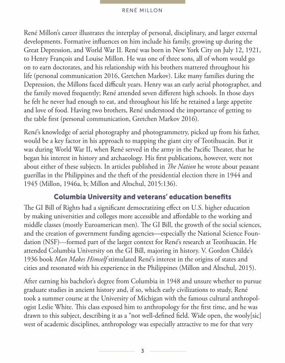
Teotihuacán Map (Millon 1973b, modified by Ian Robertson.)
13
RENÉ MILLON
Millon as mentor
Great scholars are both researchers and teachers. René had some graduate students in archaeology at Rochester, but because he was a generous mentor he did not develop the large cadre that he likely would have had at one of the top graduate programs in archae-ology. He attracted talented students and younger colleagues from other universities to the Mapping Project and to take the opportunity to do their own research with the collections and data.
“The Lab” where the collections were stored and analyzed and the Millons’ apartment in the town of San Juan Teotihuacán were gathering places to discuss Teotihuacán research, meet project members, and Meccas for visiting archaeologists making their own pilgrimages to Teotihuacán. Art historian Esther Pasztory describes the Millons as formidable during her first meeting with them to discuss her dissertation research on Teotihuacán mural painting. “The fact that I was an art historian displeased the Millons. They cross-examined me for nearly an hour.” When convinced she was not a diffusionist—one who posits the spread of cultural traits from one civilization to another—looking for Chinese influences on Teotihuacán art, they came to “amicable terms” with her (Pasztory, 1997:10-11).
René’s classes at Rochester were equally memorable, and both stimulating and intimi-dating for the breadth of his knowledge and reading. He and Ed Calnek co-taught an early civilization course where they compared Teotihuacán and Tenochtitlan; hopefully, someone has archived his/her class notes. René brought three-foot-tall stacks of books and papers to all his classes and expected students to read 300 pages each week and to use the ideas contained within (Starbuck, 2016; personal communication from Martha Sempowski, 2016). Peg Turner (personal communication, 2016) recalls René as the “Fred Astaire of archaeology.” Just as Gordon Willey had shared original data with graduate student Millon, René was equally generous with access to the mapping project data for student researchers. I was neither a student nor collaborator of René’s. His research, however, was foundational to my own investigations of pre-Hispanic urbanism, and like many, I benefitted from his thorough comments and reviews of papers and proposals and his encouragement. He was generous with his time with students, even those from other graduate programs. Michael Spence well expresses the sentiments of others who worked with him as students. “René has that quality, he inspired dedication and enthusiasm, brought us into his evolving view of the city. I count him as my greatest mentor, even though I never took a university course from him" (Michael Spence, personal communi-cation, 2017).
14
RENÉ MILLON
Unfinished business
Big research projects like Teotihuacán depend on the sustained commitment of the lead researchers (Altschul, 1997). Directing the Mapping Project and preparation of the map exhausted René physically and emotionally. The 1973 volumes were intended to be the beginning of a series of publications. With the exception of Volume 3 on the skeletal remains (Sempowski and Spence, 1994), the other volumes never appeared, nor did the detailed reports of the 5,000 sites identified by the Mapping Project within Teotihuacán or the writeups of the test excavations. The publication phase of the project was less centralized than the mapping itself, and consistent funding for this aspect of archaeology is more challenging to obtain. René did not fulfill commitments to other researchers to publish volumes in the Mapping Project series and/or hold others to their publishing obligations (Altschul, 1997:658; Millon and Altschul, 2015:145).
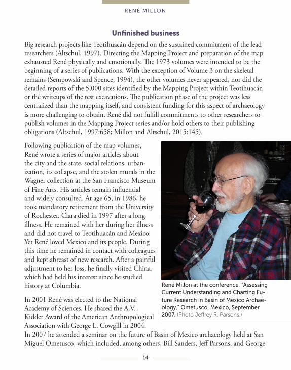
Following publication of the map volumes, René wrote a series of major articles about the city and the state, social relations, urban-ization, its collapse, and the stolen murals in the Wagner collection at the San Francisco Museum of Fine Arts. His articles remain influential and widely consulted. At age 65, in 1986, he took mandatory retirement from the University of Rochester. Clara died in 1997 after a long illness. He remained with her during her illness and did not travel to Teotihuacán and Mexico. Yet René loved Mexico and its people. During this time he remained in contact with colleagues and kept abreast of new research. After a painful adjustment to her loss, he finally visited China, which had held his interest since he studied history at Columbia.
In 2001 René was elected to the National Academy of Sciences. He shared the A.V. Kidder Award of the American Anthropological Association with George L. Cowgill in 2004. In 2007 he attended a seminar on the future of Basin of Mexico archaeology held at San Miguel Ometusco, which included, among others, Bill Sanders, Jeff Parsons, and George
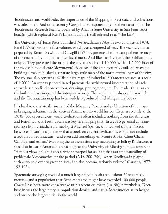
René Millon at the conference, “Assessing Current Understanding and Charting Fu-ture Research in Basin of Mexico Archae-ology,” Ometusco, Mexico, September 2007. (Photo Jeffrey R. Parsons.)

15
RENÉ MILLON
Cowgill (Robertson and Gorenflo, 2015). Although Sanders and René sparred about the role of irrigation and trade in the growth of the city, their shared intellectual curiosity toward understanding the big questions of urbanization and state formation also forged bonds of friendship between them. Papers from the seminar were published in 2015 in a special section of the journal Ancient Mesoamerica, and Jeff Altschul incorporated reflec-tions and background from René in a joint article (Millon and Altschul, 2015). René died on February 22, 2016 at age 94. He is survived by his children David, Marc, and Michele.
Under René’s leadership, the Teotihuacán Mapping project had been carried out on an unprecedented scale and with an unparalleled combination of skill, thoroughness, detail, imagination, and determination to address one of the big questions for archae-ology and the social sciences. Such a project required many talents and collaborators, which René always acknowledged, including his long-time Mexican assistants, Pedro Baños and Ceferino Ortega. Big research projects cannot succeed without leadership, without a vision to ask the important question and develop and execute the research design, without the commitment to carry it through with enthusiasm, attract talented collaborators, and keep the work fresh and exciting with evolving ideas. René’s mapping of Teotihuacán pioneered a new approach to the archaeology of cities. The Teotihuacán Mapping Project produced perhaps the most detailed archaeological dataset for an ancient city anywhere in the world and stands as an unprecedented contribution of 20th century archaeology. The data and collections remain as important today as half a century ago and they will continue to be used by researchers armed with techniques, methods, and theories that did not exist when René began to document the ancient city’s scale and complexity.

16
RENÉ MILLON
REFERENCES
Altschul, J. H. 1997. The Lower Verde Valley Archaeological Project, big projects, and cultural resource management. In Overview, Synthesis, and Conclusions. Edited by S. H. Whittlesey, R. Ciolek-Rorrello, and J. H. Altschul. pp. 639-659. Vanishing River, Landscapes and Lives of the Lower Verde Valley. The Lower Verde Valley Archaeological Project. Tucson: SRI Press.
Andrews, B. 2002. Stone tool production at Teotihuacán: What more can we learn from surface collections. In Pathways to Prismatic Blades: A Study in Mesoamerican Core-Blade Technology, eds. K. G. Hirth and B. Andrews, pp. 47-60. Los Angeles: Cotsen Institute of Archaeology 45. University of California.
Childe, V. G. 1936. Man Makes Himself. London: Watts & Co.
Cowgill, G. L. 2008. How I got to where I am now: One thing after another, a (mostly) linear narrative. Ancient Mesoamer. 19:165-173.
Cowgill, G. L. 2015a. The Teotihuacán Mapping Project: Experiences with data files, big ques-tions, and some research priorities for Teotihuacán. Ancient Mesoamer. 26:153-161.
Cowgill, G. L. 2015b. Ancient Teotihuacán: Early Urbanism in Central Mexico. Cambridge, U.K.: Cambridge University Press.
Fowler, W. R. 2015. Taking stock of Basin of Mexico archaeology in the early twenty-first century: Introduction. Ancient Mesoamer. 26(2):127-129.
Jacobs, J. 1969. The Economy of Cities. New York: Vintage Books.
Millon, C. 1988. Great Goddess Fragment. In Feathered Serpents and Flowering Trees: Recon-structing the Murals of Teotihuacán. Edited by Kathleen Berrin. pp. 226-228. San Francisco: The Fine Arts Museums of San Francisco.
Millon, R. 1946a. Fascism, Philippines style I. The Nation Sep. 21, 1946:320-322.
Millon, R. 1946b. Fascism, Philippines style II. The Nation Oct. 19, 1946:432-434.
Millon, R.1954 Irrigation at Teotihuacán. American Antiquity 20(2):177-180.
Millon, R. 1955. Trade, Tree Cultivation and the Development of Private Property in Land. American Anthropologist 57(4):698-712.
Millon, R. 1957. New Data on Teotihuacán I in Teotihuacán. Boletin del Centro de Investigaciones Antropológicas 4:12-17.

17
RENÉ MILLON
Millon, R.1959. La agriculture como inicio de la civilizacion. In EspLendor del Mexico Antiguo v. 2. Ed. by Carmen Cook de Leonard. pp. 997-1018. Mexico City: Centro de Investigaciones Antropologicas de Mexico,
Millon, R. 1960. The beginnings of Teotihuacán. American Antiquity 26(1):1-10.
Millon, R. and James A. Bennyhoff. 1961. A Long Architectural Sequence at Teotihuacán. American Antiquity 26(4):516-523.
Millon, R. 1964. The Teotihuacán Mapping Project. American Antiquity 29:345-352.
Millon, R. with Bruce Drewitt and James A. Bennyhoff. 1964. The Pyramid of the Sun at Teoti-huacán: 1959 Investigations. Transactions of the American Philosophical Society 55(6):1-93.
Millon, R. 1967 Teotihuacán. Scientific American 216(6):38-48.
Millon, R. 1973a. Urbanization at Teotihuacán, Mexico. Vol. 1: The Teotihuacán Map. Part 1: Text. Austin: University of Texas Press.
Millon, R. with Bruce Drewitt and George Cowgill. 1973b. Urbanization at Teotihuacán, Mexico. Vol. 1: The Teotihuacán Map. Part 2: Maps. Austin: University of Texas Press.
Millon, R. 1976. Social Relations in Ancient Teotihuacán. In The Valley of Mexico: Studies in Pre-Hispanic Ecology and Society. Edited by Eric R. Wolf. pp. 205-248. Albuquerque: University of New Mexico Press.
Millon, R. 1988. Where Do They All Come From? The Provenance of the Wagner Murals from Teotihuacán. In Feathered Serpents and Flowering Trees: Reconstructing the Murals of Teotihuacán. Edited by Kathleen Berrin. pp. 78-113. San Francisco: The Fine Arts Museums of San Francisco.
Millon, R. 1992. Teotihuacán Studies: From 1950 to 1990 and beyond. In Art, Ideology and the City of Teotihuacán. Edited by Janet C. Berlo. pp. 339-419. Washington, DC: Dumbarton Oaks Research Library and Collection.
Millon, R., and J. H. Altschul. 2015. The making of the map: The origin and lessons of the Teoti-huacán Mapping Project. Ancient Mesoamer. 26:135-151.
Parsons, J. R. 1977. Archaeological research 1: Teotihuacán. Latin Amer. Res. Rev. 12:192-202.
Parsons, J. R. 2015. An appraisal of regional surveys in the Basin of Mexico, 1960-1975. Ancient Mesoamer. 26:183-196.

18
RENÉ MILLON
Pasztory, Esther. 1997. Teotihuacán: An Experiment in Living. Norman. OK: University of Oklahoma Press.
Robertson, I. G. 2015. Investigating Teotihuacán Through TMP Surface Collections and Observa-tions. Ancient Mesoamerica 26:663–181.
Robertson, I. G., and L. G. Gorenflo. 2015 Introduction. Ancient Mesoamerica 26:217–133.
Sanders, W. T. & Santley, R. S. 1979. The Basin of Mexico. Ecological Processes in the Evolution of a Civilization. Studies in Archaeology. New York: Academic Press.
Sempowski, M. L., and M. W. Spence. 1994. Mortuary Practices and Skeletal Remains at Teoti-huacán, Vol. 3. Ogden: University of Utah Press.
Starbuck, D. 2016. René Millon. Anthropology News 57:e130–e131. doi:10.1111/AN.36.
Wittfogel, K. A. 1938. Die Theorie der orientalischen Gesellschaft, in: Zeitschrift für Sozialfor-schung, Vol. 7, No. 1/2. Paris: Alcan.
19
RENÉ MILLON
SELECTED BIBLIOGRAPHY
1954 Irrigation at Teotihuacán. American Antiquity 20(2):177-180.
1955 Trade, Tree Cultivation and the Development of Private Property in Land. American Anthropologist 57(4):698-712.
1957 Irrigation Systems in the Valley of Teotihuacán. American Antiquity 23(2):160-166.
1960 The Beginnings of Teotihuacán. American Antiquity 26(1):1-10.
1961 With B. Drewitt. Earlier Structures within the Pyramid of the Sun at Teotihuacán. American Antiquity 26(3):371-380.
With J. A. Bennyhoff. A Long Architectural Sequence at Teotihuacán. American Antiquity 26(4):516-523.
The Northwestern Boundary of Teotihuacán: A Major Urban Zone. In Homenaje a Pablo Martínez del Río, Edited by Ignacio Bernal and others. pp. 311-318. Mexico: Instituto Nacional de Antropología e Historia.
1962 With C. Hall and M. Díaz. Conflict in the Modern Teotihuacán Irrigation System. Comparative Studies in Society and History 4(4):494-524.
1964 The Teotihuacán Mapping Project. American Antiquity 29(3):345-352.
1965 Wth B. Drewitt and J. A. Bennyhoff. The Pyramid of the Sun at Teotihuacán: 1959 Investigations. American Philosophical Society, Transactions vol. 55, pt. 6. Philadelphia: American Philosophical society.
1967 Teotihuacán. Scientific American 216(6):38-48.
Extensión y Población de la Ciudad de Teotihuacán en sus Diferentes Períodos: Un Cálculo Provisional. In Teotihuacán: XI Mesa Redonda. vol. 1. pp. 57-78. Mexico, D. F.: Sociedad Mexicana de Antropología.
Cronología y Periodificación: Datos Estratigráficos sobre Períodos y sus Relaciones con la Pintura Mural. In Teotihuacán: XI Mesa Redonda, vol. 1. pp. 1-18. Mexico, D. F.: Sociedad Mexicana de Antropología.
Urna de Monte Alban IIIA Encontrada en Teotihuacán. Boletín del Instituto Nacional de Antropología e Historia 29:42-44.

20
RENÉ MILLON
1970 Teotihuacán: Completion of Map of Giant Ancient City in the Valley of Mexico. Science 170(3962):1077-1082.
1973 Urbanization at Teotihuacán, Mexico. Volume 1: The Teotihuacán Map. Part 1: Text. Austin and London: University of Texas Press.
With B. Drewitt and G. L. Cowgill. Urbanization at Teotihuacán, Mexico. Volume 1: The Teotihuacán Map. Part 2: Maps. Austin and London: University of Texas Press.
1975 Teotihuacán como centro de transformación. In Las Ciudades de América Latina y sus áreas de influencia a través de la historia. Compiled by Jorge E. Hardoy and Richard P. Schaedel. pp. 19-26. Buenos Aires: Ediciones S.I.A.P., Ediciones Nueva Visión.
1976 Chronological and Developmental Terminology: Why They Must Be Divorced. In The Valley of Mexico: Studies in Pre-Hispanic Ecology and Society. Edited by Eric R. Wolf. pp. 23-27. Albuquerque: University of New Mexico Press.
Social Relations in Ancient Teotihuacán. In The Valley of Mexico: Studies in Pre-Hispanic Ecology and Society. Edited by Eric R. Wolf. pp. 205-248. Albuquerque: University of New Mexico Press.
1981 Teotihuacán: City, State and Civilization. In Supplement to Handbook of Middle American Indians, vol. 1. Edited by Jeremy A. Sabloff. pp. 198-243. Austin: University of Texas Press.
1986 The Last Years of Teotihuacán. In The Collapse of Ancient States and Civilizations. Edited by George L. Cowgill and Norman Yoffee. Albuquerque: University of New Mexico Press.
Descubrimiento de la procedencia en Teotihuacán de las pinturas murals saqueadas con representaciones de personajes llevando el tocado de borlas, In Memoria del Proyecto Arqueológico Teotihuacán 80-82, vol. 2. Edited by S. Cabrera C., I. Rodriguez G., and N. Morelos G. Mexico, D. F.: INAH.
Where Do They All Come From? The Structures at Teotihuacán from which Bequest Murals Were Taken. In Teotihuacán Murals. Edited by Kathleen Berrin, San Francisco:The Fine Arts Museums of San Francisco.
Co-author Sugiyama, Saburo. Concentración de pinturas murals en conjunto arqui-tectónico grande al este de la Plaza de la Luna en Teotihuacán, in Memoria del Proyecto Arqueologico Teotihuacán 80-82, v. 2, edited by R. Cabrera et al., Mexico, D. F.: INAH
21
RENÉ MILLON
Published since 1877, Biographical Memoirs are brief biographies of deceased National Academy of Sciences members, written by those who knew them or their work. These biographies provide personal and scholarly views of America’s most distinguished researchers and a biographical history of U.S. science. Biographical Memoirs are freely available online at www.nasonline.org/memoirs.