RELOCATION OF GRESHAM
19
6/8/2010 1 RELOCATION OF GRESHAM FIRE STATION #76 Mike Shelby | Annie Scriven | Andrea Consalus Background of Project ¤ Wanted to do a project that was meaningful ¤ Contacted Molly Vogt, GIS Manager at City of Gresham ¤ Informed of a need for a GIS analysis with the “severely underfunded” Gresham Fire Department City of GRESHAM
Transcript of RELOCATION OF GRESHAM
6/8/2010
1
RELOCATION OF GRESHAM FIRE STATION #76
Mike Shelby | Annie Scriven | Andrea Consalus
Background of Project
¨ Wanted to do a project that was meaningful
¨ Contacted Molly Vogt, GIS Manager at City of Gresham
¨ Informed of a need for a GIS analysis with the “severely underfunded” Gresham Fire Department
City of
GRESHAM
6/8/2010
2
Meeting with Chief Scott Lewis
¨ Have funds to relocate Station #76 starting July, 2010
¨ Current site is too small, in disrepair
¨ Where should Station #76 be moved to?
¨ Fire station location is often a happening rather than a plan… for Station 76 this time he wants it to be a plan
Gresham Fire Department
¨ Multnomah County Fire District #10 service area
¨ Operates six fire stations within its service area and one shift in a shared Portland station
¨ Each engine is staffed and equipped as an Advanced Life Support (ALS) unit

6/8/2010
3
Gresham Fire Department
¨ Provides life safety services to city residents and contract districts for residents living in the cities of Gresham, Fairview, Troutdale, Wood Village and areas of unincorporated Multnomah County
¨ Each fire station responds to calls within its fire management area (FMA) with few exceptions to assist with other areas
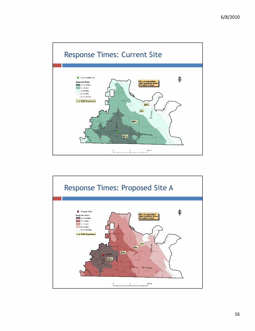
¨ Goal response time: FOUR MINUTES OR LESS
Data
¨ Fire station locations
¨ Fire management areas
¨ City boundaries
¨ County boundaries
¨ Taxlots
¨ TAZ (Transportation Analysis Zones) current/projected population
¨ Roads
6/8/2010
4
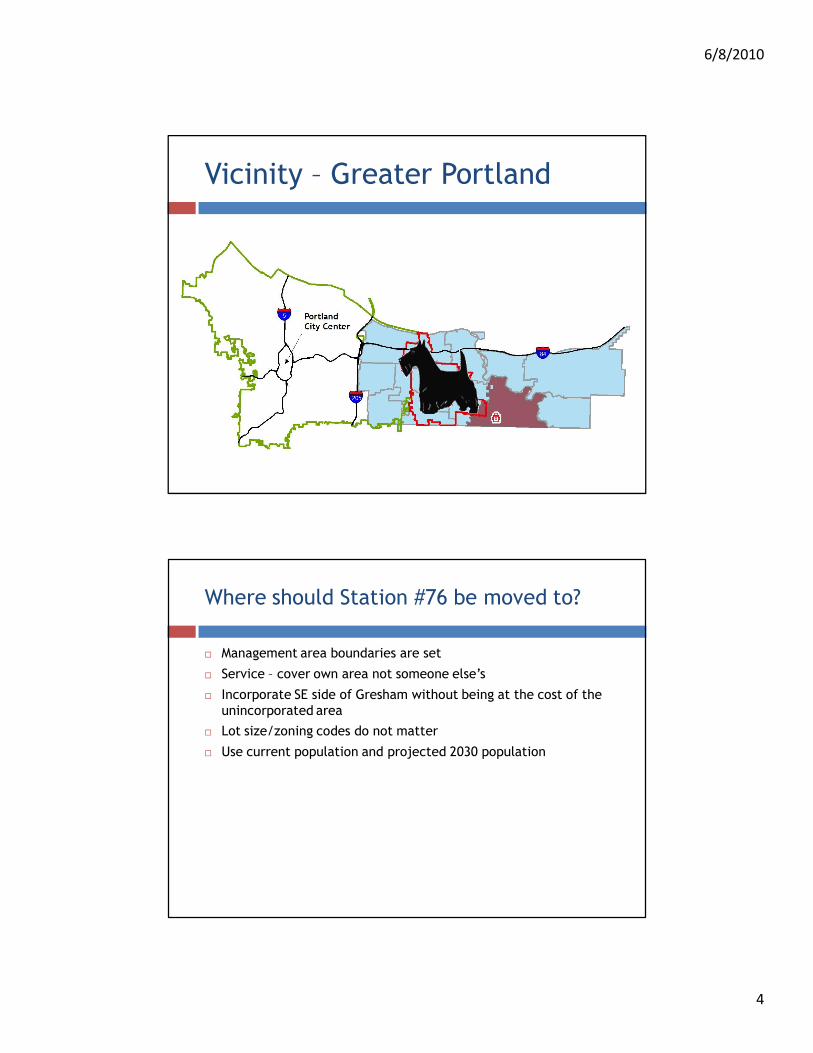
Vicinity – Greater Portland
Where should Station #76 be moved to?
¨ Management area boundaries are set
¨ Service – cover own area not someone else’s
¨ Incorporate SE side of Gresham without being at the cost of the unincorporated area
¨ Lot size/zoning codes do not matter
¨ Use current population and projected 2030 population
6/8/2010
5
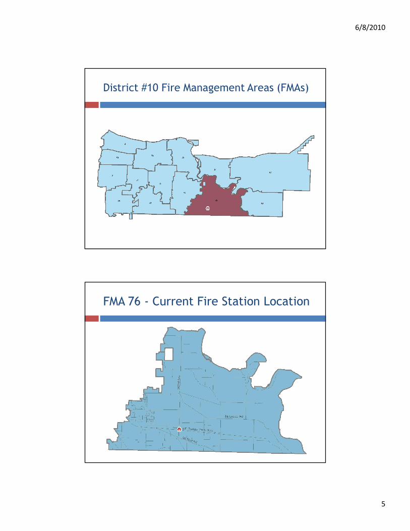
District #10 Fire Management Areas (FMAs)
FMA 76 ‐ Current Fire Station Location
6/8/2010
6
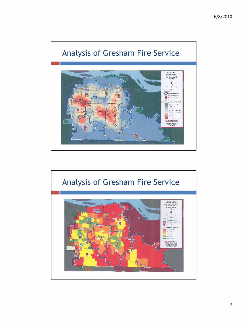
Analysis of Gresham Fire Service
¨ ECONorthwest (ECO) consulting company completed the report in February, 2010 ¤ Provided snapshot of service demand and response times ¤ Identified trends over the past five years ¤ Predicted future changes in demand
¨ Historical call data from every call from FY 04‐05 to 08‐09 provided by the City of Portland Bureau of Emergency Communications (BOEC) ¤ Location and type of call and time stamps for each step of the response:
n Call received n Dispatched n En‐route n On scene n Cleared
¨ Forecasts for population growth from MetroScope to predict where growth will occur through the year 2030
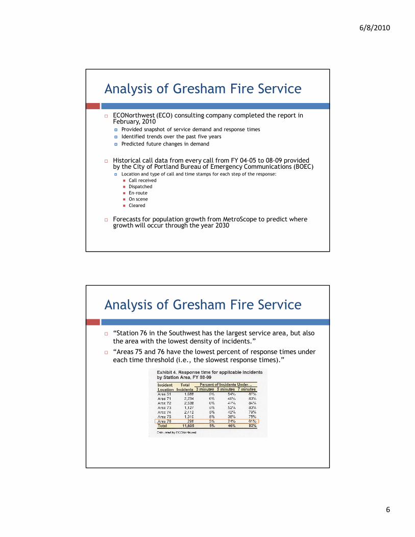
Analysis of Gresham Fire Service
¨ “Station 76 in the Southwest has the largest service area, but also the area with the lowest density of incidents.”
¨ “Areas 75 and 76 have the lowest percent of response times under each time threshold (i.e., the slowest response times).”
6/8/2010
7
Analysis of Gresham Fire Service
Analysis of Gresham Fire Service
6/8/2010
8
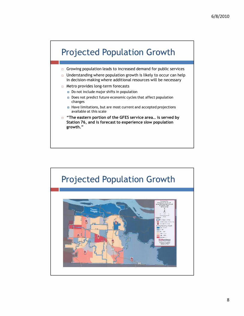
Projected Population Growth
¨ Growing population leads to increased demand for public services
¨ Understanding where population growth is likely to occur can help in decision‐making where additional resources will be necessary
¨ Metro provides long‐term forecasts ¤ Do not include major shifts in population
¤ Does not predict future economic cycles that affect population changes
¤ Have limitations, but are most current and accepted projections available at this scale
¨ “The eastern portion of the GFES service area… is served by Station 76, and is forecast to experience slow population growth.”
Projected Population Growth
6/8/2010
9
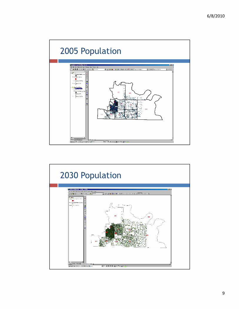
2005 Population
2030 Population
6/8/2010
10
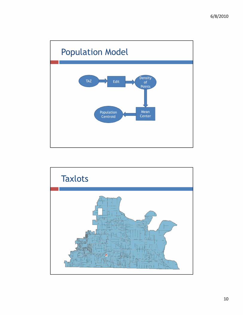
Population Model
TAZ Edit Density
of Points
Mean Center
Population Centroid
Taxlots
6/8/2010
11
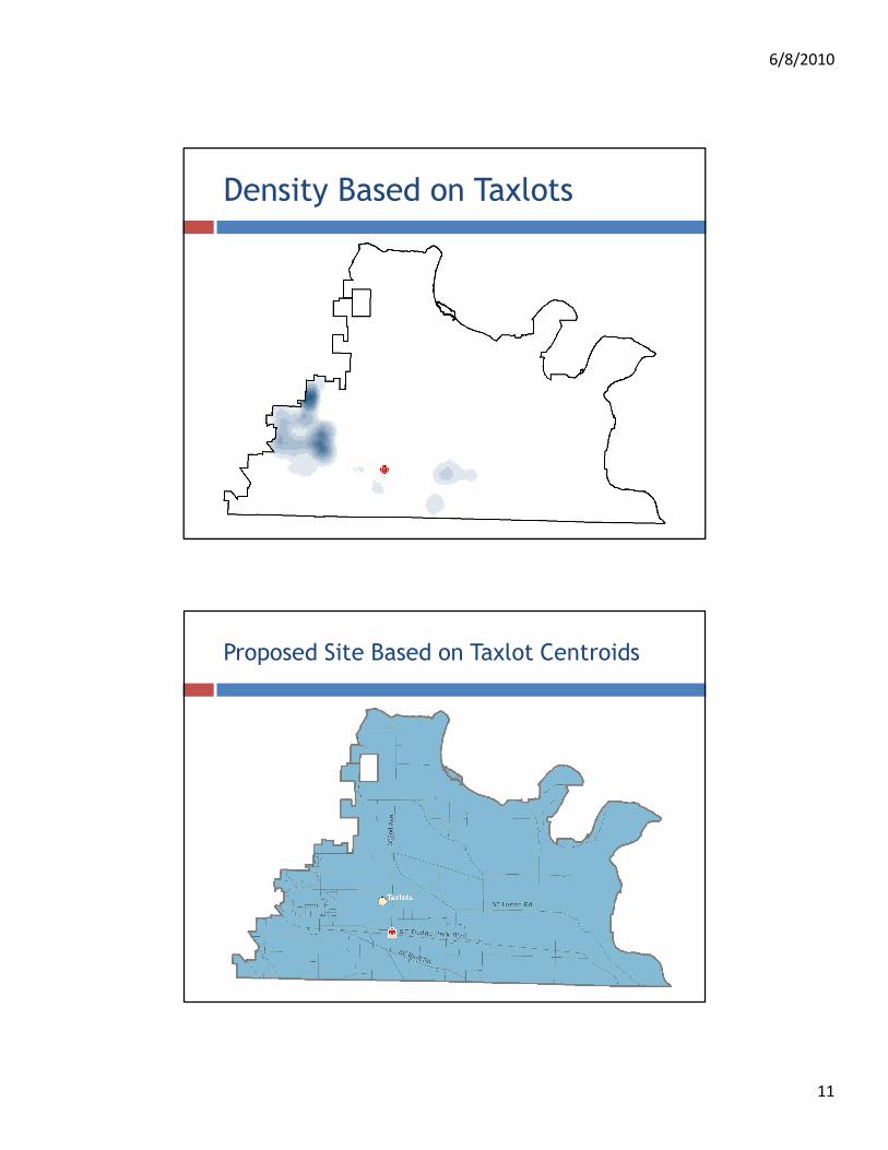
Density Based on Taxlots
Proposed Site Based on Taxlot Centroids
6/8/2010
12
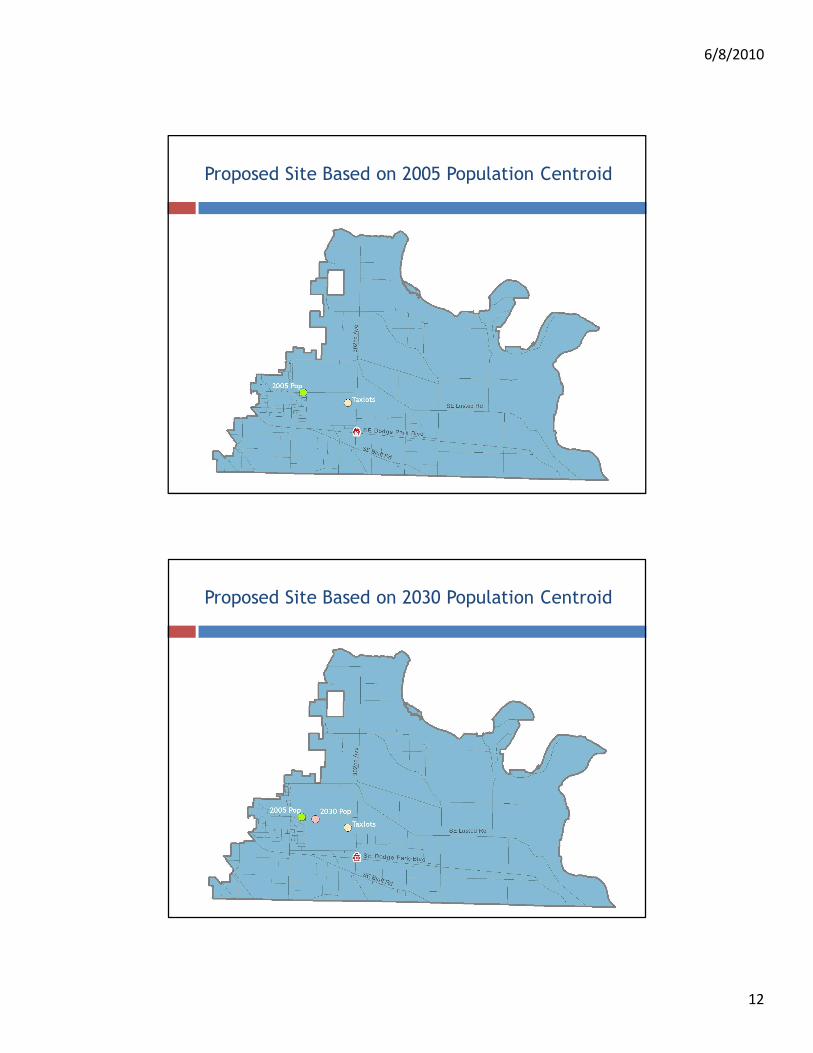
Proposed Site Based on 2005 Population Centroid
Proposed Site Based on 2030 Population Centroid
6/8/2010
13
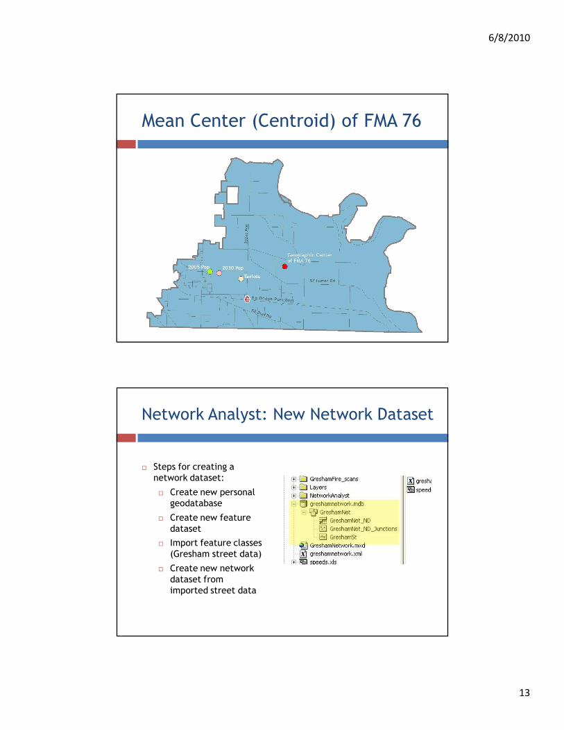
Mean Center (Centroid) of FMA 76
Network Analyst: New Network Dataset
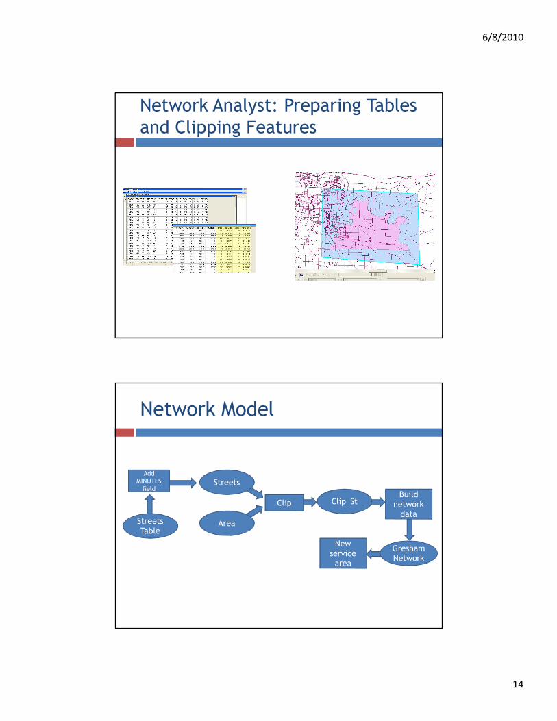
¨ Steps for creating a network dataset:
¨ Create new personal geodatabase
¨ Create new feature dataset
¨ Import feature classes (Gresham street data)
¨ Create new network dataset from imported street data
6/8/2010
14
Network Analyst: Preparing Tables and Clipping Features
Network Model
Clip
Streets
Area
Clip_St Build
network data
Gresham Network
New service
area
Streets Table
Add MINUTES
field
6/8/2010
15
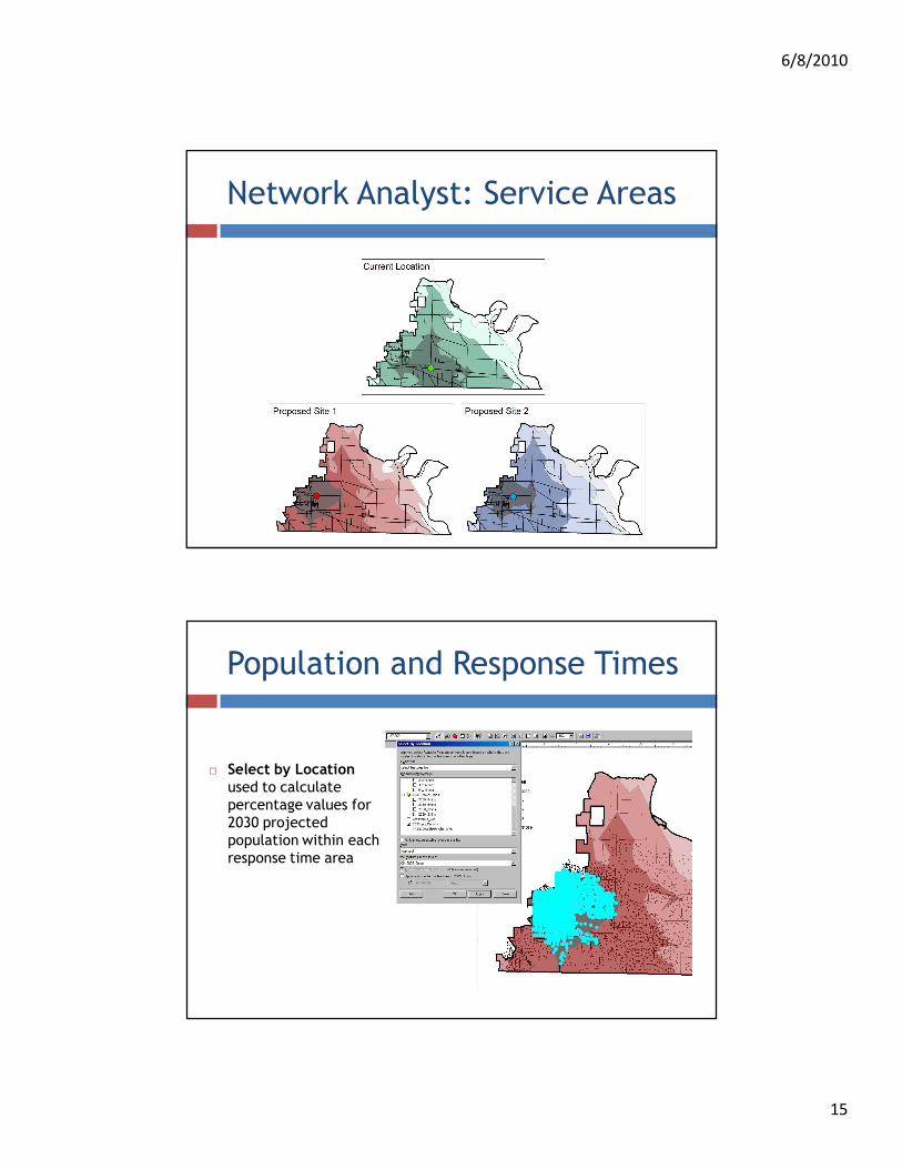
Network Analyst: Service Areas
Population and Response Times
¨ Select by Location used to calculate percentage values for 2030 projected population within each response time area
6/8/2010
16
Response Times: Current Site
Response Times: Proposed Site A
6/8/2010
17
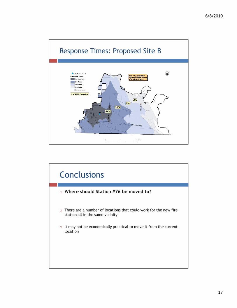
Response Times: Proposed Site B
Conclusions
¨ Where should Station #76 be moved to?
¨ There are a number of locations that could work for the new fire station all in the same vicinity
¨ It may not be economically practical to move it from the current location
6/8/2010
18
Limitations
¨ Because we don’t actually know where the population will be increasing, it is difficult to predict where increased emergencies will occur in the next 20 years
¨ Information regarding future zoning
¨ We did not have access to the actual travel time data nor the data created from the consultant study
¨ Traffic Analysis Zones (TAZ) were the smallest census areas available but still very large for our area of study
¨ Most of FMA 76 is unincorporated county and therefore data was limited
¨ Knowledge: If we knew what we know now…
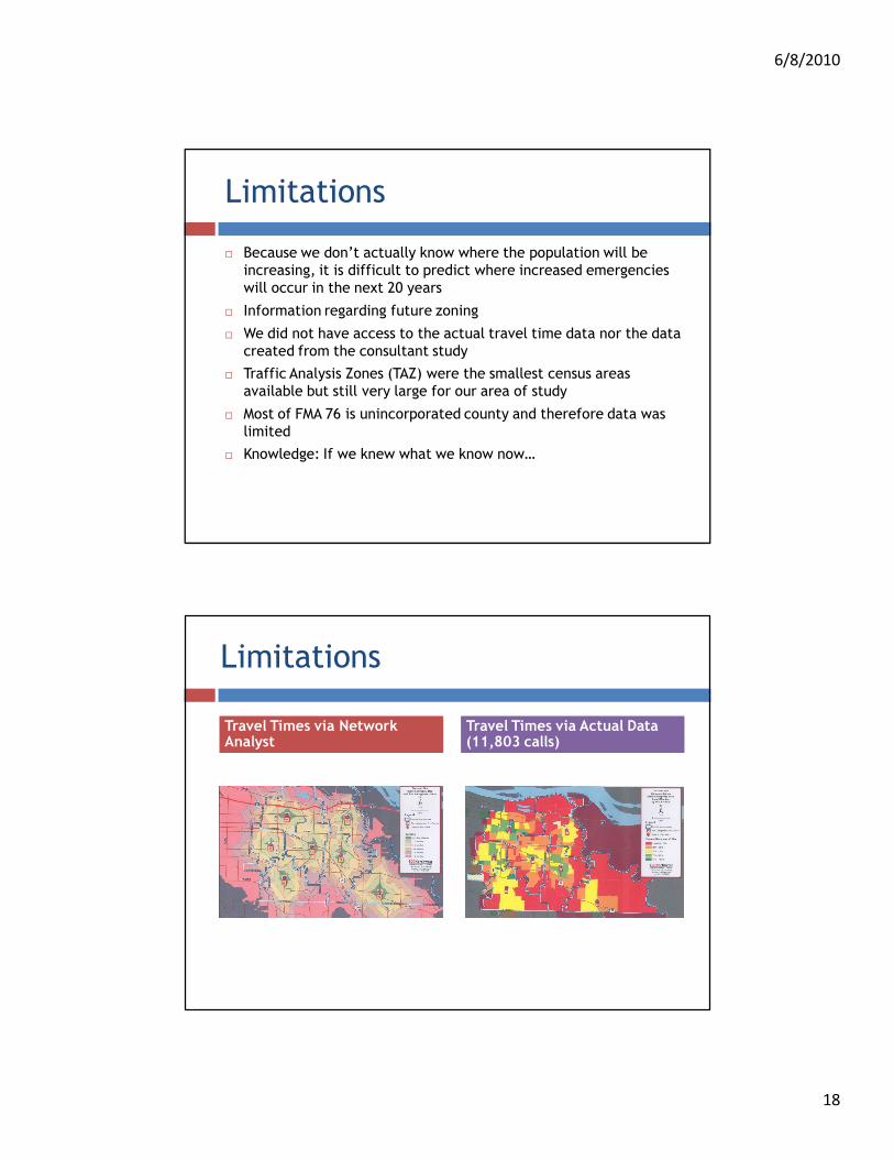
Limitations
Travel Times via Network Analyst
Travel Times via Actual Data (11,803 calls)
6/8/2010
19
Further Study
¨ Spatial Analyst
¨ Incorporate land uses into 2030 population dasymetric maps
¨ Reevaluate with 2010 census data
¨ Reevaluate with actual travel times for the past ten years
¨ Consider lot size and zoning for station location
Questions?