Regional Water Resources Planning Guidelines for … Regional Water Resources Planning Guidelines...
30
Regional Water Resources Planning Guidelines for Tennessee March 2013
Transcript of Regional Water Resources Planning Guidelines for … Regional Water Resources Planning Guidelines...

Regional Water Resources Planning Guidelines
for Tennessee
March 2013

i
Regional Water Resources Planning Guidelines for Tennessee
Contributors
Tennessee Department of Environment & Conservation
Elaine Boyd, Director of Strategic Management Alan Leiserson, Director of Legal Services Alan Schwendimann, Chief Deputy Director, Division of Water Resources
Tennessee Wildlife Resources Agency
David McKinney, Chief of Environmental Services Pandy English, In-stream Flow Coordinator
U.S. Army Corps of Engineers, Nashville District
Ben Rohrbach, Chief, Hydrology and Hydraulics Branch Sue L. Ferguson, Project Manager
Tennessee Advisory Commission on Intergovernmental Relations
Lynnisse Roehrich-Patrick, Executive Director Bill Terry, Senior Research Consultant Ben Smith, Senior Research Consultant
Tennessee Association of Utility Districts
Bob Freudenthal, Executive Director
The Nature Conservancy
Sally Palmer, Director of Science
U.S. Geological Survey Water Science Center
W. Scott Gain, Director John A. Robinson, Hydrologist Michael W. Bradley, Assistant District Chief, Hydrologic Studies

0
REGIONAL WATER RESOURCES PLANNING GUIDELINES FOR TENNESSEE
WHY REGIONAL PLANNING
In 2007 and 2008, Tennessee suffered a drought of record in many parts of the state. In the late spring and early summer of 2012, we found ourselves once again facing the threat of a serious drought with some reservoirs at lower levels than they were at the comparable point in 2007. Even though the state managed through those extreme conditions, there was a desire to be better prepared for both this kind of scarcity and the stress that growth and development are placing on water resources in some communities.
There are many reasons to engage in regional water supply planning. The first is that the Tennessee General Assembly, in 2002, directed state agencies to encourage it:
The Commissioner [of the Department of Environment and Conservation] and the [Water Quality, Oil and Gas] Board shall encourage and support regional water planning whenever possible. In the future, if there is a specific appropriation of state or federal funds for regional water supply planning, the board may require regional water supply planning and may provide incentives to encourage such regional planning, using the rulemaking authority under this part for so long as such specific appropriation is in effect. Among other criteria, state agencies are authorized to consider regional planning and regionalization efforts when awarding grants, making loans or funding projects. Tenn. Code Ann. § 69-7-308(a)
The Water Resources Technical Advisory Committee (WRTAC) appointed by the Commissioner pursuant to Tenn. Code Ann. § 69-7-309 identified the following likely benefits of regional water resource planning:
increasing system flexibility during droughts through sharing water resources that remain viable;
preparing for the uncertainty of climate variability;
encouraging utilities and municipalities/counties to work together to address water resource and supply issues;
increasing sustainability by minimizing demand on resources;
eliminating duplicate solutions and promoting efficiency;
providing funding advantages for utilities, municipalities, counties, and ultimately citizens.
The WRTAC recommended two regional water-resource planning pilot studies to validate those benefits and develop regional water planning guidelines for the state.
Another benefit of regional water planning is that it facilitates permitting for the projects chosen in the planning process. A public water system often must obtain a permit from the Tennessee Department of Environment and Conservation (TDEC) to implement a plan, for example, for water withdrawals or
Regional Water Resources Planning Guidelines for Tennessee Page 1
impoundments. Those permits generally require the applicant and the department to consider alternatives to the proposed action and their impacts on water resources and the environment.
A regional plan that adequately analyzes the alternatives and their impacts will be given additional consideration during permit review. A high quality regional plan could help a permit application that is consistent with it or hurt an application that is inconsistent with it. Early engagement of TDEC in the regional planning effort may also help facilitate the permitting and granting processes. TDEC can comment on how the region is structured and potential alternatives before extensive time and effort has been spent on the plan. Involving TDEC early in the process may work in favor of the selected alternative or create a disincentive for water systems to pursue options that are inconsistent with the selected alternative. Of course, early involvement of TDEC does not take the place of the formal permitting process.
The WRTAC recommends that state agencies do more to encourage regional planning to carry out the authorization in § 69-7-308. Some of these recommendations may require legislative or rulemaking action. In particular, the WRTAC makes these recommendations:
Establish an independent body comprised of people from governmental agencies, universities, and non-governmental organizations to review and make recommendations on proposed regional water plans.
Evaluate the substance of regional water plans, considering the quality of the work performed, rather than just checking off a list of required items. This evaluation should cover everything in the process, including the determination of how a region is comprised, the alternatives evaluated, and the methodology used to evaluate alternatives.
Designate a state agency to make the final decision approving regional water plans.
Consider approved regional water plans when awarding grants, making loans, and funding projects. This consideration should include giving some advantage to projects that are consistent with an approved plan and disadvantage those that are inconsistent.
Purpose of this Report
In late 2008, TDEC partnered with the Nashville District of the U.S. Army Corps of Engineers (USACE), members of the WRTAC and other regional planning experts to initiate a water resources planning pilot in two areas significantly affected by the 2007-2008 drought: the North Central Tennessee region (Sumner County, including Portland, Gallatin, Castalian Springs/Bethpage, Westmoreland, and White House plus the portion of Robertson County served by the White House Utility District) and the Southern Cumberland region (portions of Franklin, Grundy, Marion, and Sequatchie counties and the towns of Tracy City, Sewanee, Altamont, and Monteagle). The specific implementation information and final recommendations of the pilot studies were outlined in two reports: South Cumberland Regional Water Resources Planning Study and the North Central Tennessee Regional Water Resources Planning Study. Taking on these two studies allowed the team to develop and apply the same general principles and process in two very different study areas.

Regional Water Resources Planning Guidelines for Tennessee Page 2
These guidelines include recommended procedures for regional planning that should be utilized in other regions across the state.
Regardless of the location of the region, or the water resource issues to be addressed, several principal steps must be taken in the planning process:
Climate Variability
The possible effects of climate variability must be considered in regional water resources planning and decision making. Although these effects may be significant in the future, the uncertainties associated with specific climatic projections are large enough today to make them unworkable as a guide to decision-making. Further, the uncertainties associated with climate are only one aspect of a large realm of unknowns inherent in long-range planning. These other sources of uncertainty by themselves dictate the need for a conservative approach in weighing options that direct resources and determine outcomes beyond a few years into the future.
The planning approach recommended in this document accommodates climate and other uncertainties by adopting two principal practices. First is to allow extra margins of safety by establishing system reserve capacities because future conditions may exceed historical extremes. Second is to engage in planning as a continuing and adaptive process, routinely revisiting and revising plans as new and more precise information becomes available. This combined approach provides reserve capacity and the flexibility to respond to future changing conditions as certainty improves.
DEFINE THE REGION AND
IDENTIFY AND ENGAGE
STAKEHOLDERS
Determine the geographic boundaries of the region and determine the stakeholders to be involved in and informed of the process (decision makers, engineers, ratepayers, permit issuers, etc.)
ASSESS EXISTING SOURCES
AND SYSTEMS
Define existing sources, their yields and uses, as well as the relationships among them, and the utilities’ financial capabilities.
DEFINE AND EVALUATE
ALTERNATIVES AND SELECT
THE BEST PLAN
Define and evaluate proposed alternatives for infrastructure requirements, environmental impacts, and the financial effect that the alternatives would have on ratepayers. Consider comments of stakeholders on the alternatives evaluated and determine the best plan.
IMPLEMENT THE BEST PLAN
PROJECT FUTURE UNMET
NEED
Develop population and demand projections to determine unmet water supply need.
Determine the steps required to implement the plan.

Regional Water Resources Planning Guidelines for Tennessee Page 3
Other Resources
Other states have recognized the benefits of a regional approach to water supply planning and implemented policies and programs as a result. Some information about other states’ efforts is available at
Texas—http://www.window.state.tx.us/specialrpt/water/planning.php
Florida—http://www.dep.state.fl.us/secretary/watman/default.htm
Georgia—http://www.georgiawaterplanning.org/
Illinois—http://www.isws.illinois.edu/wsp/
In addition, the Tennessee Advisory Commission on Intergovernmental Relations published a nine-state study of water resources planning by the University of Tennessee’s Institute for a Secure and Sustainable Environment in 2010. The experiences of other states provide some important considerations; however, it is up to Tennessee to plot its own path forward in water supply planning.
TDEC, in partnership with USACE, has acquired a multi-criteria decision-making model called OASIS (Operational Analysis and Simulation of Integrated Systems) that can be used free of charge by anyone in Tennessee to evaluate the water supply sufficiency of a region. It also provides a consistent platform to evaluate alternatives. The OASIS model is supported by the Center for the Management, Utilization, and Protection of Water Resources at Tennessee Technological University and is available at the following link: http://www.tnporws.org.
Summary
The need for water resource regional planning is undeniable. It is critical to sustain our natural and cultural resources, many of which contribute to the unique identity of the state. Likewise, it is critical to our fiscal sustainability and prosperity—the attraction of visitors, new residents and companies to the distinctive beauty of Tennessee.

Regional Water Resources Planning Guidelines for Tennessee Page 4
DEFINE THE REGION AND IDENTIFY AND ENGAGE STAKEHOLDERS
A water supply plan will be considered regional in nature if it includes multiple water supply and distribution systems. The regional nature of a plan may be demonstrated by defining water resources issues across systems or by developing potential solutions across regions or by doing both.
Representatives of the systems in the region will be the partners working on the plan, but plans coordinated with stakeholders and with local and state agencies have the best chance at successful implementation. A regional plan intended to be the basis for a permit application with the State of Tennessee should be discussed with representatives of TDEC in the initial phases of the planning process.
Define the Region
Identifying the region is the first step in developing any water supply plan. The size and characteristics of the region are directly related to problems, opportunities, and potential solutions. Depending on the geography; existing water supplies and use; watershed, political and utility boundaries; connections
between utilities; and the goals of a region; the area may be defined in several ways.
One good approach is to use the service area of the primary utility system(s) of concern. Adjacent utility systems, particularly those with water production capabilities and utilities that regularly purchase water from or sell water to the primary system(s) should be included. Even when the planning region is based primarily on service area boundaries, they will be grouped within natural boundaries such as watersheds.
Defining the planning region to include utilities that use common water resources facilitates the assessment of potential solutions to the water resources concerns, and
potential impacts on them, consistent with the natural systems in the region. This is especially important in areas where there are Exceptional Tennessee or Outstanding National Resource Waters (http://environment-online.state.tn.us:8080/pls/enf_reports/f?p=9034:34304:4321823005410452) or where threatened or endangered species are known to exist. Whether the planning region is defined primarily by service area or based on common water resources, potential impacts on the environment and other systems must be considered.
Regions may be expanded or reduced in size as the water supply plan is developed. During the North Central Tennessee Planning Study, the region was initially defined by the service areas of White House and Castalian Springs/Bethpage utility districts and the cities of Gallatin, Portland, Westmoreland, Lafayette and Hartsville, which covered a five-county geographical region including portions of Robertson, Sumner, Macon, Smith and Trousdale counties. However, after a preliminary evaluation of each of the existing utility systems and their interconnections, the study focus narrowed to exclude Lafayette and Hartsville, Macon, Smith and Trousdale counties, and most of Robertson County. The remaining utilities were included for further study because of their many interconnections with each other and because they buy and sell water to each other in significant quantities daily. During
Expertise needed on the
study team:
engineering
finance
legal
planning
environmental
operational experience in water systems

Regional Water Resources Planning Guidelines for Tennessee Page 5
evaluation of the potential growth in water demand, compared to existing supply for each utility, it was discovered that only Portland was approaching the limits of their existing supply. The study focus narrowed again to include only Portland and those utilities that had existing connections or could reasonably connect with them.
There may be circumstances where the initial concept for the scope of the region should be expanded to include other viable water supply sources. Defining a broader scope for the region may be necessary to lessen the competitive demands on ecologically sensitive water resources.
Identify and Engage Key Stakeholders
Another critical step when initiating a regional water resources planning process is defining the key stakeholders. Utility managers, staff and consulting engineers, local government representatives, state representatives, state and federal permitting or funding agency representatives, non-government organizations, water customers, citizen coalitions, members of the public, and news media may all play important roles in various stages of regional water resources planning, development, and implementation. When water systems rely on reservoirs owned and operated by USACE or the Tennessee Valley Authority (TVA) as their water sources, or where potential solutions to water resources issues may rely on such reservoirs, representatives from these agencies should be included in this list of key stakeholders. Academic institutions can also be valuable sources of knowledge and expertise in water resources planning. Involving academia in the planning process may make it possible to obtain support at a reduced cost compared to contract engineering services.
Involving key stakeholders early in the process and keeping them involved throughout the process helps ensure that appropriate water resources-related data are considered, the proposed plan or solution to the problem has broad support throughout the region, and hurdles to implementing the plan or solution are identified and addressed.
Public meetings are one method recommended for stakeholder communication and coordination. The list of invitees can be tailored to fit each phase of planning process. For example, in the early stages of regional planning, a broad cross section of stakeholders should be invited, including members of the general public. The purpose would be to introduce the intent and goals of the plan, assess initial reaction, and gather feedback. As planning and study progress, meetings can be held with specific stakeholder groups most relevant to the task or issue at hand. Updates on progress between meetings should be provided and can be delivered by such means as a study-specific web page, share-point, wiki, or simply an email distribution list.
Direct communication with water customers is also important. The evaluation and selection of the best plan or solution should include consideration of customer opinion and the potential effect on water rates. Water customers will need access to all of the key considerations that influence selection of the plan. A robust, multifaceted public involvement program to inform water customers is a must. Flyers and notices can be included with billing statements or information can be mailed separately or posted on websites.
Large study regions or complicated evaluations may require the formation of steering committees or a series of public workshops and meetings may be held such as those organized by the Duck River Agency (http://duckriveragency.org/) in its evaluation of potential water supply options.

Regional Water Resources Planning Guidelines for Tennessee Page 6
ASSESS EXISTING SOURCES AND SYSTEMS
A full understanding of the utility systems in the planning region including their characteristics, existing water sources, current operational conditions, relationships to other systems, drought and conservation plans, and financial health is essential to understanding potential needs and determining how to meet them. Sound analysis and informed decisions require accurate and reliable data. High quality
operational and engineering data help water utilities more accurately define potential needs and thus help to ensure that a safe, reliable water supply is available at a reasonable cost to customers. Good data is good business.
Assessing system losses is also critical to a regional water supply study or plan. Tennessee has established acceptable water loss limits, which are explained at http://www.comptroller.tn.gov/umrb/. Bringing losses within this limit can lessen or eliminate the need to pursue additional supply. It can also save money. Treated water lost is money down the drain.
Understand the Yield of Existing Water Sources
Existing sources of water in Tennessee are principally of three general types: surface-water reservoirs, free-flowing streams, and ground-water aquifers. In many cases, a single one of these may be sufficient to meet the water needs of a community or region, but at times, a combination of sources may be required to overcome periodic limitations or to mitigate the undesirable characteristics of a single source. Reservoirs, for example, may with adequate planning provide very reliable supplies of water through both wet and dry periods but may require significant investment in infrastructure to build and access and may be subject to contamination, taste, and odor problems, or other water-quality limitations if not properly protected and managed. Free-flowing streams on the other hand are widely available with typically lower investment in infrastructure but in most places are subject to large seasonal variations in flow that make them less than dependable during long dry periods or when demands are high. Smaller streams may also be subject to water quality issues that increase the complexity and cost of treatment—particularly the increase in sediment, bacteria, or surface-water contamination that sometimes occurs at high flows. Groundwater can provide some of the most reliable and high-quality water in Tennessee, but the areas where this is feasible for large public supply are geographically limited. Groundwater sources are typically slow to respond to seasonal or multi-year changes in weather but quality, particularly hardness, can be a recurring problem made worse by overuse.
The unique natural characteristics of each of the principal sources of water in Tennessee and the particular infrastructure required to develop them produce unique patterns of susceptibility to failure that constrain their overall reliability in different ways. Estimating the yield that can be derived from each source with reliable consistency (or certainty) is essential to objective comparison and selection of
Typical Data for Technical Analyses of Water Availability and Need
Operational Data Technical Data
Daily water withdrawal patterns Historical or simulated rainfall
Commercial and industrial use Historical or simulated stream flow
Non-revenue water estimates Reservoir volume curves
Treatment plant capacities Population growth projections
Elevation of water intakes Water demand projections
Minimum flow or release requirements

Regional Water Resources Planning Guidelines for Tennessee Page 7
alternatives actions. Ultimately, the determination of reliable yield for water resources planning depends on, among other things, the frequency with which the source is projected not to meet demand, the existence of alternate or emergency water sources, the capacity or yield of those emergency sources, the amount of storage in the distribution system, and the ability of the community to enact demand management or drought mitigation measures.
Reservoir or Lake Sources
Determining the potential yield of existing sources includes defining the critical drought for each source and evaluating the impact of the critical drought on the source. The critical drought is the historic drought that had or would have the greatest impact on the source if it were to re-occur. It is determined by examining the historical record of rainfall in the region and evaluating how the water source responds to that historical record. A good source of data related to weather and climate, including rainfall, is the National Oceanographic and Atmospheric Administration’s National Climatic Data Center (http://www.ncdc.noaa.gov/oa/ncdc.html).
With large reservoirs, such as Chickamauga Lake or Old Hickory Lake, part of a complex system, defining the critical drought for the specific reservoir will likely be beyond the scope of regional water supply studies or plans. The yield of those reservoirs depends on the operation of an entire system, some portion of which may not be subject to the same drought conditions. When evaluating these large systems for water supply use, it should be understood that they must address a wide array of objectives beyond water supply, for example flood risk management, navigation, water quality, hydropower production, and recreation. Consequently, close coordination with representatives from the agencies operating these systems is essential to address questions of source sufficiency or availability, applicable regulatory requirements, real estate considerations, and whatever agreements may be required when considering them as potential solutions to water resources.
In the case of smaller reservoir sources, total usable storage (the volume between the normal elevation of the pool and the lowest operating level of any intakes) should be estimated based on the reservoirs’ elevation-storage curves, which are graphical representations of how the volume (storage) in the reservoir changes with elevation or stage. Each elevation, or stage, in the reservoir has a specific volume starting at zero (no storage at all) at the very bottom of a reservoir and ranging upward to the greatest volume at the normal pool elevation. Above the normal pool to the top of dam, the reservoir volume is generally filled with water only for a short time during flood events.
The volume of water available for withdrawal (usable storage) is calculated by subtracting the volume in the reservoir below the elevation of the water supply intake from the volume of the reservoir at normal pool. Accurate estimates of total reservoir volume, useable storage, and the reservoir elevation-storage
Regional Water Resources Planning Guidelines for Tennessee Page 8
curve are important and should be based on recent surveys of the bottom of the reservoir. Even small errors can have a dramatic effect upon the estimated potential yield of the reservoir as a water supply source.
Firm yield should be estimated for each existing reservoir source in the study region. For a reservoir source with a known usable storage volume, the firm yield represents the constant daily withdrawal that causes the useable storage to be exactly emptied during the historical drought of record and allow (the reservoir to completely refill. If the reservoir cannot refill after being completely emptied, then the firm yield is the maximum that can be removed and allow it to refill. Ideally, firm yield is estimated using historical inflow to a reservoir calculated from reservoir operations data (pool elevation, discharge, and stage/storage curve) or a stream flow gage. In the absence of either, watershed hydrology should be developed using software capable of appropriately simulating watershed response to rainfall across the period of record such as the U.S. Army Corps of Engineers Hydrologic Modeling System, HEC-HMS (http://www.hec.usace.army.mil/). Firm yield estimates depend on the set of meteorological conditions (and also basin and reservoir characteristics) that represent the critical drought. Because estimates are highly dependent on the length of the historical record, it is important to use as long a record as possible (stream gage, reservoir operations, or rainfall) when developing the historical inflow to a reservoir source. Once the inflow is determined, the firm yield can be estimated using options ranging from a spreadsheet calculation to proprietary commercial software packages such as OASIS or STELLA (http://www.iseesystems.com/softwares/education/stellasoftware.aspx). The firm yield calculation should include estimates of reservoir leakage, or minimum releases required for environmental protection, other withdrawals, recreation, etc.
Because firm yield represents the theoretical maximum amount of water that can be withdrawn from a reservoir source during a reoccurrence of the historical drought of record, it leaves no margin for error. Utilities should never plant to routinely operate to the firm yield limit. Instead, water supply plans should include a margin of safety to account for uncertainty in demand projections, climate variability, and water treatability, for example. A margin of safety can also account for inaccuracies in the record of performance kept by the utility system, or a lack of rainfall data for the watershed being evaluated. Other inaccuracies can occur if the historical record is from a time of above or below average rainfall (wet or dry periods).
One way to apply a margin of safety to account for these uncertainties and inaccuracies is to reserve a percentage of usable storage in a reservoir when estimating the reservoir’s yield. A reservoir yield that reserves a percentage of usable storage in the reservoir is called reliable yield. The amount of reserve storage desired depends not only on the level of uncertainty involved in data and model development but also on a community’s willingness to tolerate water use restrictions during drought. Reserve storage can be based on a percentage the that water supply planners are comfortable with, as was done in the two pilot studies that led to this report, or on the number of additional days of supply that will need to be provided for a given demand. A range of potential reserves should be considered in light of a number of factors including the frequency with which the reserve is predicted to be used, the adequacy of existing connections to adjacent water systems, how quickly emergency sources or connections can be established, and the amount of storage in the distribution system.
The rationale and method for the margin of safety for determining reliable yield should be fully explained in the plan.
Regional Water Resources Planning Guidelines for Tennessee Page 9
Stream Sources
Tennessee’s water quality rules require stream flows to maintain the quality of stream habitats and water quality so that streams continue to support diverse, healthy aquatic life. Planning should consider the multiple demands on stream waters for such uses as municipal water supply, agricultural withdrawals for livestock and crop irrigation, lawn and turf irrigation, and industrial use. Significant alteration of high quality waters will require strong justification to be permitted. Engaging with TDEC and the Tennessee Wildlife Resources Agency early in the planning process will help water systems avoid potential pitfalls.
Understanding the seasonal timing, magnitude, frequency, and duration of flows in a stream or river, as well as the existing withdrawal and assimilative capacity demands, is important to assess the capacity of the resource to provide reliable water supply. Flow or gage records at or near the withdrawal location should be collected and compiled for the longest period possible. Because surface rivers and streams are often used for multiple purposes, care must be taken to account for water supply withdrawals or wastewater inflows that might be occurring between the intake and the gage.
Reliability statistics, such as the probability each year that stream flow is less than a specified yield (current or projected withdrawals) for a certain number of days, should be developed for each existing stream source based on data from the gage records or hydrologic models. Again, as with reservoirs, because estimates are highly dependent on the length of the historical record, it is important to use as long a record as possible.
If stream flow records are not available through the United States Geological Survey (USGS) or other sources, they should be estimated by applying hydrologic modeling techniques appropriate for the stream being considered. Methods vary, but this will generally involve collecting historical rainfall data for the watershed above the withdrawal location and developing a calibrated hydrologic model of the watershed to transform the historical rainfall into stream flow (using software such as the U.S. Army Corps of Engineers Hydrologic Modeling System, HEC-HMS). The yield of a stream source is often estimated by analyzing historical stream flow data using statistical methods to determine a threshold minimum flow that protects water quality, including protection of fish and aquatic life.
Just as it does with reservoirs, the inherent uncertainty in assessing the reliability of a stream as a water source requires a margin of safety when estimating the flow available for water supply. This uncertainty is related to, among other factors, the quality of historical data, the accuracy of projections, modeling techniques employed, and future effects of climate variability. Reliability statistics should be developed for a range of withdrawals with adjustments for uncertainties for each stream source to guide the reliable yield determination for that source.
The rationale and method both for the margin of safety for determining reliable yield and for determining reliable yield itself should be fully explained in the plan.
Groundwater Sources
The availability of groundwater for development of new sources will depend in large measure on the geology of the specific aquifers involved and the effects of existing groundwater production on surrounding water levels. The properties of aquifers are well understood in some areas of Tennessee where groundwater use for public water supply is common. This is particularly true in the western part
Regional Water Resources Planning Guidelines for Tennessee Page 10
of the state where sand aquifers are extensive and provide consistent quality and quantity—wells there may easily exceed yields of 1 to 2 million gallons per day. Elsewhere in the state, aquifers tend to be geographically smaller and more variable in geologic character making generalizations about supply less reliable. Although groundwater sources may be sufficient to provide significant supplies in East Tennessee (reaching 1 to 2 million gallons per day in limited limestone aquifers for example), the use of groundwater to supply larger communities is rare, and where it does occur may be supported by proximity to a local and well defined source of recharge such as a nearby lake. Groundwater in Middle Tennessee is generally unreliable in quality and quantity for public water supply but can produce as much as 0.2 to 0.5 million gallons per day in some limited limestone aquifers. Availability in this area of the state should not be presumed without local testing.
As with other sources, groundwater systems should be evaluated to estimate the yield that can be relied on over long periods without interruption or reduction. Wherever located, groundwater usage should always take into account, and expect to monitor, the effects of usage on source aquifers. Over-production from groundwater sources over long periods can lead to significant reductions in water levels and production rates from wells, irreversible degradation in well water quality, and local land-surface subsidence. Without care, groundwater levels may decline sufficiently during extended drought to expose pump intakes, decrease flow to streams and springs, and interrupt agricultural and domestic supply.
Yields from groundwater systems may be somewhat less dependent than yields from reservoirs and streams on short-term weather conditions. Like those sources, they will, however, depend on the cumulative effects of climate and regional ground-water flow patterns. Taking the unique behavior of groundwater systems into account, the yield that can be provided safely (without interruption or other substantial degradation of the resource) may be somewhat less than might appear from the absolute quantity of water resident in the ground or the annual rate of recharge. Estimation of this “safe” yield must be based on an analysis of measured and anticipated production rates in relation to the response of groundwater levels, changes in groundwater flow directions, and changes in water-quality characteristics. In limited circumstances, a general assessment of the reliability of groundwater resources for a given area can be inferred from local experience and relatively simple aquifer tests, but assessment of large or complex systems may require models to estimate the yield that can be safely sustained over extended time and distance. Further, in these circumstances reliability estimates should include longer-term climatic patterns as well as short-term surges in peak demand, either of which may produce unanticipated consequences in systems that respond only slowly to inputs.
This estimate of the yield for groundwater sources must be adjusted to determine the reliable yield with an associated margin of safety. Reliable yield accounts for uncertainty associated with such factors as the quality of historical data, the accuracy of projections, modeling techniques employed, and future effects of climate variability. However the margin of safety is established, the rationale and method should be fully explained in the plan.
Understand Utility Systems in the Region
Operational Data
A thorough understanding of the utility systems in the region is essential. Data describing existing and historical raw water withdrawal patterns, existing treatment plant design capacities, commercial and industrial water use, and estimates of non-revenue water (leakage, line-flushing, firefighting, etc.)
Regional Water Resources Planning Guidelines for Tennessee Page 11
volumes should be collected or developed. Information should be gathered from any existing contracts and water sales agreements, including generally accepted transfer rates between systems. Any plans for service expansion or treatment plant upgrades should also be documented. And existing drought management and conservation plans should be assembled and reviewed.
Financial Strengths and Weaknesses
A thorough assessment of the financial strengths and weaknesses of the primary regional utilities ensures that potential alternatives are economically feasible for the system and its ratepayers. The primary utilities in the region may have significantly different financial capacities to implement a regional solution. Current water rates, rate structures, and the “affordability” of water for low-income ratepayers must also be well understood. Regional water rates can be compared to rates statewide from annual surveys such as those conducted by Allen & Hoshall Engineers.
State law requires public water supply systems to operate as self-sufficient enterprise funds supported primarily by customer revenues. Tennessee’s Comptroller and Utility Management Review and Water and Wastewater Financing boards have a long history of active oversight of municipal and utility district water and sewer system financial management and have established threshold criteria for identifying financially distressed water
systems. As a starting point, the status of the primary utilities with respect to the Comptroller’s financial distress criteria should be examined. The required annual financial reports are an excellent source of information.
The financial strengths and weaknesses of water systems may be evaluated in a number of ways such as by comparing financial data to generally accepted performance measures, to benchmark indicators from peer utilities such as those conducted by the American Water Works Association, and to ideal full-cost-pricing financial indicators such as those published by the University of North Carolina, USEPA Regional Environmental Finance Center (http://www.efc.unc.edu/).
There is no single test that can accurately or completely assess the financial condition of a water utility. The analysis should include several different tests of financial conditions that emphasize different but relevant metrics. Tests of the financial conditions of the individual utilities should be understood to represent a spectrum with a number of points along it. Those financial distress tests used by the Comptroller would appear at one end of the spectrum where unfavorable comparisons would indicate financial crisis. At the other end would be comparisons to ideal full-cost-pricing financial indicators. These carry less immediate financial implications but can be critical to the long-term financial sustainability of the utility.
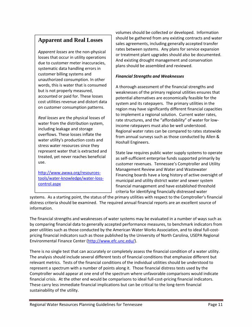
Apparent and Real Losses
Apparent losses are the non-physical losses that occur in utility operations due to customer meter inaccuracies, systematic data handling errors in customer billing systems and unauthorized consumption. In other words, this is water that is consumed but is not properly measured, accounted or paid for. These losses cost utilities revenue and distort data on customer consumption patterns.
Real losses are the physical losses of water from the distribution system, including leakage and storage overflows. These losses inflate the water utility's production costs and stress water resources since they represent water that is extracted and treated, yet never reaches beneficial use.
http://www.awwa.org/resources-tools/water-knowledge/water-loss-control.aspx

Regional Water Resources Planning Guidelines for Tennessee Page 12
Tests and measures of financial data from recent years should be supplemented with a structured survey of the utility managers to determine their forecasts for upcoming capital improvements and/or additional debt as well as any upcoming rate increases or rate structure changes. Both pilot studies include examples to use as guides to assessing the financial ability of water utilities to expand their systems.
PROJECT FUTURE UNMET NEED
Unmet need is defined by a simple supply and demand equation. Water demand (including potential growth or change) minus the reliable amount of existing supply equals unmet need. Both demand and supply must be estimated for a period or point in time. The length of the planning period is a critical decision. Water infrastructure often lasts much longer than 30 years, but demographers rarely attempt to project population any further than that because it is impossible to anticipate and reliably model changes over such a long period. Projecting domestic and industrial water use beyond 30 years is further complicated by the inability to forecast changing economic conditions over such a long period. The longer the planning period, the greater the risk that projections will be wrong. Consequently, projections past 20 or 30 years may be too uncertain a base for financial decisions to rest on.
Develop Population and Demand Projections
Demand projections are generally based on two data sets: historical water use and population projections. Demand projections should account for population growth as well as commercial and industrial growth in the planning area. Baseline water-use information can be compiled for systems in the planning region using two types of reports regularly submitted to TDEC: monthly operating reports (MORs) and water system surveys (WSSs) of operation characteristics. Information obtained from MORs include monthly average raw water withdrawals by source, finished water purchased or sold, and the population served by each system. Data documented in the WSSs include total finished water distributed (including water sold to other water systems); the number of accounts billed to residential, commercial, and industrial customers; and water used for non-revenue purposes such as firefighting, line flushing, maintenance, and other public uses or losses of water. Detailed records of these types of water use by each system in the planning region are critically important to the development of accurate projections of future demand and should be carefully maintained.
Published population projections, such as those produced by the University of Tennessee’s Center for Business and Economic Research (CBER), may be used to develop future demand projections for Tennessee counties, or specific population projections can be made for the study region. Overall, any reasonable population projection can provide a good basis for planning if the projections are reviewed and adjusted to reflect reality as new information becomes available. Currently, CBER’s population projections provide the best population trends available and the best single basis for developing projections of future demand. However, planning for future water use based on these projections
SYSTEM EFFICIENCY FACTORS
Water Accountability
Leak Detection
Metering
Energy Consumption
Resource Conservation
Resources
American Waterworks Association http://www.awwa.org/resources-tools/water-knowledge/water-loss-control.aspx
Environmental Protection Agency http://water.epa.gov/infrastructure/sustain/wec_wp.cfm

Regional Water Resources Planning Guidelines for Tennessee Page 13
should recognize that actual populations and the water uses may be larger or smaller than projected. For example, a comparison of CBER predictions to actual 2010 census results for the two pilot water supply studies performed by TDEC (North Central Tennessee and Southern Cumberland Plateau) shows that over a projection period of 10 years population estimates were accurate within a range plus or minus 1.4% to 4.8%.
When using CBER projections of population growth, the percentage of any county’s population that is served by each water system in the region may be assumed constant over time, but if there are known reasons to expect population growth to vary significantly across utilities, those differences should be considered. Likewise, where the planning region or water system boundaries cross or encompass multiple counties, some proportional allocation of current and projected population may be necessary. Ideally, commercial, industrial, and residential water use information will be well documented and available through MORs or WSSs for each system in the study region and rates of residential use per capita should be reasonably constant within a normal planning horizon. Combined commercial and industrial demand projections may be used where industrial use is relatively small. Otherwise, projections of industrial use should be made separately based on anticipated growth in specific economics sectors, and projected general commercial use should be made based on population growth or other economic indicators. Based on statewide information for 2005, the ratio of commercial to domestic use appears to level out at about 1:1 as county densities approach about 800 persons per square mile (see figure below). This varies from county to county based on such factors as proximity to transportation corridors but can be considered a cap for projections in the absence of better information. The outcome of this computation is illustrated in the example for Moore County in the figure below which starts at an initial commercial use rate of only about 2 gallons per person per day.

Regional Water Resources Planning Guidelines for Tennessee Page 14
Per capita water use by sector as a function of county population density in Tennessee, 2005.
The effects of passive and active conservation or demand management measures should also be evaluated as part of the development of a realistic demand projection for the study region. Utilities may find significant opportunities for greater efficiency in their own distribution systems by finding and fixing leaks and managing line flushing more effectively. They may also encourage conservation by customers through replacement of older fixtures with more efficient ones, fixture replacement rebate programs, and education campaigns. Additional information can be found from the U.S. Environmental Protection Agency (http://www.epa.gov/watersense/). These are sound cost reduction and cost avoidance measures that may be preferable to development of new alternatives or at least make it possible to postpone them.
Ultimately, accurate projections of water use are critical to effective water-supply planning for an uncertain future. Although it is possible to approximate future use based on
Of the many options
available for conserving
water, leak detection is a
logical first step. If a utility
does what it can to conserve
water, customers will tend
to be more cooperative in
other water conservation
programs, many of which
hinge on individual efforts.
Leak Detection and Water Loss Control
National Drinking Water Clearinghouse

Regional Water Resources Planning Guidelines for Tennessee Page 15
existing information, the resulting estimates are inherently uncertain, more so when based on simplified assumptions. Actual future water demand will depend on numerous decisions and planning processes that guide economic development and on demographic changes and individual behavior (e.g. conservation). Any one of these factors could make predictions based on the past unreliable. Ideally, the potential for large changes in water-use trends resulting from shifts in land use or major infrastructure investments should be considered in the evaluation of projections. Consequently, communication with and direct participation by a range of other planning organizations and community groups that may both influence and be influenced by long-term trends in the availability and use of water is essential.
Determine Unmet Water Supply Need
The unmet water supply need in a region is the difference between the projected demand and the reliable yield of existing sources. However, as discussed earlier, both the projected demand and the reliable yield of existing sources produce a range of potential estimates. Neither is exactly known. In addition, various conservation strategies can be employed to reduce demand overall and save water in times of drought. Thus, determining the unmet need of a region will likely require a framework or model within which various yield, demand, and conservation strategies for existing and future scenarios can be evaluated. The two pilot studies used a software program called Operational Analysis and Simulation of Integrated Systems (OASIS) to model both the existing water systems and alternatives. TDEC and USACE have collaborated to make OASIS available throughout Tennessee. The model is housed and supported by the Center for the Management, Utilization and Protection of Water Resources at Tennessee Technological University and is available at the following link http://www.tnporws.org. This model can be used to evaluate multiple utilities with a combination of sources in a planning region to determine how they could operate under various connection scenarios. The model also can be used to evaluate conservation strategies, various demand scenarios, and potential alternatives.

Regional Water Resources Planning Guidelines for Tennessee Page 16
A map-based schematic of the model for the South Cumberland Plateau study area is displayed above. The red triangles indicate storage in the system such as the Big Fiery Gizzard Reservoir. The blue squares indicate a demand such as the daily withdrawals by the Tracy City Public Utilities. The yellow ovals indicate conveyances or connections between utility systems. The green circles indicate a terminal or quantity of water leaving the study area. Black lines show a permanent connection with arrows indicating direction of flow and the red lines show a temporary or emergency connection. Conceptually, the model shows the interrelationships between utility systems. It is a generalized, mass-balance model that can assess the effects of different water policies and facilities over the historic record of rainfall and inflows. It works on a daily basis and can be used for both drought management and capital expansion planning. It is not intended for the explicit modeling of distribution systems, hydraulic routing, or flood management, although it can be linked to other models for those purposes.
SOUTH CUMBERLAND PLATEAU STUDY AREA

Regional Water Resources Planning Guidelines for Tennessee Page 17
DEFINE AND EVALUATE ALTERNATIVES AND SELECT THE BEST PLAN
Define Alternatives
There are a finite number of basic alternatives to meet the unmet water supply need in any planning region. These fall into the general categories of conservation and demand management, regionalization or resource sharing, existing source alteration, and new source development (surface water or groundwater). It is important to develop a comprehensive list of alternatives from all of these categories to ensure that options are not overlooked. It is also important to consider alternative combinations. Affordability and stakeholder input into the development of a potential list of alternatives and the selection of the preferred alternative is crucial.
The alternatives considered, evaluated, and finally selected define the regional water supply plan. A regional plan will include multiple water supply and distribution systems in defining the water resources issues and in developing potential solutions to those issues. It also considers the financial capabilities of the utilities.
Conservation and Demand Management
Conserving water and managing, even restricting, its use are common strategies in times of drought, and they are becoming more commonplace in times of normal rainfall because they can reduce costs—both for utilities and for customers—and postpone the need to invest in expensive, new water supply sources. For some utilities, the most effective way to reduce pressure on existing water supply sources is by reducing the amount of water lost through leaks and flushing. Utilities that adopt strategies to reduce leaks and flushing save both water and money by reducing the amount of raw water that must be treated but can’t be billed.
Other effective strategies for reducing the pressure on existing water supply sources and reducing current costs include
Water Conservation
The following list includes some of the options available to utilities to reduce inefficiencies:
Reducing Water Loss
Addressing distribution system leaks
Reducing line flushing
Metering All Water Use
Pricing Water for Conservation
Charging more as consumption rises
Varying seasonal rates
Encouraging Landscape Efficiency
Promoting conserving development and management principles with new large residential and commercial/industrial projects
Informing and Educating the Public
Easy-to-read bills with trend information on water use
Outreach programs and bill inserts
Retrofitting and Replacing Old Fixtures and Appliances
Regulating Water Use
Recycling Water
U.S. Environmental Protection Agency Water Conservation Plan Guidelines American Water Works Association Water Conservation Communications Guide

Regional Water Resources Planning Guidelines for Tennessee Page 18
metering all water use, even use that isn’t billed, to support leak detection efforts and minimize the amount of water that can’t be accounted for;
pricing water to promote conservation, for example by adopting an inclining block rate schedule and higher rates for landscape irrigation;
installing landscaping that requires less water with less turf, more mulch, and timed or moisture-sensing irrigation systems;
replacing old fixtures and appliances that require more water than newer models; and
reusing or recycling water, using treated wastewater for irrigation, groundwater recharge, etc.
Capital projects can be expensive because they are usually sized for future needs and must be financed with debt. If such projects are oversized for the future or built before the projected need is fully developed, existing water customers could see steep increases in their monthly bills as they bear costs that should be borne by future water customers. Therefore, identifying opportunities for more efficient use and management of existing water sources should always be considered before altering existing sources alteration or developing new ones.
Regionalization and Resource Sharing
Regionalization as an alternative involves increased sharing among utilities of existing water sources. Limited supplies can be extended by optimizing the way in which utilities in the region share water resources. Regionalization is often the most cost effective, publicly acceptable and least environmentally damaging means of providing additional water to a utility. It may be more advantageous or cost effective for Utility A to increase production and sell to Utility B than for Utility B to develop a new source. Typically, many of the utilities in a planning region will already be connected, but further regionalization may require improved connections and more formal agreements. Some utilities will be providing water routinely and some intermittently as needed in dealing with drought and other shortages. Both types of connections are needed to ensure that a system is resilient not only to drought but also to flooding. Water treatment plants can be damaged during floods and taken completely out of production for weeks or months as happened in Nashville in 2010. Having agreements in place before they are needed helps to ensure the water will be available during emergencies. A thorough understanding of the potential to improve connections between utilities and sharing of water sources is a necessary step. Again, Nashville offers a good example of how extreme emergencies can be handled effectively through planned cooperation.
Existing Source Alteration
Often changing the way a system is operated or making a simple structural adjustment at an existing source can yield additional water supply. Lowering a water intake, changing release patterns, or changing the location of a water intake can yield a significant amount of additional water. If a system relies on multiple sources, how, when, and in what combination the sources are used can affect the amount of water in the system. Relatively small adjustments of existing sources can potentially be enough to supply the future need of a region. For example on the South Cumberland Plateau, a detailed study of flow requirements below the Big Fiery Gizzard Dam allowed a reduction in the minimum release requirements that, combined with raising the height of the dam, provided enough additional supply to satisfy the unmet need of the region.

Regional Water Resources Planning Guidelines for Tennessee Page 19
New Source Development
New public water supply sources can be developed in many ways. Options include
building a new reservoir or lake,
buying an existing reservoir or lake and changing its use,
buying storage from an existing reservoir,
building a pipeline to a large stream,
harvesting water,
reusing water,
drilling new groundwater wells, and
storing surface water in an existing aquifer.
Factors affecting the choice of options for a particular region include geology, topography, and amount of water needed. Building reservoirs or lakes is an option in many locations in Tennessee; however, given the financial and other costs, the need must be significant, and evaluation must consider the full effects of stream impoundments on aquatic species and other stream uses. Purchasing an entire reservoir or some of the reservoir’s storage currently used for other purposes, such as recreation or power production, and converting it to water supply can sometimes be an alternative. Alternatives can also include building pipelines to large rivers, water harvesting, and water reuse. Water harvesting involves construction of storage away from the stream itself to hold excess water withdrawn from the stream during periods of high flow. Water reuse usually involves highly treated domestic wastewater for irrigation, car washes, ponds, fountains, industrial processes, or groundwater recharge.
Groundwater alternatives include drilling one or a number of wells. In 2005, about 62% of the public water systems in Tennessee used a ground water source. Many regions of the state still have potential to meet future needs through use of groundwater. Aquifer storage and recovery, the process of injecting water from the surface into a suitable aquifer, can boost the yields of groundwater. It can be used to store large volumes of water from wet periods (e.g. storms) with very little evaporation. It is appropriate where surface storage is limited and demand is seasonal.
Evaluate Alternatives and Select the Best Plan
Evaluation of alternatives requires comprehensive study and fair comparison. Each alternative or combination of alternatives must be measured against the same criteria. Alternatives can be evaluated in phases or tiers, reducing overall evaluation costs by narrowing the range of alternatives to the most promising in the first evaluation tier. Criteria such as sufficiency, cost, flexibility, and implementability are among the most important factors in the initial screening of alternatives. Alternatives that meet the initial criteria are then evaluated against a second tier of criteria such as cost, affordability, and environmental impacts before the best plan is selected. The following evaluation criteria were used in a two-tiered process to evaluate alternatives and select the best plan in the South Cumberland and North Central Tennessee regional water resources planning studies. Each planning region is unique, however, with specific needs and issues, and every alternative evaluation and plan selection process will be likewise unique.

Regional Water Resources Planning Guidelines for Tennessee Page 20
Tier 1 Criteria
Sufficiency—the ability of the alternative to meet the region’s projected need, alone or in combination with other alternatives, for the chosen planning period.
Cost—developed for comparison in Tier 1 at the conceptual design level, consistent across all alternatives.
Implementability—the presence or absence of known obstacles or challenges to gaining funding and approval for and completing each alternative.
Flexibility—drought resistance, adaptability to changing conditions, and capacity for phased implementation to better match costs with benefits.
Tier 2 Criteria
Cost—more precise than in Tier 1 but still estimates of all costs including planning, design, permitting, real estate, construction, operation, maintenance, and debt service, again, consistent across all alternatives.
Affordability—potential availability of grants or loans, as well as effect on fund balances, net assets, and ultimately, water rates.
Raw and Finished Water Quality—compatibility with existing treatment methods and effect on treatment costs.
Environmental Benefits and Impacts—effect on natural, ecological services, such as nutrient dispersal; potential to improve environmental conditions, such as downstream flows; and ability to comply with applicable regulations.
Other Relevant Factors—any factors not included in other criteria but considered important in determining the best water supply alternative.
Alternatives are typically evaluated by a small, technically focused subgroup of stakeholders or stakeholder representatives with time and the appropriate expertise to score or rate the alternatives. A technical group that includes consulting engineers, utility officials, academics, state and local officials, and interested citizens can provide a thorough, rational, and logical review of the alternatives; examine the level of detail and assumptions made for each; provide a credible, independent review of the work; and make objective evaluations and recommendations. Their evaluation and recommended best plan should be shared with the larger study team at key points in the process and, when complete, put into an easily communicated format for a broad-based community meeting or other public involvement.
Tier 1 Evaluation of Alternatives
Sufficiency is a threshold criterion that compares the reliable yield of an alternative or combination of alternatives to the region’s unmet need. Alternatives and combinations of alternatives that do not reliably yield sufficient water to meet the region’s needs should be eliminated from further consideration.
Sufficiency requirements may be drawn from the study team’s standards for reliable yield (see discussions of margin of safety above in relation to reservoirs, streams, and groundwater sources) or from other factors, such as how often the community is willing to submit to drought restrictions. For example, two sufficiency tests were use in the Tier 1 evaluation in the North Central Tennessee and

Regional Water Resources Planning Guidelines for Tennessee Page 21
South Cumberland planning studies: (1) reservoirs must have a reserve of 20% of usable storage for all years of the historical drought record and (2) no drought restrictions were triggered more often than once every 7 to 10 years.
Evaluating sufficiency requires developing the alternatives in adequate detail to determine their reliable yield and creating models similar to those used to evaluate existing sources. Models should be capable of simulating the relationship between the primary system(s) and their sources and any constraints on an alternative such as minimum release requirements below dams, minimum flow requirements for stream sources, or drawdown restrictions for groundwater. For the small reservoirs in the South Cumberland study, the technical group used the OASIS model to analyze various alternatives over the period of hydrologic record and to determine how often a source was below a reserve of 20%, the maximum number of days below that reserve, the minimum storage remaining in the source, how frequently drought restrictions would be required, the maximum days the community would be in drought restrictions, how frequently emergency water transfers would be required, etc. For stream and groundwater sources, the model can evaluate similar criteria.
Models with these capabilities are often referred to as multi-criteria decision-making models. Two with the required capabilities are STELLA and OASIS (discussed earlier in relation to evaluating existing sources). Both allow users to model water supply systems including sources, withdrawal points, constraining criteria, and other requirements. And both allow users to simulate scenarios over time and use various data sets from other models such as distribution hydraulics and watershed hydrology models.
Using a model to consider how a water system or group of systems with multiple sources and withdrawals responds to various operational, growth, or climate scenarios can greatly assist the understanding of performance of alternatives. By capturing a full range of hydrologic conditions and operational thresholds such as triggers for enacting drought restrictions, the model helps the team ensure that all sources in a system are used to their full advantage and their shortcomings are well understood. Scenario-based modeling also helps the team to understand the performance of alternative measures and allows a fair comparison of alternatives and how they perform under various conditions.
Cost estimates should be developed at the conceptual level in Tier 1 for each alternative that meets the threshold criterion of sufficiency. At this stage of evaluation, the cost estimates can be “order of magnitude,” meaning gross estimates adequate to rank alternatives based on relative costs rather than precise estimates, but the factors considered in developing these estimates should be consistent across all alternatives.
Implementability is a criterion that considers whether regulatory permitting (including environmental considerations), public acceptance, property acquisition, or constructability issues could delay or obstruct implementation of the alternative. The implementability of an alternative is a measure of the relative ease of accomplishing the proposed improvements in time to meet projected needs. The implementation of many alternatives may depend on or be subject to the requirements or permits listed below.
Aquatic Resource Alteration Permit through TDEC
Section 401 Water Quality Certification through USACE
Safe Dams Certification (SDC) through TDEC Division of Water Resources

Regional Water Resources Planning Guidelines for Tennessee Page 22
Storm Water Runoff Permit through the TDEC Division of Water Resources
USACE or TVA regulatory requirements, leases or storage agreements
Inter-basin Transfer Permit from TDEC Division of Water Resources
Tennessee dams are regulated by the Division of Water Resources’ Safe Dams Program, which is responsible for certification, inspection, and approval. In addition to these permit reviews, some alternatives may require consultation with the US Fish and Wildlife Service regarding species listed under the federal Endangered Species Act.
Flexibility of an alternative is a measure of whether it can be implemented in phases, with costs spread over time, while still reliably meeting projected regional water supply needs. This criterion also considers an alternative’s ability to expand to meet demands beyond the planning horizon. The flexibility of an alternative is typically determined during its conceptual design. Sometimes an alternative can be implemented in phases, but sometimes it is “all-or-nothing.” Drilling multiple wells can easily be done in increments. Reservoir modifications may or may not be done in phases depending on the specific modifications. Pipelines may also be constructed in phases depending on the magnitude of use and size of existing or proposed lines. Flexibility also includes the ease with which an alternative can be adapted to circumstances that differ from those originally projected. For example, if actual water needs in the region were larger or smaller than projected or future hydrologic conditions more or less severe, then an alternative that could be adapted to meet those needs would be considered flexible. One that could not would not.
Tier 2 Evaluation of Alternatives
Alternatives that meet the Tier 1 criteria are evaluated more rigorously in Tier 2. Suggested criteria for Tier 2 are discussed below, but other criterion may need to be developed to fully capture the uniqueness of the situation and the differences between alternatives.
Cost estimates for Tier 2 need to be both more detailed and more precise. In addition to the planning, design, permitting, real estate, construction, and debt service costs of each alternative, a thorough look at the potential operation and maintenance costs and additional treatment costs, including treatment plant expansions or upgrades, should be undertaken. Cost effectiveness is also a very important consideration when evaluating alternatives. It is a measure of benefit versus cost. It is important to try to achieve the most benefit (reliable yield) for the least cost. Building a project that is considerably larger than is needed will saddle customers with unnecessarily high water rates. As with the Tier 1 evaluation, alternatives should be developed to a consistent level of detail so that costs are comparable.
Affordability is a measure of how the alternative would be financed or paid for and how that cost would affect water rates and the solvency of participating utilities. Some alternatives may be beyond the reach of smaller utilities. Others may place an unfair burden on certain customers. Guidance on average and median burdens of water and wastewater bills for different income groups can be found in a 2003 study published by the National Rural Water Association, The Cost of Water and Wastewater Service in the United States.
Questions that should be asked and answered in this evaluation include how the alternative would be financed and how it financing it would affect customers, especially low-income households; whether

Regional Water Resources Planning Guidelines for Tennessee Page 23
loans are available; and how great the operation and maintenance (O&M) costs would be. O&M costs may have the greatest impact on ratepayers since grants are not usually available for these costs.
State law requires water utilities to operate on an enterprise basis, which means they cannot be subsidized by other functions or services or with general tax revenues. Consequently, water customers must pay for all debt service and operational costs. Grants may help offset some portion of construction costs, but the remaining costs of infrastructure improvements to meet projected water needs—including debt service, construction, operation, and maintenance—will eventually affect customers’ monthly bills.
Raw and finished water quality from an alternative may be a significant factor in the evaluation and comparison of alternatives. Some alternatives may have lower raw water quality than others. For example, a proposed impoundment may be very shallow and have high levels of background nutrients that make it vulnerable to frequent algal blooms. Other alternatives might require a long transit of treated water during which its quality could degrade. The potential effect of raw water on treatment and operation costs should be included in cost estimates for each alternative.
Environmental benefits and impacts of each alternative are essential to comparing them. Some alternatives may provide significant benefits while others have significant negative effects. In the South Cumberland regional planning study, a detailed assessment of the flow requirements in Big Fiery Gizzard Creek downstream of the Monteagle Utility District’s dam revealed that release requirements could be modified to preserve more water in storage. A mixing device installed in the reservoir would significantly improve the quality of the water released through the dam. The energy demands associated with alternatives could have environmental as well as financial impacts and should also be considered in this analysis.
Other relevant factors can often be important in determining the best water supply alternative for a specific region and should be carefully evaluated. These factors are as varied and unique as the planning region and potential alternatives being evaluated. Factors not listed above but considered relevant in the South Cumberland regional study included modifications needed to make a reservoir meet state dam safety requirements and sustainability concerns related to energy use and equipment maintenance for a proposed pipeline. Other relevant factors considered in the North Central Tennessee regional study included the level of cooperation required between utilities sharing a reservoir source and disproportionately high maintenance costs versus anticipated amount and frequency of use for a proposed pipeline.
Select the Best Plan
A deliberative evaluation of proposed alternatives following the tiered approach and criteria presented above will result in identification and selection of the best plan for the study region. This process and the resulting plan must be clearly communicated to the public, in particular water customers who may be asked to finance the plan through higher water rates. The study and evaluation of alternatives will generate a wealth of detailed qualitative and quantitative information about the alternatives and will need to be summarized and explained so that those who did not participate directly in the process and those without specialized knowledge of water systems can understand both what was done and why the chosen plan is the best one. Providing important information to the public throughout the process will increase the likelihood that the plan will be fully embraced by the community.

Regional Water Resources Planning Guidelines for Tennessee Page 24
IMPLEMENT THE BEST PLAN
This section describes strategies for implementing the best plan. Making it happen and making it affordable will require no small amount of cooperation and coordination. Each utility will need its own implementation strategy. These “next steps” are offered as a starting point and will need to be evaluated by the communities and adapted to their circumstances.
Water conservation and demand management is an excellent strategy for making the best use of current and future water supply sources. Implementing the best plan may take a number of years, but conservation can be implemented immediately or as needed. It will also lay the groundwork to protect the new water supply and to respond to unanticipated events. The more efficient the utilities can become the more easily the regional partners will be able to afford to implement the new solution.
The utilities in the region should work together to educate their customers about the conservation and demand management practices that should be part of the best plan. Conserving water and even reusing it can help reduce overall water withdrawals and save both water and money. These laudable conservation efforts require the understanding and acceptance of the community.
Likewise, if increases in water rates are needed to implement the best plan, customers will be more likely to accept them if they are confident that their water utilities are operating efficiently. As part of the pilot studies, energy audits (http://www.tn.gov/environment/regionalplanning/pdf/EnergyAuditPublicWaterSystems.pdf) were provided to a participating utility in each region and used to increase energy efficiency. Other strategies for increasing operational efficiencies are detailed in the section on defining alternatives.
Formalizing the commitment to implement the selected regional alternative may require a contract or inter-local agreement. Tennessee’s Inter-local Cooperation Act (Tennessee Code Annotated, Title 12, Chapter 9) enables local government units, including utility districts, to cooperate to provide services and facilities. The Act sets out a legal framework for inter-local agreements and requires that such agreements include certain types of provisions (e.g., duration, purpose, manner of financing). The Act leaves the details of these provisions to the parties, for instance, they may establish a separate legal or administrative “joint venture entity” or provide for an administrator or joint board to manage the project. If a separate entity is created to conduct the joint undertaking, the agreement must be filed with the Tennessee Comptroller of the Treasury.
Regardless of whether a separate management entity is created, arriving at an agreement to jointly support a shared water supply project will require extensive communication among the parties and a strong commitment to a successful resolution. Before executing a formal agreement, the interested parties should adopt a memorandum of understanding that identifies the steps to be taken and a target date for creating the formal inter-local agreement. This document will establish and describe the commitment to follow through with a regional project. The University of North Carolina’s Environmental Finance Center has published a useful guide, “Crafting Inter-local Water Agreements” that covers topics to consider in preparing inter-local agreements and water sharing contracts.
Potential regional partners may have already used the Tennessee Department of Environment and Conservation’s Guidance for Developing Community Water System Drought Management Plans as a first step in regional cooperation. Across Tennessee, some adjoining utilities have already formulated regional drought management plans. If such a plan is not already in place, creating a formal inter-utility

Regional Water Resources Planning Guidelines for Tennessee Page 25
communication and coordination plan for sharing water supply sources during a drought is a good starting point for regional cooperation.
Design engineering, investment-grade cost estimates, project financing and rate studies, and project permitting are all likely project implementation steps. All of these steps will serve to specifically define the roles and financial responsibilities of regional partners. Refinements of project design should anticipate all of the requirements for permits to implement the project. Design engineering should also include cost estimates across the full range of construction and operation steps over a complete project design life. Such cost estimates are essential to formulation of a project financial plan. A number of possible funding sources are listed in Finding Money for Municipal Water, Wastewater and Solid Waste Projects in Tennessee, a publication of the University of Tennessee’s Municipal Technical Advisory Service (MTAS). If the regional plan is approved at the state level, TDEC will work with the regional partners to identify funding options.
Whether the expected project costs are financed on a pay-as-you-go basis or by borrowing, customers will likely see some changes in their bills. Utility partners to an agreement to develop and operate a regional water supply project will need rate structures that ensure their customers pay only their fair share of the costs. Guidance for studying revenue needs and adopting rate increases can be found in MTAS’ How Any City Can Conduct a Utility Rate Study and Successfully Increase Rates. Guidance for choosing among various rate structures can be found in Meeting Water Utility Revenue Requirements: Financing and Ratemaking Alternatives,” a publication of the National Regulatory Research Institute.
End-of-process coordination with TDEC is important for continuing the dialogue which started early in the planning process. Coordination with the state began in the earliest phases of plan preparation with securing TDEC comments on how the region is structured and potential alternatives. TDEC will be interested in reviewing the process of engagement with stakeholders which has produced the plan. The logic of Tier 1 and Tier 2 evaluations of alternatives will also be of interest. State review of the selected “best plan” and the alternatives which have been considered should inform later permitting processes.
Long-range planning is essential to coordinate government services with development and to guide it in order to ensure the best possible outcomes for local residents. Planning programs can be tailored to fit the particular needs of any community, taking into account local culture and traditions. One essential element in planning for new developments is ensuring that utilities are available to support them.
Planning commissions in the region should require letters of availability (of adequate utility service) from the appropriate utility before approving new developments to assure buyers that adequate utilities will be available when a lot is purchased for building purposes. Such a requirement is typically implemented through subdivision regulations adopted by the local planning commission. Those cities and counties that enforce a zoning ordinance may also require a letter of availability as a part of a request for a zoning amendment or approval of a site plan. These mechanisms ensure that land-use and water-supply planners work together to support the needs of their communities. Communities without established structures and organizations to coordinate general land development and community planning with water and sewer utilities should consider establishing those capabilities that are enabled by state law.
The interrelationship of water resources and land use is one of the hottest topics in growth planning today. The primary focus of regional water supply planning is usually on water quantity, but quality is equally important and becomes more of a factor as development occurs. Community growth and

Regional Water Resources Planning Guidelines for Tennessee Page 26
development will affect both water quality and quantity as impervious surfaces replace more and more raw land. Land development’s effects on the water resources can be reduced with low-impact development, which can promote the natural movement of water in a watershed and restore water supplies. Planning commissions can affect these issues through flexible regulations on new development.
Water supply planning and general community development planning must continue to be coordinated over time. Neither of these aspects of community development should advance so far in front of the other that the effectiveness of either is compromised. The basic assumptions of both the water supply plan and the community development plan, including population projections and other trends, should be re-examined on a five to ten year cycle or as circumstances warrant to determine whether a major update is necessary.
CONCLUSION
Our goal for this report is to enable water utilities to engage in regional planning in order to meet future needs at a reasonable cost both financially and environmentally. Achieving this goal is realistic. More importantly, it is as essential to our economic prosperity as it is to the preservation of Tennessee’s great natural beauty and cultural resources.

Regional Water Resources Planning Guidelines for Tennessee Page 27
Water Resources Technical Advisory Committee (2007)
The Water Resources Technical Advisory Committee was authorized in the Tennessee Water Resources Information Act of 2002. Members of this committee serve as an advisory group to the Tennessee Department of Environment and Conservation by making recommendations on water resources issues in response to requests from the department. The committee will assess each issue in some detail to provide insight from diverse perspectives with the objective of helping to refine and improve water management policies or options for the department.
2002 Tennessee Water Resources Information Act
69-7-309. Technical advisory committee. The commissioner shall appoint a technical advisory committee, the number of members to be determined by the commissioner, that shall advise the commissioner on the status of the state's water resources and future planning efforts. The technical advisory committee shall be composed of representatives of federal, state, and local agencies and of appropriate private organizations, including not for profit organizations
Member Agency Represented
Bob Freudenthal Tennessee Association of Utility Districts
Scott Davis The Nature Conservancy of Tennessee
W. Scott Gain U.S. Geological Survey
Dennis George Center for the Management, Utilization and Protection of Water Resources (Tennessee Technological University)
Dan Hawk Tennessee Department of Economic and Community Development
Michael Hughes Watauga River Regional Water Authority
Elmo Lunn Former Director of the Water Authority of Dickson County and the Former Director of the TDEC Water Management Division
John McClurkan Tennessee Department of Agriculture
David McKinney Tennessee Wildlife Resources Agency
Doug Murphy Tennessee Duck River Development Agency
Lynnisse Roehrich-Patrick Tennessee Advisory Commission on Intergovernmental Relations
Bob Sneed U.S. Army Corps of Engineers, Nashville District
Gary Springston Tennessee Valley Authority
Brian Sutherland U.S. Department of Agriculture Rural Development
Brian Waldron University of Memphis Ground Water Institute