ReCaREDD Project F. Achard, R. Beuchle, S. Carboni, H. Eva, R. Grecchi, A. Langner, A. Marelli, D....
11
ReCaREDD Project F. Achard, R. Beuchle, S. Carboni, H. Eva, R. Grecchi, A. Langner, A. Marelli , D. Simonetti, H-J Stibig, A. Verheggen Institute for Environment and Sustainability European Commission Joint Research Centre Hans-Jürgen Stibig
Transcript of ReCaREDD Project F. Achard, R. Beuchle, S. Carboni, H. Eva, R. Grecchi, A. Langner, A. Marelli, D....
ReCaREDD Project
F. Achard, R. Beuchle, S. Carboni, H. Eva, R. Grecchi, A. Langner, A. Marelli , D. Simonetti, H-J Stibig, A. Verheggen
Institute for Environment and SustainabilityEuropean Commission Joint Research Centre
Hans-Jürgen Stibig
ReCaREDD
• EC-project of the DG DEVCO (Directorate General - DEVELOPMENT & COOPERATION)
• implemented by the JRC
• in collaboration with partner countries and institutions in the tropical regions
• total budget ~5 Mio Euro
developing/testing new Remote Sensing methodologies for monitoring of forest degradation in the tropics
contribute to capacity building in tropical countries for reporting on mitigation actions in the forest sector (REDD+)
Main Objectives
developing specific software tools (open software development)
Approach: enhancing and complementing ongoing country activities and collaborating with
institutions and existing projects in the region
support RS based forest degradation monitoring at local or national scale
help establishing reference emission levels
collaboration with and involvement of partner institutions in research and testing
organize regional/national Technical Workshops and Training (in the region or at the JRC)
compiling REDD+ relevant regional database (e.g. on methods, statistics, maps, allometry, biomass data)
Other Objectives
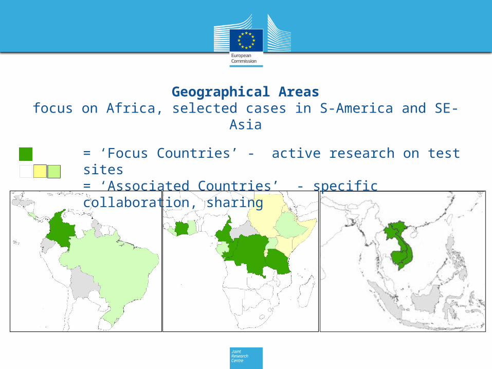
Geographical Areasfocus on Africa, selected cases in S-America and SE-Asia
= ‘Focus Countries’ - active research on test sites= ‘Associated Countries’ - specific collaboration, sharing
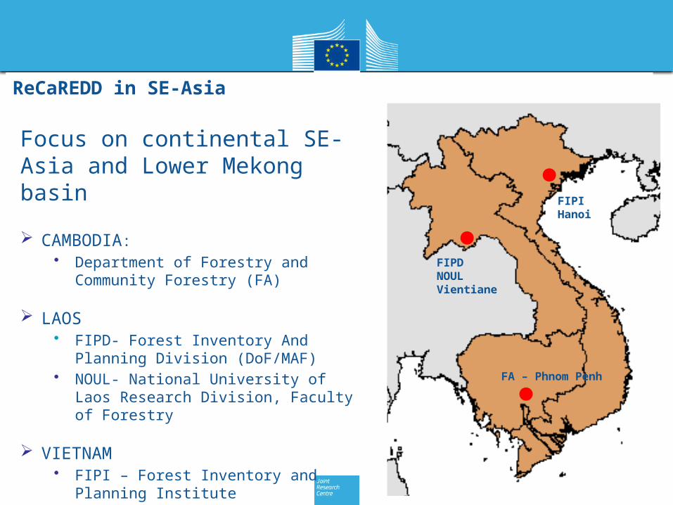
ReCaREDD in SE-Asia
Focus on continental SE-Asia and Lower Mekong basin
CAMBODIA: • Department of Forestry and
Community Forestry (FA)
LAOS • FIPD- Forest Inventory And Planning
Division (DoF/MAF)• NOUL- National University of Laos
Research Division, Faculty of Forestry
VIETNAM• FIPI – Forest Inventory and Planning
Institute
FIPDNOULVientiane
FIPIHanoi
FA – Phnom Penh
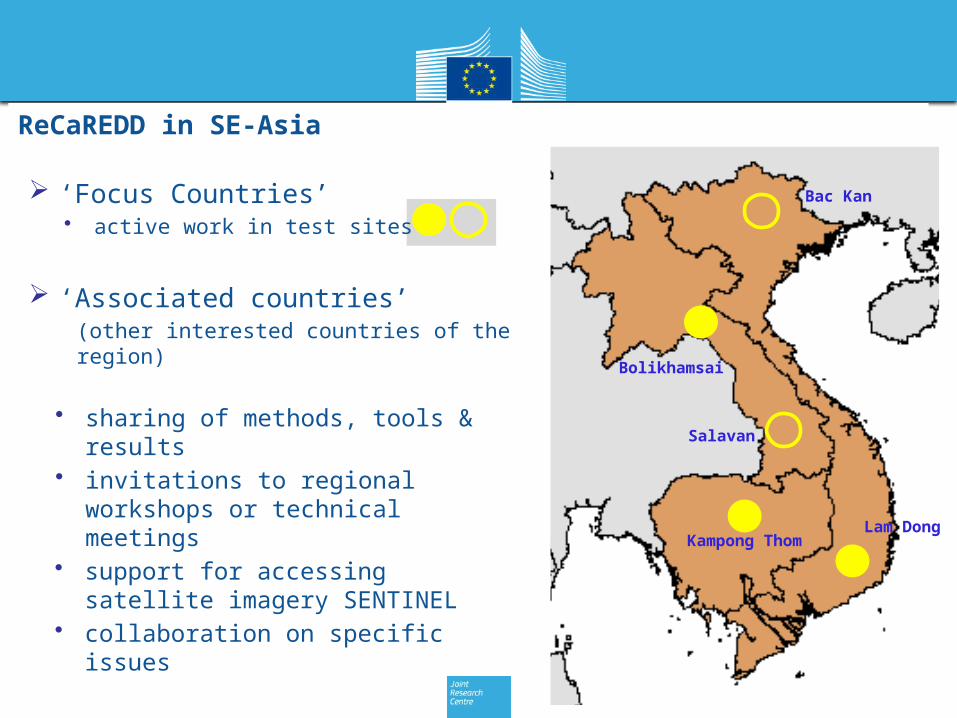
ReCaREDD in SE-Asia
‘Focus Countries’• active work in test sites
‘Associated countries’(other interested countries of the region)
• sharing of methods, tools & results• invitations to regional workshops or
technical meetings• support for accessing satellite
imagery SENTINEL• collaboration on specific issues
Bac Kan
Kampong Thom
Bolikhamsai
Lam Dong
Salavan
main focus on national & regional-scale monitoring(medium-resolution satellite imagery 10m-5m)
test cases for local scale monitoring • (high-res imagery 5m-≤1m)
Scale
flexible approaches, most appropriate choice: • automated (pixel or segment based) • visual methods
Methods
LANDSAT 1-8 SENTINEL-2
Mission Lifetime 1972 – present launch: June 2015
Repeat cycle 16 days 10 – 5* days
* in 2017 with S2a & S2b
Swath width 185 km 290 km
Spectral bands 7 13
Spatial resolution 30 (60) m 10 (20, 60)m
Looking forward for intense use of expected ‘Sentinel-2’ (10m) imagery
• Feasibility study establishing information systems and databases for ‘regional forest observatories’
• Open call for tender to be launched the study
Regional Forest Observatories