Proposed Photo-Voltaic Solar Power Plant on Farm … · Proposed Photo-Voltaic Solar Power Plant on...
43
Proposed Photo-Voltaic Solar Power Plant on Farm Nuwerus, No. 450 Portion 6, Worcester Final Environmental Scoping Report & Plan of Study for EIA DEA REF. NO. 12/12/20/2019 Applicant: SanVal Energy January 2011 Consultants: Boland Environmental Consultants CC PO Box 250, Worcester, 6849 Tel / Fax 023 347 0336 [email protected] © BolandEnviro CC 2011 All rights reserved
Transcript of Proposed Photo-Voltaic Solar Power Plant on Farm … · Proposed Photo-Voltaic Solar Power Plant on...

Proposed Photo-Voltaic Solar Power Plant on Farm
Nuwerus, No. 450 Portion 6, Worcester
Final Environmental Scoping Report &
Plan of Study for EIA
DEA REF. NO. 12/12/20/2019
Applicant: SanVal Energy
January 2011
Consultants: Boland Environmental Consultants CC
PO Box 250, Worcester, 6849
Tel / Fax 023 347 0336
© BolandEnviro CC 2011 All rights reserved

Final Scoping Report – 25 MW PV Solar Power Plant on Farm Nuwerus, 450 Portion 6, Worcester DEA Reference No. 12/12/20/2019
2
CONTENTS
1. INTRODUCTION .............................................................................................................. 6 1.1. BACKGROUND ............................................................................................................... 6 1.2. PROJECT OVERVIEW .................................................................................................... 7 1.3. SCOPE OF THE WORK TO BE UNDERTAKEN AND PROCESS OVERVIEW ............ 8
1.3.1 SCOPING PHASE ..................................................................................................... 8 1.3.2 EIA PHASE ................................................................................................................ 8
1.4 DETAILS OF ENVIRONMENTAL ASSESSMENT PRACTITIONER .............................. 9 2. SOLAR POWER TECHNOLOGY ................................................................................. 11 2.1 PV SOLAR POWER ....................................................................................................... 11 2.2 ADVANTAGES OF PV SOLAR POWER OPERATIONS .............................................. 12 3. PROJECT DESCRIPTION............................................................................................. 12 3.1 THE PROPOSED PV SOLAR POWER PLANT ............................................................ 12 3.2 SERVICES AND INFRASTRUCTURE .......................................................................... 13
3.2.2 ROADS .................................................................................................................... 13 3.2.3 WATER .................................................................................................................... 13 3.2.4 SEWER .................................................................................................................... 13 3.2.5 STORM WATER ...................................................................................................... 13
4. PROJECT ALTERNATIVES ......................................................................................... 14 4.1 SITE ALTERNATIVES ................................................................................................... 14 4.2 TECHNOLOGY ALTERNATIVES .................................................................................. 14 4.3 LAYOUT (AND SCALE) ALTERNATIVES ..................................................................... 15 4.4 NO-GO ALTERNATIVE ................................................................................................. 19 5. STUDY AREA ................................................................................................................ 20 5.1 LOCATION AND SITE DESCRIPTION ......................................................................... 20 5.2 LANDSCAPE AND GEOLOGY ...................................................................................... 21 5.3 CLIMATE ........................................................................................................................ 22 5.4 HYDROLOGY ................................................................................................................ 23 5.5 VEGETATION ................................................................................................................ 23 5.6 FAUNA ........................................................................................................................... 25 5.7 SOCIO-ECONOMIC CHARACTERISTICS ................................................................... 25 5.8 PLANNING CONTEXT ................................................................................................... 25 6. RATIONALE FOR THE DEVELOPMENT ..................................................................... 27 6.1 NEED ............................................................................................................................. 27 6.2 DESIRABILITY ............................................................................................................... 28 7. LEGAL REQUIREMENTS ............................................................................................. 29 7.1 THE CONSTITUTION OF THE REPUBLIC OF SOUTH AFRICA................................. 29 7.2 NATIONAL ENVIRONMENTAL MANAGEMENT ACT .................................................. 29 7.3 CONSERVATION OF AGRICULTURAL RESOURCES ACT ....................................... 30 7.4 NATIONAL ENVIRONMENTAL MANAGEMENT: BIODIVERSITY ACT ...................... 30 7.5 NATIONAL HERITAGE RESOURCES ACT.................................................................. 30 7.6 FENCING ACT ............................................................................................................... 31 7.7 GUIDELINES AND CONSERVATION PLANS .............................................................. 31 8. PUBLIC PARTICIPATION PROCESS .......................................................................... 32 9. ENVIRONMENTAL ISSUES ......................................................................................... 34 9.1 VEGETATION ................................................................................................................ 34 9.2 FAUNA ........................................................................................................................... 34 9.3 ECOLOGICAL PROCESSES ........................................................................................ 34 9.4 STORM WATER ............................................................................................................ 34 9.5 SOIL EROSION ............................................................................................................. 34 9.6 VISUAL IMPACT ............................................................................................................ 34 9.7 HERITAGE RESOURCES ............................................................................................. 35

Final Scoping Report – 25 MW PV Solar Power Plant on Farm Nuwerus, 450 Portion 6, Worcester DEA Reference No. 12/12/20/2019
3
9.8 RECOMMENDATIONS .................................................................................................. 35 10. PLAN OF STUDY FOR EIA........................................................................................... 36 10.1 TASKS TO BE UNDERTAKEN ...................................................................................... 36 10.2 METHODOLOGY TO BE FOLLOWED .......................................................................... 36 10.3 CRITERIA FOR SPECIALIST ASSESSMENT OF IMPACTS ....................................... 37 10.4 BRIEFS FOR SPECIALIST STUDIES TO BE UNDERTAKEN AS PART OF THE EIA 38 10.4.1 HERITAGE IMPACT ASSESSMENTS ............................................................................ 38
10.4.1.1 ARCHAEOLOGICAL IMPACT ASSESSMENT ...................................................... 38 10.4.1.2 VISUAL IMPACT ASSESSMENT ........................................................................... 39 10.4.1.3 PALAEONTOLOGICAL IMPACT ASSESSMENT .................................................. 39
10.4.2 BOTANICAL/ECOLOGICAL ASSESSMENT .................................................................. 40 10.4.3 FLOOD LINE ASSESSMENT .......................................................................................... 41 10.4.4 SOCIO-ECONOMIC IMPACT ASSESSMENT ................................................................ 41 10.4.5 GEOTECHNICAL STUDY ............................................................................................... 42 10.5 PROJECT TEAM ........................................................................................................... 42 10.6 AUTHORITY CONSULTATION ..................................................................................... 42 11. CONCLUSIONS ............................................................................................................. 42
LIST OF FIGURES
Figure 1. Location of the proposed PV Solar Power Plant near Worcester, Western Cape, South Africa.
Sourced from 1 : 250 000 Government topo-cadastral map 3319…………………………………..5
Figure 2a: The Scoping Process………………………………………………………………………………….8
Figure 2b: The EIA Process to be followed……………………………………………………………………...8
Figure 3. Schematic diagram of a simple PV system.…………………………………………………………..10
Figure 4. Example of a polycrystalline PV solar module……………………………………………………….11
Figure 5. Module installation zones (quadrants) identified within the boundaries of Farm 450/6, Worcester.
The R60 road, river bed and location of science centre (SC) and parking (P) are shown……….14
Figure 6. Boundaries of Farm 450/6, Worcester showing schematic PV power plant Layout Option 1 for
Phase 1. The road, river bed and location of science centre (SC) and parking (P) are shown….16
Figure 7. Boundaries of Farm 450/6, Worcester showing schematic PV power plant Layout Option 2 for
Phase 1. The road, river bed and location of science centre (SC) and parking (P) are shown….16
Figure 8. Boundaries of Farm 450/6, Worcester showing schematic PV power plant Layout Option 3 for
Phase 1. The road, river bed and location of science centre (SC) and parking (P) are also
shown……………………………………………………………………………………………………..17
Figure 9. Boundaries of Farm 450/6, Worcester showing schematic PV power plant, Scale and Layout
Option 1 for Phase 2. The road, river bed and location of science centre (SC) and parking (P) are
shown……………………………………………………………………………………………………..17
Figure 10. Boundaries of Farm 450/6, Worcester showing schematic PV power plant, Scale and Layout
Option 2 for Phase 2. The road, river bed and location of science centre (SC) and parking (P) are
shown………………………………………………………………………………………………………18
Figure 11. Locality map of the area surrounding Farm 450/6, Worcester, sourced from 1 : 250 000
Government topo-cadastral map 3319………………………………………………………………...19
Figure 12. Locality map of the area and farms surrounding Farm 450/6, Worcester, sourced from 1 : 50
000 Government topo-cadastral map 3319DA……………………………………..…………………19
Figure 13. Looking north-westwards towards the R60 and Worcester………………………………………20
Figure 14. Looking eastwards towards Robertson. The Eskom servitude line is also shown……………..20
Figure 15. Looking from the road southwards towards the subject land……………………………………..20
Figure 16. Looking northwards from the site towards the R60………………………………………………..20
Figure 17. Satellite image depicting the boundaries of Farm 450/6, Worcester. Imagery dated January
2010 (sourced from Google Earth)..............................................................................................21

Final Scoping Report – 25 MW PV Solar Power Plant on Farm Nuwerus, 450 Portion 6, Worcester DEA Reference No. 12/12/20/2019
4
Figure 18. Climate graphs for Worcester depicting monthly distribution of average rainfall and
temperatures……………………………………………………………………………………………..21
Figure 19. Farm dam wall and non-seasonal water course down stream……………………………………22
Figure 20. Farm dam located on the subject land………………………………………………………………22
Figure 21. Water furrow located on the subject land…………………………………………………………..22
Figure 22. Old sluice-gates and water furrows located on the subject land………………………………….22
Figure 23. Extract from CAPE Fine-Scale Plan Integrated Vegetation Layer for the Upper Breede River
Valley showing vegetation types present on the subject land (red polygon) and surrounding
area...............................................................................................................................................23
Figure 24. Extract from CAPE Fine-Scale Plan Critical Biodiversity Areas Map showing aquatic and
terrestrial CBAs, ecological support areas (oesa), other natural areas and areas where no natural
vegetation remain on the subject land (red polygon) and surrounding area.................................23
Figure 25. The Spatial Development Framework Proposal for the Worcester-Overhex/Moordkuil Planning
depicting the location of the Subject Land (2003)…………………………………………………….26
APPENDICES
Appendix A: Maps
Appendix B: Layouts
Appendix C: Letter of Appointment and Landowners consent form
Appendix D: Photographs
Appendix E: Public Participation Process
Appendix F: EAPs and Specialists CV’s
GLOSSARY
AIA Archaeological Impact Assessment
CAPE Cape Action for People and the Environment
CBA Critical biodiversity Area
DEA&DP Department of Environmental Affairs and Development Planning
DEA Department of Environmental Affairs
DWAF Department of Water Affairs and Forestry
EAP Environmental Assessment Practitioner
EIA Environmental Impact Assessment
EIR Environmental Impact Report
EMP Environmental Management Programme
Gwh Giga Watt hour
HIA Heritage Impact Assessment
HWC Heritage Western Cape
I&APs Interested and Affected Parties
IEM Integrated Environmental Management
m2 square meters
MJ Mega Joule
MW Mega Watt
NEMA National Environmental Management Act (Act 107 of 1998)
NEMBA National Environmental Management: Biodiversity Act (Act 10 of 2004)

Final Scoping Report – 25 MW PV Solar Power Plant on Farm Nuwerus, 450 Portion 6, Worcester DEA Reference No. 12/12/20/2019
5
NHRA National Heritage Resources Act (Act No. 25 of 1999)
NSBA National Spatial Biodiversity Assessment
OEMP Operational Environmental Management Plan
PPP Public Participation Process
PV Photovoltaic
SAHRA South African Heritage Resources Agency
VIA Visual Impact Assessment

Final Scoping Report – 25 MW PV Solar Power Plant on Farm Nuwerus, 450 Portion 6, Worcester DEA Reference No. 12/12/20/2019
6
Development Site
1. INTRODUCTION
1.1. BACKGROUND
The rapid development of the South African economy over the last ten years has caused the country to
experience notable depletion in its security of electricity supply. The sharp increase in demand resulted
in the implementation of emergency load shedding during 2007 and 2008 and concerted action by
Government to increase electricity supply into the National Grid. South Africa currently relies mostly on
fossil fuels (coal and oil) for the generation of electricity. As fossil fuels are non renewable, they are
limited in supply and are fast depleting. Additionally there is a growing awareness of environmental
impact, climate change and sustainable development. It is therefore becoming more vital to find
alternative energy sources to meet the increase in demand.
South Africa has a high level of renewable energy potential. Renewable energy utilizes naturally
occurring, non-depletable sources of energy such as solar, wind, biomass, hydro, tidal, wave, ocean
current and geothermal, to produce electricity or other energy types (fuel or heat). These alternative
energy sources are also referred to as green energy as they are more environmentally friendly and less
or even non-polluting. The Government’s White Paper on Renewable Energy Policy (2003) supports the
establishment of renewable energy technologies, targeting the provision of 10 000 GWh of electricity
from renewable resources by 2013.
South Africa experience some of the highest levels of solar radiation in the World. Although solar power
is relatively new in the country SanVal Energy (the developer) intends to develop a phased 25-70 MW
Photo-voltaic (PV) Solar Power Plant near Worcester, Western Cape, South Africa.
Figure 1. Location of the proposed PV Solar Power Plant near Worcester, Western Cape, South Africa.
Sourced from 1 : 250 000 Government topo-cadastral map 3319.

Final Scoping Report – 25 MW PV Solar Power Plant on Farm Nuwerus, 450 Portion 6, Worcester DEA Reference No. 12/12/20/2019
7
1.2. PROJECT OVERVIEW
SanVal Energy proposes to develop renewable energy projects in South Africa with the mission of
having “minimal environmental impacts, executed in an aesthetically pleasing manner, harmonious with
the surrounding landscape and the receiving community”. The proposed project, identified as Project
Alpha, will be the first of SanVal Energy’s planned renewable energy projects in South Africa.
South Africa experiences some of the highest levels of solar radiation in the World. The average daily
solar radiation varies between 4.5 and 6.5 kWh/m2 (16 and 23 MJ/m
2), compared to about 3.6 kWh/m
2
for parts of the United States and about 2.5 kWh/m2 for Europe and the United Kingdom. Project Alpha
will utilize the abundant solar energy readily available in South Africa which will be converted directly
into usable electricity using photovoltaic (PV) cells. The subject site, Farm No. 450 Potion 6 (Nuwerus)
near Worcester, Western Cape Provence, was identified on the basis of low biodiversity, current land
use, community values, eco-tourism, market and transmission costs.
The proposed PV Solar Power Plant will be developed in phases, of which Phase I will have an
electricity output of 25 MW which will be provided to Eskom via the national grid. Installation is planned
for 2011-2012. The total electricity output of the proposed project (Phase II) will be in the region of 45-70
MW.
The power plant will consist of the following elements:
• PV solar panels/modules (arranged in arrays)
• PV module mountings
• DC-AC current inverters
• Electricity distribution boxes
• Cabling
• Earthing systems
• Electrical substation
In addition to the power plant, the following associated infrastructure will be required:
• Temporarily trailer homes and mobile toilet and bathroom facilities during the construction phase
• Office and technical service buildings
• Electricity distribution lines (from substation to Eskom power line)
• A perimeter fence will be erected around the development sections
• Paved roads within the development area
• Educational and Environmental Awareness Centre (contemplated)
The Environmental Impact Assessment (EIA) Regulations 2010, promulgated in terms of the National
Environmental Management Act (Act 107 of 1998) (NEMA), specifies activities that require authorization
from the relevant authorities, based on the findings of an environmental assessment, before such
activities can be implemented (Government Notice (GN) No. R. 543 - 547 of 2010). The proposed
SanVal PV Solar Power Plant constitutes activities listed in Schedule 1 (GNR 544 No. 56), Schedule 2
(GNR 545 No. 1 & 15) and Schedule 3 (GNR 546 No. 14). A full Scoping and EIA process is therefore
required before environmental authorization ca be considered.

Final Scoping Report – 25 MW PV Solar Power Plant on Farm Nuwerus, 450 Portion 6, Worcester DEA Reference No. 12/12/20/2019
8
Boland Environmental Consultants were appointed to conduct the Environmental Impact Assessment
process and facilitate Public Participation as required in terms of NEMA. An application form to
undertake a Scoping and EIA process has been submitted to the Department of Environmental Affairs
(DEA) which is the relevant authority for energy development projects which fall under the National
Energy and Response Plan (NERP).
1.3. SCOPE OF THE WORK TO BE UNDERTAKEN AND PROCESS OVERVIEW
The proposed project requires an assessment of all impacts in compliance with the EIA Regulations
2010, read with Section 24 (5) of NEMA. The scope of the study is determined with reference to the
requirements of the relevant legislation and undertaken in terms of the Guideline Series on
Requirements with respect to the EIA Process (various publication dates up to August 2010), issued by
the Department of Environmental Affairs and Development Planning.
The required environmental assessment process is undertaken in two phases:
• Phase 1 – Scoping Phase
• Phase 2 – EIA Phase
1.3.1 SCOPING PHASE
The Scoping Phase involves a description of the proposed activity and the property and the receiving
environment, the identification of potential significant positive and negative impacts, the identification of
opportunities and constraints, alternatives and mitigation measures which need to be evaluated and
investigated during the EIA phase.
A detailed Public Participation process will be conducted to involve all Interested and Affected Parties
(I&APs) in the EIA process and to identify any additional issues for consideration. All issues and
concerns identified during the scoping phase will be adequately documented in the final Scoping Report
which is to be submitted to the Competent Authority (DEA) together with a Plan of Study for EIA.
1.3.2 EIA PHASE
All issues that are considered to be of significance will be further investigated and assessed during the
EIA phase of this project. The EIA will involve various specialist studies and should provide an overall
assessment of the biophysical, social and economic environment affected by the proposed
development. A detailed assessment will be undertaken in terms of environmental criteria and the rating
of significant impacts of all alternative options identified in the scoping phase. Appropriate mitigation
measures will be identified and recommend for all significant impacts. These measures should be
included in an Environmental Management Program (EMP) to be submitted together with the
Environmental Impact Report (EIR) to the DEA.
The EIA phase will include a detailed Public Participation process to ensure that all comments, issues
and concerns raised by state departments and registered I&APs will be adequately documented and
addressed in the EIA process.

Final Scoping Report – 25 MW PV Solar Power Plant on Farm Nuwerus, 450 Portion 6, Worcester DEA Reference No. 12/12/20/2019
9
Figure 2a: The Scoping Process
Figure 2b: The EIA Process to be followed.
1.4 DETAILS OF ENVIRONMENTAL ASSESSMENT PRACTITIONER
Boland Environmental Consultants CC (BolandEnviro) have been appointed as the independent
Environmental Assessment Practitioner (EAP) by SanVal Energy, to undertake the environmental
process for the proposed PV Solar Power Plant.
BOLAND ENVIRONMENTAL CONSULTANTS - COMPANY PROFILE
Boland Environmental Consultants CC (BolandEnviro CC) serve private and public sector clients by
integrating through project management, science, public participation, engineering and planning
processes to provide environmental solutions. BolandEnviro CC was established in 2005, and operates
from Worcester in the Western Cape, with a focus on the rural Boland, Cape Winelands and West Coast
areas. Our multidisciplinary team focuses their expertise toward practical, cost-effective solutions to
complex environmental applications. Our staff's in-depth industry expertise ensures the highest quality
and technical defensibility of all services and work products.
BolandEnviro has successfully applied knowledge and experience to solve numerous environmental
challenges and welcomes the opportunity to once again prove our reputation for quality on your next
project. BolandEnviro has been involved in a wide range of projects, including housing developments,
packing sheds, wine cellar expansion, cultivation of virgin land / clearing of natural vegetation,
construction of roads, wind farms, industrial development, upgrading of facilities, chicken broiler houses
etc.
VISION AND MISSION
BolandEnviro places a strong emphasis on ethical environmental management. As independent
environmental practitioners, we are passionate about the environment. Our job is to safeguard the
Authorisation

Final Scoping Report – 25 MW PV Solar Power Plant on Farm Nuwerus, 450 Portion 6, Worcester DEA Reference No. 12/12/20/2019
10
environment for future generations, and we do this through open, honest assessment of the risks and
impacts of proposed development activities. We strive to advise and guide our clients to ensure that the
outcome of any application is not only beneficial to them, but also to the environment and society.
STAFF AND PERSONNEL
BolandEnviro was founded in 2005 by Nik Wullschleger (B.Sc. Climate and B.Sc Hons. Geology, Pr. Sci.
Nat), and expanded in 2007 with the addition of Gisela Wullschleger (B.Soc.Sci & B.Com). Johlene
Krige (B. Sc. Biodiversity and Ecology, M. Sc. Botany) joined the company in 2010 and Marizanne Vos
(BTech Nature Conservation) in 2011. Other associates include Schalk van der Merwe (M. Phil Env.
Man.) and Tony Barbour (M. Sc. Env.Sci.). BolandEnviro also maintains good relationships with the
University of Cape Town and other professionally qualified specialists, and can thus provide services for
all aspects of Integrated Environmental Management.
SERVICES
BolandEnviro combines experience and integrity, specialising in the field of environmental management.
BolandEnviro offers full Scoping and Environmental Impact Assessments, Basic Environmental
Assessments, Specialist Studies, Environmental Management Planning. In addition to the above, we
also offer pre-application consultations and a host of other services related to environmental
management. BolandEnviro, with it’s association with Informage GIS, has access to qualified GIS
operators using ArcGIS, networked with scanners and colour plotters and printers, for the production of
high quality reports, maps and plans. A full list of the services offered by BolandEnviro is available at
www.bolandenviro.co.za
LOCATION AND AREA OF OPERATION
BolandEnviro is based in Worcester, but is active throughout the Boland area. In the past we have run
impact assessments and other projects in Worcester, Robertson, Rawsonville, De Doorns, Touws River,
Montagu, Tulbagh and Saldanha Bay. This local focus means that BolandEnviro has an excellent
knowledge of environmental conditions in this area, and are experienced in dealing with the various
challenges to development in the Boland area. BolandEnviro are also well acquainted with the various
development authorities in the Breede Valley, Witzenberg and Breede River Winelands Municipalities,
and are thus well-equipped to facilitate the processing of environmental authorisation applications.
CONTACT DETAILS
Street address: 74 Stockenstrom Street, Worcester, 6850
Postal address: PO Box 250, Worcester, 6849
Telephone: (+27) (0)23 347 0336
Facsimile: (+27) (0)23 347 5336 or 0336
Skype: Boland.Enviro
Email: [email protected]
Website: www.BolandEnviro.co.za

Final Scoping Report – 25 MW PV Solar Power Plant on Farm Nuwerus, 450 Portion 6, Worcester DEA Reference No. 12/12/20/2019
1. http://photovoltaics.sandia.gov/docs/PVFEffIntroduction.htm
11
2. SOLAR POWER TECHNOLOGY
Sunlight can be converted directly into electricity using photovoltaics (PV), or indirectly with
concentrating solar power (CSP). CSP use reflective panels to focus the sun's energy to heat a solution
(typically a saline brine). The absorbed thermal energy is then utilized to generate electricity. In contrast
a PV system uses solar cells to convert sunlight into electrical direct current (DC) through a photovoltaic
effect.
2.1 PV SOLAR POWER
The photovoltaic effect is the creation of a voltage (or a corresponding electric current) in a material
upon exposure to light1. A PV system consists of cells containing the photovoltaic material, mechanical
and electrical connections, mountings and means of regulating and/or modifying the electrical output.
Several solar cells are combined into PV modules (solar panels), which are in turn connected together
into an array. The electricity generated can be either stored, used directly (standalone plant) or fed into a
large electricity grid, typically the public electricity grid (grid-connected system). The feeding of electricity
into the grid requires the transformation of direct current (DC) from the PV array into alternating current
(AC) by a specialised, grid-controlled inverter. These solar inverters contain special circuitry
(transformers, switching and control circuits) to precisely match the voltage and frequency of the grid
and to disconnect from the grid if the grid voltage is turned off.
There are two dominant competing technologies in the field, crystalline silicon and thin film.
• Thin-film technology is cheaper but it has a lower efficiency than polycrystalline systems. The
active material tends to be less stable than crystalline causing degradation over time. Thin-film
technology systems would require more space and hardware to produce the same amount of
power output as polycrystalline systems. Thin-film modules have a glass like appearance with
higher visibility and reflections.
• Polycrystalline modules have a uniform, dark blue colour. They are non-reflective and has a
homogenous appearance. The active material is silicon which is derived from sand. These
systems have a 10% higher efficiency and a higher durability than thin-film systems but are
more expensive.
Figure 3. Schematic diagram of a simple PV system.

Final Scoping Report – 25 MW PV Solar Power Plant on Farm Nuwerus, 450 Portion 6, Worcester DEA Reference No. 12/12/20/2019
12
Figure 4. Example of a polycrystalline PV solar module.
2.2 ADVANTAGES OF PV SOLAR POWER OPERATIONS
• Non-depletable source (the sun)
• Pollution free (no fuel, no emissions, recyclable)
• No noise
• No moving parts to wear out (if fixed panels are used). PV installations can operate for many
years with little maintenance.
• PV systems are modular. You can start with a small system and expand as demand for power
increases.
• PV systems have a long life & durability. Cells last 25-30 years.
• Systems installed and operated anywhere including areas of difficult access and remote
locations.
• Do not require water.
3. PROJECT DESCRIPTION
3.1 THE PROPOSED PV SOLAR POWER PLANT
Project Alpha will entail the installation of the proposed PV solar power plant on Farm No. 450 Potion
6 (Nuwerus) near Worcester, Western Cape Province during 2011-2012. The first phase will have a
maximum electricity output of 25 MW built in 5 MW sub-phases for each alternative option. The
second phase would entail the utilization of up to the entire capacity of the property for electricity
generation (preferred option). The electricity output will be increased through 5 MW sub phases from
25 MW (phase 1) up to a final output of 45-70 MW. Generated electricity will be provided directly to
Eskom via the national grid.
Three scenarios are being proposed for the first phase that differ in terms of layout, area and visual
impact. Two alternative options were identified for Phase 2 of the development that differ in terms of
scale and layout (refer to Section 4.3).
Final Scoping Report – 25 MW PV Solar Power Plant on Farm Nuwerus, 450 Portion 6, Worcester DEA Reference No. 12/12/20/2019
13
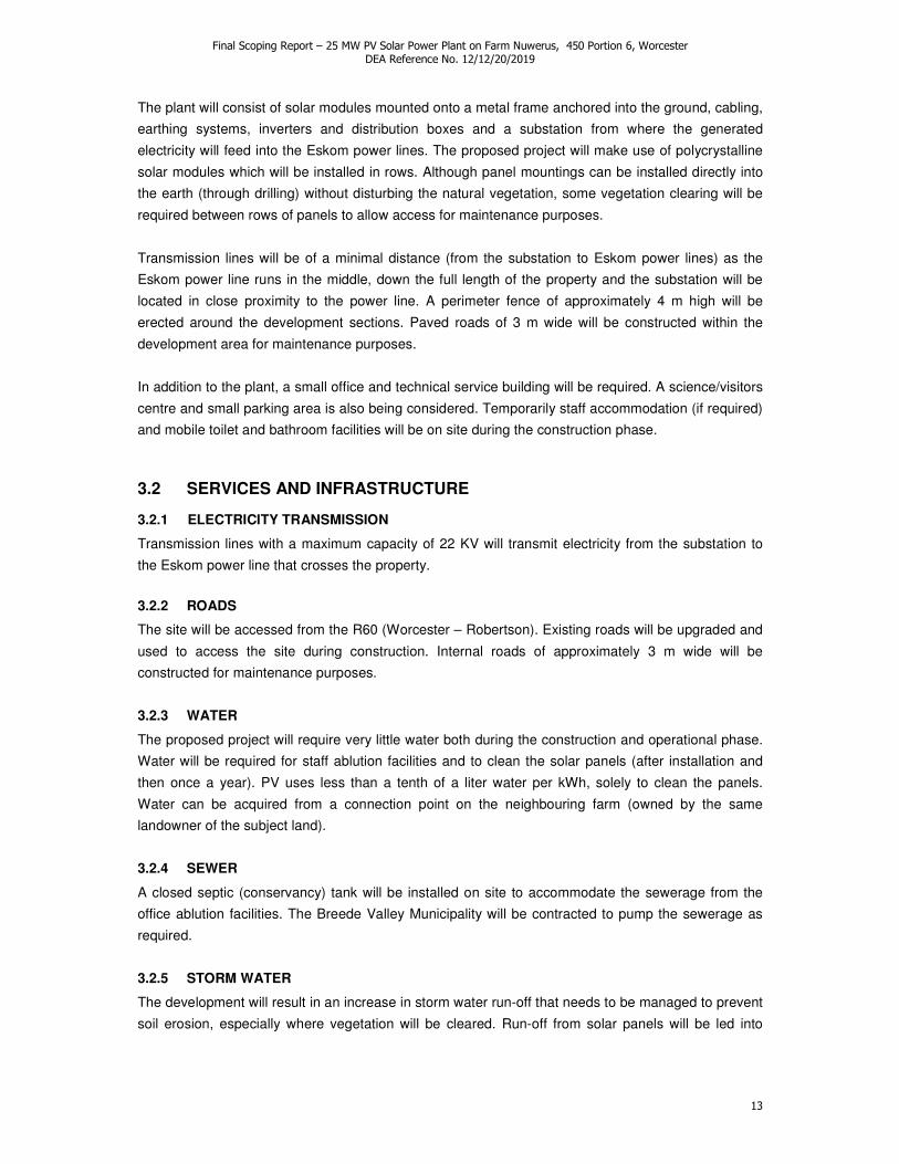
The plant will consist of solar modules mounted onto a metal frame anchored into the ground, cabling,
earthing systems, inverters and distribution boxes and a substation from where the generated
electricity will feed into the Eskom power lines. The proposed project will make use of polycrystalline
solar modules which will be installed in rows. Although panel mountings can be installed directly into
the earth (through drilling) without disturbing the natural vegetation, some vegetation clearing will be
required between rows of panels to allow access for maintenance purposes.
Transmission lines will be of a minimal distance (from the substation to Eskom power lines) as the
Eskom power line runs in the middle, down the full length of the property and the substation will be
located in close proximity to the power line. A perimeter fence of approximately 4 m high will be
erected around the development sections. Paved roads of 3 m wide will be constructed within the
development area for maintenance purposes.
In addition to the plant, a small office and technical service building will be required. A science/visitors
centre and small parking area is also being considered. Temporarily staff accommodation (if required)
and mobile toilet and bathroom facilities will be on site during the construction phase.
3.2 SERVICES AND INFRASTRUCTURE
3.2.1 ELECTRICITY TRANSMISSION
Transmission lines with a maximum capacity of 22 KV will transmit electricity from the substation to
the Eskom power line that crosses the property.
3.2.2 ROADS
The site will be accessed from the R60 (Worcester – Robertson). Existing roads will be upgraded and
used to access the site during construction. Internal roads of approximately 3 m wide will be
constructed for maintenance purposes.
3.2.3 WATER
The proposed project will require very little water both during the construction and operational phase.
Water will be required for staff ablution facilities and to clean the solar panels (after installation and
then once a year). PV uses less than a tenth of a liter water per kWh, solely to clean the panels.
Water can be acquired from a connection point on the neighbouring farm (owned by the same
landowner of the subject land).
3.2.4 SEWER
A closed septic (conservancy) tank will be installed on site to accommodate the sewerage from the
office ablution facilities. The Breede Valley Municipality will be contracted to pump the sewerage as
required.
3.2.5 STORM WATER
The development will result in an increase in storm water run-off that needs to be managed to prevent
soil erosion, especially where vegetation will be cleared. Run-off from solar panels will be led into

Final Scoping Report – 25 MW PV Solar Power Plant on Farm Nuwerus, 450 Portion 6, Worcester DEA Reference No. 12/12/20/2019
14
existing water furrows that traverse the property. These furrows feed into ephemeral water courses
and farm dams located on the subject land and neighbouring properties.
4. PROJECT ALTERNATIVES
In terms of the EIA Regulations, Section 28(1)(c) and NEMA, Section 24(4), feasible and reasonable
alternatives are required to be considered as part of the environmental process.
“Alternatives”, in relation to a proposed activity, means different ways of meeting the general purposes and
requirements of the activity, which may include alternatives to –
(a) the property on which, or location where, it is proposed to undertake the activity;
(b) the type of activity to be undertaken;
(c) the design or layout of the activity;
(d) the technology to be used in the activity;
(e) the operational aspects of the activity; and
(f) the option of not implementing the activity (No Go).
4.1 SITE ALTERNATIVES
The proposed site was identified considering factors such as market, transmission costs, low
biodiversity, current land use, eco-tourism potential, proximity to power transmission lines and socio-
economic issues such as cost of land, unemployment of the local community etc. Farm Nuwerus No.
450/6, Worcester was the only site that proved feasible and reasonable for the proposed
development. The site is located in the Breede Valley Municipal area, approximately 15 km SE of
Worcester, adjacent to the R60 (SW side) towards Robertson in the area between the Nuy valley turn-
off and Mowers (Figure 9 & 10). The land is currently used for small stock grazing, as is the
predominant land use of the surrounding area. The vegetation on site is considered least threatened
and the property is bordered by vast areas of natural habitat. The site is located right underneath an
existing Eskom servitude line that crosses the entire length of the property (minimal infrastructure
required for transmission) and alongside the R60 providing access. Refer to Section 5 for a detailed
site description and maps.
4.2 TECHNOLOGY ALTERNATIVES
Technology alternatives were investigated in terms of module capacity, efficiency, cost effectiveness
and space required. The technology that proved most feasible and reasonable with respect to the
proposed PV solar power plant (preferred technology alternative) entails the use of 200 W
polycrystalline modules.
Lower capacity modules, including thin film modules, are more cost effective, but would be less
efficient in terms of electricity generation. It would thus require more panels, i.e. a larger surface area
and would use more logistical resources to generate an equal amount of electricity. On the other
hand, ultra premium, higher output panels are more energy efficient, but the marginal incremental
performance is not justified by the substantial price difference. Although such a system would require
less space, it will not be economically viable.

Final Scoping Report – 25 MW PV Solar Power Plant on Farm Nuwerus, 450 Portion 6, Worcester DEA Reference No. 12/12/20/2019
15
Alternative options such as fixed modules vs tracking modules (modules that follow the sun) are also
under consideration. Tracking modules will be more expensive than fixed modules and will require
higher maintenance due to moving parts. Tracking modules will on the other hand be more efficient as
it will be able to absorb direct sunlight as it follows the track of the sun. At this stage, the use of
specific technology alternatives is still under investigation by the Developer.
4.3 LAYOUT (AND SCALE) ALTERNATIVES
Three feasible layout alternatives were identified for Phase 1 (25 MW) of the proposed PV solar
power plant. Two alternative options, in terms of scale and layout were identified for Phase 2 of the
development. The second phase would entail the utilization of up to the entire area of the property for
electricity generation (preferred option).
All layout alternatives took into consideration the ephemeral water course that cuts across the subject
land. Additionally, the powerline servitude will be avoided to ensure free access for maintenance.
Roads, fencing and servitudes will be included in final layout plans. The total surface area proposed
for layout options include the PV panel arrays, spaced to avoid shadowing, access and maintenance
roads and associated infrastructure (buildings, power inverters, transmission lines and perimeter
fences.
A science/visitors centre is being considered and will be located along the R60 towards the centre of
the property. The visitors centre will be used as a tourist attraction point with a demonstration area
where locals and visitors can learn more about alternative energy and the power plant. The facility can
also be used as a science centre which can be incorporated into school projects and renewable
energy/environmental education.
Four quadrants has been identified on the Property, each representing a module installation zone.
Factors considered are visibility from the road, location with respect to the riverbed and slope (Fig. 5).
Figure 5. Module installation zones (quadrants) identified within the boundaries of Farm 450/6,
Worcester. The R60 road, river bed and location of science centre (SC) and parking (P) are shown.
Worcester
Robertson
N
Quadrant D
Quadrant C
Quadrant B
Quadrant A

Final Scoping Report – 25 MW PV Solar Power Plant on Farm Nuwerus, 450 Portion 6, Worcester DEA Reference No. 12/12/20/2019
16
Table 1. Technical information for layout (and scale) options indentified for the proposed PV solar power plant.
Phase Phase I Phase II
Layout option Option 1 Option 2 (preferred) Option 3 Option 1 (preferred) Option 2
Total electricity
output
25 MW 25 MW 25 MW 25 + 45 = 70 MW 25 + 20 = 45 MW
Capacity of PV
panels
220 W 220 W 220 W 220 W 220 W
Number of panels 113 636 113 636 113 636 318 181 204 545
Surface area 44.3 ha 41.2 ha 44 ha 124.6 ha 79.2 ha
Module placement
(installation zones)
• Quadrants selected
furthest from R60 (facing
SW)
• Quadrant C, and only half
of Quadrant D is utilized
• Quadrants (A & B) closest
to R60 remain untouched
• Quadrants selected closest to
R60 (facing NE)
• Approximately 75% of each
quadrant (A & B) is utilized
• Quadrants furthest from road (C
& D) untouched
• Dispersed
• All quadrants impacted
• Small portion of quadrants
closest to R60 (A & B)
• Most of the utilized area
located on quadrants (C &
D) furthest from R60
• All quadrants impacted
• Ultimate plant capacity
• Quadrants furthest from the R60
(C & D) fully utilized
• Only half of quadrant A and a
small portion of quadrant B are
utilized
Location of
substation
Furthest from R60 (along
SW boundary of property)
Closer to R60 (northwards) Same as option 1 Same as option 1 Same as option 1
Science centre and
parking area
Along R60 (> 32 m from
river)
Same as option 1 Same as option 1 Same as option 1 Same as option 1
Benefits • Reduced visual impact
from R60
• Added security due to close
proximity to busy road
• Maximum visibility could attract
green tourists
• Limited visual impact
• Provides for demonstration
area (from visitors centre) to
tourists and public
• Higher renewable energy
output
• Full utilization of existing
infrastructure
• Lower visual impact
• Smaller area occupied
• Apart from riverbed, some
natural area maintained
Disadvantages • Reduced tourist
attractiveness
• Higher security risk
• Maximum visual impact
• Some visibility from R60
• Installation complexity and
costs
• Operation and maintenance
concerns
• Maximum visual impact
• Maximum area utilized
(higher impact on natural
habitat)
• Only riverbed maintained
• Some visibility from R60
• Lower electricity output
• Limitation to potential of existing
facility and property

Final Scoping Report – 25 MW PV Solar Power Plant on Farm Nuwerus, 450 Portion 6, Worcester DEA Reference No. 12/12/20/2019
17
4.3.1 PHASE 1 (25 MW) - LAYOUT 1
MINIMUM VISIBILITY
Figure 6. Boundaries of Farm 450/6, Worcester showing schematic PV power plant Layout Option 1 for
Phase 1. The road, river bed and location of science centre (SC) and parking (P) are shown.
4.3.2 PHASE 1 (25 MW) - LAYOUT 2
MAXIMUM VISIBILITY (PREFERRED OPTION)
Figure 7. Boundaries of Farm 450/6, Worcester showing schematic PV power plant Layout Option 2 for
Phase 1. The road, river bed and location of science centre (SC) and parking (P) are shown.
N
N

Final Scoping Report – 25 MW PV Solar Power Plant on Farm Nuwerus, 450 Portion 6, Worcester DEA Reference No. 12/12/20/2019
18
4.3.3 PHASE 1 (25 MW) - LAYOUT 3
DISPERSED VISIBILITY
Figure 8. Boundaries of Farm 450/6, Worcester showing schematic PV power plant Layout Option 3 for
Phase 1. The road, river bed and location of science centre (SC) and parking (P) are also shown.
4.3.4 PHASE 2 (70 MW) – SCALE & LAYOUT OPTION 1
ULTIMATE PLANT CAPACITY (PREFERRED OPTION)
Figure 9. Boundaries of Farm 450/6, Worcester showing schematic PV power plant, Scale and Layout
Option 1 for Phase 2. The road, river bed and location of science centre (SC) and parking (P) are
shown.
N
N

Final Scoping Report – 25 MW PV Solar Power Plant on Farm Nuwerus, 450 Portion 6, Worcester DEA Reference No. 12/12/20/2019
19
4.3.5 PHASE 2 (45 MW) – SCALE & LAYOUT OPTION 2
NATURAL AREA REMAINING
Figure 10. Boundaries of Farm 450/6, Worcester showing schematic PV power plant, Scale and Layout
Option 2 for Phase 2. The road, river bed and location of science centre (SC) and parking (P) are
shown.
Note. Detailed layout plans will be compiled by the project engineers during the EIA Phase upon
the outcomes of the specialists studies. These layouts will incorporate recommendations
provided by specialists to reduce potential negative impacts. New layout plans may indicate
sensitive areas that should be avoided.
4.4 NO-GO ALTERNATIVE
The no-go alternative is the option of not establishing a PV solar power plant on the site. The
environment will remain in its current state and will be utilized for agricultural purposes (small stock
grazing). This will not create any new employment opportunities.
The proposed solar power plant would be the first large-scale PV development in South Africa. Although
solar power is relatively new in the country, an increasing number of Concentrated Solar Power (CSP)
projects are being proposed. PV technology has many benefits as opposed to CSP. PV technology
consists of non-reflective panels (less visual impact) and PV systems do not require the use ofa heat
transfer medium, usually water, an advantage in a water scarce country such as South Africa. In
addition, PV systems are not limited by economies of scale which necessitate large centralised plants
(CSP min 100-300MW) and high placement flexibility allows for close proximity to load centers and
avoidance of the need for large scale transmission investment and permits.
Without the implementation of this project (the first to utilize PV technology on a large scale), diversity of
the energy generation mix would be limited.
N

Final Scoping Report – 25 MW PV Solar Power Plant on Farm Nuwerus, 450 Portion 6, Worcester DEA Reference No. 12/12/20/2019
20
5. STUDY AREA
5.1 LOCATION AND SITE DESCRIPTION
The site is located on Farm Nuwerus No. 450, Portion 6, Worcester, hereafter referred to as the subject
land. The subject land is located in the Breede Valley Municipal area, approximately 15 km SE of
Worcester adjacent to the R60 (SW side) towards Robertson in the area between the Nuy turn-off and
Mowers (Figure 11 & 12). The total farm (SG21 Digit Code C08500000000045000006) is 173.7013 ha in
extent. GPS coordinates for the centre of the property are 33°42’40.18’’S, 19°36’51.65’’E.
Figure 11. Locality map of the area surrounding Farm 450/6, Worcester,
sourced from 1 : 250 000 Government topo-cadastral map 3319.
Figure 12. Locality map of the area and farms surrounding Farm 450/6, Worcester,
sourced from 1 : 50 000 Government topo-cadastral map 3319DA.
Farm 450/6
Eskom powerline servitude
R60
Farm 450/6
461/RE
441/RE
449/RE 450/4
460/2
Railway line

Final Scoping Report – 25 MW PV Solar Power Plant on Farm Nuwerus, 450 Portion 6, Worcester DEA Reference No. 12/12/20/2019
21
The subject land currently consists of natural karoo veld utilized for small stock grazing. The Eskom
power line servitude crosses the entire length of the property (W-E). There are currently no buildings on
the subject land. Other features that are present on site include a small farm dam, a non-perennial water
course that crosses the farm in a S to N direction, old water furrows (previously used to transfer water
between small dams on the current and surrounding farms) and a number of existing farm tracks.
Access to the subject land is via the R60.
Land uses and prominent features of the surrounding area include undeveloped veld typically utilized for
small stock grazing (all around the subject land), small scale free range poultry on the neighbouring
property (SW), a few farm dams, vineyards (approximately 2 km towards Worcester and north of the
R60) and a railway line to the north of R60.
5.2 LANDSCAPE AND GEOLOGY
The subject land is located within an undulating plain and comprise low hills (W - E trending), traversed
by a small non-seasonal water course (flowing S to N). North-eastward from the Eskom servitude line,
the site slopes gently down towards the R60 and down towards the back of the farm (south). The site
has a slight NW slope on the western side, changing towards a NE slope as one approaches the non-
perennial river, then again sloping towards the NW changing over to NE as one proceeds over the hill.
Termitaria (heuweltjies) are prominent features within the otherwise homogenous landscape.
Figure 13. Looking north-westwards towards the R60 and Worcester.
Figure 14. Looking eastwards towards Robertson. The Eskom servitude line is also shown.
Figure 15. Looking from the road southwards towards the subject land.
Figure 16. Looking northwards from the site
towards the R60.

Final Scoping Report – 25 MW PV Solar Power Plant on Farm Nuwerus, 450 Portion 6, Worcester DEA Reference No. 12/12/20/2019
22
The oldest rocks are found in the south of the property, consisting of Dwyka Tillite and Ecca Shales of
the karoo. They are covered by the younger Uitenhage Group Enon Conglomerates (reddish
conglomerates with lenses of mudstone and sandstone) and superficial sands deposited by rivers and
shale derived clay soils.
5.3 CLIMATE
Worcester normally receives about 246 mm of rain per year and because it receives most of its rainfall
during winter it has a Mediterranean climate. The chart below (lower left) shows the average rainfall
values for Worcester per month. It receives the lowest rainfall (4 mm) in January and the highest (46
mm) in June.
The monthly distribution of average daily maximum temperatures (right chart below) shows that the
average midday temperatures for Worcester range from 16.5°C in July to 29.3°C in February. The
region is the coldest during July when the temperature drops to 4.7°C on average during the night.
Figure 18. Climate graphs for Worcester depicting monthly distribution of average rainfall and
temperatures.
13 16
Fig 15
Fig 14
Figure 17. Satellite image depicting the boundaries of Farm 450/6, Worcester. Imagery dated
January 2010 (sourced from Google Earth).

Final Scoping Report – 25 MW PV Solar Power Plant on Farm Nuwerus, 450 Portion 6, Worcester DEA Reference No. 12/12/20/2019
23
5.4 HYDROLOGY
The perennial Breede River flows approximately 5.5 km to the south of the subject land, south of the
Aasvoëlberge (Figure 11). The Toontjiesrivier is located approximately 2 km to the north of the subject
land, north of the R60 (Figures 11 & 12). A non-seasonal water course runs through the centre of the
subject land (from south to north), with a small farm dam located within this water course (Figures 12 &
17). In addition, the subject land is traversed by old water furrows (Figure 12) previously used to connect
farm dams and divert/transport water between farm dams on the subject land and surrounding
properties. These furrows are now overgrown with vegetation and the sluice-gates not functioning.
5.5 VEGETATION
According to the NSBA 2004 the subject land consists of Robertson Karoo vegetation which is
considered “Least Threatened”. The more recent CAPE Fine-Scale Biodiversity Planning project (FSP)
classified the vegetation on site as Worcester Renosterveld Karoo (Least Threatened) (Figure 23).
According to the CAPE Fine-Scale Plan Critical Biodiversity Areas Map there is an ecological support
area located on the site which corresponds to the non-seasonal water course running through the
property (Figure 24). Ecological processes should be maintained within these buffer/supporting areas.
The remainder of the subject land is characterised as “other natural areas”. There are no identified
Critical Biodiversity Areas (CBAs) present on the subject land.
Figure 19. Farm dam wall and non-seasonal water course down stream.
Figure 20. Farm dam located on the subject land.
Figure 21. Water furrow located on the subject land.
Figure 22. Old sluice-gates and water furrows located on the subject land.

Final Scoping Report – 25 MW PV Solar Power Plant on Farm Nuwerus, 450 Portion 6, Worcester DEA Reference No. 12/12/20/2019
24
Figure 23. Extract from CAPE Fine-Scale Plan Integrated Vegetation Layer for the Upper Breede River
Valley showing vegetation types present on the subject land (red polygon) and surrounding area.
Figure 24. Extract from CAPE Fine-Scale Plan Critical Biodiversity Areas Map showing aquatic and
terrestrial CBAs, ecological support areas (oesa), other natural areas and areas where no natural
vegetation remain on the subject land (red polygon) and surrounding area.
A site visit was conducted on the 19th of October 2010. The vegetation on site was confirmed as natural
Robertson Karoo (Worcester Renosterveld Karoo). Termitaria (heuweltjies) is a common feature where
the vegetation appear more species rich. Overall the vegetation is in a good condition with large areas
of natural Worcester Renosterveld Karoo vegetation surrounding the property on all sides. Erosion was
not evident on site.
subject land
subject land

Final Scoping Report – 25 MW PV Solar Power Plant on Farm Nuwerus, 450 Portion 6, Worcester DEA Reference No. 12/12/20/2019
25
5.6 FAUNA
The subject land is in a fairly pristine condition and comprise a large area of natural habitat. A number of
reptiles and small mammals will occur naturally on the subject land. Mammals that are commonly found
in the Robertson Karoo region include amongst others, Small Grey Mongoose (Galerella pulverulenta),
Scrub Hare (Lepus saxatilis), Cape Porcupine (Hystrix africaeaustralis), Cape Grysbok (Raphicerus
melanotis) and Caracal (Felis caracal). Notable reptiles include Angulate Tortoise/Ploegskaarskilpad
(Chersina angulata), Leopard Tortoise (Stigmochelys pardalis) and Parrot Beaked Padloper (Homopus
areolatus).
5.7 SOCIO-ECONOMIC CHARACTERISTICS
Farm Nuwerus, 450/6, where the proposed solar power development will take place is located within the
Worcester, none-urban sub-region of the Breede Valley Municipality. The Greater Breede Valley
Municipality consists of the town of Worcester, De Doorns, Rawsonville and Touwsrivier, and smaller
settlements of Nuy, Overhex and De Wet.
The closest urban settlements (Historically Disadvantaged (HD) communities of Johnsons Park,
Riverview and Hex Park) are approximately 15 km Northwest of the proposed development. The
description of the socio-economic context is drawn from the Census 2001 data on the Breede Valley
Municipality, Worcester non-urban sub-region.
In 2001, the Breede Valley non-urban sub-region had a population of 44 112 (Census 2001). The vast
majority of people are Coloured (75%), with African (17%) and White (8%) at the minorities. Afrikaans is
by far the most commonly spoken first language (88%), followed by isiXhosa (10%) and English (1%).
The sex ratio is slightly skewed in favour of females (52% females and 48% males).
Education levels were low, with 17% of people 20 years and older having received no schooling, 11%
having only obtained complete primary education, only 8% obtained secondary education and less than
3% obtained tertiary education.
Although the estimated 2001 unemployment rate was very low (2% for this non-urban region compared
to13% for the whole Breede Valley local Municipality area), monthly individual income of the working
population was overwhelmingly less than R800 per month (84%). The majority of the community was
employed in the Agricultural industry (62%) or had an occupation as farm labourers (43%) with 4% in
retail and trade.
In summary: In terms of 2001 Census data, the Breede Valley, Worcester non-urban sub-region may be
described as an overwhelmingly Coloured, Afrikaans speaking community with a low levels of education.
The unemployment rate is low and the largest portion of the community makes a living from the
agricultural industry. Most people are employed as farm workers, with very low income.
5.8 PLANNING CONTEXT
The Breede Valley Municipality Spatial Development Framework (SDF) broadly aims to:
• improve access to services and opportunities for the largest part of the community,

Final Scoping Report – 25 MW PV Solar Power Plant on Farm Nuwerus, 450 Portion 6, Worcester DEA Reference No. 12/12/20/2019
26
• place new services where they will not only benefit the surrounding inhabitants but also the
wider community,
• improve the quality of life for all inhabitants,
• integrate the racially divided communities,
• stimulate economic development and access to resources.
The proposed solar power plant development on the subject land supports these objectives especially
with respect to stimulation of economic development and through benefit to the wider community.
The subject land forms part of the rural area of the Breede Valley Municipality. The Breede Valley
Municipality’s SDF states; “The rural areas of the municipality is characterised by intensive agricultural
activities. These activities together with the natural and scenic beauty of the rural areas lends itself to a
host of tourism-related activities, including resort development, tourist accommodation, wine routes and
eco-tourism. The nature of the agricultural activities contributes to large farmsteads with a multiplicity of
processing facilities, farm labour accommodation and storage and cooling facilities. These
characteristics of the agricultural industry give rise to unique challenges in the form of poor, insecure
labourer accommodation, poor access to basic services and facilities and environmental management.”
Furthermore, the SDF recognizes that unemployment is a “major problem in farm areas” and is a priority
issue. The report finds that “With the rural component making up just under one third of the total
populace dependent on seasonal employment in the agricultural sector ... decisive intervention from the
public sector is required.”
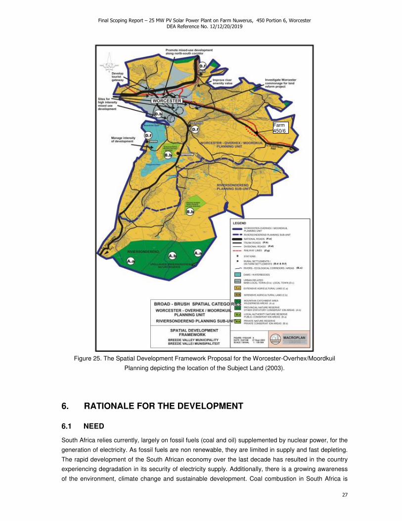
The subject land is located in the Worcester-Overhex/Moordkuil Planning Unit of the Breede Valley
Municipality. The SDF classifies the subject land as Extensive Agricultural Land (C.a.). The proposed
PV solar power plant aims to have a much more positive impact with respect to economic development,
employment opportunities and tourist attraction to the region in comparison to the current land use of
small stock farming.
The subject land is currently zoned Agriculture I. The Breede Valley Municipality currently do not have a
specific zoning scheme that applies to this type of development (power generation). After discussions
between BolandPlan Town and Regional Planners and the senior personnel at DEADP PLANNING and
the National Department of Agriculture, they were given the advice not to rezone to accommodate the
establishment of any sunpower structures, supporting infrastructure or access routes in any form or for
any purpose, unless the application adheres to the norms and standards for approval of the subdivision
of agricultural land. Which in this applications case is not applicable.
An application is in process to obtain a temporarily “Departure” from the current zoning scheme to
accommodate the development. There will be no change in land use. No agricultural land will be
subdivided.
DEPARTURE:- a temporary land use in terms of Section 15(1)(a)(ii) of the Ordinance on Land Use
Planning, 1985, to use land on a temporary basis for a purpose that is not included in the Land Use
Planning Ordinance.
Final Scoping Report – 25 MW PV Solar Power Plant on Farm Nuwerus, 450 Portion 6, Worcester DEA Reference No. 12/12/20/2019
27
Figure 25. The Spatial Development Framework Proposal for the Worcester-Overhex/Moordkuil
Planning depicting the location of the Subject Land (2003).
6. RATIONALE FOR THE DEVELOPMENT
6.1 NEED
South Africa relies currently, largely on fossil fuels (coal and oil) supplemented by nuclear power, for the
generation of electricity. As fossil fuels are non renewable, they are limited in supply and fast depleting.
The rapid development of the South African economy over the last decade has resulted in the country
experiencing degradation in its security of electricity supply. Additionally, there is a growing awareness
of the environment, climate change and sustainable development. Coal combustion in South Africa is
Farm 450/6

Final Scoping Report – 25 MW PV Solar Power Plant on Farm Nuwerus, 450 Portion 6, Worcester DEA Reference No. 12/12/20/2019
28
the main contributor to carbon dioxide emissions, which is one of the main greenhouse gasses linked to
climate change. It is therefore becoming critical to find alternative energy sources to meet the expected
increases in electricity demand. South Africa requires investment in an electricity generation mix and the
development of large-scale renewable energy systems is strategically important for increasing the
diversity of electricity supply. Project Alpha therefore attempts to address an issue of national
importance.
The subject land is currently used for grazing of small stock (sheep and goat). This agricultural activity
has a much lower economic value in comparison to the proposed PV solar power plant. The proposed
activity will provide additional employment opportunities and will make use of local companies in the
construction and security sector. Additionally SanVal Energy has indicated its intention to draw on local
woman owned businesses for the proposed development.
6.2 DESIRABILITY
South Africa has a high level of renewable energy potential. The Government’s White Paper on
Renewable Energy Policy (2003) supports the establishment of renewable energy technologies,
targeting the provision of 10 000 GWh ( 10 000 000 MWh) of electricity from renewable resources by
2013.
South Africa experiences some of the highest levels of solar radiation in the World. PV Solar Power
does not require water as an energy transfer medium, which is desirable in a water scarce country.
The Western Cape Provincial Growth and Development Strategy (Western Cape Provincial Government
Gazette, PN 306/2006) identifies the Breede Valley, as a major regional development corridor, and
Worcester, as a leader town with high growth potential.
Although the extent of job creation is difficult to quantify at this stage, it is expected that approximately
200 employment opportunities will be created during the construction, manufacturing and installation
stages for Phase I. For the operation and maintenance phase of this development, back-office support
will be boosted due to the relative infancy of this technology in South Africa. Base operations is
expected to provide 22-25 job opportunities. Additional employment opportunities would include security
services and the proposed science centre.
This development is furthermore desirable as it:
• Does not detract from policy plans.
• Will encourage the social and economic development of marginalised, rural communities.
• May attract environmentally aware (green) tourists to the region and is adequately situated
along the Route 62.
• Falls within an ecosystem that is considered Least Threatened.
• Is located in an area that does not fall within any Critical Biodiversity Areas.
• Will not impact on peoples health or wellbeing as the development is waste, noise, odour and
emission free.
• Can feed the electricity into the Eskom power line crossing the property.

Final Scoping Report – 25 MW PV Solar Power Plant on Farm Nuwerus, 450 Portion 6, Worcester DEA Reference No. 12/12/20/2019
29
• Does not require additional infrastructure or municipal services apart from a short distance of
transmission line.
• Will be the first large scale PV technology solar power plant in the region if not South Africa, and
will inform the development of future PV solar power developments.
7. LEGAL REQUIREMENTS
The current environmental impact assessment is being undertaken in terms of the National
Environmental Management Act (Act 107 of 1998), read with section 24 (5): NEMA EIA Regulations
2010. Provisions of various other Acts are also considered within this EIA. Compliance with the
provincial planning ordinance, the Land Use Planning Ordinance No. 15 of 1985 (LUPO) is being
undertaken as a separate, but parallel process to the EIA.
The legislation that is relevant to this study is briefly outlined below. These environmental requirements
are not intended to be definitive or exhaustive but serve to highlight key environmental legislation and
responsibilities.
7.1 THE CONSTITUTION OF THE REPUBLIC OF SOUTH AFRICA
The Constitution of the Republic of South Africa (Act 108 of 1996) states that everyone has a right to a
non-threatening environment and that reasonable measure are applied to protect the environment. This
includes preventing pollution and promoting conservation and environmentally sustainable development,
while promoting justifiable social and economic development.
7.2 NATIONAL ENVIRONMENTAL MANAGEMENT ACT
The National Environmental Management Act (Act 107 of 1998) (NEMA), as amended, makes provision
for the identification and assessment of activities that are potentially detrimental to the environment and
which require authorization from the relevant authorities based on the findings of an environmental
assessment. NEMA is a National Act, which is enforced by the Department of Environmental Affairs
(DEA). These powers are delegated in the Western Cape to the Department of Environmental Affairs
and Development Planning (DEA&DP). The DEA is however the relevant authority for all energy
development projects which fall under the National Energy and Response Plan (NERP).
According to the regulations of Section 24(5) of NEMA, authorisation is required for the following for the
proposed PV solar power plant development (Project Alpha) on the farm Nuwerus No. 450, Portion 6,
Worcester.
Government Notice R545 of 2010, listed activities as amended by R660:
1 The construction of facilities or infrastructure for the generation of electricity where the electricity
output is 20 megawatts or more. 15 Physical alteration of undeveloped, vacant or derelict land for residential, retail, commercial,
recreational, industrial or institutional use where the total area to be transformed is 20 hectares or more;
except where such physical alteration takes place for:

Final Scoping Report – 25 MW PV Solar Power Plant on Farm Nuwerus, 450 Portion 6, Worcester DEA Reference No. 12/12/20/2019
30
(i) linear development activities; or (ii) agriculture or afforestation where activity 16 in this Schedule will apply.
Government Notice R546 of 2010, listed activities as amended by R660: 14 The clearance of an area of 5 hectares or more of vegetation where 75% or more of the
vegetative cover constitutes indigenous vegetation..., (a) In Eastern Cape, Free State, KwaZulu-Natal, Gauteng, Limpopo, Mpumalanga, Northern Cape, Northwest and Western Cape: All areas outside urban areas.
Government Notice R544 of 2010, listed activities as amended by R660:
56 Phased activities for all activities listed in this Schedule, which commenced on or after the effective date of this Schedule, where any one phase of the activity may be below a threshold but where a combination of the phases, including expansions or extensions, will exceed a specified threshold; -
The environmental scoping and EIA processes are being undertaken in distinct phases, refer to Figures 1a
& 1b. This Report forms part of the Scoping Phase.
7.3 CONSERVATION OF AGRICULTURAL RESOURCES ACT
The purpose of the Conservation of Agricultural Resources Act (Act 43 of 1983) is to provide for control
over the utilization of the natural agricultural resources in order to promote the conservation of the soil,
the water sources and the vegetation and the combating of weeds and invader plants.
7.4 NATIONAL ENVIRONMENTAL MANAGEMENT: BIODIVERSITY ACT
The National Environmental Management: Biodiversity Act, 2004 (Act 10 of 2004) (NEMBA) is part of a
suite of legislation falling under NEMA, which includes the Waste Act, Protected Areas Act, the Air
Quality Bill and the Coastal Zone Bill. Chapter 4 of NEMBA deals with threatened and protected
ecosystems and species and related threatened processes and restricted activities. The need to protect
listed ecosystems is addressed (Section 54). Section 73 deals with Duty of Care relating to invasive
species, while Section 76(2) calls for development of invasive species monitoring, control and
eradication plans by all organs of state in all spheres of government, as part of environmental
management plans required in terms of Section 11 of NEMA.
7.5 NATIONAL HERITAGE RESOURCES ACT
The protection and management of South Africa’s heritage resources are controlled by the National
Heritage Resources Act (Act No. 25 of 1999). South African National Heritage Resources Agency
(SAHRA) is the enforcing authority and in the Western Cape, SAHRA have, in most cases, delegated
this authority to Heritage Western Cape (HWC).
In terms of Section 38 of the National Heritage Resources Act, SAHRA and/or HWC will require a
Heritage Impact Assessment (HIA) where certain categories of development are proposed. Section
38(8) also makes provision for the assessment of heritage impacts as part of an EIA process and
indicates that if such an assessment is found to be adequate, a separate HIA is not required.

Final Scoping Report – 25 MW PV Solar Power Plant on Farm Nuwerus, 450 Portion 6, Worcester DEA Reference No. 12/12/20/2019
31
The National Heritage Resources Act requires relevant authorities to be notified regarding this
proposed development, as the following activity is relevant:
•••• any development or other activity which will change the character of a site exceeding 5 000 m² in
extent;
Furthermore, in terms of Section 34(1), no person may alter or demolish any structure or part of a
structure, which is older than 60 years without a permit issued by the SAHRA, or the responsible
resources authority. Nor may anyone destroy, damage, alter, exhume or remove from its original
position, or otherwise disturb, any grave or burial ground older than 60 years, which is situated outside a
formal cemetery administered by a local authority, without a permit issued by the SAHRA, or a provincial
heritage authority, in terms of Section 36 (3). In terms of Section 35 (4), no person may destroy,
damage, excavate, alter or remove from its original position, or collect, any archaeological material or
object, without a permit issued by the SAHRA, or the responsible resources authority.
7.6 FENCING ACT
The fencing Act (No 31 of 1963) states that any person erecting a boundary fence may clean any bush
along the line of the fence up to 1.5 meters on each side thereof and remove any tree standing in the
immediate line of the fence. However, this provision must be read in conjunction with the environmental
legal provisions relevant to protection of flora.
7.7 GUIDELINES AND CONSERVATION PLANS
There are a number of guideline documents and conservation plans that must inform the work of both
the environmental practitioner and the various specialists. The principles contained in these documents
will be incorporated into the various aspects of the study. Policies and Guidelines considered during this
environmental assessment process include:
POLICY/ GUIDELINES ADMINISTERING AUTHORITY
Guidelines on Public Participation (2010) Dept. Environmental Affairs and Development Planning
Guidelines on Alternatives (2010) Dept. Environmental Affairs and Development Planning
Guidelines on Need and Desirability (2010) Dept. Environmental Affairs and Development Planning
Information Document on Generic Terms of Reference for
EAPs and Project Schedules (2010) Dept. Environmental Affairs and Development Planning
Guidelines for involving Heritage Specialists in EIA
Processes (2005) Dept. Environmental Affairs and Development Planning
Guidelines for involving Biodiversity Specialists in EIA
Processes (2005) Dept. Environmental Affairs and Development Planning
Guideline for Involving Visual and Aesthetic Specialists in
EIA Processes (2005) Dept. Environmental Affairs and Development Planning
Western Cape Provincial Spatial Development Framework
(2005) Dept. Environmental Affairs and Development Planning
Breede Valley Spatial Development Framework (2007) Breede Valley municipality
Guideline for Environmental Impact assessment for Department of Environmenatl Affairs and Tourism

Final Scoping Report – 25 MW PV Solar Power Plant on Farm Nuwerus, 450 Portion 6, Worcester DEA Reference No. 12/12/20/2019
32
Facilities to be Included in the National Energy Response
Plan (2008)
Fynbos Forum Ecosystem Guidelines for Environmental
Assessment in the Western Cape (2005) Capenture, South African National Biodiversity Institute
8. PUBLIC PARTICIPATION PROCESS
The Public Participation Process (PPP) during the Scoping Phase of this environmental process was
conducted in order to inform Interested and Affected Parties (I&APs) of the proposed project and to
identify issues, comments and concerns as raised by I&APs. The PPP aims to promote open channels
of communication between the project team and I&APs. All views and concerns are documented and
considered during the evaluation of potential impacts and risks associated with the project.
Public Participation Process to date:
• The addresses of all neighbours, and properties within 100 metres of Farm 450/6, Worcester
were obtained from the Breede Valley Municipality records office and entered into an I&APs
database.
• An advert describing the proposed development, expected activities to be triggered, the public
participation process and including an invitation to register and comment, was placed in English
and Afrikaans in the local newspaper, the Worcester Standard, on the 14th of October 2010.
• An A1 sized site notice, in English and Afrikaans, describing the proposed development,
expected activities to be triggered, public participation process, and inviting comment, was
erected at the proposed site on the 19th of October 2010.
• Notices describing the proposed development, expected activities to be triggered, the public
participation process and including an invitation to comment, were sent to the neighbours and
properties within 100 metres of Farm 450/6, Worcester on the 15th of October 2010.
• All the notices also advertised the Public Meeting which was held on the 28th of October 2010 at
the Worcester Public Library (Baring Street).
• Notices and copies (digital or hard copy) of the draft Scoping Report were send to the following
commenting authorities:
� Breede Valley Municipality
� Worcester Tourism Office
� Cape Winelands District Municipality
� Cape Winelands Regional Tourism Office
� Municipal Ward Councilor
� Director of Sustainable Resource Management at the Department of Agriculture
Western Cape
� CapeNature
� Heritage Western Cape
� Department of Environmental Affairs and Development Planning (Western Cape)
� Department of Environmental Affairs (National)
� Eskom
� Breede Overberg Catchment Management Agency BOCMA

Final Scoping Report – 25 MW PV Solar Power Plant on Farm Nuwerus, 450 Portion 6, Worcester DEA Reference No. 12/12/20/2019
33
• Copies of the draft Scoping Report were available for public view at the Worcester Public
Library, the BolandEnviro offices in Worcester and on the website
www.BolandEnviro.co.za/projects for the duration of the commenting period.
• The comment period (40 days) commenced on the 28th of October and closed on the 6
th of
December 2010.
• In addition to the public Open Day (28th of October 2010) a Solar Energy Focus Group meeting
was held at the Worcester Business Forum on the 3rd
of December 2010.
Comments on the draft Scoping Report were received from CapeNature, Heritage Western Cape, Mr
Andres De Wet from the Worcester Business Forum, Department of Environmental Affairs and
Development Planning (Western Cape), Western Cape Department of Agriculture and BOCMA.
All comments and recommendations received from the public and authorities during the review of the
draft Scoping Report were considered and included into the Final Scoping Report and Plan of Study
which were submitted to the DEA on the 10th of February 2011.
It was agreed by the Department of Environmental Affairs Case Officer that the Final Scoping Report
could be submitted directly to the Department for review, without an additional commenting period of 21
days, based on the following (see correspondence – Appendix E):
• There were no substantial changes to the final report.
• All registered I&APs and commenting authorities will have the opportunity to comment on the
draft Environmental Impact Report (EIR) (40 days) as well as the Final EIR and Environmental
Management Program (21 days) during the EIA Phase.
• All registered I&APs were notified of the submission of the Final Scoping Report to the
Department of Environmental Affairs. The Final Scoping report will also be available on the
BolandEnviro website www.bolandenviro.co.za should any registered I&APs or commenting
authorities wish to comment on this report. Such comment will be incorporated into the draft EIR
should the Scoping Report and Plan of Study be accepted by the Department of Environmental
Affairs.
Once the Final Scoping Report and Plan of Study for EIA have been approved, the EIAs Phase will
proceed. All project documents in relation with the EIA Phase (draft EIA Report, Specialists Reports,
etc.) will be submitted for review to commenting authorities and registered I&APs.
Details and proofs of the Public Participation Process are included in Appendix E.

Final Scoping Report – 25 MW PV Solar Power Plant on Farm Nuwerus, 450 Portion 6, Worcester DEA Reference No. 12/12/20/2019
34
9. ENVIRONMENTAL ISSUES
9.1 VEGETATION
• Vegetation type is confirmed as Robertson Karoo (Worcester Renosterveld Karoo) which is
least threatened.
• Extensive areas of natural Robertson Karoo vegetation surround the subject land, and the
development is unlikely to have a significant high impact on the loss of the vegetation type or
connectivity.
• Although the solar panel mountings can be drilled into the earth, some vegetation will need to be
cleared for the roads and substation or when taller shrubs affect the installation of the panels.
• The long term effect of permanent shade over a large continuous natural area is likely to impact
on the vegetation composition.
• The development may impact on localised plant species.
9.2 FAUNA
• The development will transform the natural habitat of fauna occurring on the subject land.
• Large areas of natural habitat will still be available to fauna in the immediate surrounding areas.
• Proposed fences may have a significant impact on animal movement.
9.3 ECOLOGICAL PROCESSES
• The non-seasonal water course has been identified as an aquatic ecological support area.
These areas supports ecological processes such as plant distribution and animal migration.
9.4 STORM WATER
• The area covered by solar panels will produce storm water runoff with the potential of soil
erosion if counter measures are not put in place.
• The clearing of vegetation will also increase storm water runoff and induce the risk of erosion.
• The property is traversed by old water furrows which may have registered servitudes.
9.5 SOIL EROSION
• Storm water runoff from solar panels in combination with clearing of vegetation could induce a
higher risk of soil erosion.
9.6 VISUAL IMPACT
• The large number of solar panels will have a visual impact.
• The perimeter fence could have a visual impact, depending on material used.
• The proposed site is located adjacent to the Route 62. The site has a gentle slope towards the
R60 road (north) and a moderate north-western slope (towards Worcester) or a moderate north-
eastern slope (towards Robertson) in some areas. The development will be visible from the
road.
• The development will impact on the aesthetic appearance of the area.
• Alternative lay-out plans have been developed for the project which will vary in terms of visibility.

Final Scoping Report – 25 MW PV Solar Power Plant on Farm Nuwerus, 450 Portion 6, Worcester DEA Reference No. 12/12/20/2019
35
• Phase II of the project will have a higher visual impact as the area to be developed will be
increased significantly.
• The solar panels considered for this development are non-reflective.
• Could attract tourists that are environmentally aware (green) (Science/visitors centre).
• A Visual Impact Assessment will be conducted during the EIA Phase.
9.7 HERITAGE RESOURCES
• No historical buildings will be impacted by the development.
• The project may impact on archaeological remains. An Archaeological Impact Assessment will
be conducted during the EIA Phase.
• The development will impact on the aesthetical appearance (sense of place) of the area.
• A Visual Impact Assessment will be conducted during the EIA Phase.
9.8 RECOMMENDATIONS
• Vegetation corridors should be maintained within the subject land.
• Fences should be designed to allow animal movement, especially along the water course.
• Development within the water course should be avoided and a minimum of 32 m buffer area
should be maintained between the development and the water course.
• The water furrows should be excluded from the development and natural run-off within furrows
should be respected.
• Excessive storm water run off should be directed towards the existing water furrows and the
water courses located on the property.
• Adequate measures should be implemented to prevent soil erosion.
• Fences and buildings design and colour should blend in with the natural appearance of the
landscape.
• Slopes should be considered in the lay-out to reduce visibility from the road.
• PV panels selected should be as non-reflective as possible.

Final Scoping Report – 25 MW PV Solar Power Plant on Farm Nuwerus, 450 Portion 6, Worcester DEA Reference No. 12/12/20/2019
36
10. PLAN OF STUDY FOR EIA
10.1 TASKS TO BE UNDERTAKEN
The following is a list of tasks to be performed as part of the EIA Process. Should the process be
modified significantly, changes will be copied to DEA.
EIA PROCESS
Acceptance of the SR and approval of the Plan of Study for EIA. February 2011
Undertake specialist studies. February 2011 - April 2011
Compile draft Environmental Impact Report (EIR) February 2011 - April 2011
Advertise and release draft EIR for public comment (40 days)
End April 2011, depending on additional specialist requirements from DEA
Receive responses to the draft EIR. End May / beginning June 2011
Preparation of a FINAL EIR and submission to registered I&APs (21 days commenting period).
June 2011
Receive responses to the Final EIR. End June 2011
Update Final EIR and submit to DEA for a decision. July 2011
10.2 METHODOLOGY TO BE FOLLOWED
Full copies of the draft Environmental Impact Report (EIR) will be placed at the Worcester Library and
on our website www.BolandEnviro.co.za. Interested and affected parties will be notified of the draft EIR
by means of advertisements in the Worcester Standard. In addition to the advertisements, registered
I&APs and commenting authorities will be notified and the executive summaries and digital copies of the
full EIR will be posted to them. The draft EIR will be made available for a 40-day comment period.
Correspondence with I&APs will be via registered/normal post, fax, telephone, email and newspaper
advertisements. All reports will be in English, with advertisements and notification letters in English and
Afrikaans.
At the end of the comment period, the EIR will be revised in response to feedback received from I&APs.
All comments received and responses to the comments will be incorporated into the final EIR. Should
there be significant changes to the EIR, the Final EIR will be released for an additional 21 days
commenting period to all registered I&APs. The final EIR will then be updated (according to any
responses received) and submitted to DEA for a decision.

Final Scoping Report – 25 MW PV Solar Power Plant on Farm Nuwerus, 450 Portion 6, Worcester DEA Reference No. 12/12/20/2019
37
10.3 CRITERIA FOR SPECIALIST ASSESSMENT OF IMPACTS
Based on the issues raised by I&APs and the project team, specialist studies will be undertaken to
provide information to address concerns and assess the impacts of the proposed development on the
environment. The specialists are provided with set criteria for undertaking their assessments, to allow
for comparative assessment of all issues. These criteria are detailed in the Terms of Reference to each
specialist. The criteria are based on the EIA Regulations, published by the Department of
Environmental Affairs and Tourism (April 1998) in terms of the National Environmental Management Act
(NEMA) Act 107 of 1998.
These criteria include:
• Nature of the impact
This is an appraisal of the type of effect the construction, operation and maintenance of a
development would have on the affected environment. This description should include what is
to be affected and how.
• Extent of the impact
Describe whether the impact will be: local extending only as far as the development site area; or
limited to the site and its immediate surroundings; or will have an impact on the region, or will
have an impact on a national scale or across international borders.
• Duration of the impact
The specialist should indicate whether the lifespan of the impact would be short term (0-5
years), medium term (5-15 years), long terms (16-30 years) or permanent.
• Intensity
The specialist should establish whether the impact is destructive or benign and should be
qualified as low, medium or high. The specialist study must attempt to quantify the magnitude of
the impacts and outline the rationale used.
• Probability of occurrence
The specialist should describe the probability of the impact actually occurring and should be
described as improbable (low likelihood), probable (distinct possibility), highly probable (most
likely) or definite (impact will occur regardless of any prevention measures).
The impacts should also be assessed in terms of the following aspects:
• Status of the impact
The specialist should determine whether the impacts are negative, positive or neutral (“cost –
benefit” analysis). The impacts are to be assessed in terms of their effect on the project and the
environment. For example, an impact that is positive for the proposed development may be
negative for the environment. It is important that this distinction is made in the analysis.
• Cumulative impact
Consideration must be given to the extent of any cumulative impact that may occur due to the
proposed development. Such impacts must be evaluated with an assessment of similar
developments already in the environment. Such impacts will be either positive or negative, and
will be graded as being of negligible, low, medium or high impact.
• Degree of confidence in predictions
The specialist should state what degree of confidence (low, medium or high) is there in the
predictions based on the available information and level of knowledge and expertise.

Final Scoping Report – 25 MW PV Solar Power Plant on Farm Nuwerus, 450 Portion 6, Worcester DEA Reference No. 12/12/20/2019
38
Based on a synthesis of the information contained in the above-described procedure, the specialist is
required to assess the potential impacts in terms of the following significance criteria:
• No significance: the impacts do not influence the proposed development and/or environment in
any way.
• Low significance: the impacts will have a minor influence on the proposed development and/or
environment. These impacts require some attention to modification of the project design where
possible, or alternative mitigation.
• Moderate significance: the impacts will have a moderate influence on the proposed
development and/or environment. The impact can be ameliorated by a modification in the
project design or implementation of effective mitigation measures.
• High significance: the impacts will have a major influence on the proposed development and/or
environment.
The final Impact Assessment Report will include the following sections:
• Executive Summary
• Introduction and Description of Study
• Methodology
• Results
• Assessment of Impacts (including mitigation measures to reduce negative impacts and
measures to enhance positive impacts and the completion of impact tables)
• Discussion
• Recommendations
• Conclusion
10.4 BRIEFS FOR SPECIALIST STUDIES TO BE UNDERTAKEN AS PART OF
THE EIA PHASE
10.4.1 HERITAGE IMPACT ASSESSMENTS
In terms of the National Heritage Resources Act (Act No. 25 of 1999), a Heritage Impact Assessment
(HIA) is required for this proposal. The following specialised impact assessments are required from
Heritage Western Cape (HWC) (see comments from HWC in Appendix E - PPP).
10.4.1.1 ARCHAEOLOGICAL IMPACT ASSESSMENT
An Archaeological Impact Assessment will be conducted by the Agency for Cultural Resource
Management (ACRM).
The terms of reference for the archaeological study are:
• to determine whether there are likely to be any important archaeological sites within the proposed
site;

Final Scoping Report – 25 MW PV Solar Power Plant on Farm Nuwerus, 450 Portion 6, Worcester DEA Reference No. 12/12/20/2019
39
• to identify and map archaeological occurrences within the proposed site;
• to assess the sensitivity and conservation significance of archaeological sites within the proposed
site;
• to assess the status and significance of any impacts resulting from the proposed development, and
• to identify measures to protect any valuable archaeological sites that may exist within the proposed
site.
10.4.1.2 VISUAL IMPACT ASSESSMENT
A specialist Visual Assessment will be conducted by Bridget O’Donoghue Heritage Specialist and
Architect Consultancy to assess the extent of the visual impact on the natural environment.
The VIA will include the following:
• Assess the two development options identified in the Scoping Report;
• Determine the visibility of the proposed development area from significant routes and
viewpoints;
• Assess the area from which the development will be visible i.e. the view catchment or the view
shed;
• Identify the scenic resources and visually sensitive environments;
• Identify potential visual impacts of the proposed developments;
• Recommend possible mitigation measures to minimise the visual impacts of the proposed
development if necessary.
10.4.1.3 PALAEONTOLOGICAL IMPACT ASSESSMENT
A desktop Palaeontological Impact Assessment will be conducted by Natura Viva cc.
The Scope of Work include:
PHASE 1 – PREPARATION
Preparation of the desktop study on fossil heritage of study area is based on:
• analysis of stratigraphy, age and depositional setting of fossil-bearing units
• review of all relevant palaeontological and geological literature, including geological maps,
previous palaeontological impact reports
• location and examination of any fossil collections from study area (e.g. museums)
• data on proposed development provided by the developer (e.g. location of footprint, depth and
volume of bedrock excavation envisaged)
PHASE 2 – REPORT & FEEDBACK
The palaeontological impact report includes:
• outline of relevant legislation
• illustrated, fully-referenced review of palaeontological heritage within study area

Final Scoping Report – 25 MW PV Solar Power Plant on Farm Nuwerus, 450 Portion 6, Worcester DEA Reference No. 12/12/20/2019
40
• identification and ranking of highlights and sensitivities to development of fossil heritage within
study area
• specific recommendations for further palaeontological mitigation (if any)
• recommendations and suggestions regarding fossil heritage management on site, including
conservation measures as well as promotion of local fossil heritage (e.g. for public education,
schools)
• outline of experience of heritage practitioner and statement of independence
10.4.2 BOTANICAL/ECOLOGICAL ASSESSMENT
A botanical assessment will be conducted by our botanical specialist. A site visit was already conducted
in October 2010 in order to assess the presence of bulbs. A detailed report will be compiled during the
EIA Phase.
The terms of reference for this will include the following:
• The broad ecological characteristics of the site and its surrounds will be described in terms of
any mapped spatial components of ecological processes and/or patchiness, patch size, relative
isolation of patches, connectivity, corridors, disturbance regimes, ecotones, buffering, viability,
etc.
• In terms of biodiversity pattern, the following will be identified or described:
Community and ecosystem level
� The main vegetation type, its aerial extent and interaction with neighbouring types, soils or
topography.
� The types of plant communities that occur in the vicinity of the site.
� Threatened or vulnerable ecosystems.
Species level
� Red Data Book (RDB) species.
� The viability of, and estimated population size of the RDB species that are present.
� The likelihood of other RDB species, or species of conservation concern, occurring in the
vicinity.
Other pattern issues
� Any significant landscape features or rare or important vegetation associations such as
seasonal wetlands, alluvium, seeps, quartz patches in the vicinity.
� The extent of alien plant cover of the site, and whether the infestation is the result of prior soil
disturbance such as ploughing or quarrying.
� The condition of the site in terms of current or previous land uses.
• In terms of biodiversity process, the following will be identified or described:
� The key ecological “drivers” of ecosystems on the site and in the vicinity.
� Any mapped spatial component of an ecological process that may occur at the site or in its
vicinity.
� Any possible changes in key processes.

Final Scoping Report – 25 MW PV Solar Power Plant on Farm Nuwerus, 450 Portion 6, Worcester DEA Reference No. 12/12/20/2019
41
This report will clearly indicate any constraints that would need to be taken into account in considering
the development proposals further, as well as indications of important constraints on the Subject Land.
The report will include the following:
• The significance of the potential impact of the proposed project, alternatives and related
activities – with and without mitigation – on biodiversity pattern and process at the site,
landscape and regional scales.
• The following will be indicated on a topographical map or orthomap:
� The area that would be impacted by the proposed development.
� The location of vegetation and spatial components of ecological processes that should not be
developed or otherwise transformed.
� Areas that must remain intact as corridors or ecological “stepping stones” to maintain
ecosystem functioning, including fires in fire-prone systems.
• Recommended actions that should be taken to prevent or, if prevention is not feasible, to
mitigate impacts and restore disturbed vegetation or ecological processes.
• Limitations and assumptions, particularly in relation to seasonality.
• Biodiversity considerations, which could be used to inform socio-economic aspects of the
proposed project.
10.4.3 FLOOD LINE ASSESSMENT
A flood line assessment will be conducted by African Environmental Development. The flood line
specialist will determine the 50 year flood line of the non-seasonal water course on the property, as
requested by BOCMA. The specialists will also be able to provide recommendations and assist with
implementation measures for storm water management.
The scope of work include:
• Modelling of a “Design Storm” (design flood determination) which will provide a water
discharge rate and a time frame over which the peak flood will occur.
• Accurate survey of the banks of the stream to produce a number of cross sections through
the water course.
• Routing of the determined flood volume through the stream profile.
• Determination of actual flood elevation.
• The flood lines are done in accordance with the official methods developed specifically for
South African conditions and are accepted throughout South Africa by all Government
Departments.
10.4.4 SOCIO-ECONOMIC IMPACT ASSESSMENT
A specialist, socio-economic study will not be conducted as this stage. The current socio-economic
environment will be described at an initial level and will address the potential impacts of the proposed

Final Scoping Report – 25 MW PV Solar Power Plant on Farm Nuwerus, 450 Portion 6, Worcester DEA Reference No. 12/12/20/2019
42
development within the environment. The project will have an overall positive impact on the socio-
economic environment.
10.4.5 GEOTECHNICAL STUDY
An engineering company will be appointed to conduct a geotechnical assessment of the soil and
geology which will be considered for the installation of panel mountings into the ground and materials
used for panel mountings.
10.5 PROJECT TEAM
EAP: Boland Environmental Consultants
Director Mr Nik Wullschleger
Project practitioner Mrs Johlene Krige
Specialists
Archaeological Mr Jonathan Kaplan Agency for Cultural Resource Management (ACRM)
Visual Mrs Bridget O’Donoghue Heritage Specialist and Architect
Consultancy
Palaeontological Dr John Almond Natura Viva cc, Cape Town
Botanical/Ecological Mrs Johlene Krige BolandEnviro (Botanist)
Flood Line Mr Garfield Krige African Environmental
Development
10.6 AUTHORITY CONSULTATION
The relevant authority (DEA) will be contacted during the following stages of the EIA Process:
• Accepting the Plan of Study for EIA
• Submission of Draft EIR
• Submission of Final EIR
• Issuing of the Environmental Authorisation
11. CONCLUSIONS
This Scoping Report, being undertaken in terms of NEMA (Act 107 of 1998), summarises the
environmental process undertaken to date, it provides a description of the proposed activity, the property
and the receiving environment. It summarizes environmental issues related to the proposed
development, potential significant positive and negative impacts, the identification of alternatives and
recommendations which need to be evaluated and investigated during the EIA phase.
As a result of the above, the need for the following specialist studies, were identified:
• Heritage Impact Assessment (Archaeological)
• Visual Impact Assessment

Final Scoping Report – 25 MW PV Solar Power Plant on Farm Nuwerus, 450 Portion 6, Worcester DEA Reference No. 12/12/20/2019
43
• Palaeontological Desktop Study
• Botanical/Ecological Assessment
• Flood Line Assessment
The significance of the impacts associated with the alternatives proposed will be assessed in these
specialist studies, as part of the EIA. Once the specialist studies have been completed, they will be
summarised in an Environmental Impact Report (EIR), which integrates the findings of the assessment
phase of the EIA. Mitigation measures will be separated into construction and operational phases.
Specific management and monitoring requirements/guidelines will also be provided and these
requirements/ guidelines will be used as conditions for the Environmental Decision, (should it be
granted), and subsequent Construction and Operational Environmental Management Programmes.
Based on the significance of the issues raised during the Public Participation Process and Scoping
Phase, it is evident that an Environmental Impact Assessment (EIA) is required. It is therefore
recommended that authorisation for the commencement of an EIA for the proposed development
be granted. Should the EIA process be authorised, the significant issues raised in the process to date
will be addressed and the specialist studies noted in this report, will be undertaken.