Project Location Demonstration Project Mining Area County ...

626 Wilshire Boulevard
Suite 1100
Los Angeles, CA 90017
213.599.4300 phone
213.599.4301 fax
www.esassoc.com
October 2, 2017 Doug McPherson Environmental Protection Specialist Bureau of Reclamation, Southern California Area Office 277008 Jefferson Avenue, Suite 202 Temecula, CA 92590 Subject: Torrance Van Ness Well Field for Water Sufficiency and Drought Resiliency Project Dear Mr. McPherson: The following letter report documents the results of cultural resources tasks conducted by Environmental Science Associates (ESA) in support of the Torrance Van Ness Well Field for Water Sufficiency and Drought Resiliency Project (Project). The City of Torrance (City) is seeking funding from the U.S. Bureau of Reclamation (BOR) for the Project. As such, BOR is the lead federal agency responsible for compliance with Section 106 of the National Historic Preservation Act of 1966 (Section 106). This letter report was prepared to assist BOR in completing cultural resources identification efforts required by Section 106 and provides the methods and results of Native American outreach and an archaeological resources survey conducted for the Project.
ESA personnel involved in the preparation of this letter report include Candace Ehringer, M.A., RPA, Principal Investigator; Michael Vader B.A., report author; and Vanessa Ortiz M.A., RPA and Henry Chodsky B.A., surveyors. Ms. Ehringer and Ms. Ortiz meet the Secretary of the Interior’s (SOI) Professional Qualification Standards (PQS) for Archaeology.
Project Understanding and Location
The Project would enhance local and regional drought resiliency and water emergency preparedness within the City and neighboring jurisdictions.
The Project would construct three new groundwater wells, which can produce an average 4,500 acre-feet-year of local, drought-resilient groundwater. The three new groundwater wells (Well No. 12, 13, and 14) would be installed at three separate locations: Well No. 12 would be located within a vacant lot (APN 409-501-9901); Well No. 13 would be located within La Carretera Park (APN 409-600-3901); and Well No. 14 would be located within Descanso Park (APN 409-503-5900). A 4-mile municipal water main would be constructed to connect the wells to the City’s currently-unused, existing Border Avenue water treatment and storage reservoir facility.
The Project is located within the City of Torrance situated in the southern portion of Los Angeles County approximately 16 miles southwest of downtown Los Angeles (Figure 1). Specifically, the Project is located within unsectioned portions of Township 3 and 4 South, Range 14 West on the Torrance 7.5-minute U.S. Geological Survey (USGS) topographic map (Figure 2). The horizontal Area of Potential Effects (APE) for the

Mr. McPherson October 2, 2017 Page 2
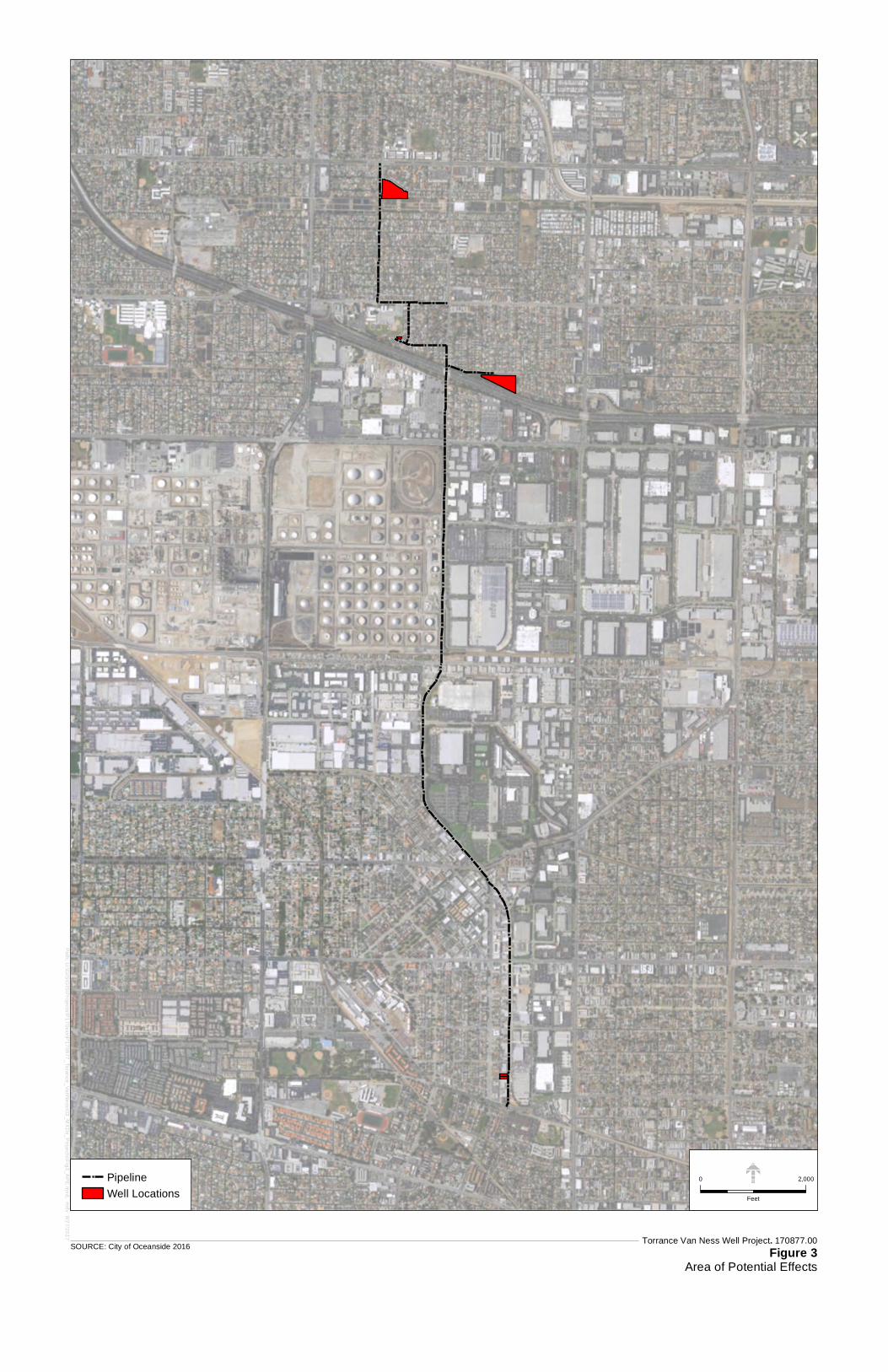
Project includes 5.96 acres and 4 linear miles and encompasses the Project components listed below (Figure 3). The vertical APE would include the maximum depth of ground disturbance, which is currently unknown.
1. The three parcels in which the proposed wells would be installed (APNs 409-501-9901, 409-600-3901, and 409-503-5900);
2. The footprint of the water main, which would be constructed within the existing right-of-ways of Casimir Avenue, West 182nd Street, Purche Avenue, 185th Street, Van Ness Avenue, and Border Avenue; and
3. The Border Avenue water treatment facility located on the east side of Border Road approximately 515 north of the intersection of Border Road and West 223rd Street.

MontebelloSanta Monica
Santa Monica
Los Angeles
Marinadel Rey
Inglewood
Commerce
El Segundo
Gardena
Compton
Redondo BeachTorrance
Carson
Lakewood
Dominguez
RanchoPalosVerdes
Long Beach
§̈¦710
§̈¦710
§̈¦5
§̈¦10
§̈¦105§̈¦105
§̈¦110
§̈¦405
UV91
UV42
UV19
UV1
UV2
UV90
UV2
UV90
SOURCE: ESRI.
Area ofDetail
0 3
Miles
Torrance Van Ness Well Project. 170877.0
Figure 1Project Vicinity
P a c i f i c O c e a n
Project Area

Torrance Van Ness Well Project. 170877.00
Figure 2Project Location
SOURCE: City of Oceanside 2016
Water Main
Well Locations
0 2,000
Feet
Pa
th: U:\G
IS\G
IS\P
roje
cts\P1
70xxx\P
17
0877
_To
rance
_V
anN
ess\03
_MX
Ds_
Proje
cts\Fig2
_Pro
j_L
ocation.m
xd, md
v 9/19/2
017
Torrance Van Ness Well Project. 170877.00
Figure 3Area of Potential Effects
SOURCE: City of Oceanside 2016
Pipeline
Well Locations
0 2,000
Feet
Pa
th: U:\G
IS\G
IS\P
roje
cts\P1
70xxx\P
17
0877
_To
rance
_V
anN
ess\03
_MX
Ds_
Proje
cts\Fig3
_AP
E.m
xd, md
v 9/27/2
017
Mr. McPherson October 2, 2017 Page 6
Archival Research
A records search for the Project was conducted by staff at the California Historical Resources Inventory System (CHRIS) South Central Coastal Information Center (SCCIC) on August 10, 2017. The records search included a review of all recorded cultural resources within a ½-mile radius of the APE, as well as a review of cultural resource reports on file. The California Points of Historical Interest (PHI), the California Historical Landmarks (SHL), the California Register of Historical Resources (CRHR), the National Register of Historic Places (NRHP), the California State Historic Properties Directory (HPD), and the City of Los Angeles Historic-Cultural Monuments (LAHCM) listings were also reviewed. The SCCIC records search indicates that no archaeological resources have been previously recorded within the APE or the ½-mile records search radius, and that the APE has not been previously surveyed for archaeological resources (Galaz, 2017).
Native American Outreach
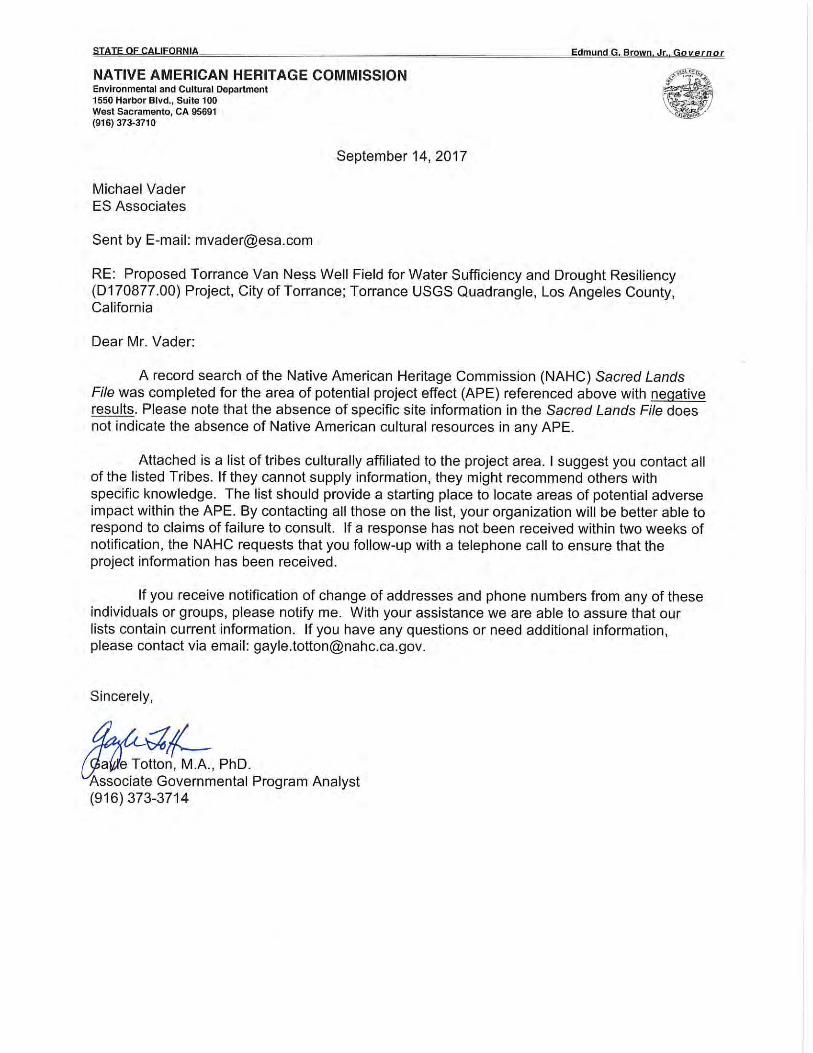
The California Native American Heritage Commission (NAHC) maintains a confidential Sacred Lands File (SLF) that contains sites of traditional, cultural, or religious value to the Native American community. The NAHC was contacted on September 11, 2017 to request a search of the SLF. The NAHC responded to the request in a letter dated September 14, 2017. The results of the SLF search indicate that Native American cultural resources are not known to be located within or in the vicinity of the APE. The NAHC also provided a list of Native American groups and individuals who are culturally and traditionally affiliated with the region in which the APE is located.
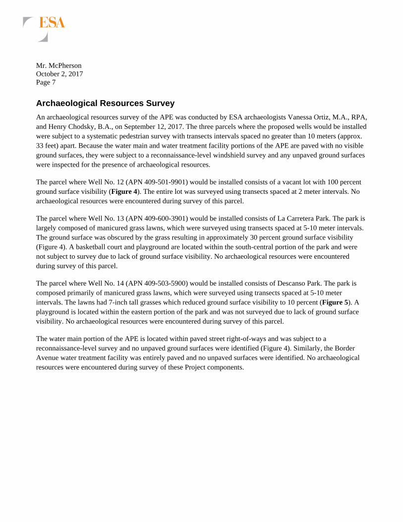
Outreach letters were sent via certified mail on September 18, 2017 to the Native American groups and individual identified by the NAHC as being affiliated with the APE. The letters described the Project and included a map depicting the location of the APE. Recipients were requested to reply with any information concerning Native American cultural resources that might be affected by the Project. Table 3 provides a summary of ESA’s outreach efforts. To date, one response has been received from Andrew Salas, Chairperson of the Gabrieleno Band of Mission Indians –Kizh Nation. In a letter dated September 21, 2017, Chairperson Salas stated that the Project is located within a sensitive area and requested consultation regarding the Project. All correspondence conducted as part of the Native American outreach is included in Appendix A.
TABLE 3
NATIVE AMERICAN OUTREACH SUMMARY
Contact Tribe/Organization Date Letter Mailed Response
Andrew Salas, Chairperson
Gabrieleno Band of Mission Indians - Kizh Nation 9/18/2017
Requested consultation on 9/21/2017
Anthony Morales, Chairperson
Gabrieleno/Tongva San Gabriel Band of Mission Indians 9/18/2017 No response to date
Sandonne Goad, Chairperson Gabrielino/Tongva Nation 9/18/2017 No response to date Robert Dorame, Chairperson
Gabrielino Tongva Indians of California Tribal Council 9/18/2017 No response to date
Charles Alvarez Gabrielino-Tongva Tribe 9/18/2017 No response to date
Mr. McPherson October 2, 2017 Page 7
Archaeological Resources Survey
An archaeological resources survey of the APE was conducted by ESA archaeologists Vanessa Ortiz, M.A., RPA, and Henry Chodsky, B.A., on September 12, 2017. The three parcels where the proposed wells would be installed were subject to a systematic pedestrian survey with transects intervals spaced no greater than 10 meters (approx. 33 feet) apart. Because the water main and water treatment facility portions of the APE are paved with no visible ground surfaces, they were subject to a reconnaissance-level windshield survey and any unpaved ground surfaces were inspected for the presence of archaeological resources.
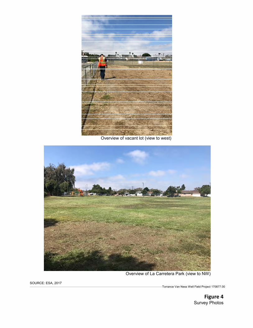
The parcel where Well No. 12 (APN 409-501-9901) would be installed consists of a vacant lot with 100 percent ground surface visibility (Figure 4). The entire lot was surveyed using transects spaced at 2 meter intervals. No archaeological resources were encountered during survey of this parcel.
The parcel where Well No. 13 (APN 409-600-3901) would be installed consists of La Carretera Park. The park is largely composed of manicured grass lawns, which were surveyed using transects spaced at 5-10 meter intervals. The ground surface was obscured by the grass resulting in approximately 30 percent ground surface visibility (Figure 4). A basketball court and playground are located within the south-central portion of the park and were not subject to survey due to lack of ground surface visibility. No archaeological resources were encountered during survey of this parcel.
The parcel where Well No. 14 (APN 409-503-5900) would be installed consists of Descanso Park. The park is composed primarily of manicured grass lawns, which were surveyed using transects spaced at 5-10 meter intervals. The lawns had 7-inch tall grasses which reduced ground surface visibility to 10 percent (Figure 5). A playground is located within the eastern portion of the park and was not surveyed due to lack of ground surface visibility. No archaeological resources were encountered during survey of this parcel.
The water main portion of the APE is located within paved street right-of-ways and was subject to a reconnaissance-level survey and no unpaved ground surfaces were identified (Figure 4). Similarly, the Border Avenue water treatment facility was entirely paved and no unpaved surfaces were identified. No archaeological resources were encountered during survey of these Project components.
Overview of vacant lot (view to west)
Overview of La Carretera Park (view to NW)
SOURCE: ESA, 2017 Torrance Van Ness Well Field Project 170877.00
Figure 4 Survey Photos

Overview of Descanso Park (view to SE)
Overview of water main alignment on Van Ness Ave (view to SW)
SOURCE: ESA, 2017 Torrance Van Ness Well Field Project 170877.00
Figure 5 Survey Photos

Mr. McPherson October 2, 2017 Page 10
Summary
No archaeological resources were identified as a result of the survey carried out for the Project. To date, one Native American representative (Chairperson Salas of the Gabrieleno Band of Mission Indians – Kizh Nation) has responded indicating that the Project is in a sensitive area and requesting consultation.
If you have any questions concerning the results of this letter report, please do not hesitate to contact me via email [email protected], or via phone at 831-737-7438.
Sincerely,
Candace Ehringer, M.A., RPA Senior Cultural Resources Specialist
References
Galaz, Michelle 2017 Records Search Results for the Van Ness Ave Well Field Project. Prepared for the City of
Torrance by the South Central Coastal Information Center.

Appendix A Native American Outreach

550 West C Street
Suite 750
San Diego, CA 92101
619.719.4200 phone
619.719.4201 fax
www.esassoc.com
September 11, 2017 Native American Heritage Commission 1550 Harbor Boulevard, Suite 100 West Sacramento, CA 95691 FAX- 916-373-5471 Subject: SLF search request for the Torrance Van Ness Well Field for Water Sufficiency and Drought
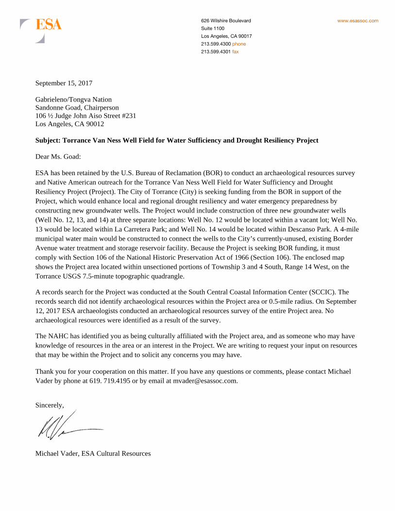
Resiliency Project (D170877.00) To whom it may concern: ESA has been retained by the U.S. Bureau of Reclamation (BOR) to conduct an archaeological resources survey and Native American outreach for the Torrance Van Ness Well Field for Water Sufficiency and Drought Resiliency Project (Project). The City of Torrance (City) is seeking funding from the BOR in support of the Project, which would enhance local and regional drought resiliency and water emergency preparedness by constructing new groundwater wells, which can produce an average 4,500 acre-feet-year of local, drought-resilient groundwater, to serve the City of Torrance (City) and neighboring jurisdictions. The Project would include construction of three new groundwater wells (Well No. 12, 13, and 14) at three separate locations: Well No. 12 would be located within a vacant lot; Well No. 13 would be located within La Carretera Park; and Well No. 14 would be located within Descanso Park. A 4-mile municipal water main would be constructed to connect the wells to the City’s currently-unused, existing Border Avenue water treatment and storage reservoir facility. The enclosed map shows the Project area located within unsectioned portions of Township 3 and 4 South, Range 14 West, on the Torrance USGS 7.5-minute topographic quadrangle.
In an effort to provide an adequate appraisal of all potential impacts that may result from the Project, ESA is requesting that a Sacred Lands File search be conducted for sacred lands or traditional cultural properties that may exist within the Project area.
Thank you for your time and cooperation regarding this matter. To expedite the delivery of search results, please e-mail them to [email protected], or fax them to 619.719.4201. Please contact me at 619.241.9238 or e-mail me at [email protected] if you have any questions. Sincerely,
Michael Vader Cultural Resources

Torrance Van Ness Well and Pipeline Project. P170877.00
Figure 1Records Search Map
SOURCE: City of Oceanside 2016
Pipeline
Well Locations
0 2,000
Feet
Pa
th: U:\G
IS\G
IS\P
roje
cts\P1
70xxx\P
17
0877
_To
rance
_V
anN
ess\03
_MX
Ds_
Proje
cts\TV
N_R
ecords_
Sea
rch.m
xd, md
v 9/11/20
17


626 Wilshire Boulevard
Suite 1100
Los Angeles, CA 90017
213.599.4300 phone
213.599.4301 fax
www.esassoc.com
September 15, 2017 Gabrieleno/Tongva San Gabriel Band of Mission Indians Anthony Morales, Chairperson P.O. Box 693 San Gabriel, CA 91778 Subject: Torrance Van Ness Well Field for Water Sufficiency and Drought Resiliency Project Dear Mr. Morales: ESA has been retained by the U.S. Bureau of Reclamation (BOR) to conduct an archaeological resources survey and Native American outreach for the Torrance Van Ness Well Field for Water Sufficiency and Drought Resiliency Project (Project). The City of Torrance (City) is seeking funding from the BOR in support of the Project, which would enhance local and regional drought resiliency and water emergency preparedness by constructing new groundwater wells. The Project would include construction of three new groundwater wells (Well No. 12, 13, and 14) at three separate locations: Well No. 12 would be located within a vacant lot; Well No. 13 would be located within La Carretera Park; and Well No. 14 would be located within Descanso Park. A 4-mile municipal water main would be constructed to connect the wells to the City’s currently-unused, existing Border Avenue water treatment and storage reservoir facility. Because the Project is seeking BOR funding, it must comply with Section 106 of the National Historic Preservation Act of 1966 (Section 106). The enclosed map shows the Project area located within unsectioned portions of Township 3 and 4 South, Range 14 West, on the Torrance USGS 7.5-minute topographic quadrangle.
A records search for the Project was conducted at the South Central Coastal Information Center (SCCIC). The records search did not identify archaeological resources within the Project area or 0.5-mile radius. On September 12, 2017 ESA archaeologists conducted an archaeological resources survey of the entire Project area. No archaeological resources were identified as a result of the survey.
The NAHC has identified you as being culturally affiliated with the Project area, and as someone who may have knowledge of resources in the area or an interest in the Project. We are writing to request your input on resources that may be within the Project and to solicit any concerns you may have.
Thank you for your cooperation on this matter. If you have any questions or comments, please contact Michael Vader by phone at 619. 719.4195 or by email at [email protected].
Sincerely,
Michael Vader, ESA Cultural Resources

626 Wilshire Boulevard
Suite 1100
Los Angeles, CA 90017
213.599.4300 phone
213.599.4301 fax
www.esassoc.com
September 15, 2017 Gabrieleno Band of Mission Indians – Kizh Nation Andrew Salas, Chairperson P.O. Box 393 Covina, CA 91723 Subject: Torrance Van Ness Well Field for Water Sufficiency and Drought Resiliency Project Dear Mr. Salas: ESA has been retained by the U.S. Bureau of Reclamation (BOR) to conduct an archaeological resources survey and Native American outreach for the Torrance Van Ness Well Field for Water Sufficiency and Drought Resiliency Project (Project). The City of Torrance (City) is seeking funding from the BOR in support of the Project, which would enhance local and regional drought resiliency and water emergency preparedness by constructing new groundwater wells. The Project would include construction of three new groundwater wells (Well No. 12, 13, and 14) at three separate locations: Well No. 12 would be located within a vacant lot; Well No. 13 would be located within La Carretera Park; and Well No. 14 would be located within Descanso Park. A 4-mile municipal water main would be constructed to connect the wells to the City’s currently-unused, existing Border Avenue water treatment and storage reservoir facility. Because the Project is seeking BOR funding, it must comply with Section 106 of the National Historic Preservation Act of 1966 (Section 106). The enclosed map shows the Project area located within unsectioned portions of Township 3 and 4 South, Range 14 West, on the Torrance USGS 7.5-minute topographic quadrangle.
A records search for the Project was conducted at the South Central Coastal Information Center (SCCIC). The records search did not identify archaeological resources within the Project area or 0.5-mile radius. On September 12, 2017 ESA archaeologists conducted an archaeological resources survey of the entire Project area. No archaeological resources were identified as a result of the survey.
The NAHC has identified you as being culturally affiliated with the Project area, and as someone who may have knowledge of resources in the area or an interest in the Project. We are writing to request your input on resources that may be within the Project and to solicit any concerns you may have.
Thank you for your cooperation on this matter. If you have any questions or comments, please contact Michael Vader by phone at 619. 719.4195 or by email at [email protected].
Sincerely,
Michael Vader, ESA Cultural Resources

626 Wilshire Boulevard
Suite 1100
Los Angeles, CA 90017
213.599.4300 phone
213.599.4301 fax
www.esassoc.com
September 15, 2017 Gabrielino-Tongva Tribe Charles Alvarez 23454 Vanowen Street West Hills, CA 91307 Subject: Torrance Van Ness Well Field for Water Sufficiency and Drought Resiliency Project Dear Mr. Alvarez: ESA has been retained by the U.S. Bureau of Reclamation (BOR) to conduct an archaeological resources survey and Native American outreach for the Torrance Van Ness Well Field for Water Sufficiency and Drought Resiliency Project (Project). The City of Torrance (City) is seeking funding from the BOR in support of the Project, which would enhance local and regional drought resiliency and water emergency preparedness by constructing new groundwater wells. The Project would include construction of three new groundwater wells (Well No. 12, 13, and 14) at three separate locations: Well No. 12 would be located within a vacant lot; Well No. 13 would be located within La Carretera Park; and Well No. 14 would be located within Descanso Park. A 4-mile municipal water main would be constructed to connect the wells to the City’s currently-unused, existing Border Avenue water treatment and storage reservoir facility. Because the Project is seeking BOR funding, it must comply with Section 106 of the National Historic Preservation Act of 1966 (Section 106). The enclosed map shows the Project area located within unsectioned portions of Township 3 and 4 South, Range 14 West, on the Torrance USGS 7.5-minute topographic quadrangle.
A records search for the Project was conducted at the South Central Coastal Information Center (SCCIC). The records search did not identify archaeological resources within the Project area or 0.5-mile radius. On September 12, 2017 ESA archaeologists conducted an archaeological resources survey of the entire Project area. No archaeological resources were identified as a result of the survey.
The NAHC has identified you as being culturally affiliated with the Project area, and as someone who may have knowledge of resources in the area or an interest in the Project. We are writing to request your input on resources that may be within the Project and to solicit any concerns you may have.
Thank you for your cooperation on this matter. If you have any questions or comments, please contact Michael Vader by phone at 619. 719.4195 or by email at [email protected].
Sincerely,
Michael Vader, ESA Cultural Resources

626 Wilshire Boulevard
Suite 1100
Los Angeles, CA 90017
213.599.4300 phone
213.599.4301 fax
www.esassoc.com
September 15, 2017 Gabrielino Tongva Indians of California Tribal Council Robert Dorame, Chairperson P.O. Box 490 Bellflower, CA 90707 Subject: Torrance Van Ness Well Field for Water Sufficiency and Drought Resiliency Project Dear Mr. Dorame: ESA has been retained by the U.S. Bureau of Reclamation (BOR) to conduct an archaeological resources survey and Native American outreach for the Torrance Van Ness Well Field for Water Sufficiency and Drought Resiliency Project (Project). The City of Torrance (City) is seeking funding from the BOR in support of the Project, which would enhance local and regional drought resiliency and water emergency preparedness by constructing new groundwater wells. The Project would include construction of three new groundwater wells (Well No. 12, 13, and 14) at three separate locations: Well No. 12 would be located within a vacant lot; Well No. 13 would be located within La Carretera Park; and Well No. 14 would be located within Descanso Park. A 4-mile municipal water main would be constructed to connect the wells to the City’s currently-unused, existing Border Avenue water treatment and storage reservoir facility. Because the Project is seeking BOR funding, it must comply with Section 106 of the National Historic Preservation Act of 1966 (Section 106). The enclosed map shows the Project area located within unsectioned portions of Township 3 and 4 South, Range 14 West, on the Torrance USGS 7.5-minute topographic quadrangle.
A records search for the Project was conducted at the South Central Coastal Information Center (SCCIC). The records search did not identify archaeological resources within the Project area or 0.5-mile radius. On September 12, 2017 ESA archaeologists conducted an archaeological resources survey of the entire Project area. No archaeological resources were identified as a result of the survey.
The NAHC has identified you as being culturally affiliated with the Project area, and as someone who may have knowledge of resources in the area or an interest in the Project. We are writing to request your input on resources that may be within the Project and to solicit any concerns you may have.
Thank you for your cooperation on this matter. If you have any questions or comments, please contact Michael Vader by phone at 619. 719.4195 or by email at [email protected].
Sincerely,
Michael Vader, ESA Cultural Resources
626 Wilshire Boulevard
Suite 1100
Los Angeles, CA 90017
213.599.4300 phone
213.599.4301 fax
www.esassoc.com
September 15, 2017 Gabrieleno/Tongva Nation Sandonne Goad, Chairperson 106 ½ Judge John Aiso Street #231 Los Angeles, CA 90012 Subject: Torrance Van Ness Well Field for Water Sufficiency and Drought Resiliency Project Dear Ms. Goad: ESA has been retained by the U.S. Bureau of Reclamation (BOR) to conduct an archaeological resources survey and Native American outreach for the Torrance Van Ness Well Field for Water Sufficiency and Drought Resiliency Project (Project). The City of Torrance (City) is seeking funding from the BOR in support of the Project, which would enhance local and regional drought resiliency and water emergency preparedness by constructing new groundwater wells. The Project would include construction of three new groundwater wells (Well No. 12, 13, and 14) at three separate locations: Well No. 12 would be located within a vacant lot; Well No. 13 would be located within La Carretera Park; and Well No. 14 would be located within Descanso Park. A 4-mile municipal water main would be constructed to connect the wells to the City’s currently-unused, existing Border Avenue water treatment and storage reservoir facility. Because the Project is seeking BOR funding, it must comply with Section 106 of the National Historic Preservation Act of 1966 (Section 106). The enclosed map shows the Project area located within unsectioned portions of Township 3 and 4 South, Range 14 West, on the Torrance USGS 7.5-minute topographic quadrangle.
A records search for the Project was conducted at the South Central Coastal Information Center (SCCIC). The records search did not identify archaeological resources within the Project area or 0.5-mile radius. On September 12, 2017 ESA archaeologists conducted an archaeological resources survey of the entire Project area. No archaeological resources were identified as a result of the survey.
The NAHC has identified you as being culturally affiliated with the Project area, and as someone who may have knowledge of resources in the area or an interest in the Project. We are writing to request your input on resources that may be within the Project and to solicit any concerns you may have.
Thank you for your cooperation on this matter. If you have any questions or comments, please contact Michael Vader by phone at 619. 719.4195 or by email at [email protected].
Sincerely,
Michael Vader, ESA Cultural Resources
GABRIELEÑO BAND OF MISSION INDIANS – KIZH NATION
Historically known as The San Gabriel Band of Mission Indians
recognized by the State of California as the aboriginal tribe of the Los Angeles basin
Andrew Salas, Chairman Nadine Salas, Vice-Chairman Christina Swindall Martinez, secretary
Albert Perez, treasurer I Martha Gonzalez Lemos, treasurer II Richard Gradias, Chairman of the Council of Elders
PO Box 393, Covina, CA 91723 www.gabrielenoindians.org [email protected]
Los Angeles
626 Wilshire Blvd
Suite 1100
Los Angeles, CA 90017
Re: Section 106 Torrance Van Ness Well Field for Water Sufficiency and Drought Resiliency Project
Dear Michael Vader,
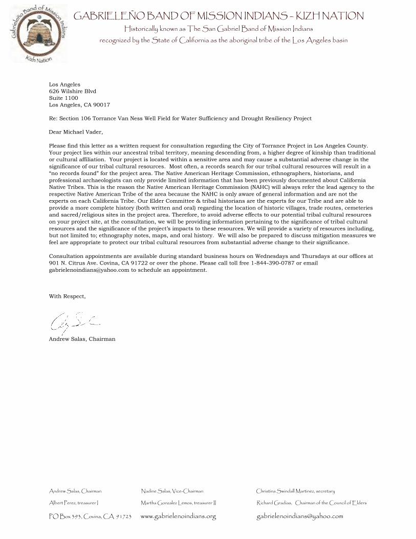
Please find this letter as a written request for consultation regarding the City of Torrance Project in Los Angeles County.
Your project lies within our ancestral tribal territory, meaning descending from, a higher degree of kinship than traditional
or cultural affiliation. Your project is located within a sensitive area and may cause a substantial adverse change in the
significance of our tribal cultural resources. Most often, a records search for our tribal cultural resources will result in a
“no records found” for the project area. The Native American Heritage Commission, ethnographers, historians, and
professional archaeologists can only provide limited information that has been previously documented about California
Native Tribes. This is the reason the Native American Heritage Commission (NAHC) will always refer the lead agency to the
respective Native American Tribe of the area because the NAHC is only aware of general information and are not the
experts on each California Tribe. Our Elder Committee & tribal historians are the experts for our Tribe and are able to
provide a more complete history (both written and oral) regarding the location of historic villages, trade routes, cemeteries
and sacred/religious sites in the project area. Therefore, to avoid adverse effects to our potential tribal cultural resources
on your project site, at the consultation, we will be providing information pertaining to the significance of tribal cultural
resources and the significance of the project’s impacts to these resources. We will provide a variety of resources including,
but not limited to; ethnography notes, maps, and oral history. We will also be prepared to discuss mitigation measures we
feel are appropriate to protect our tribal cultural resources from substantial adverse change to their significance.
Consultation appointments are available during standard business hours on Wednesdays and Thursdays at our offices at
901 N. Citrus Ave. Covina, CA 91722 or over the phone. Please call toll free 1-844-390-0787 or email
[email protected] to schedule an appointment.
With Respect,
Andrew Salas, Chairman