Project Narrative - Mesa County, Colorado Estates... · Project Report This report is for the...
32
Project Narrative December 21, 2016 Prepared for: P.O. BOX 1765 Grand Junction, CO 81502 Ron Abeloe, President For the proposed Subdivision and Development Prepared by Colorado Land Advisor, Ltd. I n d e p e n d e n c e E s t a t e s
Transcript of Project Narrative - Mesa County, Colorado Estates... · Project Report This report is for the...
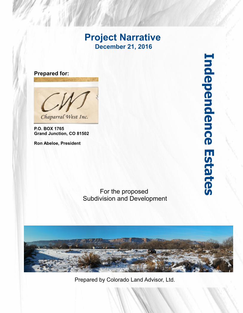
Project Narrative December 21, 2016
Prepared for:
P.O. BOX 1765Grand Junction, CO 81502
Ron Abeloe, President
For the proposed Subdivision and Development
Prepared by Colorado Land Advisor, Ltd.
Ind
e pen
de n
ce Est ates

2
Project Report
This report is for the private use and distribution of Chaparral West, Inc. it's successors and assigns.
© 2016 Chaparral West, Inc
Published in conjunction with Colorado Land Advisor, Ltd.
Prepared by: Jeffery Fleming, CNUa, RED+U Colorado Land Advisor, Ltd.305 Main Street | Suite CGrand Junction, CO. 81501
As a professional Development Planner much experience and research has gone into compiling information for this report. All statistical information was compiled from various sources and every attempt has been made to acknowledge the contributing
sources. Any errors of omission are unintentional and should be brought to the attention of the author as soon as possible.
Ind
epe n
den
c e Esta tes

3
Project Narrative
Table of Contents
Introduction and Summary 4
Site Analysis 5
Population and Density 7
Transportation and Emergency Services 8
Soils and Geological Investigations 9
Area Schools 10
Existing Land Use and Future Land Use 11
Comprehensive Plan 12
Surrounding Land Use 13
Proposed Land Use 14
RSF4 Zoning 16
Concept Layout 17
Utility Services 18
Irrigation Narrative 20
Development Schedule 21
Responses to Criteria 22
Ind
epe n
den
c e Esta tes

4
Introduction and Summary
The purpose of this Project Narrative, documents, and accompanying drawings, is intended to provide an overview of the property and proposed development utilizing Mesa County's Planning process.
The site selected for Independence Meadows consists of a single parcel of land that is 17.4 acres. The site is located near Foxwood Court and Roundup Drive in Mesa County, Colorado. The parcel of land currently is vacant. The Mesa County Assessor has assigned the property the following parcel number: 2697-354-62-003
Independence Meadows is now vacant land. Along the North end of the property there is a 560 acre vacant parcel. Along the East, West and South boundary of the property there are fully developed subdivisions with utilities, drainage and irrigation facilities in place. A small natural and seasonal creek ( known by some as Schultz Creek) flows from the Southeast towards the northwest to the Colorado River. The Colorado River is approximately 850 feet Northeast of the property.
We anticipate using the current Future Land Use zoning of Residential Medium Low with a density just under 3 units per acre as allowed in R4. We anticipate full build-out of Independence Meadows to occur over 3 filings. Access to each lot would be over fully developed asphalt street profiles with curb, gutter and sidewalk.
The plan calls for the ultimate development of up to 47 single-family homes. The resulting density is: 47 dwelling units on 17.4 development acres, or 2.7 dwelling units per acre. Home square footage will be market driven. However, typical land/structure ratios would recommend home sizes between 2000 and 4300 square feet each. 1 and 2 story homes are expected with 3 car garages prevalent on most plans.
Infrastructure construction for Filing 1 would begin in 2017 and likely be completed in less than 1 year. All necessary utilities for the new homes: water, gas, sewer, electric, etc. are adjacent, or on-site. Home construction would begin shortly after infrastructure.
.

5
Site Analysis
Location Map
The purpose of this section is to identify the physical and technical characteristics of the property selected for the Independence Meadows Subdivision in relationship to the surrounding area. This section also evaluates potential site development assets and constraints.
The site consists of one parcel of land that totals 17.4 acres. Located in Mesa County, Colorado. The longitude and latitude of the approximate center of the property is: Lat 39.108529 and Lon -108.671659. The NAD83 coordinates are UTM Zone 12N: 4331401:3194, 701317.5966
The site under consideration is one parcel of land that is irregular in shape. The parcel is vacant land. Ground cover ranges between non-existent on the formerly cultivated areas, to native landscaping typically found in a high desert setting. Grasses and natural occurring brushy areas can also be found where livestock that is currently on the property hasn't over grazed it. Hundreds of large trees are found on the property, these are mostly elm and cottonwood.

6
Site Analysis continued
The site's natural topography will be utilized in the projects design. Slopes of approximately 2% towards the Northeast will be used in street design to control stormwater flows. The trees will be considered in the lot layout. Some will be removed while others will be featured on specific lots. The natural waterway will be enhanced and featured in order to increase the appeal of the neighborhood.
Views of the valley are considered valuable by most homeowners. Independence Meadows will take advantage of it's location by positioning homes on lots in order to present the best possible views of the Bookcliff Mountains, the Grand Mesa and the Colorado National Monument.
The topography of the site consists of low to moderate slopes of 1 to 2%. An elevation distance of 4,572 feet is the lowest point (Northeast) and to 4,610 exists as the highest point (Southwest).

7
Population and DensityAccording to a recent study by the Grand Junction Economic Partnership, the Grand
Junction Area is 12th fastest growing area in the southwest United States. With the passing of the Comprehensive Plan a signal to developers to build at a higher density was given as an emphasis on infill and Blended Residential Areas was created. The following graphs depict the historical building activity in Mesa County using data obtained from Mesa County and Bray Real Estate which reveals a pent up demand.
POPULATION FORECASTS
GRAND JUNCTION
AND MESA COUNTY

8
Transportation and Emergency Services
Access to the site is gained from two points: Foxwood Court and Roundup Drive. Foxwood connect to Elm and Baseline which is a residential collector. Roundup Drive connects with F-3/4 and immediately to 20-1/2 road and ultimately the major Redlands thoroughfare Broadway. Roundup Drive has a 44 foot right-of-way, Foxwood Court, a Mesa County street, has a 42 foot right-of-way. Both have an asphalt surface with curb gutter and sidewalks running along both sides of the street. Roundup Drive and Foxwood Court are in excellent condition.
The property is located in : Fire Area “f” as established by the City of Grand Junction Fire Department. Firefighters can respond to emergencies from Fire Station No. 5 located at 2155 Broadway, which is a little over two miles away from the project site.
The Grand Junction Fire Department currently employs over 80 full time employees and is one of the largest paid fire departments between Denver and Salt Lake City; the Grand Junction Fire Department has made numerous upgrades to it's service including a new 911 Call Center.
Other emergency services are available from the Mesa County Sherriff's Department the Uniform Patrol section was comprised of sworn officers non-sworn police service technicians, Canine Program and SWAT.

9
Soils and Geological Investigations
No man-made hazards are known to exist on the subject property. Natural geologic conditions do present constraints and opportunities to the Project's development. Schultz Creek bisects the property from the Southwest towards the North-northeast. This drainage contains numerous large trees within a moderately graded drainage. Towards the northern boundary of the parcel 20 foot tall bluff drop down to an area containing a water seep. This seep is being investigated to ascertain it's source. If it is found to be a spring the owner anticipates filing a water rights claim on it. The topography of Schultz creek lends itself to the implementation of the project's stormwater pond location just North of the future Bella Canyon Drive right-of-way.
A Limited Phase One Assessment, also known as a Transaction Screen Process Report, was performed on the property. No concerns were found.
The US Department of Agriculture NRCS Soils Report is included with this submittal.
A Slope Stability Analysis was performed by Huddleston Berry Engineering & Testing. That report is part of this submittal. The Colorado Geological Survey's summer intern had questions about those test results including analysis of slopes in post development conditions. The bulk of the questions are unanswerable as they are site specific. As noted in the Concept Phase of this Project the developer anticipates building a few walk-out basement type homes on the site. Setbacks may not be relevant as walkout basements may still encroach slopes. As is required by the Mesa County Building Department the developer will perform lot specific testing for foundation design once a house plan is developed for the site. At that time all of the questions will be answerable by the geotechnical engineer, structural engineer and/or architect.
Lot specific, design level geotechnical investigations will be performed to supplement to Final Geotechnical Report. These reports are required before the parcel is to be developed as a home-site. Attempting to complete these reports before a house specific design is completed is not efficient and not likely to answer questions. Mitigation of practices will be utilized in all instances.

10
Area SchoolsSchools designated to and around the project site are as follows:
Wingate Elementary School, which is located at 351 South Camp Road. Redlands Middle School, which is located at 2200 Broadway.Fruita Monument High School, which is located at 1102 Wildcat Ave. Fruita.Colorado Mesa University, which is located at 1100 North Ave. All the above-mentioned schools are in Mesa County, Colorado.
Wingate Elementary School
Redlands Middle School
Fruita 8/9 & Monument High School
Colorado Mesa University

11
Existing Land Use and Future Land Use Zoning
Mesa County approved a development application and zoned the property in 1996 to RSF4. This approval would allow up to 70 homes to be built upon the existing vacant land. On the Future Land Use Map adjacent parcels are designated as Residential Medium Low (2-4 DU/Acre)and nearby parcels are designated as Residential Medium zone designations (4-8 DU/Acre) and as a PD.
Future Land Use Map

12
Comprehensive Plan and the Blended Residential Map
Mesa County and the City of Grand junction adopted the Comprehensive Plan as their Master Document for guiding development. The Comprehensive Plan includes a Blended Residential Zoning Map which designates the site to be zoned up to R5 in order to reach the goals for the Comprehensive Plan. The proposed County zoning will not change from the approved plan with an underlying RSF4. MC Zoning Dist. 4.2.5 | RSF-4, Residential-Single-Family District The RSF-4, Residential-Single-Family District is primarily intended to accommodate medium-density, single-family residential development, and to provide land use protection for areas that develop in such a manner. It corresponds to and implements the Mesa County Master Plan‟s “Residential/Medium-Low-Density,” “Residential/Medium-Density,” and future land use classifications. A reproduction of the Blended Residential Map follows:
Blended Residential Map

13
Surrounding Land Use
The surrounding land uses in the vicinity of the subject property are considered to be “low to moderate” intensity. Surrounding Land Uses in the immediate vicinity of the subject property are depicted on the accompanying Surrounding Land Use Map that shows the configuration of the various properties in relationship to the subject site. The following chart describes the various land uses that adjoin the property:
NORTHWEST
Single Family Dwellings on Parcels
NORTH
Cooperative Planning Area
Colorado River
NORHTEAST
Cooperative Planning area Colorado River
WEST
Single Family Dwellings on Parcels
SITE
EAST
Single Family Dwellings on Parcels
SOUTHWEST
Single Family Dwellings on Rural and Estate Parcels
SOUTH
Single Family Dwelling on Parcels
SOUTHEAST
Single Family Dwellings on Parcels
13

14
Proposed Land UseINTRODUCTION – The Concept Plan application is intended to gather input from public
review agencies prior the subsequent submission of the Final Plat and Plan applications. The reader is encouraged to review the information contained within Part A, Site Analysis, prior to examination of this section. Information gained as a result of the public review process will be utilized in the preparation of the Final Construction Plans and Plat.
SITE DEVELOPMENT – Preparation of the accompanying Site Development Plan Map is directly related to the site conditions described in this Project Report. The map depicts the relationship of the building sites to the property boundary, roadway access and adjacent properties.
Geological features limit a portion of the property from being developed. 20 foot tall bluffs along the parcels northern property line present opportunities for a park like setting below but create a situation that increases setbacks on the lots above. Fragile vegetation and possible wetlands fill the lower area. The area of Tract A is dominated by the Schultz Creek drainage. This .74 acres serves as drainage for Independence Valley and Independence Meadows. This is a critical area that cannot be altered for homesites. A stormwater pond will be the dominating feature of Tract B. This water quality pond will clean impurities out of the runoff water before it drains down to the Colorado River.
The bluffs and tracts encompass approximately 1.217 acres which are unbuildable space creating setbacks protecting both the development and the environment.

15
Proposed Land Use
Land Use Summary
To supplement the individual lot development standards presented herein, architectural controls will be implemented to ensure an aesthetically pleasing and orderly development. To achieve this, covenants, conditions and restrictions (CC&R’s) will be adopted during Final Planning to insure ongoing protection to the future residents of Independence Meadows Subdivision and the surrounding property owners. The operation and administration of irrigation water delivery to each site and maintenance of Tracts A, B & C will be the responsibility of the future Independence Meadows Home Owners Association.
USE AREA % OF TOTAL
STREETS 2.397ac 13.76%
LOTS 13.716ac 78.76%
TRACT A & B 1.217 ac 6.99%
Tract C
DENSITY: 2.7 du/ac
.085ac17.415 ac
.49%100%

16
RSF-4 ZONING
Primary Uses of RSF-4 as described in Mesa County's Land Use Code are as follows:
4.2.5 | RSF-4, Residential-Single-Family DistrictThe RSF-4, Residential-Single-Family District is primarily intended to
accommodate medium-density, single-family residential development, and to provide land use protection for areas that develop in such a manner. It corresponds to and implements the Mesa County Master Plan‟s “Residential/Medium-Low-Density,” “Residential/Medium-Density,” and “Loma Residential Medium-Low to Medium-High” future land use classifications.

17
Concept Layout

18
UTILITY SERVICES and INFRASTRUCTURE
DOMESTIC WATER – All dwellings within the subdivision will be served by a publicly owned domestic water distribution system. New water services will be extended to each new dwelling from the 8” inch water main owned and operated by Ute Water Conservation District. New fire hydrants will be located on throughout the development. It is estimated that 7,000 – 10,000 gallons per day will be consumed once the development is fully occupied.
SANITYARY SEWER – Independence Meadows is located within the 201/Persigo Boundary. Therefore, new sewage connections will be made to that system via individual 4” lines. There is currently an 8” line that bisects the property that serves Independence Valley. This line will be relocated to better serve Independence Meadows.
NATURAL GAS – XCEL Energy has a line in Foxwood and Roundup Drive that will be connected to and extended into Independence Meadows..
DRY UTILITIES – Electric and communication lines are available along the South and East of the property and will be extended into the development from existing lines. Lines will be underground on-site.
OPEN SPACE/PARKS - The Project will have 1.217 acres of Open Space which will be used as wildlife habitat for the exclusive benefit of the residents of the Project. The Open Space will also be used to contain a trail and stormwater pond. The trail will offset some of the needs for sidewalks within the development.
Currently the County has numerous small parks that are not built due to lack of funding. These undeveloped parks invite vandalism and crime, as was seen recently across the Redlands. No city park will be dedicated with this development.

19
UTILITY SERVICES and INFRASTRUCTURE
DRAINAGE – Historic drainage patterns will be addressed by the project engineer. and will continue to discharge via swales into the adjoining inlets as designed by Jim Langford. The largest drainage basin will drain into a stormwater pond that will have characteristics of a Constructed Wetland Pond. SGM and ERO Resources will work together on that design during Final Plan.
There are 3 drainage basins. Basin 1 will drain the bulk of the property as well as off site drainage totaling 17.8 acres. Basin 2 drains to 1.39 acres to the inlet behind Tranquil Trail. This historic drainage was designed to carry these runoffs when Jim Langford did the design in 2001 (see the Independence Ranch F8 Drainage Report) Basin 3 drains 1 lot, .36 acres, to Roundup Drive. See SGM's Final Drainage Report for more information.
STREETS – Approximately 2342 lineal feet of streets will be constructed with this development. Much of the development contains a standard street section. However, in lower traffic areas sidewalk is being proposed on 1 side of the street only. This is offset by trails abutting all but 5 of the lots that do not have sidewalks fronting their parcel.

20
IRRIGATION NARRATIVE IRRIGATION WATER – A new irrigation water facility will be built to serve the property, It will be
exclusively used to provide water to Independence Estates.
Independence Estates will develop the Irrigation Plan in several phases coinciding with the development phases.
During the initial phase irrigation will be provided through the three stubbed irrigation lines noted on this plan. Each of these lines is 4" in diameter and have more than adequate volume to supply the few additional homes.
With the development of phase two a pressurized pump system will be put in place pumping water out of the combined Water Quality, stormwater, irrigation pond in the lower reaches of Schultz Creek.
The WQ/stormwater/irrigation pond will be filled via runoff from Independence Estates, runoff from Independence Valley's stormwater pond, dedicated water shares coming from Redlands Water and Power headgate as well as tailwaters from both Country Estates and Independence Valley. These waters will reach the pond via the Schultz Creek drainage or directly from stormwater inlets in Bella Canyon.
The pressurized system will consist of a pump, filter system, piping, timers and zone valves in order to maximize the efficiency of the design while reducing peak demands to the system.
The developer will instruct Redlands Water and Power to deliver their additional shares to the 1880 headgate once the system is in place to deliver water to individual lots. This will increase head pressure to adjoining subdivisions, creating more head pressure for everyone and thus a more reliable water supply for their systems. Due to the pond Design which will buffer demands Independence Estates will endeavor to draw water off the 1880 headgate during non-peak demand times Thereby minimizing stress on the lateral line while increasing water volume availability.
An irrigation management plan will be managed by the Independence Estates Home Owners Association, and will be adequate to maintain all landscaped areas in private areas as well as common areas.

21
DEVELOPMENT SCHEDULE AND EVALUATION OF THE REQUEST
DEVELOPMENT SCHEDULE – The development of Independence Meadows is expected to be within one year of approval in order to meet the current housing needs. It is anticipated that site development will begin immediately upon the County's approval of the final construction documents. Occupancy of the first dwelling is expected to occur sometime during the Fall of 2017. The construction documents will be submitted approximately 30 days after the acceptance of the Final Site Plan. It is expected that development of the site will occur in 4 filings. With today's market conditions it is anticipated that each filing would occur in 2 year increments: Filing 1 in 2017; Filing 2 in 2019; Filing 3 in 2021.
GENERAL - The development of the subject property is a response to the existing, and future housing demands, of the Grand Junction area as projected in the Redlands Area Plan and Comprehensive Plan.
Any activity similar to the proposed development, no matter where it is located, will most likely create some impact to the surrounding community economically, socially and physically. The nature of the proposal and how it is handled and controlled can determine whether the impacts are positive or negative. By a logical evaluation of all aspects of the existing and proposed development, steps can be taken which insure that the ultimate affects by the proposal are beneficial to the community.
By utilizing the “performance standards” concept, negative impacts created by the proposal can be minimized. In addition to the performance standards, a review of the proposal by the general population and various governmental agencies will also occur.
Evaluation of the request is accomplished by using criteria contained within the Land Development Code for approval of Subdivisions. The following response to each of the applicable criteria illustrates compliance:

22
RESPONSES TO CRITERIA
1.5 | PurposeThis Land Development Code is adopted for the purpose of preserving and improving the public health,
safety, and general welfare of the citizens and businesses of Mesa County. More specifically, it is the purpose of this Land Development Code to:
A. implement the purposes, goals, and policies of the Mesa County Master Plan;
The project meets the criteria of the Land Development Code as well as the Mesa County Master Plan..
B. promote predictability, consistency, and efficiency in the land development process forresidents, neighborhoods, businesses, and agricultural and development interests;
RESPONSE: Independence Estates will be a consistent residential infill project. All adjoining parcels are residential and compatible to the proposed intensity of use. The Project design will efficiently transition from the neighboring rural densities to the West to more urban densities to the East. This serves the neighborhoods interest as well as development interests.
C. provide appropriate opportunities for participation and involvement in the development processby all affected parties;
RESPONSE: Independence Estates has hosted five neighborhood meetings and taken many phone calls regarding neighbors seeking information about the development. Questions have been answered satisfactorily. Input has been received and the plan has been modified where appropriate.
D. promote development that is consistent and compatible with that of the municipalities withinMesa County within the joint municipal planning areas; and
RESPONSE: The property falls within the Comprehensive Plan area and thus is controlled by those principals and goals. It is within the Urban Growth Boundary and thus is required to be developed with the proposed land use and density. It is in fact currently zoned by Mesa County RSF4. The property is within the Persigo Boundary thus each home must be served by sanitary sewer,
E. be fair to all by giving due consideration to protecting private property rights, the rights ofindividuals, and the rights of the community as a whole. In instances where an application todevelop does not meet all applicable criteria of this Code, and unique or special circumstancesexist which would warrant the approval of the application to develop, and provided the proposeddevelopment: (a) poses no threat to health or safety; (b) provides for the mitigation of impacts tothe maximum extent reasonable; and (c) is generally consistent and compatible with the alloweduses in the applicable Zoning District, the application to develop may be approved.

23
RESPONSES TO CRITERIA
RESPONSE - The development meets all applicable criteria of this Code, and poses no threat to health or safety. The Project provides for the mitigation of impacts to the environment as well as adjoining neighborhoods.
3.1.17 | General Approval CriteriaIn addition to specific approval criteria listed for each type of development review process, the Decision
Making Body shall consider if the proposal:
A. complies with all applicable standards, provisions, and the Purposes (Section 1.5), of this Land Development Code;
RESPONSE – Independence Estates will be a residential infill project. All adjoining parcels are residential and compatible to the proposed intensity of use. The project meets all criteria of the Land Development Code. The Project as designed will transition from rural densities to the West to more urban densities to the East. Along the West boundary there are 4 adjoining lots. Independence Meadows was designed with 4 lots as well. Along the East boundary Independence Ranch has 11 lots that abut the project. Independence Meadows was designed with 11 lots as well.
B. is consistent with review agency comments; and
RESPONSE: To date all agency comments have been addressed. The highest level of professional standards will be employed in the development of Independence Estates. Mesa County zoning and density standards have been reviewed by an accredited Urban Planner and implemented in the subdivision design. A Grading and Drainage Plan has been designed by a Professional Engineer and has been submitted with this Project to be reviewed by the County's Development Engineer. The natural topography of the site is being preserved and used as an asset. Soil conditions have been considered and “No Build Zones” have been established by a licensed geotechnical engineer. An Environmental Scientist has developed a plan to address several naturally sensitive areas within the site.
C. is consistent with applicable intergovernmental agreements between the County and other entities.
RESPONSE: The property falls within the Comprehensive Plan area and thus is controlled by those principals and goals. It is within the Urban Growth Boundary and thus is required to be developed with the proposed land use and
density. It is in fact currently zoned by Mesa County RSF4. The property is within the Persigo Boundary thus each home must be served by sanitary sewer.

24
RESPONSES TO CRITERIA -continued
3.6.3.G | Concept Plan Approval CriteriaA Concept Plan may be approved by the Planning Director when considering the General ApprovalCriteria in Section 3.1.17 and the following:
1. the county and other service providers will be able to provide adequate facilities and services(including sewage and waste disposal, domestic water, and irrigation water, [where available],gas, electricity, police and fire protection, and roads and transportation, as applicable) whichshall be available upon completion of the project to serve the subject property while maintainingadequate levels of service to existing development; the Natural Resources Conservation Service; and
RESPONSE – As detailed on pages 18, 19 & 20 of this report all utilities and services are adequate for the proposed development. Independence Meadows will use the existing streets which have adequate capacity to handle the development. The project will connect to dry utilities at the project boundary's and wet utilities already in place e.g. 8” active sanitary sewer.
2. the proposed subdivision will not result in significant and demonstrable adverse impacts on thenatural environment, including air, water, noise, storm water management, wildlife andVegetation;
RESPONSE: To date all agency comments have been addressed. The highest level of professional standards will be employed in the development of Independence Estates. Mesa County zoning and density standards have been reviewed by an accredited Urban Planner and implemented in the subdivision design. A Grading and Drainage Plan has been designed by a Professional Engineer that will address stromwater runoff. Improved wetlands on the site will occur within the design of the stormwater pond area. The natural topography of the site is being preserved and used as an asset. Wildlife will continue to have a protected corridor for their use. Soil conditions have been considered by a licensed geotechnical engineer. An Environmental Scientist has developed a plan to address several naturally sensitive areas within the site and increase preferred vegetation types.
3. the proposed subdivision will not impede future development of surrounding land at densitiesand intensities shown in the Mesa County Master Plan;
RESPONSE – Independence Estates will be a residential infill project. All adjoining parcels are residential and compatible to the proposed intensity of use. The Project was designed to transition from lower densities to the West to more urban densities to the East. Along the West boundary there are 4 adjoining lots. Independence Estates was designed with 4 lots as well. Along the East boundary Independence Ranch has 11 lots that abut the project. Independence Estates was designed with 11 lots as well.

25
RESPONSES TO CRITERIA -continued
4. the proposal is not significantly different from surrounding and nearby land uses and/or alloweduses in terms of density, intensity and impacts, and it mitigates any potential adverse impactsto the maximum extent practical (traffic generation, noise, odor, dust, and other externalimpacts);
RESPONSE – Independence Estates will be a residential infill project mirroring the adjoining parcels. The adjoining parcels are residential and compatible to the proposed intensity of use. Along the West boundary there are 4 adjoining lots. Independence Meadows was designed to mirror these 4 lots. Along the East boundary Independence Ranch has 11 lots that abut the Project, Independence Estates was designed to closely mirror these 11 lots.
5. the proposed subdivision, if located within the Rural Planning Area, does not result in thedivision of, or hinder, conservation of prime or prime and unique agricultural land, as defined by
RESPONSE – Independence Estates will be a residential infill project and in not within the Rural Planning Area. All adjoining parcels are urban residential and compatible to the proposed intensity of use. It is within the Urban Growth Boundary and thus is required to be developed with the proposed land use and density. It is in fact currently zoned by Mesa County RSF4. The project meets all criteria of the Zoning and Development Code. The Project as designed will transition from lower densities to the West to more urban densities to the East.
By submitting the Development Application for review to the County the various review agencies can judge the impacts of the project upon their respective areas. The parcel is vacant land with some invasive plant species. Once fully developed the project will be landscaped and the natural environment will be more stable than it is today. Anticipated improvements include removal of invasive plant species and improved water quality
6. the proposed subdivision, if located within or adjacent to the Rural Planning Area, includes asite plan and plat note reciting the County‟s Right to Farm and Ranch policy.
RESPONSE – Independence Estates will be a residential infill project and in not within the Rural Planning Area. Thus this Criteria is not applicable.

26
RESPONSES TO CRITERIA CONTINUED
By submitting the Development Application for review to the County the various review agencies can judge the impacts of the project upon their respective areas. The parcel is vacant land with some invasive plant species. Once fully developed the project will be landscaped and the natural environment will be more stable than it is today. Anticipated improvements include removal of invasive plant species and improved water quality.
Compatibility with existing and proposed development on adjacent properties;RESPONSE – Independence Meadows will be a residential infill project. All adjoining
parcels are residential and compatible to the proposed intensity of use. The project meets all criteria of the Zoning and Development Code. The Project as designed will transition from rural densities to the West to more urban densities to the East. Along the West boundary there are 4 adjoining lots. Independence Meadows was designed with 4 lots as well. Along the East boundary Independence Ranch has 11 lots that abut the project. Independence Meadows was designed with 11 lots as well.
Adjacent agricultural property and land uses will not be harmed;RESPONSE – Independence Meadows will be very compatible with adjacent land uses
and will in no way harm any agricultural properties. Through cleanup efforts and the future stormwater pond improvements adjacent lands will benefit from this projects development.
Is neither piecemeal development nor premature development of agricultural land or other unique areas;
RESPONSE – Independence Meadows has been zoned for development in Mesa County as RSF4 since 1995. Adjoining parcels are residential and compatible to the proposed intensity of use. The project meets all criteria of the Zoning and Development Code. The unique topography will be a featured amenity of the project.
There is adequate land to dedicate for provision of public services; andRESPONSE – Independence Meadows is a 17.4 acre project and thus no land will be
dedicated for public services beyond the utilities necessary to service the 47 lots of the subdivision.

27
RESPONSES TO CRITERIA CONTINUED
This project will not cause an undue burden on the County for maintenance or improvement of land and/or facilities.
RESPONSE – Independence Meadows will use the existing streets which have adequate capacity to handle the development. The project will connect to dry utilities at the project boundary's and wet utilities already in place e.g. 8” active sanitary sewer.
Avoid development in ravine slide areas, geological hazardous areas and in flood plains.
Response: A Grading and Drainage Plan designed by a Professional Engineer will be submitted with this Project to be reviewed by the City's Development Engineer. The natural topography of the site is being preserved and used as an asset. No build zones have been established by the geotechnical engineer
Preserve stands for existing mature trees and native vegetation.
Response: The proposed development is partially covered by stands of mature trees. The native trees follow a drainage channel, known by some as Schultz Creek, that runs from the Southwest to the Northeast. This geological feature is being utilized as an Open Space area.
Compliments neighborhood development and uses.
Response: The design of Independence Meadows will compliment the residential area by adding higher quality stucco homes to the single family developments of the area. The Project will contain more natural Open Space than Country Meadows featuring a natural walking trail and pond surrounded by stands of mature trees.
Reinforce the importance of public places such as boulevards, parks and open spaces.
Response: The Project will contain more natural Open Space than Country Meadows featuring a natural walking trail and pond surrounded by stands of mature trees.

28
RESPONSES TO CRITERIA CONTINUED
Protect existing natural resources and wildlife habitat.
Response: By developing Independence Meadows this will reduce pressure on surrounding natural resources. The Schultz Creek drainage will be maintained in a natural state to encourage wildlife habitat. Future plantings will encourage water foul to visit the area.
Mitigate erosion from water.
Response: A Grading Plan drawn by a Professional Engineer will be submitted with the Development Application to be reviewed by the County's Development Engineer. ERO Resources and SGM will design a specific plan for the creek. The stormwater pond and boulders placed in the drainage will stabilize the banks and reduce the velocity of the water flows in order to reduce erision and increase water quality.
The Zoning Standards
Lot layout and Design
Response: Independence Meadows will meet all standards within the Zoning and Development Code. A copy of the proposed Independence Meadows Plat is included with this Development Application showing the lot layout. The Project as designed will transition from rural densities to the West to more urban densities to the East. Along the West boundary there are 4 adjoining lots. Independence Meadows was designed with 4 lots as well. Along the East boundary Independence Ranch has 11 lots that abut the project. Independence Meadows was designed with 11 lots as well.
Circulation
Response: Circulation will be determined by the two existing connection points of the development. The Southeast portion of the development will connect at Foxwood Court. Near the Northeast corner of the Project will connect to Roundup Drive. Both of these streets are fully developed with a combined capacity of approximately 2160 Average Daily Trips. The Independence Meadows Plat includes standard pavement widths to provide access to all lots. The project will have 10% less traffic than in the approved 1995 design.

29
RESPONSES TO CRITERIA CONTINUED
Location and Use of Open and Undeveloped Space
Response: The plan shows the location of Tract A and B. These are Open Space areas that will be used for a foot traffic trail and for a water quality pond. The trail follows a natural bench next to Schultz Creek. Large trees and native plant species will be encouraged in this area as well as recommended species from ERO Resources Environmental Consultants.
Compatibility with existing and proposed development on adjacent properties.
Response: Independence Meadows, as proposed, will be compatible with the previous County Meadows Filings as well as the Independence Ranch development. The surrounding homes are primarily single family detached one and two story homes. In terms of density, intensity and architecturally the new homes will be compatible. The homes will be of a higher quality finish.
There is adequate land to dedicate for provisions of public services.
Response: All utility services for the Independence Meadows project are adjacent or onsite. Open Space will be dedicated in two tracts for use of the residents.
This project will not cause an undue burden on the County from maintenance or improvement of land and/or facilities.
Response: Independence Meadows will take advantage of existing streets and utilities. Independence Meadows will add to the tax base while adding efficiencies to the existing infrastructure of streets and sanitary sewer.

30
RESPONSES TO CRITERIA CONTINUED
Compatibility with existing and proposed development on adjacent properties.
Response: Independence Meadows, as proposed, will be compatible with the previous County Meadows Filings as well as the Independence Ranch development. The surrounding homes are primarily single family detached homes. in terms of density and intensity. Architecturally, the new homes will be ranch style stucco homes.
This project will not cause an undue burden on the County from maintenance or improvement of land and/or facilities.
Response: Independence Meadows will connect to existing streets and utilities. The R5 density is a more efficient use of infrastructure. Independence Meadows will add to the tax base while utilizing existing infrastructure e.g. sanitary sewer.
Cluster Developments
At the PreAp Meeting Cluster development was discussed and the Project Manager requested that we address this in our Project Report. As the design evolved it became apparent that clustering this development was not the direction the Applicant wanted to go. Therefore, clustering is not addressed as it is not a part of this application.
Location and Use of Open and Undeveloped Space.
(1) The plat for each subdivision shall include and protect as much of the following open space as the Director deems reasonable:
(i) Natural, geologic or other hazard areas, such as potentially unstable slopes, faults, landslides, rockfalls, expansive soils, and floodplains.
1.217 acres of Open space will be designated within the development. This area will be used for recreational activities, wildlife viewing and stormwater management.

31
RESPONSES TO CRITERIA CONTINUED
Stream beds and corridors, bluffs, ridges, steep slopes, mature trees and/or stands of native vegetation, rock outcroppings, wetlands, native upland ecosystems, riparian areas, and wildlife corridors.
Schultz Creek will continue much of it's historical uses. The creek will continue to carry irrigation runoff, along the side of the creek the trail will carry foot traffic. The mature trees will remain in place with attention to improving their health by trimming them and clearing unhealthy trees. ERO Resources has identified about 1/10th of an acre of wetlands onsite. These will be maintained and expanded upon with the building of boulder dams and the stormwater pond. ERO will develop a recommended planting list to add to the current plant species. The bluffs along the northern boundary of the property will be further stabilized by additional plantings as well. Scat found along Schultz Creek indicates several animal species frequent the area. The creek will be maintained in such a manner to encourage this continued use.
Water features such as drainages, waste ditches, washes, canals, ditches, lakes, natural ponds, and retention and detention ponds.
Schultz Creek will continue to carry irrigation runoff from Independence Valley. In the lower section of this creek a stormwater water quality pond will be built. This feature will create opportunities for further wetlands and uplands development.
Location. The open space in each subdivision shall be located to create or enhance:
Community focal points;
The Open Space location has been defined by nature. It itself will be the focal point of the development providing opportunities for recreation and reflection.
Passive recreational opportunities;
By using what is currently occurring in nature it is anticipated the through water foul and wildlife use of the open space this will create passive viewing opportunities for residents.

32
RESPONSES TO CRITERIA CONTINUED
Active recreational opportunities;
The trail connecting to neighborhood sidewalks will create active recreational opportunities such as walking, hiking and jogging. The creek and pond will provide opportunities for fishing.
Landscaped buffers or visual transitions between different types or intensities of land uses; and/or
The West, South and East sides of the Project will see the same types and intensities of land uses which do not require any buffering. Along the North boundary of Independence Meadows are some of the largest trees and brushy areas of the parcel. These in effect help to transition to the Colorado River corridor. The natural bluffs prevent development in much of this area. The overall landscape plan for the development will lend itself to accentuating the creek and pond areas with wetlands, uplands and riparian landscaping. The use of large boulders to create small wetlands areas along the creek and thus habitat for smaller creatures will be a feature of this project.
Opportunities to accommodate multiple compatible uses (such as providing scenic vistas, passive recreation opportunities, wildlife habitat, and the prevention of construction on natural hazard areas) rather than a single use.
Through the project layout and street design phase of the Project providing scenic vistas was constantly being considered. Alignment of streets will allow most homes to have multiple scenic vistas. Drivers coming into and out of the Project will have Mount Garfield, the Grand Mesa and the Colorado National Monument views. Passive recreation opportunities will occur down in the wooded creek area as previously dicussed in this report. This creek will be a wildlife habitat area. The Project layout prevents construction on natural hazard areas by designating these areas as Open Space.
~end of report~