Program and Abstracts - gcssepm
58
Reservoir Characterization: Integrating Technology and Business Practices 26th Annual Gulf Coast Section SEPM Foundation Bob F. Perkins Research Conference 2006 Program and Abstracts Houston Marriott Westchase Houston, Texas December 3–6, 2006 Edited by Roger M. Slatt, Norman C. Rosen, Michael Bowman, John Castagna, Timothy Good, Robert Loucks, Rebecca Latimer, and Mark Scheihing
Transcript of Program and Abstracts - gcssepm

Reservoir Characterization: Integrating Technology and Business Practices
26th Annual Gulf Coast Section SEPM FoundationBob F. Perkins Research Conference
2006
Program and Abstracts
Houston Marriott WestchaseHouston, Texas
December 3–6, 2006
Edited by
Roger M. Slatt, Norman C. Rosen,Michael Bowman, John Castagna,
Timothy Good, Robert Loucks, Rebecca Latimer, and Mark Scheihing

ii Program and Abstracts
Copyright © 2006 by theGulf Coast Section SEPM Foundation
www.gcssepm.org
Published December 2006

26th Annual Gulf Coast Section SEPM Foundation Bob F. Perkins Research Conference—2006 iii
Preface
As a company reservoir geologist in the mid-1980s, I still remember an incident when I jumped atthe opportunity to geologically evaluate one of thelargest oil fields in North America for equity re-determination. A younger colleague was displacedfrom an exploration group and assigned to help meon this project. He viewed this as a serious, thoughhopefully temporary demotion. His first comment tome was: “I was hired as an explorationist, and not tosift through oily dirt!” (The reservoir consists ofunconsolidated oil sands). Such was the generalfeeling of geologists and geophysicists at the time—exploration was glamorous and required big,conceptual thinking, while reservoir description was,as the name implies, descriptive, mundane, andperhaps sufficiently numerical that it should be left inthe hands of engineers, particularly since they areresponsible for production from fields discovered byexplorationists.
Fortunately, during the mid-late 1980s, some ofthe petroleum giants—such as the late RobertSneider—were promoting the methods andapplications of integrated reservoir characterizationthrough society courses, publications, and soundbusiness practices. In my own mind, the turning pointfrom which “reservoir characterization” becamesomething for geologists to avoid, to becoming ascientific discipline in its own right, was inaugurationin 1990 of the Archie Conference series, vigorouslypushed by Bob, and ultimately co-sponsored byAmerican Association of Petroleum Geologists(AAPG), Society of Exploration Geophysicists(SEG), Society of Petroleum Engineers (SPE), andSociety of Professional Well Log Analysts (SPWLA).The 1st Archie Conference and resultingProceedings volume were titled The Integration ofGeology, Geophysics, Petrophysics, andPetroleum Engineering in Reservoir Delineation,Description, and Management. This conferencewas not only an attempt to show the upstreampetroleum community that professionals and theirsocieties could work together, but to acknowledgethe added value to the petroleum industry ofdiscipline-integration. This conference provided thespringboard from which the integration of disciplinesin reservoir characterization evolved. Of course, theend-of-decade downturn in the industry alsoprompted professionals to take their skills from theexploration scale down to the reservoir scale.
Since the 1st Archie Conference, manyadditional conferences have been held, proceedingspublished, and books and papers written on the topic
of reservoir characterization. Today, the stature andvalue of integrated reservoir characterization is wellestablished and has become the norm in the globalindustry’s attempt to produce more hydrocarbonsfrom existing fields. Company annual operatingbudgets now include a substantial component forexploitation, in addition to increasingly-expensiveexploration. This strategy by companies is important,if not critical. For example, one recent estimate ofglobal production predicted a decline of 2-5%/year,which translates into an additional 10-19MMBOPDof additional production required by the year 2010just to stay even. Much of this added production willhave to come from mature or maturing fields,because they already have infrastructure in place,and because they typically retain more of theirhydrocarbon supply than they release to producers.To accomplish this lofty goal, steady improvementsin the ability to extract more hydrocarbons fromexisting fields at a reasonable cost are essential,rather than simply being good business practice.
This 26th Annual GCSSEPM Foundation BobF. Perkins Research Conference is a solidtestimonial to how far we have advanced over thepast 15 years in the technologies and practices ofreservoir characterization for improved hydrocarbonrecovery. The Call for Papers on the theme“Reservoir Characterization: IntegratingTechnology and Business Practices” was metwith a wide range of presentations from outcropstudies to advanced numerical modeling of reservoirsystems. A number of general observations can bemade about the quality of the work being conductedwithin industry and academia, as revealed at thisConference:
• The majority of studies are now cooperativeamongst the disciplines and clearly demonstratethe degree of discipline-integration that hasevolved over the past 15 years;
• A variety of workflows have been developed byindividual organizations for dealing with largedatasets and diverse reservoirs, but a generaltheme of them all is discipline-, people- and data-integration;
• A comprehensive, useable characterization in-volves a major effort in terms of computing powerand people’s time, irrespective of the size of thereservoir under study;
• There is generally universal acceptance of thefact that reservoirs are almost always complexand compartmentalized;

iv Program and Abstracts
• Outcrop analogs now provide an important inputcomponent to a characterization; lateral bed con-tinuity and vertical connectivity in 3D space areparticularly important to quantify;
• Proper characterization requires examinationand study of a reservoir at all scales from the porelevel to the field level; this can be a major chal-lenge owing to time constraints in many fields andorganizations;
• A variety of depositional processes and environ-ments, as well as post-depositional burial pro-cesses, have resulted in a spectrum of reservoirtypes through geologic time; it is important thatthese different reservoir types be recognized andcharacterized at all scales. Generalized deposi-tional models may exclude local heterogeneitiesthat affect reservoir performance;
• 3D and even 4D seismic does not always providethe desired answer to reservoir performance.Features which control fluid flow are often be-neath the resolution of normal seismic reflectionvolumes. However, advances continue to bemade in forward and inverse seismic modeling toimprove the information extracted from seismic;
• There are many risks and uncertainties associat-ed with exploiting a reservoir, but the rewards canbe substantial, though perhaps not as glamorousas a new exploration discovery;
• No matter how closely-spaced wells are, even inmature fields, there is still significantly more un-drilled rock volume between and beyond thewells than has been drilled within the confines ofthe field. Thus, there is always a degree of uncer-tainty in predicting structural and stratigraphicfeatures away from a wellbore.
• 3D geological modeling has attained a high levelof sophistication, in terms of the modeling work-flow, input parameters, and output used to simu-late reservoir performance and develop aworkable exploitation strategy. Improvements in3D modeling and reservoir simulation softwareand computer horsepower/cost are major contrib-utors to this improved sophistication in character-ization and modeling. As demonstrated in somepapers, 3D geocellular and reservoir simulationmodels being used today in large fields would nothave been possible just a few years ago.
In an attempt to optimize knowledge transferthroughout the Conference, the thirty-seven, high-quality papers for presentation both orally and ascompanion posters have been grouped into sixsessions. The first session begins after openingremarks and a thought-provoking introductory paper
on the relative value of exploration and exploitation.The sessions, in their agenda order, are as follows.
Session I: Integrated Characterization ofDeveloping Fields contains eight papers whichdescribe the delineation and early exploitationphases of reservoirs in China, U.K. and NorwegianNorth Sea, Saudi Arabia-Kuwait neutral zone,Colombia, Venezuela, Mexico, and Indonesia. Avariety of techniques, workflows and strategies arepresented to resolve a variety of reservoir issues;
Session II: Geophysical Imaging forCharacterization contains five papers dealing withseismic imaging and one paper dealing withborehole imaging. All papers combined presentadvanced processing and imaging procedures, anddemonstrate the direction in which geophysicalimaging continues to advance.
Session III: Integrated Characterization ofMature Fields contains five papers ranging from full-field modeling of the giant Prudhoe Bay Field tocharacterization of smaller gas-condensatereservoirs on the Texas gulf coast. Since there is nota universal definition of a ‘mature field’, I have single-handedly applied an ‘age-since-discovery’ factor incategorizing the fields for inclusion into this session.
Session IV: Outcrops and ModernEnvironments as Analogs for CharacterizingReservoirs contains six papers on both clastic andcarbonate outcrops and sediments. This sessiondemonstrates the level to which geoscientistsworking in surface environments have reached intheir use of a variety of techniques to quantifystratigraphic properties for application to subsurfacereservoirs. “Seeing is believing” is the key principlebehind surface characterization, becausesubsurface techniques cannot image all of thepotentially-important heterogeneities within areservoir.
Session V: Modeling for reservoirdevelopment and assessment of uncertainty andrisk contains nine papers which collectivelydemonstrate the high level of efficiency andcooperation that have been achieved in the quest forquantitative 3D geological models for reservoirperformance simulation and exploitationmanagement. Papers include the application ofintegrated datasets/people, geostatistics, upscaling,history matching, and sedimentary process-response modeling, with emphasis on quantitative3D geological models. The variety of approachesbeing utilized in this model-building endeavor areboth informative and thought-provoking. Comparingthe current state of 3D geological modeling withefforts of just a few years ago makes one wonder

26th Annual Gulf Coast Section SEPM Foundation Bob F. Perkins Research Conference—2006 v
what will be the next incremental and/or quantumadvancement in modeling, and how far the sciencecan excel.
Session VI: Improvements in reservoircharacterization and well planning is the closingsession. It contains three informative paperssummarizing recent, specific advances in aspects ofwell planning and characterization that may not befamiliar with the majority of attendees and readers.
The planning committee for this Conference isconfident that its goals have been met. New ideas,workflows, and methodologies are provided whichcan not only be used daily in the workplace, butequally important, which can provide the foundationfor the next generation of advances in the science ofreservoir characterization. Some of the thoughts forfuture work that I came away with after organizingand reading each contribution are the need for:
• advances in computing power so that less up-scaling is required for simulation;
• continued progression of geophysical imagingtechnology in order to capture important “sub-seismic scale” features;
• continuation of 3D quantitative outcrop character-ization for geologic modeling;
• significantly more integration of high-resolutionbiostratigraphy and geochemistry into the reser-voir characterization workflow;
• continuation of the phenomenal growth and abili-ties of quantitative 3D static and dynamic geolog-ical modeling;
• improved realization by company managementthat completion of a proper characterization re-quires more time than is often allotted (i.e. the in-dustry-wide’ 80% rule’ may not be sufficient whenreservoir performance is controlled by hard-to-pinpoint heterogeneities);
• a better understanding of ‘what really matters’ inreservoir characterization.
The only minor disappointment was therelatively small number of papers that includeddiscussion of the business side of reservoircharacterization, as was requested by the title of theConference. However, technical people are whatthey are, and the technical advances in the scienceof reservoir characterization that are presented atthis Conference bode well for the future, as morefocus is placed upon enhanced hydrocarbonrecovery from existing reservoirs.
Finally, I and the organizing committee wouldlike to take this opportunity to thank all of thecontributors to this Conference who took time awayfrom their busy work schedules to prepare papers.We also thank Carol Drayton for her layout andediting expertise, Andrew Slatt for re-drafting anumber of graphics that required touchup for thisProceedings volume, Gail Bergan for formatting andcompleting the Proceedings volume, and NormRosen, as Executive Director of GCSSEPM, for hismonumental effort at guiding this Conference tosuccess. Reviews of first draft papers werecompleted by organizing committee members.
Roger M. Slatt
Gungoll Family Chair Professor and
Director, Institute of Reservoir Characterization,
University of Oklahoma
And the organizing committee of:
Michael Bowman and Sandra Phillips, BP
John Castagna, University of Houston
Timothy Good, ExxonMobil
John Grace, Earth Science Associates
Robert Loucks, Texas Bureau of Economic Geology
Rebecca Latimer, Chevron
Mark Scheihing, ConocoPhillips
Ru Smith, Shell International

vi Program and Abstracts
GCSSEPM Foundation
Trustees and Executive Director
Paul Weimer (Chairman)University of ColoradoBoulder, Colorado
Rashel N. RosenMicropaleontological ConsultantHouston, Texas
Michael J. StyzenShell E&P Deepwater ServicesNew Orleans, Louisiana
Michael J. Nault
Applied Biostratigraphix
Houston, Texas
Norman C. Rosen, Executive Director
NCR & Associates
Houston, Texas
Executive Council
PresidentLesli WoodBureau of Economic GeologyAustin, Texas
President ElectKevin SchofieldBHP Billiton Petroleum (Americas) Inc.Houston, Texas
Vice PresidentBeverly DeJennerettBureau of Economic GeologyHouston, Texas
SecretaryLana CzerniakowskiConocoPhillipsHouston, Texas
TreasurerRamón TreviñoBureau of Economic GeologyAustin, Texas
Past-PresidentRobert LoucksBureau of Economic GeologyAustin, Texas
Audio-Visual and Poster Committee
Michael J. Nault (Chairman)Applied Biostratigraphix
Jerri FillonEarth Studies Associates
Arden CallenderApplied Biostratigraphix
Program Advisory Committee Co-Chairmen
Roger M. SlattUniversity of Oklahoma
Michael BowmanBP
John CastagnaUniversity of Oklahoma
Timothy GoodExxonMobil
John GraceEarth Science Associates, Inc.
Rebecca Latimer
ChevronTexaco
Robert Loucks
Bureau of Economic Geology
Mark Scheihing
ConocoPhillips
Ru Smith
Shell International
26th Annual Gulf Coast Section SEPM Foundation Bob F. Perkins Research Conference—2006 vii
Contributors to the GCSSEPM Foundation
Sponsorship Categories
Please accept an invitation from the GCSSEPM Section and Foundation to support Geological andGeophysical Staff and Graduate Student Education in Advanced Applications of Geological Research toPractical Problems of Exploration, Production, and Development Geology.
The GCSSEPM Foundation is not part of the SEPM Foundation. In order to keep our conferences priced ata low level and to provide funding for university staff projects and graduate scholarships, we must haveindustry support. The GCSSEPM Foundation provides several categories of sponsorship. In addition, you mayspecify, if you wish, that your donation be applied to Staff support, Graduate support, or support of ourConferences. Please take a moment and review our sponsor categories for 2006, as well as our current andpast sponsors. In addition, we ask that you visit our sponsors’ Web sites by clicking on their logo or name.Thank you for your support.
Corporate Sponsorships
Diamond
($15,000 or more)
Platinum
($10,000 to $14,999)
Gold
($6,000 to $9,999)
Silver
($4,000 to $5,999)
Bronze
($2,000 to $3,999)
Patron
($1000 to $1,999)
Individuals & Sole Proprietorships
Diamond
($3,000 or more)
Platinum
($2,000 to $2,999)
Gold
($1,000 to $1,999)
Silver
($500 to $999)
Bronze
($300 to $499)
Patron
($100 to $299)
Sponsor Acknowledgment
All sponsors will be prominently acknowledged on a special page inserted in the 2006 and 2007 ConferenceAbstracts volume and CDs, and with large placards strategically placed throughout the meeting areas duringthese conferences.
Corporate-level Diamond sponsors will be acknowledged by having their logo displayed on the back jewelbox cover of the Conference CD. Corporate level Platinum sponsors will be acknowledged by having theirlogo placed on the first page of the CD. All contributions used for scholarships and/or grants will be givenwith acknowledgment of source.
In addition to the recognition provided to our sponsors in GCSSEPM publications, we proudly provide alink to our sponsors’ Web site. Just click on their logo or name to visit respective GCSSEPM sponsors.
The GCSSEPM Foundation is a 501(c)(3) exempt organization. Contributions to it are tax deductible ascharitable gifts and contributions.
For additional information about making a donation as a sponsor or patron, please contact Dr. Norman C.Rosen, Executive Director, GCSSEPM Foundation, 2719 S. Southern Oaks Drive, Houston, TX 77068-2610.Telephone (voice or fax) 281-586-0833 or e-mail at [email protected].

viii Program and Abstracts
2006 Sponsors
Corporate SponsorshipsSilver
Patron
Individuals and Sole ProprietorshipsSilver
Michael J. Nault Nancy Engelhardt-Moore
Ed Picou
SHELL Exploration and Production Company
SHELL International Exploration and Production

26th Annual Gulf Coast Section SEPM Foundation Bob F. Perkins Research Conference—2006 ix
2005 Sponsors
Corporate SponsorshipsPlatinum
Silver
Patron
Individuals & Sole ProprietorshipsSilver
Michael J. Nault Paul J. Post
SHELL Exploration and Production CompanySHELL International
Exploration and Production

x Program and Abstracts
Credits
Graphics Design and CD ROM Publishing by
Rockport, Texaswww.bergan.com
Cover ImageThe cover image chosen for this year’s conference is from van Hoek and Salomons: “Understanding the
Seismic Expression of Complex Turbidite Reservoirs Through Synthetic Seismic Forward Modeling: 1D-Convolutional Versus 3D-Modeling Approaches,” Figure 4A, this volume.

26th Annual Gulf Coast Section SEPM Foundation Bob F. Perkins Research Conference—2006 xi
Reservoir Characterization: Integrating Technology and Business Practices
26th Annual Gulf Coast Section SEPM FoundationBob F. Perkins Research Conference
Houston Marriott WestchaseHouston, Texas
December 3–6, 2006
Program
Sunday, December 3, 2006
4:00–6:00 p.m. Registration (Grand Foyer) and Poster Setup (Grand Pavilion)
6:00–8:00 p.m. Welcoming Reception and Poster Preview (Grand Pavilion)
Monday, December 4, 2006
7:00 a.m. Continuous Registration (Grand Foyer)
8:00 a.m. Welcome: Paul Weimer, Chairman of the Board of Trustees, GCSSEPM Foundation (Grand Pavilion)
8:10 a.m. Slatt, Roger M.Introduction to the Conference .........................................................................................iii
Keynote Address
8:25 a.m. Grace, John D.A Closer Look at Field Reserve Growth: Science, Engineering, or Just Money? ............ 1
Session I—Integrated Characterization of Developing FieldsCo-Chairmen: J. Sneider and C. Guargena
8:50 a.m. Sneider, J.; Harper, A.; Dietrich, F.; Xuehui, Yu; Deyu, Ning; and Chunguo, Wang Reservoir Characterization of Fluvio-Lacustrine Sandstone Deposition and the Impact on Field Economics, Daan Field, Songliao Basin, P.R. China ............................ 2
9:15 a.m. Govan, Alastair; Freeman, Paul; Macdonald, Chris; Davies, Merv; Casabianca, Davide; Nieuwland, Ferry; Moodie, Neil; and Primmer, Tim
Understanding and Modeling Connectivity in a Deep Water Clastic Reservoir—The Schiehallion Experience ............................................................................................. 3

xii Program and Abstracts
9:40 a.m. Guargena, Claudia G.; Perry, Sonja; Gjerdåker, Lars; Hamre, Helge; Horvei, Nils Aksel; Nystrand, Bjørn Velle; and den Ouden, Ron
Reservoir Characterization—An Integral Aspect of Uncertainty Management for Opportunity Realization at the Ormen Lange Giant Gas Field Development, Norwegian Sea .................................................................................................................. 4
10:05 a.m. Refreshment Break and Posters
10:30 a.m. Meddaugh, W. Scott and Griest, Stewart D.A Design of Experiments-Based Assessment of Volumetric Uncertainty During Early Field Delineation and Development, Humma Marrat Reservoir, Partitioned Neutral Zone ................................................................................................................................... 5
10:55 a.m. Mendez-Hernandez, Efrain; Bahamon-Velasquez, Carlos; Slatt, Roger M.; and Garcia-Hernandez, Jesús
Workflow for Integrated Characterization of Combination Structural-Stratigraphic Traps: Example from the Southern Gulf of Mexico .......................................................... 6
11:20 a.m. Cortes, Rodrigo Bastidas; O’Meara, Daniel J.; and Slatt, Roger M.Evaluating Fault Compartmentalization by Integrating Geologic, Geophysical and Engi-neering Data: A Case Study from South America ............................................................. 7
11:45–1:15 p.m.Lunch and Open Poster Booths
Session I—Integrated Characterization of Developing Fields (continued)Chairman: M. Burnett
1:30 p.m. Gamero, Helena; Perdomo, Jose Luis; Laporte, Lucienne; Rodriguez, Freddy; Rahn, Tami Chism; and Isakson, Christina
Three-Dimensional Reservoir and Simulation Modeling Workflow of Hyperpycnal Systems: A Case Study of LAG-3047, Block X, Misoa Formation, Maracaibo Basin, Venezuela .......................................................................................................................... 8
1:55 p.m. Suta, I Nyoman; Utomo, Budi Tyas; and Slatt, Roger M.Integrated Characterization for Development of the Northeast Betara Field, South Sumatra Basin, Indonesia ................................................................................................. 9
Session II—Geophysical Imaging for CharacterizationCo-Chairmen: M. Burnett and J. Hooper
2:20 p.m. Bastia, RaviHigh-Quality Techniques of Subsurface Imaging and Reservoir Mapping of the Deep-Water Neogene Depositional Systems in Krishna-Godavari Basin, East Coast of India 10
2:45 p.m. van Hoek, Tomas and Salomons, BoudewijnUnderstanding the Seismic Expression of Complex Turbidite Reservoirs Through Synthetic Seismic Forward Modeling: 1D-Convolutional Versus 3D-Modeling Approaches ...................................................................................................................... 11
3:10 p.m. Nivlet, Philippe; Lucet, Nathalie; Tonellot, Thierry; Lerat, Olivier; Lefeuvre, Frédéric; andPiazza, Jean-Luc
Integrated Reservoir Model: Lithoseismic Interpretation and Definition of the 3D Seismic Constraint .......................................................................................................... 12
3:35 p.m. Refreshment Break and Posters
26th Annual Gulf Coast Section SEPM Foundation Bob F. Perkins Research Conference—2006 xiii
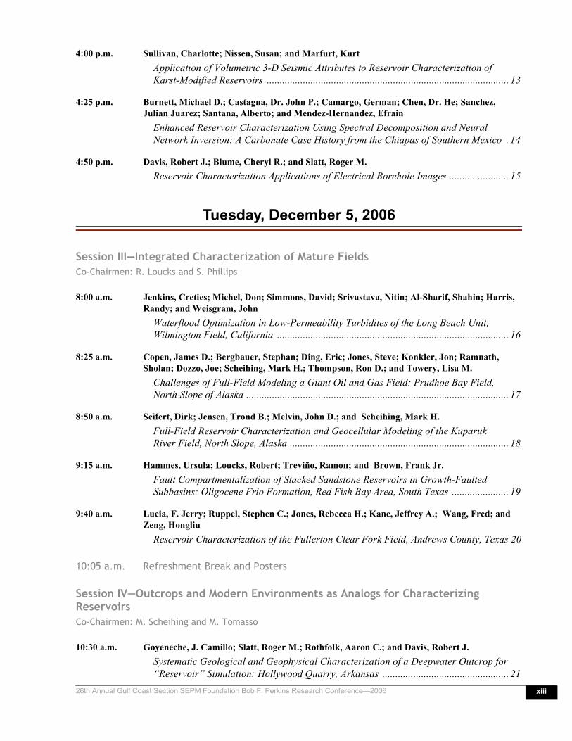
4:00 p.m. Sullivan, Charlotte; Nissen, Susan; and Marfurt, KurtApplication of Volumetric 3-D Seismic Attributes to Reservoir Characterization of Karst-Modified Reservoirs .............................................................................................. 13
4:25 p.m. Burnett, Michael D.; Castagna, Dr. John P.; Camargo, German; Chen, Dr. He; Sanchez, Julian Juarez; Santana, Alberto; and Mendez-Hernandez, Efrain
Enhanced Reservoir Characterization Using Spectral Decomposition and Neural Network Inversion: A Carbonate Case History from the Chiapas of Southern Mexico . 14
4:50 p.m. Davis, Robert J.; Blume, Cheryl R.; and Slatt, Roger M.Reservoir Characterization Applications of Electrical Borehole Images ....................... 15
Tuesday, December 5, 2006
Session III—Integrated Characterization of Mature FieldsCo-Chairmen: R. Loucks and S. Phillips
8:00 a.m. Jenkins, Creties; Michel, Don; Simmons, David; Srivastava, Nitin; Al-Sharif, Shahin; Harris, Randy; and Weisgram, John
Waterflood Optimization in Low-Permeability Turbidites of the Long Beach Unit, Wilmington Field, California .......................................................................................... 16
8:25 a.m. Copen, James D.; Bergbauer, Stephan; Ding, Eric; Jones, Steve; Konkler, Jon; Ramnath, Sholan; Dozzo, Joe; Scheihing, Mark H.; Thompson, Ron D.; and Towery, Lisa M.
Challenges of Full-Field Modeling a Giant Oil and Gas Field: Prudhoe Bay Field, North Slope of Alaska ...................................................................................................... 17
8:50 a.m. Seifert, Dirk; Jensen, Trond B.; Melvin, John D.; and Scheihing, Mark H.Full-Field Reservoir Characterization and Geocellular Modeling of the Kuparuk River Field, North Slope, Alaska ..................................................................................... 18
9:15 a.m. Hammes, Ursula; Loucks, Robert; Treviño, Ramon; and Brown, Frank Jr. Fault Compartmentalization of Stacked Sandstone Reservoirs in Growth-Faulted Subbasins: Oligocene Frio Formation, Red Fish Bay Area, South Texas ...................... 19
9:40 a.m. Lucia, F. Jerry; Ruppel, Stephen C.; Jones, Rebecca H.; Kane, Jeffrey A.; Wang, Fred; and Zeng, Hongliu
Reservoir Characterization of the Fullerton Clear Fork Field, Andrews County, Texas 20
10:05 a.m. Refreshment Break and Posters
Session IV—Outcrops and Modern Environments as Analogs for Characterizing ReservoirsCo-Chairmen: M. Scheihing and M. Tomasso
10:30 a.m. Goyeneche, J. Camillo; Slatt, Roger M.; Rothfolk, Aaron C.; and Davis, Robert J.Systematic Geological and Geophysical Characterization of a Deepwater Outcrop for “Reservoir” Simulation: Hollywood Quarry, Arkansas ................................................. 21

xiv Program and Abstracts
10:55 a.m. Field, B.D.; Pollock, R.M.; and Browne, G.H. Outcrop Analog Study of Turbidites of the Miocene Whakataki Formation, New Zealand: Significance for Reservoir Volumetrics and Modelling .................................. 22
11:20 a.m. Tomasso, Mark; Bonnaffé, Florence L.; Bouroullec, Renaud; Pyles, David R.; and Jennette, David C.
Outcrop Versus Seismic Architecture of Deep-Water Deposits: Use of LIDAR Along a Slope-to-Basin Transect of the Brushy Canyon Formation, West Texas ........................ 23
11:45 a.m. Van Dyke, S.; Slatt, R. M.; Dodson, J.; Valerio, C.; Buckner, N.; Correa-Correa, H.; and Ojo, B.
High Frequency Characterization of an Outcropping, Sinuous Leveed-Channel Complex, Dad Sandstone Member, Lewis Shale, Wyoming ........................................... 24
12:10–1:30 p.m.Lunch and Open Poster Booths
Session IV—Outcrops and Modern Environments as Analogs for Characterizing Reservoirs (continued)Co-Chairmen: M. Scheihing and M. Tomasso
1:30 p.m. Cruz, F. Eduardo; Eberli, Gregor P.;and Byrnes, Alan P.Petrophysical Heterogeneity of a Pleistocene Oolitic Shoal: Lessons for Ancient Reservoirs ........................................................................................................................ 25
1:55 p.m. Rankey, Eugene C.; Reeder, Stacy L.; Watney, W. Lynn; Byrnes, AlanSpatial Trend Metrics of Ooid Shoal Complexes, Bahamas: Implications for Reservoir Characterization and Prediction .................................................................... 26
Session V—Modeling for Reservoir Development, and Assessment of Uncertainty and RiskCo-Chairmen: J. Grace and R. Smith
2:20 p.m. Smith, Ru and Ecclestone, MartinMultiscale 3D Static Modeling for Exploration and on Down the Lifecycle Stream ..... 27
2:45 p.m. Pyrcz, Michael J. and Strebelle, SebastienEvent-Based Geostatistical Modeling: Application to Deep-Water Systems .................. 28
3:10 p.m. Refreshment Break and Posters
Session V—Modeling for Reservoir Development, and Assessment of Uncertainty and Risk (continued)Co-Chairmen: J. Grace and R. Smith
3:35 p.m. Pyrcz, Michael J.; Sullivan, Morgan; Drinkwater, Nicholas J.; Clark, Julian; Fildani, Andrea; and McHargue, Tim
Event-Based Models as a Quantitative Laboratory for Testing Quantitative Rules Associated with Deep-Water Distributary Lobes ............................................................ 29
4:00 p.m. Moore, Douglas S.; McGee, David T.; Burge, David W.; Geier, Nathan A.; and Wu, GaryBeginning with the End in Mind: Exploration-Phase Reservoir Modeling of Multi-Story Channel/Levee Complexes, Deep-Water Nigeria .................................................. 30

26th Annual Gulf Coast Section SEPM Foundation Bob F. Perkins Research Conference—2006 xv
4:25 p.m. Stright, Lisa; Caers, Jef; Li, Hongmei; Van Der Vlugt, Frans; Pirmez, Carlos; and Barton, Mark
Modeling, Upscaling and History Matching Thin, Irregularly-Shaped Flow Barriers: A Comprehensive Approach for Predicting Reservoir Connectivity .............................. 31
4:50–8:00 p.m. Beer, Wine, Snacks, and Poster Session (Sessions will end at 5:15 p.m.)
8:00 p.m. Authors Remove Posters(Contractor will remove display boards at 8:15 p.m.)
Wednesday, December 6, 2006
Session V—Modeling for Reservoir Development, and Assessment of Uncertainty and Risk (continued)Co-Chairmen: J. Chen and S. Meddaugh
8:00 a.m. Lerat, Olivier; Doligez, Brigitte; Albouy, Emily; Nivlet, Philippe; Roggero, Frédéric; Cap, Julien; Vittori, Jacques; Duplantier, Olivier; and Berthet, Philippe
Integrated Reservoir Model of a Channelized Turbidite Reservoir: Geostatistical Geological Modeling Honoring a Quantitative 3D Seismic Constraint ......................... 32
8:25 a.m. Meddaugh, W. Scott; Gross, Stephen J.; Griest, Stewart D.; Todd, W. W. (Bill); and Barge, David
Impact of Volumetric and Connectivity Uncertainty on Reservoir Management Decisions: Case Study from the Humma Marrat Reservoir, Partitioned Neutral Zone .................. 33
8:50 a.m. Chen, Jiajie (Jeff); Chen, Hung-Lung; and Chung, PaulineAn Integrated Engineering-Geoscience Approach Leads to Increased Resource Capture from Carbonate Reservoirs ............................................................................................. 34
9:15 a.m. Qi, Lianshuang; Carr, Timothy R.; and Goldstein, Robert H.An Integrated Geostatistical Approach: Constructing 3D Modeling and Simulation of St. Louis Carbonate Reservoir Systems, Archer Field, Southwest Kansas .......................... 35
9:40 a.m. Refreshment Break
Session VI—Improvements in Reservoirs Characterization and Well PlanningChairman: R. Slatt
10:05 a.m. Dastidar, Rahul; Sondergeld, Carl H.; and Rai, Chandra S.Petrophysical Data Integration for Improved Reservoir Description ............................ 36
10:30 a.m. Philp, R. Paul and Hsieh, MichaelThe Evolution of Reservoir Geochemistry ..................................................................... 37
10:55 a.m. Van Dyke, StaffanGeoscientific Workflow Process in Drilling a Deep-Water Well, Offshore Morocco .... 38
11:20 a.m. Conference Ends
Author Index ...............................................................................................................................A-1

xvi Program and Abstracts

126th Annual Gulf Coast Section SEPM Foundation Bob F. Perkins Research Conference—2006
A Closer Look at Field Reserve Growth: Science, Engineering, or Just Money?
Grace, John D.Earth Science Associates
AbstractThe growth in estimated ultimate recovery
(EUR) of oil and gas fields over the course of theirdevelopment has been recognized as a significant con-tributor to hydrocarbon supply, both in the UnitedStates and abroad. Data on changes in EUR have beenexamined for oil and gas fields discovered on the mod-ern shelf of the Gulf of Mexico, in order to empiricallydetermine the possible causes of these changes.
Using a semilog regression model of EUR as afunction of years since discovery, from 1975 through2002, roughly half of fields in the study area grew andthe balance either shrank or remained statisticallyunchanged. Fields that grew were typically large dis-coveries to start and the volumes by which they grewwere log normally distributed. The fields making thelargest contributions to aggregate growth typically hadat least 20 reservoirs over at least 5,000 feet of chargedsection, which was deposited in generally prograda-tional environments at sediment accumulation ratesbetween 500 and 2,500 feet per million years.
The principal mechanism of field growth in thestudy area was through the discovery of new reser-voirs. In the fields having the largest growth, thesediscoveries occurred in cycles based on stratigraphicinterval. Within each cycle, the largest reservoirs werediscovered early and the size of reservoir discoveriesdeclined exponentially. Up to four major stratigraphi-cally based cycles were observed; generally, but not
always, each subsequent cycle added a smaller volumeto EUR than those that preceded it.
A secondary source of growth arises through thecombined effects of recognizing an increased volumeof reservoir rock containing reserves and improvementin recovery factors. The contributions of these mecha-nisms have been examined through analysis of single-reservoir fields and growth in fields after their last newreservoir discovery.
Field growth is tied to the economic conditionssurrounding oil and gas production. From the mid-1970s through mid-1980s, during a period of rising andhigh prices, large increases in oil and gas reserves weregained through new field discoveries, discovery of newreservoirs within fields and, to a lesser extent, positivereservoir volume revisions and increases in recoveryfactors. Price collapses in 1986 and again in 1998 areboth reflected in reductions in field growth and actu-ally declines in aggregate EUR.
Although a short time series, EUR growthbetween the beginning of the current price recovery in1998 and 2002 indicates that supply of new oil and gasin existing fields is becoming more inelastic. This ismost probably due to two factors: depletion of thegrowth potential of old, very large fields; and becauseof the progressive decline in the sizes of new field dis-coveries and the high correlation between size andgrowth, as newer finds have smaller growth potential.

2 Program and Abstracts
Reservoir Characterization of Fluvio-Lacustrine Sandstone Deposition and the Impact on Field Economics, Daan Field, Songliao Basin, P.R. China
Sneider, J. Sneider ExplorationHarper, A.Dietrich, F.Xuehui, YuMI Energy Corp
Deyu, Ning
Chunguo, Wang PetroChina Jilin
Abstract
Since 2001, MI Energy - PetroChina partnershiphas drilled 400 wells at Daan Field, Songliao Basin,Jilin Province, Peoples Republic of China (Fig. 1). Themain reservoir objective is the Cretaceous FuYang flu-vio-lacustrine sandstone. The reservoir has relativelylow porosity (10-18%), low permeability (<1-30mD),and has dramatic changes in reservoir quality overshort lateral distances (Figs. 2 and 3). Accurately pre-dicting reservoir distribution is crucial for successfulfield development.
FuYang sands were deposited in a half-grabenbounded by the Daan fault to the east. FuYang sandsaccumulated in north- or northeast-trending depo-centers, parallel to the Daan fault. The graben wasinverted during the Tertiary along the Daan fault,forming the Daan anticline which is the trap for thefield. The FuYang reservoir in the Daan Field area issubdivided into approximately 25 stratigraphic inter-vals that may contain reservoir quality sandstones (Fig.3). Reservoir sandstones are not developed for eachinterval at every location in the field.
The FuYang reservoir is distributed in a series ofnorth- or northeast-trending sand thicks or “SweetSpots” that measure about 700m by 3000m and havetotal pay thicknesses of 10m to 35m (Fig. 4). Averagepermeability X net pay thickness (kh) (Fig. 5) andhydrocarbon pore volume show similar trends (Fig. 6).Typical “Sweet Spot” wells have 10 sand zones rang-ing in thickness from 1m to 10m. Sedimentary faciesare fluvial (e.g., channel bars, crevasse splays) to mar-ginal lacustrine (e.g., distributary channels, mouthbars). The top of the FuYang is marked by an abruptdeepening of the Daan Lake, which corresponds to aSongliao Basin maximum drowning event and deposi-tion of the basin's main source rock.
When the MI Energy - PetroChina partnershipbegan operations in Year 2001 at Daan, 40 wells hadbeen drilled already in the field, and the model for res-
ervoir distribution was based on a concept of east-westregional dip and east-west trending reservoir sand bod-ies (Fig. 7). Early appraisal wells often haddisappointing results and reservoir prediction waspoor. However, a detailed study of reservoir data fromwells in the most densely drilled part of the block, theDa206 area, revealed north- or northeast-trending res-ervoirs (Fig. 8). Drilling results and reservoirprediction improved in Year 2002 when the north- tonortheast-trending reservoir model was incorporated.Average net pay increased from 12.5m to 19.5m andaverage new well production increased by 21%, from6384 BO to 7737 BO for the first six months of cumu-lative production (Fig. 9). In Year 2003, new wellproduction increased by a further 24%, to 9619 BO forthe first six months of cumulative production.
During Year 2004, as field development paceaccelerated dramatically and rig utilization pressureincreased, drill locations were frequently selected on agrid system basis rather than on a geologic reservoirprediction basis. As a result, new well productiondropped by 51%, to 4694 BO for the first six months ofcumulative production (Fig. 9). Upon recognizing thepoorer results of the Year 2004 drilling program, arenewed effort began to select well locations on a sys-tematic geological basis. A system of quarterly welllocation selection meetings was instituted. At the quar-terly meetings, results of the prior quarter’s drillingwere summarized on reservoir distribution maps of netpay thickness, hydrocarbon pore volume and kh (aver-age permeability times net pay thickness), and thesemaps were used to select optimal locations for the nextquarter’s drilling program. This systematic approachresulted in improved drilling results in Year 2005, withan average new well production increase of 47%, to6920 BO for the first six months of cumulative produc-tion (Fig. 9).

326th Annual Gulf Coast Section SEPM Foundation Bob F. Perkins Research Conference—2006
Understanding and Modeling Connectivity in a Deep Water Clastic Reservoir—The Schiehallion Experience
Govan, AlastairFreeman, PaulMacdonald, ChrisDavies, MervCasabianca, DavideNieuwland, FerryMoodie, NeilBP Exploration UKDyce, Aberdeen, AB21 7PBUK
Primmer, TimBP Exploration Operating Co LtdChertsey Rd, Sunbury-on-Thames, Middlesex TW16 7LNUK
email: [email protected]
AbstractSchiehallion is a two billion barrel deepwater
clastic reservoir, situated on the Atlantic margin of theUKCS, one of the world’s most hostile environmentsfor hydrocarbon production. The field has been devel-oped via subsea wells tied back to an FPSO, and is oneof the first developments of its kind anywhere in theworld.
The field may be characterized as high produc-tivity but low energy and, as a consequence, waterinjection is essential to maintaining production. How-ever, the reservoir is channelized, faulted, and hasvarying degrees of connectivity between the compart-ments, so that a good understanding of these factors isnecessary to optimize the water injection distribution.
Our understanding of the ‘plumbing’, or connec-tivity between the wells, has evolved and matured overtime, using a wide range of different data types, from
the initial extended well test, through RFT’s, pressuretransient analyses, interference testing, PLT’s, tracerand geochemical sampling, to bi-annual 4D seismicsurveys using increasingly sophisticated processingand interpretation.
Much of this understanding has been incorporatedin a 3D model, which uses object modeling and seismicconditioning to represent the sand distribution. Potentialbarriers to flow are identified from seismic coherencyanalysis, and the strengths of these barriers have beenused as the main history matching parameters.
A key learning has been that all data needs to beinterpreted with great care, and it is essential to inte-grate several data types in order to obtain reliableconclusions. The paper gives examples of data whichhas been invaluable, as well as examples where thedata is ambiguous or misleading.

4 Program and Abstracts
Reservoir Characterization—An Integral Aspect of Uncertainty Management for Opportunity Realization at the Ormen Lange Giant Gas
Field Development, Norwegian Sea
Guargena, Claudia G.Perry, SonjaGjerdåker, LarsHamre, HelgeHorvei, Nils AkselNystrand, Bjørn VelleA/S Norske ShellP.O. Box 40N-4098 TanangerNorwayemail: [email protected]
den Ouden, RonHydro ASASandvikaNorway
Abstract The Ormen Lange gas field, discovered in 1997
(Hydro operated License PL209) in 1000 m (3,281 ft)
water depth and covering an area of ca. 350 km2 (217
mi2) was further appraised by four wells prior to devel-opment approval in April, 2004. The partnership,Hydro (development operator), Norske Shell (produc-tion operator), Petoro, Statoil, ExxonMobil, and Dong,had a planned production-start in October, 2007, from8 of 28 possible production wells in a staged develop-ment using four subsea templates. The developmentfaced a number of challenges; rough seabed topogra-phy, subzero sea bottom temperatures, harsh oceanconditions and a change of operatorship at productionstart-up.
Reservoir characterization of the areally limited,but intensely faulted turbidite reservoir has formed anintegral part of the work flows. These work flowsaddress the uncertainty of vertically and horizontally
connected reservoir volumes for productivity at welltargets. Model scenarios have been constructed in a 3Dvisualization environment where optimal integration ofa multitude of seismic data volumes, derived attributes,and geological model concepts has been achieved. Theroughly polygonally distributed faults are not expectedto be sealing; having developed close to sea bed, theirorigin rules out cataclasis and cataclasis-enhancedcementation. The common gas gradient and absence ofmeasurable depletion during well tests support non-sealing faults and vertical connectivity. However,dynamic fault seal uncertainties related to reservoirheterogeneity and compartmentalization have necessi-tated risking the relatively simple tank scenario and amore cautious, stepwise approach for the developmentconcept. A significant opportunity can be realized ifthe gas can be produced profitably using only threetemplates.

526th Annual Gulf Coast Section SEPM Foundation Bob F. Perkins Research Conference—2006
A Design of Experiments-Based Assessment of Volumetric Uncertainty During Early Field Delineation and Development,
Humma Marrat Reservoir, Partitioned Neutral Zone
Meddaugh, W. ScottGriest, Stewart D.Chevron Energy Technology Company1500 Louisiana Street Houston, Texas 77002email: [email protected]
Abstract A consistent design of experiments (DoE) based
evaluation process was used to assess the magnitude ofOOIP uncertainty as well as the relative contributionsfrom uncertainty sources as a function of the historicaldevelopment of the Jurassic Humma Marrat carbonatereservoir in the Partitioned Neutral Zone (PNZ).Within the Marrat interval, three stratigraphic layers,known informally as the A, C, and E zones, produceoil. Porosity and permeability is best developed in thedolomitized lowermost Marrat E interval. Based onlimited data, approximately 80-85% of the current oilproduction is from the E zone and 10-15% from the Azone. The C zone contribution is 5% or less.
The uncertainty sources used in the DoE-basedevaluation were: structure (time-to-depth conversionand overall interpretation uncertainty), original oil-water contact (OOWC), porosity histogram, and oilsaturation histogram. All of the uncertainties exceptstructure were evaluated for each of the three strati-graphic zones known to produce oil in the Marrat.High, mid, and low-case values were determined foreach of the uncertainty sources listed using well log,core, and analog information available after each wellwas drilled or as significant new data became available(e.g., reprocessed seismic volume). The time period
covered by this historical look-back is from 1998 (pre-drill) to 2005.
The pre-drill P50 OOIP estimate for the HummaMarrat was about 900 million reservoir barrels. Fol-lowing drilling of the initial two wells, the P50 OOIPestimate was < 400 million reservoir barrels. Subse-quent drilling and structure modifications(interpretation and time-to-depth conversion) increasedthe P50 OOIP estimate to just over 1500 million reser-voir barrels in April 2004. The P50 OOIP was droppedto 625 million reservoir barrels after Well F was drilledin mid-2005. The OOIP uncertainty range, defined asthe P90 OOIP value minus the P50 OOIP value,decreased from nearly 700 million barrels in 2004 toabout 130 million barrels in mid-2005. Analysis of theDoE-based results show that the significant contribu-tors to OOIP uncertainty changed as additional wellswere drilled or existing data was re-processed or re-interpreted. However, the structure and/or OOWCuncertainties were generally the largest, though notnecessarily always statistically significant contributorsto OOIP uncertainty (based on a 95% confidencelevel). A normalized uncertainty index (UI) derivedfrom the probabilistic OOIP values is used to discussdelineation efficiency and may be useful in delineationwell planning.
6 Program and Abstracts
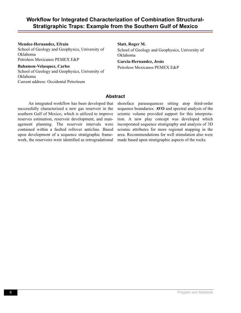
Workflow for Integrated Characterization of Combination Structural-Stratigraphic Traps: Example from the Southern Gulf of Mexico
Mendez-Hernandez, EfrainSchool of Geology and Geophysics, University of OklahomaPetroleos Mexicanos PEMEX E&P
Bahamon-Velasquez, Carlos School of Geology and Geophysics, University of OklahomaCurrent address: Occidental Petroleum
Slatt, Roger M. School of Geology and Geophysics, University of Oklahoma
Garcia-Hernandez, JesúsPetroleos Mexicanos PEMEX E&P
AbstractAn integrated workflow has been developed that
successfully characterized a new gas reservoir in thesouthern Gulf of Mexico, which is utilized to improvereserves estimation, reservoir development, and man-agement planning. The reservoir intervals werecontained within a faulted rollover anticline. Basedupon development of a sequence stratigraphic frame-work, the reservoirs were identified as retrogradational
shoreface parasequences sitting atop third-ordersequence boundaries. AVO and spectral analysis of theseismic volume provided support for this interpreta-tion. A new play concept was developed whichincorporated sequence stratigraphy and analysis of 3Dseismic attributes for more regional mapping in thearea. Recommendations for well stimulation also weremade based upon stratigraphic aspects of the rocks.

726th Annual Gulf Coast Section SEPM Foundation Bob F. Perkins Research Conference—2006
Evaluating Fault Compartmentalization by Integrating Geologic, Geophysical and Engineering Data: A Case Study from South America
Cortes, Rodrigo BastidasSchool of Geology and Geophysics and Sarkeys Energy CenterUniversity of OklahomaCurrent address: Marathon Oil Co.
O’Meara, Daniel J.School of Geology and Geophysics and Sarkeys Energy CenterUniversity of OklahomaHalliburton Digital & Consulting Solutions
Slatt, Roger M.School of Geology and Geophysics and Sarkeys Energy CenterUniversity of Oklahoma
AbstractA set of seismic, well log, core, petrophysical,
and well test data was integrated to construct a 3D geo-logical model for reservoir characterization and laterperformance simulation. The model was initially builtto address the unexpected performance of a singlewell. This well was designed as a water injector butproduced sufficient oil to be deemed a producing well.The model explained the reason for this unexpectedbehavior—the reservoir was compartmentalized intofifteen fault blocks, many of which were not in mutualcommunication. Also, individual fault blocks werestratigraphically compartmentalized. The case for com-
partmentalization was built upon analysis of log-derived Leverett J-Functions and petrophysical andwell data, all within the context of a 3D geological
model constructed in GoCadTM.
This case study serves as an example of the valueof integrating available data to develop a 3D geologicalmodel which can address short-term production issues,broader performance issues, and infill drilling opportu-nities, all of which may be affected bycompartmentalization.
8 Program and Abstracts
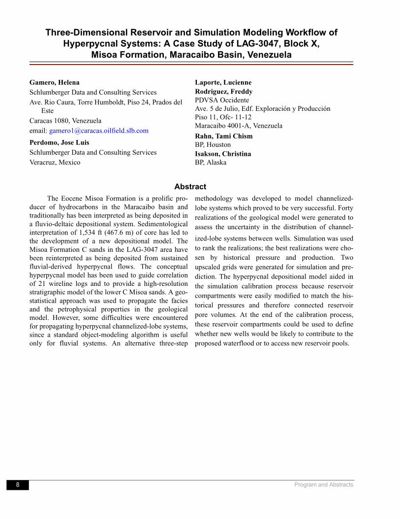
Three-Dimensional Reservoir and Simulation Modeling Workflow of Hyperpycnal Systems: A Case Study of LAG-3047, Block X,
Misoa Formation, Maracaibo Basin, Venezuela
Gamero, HelenaSchlumberger Data and Consulting ServicesAve. Rio Caura, Torre Humboldt, Piso 24, Prados del
EsteCaracas 1080, Venezuelaemail: [email protected]
Perdomo, Jose LuisSchlumberger Data and Consulting ServicesVeracruz, Mexico
Laporte, LucienneRodriguez, FreddyPDVSA OccidenteAve. 5 de Julio, Edf. Exploración y ProducciónPiso 11, Ofc- 11-12Maracaibo 4001-A, Venezuela
Rahn, Tami ChismBP, HoustonIsakson, ChristinaBP, Alaska
Abstract The Eocene Misoa Formation is a prolific pro-
ducer of hydrocarbons in the Maracaibo basin andtraditionally has been interpreted as being deposited ina fluvio-deltaic depositional system. Sedimentologicalinterpretation of 1,534 ft (467.6 m) of core has led tothe development of a new depositional model. TheMisoa Formation C sands in the LAG-3047 area havebeen reinterpreted as being deposited from sustainedfluvial-derived hyperpycnal flows. The conceptualhyperpycnal model has been used to guide correlationof 21 wireline logs and to provide a high-resolutionstratigraphic model of the lower C Misoa sands. A geo-statistical approach was used to propagate the faciesand the petrophysical properties in the geologicalmodel. However, some difficulties were encounteredfor propagating hyperpycnal channelized-lobe systems,since a standard object-modeling algorithm is usefulonly for fluvial systems. An alternative three-step
methodology was developed to model channelized-lobe systems which proved to be very successful. Fortyrealizations of the geological model were generated toassess the uncertainty in the distribution of channel-
ized-lobe systems between wells. Simulation was usedto rank the realizations; the best realizations were cho-sen by historical pressure and production. Twoupscaled grids were generated for simulation and pre-diction. The hyperpycnal depositional model aided inthe simulation calibration process because reservoircompartments were easily modified to match the his-torical pressures and therefore connected reservoirpore volumes. At the end of the calibration process,these reservoir compartments could be used to definewhether new wells would be likely to contribute to theproposed waterflood or to access new reservoir pools.

926th Annual Gulf Coast Section SEPM Foundation Bob F. Perkins Research Conference—2006
Integrated Characterization for Development of the Northeast Betara Field, South Sumatra Basin, Indonesia
Suta, I NyomanUtomo, Budi TyasPetroChina InternationalJakarta, Indonesia
Slatt, Roger M.University of OklahomaNorman, Oklahoma U.S.A.
AbstractNortheast Betara Field, located in the south
Sumatra basin of Indonesia, is a fault-bounded reser-voir comprised of the Oligocene lower Talang AkarFormation. The reservoir consists of two fluvial facies,a lower braided river facies and an upper meanderingriver facies. Both facies are separated by areally exten-sive floodplain/marine shale. Based upon bothsequence stratigraphic and structural analysis of 3Dseismic and well/core data, the distribution of braidedriver facies is controlled strongly by block faultingcoupled with a significant drop in relative sea level.During subsequent early rise in relative sea level, res-ervoir sands have been re-cycled and reworked toprovide better reservoir quality of the upper meander-ing river sandstones. This facies has tested >1400BOPD, >10 MCFGPD, and some condensate fromNEB #7 well.
The Northeast Betara Field is highly compart-mentalized both structurally (faults and folds) andstratigraphically (discontinuous sandstones and shale
interbeds). The field consists of separate oil and gas-condensate reservoir systems. Volumetric reserves cal-culation, combined with material balance studies,indicate the potential oil reserves comprise approxi-mately 10 to 15% of the total potential gas-condensatereserves.
Recognition of reservoir compartments havingvarying fluid contacts constitutes an important inter-well frontier for development of Northeast Betara andother, similar fields in the area. Compartments havebeen identified using the integrated methodologydescribed here. In structurally and stratigraphicallycompartmentalized reservoirs such as Northeast BetaraField, development of an integrated 3D geologicmodel, numerical reservoir simulation model, and pro-duction strategy has been critical to optimize both oiland gas production. Oil rim reserves have been pro-duced in the early stage of development, followed bycurrent production from the main gas-condensate res-ervoir.
10 Program and Abstracts
High-Quality Techniques of Subsurface Imaging and Reservoir Mapping of the Deep-Water Neogene Depositional Systems
in Krishna-Godavari Basin, East Coast of India
Bastia, RaviReliance Industries Ltd., PHQ, DAKCThane Belapur Road Navi Mumbaiemail: [email protected]
Abstract The east coast of India represents a passive
Atlantic-type peri-cratonic margin setup. The Krishna-Godavari basin along the east coast of India covers thedeltaic and inter-deltaic areas of Krishna and Godavaririvers and extends into the offshore; it has an area of1,45,000 sq. km. The basin evolved through crustalrifting and subsequent drifting during Mesozoic time,followed by major fluvial and marine Tertiarysedimentation.
A geologic model has been constructed for Neo-gene deep-water depositional systems in the Krishna-Godavari basin to conceptualize the reservoir architec-ture of complex channel-levee, overbank, and lobes onthe shelf-slope geologic setting. While the channel-levee deposits are dominated by siltstone/ sandstoneprone facies assemblages, the lobes are predominantlyfine-grained sandstone/ siltstone/ mudstone facies.High quality 3D seismic imaging and interpretation
techniques, integrated with wire-line logs, litho-cut-tings and cores have been followed in characterizingthe complex deep-water reservoirs. The study inte-grates different data sets and methodologies such as (1)high quality 3D seismic with rigorous quality controlin acquisition and processing using interactive geologi-cal input; (2) imaging enhancement through pre-stackdepth migration of selective areas; (3) extensive use ofrock-physics attributes through inversion and AVOstudies; (4) detailing of depositional architecturethrough stratal-amplitude attribute, spectral decompo-sition, and coherency slices; (5) high resolution wire-line logs and analysis; (6) detailed petrophysical andpetrological evaluation of conventional cores, and (vii)quantitative computation of reservoir properties andimproving bed resolution through simultaneous angledependent inversion.

1126th Annual Gulf Coast Section SEPM Foundation Bob F. Perkins Research Conference—2006
Understanding the Seismic Expression of Complex Turbidite Reservoirs Through Synthetic Seismic Forward Modeling:
1D-Convolutional Versus 3D-Modeling Approaches
van Hoek, TomasSalomons, BoudewijnShell International Exploration and ProductionKessler Park 1, 2288 GS Rijswijk ZHThe Netherlands
Abstract Synthetic seismic forward modeling has been
used for many years to gain a better understanding ofthe seismic expression of subsurface geology and toensure consistency between quantitative models andavailable data. With improvement in static model-building capabilities, increased computing power, andthe ongoing need to optimally use seismic informationto condition exploration and production models, syn-thetic seismic modeling approaches have evolvedtowards 3D modeling of realistic and complex inputmodels.
The 1D-convolutional method of generating 3Dsynthetic seismic models is computationally very fastand convenient to apply. However, influences of spa-tially varying lateral resolution, acquisition,processing, and overburden effects on the resultingseismic image are fully or partially neglected. Giventhe simplifying assumptions of the 1D-convolutionalmodeling method, it is important to understand the
degree to which results are representative of the actualseismic expression of the subsurface geology. It isdesirable to know under which circumstances the 1D-convolutional approach can be assumed to be a suffi-ciently close approximation and under whichconditions the more sophisticated 3D techniques arerequired.
As a contribution to addressing this question,two suites of 3D synthetic seismic models were con-structed from high resolution, realistic, andrepresentative static facies models of complex turbiditereservoir architecture; one using the 1D-convolutionalmethod and the other employing a 3D-modeling tech-nique. The latter approach honors lateral resolution,processing, acquisition, and overburden effects. Com-parison of results of the two methods suggests potentialpitfalls in applying inferences from the 1D method inreservoir characterization (e.g., lithofacies distribution,net-to-gross, and connectivity).

12 Program and Abstracts
Integrated Reservoir Model: Lithoseismic Interpretation and Definition of the 3D Seismic Constraint
Nivlet, PhilippeLucet, NathalieTonellot, ThierryLerat, OlivierIFP1-4, avenue de Bois-Préau92500 Rueil-MalmaisonFranceemail: [email protected]
Lefeuvre, FrédéricTotal – Exploration & Production26, avenue Larribau64018 Pau cedexFrancePiazza, Jean-LucTotal – Exploration & Production2, place de la Coupole – La Défense 692078 Paris La Défense cedexFrance
AbstractA methodology devoted to the integration of
seismic information within the geological stochasticmodeling workflow has been developed in order tooptimize the characterization of small scale internalreservoir heterogeneities.
The workflow consists of three stages detailedhere and in a companion paper in this volume (Lerat etal., 2006):
• Litho-seismic interpretation and definition of the3D seismic constraint;
• geostatistical geological modeling using a 3Dseismic constraint; and
• reconciling seismic data with the geologicalmodel.
In this paper, we present the interpretation ofseismic data in terms of 3D geological facies propor-tions at Girassol, a large and complex turbidite fieldlocated offshore Angola. This type of interpretationrequires high quality seismic data, which was the casein the present case-study. Secondly, particular attentionhas been paid to calibration issues: for wells with avail-able sonic data, vertical and lateral shifts have beendetermined at early stages of the analysis to ensure
optimal local consistency between well logs and localseismic amplitudes. For the other wells, an optimallocation has been found a posteriori by comparingelectrofacies analysis results with geological faciesproportions predicted from seismic.
The proposed workflow integrates knowledgefrom various sources and with different spatial resolu-tion and support: pre-stack seismic amplitudes andvelocities, well logs, stratigraphy, and structural infor-mation. It is divided into three parts.
• Pre-stack stratigraphic inversion;
• Probabilistic seismic facies analysis from theinversion results based on discriminant analysis;and
• Computation of geological facies proportionsfrom the previous results by a novel approachdeveloped to account for scale differencesbetween seismic facies and detailed geologicalfacies description, in order to produce a geologi-cally interpreted 3D model of the reservoir to beused in further steps of the reservoir modelingworkflow.
1326th Annual Gulf Coast Section SEPM Foundation Bob F. Perkins Research Conference—2006
Application of Volumetric 3-D Seismic Attributes to Reservoir Characterization of Karst-Modified Reservoirs
Sullivan, CharlottePacific Northwest National LaboratoriesP. O. Box 999 Richland, Washington 99352email: [email protected], SusanKansas Geological Survey, University of Kansas1930 Constant AvenueLawrence, Kansas 66047
Marfurt, Kurt
Allied Geophysical Laboratories
University of Houston
Houston, Texas 77204
AbstractReservoir production and compartmentalization
in many karst-modified reservoirs can be related to fea-tures resulting from subaerial weathering, tectonicfaulting and fracturing, and/or hydrothermal processes.Critical features relating to reservoir character areoften subtle and are difficult to image with standardseismic attributes. We have developed new 3D seis-mic-based geometric attributes that, calibrated withgeologic and engineering data, have the potential toimage and quantify karst-modified reservoir features atan interwell scale not previously possible. Our aim isto develop innovative seismic-based methodologiesand workflows for reservoir characterization of karst-modified reservoirs.
We have applied our new seismic attributes toreservoirs in Kansas, Colorado, and Texas that repre-sent a diversity of ages, lithologies, karst processes,and porosity/permeability systems. In these reservoirs,we have mapped horizon structure, faults, and fractures
with a combination of conventional seismic data,coherency, and new volumetric curvature attributes.Using horizon extractions and time slices, we haveimaged the geomorphology of eroded surfaces andidentified subtle attribute lineaments associated withfaults and fractures that relate to reservoir productionand compartmentalization. We predict azimuths ofopen and closed fractures by matching rose diagramsof attribute lineaments with strain ellipsoids, by cali-brating to wellbore data, and by relating attributelineaments to produced fluid volumes. We useimproved spectral decomposition and acoustic imped-ance inversion technologies to image porosityvariations in the reservoir.
Our attribute-based structural and stratigraphicmodels, populated with borehole and engineering data,serve as the basis for improved geomodels that we val-idate with reservoir simulation.

14 Program and Abstracts
Enhanced Reservoir Characterization Using Spectral Decomposition and Neural Network Inversion: A Carbonate Case History
from the Chiapas of Southern Mexico
Burnett, Michael D.*Castagna, Dr. John P.Camargo, GermanChen, Dr. HeFusion Petroleum Technologies, Inc.1818 W. Boyd St. Ste A105Norman, Oklahoma 73069*email: [email protected]
Sanchez, Julian JuarezSantana, AlbertoMendez-Hernandez, EfrainPetroleos MexicanosC.P. 86030 VillahermosaTabasco, Mexico
AbstractA reservoir study was conducted at Gaucho Field
in the Chiapas of Southern Mexico, the primary objec-tive of which was to determine porosity in the base ofthe upper Cretaceous carbonate in order to facilitatefurther field development. Conventional seismicimpedance inversion alone did not adequately predictporosity nor did neural network predictions using con-ventional seismic attributes. Spectral decompositionand neural network inversion were integrated to pro-duce an estimated porosity cube at the target level thatprovided excellent porosity indication in validationwells. The lateral variation of porosities within the arearanged from about 2% to more than 30%. Thus, theapplication of these techniques allowed final adjust-ment of drilling locations, in order to capture themaximum local porosity possible. Resulting porositymaps within the field area are shown to have important
implications for field development and further explora-tion in this area.
For spectral decomposition, this study illustratesthe relationship between porosity thickness and peakfrequency and between the magnitude of the averageeffective zone porosity and peak amplitude. Addition-ally, the study demonstrates the importance of traininga neural network properly with (1) appropriate inputattributes and (2) utilization of wells which cover thespectrum of possible porosity encountered in the area.We show how such a methodology can be applied tosimilar carbonate reservoirs so as to distinguish loca-tions having minimal to no effective porosity fromareas having excellent porosity where additional devel-opment drilling can be fruitful.
The aim of this paper is to showcase an inte-grated workflow for this type of study, rather than tofocus on results.

1526th Annual Gulf Coast Section SEPM Foundation Bob F. Perkins Research Conference—2006
Reservoir Characterization Applications of Electrical Borehole Images
Davis, Robert J.Blume, Cheryl R.Schlumberger4900 California Avenue, Suite 401ABakersfield, California 93312USA
Slatt, Roger M.
The University of Oklahoma
Sarkeys Energy Center
100 East Boyd, Room 810
Norman, Oklahoma 73019
AbstractSince the introduction of electrical borehole
images over twenty years ago, many very useful appli-cations have been developed for this data. Some ofthese applications range from hand-picked bed dips tofracture analysis; from thin-bedded pay determinationto vugular porosity measurement; and from faultgeometry determination to facies analysis. These appli-cations are made possible because of the highresolution provided by these images.
Electrical borehole images provide the means toperform detailed high-resolution reservoir character-ization at and adjacent to the borehole. This paper
addresses several of these applications, which give thegeologist, petrophysicists, and reservoir/productionengineer a means to evaluate their reservoir and makedecisions ranging from setting pipe, to completionstrategy, to offset well placement. Various images ofthin bedded formations, slumped zones, fracturedintervals, and faulted and folded intervals are shownalong with the associated interpretations. Also, a seriesof images, coupled with corresponding outcrop and/orcore photos, is provided of deep-water deposits. Impli-cations of reservoir behavior and the required action toefficiently produce the reservoir are included.

16 Program and Abstracts
Waterflood Optimization in Low-Permeability Turbidites of the Long Beach Unit, Wilmington Field, California1
Jenkins, CretiesMichel, DonDeGolyer and MacNaughtonSimmons, DavidSrivastava, NitinAl-Sharif, ShahinOXY Long Beach Inc.
Harris, RandyTHUMS Long Beach CompanyWeisgram, JohnBainbridge Petroleum Consulting
AbstractThe U-P Ford zone in the Long Beach Unit of
the East Wilmington Field consists of low-permeabil-ity (2-50 millidarcies) turbidites that have beenwaterflooded since field start-up. Forty years of suc-cesses and failures have provided valuable insights intohow to best waterflood these reservoirs given theirthin-bedded nature, lateral and vertical changes in res-ervoir quality, formation damage susceptibility, and
sand control problems. Multiple techniques and tech-nologies have been applied to describe their reservoirarchitecture, quantify reservoir performance, andextract the oil. This work has become more challeng-ing as the waterflood has matured and will require theclose integration of all disciplines to identify andexploit remaining opportunities.
1. Updated from SPE 92036, “Forty Years of Improved Oil Recovery: Lessons from Low-Permeability Turbidites of the East Wilmington Field, California”, presented at the SPE International Petroleum Conference, Puebla, Mexico. Copyright 2004, Society of Petroleum Engineers Inc.
1726th Annual Gulf Coast Section SEPM Foundation Bob F. Perkins Research Conference—2006
Challenges of Full-Field Modeling a Giant Oil and Gas Field: Prudhoe Bay Field, North Slope of Alaska
Copen, James D.
Bergbauer, Stephan
Ding, Eric
Jones, Steve
Konkler, Jon
Ramnath, Sholan
BP Exploration (Alaska) Inc.
P.O. Box 196612
Anchorage, Alaska 99519-6612
email: [email protected]
Dozzo, JoeInternational Reservoir Technologies, Inc.300 Union Blvd., Suite 400Lakewood, Colorado 80228Scheihing, Mark H.Thompson, Ron D.ConocoPhillips Inc.600 North Dairy AshfordHouston, Texas 77079Towery, Lisa M.BP America, Inc.501 Westlake Park Blvd.Houston, Texas 77079
Abstract Prudhoe Bay Field, the largest non-heavy-oil
field in North America, has produced about 11 billionof 25 billion barrels of oil-in-place since productionbegan in 1977. Co-owners ExxonMobil, ConocoPhil-lips, and BP made the decision to build a new full-fieldmodel to evaluate future development decisions in thefield. Requirements for the full-field, 12-componentreservoir simulation model included a model size limitof about one million active cells and an areal grid blockresolution of 5 acres (467ft / 142m X 467ft / 142m) and10 to 15 feet (3.0m to 4.6m) vertically. The modelincorporates approximately 2600 wells (about 1000 ofwhich are horizontal), 1800 faults, all productive reser-voir zones and other important geological controls onfluid flow such as shales and conglomeratic thiefzones. A team composed of BP’s Alaskan geological,
geophysical, petrophysical, and reservoir engineeringstaff; geocellular modelers from the three partner com-panies; and a consultant reservoir simulation engineerwas assembled to build the model. The inclusion ofoperating company geoscience and engineering staffcontributed specific expertise in the geology and reser-voir engineering of Prudhoe Bay Field. The inclusionof multiple geocellular modeling staff contributed“best practices” from each partner company and alsoallowed key parts of the model, such as the structuralframework and properties model, to be built concur-rently, thus saving substantial time. The inclusion ofthe consultant reservoir simulation engineer havingextensive experience with previous Prudhoe Bay full-field models provided continuity with prior modelingefforts.

18 Program and Abstracts
Full-Field Reservoir Characterization and Geocellular Modeling of the Kuparuk River Field, North Slope, Alaska
Seifert, DirkJensen, Trond B.Melvin, John D.ConocoPhillips Alaska, Inc.700 G StreetAnchorage, Alaska 99510email: [email protected]
Scheihing, Mark H.ConocoPhillips, Inc.600 North Dairy AshfordHouston, Texas 77079
AbstractThe Kuparuk River Field, located on the North
Slope of Alaska, is the second largest oil field in theU.S. Discovered in 1969 with production beginning in1981, the reservoir interval extends over 280 squaremiles and has a gross thickness of 300 ft. STOOIP isestimated to be 6 BBO, of which 2 BBO have beenproduced to date. The field is produced from approxi-mately 1000 wells on 160 acre spacing from 44 drillsites, employing a north-south line drive with water-flood, and miscible WAG processes.
A major initiative has been undertaken to build anew full-field reservoir simulation model as a leverag-ing tool for managing the field performance. Keyissues to be addressed using this model include EORexpansion to additional drill sites and field-wide evalu-ation of potential by-passed oil. In addition, this
modeling work will support justification and planningof infill CTD (coil tubing drilling) and rotary wells.
To support this reservoir engineering effort, afull-field geocellular model has been constructed, inte-grating 20 years of field data and reservoircharacterization work. The full-field model consists of151 million total cells of which approximately 20 mil-lion active cells are in the fine scale model. The finescale model has been up-scaled in preparation for fullfield compositional flow simulation which, in turn,may impact flood design, EOR adjustments, dataacquisition strategies, and budgetary long range plan-ning. Small sectors of the model are extracted to lookat individual well patterns in more detail. Using suchsector models enables the identification, planning, andexecution of infill drilling opportunities.

1926th Annual Gulf Coast Section SEPM Foundation Bob F. Perkins Research Conference—2006
Fault Compartmentalization of Stacked Sandstone Reservoirs in Growth-Faulted Subbasins: Oligocene Frio Formation,
Red Fish Bay Area, South Texas
Hammes, UrsulaLoucks, RobertTreviño, RamónBrown, Frank Jr. Bureau of Economic GeologyJackson School of GeosciencesThe University of Texas at AustinAustin, Texas 78713
Abstract An integrated study using 3D seismic, wireline
logs, and core analyses was conducted to establishstrategies for exploring in compartmentalized, low-stand, prograding, deltaic systems. Frio sediments,averaging ~11,000 ft, are commercial gas reservoirs inseveral of the growth-faulted, intraslope subbasins inSouth Texas. These exploitation targets are typicallylocated in fault-bounded compartments that formthree- and four-way structural closure. However,understanding the stratigraphic component is crucial tosuccessful exploitation of these sandstones.
The Frio third-order lowstand prograding wedgein Red Fish Bay Field is composed of 10 higher order,lowstand deltaic and superposed transgressive, deposi-tional systems tracts. The sandstones are fine-grained,lithic arkoses having a mean porosity of 20% and tensof millidarcies of permeability. The main constituentsof these sandstones are quartz, feldspar, and volcanic-
rock fragments. Feldspars typically exhibit a substan-tial amount of secondary dissolution and micropores.Quartz cements, as well as interstitial clays, are minor.Porosity reduction occurs primarily by compaction.
Gravity failure along the upper slope generatedsyndepositional faults that displaced mobilized mudbasinward of a growing lowstand sedimentary wedge.These growth faults trend generally northeast-south-west, setting up small subbasins. Associated with thegrowth faults are numerous subparallel, postdeposi-tional synthetic faults. In addition, normal faults trendperpendicular to the growth faults, establishing a com-plex pattern of fault compartmentalization, whichdissects the prograding-wedge depositional patterns.Pressure-decline analysis demonstrates compartmen-talization that is due to (1) laterally discontinuoussandstone bodies and (2) fault-segregated sandstonebodies.
20 Program and Abstracts
Reservoir Characterization of the Fullerton Clear Fork Field, Andrews County, Texas
Lucia, F. JerryRuppel, Stephen C.Jones, Rebecca H.Kane, Jeffrey A.Wang, FredZeng, HongliuBureau of Economic GeologyJackson School of GeosciencesThe University of Texas at AustinAustin, Texas 78713-8924email: [email protected]
AbstractThis paper is a summary of the six-step method-
ology used to build a full-field reservoir model of theFullerton Clear Fork Field in Andrews County, Texas.(1) Three Leonardian sequences and three high-fre-quency sequences are defined on the basis of verticalfacies successions observed in core material and inter-preted on cross sections. Studies of analog outcrops inthe Apache Mountains, West Texas, are integrated intothe interpretation to verify the stratigraphic architec-ture. (2) The sequences are subdivided into high-frequency cycles and flow layers suitable for distribut-ing petrophysical properties and correlated to morethan 1,000 wells. (3) Vertical profiles of porosity, per-meability, and initial water saturation (Swi) arecalculated from wireline logs using the rock-fabric
approach. Because only gamma-ray and porosity logswere available, the stratigraphic framework was usedto map the spatial distribution of rock fabrics. (4) Therock fabrics were converted to petrophysical class and,together with porosity from wireline logs, used inclass-specific transforms to calculate permeability andSwi. (5) The full-field model was constructed by dis-
tributing the calculated petrophysical propertieslaterally within high-frequency cycles. The resultingpatterns vary considerably from sequence to sequence.(6) A flow simulation model was then constructed in aportion of the field in a similar manner. Areas ofupswept hydrocarbons were located by reconstructingfield history and simulating production history.

2126th Annual Gulf Coast Section SEPM Foundation Bob F. Perkins Research Conference—2006
Systematic Geological and Geophysical Characterization of a Deepwater Outcrop for “Reservoir” Simulation: Hollywood Quarry, Arkansas
Goyeneche, J. Camillo1
Slatt, Roger M.
Rothfolk, Aaron C.2
School of Geology and GeophysicsUniversity of OklahomaNorman, Oklahoma1Current address: Total E&P UK PLC, Aberdeen, UK2Current address: Devon Energy Co., Houston, Texas
Davis, Robert J.3
Schlumberger DCS
Oklahoma City, Oklahoma3Current address: Schlumberger
Abstract
A 3D geological model was constructed from a3D quarry outcrop near Hollywood, Arkansas, for ‘res-ervoir’ flow simulation that can address the effects ofsmall-scale (‘subseismic’) interwell heterogeneities onpotential production problems in analog deepwater(and other) oil and gas reservoirs.
Dimensions of Hollywood Quarry are 380 x 250x 25 m (1247 x 821 x 83 ft). The quarry exposes in 3Dthe upper Jackfork Group turbidites, which are oftenused as an outcrop analog for deep-water reservoirs inthe Gulf of Mexico and elsewhere. The quarry isunique in that within its walls, numerous features canbe examined which are typically found in subsurfacereservoirs at larger scales, and which could dramati-cally affect reservoir performance.
Systematic characterization of this quarry wasconducted in order to (A) simulate the effects of thesefeatures upon reservoir performance and (B) character-ize them with instrumentation routinely used byreservoir geologists, geophysicists, and engineers.Techniques used to characterize the quarry include:photomosaic mapping, behind-outcrop coring and
borehole image logging (FMITM), outcrop gamma-ray(GR) logging, measured stratigraphic sections, sequen-tial photography of quarry walls, Digital Orthophoto-Quadrangle mapping (DOQ), Global Positioning Sys-tem (GPS), including laser gun positioning of geologicfeatures in 3D space, shallow high resolution (ham-mer) seismic reflection (SHRS), and Laser ImagingDetection and Ranging (LiDAR).
These combined techniques provided the basisfor reconstructing the 3D geology within the quarryprior to its excavation. The resultant 3D geological
model, constructed in GoCad™, includes spatially-oriented stratigraphic and structural features, and vari-ous up-scaling combinations. Results of fractureanalysis were not included in the model, however, thisanalysis provided information on the orientation andorigin of the fractures in relation to regional and local
deformation. The model was imported into EclipseTM
and 101 combinations of geological features, drillingscenarios, and drive mechanisms were simulated for a10 year ‘production’ period.
Results indicated that presence and absence offaults is a major factor when producing this analog“reservoir.” Simulated production is reduced by 0.1 -15% when faults are incorporated into the simplest“Tank” model. Partially sealing faults result in 1-10%less production than when faults are not sealing. A hor-izontal well across faults results in 4-21% higherproduction than with vertical wells.
The “Tank” model, provides 17% more oil inplace (OOIP) and 12% more oil production than doesmore geologically realistic “reservoir” models. Addinggeological information to the model, such as shaleboundaries and faults, increases the accuracy of the ini-tial volumetric calculations.
Stratigraphic and structural features within the24 acres of geology reconstructed at HollywoodQuarry reveal horizontal and vertical complexitieswhich could aid or hinder fluid flow in an analog reser-voir at this, or larger scales. Systematiccharacterization of this quarry, and subsequent fluidflow simulation, has proven to be very useful in pro-viding a better understanding of the geologic causes ofvarious reservoir performance issues.

22 Program and Abstracts
Outcrop Analog Study of Turbidites of the Miocene Whakataki Formation, New Zealand: Significance for Reservoir Volumetrics and Modelling
Field, B.D. Pollock, R.M. Browne, G.H. GNS ScienceP.O. Box 30-368Lower HuttNew Zealandemail: [email protected]
AbstractThin-bedded turbidites are an important hydro-
carbon reservoir facies worldwide. An example occursin an exceptionally well exposed, laterally extensiveshore platform outcrop of early Miocene WhakatakiFormation, East Coast North Island, New Zealand. Themost likely depositional setting is overbank, near baseof slope.
The thin-bedded turbidites studied compriseapproximately 360 sandstone beds interbedded withmudstone in a 32 m thick section. Beds show cyclicityin thickness with wavelengths of approximately 1 mand perhaps 14 m. Misleading estimates of net:grosscan be made if cyclicity is ignored. Detailed study of asingle bed comprising mainly Tb-Tc turbidite intervalsindicates considerable variation at a decimeter and
finer scale in porosity and permeability, both laterallyand vertically within the bed. This suggests reservoirparameters derived from cores may not be reliablewhen extrapolated away from a well. An overall mod-eled average porosity of 14.5%, when combined withaverage net:gross of 74%, indicates bulk porosity forthe unit of around 10%.
FMI image logs and the seismic character ofgas-bearing thin beds drilled nearby in the offshore atTitihaoa-1 exploration well also show cyclicity ofwavelength ~ 1 m and suggest the outcrop studied is aclose analog, and hence, could provide a useful insightinto likely reservoir architecture and characteristics atdepth.
2326th Annual Gulf Coast Section SEPM Foundation Bob F. Perkins Research Conference—2006
Outcrop Versus Seismic Architecture of Deep-Water Deposits: Use of LIDAR Along a Slope-to-Basin Transect of the
Brushy Canyon Formation, West Texas
Tomasso, MarkBonnaffé, Florence L.Bouroullec, RenaudBureau of Economic GeologyJohn A. and Katherine G. Jackson School of GeosciencesThe University of Texas at AustinAustin, Texas 78713-8924email: [email protected]
Pyles, David R.Chevron Center of Research ExcellenceDepartment of Geology and Geological EngineeringColorado School of MinesGolden, Colorado 80401-1887Jennette, David C.Apache Corporation2000 Post Oak Blvd.Houston, Texas 77056-4400
AbstractThe stratigraphy of deep-water reservoirs is
commonly interpreted using seismic data. Exploration-grade seismic data are typically acquired with peak fre-quencies varying from 30 to 60 Hz, resulting in anaverage vertical stratigraphic resolution of between~23 m (30 Hz) to 11 m (60 Hz) in siliciclastic sedi-ments. Many stratigraphic bodies, such as architecturalelements and beds, can not be resolved at these fre-quencies, however. Seismic forward modeling of deep-water outcrop analogs provides a method by which thisuncertainty can be addressed. Such modeling allows usto produce seismic images constructed from outcrops,where architectural elements, bedding, and facies areknown. One of the advantages of this technique is theability to bridge the gap between stratigraphic conceptslearned from outcrop analogs and observations fromseismic data sets.
Seismic forward models of five exposures fromthe Brushy Canyon Formation of west Texas are pre-
sented here. The exposures span an upper slope tobasin-floor transect through the depositional system.Each outcrop contains unique stratal architecture andfacies related to its position on the slope-to-basin phys-iographic profile. The seismic forward models havebeen constructed using geologic interpretations fromLIDAR (light detection and ranging) data, stratigraphiccolumns, photo-panels, and paleocurrent measure-ments. These models are generated at several peakfrequencies (30, 60, and 125 Hz). The resulting seismicforward models can be compared directly with corre-sponding outcrop analogs, allowing a directcomparison between outcrop and seismic architecture.The outcrop and seismic architecture of each of thefive models can be compared with one another toaddress changes in seismic architecture associated withtheir positions on the slope-to-basin physiographic pro-file.

24 Program and Abstracts
High Frequency Characterization of an Outcropping, Sinuous Leveed-Channel Complex, Dad Sandstone Member, Lewis Shale, Wyoming
Van Dyke, S.University of OklahomaAera Energy LLC
Slatt, R. M.University of Oklahoma
Dodson, J.University of Oklahoma
Valerio, C.University of OklahomaOccidental Oil and Gas Corp.
Buckner, N.University of Oklahoma
Correa-Correa, H.University of OklahomaShell Oil Corp.
Ojo, B.University of OklahomaSchlumberger Inc.
AbstractThis paper presents the results of data collection,
analysis, and integration to build a 3D geologic modelof an outcropping leveed-channel complex. Data isfrom more than 120 standard measured stratigraphicsections, behind-outcrop drilling/logging/coring,ground-penetrating radar and electromagnetic induc-tion surveys, and 2D shallow seismic reflectionacquisition.
This leveed-channel complex, which is part ofthe Dad Sandstone Member of the Cretaceous LewisShale, Wyoming, consists of ten channel-fill sand-stones, confined within a master channel. The complexis 67m (200ft.) thick, 500m (1500ft.) wide, and has anet sand content of approximately 57 percent. Individ-ual channel-fills are internally lithologically complex,
but in a systematic manner which provides a means ofpredicting orientation and width of sinuosity. Althoughit has not been possible to completely document thethree-dimensionality of this system, the 3D model thathas evolved provides information on lithologic vari-ability at scales which cannot be verified fromconventional 3D seismic of subsurface analog reser-voirs. This vertical and lateral variability can providerealistic lithologic input to reservoir performance pre-diction. An outcome of this study has been knowledgegained of the extent of manipulation required to obtainthe spatially correct geometry and architecture of stratawhen integrating outcrop and shallow, behind-outcropdata sets.

2526th Annual Gulf Coast Section SEPM Foundation Bob F. Perkins Research Conference—2006
Petrophysical Heterogeneity of a Pleistocene Oolitic Shoal: Lessons for Ancient Reservoirs
Cruz, F. Eduardo
Eberli, Gregor P.
Comparative Sedimentology Laboratory
RSMAS/University of Miami
Miami, Florida 33149
email: [email protected]
Byrnes, Alan P.Kansas Geological SurveyLawrence, Kansas 66046
Abstract
The shallow subsurface at Ocean Cay on westernGreat Bahama Bank consists of Pleistocene ooliticsand shoals and adjacent facies that exhibit facies-dependent petrophysical heterogeneity and reveal dep-ositional and early diagenetic controls on petrophysicalproperties in oolitic bank margin reservoirs. Sedimen-tological heterogeneity is produced by complex faciesarchitecture associated with abrupt lateral changes,while diagenetic heterogeneity is largely the result ofpatchy dissolution and cementation.
The investigated oolitic interval is the topmostunit in 22 tightly-spaced borings covering an area of
about 1 km2. Typical lithofacies include cross-beddedoolitic and oolitic/skeletal/peloidal fine- to coarse-grained grainstones and bioturbated skeletal/peloidalgrainstone to packstone ranging in thickness from 0.5m to 15 m. The architecture of the cross-bedded faciesis similar to the modern Cat Cay shoal configuration ofbars and superimposed sand waves that are linked totidal flows. Particularly, the juxtaposition of biotur-bated skeletal/peloidal sediment to cross-beddedoolitic/peloidal sands is mirrored in the Pleistocenesection. Intense bioturbation within the skeletal/peloi-dal grainstone to packstone and bedding in the oolitic/peloidal/skeletal grainstone facies produce small-scaleheterogeneity that is enhanced by diagenesis.
Petrophysical data and petrographic analysisshow that, in addition to facies, diagenesis controlsporosity and permeability at different intensities. Inparticular, permeability is very sensitive to cementa-
tion and can be drastically reduced by few rims of
fibrous aragonite and/or meniscus cements. Porosity in
the Ocean Cay grainstones is high, ranging from 29 to
47%, and permeability ranges from 0.1 to 11500 mD.
Permeability is partly controlled by bedding. The aver-
age permeability in the massive-bedded oolitic
grainstone lithofacies is 2770 mD while it is only 620
mD in the laminated and cross-bedded oolitic/peloidal
grainstone lithofacies. Vertical/horizontal permeabil-
ity ratio decreases with increasing bedding complexity:
in massive bedded oolitic grainstone kv/kh 0.34, in
oolitic/peloid laminated and low-angle cross-bedded
grainstone kv/kh 0.22, and in trough and tabular cross-
bedded oolitic/peloid grainstone kv/kh 0.11. The rela-
tionship between permeability and porosity can be
approximated by power-law functions.
Values for the Archie cementation exponent
range from 1.9 to 4.3 (mavg = 2.7), and the cementation
exponent generally increases with increasing depth.
For Ocean Cay carbonates the influence of
microporosity, which is as much as 35-55% of the pore
volume in these rocks, on critical water saturation is
significant. Critical water saturation ranges from 36%
to 95% and decreases with increasing porosity. In gen-
eral, petrophysical trends for some properties in the
Ocean Cay oolitic/oomoldic rocks are consistent with
extension of trends for lower porosity/permeability
rocks in ancient reservoirs to higher porosity and
permeability.

26 Program and Abstracts
Spatial Trend Metrics of Ooid Shoal Complexes, Bahamas: Implications for Reservoir Characterization and Prediction
Rankey, Eugene C.Reeder, Stacy L.Comparative Sedimentology Laboratory RSMAS/University of MiamiMiami, Florida 33149email: [email protected]
Watney, W. LynnByrnes, AlanKansas Geological SurveyLawrence, Kansas 66046
Abstract Although the general aspects of oolitic deposi-
tional systems are well-documented, their landscape-scale patterns (geobodies) are not well enough under-stood to offer quantitative, predictive insights forreservoir characterization. To begin to fill this basicgap in understanding, this study describes the morphol-ogy, hydrodynamics, and process sedimentology ofseveral modern tidally dominated Bahamian ooid shoalcomplexes and compares the patterns with patterns inKansas Pennsylvanian analogs. A companion paperexplores linkages further, documenting petrophysical,geophysical, and production characteristics of thesePennsylvanian oolitic reservoirs.
Integrating remote sensing imagery with quanti-tative bathymetric, fluid flow, and granulometric datain a GIS, we document geomorphic and sedimento-logic patterns and processes in several active tidally-dominated shoals. Results reveal that parabolic barsform a common morphologic motif, although there is
considerable variation on that general theme. Differentprocesses can lead to varying depositional geometriesand sedimentologic patterns. Nonetheless, the land-scape-scale configuration of bars and superimposedsand waves is linked closely to patterns of tidal flows.Bars are not homogenous bodies, however, and granu-lometric parameters such as sorting and mudpercentage vary systematically and predictably withinthe hydro-geomorphic framework.
Through exploring modern oolitic shoals, thisstudy provides new insights on details of their mor-phology and dynamics as well as links betweengeomorphic framework and grain size and sorting;some patterns are similar to those within geobodies inPennsylvanian reservoir analogs. These insights pro-vide quantitative predictive information on faciesgeometries, on grain characteristics, and depositionalporosity in analogous ancient ooid shoals.

2726th Annual Gulf Coast Section SEPM Foundation Bob F. Perkins Research Conference—2006
Multiscale 3D Static Modeling for Exploration and on Down the Lifecycle Stream
Smith, RuShell International Exploration and ProductionKessler Park 1, 2288 GS Rijswijk ZHNetherlands
Ecclestone, MartinNorske Shell4098 Tananger, StavangerNorway
Abstract A hierarchical organization of heterogeneity in
sedimentary systems has long been noted and this con-cept was explicitly built into Shell’s proprietaryreservoir modeling system in the early 1990’s. Theapproach nested progressively finer levels of detailwithin parent objects and provided a mixed determinis-tic and stochastic technique for achieving realisticreservoir architectures at multiple levels in the hierar-chy of heterogeneity. By 1999, the concept ofhierarchical static modelling had been extended tobasin-scale, as a means to promote consistencybetween local and regional data, interpretations, andmodels. Tangible business benefits were demonstrated
for both exploration and appraisal decision making andthe approach promoted continuity in subsurface evalu-ation along the whole exploration through toproduction lifecycle.
Key to the success of the multiscale static model-ing approach is the combination of multiple data types(having differing resolutions and degrees of complete-ness) and global geological knowledge to complete thegaps associated with data resolution limits and incom-plete data coverage. Synthetic seismic expression ofresultant models is used to ensure consistency withavailable seismic information.

28 Program and Abstracts
Event-Based Geostatistical Modeling: Application to Deep-Water Systems
Pyrcz, Michael J.Strebelle, SebastienChevron Energy Technology Company1500 Louisiana Street Houston, Texas 77002email: [email protected]
Abstract Geostatistics is often used to build multiple mod-
els of reservoir geological heterogeneity for theprobabilistic assessment of reservoir flow response.Current geostatistical algorithms, object-based orpixel-based, using semivariograms or training images,enable the reproduction of spatial statistics inferredfrom available conditioning data and analogs but rarelyintegrate information related to depositional processes.Indeed, because conventional geostatistical models areconstructed without any concept of time or deposi-tional sequence, their ability to incorporatesedimentological rules, which explain facies geobodiesinteractions and intra-body porosity/permeability het-erogeneity, is quite limited. One consequence of such alimitation is that, unless spatial constraints tediouslyderived from alternative depositional interpretationsare explicitly imposed to the simulation, conventionalgeostatistical methods only generate stationary statisti-cal models that may not be representative of the fullrange of actual reservoir heterogeneity uncertainty.
Recently, the event-based approach has beenintroduced recently as a new branch of geostatistics, inwhich stochastic models are constructed as a sequenceof depositional events. The sedimentological process isincorporated as a set of numerical rules that controlarchitectural element geometry and the sequence ofevents through the occurrence of avulsion, meandermigration, progradation, retrogradation, and aggrada-tion. In addition, event-based models can beconditioned to sparse well data and soft data (seismic),typically available in deep-water systems.
The integration of sedimentological process intogeostatistical modeling may provide a more geologi-cally realistic representation of reservoir heterogeneityand help better assess reservoir flow response. Also,event-based geostatistics may be applied as a newframework to test distilled sedimentological rules andanalyze their impact on reservoir heterogeneity.

2926th Annual Gulf Coast Section SEPM Foundation Bob F. Perkins Research Conference—2006
Event-Based Models as a Quantitative Laboratory for Testing Quantitative Rules Associated with Deep-Water Distributary Lobes
Pyrcz, Michael J.Sullivan, MorganDrinkwater, Nicholas J.Clark, JulianFildani, AndreaMcHargue, TimChevron Energy Technology Company1500 Louisiana StreetHouston, Texas 77002email: [email protected]
Abstract Analysis of modern depositional systems, high-
resolution seismic and outcrop data reveal a significantdegree of complexity in the heterogeneity associatedwith deep water distributary lobes. These heterogene-ities commonly have a significant influence onreservoir performance. This complexity is the result ofvariations in sand body architectures related to varyingdepositional and erosional processes. The translation ofthese processes into quantitative rules is a powerfulexercise for the purpose of testing our understanding ofdepositional processes and hence forming predictivegeologic models. Yet, the influence of coupled rules isdifficult to assess a priori due to feedbacks and interfer-ence. A computationally efficient and intuitivequantitative framework is, therefore, a valuable meansto explore potential rules and their associated interac-tions.
In the event-based framework, architectural ele-ments are assigned to forward-simulated flow-eventpaths that obey simple geologic rules. The geologicrules qualitatively relate to sedimentary processes andconstrain the geometry and location of architecturalelements given the current state of the model for anytime step. Rules may be coded to model allogenic andautogenic sedimentary processes such as avulsion,aggradation, progradation, retrogradation, and meandermigration, along with the evolving influence of gradi-ent and accommodation. Thus, event-based models canaid in the empirical testing of quantitative rules. Thisexercise leads to an improved quantitative understand-ing of process and the construction of more accurategeologic models that may better predict reservoir per-formance of these often economically challengingdevelopments.

30 Program and Abstracts
Beginning with the End in Mind: Exploration-Phase Reservoir Modeling of Multi-Story Channel/Levee Complexes, Deep-Water Nigeria
Moore, Douglas S.ConocoPhillips (UK) LTDRubislaw HouseAberdeen, UK AB15 6FZemail: [email protected]
McGee, David T.Burge, David W.Geier, Nathan A.*ConocoPhillips600 N. Dairy AshfordHouston, Texas 77079
Wu, GaryConocoPhillips NorgeP.O. Box 220N-4098 Tananger, Norway*Current addressSamson ResourcesTwo West Second Street Tulsa, Oklahoma 74103
AbstractGeoscientists commonly employ high-quality
three-dimensional seismic data to reduce deep-waterprospect risk. For years, direct hydrocarbon Indicators(DHIs) have addressed hydrocarbon presence, how-ever only more recently have images from three-dimensional datasets been employed to interpret thesubsurface reservoir architecture of deep-water sinuouschannel systems. Such architectural understanding,particularly in multi-story deep-water channel com-plexes, is key to predicting well count and spacing,thus ultimately prospect value.
By combining seismic profile channel interpreta-tion, volume interpretation and analog studies, detailedgeocellular models were created for offshore Nigeriaisolated and stacked multi-story channel complexes.Gross rock volume was defined by interpreting thechannel complex top and base horizons that define thereservoir ‘container.’ Seismic facies analysis wasapplied to amplitude extractions representative ofinterpreted discrete architectural zones within the res-
ervoir container. In turn, interpreted facies maps wereused for conditioning layers within the geocellularmodel. Dimensional information for facies objects wasrecorded from the three-dimensional seismic volumeand from both subsurface and outcrop analogs. Indi-vidual facies objects were stochastically placed,heavily conditioned to seismic control, having an over-all aim of replicating analog end members. The keyidentified uncertainties of net-to-gross and sand objectconnectivity were characterized quantitatively andqualitatively through the application of volume sculpt-ing, opacity rendering, and multi-body detectiontechniques. Geocellular modeling-ranged results wereassigned within the flow simulation process to condi-tion well performance, and ultimately, risked pre-drillprospect value was calculated. Subsequent drilling ofone of the modeled prospects provided calibration forthe assumptions entered into the geocellular models,enhancing the value of the models as predictive toolsfor analogous leads/prospects.

3126th Annual Gulf Coast Section SEPM Foundation Bob F. Perkins Research Conference—2006
Modeling, Upscaling and History Matching Thin, Irregularly-Shaped Flow Barriers: A Comprehensive Approach for
Predicting Reservoir Connectivity
Stright, Lisa*Caers, JefLi, HongmeiDepartment of Petroleum EngineeringStanford UniversityStanford, California 94305, USA* Now with the Graduate Program in Earth, Energy and Environmental Sciences at Stanford University
Van Der Vlugt, Frans
Pirmez, Carlos
Barton, Mark
Shell International E&P
Houston, Texas USA
AbstractAccurate modeling of flow path connectivity is
critical to reservoir flow performance prediction. Flowpath connectivity is controlled by the complex shape,extent, and spatial relationships between pay intervals,their intersection with wells, and the existence of flowbarriers between wells. This reservoir heterogeneitycan be captured in a flow simulation model as faciespatterns among cells and as effective properties withincells (porosity and permeability). However, fine-scale,irregularly-shaped flow barriers between cells can notbe accurately represented with pixel-based modelingtechniques.
To preserve these important fine-scale geologi-cal features at the flow simulation block scale, anadditional modeling variable is introduced as the edgeof a model cell. This cell edge is a continuous or cate-gorical value associated with the cell face and isdefined in conjunction with the cell centered propertywhich is often reserved for facies types and/or petro-
physical properties. An edge model is created thatcaptures the facies and edge properties as a vector ofinformation at each cell location. For the flow simula-tion model, the edge properties are easily translatedinto transmissibility multipliers.
Using the example of 3D shale-drapes attachedto channel-sand bodies in a deep-water depositionalsetting, a methodology is presented in which theseshale drapes are accurately up-scaled and historymatched to production data while maintaining the geo-logical concept that describes the drape geometry. Theperturbation parameter in history matching is the conti-nuity of the shales as an edge property.
More generally, this coupled modeling of cell-center and cell-edge allows for more flexible reservoirmodeling, opening up the potential for modeling andhistory matching complex geological features effec-tively at the scale that they are relevant, withoutadditional computational cost of flow simulation.

32 Program and Abstracts
Integrated Reservoir Model of a Channelized Turbidite Reservoir: Geostatistical Geological Modeling Honoring a
Quantitative 3D Seismic Constraint
Lerat, OlivierDoligez, BrigitteAlbouy, EmilyNivlet, PhilippeRoggero, FrédéricCap, JulienIFP1-4, avenue de Bois-Préau92500 Rueil-MalmaisonFranceemail: [email protected]
Vittori, Jacques
Duplantier, Olivier
Berthet, Philippe
Total – Exploration & Production
26, avenue Larribau
64018 Pau cedex
France
AbstractA methodology has been developed which is
devoted to the integration of seismic informationwithin the geological stochastic modeling workflow.Its aim is to optimize the characterization of fine-scaleinternal heterogeneities of the reservoirs. This work-flow consists of three steps:
• Lithoseismic interpretation and definition of a3D seismic constraint,
• Reconciliation of seismic data with the geologi-cal model,
• Geostatistical geological modeling using a 3Dseismic constraint
The result of the first step is a 3D volume of geo-logical facies proportions at the seismic scale. It isdescribed in detail in a separate companion paper.
The second step aims to improve the quantitativematch of 3D seismic attributes computed directly fromthe detailed geological model. This implies first ensur-ing optimal coherency between well and seismic data.Secondly, distributions of acoustic parameters aredetermined for each geological facies using well logdata. This information is used to obtain 3D synthetic
cubes of seismic attributes, which are compared to realdata. Finally, the 3D facies proportions are updated tominimize an objective function defined by the mis-match between real and synthetic seismic attributes.
In the third step, the non-stationary truncatedGaussian method is used to fill a fine grid geologicalmodel integrating a high resolution 3D seismic con-straint and well information. The seismic constraintdefines the main spatial trends of facies proportions,and the wells locally constrain facies in the model.This modeling process captures the geometry of com-plex geological objects and to reproduce thedistributions of heterogeneities.
This methodology has been successfully appliedto the Girassol Field. Comparisons between predictedand real impedance cubes clearly show the capabilityof the geological model to reproduce high-resolutionseismic information. Some results of the geostatisticalmodeling are presented in this paper, as well as qualitycontrol tests and sensitivity analysis to criticalparameters.

3326th Annual Gulf Coast Section SEPM Foundation Bob F. Perkins Research Conference—2006
Impact of Volumetric and Connectivity Uncertainty on Reservoir Management Decisions: Case Study from the
Humma Marrat Reservoir, Partitioned Neutral Zone
Meddaugh, W. ScottGross, Stephen J.Griest, Stewart D.Todd, W. W. (Bill)Chevron Energy Technology Company1500 Louisiana St.Houston, Texas 77002email: [email protected]
Barge, David
Saudi Arabian Texaco
1500 Louisiana St.
Houston, Texas 77002
Abstract
A two level design of experiments (DoE) work-flow was used to evaluate the Humma Marrat reservoirin the Partitioned Neutral Zone (PNZ) between SaudiArabia and Kuwait. The Jurassic-age Humma Marratreservoir consists of productive limestone and dolo-mite intervals separated by very tight limestone and/orshaly limestone zones. The reservoir depth is about9000 ft subsea and the gross reservoir interval is about730 ft thick. The partially dolomitized lowermost inter-val (informally known as the Marrat E) is the mostporous and permeable zone. The porosity within pro-ductive zones is 6-20% and permeability is generally <20 md. Fracture-controlled production may be impor-tant in the uppermost zone (Marrat A). The middleMarrat C zone is very tight. Discovered in 1998, thereservoir currently produces from five wells. Addi-tional delineation wells and production wells areplanned for 2006 and 2007.
Reservoir uncertainties were assessed via finitedifference dynamic simulation of earth models gener-ated using parameter combinations specified by aPlackett-Burman DoE table. Cumulative oil produc-tion was used as the response variable in the DoE-based workflow. The first level DoE evaluated uncer-tainty sources related to reservoir volume andconnectivity including structural uncertainty, faciesdistribution, porosity histogram, water saturation histo-gram, original oil/water contact, porositysemivariogram range, permeability multiplier, faultcompartmentalization, and fault transmissibility. Onlythe porosity histogram uncertainty was determined tobe statistically significant. The results from the firstlevel DoE work were used to define earth models forthe second level DoE, in which the following
“dynamic” uncertainty sources were assessed: aquifersupport, rock compressibility, extent of heavier oil,vertical to horizontal permeability ratio (kv/kh), PImultiplier, residual oil saturation (Sorw), and relativepermeability (krw @ Sorw). The results of the secondlevel DoE work showed that only the earth model andPI multiplier uncertainties were statistically signifi-cant. The results from the second level of the DoE-based workflow were used to generate the reservoirmodels for development optimization and economicanalysis. The P50 model was used to screen develop-
ment options that included well spacing, well type, andhorizontal well length. Economic analyses were con-ducted to select the optimum development scenariousing the P10, P50, and P90 reservoir models.
This paper focuses on the initial DoE-basedevaluation of the Humma Marrat reservoir that wascompleted in mid-2004. The work illustrates the DoE-based approach to assess and model reservoir uncer-tainties. As significant additional data (e.g.,reprocessed 3D seismic, revised velocity model, addi-tional MDT and PLT pressure data, and delineationwells) became available after the initial evaluation wascomplete, the DoE uncertainty tables and models wereupdated. Since this paper is a case history, reservoirevaluation work based on data acquired or re-inter-preted since the fourth quarter of 2004 also is included,although only critical aspects of the post-2004 workare discussed in detail. A companion paper in this vol-ume (Meddaugh and Griest, 2006) provides a historicalassessment of OOIP uncertainty for the Humma Marratreservoir from pre-drill through the end of 2005.

34 Program and Abstracts
An Integrated Engineering-Geoscience Approach Leads to Increased Resource Capture from Carbonate Reservoirs
Chen, Jiajie (Jeff)Marathon Oil CorporationP.O. Box 3128Houston, Texas 77253email: [email protected]
Chen, Hung-LungMarathon Oil CorporationP.O. Box 3128Houston, Texas 77253
Chung, PaulineBurlington Resources2100 Bow Valley Square IV250-6th Avenue S.W.Calgary, Alberta T2P 3H7Canada
AbstractPre-mature water breakthrough can be a com-
mon problem for carbonate reservoirs. The fieldconcerned here has producing intervals from the LateTriassic Baldonnel Formation, dominantly by porousdolostone and limestone. Water was produced fromsome wells, raising a question whether this implied theend of field-life or was attributed to fractures or localhigh permeability streaks. A multidiscipline studyinvolving geological, petrophysical, petrographical,geophysical, reservoir-engineering analysis, and fieldmanagement provided an integrated solution to theproblem. Structural grids based on 2D seismic map-ping were tied with well picks. Detailed core and thin-section analyses allowed us to identify petrophysicalfacies and rock types, which were then linked to asequence stratigraphic framework. A geocellular
model was constructed to delineate 3D variation ofpetrophysical properties. It was difficult to quantify theoriginal gas-water contact (GWC) using log data alonedue to the presence of bitumen in the non-reservoirzones. Therefore, pressure data were analyzed toderive P/Z plots and obtain original reserves in place.The result of P/Z analysis agrees with the geologicalmodel, suggesting that the original GWC was at 775meters subsea. By modeling the remaining reservebased on step-wise variations of current GWC andcomparing the result of decline curve analysis, the cur-rent GWC was identified at between 758 and 762meters subsea, giving a remaining reserve of 89 BCF(70% recoverable). This study resulted in a higherdegree of confidence in resource capture, leading to abetter strategy for field management and development.

3526th Annual Gulf Coast Section SEPM Foundation Bob F. Perkins Research Conference—2006
An Integrated Geostatistical Approach: Constructing 3D Modeling and Simulation of St. Louis Carbonate Reservoir Systems, Archer Field,
Southwest Kansas
Qi, Lianshuang*
Kansas Geological Survey, University of Kansas1930 Constant Ave.Lawrence, Kansas 66047-3726 USAemail: [email protected]*Current address: Chevron Energy Technology Company6001 Bollinger Canyon RoadSan Ramon, California 94583email: [email protected]
Carr, Timothy R.Kansas Geological Survey, University of Kansas1930 Constant Ave.Lawrence, Kansas 66047-3726 USAemail: [email protected], Robert H.Department of Geology, University of Kansas1475 Jayhawk Blvd.Lawrence, Kansas 66045-7613 USAemail: [email protected]
AbstractMany essential aspects are involved in quantita-
tive characterization of oolite carbonate reservoirs.Rock-facies classification, external facies geometry,and internal rock-property distribution are fundamentalto characterization for reservoir simulation and predic-tion of future hydrocarbon recovery. The typicalchallenge for small Midcontinent fields in the U.S isabsence of high-resolution seismic data capable ofresolving relatively thin reservoir intervals. An inte-grated geostatistical approach is presented that usesavailable well data from the St. Louis Limestone in theArcher Field, southwestern Kansas, to improve ooliticreservoir modeling and corresponding streamline sim-ulation. The proposed approach uses neural networkand stochastic methods to integrate different types ofdata (core, log, stratigraphic horizons, and production);at different scales (vertical, horizontal, fine-scale coredata, coarse-scale well-log data); and variable degreesof quantification (facies, log, well data).
The results include:
1. three-dimensional stochastic simulations offacies distribution of St. Louis oolitic reservoirs;
2. improved reservoir framework models (lithofa-cies) for carbonate shoal reservoirs;
3. increased understanding of spatial distributionand variability of petrophysical parameterswithin carbonate shoal reservoirs;
4. quantified measures of flow-unit connectivity; 5. 3D visualization of the St. Louis carbonate reser-
voir systems; 6. streamline simulations of the static geostatistical
models to rank and determine the efficacy of thegeological modeling procedure; and
7. better understanding of key factors that controlthe facies distribution and the production ofhydrocarbons within carbonate shoal reservoirsystems. Geostatistical 3D modeling methodsare applicable to other complex carbonate ooliticreservoirs or siliciclastic reservoirs in shallow-marine settings.

36 Program and Abstracts
Petrophysical Data Integration for Improved Reservoir Description
Dastidar, RahulSondergeld, Carl H.Rai, Chandra S.Mewbourne School of Petroleum and Geological Engineering University of Oklahoma, T-301 Sarkeys Energy Center Norman, Oklahoma, 73019-1003, USAemail: [email protected]
Abstract Integrated reservoir characterization relies
increasingly on vastly improved log-based results fromnew technologies such as Nuclear Magnetic Reso-nance, NMR. Our experimental study is designed toextract more petrophysical information from NMR forreservoir characterization.
We compared the empirical permeability estima-tion based on NMR with direct measurements;evaluated the use of NMR observations in providingcapillary pressure estimates; and the use of NMR toclassify rock types. Using a 2MHz NMR spectrometer,we analyzed 90 clastic cores from five different wells.Cores were measured at 100% brine saturated and atirreducible saturation achieved through centrifugingthe core plugs at 5800 rpm. High pressure mercuryinjection was performed on parallel samples from thesame plug. The porosity of the cores studied rangedfrom 4% to 23% while measured permeabilities rangedfrom 0.01 md to 900 md.
The measured T2 cutoffs (i.e., the boundarybetween free and bound water) ranged from 6 ms to100 ms, which represents significant departures from
the typically assumed 33 ms cutoff for clastics. Miner-alogy appears to have an influence on the T2 cutoff
value. In general the permeability estimation based onthe weighted geometric mean of the T2 time is better
than the model based on the ratio of free fluid index tobound volume index. Additionally, mapping NMR andmercury measurements provided estimates of surfacerelaxivities, which ranged from 16 to 50 μm/sec.
Measurements of surface relaxivity allow theempirical mapping of NMR data to capillary pressuredata. The mismatch between the cumulative NMR andmercury data at lower and higher T2 times reflects dif-
ferences in how the pore space is accessed between theNMR and the Hg measurements. The applicability ofNMR T2 distribution for rock typing is discussed. It is
observed that NMR is more sensitive to subtle porecharacteristics (dimension, shape, and composition,etc.) as compared to Levertt J-function derived fromcapillary pressure and may provide an alternativemethod for rock typing.

3726th Annual Gulf Coast Section SEPM Foundation Bob F. Perkins Research Conference—2006
The Evolution of Reservoir Geochemistry
Philp, R. PaulHsieh, MichaelSchool of Geology and Geophysics,University of Oklahoma,Norman, Oklahoma 73019email: [email protected]
Abstract Reservoir geochemistry evolved during the late
1980s and early 1990s during one of the many down-turns in exploration activity. A landmark paper in 1989by William England of BP was one of the primary cat-alysts for the emergence of geochemistry as a tool forreservoir characterization. Among the many conceptsappearing in that paper was the idea that compartmentswithin a reservoir could be distinguished through theuse of geochemical maturity parameters since oil in thedifferent compartments had been generated at differentlevels of source rock maturity. At the same time, thegeochemists at Chevron were utilizing high resolutiongas chromatography of crude oils to demonstratewhether or not oils in different fault blocks or compart-ments were in communication. The increase in interestin applying geochemistry to reservoir characterizationwas manifested by numerous papers using many differ-ent techniques and concepts applied to a variety ofreservoir problems. Many of these ideas quickly fell bythe wayside but those that had real application werewell received in the industry and are still in widespreaduse today.
Not all of these techniques are necessarily con-nected with communication between fault blocks butmay cover topics such as wax accumulation; asphalt-ene precipitation; biodegradation; effects of waterwashing; and numerous other problems. It is alsoimportant to remember that geochemistry can beapplied to characterization of gas reservoirs as well asoil reservoirs. In the same way as oil reservoirs, conti-nuity and compartmentalization in gas reservoirs aretwo areas where geochemistry can play a key role.With gas samples, this is typically done through a com-bination of carbon and hydrogen stable isotopes. Thedevelopment of the combined gas chromatograph–iso-tope ratio mass spectrometer now permits one todetermine the isotopic composition of individual com-pounds, and as a result, it is a relatively facile processto determine the isotopic composition of the individualcompounds in a natural gas sample. The purpose ofthis paper is to review the developments in reservoirgeochemistry over the past two decades and to high-light this with examples of where geochemistry hasbeen used successfully as one tool to address reservoirproblems.

38 Program and Abstracts
Geoscientific Workflow Process in Drilling a Deep-Water Well, Offshore Morocco
Van Dyke, Staffan*Vanco Energy Co.Houston, Texas* Current address: Aera Energy LLCBakersfield, California
AbstractAnalysis for placement of a well in deep water
typically begins with a thorough study of the seafloor.This is followed by a shallow geohazard report, whichis used to identify zones of instability in the shallowsubsurface (faulting, over-pressured zones, etc.).
An example from a 415.55 km2 (160.44 mi2) 3Dseismic survey, offshore Morocco, is presented.Amplitude extraction and stratal slice maps were gen-erated within the focus area of the Ras Tafelney 3Dseismic data-set volume. Three horizons have beenmapped in the subsurface to track reflection events thatshowed bright positive amplitudes. In the survey area,the main potential hazards appear to be active sedimentpathways (gullies) and shallow sands, both of whichcan be the site for shallow water-flow conditions.Minor faulting is present through different strati-graphic intervals but is relatively insignificant andtherefore not considered to be a potential geohazard.
Gullies and canyons are the most prominent fea-tures in the study area. They include active modernsediment pathways, which may be subject to slumpsand slides and therefore may negatively impact nearbyseabed structures. Older groups of buried channels thatmay be sand prone and/or associated with pore pres-sure anomalies were also mapped.
Sand-rich facies in the near seafloor sedimentcolumn are not in themselves hazards but should becharacterized because of the potential for problemsrelated to setting casing points. Sandy facies are alsohost to shallow water-flow conditions, shallow gas res-ervoirs, and hydrates.
Improvements in estimating drilling risk andcosts that could be carried out include the analysis ofoffset logs, velocity data, sediment properties, andpressure data. In concert with the existing seismic data,these data can be used to create pore pressure crosssections and other displays that may reduce drillingrisk and costs.

26th Annual Gulf Coast Section SEPM Foundation Bob F. Perkins Research Conference—2006 A-1
Author Index
AAlbouy, Emily 32Al-Sharif, Shahin 16
BBahamon-Velasquez, Carlos 6Barge, David 33Barton, Mark 31Bastia, Ravi 10Bergbauer, Stephan 17Berthet, Philippe 32Blume, Cheryl R. 15Bonnaffé, Florence L. 23Bouroullec, Renaud 23Brown, Frank Jr. 19Browne, G.H. 22Buckner, N. 24Burge, David W. 30Burnett, Michael D. 14Byrnes, Alan P. 25, 26
CCaers, Jef 31Camargo, German 14Cap, Julien 32Carr, Timothy R. 35Castagna, Dr. John P. 14Chen, Dr. He 14Chen, Hung-Lung 34Chen, Jiajie (Jeff) 34Chung, Pauline 34Chunguo, Wang 2Clark, Julian 29Copen, James D. 17Correa-Correa, H. 24Cortes, Rodrigo Bastidas 7Cruz, F. Eduardo 25
DDastidar, Rahul 36Davis, Robert J. 15, 21den Ouden, Ron 4Deyu, Ning 2Dietrich, F. 2Ding, Eric 17Dodson, J 24Doligez, Brigitte 32Dozzo, Joe 17Drinkwater, Nicholas J. 29Duplantier, Olivier 32
EEberli, Gregor P. 25Ecclestone, Martin 27
FField, B.D. 22Fildani, Andrea 29
GGamero, Helena 8Garcia-Hernandez, Jesús 6Geier, Nathan A. 30Gjerdåker, Lars 4Goldstein, Robert H. 35Goyeneche, J. Camillo 21Grace, John D. 1Griest, Stewart D. 5, 33Gross, Stephen J. 33Guargena, Claudia G. 4
HHammes, Ursula 19Hamre, Helge 4Harper, A. 2

A-2 Program and Abstracts
Harris, Randy 16Horvei, Nils Aksel 4Hsieh, Michael 37
IIsakson, Christina 8
JJenkins, Creties 16Jennette, David C. 23Jensen, Trond B. 18Jones, Rebecca H. 20Jones, Steve 17
KKane, Jeffrey A. 20Konkler, Jon 17
LLaporte, Lucienne 8Lefeuvre, Frédéric 12Lerat, Olivier 12, 32Li, Hongmei 31Loucks, Robert 19Lucet, Nathalie 12Lucia, F. Jerry 20
MMarfurt, Kurt 13McGee, David T. 30McHargue, Tim 29Meddaugh, W. Scott 5, 33Melvin, John D. 18Mendez-Hernandez, Efrain 6, 14Michel, Don 16Moore, Douglas S. 30
NNissen, Susan 13
Nivlet, Philippe 12, 32Nystrand, Bjørn Velle 4
OO’Meara, Daniel J 7Ojo, B. 24
PPerdomo, Jose Luis 8Perry, Sonja 4Philp, R. Paul 37Piazza, Jean-Luc 12Pirmez, Carlos 31Pollock, R.M. 22Pyles, David R. 23Pyrcz, Michael J. 28, 29
QQi, Lianshuang 35
RRahn, Tami Chism 8Rai, Chandra S. 36Ramnath, Sholan 17Rankey, Eugene C. 26Reeder, Stacy L. 26Rodriguez, Freddy 8Roggero, Frédéric 32Rothfolk, Aaron C. 21Ruppel, Stephen C. 20
SSalomons, Boudewijn 11Sanchez, Julian Juarez 14Santana, Alberto 14Scheihing, Mark H. 17, 18Seifert, Dirk 18Simmons, David 16Slatt, Roger M. 6, 7, 9, 15, 21, 24Smith, Ru 27Sneider, J. 2

26th Annual Gulf Coast Section SEPM Foundation Bob F. Perkins Research Conference—2006 A-3
Sondergeld, Carl H. 36Srivastava, Nitin 16Strebelle, Sebastien 28Stright, Lisa 31Sullivan, Charlotte 13Sullivan, Morgan 29Suta, I Nyoman 9
TThompson, Ron D. 17Todd, W. W. (Bill) 33Tomasso, Mark 23Tonellot, Thierry 12Towery, Lisa M. 17Treviño, Ramón 19
UUtomo, Budi Tyas 9
VValerio, C 24Van Der Vlugt, Frans 31Van Dyke, Staffan 24, 38van Hoek, Tomas 11Vittori, Jacques 32
WWang, Fred 20Watney, W. Lynn 26Weisgram, John 16Wu, Gary 30
XXuehui, Yu 2
ZZeng, Hongliu 20

A-4 Program and Abstracts