PROFILES CREATE STATION LABELS LABEL CENTERLINES OF DAMS, WATERWAYS, DIVERSIONS ETC. To create a...
47
PROFILES CREATE STATION LABELS LABEL CENTERLINES OF DAMS, WATERWAYS, DIVERSIONS ETC. To create a profile, you must first sample the existing ground from a surface. Sampling the existing ground creates elevational values for the profile. When sampling the existing ground data from surfaces, you have the option to sample one or multiple surfaces at the same time. To sample multiple surfaces, you must first create a file of the surface names that you want to sample using the Select Multiple Surfaces command. Then you must enable the use of multiple surfaces before sampling the data using the Toggle Multiple Surfaces command.
-
Upload
alannah-melton -
Category
Documents
-
view
215 -
download
0
Transcript of PROFILES CREATE STATION LABELS LABEL CENTERLINES OF DAMS, WATERWAYS, DIVERSIONS ETC. To create a...
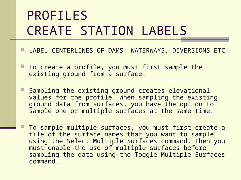
PROFILESCREATE STATION LABELS
LABEL CENTERLINES OF DAMS, WATERWAYS, DIVERSIONS ETC.
To create a profile, you must first sample the existing ground from a surface.
Sampling the existing ground creates elevational values for the profile. When sampling the existing ground data from surfaces, you have the option to sample one or multiple surfaces at the same time.
To sample multiple surfaces, you must first create a file of the surface
names that you want to sample using the Select Multiple Surfaces command. Then you must enable the use of multiple surfaces before sampling the data using the Toggle Multiple Surfaces command.

WHILE IN MODEL SPACE, WITH ITEM
TO BE LABELED
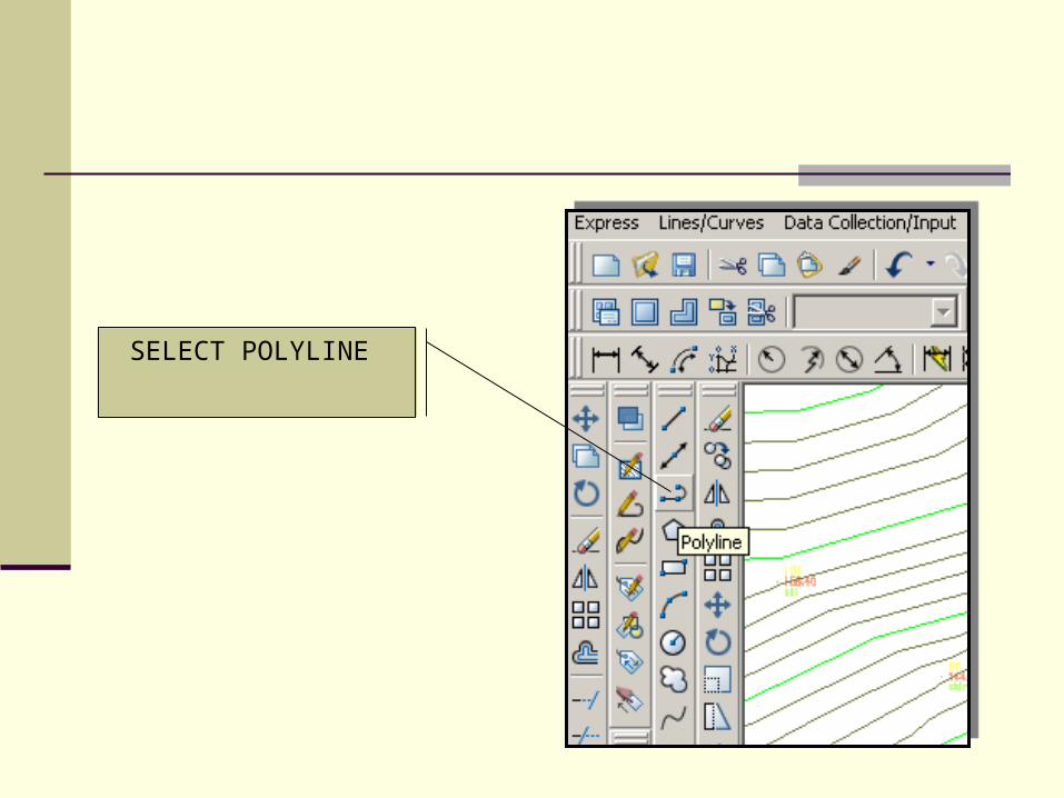
SELECT POLYLINE

START POLYLINE WHERE YOU WOULD LIKE TO START
THE SAMPLING
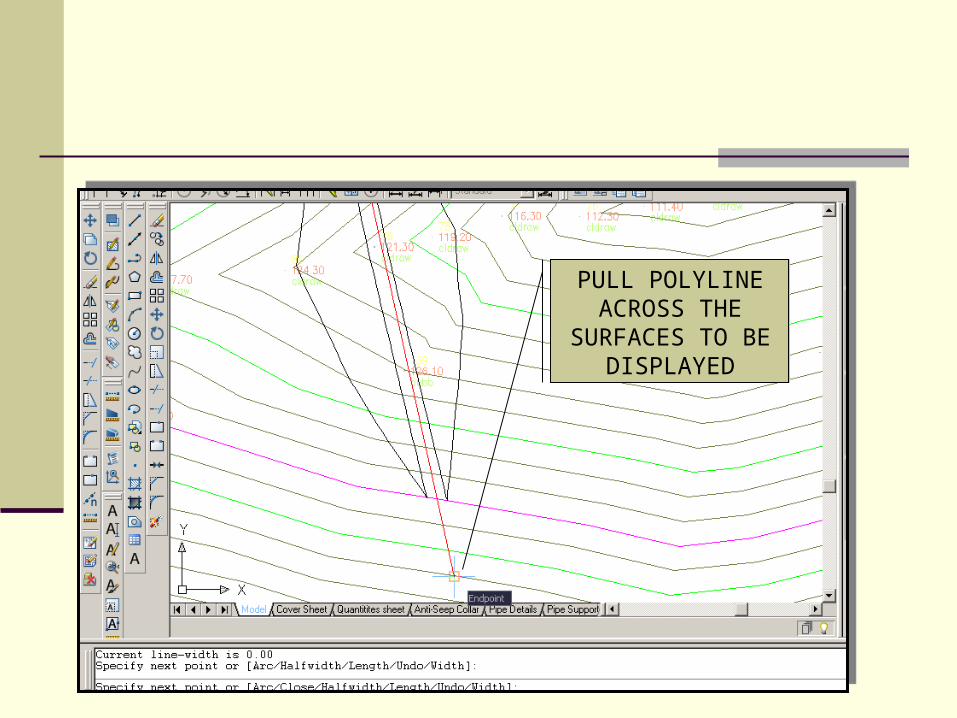
PULL POLYLINE ACROSS THE
SURFACES TO BE DISPLAYED

FROM TERRAIN, SELECT
DEFINE FROM POLYLINE

SELECT THE POLYLINE JUST
CREATED
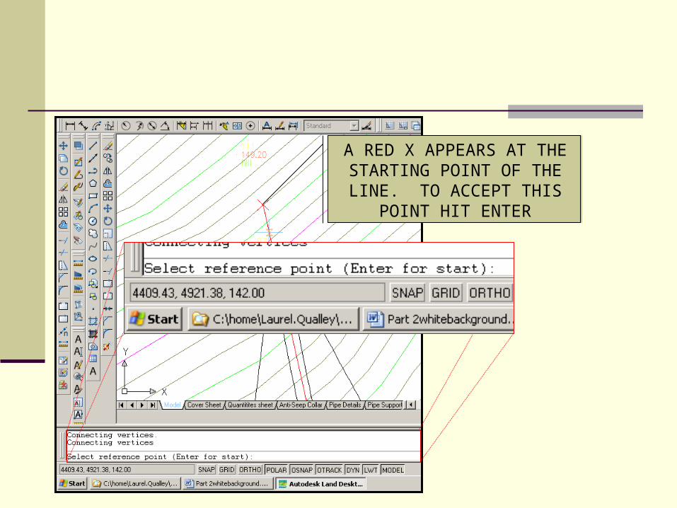
A RED X APPEARS AT THE STARTING POINT OF THE LINE. TO ACCEPT THIS
POINT HIT ENTER

NAME THE ALIGNMENT AND SELECT A
STARTING STATION REFERENCE, (IE, 0 OR
100). HIT OK

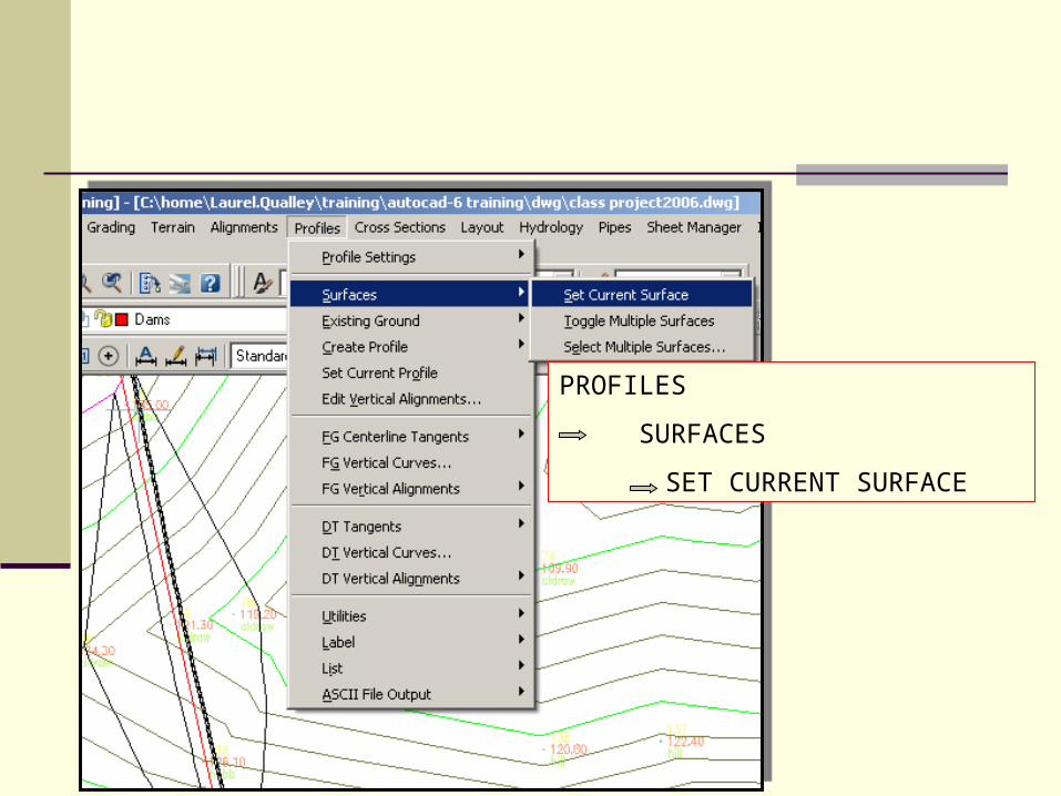
PROFILES
SURFACES
SET CURRENT SURFACE

SELECT THE EXISTING GROUND SURFACE
HIT OK

PROFILES
SURFACES
TOGGLE MULTIPLE SURFACES

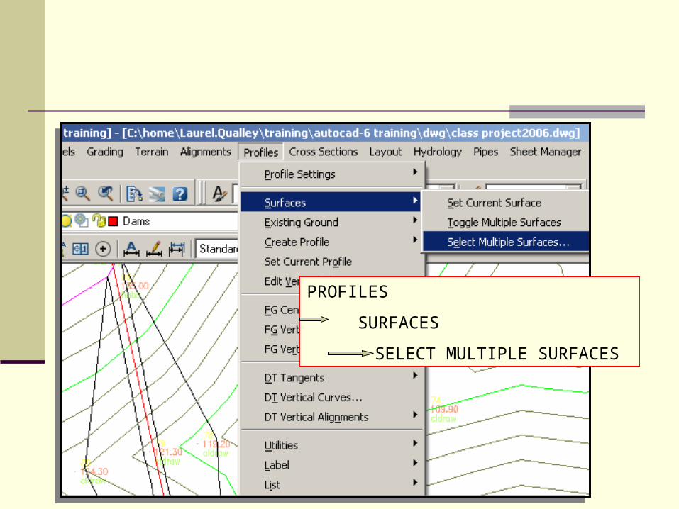
PROFILES
SURFACES
SELECT MULTIPLE SURFACES

HOLDING DOWN THE SHIFT BUTTON, SELECT THE SURFACES TO BE SAMPLED
(IF THEY ARE NOT TO BE NEXT TO EACH OTHER, USE THE CONTROL KEY TO SELECT MORE THAN ONE.)
HIT OK

PROFILES
EXISTING GROUND
SAMPLE FROM SURFACE

LEAVE UNCHECKED,
SAMPLED DATA APPEARS ON
BOTTOM, HIT OK

HIT ENTER

HIT ENTER

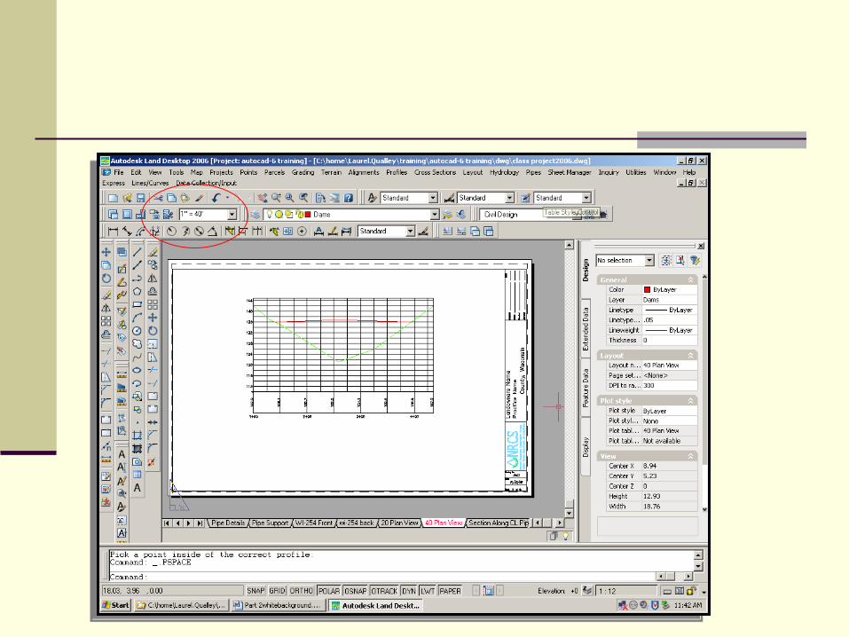
336 FEET OF PROFILE WILL
NEEDTO FIT ON PAPER
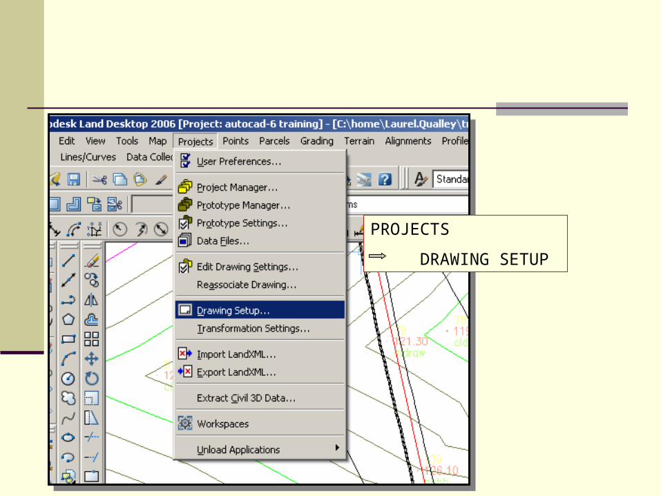
PROJECTS
DRAWING SETUP

SELECT A SCALE THAT WILL FIT
HORIZONTALLY ON THE PAPER SIZE
HIT OK
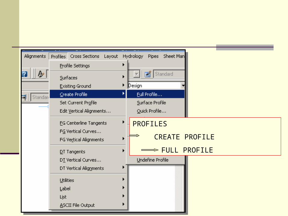
PROFILES
CREATE PROFILE
FULL PROFILE
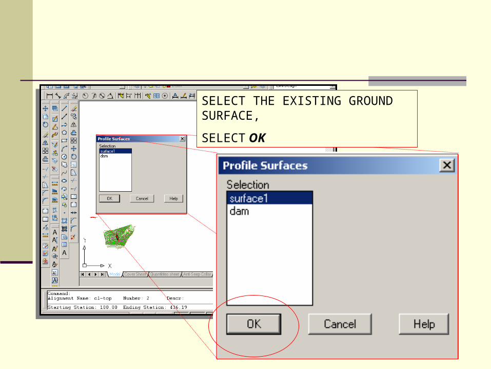
SELECT THE EXISTING GROUND SURFACE,
SELECT OK

VERTICAL SCALE FACTOR FROM: PROJECTS DRAWING SETUP CAN BE OVERWRITTEN.

SELECT A POINT AWAY FROM SURVEY
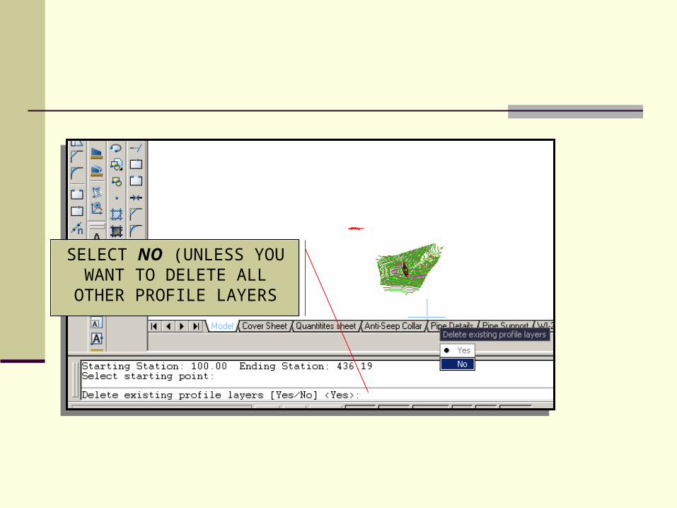
SELECT NO (UNLESS YOU WANT TO DELETE ALL
OTHER PROFILE LAYERS
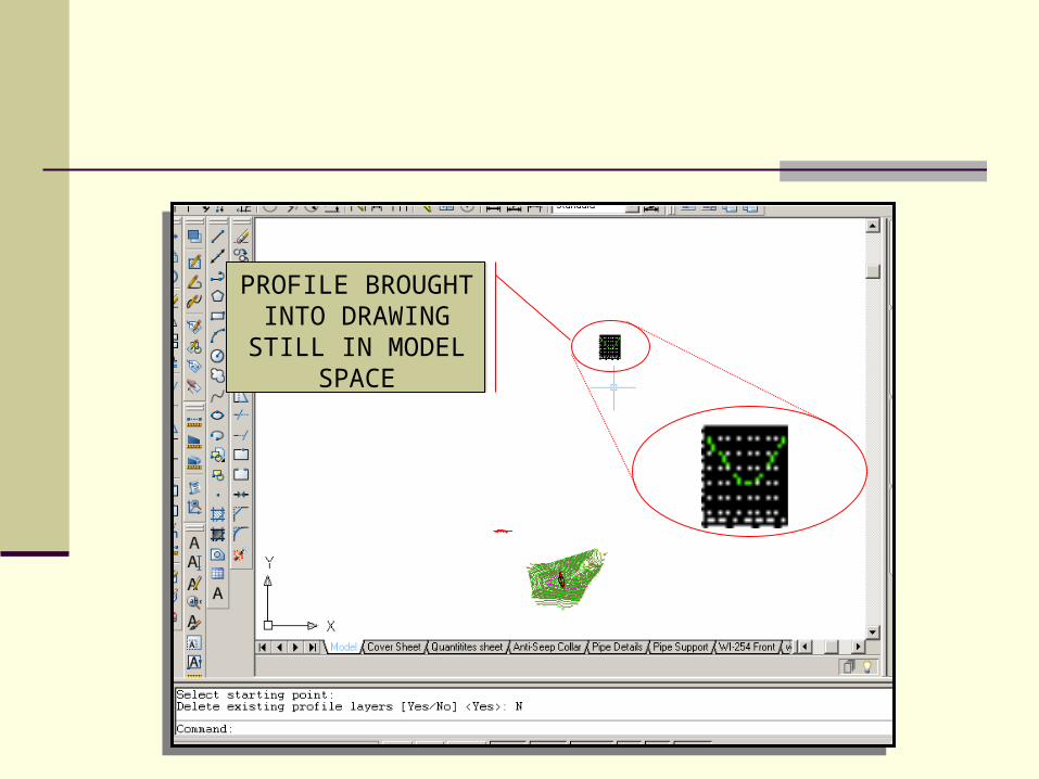
PROFILE BROUGHT INTO
DRAWING STILL IN MODEL SPACE
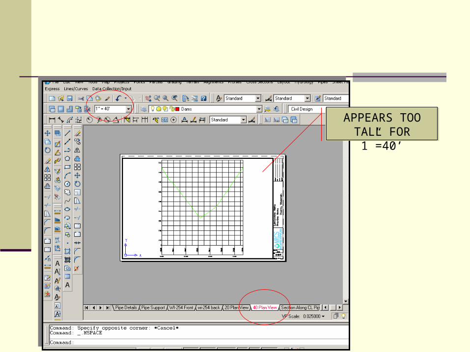
APPEARS TOO TALL FOR 1”=40’

TO REDO THE PROFILE, GO BACK TO:
PROFILES
CREATE PROFILE
FULL PROFILE
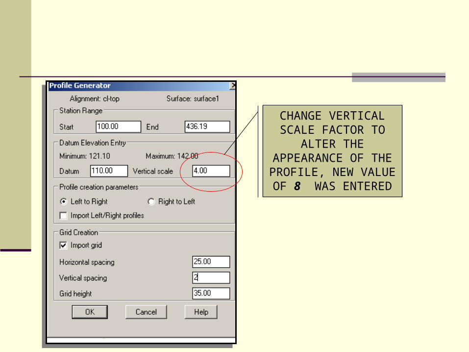
CHANGE VERTICAL SCALE FACTOR TO
ALTER THE APPEARANCE OF THE PROFILE, NEW VALUE OF 8 WAS ENTERED

NEW PROFILE IS
NEATER

FROM ALIGNMENTS
SELECT CURRENT ALIGNMENT
TO LABEL THE ALIGNMENT

FROM ALIGNMENTS SELECT STATION LABEL SETTINGS

SET THE DISTANCE YOU WANT
THE LABELS AND TICKS
TO APPEAR, SELECT OK
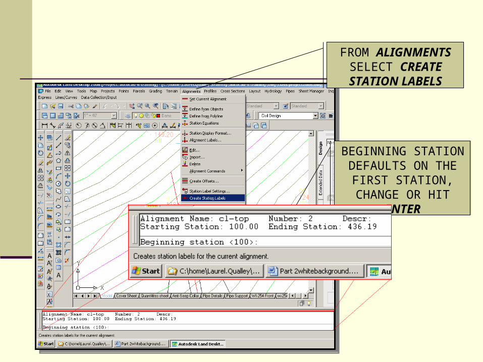
FROM ALIGNMENTS SELECT CREATE STATION LABELS
BEGINNING STATION DEFAULTS ON THE
FIRST STATION, CHANGE OR HIT
ENTER

ENTER TO ACCEPT THE STATIONS
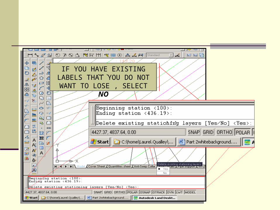
IF YOU HAVE EXISTING LABELS THAT YOU DO NOT
WANT TO LOSE , SELECT NO```
```
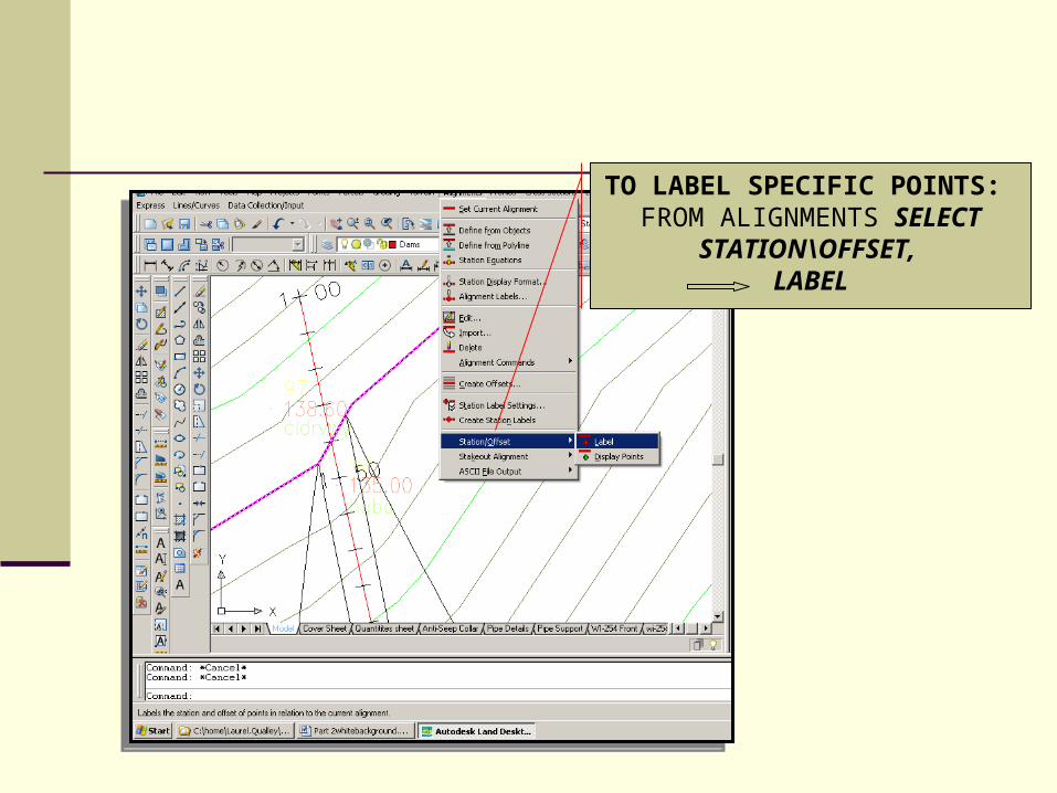
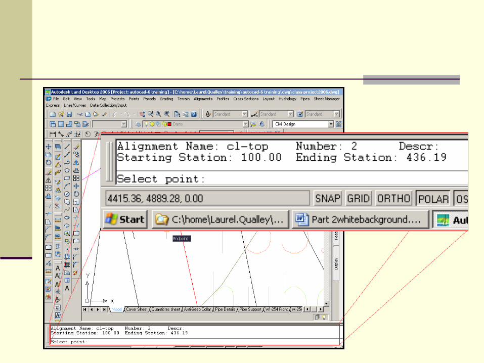
TO LABEL SPECIFIC POINTS: FROM ALIGNMENTS SELECT
STATION\OFFSET, LABEL
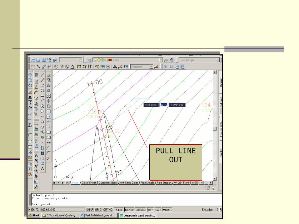
PULL LINE OUT

HIT ENTER
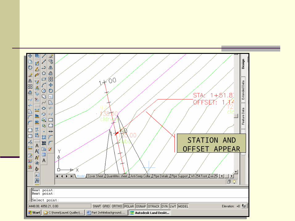
STATION AND OFFSET APPEAR

TEXT HAS BEEN EDITED