Orbit Determination for the Lunar Reconnaissance Orbiter ...
Processing of Lunar Reconnaissance Orbiter Camera
Narrow Angle Camera Image Frames with ISIS 3
featuring
How to Create NAC CDRs
February 2014
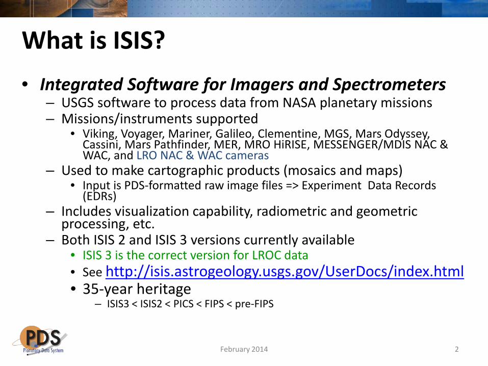
What is ISIS? • Integrated Software for Imagers and Spectrometers
– USGS software to process data from NASA planetary missions – Missions/instruments supported
• Viking, Voyager, Mariner, Galileo, Clementine, MGS, Mars Odyssey, Cassini, Mars Pathfinder, MER, MRO HiRISE, MESSENGER/MDIS NAC & WAC, and LRO NAC & WAC cameras
– Used to make cartographic products (mosaics and maps) • Input is PDS-formatted raw image files => Experiment Data Records
(EDRs) – Includes visualization capability, radiometric and geometric
processing, etc. – Both ISIS 2 and ISIS 3 versions currently available
• ISIS 3 is the correct version for LROC data • See http://isis.astrogeology.usgs.gov/UserDocs/index.html • 35-year heritage
– ISIS3 < ISIS2 < PICS < FIPS < pre-FIPS
2 February 2014

Supported OS Platforms • ISIS3 runs on many Unix variants including:
– Ubuntu, RHEL, Debian, Fedora, SUSE, MacOSX • ISIS3 does not run on MS Windows • ISIS requirements (depending on your needs):
– 64-bit x86 processors (more cores is better) – 2GB memory (more memory is better) – 10GB to 180GB disk storage for ISIS installation – 10GB to many TB disk storage for processing images – Quality graphics card (one that support two monitors can be
useful)
3 February 2014

How to Get ISIS 3
• Start at the ISIS Website – http://isis.astrogeology.usgs.gov
• Installing ISIS – http://isis.astrogeology.usgs.gov/documents/InstallGuide/index.html
• User documentation – http://isis.astrogeology.usgs.gov/UserDocs/index.html
• List of ISIS applications (alphabetical) – http://isis.astrogeology.usgs.gov/Application/alpha.html – Run programs from command line or using GUI interface
4 February 2014
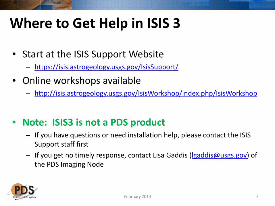
Where to Get Help in ISIS 3
• Start at the ISIS Support Website – https://isis.astrogeology.usgs.gov/IsisSupport/
• Online workshops available – http://isis.astrogeology.usgs.gov/IsisWorkshop/index.php/IsisWorkshop
• Note: ISIS3 is not a PDS product
– If you have questions or need installation help, please contact the ISIS Support staff first
– If you get no timely response, contact Lisa Gaddis ([email protected]) of the PDS Imaging Node
5 February 2014
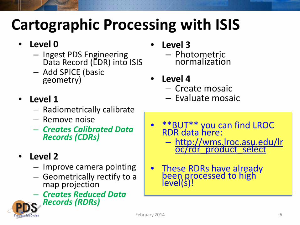
Cartographic Processing with ISIS • Level 0
– Ingest PDS Engineering Data Record (EDR) into ISIS
– Add SPICE (basic geometry)
• Level 1
– Radiometrically calibrate – Remove noise – Creates Calibrated Data
Records (CDRs)
• Level 2 – Improve camera pointing – Geometrically rectify to a
map projection – Creates Reduced Data
Records (RDRs)
• Level 3 – Photometric
normalization
• Level 4 – Create mosaic – Evaluate mosaic
• **BUT** you can find LROC RDR data here: – http://wms.lroc.asu.edu/lr
oc/rdr_product_select
• These RDRs have already been processed to high level(s)!
6 February 2014
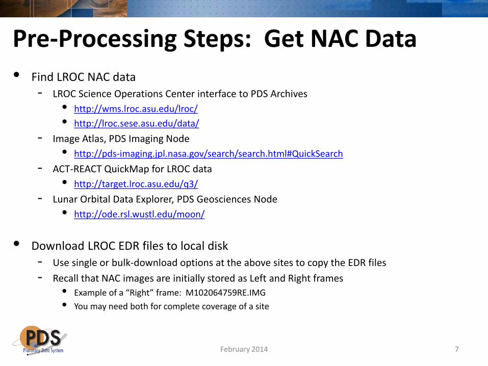
Pre-Processing Steps: Get NAC Data • Find LROC NAC data
- LROC Science Operations Center interface to PDS Archives • http://wms.lroc.asu.edu/lroc/ • http://lroc.sese.asu.edu/data/
- Image Atlas, PDS Imaging Node • http://pds-imaging.jpl.nasa.gov/search/search.html#QuickSearch
- ACT-REACT QuickMap for LROC data • http://target.lroc.asu.edu/q3/
- Lunar Orbital Data Explorer, PDS Geosciences Node • http://ode.rsl.wustl.edu/moon/
• Download LROC EDR files to local disk - Use single or bulk-download options at the above sites to copy the EDR files - Recall that NAC images are initially stored as Left and Right frames
• Example of a “Right” frame: M102064759RE.IMG • You may need both for complete coverage of a site
7 February 2014

• Get ready to start processing: - Make sure ISIS3 is installed and running on your system
- See slide #4 - As part of the ISIS3 release, you will receive a lunar surface
topography model (or a Digital Elevation Model, DEM) so that images will be placed accurately onto the lunar surface during processing
- The current default DEM is the March 2011 version of the LROC LOLA DEM
- Create a map template file - Used by cam2map to map-project the images ₋ See next slides
- Note: “>command” here means run in Linux at prompt
8
Pre-Processing Steps
February 2014
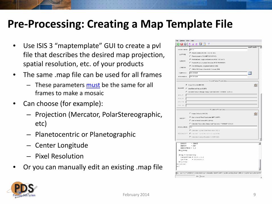
Pre-Processing: Creating a Map Template File
• Use ISIS 3 “maptemplate” GUI to create a pvl file that describes the desired map projection, spatial resolution, etc. of your products
• The same .map file can be used for all frames – These parameters must be the same for all
frames to make a mosaic • Can choose (for example):
– Projection (Mercator, PolarStereographic, etc)
– Planetocentric or Planetographic – Center Longitude – Pixel Resolution
• Or you can manually edit an existing .map file
9 February 2014

Pre-Processing: Maptemplate Output Sample lroc_equi.map
• Group = Mapping • ProjectionName = Equirectangular • CenterLongitude = 180.0 • CenterLatitude = 0.0 • TargetName = Moon • EquatorialRadius = 1737400.0 <meters> • PolarRadius = 1737400.0 <meters> • LatitudeType = Planetocentric • LongitudeDirection = PositiveEast • LongitudeDomain = 360 • PixelResolution = 3.0 <meters/pixel> • End_Group • End
10
<< change as needed; use lower resolution for quick-look mosaics or for smaller images
February 2014
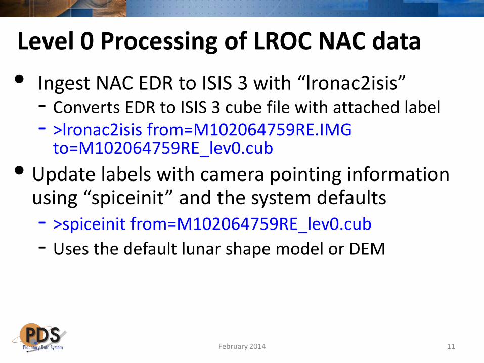
Level 0 Processing of LROC NAC data • Ingest NAC EDR to ISIS 3 with “lronac2isis”
- Converts EDR to ISIS 3 cube file with attached label - >lronac2isis from=M102064759RE.IMG
to=M102064759RE_lev0.cub • Update labels with camera pointing information
using “spiceinit” and the system defaults - >spiceinit from=M102064759RE_lev0.cub - Uses the default lunar shape model or DEM
11 February 2014

• Calibrate image to convert to I/F values using “lronaccal” - >lronaccal from= M102064759RE_lev0.cub
to=M102064759RE_lev1.cub • Remove artifacts using “lronacecho”
- A correction designed to remove an observed brightness “echo” across adjacent pixels in NAC frames
- >lronacecho from= M102064759RE_lev1.cub to=M102064759RE_lev1.echo.cub
• Result is a Calibrated Data Record (CDR)
Level 1 Processing of LROC NAC data
12 February 2014
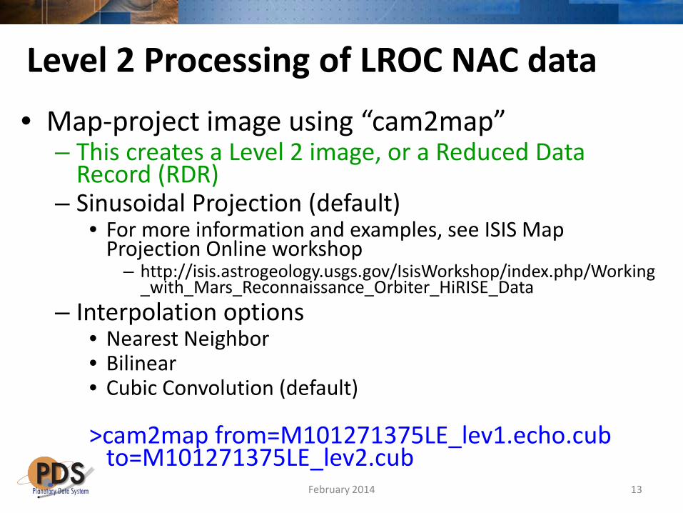
• Map-project image using “cam2map” – This creates a Level 2 image, or a Reduced Data
Record (RDR) – Sinusoidal Projection (default)
• For more information and examples, see ISIS Map Projection Online workshop
– http://isis.astrogeology.usgs.gov/IsisWorkshop/index.php/Working_with_Mars_Reconnaissance_Orbiter_HiRISE_Data
– Interpolation options • Nearest Neighbor • Bilinear • Cubic Convolution (default) >cam2map from=M101271375LE_lev1.echo.cub
to=M101271375LE_lev2.cub
Level 2 Processing of LROC NAC data
13 February 2014

Level 3 Processing of LROC NAC data • Photometric correction
- This step is not yet used routinely for correcting NAC data
- Research is being conducted on this topic, for example: • Clegg et al., 2013
- http://www.lpi.usra.edu/meetings/lpsc2013/pdf/2171.pdf • Boyd et al., 2012
- http://lunarscience.nasa.gov/lsf2012/lunar-reconnaissance-orbiter-camera-narrow-angle-camera-global-photometric-solution-empirical-functi
14 February 2014
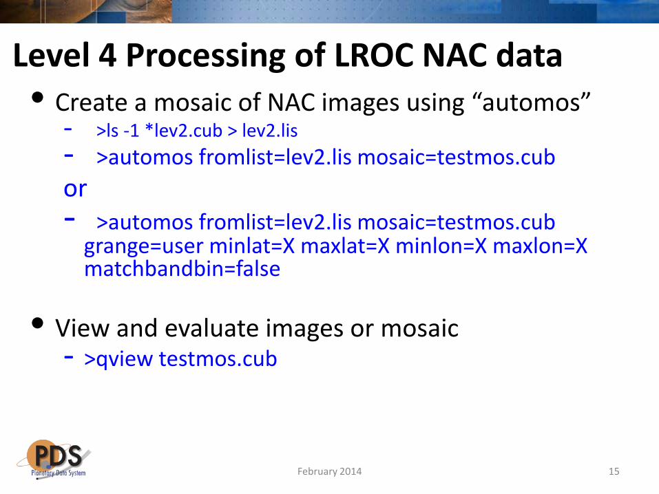
Level 4 Processing of LROC NAC data • Create a mosaic of NAC images using “automos”
- >ls -1 *lev2.cub > lev2.lis - >automos fromlist=lev2.lis mosaic=testmos.cub or - >automos fromlist=lev2.lis mosaic=testmos.cub
grange=user minlat=X maxlat=X minlon=X maxlon=X matchbandbin=false
• View and evaluate images or mosaic
- >qview testmos.cub
15 February 2014
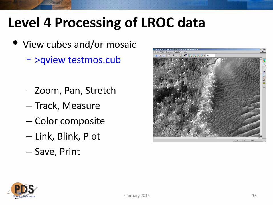
Level 4 Processing of LROC data • View cubes and/or mosaic
- >qview testmos.cub
– Zoom, Pan, Stretch – Track, Measure – Color composite – Link, Blink, Plot – Save, Print
16 February 2014
Exporting ISIS3 files • Within ISIS3 ₋ Directly from qview or ₋ >isis2std from=LROCfile.cub to=LROCfile.png
• GDAL: Geospatial Data Abstraction Library ₋ See http://www.gdal.org/ ₋ Open Source library, supports PDS v3, ISIS2, and ISIS3 file formats ₋ Binaries available for Mac, Windows, Linux ₋ Export raw and many other image file formats ₋ Maintains projection information and some metadata to output ₋ Utility applications have stretching (scaling options), map projection
support, clipping, resampling and mosaic capabilities ₋ To output lossless geoJpeg2000
₋ >gdal_translate -of JP2KAK -co quality=100 input.cub out.jp2 ₋ This .jp2 product retains geospatial information and can be exported
directly into an Arc GIS project
17 February 2014
Finding Help
• For ISIS 3, start at the ISIS Support Website – https://isis.astrogeology.usgs.gov/IsisSupport/
– Online workshops available • http://isis.astrogeology.usgs.gov/IsisWorkshop/index.php/IsisWorkshop
– Recall that ISIS3 is not a PDS product • If you have questions or need installation help, please contact the ISIS
Support staff first • If you get no timely response, contact Lisa Gaddis ([email protected]) of the
PDS Imaging Node
18 February 2014
Finding Help • For help using LROC NAC data
• LROC Instrument Overview (Space Science Reviews, 2010:
http://link.springer.com/article/10.1007%2Fs11214-010-9634-2
• LROC EDR/CDR PDS Product Description: http://lroc.sese.asu.edu/data/LRO-L-LROC-2-EDR-V1.0/LROLRC_0001/DOCUMENT/LROCSIS.PDF
• LROC RDR Product Description: http://lroc.sese.asu.edu/data/LRO-L-LROC-5-RDR-V1.0/LROLRC_2001/DOCUMENT/RDRSIS.PDF
• For questions regarding LROC PDS products, send email to the address [email protected]. For questions regarding the LROC PDS Data Node interface, send email to the address [email protected].
19 February 2014

![Lunar Reconnaissance Orbiter (LRO): Leading NASA’s Way ...2].pdf · Lunar Reconnaissance Orbiter (LRO): Leading NASA’s Way Back to the Moon ... nancy.n.jones@nasa.gov Jonas Dino](https://static.fdocuments.net/doc/165x107/5e703682e07d8403d07255d8/lunar-reconnaissance-orbiter-lro-leading-nasaas-way-2pdf-lunar-reconnaissance.jpg)