GEO-X Plenary + Geneva Ministerial Summit 2014 15 – 17 January 2014, Geneva, Switzerland

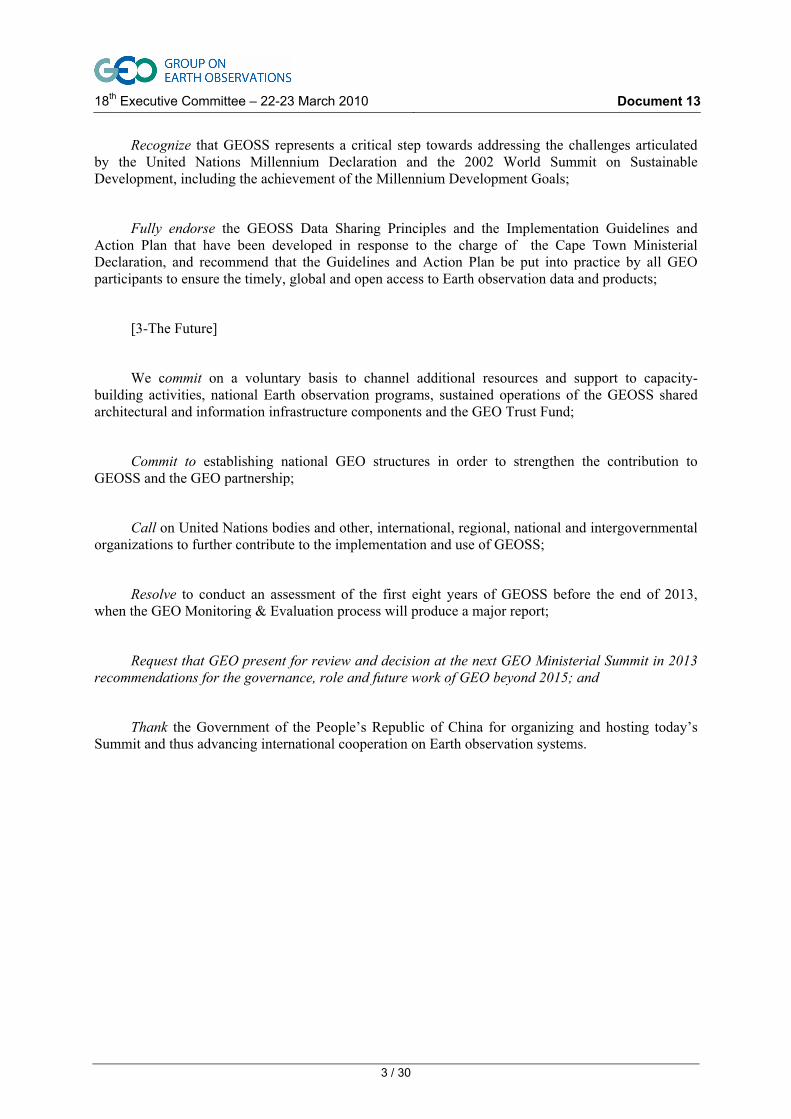
18th Executive Committee – 22-23 March 2010 Document 13
Preparation of 2010 Ministerial Summit
The 2010 Ministerial Task Force is leading the preparations for next November’s Beijing Ministerial Summit by identifying “showcases” that could be presented to the Ministers, developing the first draft of a Ministerial Declaration, and identifying other potential documents and outreach activities.
This report contains a number of documents that together provide a full picture of the activities and plans of the Task Force. A table of contents is provided below for the convenience of the reader. The Task Force invites comments and guidance from the Executive Committee.
The Draft Beijing Declaration on GEOSS ...............................................................................................2
Draft Agenda for the Beijing Summit .....................................................................................................4
Draft Outline of General Summary Outreach Document ........................................................................6
Minutes of the Task Force teleconference of 25 February ......................................................................8
Summary report of second meeting of Task Force (2-3 February) .......................................................10
Annex I: List of Actions .................................................................................................................16
Annex II: Descriptive texts of showcases ......................................................................................19

18th Executive Committee – 22-23 March 2010 Document 13
2 / 30
The Beijing Declaration on the Global Earth Observation
System of Systems (GEOSS)
[1-Preamble]
We, the Ministers and participants assembled at the Group on Earth Observations (GEO) Ministerial Summit in Beijing, China, on 5 November 2010:
Recognizing that nations are facing major environmental, social and economic challenges as a consequence of rapidly increasing world population, industrial development, changing weather and climate patterns and globalization;
Noting the outcomes of the Earth Observation Summits in Washington in 2003, Tokyo in 2004, Brussels in 2005, and more recently in Cape Town in 2007;
Realizing the importance of making sustained progress on the Global Earth Observation System of Systems (GEOSS) 10-Year Plan and towards its vision for building a coordinated, comprehensive and sustained GEOSS that serves the global public good to enhance human health, safety and welfare; alleviate human suffering and poverty; protect the global environment; achieve sustainable economic development; and meet the needs of users in the nine Societal Benefit Areas;
Recognizing that GEOSS can contribute to advancing the implementation of international treaty obligations in the fields of environment and sustainable development;
Recognizing the importance of providing stable, reliable and long-term operations of land, sea, atmosphere and space-based Earth observation networks and systems within the framework of national policies and international obligations;
Welcoming a future wherein decisions and actions for the benefit of humankind are more fully informed by Earth observations, science and associated information products and services;
[2-Response to Cape Town]
Note with satisfaction the mid-term achievements reported by Members and Participating Organizations, which build on the early achievements reported at the Cape Town Ministerial, and which are already delivering multiple social, environmental and economic benefits;
Endorse the refined GEO Targets set out in the “Strategic Targets: GEOSS Implementation by 2015” that are consistent with the two- and six-year targets in the 10-Year Implementation Plan;
18th Executive Committee – 22-23 March 2010 Document 13
3 / 30
Recognize that GEOSS represents a critical step towards addressing the challenges articulated by the United Nations Millennium Declaration and the 2002 World Summit on Sustainable Development, including the achievement of the Millennium Development Goals;
Fully endorse the GEOSS Data Sharing Principles and the Implementation Guidelines and Action Plan that have been developed in response to the charge of the Cape Town Ministerial Declaration, and recommend that the Guidelines and Action Plan be put into practice by all GEO participants to ensure the timely, global and open access to Earth observation data and products;
[3-The Future]
We commit on a voluntary basis to channel additional resources and support to capacity-building activities, national Earth observation programs, sustained operations of the GEOSS shared architectural and information infrastructure components and the GEO Trust Fund;
Commit to establishing national GEO structures in order to strengthen the contribution to GEOSS and the GEO partnership;
Call on United Nations bodies and other, international, regional, national and intergovernmental organizations to further contribute to the implementation and use of GEOSS;
Resolve to conduct an assessment of the first eight years of GEOSS before the end of 2013, when the GEO Monitoring & Evaluation process will produce a major report;
Request that GEO present for review and decision at the next GEO Ministerial Summit in 2013 recommendations for the governance, role and future work of GEO beyond 2015; and
Thank the Government of the People’s Republic of China for organizing and hosting today’s Summit and thus advancing international cooperation on Earth observation systems.

18th Executive Committee – 22-23 March 2010 Document 13
4 / 30
Beijing Ministerial Summit
“Realizing the Benefits of the GEO Framework” 5 November 2010
Special Dinner Event? (4 November) – Presentation of a showcase
AGENDA
Session 1 09h00 - 10h15 Chair: China
1. Welcome Addresses & Introductions – statements by Chair and Ministerial Co-Chairs
2. Keynote Address (Could be a Minister/Showcase or GEO Report/video on progress)
3. Regional Showcase – Demonstrating the GEO Difference
4. Presentation of Beijing Declaration
Ministers visit the Exhibition 10h15-11h00 &
Presentation of 1-2 GEO Showcase Achievements
Session 1 (continued) 11h00 – 11h30
5. Presentation on Data Sharing implementation Plan
Session 2 11h30 – 13h00 Chair: US
6. Discussion and Statements Ministers and Heads of Participating Organizations
Lunch in VIP area of Exhibition 13h00 – 14h30 &
Presentation of 1-2 GEO Showcase Achievements
Session 3 14h30 - 16h00 Chair: South Africa
7. Discussion and Statements Ministers and Heads of Participating Organizations
Tea Break 16h00-16h30
Session 4 16h30 - 18h00 Chair: EC
8. Showcase (that speaks to the future – such as Carbon Tracking)
9. Discussion and Statements Ministers and Heads of Participating Organizations

18th Executive Committee – 22-23 March 2010 Document 13
5 / 30
Session 5 18h00 - 18h30 Chair: China
10. Adoption of the Declaration
11. Closing Statements
Special Dinner Event (?) 19h30-22h30
18th Executive Committee – 22-23 March 2010 Document 13
6 / 30
PROPOSED DOCUMENT STRUCTURES
PROPOSED ACHIEVEMENTS DOCUMENT FORMAT
• General Summary;
• Next 100 Steps ( based on contributions of GEO Task leads);
• The GEO Spirit (based on contributions of participating organizations).
Draft Outline and Messages of General Summary
Suggested objectives & messages:
• a communication targeted for Ministers,
• remind Ministers of their political commitments and priorities for GEO;
• crafted with ‘ministerial’ high-level language;
• be highly consistent with Cape Town and Beijing declarations;
• build on the messaging of the 2007 Report on Progress;
• emphasize the uniqueness of the GEO framework – strong partnership among countries and Participating Organizations who have a shared vision and passion for a successful GEOSS;
• along with Component 2 (the next 100 steps), emphasize the importance of the Participating Organizations in the development of GEOSS – show how the Participating Organizations have responded to the 2007 Call to Action;
• develop a 2010 Theme (2007 was: Earth Observations for Sustainable Growth and Development).
__________________________________________________________________________________
PROPOSED OUTLINE
An appropriate title (Proposed Theme of the Summit)
““Realizing the Benefits of the GEO Framework”
EXECUTIVE SUMMARY
Preamble
Section I: Introduction
• societal needs for Earth observations;
• brief history, aims & goals of GEO and GEOSS;
• the spirit of GEO;
• the role of Ministers at Cape Town - reaffirming & providing guidance for 3 years of action leading to Beijing.

18th Executive Committee – 22-23 March 2010 Document 13
7 / 30
Section II: GEOSS today – where we are, what we have achieved since 2007
• response to Cape Town;
• a common vision is being implemented;
• development of Strategic Targets;
• a unique partnership of Governments and Participating Organizations;
• GEOSS is on track;
• … but there are challenges.
Section III: GEOSS tomorrow – where we want to be in 2013, 2015… and beyond
• the GEO Work Plan;
• next steps in the incremental process leading to 2015;
• overcoming the challenges;
• from Beijing to 2013 – succinct thematic focus areas for GEO.
Section IV: A roadmap to success – how Ministers can ensure an implemented GEOSS with real and measurable societal benefits
• the political imperative;
• measuring success;
• how to sustain the momentum, the success and the vision;
• starting to think about post-2015 global EO governance.

18th Executive Committee – 22-23 March 2010 Document 13
8 / 30
The GEO 2010 Summit Task Force
Teleconference of 25 February 2010
Minutes
This third Task Force teleconference lasted for 130 minutes and was chaired by David Grimes.
1 SUMMARY REPORT OF THE 2ND TASK FORCE MEETING
David requested edits to section 5 of the report to position it as an active recommendation.
The teleconference noted that revised showcase texts have been received for carbon, GEO BON, capacity-building and health; Yu Jun confirmed that discussions are ongoing concerning an Asian regional showcase. The relevant GEO Secretariat experts will now work with the showcase proponents to advance the preparations to ensure a strong definition of each showcase by the end of March. The six showcases will be presented to the March meeting of the Executive Committee as well as to the Pretoria Symposium in May. The Task Force will consider demos of the showcases and how best to present them at its June meeting.
The teleconference then discussed the documents that could be produced for the Ministerial. The three options include a strategic general summary, “the fuller picture” coffee-table book, and “the next 100 steps”. An outline for the general summary is needed by April; David offered to draft this outline. The Secretariat will write to Task leads requesting contributions to the “100 steps” with the aim of having a rough draft by June. José proposed integrating “the fuller picture” and “the next 100 steps” into one outreach document for the Ministerial and considering the evaluation report and work plan progress report as management documents; others proposed maintaining the three outreach options. The availability of time and resources needs to be considered. The Executive Committee’s views will be sought on whether to streamline the number of documents and the Task Force will discuss the format of the documents in its April teleconference.
Gilles will report orally to the Executive Committee on behalf of the Task Force, and David will be available via phone hook-up. The written document will include the minutes of the 25 February teleconference, the updated minutes of the February Task Force meeting, the action points, the most recent versions of the six showcases, the draft Beijing Declaration, and the draft Summit Agenda.
2 DRAFT BEIJING DECLARATION
A number of comments were made on the newest draft of the Declaration regarding the preamble, including revisions to paragraph 3, the reference to the Cape Town Summit, and the use of the word “endorsing” in paragraph 5. In the section on progress it was suggested that the strategic targets for 2015 be reflected in paragraph 1. In the section on the Future, it was suggested that the first paragraph could be stronger, that the reference to intergovernmental organizations be elaborated in paragraph 2, and that Gilles bring to the attention of the Executive Committee the proposed study in paragraph 4. Participants were invited to send their comments to David by email to be incorporated into a new draft.

18th Executive Committee – 22-23 March 2010 Document 13
9 / 30
3 AGENDA OF SUMMIT
A number of participants supported the approach taken by the draft agenda, including the link to the Exhibition. It was suggested that the Ministerial dinner could take place on Thursday, the night before the Summit, opening up another opportunity for presenting showcases. In the current draft agenda, China should be indicated as the chair of the continued session 1. Time slots are needed for addresses by the GEO Co-Chairs and by the Ministers representing the Co-Chair countries. Based on these comments, David undertook to revise the draft agenda and circulate it, together with the revised Declaration, by Monday 1 March, with comments from the Task Force due by Wednesday 3 March.
4 OTHER ACTIONS AND ISSUES
The participants agreed to schedule the next two teleconferences for 13 April and, tentatively, 11 May, both at 13h30 Geneva time. The third meeting of the Task Force will take place in Geneva on 16-17 June. Gilles will present the first cut of a possible curtain-raiser video at this meeting.
The following Task Force members participated in the teleconference: Carsten Dettmann, David Grimes, Kenneth Korporal, Gilles Ollier, Evangelina Oriol-Pibernat (for ESA), Aurelie Sand, Brent Smith, Hirota Tani, Joao Vianei, Wang Hong, Gregory Withee, Yu Jun, Yue Huanying, José Achache, Fan Jinlong, and Michael Williams.

18th Executive Committee – 22-23 March 2010 Document 13
10 / 30
The GEO 2010 Summit Task Force
Second meeting, 2-3 February 2010 Geneva, Switzerland
Summary Report (as updated on 5 March)
1 OPENING OF MEETING
The second meeting of the GEO 2010 Summit Task Force was held on 2 and 3 February 2010 in Geneva. The participants were Pakorn Apaphant, CEOS; Simonetta Cheli, European Space Agency; Paul Counet, EUMETSAT; Carsten Dettmann, Germany; Raimundo González Aninat, Chile; David Grimes, Canada; Alexander Gusev, Russian Federation; Mmboneni Muofhe, South Africa; Ion Nedelcu, Romania; Gilles Ollier, European Commission; José Romero, Switzerland; Aurelie Sand, France; Brent Smith, CEOS; Rio Tanabe, Japan; Joao Vianei Soares, Brazil; Gregory W Withee, USA; and Jun Yu, China. The GEO Secretariat was represented by José Achache, Jinlong Fan and Michael Williams. David Grimes and Gilles Ollier co-chaired the meeting.
The meeting started with opening remarks, the introduction of participants, a review of actions from the 1st meeting (see annex 1 for updated list of actions), and a presentation of the China National Convention Center, which will serve as the Summit venue. Jun Yu explained that the first invitation letter to Ministers was now being signed by the two Chinese ministers and would be sent out shortly to the 24 ministers identified by GEO Principals. For the other Members, the letter will be addressed to foreign affairs ministers.
Gilles Ollier made a presentation on the video and other communications services that could be provided by an EC consultant.
2 REVIEW AND SELECTION OF SHOWCASES
The meeting held an extensive debate on the 19 proposed showcases that had been submitted by the GEO Committees as well as by CEOS, ESA, the GEO Secretariat, and the Task Force itself. The proposals addressed forest carbon tracking, global monitoring of greenhouse gases, climate change, climate and carbon, global monitoring of greenhouse gases from space, data sharing principles, data democracy, the GEO web portal (ESA/FAO), Architecture Implementation Pilots 2 & 3, GEOSS Architecture Implementation, end-to-end capacity building, GEO BON, the Asia/Africa Water Cycle Initiative, Health and Air Quality, the GEOWiki land cover validation tool, the Energy Community of Practice, One-Geology and One-Geology Europe, global soil mapping, and the GEO geohazards Supersites.
Building on last October’s discussion, the meeting debated various messages that the showcases should communicate, including:
• GEOSS is a user driven process (as opposed to being science or provider driven);
• GEOSS responds to and supports major processes and assessments;
• GEOSS complements GCOS and other processes;

18th Executive Committee – 22-23 March 2010 Document 13
11 / 30
• By improving access to information, GEOSS leads to be better decision making (the “GEO difference”);
• GEO Members should continue investing in GEOSS;
• GEOSS can support economic efficiency and the “green economy”.
Other recommendations including ensuring that the showcases support the Declaration, that the messages are presented in a striking way, and that the bottom-up nature of GEO is evident. It was noted that the climate issue would need to be dealt with carefully given the existence of differing national perspectives and political stances.
While confirming the value of showcases, the meeting agreed that they should be introduced at the Ministerial by some kind of general presentation on GEO. This presentation and/or document should highlight GEO’s accomplishments, its future perspectives, and its role as a coordination mechanism that is based on the infrastructure of its Members and Participating Organizations. The aim would be to tell a comprehensive story about GEOSS and its importance to policy-making for environment and natural resources. Many of the 19 original proposals might contribute to this story. For example, One Geology and GEO BON illustrate the emergence of new communities that GEO is bringing together, offering evidence of the attractiveness of the GEO model. Themes like health, energy and soil could also be embedded. The Supersites could also be referred to in this general presentation as an example of GEO’s ability to react rapidly to catastrophic events.
The discussion focused on the maturity of the Tasks underlying each proposed showcase, their political relevance and profile, and their breadth or narrowness. Some of the proposals, it was felt, would be more effective if presented in the exhibition, folded into the capacity building showcase, or featured in the general overview presentation. The eventual titles of the showcases should be centered on verbs, and not nouns, to emphasize the functionalities of GEOSS.
The meeting decided that it would be more appropriate to address data sharing, which was highlighted in the Cape Town Declaration, through the Beijing Declaration and other appropriate means rather than presenting it as a showcase. Ministers could also be encouraged to address this issue in their statements.
From the 19 original proposals, plus several others generated by the Task Force itself, the meeting developed a new list of the following six potential showcases. More detailed descriptions of the six showcases were produced by the Task Force as preliminary drafts to be sent to the showcase proponents to guide them for preparing the new template (see Annex 2 to this document):
- End-to-end capacity building. This showcase could be developed by the CBC and incorporate data democracy, the GEO wiki, education and training, gap filling, and other elements, including some of the other original 19 proposed showcases. (Template sent to five CBC co-chairs);
- Global carbon tracking system. This showcase could feature links to ecosystems and biodiversity, focus on carbon rather than climate per se, be referenced in the Declaration, credit the various individual system components, stress the integration of satellite and in situ, and acknowledge gaps. It should highlight the forest carbon component as a concrete example and emphasize for Ministers the unique role that GEO can play in bringing the carbon community together. (Roger Dargeville of Carbon CoP);
- Geohazards supersite. Developed in rapid response to the Haitian earthquake, the supersite is a scientific resource that can also be increasingly operationalized. The International Charter is an operational mechanism that could perhaps be integrated into this showcase. The supersite can be positioned as crisis-driven. It lends itself to colorful and meaningful imagery. The message: GEO is flexible and can adapt rapidly to events like earthquakes. (Task leads Falk Amelung and Wolfgang Lengert);

18th Executive Committee – 22-23 March 2010 Document 13
12 / 30
- GEO BON. As an emerging community bringing together over 100 organizations and national agencies, GEO BON highlights the breadth of GEO. The UN has declared 2010 the International Year of Biodiversity, and shortly before the GEO Ministerial the Conference of the Parties of the Convention on Biological Diversity will meet in Nagoya, where it may recognize GEO BON’s ability to develop a 2010 baseline against which to measure a newly agreed target for reducing the rate of biodiversity loss by 2020. (Task Leads Woody Turner, Anne Larugaurderie, Rob Jongman);
- Health services. Progress is being made on the links between health and climate and environmental change, for example with meningitis in Africa, dengue fever in Brazil, and malaria. This link however is not fully developed. (Gary Foley);
- Asian regional showcase. Water, for example, could be used to demonstrate the regional aspect of GEO, notably via the Asian Water Cycle Initiative. The message could that one region can learn from another, so for example the lessons of AWCI could support an African version. Given the benefits of having an Asian regional example for the Beijing Summit, China will consult with its caucus on whether this, or another showcase, should be chosen. (Jun Yu.);
The showcases are likely to be allotted a limited amount of time for presentation at the Ministerial, perhaps 5 or 10 minutes. The eventual number of showcases will impact the total time allotted to each one.
The proponents of the six potential showcases will now be asked to present revised proposals that could in their final form be presented as two-page papers for the Ministers. These proposals should be received in time for consideration at the late February teleconference. Each paper should follow this standard template:
• An appealing, verb-driven title;
• A one-sentence political message;
• A maximum one-page description of the showcase, including its added value for policymakers, the green economy/sustainable development and other global priorities;
• Proposed presentation tools: podium presentation (including proposed length), documents & publications, multimedia, (e.g. videos), posters, images, exhibition booth, side events, etc.;
• Expected response or action from Ministers;
• If possible, an illustrative diagram, image or picture to accompany the text.
José Achache suggested developing a way to present the showcases in a more transverse manner and offered to propose such an approach to the Task Force in the near future.
3 THE GEO-VII EXHIBITION
The exhibition will be useful for highlighting GEO’s many achievements. In addition to the traditional bottom-up approach by which past exhibition have been developed, whereby countries and organizations organize their own individual stands to highlight their voluntary contributions, the Task Force suggested exploring the possibility of orchestrating cross-cutting stands for SBAs, Tasks, showcases, and so forth.
A one-line theme could be developed for the Exhibition and perhaps for the conference as a whole, as was done for Cape Town. The Task Team was invited to reflect on this and to provide comments when submitting comments on the Declaration for discussion at the February teleconference. The Secretariat will issue an early announcement to allow possible contributors to start planning for the exhibition.

18th Executive Committee – 22-23 March 2010 Document 13
13 / 30
4 PREPARING THE BEIJING DECLARATION
Jun Yu introduced the draft Beijing Declaration that had been prepared by a host country team. The meeting thanked China for preparing an excellent first draft. A discussion of how to advance the text further generated the following suggested messages and approaches by individual Task Force members:
• Shorten the text, particularly the front end, to two pages;
• Link it more strongly to issues of the day, such as climate, biodiversity, and the economy;
• Reconfirm the importance of implementing the data sharing principles;
• GEO has taken the Cape Town Declaration seriously and responded in diverse ways;
• Clearly demonstrate Ministers’ value-added in the Summit process;
• Recognize what GEO has already accomplished;
• Given that mailing list contains mostly ministers responsible for environment and for science & technology, focus on issues of relevant to such ministers;
• Use stronger verbs than “confirm” in order to be more forward looking and action oriented;
• Call for mobilizing and further engaging Intergovernmental Organizations and other Participating Organizations;
• Invite Member governments to be more proactive;
• State that the original GEOSS vision and objectives are still valid;
• Recognize that access to better observational data and information leads to better decisions;
• Make connections to contributions that enhance economic performance;
• Highlight the need to ensure the sustainability of both space and in situ systems;
• Ensure that GEOSS implementation and the maintenance of Earth observation systems are properly resourced;
• Call for stronger support to the Trust Fund;
• Highlight the value of GEO as an international coordination mechanism;
• Bind ministers to milestones;
• Increase national Earth observation budgets;
• Recommit to existing targets and to filling gaps;
• Stress the role of GEOSS as a global public good;
• Stress that science is critical to effective policy making and too often overlooked;
• GEOSS supports the UN’s Millennium Development Goals (MDGs);
• Highlight the needs of developing countries;
• Note the effective and voluntary response of GEO to the Haitian earthquake;
• Note that the Monitoring & Evaluation process will produce a major evaluation in 2013;
• Initiate a study of GEO governance;
• Encourage Members governments to establish a national GEO;

18th Executive Committee – 22-23 March 2010 Document 13
14 / 30
• Make an explicit link to international policy making processes, including the MDGs, Rio Conventions, green economy;
• Highlight the need for a sustainable GCI;
• Site specific examples of progress Focus on the big results we want to see for 2015 and milestones on the way;
• Address the post-2015 future of GEO. Instruct the Secretariat, in concert with the Executive Committee, to commission a study to look at next decade, 2015-2025. Given the time required this should be done now rather than in 2013;
• Post-2015, revisit the list of nine SBAs;
• Start to explore the post-2015 Targets;
• Stress the Ministers’ commitments to the future of GEO;
• Address the issue of GEO’s governance beyond 2015;
• Invite Ministers to set up a process to prepare the future of GEO;
• Include a strong incentive to strengthen the GEO partnership, including strengthening of national GEO structures;
• Recognize the importance of developing and maintaining the GCI and the information system that at the heart of GEOSS.
The meeting agreed that the Declaration should be split into four sections: 1) a preamble forming the rational for the Declaration; 2) a section recognizing the progress made by GEO since Cape Town; 3) a section endorsing the processes for responding to the Cape Town Declaration (e.g. data sharing principles); and 4) a concluding section looking to the future of GEO beyond 2013 and 2015.
Task Force members were invited to submit additional comments to the Secretariat by 9 February. The Co-Chairs, supported by the Secretariat, will then hold a teleconference to integrate the comments into the text. This revised version will be distributed to the Task Force for discussion at the late February teleconference.
The revised text then goes to the Executive Committee for comment at its March meeting. The Co-Chairs, supported by the Secretariat, will respond to these comments as needed and distribute a revised draft version to the Task Force for discussion at an April teleconference. The aim is to distribute the final draft version to Principals by late April; recognizing that it can take three rounds and six months to negotiate the Declaration text, it is important that this April deadline is fulfilled. China, supported by the Secretariat, will collate and integrate the comments that start to come in after April.
5 PREPARING OTHER DOCUMENTS
A general document should be developed with a 15-page introduction to GEO, including its history, membership, mandate, governance, etc. The annex, or second part, should consist of “The next 100 steps”. These “steps” are to consist of texts contributed by the GEO community describing their contributions and the document is to be positioned as a mid-term assessment or progress document. The Secretariat will send out a letter to Task leads and others requesting these texts by a given deadline. This document may address the proposal above under section 2 on showcases for having a general introductory presentation and/or documents to preface the showcases.
Another idea was to reprise the coffee-table Tudor Rose book produced at Cape Town. This could be based on contributions from the Participating Organizations.
Addition brochures that may be needed should be considered at a later date.

18th Executive Committee – 22-23 March 2010 Document 13
15 / 30
6 OUTREACH ACTIVITIES
Press outreach will be further discussed by China, the Secretariat and others interested in participating in a GEO-VII Press Team.
7 FUNCTIONING OF THE TASK FORCE
The Task Force has held two meetings (October 2009 and February 2010) and two teleconferences (October 2009 and January 2010). ). Teleconferences will now be held on a monthly, but flexible, basis. The next teleconference will take place during the week of 20 February; this teleconference will decide on the dates of the next meeting (probably week of 14 June), unless it is decided that a face-to-face meeting should be held earlier.
On 5 March, the Task Force will forward the draft Declaration prefaced by a brief report to the Executive Committee for consideration at its 22-23 March meeting. The Task Force co-chairs plan to be available at this meeting in person and via phone hook-up. The Task Force may also propose to the Committee a first draft agenda for the Ministerial.
The actions, outputs and schedule of the Task Force will be tracked through the table attached here as Annex I.
The Co-Chairs asked the Secretariat to elaborate a process for inviting heads of Participating Organizations.

18th Executive Committee – 22-23 March 2010 Document 13
16 / 30
ANNEX I
2010 MINISTERIAL SUMMIT TASK FORCE
LIST OF ACTIONS
Item Action Status/outcome Lead Timeframe
Scope and Role of Task Force
Obtain TOR and mandate to provide strategic and oversight role for preparations of Ministerial Summit, including defining themes and content of summit products and initiating development of Declaration
Mandate from GEO-VI
Secretariat COMPLETED
Acquire timetable of GEO-related meetings in order to engage and inform GEO community for Summit
Meetings timetable Secretariat COMPLETED
Track processes for M&E and data-sharing principles
Updated information for Task Force
Secretariat Continuous
Themes Assess political priorities in 2010
Major events calendar
Secretariat COMPLETED
Develop key messages for Ministers. TF discussions summarized in minutes of 1st and 2nd meetings
List of key messages Co-chairs COMPLETED
Engaging ministers
Send out first invitation letter to 24 Ministers identified by GEO Members and to foreign ministers of other member countries
Letter drafted, signed by Chinese Ministers, delivered
China co-chair with Secretariat
COMPLETED
Send out second invitation letter, with themes, messages, brochure. Update mailing list
Pending Co-chairs with Secretariat
March/April
Engage the “Sherpa” process
Pending Co-chairs with Secretariat
March/April
Consider special events during Ministerial, e.g. Ministerial roundtable,
Pending Co-chairs with Secretariat
March/April

18th Executive Committee – 22-23 March 2010 Document 13
17 / 30
Item Action Status/outcome Lead Timeframe
dinner
Develop plan for press outreach and advance press events
Engage interested members and POs
Initiate outreach to Beijing national and international press corps
China and Secretariat
April
Before October
Develop draft agenda for the Ministerial
Develop first draft
Develop second draft
Co-chairs with Secretariat
COMPLETED
June
Invite heads of UN and other Participating Organizations
Pending Secretariat March
Showcases Identify “showcases”. Criteria and process summarized in minutes of 1st and 2nd meetings of Task Force
18 proposals received from Committees. TF made initial selection of 6 on 3 Feb.
Task Force February/March
Inform Committees and teams responsible for six potential showcases of next steps
To send letter Secretariat COMPLETED
Inform Committees and teams responsible for other 12 proposals of recommendations for their presentation at Ministerial
To send letter Secretariat COMPLETED
Phase II of showcase development
Develop content and demos
Showcase proponents
April/June
Declaration Develop draft Declaration China has developed 1st draft, Task Force develops 2nd draft by 5 March.
Incorporate ExCom comments into 3rd draft for distribution to Principals
Co-Chairs with Secretariat
COMPLETED
April
Documents Publish “The Fuller Picture”
Approach Tudor Rose in February to assess interest
Secretariat October
Publish “The next 100 Steps”
Initiate requests for inputs to GEO Task leads
Secretariat March

18th Executive Committee – 22-23 March 2010 Document 13
18 / 30
Item Action Status/outcome Lead Timeframe
Produce first draft
June
Publish strategic general summary or overview document
Produce draft outline
Produce first draft of report
Co-Chairs with Secretariat
April
July
Exhibition Announce exhibition
Develop themes and encourage contributions to them
Plan for orchestrating SBA, Task, CoP and other thematic stands
Initial themes developed
Secretariat
Secretariat
March
April
Engage GEO community, develop floor plan, pricing, etc.
Make initial announcement
Provide detailed logistical information
China and Secretariat
February
May
Task Force schedule
October 2009 meetingJanuary 2010 teleconference February meeting
Minutes available Co-Chairs with Secretariat
COMPLETED
February teleconferencePrepare document for Executive Comm
To be scheduled 22-25 FebBy 5 March
Co-chairs with Secretariat
COMLPETED
4th teleconference
Pending Co-Chairs with Secretariat
April
5th teleconference Pending Co-Chairs with Secretariat
May
Third meeting Pending Co-Chairs with Secretariat
June

18th Executive Committee – 22-23 March 2010 Document 13
19 / 30
ANNEX II
DESCRIPTIVE TEXTS OF SHOWCASES
This annex contains the most recent versions of the descriptive texts for six potential showcases for the Beijing Ministerial Summit. These texts will continue to be improved over the coming weeks.
1 ASIAN REGIONAL SHOWCASE
Details of an Asian regional showcase are being discussed by the Asia-Pacific caucus. China will report on the outcome in the near future.
2 GEO GEOHAZARDS SUPERSITES
2.1 1. The Supersites Concept
The GEO Workplan includes a Task on systematic Monitoring for Geohazard Risk Assessment. In this context GEO has launched a Supersite Initiative on Geohazard.
In crisis situations a new Supersite can be set up within 1-2 working days, allowing very fast and easy access to large data sets (e.g. satellite data). The Supersite infrastructure is based on ESA’s “Virtual Archive”, an asset built on a global Cloud Computing Infrastructure. It supports simultaneous large scale data access, an important asset in crisis situations.
The Supersites have been set up in collaboration among partners (Space agencies, data providers and scientists) to establish a coordinated Observation System through a single web entry point that includes data, infrastructure, and science coordination.
The Objective of the Supersites is to provide easy and fast access to a complete dataset derived from different sources and Geophysical disciplines (cross-cutting) supporting the derivation of novel science leading to risk mitigation, new applications and capacity building.
The Supersite connotation is strongly oriented to support the scientific GEO community. A link with more operational oriented initiatives (like the International Charter on Risks and Major Disasters) and user driven entities can be investigated and possibly presented at the time of the summit.
The GEO Hazard Supersite Infrastructure provides a single Web entry for access to data, by linking together data contributors, information (e.g. maps, interferograms) and scientific results.
2.2 The Demonstration
The usefulness of the system can be demonstrated and communicated through a showcase at the occasion of the GEO summit.
A very good example of Supersite collaboration has been demonstrated following the Haiti earthquake, where the GEO Supersite has been the central point for scientists to quickly access data, to post early results and to exchange scientific results. Furthermore the Supersite Web master has taken the central role of coordinating satellites requests on behalf of the science community. Similar Supersites can be demonstrated on natural risks at the time of the summit on recent events.
ESA offered its virtual archive as data sharing infrastructure and several agencies (e.g. JAXA) contributed with their data.

18th Executive Committee – 22-23 March 2010 Document 13
20 / 30
3 HEALTH SERVICES SHOWCASE
[Note: this is a joint submission by Gary Foley (UIC) and Pai-Yei Whung (STC)]
An appealing, verb driven title:
Using Earth Observations to Benefit Global Health
A one-sentence political message:
Global health is improved by incorporating earth observation data in global, regional, and local, and personal decisions for disease prevention.
A maximum one-page description of the showcase, including its added value for policymakers, the green economy/sustainable development and other global priorities:
3.1 Description
Keeping people healthy is a global issue. Healthy communities contribute to healthy economies, environments, and nations; and health environments help make healthy communities. Many diseases are linked to the environment, for instance- malaria, meningitis, cholera, and dengue. Public health concerns drive the disease, air, and contaminants Tasks in GEO’s Health Societal Benefit Area (SBA). These are demonstrating how earth observation data enhances decision-making and creates tools for disease prevention. This Showcase highlights the multidisciplinary approach underway to address global health problems. Projects within the Health SBA demonstrate the importance of spatial and temporal environmental data; the application of monitoring data in the development of models and other decision support tools; and sharing data and tools through web-based portals.
3.2 Added Value for Policymakers
• Overview of how GEO addresses complex, global health issues using earth observations and collaborating with local, regional, and international partners;
• Understand the role of earth observation-based tools and data in the decision-making process;
• Learn the value of earth observation data for disease prevention and improving public health.
3.3 Global Priorities
3.3.1 Sustainable development
Disease risk can be reduced in sustainably designed communities. The Health Showcase will highlight a biodiversity and human health project focused on reducing the risk of Lyme disease and West Nile encephalitis by identifying best management practices related to land-use, and by using Green Infrastructure and Smart Growth approaches to implement new risk reduction tools.
3.3.2 Climate change
The IPCC and others have recognized climate change as a major driver of adverse health outcomes, worldwide. Emergence and re-emergence of diseases and many pollution-driven health issues could be exacerbated by changing environmental conditions; some examples will be given as part of the Showcase.
3.3.3 Disease prevention and control
Disease prevention requires multiple, coordinated efforts in research, delivery, education, and outreach. The Health Showcase will highlight a meningitis vaccination/control effort in Africa and an air quality-health monitoring tool in the United States that is being replicated in Shanghai, China.

18th Executive Committee – 22-23 March 2010 Document 13
21 / 30
Proposed presentation tools: podium presentation (including length), documents & publications, multimedia, (e.g. videos), posters, images, exhibition booth, side events, etc.:
1. Podium presentation – a short (maximum 5 minute) presentation during the ministerial meeting that gives an overview of the Health Showcase and encourages the Ministers to explore the other Showcase presentation tools. The podium presentation would consist primarily of a narrated video (see below).
2. Video (3-4 minutes) – Summarizes the Health Showcase and its main messages.
Storyline:
a. The video would begin with several key messages of the Showcase (Global health is improved by using real-time earth observation data in global, regional, local, and personal decisions for disease prevention; healthy communities are key to a healthy economy, sustainable environment, and productive nation);
b. Next would be a global view of where GEO Health work is occurring throughout the world. Images would show the types of data being collected, people collecting data in different areas of the world, and the geographical extent of influence the project is having or will have when complete;
c. The video would end with two or three short examples of successful projects to date (i.e., MERIT, AIRNow, and Global Transport of Pollutants could be highlighted).
3. Exhibition booth – would include a poster for each of the Health Tasks, pamphlets and information, and video capabilities. The video from the Ministerial Summit could be aired as well as other videos on the Health projects. High visibility, peer-reviewed publications related to specific subtasks will be available.
4. Special presentation/discussion session (~2 hours) – The session would be directed at the Science and Technology Committee (STC) (with the public encouraged to attend) to focus on the importance of water-health issues and to promote the development of a water-health task. An internationally recognized expert on water and health would give a presentation highlighting the importance of the issue. Following the presentation would be a discussion period among the STC and the public. The goal is to stimulate interest in a water-health project in the GEO community and to begin preliminary conversations about how this could be accomplished. Subsequent steps would involve reaching out to non-GEO stakeholders and bringing them into the discussion and developing a task.
Expected response or action from Ministers:
1. Gain a better understanding of the value of a multidisciplinary, science-to-application approach to address global health problems using earth observations.
2. Interest in local, regional, and/or international capacity building and partnerships to better address health issues with earth observations.
3. Begin the conversations that could lead to initiating new projects that use environmental observations to improve public health, especially water-health projects.

18th Executive Committee – 22-23 March 2010 Document 13
22 / 30
Illustrative diagram, image or picture to accompany the text:
Examples:
The “meningitis belt” in Africa
Atmospheric dust can cause or exacerbate disease.

18th Executive Committee – 22-23 March 2010 Document 13
23 / 30
4 ENHANCING BIODIVERSITY OBSERVATION SYSTEMS FOR DECISIONS MAKERS THROUGH INCREASED COORDINATION: GEO’S BIODIVERSITY OBSERVATION NETWORK
4.1 Political message
By coordinating the collection, management, and utilization of biodiversity observations, GEO’s Biodiversity Observation Network will enhance biodiversity change assessment capabilities to help countries improve sustainability and meet their international obligations.
4.2 Showcase Description
This showcase would use a variety of presentation tools to convey the value of GEO BON for the coordination and integration of existing biodiversity observation efforts. Such increased coordination will enhance the value of existing observations as well as the effectiveness of existing data gathering and analysis efforts, resulting in improved assessment and communication abilities at scales relevant to decision makers. In addition to overview material that emphasizes coordination and integration, the showcase would focus on several exemplary existing tools and products, described below.
• Global Ecosystem Map: This map will be generated at different points in time to show how ecosystem distributions are changing. It will be a key element used in studying ecosystem change, one of the GEO BON focal areas;
• Ecosystem Services Change. Changes in ecosystem services would be visualized using data from the network of International Long Term Ecological Research (ILTER) sites in 16 countries. The visualisation could use images, maps, dynamic graphs, and perhaps a video showing how ecosystem services vary over time, as well as between sites, and providing explanations of the key drivers of change;
• Global Biodiversity Change Assessment: New spatial models can draw on rich existing biological and environmental datasets to interpret satellite images of land/water condition in terms of the implications for biodiversity. This can be used to produce a global report card on biodiversity loss. The same approach could be used to forecast impacts of future land-use and climate-change scenarios on biodiversity;
• GEO Protected Areas and Monitoring Pilot (GPAAMP): GPAAMP is a web based GIS application that focuses on African protected areas and integrates relevant products/services from various providers of biodiversity, environmental and climate data, via standards-based web services. The resulting product, which visualises information from disparate sources (please see the figure), will aid in the management and assessment of protected areas,
• Continuous Plankton Recorder Early Product (CPR): CPR is a marine biological survey started in 1931 that documents the change in distribution of various planktons. Findings include major changes to the Atlantic plankton communities as well as the transfer of Pacific phytoplankton into the Atlantic for the first time in 800,000 years.
Taken together, the above examples plus other products and tools will be useful in helping decision makers understand the current state of biodiversity, how it is changing, and how it is likely to change in the future. GEO BON can thus help improve decision-making capabilities as well as help countries meet their international obligations.
4.3 Proposed presentation tools
Some examples of presentation tools we would expect to utilize:
• A 15-20 minute PowerPoint presentation that demonstrates the value of GEO BON by focusing on several products that exemplify GEO BON’s goals of adding value to existing observations by combining them in new ways and with new tools, and enhancing the ability to detect and communicate change at a variety of scales;

18th Executive Committee – 22-23 March 2010 Document 13
24 / 30
• A short video demonstrating the GEO Protected Areas and Monitoring Pilot, a tool that helps users explore the situation within protected areas by providing a simple, interactive mechanism for visualizing information from disparate sources,
• A short video outlining the concept and some results for the Biodiversity Change Assessments Tool, which assesses the impact of changes in land use or climate on biodiversity at various spatial scales,
• Other materials, including maps that show changes in ecosystem extent, and the results of the Continuous Plankton Recorder, a plankton distribution record going back to 1931;
• A 1 hour side event introducing GEO BON concepts and plans via several presentations and videos;
• A booth that, in addition to handouts and discussion with the booth operators, has a computer that allows users to try GPAAMP and other early products and tools;
• Publications: A CD that contains the above material, plus the GEO BON Concept Document and the GEO BON Detailed Implementation Plan.
4.4 Expected response or action from Ministers
The information provided will demonstrate to the Ministers how GEO BON, by coordinating and integrating existing biodiversity observation efforts, can help them extract more value from these observations, particularly in assessing biodiversity change. The enhanced capabilities will help them meet their CBD and other international evaluation and reporting obligations, facilitate sustainability efforts, and assess impacts of change on ecosystem services. Based on these real benefits, the expected response is enthusiastic support for GEO BON, and increased engagement and participation by their country agencies.
Figure 1. The GBIF-UNEP-WCMC Rich Internet Application for visualising data on protected areas. This example features Serengeti National Park (black outline) in Tanzania and is accessible online at: http://widgets.gbif.org/pa/#/area/916. This tool is the inspiration for the GPAAMP tool, now under development with expected availability by June, 2010. This image shows the number of occurrences available via GBIF in each 15 km block in each of several categories, and has links to other information.

18th Executive Committee – 22-23 March 2010 Document 13
25 / 30
5 A GLOBAL CARBON TRACKING SYSTEM: SUPPORTING SOCIETY’S IMPORTANT 21ST CENTURY DECISIONS
(This outline is based on the GEO Carbon Strategy report, in preparation by the Carbon Community of Practice. We will work closely with the forest tracking and satellite tasks to ensure a coherent and integrated carbon showcase at the ministerial.)
Society will need trusted, reliable, and accurate information to inform international treaties, national laws, and regional strategies addressing greenhouse gas issues.
5.1 The Issues
• Most of the observed increase in global average temperature since the mid-20th century is very likely due to the observed increase in greenhouse gas concentrations emitted by humans (IPCC 2007);
• Carbon dioxide accounts for ~2/3 of the long-lived greenhouse gas contribution to global warming; doubling its pre-industrial concentration will lead to a 3°C increase in global temperature. We’re more than half-way there today;
• Fossil fuel emissions account for 85% of the carbon dioxide increase in the atmosphere; 15% derives from changes in land-use, mainly tropical deforestation.
5.2 The Substantial Role of Natural Systems
• Today only half of the emissions of carbon dioxide stay in the atmosphere – the remainder is taken up by ocean and terrestrial ecosystems, but that likely will change in the future;
• Land use change, including deforestation generates a large amount of carbon emissions;
• Carbon dioxide uptake by the ocean continues to increase ocean acidity, with significant impacts on marine ecosystems;
• Continued climate change due to greenhouse gas emissions could take us past “tipping points” where ecosystem CO2 emissions could be irreversibly accelerated.
5.3 Managing Sources and Sinks of Carbon: Verifying Results
• Society likely will attempt to reduce carbon dioxide and other greenhouse gas emissions in coming decades;
• Such large-scale, diverse emission reduction efforts will require independent verification to succeed;
• The complexity, variability, and ubiquity of CO2 fluxes, make this a challenging scientific and technical issue.
5.4 Delivering Useful Information for Management Strategies
• Country-level constraints on net emissions & ecosystem carbon stocks,
• Assessments of the effectiveness of greenhouse gas management strategies;
• Evaluation of changes in biosphere or ocean feedbacks;
• Early warning of rapid greenhouse gas release events.

18th Executive Committee – 22-23 March 2010 Document 13
26 / 30
5.5 GEO Carbon Showcase
We will have a podium presentation on the global carbon tracking system of about 5-10 min, by a narrator, we will include a short movie of about 2 minutes showing the variability of CO2 in the global atmosphere, and the implications for sources and sinks..
Documents available: 4 page Flyer; Geo carbon strategy report
Exhibition booth, including demonstration of
• Online carbon tracking: CarbonTracker, CarboScope
5.6 Side event on Global Carbon Tracking System
Theme: Information needs for managing greenhouse gases; where are we?
• Assessment following the Geo Carbon Report;
• Integrating the other two (Forest Carbon Tracking (CL-09-03b) and satellite observations (CL09-03c) ) into the Integrated Carbon task (CL-09-03a).
Expected response from Ministers
Endorsement of proposed actions; request for ministers to support their nations’ contributions toward implementation of this strategy.
6 END-TO-END CAPACITY BUILDING
An appealing, verb-driven title;
Empowering PEOPLE: building capacity from the provider to the user
A one-sentence political message;
Demonstrating how GEO Capacity Building can provide the means whereby all GEO Members are able to facilitate access to, and use of, Earth observation data and information across GEOSS Societal Benefit Areas in order to deliver local, national and regional support services.
A maximum one-page description of the showcase, including its added value for policymakers, the green economy / sustainable development and other global priorities;
The idea driving this CB showcase is to focus on PEOPLE, telling “stories” of how the implementation of the GEOSS and the data and information it can deliver are helping to empower them to use EO for their benefit.
Examples of stories which can be included in this “End-to-end capacity building” showcase include:
6.1 Fighting wild fire in southern Africa
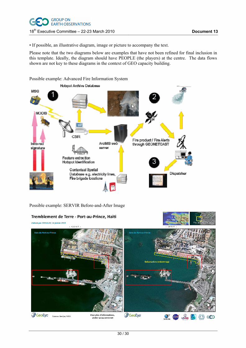
The South African Council for Scientific and Industrial Research (CSIR) has developed a Fire detection system - the Advanced Fire Information System - which provides automated fire alerts to pre-defined areas such as along electric power lines. The AÏDA and DevCoCast project funded by the EC under FP7 have successfully demonstrated the relevance of GEONETCast for the dissemination of AFIS alarm and associated data to a Fire Control Centre in South Africa. Active fire products from MSG are provided as many as 96 times a day and six times a day from MODIS. Fire danger and fire potential indexes generated by the CSIR are provided once a day. Fire Control Centres have now adopted this system and it will be deployed in several centres in South Africa and to all countries of the Southern African region, through the AMESD programme.
A demonstration of this end-to-end application could be demonstrated in Beijing thanks to FENYUNG Cast, the Asian component of GEONETCast

18th Executive Committee – 22-23 March 2010 Document 13
27 / 30
Involved partners: NASA (Modis), EUMETSAT, CSIR (South Africa), European Commission, African Union, Southern African region (SADC), GEO DISASTER SBA.
6.2 Crop and agricultural monitoring in Brazil and Argentina
In Argentina, a number of satellite-derived indices are used in environmental monitoring and consequently decision-making processes. Vegetation indices and weather data are used in drought and crop monitoring for impact assessment and production estimates at a regional scale by government and research institutions. Rural fire risk assessment and decisions on vegetation cover rehabilitation programs are established by local agencies based on vegetation and climate indices. At national level, land use and desertification process assessments are made using ground (climate, census and land surveys) and satellite (vegetation cover and crop classification) data.
The flow of data from GEONETCast and other sources is processed routinely by different systems, which leads to timely and useful information for a wide spectrum of users in Argentina.
Brazilian Agencies working on agriculture are using the “Rainfall Satellite” (RFS) and “Number of Days without Rain” (NDR) products to guide their cropping operations, helping them to program irrigation and application of pesticides. The University of Campinas is using the SPOT-Vegetation Product combined with precipitation data (RFS and NDR products, and ECMWF model), for monitoring the crop condition, particularly soybean (in the PARANÁ province of Brazil) and sugarcane (in the Sao Paulo province of Brazil), by creating every 10 days a graphical indication of crop condition and development. NDVI combined with Land Surface Temperature products, are used to feed a model for monitoring crop drought and crop freeze occurrences and impact. They also use this information for crop yield forecasts.
CONAB (Companhia Nacional de Abastecimiento – National Food Supply Agency of the Ministry of Agriculture) is a Brazilian public institution that contributes to the regularity of food supply and guarantee of gains of agricultural producers. CONAB is refining the crop calendar of the main Brazilian crops, including sugarcane, soybean, corn and coffee, using data obtained through GEONETCast. This information will be applied in crop yield models that were developed, and in the monitoring of crop yields in the most important agricultural regions.
(Note: this example is still to be fully developed and worked out with the required focus on the CB / People aspects of the showcase.)
6.3 Food Security and Crop Monitoring in Africa
Crop Monitoring is a key activity to provide timely alarm to countries, UN organisation and NGOs about risk of food shortage in several African regions. Rainfall estimate is an important parameter to secure accuracy and relevance of the Crop Monitoring. Since 2010, two Rain fall estimate indicators have been introduced into GEONETCast to support better Crop Monitoring and Early Warning. The TAMSAT product of the University of Reading (part of the EC-JRC MARS Food initiative) and the NOAA-USGS RFE products (part of the US AID FEWSNET) have been included in GEONETCast. This information will help African countries to improve management of this important item for their population. In the framework of the AMESD programme, the countries in the SADC and ECOWAS region (southern and western Africa) will be equipped with GEONETCast stations to receive information related to Agriculture management.
A demonstration of this end-to-end application could be demonstrated in Beijing thanks to FENYUNG Cast, the Asian component of GEONETCast
Involved partners: NOAA, USGS, AMESD, EUMETSAT, EC-JRC, African Union, GEO AGRICULTURE SBA
6.4 East African Regional Centre for Mapping of Resources for Development (RCMRD)
We can identify some strong examples of an end user being served by RCMRD, such as: the Ministry of Agriculture estimating crop production to anticipate mobilizing food relief; assistance to relief and

18th Executive Committee – 22-23 March 2010 Document 13
28 / 30
relocation of flood victims; showing illegal occupation of protected land; examples of resource mapping.
Both the user(s) satisfaction and (changes in the) increased capacity (with RCMRD and GEONETCAST in a key role) will be highlighted in the showcase.
Most interesting is to highlight changes in how RCMRD acts as an intermediary by assisting users to incorporate satellite data in their business processes.
Nowadays RCMRD is also highly visible in integrating training courses.
Two specific examples are given below.
Example 1: Early Warning and food security monitoring in East Africa
The IGAD region (Sudan, Eritrea, Ethiopia, Uganda, Kenya, Somali and Djibouti) is home to more then 200 million people, a majority of which is highly dependent upon low-input farming and subsistence agriculture, which in turn is vulnerable to climatic events. The region is struck by drought approximately every 9 years - a phenomenon which seems to increase in scale and intensity in the recent years - affecting the livelihoods of millions of people. The IGAD Member States, the secretariat and the international community have in the past started up a large number of projects and initiatives to increase the capacity of the Ministries of Agriculture and other agencies to improve the information base for a better understanding of the environmental and agricultural conditions in the region. Improved access to satellite data through programmes like PUMA/AMESD and DEVCOCAST (using GEONETCast) and improved capacity to deal with this information through dedicated actions of the FAO SIFISIA proect, JRC MARSOP action and GMFS has shown to be a good step forward in Sudan. Early warning Bulletins, which were produced in Europe in the past years, are now being produced by the National Meteorological Agency and the Ministry of Agriculture. The improved access to data through GEONETCAST along with training sessions (through SIFISIA and MARSOP) on the use of the data have led to a smooth transition from Europe to Sudan for what concerns the production of these bulletins. In addition, under the GMFS project, multiple training sessions have taken place to build up capacity to handle and deal with a variety of satellite data for the use of agricultural mapping and early warning, an activity which is considered instrumental by the Sudanese government to increase the understanding its agricultural resources. RCMRD, as a regional organization, plays an important role by training staff members of the relevant Sudanese authorities in dealing and handling spatial data including GPS based field data collection. Similar efforts are ongoing in Ethiopia where activities have been started up to reinforce the capacity of the newly established Department of Disaster Reduction and Food Security (DRMFSS) Sector to integrate satellite data in its early warning activities. DEVCOCAST and the GEONETCast (EUMETCAST component) System are a backbone to those activities by providing access to the necessary data.
Example 2: Department of Resource Surveys and Remote Sensing (DRSRS) and enhancing national capacity in Kenya
DRSRS, Kenya’s national remote sensing and surveying department, provides spatial data services to the Kenyan Government in the field of environment and agriculture. For example DRSRS, together with its partners, make comprehensive inventories of the countries’ wild life and livestock resources, and assess the agricultural season. It is also closely involved in the ongoing discussions concerning ‘Kenya’s water towers’, being the major forest ecosystems in Kenya (Mau, Mount Kenya, Aberdares and others). The department is a national resource for multiple stakeholders from governmental departments to NGO’s and nature conservation organizations. Through programmes like DEVCOCAST (using GEONETCast) / AMESD and through their partnership with RCMRD the capacity at DRSRS is reinforced, through dedicated training sessions and tools In addition a EUMETCAST reception station is planned at the department. Linked to that, the Belgian government (through the ENDELEO project – http://endeleo.vgt.vito.be) supports the agency by providing tools and hardware to facilitate the use of satellite based products to downstream users such as the Laikipia research Station, the Northern Rangeland Trust and others) This setup is an excellent example of how multiple agencies work together from data reception (DEVCOCAST and AMESD) to reinforcing the agencies capacity (RCMRD, DEVCOCAST, AMESD, ENDELEO) to downstream usage in the field.

18th Executive Committee – 22-23 March 2010 Document 13
29 / 30
How does these possible RCMRD examples showcase the role of GEO?
Institutional development of RCMRD and the impact on the capacity in the IGAD region is a practical example of operating within the GEO framework. Both showcases could highlight how the capacity build up at RCMRD proliferates to specific agencies in its member states.
6.5 Desert locust monitoring in the Sahel region
The Desert Locust (Schistocerca gregaria Forskal) is the most feared of all the locusts worldwide. The Desert Locust is one of about a dozen species of short-horned grasshoppers (Acridoidea) that are known to change their behavior and form swarms of adults or bands of hoppers (wingless nymphs). The swarms that form can be dense and highly mobile (up to 1000km a week).
Through the GEONETCAST system desert locust data is sent to decision makers at national and international level, enabling a near real time follow up of the desert locust situation in their and the surrounding countries. As such this data helps to speed up the decision process and helps to fight the desert locust plagues and the related food security situations.
Every 10 days, a new Desert Locust map is produced and broadcasted to Africa and to FAO in Rome via GEONETCast. For Example, the National Locust Unit of Eritrea receives the Locust maps in near real time via their stand-alone low-cost receiving station.
New technologies and advances are being exploited in the post-processing of these data to provide FAO and affected countries with new and improved products for use on an operational basis.
6.6 Disaster Response: the Haitian Earthquake
The SERVIR initiative integrates satellite observations, ground-based data and forecast models to monitor and forecast environmental changes and to improve response to natural disasters. It is principally supported by USAID and NASA. The SERVIR Central American node responded to more than 37 extreme events during the last two and a half years, including a very quick response to the recent Haiti earthquake (less than 30 hours), with Satellite images "before and after" showing damage in Port-au-Prince, Haití, due to the magnitude 7.0 earthquake on 12 January 2010.
(Note: this example is still to be fully developed.)
Proposed presentation tools: podium presentation (including proposed length), documents & publications, multimedia, (e.g. videos), posters, images, exhibition booth, side events, etc.;
For this, a short video, (approximately 5 minutes), with personal testimonials should tell a number of the "stories" outlined in the examples given above, showing how GEOSS is helping people in the developing world, e.g., the quick response of SERVIR after the earthquake in Haiti.
The stories should be told by the voice of a narrator, interspersed by clips showing the effects of GEO in the field. Each story should have a main character, who speaks in the clips of the difference Earth observations and GEO have made for him/her. The conclusion should be delivered by the narrator and the end-sequence should include a “slogan” showing the advantage of doing things within a collaborative network (e.g., different characters turning to the camera saying "I can" and a narrator conclusion saying "GEO, empowering people to enjoy a better live today and tomorrow".
Expected response or action from Ministers
Developed Countries should look to COMMIT resources in support of the GEO Capacity Building Strategy, both Individual, Infrastructure and Institutional [I3] and End-to-End [E-2-E] delivery), filling gaps, making tools and applications available and delivering education and training.
GEO Capacity Building and its strategy should be adopted as a key tool in the implementation and use of Earth observation within programmes in the developing world.
Developing countries should promote advocacy for expanding the vision of Earth Observation data and information as a public good, ensuring the broad uptake and use of EO data to address societal issues and developing networks to exploit synergies.
18th Executive Committee – 22-23 March 2010 Document 13
30 / 30
• If possible, an illustrative diagram, image or picture to accompany the text.
Please note that the two diagrams below are examples that have not been refined for final inclusion in this template. Ideally, the diagram should have PEOPLE (the players) at the centre. The data flows shown are not key to these diagrams in the context of GEO capacity building.
Possible example: Advanced Fire Information System
Possible example: SERVIR Before-and-After Image