
Pre Fisibility Report - Welcome to...
26
Pre Fisibility Report Mineral – Blacktrap Mining project - Category “B2” Lease Area – 4.90.00 Ha. Survey No. ~ 984 paiki Village – Anjar Seem , Taluka - Anjar, District - Kutch State - Gujarat ||PROJECT PROPONENT || Haresh N Bambhaniya, Krishna Engineering, Plot No. 45, Secotor 10 A, GIDC, Gandhidham, Kutch 370201. Ph. 99825824550, Email : [email protected]
Transcript of Pre Fisibility Report - Welcome to...

Pre Fisibility Report
Mineral – Blacktrap
Mining project - Category “B2” Lease Area – 4.90.00 Ha. Survey No. ~ 984 paiki Village – Anjar Seem ,
Taluka - Anjar, District - Kutch State - Gujarat
||PROJECT PROPONENT||
Haresh N Bambhaniya, Krishna Engineering, Plot No. 45, Secotor 10 A, GIDC, Gandhidham,
Kutch 370201. Ph. 99825824550, Email : [email protected]

Index
Sr. No.
Content Page Number
1 EXECUTIVE SUMMARY
1
2 INTRODUCTION OF THE PROJECT/ BACKGROUND INFORMATION
2-3
3 Project Description (Including Location and Site Map)
4-8
4 Geology of Area
9 – 13
5 SITE ANALYSIS
14 – 17
6 PLANNING IN BRIEF
18
7 PROPOSED INFRASTRUCTURE
19
8 REHABILITATION AND RESETTLEMENT (R & R) PLAN
20
9 Analysis of proposal (Final recommendation)
21
10 ENVIRONMENTAL MANAGEMENT PLAN
22-23
11 List of Annexure Enclosed
24

1
1. EXECUTIVE SUMMARY
This is a proposal of Blacktrap mining Project at Survey no. 984 paiki, at Village Anjar , Taluka : Anjar, District: Kutch, Gujart of Haresh Narshibhai Bambhaniya.
S. No. Particulars Details
A Mining Lease Details 1 Name of the Project
Haresh Narshibhai Bambhaniya
2 Mineral Blacktrap
3 Lease Area 4.90.00 Ha
4 Mining Applicant Haresh Narshibhai Bambhaniya
5 Lease Validity
10 years
B Location 1 Survey Number 984 Paiki 2 Village Anjar Seem 3 Taluka Anjar 4 District Kutch
5 State Gujarat 6 Latitude & Longitude
1. X=601603.5868, Y=2550392.7508 2. X=601762.6784, Y=2550470.7785 3. X=601882.0900, Y=2550478.8015 4. X=601910.6007, Y=2550328.8181 5. X=601551.5456, Y=2550262.3513
C. Other details
1 Cost of the project Rs. 15 Lakh
2 Annual Rainfall 300mm to 350 mm
3 Seismic Zone Zone V

2
2. INTRODUCTION OF THE PROJECT/ BACKGROUND INFORMATION
Production capacity of Blacktrap is proposed 1000 MT/PM from mining
lease of an area of 4.90 ha located on Survey no. 984 paiki, Village: Anjar
Seem , Taluka: Anjar, District: Kutch (Gujarat) of Shree Haresh Narshibhai
Bambhaniya.
(i) Identification of Project and Project Proponent Shri Haresh Narshibhai Bambhaniya have a Blacktrap mining lease project
for an area of 4.90 Ha located on Survey no. 984 paiki, Village: Anjar
Seem, Taluka: Anjar, District: Kutch (Gujarat) wide Order No.
GK/QL/11054/4142 dated 24.03.2006 of office of the Geologist, Jilla Seva
Sadan, Bhuj-Kutch. (Order is enclosed as annexure 1)
(ii) Brief Description of the Nature of Project It is a Black Trap mining project for an area of 4.90 Ha located on Survey no.
984 paiki, Village: Anjar seem, Taluka: Anjar, District: Kutch (Gujarat) of
Jagdish Narshibhai Bambhaniya. Environmental Clearance is required from
the State Level Environmental Impact Assessment Authority (SEIAA). As
per MoEF Office Memorandum No. J-13012/12/2013-IA-II (I) dated
24.12.2013 the project comes under B2 Category.
(iii) Need for the Project & Its Importance to the Country/ Region
Due to economical profit the local residential are agreed and prefers to
work in the mines. This will improve their standard of living through
getting livelihood locally. Moreover, they will remain staying in the

3
village rather than migrating to earn their bread & butter. The mining in
the area will help in developing the area in many ways like improvement
in road, communication facility, health and educational benefits. The
mining will significantly help in generation. This will result into the
overall socio economic benefit to the local residence of the surrounding
area.
(iv) Demand – Supply Gap
Considering the demand of mineral sufficient availability of the mineral
in the area, it is essential to have mining to sustain the supply of mineral
for end use.
(v) Imports vs. Indigenous Production
The Blacktrap crushed stone will be directly sold to the in the local areas
for the work of base filling materials and construction work.
(vi) Export Possibility
There is no export possibility of the mineral as it’s widely used locally.
(vii) Domestic/Export Markets
Mineral has only domestic market and will fulfill the requirement of local
market base is locally in the area, in general it is supplied at the work site
through local transportation.
(viii) Employment Generation (Direct and Indirect) due to the Project
Approx 8 to 10 skilled and semiskilled manpower needed to run the mine.

4
3. Project Description
i. Type of Project Including Interlinked And Independent Projects, If Any There is no interlinked or interdependent project based on mineral produced. The mineral will be sold directly. This is proposed Blacktrap mining project the Lease order is received from the competent authority. (Copy enclosed)
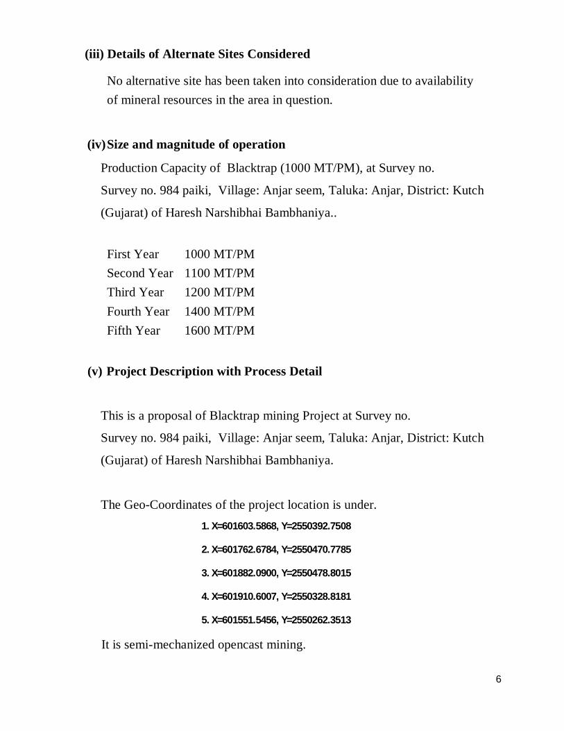
ii. Location (map showing general location, specific location, and
project boundary & project site layout) with coordinates. The project is situated at Survey no. 984 paiki, Village: Anjar seem,
Taluka: Anjar, District: Kutch (Gujarat) of Haresh Narshibhai
Bambhaniya.
The Geo-Coordinates indicated maps are as follows.

5
6
(iii) Details of Alternate Sites Considered
No alternative site has been taken into consideration due to availability of mineral resources in the area in question.
(iv) Size and magnitude of operation
Production Capacity of Blacktrap (1000 MT/PM), at Survey no.
Survey no. 984 paiki, Village: Anjar seem, Taluka: Anjar, District: Kutch
(Gujarat) of Haresh Narshibhai Bambhaniya..
First Year 1000 MT/PM Second Year 1100 MT/PM Third Year 1200 MT/PM Fourth Year 1400 MT/PM Fifth Year 1600 MT/PM
(v) Project Description with Process Detail
This is a proposal of Blacktrap mining Project at Survey no.
Survey no. 984 paiki, Village: Anjar seem, Taluka: Anjar, District: Kutch
(Gujarat) of Haresh Narshibhai Bambhaniya.
The Geo-Coordinates of the project location is under. 1. X=601603.5868, Y=2550392.7508
2. X=601762.6784, Y=2550470.7785
3. X=601882.0900, Y=2550478.8015
4. X=601910.6007, Y=2550328.8181
5. X=601551.5456, Y=2550262.3513
It is semi-mechanized opencast mining.

7
(Vi) Raw Material required along with estimated quantity, likely source,
marketing area of final product, Mode of transport of raw material and
Finished Product.
This is Blacktrap Mining Lease. The mineral will be directly sold locally as
base filling material for construction works. No raw material will be required to
dependent industries.
(vii) Resources Optimization/ Recycling and Reuse Envisaged in the Project, if any, should be briefly Outlined
No waste water will be generated from mining operation.
Domestic sewage water generated from office toilet will be disposed in soak pits via septic tank.
(viii) Availability of Water Its Source, Energy /Power Requirement and
Source
A. Water requirement:
Total water requirement for the proposed project will be 10 KLD which will be sourced from nearby villages.
B. Power requirement:
The electric power will line will be obtained from PGVCL.
(ix) Quantity of Waste to Be Generated (Liquid and Solid) And Scheme
for Their Management/Disposal:
Domestic sewage water generated from office toilet will be disposed in soak pits via septic tank.

8
WASTE GENERATION & DISPOSAL Mineral rejects and Waste will be temporarily dumped near the working.
Following measures will be taken for the safe and secure waste management.
To provide stability to the waste dump a retaining wall/toe wall
around the waste dump is proposed, if required.
The waste dump will be managed in such a way that the completed
overall out-slope don’t exceed 20 degree from the vertical.
Keeping the fact of rainfall in the area, to collect the erosions and
wash off from the dump during the rainy season a garland drain
surrounding the toe and of the existing dump is also proposed.
Further, a sedimentation tank or setting tank is proposed, if needed,
so that the discharge from the dump may be passed through it
before its final discharge to the environment.
Efforts will also be made to grow vegetation on the surface of the
waste dump and on the top of the mineral rejects grass/bush/shrub
will be tied.
No toxic and hazardous element present in the material, which may
pollute the nearby area and ground water. As the manual mining
will be carried out due to the vehicle movement. To prevent that it
is proposed to spray water on the vehicle movement track.
Backfilling of the Mined out area . The waste and mineral reject
will be backfilled in the mined out area, starting of fifth year.

9
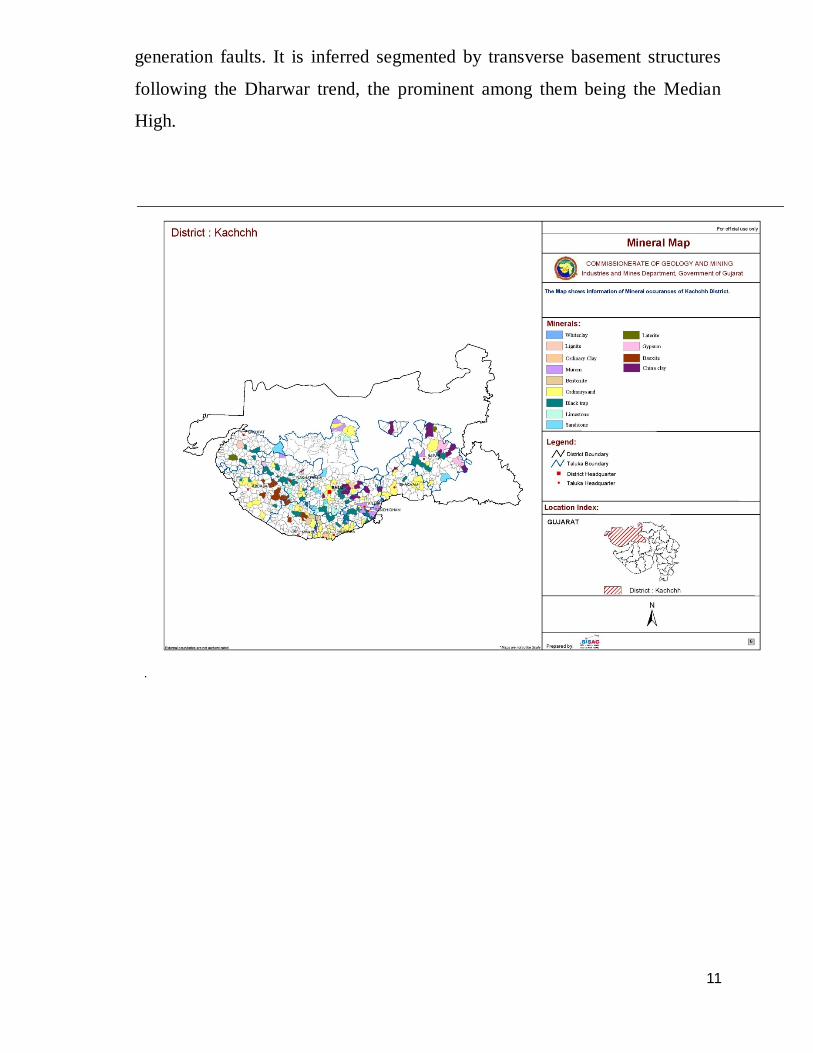
4. GEOLOGY OF THE AREA
The Kachchh Peninsula, located between latitude 23.13°-24.68°N and
longitude 68.10°-71.80°E, forms the western most part of India and
constitutes the Kachchh district of Gujarat State. Occupying an area of 45,612
sq km, it has length and width extensions of 320 and 170 km, respectively
through which passes the Tropic of Cancer. The delta land of Sindh
(Pakistan), also known in the olden times by the name Sapta Sindhhu, or the
seven distributaries of Indus River, borders it in the west. Its 352 km long
southern margin is demarcated by the Gulf of Kachchh, which separates the
peninsula from Saurashtra. Its northern margin makes the International border
with Pakistan and the eastern abuts Gujarat Mainland. The district has a
population of 1,526,321 people inhabiting 949 villages in ten Talukas,
population density of 33-persons/sq km, and a total of 466,239 housing units
(Source: Census of Housing, GoI, 2001).
The tectonic evolution of the Kachchh Rift Basin (KRB) dates back to early
Mesozoic times, when the Indian landmass was part of the Gondwana
Supercontinent. The breaking-off of the Indian subcontinent from the parent
mass and its subsequent northward drift owing to fast accretion of more than
16 cm/yr at the Indian Ocean ridge started in Late Triassic. In Late
Cretaceous, the subcontinent got detached from Madagascar and, by Early
Eocene, separated out from Seychelles. The free drift of the continent was
checked during Eocene-Oligocene times, with commencement of subduction
of its oceanic crust below the Tibetan plate. By 45-40 Ma, the Neo-Tethys
Ocean closed along the Indus-Tsangpo suture, and the collision of the Indian
and Tibetan continental crusts began, thereby heralding the rise of the
Himalaya. The Indian plate, in its journey beginning from its break-off from
the Gondwanaland to its collision with the Asian plate, passed through four

10
plume heads, centered at Crozet, Kerguelen, Marion and Reunion Islands. The
Deccan volcanicity, related with the Reunion plume, continued for nearly one
million years soon after Maastrichtian age (65 Ma). During extrusion, the
Deccan Basalts occupied approximately the same absolute position as that of
the Reunion Island; in less than one million years, 1 to 2 million km3 of lava
spread out over an area of about 0.5 million km2.
Rifting in the subcontinent along certain Precambrian structural trends started
since its detachment from the mainland. In the western margin of the Indian
Shield, the faulting was controlled by NE-SW Aravalli-Delhi trend, ENE-
WSW Son-Narmada-Tapti (SONATA) trend and NNW-SSE Dharwar trend
(Biswas, 1987). Thus, during the migratory history of the subcontinent, three
rifted basins, viz, Kachchh, Cambay and SONATA, developed and aborted at
different times, became hosts to thick sedimentation of different ages and
volcanic activity. The three basins now stand separated by the Saurashtra
horst, which has been established to be an extension of the Aravalli range,
uplifted in part, during Late Cretaceous times. By Early Cretaceous times, the
sea started receding from the KRB, allowing deposition of continental facies.
The Mesozoic sediments were deposited in two mega-cycles of i) Late
Triassic-Late Jurassic synrift marine transgressive and ii) Late Jurassic-Early
Cretaceous post rift deltaic regressive environments. The early part of Tertiary
continued to remain terrestrial, but by Early Eocene time, there was marine
transgression. The Eocene-Middle Miocene period saw lagoonal, marine shelf
to open marine platform type of depositional environment. In Pliocene-
Pleistocene times the environment of deposition was littoral to fore shore.
Most part of the Quaternary remained terrestrial, with dominance of tidal flat
and marsh deposits in the latest part. A pre Holocene period was characterised
by desertification in Kachchh. Nagar Parkar, Kachchh Mainland and North
Kathiawar faults are recognized as the primordial tectonic discontinuities of
the basin with Katrol hill, Gora Dongar, Island Belt, etc. as subsequent
11
generation faults. It is inferred segmented by transverse basement structures
following the Dharwar trend, the prominent among them being the Median
High.

12
1. Method of the Mining Proposed method of mining will be opencast by forming proper benches. The
mining is proposed as per present situation of the deposit. Proposed mining is with
simple hand tools. Hydraulic excavator/loader are proposed for removal of mineral
and for loading of mineral and waste by blasting as and when required. The haul/
approach roads will be provided up to the proposed working, site services, site of
dump and site of stock from the nearest tar road. The mineral and waste are
proposed to transport by tractor trolley and tippers. The mining will be carried out
by opencast method by developing the bench height and width 6 meters each.
(1) PROCESS FLOW CHART OF MINING
TOP SOIL & O.B. REMOVAL
DRILLING
BLASTING
LOADING
TRANSPORT TO CONSUMERS

13
(2) EXTENT OF MECHANIZATION
Details of proposed Mining Machinery
S.No Machinery Number
1 Hydraulic Excavator 1 2 Number 1 3 Jack Hammaer 2 4 Drill Roads As required 5 Water Tank Trolly 1 6 Tippers 2 7 Hand Tool As required
(3) PROPOSED YEAR WISE PRODUCTION DETAILS OF THE NEXT FIRST FIVE YEARS.
First Year 1000 MT/PM Second Year1100 MT/PM Third Year 1200 MT/PM Fourth Year 1400 MT/PM Fifth Year 1600 MT/PM
(4) LOADING & TRANSPORTATION Tyre mounted Hydraulic machineries will be deployed from time to time and when
required. Trucks and tractor trolley will be deployed for transportation of stone
from working to consumer.

14
5. SITE ANALYSIS
(i) Connectivity
Road : The lease area is connected by road with Anjar. Anjar is 7 Kms far from the site. Rail : Anjar is nearest railway station. The lease area is 8 Km away from the railway station. Air : Bhuj is nearest airport & served by schedule flights of Jet and Indian Airlines. Bhuj Airport is 58 kms far from the lease area. (ii) Land Form, Land Use and Land Ownership
Existing Land Use Pattern The total area of 4.90.00 ha of Government land is obtained on lease
for mining on Survey no. 984paiki, Village: Anjar seem, Taluka:
Anjar, District: Kutch (Gujarat) of Haresh Narshibhai Bambhaniya.
(iii) Topography The lease area is geomorphologically a part of the Kachchh main land,
which has a moderate to low relief and localized hillocks. 2 to 4 Mtr
Height and 3 to 4 Mtr. width slope angle not more than 45 horizontal
degree. In the area bottom having hard ferruginous sand stone is present.

15
(iv) Existing Land Use Pattern {Agriculture, Non-Agriculture, Forest,
Water Bodies (Including Area Under CRZ)}, Shortest Distances From The Periphery Of The Project To Periphery Of The Forests, National Park, Wild Life Sanctuary, Eco Sensitive Areas, Water Bodies (Distance From The HFL Of The River), CRZ. In Case Of Notified Industrial Area, A Copy Of The Gazette Notification.
Environmental Settings S. No. Particular
Details
1
Nearest Village Anjar is in NE direction from mine
2 Nearest city/ town Anjar is ~8 NE in NW direction from mine site
3 Nearest Railway Station Anjar Railway Station is ~ 8 km from mine
4 Nearest Airport Bhuj Airport around ~ 58 km in NE
direction from mine
5 Archaeological Important Place None, within 10 km radius area of mine site.
6 Ecological
Sensitive Areas
There is no National Park, Wild Life Sanctuaries,
(National Park, Wildlif
e Biosphere Reserves, Tiger Reserves, Wildlife
Sanctuary, Biosphere Reserve Corridors, etc. within 10 km radius
etc.) 7 Reserved/Protected Forest None
within 10 km radius 8 Nearest River / water body None

16
(V) Existing Infrastructure:
There is no building & structure within mining lease area except some
vegetations existing on the lease area which will be cleared when required.
Total lease area is 4.90 ha.
The lease area about 8 km from Village Anjar. Post and Telegraph, Hospital,
Bank, Education and all market facilities are available. The nearest city ,
Railway station Anjar is 8 km from the mine. The nearest Airport is Bhuj that
is 58 Km far away from the mining lease.
(Vi) Soil Classification :
The lease area is geomorphologically a part of the Kachchh main land, which
has a moderate to low relief and localized hillocks. The Mesozoic and tertiary
sediments have deposited in thin to thick sedimentary depositions in this part
of the Indian sub continent. So, the lease area belongs to the territories of
Kachchh. In the lease area mineral has been proved upto 6m depth below sand
with kankar overburden of 2.0m on surface. In the area bottom having hard
ferruginous sand stone is present.
Blacktrap: It is overlain by the ferruginous sandstone. It is fine ell and analla.
grained sticky white in colour. The average exposed thickness is 8.00 m in the
neighboring working area, the nearby well and nalla. The alumina content is
50.00% titanium content is 1.76% and iron oxide content is 1.28%. The
plasticity by hand filling is fair.
Ferrugenous Sand stone : It overlies the rock bed. The rock is fine grained,
medium hard and brown in colour.

17
Sandy Soil : Major part of the area is covered by a thick layer of sandy soil,
kankar. The average thickness of the sandy soil is 2.0 m.
(5) Climatic data from secondary sources. Climatic data table of the region (PERIOD: 1971-2000)
Month
Mean Temperature(oC)
Mean Total
Rainfall (mm)
Mean Number of Rainy
Days
Mean Number of days with
Daily Maximum
Daily Minimum HAIL Thunder FOG SQUALL
Jan 27.4 8.4 2.0 0.3 0.0 0.2 0.4 0.0 Feb 30.1 11.4 0.6 0.1 0.0 0.2 0.1 0.0 Mar 35.4 17.0 1.2 0.2 0.0 0.2 0.1 0.0 Apr 39.2 21.9 0.2 0.1 0.0 0.4 0.0 0.0 May 39.7 25.2 2.6 0.4 0.0 0.7 0.0 0.0 Jun 37.9 27.2 34.7 1.4 0.0 2.3 0.0 0.0 Jul 34.3 26.4 104.6 4.4 0.0 2.8 0.0 0.0 Aug 33.0 25.3 74.4 3.5 0.0 2.1 0.0 0.0 Sep 34.9 23.9 43.5 2.3 0.0 2.3 0.0 0.1 Oct 36.8 20.7 8.1 0.7 0.0 1.0 0.1 0.0 Nov 32.9 14.7 4.3 0.5 0.0 0.2 0.2 0.0 Dec 28.8 9.6 0.2 0.0 0.0 0.0 0.3 0.0
Annual 34.2 19.3 276.4 13.6 0.0 12.6 1.3 0.1 source : www.imd.gov.in
(6) Social Infrastructure available.
No social locality or any infrastructure is available on the proposed site of
mining of 1.0 ha. The nearby locality and infrastructure is situated in village
Nagor.

18
7. PLANNING BRIEF a. Planning Concept (Type of Industries, Facilities, and
Transportation etc.) Town and Country Planning/Development Authority Classification Uses: This is a mining Project. Hence this section not applies.
b. Population Projection Manpower required will be engaged from nearby areas. No significant influx of people is anticipated in the area.
c. Land Use Planning
The extent of proposed mining lease area is 4.90 ha. The area
comprises of Govt. waste / Non Forest land which is obtained for
mining on lease. The required NOC of the forest department is already
issued.
d. Assessment of Infrastructure Demand (Physical & Social)
No physical or social infrastructure is proposed on the site of mining.
e. Amenities / facilities : Not any specific notable amenities are demanded on the site of mining other electricity. Mining Management will develop the Amenities/Facilities in the nearby area of the proposed mine site as per requirement of local people of the nearby area under corporate social responsibility programs.

19
8. PROPOSED INFRASTRUCTURE
(i) Residential Area (Non Processing Area)
This is not required as mine workers comes from nearby villages. Rest shelter to the workers already exists in the major mining lease of the lessee.
(ii) Green Belt
Green belt will be developed on the approach road and surrounding the
pit around 400 plants will be planted per year with 80% of survival rate
the lease boundary, haul roads, office, plantation will be done at the
Dump, at the mine area.
(iv) Water Management (Source & Supply of water)
Total water requirement for the project will be 10 KLD which will be used for domestic as well as dust supression purpose and sourced from nearby villages .
(v) Sewerage System
Domestic sewage water generated from office toilet will be disposed in soak pits via septic tank. Outside discharge is not envisaged.
(vi) Industrial Waste Management
No industrial waste will be generated from this mine mining operation.
(vii) Power Requirement & Supply/Source
Electric power through proper connection from PGVCL will be made available.

20
9. REHABILITATION AND RESETTLEMENT (R & R) PLAN
Policy To Be Adopted (Central/State) In Respect Of The Project Affected Persons Including Home Oustees, Land Oustees And Landless Laborers (Brief Outline To Be Given)
Not Applicable as the lease area falls out of human habitation and locality.
10. PROJECT SCHEDULE & COST ESTIMATES
(i) Likely Date Of Start Of Construction And Likely Date Of Completion (Time Schedule For The Project To Be Given)
The mining activity will be started after obtaining Environmental Clearance from SEIAA, Gujarat and acquiring the valid mining lease from Mines and Geology Department of the State Government.
(ii) Estimated Project Cost Along With Analysis In Terms Of Economic
Viability of the Project: Project cost is approximately 15 Lacs as per the quotational counting. As per
the rules under the CSR activities tree plantation, safe drinking water
facilities to nearby schools, academic financial assistants to the needy of the
local, distribution of books, charity in local festivals and celebration will be
carried out. The serious concern towards the value based living of laborers
would be great concern.

21
BUDGETARY ALLOCATION FOR THE FACILITIES TO BE PROVIDED TO LABOURERS
S. No.
Facilities Provided for Labourers
Cost (in Rs)
1. Shelter 30,000
2. Health Facility 20,000
3. Drinking Water & Sanitation Facility 15,000
4. Education for children 15,000 Total 80,000
10. Analysis of proposal (Final recommendation)
Proposed Mining Lease will result in growth of the surrounding areas by
increasing direct and indirect employment opportunities in the region
including ancillary development and supporting infrastructure.
Development of social amenities will be in the form of medical facilities,
education to underprivileged and creation of self help groups.
No major adverse effect on environment is envisaged as the required mitigation measures are inbuilt in the project.

22
11. ENVIRONMENTAL MANAGEMENT PLAN 1. AIR POLLUTION CONTROL
Spry of water will be done to reduce generation of dust.
Sharp drill bits will be used for drilling to reduce generation of dust.
Green Belt will be developed inside & out side of the lease area eqaul to
33% of the lease area.
Periodical water spraying on the haul roads will be done.
2. WATER MANAGEMENT There is no surface water body in and around the mining lease area.
The rain water collected in mining pit will be diverted in the abandoned pit
of major mineral mining lease and used for water sprinkling and plantation.
Domestic waste water generated from office toilet will be disposed in soak
pits via septic tank.
3. NOISE POLLUTION CONTROL
Proper maintenance of all machines will be carried out which will reduce
noise generation during operations.
Workers exposed to high noise levels will be provided with ear defenders.
Alert and awareness in surrounding area of locality regarding time and type
and aim of blasting.
Blasting will be handled with the experienced worker who will be equipped
with all safety tools like hand gloves, helmet, earmuff, safety shoes and
mask the other workers who are present during the blasting at site must be
equipped with all above safety measures.

23
4. LAND RECLAMATION
Total mining lease area is 4.90 hectares. The O/B will be used to as reclamation.
5. GREEN BELT DEVELOPMENT
Around 400 trees will be planted inside &outside the lease area equal to and 33 % of the lease area. Local species will be preferred for plantation. Tree guards will be provided for protection and survival of the saplings.

24
List of Annexure
Sr. No.
Description
1 Copy of the Lease order
2 Copy of Lease dead
3 Map
![GFDo ... · haresh gohel ljnfyl”g]\gfdo< ppppppppppppppppppppppppppppppppppppppppppppppppppppppppppppppppppppp 83) l;\cgf rfz …](https://static.fdocuments.net/doc/165x107/5f7478c5401ebe13b553119f/gfdo-haresh-gohel-ljnfylaggfdo-ppppppppppppppppppppppppppppppppppppppppppppppppppppppppppppppppppppp.jpg)


![Bhupal Dev - Physics Department at UMass Amherst ’15; Bambhaniya, BD, Goswami, Khan, Rodejohann ’16] Bhupal Dev (Washington U.) Leptogenesis and Colliders ACFI Workshop 13 / 45](https://static.fdocuments.net/doc/165x107/5af7528b7f8b9a5f588b5a95/bhupal-dev-physics-department-at-umass-15-bambhaniya-bd-goswami-khan-rodejohann.jpg)


