Planning naturally - The RSPB
32
Planning naturally Spatial planning with nature in mind: in the UK and beyond Working together to give nature a home
Transcript of Planning naturally - The RSPB

Planning naturallySpatial planning with nature in mind: in the UK and beyond
Working together to give nature a home
The RSPB’s mission is to save nature in the UK and also in the UK Overseas Territories and beyond, in support of our BirdLife International partners in Europe, Africa and Asia. This often involves engaging with planning systems in the UK and abroad, in order to protect important wildlife sites and to promote biodiversity in development. The Chartered Institute of Ecology and Environmental Management (CIEEM) and the Royal Town Planning Institute (RTPI) represent professionals working in ecology, environmental management and town planning respectively in the UK, Ireland and around the world.
The global biodiversity crisis continues unabated. Even in the UK, we are failing to halt biodiversity loss; the recent report, State of Nature (Burns et al 2013)1, shows just how significant the losses are. We have signed up to a new, more demanding target: to halt the loss of biodiversity and the degradation of ecosystem services in the EU by 2020, and to restore them so far as is feasible. Planning for biodiversity and the natural environment has never been more important. There is no shortage of detailed advice available (see p27 for further information), but the RSPB, CIEEM and the RTPI have come together to show how planning for biodiversity should be integral to every part of the planning process and to inspire with examples of good practice, whatever country you are working in.
This report is structured around 12 principles of good spatial planning, and illustrates them with case studies from all four countries of the UK, as well as some international examples. Although the UK has an emerging marine spatial planning system where many of the principles are equally applicable, the report focuses on spatial planning on land. The principles are not the last word on planning, but they capture a broad range of issues that are critical for all effective planning systems.
The case studies come from a variety of sources, and were compiled from a long list with the help of LUC (Land Use Consultants), who we thank for their input to this report. Although for some principles we struggled to find good case studies, we are sure there are other great examples that we are not aware of. We hope that this report will inspire you to plan with nature in mind, wherever you are.
Mike Clarke, Chief Executive, The RSPB
John Box, President, CIEEM
Trudi Elliott, Chief Executive, RTPI
Preface
Ben H
all (rspb-images.com
)
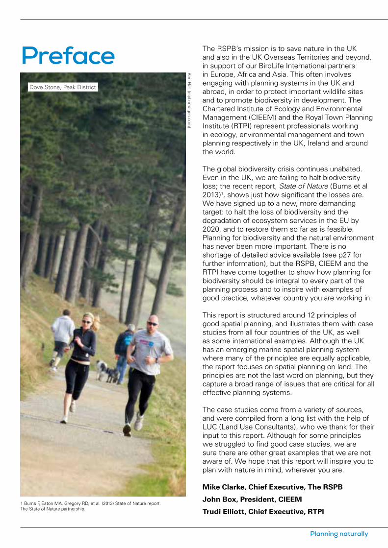
Dove Stone, Peak District
1 Burns F, Eaton MA, Gregory RD, et al. (2013) State of Nature report. The State of Nature partnership.
Planning naturally

Twelve principles of good spatial planning
1Planning should be positive, setting out a clear vision for how
areas should look and function in the long-term.
Spatial planning is about far more than just controlling development through a regulatory process – although this is essential to give it real teeth in managing land use change. Above all it should be positive, considering what development people need, being visionary about the kind of places that people will want to live and work in, and mindful of the long-term needs of future generations, as well as our own.
Statutory plans have a crucial role here, looking forward 10 or 20 years, or even longer, and considering the many and varied needs of local communities. Large-scale individual projects can also make a significant difference to the character of places.
If they are to thrive, people need places with biodiversity and green infrastructure at their heart. The Central Scotland Green Network exemplifies long-term positive planning, providing a green vision for the growing communities of Scotland’s central belt. On a smaller scale, the redevelopment of Magheramorne Quarry in Northern Ireland aims to develop a long-term sustainable future for the former quarry as a major recreational and leisure attraction.
2Spatial plans should integrate all the issues that affect the
development and use of land within a specific territorial area, whether social, economic or environmental.
The work of government is usually carried out on a sectoral basis, with different departments for business, housing, health, education, environment and so on. Spatial planning (which can be at the national, strategic or local level) provides an opportunity to integrate all the issues that affect the development and use of land within a specific territorial area and to resolve competing uses of limited space and resources.
The Tana River Delta Land Use Plan in Kenya seeks to do exactly that, in an area where the demands of commercial agriculture, oil and gas exploitation, and infrastructure development are threatening rich wildlife habitats and traditional pastoral practices. It also showcases the consideration of alternative land use strategies, through strategic environmental assessment and public participation in a developing country (principles 6, 7 and 8).
In the UK, the coastal habitat creation at Wallasea Island is the largest of its kind in Europe. It brings together a number of partners to deal with multiple issues on the Essex coast.
Although not itself a statutory spatial plan, the size of the project makes its lesson very relevant to plans dealing with similar issues.
3Plans should consider strategic issues that may affect a wider
area than the individual plan, including functional ecological areas.
Administrative boundaries rarely reflect accurately real geography. This is especially true for the natural environment. Functional ecological areas may be based on estuaries, river catchments or semi-natural habitats such as heathland, moorland or forest, some of which are illustrated by case studies in this report. This principle is particularly important for plans prepared by local planning authorities where there is no higher tier of spatial planning, as functional ecological areas often cross many local authority boundaries.
Two case studies in this report illustrate the benefits of working across a wider area than the individual plan. In the example of the Green Infrastructure Framework for North East Wales, Cheshire and Wirral, not only were six local planning authorities involved, but the Framework area straddles the England and Wales border, and includes a number of different ecological areas. Therefore this approach makes sense ecologically, and where a number
Spatial planning with nature in mind 1
of partners work together, costs are shared too. The Hertfordshire Strategic Green Infrastructure Plan similarly covers a number of different ecological areas, and links in to the wider green infrastructure network in neighbouring counties.
4Plans should contribute to sustainable
development by enhancing the natural environment and ensuring that social and economic development takes place within environmental limits.
The five guiding principles of sustainable development are sometimes defined as: living within the planet’s environmental limits and ensuring a strong, healthy and just society, underpinned by a sustainable economy, good governance and responsible use of sound science. For many planning systems, achieving sustainable development is their central purpose, and spatial plans in particular have an important contribution to make.
A healthy natural environment is fundamental to sustainable development. Given the scale of biodiversity loss and the degradation of ecosystem services, plans and projects not only need to protect what we have but also must enhance it wherever possible. Two case studies in this report illustrate this principle. In Wales, the Statement of Environmental Masterplanning Principles, Clocaenog Forest shows how development (in this
case, onshore wind farms) can contribute to habitat creation and enhancement through evidence-based development management policies. The Exeter City Council Residential Design Supplementary Planning Document requires developers to incorporate biodiversity enhancement, such as nesting opportunities for swifts, house sparrows and bats, in an urban setting.
5Plans and projects should be based on up-to-date and
scientifically robust evidence, including evidence on the value of the natural environment.
Spatial planning is both an art and a science. The preparation of both plans and projects should be based on sound evidence, which in many cases will be tested through some form of examination or inquiry process. Evidence will be drawn from a variety of sources, but in the case of the natural environment it is important that it is scientifically robust and credible. It must be up-to-date, methodologically sound, and based on professional expertise.
Some, but by no means all, local authorities employ professional ecologists or have access to shared ecological services. Recent research in England suggests that this is one of the most important factors in securing good biodiversity outcomes from development. Other sources of data and expertise include the statutory environmental bodies, local records centres, ecological consultancies and NGOs such as the RSPB and the Wildlife Trusts.The case study Aylesbury Vale
District Council, ecological assessments and the planning process shows what can be done by a pro-active local planning authority to identify the need for ecological surveys at an early stage in the planning process. The study of Environmental capacity in Cannock Chase District aimed to understand, using the best available evidence, environmental constraints to development in the district.
6Plans and projects should be rigorously assessed for their
environmental impacts, and the results used to improve the plan.
Many plans and projects are proposed in order to achieve economic and social objectives, such as the need for new housing, businesses, shops, roads and other ”grey” infrastructure. They need to be assessed rigorously for their environmental impacts – not merely to inform the decision-maker or to “tick a box” – but to improve the plan so that it is more sustainable. This is also true for plans with an environmental objective, such as reducing flood risk, as they may have adverse consequences for other aspects of the natural environment.
This principle is closely linked to the need to base plans and projects on robust evidence (principle 5), but focuses on the assessment process. There are a variety of assessment techniques available, some of which may be required for certain types of plans and projects under European or domestic legislation, such as Strategic Environmental Assessment or Sustainability Appraisal (for spatial plans),
Twelve principles of good spatial planning
2 Planning naturally

Spatial planning with nature in mind 3
12 principles of good spatial planningS
hutterstock
Bloody-nosed beetle

Environmental Impact Assessment (for projects) and Habitats Regulations Assessment (for plans and projects affecting Natura 2000 sites). For further details see p27.
The Habitats Regulations Assessment of the Breckland core strategy was a rigorous assessment of the impacts of a proposed housing development on a vulnerable species, which enabled the local planning authority to meet its housing target in a sensitive way. It is also a good example of considering alternative options which are less damaging to the environment (principle 7).
7Alternative options should be considered, particularly alternatives
that are less damaging to the environment, and the reasons for rejecting any options should be made public.
Considering alternative options is an integral part of the planning process, particularly in strategic planning when a wide range of options is available. These typically include a range of development and/or spatial scenarios for the plan area, providing as a minimum a ”business as usual” option. The challenge for planners is to consider a genuinely wide range of realistic alternatives that put society on a more sustainable path.
The ”mitigation hierarchy” of firstly avoiding environmental harm, then mitigating for any adverse impacts, and then as a last resort compensating for residual impacts, is a well-established principle of environmental planning, alongside
the need to seek environmental enhancement wherever possible (principle 4). The need to consider alternative options, particularly options that are less damaging to the environment, is relevant to all these steps, as options can be either strategic or more detailed in nature.
In the UK and Europe, alternative options must be considered for spatial plans under the requirements of the Strategic Environmental Assessment Directive, and for both plans and projects under the Habitats Directive, but the principle is more widely applicable, including projects which are subject to Environmental Impact Assessment.
The Scottish Borders biodiversity offsets scheme shows that a range of detailed options for mitigation or compensation can successfully be considered at the project level.
8Public participation is essential. It should be both
timely and inclusive of civil society, whether community groups or other stakeholders.
Public participation in the planning process is a long-established feature of the UK’s planning systems. Legislation provides many opportunities for the public to be involved in both plan making and decision-taking. There are close links with the democratic decision-making process, which is described further under principle 9. The UK and other European Union member states are signatories to the Aarhus Convention, which establishes principles of public
access to environmental decision-making.
However, planners in the UK and elsewhere need to be careful that consultation is not just ”ticking the box”, but that public participation is effective. As the principle states, it needs to be timely and inclusive of civil society, including not only local residents and businesses, but community groups and other stakeholders, such as those representing environmental interests.
The two case studies illustrate public participation in plans for communities where protection and enhancement of the natural environment is a particular issue: Brecon Beacons National Park Local Development Plan, in Wales, and Rathlin Island Action Plan in Northern Ireland. Public participation is also a feature in many of the other case studies included in this report.
9Decision-making must be transparent and made by a
democratically accountable body or person. Planning raises many issues, which can make decision-making complex, at both the national and local level. Transparent and democratically accountable decision-making is fundamental to ensuring that the interests of the environment are properly taken into account in the planning system.
Nature does not have a voice in decision-making, but the support in the UK for wildlife conservation organisations (the RSPB alone has more than one million members) shows a high level of public interest in nature. Members of the public,
Twelve principles of good spatial planning
4 Planning naturally

community groups and wildlife organisations play an important role in speaking up for nature, and depend on access to the decision-making process to make their voices heard.
The case study is Democratic decision-making in the UK, where decision-making is generally highly transparent, particularly in local planning authorities. While it may state the obvious to planners working in England, Wales or Scotland, it serves as a useful reminder of why things are done in certain ways, and is an example which will shortly be followed in Northern Ireland, where many planning powers will be delegated to new local authorities. It can also serve as a model for countries where governance systems are less-developed, either in Europe or elsewhere in the world.
10Those adversely affected by a planning decision
should have a fair opportunity to challenge it.
Once made, planning decisions have significant consequences for landowners, developers, communities and frequently the environment. It is crucial that when poor decisions are made, there is an opportunity to put them right.
Planning systems in the UK allow for developers to appeal on the merits of the case against a refusal of planning permission, usually to an independent body such as the Planning Inspectorate in England and Wales. Fewer than 5% of planning applications in England are taken to appeal. Appeal systems allow for third party views to be taken into account,
although there is no opportunity for third parties to challenge decisions directly.
The planning appeal process deals with the vast majority of cases satisfactorily, but environmental justice may in some cases require legal redress for affected individuals and communities. The judicial review of planning decisions is restricted to points of law rather than the planning merits of the case, and can be prohibitively expensive. Planning judicial reviews involve only a tiny fraction of planning applications in any year.
The case study included in this report is the Environmental Court, State of Vermont in the United States. Although the legal context is completely different to the UK, and we are not advocating its adoption, it presents an interesting example of an accessible and specialist environmental court.
11Public authorities should be given the legal
powers and resources to enforce planning laws, especially where illegal development is resulting in environmental damage.
Unauthorised development undermines the planning system, erodes public confidence in its integrity and can result in significant environmental damage as well as developments that are a blight to communities. The enforcement of planning law is usually a matter of last resort, but is essential to give the planning system teeth. Likewise, public authorities (usually the local
planning authority) need to have the resources to carry out effective enforcement.
The case study of Thameside Terminals, Medway, shows a local planning authority taking enforcement action against an unauthorised industrial development that was having adverse impacts on a designated wildlife site, part of which is an RSPB nature reserve.
12Plans should bemonitored and reviewed regularly.
Planning is not a one-off activity of preparing a plan. Rather, it is a continuous cycle from collecting evidence and drafting the plan to adopting it, monitoring its implementation and reviewing the plan in the light of changing circumstances. Good planning processes have monitoring and review built in as an integral part of spatial plan-making, including monitoring across a full range of indicators: economic, social and environmental.
Monitoring is an established part of many statutory plan-making processes, but is perhaps less common for projects, as it depends on a monitoring condition being imposed on a planning permission by the local planning authority. However, monitoring the environmental impacts of major or innovative (and therefore untested) development is an important means of learning. As the Edinbane wind farm monitoring programme shows, the evidence gathered is invaluable in designing future developments so that their impacts on biodiversity can be minimised.
Spatial planning with nature in mind 5
Twelve principles of good spatial planning
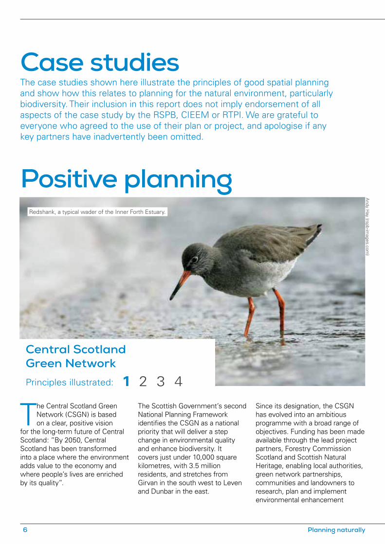
The Central Scotland Green Network (CSGN) is based on a clear, positive vision
for the long-term future of Central Scotland: ”By 2050, Central Scotland has been transformed into a place where the environment adds value to the economy and where people’s lives are enriched by its quality”.
The Scottish Government’s second National Planning Framework identifies the CSGN as a national priority that will deliver a step change in environmental quality and enhance biodiversity. It covers just under 10,000 square kilometres, with 3.5 million residents, and stretches from Girvan in the south west to Leven and Dunbar in the east.
Since its designation, the CSGN has evolved into an ambitious programme with a broad range of objectives. Funding has been made available through the lead project partners, Forestry Commission Scotland and Scottish Natural Heritage, enabling local authorities, green network partnerships, communities and landowners to research, plan and implement environmental enhancement
Case studies The case studies shown here illustrate the principles of good spatial planning and show how this relates to planning for the natural environment, particularly biodiversity. Their inclusion in this report does not imply endorsement of all aspects of the case study by the RSPB, CIEEM or RTPI. We are grateful to everyone who agreed to the use of their plan or project, and apologise if any key partners have inadvertently been omitted.
Positive planning
Central Scotland Green NetworkPrinciples illustrated:
Redshank, a typical wader of the Inner Forth Estuary.
1 2 3 4
Andy H
ay (rspb-images.com
)
6 Planning naturally
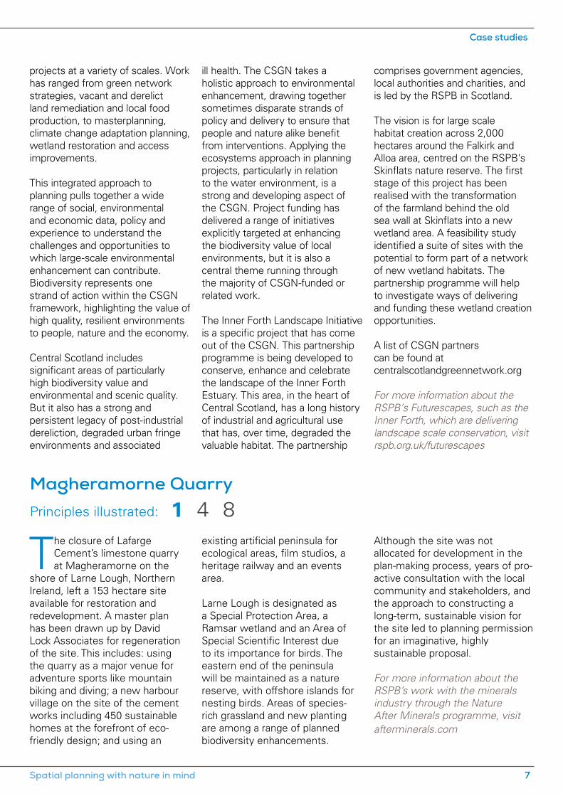
Magheramorne Quarry Principles illustrated:
projects at a variety of scales. Work has ranged from green network strategies, vacant and derelict land remediation and local food production, to masterplanning, climate change adaptation planning, wetland restoration and access improvements.
This integrated approach to planning pulls together a wide range of social, environmental and economic data, policy and experience to understand the challenges and opportunities to which large-scale environmental enhancement can contribute. Biodiversity represents one strand of action within the CSGN framework, highlighting the value of high quality, resilient environments to people, nature and the economy.
Central Scotland includes significant areas of particularly high biodiversity value and environmental and scenic quality. But it also has a strong and persistent legacy of post-industrial dereliction, degraded urban fringe environments and associated
The closure of Lafarge Cement’s limestone quarry at Magheramorne on the
shore of Larne Lough, Northern Ireland, left a 153 hectare site available for restoration and redevelopment. A master plan has been drawn up by David Lock Associates for regeneration of the site. This includes: using the quarry as a major venue for adventure sports like mountain biking and diving; a new harbour village on the site of the cement works including 450 sustainable homes at the forefront of eco-friendly design; and using an
ill health. The CSGN takes a holistic approach to environmental enhancement, drawing together sometimes disparate strands of policy and delivery to ensure that people and nature alike benefit from interventions. Applying the ecosystems approach in planning projects, particularly in relation to the water environment, is a strong and developing aspect of the CSGN. Project funding has delivered a range of initiatives explicitly targeted at enhancing the biodiversity value of local environments, but it is also a central theme running through the majority of CSGN-funded or related work.
The Inner Forth Landscape Initiative is a specific project that has come out of the CSGN. This partnership programme is being developed to conserve, enhance and celebrate the landscape of the Inner Forth Estuary. This area, in the heart of Central Scotland, has a long history of industrial and agricultural use that has, over time, degraded the valuable habitat. The partnership
existing artificial peninsula for ecological areas, film studios, a heritage railway and an events area.
Larne Lough is designated as a Special Protection Area, a Ramsar wetland and an Area of Special Scientific Interest due to its importance for birds. The eastern end of the peninsula will be maintained as a nature reserve, with offshore islands for nesting birds. Areas of species-rich grassland and new planting are among a range of planned biodiversity enhancements.
comprises government agencies, local authorities and charities, and is led by the RSPB in Scotland.
The vision is for large scale habitat creation across 2,000 hectares around the Falkirk and Alloa area, centred on the RSPB’s Skinflats nature reserve. The first stage of this project has been realised with the transformation of the farmland behind the old sea wall at Skinflats into a new wetland area. A feasibility study identified a suite of sites with the potential to form part of a network of new wetland habitats. The partnership programme will help to investigate ways of delivering and funding these wetland creation opportunities.
A list of CSGN partners can be found at centralscotlandgreennetwork.org
For more information about the RSPB’s Futurescapes, such as the Inner Forth, which are delivering landscape scale conservation, visit rspb.org.uk/futurescapes
Although the site was not allocated for development in the plan-making process, years of pro-active consultation with the local community and stakeholders, and the approach to constructing a long-term, sustainable vision for the site led to planning permission for an imaginative, highly sustainable proposal.
For more information about the RSPB’s work with the minerals industry through the Nature After Minerals programme, visit afterminerals.com
1 4 8
Spatial planning with nature in mind 7
Case studies
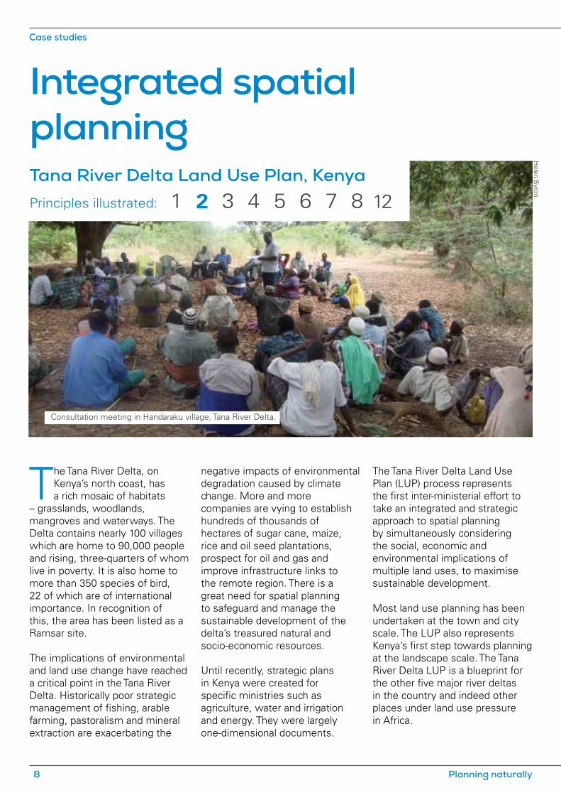
Tana River Delta Land Use Plan, Kenya Principles illustrated:
The Tana River Delta, on Kenya’s north coast, has a rich mosaic of habitats
– grasslands, woodlands, mangroves and waterways. The Delta contains nearly 100 villages which are home to 90,000 people and rising, three-quarters of whom live in poverty. It is also home to more than 350 species of bird, 22 of which are of international importance. In recognition of this, the area has been listed as a Ramsar site.
The implications of environmental and land use change have reached a critical point in the Tana River Delta. Historically poor strategic management of fishing, arable farming, pastoralism and mineral extraction are exacerbating the
negative impacts of environmental degradation caused by climate change. More and more companies are vying to establish hundreds of thousands of hectares of sugar cane, maize, rice and oil seed plantations, prospect for oil and gas and improve infrastructure links to the remote region. There is a great need for spatial planning to safeguard and manage the sustainable development of the delta’s treasured natural and socio-economic resources.
Until recently, strategic plans in Kenya were created for specific ministries such as agriculture, water and irrigation and energy. They were largely one-dimensional documents.
The Tana River Delta Land Use Plan (LUP) process represents the first inter-ministerial effort to take an integrated and strategic approach to spatial planning by simultaneously considering the social, economic and environmental implications of multiple land uses, to maximise sustainable development.
Most land use planning has been undertaken at the town and city scale. The LUP also represents Kenya’s first step towards planning at the landscape scale. The Tana River Delta LUP is a blueprint for the other five major river deltas in the country and indeed other places under land use pressure in Africa.
Helen B
yron
Integrated spatialplanning
Consultation meeting in Handaraku village, Tana River Delta.
1 2 4 6 83 5 7 12
Case studies
8 Planning naturally
Illus
trat
ion
by R
icha
rd A
llen
Wallasea Island coastal habitat creation Principles illustrated:
In response to the need to harmonise the different, sometimes conflicting, land uses in the delta, a Strategic Environmental Assessment (SEA) of the LUP is being undertaken, one of the first assessments of a plan in east Africa. It aims to ensure a balanced combination of robust scientific data and indigenous knowledge has informed and justified the design of regulations to facilitate resource management and designations for managed development areas and conservation areas. Alternative land use strategies have been scoped into the SEA process, including the “status quo”, a development oriented strategy, and a conservation orientated strategy.
The Tana Planning Advisory Committee was created to represent local interests, consult communities on the contents of
the plan and create awareness in the villages. There is extensive consultation at local and national levels to build trust and consensus around land use issues where win-wins can be achieved.
This integrated, strategic spatial planning process will deliver:• a set of planning policies for
guiding all land use decisions, based on the national policies but adjusted to meet local conditions;
• a LUP composed of map(s) and statements;
• land use zoning plans (maps);
• land use guidelines and regulations;
• an implementation strategy, and
• action plans.
As a transparent document, the LUP will provide clarity, consistency and predictability for
local communities and prospective investors and developers in the delta, helping to alleviate widespread poverty.
An iterative process of implementation, monitoring and evaluation has been formulated to ensure that the LUP can continue to perform as a working document even as the delta develops and pressures and priorities change.
The principal project partners are the Government of Kenya, the Inter-Ministerial Technical Committee on Sustainable Management of Deltas in Kenya, Nature Kenya, the UK Department for International Development and the RSPB.
For more information about the RSPB’s international work, visit rspb.org.uk/international
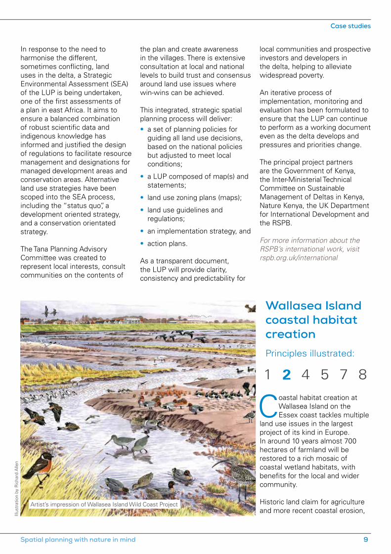
Coastal habitat creation at Wallasea Island on the Essex coast tackles multiple
land use issues in the largest project of its kind in Europe. In around 10 years almost 700 hectares of farmland will be restored to a rich mosaic of coastal wetland habitats, with benefits for the local and wider community.
Historic land claim for agriculture and more recent coastal erosion,
Artist’s impression of Wallasea Island Wild Coast Project
1 2 5 84 7
Spatial planning with nature in mind 9
Case studies

due to rising sea levels, have seen the area of intertidal saltmarsh on the Essex coast reduce by more than 91% in the past 400 years. Wallasea Island, which lies at the junction of the Crouch and Roach estuaries, was made up of five separate saltmarsh islands, progressively enclosed by sea defences and initially largely managed as coastal grazing marsh. It was converted to arable land in the late1950s.
A number of spatial planning challenges came together in two linked projects, which resulted in some imaginative win-win solutions that enhance the natural environment.
Firstly, the UK Government was legally obliged to provide compensation for the loss of wetland habitats of international importance for birds as a result of port development in the late 1980s and early 1990s in the Medway and Orwell estuaries. The Defra Wallasea Wetland Creation Project considered more than 120 alternative locations across the Greater Thames Estuary Natural Area against a range of pre-defined environmental and socio-economic criteria. A short-list of 13 sites was subject to very detailed analysis and extensive public consultation before Wallasea was identified as the preferred site.
Wallasea is not only big enough to attract the large numbers of birds that had been using the destroyed wetlands, but gives the opportunity to deal with a further spatial planning challenge. The existing sea walls on the
north shore of Wallasea were in very poor condition: the habitat creation project reduced the risk of flooding to Wallasea and subsequent damage to the estuary.
The Defra project provides 115 hectares of mudflat and saltmarsh through managed realignment of flood defences. Monitoring shows that the developing habitats are already supporting good numbers of overwintering birds, including high proportions of key species such as shelducks, dunlins, black-tailed godwits, ringed plovers and golden plovers.
The RSPB was employed by Defra to manage Wallasea Wetlands (now named Allfleets Marsh) and has since acquired the bulk of Wallasea Island (744 hectares) to create the UK’s largest coastal habitat restoration scheme, the Wallasea Island Wild Coast Project. The project partners worked closely with Essex County Council as the planning authority.
A managed realignment option was considered the most appropriate to restore the inter-tidal habitats, but this was subject to being able to raise the low-lying land. The solution helped to tackle a further planning challenge. Crossrail – a major engineering project to build a new west to east railway under central London – was seeking a sustainable use for the large quantities of clean clay, sand and gravel arisings from its tunnelling. Using this material to build up the island not only allows the restoration of coastal habitats but provides an alternative to
landfill for 7.5 million cubic metres of recovered inert material. The material is brought in by sea to a new unloading facility, reducing the amount of transport-related emissions. Crossrail will be providing around half of the required fill material.
The Wallasea Island Wild Coast project will create 133 hectares of mudflats, 276 hectares of saltmarsh and 56 hectares of shallow saline lagoons adjacent to Defra’s Allfleets Marsh in phases, over a period of about 10 years. A habitat adaptation zone of 48 hectares will support further new saltmarsh as sea level continues to rise. It will support the internationally important bird populations of the surrounding area, which is designated as a Special Protection Area for ducks, geese and waders, as a Special Area of Conservation for its intertidal habits, and as a wetland of international importance under the Ramsar Convention.
The scheme will also provide extensive coastal access with nine miles (15 km) of new and improved access routes, and eventually a range of visitor facilities. It will not only be a haven for wildlife, but a place that local people and those from further afield can come to enjoy.
The principal project partners are Defra, Crossrail, the Environment Agency, Natural England and the RSPB.
For more information about the Wallasea Island Wild Coast project, visit rspb.org.uk/wallaseaisland
Case studies
10 Planning naturally

Principles illustrated:
Strategic planning
The North East Wales, Cheshire and Wirral Green Infrastructure Framework
covers the area of six local planning authorities, straddles the England and Wales border and is home to more than 1.3 million people, a number that is forecast to grow significantly. It contains a diverse range of cultural and physical landscapes, including the Clwydian Range Area of Outstanding Natural Beauty and the Dee and Mersey estuaries, which are European nature conservation sites.
A partnership of the local authorities (Cheshire East, Cheshire West and Chester, Denbighshire, Flintshire, Wrexham and Wirral), Natural England and the Environment Agency commissioned consultants TEP
to construct a framework for planning and coordinating green infrastructure across the area.
The framework used public benefit assessment and stakeholder consultation to highlight hotspots for green infrastructure planning, investment and delivery over the next 10 to 15 years. It highlights where the existing green infrastructure assets are, locates the weaker areas and guides the area’s long term sustainable development.
The Framework supports the production of local development plans in North East Wales and local development frameworks in Cheshire and Wirral. It provides a firm foundation for joined-up planning and delivery of a high quality natural environment
Green Infrastructure Framework for North East Wales, Cheshire and Wirral
TEP
TEP
Thurstaston, Wirral
1 3 54
Spatial planning with nature in mind 11
Case studies
Hertfordshire Strategic Green Infrastructure Plan Principles illustrated:
across local authority boundaries. It was informed by extensive consultations with more than 100 local stakeholders, bringing together diverse interests to provide a vision of how a healthy natural environment can help sustain economic growth and thriving communities.
The Framework proposed seven integrated Environmental Management Areas. These are broad landscape or catchment focused zones where a step change in landscape scale biodiversity enhancement and ecological networks will produce a richer and healthier landscape, and a quality setting for towns and villages. The Dee catchment was identified as the highest priority for integrated management. The Dee and Mersey estuaries are European nature conservation sites with a unique estuarine ecology that supports internationally important populations of birds. Additionally,
Hertfordshire has a rich green infrastructure encompassing parts of the Chilterns Area
of Outstanding Natural Beauty, river valleys, chalk grasslands, farmlands, ancient woodlands and designed landscapes and parklands, in addition to an extensive 20th century urban green infrastructure heritage.
The Strategic Green Infrastructure Plan, prepared by LUC for Hertfordshire County Council and GreenArc, takes a landscape scale approach: it considers Hertfordshire Biodiversity Action
the marine ecology and economy of Liverpool Bay is affected by the quality of water arriving from these rivers.
Fifteen Action Plan Areas were also identified. A number of Action Plans, which are largely settlement focused, have already been completed, including those for Flintshire Coastal Park, Crewe, Lower River Dee and Ellesmere Port and Chester. Once they are endorsed by the relevant local planning authority, they will become part of the evidence base for the local plan. They will also be used to assist with development management decisions.
Examples of potential for biodiversity enhancement identified by the Action Plans include the following.
• Biodiversity corridor linking – mapping of broad areas which could provide links between core biodiversity areas through investment in measures such
Plan Key Areas, in addition to statutorily and locally designated nature conservation sites. Careful attempts were made to link this work to the wider green infrastructure network. For example, the Woodland Arc project goes well beyond the study area to provide links with the All London Green Grid and Thames Chase Community Forest. Similarly, the Chalk Arc project, is an extension of a Bedfordshire initiative.
The plan sets out an assessment, at the strategic level, of the ability
as tree planting, hedge laying, watercourse enhancement and other land management practices.
• Managed retreat – identification of a site with longer term potential to accommodate managed retreat as well as flood management of the Dee Estuary.
• River management – re-profiling canalised watercourses to improve biodiversity opportunities and manage flood risk; securing biodiversity and recreating buffer zones around watercourses; and instituting clean-up campaigns.
Providing green infrastructure can also help create a wide range of other benefits, including unlocking economic development potential; addressing health inequalities and creating a high quality of life; and helping climate proof settlements and the rural economy.
of green infrastructure to provide multiple environmental, social and, in some cases, economic functions. It also outlines a series of potential projects and provides advice on taking them through spatial planning and practical delivery.
The plan was produced alongside more detailed district-scale green infrastructure plans, and has been embraced by local planning authorities such as Dacorum, Watford and Welwyn and Hatfield in their core strategies.
1 3 4
Case studies
12 Planning naturally

Climate change is the most significant long-term threat to biodiversity, and onshore
wind energy development plays an important role in providing renewable energy and mitigating climate change. However, like any other form of development, it needs to be carried out in harmony with nature. Spatial planning, using rigorous environmental assessment (see principle 8), is an important means of achieving this. Where wind
farms are acceptable in principle, they may provide opportunities for enhancing biodiversity, as in this example of Clocaenog Forest.
In Wales, national planning policy has established seven Strategic Search Areas (SSAs), which are considered by the Welsh Government to be generally suitable for onshore wind farm development. The policy provides the context for the consideration of both the nature
conservation implications and the community benefits of wind farm development.
The Clocaenog Forest SSA lies on the border between Denbighshire and Conwy in north east Wales. The RSPB carried out a large-scale habitat masterplanning project for both Denbighshire and Conwy local planning authorities, which involved the spatial analysis of habitat data and the identification of species of highest conservation concern that could benefit from habitat management. The resulting Statement of Environmental Masterplanning Principles (SEMP) takes the form of a map-based masterplanning statement, which informs habitat management and enhancement within and around the Clocaenog Forest SSA.
The SEMP identifies broad Ecological Character Zones in relation to wind farm development within the SSA. It also includes simple but robust schedules of land management to maintain, improve or restore habitats within each Zone – to be adhered to by developers applying for consent for wind farm development within the SSA.
This approach provides certainty to the developer, the local planning authority and to the community, as to what the local planning authority expects from development in terms of land management, at an early stage in the process. It allows for an agreed strategic land management pattern, in order to avoid a patchwork of inappropriate and conflicting land management proposals. It assists in meeting the requirement set out in national policy, and in the emerging Denbighshire and Conwy local
Environmentalenhancement
Statement of Environmental Masterplanning Principles, Clocaenog Forest, WalesPrinciples illustrated:
And
y H
ay (r
spb-
imag
es.c
om)
Cottongrass
4
Spatial planning with nature in mind 13
Case studies

development plans, to address land management, community benefit and enhancement. It also provides a strategic analysis and rationale for the spatial location of environmental community benefit.
The Clocaenog SEMP is reflected in policies of the emerging Conwy and Denbighshire Local Development Plans. The SEMP will help to frame dialogue between developers, local planning authorities and local communities when determining the type of management required to enhance local biodiversity and maximise environmental community benefit within the Clocaenog Forest SSA. It is effectively facilitating a cross-boundary approach to land management, to maintain, improve or create habitats
Exeter City Council published a new Residential Design Supplementary Planning
Document (SPD) to support the policies in the city’s local plan. The SPD is designed to guide developers on how to meet the city’s high standards for housing design, safeguarding its valued green spaces and enhancing those in need of improvement.
The Council worked closely with the RSPB and Devon Wildlife Trust to ensure that developers consider and incorporate biodiversity enhancement into new dwellings. Since the SPD’s adoption, the sustainability standard of new housing stock has improved.
The document offers guidance on how to cater for the needs of key species that rely on nesting
affected by onshore wind farm development.
Once a broad agreement is reached, developers are committed to producing and implementing a more detailed management plan for the development site and vicinity, pursuant to the signing of a planning obligation and/or a set of planning conditions.
The SEMP has had a positive impact on the spatial planning of habitat conservation and enhancement tied to onshore wind developments in Wales. The National Assembly of Wales has recognised the SEMP approach in the Clocaenog Forest SSA as an innovative example of best practice in ensuring that wind farm developments also
opportunities within buildings, including swifts, house sparrows, starlings, swallows, house martins and bats. It includes detailed notes on appropriate orientations, dimensions and density of bird and bat boxes.
The importance of landscaping, using hedges, trees and shrubs, climbing plants and wild flower-rich grasses, for creating new habitats for key species is covered in detail. Where habitat is lost at ground level, the SPD points to the importance of creating new habitat for species through the provision of living (green) roofs.
For more information about giving nature a home, please visit rspb.org.uk/homes
contribute to the biodiversity and habitat management of the sites where they are located. Its report recommends that the Welsh Government develops a similar strategic approach to manage the land on which all wind farms in Wales are located.
The principal project partners are the RSPB, Denbighshire and Conwy County Councils, the Countryside Council for Wales (now Natural Resources Wales) and the North Wales Wildlife Trust.
For more information about the RSPB and climate change, visit rspb.org.uk/ourwork/policy/climatechange
Exeter City Council Residential Design Supplementary Planning Document
Principles illustrated:
Apex P
hotography
Knight’s Place, Exeter City Council Passivhaus Affordable Housing
4
Case studies
14 Planning naturally

Under European and domestic legislation, the presence of protected
species is a material consideration in planning decisions. Decision-making should be based on robust evidence about the value of the natural environment, including the presence of protected species. This usually needs to be established by up-to-date, timely and relevant survey work carried out by qualified professionals in accordance with good practice standards. However, undertaking unnecessary survey work imposes avoidable costs on developers, so national guidance to local planning authorities in England is that developers should not be required to undertake surveys
for protected species unless there is a ”reasonable likelihood” of the species being present and affected by development. In such cases, surveys should be completed and necessary measures to protect the species should be conditioned or secured through planning obligations before permission is granted.
Aylesbury Vale District Council has developed a planning procedure based on good practice advice published by the statutory nature conservation body, Natural England, and the Government. The procedure is designed to screen planning proposals for the potential presence of protected species, ensuring that ecological
surveys are only requested when there is a reasonable likelihood of protected species being present, and also that significant biodiversity issues are flagged up at an early stage in the planning process.
New planning proposals are first screened against a checklist of site features where protected species are likely to be present. Council officers use the checklists to highlight applications requiring further investigation, which are passed to the Green Spaces Team for assessment. Where it is considered there is a reasonable likelihood of priority habitats or protected species being present and affected by proposals
Evidence, assessment and alternatives
Aylesbury Vale District Council, ecological assessments and the planning processPrinciples illustrated:
Shu
tter
stoc
k
Great crested newt
5
Spatial planning with nature in mind 15
Case studies

(based on aerial photos, Google streetview, biodiversity records and previous site visits), a site visit is requested prior to the application being registered. The Green Spaces Team issues around 2,000 comments on applications annually.
The Council always encourages applicants to contact the planning department prior to submitting an application, especially if it seems the proposal may have an impact on priority habitats or protected species. The Green Spaces Team then carries out the screening process earlier and advises if more information is required with the development proposals, thus minimising delay at the application stage.
The standard of submitted survey information and the biodiversity benefit of mitigation and compensation proposals are reviewed by the Green Spaces Team, and Natural England where
appropriate. If they are satisfactory they will be conditioned in the planning permission. Mitigation and compensation measures are expected to be in place before development activities that may disturb protected species start.
The biodiversity checklist is proving an effective and accurate method of identifying when there is a reasonable likelihood of protected species and priority habitats. Affected applications are isolated early, more often than not at the pre-application stage, to ensure that planning decisions are made on the basis of the most up-to-date biodiversity information. By encouraging applicants, agents and ecological consultants to consult the Council at an early stage, the chance of ecological reports being approved first time round and of ecological enhancements being included within the design of proposals is maximised.
Proactive screening saves applicants and the Council time and money in the long run by reducing the volume of unnecessary speculative ecological surveys and reports. Furthermore, early consultation ensures that applicants, officers and ecological consultants are more informed and able to make more accurate judgements as to the ecological value of mitigation and enhancement strategies.
The Council’s approach works. Between 2003 and 2009, 81% of surveys revealed evidence of protected species requiring mitigation or compensation, ensuring that significant impacts were designed-out or reduced. The early dialogue between the Council and applicants ensured that environmental enhancements were given due consideration at all stages of proposals – detailed design, consultation and determination.
Cannock Chase District in Staffordshire contains a significant number
of environmental assets, including Cannock Chase Area of Outstanding Natural Beauty and Cannock Chase Special Area of Conservation (SAC). A housing needs study and Strategic Housing Market Assessment identified a minimum requirement of 250 new homes per annum for the district from 2006 to 2028.
LUC was commissioned by Cannock Chase District Council to assess the environmental capacity of the district based on a number of environmental themes,
Environmental capacity in Cannock Chase
LUC
Priority habitats, Cannock Chase District
Principles illustrated:
4 5
Case studies
16 Planning naturally
including biodiversity. For each theme, the study established a baseline position and then sought to describe the ”tipping point” beyond which development would have an unacceptable impact. Vulnerability to climate change was included as a cross-cutting issue.
To test the environmental capacity, the Council provided locations where longer-term pressures for growth were most
likely to arise. Environmental capacity is difficult to define and measure. The study sought to provide an objective assessment using a wide range of quantitative and qualitative data, with particular reference to standards and targets where available.
The study confirmed that the district has a highly constrained environment. Currently it is possible to mitigate impacts from recreation and traffic pollution
on Cannock Chase SAC due to development proposed in the emerging Local Plan. However, this will remain a key concern for longer term growth. Although less certain, the wider biodiversity interest of the district is likely to be under similar pressure.
The study provides a valuable evidence base for the preparation of the Cannock Chase Local Plan.
Breckland core strategy
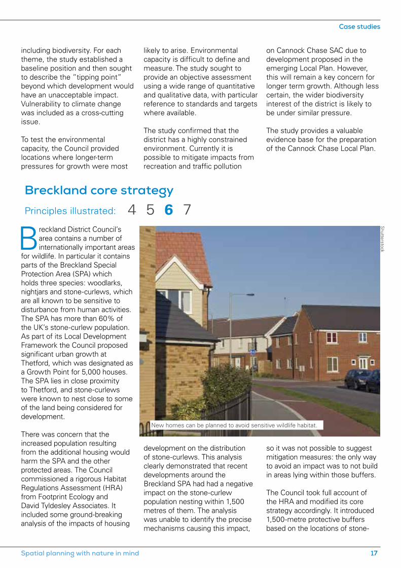
Breckland District Council’s area contains a number of internationally important areas
for wildlife. In particular it contains parts of the Breckland Special Protection Area (SPA) which holds three species: woodlarks, nightjars and stone-curlews, which are all known to be sensitive to disturbance from human activities. The SPA has more than 60% of the UK’s stone-curlew population. As part of its Local Development Framework the Council proposed significant urban growth at Thetford, which was designated as a Growth Point for 5,000 houses. The SPA lies in close proximity to Thetford, and stone-curlews were known to nest close to some of the land being considered for development.
There was concern that the increased population resulting from the additional housing would harm the SPA and the other protected areas. The Council commissioned a rigorous Habitat Regulations Assessment (HRA) from Footprint Ecology and David Tyldesley Associates. It included some ground-breaking analysis of the impacts of housing
development on the distribution of stone-curlews. This analysis clearly demonstrated that recent developments around the Breckland SPA had had a negative impact on the stone-curlew population nesting within 1,500 metres of them. The analysis was unable to identify the precise mechanisms causing this impact,
so it was not possible to suggest mitigation measures: the only way to avoid an impact was to not build in areas lying within those buffers.
The Council took full account of the HRA and modified its core strategy accordingly. It introduced 1,500-metre protective buffers based on the locations of stone-
New homes can be planned to avoid sensitive wildlife habitat.
4 65 7Principles illustrated:
Shutterstock
Spatial planning with nature in mind 17
Case studies
curlew nesting records, which severely curtailed development for land within them. This had important consequences at Thetford, where it became clear that it would not be possible to build one mooted urban extension to the south east of the town because it lay inside the buffer zone. Instead, the housing that would have been built there has been relocated to an area north east of the town which lies outside the buffer zones. Overall, however, the housing target for the Thetford Growth Point was unaffected.
The HRA also identified that proposed development at Dereham would have an impact on the water quality of the River Wensum Special Area of Conservation. Again, it was not possible to overcome this problem, so the town of Attleborough
was selected to receive much of the development that would otherwise have gone to Dereham. However, the overall housing figure for Breckland District was not affected.
The HRA findings have subsequently been taken forward to inform the Council’s Sites Allocations Development Plan Document and the Thetford Area Action Plan. The findings have also been taken up by the three neighbouring local authorities which contain parts of the Breckland SPA, and as a result the stone-curlew buffers have been incorporated into the plans for each of these areas.
The stone-curlew buffer approach in the plans has undergone a number of examinations and has been found to be sound in all of
them. Importantly, each of the local authorities has been able to satisfy the inspector that the overall housing figures for their plan are feasible.
Breckland District Council’s HRA, the supporting analysis work for the stone-curlew population, and the clear changes that were made in the plan as a result of the findings of the HRA, remain an exemplar of how plan assessment can help shape the overall form of the plan. It clearly demonstrates that a detailed assessment, coupled with appropriate strategic choices based on the findings of that assessment, will lead to a robust plan that ensures wildlife is protected.
For more information about RSPB casework, see rspb.org.uk/ourwork/casework
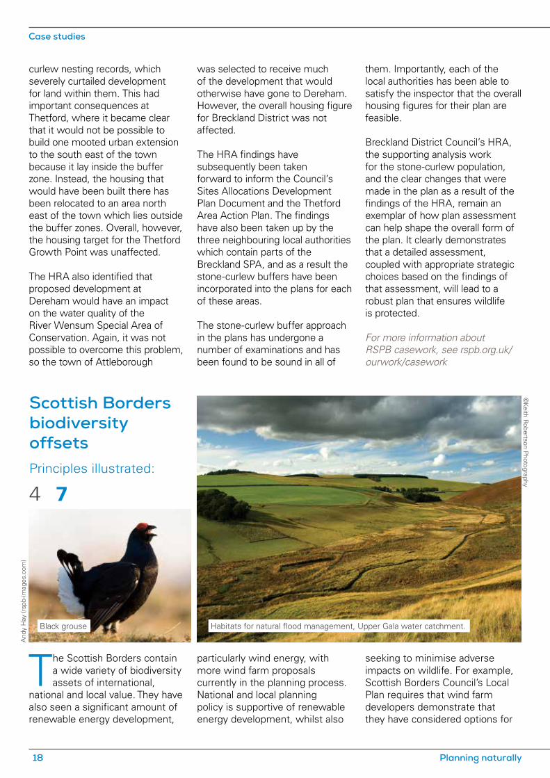
Scottish Borders biodiversity offsets
The Scottish Borders contain a wide variety of biodiversity assets of international,
national and local value. They have also seen a significant amount of renewable energy development,
particularly wind energy, with more wind farm proposals currently in the planning process. National and local planning policy is supportive of renewable energy development, whilst also
seeking to minimise adverse impacts on wildlife. For example, Scottish Borders Council’s Local Plan requires that wind farm developers demonstrate that they have considered options for
©Keith R
obertson Photography
And
y H
ay (r
spb-
imag
es.c
om)
Habitats for natural flood management, Upper Gala water catchment.Black grouse
Principles illustrated:
4 7
Case studies
18 Planning naturally

The programme of works for an offset project is agreed with a third party (a local environmental NGO) and secured with the Council by a legal agreement through the statutory planning process. The projects are steered by a small group chaired by the Council, with developer and NGO representatives. Projects use bespoke Geographic Information Systems (GIS) decision support tools to guide implementation.
The offsets scheme illustrates a policy approach to conserving and enhancing biodiversity, based on a hierarchy of policy options. First, developers must seek to avoid adverse impacts on habitats and species, for example by considering development sites which avoid more sensitive features. Secondly they must seek to mitigate biodiversity impacts on the development site, for example through the timing and method of construction. Thirdly where residual impacts on local biodiversity cannot be avoided then, as a last resort, these must be compensated for. By working with local partners to develop an offset mechanism, the Council has ensured that, where compensation is the only option, appropriate habitat compensatory measures can be secured.
When well planned and executed, compensation in the form of offsite biodiversity enhancement may be more beneficial for the impacted wildlife than seeking to maintain existing, isolated habitats and species on proposed development sites. One species that has benefited from the offset mechanism is the black
minimising impacts, including options for positioning the wind farm in relation to the biodiversity interest of the site and surrounding area. In the case of locally important biodiversity, however, Local Plan policy allows that the reasons in favour of development may sometimes outweigh the desirability of retaining particular habitat features on a development site. Where this is clearly demonstrated, the Council’s policy seeks local compensation measures aimed at ensuring no net loss of Local Biodiversity Action Plan (LBAP) habitats, including the creation of new habitats or the enhancement of existing habitats.
The Council has, together with stakeholders, developed a biodiversity offset scheme that accounts for the residual environmental impacts of renewable energy and mineral development on black grouse, and on blanket bog and other upland habitats. The implementation of eight schemes has mainstreamed biodiversity into the planning process by seeking biodiversity benefits at the landscape scale, whilst simultaneously benefiting ecosystem services. These include flood protection, water quality (siltation, diffuse pollution), carbon storage (woodland, grassland and bog habitats) and recreation (game management, fisheries management). Careful negotiation by the partner NGOs with farmers and landowners has balanced their needs with those of biodiversity and flood protection gains.
grouse. The subspecies of black grouse present is endemic to the UK, and numbers have fallen greatly since at least the 1970s, particularly in areas south of Scotland’s central belt. One factor in this decline is thought to be fragmentation of black grouse habitat, resulting in small populations that are less likely to survive development impacts. The black grouse is therefore a Biodiversity Action Plan priority species and the Scottish Borders biodiversity offsets programme has supported two black grouse projects (Central Southern Uplands and Lammermuirs), which have together put more than 30,000 hectares under positive management for this bird. Offsets have drawn in, through the Scottish Rural Development Programme, more than £3 million in extra resources for habitat enhancement and management. The habitat works also help meet the objectives of the Scottish Biodiversity Strategy, the Scottish Borders LBAP, the Scottish Borders Woodland Strategy and the Council’s biodiversity duty under the Nature Conservation (Scotland) Act 2004. The mechanism has also informed Forestry Commission Scotland guidance on the Control of Woodland Removal in Scotland.
The principal project partners are: Scottish Borders Council, Borders Forest Trust, Southern Uplands Partnership; Tweed Forum, the Game and Wildlife Conservation Trust, the RSPB, East Lothian Council, Scottish & Southern Energy, Scottish Power Renewables, Fred Olsen Renewables/Natural Power, Infinis and EDF.
Spatial planning with nature in mind 19
Case studies

responsible for organising involvement of their local community in the early stages of plan preparation. The councils worked with their communities to collect detailed information about the local area and define local preferences and ideas for future growth, and where such growth should occur and on what scale. This information was then used to help community councils respond to strategic development options proposed by the planning authority, thus influencing the final policies within the plan.
As an independent facilitator of this engagement process, Planning Aid Wales delivered a three-stage programme of community workshops to provide an overview of the planning process, and to help develop a common approach for councils to work together with their communities. During the latter stages of plan preparation, further
workshops and training events were planned and carried out to assist community councils in preparing a response to the published draft version of the plan.The project provided an exemplar case study of structured and innovative community involvement in planning policy-making.
As a result of this work, Planning Aid Wales, in collaboration with the Planning Inspectorate, developed new user-friendly ”model” local development plan representation forms and guidance.
The final policies of the plan took into consideration the results of the engagement with community councils. They seek to ensure that proposed developments demonstrate that they will have no unacceptable impact on, or detract from or prevent the enjoyment of, the features of the natural and built environment that characterise the Brecon Beacons.
The Brecon Beacons National Park in South Wales was designated in 1957. The
National Park Authority is the local planning authority for the designated area, and must have regard to the purpose of conserving and enhancing the natural beauty, wildlife and cultural heritage of the area.
The National Park Authority is responsible for preparing a local development plan, reflecting the vision of the National Park Management Plan. In preparing the plan, the National Park Authority aimed to engage around 50 community and town councils, to help communities get involved in strategic planning policy making and provide opportunities to improve communications between the Authority, town councils and local communities.
Each community council was offered the opportunity to be
Public participation and decision making
Brecon Beacons National Park local development plan
© C
orbisPublic participation is essential to good planning.
8Principles illustrated:
Case studies
20 Planning naturally
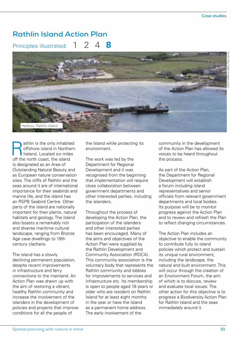
Rathlin Island Action Plan Principles illustrated:
Rathlin is the only inhabited offshore island in Northern Ireland. Located six miles
off the north coast, the island is designated as an Area of Outstanding Natural Beauty and as European nature conservation sites. The cliffs of Rathlin and the seas around it are of international importance for their seabirds and marine life, and the island has an RSPB Seabird Centre. Other parts of the island are nationally important for their plants, natural habitats and geology. The Island also boasts a remarkably rich and diverse maritime cultural landscape, ranging from Bronze Age cave dwellings to 19th century clachans.
The island has a slowly declining permanent population, despite recent improvements in infrastructure and ferry connections to the mainland. An Action Plan was drawn up with the aim of restoring a vibrant, healthy Rathlin community and increase the involvement of the islanders in the development of policies and projects that improve conditions for all the people of
the Island while protecting its environment.
The work was led by the Department for Regional Development and it was recognised from the beginning that implementation will require close collaboration between government departments and other interested parties, including the islanders.
Throughout the process of developing the Action Plan, the participation of the islanders and other interested parties has been encouraged. Many of the aims and objectives of the Action Plan were supplied by the Rathlin Development and Community Association (RDCA). This community association is the voluntary body that represents the Rathlin community and lobbies for improvements to services and infrastructure etc. Its membership is open to people aged 18 years or older who are resident on Rathlin Island for at least eight months in the year or have the Island as a permanent home address. The early involvement of the
community in the development of the Action Plan has allowed its voices to be heard throughout the process.
As part of the Action Plan, the Department for Regional Development will establish a forum including island representatives and senior officials from relevant government departments and local bodies. Its purpose will be to monitor progress against the Action Plan and to review and refresh the Plan to reflect changing circumstances. The Action Plan includes an objective to enable the community to contribute fully to island policies which protect and sustain its unique rural environment, including the landscape, the natural and built environment. This will occur through the creation of an Environment Forum, the aim of which is to discuss, review and evaluate local issues. The other action for this objective is to progress a Biodiversity Action Plan for Rathlin Island and the seas immediately around it.
Andy H
ay (rspb-images.com
)
Harbour, Rathlin Island
1 842
Spatial planning with nature in mind 21
Case studies

There are many different players in the planning process – not only
professional planners, but a host of other experts from ecologists to engineers; developers and their advisers; members of the public and community groups; government agencies; NGOs such as the RSPB; professional bodies such as CIEEM and the RTPI, and more. But at the heart of planning systems in most of the UK is a statutory process in which decisions are taken in the public interest by elected members of local planning authorities.
This democratic check on the planning system by councillors who are responsible to the electorate recognises that, although planning is a quasi-judicial process and requires the application of professional expertise, it is also ultimately a political process, in which elected politicians determine the future of the area they represent. This does not mean that planning should be party political, but that plan-making and decision-taking are about the future of the places in
Democratic decision-making in the UK
committee free to deal with the more significant or publicly-sensitive cases. In England, local planning authorities delegate 90% of planning applications in this way. Many planning committees also have arrangements to allow developers and objectors to appear before them.
The same applies at the national level. Although the vast majority of planning decisions are taken locally, there will always be a role for government in setting national policy and in determining applications for major infrastructure. There are different arrangements for doing this in each country of the UK; in England and Wales, for example, nationally-significant infrastructure projects are dealt with by the Planning Inspectorate, which does so on behalf of the Secretary of State, maintaining the democratic check on planning decisions.
Similarly, whenever a refusal of planning permission is appealed by a developer, or where a planning application is called in for a decision by government,
which people live and work, and of the environment that we depend on – and these are fundamentally political issues.
In England, Wales and Scotland there are more than 400 local planning authorities. They come in many different forms, including authorities specifically for National Parks and the Broads. In Northern Ireland there is currently only one centralised planning authority, but plans are in hand to transfer the majority of planning powers to 11 new local authorities. The quasi-judicial nature of planning in the UK means that, whatever the structure of the local authority, a planning committee of elected members takes responsibility for planning decisions. The role of planning officers is to advise and make recommendations to the committee members, not to take decisions. In practice, local authorities delegate powers to planning officers to deal with straightforward and uncontroversial planning applications, leaving the planning
People play an important role in speaking up for nature.
© C
orbis
9Principles illustrated:
Case studies
22 Planning naturally

Environmental Court, State of Vermont Principles illustrated:
they are dealt with by the Planning Inspectorate on behalf of the Secretary of State and this system generally works very well. Reporters in Scotland and commissioners in Northern Ireland play a similar expert and accountable role.
The transparency of decision-making is helped not only by the democratic process, but by arrangements for public participation (principle 8) and challenge (principle 10), as well as by requirements such as a publicly-accessible planning register, the publication of committee minutes
and appeal, or Secretary of State, decisions. In the UK, many local planning authorities make all the necessary information available online.
Ele
anor
Ben
tall
(rsp
b-im
ages
.com
)
Public participation principles for planning systems are laid out in the Rio Declaration on
Environmental Development and the Aarhus Convention, both of which require public authorities (at national, regional and local level) to make provisions to establish a number of rights of the public:
• Public access to environmental information
• Public participation in environmental decision-making for projects, plans and programmes relating to the environment
• Public right to challenge public decisions and review procedures.
Transparency, effective public participation, fairness, consistency and clarity are key ingredients for good environmental governance that empowers individuals, communities and institutions to represent the people and places that cannot represent themselves. Although the legal context is very different to the UK, governments considering how to implement good practice in participative democracy and environmental justice can look to Vermont in the United States of America to see how an accessible and specialist environmental court can effectively
People have a right to information about their environment.
8 10 11
Spatial planning with nature in mind 23
Case studies
Ernie Janes (rspb-im
ages.com)
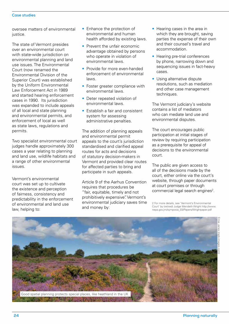
Good spatial planning protects special places, like heathland in the UK
oversee matters of environmental justice.
The state of Vermont presides over an environmental court with state-wide jurisdiction on environmental planning and land use issues. The Environmental Court (now renamed the Environmental Division of the Superior Court) was established by the Uniform Environmental Law Enforcement Act in 1989 and started hearing enforcement cases in 1990. Its jurisdiction was expanded to include appeals of all local and state planning and environmental permits, and enforcement of local as well as state laws, regulations and permits.
Two specialist environmental court judges handle approximately 300 cases a year relating to planning and land use, wildlife habitats and a range of other environmental issues.
Vermont’s environmental court was set up to cultivate the existence and perception of fairness, consistency and predictability in the enforcement of environmental and land use law, helping to:
• Enhance the protection of environmental and human health afforded by existing laws.
• Prevent the unfair economic advantage obtained by persons who operate in violation of environmental laws.
• Provide for more even-handed enforcement of environmental laws.
• Foster greater compliance with environmental laws.
• Deter repeated violation of environmental laws.
• Establish a fair and consistent system for assessing administrative penalties.
The addition of planning appeals and environmental permit appeals to the court’s jurisdiction standardised and clarified appeal routes for acts and decisions of statutory decision-makers in Vermont and provided clear routes for affected parties to bring and participate in such appeals.
Article 9 of the Aarhus Convention requires that procedures be “fair, equitable, timely and not prohibitively expensive”. Vermont’s environmental judiciary saves time and money by:
• Hearing cases in the area in which they are brought, saving parties the expense of their own and their counsel’s travel and accommodation.
• Hearing pre-trial conferences by phone, narrowing down and sequencing issues in fact-heavy cases.
• Using alternative dispute resolutions, such as mediation and other case management techniques.
The Vermont judiciary’s website contains a list of mediators who can mediate land use and environmental disputes.
The court encourages public participation at initial stages of review by requiring participation as a prerequisite for appeal of decisions to the environmental court.
The public are given access to all of the decisions made by the court, either online via the court’s website, through paper documents at court premises or through commercial legal search engines2.
2 For more details, see ‘Vermont’s Environmental Court’ by (retired) Judge Merideth Wright http://www.nepa.gov.jm/symposia_03/Papers/Wrightpaper.pdf
Case studies
24 Planning naturally

An industrial estate was constructed without permission next to the
Thames Estuary and Marshes Special Protection Area (SPA), a site designated for its internationally important numbers of wintering waterbirds.
The RSPB’s Cliffe Pools nature reserve is a 237-hectare nature reserve on the north Kent marshes within the SPA. It is a series of pools created by clay extraction between the late 19th century and the early 1970s. The pools have been used since the 1960s for depositing river dredgings. Since then, the area has attracted an increasing number of birds, particularly wintering waterfowl. The pits are now a series of saline lagoons, open water and shallow brackish pools. The RSPB purchased the nature reserve in 2001. Its long term vision is to restore the site to shallow pools using river and marine dredgings to provide ideal habitat for the protected birds.
Thameside Terminal (the enforcement site) was purchased by the current owners in 2003 as a derelict fuel storage depot. They cleared the site and began operating a mixed-use storage and distribution depot, with uses ranging from concrete crushing to steel unit fabrication. Immediately adjacent to the SPA and the RSPB’s nature reserve, the development was causing disturbance to internationally protected birds and jeopardising the success of the RSPB’s plans to improve habitats at the site for wintering birds.
In 2007, Medway Council started enforcement action against the owners of the site, requiring them to cease their activities and vacate. The owners appealed. Initially, the public inquiry was adjourned to allow an Environmental Impact Assessment and bird surveys to be undertaken to inform a Habitats Regulations Assessment.
The inquiry eventually started in
early 2010. Medway Council put a strong case forward. The RSPB submitted a statement, objecting to the appeal on legal, policy and ecological grounds and provided expert ecological evidence on Medway’s behalf.
The planning inspector’s decision on behalf of the Secretary of State upheld the enforcement notices, requiring that the development at the site is cleared within two years. The inspector agreed with concerns about environmental damage and concluded that an adverse effect on the SPA could not be ruled out, and that the development was insensitive to the surrounding environment that Medway Council was seeking to restore and manage as a Conservation Park.
The developers challenged that decision through the courts, but Medway Council and the Department of Communities and Local Government rigorously defended their positions and the challenges failed.
Enforcement
Chris G
omersall (rspb-im
ages.com)
Avocets breed at RSPB Cliffe Pools.
Principles illustrated: 11
Thameside Terminal, Medway
Spatial planning with nature in mind 25
Case studies

Scottish Natural Heritage (SNH) has devised a standard programme for monitoring
the impacts of wind turbines on birds, given the significance of their potential impact. Good practice dictates that monitoring requires both pre-construction monitoring (to provide a baseline) and a programme of construction and operational monitoring, to identify the short to medium-term impacts.
Vattenfall Wind Power received permission for the Edinbane wind farm on the Isle of Skye, with up to 18 turbines. A condition of the planning permission required detailed proposals for ornithological monitoring to be approved by the local planning authority, in consultation with SNH.
The Ornithological Monitoring Programme committed to detailed monitoring of breeding birds on the wind farm site before and during construction, continuing through each of the first five years of operation (as required by the
planning permission) and then the 10th and 15th years following the final commissioning of the development. All golden eagle territories on the Isle of Skye are also to be monitored.
Hen harriers, merlins and short-eared owls were recorded breeding on or close to the wind farm site. Comprehensive observations of foraging white-tailed eagles, golden eagles and hen harriers provided a detailed picture of flight activity patterns in the general vicinity of the wind farm. After six years of survey work, a review by the contractor, Hawthorn Conservation, shows a clear reduction in use of habitat within the wind farm by golden eagles during the construction period, but since 2011, activity has been greater than it was prior to construction. At the scale of vantage point surveys there is no evidence for a reduction in golden eagle activity after construction disturbance has ceased.
There is evidence of avoidance of the wind farm site, which may be more pronounced near to the turbines. However, this trend seems to be declining over time and the apparent decrease in avoidance is backed up by an increasing number of observations of golden eagles passing close to the turbines. Apart from one year, white-tailed eagle use has increased over the survey period. Unlike golden eagles, there is little evidence to suggest that white-tailed eagles are avoiding the turbines.
More wind farms across the UK are likely to be proposed over the coming years, and only by monitoring accurately the impacts of developments that have already been built can we properly assess the potential impact of future wind farms. The evidence gathered in studies such as this will be invaluable in informing the design and location of future wind farms to minimise their impacts on biodiversity. Such monitoring could be applied to other forms of development, thereby informing future planning practice.
Monitoring and review
Vattenfall Wind Pow
er Ltd
Principles illustrated: 12
Edinbane wind farm, Isle of Skye – monitoring programme
Case studies
26 Planning naturally

UK Planning is a devolved responsibility in the UK, and although the planning systems of each country share some common features, they are becoming increasingly divergent.
A shared theme in all parts of the UK is the need to resolve tensions between government objectives for new development and economic growth, and commitments to protect and restore the natural environment. As this report demonstrates, spatial planning plays a key role in reconciling these ambitions. A healthy natural environment forms the basis of healthy and prosperous communities.
Each country has a statutory adviser on nature conservation – Natural England, Natural Resources Wales, Scottish Natural Heritage and the Northern Ireland Environment Agency – which has a significant role in the planning system. The Joint Nature Conservation Committee maintains a UK overview of biodiversity issues. However, non-statutory organisations can also be an important source of biodiversity data and expertise. The RSPB has particular experience of working with the European and domestic legislation to protect designated sites, of landscape-scale conservation and of working with the minerals industry and other developers. Other NGOs, such as the Wildlife Trusts, are also a good source of advice for local planners.
The sections below deal briefly with some particular characteristics of each part of the UK. Further sources of information, which may be helpful in all parts of the UK, include:
• Planning for a healthy environment: good practice guidance for green infrastructure and biodiversity (TCPA and the Wildlife Trusts) – based on English planning policies, but relevant more widely
•Biodiversity planning toolkit (online resource, Association of Local Government Ecologists) see biodiversityplanningtoolkit.com
• Strategic Environmental Assessment – Learning from Practice (The RSPB)
• Appropriate Assessment of Spatial Plans (The RSPB).
England The planning system in England has seen significant changes in recent years. Nationally, planning policy is consolidated in the National Planning Policy Framework (NPPF), and government is also updating its planning practice guidance. For major infrastructure, the regime introduced by the Planning Act 2008 is still bedding in. Further changes are being introduced by the Growth and Infrastructure Act 2013.
Following the revocation of regional strategies, local plans form the cornerstone of the plan-
led system. Many local planning authorities are publishing new-style local plans, and there is also widespread interest in statutory neighbourhood plans at the very local level.
Many of the principles in this report are already embedded in legislation and policy in England, such as the positive planning approach of the NPPF (principle 1).
One of the greatest challenges for the planning system in England is how to consider strategic issues that may affect a wider area than the individual plan (principle 3). The duty to cooperate is the statutory mechanism to do this, but will only work effectively if local authorities work closely together. Strategic issues include the conservation and enhancement of the natural environment, and the NPPF specifically requires planning for biodiversity at a landscape-scale across local authority boundaries. Nature Improvement Areas, which have now been designated in a number of areas, are one way of achieving this.
Contributing to the achievement of sustainable development (see principle 4) is the statutory purpose of the planning system, and local plans must be subject to sustainability appraisal which incorporates Strategic Environment Assessment (see principle 8). They are also required to plan positively for the creation, protection, enhancement and management of networks of biodiversity and green infrastructure.
Countries
Spatial planning with nature in mind 27
Countries

Wales The Welsh Government is responsible for the framework within which the planning system operates, comprising primary and secondary legislation. Following a referendum in 2011, the National Assembly for Wales now has the power to make primary legislation in certain fields, one of which is planning. A Welsh Planning Bill is being prepared to this effect, along with a Sustainable Development Bill and an Environment Bill.
The Welsh Government is also responsible for producing national planning policy and guidance inPlanning Policy Wales and Technical Advice Notes. It retains reserve powers to intervene in the production of development plans, the determination of planning applications and undertakes an adjudication role in the appeals system.
Local planning authorities, comprising 22 unitary authorities and 3 national parks, are responsible for delivery of the planning system locally. Their main responsibilities include the preparation of local development plans and operation of the development management system – determining planning applications and planning enforcement. Other key contributors to the planning system include town and community councils and statutory consultees.
A challenge for the future will be the way in which the planning system in Wales engages with a new presumption in favour of sustainable development where there is no development plan in place (see principle 4). The Welsh Government’s Independent
Advisory Group stated that the environmental framework, which the conservation purpose of planning delivers, should channel growth to sustainable locations.
A further challenge will be the ”larger than local” agenda, with tensions between the need for community participation and consultation at the local level on the one hand (principle 8), and the need to attain challenging targets for national infrastructure (including climate change mitigating infrastructure), on the other, through swift and seamless delivery via larger than local working and consenting.
Scotland There have been significant changes to the planning system in Scotland, and further changes are likely with the production of the third National Planning Framework and a comprehensive review of Scottish Planning Policy, the two key national planning policy documents.
The purpose of the Scottish planning system remains broadly to act in the long term public interest, balancing the need to facilitate appropriate development while protecting and enhancing the natural and built environment. The Planning etc. (Scotland) Act 2006 requires Scottish Ministers, when preparing the National Planning Framework, and local planning authorities when preparing development plans, to do so with the objective of contributing to sustainable development.
National and local spatial planning policy will continue to have a critical role in ensuring that any short term benefits
of development do not result in significant or long lasting environmental damage. There is also an increasing need for spatial planning to consider how to act positively to deal with major contemporary challenges such as climate change and biodiversity loss.
Some of the principles for good spatial planning set out here are already embedded in the Scottish planning system. For example, the legal requirement for plans to contribute to sustainable development was a very forward-looking move (principle 4) and Scotland is at the forefront of the use of strategic environmental assessment. However, there is some way to go on others – consideration of genuine alternatives (principle 7) could be improved. The planning appeal system generally works well for developers and decision-makers, but others affected by planning decisions continue to face significant hurdles if they wish to challenge decisions through the courts in Scotland (principle 10).
Northern IrelandAt present, Northern Ireland has a population of 1.8 million people, 26 local councils, but only one statutory planning authority. The planning system in Northern Ireland is currently undergoing the most dramatic and fundamental reform that has been experienced in the past 40 years.
Following restoration of a devolved administration in 2007, a major programme of reform of the planning system was announced. This will take account of and enable the implementation of
Countries
28 Planning naturally

the Northern Ireland Executive’s decision in relation to the Review of Public Administration.
The Planning (Northern Ireland) Act 2011 was passed with the objective of establishing a fit for purpose planning system prior to transfer of powers in 2015. The reform will see local councils reduced from 26 to 11, will transfer the majority of planning powers back to local councils and will have an increased emphasis on community involvement (see principles 8 and 9).
The hierarchy of the current planning system places the statutory Regional Development Strategy 2035 (RDS) as the spatial strategy for the future development of Northern Ireland to 2035. It provides an overarching strategic planning framework to facilitate and guide the public and private sectors.
Planning Policy Statements contain policies on land use and other planning matters and apply to the whole of Northern Ireland. They set out the planning considerations for various forms of developments and are relevant to the preparation of development plans.
Development Plans may be in the form of area, local or subject plans. They apply the regional policies at local level. Development plans inform the general public, statutory authorities, developers and other interested bodies of the policy framework and land use proposals that will be used to guide development decisions within their local area.
International It is hard to generalise about spatial planning systems outside the UK. However, there are some broad similarities that can allow grouping of some countries into those that are part of the European Union, UK overseas territories or developing countries, although there will be many exceptions to the rule.
Although the European Union has no competency in spatial planning, its legislation has a significant influence on planning systems in EU countries, through the rules governing European protected areas (Natura 2000 sites), strategic and project environmental assessment, and requirements cascading down from the Aarhus Convention (access to information, public participation and access to justice). Policy initiatives such as the European Spatial Development Perspective aim to inform and guide member state and EU sectoral policy. Therefore, in theory, integration of principles 6 to 10 should be similar and relatively well-integrated into planning frameworks across the member states. However, in practice, implementation of these principles still varies widely.
The UK overseas territories have planning systems that are at least loosely based on those of the UK. However, many territories have very limited institutional capacity, so planning law and policy are often old and incomplete, and implementation often lags behind what would be considered good practice in the UK. 3 In some territories there are now moves to update the legislative and policy frameworks to enshrine many of the planning principles outlined in this document. However,
transparency and accountability in decision making (principle 9) remains a particular issue of concern.
Elsewhere in the world there is a very wide range of planning systems of variable effectiveness, often depending on their history and present regulatory capacity. In many countries, most planning principles are poorly applied, from a total lack of spatial planning, to poor baseline data provision, lack of effective public participation, ineffective or no impact assessment, lack of accountability and transparency or of enforcement and monitoring. However, there are examples of good practice, as the Tana River Delta Land Use Plan case study shows.
Safeguarding systems from international lending banks (such as the World Bank) are providing a positive influence in the better implementation of some of the principles (for example, public participation and impact assessment). Planning frameworks tend to focus more on primary industries and social and economic development needs, but the need to integrate the natural environment into these frameworks is now being more widely recognised.
3 An assessment of environmental protection frame-works in the UK overseas territories. The Foundation for International Environmental Law and Development and the RSPB, February 2013.
Spatial planning with nature in mind 29
Countries

The RSPBThe RSPB is the country’s largest nature conservation charity, inspiring everyone to give nature a home. Together with our partners, we protect threatened birds and wildlife so our towns, coast and countryside will teem with life once again. We play a leading role in BirdLife International, a worldwide partnership of nature conservation organisations.UK Headquarters, The Lodge, Sandy, Bedfordshire SG19 2DL.Tel: 01767 680551rspb.org.uk
CIEEMThe Chartered Institute of Ecology and Environmental Management (CIEEM) is the leading membership body for ecologists and environmental managers in the UK and Ireland. It promotes the highest standards of professional practice for the benefit of nature and society. 43 Southgate Street, Winchester, Hampshire, SO23 9EH Tel: 01962 868626 cieem.net
RTPIThe Royal Town Planning Institute (RTPI) is the UK’s leading planning body for spatial, sustainable and inclusive planning and is the largest planning institute in Europe with more than 23,000 members. 41 Botolph Lane, London EC3R 8DL Tel: 020 7929 9470 Fax: 020 7929 9490 rtpi.org.uk
Cover image © Biosphoto / J.-L. Klein & M.-L. HubertThe RSPB is a registered charity in England and Wales 207076, in Scotland SC037654
Publication date: July 2013275-1093-12-13
RSPB Country and Regional Offices:
Northern Ireland HeadquartersBelvoir Park Forest, Belfast BT8 7QT Tel: 028 9049 1547 Fax: 028 9049 1547
Scotland Headquarters2 Lochside View, Edinburgh Park, Edinburgh, EH12 9DH Tel: 0131 317 4100
Wales HeadquartersSutherland House, Castlebridge, Cowbridge Road East, Cardiff CF11 9ABTel: 029 2035 3000 Fax: 029 2035 3017
North Wales OfficeUned 14, Llys Castan, Ffordd Y Parc, Parc Menai, Bangor, Gwynedd LL57 4FD Tel: 01248 672850 Fax: 01248 676767
Midlands Regional Office46 The Green, South Bar, Banbury, Oxfordshire OX16 9AB Tel: 01295 253330 Fax: 01295 265734
Eastern England Regional OfficeStalham House, 65 Thorpe Road, Norwich NR1 1UD Tel: 01603 661662 Fax: 01603 660088
Northern England Regional Offices1 Sirius House, Amethyst Road, Newcastle Business Park, Newcastle upon Tyne NE4 7YL Tel: 0191 256 8200 Fax: 0191 212 0622
Westleigh Mews, Wakefield Road, Denby Dale, Huddersfield HD8 8QDTel: 01484 861148 Fax: 01484 862018
South East England Regional Office1st Floor, Pavilion View, 19 New Road Brighton, East Sussex BN1 1UFTel: 01273 775333 Fax: 01273 220236
South West England Regional Office1st Floor, Keble House, Southernhay Gardens, Exeter, Devon EX1 1NTTel: 01392 432691 Fax: 01392 453750
East Scotland Regional Office10 Albyn Terrace, Aberdeen AB10 1YPTel: 01224 624824 Fax: 01224 626234
North Scotland Regional OfficeEtive House, Beechwood Park, Inverness IV2 3BW Tel: 01463 715000 Fax: 01463 715315
South and West Scotland Regional Office10 Park Quadrant, Glasgow G3 6BSTel: 0141 331 0993 Fax: 0141 331 9080
The RSPB is a member of BirdLife International, a partnership of conservation organisations working to give nature a home around the world.