Frederick County, MD ray smith road | frederick, maryland ...

WESTSIDE REGIONAL PARK PLAN
CITY OF FREDERICK, MARYLAND
Prepared June, 2016

ACKNOWLEDGEMENTS
Westside Regional Park City of Frederick County Maryland
MAYOR & ALDERMAN: Mayor Randy McClement
Alderwoman Kelly Russell, President Pro Tem Alderman Michael O’Connor
Alderman Phil Dacey Alderman Josh Bokee
Alderwoman Donna Kuzemchak
PARKS & RECREATION COMMISSION: Joe Baldi, Chairman
Mark Lawrence, Vice Chairman Alderman Michael O’Connor
Dan D’Agostino Jennifer Grove
Rob Fox Larry Hill
Mike Long
CITY OF FREDERICK STAFF: Zack Kershner, Director of Public Works
Bob Smith, Deputy Director for Parks and Recreation Tracy Coleman, Deputy Director for Engineering
Gabrielle Collard, Division Manager Current Planning Jim Rahochik, Manager of Surveying and Mapping
Jenny Willoughby, Sustainability Manager Scott Geasey, Parks Superintendent
Tim Davis, Planner Pam Reppert, Planner
Kristi Winterstein, Office Manager, Parks Department Capt. Dwight Sommers
Sgt. Jonathan Holler CPL. Rebecca Carrado
Officer First Class Sean Carpenter Meredith Wivell, Special Operations Division
PPRREEPPAARREEDD BBYY
G. E. Fielder & Associates, Chartered Planners, Landscape Architects,Environmentalists Grace E. Fielder, RLA,ASLA,AICP President Laurel, Maryland 20708 301-490-3207 [email protected]

TABLE OF CONTENTS Acknowledgements Executive Summary..............................................1
A. History of Project……………………………………..1 B. Proposed Design……………………………………….1 C. Master Plan Highlights ……………………………..3 D. Economic Feasibility of Master Plan……………4 E. Sustainablity…………………………………………...6 F. Phasing ………………………………………………….7 G. Security………………………………………………….7 H. Project Cost…………………………………………….8
Master Plan.. ........................................................... .11I.Introduction..............................................................11
A. History of the Project..……………………………...11 B. Park Planning and Analysis………………………..11 C. Public Input…………………………………….………12
D. Joint Use Considerations with Elementary School………….………………...13
II. Site Description and Analysis……………..……15 A. Existing Site Conditions
and Easements………………………………………..15 B. Roads,Utilities and Existing Access……………16 C. Flora and Fauna………………………………………17 D. Site Hydrology………………………………………..18 E. Land Use, Views and Vistas……………………….18 F. Geology, Soils and Slopes………………………….22 G. Cultural Resources…………………………………..23 H. Opportunities and Constraints…………………..25 I. Needs Assessment and Public Input……..….…25 J. Economic Analysis…………………………………...29
K. Traffic Analysis………………………………..……...31 L. Traffic Consideration and Way Finding………..33
III. Development Plan……………………………..34 A. Overview…………………………………………….34 B. Master Plan Description………………………..34 C. Design Guidelines………………………………...41 D. Natural Resource Management…………….…46 E. Programming…….………………………………...47 F. Sustainability……………………………………...47
IV. Phasing Plan with Cost Estimates…….….50A. Phasing………………………………………………50 B. Cost Estimate……………………………………..51
Appendix…………………………………………………….…52 A. Plans and Maps …………………………………….A1 B. Archaeological Report...................................B1 C. Wetland Delineation………………...…………....C1 D. Earthwork…………………………………………….D1 E. Structural Report…………………………………..E1 F. Master Plan Estimate……………………………..F1 G. Traffic Study…………………………………………G1 H. Economic Analysis………………………………...H1

EXECUTIVE SUMMARY
A. History of the Project
n 2008, The City of Frederick had the foresight to acquire a special, 148-acre parcel of open space
on its southwestern border with the intent of creating its first regional park. The property boasts an historic farm complex and expansive views toward Catoctin Mountain. It is surrounded by an increasingly dense urban environment and bounded on the south by I-70.
Between 2005 and 2008 proposals were underway to create a residential development on the site known as Hargett Farm Development, Inc. The City of Frederick purchased the 148-acre property in late 2008 and began deliberating how to create a future regional park for its citizens. A public workshop was held in 2010 to begin the process. In 2012, an agreement was reached with the Frederick County Board of Education to sell 12.12 acres for the new Butterfly Ridge Elementary School and provide for an access right of way. The remaining 130.86 acres of the land underwent further planning in 2014 in the form of an in-house concept plan with opportunity for public comment, all while interim uses were occurring (leasing portions for commercial agricultural use and community gardens).
In late 2015, consultant services were requested for a detailed feasibility study for a regional park and G.E. Fielder & Associates, Chartered was selected to do this work. This document is the summary of their findings and recommendations with public and local government planning team input as important components of the entire planning process. All support documents are included in the appendix.
B. Proposed Design
he property is a roughly rectangular parcel bounded by I-70 on the south and Butterfly
I
T1950’s Painting of Hargett Farm, Provided Courtesy
of Hargett Family
CITY OF FREDERICKG.E. FIELDER & ASSOCIATES
1 WESTSIDE REGIONAL PARKJUNE 2016

Lane on the north. To the southeast is a Potomac Edison power station and beyond it is the First Missionary Baptist Church. On the north side of Butterfly Lane are medium to high density residential neighborhoods, while to the immediate west is a 35-acre farmed parcel which is framed by another subdivision.
This master planning process began with extensive research into various physical parameters of the property and study of the region and immediate environs of the park. The planning team sought current public input and reviewed past efforts in this regard. Thorough site description and analysis included a detailed look at existing conditions such as: roads, utilities, access, flora and fauna, site hydrology, wetlands, views and vistas, geology, soils and slopes, sustainability, and cultural resources. This resulted in an opportunities and constraints map that shows where recreational development can best be located and why. Other vital analyses were completed as well, focusing on traffic and the economic viability of possible park elements. A final important issue that was reviewed relates to the adjacent 12.12 acre parcel carved out of the property for the future Butterfly Ridge Elementary School. The access to the school also is from a right of way that also provides for park access at McCain Drive, and there are opportunities for future joint use that were considered.
The actual development plan as created by GEF evolved from the needs assessment, traffic studies, economic studies, historical and archaeological review, existing conditions study, and public and local government planning team input. The process has had multiple reviews along the way. The initial feasibility study components included aquatics, sports field complex with stadium, destination
BANK BARN STONE WALLS AND SILO – PROVIDES VIEW TO SURROUNDING AREA
WESTSIDE REGIONAL PARKJUNE 2016
2 CITY OF FREDERICKG.E. FIELDER & ASSOCIATES

LOOKING SOUTH FROM FARMSTEAD TO MOUNTAINS
playground, passive open space recreation, and repurposed farmstead.
Multiple development concept schematics were initially discussed in an all-day charrette with the planning team that included City of Frederick planning team members. While many of the elements in each plan had similarities, the layout and scale of the facilities differed. Ultimately, one concept was refined to include design elements of all the other plans. It incorporates a natatorium—an indoor swimming facility, water park, festival space in the farmstead complex, 11 multipurpose fields, one of which is located in the stadium nestled in a natural bowl area, loop walking/ biking trail, maintenance yard, picnicking areas, two playgrounds, three entrances, a 24-foot wide park road with five parking areas, and reforestation areas. A cost estimate has been prepared for the final Master Plan.
C. Master Plan Highlights
he views and vistas were the most dramatic aspects of the site, one can look out from the
farmstead and see the mountains or look toward the farmstead from points on the property that are more than a quarter of a mile away. These views give the observer a sense of openness that becomes more
significant as the surrounding area becomes ever more developed, and this is the feeling that is preserved by the Master Plan. Large footprint uses are placed on the eastern end of the park where higher surrounding densities already exist, while lower profile uses are on the southern and western portions of the site. The advantages of the natural topography are used to preserve the overall views and the farmstead area.
The Master Plan has several distinct major attractions in separate areas:
1.Farmstead Complex and Festival Grounds.2.Water Park and Natatorium.3.Multipurpose Fields and Stadium.
4.Maintenance Yard.Important ancillary uses include: ADA walking/ biking trails, and significant reforestation areas.
T
CITY OF FREDERICKG.E. FIELDER & ASSOCIATES
3 WESTSIDE REGIONAL PARKJUNE 2016

accessibility is an important component and goal throughout the design.
The Master Plan for Westside Regional Park incorporates the vast views of the mountains into the design by creating overlooks at high points in the farmstead area and by clustering areas of forest planting at a distance from these points. The trail
system, totaling 5 kilometers, is made up of loops and crossovers. The total of more than 1,700 parking spaces are located close to the areas where patrons would want to park and conveniently walk to activities.
A significant element of the Master Plan is the realignment of Butterfly Lane and its connection to
Swallowtail Drive. This results in two larger land bays that better suit the proposed uses, and one land bay is planned for a maintenance area to include a salt barn. The intersection of Butterfly, Himes and Swallowtail Roads has become a roundabout. A 24 foot wide park access road connects realigned Swallowtail and Butterfly. Access through the park is limited.
D. Economic Feasibility of the Master Plan
onsult Econ is a part of the GEF team that analyzed the resident and tourist
markets for an indoor and outdoor aquatic facility, a field sports complex, and a
C
WESTSIDE REGIONAL PARKJUNE 2016
4 CITY OF FREDERICKG.E. FIELDER & ASSOCIATES

repurposed historic farmstead complex. Comparable facilities in the region were studied and their economic viability in terms of budget and revenue were assessed.
The development of the design also focused on ways to achieve cost savings through sensible siting of major facilities including minimizing utility runs, utilization of the existing storm water management pond, placement of fields to avoid excessive grading, use of native plant materials, and repurposing of farm buildings.
Aside from the potential economic impacts and fiscal revenue generation potential, the community development benefits of Westside Regional Park may have the most profound and long lasting impacts on the community. Westside Regional Park will create a new, high-quality, recreational and leisure-time destination in the City of Frederick that will bring additional tourists to the community, thereby enhancing it as a visitor destination. The development and operation of Westside Regional Park will support the expansion of the sports tourism economy in the City of Frederick and in Frederick County. The stadium, field complex, outdoor waterpark, and aquatic/recreation center will become part of the array of attractions in the City that attracts visitors from outside of the City and out of County. In addition to attracting out of County sports events to the area that would not otherwise visit, the
major program components have to influence travel behaviors of existing visitors by encouraging additional spending at local businesses and attractions, extending stays in Frederick County, and encouraging repeat visitation. Westside Regional Park can support commercial revitalization of the Golden Mile and act as an anchor attraction in the City, creating a new steady flow of visitors and spending potential for area businesses. As indicated by numerous studies of the economic value of parks, the creation of this signature park has the potential to enhance property values in the City, thereby increasing property tax revenues to the City. Westside Regional Park will contribute to quality of life
HEDGE APPLE
CITY OF FREDERICKG.E. FIELDER & ASSOCIATES
5 WESTSIDE REGIONAL PARKJUNE 2016

SOLAR POWERED EMERGENCY CALL BOX
among residents in the City and beyond, will become a source of community pride and identity and will enhance the region as a place to live, work, and recreate, thus improving all aspects of the local economy and community.
E. Sustainability
ustainable sites are designed with respect to both human and natural ecosystems that are
highly site-specific and function as a whole system. The Master Plan embraces this sustainable, holistic approach by addressing all aspects of sustainability. The entire design took into account all characteristics of the site, from hydrology to land use, in order to enhance existing advantages of the site while also limiting disturbance of local ecosystems and minimizing project costs. The Master Plan builds on historic farming practices by orienting fields and buildings north-south and placing structures on high points. Stormwater quality and quantity will be improved with best management practices such as swales, porous pavement, and micro-bio retention area. Solar panels could be placed on the western edge of the parking lot (A) north of the multipurpose complex.
Solar powered emergency call boxes could also be used. Sustainable materials such as vinyl fencing and stone walls will not only be used to reflect the site’s historic culture but also for their durability
and low-maintenance costs. In order to promote safety, equitable access, and outdoor physical activity, techniques such as safety lighting, clear signage. The trails will be ADA accessible as will be the facilities. The Conceptual Grading Study, gave a clear indication that this will be implemented through the site. Management of Westside Regional Park will develop over the years as the phasing is implemented. The City of Frederick initially will manage the park from off-site using existing maintenance personnel. The site will be checked
S
WESTSIDE REGIONAL PARKJUNE 2016
6 CITY OF FREDERICKG.E. FIELDER & ASSOCIATES

daily, and facilities such as the barns and houses, will be locked every evening or remain locked based on park functions. Vehicular gates will be placed at all entrances from Butterfly Lane and realigned Butterfly Lane, which can be locked when the park is not in use.
F. Phasing
he Master Plan layout provides for immediate and phased development of the plan. Existing Butterfly Lane, provides access to the Park at
McCain and at Himes. Festival Spaces border on and are accessed from existing Butterfly Lane, The site closest to intersection with McCain Drive can be accessed and used immediately with little investment, the site is to grade and the access will require only minor preparation. Festival organizers would need to bring in temporary restroom facilities. The City would provide electric to the site. Parking would be on the fields and temporary fencing would define the extent of the festival, as well as keep patrons away from the barns. This is one example of how the proposed site layout provides developable “pad-sites” in modules, developable as the new realigned Butterfly Lane is constructed that is in the Capital Budget for 2017. This realignment provides
direct access to the Maintenance Yard as well as the Water Park and Natatorium. The roundabout that provides a grand entrance to the park will be constructed at Himes Avenue and the realigned Butterfly Lane, and the existing Butterfly Lane. Access for construction of either the Natatorium or water park, can be from existing Butterfly Lane. Permanent access for both of these uses would be from the newly constructed realigned Butterfly Lane. The final module of sports fields will be accessed from the connector road that connects to McCain Drive and realigned Butterfly Lane.
In addition to the completed conceptual grading study and the realigned Butterfly Lane, a business plan would be a strategic help to bring the park as envisioned to fruition.
G. Security
ity Police will have access at all times. The park will be a dawn to dusk facility with gated
entrances. There will be security lighting at facilities, unless they are to be used during later hours. If that is the case the lighting will be designed accordingly. The principals of Crime Prevention Through Environmental Design have
T
C
CITY OF FREDERICKG.E. FIELDER & ASSOCIATES
7 WESTSIDE REGIONAL PARKJUNE 2016

been included in the overall Master Plan. These guidelines will be continued to be followed during the development of construction documents. Security considerations have been a part of the design process from the initiation of the Master Plan. Access points have been minimized and lines of sight have been retained. Emergency call boxes and park maps will be placed throughout the park at strategic locations including entry points, parking lots, and trail side. As the park progresses through the development process design should consider the placement of trees so that they do not block lines of sight. Future design considerations will also review materials being used for construction to make sure they are durable and vandal resistant.
H. Project Costs he projected cost for the construction ofWestside Regional Park include grading,
roadways, sediment control, utilities, parking as well as pavilions, and restrooms. The estimated cost is 98.5 million for the park. Which includes: Internal Road, Forest Conservation, Water Park and Natatorium, Farmstead and Festival Grounds, Stadium and Multi-purpose Field Complex and Maintenance yard. Forty one percent of the cost or approximately 33.3 million is in contingency costs
which includes bonda and insurance, general conditions, design contingency and overhead and profit. The cost of the project does not include the realignment of Butterfly Lane or the solar.
T
WESTSIDE REGIONAL PARKJUNE 2016
8 CITY OF FREDERICKG.E. FIELDER & ASSOCIATES

CITY OF FREDERICKG.E. FIELDER & ASSOCIATES
9 WESTSIDE REGIONAL PARKJUNE 2016
MASTER PLAN I. Introduction
A. History of the Project etween 2005 and 2008 proposals were underway to create a residential development
on the 148 acre site known as Hargett Farm Development, Inc. Located on the extreme south west edge of town, The City of Frederick purchased the property in late 2008 with an eye toward a future regional park for its citizens. A public workshop was held in 2010 to begin the process. In 2012, an agreement was reached with the Frederick County Board of Education to sell just over 12 acres for a new elementary school and provide for an access right of way. The remainder of the land underwent further planning in 2014 in the form of an in-house concept plan with opportunity for public comment, all while interim uses were occurring (leasing portions for commercial agricultural use and community gardens). In late 2015, consultant services were requested for a detailed feasibility study for a regional park and G.E. Fielder & Associates, Chartered was selected to do this work. This document is the summary of their findings and recommendations with public and local government planning team input as important components of the entire planning process.
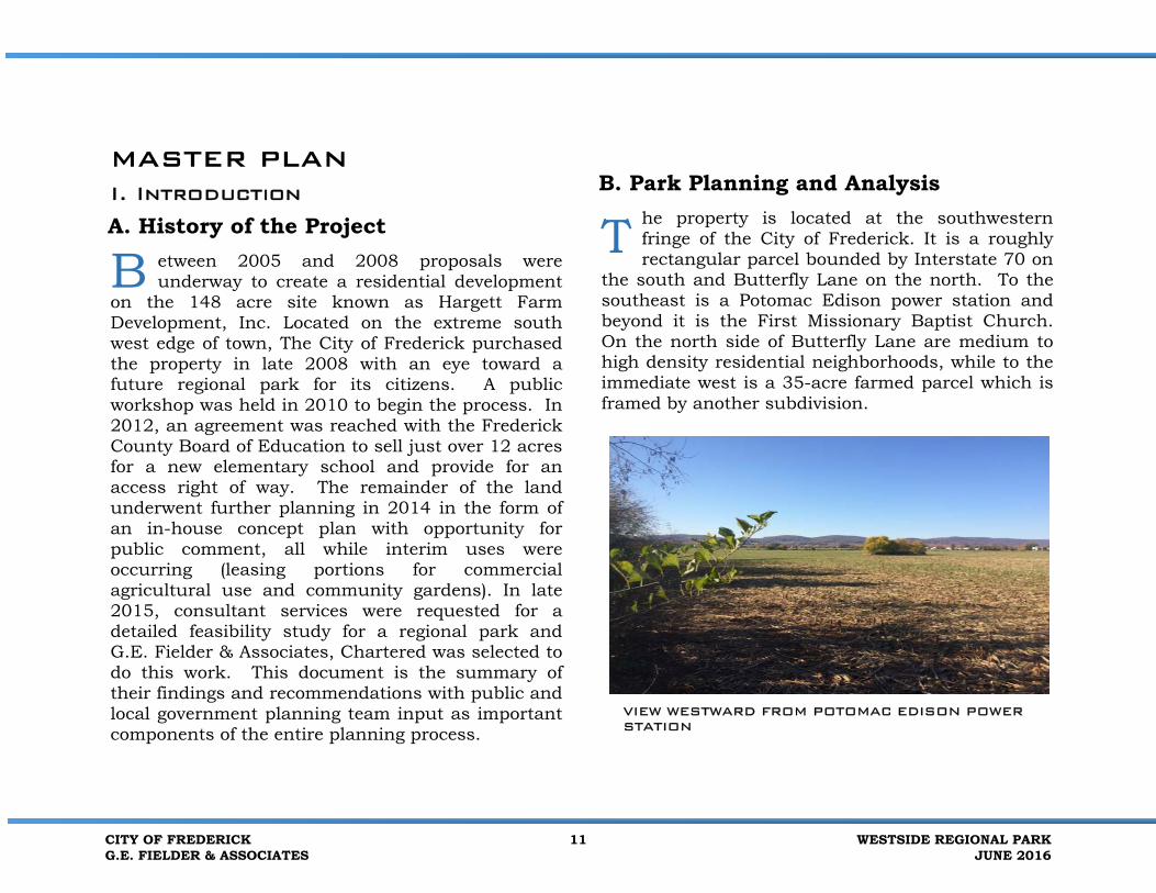
B. Park Planning and Analysis he property is located at the southwesternfringe of the City of Frederick. It is a roughlyrectangular parcel bounded by Interstate 70 on
the south and Butterfly Lane on the north. To the southeast is a Potomac Edison power station and beyond it is the First Missionary Baptist Church. On the north side of Butterfly Lane are medium to high density residential neighborhoods, while to the immediate west is a 35-acre farmed parcel which is framed by another subdivision.
B T
VIEW WESTWARD FROM POTOMAC EDISON POWER STATION
CITY OF FREDERICKG.E. FIELDER & ASSOCIATES
11 WESTSIDE REGIONAL PARKJUNE 2016

FREDERICK COUNTY PARKS
As of the most recent census data of 2010, bolstered by 2014 projections, Frederick County had a population of approximately 243,675 while the City of Frederick, which is the county seat and third largest city in the state, had 65,239. The City boasts of 676 acres of parks and open space including Westside which will be its first regional
park; this total is in the form of 74 individual properties, with the largest being Baker Park that includes an outdoor swimming facility. In Frederick County there are 28 parks, several of which are regional in nature. The closest county parks to Westside are Ballenger Creek Park on the south side of the City and Rose Hill Manor Park on the north.
C. Public Outreach/Input ince acquiring the property, the City ofFrederick has encouraged public inputthrough a series of meetings, questionnaires and workshops. This input helped the City in
refining its request for proposals which ultimately led to G.E. Fielder & Associates, Chartered being chosen to develop a feasibility study and Master
S
FREDERICK COUNTY, MARYLAND
WESTSIDE REGIONAL PARK
WESTSIDE REGIONAL PARKJUNE 2016
12 CITY OF FREDERICKG.E. FIELDER & ASSOCIATES

Plan for the park. Included in the work proposal was further public outreach.
GEF Public outreach included an online questionnaire. Physical boxes with questionnaires were also placed at City Hall, Senior Center, Winchester Hall, Annex, and Talley Rec. in November 2015. One workshop was held on November 10, 2015 at the Recreation and Parks Commission, and a second workshop with the Board of Alderman on April 20, 2015.
In November, 2015, G.E. Fielder & Associates (GEF) conducted an on-line survey of citizens to confirm the interest in various possible facilities. The link to the online questionnaire was placed on the City of Frederick’s website, additionally a link was sent directly to the following organizations in November of 2015:
Asian American CenterCentral HispanoFrederick Chamber of CommerceFrederick Community CollegeFrederick County Public Schools PTAFrederick Memorial HospitalFt. DetrickHood CollegeRotaryUnesco Center for Peace
GEF also sought input from students at West Frederick Middle School and held a design charrette with them in teams to teams to design playground and splash park concepts.
D. Joint Use Considerations with future Butterfly Ridge Elementary School
n the past, several schools in the FrederickCounty school system have developed OperatingAgreements for shared use of school
recreational facilities. In this case, the future Butterfly Ridge Elementary School will be surrounded by a park with varied facilities that it may want to use. For example, an agreement may be developed to address student use of the athletic fields, the trails and possibly one of the display gardens. During non-school hours, park event attendees may wish to use some of the school’s 150 parking spaces. It has already been acknowledged that the access road (extension of McCain Drive) to the school will be available as a park entrance road. This access has been modified as part of the Master Plan to better preserve the existing views and environmental elements of the park. The access to McCain, from the park that also provides access to the school has been realigned in the Master Plan to better accommodate the proposed land uses within the Westside Regional Park. The realignment of the internal roadway, allowed for two important things to occur, one the retainage of the farm pond, and secondly the retainage of the farmstead.
I
CITY OF FREDERICKG.E. FIELDER & ASSOCIATES
13 WESTSIDE REGIONAL PARKJUNE 2016

II. Site Description and Analysis
A. Existing Site Conditions and Easements
he farm is almost entirely open land, with approximately 90 acres under cultivation for corn, soybeans and wheat. There is a cluster
of buildings on the northwest edge, adjacent to the future elementary school site, which includes all the barns, sheds, silos, tenant house and main house from the many years of the property as a working farm. To the immediate east is a community garden area and individual plots that have been permitted as an interim use. The eastern 40 acres contain a storm water management pond and evidence of previous grading associated with the defunct residential development; this has all succeeded to old field conditions. A proposed relocation of the eastern section of Butterfly Lane will bisect this end of the property.
The land is very gently sloping in the general direction of I-70, from north to south. The highest elevations are near the old farmstead at 467 feet above
sea level. The lowest elevation of 421 feet is located in the extreme southwest part of the farm, adjacent to I-70. This lower north-south trending area is somewhat of a channel for noise from the interstate. The prevailing winds are from the northwest and one can assume that the farm buildings were placed so as to shield the lane from the winter blowing snows. There is one small farm pond south of the structures and a small first order stream which ultimately drains into Ballenger Creek, on the south side of I-70.
Existing easements and other agreements are a
T
CITY OF FREDERICKG.E. FIELDER & ASSOCIATES
15 WESTSIDE REGIONAL PARKJUNE 2016
part of existing conditions that need to be described. They include the proposed realignment of Butterfly Lane on the northeast of the property, the existing 50-foot wide power line right of way on the eastern end of the property, the road access into the future Butterfly Ridge Elementary School which can be shared by the future park, and the agreement to have afforestation areas set aside that resulted from the subdivision for the school. Program Open Space funds were used to help acquire the property. One very old easement that was discovered related to a radio tower in the 1930’s but no real evidence of it exists any more. Another agreement on the park site is the right to erect and maintain snow fence around the farm pond and in a line within 100 feet from I-70, although this has never been done. The City will retain for future use the triangular sediment control pond which is in the northeast corner of the park.
Finally, the City wishes to construct a salt barn for winter road maintenance. It will be located next to the power substation with access from relocated Butterfly Lane. The barn-like exterior will be in keeping with the farm theme of the other structures and it will somewhat visually buffer the substation.
The property is zoned PRK and R-4, all anticipated uses are permitted. The properties north of the site are zoned R-12, IST and R-8; to the east are IST and R-3(Potomac Edison Substation). To the south is I-70 and to the west is AG.R-3 and AG are Frederick County zoning classifications.
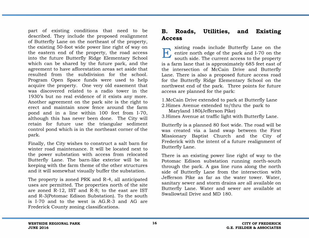
B. Roads, Utilities, and Existing Access
xisting roads include Butterfly Lane on theentire north edge of the park and I-70 on thesouth side. The current access to the property
is a farm lane that is approximately 685 feet east of the intersection of McCain Drive and Butterfly Lane. There is also a proposed future access road for the Butterfly Ridge Elementary School on the northwest end of the park. Three points for future access are planned for the park:
1.McCain Drive extended to park at Butterfly Lane2.Himes Avenue extended to/thru the park to
Maryland 180(Jefferson Pike) 3.Himes Avenue at traffic light with Butterfly Lane.
Butterfly is a planned 80 foot wide. The road will be was created via a land swap between the First Missionary Baptist Church and the City of Frederick with the intent of a future realignment of Butterfly Lane.
There is an existing power line right of way to the Potomac Edison substation running north-south through the park. A gas line runs along the north side of Butterfly Lane from the intersection with Jefferson Pike as far as the water tower. Water, sanitary sewer and storm drains are all available on Butterfly Lane. Water and sewer are available at Swallowtail Drive and MD 180.
E
WESTSIDE REGIONAL PARKJUNE 2016
16 CITY OF FREDERICKG.E. FIELDER & ASSOCIATES

One significant road issue is the City’s proposed relocation of Butterfly Lane that would impact the whole eastern corner of the property and separate several acres from the rest of the park. A roundabout could be used in the realignment. There is also the possibility of an expansion of I-70 in the distant future.
C. Flora and Fauna ther than ditches and hedgerows, woodedbuffers to I-70, and the few specimentrees around the homestead, the property is devoid of major trees or anything
approaching forest. There are three diminutive wooded stretches near the interstate border which are predominantly osage orange with some persimmon, black locust, Bradford pear, hackberry, tree of heaven, red cedar, black cherry , sweet cherry, paulownia, mulberry, oak, black willow, black walnut and American elm. The understory is largely bush honeysuckle, while oriental bittersweet and poison ivy vines extend into the canopy. Osage orange was used historically as a living edge in farming in this area.
Around the farm buildings are eight ornamental trees of 30 inches or more in diameter, in fair to poor condition. Species include Siberian elm, Norway maple, black locust, red oak, black walnut and Chinese chestnut.
The farm pond to the south of the barns includes various hydric species such as black willow, cattail and tussock sedge. Approximately one-half acre along the park’s southern border with Potomac Edison is filled with aggressively spreading Bradford pear seedlings, which will begin to overwhelm the fields unless controlled.
Animal species present on site are typical of those found along the interface of Maryland’s Piedmont and Blue Ridge physiographic regions. Signs of mammal species observed include groundhog, opossum, gray squirrel, raccoon, cottontail rabbit and red fox. White-tailed deer are abundant.
Bird species observed include white breasted nuthatch, Carolina chickadee, tufted titmouse, barn and tree swallow, downy and red-bellied woodpecker, yellow shafted flicker, indigo bunting, eastern bluebird, cedar waxwing, turkey vulture, black vulture, red-tailed hawk, broad winged and sparrow hawk, common crow, blue jay, European starling, house, field, song and white-throated sparrow, slate-colored junco, cardinal, mockingbird, catbird, eastern kingbird and Acadian flycatcher.
O
PERSIMMON TREE
CITY OF FREDERICKG.E. FIELDER & ASSOCIATES
17 WESTSIDE REGIONAL PARKJUNE 2016

There are no records of any rare, threatened or endangered species occurring on the property.
D. Site Hydrology estside Regional Park is located just south ofthe divide separating the Carroll CreekWatershed from the Ballenger Creek
Watershed. Ballenger Creek itself has an average Benthic Index of Biotic Integrity (BIBI) of 2.95, which is considered poor, indicating that insects sensitive to water pollution are generally not present.
A first order stream runs in a north-south direction from the farm pond toward I-70 and beyond. About 200 feet of stream channel can be found in the southwest corner of the property, also leading toward Ballenger Creek. The 1,750 linear feet of streams on the property are ephemeral or intermittent. They do not run year round. In addition, the longer stream appears to have their course modified somewhat in order to facilitate agriculture over the years. There are four small isolated wetlands located along the ditch/stream that drains the central portion of the property, including the pond itself. All possess the three hydrologic indicators which are: wetland soils, wetland vegetation and presence of water on the surface or within a foot of the surface
The only other wetland feature is a stormwater management pond, roughly triangular in shape, approximately 6-10 feet deep in the extreme north eastern corner, next to Butterfly Lane. It is currently unused and empty.
E. Land Use, Views and Vistas n the one mile wide area between I-70 and Route 40 (Patrick Street), Westside RegionalPark is the most significant parcel of remaining open space. The property sits just south of
medium to dense residential use, while on the immediate west is a 35-acre farm and more residential use. Several things stand out in the surrounding landscape, one of which is a large Frederick City water tower, on the north side of Butterfly Lane. The other utility feature is a six-acre Potomac Edison substation and its associated power line right of way. Beyond that, the tall steeple of the Baptist church can be seen. Connecting it to the City of Frederick, which is known for its spires.
The most notable feature that can be seen from the property is the extensive view of the gentle undulations that make up Catoctin Mountain about a mile away on the south horizon. Because the property is so open and flat, this vista is very prominent and is a significant visual asset. Another positive factor is that the I-70 corridor cannot be seen from the park because it is significantly lower in elevation. Another important visual feature of the park is the farm complex and its three silos.
W I
South of pond
WESTSIDE REGIONAL PARKJUNE 2016
18 CITY OF FREDERICKG.E. FIELDER & ASSOCIATES

CITY OF FREDERICKG.E. FIELDER & ASSOCIATES
19 WESTSIDE REGIONAL PARKJUNE 2016

1. BUTTERFLY LANE DRIVING EAST SITE IS ON RIGHT
2. Looking east to md 180 from bank barn.
2. Looking south from bank barn towards mountains.
2. Looking north from bank barn to butterfly lane 2. Looking West from Bank Barn to Mountains.
The numbered photographs on this page relate to the Views & Vistas Plan on the following page.
WESTSIDE REGIONAL PARKJUNE 2016
20 CITY OF FREDERICKG.E. FIELDER & ASSOCIATES

CITY OF FREDERICKG.E. FIELDER & ASSOCIATES
21 WESTSIDE REGIONAL PARKJUNE 2016

F. Geology, Soils and Slopes ocated very close to Catoctin Mountain, the property is just east of Maryland’s Blue Ridge
Province and near the western fringe of the Lowland Section of the Piedmont Plateau Province. The Lowland Section of the Piedmont extends from Woodsboro, Walkersville and Frederick City to the eastern slope of Catoctin Mountain. It is characterized by gently rolling terrain and slow-
flowing streams, a consequence of the relatively weak and erosive nature of the New Oxford Formation. These relatively soft sedimentary rocks often form deep soils. The park sits atop this formation. The rocks here date back to the Triassic Period (over 200 million years), roughly corresponding to the time the European and North American plates diverged, forming the proto-Atlantic Ocean. They consist of red and grey sandstone, siltstone and shale, and quartz and limestone conglomerates. The estimated thickness of the New Oxford formation is 4,500 feet. The soils at the park are relatively homogeneous; with Penn-Reaville silt loams underlying 88 percent of the site. Readington silt loam underlies 10 percent, which is where the soft swales are located and where vegetation is more likely to be forest than agriculture. The Klinesville soils are restricted to 1 percent of the property along the Interstate 70 right of way, while the Penn-Reaville-Urban land complex occupies 1% along the graded interface at the property’s northern border with Butterfly Lane. None of the soils present are highly erodible. Penn-Reaville and Readington silt loams together underlie 98 percent of the site. They are considered limited for accommodating roadways, buildings with basements and other excavations because of shallow depth to bedrock or to saturated soils.
L
SOIL SAMPLE
WESTSIDE REGIONAL PARKJUNE 2016
22 CITY OF FREDERICKG.E. FIELDER & ASSOCIATES
G. Cultural Resources
he City of Frederick and much of the county have extensive cultural resources,
both historical and archeological. In fact, within a two- mile radius of the park, there are 55 previously reported sites. The project property, formerly known as the Albert Hargett Farm includes a late nineteenth/early twentieth century farm complex that is found in the Maryland Inventory of Historic Property listings.
EAC archeology did a late 2015 preliminary study to assess the archeological sensitivity of the Westside Regional Park property. A surface inspection of the property was part of the contract. This research and companion document concluded that much of the southern and central portion is classified as sensitive for prehistoric archaeological resources. In addition, there are three areas of sensitivity for historic period resources. These include the existing cluster of farm buildings and another area to its northwest where an earlier 19th century building may have been. There is also an area of concern to the south and east of the farm pond and one along the eastern portion of the I-70 boundary.
There is relatively low potential for Civil War related sites, despite known troop movements and three periods of encampments documented in the vicinity. There appears to be no remaining potential for intact archaeological sites in the
northeast area where extensive grading was done for the proposed residential development.
The early twentieth century farmstead includes a farmhouse and tenant house, dairy barn, outbuildings and silos, in various states of repair. These features have been studied as part of the planning process to determine the likelihood of reusing them and making them a centerpiece of the park experience. Historic farms have been successfully repurposed in many ways all over the country and there are several examples in the Frederick area.
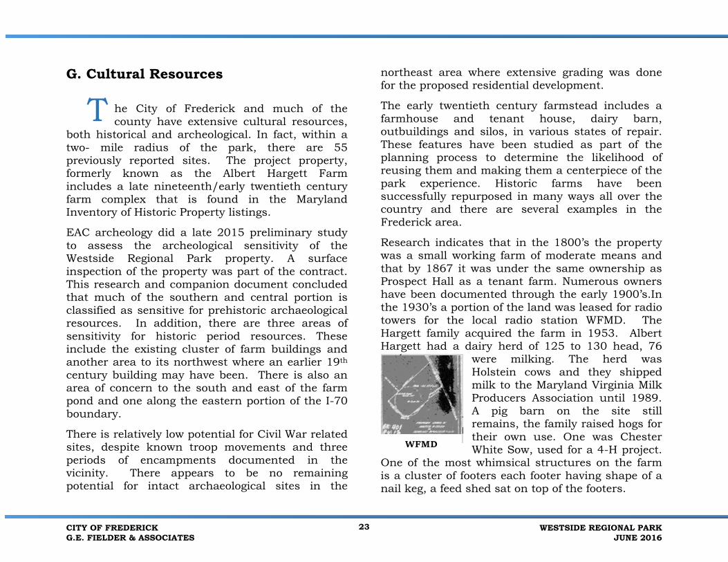
Research indicates that in the 1800’s the property was a small working farm of moderate means and that by 1867 it was under the same ownership as Prospect Hall as a tenant farm. Numerous owners have been documented through the early 1900’s.In the 1930’s a portion of the land was leased for radio towers for the local radio station WFMD. The Hargett family acquired the farm in 1953. Albert Hargett had a dairy herd of 125 to 130 head, 76
were milking. The herd was Holstein cows and they shipped milk to the Maryland Virginia Milk Producers Association until 1989. A pig barn on the site still remains, the family raised hogs for
White Sow, used for a 4-H project. One of the most whimsical structures on the farm is a cluster of footers each footer having shape of a nail keg, a feed shed sat on top of the footers.
T
CITY OF FREDERICKG.E. FIELDER & ASSOCIATES
23 WESTSIDE REGIONAL PARKJUNE 2016
WFMD their own use. One was Chester

SITE
VIEW FROM THE FARMSTEAD TO OPEN FIELDS
VIEW FROM INSIDE THE SILO
WESTSIDE REGIONAL PARKJUNE 2016
24 CITY OF FREDERICKG.E. FIELDER & ASSOCIATES

The feed shed was sold and the shed moved to another part of the City on Butterfly Lane. Small portions of the farm were sold or put under easement over the years. These include the I-70 easement for snow fence. An easement for the WFMD radio tower that was constructed on the site
(three steel I-Beams remain near the pond) was used for broadcasting from the late 1930’s to early 1940’s. The small brick building that was used for broadcasting is still
believed to be located on Butterfly Lane, although not on the site. A portion of the site was sold to Potomac Edison for a substation and an easement for transmission lines. Land records recorded the 2009 acquisition by the City of Frederick. The City purchased the property for a park.
H. Opportunities and Constraints he overall gentle terrain of the park is certainly an opportunity worth noting and this will make active recreational activities
relatively easy to develop. The farmstead itself is both an opportunity and a constraint in that it can define the overall sense of place and be the signature event space, but the economic realities of repurposing the buildings are significant. The views of Catoctin Mountain are a major positive feature that dominate the southeastern horizon.
An existing blue painted water tower on the north side of Butterfly Lane dominates the views from inside the park when looking north.
Three logical access points present themselves as opportunities, two from Butterfly Lane, and a third at Maryland 180 following the extension of Butterfly Lane. One is at the proposed school road at Mc Cain Avenue extended which allows joint use for the park; the other is across from Himes Avenue at an existing traffic light. The two wetland/intermittent streams and the farm pond are certainly development constraints, but they can become natural area focal points for the park.
Noise from I-70 is a minor constraint in the southern quarter of the property. The overhead power line running north-south on the east end, the triangular storm water management basin, and the future relocation of Butterfly Lane from Jefferson Pike are all constraints to development on the eastern part of the farm.
I. Needs Assessment and Public Input his significant parcel of property on thesouthern border of The City of Frederick canfill numerous recreational and open space needs for area residents. Since 2008, a series
of ideas have been explored as the needs and desires of the citizens have evolved. The most current economic study and public input show that an aquatic facility, multipurpose complex and open space activities are priorities. Both the aquatic and
T T
CONCRETE NAIL KEG
CITY OF FREDERICKG.E. FIELDER & ASSOCIATES
25 WESTSIDE REGIONAL PARKJUNE 2016

multipurpose components can act as major funding generators. A review of other regional facilities representative of the desired components show positive economic potential.
In 2010, the City of Frederick held a workshop to start looking at the most wanted activities for the future park. These included jogging/hiking trails, picnic pavilions, playgrounds, multi-purpose fields, and an indoor aquatic center. In 2013 Frederick County did a needs assessment survey to shed light on what the citizens felt were the most needed recreation options. Among the most wanted opportunities were trails, playgrounds, swimming facilities both indoor and outdoor, and natural areas. As referred to in the Executive Summary, a final Frederick City citizens’ survey was done in November, 2015 as well as Workshop to determine what the City’s citizens were most interested in seeing throughout their park system. The most popular answer was an aquatic center. Others were community center, lighted sports fields and walking/biking trails.
The public showed the most interest in three main categories: multipurpose, aquatics and open space activities. They also wanted something different. About 2/3 of the 335 survey responders were City residents, over 40% had children under the age of 19. Sixty-seven percent of those surveyed preferredan aquatic facility to a community center.
Ten Trends in Westside Regional Park Questionnaire •About 2/3 of respondents live in the City of Frederick
•42% of the families who responded have people under the age of 19•Almost 50% of respondents and their family members do not
currently use aquatic facilities •41% of those who currently use aquatic facilities pay $5-$10 daily•An Indoor Pool (19%), an Outdoor Pool (15%), and a Lap Pool (13%)
were the top three selected features for a new Aquatic Facility •25% of respondents would use the Aquatic Facility daily Year Round,
22% answered that they would use it daily during the Summer • A Fitness Center (19%), a Gymnasium (15%), a Youth Center (14%),
were the top three selected features for a new Community Center •67% of respondents prefer Aquatic Facility over Community Center•Soccer, Walking/ Biking Trails, and Lighted Fields -top three choices
for Very Important facilities
•Cricket, Bocce Courts, and Pickle ball Court top 3 Not Important
A charrette was held by the GEF/City of Frederick Team in February 2016. Progress was summarized, goals were set, economic analysis was discussed, and three concepts were developed. One was selected as the preferred concept.
WESTSIDE REGIONAL PARKJUNE 2016
26 CITY OF FREDERICKG.E. FIELDER & ASSOCIATES

Water Park:
Students would like to see:
WATERPARK
Students would like to see:
•Soft Ground•Water Towers/Tumble Buckets (1 story and 4 story)•Playground for kids•Train for kids•Lockers, Showers, and Snack Station•Advertisements•Swing Rope over Pool•Splash Pad•Small and Larger kids•Tot Play area – rubber floor•Water slide•Natural Area•Rock water fall – near entrance
G.E. Fielder & Associates, and members of the Frederick City Team, conducted a charrette with a diverse group of students from West Frederick Middle School to gather the child’s preference. Working in teams two plans were developed for Water Park, and two plans for the playground. Plans were scaled drawings from Westside Regional Park.
CITY OF FREDERICKG.E. FIELDER & ASSOCIATES
27 WESTSIDE REGIONAL PARKJUNE 2016

PLAYGROUND
Students would like to see:
•Animal Feeder•Water Fountain•Slides (No Steel Slides)•Rock Wall•Swings/ safety swings•Trampoline•Snack Shack with healthy options•WiFi•Air Pillows•Nature Area•Butterfly Garden/ Dome•Movie Screen•Dance Floor
•Bathrooms•Picnic Area•Vending Machines•Teen Clubhouse with slide that goes to hut•Trees•Chairs•Flower Garden•Monkey Bars, Slides, Swings connected•Maze•Moving Bridge/ Zip line•Recreational Pad for adults and kids•3 loops and slide•Bean Bag chairs•Playground with theme
WESTSIDE REGIONAL PARKJUNE 2016
28 CITY OF FREDERICKG.E. FIELDER & ASSOCIATES
J. Economic Analysis The following summarizes the economic analysis completed for the Westside Regional
Park Master Plan, including a summary of the park’s operating potential, the economic impacts due to the master plan implementation, and a qualitative assessment of the potential economic impacts.
Summary of Operating Potential The following summarizes key findings of the operations analysis.
• Visitation Potential – Based on the marketcontext for the project and similar facilities,total annual visitation to the park isestimated to range from 619,000 to 944,000,with a mid-range estimate of 781,000. Mostof this visitation is due to the Natatorium andthe Stadium / Field Complex. Users of thesefacilities will have a high frequency ofvisitation.
• Earned Revenue Potential - Total revenuepotential in a stable year of operations is $2.8million in 2016 dollars. The natatorium /recreation center has the potential togenerate the most revenue ($1.9 million),followed by the water park ($461,000),stadium / field complex ($300,000) and theFarmstead and Festival Grounds / picnicpavilions ($129.000).
• Operating Expenses - In a stable year ofoperations under the mid-range visitationscenario and assuming full build out of themaster plan, total operating expenses areestimated at $3.3 million. The outdoorwaterpark in particular has high potential toearn sufficient operating revenue to exceed itsoperating costs. The aquatic/recreationcenter and field complex have moderate costrecovery potential and the parklands andfarm area has low cost recovery potential.
• Net Operating Income - Westside RegionalPark operations would operate at a deficit,requiring an estimated $527,000 of annualnon-earned revenue or contributed revenuefor breakeven operations for all major plancomponents. As a city owned and operatedrecreation facility, the city has primaryresponsibility to sustain the operations ofWestside Regional Park. Other public andprivate sources of non-earned revenue maybe possible to support ongoing operations.Non-earned revenue can include a mix ofpossible public and private contributions, inthe form of gifts, grants or in-kind donations.
Economic Impacts Due to Westside Regional Park The following summarizes key findings of the economic impacts analysis.
T
CITY OF FREDERICKG.E. FIELDER & ASSOCIATES
29 WESTSIDE REGIONAL PARKJUNE 2016

• One-Time Economic Impacts of WestsideRegional Park Construction – The on-siteconstruction will have a one-time effect onthe Maryland Economy. This impact isanalyzed at the statewide level since suchmajor construction projects often draw onstatewide construction companies andworkers. During the construction period,which may occur over several years, a totalone-time impact of $189.2 million ineconomic impacts including $71.6 million inwages and salaries; and 1,364 “person years”of employment will be supported in the State.At the Statewide level, these impacts includethe effects on jobs and economic activitywithin and outside of the City of Frederickand Frederick County.
• City of Frederick Economic Impacts – Dueto the nature of local economies, economicimpacts are analyzed and calculated at thecounty level. However, due to the size andcentrality of the City of Frederick inrelationship to Frederick County, much of theeconomic impact would occur in the City.
• Frederick County Economic Impacts – Asthe multiplier effect works its way throughthe local (Frederick County) economy, the netdirect economic activity due to the WestsideRegional Park in a stable year of operationswill generate a total estimated impact of$21.6 million in expenditures, of which $6.6million will be wages and salaries; and 303
total jobs will be supported in Frederick County.
• Regional Statewide Impacts – As themultiplier effect works its way through theregional economy, the direct economicactivity due to the Westside Regional Parkgenerates a total estimated impact of $12.4million in expenditures, of which $3.1 millionwill be wages and salaries; and 188 total jobs,will be supported in the State. At theStatewide level, these impacts include theeffects on jobs and economic activity withinand outside of Frederick County.
• Fiscal Impacts – An estimate of selected taxtypes to City, County and State governmentdue to the proposed Westside Regional Parkwas prepared. This includes direct taxes andtaxes due to the multiplier effects. On-siteand off-site expenditures by visitors to thePark would generate sales, amusements,hotel and income taxes. Such spending hasthe potential to generate mid-range annualfiscal revenue of $213,000 in hotel,amusements and income taxes to FrederickCounty. The City of Frederick’s estimateddistribution of local income taxes is $60,000.An estimated $304,000 in sales and incometaxes would accrue to the State of Maryland.
WESTSIDE REGIONAL PARKJUNE 2016
30 CITY OF FREDERICKG.E. FIELDER & ASSOCIATES

Qualitative Assessment of Potential Economic Impacts
Aside from the potential economic impacts and fiscal revenue generation potential, the community development benefits of Westside Regional Park may have the most profound and long lasting impacts on the community. Westside Regional Park will create a new, high-quality, recreational and leisure-time destination in the City of Frederick that will bring additional tourists to the community, thereby enhancing it as a visitor destination. The development and operation of Westside Regional Park will support the expansion of the sports tourism economy in the City of Frederick and in Frederick County. The stadium, field complex, outdoor waterpark, and aquatic/recreation center will become part of the array of attractions in the City that attracts visitors from outside of the City and out of County. In addition to attracting out of county sports events to the area that would not otherwise visit, the major program components have to influence travel behaviors of existing visitors by encouraging additional spending at local businesses and attractions, extending stays in Frederick County, and encouraging repeat visitation. Westside Regional Park can support commercial revitalization of the Golden Mile and act as an anchor attraction in the City, creating a new steady flow of visitors and spending potential for area businesses. As indicated by numerous studies of the economic value of parks, the creation of this
signature park has the potential to enhance property values in the City, thereby increasing property tax revenues to the City. Westside Regional Park will contribute to quality of life among residents in the City and beyond, will become a source of community pride and identity and will enhance the region as a place to live, work, and recreate, thus improving all aspects of the local economy and community.
Consult Econ is a part of the GEF team that analyzed the resident and tourist markets for an indoor and outdoor aquatic facility, a field sports complex, and a repurposed historic farm complex.
The Economic Study is in the Appendix.
K. Traffic Analysis nother consideration is a detailed traffic impact analysis which was prepared in
November 2015, by The Traffic Group. As detailed in the Traffic Impact Analysis contained in the Appendix. The study shows that the majority of the intersections will operate acceptably (two intersections is projected to have minor delays) based on the following improvements:
1. Both Capital Projects at the intersection ofMD 180 at Butterfly Lane and at theinterchange of MD 180 at US 340.
2. A five-lane section of realigned Butterfly Laneto include two through lanes in each
A
CITY OF FREDERICKG.E. FIELDER & ASSOCIATES
31 WESTSIDE REGIONAL PARKJUNE 2016

direction plus a two-way center turn lane from MD 180 to Himes Avenue.
3. The construction of a two-lane roundabout atthe intersection of Butterfly Lane/ realignedButterfly Lane and Himes Avenue.
With these improvements, the roadway network surrounding the Westside Regional Park is projected to have acceptable operations.
Study Area
Based on the Scoping Agreement, the following intersections were identified to be included as part of this analysis:
1.Butterfly Lane at Mount Phillip Road;2.Butterfly Lane at Hunting Ridge
Drive/Hillcrest Drive; 3.Butterfly Lane at McCain Drive/Proposed Site
Access; 4.Butterfly Lane at Himes Avenue;5.MD 180 at Butterfly Lane;6.MD 180 at Himes Avenue; and7.Hillcrest Drive at McCain Drive.
Butterfly Lane is a City maintained roadway running in the east/west direction from just west of Mount Phillip Road to MD 180 for a distance of approximately 1.75 miles. The roadway features one travel lane in each direction without a median.
The eastbound portion of the roadway features a travel lane that is approximately 11 feet wide. The westbound roadway, however, is approximately 24 feet wide. Parking is permitted along the north side of the roadway.
Butterfly Lane features a posted speed limit of 30 MPH. Hillcrest Elementary School is located to the north of Butterfly Lane and features School Zone signing along the roadway.
Sidewalk is available along the north side of Butterfly Lane from Mount Phillip Road to approximately 750 feet east of McCain Drive. The sidewalk then continues on either side of Himes Avenue for a short distance. The Westside Regional Park will have trails adjoining Butterfly Lane, the internal park road and Re- aligned Butterfly Lane.
On the south side of Butterfly Lane, sidewalk is available from approximately 300 feet east of Old Stage Road to just west of Hunting Ridge Drive. Since the subject site is undeveloped, no sidewalk is currently available along its frontage.
Each study intersection features stop control with the exceptions of Butterfly Lane at Himes Avenue, Butterfly Lane at MD 180, and MD 180 at Himes Avenue. Those intersections each feature traffic signalization. The primary findings of the report show that all study intersections currently exhibit acceptable levels of service, but when the school and park are
WESTSIDE REGIONAL PARKJUNE 2016
32 CITY OF FREDERICKG.E. FIELDER & ASSOCIATES

developed, a traffic light and turn lanes will be needed at the intersection of Butterfly Lane and McCain Drive.
Another more recent traffic study was done by The Traffic Group in March, 2016 specifically to address the impact that the future regional park will have on the surrounding road network. In summary, the report suggests that the road network surrounding the park will have acceptable operations if several improvements are made. The complete Traffic Impact Study is contained in the Appendix.
L. Traffic Considerations and Way Finding
raffic issues have been studied by a trafficspecialist, The Traffic Group, specifically forthis feasibility study. Butterfly Lane is a City
maintained roadway running east-west from Mount Phillip Road to MD 180, a distance of 1.75 miles. It has one travel lane in each direction and parking is allowed on the westbound, 22 foot wide lane. Park access will be from this road which currently has a traffic signal at the intersection of Himes Avenue. Two entrances will be needed for easy access to different activity areas. McCain Drive extending south to the park and school will be one entrance while the Himes Avenue traffic light will be the other.
Distant signage will be needed on several major roads to direct people to the park and from the
park. This signage is critical for the parks success and ease of out of town users.
T
CITY OF FREDERICKG.E. FIELDER & ASSOCIATES
33 WESTSIDE REGIONAL PARKJUNE 2016

III. Development Plan
A. Overview he development plan as created by GEFevolved from the needs assessment, trafficstudies, economic studies, historical and
archaeological review, existing conditions study, and public and local government planning team input. The process has had multiple reviews along the way. The initial feasibility study components included aquatics, sports field complex with stadium, destination playground, passive open space recreation, and repurposed farmstead.
Multiple development concept schematics were initially discussed in an all-day charrette with the planning team. While many of the elements in each plan had similarities, the layout and scale of the facilities differed.
Ultimately, one concept was refined to include design elements of all the other plans. It incorporates a natatorium and water park, festival space in the farm complex, 11 multipurpose fields, one of which is located in the stadium nestled in a natural bowl area, a loop walking trail, maintenance yard, three
entrances, a 24-foot wide park road with 5 parking areas, and reforestation areas.
B. Master Plan Description he vision for the Westside Regional ParkMaster Plan is dependent on a thoroughunderstanding of the physical attributes of the
land combined with the desires of the citizens of the City of Frederick and their enthusiasm and energy which was evident in the various public outreach
T T
WESTSIDE REGIONAL PARKJUNE 2016
34 CITY OF FREDERICKG.E. FIELDER & ASSOCIATES

efforts. The public said they wanted a park that is different with aquatics, multipurpose and open areas as priorities. They also wanted group areas, walking trails and a 5K trail, and they wanted it now.
The site analysis process which studied the manmade and natural aspects of the property resulted in the opportunities and constraints plan indicating where the site is most developable, what needs to be preserved and what can be enhanced. The views and vistas were the most dramatic aspects of the site, one can look out from the farmstead and see the mountains or look toward the farmstead from points on the property that are more than a quarter of a mile away. These views give the observer a sense of openness that becomes more significant as the surrounding area becomes ever more developed, and this is the feeling that is preserved by the Master Plan. Large footprint uses are placed on the eastern end of the park where higher surrounding densities
already exist, while lower profile uses are on the southern and western portions of the site. The advantages of the natural topography is used to preserve the overall views and the farmstead area.
Overview:
The Master Plan is best discussed by individually focusing on each area starting with the farm
NORTH EAST VIEW OF REFURBISHED FARMSTEAD
CITY OF FREDERICKG.E. FIELDER & ASSOCIATES
35 WESTSIDE REGIONAL PARKJUNE 2016

complex and festival grounds, then the Water Park and natatorium, followed by the multipurpose complex and stadium, ancillary uses such as trails, and finally the maintenance facility. The Master Plan for Westside Regional Park incorporates the vast views of the mountains into the design by clustering areas of forest planting around and near parking lots and away from the high point overlook. The trail system, totaling 5 kilometers, is made up of loops and crossovers. There are 1,735 parking spaces segmented into 5 lots, located close to the areas where patrons would want to park and conveniently walk to activities.
A significant element of the Master Plan is the realignment of Butterfly Lane and its connection to Swallowtail Drive, which results in two larger land bays that better suit the proposed uses. The intersection of Butterfly, Himes and Swallowtail Roads has become a roundabout. A 24 foot wide park access road connects realigned Swallowtail and Butterfly. Vehicular access through the park is limited. The park has four distinct areas described as follows.
1. Farm Complex and FestivalGrounds:
The farm complex that fronts Butterfly Lane is preserved. The plan
retains the buildings with the exception of one which is too dilapidated and has to be removed this former run in shed was for dairy cows, the building roof has partially collapsed. The focal point of the farmstead is the area anchored on the north by the main farm house, on the east by the large dairy barn, and on the west by a line of buildings that block the prevailing winter winds. These buildings were used for storage, equipment, and work shop needs. The line also contains interesting small barrel like footers that remain from a structure of unknown use. The barns are now surrounded by cultivated fields and community gardens. The
PLAZA AT FARMSTEAD – USING EXISTING AREA OF PAVEMENT
WESTSIDE REGIONAL PARKJUNE 2016
36 CITY OF FREDERICKG.E. FIELDER & ASSOCIATES

BANK BARN OVERLOOK
remnant of a bank barn and silo create a ramp approximately 10 feet high that can be an overlook for the excellent views of the site and distant mountains. This area will be preserved and enhanced to formalize those views.
The complex also has a small tenant house, garage and milk house. These core buildings sit in the shadow of a water tower that is across Butterfly Lane at a high point 100 feet east of the main house. The tower dwarfs the farm buildings and dominates the northern horizon when viewing the complex from anywhere in the park except from the west. From that vantage point, the barns and silos break up direct views to the water tower. When the water tower is repainted, this will present a great opportunity for an offsite enhancement to the park. The tower could be painted to look like a hot air balloon that has just landed or is preparing for takeoff. This whimsical idea would add a sense of place, identity and history to the scene. The farm complex space will be enhanced with additional trees, benches and walks, all while preserving as many of the healthy existing specimen trees as possible. Small lights will be placed on the trees for evening activities. Day uses can include farmers markets and craft shows to name just two. Below the dairy barn and east of the bank barn is a large area of concrete that can be repurposed and enhanced as a plaza where activities such as movie night, dancing
and crafts or antique or art shows can occur. One run in shed will be removed but the location of the back wall will be preserved by the construction of a stone wall similar to the wall in the bank barn. This will help to define the space as a fun outdoor room.
Moving eastward beyond the complex and out of the line of sight will be a destination playground approximately 1.62 acres in size. A carousel will adjoin the playground. Rest rooms will be located here. A 106-space parking lot C accessed from the central park road will be used to serve these features. It will be tucked out of sight and screened with landscaping. The repetition of round shapes will echo the round silos and the water tower. Community display gardens will focus on various ethnic styles, framed with trellises, ending with a circle below the small tenant house, for passive enjoyment of the site with shaded seating. The gardens will display the types of vegetables from different ethnic groups in the City as well as an
American Victory Garden. The intent is to learn
CITY OF FREDERICKG.E. FIELDER & ASSOCIATES
37 WESTSIDE REGIONAL PARKJUNE 2016

about other cultures similarities. A companion circle seating area is southwest of the farm buildings to provide views of the pond area.
East and west of the central farm complex are the festival grounds with 6.74 acres on the west and 7.39 acres on the east, flanked by overflow parking. The festival grounds are large enough to have dog shows, car shows, small historic interpretation encampments, apple cider festival, snowman building contest, or sand sculpture contest. Parking in the immediate farm complex zone will be limited.
2. Water Park and Natatorium
The large foot print of the natatorium and the complementary water park are placed at the eastern end of the site, north of the proposed of the realigned Butterfly Lane. This location next to an existing storm water management basin allows for excellent access from MD 180, Jefferson Pike. A 458-car parking lot E is sited between the two uses and allows direct access to both. Utilities such as water, sewer and electric will be extended from the Swallowtail (realigned and renamed Butterfly Lane). The area has several group picnic areas for a central one will accommodate 100 users. Both areas have smaller sites for 30 and 50 people respectively. The power line splits these
two uses and open space buffers are placed on either side of the power line. A trail loop is on the water park side of the power line. This trail provides access to both water based uses from the existing residential developments to the north and the churches and schools to the east. The water park is 2.47 acres, and the natatorium is 1.38 acres which can accommodate a 60,000 square foot structure. The natatorium will look like a farm barn structure with silo accents. The water park could be designed with a natural theme of a forest, or perhaps farm field with corn stalks that drip water and ears of
Natatorium AND MAINTENANCE BUILDINGS WILL LOOK LIKE
AGRICULTURAL STRUCTURES
WESTSIDE REGIONAL PARKJUNE 2016
38 CITY OF FREDERICKG.E. FIELDER & ASSOCIATES

corn that shoot water, the only limit is the imagination.
The results of the public outreach process indicated that the people wanted a park that was different, yet one that offered a wide variety of activities including swimming, Water Park, multipurpose fields and trails that connect to nature, as well as passive open spaces.
3. Multipurpose Sports Complex
The multipurpose complex is located south of the internal park road. There are 11 total fields. Ten have north -south orientation while the 11th field is within a stadium and has a slight north-east orientation. The stadium has been placed in a natural bowl, where its profile will be lower thus preserving the views of the mountains. The stadium is proposed as a horseshoe shape to allow fans to enjoy the great views to the mountains that have been preserved as part of the Master Plan. The slightly rotated orientation will make it easier to view the field of play for both sides, since the spectators will not be looking directly east or west. A 4,000-seat stadium is proposed. It is supported by parking lot A with 648 spaces and further to the north is 152 spaces of parking at Butterfly Ridge Elementary School, which can be accessed if a joint use agreement is developed with the Frederick County Public Schools for non-school hour use. Trails and walkways will provide easy access to the park. A loop trail of 1,800 linear feet will be placed around the stadium to provide an exercise loop for
walkers and an easy connection to the school. There are two multipurpose fields close to the stadium. The remaining eight fields are east of the stadium complex. Parking is provided at a ratio of 70:1 spaces per field. The eight fields have two parking lots, one at either end. Parking lot B has 263 spaces and parking lot D contains 259 spaces. The overall parking ratio for multipurpose is 106:1 which includes the stadium parking.
All fields are 240 x 380 feet which includes a 10 foot safety run-out on all sides. The fields are 40 feet apart on the long sides and 100 feet apart on the short ends. Fields are a combination of artificial and natural turf. The multipurpose complex contains
CITY OF FREDERICKG.E. FIELDER & ASSOCIATES
39 WESTSIDE REGIONAL PARKJUNE 2016

one of the two large group picnic areas for 100 to 300 persons and two smaller areas for groups of under 50 persons. The large group picnic area is located west of the stadium and is partially shaded by solar panels that also take up a portion of the western edge of the parking lot. View studies will be conducted in conjunction with the final grading study to determine the feasibility, exact height, location and quantity of the panels.
4. Maintenance Area
On the south side of the realigned Butterfly Lane at the southeast corner of the site, is the park maintenance complex of 4.82 acres. The maintenance complex will have an internal roadway
system that connects on the west side with the trail system. The maintenance complex contains a salt barn and maintenance building. All the structures on the north and south side of the roadway will be farm like in appearance, so that when you look east from the existing farmstead you see another farmstead. The Maintenance Area provides an excellent resource on the southside of the City of Frederick that is readily accessible from major roadways.
Site Amenities
The elements that bind the park together are the views and vistas that are preserved and enhanced. The parking lots have been placed to be an extension of the forests that will be created on the site using native plant material. A typical Piedmont Maryland forest featuring nine diverse native canopy and understory trees will be created and will be capable of growing and maturing for hundreds of years. The intent is that, with each passing year, the character of the forest evolves to provide an ever-changing learning experience for neighboring school children and adults as well. A forest is proposed for the south west corner of the site, the forest will angle across the pond. The existing farm pond will be enhanced by low growing native trees and shrubs and small flowering trees. A floating dock can be placed on the pond for use by school students and others to study the environment. The forest conservation area of 20.96 acres. The forested area on the southern border is a 75 foot strip, and a 1.48 acre is in the north east
MAINTENANCE AREA
WESTSIDE REGIONAL PARKJUNE 2016
40 CITY OF FREDERICKG.E. FIELDER & ASSOCIATES
corner adjacent to the Potomac Edison station. There is also a 4 acre increase of forest on the south east side of park.
Additional site amenities include restrooms at 5 locations; natatorium, water park, stadium, farm complex and multipurpose fields. There will be a total of 3 large picnic areas, and 5 smaller picnic areas. The trails will be 11 feet wide with 2 feet shoulders. A five- kilometer trail loops through the park which will be accessible to maintenance vehicles.
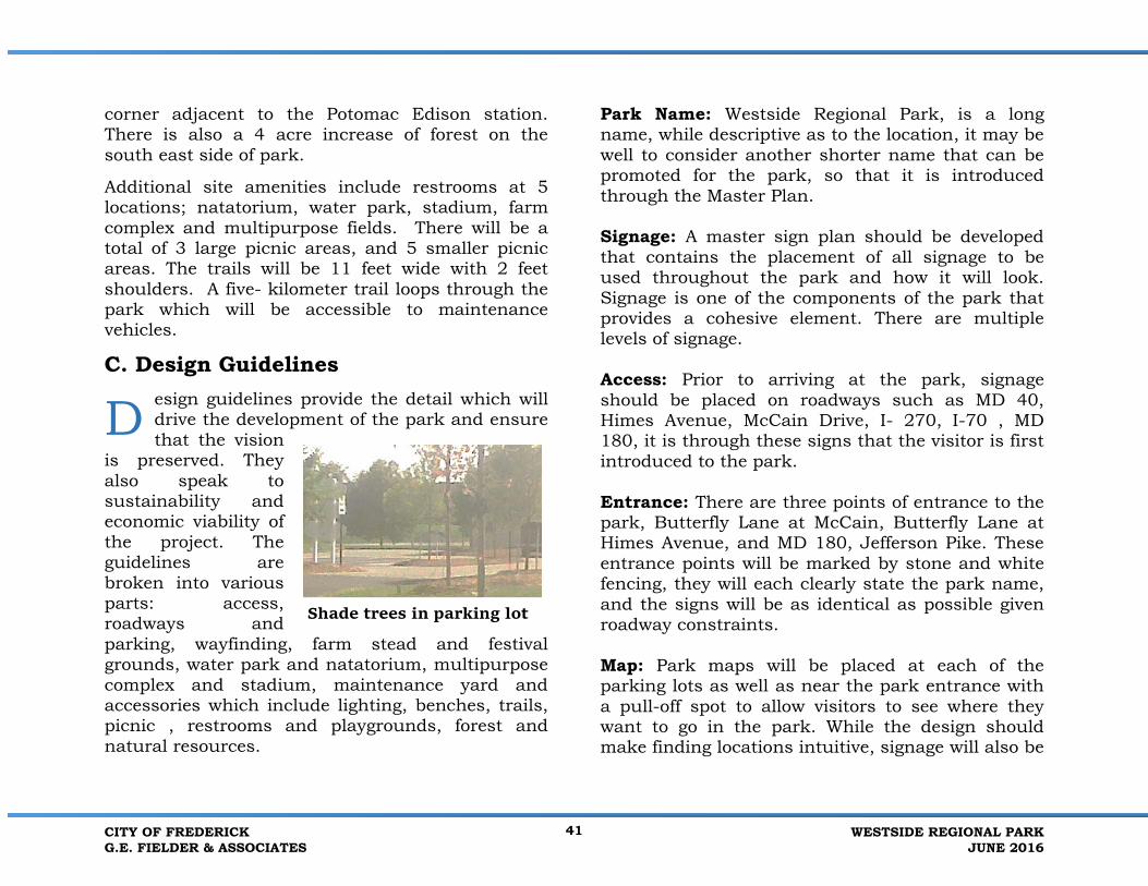
C. Design Guidelinesesign guidelines provide the detail which willdrive the development of the park and ensurethat the vision
is preserved. They also speak to sustainability and economic viability of the project. The guidelines are broken into various parts: access, roadways and parking, wayfinding, farm stead and festival grounds, water park and natatorium, multipurpose complex and stadium, maintenance yard and accessories which include lighting, benches, trails, picnic , restrooms and playgrounds, forest and natural resources.
Park Name: Westside Regional Park, is a long name, while descriptive as to the location, it may be well to consider another shorter name that can be promoted for the park, so that it is introduced through the Master Plan.
Signage: A master sign plan should be developed that contains the placement of all signage to be used throughout the park and how it will look. Signage is one of the components of the park that provides a cohesive element. There are multiple levels of signage.
Access: Prior to arriving at the park, signage should be placed on roadways such as MD 40, Himes Avenue, McCain Drive, I- 270, I-70 , MD 180, it is through these signs that the visitor is first introduced to the park.
Entrance: There are three points of entrance to the park, Butterfly Lane at McCain, Butterfly Lane at Himes Avenue, and MD 180, Jefferson Pike. These entrance points will be marked by stone and white fencing, they will each clearly state the park name, and the signs will be as identical as possible given roadway constraints.
Map: Park maps will be placed at each of the parking lots as well as near the park entrance with a pull-off spot to allow visitors to see where they want to go in the park. While the design should make finding locations intuitive, signage will also be
D
Shade trees in parking lot
CITY OF FREDERICKG.E. FIELDER & ASSOCIATES
41 WESTSIDE REGIONAL PARKJUNE 2016

helpful. An App for a park map could be developed that is downloadable.
Rules: The park rule signs will be placed near each park entrance and at each parking lot. The wording on the signs will address hours of operation, park use, emergency contact procedures, etc.
Interior Park Signs: No parking on roadways or in forest conservation areas, no swimming in pond, no fishing, no skating, no wading.
Facility Signs: Each facility will be clearly labeled, multipurpose fields will be numbered as will parking lots, picnic pavilions, and trail. Emergency call boxes will be clearly labeled. The signage will also provide emergency contact information.
Roadway Signs: The streets follow the naming protocol of the City in type and placement. Speed limit signs should be placed on all park roads. Speed limits interior to the park, including Butterfly Lane and Swallowtail Drive, should be same speed as school zones. Ten pedestrian crossing points are proposed which will be well marked, using Maryland State Highway sign standards.
Fencing, Walls and Barriers: White four board vinyl fencing like the wooden fences that remain at the farmstead and 30 -36 inch dry staked stone walls like those within the City and more closely located at Prospect Hall historic site will be used throughout the park, as shown on the Master Plan. It will be appropriate in some areas to use wire fencing on one side of the white vinyl board fencing to deter climbing.
Gates: The two major access points to the park will be gated, also using white gates with stone posts. The park road will be locked at night just beyond the last school entrance. The natatorium and the maintenance yard will also be gated as will all major parking lots. These entry points can be designed with keyless entries so that the codes can be changed.
SIGNAGE - FARM STYLE
FENCING
Stone walls are planned for the park, like this one nearby
WESTSIDE REGIONAL PARKJUNE 2016
42 CITY OF FREDERICKG.E. FIELDER & ASSOCIATES

Athletic Field Fencing: Barrier fencing for multipurpose fields will be seasonal, and removed or lowered at the end of season or play whichever is appropriate. Limiting the number of poles will be critical to maintaining the view toward the mountains from the farm stead and other vantage point.
Trails: The trails will be 11 feet wide and have 2 feet shoulders and be made of pervious surfacing. The trails will be well marked with trail lengths and difficulty in order to provide users with a sense of comfort as to where they are and how far they have to go to reach a certain point. Segments of trails in forested areas will be limited to shorter distances and avoid understory planting for user safety. A 5K trail loop will include minimal roadway crossings. An App could be developed for the park trails and 5K loop.
Park Road and Parking: The park road will be 24 feet wide in width with no parking on either side. Pedestrian crossing points will be limited to three. The crossing will be striped and well signed with advance signing. Trails will be placed on both the north and south side of the interior park road. There will be no roadside parking. All parking will be in parking lots which will be designed to the City’s parking standards. Each of the five parking lots will be clearly lettered. Park rules will be placed at each parking lot.
Restrooms: The milk house in the farm complex is an excellent size and architectural style for one of the three restrooms to be built on site. The milk house will be rehabbed as a restroom, and will have both interior and exterior connections to the stanchion barn. A second restroom will be placed in the vicinity of the festival grounds parking lot, designed in the size and style of the rehabilitated milk house. The third restroom will be central to the 8 multipurpose fields and be in the same style. There will be three other restroom opportunities, each to be integrated into the design of the stadium, natatorium and the water park respectively.
Playgrounds: All playgrounds will be marked with age appropriate signage, have good visibility, and contain seating for adults and children. Shade will be provided by shade pavilions or by use of trees. Playgrounds will meet or exceed ADA guidelines. The Master Plan contains two playgrounds.
Playground A: This is 7,500 square feet located within the multipurpose complex. This playground will be divided and signed for two different age groups: tot and preteen. The tot lot will be 2,500 square feet and the pre-teen lot will be 5,000 square feet. The playground will include component play pieces and swings, be located near the restroom and picnic pavilion. It may be appropriate to fence the playground.
CITY OF FREDERICKG.E. FIELDER & ASSOCIATES
43 WESTSIDE REGIONAL PARKJUNE 2016

Playground B: This is a 1.62 acre Destination Playground located between the farmstead and the festival grounds. The playground is based on The City of Frederick’s moniker as the City of Clustered Spires, containing scaledreplicas of its numerous spires, City Hall, and the Carroll Creek Carillion. The grouping would have the same
relationship as it does within the City; they will be aligned like City streets in an east west direction where the existing First Baptist Church spire will be able to be seen in the distance. The structures will all be for ground play only and the design should deter climbing. Outside the “City” will be other play components. On the north side of town, the items will be urban in nature, such as a see-saw and/or climbers, on the south side of town the
components will be more rural, like a corn maze, and/or mushroom tops. The Carroll Creek Carillion will have playable bells for children. North of the playground is an ADA accessible carousel; there will be a fee for riding the carousel. The animals on the carousel could be horses, or various farm animals. As discussed earlier in this document, the water tower across Butterfly Lane could be repainted at some point in the future when a maintenance painting is needed to be hot air balloon. This north side of the park will require fencing that will stop a car from reaching the playground and the carousel. A natural stone wall that mirrors those found in Frederick would be the most appropriate barrier.
Picnic Shelters: Shelters are to be appropriate in size for their designated number of users. They will be ADA accessible. Picnic grills will be out from under the shelter and be sited to consider prevailing winds. The structures are to resemble the sheds within the farm complex.
CITY OF SPIRES
RUN IN SHED IS A PERFECT PICNIC SHELTOR –MODEL
BAPTIST CHURCH SPIRE
WESTSIDE REGIONAL PARKJUNE 2016
44 CITY OF FREDERICKG.E. FIELDER & ASSOCIATES

Multipurpose Fields: The multipurpose fields are 240’ x 380’ which includes 10 foot safety run out on all sides. The fields are to be oriented north-south. The fields are to be graded as table tops. They are to be placed 40 feet apart on the long side and 100’ on the short side. Each field is numbered. The field number sign also contains an emergency contact number. The fields are a combination of natural turf and artificial turf. Since these are the first artificial turf fields within the City park system, we recommend the City not use rubber as infill but explore the use of plant-based infill (coconut husk, cork, sand). This should be done closer to the time of the design and construction to take full advantage of advancing technology and thinking. Fields1-8 have a north-south orientation and fields 9-10 are rotated 10 to 15 degrees east to match the orientation of the stadium field. The parking lots and access drives will be built to the City’s standards. In keeping with the farm theme, fences between fields are to be four-board white vinyl. This will give the appearance of paddocks. A maintenance gate will be placed on the end of each field off the central trail. Initial field construction will be natural turf.
Stadium: The stadium contains a 240’ x 380’ multipurpose field and will seat 4,000 spectators. The field will be artificial turf. Seating will be on three sides of the horseshoe shaped stadium that is sited in a natural bowl on the site. Leading to the stadium and its parking is a large 180’ by 300’open space. This not only provides a beautiful entrance
to the stadium, but also can be used during tournaments as a gathering space for teams. The stadium restrooms also will be accessible to the outside fields and group picnic areas. Lower story trees will define the space, and not block the mountain views. Shade structures like pergolas can also be used.
Player benches should be powder coated steel and placed on either side of each field. Bleacher seating for 30 spectators per field are to be placed on concrete slabs.
Water Park and Natatorium: The 2.51-acre space at the intersection of Himes Avenue and Butterfly Lane is highly visible from the realigned Butterfly Lane. An 11 foot wide trail will loop around the water park and provides access to three picnic areas. The water park will have space for office, restroom, showers, and possible concession for the use of guests. There will also be three picnic pavilions in the area, one for 30 persons, one for 50, and one for 100. A direct pedestrian way will lead across the power line and through the parking lot between the two facilities. The natural rise to the site from existing Butterfly Lane should be preserved to reduce visibility from nearby residences.
The 60,000-square foot natatorium is to be designed to resemble an agricultural barn with silo style accents that can be used for meeting rooms and storage. The future design of the natatorium will accommodate an 11-lane competition pool,
CITY OF FREDERICKG.E. FIELDER & ASSOCIATES
45 WESTSIDE REGIONAL PARKJUNE 2016

leisure pool with water slide, lazy river, vortex and zero depth toddler pool. The building will contain restrooms, showers and family changing rooms. A fitness center may also be accommodated.
Parking lots will be built to the City standards with 10 percent green space and required ADA parking. Parking lots will be gated at dusk. Pedestrian connections will link these facilities to the nearby residential neighborhoods, churches and schools.
Maintenance Yard: The 4.82-acre maintenance yard will contain a salt barn (designed to look like an agricultural barn) that is 130’ by 140’ or 18,200 square feet. The openings for the two buildings will face away from Butterfly Lane. The salt barn and maintenance yard access aligns with the access to parking lot E. The 19,750-square foot maintenance building will contain 6,000 square feet for office and storage. Lines of trees, fencing and stone walls will block the view from the entrance road. An interior roadway will connect the yard to the internal trail system so that maintenance vehicles will not have to travel on Butterfly Lane. Permission will have to be sought from Potomac Edison to cross their easement.
Park Accessories:
•Benches – metal benches with wide metal slatesthat complement the vinyl fencing
•Trash and recycling containers- should followthe same theme as the benches.
•Water fountains; ADA accessible with cut offvalves for winter shut downs. Pet fountains could be added to some water fountains.
•Pedestrian bridges should be either stone orwood and able to carry emergency and/or maintenance vehicles
•Safety lighting lights should be full cut offlighting, security lights only since the park operates at dawn to dusk.
•Sports Lighting : full cut off lighting with polesthat provide lights to multiple fields at the same time
•Call Boxes should be placed at each parkinglot, call boxes can be solar powered. Signs at the call boxes should provide information as to where it is located.
•Solar Panels can be usedin parking lots and also to provide shade for picnicking at the southeast corner of parking lot A.
D. Natural Resources Management he existing wetlands will be preserved and enhanced and runoff will be effectively managed throughout the site. Areas have been
T
WESTSIDE REGIONAL PARKJUNE 2016
46 CITY OF FREDERICKG.E. FIELDER & ASSOCIATES

set aside to be planted in trees to act as a visual and noise buffer from I-70 and adjacent roads but also as habitat enhancement. Areas will be planted to simulate a forest as it grows and will include ground cover, understory and canopy layer plants. Some evergreens will be used for diversity. The few very large trees on the site will be protected during construction and incorporated into the design. Some of the recommended species include: shagbark hickory, black gum, red maple, sugar maple, pin oak, sycamore, white pine, yellow poplar, American holly, red cedar, witch hazel, halesia, redbud, shadbush, spicebush, viburnum, persimmon, pawpaw and apple trees. Ground cover species will include hay scented fern, Christmas fern, black cohosh and pockets of spring ephemerals such as spring beauty, trillium and Dutchman’s breeches, bluebells, common milkweed, in sun pockets.
One overarching design principle of the plan is to protect the special view of Catoctin Mountain when locating the forested areas.
E. Programming he facilities are only infrastructure,programming is the next step. The overallsuccess of the park will depend on detailed
programming ideas. Programming will be the responsibility of the City of Frederick, Parks and Recreation Department. The Westside Regional Park with its large variety of natural and man-made facilities provides tremendous opportunities, from
nature interpretation to hiking and biking, as well as various formal sport playing. The festival sites provide opportunities for activities such as kite flying, cider festival, strawberry festival and even an ice cream festival, where vendors could compete for the grand prize. After all it was a dairy farm.
F. Sustainability ustainable Sites Initiative (SITES) definessustainable design as “design, construction,operations, and maintenance practices that
meet the needs of the present without compromising the ability of future generations to meet their own needs” (SITES 2009). Sustainable sites are designed with respect to both human and natural ecosystem that are highly site-specific, reduce the demand on natural resources, and provide benefits such as clean water and opportunities for social connection. The Master Plan embraces this sustainable approach and can be exemplified in the following topics:
Sustainable Environment The Master Plan process for Westside Regional Park layered existing site conditions such as topography, hydrology, soils, ecology, views and land use to enhance existing advantages of the site while also limiting disturbance of soils and local ecosystems. The resulting plans limit the impact to the environment, reduce the amount of paving, and retain the existing farmstead, use natural features like the sites bowl for the proposed stadium, flat
T
S
CITY OF FREDERICKG.E. FIELDER & ASSOCIATES
47 WESTSIDE REGIONAL PARKJUNE 2016

areas for multi-purpose fields and by placing the Water Park and natatorium on the eastern side of the property where there are more intense uses. Festival grounds preserve to farmsteads historic setting and provide much desired unstructured open space. The main house will still have a commanding view of the access and barns. The entire design has taken into account ease of sustainability and builds on the sites history, where farming practices placed structures on high points with north-south orientations and rows of sheds were placed to block the northwest winds and drifting snow to keep the farm lane open. The sun rotates providing full light in the milking barn. The Master Plan builds on these practices, orienting fields and buildings north-south.
Sustainable Natural Resources The inevitably increasing amounts of impervious surface in growing urban areas create more pollution and stormwater issues downstream. Stormwater quality and quantity will be improved throughout the site. Installing porous pavement in the parking lot areas will help reduce stormwater runoff and recharge groundwater reservoirs. Swales, tree plantings and micro-bio retention areas located throughout the site will infiltrate stormwater runoff, breakdown pollutants and reduce sediment erosion and peak discharges into waterways. Future restrooms located throughout the park can conserve water through water-efficient toilets and sinks. Solar panels will be placed on the
southwest corner of parking lot A. Call boxes located at major parking lots can be solar powered.
Sustainable Materials Materials will not only be selected to reflect the site’s historic culture but also for their durability and low-maintenance costs. The stone walls located on the edge of parking lots will help enhance sightlines without requiring the regular maintenance that typical planting beds require. The vinyl fencing located around the multipurpose fields will be durable and does not require routine re-painting. Durability of the fence will also be enhanced by placing the posts on the exterior of the side of the field away from incoming sports balls. When sports balls do hit the fence, they will only drive nails deeper into the post.
Sustainable Community The Master Plan promotes safety, equitable access, and numerous opportunities for outdoor physical activity in order to improve human wellbeing and to help build a stronger community. Throughout the site, techniques such as safety lighting, clear signage, open sightlines and wayfinding provide for user sustainability where repeat visits will be the norm. ADA accessibility will also be provided throughout the site including the pathways and playgrounds. All playgrounds will be specialized for different interests and age groups.
WESTSIDE REGIONAL PARKJUNE 2016
48 CITY OF FREDERICKG.E. FIELDER & ASSOCIATES

Sustainable Design Guidelines
The sustainable design guidelines discussed in Section III provide the detail which will drive the development of the park and ensure that the vision is preserved. They also speak to sustainability and economic viability of the project. The guidelines are broken into various parts: access, roadways and parking, wayfinding, farmstead and festival grounds, waterpark and natatorium, multipurpose complex and stadium, maintenance yard and accessories which include lighting, benches, trails, picnic, restrooms and playgrounds, forest and natural resources. Management of Westside Regional Park will develop over the years as the phasing is implemented. The City of Frederick initially will manage the park from off-site using existing maintenance personnel. The site will be checked daily, and facilities such as the barns and houses, will be locked every evening or remain locked based on park functions. Gates will be placed at all entrances from Butterfly Lane and realigned Butterfly Lane.
NATIVE BLACK EYED SUSAN
CITY OF FREDERICKG.E. FIELDER & ASSOCIATES
49 WESTSIDE REGIONAL PARKJUNE 2016

IV. Phasing Plan with CostEstimates
A. Phasing primary goal of the phasing plan is first to create a stand-alone facility that can generatefunds to help make the burden of other capital expenses easier. Certain interim uses
can occur immediately, beyond the gardens and commercial agriculture uses.
The phasing recommendations contained herein are based on cost effective construction methods and direct economic benefits. Major costs are grading, roads, utilities and individual facilities.
The Master Plan is broken into 4 distinct areas festival, aquatic, athletic and maintenance. The layout provides acres for the festival area which includes the farm stead and for the aquatic area to existing Butterfly Lane in its current alignment. The planned realignment of Butterfly Lane to MD 180 via Himes Avenue.
The Master Plan presents immediate opportunities for use with little financial investment on the part of the City. The 6.4 Festival A acre portion of the festival site of the intersection with McCain Drive can be accessed from Butterfly Lane. The layout the festival area could be fenced off from the farmstead. Renters of the area can provide port-a- pots and
parking can be placed, in a portion of the field and activities in the other. Power exists on poles in Butterfly Lane, and can be brought into the site. Using a portion of this site immediately will provide much needed exposure for future development. This portion of the site will have minimal change in grade. The second phase should include a mass, grading of the site. The plan will have to consider the 20-acre limit and Stormwater Management regulations. Grading will encompass less than 110 acres of the site, this excludes approximately 10 acres of the festival and homestead. The first 20 acres of grading should include the area of the water park. Once grading of the water park area is completed pad sites can be accessed temporarily from the existing Butterfly Lane. When the realignment of Butterfly Lane from Himes, to MD 180 is complete access from this roadway will be utilized. The utilities can be brought from MD 180 that exist at the Baptist church. The realignment opens access to the future maintenance yard and salt barn.
The athletic field area can be broken into two areas; area 1 is 8 fields and two parking lots with ancillary trails and picnic areas. The area set aside for three more fields and a potential stadium is the final section.
5K the trails that make up the 5K will be completed with each section. When the final section is graded
A
WESTSIDE REGIONAL PARKJUNE 2016
50 CITY OF FREDERICKG.E. FIELDER & ASSOCIATES

the two pedestrian bridges will be completed as will the trails to complete the circuit.
The construction of realigned Butterfly Lane to MD 180 Realignment of Butterfly Lane will provide opportunities for exposure to the interior of the site, however as designed, the Master Plan provides opportunities for immediate use and access to the festival, natatorium and water park and farmstead. The realigned Butterfly Lane is not part of the Westside Regional Park costs. Signage will be provided for the park as part of the costs and is allocated in the Internal Road budget.
B. Cost Estimate: The cost estimate is based on industry standards as well as detailed take offs. The detailed take offs include square feet of pavement depth of pavement, numbers of trees, length of trails, quantity of bio retention areas, square footage of disturbance, cubic yards of earth being moved, and the anticipation of a balanced site. The following is a summary of the costs for each of the site areas, as well as the internal roadway and forest conservation.
The cost estimate includes approximately $33,300,000 in contingencies including design, bonding, insurance, overhead and general conditions. The design contingency is based on the complexity of the area being designed, for instance the Natatorium is more complex than the Maintenance Yard.
The cost estimate is contained in the Appendix in its entirety.
DESCRIPTION AMOUNT
Forest Conservation $484,880 Internal Park Road $2,024,435 Water Park and Natatorium $46,076,883 Farmstead and Festival Grounds $13,637,634 Stadium and Multi-Purpose Field Complex $27,824,366 Maintenance Yard $8,420,306
TOTAL $98,468,504
CITY OF FREDERICKG.E. FIELDER & ASSOCIATES
51 WESTSIDE REGIONAL PARKJUNE 2016