Physical Structure Attribute - Cram Wetlands
14
1/16/2016 1 California Rapid Assessment Method for Wetlands (CRAM) Physical Structure Attribute Physical Structure Attribute Considers complexity of form and structure affecting biodiversity and other wetland functions Spatial organization of living and non-living surfaces that provide habitat (Maddock 1999, Frissell et al. 1986) Physical conditions indicate capacity of a wetland to support flora and fauna Richness of structural surfaces and features reflects the diversity of physical processes including: • Energy dissipation • Water storage • Groundwater exchange • Flood attenuation • Filtering of pollutants Physical Structure Attribute
Transcript of Physical Structure Attribute - Cram Wetlands
1/16/2016
1
California Rapid Assessment Method for Wetlands
(CRAM)
Physical Structure Attribute
Physical Structure Attribute Considers complexity of form
and structure affecting biodiversity and other wetland functions
Spatial organization of living and non-living surfaces that provide habitat (Maddock 1999, Frissell et al. 1986)
Physical conditions indicate capacity of a wetland to support flora and fauna
Richness of structural surfaces and features reflects the diversity of physical processes including:
• Energy dissipation
• Water storage
• Groundwater exchange
• Flood attenuation
• Filtering of pollutants
Physical Structure Attribute

1/16/2016
2
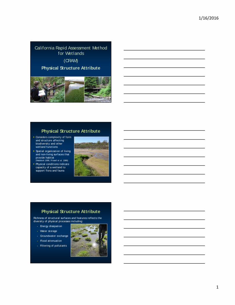
Physical complexity promotes ecological complexity and increases:
• Ecological functions
• Beneficial uses
• Overall condition
Physical Structure Attribute
Physical Structure Attribute
Composed of two metrics:
Structural patch richness• Number of patch types within AA
Topographic complexity• Variety of elevations and extent of
microtopography within AA
Structural Patch Richness For each wetland type:
• Visible patches of physical structure
• May occur along hydrologic/moisture gradients
• Not all patches are expected to occur in all wetlands
• Minimum patch size for many (3 m2 for most)
• May be artificial

1/16/2016
3
Structural Patch Richness
Boulder in channel
Pool in channel
Riffle
In-channel bar
Large woody debris
Structural Patch Richness
Hummocks
Debris JamVariegated Shore
Undercut bank
Abundant Wrackline
• Provides organic material for detritivores
• Source of genetic material (seed dispersal)
• Foraging habitat• Structure for nesting/burrowing• Soil nutrient cycling

1/16/2016
4
Animal Burrows
Bank Slumps or Undercut Banks
• Shading (temperature)• Fish habitat• Invertebrate habitat
Note: Slump must still be present
Cobbles and Boulders
Note: Large broken cement pieces (i.e. unnatural) may still count toward the patch type

1/16/2016
5
Concentric or Parallel High Water Marks
Structural Patch Richness
Soil Cracks
Debris Jam
Beaver Dam
Bare Ground
Structural Patch Richness
• Foraging habitat• Biogeochemical cycling• Invertebrate habitat
1/16/2016
6
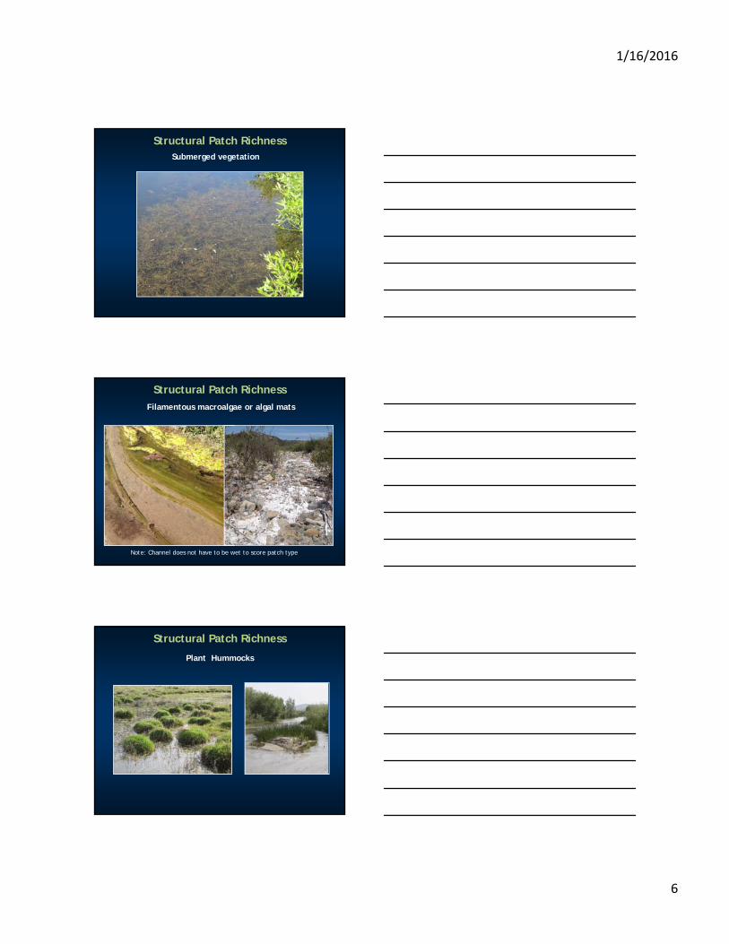
Structural Patch RichnessSubmerged vegetation
Filamentous macroalgae or algal mats
Structural Patch Richness
Note: Channel does not have to be wet to score patch type
Plant Hummocks
Structural Patch Richness
1/16/2016
7
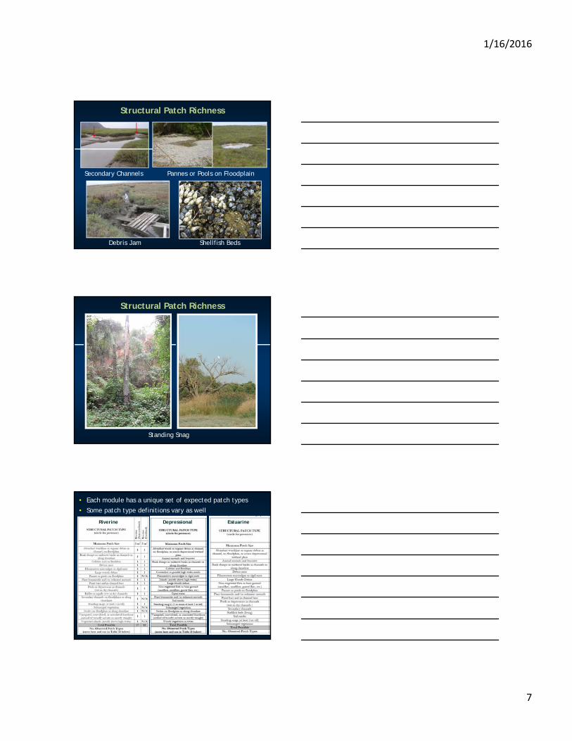
Secondary Channels
Debris Jam Shellfish Beds
Pannes or Pools on Floodplain
Structural Patch Richness
Standing Snag
Structural Patch Richness
• Each module has a unique set of expected patch types
• Some patch type definitions vary as well
Riverine Depressional Estuarine

1/16/2016
8
Structural Patch Richness
Transient in nature, appropriate timing of observations are critical
Expected patch types vary between modules
Read the definitions
Photo dictionary (http://www.cramwetlands.org/documents)
Topographic Complexity
Physical, abiotic features and elevation gradients
Micro- and macro-topographic relief
Reference standard varies among wetland types
Topographic Complexity
Promotes variable hydroperiods and moisture gradients
Promotes ecological complexity
Increases spatial and temporal variability in: Energy dissipation
Surface water storage
Groundwater recharge
Particulate matter detention
Cycling of elements and compounds
Habitat dynamics

1/16/2016
9
Indicators of Topographic Complexity by Module
Examples of Topographic Features
Islands
Partially Buried Debris
Pools
Variegated Shoreline
Scale of Topographic Features Varies with Complexity
• Benches may be centimeters up to meters in scale
• May vary by module (i.e. depressional often smaller scale than riverine)
• May vary within module (i.e. small creek versus large river)

1/16/2016
10
Depressional Topographic Complexity
Topographic Complexity
BB
CC DD
AA
Estuarine Topographic Complexity

1/16/2016
11
DDCC
Topographic Complexity
AA BB
Riverine Topographic Complexity
Macro-topographic Indicators
Presence and number of benches
1
2
1

1/16/2016
12
Micro-topographic Indicators
Pools, pits, bars, debris jams
Cobble, bank slumps, tree fall holes
Topographic Complexity
Topographic Complexity
1
2
AA

1/16/2016
13
Topographic Complexity
1
1
B2B2
CC
Topographic Complexity
DD
DD
DD

1/16/2016
14
Vernal Pools
Bar-built Estuaries
Slope Wetlands
Thank You