PHYSICAL GEOGRAPHY - WordPress.com of Geography – Physical & Human or Cultural (see next slide)....
33
PHYSICAL GEOGRAPHY By Brett Lucas
-
Upload
nguyenduong -
Category
Documents
-
view
217 -
download
4
Transcript of PHYSICAL GEOGRAPHY - WordPress.com of Geography – Physical & Human or Cultural (see next slide)....

PHYSICAL
GEOGRAPHY
By Brett Lucas

INTRODUCTION
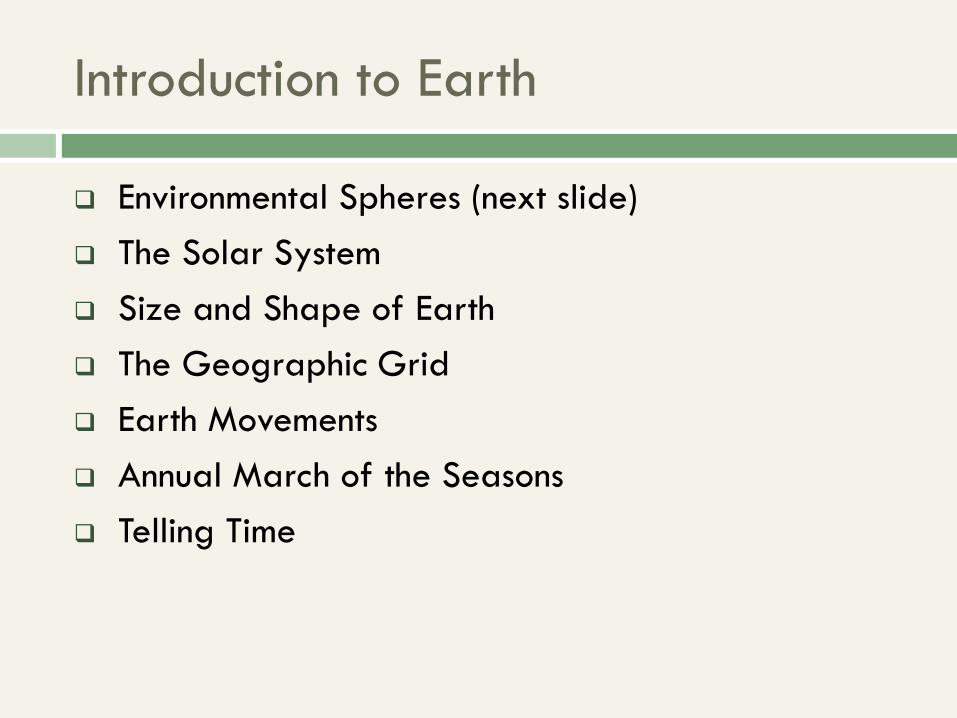
Introduction to Earth
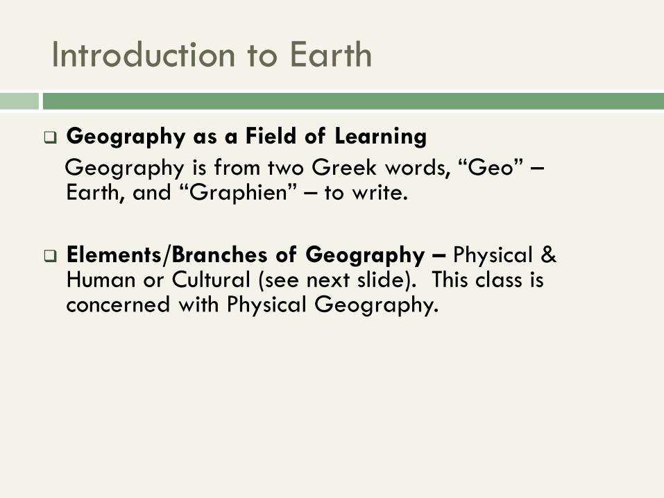
Geography as a Field of Learning
Geography is from two Greek words, “Geo” – Earth, and “Graphien” – to write.
Elements/Branches of Geography – Physical & Human or Cultural (see next slide). This class is concerned with Physical Geography.
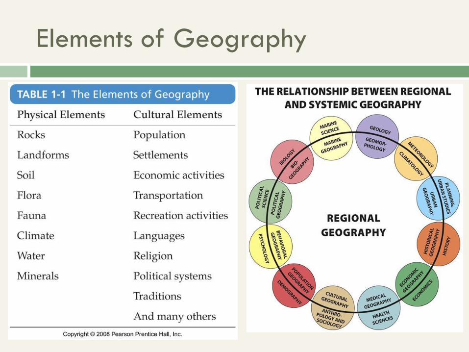
Elements of Geography
Introduction to Earth
Environmental Spheres (next slide)
The Solar System
Size and Shape of Earth
The Geographic Grid
Earth Movements
Annual March of the Seasons
Telling Time
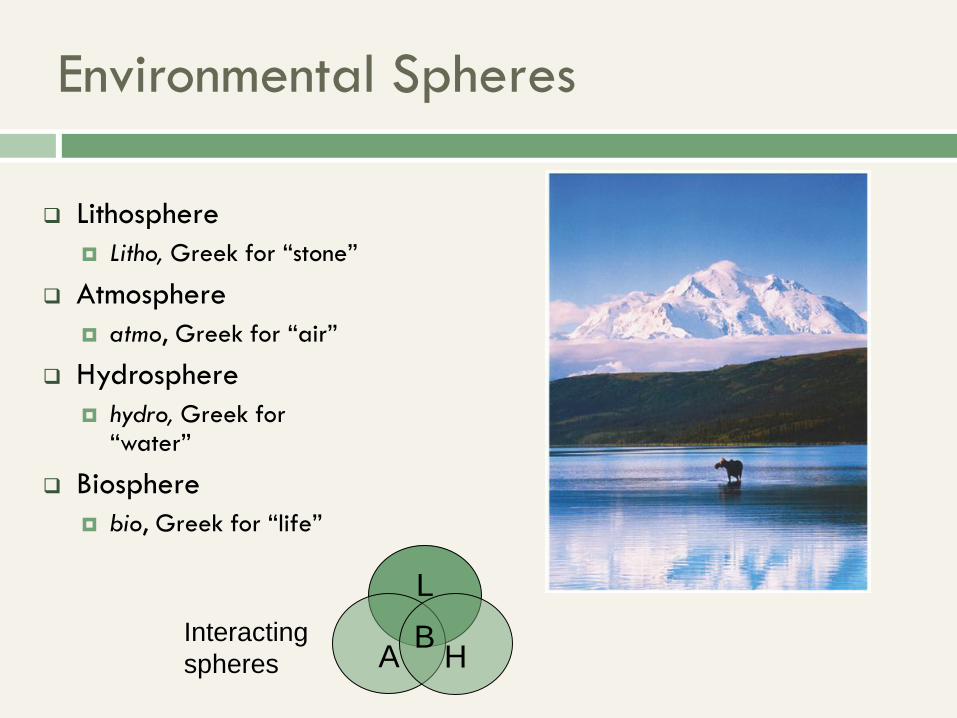
Environmental Spheres
Lithosphere
Litho, Greek for “stone”
Atmosphere
atmo, Greek for “air”
Hydrosphere
hydro, Greek for “water”
Biosphere
bio, Greek for “life”
L
A H B Interacting
spheres
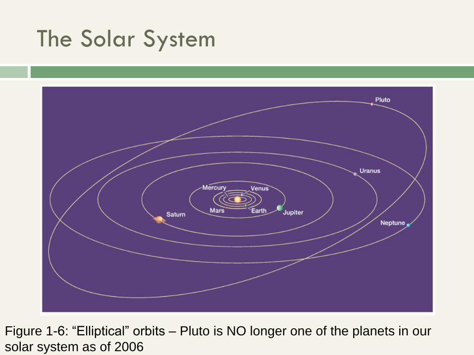
The Solar System
Figure 1-6: “Elliptical” orbits – Pluto is NO longer one of the planets in our
solar system as of 2006
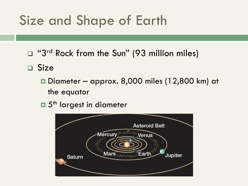
“3rd Rock from the Sun” (93 million miles)
Size
Diameter – approx. 8,000 miles (12,800 km) at
the equator
5th largest in diameter
Size and Shape of Earth
Size and Shape of Earth
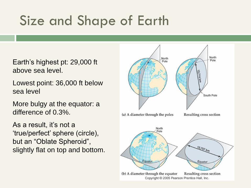
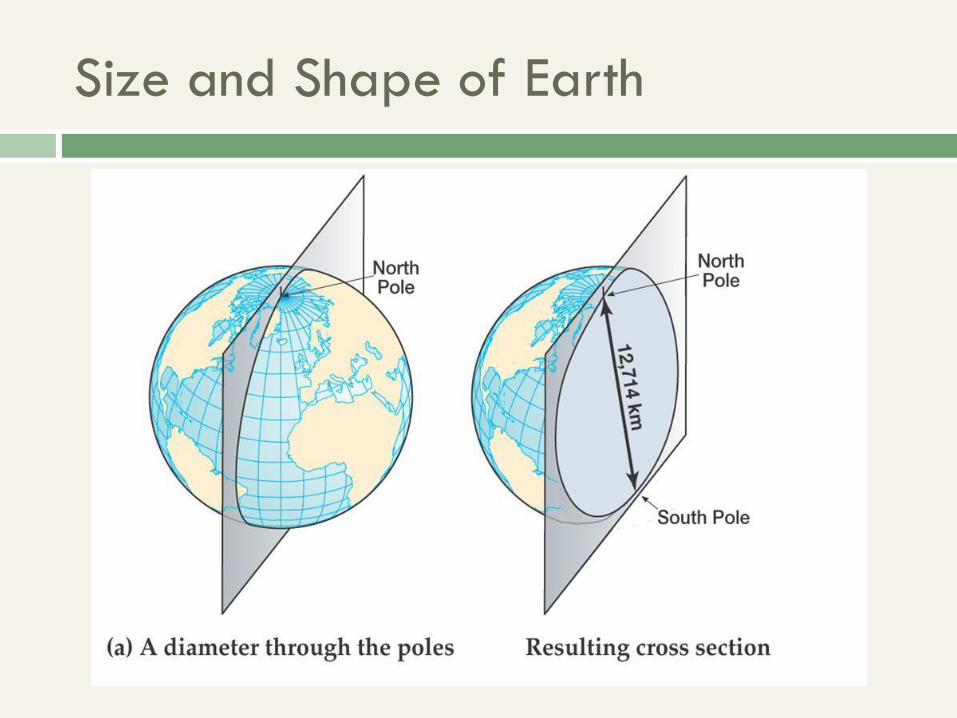
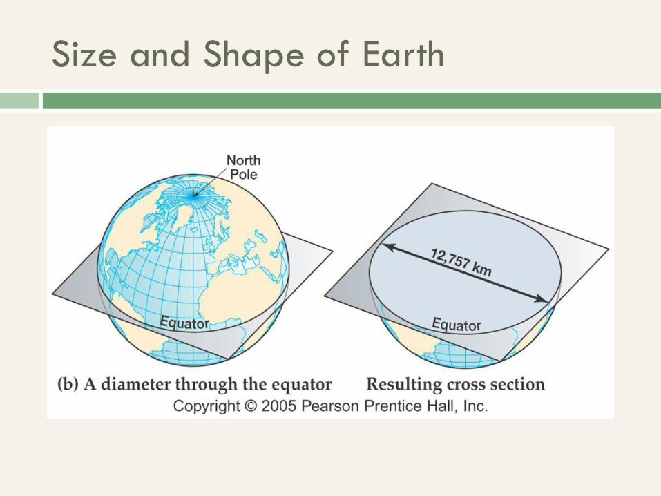
Earth’s highest pt: 29,000 ft
above sea level.
Lowest point: 36,000 ft below
sea level
More bulgy at the equator: a
difference of 0.3%.
As a result, it’s not a
‘true/perfect’ sphere (circle),
but an “Oblate Spheroid”,
slightly flat on top and bottom.
Size and Shape of Earth
Size and Shape of Earth
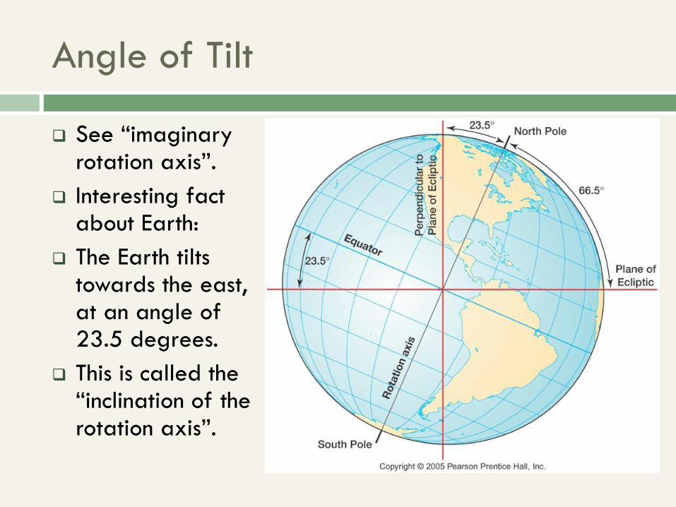
Angle of Tilt
See “imaginary rotation axis”.
Interesting fact about Earth:
The Earth tilts towards the east, at an angle of 23.5 degrees.
This is called the “inclination of the rotation axis”.

The Geographic Grid
The Combination of Latitude and Longitude Lines
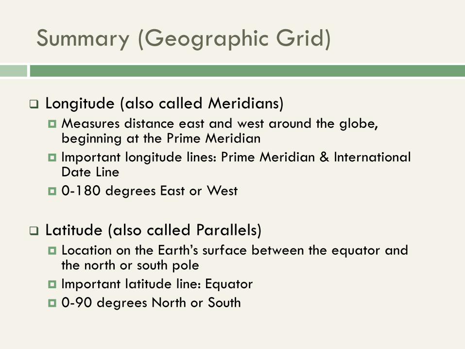
Summary (Geographic Grid)
Longitude (also called Meridians) Measures distance east and west around the globe,
beginning at the Prime Meridian
Important longitude lines: Prime Meridian & International Date Line
0-180 degrees East or West
Latitude (also called Parallels) Location on the Earth’s surface between the equator and
the north or south pole
Important latitude line: Equator
0-90 degrees North or South

The Geographic Grid
The Equator (next slide) – the line thru the earth’s middle
Latitude (run north and south of Equator)
Longitude – E/W of the Prime/Greenwich Meridian
They are used to establish location, for navigation and for telling time.
The circle is 360 degrees around; therefore since there are 24 MAJOR longitude lines, each line is 15 degrees, same as ONE HOUR. So 360 degrees = 24 hours.
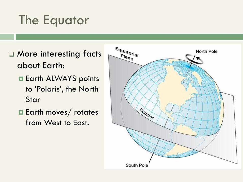
The Equator
More interesting facts
about Earth:
Earth ALWAYS points
to ‘Polaris’, the North
Star
Earth moves/ rotates
from West to East.

Great and Small Circles
A great circle is the largest circle than can be drawn on a sphere and they bisect the Earth into 2 equal halves e.g.
The Equator
The Prime Meridian
The Sun’s Circle of Illumination (see “Blue Beauty” NASA slides)
Small circles are any other circles that can be drawn.
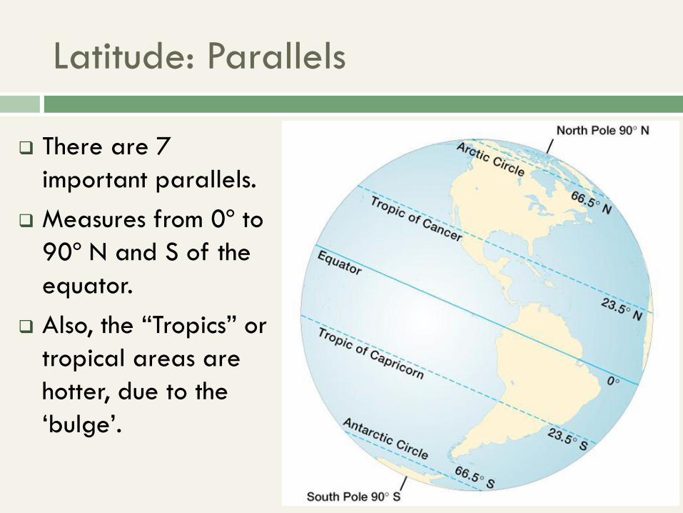
Latitude: Parallels
There are 7
important parallels.
Measures from 0º to
90º N and S of the
equator.
Also, the “Tropics” or
tropical areas are
hotter, due to the
‘bulge’.
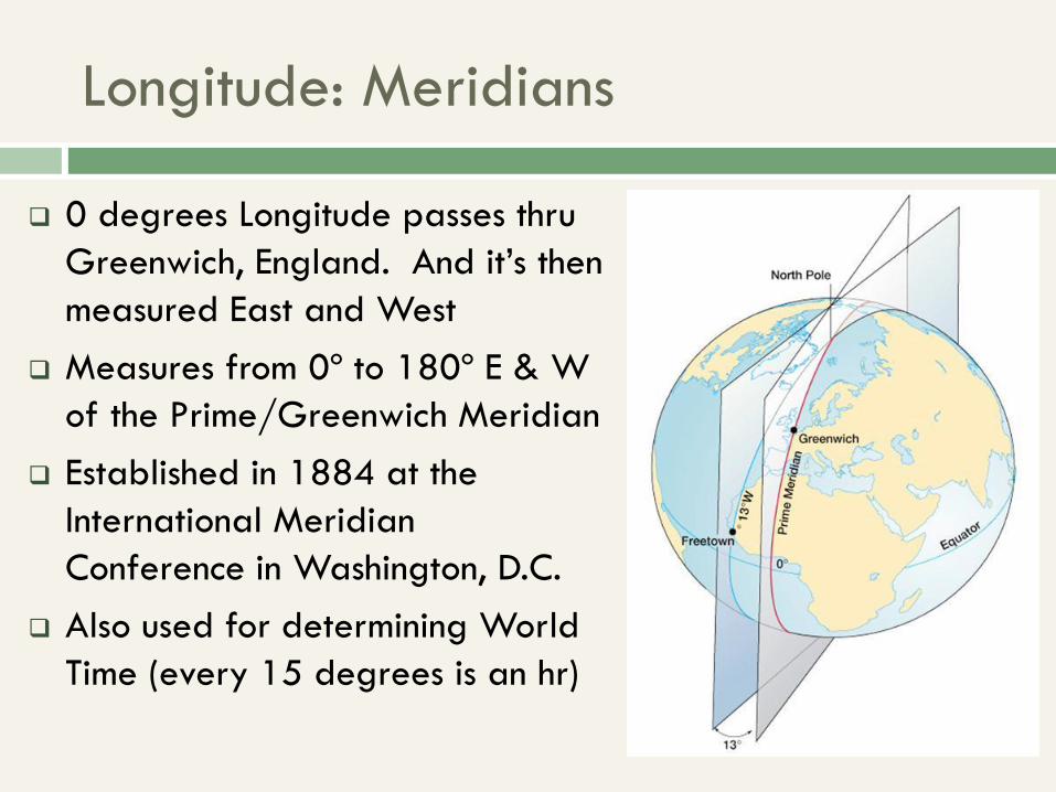
Longitude: Meridians
0 degrees Longitude passes thru
Greenwich, England. And it’s then
measured East and West
Measures from 0º to 180º E & W
of the Prime/Greenwich Meridian
Established in 1884 at the
International Meridian
Conference in Washington, D.C.
Also used for determining World
Time (every 15 degrees is an hr)
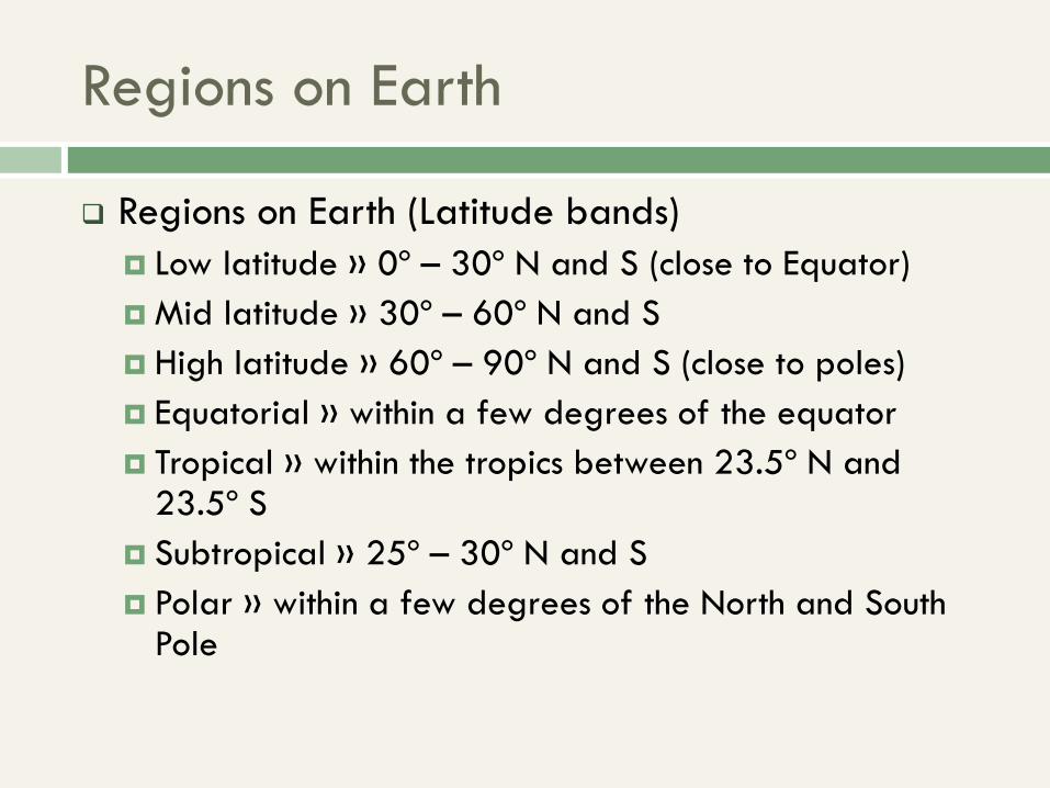
Regions on Earth
Regions on Earth (Latitude bands)
Low latitude » 0º – 30º N and S (close to Equator)
Mid latitude » 30º – 60º N and S
High latitude » 60º – 90º N and S (close to poles)
Equatorial » within a few degrees of the equator
Tropical » within the tropics between 23.5º N and 23.5º S
Subtropical » 25º – 30º N and S
Polar » within a few degrees of the North and South Pole
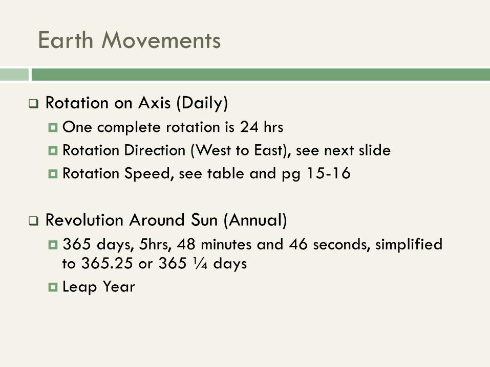
Earth Movements
Rotation on Axis (Daily)
One complete rotation is 24 hrs
Rotation Direction (West to East), see next slide
Rotation Speed, see table and pg 15-16
Revolution Around Sun (Annual)
365 days, 5hrs, 48 minutes and 46 seconds, simplified to 365.25 or 365 ¼ days
Leap Year
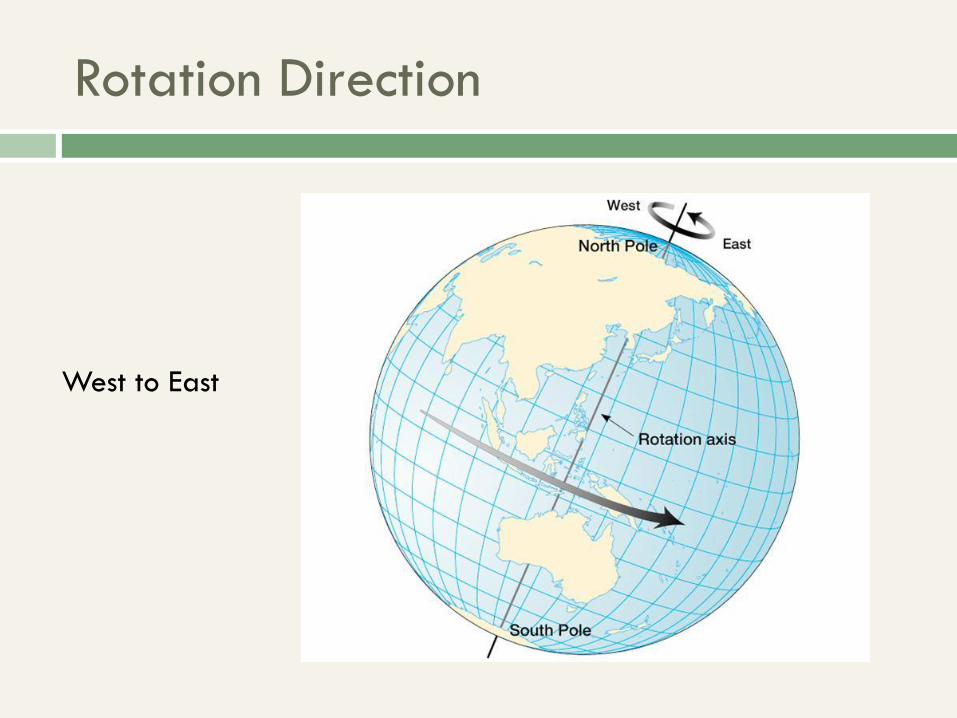
Rotation Direction
West to East
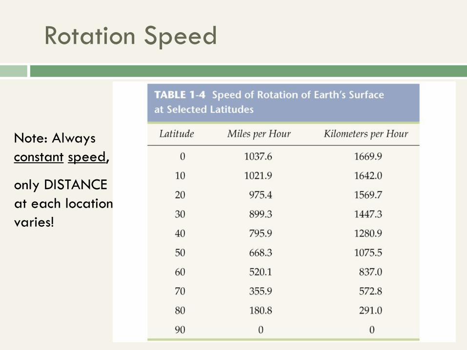
Rotation Speed
Note: Always
constant speed,
only DISTANCE
at each location
varies!
Annual March of Seasons
Solstices – Summer & Winter; unequal daylight (see
next slides)
Equinoxes – 12 equal hours of daylight; start of Spring
and Fall (anywhere between the 20th and the 23rd)
Also, see Table 1-7 (pg 22)
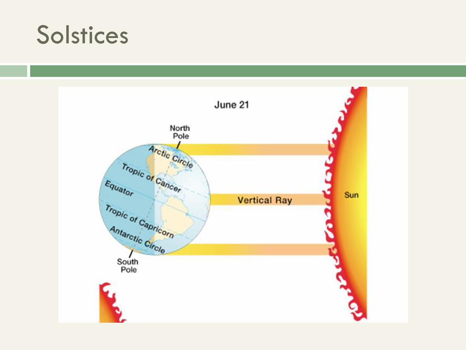
Solstices

Solstices
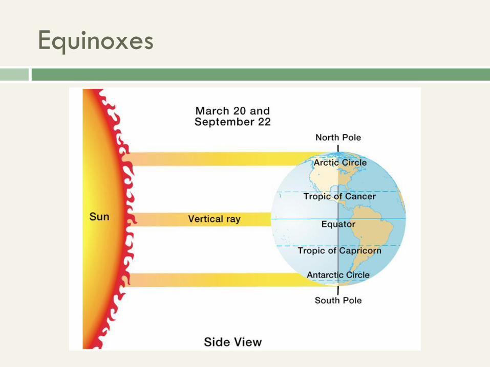
Equinoxes
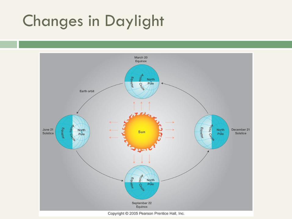
Changes in Daylight
Time Zones
Accurate calendars have been kept by great civilizations for 1000s of years – the Egyptians, Mayas, Aztecs, Chinese, Indians, etc. Pg 23 (Babylon – 2,000 B.C.)
A.M. & P.M. are Latin words (pg 23). “Meri” (highest) is the root word for “Meritorious”.
3 units of natural time – the year, month and day. Everything else is man-made (hour, minute, second, etc)
Time Zones
Standard Time – starts at the Greenwich Meridian (GMT) or ‘Zulu’. Now called UTC (Universal Time Coordinated).
All areas to the east of the Prime Meridian are ‘ahead’ in time, and all areas to the west are ‘behind’ in time.
Some countries have one time zone, while others have several. Russia has 9.
International Date Line (further slides)
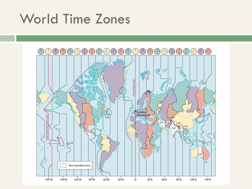
World Time Zones
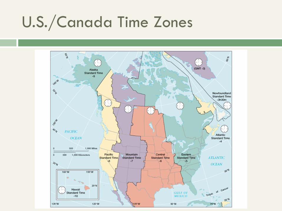
U.S./Canada Time Zones
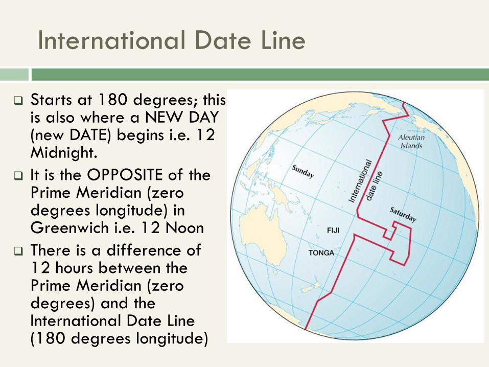
International Date Line
Starts at 180 degrees; this is also where a NEW DAY (new DATE) begins i.e. 12 Midnight.
It is the OPPOSITE of the Prime Meridian (zero degrees longitude) in Greenwich i.e. 12 Noon
There is a difference of 12 hours between the Prime Meridian (zero degrees) and the International Date Line (180 degrees longitude)