Photomontage 2 - assets.gov.ie
1
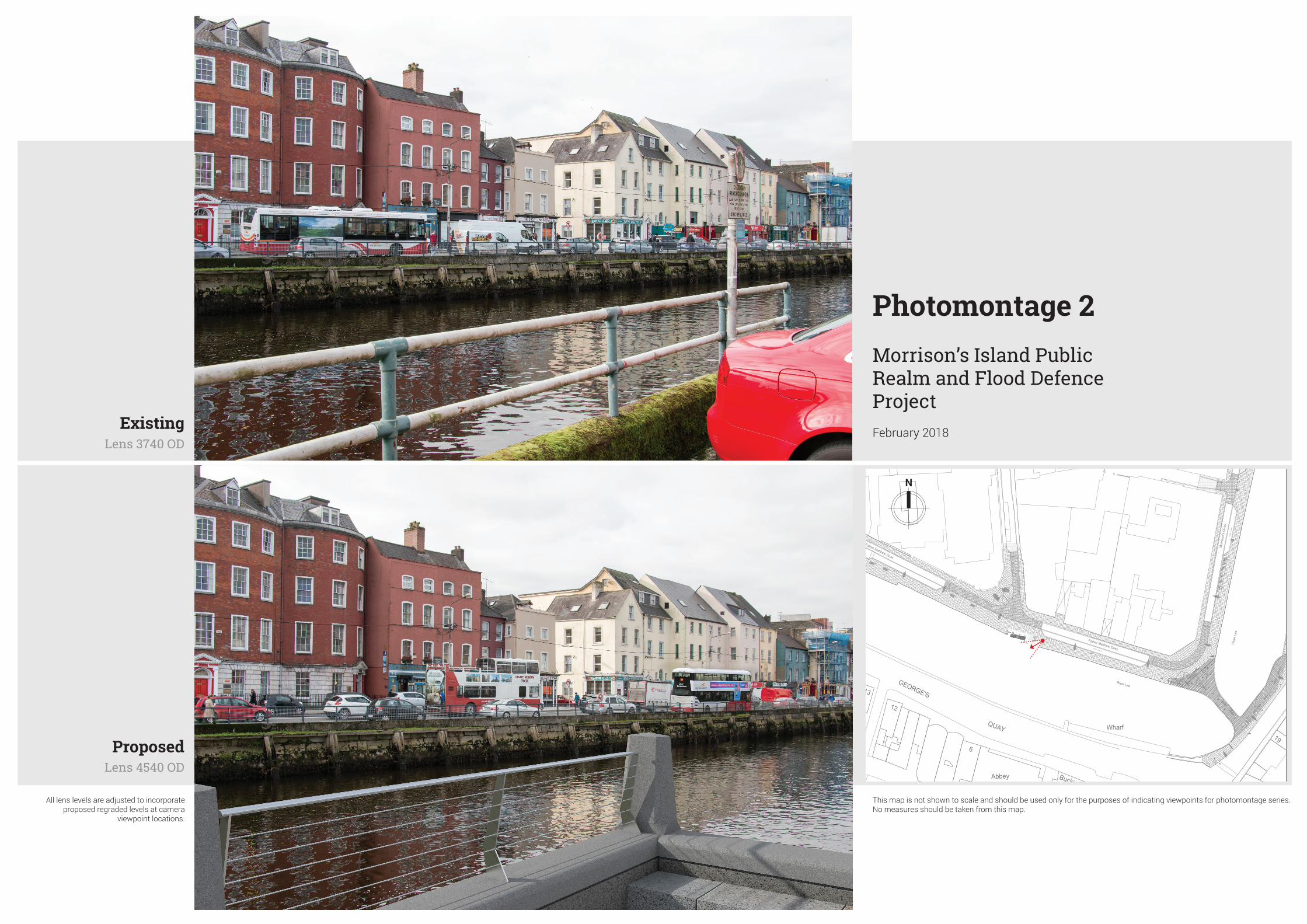
GEORGE'S QUAY Wharf Buckingh P Abbey Court 12 19 13 6 LB LB LB LB LB LB LB S2 S1 S1 S1 S1 River Lee River Lee Father Matthew Quay Father Matthew Quay Morrison's Quay Photomontage 2 Morrison’s Island Public Realm and Flood Defence Project February 2018 Existing Lens 3740 OD Proposed Lens 4540 OD All lens levels are adjusted to incorporate proposed regraded levels at camera viewpoint locations. This map is not shown to scale and should be used only for the purposes of indicating viewpoints for photomontage series. No measures should be taken from this map.
Transcript of Photomontage 2 - assets.gov.ie
+ 3.42 (tok)
LB
14m
(2 d
isab
led
spac
es)
38.5
m -
7 sp
aces
GEORGE'S
PE
MB
RO
KE
QUAY
Red AbbeyCourt
QUAY
MARGARET STREET
COPLEY'S STREET
ST
PHOENIX STREET
SM
ITH
STR
EE
T
STABLE LANE
MA
RY
STR
EE
T
CR
AN
E
STR
EE
T
STREET
MO
RG
AN
STR
EE
T
ST
MarleeCourt
PLUNKETT
STR
EE
T
UN
ION
BE
AS
LY LAPP'S
QUAY
LAN
E
MA
RLB
OR
OU
GH
STR
EE
T
Exham Place
CO
OK
Ball Alley
Car Park
Wharf
CarPark
Bank
Hotel
Copley P
lace
Mary Ville
GPO
Bank
Bank
BuckinghamPlace
YMCA
School of Music
School
Bruach Na Laoi
Bank
Timber Store
Dún Na Laoi
26
31-30
36
22
23
24
14
36
19
5-7
19
2
93-95
1
AbbeyCourtHouse
7
11
48
12
7
12
12
80A
39-41
88
92
1 15-16
19
81
12
16
1
31
33
73
91
88
13
72
1-4
6
16
8
7
11
24
38
3
22
5
26A26B
97
5
41
13
34
98
1
1 2
77
94
58
469
67
13
7
14
30
103
96
1
4 3
8
29
35
78-80
50-49
122
60
40
25
5
3
6
29
28
27
18
5
33
22
4
24
9
21
17A17B
Trinity Court Apts
1
95
21
10
35+ 3.42 (tok)
LB
LB
LB
LB
LB
LB
LB
LB
LB
LB
LB
LB
LB
LB
LB
S3
S2
S1
S1
S1
S1
S1
S1
LB
S3
S2
S3
+ 2.49
S1
South Mall Street
River L
ee
River L
ee
Riv
er L
ee
Riv
er L
ee
River Lee
River Lee
Father Matthew Quay
Father Matthew Quay
Mor
rison
's Q
uay
Mor
rison
's Q
uay
Photomontage 2Morrison’s Island Public Realm and Flood Defence ProjectFebruary 2018
ExistingLens 3740 OD
ProposedLens 4540 OD
All lens levels are adjusted to incorporate proposed regraded levels at camera
viewpoint locations.
This map is not shown to scale and should be used only for the purposes of indicating viewpoints for photomontage series. No measures should be taken from this map.