PHASE II SURVEY Statement of Purpose...PHASE II SURVEY Statement of Purpose The purpose of this...
37
PHASE II SURVEY Statement of Purpose The purpose of this section is to describe the Phase II research that evaluated the significance and integrity of the historic cultural resources located by the Phase I survey. The criteria for this evaluation are those of the Department of the Interior for reviewing nominations to the National Register of Historic Places (36 CFR part 60.6). Background Research and Methodology The general excavation plan was to locate test squares in those areas of the si te which had yielded subsurface artifacts and features during the Phase 1 survey. These test squares were excavated to delineate artifact distributions; to identify the structures; to establish the limits and chronology of the site; and to investigate other potentially sensitive areas of the site. Specifical1y, Test Pits (TP) 15 (5x5 ft.), 18 (3x3 ft.), 19 (5x5 ft.), 40 (5x5 ft.), and 57 (5x5 ft.), and Test Trenches (TR) 16 (2x5 ft.) and 17 (2xlO ft.) were excavated, and a postholer test grid was laid out east of the rubble pile (Map 9). TP 15 was placed so as to define the edge of rubble located by T P II, while TP 18 and TR 17 were placed over the rubble foundation located in the excavation of shovel test ST 76. TR 16 was placed so as to bisect the stone foundation which was located by ST 63 and TP 19 in the investigation of the mortar layer found in ST 57 (Maps 7 &: 8). TP 40 and 57 were designed to test for downslope deposition, such as trash dumps. The initial background research was to contact the last private owner of the property, Mr. Oliver C. Lynam, Jr., to determine the extent of his knOWledge of the history of the property. Although he was located, he could not provide any information. No other informants were located during the survey. A re-examination of historic maps showed a change in access to the farmstead during the last third of the 19th century. Beers' 1868 Atlas (Map 4)
Transcript of PHASE II SURVEY Statement of Purpose...PHASE II SURVEY Statement of Purpose The purpose of this...

PHASE II SURVEY
Statement of Purpose
The purpose of this section is to describe the Phase II research that evaluated
the significance and integrity of the historic cultural resources located by the
Phase I survey. The criteria for this evaluation are those of the Department of the
Interior for reviewing nominations to the National Register of Historic Places (36
CFR part 60.6).
Background Research and Methodology
The general excavation plan was to locate test squares in those areas of the
si te which had yielded subsurface artifacts and features during the Phase 1 survey.
These test squares were excavated to delineate artifact distributions; to identify
the structures; to establish the limits and chronology of the site; and to investigate
other potentially sensitive areas of the site. Specifical1y, Test Pits (TP) 15 (5x5
ft.), 18 (3x3 ft.), 19 (5x5 ft.), 40 (5x5 ft.), and 57 (5x5 ft.), and Test Trenches (TR)
16 (2x5 ft.) and 17 (2xlO ft.) were excavated, and a postholer test grid was laid out
east of the rubble pile (Map 9). TP 15 was placed so as to define the edge of rubble
located by TP II, while TP 18 and TR 17 were placed over the rubble foundation
located in the excavation of shovel test ST 76. TR 16 was placed so as to bisect
the stone foundation which was located by ST 63 and TP 19 in the investigation of
the mortar layer found in ST 57 (Maps 7 &: 8). TP 40 and 57 were designed to test
for downslope deposition, such as trash dumps.
The initial background research was to contact the last private owner of the
property, Mr. Oliver C. Lynam, Jr., to determine the extent of his knOWledge of
the history of the property. Although he was located, he could not provide any
information. No other informants were located during the survey.
A re-examination of historic maps showed a change in access to the
farmstead during the last third of the 19th century. Beers' 1868 Atlas (Map 4)
shows the driveway to the W. M. Hawthorn residence leading in from Route 7 to
the east of the site. Baist's 1893 Atlas (Map 5) shows a driveway leading in from
Old Churchman's Road which has been built to the northeast in the interim, with
the farm listed as belonging to "A. Naudain". Thus the remains of two different
lane/driveways could be expected to be found on the property.
A chain of titles was developed from county deed records and is presented in
\figure ~, beginning with the latest and working back to the earliest known owner.
Oliver Lynam is shown as the owner of the property on the DelDOT 1953 New
Churchman's Road Construction Map (Map 10), and it is known from deeds to have
been in the Lynam family from 1917 to 1962 (Deed 2-26-108). Also shown on this
map (Map 10) is a "springhouse" 10 ft. x 10 ft., a "chicken house" slated for
demolition by roadway construction, wire-fenced chicken yards attached to it, and
a "HO" (House) in the location of what is presently a rubble pile.
Al though Elizabeth Naudain, owner of the property from 1899 to 1917 (Deed
A- 18-393) is not specifically referenced on any maps, "Misses A. & Ella Naudain"
were assessed the following taxes in 1899: $40.55 for a "Frame House & Barn" on
90 acres of land plus $2.00 for 20 acres of "wood & Brush". It is probable that this
is the Hawthorn Farmstead shown on Beers' 1868 Atlas (Map 4) and not only
denotes the structures present on the property at the time, but also gives an
indication of the portion of the property actively being used, that being 90 of 1 to
acres.
No property assessments were found for their father, Arnold Naudain, who
owned it from 1874 to 1899 (Deed G-IO-38) although his ownership is indicated by
the label "A. Naudain, Res." (residence) on the 1893 Baist Atlas (Map 5). The
"Inventory and Appraisement of the Goods and Chattels" filed in 1899 at his death
indicates he was a farmer with a total appraisal of $1,040. The inventory provides
information on the structures present in appraisals made of "Goods in house,"

FIGURE 8
W.M. HAWTHORN FARMSTEAD
(Delaware Cultural Resource Survey No. N-6264) State No. 7NC-E-46
CHAIN OF TITLES
Grantee Grantor Deed Ref. Date Consideration Acreage Note Ref. Welfare Foundation, Inc. Magness Shopping Mart K-75-31 6/30/1965Magness Shopping Mart, Inc. $ 10 + 52.2 1W.W. Lynam, et.al.O.C. Lynam U-69-400 7/16/1962 $ 318,789 108.0 1,2E.T. Naudain, et.al. 2-26-108 3/26/1917E. T. Naudain, et.a1. $ 6,000 IIIA. Naudain, Jr., et.al. A-18-393A. Naudain 8/19/1899 $ 4,000 IIIJ. Springer G-IO-38 2
w J. Springer 3/24/1874 $ 4-,000 111J. Armstrong, Sheriff 0-10-489 5/23/1872'"'" J. Armstrong, Sheriff $ 2,500 III 3W.M. Hawthorn, et.al. unknown unknown unknown unknown 4
Notes
L New Churchman's Road has been constructed and is deleted from Acreage transferred.
2. Grantor's received title to the Farmstead following execution of will of previous Grantee.
3. Sheriff sale to payoff $1,500 debt of W. Hawthorn.
4. Transfer unknown; folloWing deed (D-10-489) mentions that W.\1. Hawthorn, et.al. received title to property upon the death of theirfather (W. Hawthorn).

"Sundries in barn," and "Sundries Lower floor of granary". It also details the
material and goods required on a farm operation around the turn of the 20th
century: "daily fixtures," "farm wagon," "round all harrow," "mowing machine,"
"plows," "harrows and cultivators," "4 hogs," "4 shoats," "bay horse," and "black
horse." Also listed are goods probably produced on the farm itself: "growing crop
of corn," "oats in field," "200 bu. of wheat," and "hay in barn."
Aside from deed information, the only record found of the previous owner,
James Springer (1872-1874, Deed 0-10-489) is his 1872 tax assessment of $54.00,
which was not itemized.
A sheriff's sale of 1872 (Deed 0-10-489) referred to the property as " ...being
the same land •..in which William Hawthorn deceased •••descended to his two
children and the said William M. Hawthorn and George Hawthorn his only heirs at
law." Specific land records referring to the property could not be located for the
years prior to 1872, so the chain of title could not be continued. However, the
name "W. M. Hawthorn" does appear on the 1868 Beers' Atlas and a "William
Hawthorn" is listed in the tax rolls on three separate occasions as owning III
acres. In 1861, he was assessed a tax of $41.07 for the acreage and a "Frame
House &. barn" plus $3.75 for stock owned and $4.00 as a poll tax. In 1852, the tax
was $33.50 with a "Frame House &. Frame barn", and in 1845, it was $27.75 for a
"Log House &. Frame Barn."
An "Inventory and Assessment" for a William Hawthorn dated September 1840
(presumably the father of William M. and George mentioned in the preceding
paragraph) listed among his property three "Feather beds," "carpet," "china &.
glassware," "mahogany washstand," "Winsor chairs," and "brass candlestickes." The
Inventory also provides information about the house and outbuildings: "carpet in
parlor chamber ," "heather rug," "carpet in entry downstairs," "carpeting in common
room," "kit<:hen and irons," "earthware in springhouse," and "stack of hay in barn."
J7

rrom these few items it is learned that it must have been a substantial house, with
multiple stories of at least two and possibly three rooms each, an entryway, and
several fireplaces, along with a barn and a springhouse designed to last for many
years. The tools and equipment indicate a farm that had been active for some
time, as evidenced by "old wood wagon," "old wood plow," and "old wheelbarrow",
and one that was still quite active: "family carriage and harness" and "maul,
wedges, & post spade." The productivity of the farmstead and its market
orientation are indicated by "yoke oxen," 20 cows and calves, four horses of varying
ages, eight shoats, several stacks of hay, "unbroken flax," "corn fodder," 300
bushels of "corn, in the ear," and "300 bushels of oats, in the stack ..subject to the
experience of getting out & delivering at market." The total assessment of the
inventory was $1,357.09.
A photograph of the farmstead was later located in DeIDOT's files (Plate l).
It showed the house, and the woodframe structure to the south, and was taken
sometime between the construction of New Churchman's Road in 1955 and the
demoli tion of these two structures in the early 1960's. The farmhouse was a three
bay, two story structure with a gable r00f, at least two chimneys, and a small
porch or pent roof over the centered front door. The frame outbuilding with a
concrete block foundation was a one-story shed which opened to the south. In the
photograph, the springhouse is obscured by vegetation, a road sign, and a line drawn
on the negative. However, it already appeared to be in a state of disrepair.
Results and Interpretations of Phase II Survey
Test Pit 15 (Fig. 9 & Map 9) was placed in the rubble pile adjacent to the
earlier TP 11. At a depth of approximately 3 in. a level of coursed dnd mortared
bricks was located in the east corner. It was oriented east-west and extended to
the center of the excavated square. To both the nbrth and south of this was
building demolition rubble, to the east was another separate course of bricks, while
3H

W
te( ..I a.
39
FIGURE 9 TEST PIT NO. 15. HOUSE RUBBLE PILE
PLAN VIEW 6" BELOW SURFACE
THIS AREA EXCAVATED ONLY TO 6" BELOW
THE SURFACE
~ TEST PIT NO. 11 ~ l'
PLAN VIEW 45" BELOW SURFACE
(End of Excavation)
0" 6"
10"
45"
CROSS SECTION A-1Ji PROFILE SHOWING RELATIONSHIP BETWEEN FEATURE NO.1 AND FEATURE NO.2
202 4 ~i~~~~ ~~~~~i
SCALE IN FEET
KEY:
-STERILE SOIL - YELLOWISH BROWN CLAY
n~-CONCRETE SLAB
m~Ni-BRICK
[::1-DE M OL ITIO N RUB B LE - AS H, TIL E, BRIC K. CHA RCOA L, NA ILS, • WINDOW GLASS, METAL, MORTAR
[;:;:;I-RUBBLE & TOPSOIL - DARK BROWN LOAM
@-FEATURE NO. 40
SOUTH WALL
to the west was sterile soil. Recovered within this initial level was bottle glass,
window glass, wire nails, one Lincoln head penny, and a metal toy train fragment
embossed with the letters "NYCRR". Excavation continued to 44 in. below the
surface and eventually two distinct features were identified: the eastern brick
course (I'ea. 1) and the western course (Fea. 2), both extending to the full depth.
The unit fill surrounding these two features included mostly window glass, wire
nails, and asbestos tile shingle fragments. Very few fragments of ceramics or
bottle glass were recovered. Much of this unit was not excavated more than 6 in.
below surface and no builder's trench was identified.
Trench 17, later expanded by Test Pit 18, (Fig. 10, Map 9) was located
approximately 12 ft. north of TP 15 and in the same location as ST 76. It exposed a
"3 ft. long section of stone foundation composed of unfaced rubble stones and
mortar and oriented east-west (Fea. 3). The feature extended to a depth of 58
inches below the surface and rested on yellow sand. Excavation on the north side
of the foundation yielded no artifacts and no builder's trench was noted. The south
side was filled with demolition rubble, clayey soil fill, and artifacts, including
bottle glass, cut and wire nails, asbestos tile fragments, and sherds of whiteware,
pearlware, and creamware.
Trench 16 (Fig. 11 &. Map 9) bisected the foundation (Fea. 4) exposed by ST 63
and revealed that it extended only 18 in. below the surface. No filled cellar holes
were found on either side of the foundation, suggesting that this feature Was
support for a lighter, perhaps one-story addition to the main building. Artifacts
recovered included primarily ironstone and pearlware sherds, and cut nails.
Test Pit 19 (Fig. 12 &. Map 9) was superimposed over ST 57 to determine the
extent and nature of the mortar layer. This layer was found to be more than six
feet in diameter and approximately three inches thick. Recovered artifacts
include redware and ironstone sherds, aqua and clear bottle glass, window glass,
41

FIGURE 10 TEST PIT NO. 18 PLAN AN-C PROFILE, AREA "e"
AI ~ , TEST HOLE
) ~f .1
0"----Z 0'
::: =C:B =*' ,,-' I::.~:I: (,) Z W a: I 18" u.. 24"
to • (/)
I
:E ..J
.Pr'-"';' PLAN VIEW
58"----62" =1 ~
CROSS SECTION A-A' SHOWING COMBINED PROFILE OF TRENCH NO. 17.
TEST PIT NO. 18, AND TEST HOLES
2 o 2 4 C I
SCALE IN FEET
KEY:
A - TOPSOIL - DARK BROWN LOAM [f~:-:~ STONE :::.:~'T.
B - YELLOWISH BROWN CLAY
C -TOPSOIL, BRICK, ASH
C -YELLOWISH BROWN CLAY FILL
E- RUB&LE, BRICK. ASH, CLAY, CHARCOAL, TOPSOIL
F -MOIST YELLOW SAND

FIGURE ~~
TRENCH NO. 16 PLAN ANC PROFILE, AREA IIC" 2 o 2 4
i i SCALE IN FEET
FOU~'~EATURE N0;~-i~__-.-~_~ HOLE
I -V) I "-..,., I . TEST HOLE ------ --, .1 --.JI . ....L-------"-
PLAN VIEW
FOUNDATION, FEATURE NO.4
TEST .YrHOLE- c:
C
~~~~~.~I""----'---~. (TEST HOLE
PROFILE - SOUTH WALL KEY:
A - TOPSOIL - DARK BROWN SANDY LOAM
B - GRAYISH BROWN MOTTLED CLAY
C - YELLOWISH BROWN SANDY CLAY
D - MOTTLED BROWN CLAY, SAND, AND CHARCOAL
~%;J! - STONE ::..~:.':.);
~-MORTAR

FIGURE 12 TEST PIT NO. 19 PLAN AND PROFILE. AREA IIDu
i ~A
0"
7" 5" 9"
16" C I
.
0
zl""~IO
24" ~~ en
CROSS SECTION A-~
.;:
.;:
SHOWING COMBINED PROFILE OF TEST PIT NO. 19 AND SHOVEL TEST NO. 57
ST NO. 57
2
I
o 2
SCALE IN FEET
4 1
KEY:
A - TOPSOIL - DARK BROWN LOAM
B - DARK BROWN LOAM WITH LOTS OF MORTAR AND BURNED WOOD
C - DARK YELLOWISH BROWN SANDY LOAM WITH PEBBLES
0- YELLOWISH BROWN SANDY LOAM
,- AREA WHERE
tt1.1- STONE
r:~] MORTAR
MORTAR WAS REMOVED

and rut nails. Also found beneath the mortar layer were two fragments of a
pewter spoon, a metal bale seal and two mocha pearlware fragments. In the
southern end of the unit, some loose stones were found, possibly associated with
the foundation located in TR 16 and ST 57.
All three historic artifact bearing levels (to 20 in. below surface) yielded
prehistoric artifacts. Found along with quartz and quartzite flakes and a chert
flake tool were a quartzite Broadspear-like knife or projectile point, two
contracting-stemmed bifaces, one of jasper and one of quartzite, and a one-inch
long distal section of a fourth, quartzite biface.
The stemmed bifaces are typical of the Woodland I Period 0000 B.C. to 1000
A.D.), described previously. Over half of the flakes found contained cobble cortex,
indicating that local cobble resources were being exploited. No prehistoric
ceramics, ground stone tools, or other artifacts were found.
A postholer test grid was laid out and excavated to the east and southeast of
the rubble pile and indicated extensive undisturbed prehistoric archeological
deposi ts (Map 9).
The "70S" and" 190E" grid lines served to form right-angle transects to give
an idea of the extent of the deposits (Map 9). The lithics were primarily
cryptocrystalline jaspers and cherts, quartz, and occasionally rhyolite, quartzite,
and argillite flakes. All of this material was found below the humus or plow zone;
and the majority of test holes, except where noted in Appendix 2, contained no
historic material. The subsoil bearing the artifacts was primarily yellow-brown
silty loams and sands; little clay was encountered.
Test Pits 40 and 57 were also excavated in this area of the site and yielded
numerous artifacts in both disturbed and undisturbed contexts. Test Pit 40 (Fig.
13) contained at least three distinct levels of plow zone and/or slope wash (the
deepest being a buried horizon) down to 26 Ln. below the surface with prehistoric
45

FIGURE 13
WEST WALL TEST PIT NO. 40
5'x5'
WAGNER, 1982 DELDOT SOIL LEVELS EXCAVATION LEVELS
0" --- ~*~ *.z;;..__""""';*E........, r--:z:...-__--=lL.__---lI~ SUR F ACE
Ap 1 & Ap 2
LEVELS 1-3 PLOW ZONE
11 (3) FLAKES 1 FLAKE TOOL
NAILS COAL
GLASS STYROFOAM
REDWARE WHITEWARE
20" -
I Ap 3
27" -
LEVELS 4 & 6I UNDISTURBED 2 BIFACES
23(6) FLAKESB 1
39" -
B 2t t LEVEL 6
47" -

flakes and redware, nails, coal, and other historic artifacts throughout. The in-
place B soil horizon (subsoil) extended to 42 in. with prehistoric artifacts to 37
inches. Levels 4 and 5 (27-39 in.) contained 21 quartz flakes (5 with cortex), 2
chert flakes (I with cortex), the distal end of a quartz biface, and a teardrop-
shaped quartz biface missing its distal end. Below level 5 lay a sterile argillic
subsoil estimated to be 7,000 to 8,000 years old (Daniel p. Wagner, pers. comm.
1982). This would place level 4 and 5 as somewhat younger and would temporally
place the artifacts late in the Archaic Period (4000-3000 B.C.) or in the Woodland I
Period 0000 B.C. -A.D. 1000).
Test Pit 57 (Figs. 14, 15, & 16) contained many artifacts and two features in
undisturbed contexts. Two distinct plow zones with slope wash horizons extended
to 18 in. below surface and contained 235(74)* flakes, 6 cores, and a square-
stemmed jasper projectile point. In the lower of the two plow zones, at about 14
in., a single prehistoric ceramic sherd was found. It is interior/exterior cord-
marked, tempered with coarse sand, and generally resembles early ceramic types
like Accokeek or Wolfe Neck. Also found were redware, pearlware, and whiteware
sherds, clear bottle glass fragments, and other historic artifacts. The B1 subsoil
contained levels 4 through 10 and extended from 18 to 32 inches. Appearing at the
top of level 6 were prehistoric features I and 2, the latter subsuming the former.
It is probable that feature No. I is the leached portion of No.2. Together they
contained charcoal flecks, fire cracked rocks (FeR), 10(2) flakes, and an
undiagnostic fragment of a red jasper biface. Aside from the features, this level
produced another 27(7) flakes, while level 7 contained 1(I) flake, and level 10
another 3 flakes. (Levels 7 through 10 were tested by auger hole only.) The
*The-number -within the- parentheses which follows the total number of flakes is that number of flakes within that total which had cortex.
47

FIGURE 14
WEST WALL TEST PIT NO. 57
5'x5'
WAGNER, 1982 SOIL LEVELS
011-1 + * +
Ap 1
13"~1 Ap 2
1 8"~ '----------
B 1
31"-1 B 2t
39"--1 B 3
43" - .---------
C 1
C 2 49"-- .---------
C 3
47"-1 51"- .....1 _
DELDOT EXCAVATION LEVELS
-+= f SURFACE;-
1-3Lt:VELS PLOW ZONE
235(74) FLAKES 1 PROJECTILE PT.
e CORES REDWARE
WHITWARE PEARLWARE
.22 CAL. SHELL GLASS NAILS
LEVELS 4-10 UNDISTURBED
31 (8) FLAKES FEATURE 1 & 2 10(2) FLAKES
RED JASPER BIFACE
48

FIGURE 15 W.M. HAWTHORN SITE
TEST PIT NO. 67 FINAL PROFILES NATURAL SOIL LEVELS
A :;"';':':":"':':'~~:::j-- SAND LENS
LENS--,
WEST WALL PROFILE
.. a .. 2 i :
SCALE IN FEET
:ok"......<:± ~1INTERMITTENT ~ * AY
BSAND LENSES IN _. BOTTO M LE VEL B ~"":'''':'''':':''''.;....'--'-'---------~"'---~~ ~ . _es:. 0
F ~.. ~ ___~----_ . AI'\'!' _-=--__"'--
o
c , 0 Si' . -~ 0 •
~ LENS (1.6YR 3/4 DARK BROWN SANDY CLAY LOAM)
SOUTH WALL PROFILE
KEY;
D -1.6YR 4/4 DARK BROWN SANDY LOAM
A - HUMUS E -7 .6YR 4/6 STRONG BROWN SANDY LOAM
B-10YR 4/4 DARK YELLOWISH BROWN F 7.6YR 6/8 STRONG BROWN SANDY CLAY WITH CLAY LOAM HEAVY COBBLES
C - 10YR 3/6 DARK YELLOWISH BROWN SANDY LOAM 49

FIGURE ~6
W.M. HAWTHORN SITE TEST PIT NO. 57. FEATURE NO . ., & NO. 2
EXCAVATION LEVEL 6
. DARK STAIN%l\
.:::::::::~..
... 1.52'
IJ
FEATURE 2
A f!j;:jii'
tV .~~~ A~" t1 .1.46' ~4J'
1.63'
1}'!3€i7
c:>~L- ....._0· ~~_
PLAN VIEW
., Q ., 2 ~i~~~~~ ~~~~~i
SCALE IN FEET
KEY:
... - ELEVATION DEPTH
so

features were collectively interpreted as a small hearth and bottomed out in level
10 at about 29 in. below the surface.
As in TP 40, TP 57 disclosed a well-developed argillic soil horizon directly
beneath the lowest cultural material (Daniel P. Wagner, pers. comm. 1982). Again
this places levels 4 through 10 sometime late in the Archaic or in the Woodland I
Periods.
Conclusions of the Phase II Survey
The Phase Il subsurface testing at the Hawthorn Farmstead served to
distinguish three and possibly four intact subsurface foundations and two undistur
bed prehistoric features plus associated artifacts: Feature I, the easterly of the
two brick foundations located in TP 15; Feature 3, found in TR 17 & TP 18 and ST
76; Feature 4, exposed by TR 16; and Prehistoric Features I & 2 in TP 57. Further
excavation is required to determine the structural integrity and contents of the
slanting brick foundation located in TP 15 (Feature 2).
The foundations suggest three different functions or building episodes. The
foundation located in TR 17 and TP 18 is thought to be part of the main block of
the house, based upon its width and depth. The brick structure found in TP 15 may
be an internal basement partition wall or a rear addition to the main block. As
mentioned, the shallow foundation found in TR16 and ST 63 may have supported a
one story addition, perhaps a service or kitchen wing built onto the main block.
The artifacts recovered from units in the vicinity (TR 16 and TP 19) serve neither
to support nor to refute this supposition, and additional testing is required.
Artifact distribution maps for historic artifact types, including temporally
diagnostic ceramics, glass, and nails, were prepared to see if any spatial patterning
through time was evident at the site (Maps 11-19). Although the spatial coverage
was somewhat biased and several units were filled with demolition debris and as
such had poor context for the artifacts recovered, some tentative interpretations
51

••
MAP 11 REDWARE DISTRIBUTION [1600 - 1 BOSJ
10.54.2 6.3
77• ~132
10 0 10 ao (¥/f{~~E~~~~~~iiiiiiiiiiiiiiiiiiiiiiii~~~~~~~1
SCALI! IN FEET
87•72• 57 :3
~~-- FEATURE8S
83 B 4.2 2.1
18 //~" J"(..54•
W~ 51
15 ~4 ~ ~~ B ~ 1 ~,
FEATURE NO. 22 ~1i1~ 74 70 80 52 .t FEATURE NO.1. • •
~ 85 58 1 ~ . .
11 1
NOTES: ~ 75// 71 61
TEST PIT 14 WITH 1 ARTIFACT & 86• 2DRAIN WITH 10 ARTIFACTS. DO NOT APPEAR ON MAP
1tl~EATURE NO.3 136 ARTIFACTS TOTAL 17
4 CONTOURS IN aUINTILES
76
~12 2
KEV:
~-TEST PIT EXCAVATION UNIT .-SHOVEL TEST UNIT
~-TOPSOIL REMOVED O-IDENTIFICATION NO.
R-STRUCTURAL FEATURE 0- ARTIFACT COUNT NO •
• -TRENCH o.o-CONTOUR VALUES
52

71
• ~
75
MAP 12 WHITEWARE AND IRONSTONE DISTRIBUTION [1 BeD - 1900]
2 =
___ 1 9
•2367
72• 1
68
73•
59 4.a
4
64• • 55•15
~~ 74 70FEATURE NO. 60• 52•A,l.;ilALtt1~1I F EAT U R E NO.1.
11 ~y~. 66• 66•
NOTES: 7
TEST PIT 14 WITH 1 ARTIFACT & DRAIN WITH 5 ARTIFACTS. DO NOT APPEAR ON MAP
123 ARTIFACTS TOTA L
CONTOURS IN QUINTILES
KEY:
L~;;~-TEST PIT EXCAVATION UNIT .-SHOVEL TEST UNIT
fa'~-TOPSOIL REMOVED O-IDENTlfICATION NO.
15'{0~J-STRUCTU R A L FEATURE 0- ARTIFACT C OU NT NO.
II-TRENCH a.a-CONTOUR VALUES
5J

MAP 13 PEARLWARE DISTRIBUTION [1780 - 1830]
2.8
1.4
~ ~ 77• ~13
11
48•63• 1 10 0 10 20 ~E~~~~ ~~~~~3
SCALE IN FEET
67•72• NO.4
6850
73• 54•
• 69 61
64 "
66 "• • (~r~8\
. FEATURE NO. 6~~
1.4
) 52 FEATURE "'
65• •
56••
1-----1 1
NOTE: 71
• 61•36 ARTIFACTS TOTAL
66• 1
CONTOURS IN QUINTILES ' NO.3\8 ~----~.~E_A,T7URE ~ 3
'- 76
KEY:
[:J-TEST PIT EXCAVATION UNIT .-SHOVEL TEST UNIT
~-TOPSOIL REMOVED O-IDENTIFICATION NO.
mitj,:;:J-STRUC TUR A L FEATURE o-ARTIFACT COUNT NO.
II-TRENCH oo-CONTOUR VALUES
54

MAP 14 CLEAR GLASS BOTTLE DISTRIBUTION
[LATE 19TH CENTURY]
~ 77• ~--13
92
48•53
•10 a 10 20 ~L~..~._~._~~~~_~~ ~~~~~~S~
BCALE IN FEET
867•/~ 19
.. 571
. /" 58 : .
49•72• 1 2 3
-_.. F EAT U R E NO.468 -.
5073• 54 •
•
• 51•59
64• 55•._15 .--- 31
;;~ · .... 74 70FEATURE NO. 60• 62•FEATURE NO.1·
65• 56•//~ /~:i/
~~----11
789 0/
NOTES: ~ DRAIN WITH 3 ARTIFACTS DOES NOT APPEAR ON MAP
882 ARTIFACTS TOTAL
61• NO.3
71
•76
(/1,\..\R. ---12 22
KEY:
t:>]-TEST PIT EXCAVATION UNIT .-SHOVEL TEST UNIT
U]-TOPSOIL REMOVED O-IDENTIFICATION NO.
I£:<.'J-S TRUC TU R A L FEATURE a-ARTIFACT COUNT NO.
II-TRENCH
55
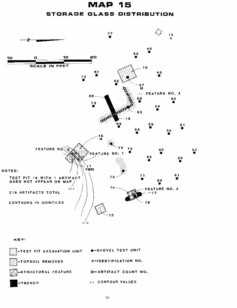
MAP 15 STORAGE GLASS DISTRIBUTION
77
• ()
13z _ 1
48•53•10 0 10 20
~t~~~~~~_~"~~~~~~~~3 SCALE IN FEET - 1 9
67•
-16
/
49•72• '-- 5 7
B
FEATURE NO. 4 68-
56 50 73• •
54•
--·63 • 69• 59• 51•64• 66•15
4
~ "'--74 70FEATURE NO~ 60 52NO. 1 •
65 • • • 56•
NOTES: 71
• 61•TEST PIT 14 WITH
66•DOES NOT APPEAR
3 O. 4 1b-............"-.~ATURE NO.3 216 ARTIFACTS TOTAL
~.17 CONTOURS IN QUINTILES '-76
I /
~12
0.16
KEY:
[::J-TEST PIT EXCAVATION UNIT
~-TOPSOIL REMOVED
!;NF1J -S T RU C T U R A L F EAT U R E
II-TRENCH
.-SHOVEL TEST UNIT
Q-IDENTIFICATION NO.
O-ARTIFACT COUNT NO.
0.0 CONTOUR VALUES
56

• •
69•
• / "---~ 5 7 1. 22
' .......--- FEATURE 58•
68
73•
MAP 16 WINDDW GLASS DISTRIBUTIDN
77• ~-13 S
48
•53•10 0 10 20 ~E~.,~~IIIIIIII~IIIIIJI ~~~IIIIIIIIIIIIIIIIIIIIIIII~I 1
SCALE IN FEET
67 .... f .. - 19 49•72 2• . " :::' 62•.•
NO.4
50
•54•1
59• 51•64• 66•15
330~
FEATURE NO.2 74 70 60• 52•FEATURE NO.1.
%65• 56•
1
11 136 ~.NOTES:
;$ 71 61TEST PIT 14 WITH 1 ARTIFACT & 7 5-~
DRAIN WITH 16 ARTIFACTS, 66•DO NOT APPEAR ON MAP 18
590 ARTIFACTS TOTAL S ~~~ NO.3FEATURE , .' 17 . 26
d1A -76
~ ~12
52
KEY:
L:J-TE ST PIT EXCAVATION UNIT .-SHOVEL TEST UNIT
[)~~-TOPSOIL REMOVED O-IDENTIFICATION NO.
t/Y.-]-S TRUCT U R A L FEATURE O-ARTIFACT COUNT NO.
III-TRENCH
57

MAP 17 CUT NAIL DISTRIBUTIDN
/77--- -- "- ~---13
"" ~
//
~ '\
/ I
\ 53
48• 10 0 ~L1lllllllIIIIIIIIIIIIIIIIIIIIIIII!iIIi
10 20 iiiiiiiiilllllllllllllllllllllllllllllllll/~(
• \ 1 I
SCALE IN FEET /
/
172,.,,5 67
•
19 42
67
49• ' B
':ao':"'--._- F EAT U R E 68 1 68•73• 4 64•
59• 16
/.,- 81 ~ 1
FEATURE NO.2" 74 70 60•/ FEATURE NO.1·
( "% 65• \ 11 '\. "///
NOTE: \ 10 "" ~ 246 ARTIFACTS TOTAL \ 75>(// 71
\ ". 66........ . \ ~~--_.~~FEATURE\ ,. 17
\ ') 30
\ \ . "... __ ./'" ~- 76(fJJ!A.
" ........ ~----- 12 24
KEY:
r::~-TEST PIT EXCAVATION UNIT .-SHOVEL TEST UNIT
~3-TOPSOIL REMOVED O-IDENTIFICATION NO.
IBi~j:J-STRUCTUR A L FEATURE 0- ARTIFACT CO U NT NO.
II-TRENCH ----ARTIFACT CONCENTRATIONS
58
64•1
11
NO.4
50•
51•56• 62•
56• 61•
NO.3

MAP ~B
WIRE NAIL DISTRIBUTION
77
• ~-13 22 1
48•53
• 19
87• 10
•4972•
~57
~- FEATURE NO.4 88~
/ 58
• 54
50•73• -~/ 4 /
--- 63 • 69• 59• 51•64 66
16 •, • 409~
-...-..... ," '-----74FEATURE NO.2 -...-..... 70 60 52/ FEATURE NO.1· I/"""" 66 • •
• 56
\ 11 "~ • NOTES: \ 92 ~
DRAIN WITH 6 ARTIFACTS DOES NOT 75P'", 71 61
APPEAR ON MAP \ "'. 66 •'" .\ 1 8 " NO.3786 ARTIFACTS TOTAL \ 123 ~,_FEATURE'"
\ ~-'Q 17
\ /" 76
\" ~ .--./'/"
'~12 134
KEY:
L::J-TEST PIT EXCAVATION UNIT .-SHOVEL TEST UNIT
8?:a-TOPSOIL REMOVED Q-IDENTIFICATION NO.
L'Y] -S T R U C T U R A L F EAT UREO- A R TI F ACT C 0 U NT NO.
II-TRENCH - ~ -- ARTIFACT CONCENTRATIONS
59
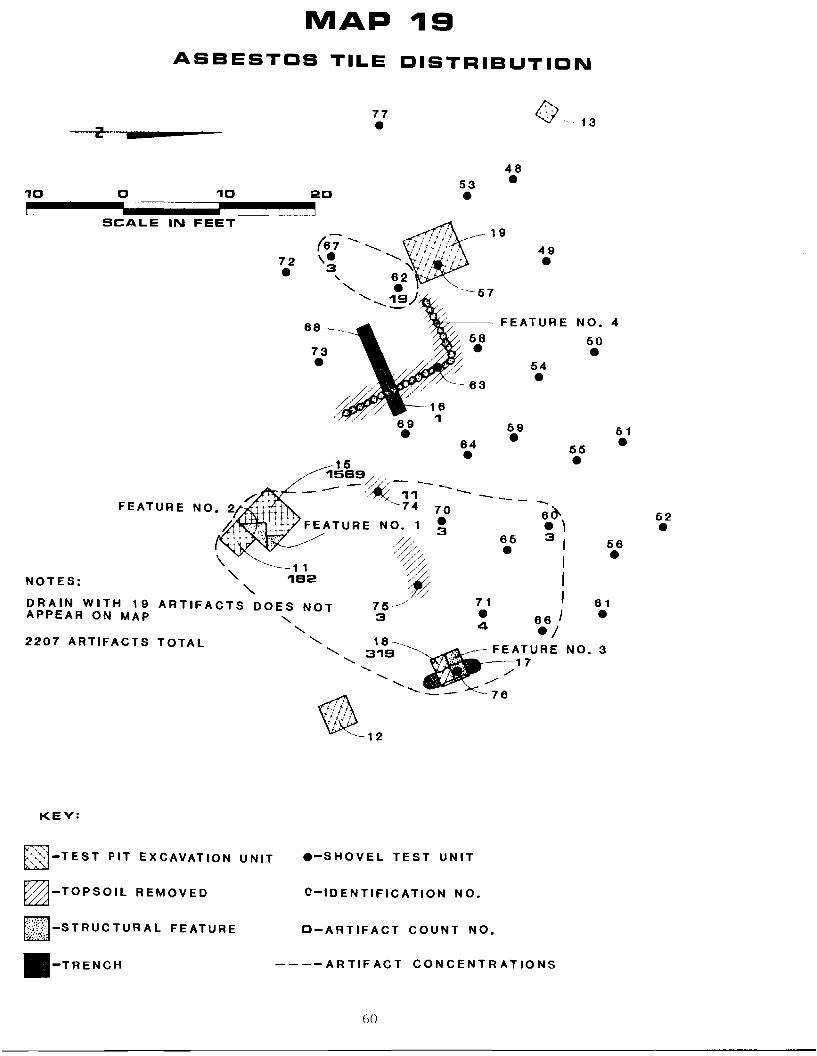
MAP 19
ASBESTOS TILE DISTRIBUTION
77
• o -13
48•53
•10 0 10 20 ~E~IIIIIIIIIIIIIIIIIIIIIIIIIIII~ ~~~IIIIIIIIIIIIII:::SIllllll~
SCALE IN FEET 19
49•72• --- 57
~88 _ FEATURE NO.4
5073• 54
• •
89• 59• 51•84• 55•15 1589//,
-- -'~11--- _..
FEATURE 74 70 6()o. 52•FEATURE NO. 1 ~ • ,
56% ~5 3: \ -----.~11 :;;:;/ •
NOTES: "1S2 .~ I , 7~ I
DRAIN WITH 19 ARTIFACTS DOES NOT 75/ 71 61APPEAR ON MAP •" 3 • 88 J" 4./2207 ARTIFACTS TOTAL " 18-·",- ~:9 ~~T7URE NO.3
''-~~:~-12 ~-- --76
KEY:
t~~-TEST PIT EXCAVATION UNIT .-SHOVEL TEST UNIT
~j-TOPSOIL REMOVED O-IDENTIFICATION NO.
I;Vj~r~-s TRUC TUR A L FEATURE O-A RT IFACT COUNT NO.
_-TRENCH ----ARTIFACT CONCENTRATIONS
60

of spatial patterning can be offered. The area of the site northeast and northwest
of the foundation (Feature 4) including Test Pits 13 and 19, Trench 16, and Shovel
Tests If8, 49, 53, 57, 67, 68, 72, and 73, contained late 19th-century bottle glass,
pearlware dated to between 1780 and 1830, whiteware and ironstone ceramics
dating to dnd between 1820 and the early 20th-century, cut nails dating to between
1825 and 1890, and wire nails dating from after 1890. Trash deposition in this area
seemed to post-date the beginning of the 19th-century. A second area southeast of
Feature 4 including Test Pits, 11, 12, 15, and 18, Trench 17, and shovel Tests 71,
75, and 76 is dated slightly later (post 1820) and included late 19th-century bottle
glass, whiteware, ironstone and cut nails. These two areas can be contrasted to a
third area northeast and east of Feature 4 that includes Shovel Tests 50, 51, 54, 55,
58-60, 63, 64, and 70, and contained primarily redware predating 1805. These
distributions seem to suggest that dumping of trash and deposi tion of artifacts
varied through time and that spatial utilization of the Hawthorn Farmstead
probably varied as well. The date of the shift in trash deposition patterns would be
ca 1780-1820. Additionally, the earlier deposits seem to be buried in undisturbed
contexts (see Figure 7 and associated profiles) suggesting in situ buried deposits
spatially distinct from later deposits.
The varied artifact and spatial deposi tion and utilization at the Hawthorn
Farmstead through time and the presence of undisturbed, buried, artifact-bearing
horizons in the surrounds of a residential structure dating from the late 18th-to
lTl id 20th-century provide unique opportunities to study the changing lifeways of
the Delaware Farmer. For the same reasons, the site could be used to develop a
comparative data base for future excavations at other similar sites. No farmsteads
of a similar socio-economic group have been excavated in the northern Delaware
area. Only one additional farmstead, the Robert Ferguson Site, has been studied by
Delaware Department of Transportation archaeologists (Coleman et al 1983);
61

however, the Ferguson site was a tenant house with associated outbuildings. The
apparent non-tenant occupation of the Hawthorn Site should produce contrasting
information to that discovered at Ferguson.
Study of the changing lifeways at rural farmsteads is a interesting research
question for the northern Delaware area, as well as for the entire Middle Atlantic
region, and this accentuates the significance of the Hawthorn Site. Fletcher (1950)
suggests that most farming operations in the central Middle Atlantic were
primarily subsistence economies in the late 18th- and early 19th-century. However
wi th the development of improved transportation networks, the corning of the
industrial revolution, and increased population densities in urban areas, farm
economies in the central Middle Atlantic were drawn into a broader market
economy (Lemon 1972:224-228). In the northern Delaware area, local historical
(Hoffecker 1974) and archaeological studies (Klein and Garrow 1982) of
Wilmington, Delaware (Jess than 15 miles from the Hawthorn Site), indicate an
emerging transportation and commercial center through the late 18th- and 19th
centur ies. With further industrialization, varied patter ns of ethnic and socio
economic groups with different residence patterns and complex changes in land use
seem to be apparent in urban contexts. However, the effects of industrialization,
expanding markets, and improved transportation on rural areas are not known at
present. The Hawthorn Site provides a unique setting to see if these historically
documented urban and regional trends had effects on farmsteads in rural, yet not
isolated, areas. Archaeological studies of these effects may be particularly useful
because they may identify changes in material culture and spatial utilization
patterns that would not necessarily be documented in the historical record. The
fact that the break in spatial distributions at the Hawthorn site occurs ca 1780
1820 indicates that the site may provide significant data for this regional research
Issue.
h2

Because the site contains artifacts that are likely to provide relevant
information for significant research issues, it is considered to be eligible for listing
on the National Register of Historic Places (see Appendix 5). The archaeological
study of rural farmsteads, such as the Hawthorn Site, in this area of the Middle
Atlantic is undeveloped. Therefore, one major goal of further research should be
to provide a broad data base that can be used for comparisons with other rural sites
that may be excavated in the future, and to compare the data to previously studied
sites in the Chesapeake where much more work has been done. Additionally, other
more general research issues can be developed from the regional land use and
economic patterns noted above and from more general studies in Middle Atlantic
historical archaeology (H. Miller 1980). These questions include:
1) Are changes in artifact distributions present and are they indicative of
changing spatial utilization present at the site? Can such changes in
patterns be related to historically-documented economic and social
changes in the surrounding area?
2) Are there changes in the presence or absence, and frequencies, of
certain artifact classes through time that can be related to changes
and!or stability in purchase and consum ption habits of the si te's
occupants?
3) Can changes in either of the above categories of data be analyzed for
meaningful covariance?
Each of these three questions is discussed below.
1) Patterns of Artifact Distribution and Spatial Utilization
Based on the work of South (1979), it can be expected that changing uses of
the Hawthorn Farmstead through time would have produced different distributions
of varied classes of artifacts such as domestic refuse, agricultural refuse, and
subsistence refuse during different time periods. Similarly, artificial changes in
oJ

site landscape may have been accomplished through time as the activities at the
farmstead changed (Handsman 1981). All of these changes may reflect variation in
the economic orientation of the farmstead (e.g., from agricultural to livestock) and
are related to regional economic trends (see Lemon 1972). Preliminary
documentary and archaeological research suggests that the farmstead has been
primarily oriented toward moderate scale grain agriculture throughout its
documented history and little distributional change is expected.
Previous research at this site was limited in its areal extent and has limited
interpretive value for such questions. Nevertheless, a locus of late 18th- and early
19th-century artifacts was discovered within the general distribution of late 19th
and 20th-century artifacts. Therefore, the major research task should be to obtain
a representative sampling of the various sections of the site and to further
investigate the possible spatially distinct late 18th-and early 19th-century
artifacts. A sample of varied site areas such as front yard and back yard should
also be obtained using stratified sampling techniques. These samples should consist
of a series of test units (measured excavation units and postholer tests, depending
on stratigraphy) placed at regular intervals i ~ transects across the known site area
and within special site areas.
Cataloging and laboratory analysis of the artifacts from the excavations
should focus on variation in function and should follow the methods proposed and
described by South (1979). Expected categories to be delineated include household
vs. farm implement, ceramic vs. metals, and varied ages. Diagnostic artifacts and
histograms of ceramic and glass categories should be used to define chronological
controls within the spatial analysis. A series of distribution maps for various points
in time should be produced to show the presence or absence of changes in spatial
distribution.
64

2). Purchase and Consumption Habi ts
The regional socio-economic changes described earlier may not only have
changed spatial utilization at the site, but may also have affected the income of
the site's inhabitants and their purchase and consumption habits. For example, as
northern Delaware was drawn into wider ranging market economies, new goods and
perhaps foods might have become available. This is especially true given the role
of Philadelphia and Wilmington as import/export centers. Also, the vagaries of
local and regional economies may have had important effects upon the economic
standings of farms. Lemon (1972:224) notes that in nearby southeastern
Pennsylvania, the period between 1760 and 1790 was one of disruption of "normal
economic patterns" due partly to the Revolutionary War, but also due to a major
reorientation of immigration patterns and fluctuations in the values of goods within
the trans-Atlantic market. There are some indications that real income rose
throughout the new "national" economy in the 1790's and again between 1815 and
1830 (Adams 1968). However, Fletcher's (1950) study of agricultural economy
during the same period does not clearly indicate a change in agricultural income
until after 1840.
Both archival and archaeological research should be used to analyze the
economic standing of the inhabitants of the Hawthorn Site through time. The
original archival research suggests that on the basis of size, land holding, and taxes
the Hawthorn Site was in the middle income range and little change could be seen
in its economic status over time. However, the initial research did not include a
consideration of regional and local economic trends and there is really no existing
basis for comparison to other rural farm economies in northern Delaware.
Consequently, some archival research should be carried out to document the
comparative backdrop of regional and local agricultural economies against which
the Hawthorn Site can be considered. Archaeological research should consist
65

[Jrimarily of artifact analysis and utilize the artifacts recovered during the testing
program described for the analysis of spatial distributions. These artifacts should
be analyzed as indicators of socio-economic status using techniques similar to
those utilized by G. Miller (1974, 1980). The varied classes of artifacts recovered
should also be analyzed for indications of changing primary trade networks.
The presence of stratified remains, including a variety of household and
agricultural artifacts, recovered in the initial testing of the site ensures that there
should be sufficient archaeological data to analyze this research topic.
3) Covariation of Change
Changes in any of the data categories noted above mayor may not be
correlated with each other. As part of the overview of the analysis, the
covariation of the changes should be studied specifically. This research should
reveal the different ways by which varied cultural sub-systems are intergrated with
one another and with the changing biosocial environment (Binford 1965). It is also
possible that the data categories may show no change in the face of regional socio
economic change. In this case, the conservative resiliency of certain kinds of rural
economies may be apparent, or perhaps arrhaeological data do not reveal these
kinds of changes.
The prehistoric components of 7NC-E-46 seem to date to the Late Archaic
Woodland I Period based on the recovered artifacts (stemmed points) and soils
analysis. Excavation of a storage feature present in test unit 57 recovered bifaces
and large amounts of debitage. Based on this preliminary evidence, along with its
setting adjacent to an ephemeral stream and spring, the site is probably a micro
band base camp (Custer 1983, 1981) of the Woodland I Period. Previous research in
the immediate area has revealed the presence of large macro-band (Clyde Farm
Site, Custer 1982; Delaware Park Site, Thomas 1981) and micro-band base camps
(Green Valley Complex, Custer et al. 1982). In most cases large portions of these
66

known sites have been partially disturbed by plowing. In contrast, the cultural
materials at 7NC-E-46 have been buried by slope wash, and possibly some aeolian
deposition, and protected from disturbance by agricultural activities. As such,
7NC-E-46 offers the unique opportunity to study an undisturbed Late Archaic
Woodland 1 micro-band base camp.
Research on sites of the Late Archaic-Woodland I Period from this section of
New Castle County has recently focused on the processes by which these societies
developed a sedentary lifestyle with associated exchange networks, storage
facilities, and intensified food production systems (Custer 1982, 1983). At the
large macro-band base camps special emphasis has been placed on understanding
intra-site patterning of tool production activities, storage, and habitation areas
(Custer 1982; Thomas 1980. Similar research has also been carried out at micro
band base camps (Custer et al. 1980. It is proposed here that similar research be
carried out at 7NC-E-46 by opening contiguous squares in several sections of the
site and carefully recording the locations and configurations of any features and
artifact concentrations. Analysis of distribution patterns of artifact classes such
as fire-cracked rock (indicative of hearths and habitation areas) and debi tage
(indicative of tool production areas) will be important. Similarly, close analysis of
tool use by microscopic and macroscopic analysis should be undertaken to further
differentiate varied activity areas within the site. Flotation analysis of feature fiJl
and living floors will also be used to gain further information on food production
systems at the site.
The above-noted methods and research activities will maximize the informa
tion recovered from the site; however, they are also designed to be comparable to
research methods used at the other sites in the area (particularly Clyde Farm,
Oelaware Park, and Green VaHey). This will facilitate the comparison of the
results of the excavations of 7NC-E-46 to the other sites. Such a comparison will
67

allow the consideration of the data from a regional perspective and will reveal the
role of the site in larger settlement subsistence systems. For example, it is not
clear whether or not the large macro-band base camps of the area are seasonally
revisited locations with related sporadically revisited micro-band camp sites.
Fusion and fission of social units would accompany such a pattern, and micro-band
base camps would be expected to be miniature versions of the large macro-band
base camps. On the other hand, macro-band base camps may represent sedentary
occupations, and the micro-band base camps may be special purpose camps that
were visited for extended periods of time for special intensive resource
procurement activities. In this case social organizations would be less flexible.
Also, the micro-band base camps might not contain all of the activities seen at a
macro-band base camp or they may contain disproportionate numbers of special
purpose tools. No matter which scenario is accurate, the research design proposed
here, with its insurance of comparable data, should be able to clarify the role of
micro-band base camps in the regional settlement system.
Because the size of the site prohibits complete excavation, a sampling
strategy is necessary. Also, it is very li'<ely given excavation experiences at
similar sites in New Jersey (Stewart 1981), that complete excavation would
generate much redundant data. It is proposed here that the sampling design for the
site be based on regular testing of the site with 5£1. x 5ft. excavation units.
These units should be placed to cover the spatial extent of the site within the area
of highest artifact density based on the preliminary test results. When subsurface
concentrations of artifacts are encountered, adjacent units should be opened up to
generate broader horizontal exposure and maximize the spatial data from the
excavations. If adjacent units do not contain more cultural materials, the coverage
of the testing could be expanded.
611

Preliminary test results show that the artifact-bearing horizons at the site
are buried under culturally-sterile slope wash approximately 1 ft. deep. This
overburden should be removed with minimal examination for cultural materials. It
should not be screened. The remaining soils containing artifacts should be
excavated in 3 in. arbitrary levels within any natural soil horizons. Excavation of
the arbi trary levels should utilize a variety of methods. Initial excavation of the
levels should be done with shovels and the minimum provenience unit should be
quadrants of a 5 ft. square. If features or high density artifact concentrations are
encountered, methods should be changed to exact provenience techniques using
trowels. Also, any diagnostic stone tools (projectile points, knives and
ceramics) should be treated with exact provenience techniques. Flotation samples
of a standard volume, to be determined later, should be taken from excavation
levels and all features should be floated. Standard pollen samples should also be
taken from excavation levels and features. A standard volume soil sample should
also be taken from all excavation units and features.
In sum, both the historic and prehistoric components of the Hawthorn Site
have been determined eligible for listing on the National Register of Historic
Places and the Determination of Eligibility for both components is included as
Appendix 5. While a portion of the prehistoric component was disturbed by historic
occupation, much of it retains contextual integrity. This undisturbed portion, as
well as the historic component, will be destroyed by the proposed widening of New
Churchman's Road and thus will be directly impacted. Therefore, it is
recommended that Phase III excavation as described above be scheduled for both
components to determine their nature and place in local cultural development.
Data recovery plans, schedules and budgets for both components have been
proposed and are included as Appendices 6 and 7.
69

Appreciation for their support, administration and services is extended to all
the involved individuals from:
Division of Highways
Raymond M. Harbeson, Jr., Asst. Director, Preconstruction Joseph T. Wutka, Jr., Location Studies and Environmental Enginc('r Honesto Abadines, Project Engineer Nicholas S. Blendy, Environmental Planner Thomas W. Brockenbrough, Jr., Project Engineer Hugo A. Dreibelbis, Project Engineer Therese M. Fulmer, Environmental Planner Carol L. Kates, Secretary Paul H. Meleri, Draftsperson Jackie Mitchell, Word Processor Tim O'Brien, Photographer T1aniel J. Stoneman, Training Engineer
Federal Highway Administration
A. George Ostensen, Engineer Michael J. Otto, Environmental Engineer
Bureau of Archaeology and Historic Preservation
Daniel R. Griffith, Bureau Chief Faye L. Stocum, Archeologist Alice H. Guerrant, Archeologist
University of Delaware
Juan Villamarin, Chairman, Department of Anthropology
Division of Graphics and Printing
Ray Moore, Shop Supervisor John Farley, Pressman Merrill Clark, Cameraman Bob Farley, Pressman Jeff Faulkner, Pressman Dorothy Hutchins, Machine Person Joan Pillsbury, Machine Person Charles Pritchard, Pressman William Yerkes, Pressman
70