Paula Dunbar and Kelly Stroker - University of Colorado ...Beginning in the summer of 2005, the...
85
Poster Session Abstracts (PS06) PS06‐01 The Research Experience for Undergraduates (REU) Program: Training the Next Generation of Disaster Researchers Lauren Barsky and Michelle Moses PS06‐02 Communicating Early Flood Warnings to the Public Using Interactive Maps and the Internet Fatima Basic and John Handmer PS06‐03 Mapping the 100‐Year Floodplain Is Not the End of the Story—Incorporating Stream Bank Erosion Hazards into a Flood Ordinance and the St. George 2005 Flood Doug Bausch and Jeanine Petterson PS06‐04 Integral Avalanche Risk Management—A Case Study from Davos, Switzerland Nicole Bischof, Michael Bründl, and Lukas Stoffel PS06‐05 The James and Marilyn Lovell Center for Environmental Geography and Hazards Research Denise Blanchard, Joanna Curran, and Rich Dixon PS06‐06 Spatio‐Temporal Trends in Natural Hazard Mortality among U.S. Counties Kevin Borden PS06‐07 Pacific Disaster Center Jim Buika and Sharon Mielbrecht PS06‐08 Inter‐ and Intra‐Organizational Networks in the World Trade Center and Hurricane Katrina Disasters Carter T. Butts, Ryan Acton, B. Remy Cross, Lorien Jasny, Ben Lind, Miruna Petrescu-Prahova, Christine Bevc, Sophia Liu, and Kathleen Tierney PS06‐09 Apophis: Risk Forecast and Communication Issues about a Possible Asteroid Strike in 2036 Clark R. Chapman PS06‐10 How to Empower the Local‐Level Capability for Disaster Reduction— Two Practical Projects Liang‐Chun Chen, Wei‐Sen Li, and Chun‐Wen Hsu
Transcript of Paula Dunbar and Kelly Stroker - University of Colorado ...Beginning in the summer of 2005, the...

Poster Session Abstracts (PS06)
PS06‐01 The Research Experience for Undergraduates (REU) Program: Training the
Next Generation of Disaster Researchers Lauren Barsky and Michelle Moses
PS06‐02 Communicating Early Flood Warnings to the Public Using Interactive Maps and the Internet Fatima Basic and John Handmer
PS06‐03 Mapping the 100‐Year Floodplain Is Not the End of the Story—Incorporating Stream Bank Erosion Hazards into a Flood Ordinance and the St. George 2005 Flood Doug Bausch and Jeanine Petterson
PS06‐04 Integral Avalanche Risk Management—A Case Study from Davos, Switzerland Nicole Bischof, Michael Bründl, and Lukas Stoffel
PS06‐05 The James and Marilyn Lovell Center for Environmental Geography and Hazards Research Denise Blanchard, Joanna Curran, and Rich Dixon
PS06‐06 Spatio‐Temporal Trends in Natural Hazard Mortality among U.S. Counties Kevin Borden
PS06‐07 Pacific Disaster Center Jim Buika and Sharon Mielbrecht
PS06‐08 Inter‐ and Intra‐Organizational Networks in the World Trade Center and Hurricane Katrina Disasters Carter T. Butts, Ryan Acton, B. Remy Cross, Lorien Jasny, Ben Lind, Miruna Petrescu-Prahova, Christine Bevc, Sophia Liu, and Kathleen Tierney
PS06‐09 Apophis: Risk Forecast and Communication Issues about a Possible Asteroid Strike in 2036 Clark R. Chapman
PS06‐10 How to Empower the Local‐Level Capability for Disaster Reduction— Two Practical Projects Liang‐Chun Chen, Wei‐Sen Li, and Chun‐Wen Hsu

PS06‐11 The Homeland Security Institute: The Only Congressionally Chartered
FFRDC for the Department of Homeland Security Jude Colle
PS06‐12 Understanding Communities and Wildfire Alison Cottrell
PS06‐13 Current Projects of the Hazards Research Lab at the University of South Carolina Susan L. Cutter
PS06‐14 “Smong”: Tsunami Mitigation Lessons from Simeulue Island Lori Dengler
PS06‐15 Communication Technology Considering Social Implications Raheleh B. Dilmaghani and Ramesh R. Rao
PS06‐16 WDC/National Geophysical Data Center Provides Web Access to Natural Hazards Data Paula Dunbar and Kelly Stroker
PS06‐17 Analogies between Natural Hazards and Terrorism Preparedness: The U.S. and Israeli Experience Frances L. Edwards and Daniel C. Goodrich
PS06‐18 Building a Disaster Risk Reduction Consortium at the University of Hawai‘i John Robert Egan, Karl Kim, and Barbara H. Keating
PS06‐19 Urban Hazard Vulnerability: Downscaling Social Vulnerability to the Sub‐Metropolitan Level Christopher T. Emrich
PS06‐20 Spatial and Temporal Analysis of Social Vulnerability to Environmental Hazards in the United States Christina Finch
PS06‐21 Storm Surge Structural Damage Estimation Phase 1: Methodological Review and Initial Progress Using Remote Sensing Carol J. Friedland, Marc L. Levitan, and Beverley Adams
PS06‐22 Disaster Management Program at Hesston College Russ Gaeddert

PS06‐23 World Housing Encyclopedia: Sharing Knowledge and
Promoting Action Globally Marjorie Greene
PS06‐24 Recovery and Remote Sensing on the Gulf Coast Post-Katrina Dean M. W. Podolsky, Beverley J. Adams, Arleen A. Hill, and Lisa D. Keys‐Mathews
PS06‐25 The North Carolina Rapid Response Project: Public Health Utilization of Handheld Technology to Conduct Rapid Needs Assessments Following Outbreaks and Disasters Jennifer A. Horney and Mark Smith
PS06‐26 Opportunity in Chaos: Post‐Earthquake Rebuilding in Los Angeles and Kobe Laurie A. Johnson, Robert Olshansky, and Kenneth Topping
PS06‐27 Volcanic Risk Management and Evacuation Planning for Auckland Volcanic Field, New Zealand David Johnston
PS06‐28 The Improvement of Early Warning and Response System of Typhoon in Taiwan Ben Jong‐Dao Jou
PS06‐29 Island Affairs: Integrating Vulnerability into Sustainability for Isolated Locations Ilan Kelman
PS06‐30 GIS Makes Surge Risk Graphic for the Land between Two Storms Barrett Kennedy
PS06‐31 The Center for Natural Hazards Research at East Carolina University Jamie Brown Kruse
PS06‐32 The Experience of Establishing Disaster Management Information System in Taiwan Feng‐Tyan Lin, Pai‐Hui Hsu, and Wen‐Ray Su
PS06‐33 Using Remotely Sensed Data to Map Urban Development in Hazard‐Prone Areas: A Case Study of Galveston County, Texas Yi‐Sz Lin
PS06‐34 Multifamily Housing Recovery in South Miami‐Dade County, Florida, after
Hurricane Andrew, 1992 Jing‐Chein Lu
PS06‐35 Wildfire Resilience in Rural Communities of the Pacific Northwest Kathy Lynn and Arleen A. Hill
PS06‐36 Utilizing the National Hurricane Center’s Forecast of Inland Wind Fields in Conjunction with FEMA’s Descriptive Reference Guide (DRG) to Estimate Potential Wind Damages Bill Massey and Dennis Kwiatkowski
PS06‐37 Mid‐America Earthquake (MAE) Center: Reducing Earthquake Losses through Research and Education Sandra Menke
PS06‐38 Disaster Dynamics: The Hurricane Landfall Game Seth McGinnis
PS06‐39 Resilient Organisations: A New Zealand Perspective S.T. McManus and E.P. Seville
PS06‐40 Holistic Approach to Community Risk Reduction Krista Mitchell
PS06‐41 First Year Activities of the Center for the Study of Disasters and Extreme Events (CSDEE) at Oklahoma State University David M. Neal and Gary Webb
PS06‐42 The Gender and Disaster Network Amarah Niazi, Sudha Arlikatti, Kathy Lynn, Lori Peek, and Elaine Enarson
PS06‐43 NOAA’s National Weather Service Polygon Warnings: What They Mean to You John E. Ogren
PS06‐44 LSU GIS Clearinghouse Cooperative John Pine and Jacqueline W. Mills
PS06‐45 FEMA after Katrina Patrick S. Roberts

PS06‐46 Collaborative Adaptive Sensing of the Atmosphere: Integrating the End‐
User Community Havidán Rodríguez, Walter Díaz, Jenniffer Santos, William Donner, and Daniel Marks
PS06‐47 Unequal Access, Unequal Opportunities: Vulnerability to Disasters in Puerto Rico’s West Coast Jenniffer M. Santos and Havidán Rodríguez
PS06‐48 Multi‐Hazard Vulnerability Assessments for the United States Mathew C. Schmidtlein
PS06‐49 Interagency Workgroups Plan for Potential Volcanic Crises in the Cascade Range William E. Scott and Cynthia A. Gardner
PS06‐50 The Southeast Coastal Ocean Observing Regional Association (SECOORA): Applications of Sub‐Regional Coastal Ocean Observing Systems to Hazard Prediction and Mitigation Susannah Sheldon
PS06‐51 EDEN – Disaster Education Programs for Local Delivery Pat Skinner
PS06‐52 National Emergency Management Network: Building a National Network for Community Emergency Response and Recovery Shawn D. Smith
PS06‐53 Risk Management and Governance: The Case of Earthquake Risk Delta Sousa e Silva
PS06‐54 Measuring Tsunami Planning Capacity in the U.S. Pacific Coast Zhenghong Tang
PS06‐55 Social Vulnerability Research Koko Warner, Úrsula Oswald‐Spring, Hans‐Georg Bohle, Anthony Oliver‐Smith, and Thomas E. Downing
PS06‐56 Rapid Damage Mapping for Hurricane Katrina (Using Remote Sensing for Insurance and Emergency Management) J. Arn Womble, Beverley J. Adams, and Shubharoop Ghosh
PS06‐57 Hurricane Katrina: Storm Surges, Levees, and the Pathway Forward Ivor van Heerden, Dr. G. Paul Kemp, Dr. Hassan Mashriqui, PE, Wes Shrum, Ezra Boyd, S. Ahmet Binselam, and Kate Streva

Poster Session Abstracts – PS06‐01
Lauren Barsky Michelle Moses
Disaster Research Center University of Delaware
87 East Main Street Newark, DE 19716 [email protected] [email protected]
The Research Experience for Undergraduates (REU) Program: Training the Next Generation of Disaster Researchers
Beginning in the summer of 2005, the Disaster Research Center (DRC) at the University of Delaware established a three‐year Research Experience for Undergraduates (REU) 1 site to engage 10 undergraduate students each year (11 in 2006) in hands‐on research training to enhance their understanding of the social science aspects of disasters. Each summer, a nine‐week research training institute is held at the DRC‐REU site to provide students with the necessary academic background, training, and relevant research experiences to prepare them to function as relatively independent research scholars under the guidance of faculty mentors. The REU program is funded by the National Science Foundation and the U.S. Department of Defense as well as the University of Delaware. Over the course of nine weeks, students are exposed to several course modules, including: research methodology most frequently used in the study of hazards and disasters; theoretical social science approaches to understanding the causes and consequences of disasters; and the ethical implications of the research process. REU trainees work with leading scholars and researchers on state‐of‐the‐art research projects that focus on issues, such as disaster mitigation, preparedness, response and recovery; warnings and technology; and disaster vulnerability and resilience. A national and multidisciplinary group of leading disaster researchers is participating in the Invited Speaker Series of the program in order to emphasize the contributions that other disciplines bring to the field.
The objectives of the DRC‐REU program are to contribute to increasing the talent pool of students in general and, specifically, women and students of color pursuing a graduate degree with a focus on the social science aspects of disasters. Another objective of the program is to train the next generation of social science disaster researchers.
For the past 43 years, DRC researchers have pioneered research focusing on the societal and organizational aspects of disasters and have had a strong impact on the growth and development of the field of disasters. Through the REU program, trainees have the unique opportunity of working in a challenging, dynamic, and intellectually stimulating environment
1 Havidán Rodríguez is the principal investigator and Joanne Nigg is the co‐principal investigator of the DRC‐REU Program.

with key disaster researchers. Given DRC’s and the senior personnel’s track records in disaster research, training, and education, REU participants are receiving the best training and education possible in the study of disasters.
During this nine‐week intensive research experience, all REU trainees will develop a research proposal and engage in independent research projects under the guidance of a faculty mentor and will develop a research paper based on the selected projects. Students are also encouraged to present these papers in regional or national scientific conferences. The research papers will form part of a DRC edited publication, which will be made available to the academic, research, and general community through the E.L. Quarantelli Resource Collection and the DRC Web site, www.udel.edu/DRC.

Poster Session Abstracts – PS06‐02
Fatima Basic John Handmer
Centre for Risk and Community Safety RMIT University GPO Box 2476V
Melbourne 3001 Australia [email protected]
Communicating Early Flood Warnings to the Public
Using Interactive Maps and the Internet When properly developed and communicated, flood warnings can be highly effective tools for managing flooding, reducing damage, and maintaining the safety of individuals. Over the past several years, greater attention has been given to computational and analytical components of the Australian Total Flood Warning System, and less time, research, and funding has been allocated to message construction and dissemination, contributing to the low success rate of effective flood warning communication in Australia. This is a common occurrence in many countries with serious flood problems. Effective communication can be difficult to achieve, especially when dealing with a spatial phenomenon such as floodwaters. General modes of communication, such as radio and television, are often used to communicate warnings to the public. Due to the dynamic nature of such modes, messages are broad and rarely provide those at risk with direct information on how or if the floodwaters will affect them or specific suggestions to maximize safety. In response to this, a research project has been implemented with the aim of investigating how the public responds to flood risks that are communicated through interactive maps accessed via the Internet. By using interactive maps to communicate flood warnings and associated flood risks, and using the Internet as a dissemination medium, messages can be catered to individual properties efficiently and accessed from any computer that is wired to the World Wide Web. The interactive maps are part of a Flood Warning Information System designed as part of this research. The maps depict the expected flood extents based on corresponding river heights collected upstream and posted online by the Bureau of Meteorology. Using a computer mouse, users are able to interact with the map and obtain flood information and safety suggestions relating to the expected floodwaters. All other map information is based on past events and engineered flood maps. In order to evaluate the Flood Warning Information System, it has been customized to the flood‐prone township of Myrtleford in northeast Victoria, Australia. Twenty‐eight members of the small alpine community evaluated the system by participating in a usability test. In addition, participants were interviewed in regards to their satisfaction with current warning modes, radio and fax, and the clarity and overall effectiveness of the message as disseminated by these two modes. The results and outcomes of the evaluation indicate a positive attitude towards the use of the Flood Warning Information System and when the three message formats were compared, online graphics (maps), broadcast media (radio), and text (fax), all formats were appreciated for different reasons.

Poster Session Abstracts – PS06‐03
Doug Bausch Jeanine Petterson
Federal Emergency Management Agency Region VIII Denver Federal Center Building 710, Box 25267 Denver, CO 80225‐0267
(303) 235‐4859 (303) 235‐4610
[email protected] [email protected]
Mapping the 100 Year Floodplain Is Not the End of the Story—Incorporating Stream Bank
Erosion Hazards into a Flood Ordinance and the St. George 2005 Flood In communities susceptible to stream bank erosion, incorporating an erosion hazard zone (EHZ) into a floodplain development ordinance is critical to saving lives and reducing future losses within these communities. In the state of Utah, 90 percent of flood insurance claims are paid to homeowners who live outside of the 100‐year floodplain, and the vast majority of these losses are a result of stream bank erosion. The 2005 St. George flood event, which destroyed $85 million in private property, $145 million in roads and infrastructure, and resulted in one fatality, was no exception. The City of St. George, Utah, however, is one of only a few communities in the nation to incorporate an EHZ into their Flood Damage Prevention Ordinance. This helped to reduce losses associated with the 2005 event and clearly demonstrated the value of such an approach. Of the 28 homes destroyed in St. George in the 2005 flood, only two were within the 100‐year floodplain. However, nearly all of them were within the EHZ but built before the EHZ was implemented. In January 1997, J.E. Fuller completed an EHZ for St. George using geomorphology, field mapping, and aerial photographic interpretation. The City incorporated the EHZ into their Flood Damage Prevention Ordinance in 1999 and implemented it in a way that did not prohibit development, but rather assured that the hazard was mitigated and responsible development took place. During the January 2005 disaster, the EHZ saved numerous homes and businesses and prevented more than $5 million in property damage in the very short time the ordinance was in place. Now Santa Clara, Washington City, and Washington County, in partnership with the State and the Federal Emergency Management Agency (FEMA), are expanding the EHZ along the Santa Clara and Virgin rivers and other reaches. The jurisdictions are incorporating the enhanced EHZ into an expanded Flood Damage Prevention Ordinance that will be critical in saving lives and reducing future losses to these communities, which are expected to double in population by 2020.

Poster Session Abstracts – PS06‐04
Nicole Bischof Michael Bründl
Lukas Stoffel WSL Swiss Federal Institute for Snow and Avalanche Research SLF
Flueelastrasse 11, CH‐7260 Davos, Switzerland
+41‐81‐4170 355 [email protected]
Integral Avalanche Risk Management—A Case Study from Davos, Switzerland
In mountainous regions, snow avalanches pose a threat to settlements and infrastructure and are a risk to human life. Federal and cantonal forest laws in Switzerland require protection of human life and property by appropriate protection measures. Thus, reducing or managing avalanche risk in alpine valleys has been one of the key issues for local and regional authorities. Since 1950, investments of over 1.5 billion CHF (USD/CHF=1.2, Credit Suisse 2006) have been made to protect against avalanche danger using technical measures (Wilhelm 2000). Starting with technical measures and protection forests in the 1950s, the introduction of land use planning measures, such as hazards maps in the 1970s and organizational measures in the 1980s and 1990s, have continuously improved avalanche protection. The modern strategy for natural hazards protection requires a combination of technical, biological (e.g., protection forest), organizational measures, and land use planning (Bründl et al. 2004; Planat 2004). Due to decreasing public budgets, risk reduction strategies are favoured that find the optimal risk reduction measure at optimal investment costs. In the community of Davos, located in the eastern part of the Swiss Alps, coping with avalanche risk has been a key issue for the inhabitants, as reported by the avalanche chronicle of Davos (Laely 1984). Today, Davos is a well‐known tourist and conference resort destination (hosting the World Economic Forum in January each year) with 13,000 permanent residents and up to 40,000 residents and visitors during high season. Although avalanche safety in Davos has greatly improved over the last 50 years, there are still several areas where avalanche hazards pose a threat to people in buildings and on traffic routes every 10 to15 years (Fuchs et al. 2004). The crucial question for the planning authorities of Davos is where additional countermeasures should be planned first. The planning and decision process for protection measures of several avalanche tracks in the community of Davos, Switzerland, is the topic of this poster. The first step is a rough estimation of the avalanche risk for persons, settlements and infrastructure by applying a risk matrix. Thereby, avalanche affected areas are overlaid with maps of land use patterns, including buildings, infrastructure, and traffic routes. The second step is a detailed risk analysis for certain areas that have been identified as considerable risk areas by the matrix. An approach for planning protection measures is presented.

Poster Session Abstracts – PS06‐04
Results The results indicated a violation of the threshold of individual risk. A stepwise planning of protection measures and evaluation of measure combinations by applying the marginal cost approach yielded the optimal combination of countermeasures. Although the proposed method is based on several initial assumptions, which contain some uncertainties (e.g., vulnerability of buildings), it provides a comprehensive way for planning countermeasures in natural hazards risk management. Besides economic effectiveness, there are also other criteria that have to be taken into account, such as ecological and socioeconomic factors, which can hardly be quantified and were therefore neglected in this case study. However, we argue that a fair allocation of the limited financial resources for natural hazards risk management has to be based on clearly defined economic criteria and accepted safety goals for the future.
Poster Session Abstracts – PS06‐05
Denise Blanchard Joanna Curran
Rich Dixon Department of Geography
Texas State University 601 University Drive
San Marcos, Texas 78666‐4616 (512) 245‐3090
[email protected] [email protected] [email protected]
The James and Marilyn Lovell Center for Environmental Geography and Hazards Research
The purpose of the James and Marilyn Lovell Center is to provide a focus for geographers with interests in environmental geography and natural and technological hazards. The center provides a locus of scholarship and activity emphasizing the importance of understanding the Earth environment, the analysis and reduction of natural and technological hazards, and achieving sound policy formulation on these issues. Center activities include:
• Inviting prominent leaders in the fields of environmental studies and hazards research to present a university and communitywide annual Lovell Center Distinguished Lecture;
• Convening and sponsoring conferences on critical issues in the fields of environmental geography and hazards research;
• Publishing plenary papers from such conferences in special issues of renowned international journals;
• Serving as a clearinghouse of information for the citizens of Texas, the United States, and the world on environmental geography and hazards issues;
• Offering research and office space, and an in‐house library for the use of visiting scholars; and
• Fostering and mentoring the next generation of environmental and hazards geographers through the PhD and masters programs.
Current research topics by center scholars include: • Natural hazards in Glacier National Park • Effects of global change on alpine tree line • Experiences of Hurricane Katrina evacuees in central Texas • Geographic information systems (GIS) modeling of evacuee routes during hurricane
advisories • Perceptions and responses of citizens in central Texas to future water shortages • Risk assessment, perception, and management of natural and environmental hazards • Ethnic and gender responses to natural and environmental hazards • River hydrology and engineering in central Texas
Poster Session Abstracts – PS06‐05
• Modeling of water supply and demand • Threshold values for hazardous heat advisories • Climatological effects of El Nino/La Nina in Texas • Natural and environmental hazards found on the U.S.‐Mexico borderland • Health and infection control readiness for bioterrorism • GIS mapping of critical facilities on university campuses • Environmental issues and resource management of water supplies in Texas • Remote sensing and GIS mapping of the flood and hurricane hazard in the state and the
Gulf Coast
Visit our Web site at www.geo.txstate.edu/lovell/.

Poster Session Abstracts – PS06‐06
Kevin Borden Hazards Research Lab
University of South Carolina Columbia, SC 29208
(803) 777‐1699 [email protected]
Spatio‐Temporal Trends in Natural Hazard Mortality among U.S. Counties
Impacts from natural hazards events, such as building and infrastructure destruction, often devastate affected communities. However, these types of damages are largely reversible in that homes, business, and buildings can be rebuilt or relocated. A more permanent effect of natural hazards on populations is the resulting mortality after an event. Although the United States does not have a relatively high mortality rate attributed to natural hazards, a major goal of emergency management is to minimize deaths due to natural events. Studying the variation of hazards‐induced mortality over time and across space can lead to a better understanding of these types of deaths. Unfortunately, this type of research has been hindered by a lack of reliable data. The purpose of this research is to: 1) create a county‐level georeferenced database of hazards‐induced mortality for the United States; 2) use these data to reveal and analyze hazards‐induced mortality patterns among U.S. counties to determine if certain places demonstrate higher levels of hazards‐related deaths; and 3) explore those factors that contribute to such trends. The questions that guide this research include the following: What spatial and temporal patterns are evident in hazards‐induced mortality? Are areas of abnormally high and low mortality clustered or randomly distributed? Do the spatial patterns of mortality demonstrate spatial persistence over time? How does hazards‐induced mortality manifest itself with respect to seasonality, urban/rural nature of the county, extreme versus chronic nature of the event, and socially vulnerable populations?

Poster Session Abstracts – PS06‐07
Jim Buika Sharon Mielbrecht
Pacific Disaster Center 1305 North Holopono Street, Suite 2
Kihei, Hawaii 96753 (808) 891‐7925
[email protected]@pdc.org
Pacific Disaster Center
The Pacific Disaster Center’s (PDC) mission is to provide applied information research and analysis support for the development of more effective policies, institutions, programs and information products for the disaster management and humanitarian assistance communities of the Asia Pacific and Indian Ocean regions and beyond.
The disaster management community benefits from the following PDC Web sites:
• PDC’s home page contains hazards information for the Asia Pacific region through a composite map and a display of public disaster‐related messages. Also available is information on PDC’s accomplishments, case studies, selected ongoing projects, products and services, as well as additional disaster resources. www.pdc.org.
• The Asia Pacific and Hawaii editions of the Natural Hazards Atlas provide a geospatial framework through which a wealth of hazards‐related information can be viewed, including real‐time and historical tropical cyclone tracks, earthquake locations, wildfires, and tsunami run‐up zones. http://atlas.pdc.org/.
• The Asia Pacific Natural Hazards Information Network is a PDC‐hosted disaster management resource providing access to a wealth of geospatial data that supports risk reduction and vulnerability assessment applications in the Asia Pacific region. http://apnhin.pdc.org.
• The Megacities Disaster Risk Management Knowledge Base has been developed with the Earthquakes and Megacities Initiative to share disaster risk management sound practices used in many of the world’s most vulnerable cities. www.pdc.org/emi.
• The Indian Ocean Tsunami Response Map Viewer provides access to a wide spectrum of geospatial information relating to the Indian Ocean tsunami of December 2004—including high‐resolution imagery of the impacted area. www.pdc.org/tsunami.
• The Avian Influenza Web site is a tool to track potential outbreaks of avian influenza at local, regional, and international levels in human and avian populations. www.pdc.org/ai.
• The Hawaii HAZUS Atlas is a risk communication tool for the State of Hawaii that contains a catalog of hypothetical earthquakes scenarios. www.pdc.org/hha.

Poster Session Abstracts – PS06‐07
The PDC is a public/private partnership sponsored by the PDC Program Office (ASD/NII). The content of the information does not necessarily reflect the position or policy of the U.S. government and no official government endorsement should be inferred. Since 2001, the East‐West Center has been the managing partner of the PDC.

Poster Session Abstracts – PS06‐08
Carter T. Butts Ryan Acton
B. Remy Cross Lorien Jasny
Ben Lind Miruna Petrescu‐Prahova Department of Sociology
University of California, Irvine Irvine, CA 92697
(949) 824 8591 [email protected]
Christine Bevc
Sophia Liu Kathleen Tierney
Natural Hazards Center University of Colorado at Boulder
Boulder, CO 80309
Inter‐ and Intra‐Organizational Networks in the World Trade Center and Hurricane Katrina Disasters
Disasters, by definition, are extreme circumstances in which conventional systems of adverse event response are overwhelmed. In the immediate aftermath of a disaster‐inducing event, actions by both volunteer and specialist responders and their associated organizations can have a tremendous impact on the magnitude of eventual losses. The success of these actions, in turn, depends in a large part upon the ability of responders to effectively coordinate their activities. In this project, we measure and analyze various networks of coordination and communication among individuals and organizations arising from the responses to the World Trade Center (WTC) and Hurricane Katrina disasters. The phenomena studied as part of this effort include:
• The emergence of coordinative roles within WTC responder radio communication networks;
• The effect of responder specialization and institutional status on communication activity in the WTC response;
• The global structure of the Port Authority police response during the day of September 11, 2001;
• Predictors of organizational interaction during the first 12 days of the WTC response; and • The incidence of brokerage roles within emergent multiorganizational networks formed
during the Hurricane Katrina and WTC responses. Here, we highlight a number of key findings from this ongoing program of research. Taken together, these findings underscore the importance of capturing the detailed structure of realized interaction among both individuals and organizations when studying human system responses to disaster.

Poster Session Abstracts – PS06‐09
Clark R. Chapman Southwest Research Institute (and University of Colorado)
1050 Walnut Street, Suite 400 Boulder, CO 80302
(303) 546‐9670 [email protected]
Apophis: Risk Forecast and Communication Issues about a Possible Asteroid Strike in 2036 The near‐Earth asteroid 99942 Apophis (once known as 2004 MN4) is between 300 and 400 meters in diameter and has a very small probability of striking the Earth early on April 13, 2036. If it does strike the Earth, it will hit somewhere along a line (ʺpath of riskʺ) stretching from Siberia, to the Kamchatka Peninsula, across the eastern Pacific, to Costa Rica, along the northern coast of Venezuela, and across the Atlantic to the Cape Verde islands. The impact would have an energy equivalent to about 1,000 megatons of TNT. An ocean strike could cause a tsunami comparable to the Indian Ocean tsunami of December 2004. There are technological capabilities (of relatively modest scale but requiring further development) that could be deployed in the 2020s, which would be capable of diverting Apophis from a 2036 impact if further observations about 7 and 14 years from now show that the probability of impact is increasing. Currently, the impact probability is rated as about 1 in 25,000, based on radar echoes obtained from the world’s largest radar (Arecibo, Puerto Rico) on May 6, 2006. Until these new data were obtained, the probability was estimated at about 1 in 6,000. However, the history of astronomical determination of the orbit and impact probabilities for Apophis, since its original discovery in June 2004, has been fraught with difficulties. At one point, the estimated chances of an impact in 2029 were as high as 1 in 20, an extraordinarily high chance for an asteroid impact. Further observations reduced the uncertainty in its orbit and appeared to show that it would certainly miss the Earth by five Earth diameters. Then, radar echoes were obtained in early 2005 that showed Apophis coming twice as close to Earth (five Earth radii, below the level of telecommunications satellites), far outside the supposed error bars of the five Earth‐diameter miss distance. Why are astronomers misestimating their error bars so badly? It was soon realized that there was a significant possibility of Apophis passing through a ʺkeyholeʺ during its 2029 near‐miss that would bring it back to a 2036 impact. How reliable is the new estimate of a 1‐in‐25,000 chance? Apophis probably will not be seen again until about 2012, at least not well. By 2013, we should have a much better fix on it. Should the impact probability go up, rather than vanish, it is possible that mitigation efforts would need to be mounted during Apophisʹs next six‐year period of invisibility, and certainly by the early 2020s. The way to avert the 2036 impact scenario is to pull on it (e.g., with the so‐called ʺgravity tractorʺ) before it reaches the keyhole in 2029. Major issues of risk communication, not usually the purview of astronomers, have been debated in the case of Apophis. For example, many astronomers were inclined to keep secret their calculations of the ʺpath of riskʺ for fear of alarming the citizenry, in the expectation that the probability of impact would go to zero in the near future. This attitude is contrary to the usual recommendations about open risk communications. But is this impact hazard so different in character from other natural hazards that different rules should apply? In general, risk management agencies have given little or no thought to the impact hazard. Should they?

Poster Session Abstracts – PS06‐10
Liang‐Chun Chen [email protected]
Wei‐Sen Li [email protected]
Chun‐Wen Hsu [email protected]
National Science and Technology Centre for Disaster Reduction Taiwan
How to Empower the Local‐Level Capability for Disaster Reduction—
Two Practical Projects The catastrophic events of natural disasters have been frequently reported around the world in recent years, claiming the loss of properties and lives and bringing serious impacts on global development. The specific characteristics of geography and topography, the impacts of natural disasters like typhoons and earthquakes, and environmental vulnerability challenge Taiwan on how to balance speedy development with natural hazards. Especially within the densely‐populated areas, the aftermath from natural disasters are often beyond expectancy. For improving sustainability and prosperity, hazards mitigation is drawing more public concern and becoming the major commitment of government administration. For decades, Taiwan has been focusing on disaster mitigation work including legislation, a disaster management system, emergency response framework and technical research. All these results are generated by the cooperation among government agencies, the private sector, and academic fields. The main targets of disaster prevention and response are areas with high potential risk, and the local governments should build sufficient capability and capacity to satisfy the demand from the people. Disaster prevention awareness from community residents is in favor of minimizing overall hazard risk and impacts. However, due to the lack of experience and technologies in most local governments, these insufficiencies will downgrade the performance and slow the response on disaster reduction. Furthermore, these inadequacies will influence the regional plan of disaster prevention and response on covering the short‐, medium‐, and long‐term policies, which should lead the direction of strengthening disaster reduction at the local administrative level. Therefore, how to strengthen the local government’s and the community’s hazard mitigations capabilities are the most essential subject at present. This article will summarize the recent work in Taiwan to intensify disaster prevention and response at the local level. There are two major projects: “Improvement of Local Government’s Capability on Regional Disaster Prevention and Response Plan” and “Promotion and Establishment of Community‐Based Project on Disaster Prevention and Response.” These two new projects seek to combine both the academic research and practical applications to extensively enrich the local level’s capability. The five key criteria are: 1) collaboration and cooperation, 2) technology transfer, 3) improvement by training, 4) financial support, and 5) quality control.

Poster Session Abstracts – PS06‐10
The projects are entering the final stage of implementation. An influential outcome has driven the local governments to move proactively on disaster management with the localized consideration to cope with the specific threat. A substantial assistance mechanism had been established to further help the local governments move toward a healthy and smart homeland with safety and prosperity. Keywords: hazard mitigations, regional disaster prevention and response plan, community‐based hazard mitigation project

Poster Session Abstracts – PS06‐11
Jude Colle Homeland Security Institute
2900 South Quincy Street, Suite 800 Arlington, VA 22206
(703) 416‐3190 [email protected]
www.homelandsecurity.org
The Homeland Security Institute:
The Only Congressionally Chartered FFRDC for the Department of Homeland Security
The Homeland Security Institute (HSI) is a studies and analysis federally funded research and development center (FFRDC) authorized under Section 312 of the Homeland Security Act of 2002 and established by the secretary of the U.S. Department of Homeland Security (DHS). The institute provides independent, authoritative, and objective studies, analyses, and advice to help with policy development and decision making for significant homeland security issues. The Homeland Security Act requires HSI to function as an integrator through consulting widely with representatives from private industry, institutions of higher education, nonprofit organizations, and other government agencies and FFRDCs. HSI maintains a dedicated research staff as well as an extensive network of institutional and individual sources of expertise. HSI’s primary core competencies—which include systems evaluations, technology assessments, operational assessments, and resource and support analyses—are applied across all homeland security mission areas. As a FFRDC, the Homeland Security Institute maintains a strategic relationship with its sponsor, DHS, and users (any governmental agency or nonprofit organization). This relationship is described below:
• FFRDCs and their sponsor commit to stable and long‐term relationships. • FFRDCs are granted access to government information beyond that which is common to
the normal contractual relationship, including intelligence and proprietary data and program planning information.
• FFRDCs bear a special responsibility to avoid actual and perceived conflicts of interest, and they accept stringent restrictions on their scope, method of operations, and the kinds of efforts they can undertake either for their sponsor or for other users.
To conduct its mission of providing analytic support to its sponsors in an efficient, effective, and responsive manner, the HSI develops and executes an annual research plan. The plan is developed through an interactive process and is comprised of:
• Core support efforts, which are designed to build HSI’s institutional memory and to sustain a forward‐looking perspective that enables analysts to anticipate problems and issues, and
• Analytic tasks, which are specific, time‐limited, deliverable‐oriented projects.

Poster Session Abstracts – PS06‐12
Alison Cottrell Centre for Disaster Studies
James Cook University Townsville, Queensland 4811 Australia
Understanding Communities and Wildfire
The aim of the Understanding Communities Project within the Bushfire Cooperative Research Centre is to increase community resilience to bushfires/wildfires. The project takes an action research approach using mixed methods to understand wildfire issues, particularly in periurban areas. Interviews with stakeholders, review of internal reports from fire agencies in Australia, and initial academic research indicated that building community resilience requires an understanding of how government policy and public perceptions interact and of how the expectations of service providers, communities, and agencies agree and differ. These links between policy, planning, community, and fire services are presented in the poster. Key Issues
• In most communities, only a small proportion has the capacity to prepare for and react appropriately.
• Most people rely on fire services to protect them and their property, but the services’ capacity to do this is finite and in major events inadequate.
• There may be a trend toward increasing reliance on the fire services at the same time that risk is increasing due to settlement patterns and climate change.
Key Outputs and Outcomes
1) Typology of the nature and extent (existing and future) of the bushfire risk for a range of communities across Australia. This typology will improve the effectiveness of work undertaken by bushfire management agencies through informing planning and decision making.
2) Framework and methodology for defining community values, attitudes, perceptions, needs, and expectations in relation to bushfire risk. The methodology and techniques developed will provide a framework to help improve the effectiveness of work undertaken by bushfire management agencies by providing a means of better understanding the context of community decision making.
3) Guidelines for assessing organizational needs and expectations in relation to bushfire risk. The methodology and techniques developed will form part of a research framework to help improve the effectiveness of the work undertaken by bushfire management agencies and to increase the self‐sufficiency of communities in relation to bushfire risk. It will do this by providing a means to better understand organizational responsibilities and expectations.

Poster Session Abstracts – PS06‐12
For more information on research progress, visit the Centre for Disaster Studies at www.tesag.jcu.edu.au/CDS/Pages/Bushfire_CRC.htm or the Bushfire Cooperative Research Centre at www.bushfirecrc.com/.

Poster Session Abstracts – PS06‐13
Susan L. Cutter Hazards Research Lab
Department of Geography University of South Carolina
Columbia, SC 29208 (803) 777‐1699 [email protected]
www.cas.sc.edu/geog/hrl/home.html
Current Projects of the Hazards Research Lab at the University of South Carolina
The Hazards Research Lab (HRL) is now a core part of the Hazards and Vulnerability Research Institute—a new state‐approved center at the University of South Carolina. There are seventeen faculty formerly affiliated with the HRL, with eight students fully funded on HRL projects. Five additional faculty and six graduate students are also supported by HRL projects. In addition to research and training, the HRL has an active outreach program that provides technical expertise to state and local governmental agencies. In response to Hurricane Katrina (and Rita), two HRL students were temporarily deployed as geographic information system (GIS) specialists for the Federal Emergency Management Agency (FEMA) in the Jackson, Missouri, Joint Field Office, while two former HRL students were employed as GIS specialists for FEMA contractors in Baton Rouge, Louisiana, and Austin, Texas. 1. Hurricane Katrina: Predicted versus the Observed Social Vulnerability of Coastal Residents: Impacts in Mississippi and Alabama. This project systematically assesses the disparities in the level of damage from storm surge inundation and the socioeconomic characteristics of residents (social vulnerability) along the Mississippi‐Alabama coast. Team members collected geographically referenced field data on the location and extent of the destruction caused by storm surge inundation in October 2005, six weeks after the hurricane. Field data are being correlated with empirically derived social vulnerability indices to more fully explain place‐based vulnerability to disaster events. The results will provide information to state and local officials as they begin the process of reconstruction of these coastal and inland communities (University of South Carolina Office of the Vice‐President for Research, CRISIS Initiative, S.Cutter, J. Mitchell, and B.Boruff, coinvestigators, www.sc.edu/katrinacrisis/). 2. Place‐Based Decision Support for Spatial and Temporal Transference of Risk and Hazards. This project examines the different impacts of hazards and risks on people and the places they live and will develop new methods and models for measuring vulnerability (and resilience) to extreme events and chronic risks at the local level using Los Angeles, California, and Charleston, South Carolina, as test beds (National Science Foundation, S. Cutter and John Wilson (University of Southern California), coinvestigators). 3. National Center for the Study of Terrorism and Responses to Terrorism (START). The University of South Carolina is a partnering institution in this national center established to use

Poster Session Abstracts – PS06‐13
state‐of‐the‐art theories, methods, and data from the social and behavioral sciences to better understand the origins, dynamics, and social/psychological impacts of terrorism and provide guidance to improve the resilience of U.S. society in the face of such threats. The HRL’s role is to assist in the geo‐referencing of databases and to implement the use of spatial social science in the research activities (DHS, S. Cutter, principal investigator for South Carolina).
4. Student Research. Student research projects are focused on optimal locations for pet shelters in emergencies, GIS‐based models of avian influenza exposure, historic patterns of social vulnerability, improving multihazard vulnerability assessment frameworks, the relationship between social vulnerability and economic losses from hurricanes, erosion hazards, terrorist activity and demographics in the Middle East, spatial variability in natural hazards mortality, and an evaluation of global vulnerability indices.

Poster Session Abstracts – PS06‐14
Lori Dengler Humboldt State University
Geology Department #1 Harpst Street
Arcata, CA 95521 (707) 826‐3115
“Smong”: Tsunami Mitigation Lessons from Simeulue Island
The 2004 Indian Ocean tsunami raised global concerns about tsunami hazards and created an opportunity to promote tsunami mitigation programs. Much attention has been focused on warning systems and significant resources have been expended to improve detection and dissemination of warnings. While recognized as important, there has not been a commensurate increase in education and outreach efforts. One of the most important lessons from the Indian Ocean event is the importance of awareness and education in reducing loss of life. Simeulue Island, off the Aceh coast, was the closest landmass to the epicenter of the December 26 earthquake and experienced damage to about 25 percent of structures from ground shaking. The first tsunami waves arrived only eight minutes after the earthquake on the northern part of the island. Peak tsunami water heights were less than the Aceh coast but were still significant, averaging 10 meters in the north and destroying 100 percent of structures in the inundation zone. Fewer than 10 fatalities were attributed to the tsunami on the entire island and none in the villages in the north where the waves were the largest and the arrival time the shortest. The survival of the Simeulue people is attributed to oral tradition. In 1907, a significant tsunami killed numerous people on the island and the Simeulue people have kept the event alive by giving it a name in their language (smong) and telling stories that link ground shaking and inundation. People are trained from a young age to immediately head to higher ground after an earthquake and stay away from low‐lying areas for days. In 2002, a 7.4 magnitude earthquake struck near Simeulue, killing several people and damaging many structures. The people self‐evacuated coastal areas and stayed away from the coast for many hours even though a tsunami was not generated. This “false alarm” did not discourage the Simeulue Islanders from again evacuating on the morning of December 26. They consider all significant earthquakes an opportunity to practice their evacuation skills and their practice paid off in the great Sumatra earthquake. The Simeulue Island experience is an important and effective educational message that is easily transferred to other areas at tsunami risk.

Poster Session Abstracts – PS06‐15
Raheleh B. Dilmaghani
Ramesh R. Rao University of California, San Diego
San Diego, California [email protected]
Communication Technology Considering Social Implications
The application of a reliable communication infrastructure in emergency situations is the focus of the Responding to Crises and Unexpected Events (RESCUE) project. This communication infrastructure has specific requirements, including high reliability, robustness, and interoperability with existing technologies. It must be able to operate in a highly distributed and infrastructure‐less manner and allocate network resources efficiently and be quickly deployable and easy to reconfigure. We propose a hybrid wireless mesh network (HWMN) as a well‐suited candidate capable of creating a communication infrastructure in a heterogeneous environment, where different technologies might be available as backhaul. Interoperability can be addressed by deploying Calit2’s CalMesh boxes with multiple interface cards. In addition to the technical constraints in such a demanding environment, we must consider some of the sociological problems that arise when new technologies are introduced, including resistance to technology adoption, new warning systems needed to utilize the new infrastructure, and concerns surrounding sharing information and privacy. In our research to date, we have deployed a HWMN made up of Calit2’s interoperable CalMesh nodes at a full‐scale crisis response drill organized by the San Diego Metropolitan Medical Strike Team. We were able to collect network statistical data from the medical first responders’ communication over the network we deployed. We are running cellular simulations and working to integrate this with other simulators, including transportation and evacuation simulators, in order to allocate network resources efficiently and route traffic effectively to insure that cellular infrastructures are not overloaded and broadcast warnings and messages are still received by evacuees. We would like to extract mobility patterns and integrate OPNET with other simulators, including transportation simulators and evacuation simulators, in order to route traffic more efficiently in an emergency situation. This study can be of mutual benefit to social scientists and other researchers with interest in crowd behavior dynamics in emergency scenarios.

Poster Session Abstracts – PS06‐16
Paula Dunbar National Geophysical Data Center
National Oceanic and Atmospheric Administration E/GC1, 325 Broadway
Boulder, CO 80305 (303) 497‐6084
[email protected]/seg/hazard/hazards.shtml
Kelly Stroker
Cooperative Institute for Research in Environmental Sciences (CIRES) University of Colorado, Campus Box 216
Boulder, CO 80309 (303) 497‐4603
WDC/National Geophysical Data Center Provides Web Access to Natural Hazards Data The World Data Center (WDC) for Solid Earth Geophysics (including tsunamis) is operated by the National Oceanic and Atmospheric Administration’s (NOAA) National Geophysical Data Center (NGDC). NGDC is one of three environmental data centers within the National Environmental Satellite, Data and Information Service. Operating both World and National Data Centers, WDC/NGDC is now providing the long-term archive, data management, and access to national and global tsunami data for research and mitigation of tsunami hazards. Archive responsibilities include the global historic tsunami event and runup database, the bottom pressure recorder data, and access to event-specific tide-gauge data as well as other related hazards and bathymetric data and information. The WDC/NGDC Global Tsunami Database includes data for more than 2,300 tsunami source events since 2,000 B.C. and more than 7,400 locations where tsunamis were observed. The WDC/NGDC Global Significant Earthquake Database includes information for more than 6,600 destructive earthquakes from 2,000 B.C. to the present. The WDC/NGDC Global Significant Volcano Database includes information for more than 400 significant volcanic eruptions. A significant volcanic eruption is one that caused fatalities and/or extensive damage or is associated with a tsunami or a significant earthquake. In the 1980s, NOAAʹs Pacific Marine Environmental Laboratory (PMEL) developed deep ocean tsunameters for the early detection, measurement, and real‐time reporting of tsunamis in the open ocean. The tsunameters were developed by PMEL’s Project DART (Deep‐ocean Assessment and Reporting of Tsunamis). A DART system consists of a seafloor bottom pressure recording (BPR) system capable of detecting tsunamis as small as one cm and a moored surface buoy for real‐time communications. An acoustic link is used to transmit data from the BPR on the seafloor to the surface buoy. The data are then relayed via a Geostationary Operational Environmental Satellites link to ground stations for immediate dissemination to NOAA’s

Poster Session Abstracts – PS06‐16
Tsunami Warning Centers and PMEL. These systems were deployed near regions with a history of tsunami generation to ensure measurement of the waves as they propagate towards threatened U.S. coastal communities and to acquire data critical to real‐time forecasts. Currently, there are eight BPRs located near Alaska, Hawaii, Chile, and in the equatorial Pacific. The WDC/NGDC is now providing access to BPR data from 1986 to the present. The BPR database includes pressure and temperature data from the ocean floor. All of the WDC/NGDC tsunami, earthquake, and volcano databases are stored in a relational database management system. These data are accessible over the Web as tables, reports, and interactive maps. The maps provide integrated Web‐based geographic information systems (GIS) access to individual GIS layers, including tsunami sources, tsunami effects, significant earthquakes, significant volcano events, and various spatial reference layers such as topography, population density, and political boundaries. The map service also provides ftp links and hyperlinks to additional hazards information, such as the NGDC collection of hazards photos.

Poster Session Abstracts – PS06‐17
Frances L. Edwards San Jose State University
Public Administration Program/Political Science Department One Washington Square
San Jose, CA 95192 (408) 924‐5559
Daniel C. Goodrich San Jose State University
Mineta Transportation Institute/College of Business One Washington Square
San Jose, CA 95192 (408) 807‐0930
Analogies between Natural Hazards and Terrorism Preparedness: The U.S. and Israeli Experience
This poster describes the analogies between preparing for a variety of natural hazards and preparing for terrorism. While the mechanism of disaster may be dissimilar, the need for effective leadership, the need for effective communications, and the need to manage the psychological reactions of the community pose similar problems. Israel’s approach to disaster management is based on maintaining an effective command and control system nationally, with a similar approach in the recent U.S. adoption of the National Incident Management System (NIMS). Interoperable communications systems are a key to Israeli management of response to terrorism, while U.S. adoption of interoperable communications system strategies will facilitate a more rapid exchange of information among first responders and between levels of government. Israel’s approach to coping with the threat of terrorism includes a rapid response to an event, minimizing the impact on the community through rapid removal of all evidence, usually within one hour. U.S. first responders could adopt some of the rapid response and removal procedures for natural hazard events, but these are only possible through long‐term preparedness. American professors and researchers have the opportunity to learn more about Israeli disaster response methods through the Foundation for Defense of Democracies at www.defenddemocracy.org/programs/programs.htm. Programs include the Academic Fellowships for study in Israel and two summer programs within the United States to improve teaching about terrorism. Through these opportunities, American professors and researchers can learn how Israel is coping with the threat of terrorism, and how these techniques are transferable to multihazards preparedness in the United States.

Poster Session Abstracts – PS06‐18
John Robert Egan Karl Kim
Program in Disaster Management and Humanitarian Assistance University of Hawai‘i
2424 Maile Way, Saunders Hall 717 Honolulu, HI 96822 [email protected]
Barbara H. Keating
Hawai`i Institute of Geophysics and Planetology University of Hawai‘i Honolulu, HI 96822
Building a Disaster Risk Reduction Consortium at the University of Hawai‘i
The University of Hawai‘i at Mānoa provides a logical focal point for the development of an Asia Pacific disaster risk reduction research and capacity‐building consortium. The choice of Hawai‘i as venue for a research, education, and training consortium is appropriate for a number of reasons. There is a growing recognition that at‐risk communities themselves offer valuable lessons in disaster mitigation and preparedness. Hawaii’s experience with extreme events, including tsunami, hurricanes/cyclones, storm surge, volcanic eruption, and drought, has much in common with the Asia Pacific region’s exposure to natural disasters. A tropical island environment, Hawaii’s weather, soils and marine/coastal processes and influences are unique in the United States and are similar to those in the region’s most vulnerable countries. However, Hawaii is much more advanced in terms of existing emergency infrastructure, has an active professional disaster mitigation community, and hosts a Carnegie I research and doctoral program intensive university with an extraordinarily broad disciplinary skill set, which has influenced the local adaptation of standard disaster management modalities to the tropical environment. This combination of risk factors and advanced preparedness infrastructure creates a living case study, which readily illustrates the indispensable linkages between the scientific analysis and monitoring of hazards, a ubiquitous public warning system, the public administration of emergency infrastructure, and broad‐based community disaster awareness. In the months following the Indian Ocean tsunami, a number of internationally active organizations, including the United Nations International Strategy for Disaster Reduction; United Nations Educational, Scientific and Cultural Organization’s Intergovernmental Oceanographic Commission; Asia‐Pacific Economic Cooperation; National Oceanic and Atmospheric Administration; U.S. Agency for International Development; and others, have sponsored short study tours and meetings in Hawaii to take advantage of its disaster management experience, technical best practices, accessible case studies, and relevant subject matter expertise.

Poster Session Abstracts – PS06‐18
In spite of this, as yet, disaster risk reduction activities at the University of Hawai‘i are not organized within a single programmatic framework. Institutional and disciplinary barriers and administrative inertia inhibit rapid realization of a robust, theme‐oriented interdisciplinary enterprise. A working group of faculty focused on hazards and disaster is developing a consensus‐based framework for promoting a Disaster Risk Reduction Consortium at the University of Hawai‘i. This paper discusses that process and illustrates an approach to realizing the synergy available to further the goal of disaster risk reduction through research, education, and service, the university’s primary roles.

Poster Session Abstracts – PS06‐19
Christopher T. Emrich Hazards Research Lab
Department of Geography University of South Carolina
Columbia, SC 29208 (803) 777‐1699
Urban Hazard Vulnerability: Downscaling Social Vulnerability to the Sub‐Metropolitan Level
Metropolitan areas of the United States are becoming more and more hazardous places to live, subject to a myriad of threats from natural hazards, technological failures, and willful terrorist acts. Along with this increasing potential for catastrophe is a similar rise in the vulnerability of the residents who live there. This vulnerability manifests itself as the potential for harm, but it also describes the inability of people and places to adequately respond to and rebound from hazard events. Theoretically based in the Vulnerability of Place Model, the spatial distribution of social vulnerability within two U.S. cities—Tampa‐St. Petersburg, Florida, and Charleston, South Carolina—were analyzed. Variables representing three facets of social vulnerability—socioeconomics, built environment, and accessibility—were standardized and placed in an unweighted model. Experts in the natural hazards and disasters fields were surveyed to understand the relative importance of variables in determining social vulnerability. These opinions were used as weights in a weighted model. The resulting models were compared to each other to formulate an understating of how differential weighting of factors influenced each facet of social vulnerability. Results indicate that although weighting does change overall vulnerability to some degree, the metropolitan pattern of vulnerability remains relatively constant across space, while changes in all of the subcomponent facets, as well as overall social vulnerability, are more highly differentiated. These results provide an in‐depth look into those characteristics of a place or population that are most important in a spatial equation of social vulnerability. Such an understanding can aid policy makers, planners, and individual families in planning for and reducing hazards impacts in the future through improvements in mitigation programs, zoning practices, and development policies.

Poster Session Abstracts – PS06‐20
Christina Finch Hazards Research Lab
Department of Geography University of South Carolina
Columbia, SC [email protected]
Spatial and Temporal Analysis of Social Vulnerability
to Environmental Hazards in the United States
Social vulnerability characterizes how well communities are able to respond to, cope with, recover from, and adapt to environmental hazards due to their socioeconomic composition. The Social Vulnerability Index (SoVI) quantifies social vulnerability at a county level for the United States for each of the following decades: 1960, 1970, 1980, 1990, and 2000. To fill a void in the current understanding of the spatial and temporal aspects of social vulnerability, this research focuses on analyzing the historical geography of social vulnerability (1960‐2000), the spatial pattern of vulnerability, and the temporal trends. The analysis of the most socially vulnerable counties through time highlighted three main themes: development (urban); race/ethnicity (Native American); and race/socioeconomic status (lack of education, poverty, diversity). Conversely, the characteristics associated with low social vulnerability were socioeconomic status (wealth and education), homogeneous populations, and younger age structures. A global indicator of spatial autocorrelation, Moran’s I, was used to determine the overall spatial pattern of social vulnerability. All of the decades had significant positive spatial autocorrelation. However, the general linear trend of the Moran’s I through time suggested that the spatial pattern of social vulnerability was becoming more random and less concentrated in specific geographic regions over time. The Local Moran’s I was used to capture local variability and identify specific cluster areas of social vulnerability. Finally, a simple linear regression for each county was used to identify counties that experienced significant changes in social vulnerability.

Poster Session Abstracts – PS06‐21
Carol J. Friedland Marc L. Levitan
LSU Hurricane Center Louisiana State University
[email protected] [email protected]
Beverley Adams ImageCat, Inc.
[email protected] www.imagecatinc.com
Storm Surge Structural Damage Estimation
Phase 1: Methodological Review and Initial Progress Using Remote Sensing Posters presented at the Hazards Research and Applications Workshop over the past two years have highlighted storm surge‐related research conducted by Louisiana State University’s (LSU) Hurricane Center and Center for the Study of Public Health Impacts of Hurricanes. Researchers have investigated varied aspects of the vulnerability of coastal Louisiana to hurricane storm surge, including the creation of a flood fatality model (Boyd 2005), the exacerbation of storm surge conditions caused by coastal land loss (Binselam 2004), and an estimation of public health impacts of coastal flooding in urban areas (Streva 2004). Also presented at last year’s workshop were methods employed by Texas Tech University’s Wind Science and Engineering Research Center and industry partner ImageCat, Inc. that incorporate remote sensing and advanced technology to rapidly collect and record hurricane wind damage (Womble et al. 2005). Hurricane Katrina response activities used and validated these research developments and indicated areas where further investigation is needed. One important area of need is a means to estimate building damage caused by hurricane storm surge. As demonstrated by Hurricane Katrina, hurricanes are multihazard events with damage caused by wind, flood, and storm surge. Currently employed methods of building damage estimation for hurricane winds include the Federal Emergency Management Agency’s (FEMA) HAZUS‐MH Hurricane Wind Model. The HAZUS‐MH Flood Model is used to perform simplified coastal flooding analyses, although the model has not been validated for surge conditions. There is no current methodology available that incorporates modeled surge heights and velocity that has been shown to accurately estimate building damage. The present research is a multiyear endeavor to create a methodological framework for the development of a storm surge damage model for buildings. The approach used integrates the damage model with the Advanced Circulation Model (ADCIRC) storm surge model to create and validate building damage estimates based on multisource, multitemporal remote sensing imagery and geographic information systems (GIS) data layers. Areas of coastal Mississippi impacted by Hurricane Katrina’s storm surge are being used in the creation and validation of

Poster Session Abstracts – PS06‐21
this model. This poster presents Phase 1 of the project and highlights the methodological outline of the creation of the storm surge damage model as well as progress completed in the first year. Phase 2 of this project will establish consistent ground‐based and remote sensing‐based damage scales that can be reliably used to estimate building damage caused by storm surge. Phase 3 will integrate observed building damage and storm surge physical characteristics modeled with ADCIRC to provide a means of estimation of storm surge‐induced structural damage for future events.

Poster Session Abstracts – PS06‐22
Russ Gaeddert Disaster Management Program
Hesston College Box 3000
Hesston, Kansas 67062 (620) 327‐8294
Disaster Management Program at Hesston College
The Disaster Management Program began at Hesston College in the fall of 2005 as a cooperative venture between the college and Mennonite Disaster Service (MDS). With the increase in disasters and the resulting victimization, MDS and other faith‐based agencies are recognizing the need for trained leadership in managing disaster response. What makes this program very unique is the emphasis we place on long‐term disaster recovery, from a faith‐based perspective. Hesston College is a two‐year Mennonite college located in central Kansas. Why did MDS come to Hesston to start this program? Hesston College’s mission statement includes the goal that students “integrate thought, life, and faith for service to others in the church and the world.” Also, MDS began in Hesston more than 50 years ago when two Sunday school classes met to discuss how they could best serve others. MDS is a faith‐based agency that responds to disasters by providing volunteer labor for cleanup, repair, and reconstruction of homes. They believe that volunteering is a means of touching lives and helping disaster survivors regain faith and wholeness. MDS places special emphasis on helping low‐income families, single parents, the elderly, and the disabled. Through such courses as Introduction to Disaster Response, MDS Culture, Social Diversity, Conflict Resolution, Anabaptist History and Thought, Leadership Development, Group Communication, and Helping Relationships, as well as other liberal arts courses, students will develop skills to become leaders in the disaster response field. This program also includes a 10‐week summer field experience on active MDS sites for the students to get practical, hands‐on experience. Scholarships of up to $5,000 per year help the students to afford to come to Hesston. Students in this program can transfer to four‐year colleges to complete their studies in the areas of disaster management, sociology, social work, psychology, business geography, international relations, mass communications, and others. After the students get their degrees, they may serve with MDS as project directors, office managers, cooks, construction foremen, or long‐term volunteers at some point in their lives. Some of these students may end up as regional directors, unit coordinators, or as church MDS contact people. Our hope is that everyone will become long‐term supporters of the work of MDS!

Poster Session Abstracts – PS06‐23
Marjorie Greene Earthquake Engineering Research Institute
499 14th Street, Suite 320 Oakland, CA 94612
(510) 451‐0905 www.world‐housing.net
World Housing Encyclopedia: Sharing Knowledge and Promoting Action Globally
The Earthquake Engineering Research Institute and the International Association for Earthquake Engineering have created a searchable Web‐based World Housing Encyclopedia (WHE), which has become a valuable global network for sharing knowledge on housing construction practices, encouraging the use of earthquake‐resistant technologies and materials, and developing guidelines and technical resources for improving seismically vulnerable construction. This project is primarily a volunteer effort, bringing together over 180 prominent engineers and architects from 47 countries, and providing them an opportunity to share knowledge about housing in their own countries while collaborating with colleagues from other countries. For some, it is a first opportunity to share information in English on construction practices in their countries. The project has been largely implemented over the Internet; correspondence and contributions have been made via e‐mail. The project currently has 107 peer‐reviewed housing construction reports from 37 countries visible on the Web site; another 30 are under development. It is guided by an editorial board with 23 members from 16 countries, under the direction of editor‐in‐chief, C.V.R. Murty of the Indian Institute of Technology, Kanpur. In addition to reports on housing construction in specific countries, the most recent activity is the development of earthquake tutorials related to various construction materials that address key factors affecting the seismic performance and provide recommendations for improved construction technologies. Two online tutorials are currently available in Spanish and English: adobe construction and confined masonry. A third, on reinforced concrete frame with masonry infill, will be available in August 2006, and plans are underway to start a fourth tutorial on stone masonry. Over the next year, the project hopes to expand its proactive role in promoting earthquake‐resistant construction through wider dissemination of the tutorials, development of animations illustrating the construction process and seismic detailing (particularly helpful for the non‐English speaking audience), and facilitating the use of the Web site materials in postdisaster reconstruction projects. Plans are underway to build a section of the Web site that can function as a moderated clearinghouse with postings of information on community training programs, sharing of resources, such as training curricula, posters, reports, and presentations, and translation of resources into various languages. The WHE also plans to become a resource in postearthquake management by developing a section of the Web site to document temporary shelter designs, participating in postearthquake field surveys, and providing technical support to affected countries on reconstruction strategies. New participants are continually welcomed. Visit the Web site at www.world‐housing.net or contact Marjorie Greene at [email protected].

Poster Session Abstracts – PS06‐24
Dean M. W. Podolsky Department of Geomatic Engineering
University College London Gower Street, London, WC1E 6BT United Kingdom
+44 (0)20 7679 2740 [email protected]
Beverley J. Adams
ImageCat, Inc., European Operations 246 Barnett Wood Lane
Ashtead, Surrey, KT21 2BY United Kingdom +44 (0) 1372 278777
Arleen A. Hill Lisa D. Keys‐Mathews
Department of Earth Sciences University of Memphis
Memphis, TN 38152 USA (901) 678‐2589
Recovery and Remote Sensing on the Gulf Coast Post‐Katrina
Hurricane Katrina presented a unique opportunity to explore the application of advanced technologies and methods to the study of recovery associated with multiple modes of damage (flood, surge, and wind). The role of remote sensing technologies and techniques in the monitoring and assessment of disaster recovery is explored in this study. Deployment to the Gulf Coast in June of 2006 was supported with Quick Response funds from the Natural Hazards Center at the University of Colorado and a Dunsheath Expedition Award grant from the University of London. The purpose of the work is to compile a longitudinal postdisaster recovery dataset, building on benchmark September 2005 post‐Katrina reconnaissance supported by the Multidisciplinary Center for Earthquake Engineering Research. The field team traveled to the Gulf Coast of Mississippi and New Orleans, Louisiana, where VIEWS™ data collection and visualization system was deployed to collect global positioning system (GPS)‐referenced high‐resolution digital video and photographic stills documenting the recovery process. These images are linked with a temporal sequence of high‐resolution Quickbird and National Oceanic and Atmospheric Administration satellite images acquired before hurricane Katrina, immediately following, and in May 2006. The field area for this work includes Gulfport, Biloxi, and Waveland‐Bay St. Louis, Mississippi, and New Orleans, Louisiana. Preliminary findings document elements of the recovery process and will be used to support research into the characteristics of disaster recovery.

Poster Session Abstracts – PS06‐25
Jennifer A. Horney North Carolina Center for Public Health Preparedness
Chapel Hill, NC 27599 (919) 843‐5566
[email protected] www.sph.unc.edu/nccphp
Mark Smith
Public Health Regional Surveillance Team Five Greensboro, NC 27405
(336) 641‐6844 [email protected]
The North Carolina Rapid Response Project: Public Health Utilization of Handheld Technology to Conduct Rapid Needs Assessments Following Outbreaks and Disasters
North Carolina Public Health Regional Surveillance Team Five and the Office of Public Health Preparedness and Response developed a rapid needs assessment (RNA) tool utilizing technology to improve sampling and complete data collection and analysis more rapidly following an outbreak or disaster. After Hurricane Isabel made landfall in North Carolina in 2003, interview teams comprised of state, local, and university public health professionals were sent to the affected region. Paper‐based interview forms required double data entry for analysis, and opportunities for public health education were missed. In 2004, handheld computers with geographic information systems (GIS) were utilized for electronic sampling and data collection after Hurricane Charley. Global positioning system (GPS) data was used to generate maps that routed interview teams to field data collection sites. Interviewer training, data collection, analysis, and report writing were all completed in 24 hours. In 2005, by request of the Emergency Management Assistance Compact, 30 public health staff and students from the University of North Carolina’s Center for Public Health Preparedness Team Epi‐Aid traveled to Florida to conduct RNAs in several counties affected by Hurricane Wilma. There were improvements in educational materials, which were provided in multiple languages; team communications; tracking and sampling for interviews; and in the use of liaisons with Florida state and local public health agencies to meet identified critical needs. RNAs conducted with handheld technology have been used to investigate outbreaks and natural and manmade disasters in North Carolina. This technology is simple to use, provides necessary and actionable information rapidly to decision makers, and improves the efficiency and effectiveness of public health response. Next steps include the distribution of mobile GIS systems to local public health departments selected via a competitive request for proposals, which will receive training and participate in a public health exercise using the field data collection equipment.

Poster Session Abstracts – PS06‐26
Laurie A. Johnson Consultant
San Francisco, CA [email protected]
Robert Olshansky
Department of Urban and Regional Planning University of Illinois
Urbana‐Champaign, IL [email protected]
Kenneth Topping
Topping Associates International [email protected]
Opportunity in Chaos: Post‐Earthquake Rebuilding in Los Angeles and Kobe
This manuscript reports the findings from a multiyear, National Science Foundation‐funded study of recovery following the 1994 Northridge and 1995 Kobe earthquakes. These earthquakes were significant in being the largest earthquakes to strike modern, industrialized metropolitan areas, and, in both cases, damage was severe and widespread, despite being only moderate magnitude events. They suggest what a larger urban earthquake or other disaster could accomplish in a modern city. As the current situation in the Gulf Coast and Indian Ocean regions are again reminding us, disaster recovery is a long and complicated process. The manuscript describes reconstruction actions, policies, and decision processes following both of these events, at a variety of scales. In collaboration with four Japanese colleagues, we documented long‐term recovery in three case study areas in Los Angeles and four case study areas in Kobe. The manuscript includes an overview chapter for each earthquake, detailing the earthquake effects, recovery policies, and reconstruction actions. These two chapters focus on national, state (prefecture), and municipal level policies, and they provide the context for the more detailed case study chapters that follow. The heart of the book is the case study chapters, each one focusing on a neighborhood in each city. Each case study includes: maps and empirical data for the area; accounts of the effects of the earthquake descriptions of community decision processes, reconstruction strategies, and final outcomes; and selected individual cases of residents and business owners. The manuscript is grounded in theory, but is aimed primarily at an audience of disaster‐related professionals and practice‐minded academics. It includes a comprehensive review of the literature of postdisaster recovery, with a set of consensus findings about how recovery works. These findings are then refined, based on the seven systematic case studies. Our study is one of the most detailed available on the process of postearthquake recovery and it is unique in assessing the outcomes of long‐term postdisaster recovery in developed nations. We hope this

Poster Session Abstracts – PS06‐26
work can help communities better prepare for recovery following the next great earthquake. Also, underlying the study is the hope that postdisaster reconstruction can achieve betterment. A disaster creates a unique opportunity to create something new, or at least to improve upon the old. This includes mitigation for the next great disaster, but it also includes the possibility of making other improvements in the physical design and life of a community.

Poster Session Abstracts – PS06‐27
David Johnston GNS Science PO Box 30368
Lower Hutt, New Zealand [email protected]
Volcanic Risk Management and Evacuation Planning for
Auckland Volcanic Field, New Zealand Auckland is New Zealand’s largest and fastest growing city. The metropolitan center of Auckland has developed across a potentially active basaltic volcanic field. It also faces a hazard from several large, central North Island volcanic centers. Research was initiated in 1995 to provide a basis for developing a framework for the comprehensive management of the wide range of risks associated with volcanic hazards. The first phase involved developing five eruption scenarios to illustrate what might happen in Auckland should an eruption occur and a qualitative assessment of the effects of these scenarios on selected infrastructure, population, and the environment. This highlighted the value of emergency management planning that identifies in advance likely impacts on community lifelines and strengthens the links between agencies that will have to respond to such events. The second phase involved a more quantitative geographic information systems (GIS) risk assessment, including social and economic considerations of the eruption scenarios. The study concluded that accurate and comprehensive vulnerability analyses must identify the nature, number, and distribution of vulnerable groups within the community. This information provides a basis for defining community needs, accommodating differences in needs and resources, and anticipating how community needs change over time. Recent work has explored potential warnings and evacuations for future eruptions and has identified a number of key issues that need to be addressed. The research has highlighted the importance of developing liaison mechanisms between a range of organizations and community agencies representing groups identified as vulnerable. These liaison mechanisms can be used to develop training and educational programs specific to the needs of each group and to provide input into the development of information management systems to support planning and response management.

Poster Session Abstracts – PS06‐28
Ben Jong‐Dao Jou National Taiwan University and National Center for Disaster Reduction
9F, No. 200, Sec. 3, Beisun Road Sindian City, Taipei County 23143 Taiwan
The Improvement of Early Warning and Response System of Typhoon in Taiwan
The National Science and Technology Center for Disaster Reduction (NCDR) is a technically oriented organization that provides risk and vulnerability assessments of the impact of typhoons to the Central Emergency Operational Center (CEOC) under the Fire Agency of Taiwan. In the NCDR, the meteorology division, the flooding/drought division, and the slopeland disaster division cooperate to perform professional analyses of the potential rainfall distribution and the areas of inundation and debris flow and to provide suggestions and advice to the CEOC. Meteorologists in the NCDR use different techniques and tools for estimating the potential rainfall distribution caused by an approaching typhoon. In the short range to up to several hours, the Doppler radar network in Taiwan is an efficient tool in monitoring and forecasting heavy rainfall, because reflectivity data from the radar systems possess both high temporal and spatial resolution. Research is also being carried out to estimate rainfall based on radar reflectivity data for locations where there is not a ground‐based rainfall station, which will be useful for identifying potential flood and debris flow areas. For rainfall estimations for the next 24 hours to up to three days, both statistical climate‐persistence models and dynamical models, such as the Weather and Research Forecasting (WRF) model developed at the National Center for Atmospheric Research, are utilized. The former is based on historical rainfall events brought by typhoons that provide a reasonable estimation of rainfall distribution, while the latter simulates the actual structure of typhoons and is able to provide a detailed rainfall profile in every location in the Taiwan area. Simulation results for some recent typhoon cases indicate that the accuracy of typhoon rainfall forecasts from WRF is quite satisfactory. Based on the estimated rainfall distribution from our meteorologists, staff from the flooding/drought division and the slopeland disaster division in the NCDR prepares potential maps of flooding and debris flow. During the entire time period that a typhoon impacts Taiwan, a group of staff in the NCDR will shift duty periods so that a continuous update of the typhoon information is provided to the CEOC until all the warnings from the Central Weather Bureau are lowered. This operational procedure of the NCDR and CEOC has proven to be effective in evacuating residents in potentially dangerous areas and in reducing the number of deaths and injuries resulting from typhoons.

Poster Session Abstracts – PS06‐29
Ilan Kelman Center for Capacity Building
National Center for Atmospheric Research P.O. Box 3000
Boulder, Colorado 80307‐3000 (303) 497‐8122
[email protected] www.islandvulnerability.org/affairs.html
Island Affairs: Integrating Vulnerability into Sustainability for Isolated Locations Islands are isolated but inspiring, small yet fascinating. Past work illustrates the extensive vulnerabilities that islands face along with the impressive methods developed for coping with those vulnerabilities. For example, due to their small size, islands tend to experience large proportional impacts from even small events. Their marginalization often precludes detailed predisaster activities and rapid postdisaster actions. Yet, the small size permits kinship‐based systems for dealing with extreme events to link directly into national structures, potentially strengthening them. Highly‐localized economies also build a flexibility that larger economic structures cannot emulate. Island lessons of experiencing and countering vulnerabilities provide a solid basis for connecting disaster‐related activities with achieving improved sustainability. How could the collective knowledge of islands and islanders be exchanged among isolated locations and transferred elsewhere? One mechanism borrows a concept implemented by Michael Glantz: “Affairs.” Rather than separating vulnerability from the sustainability process, Affairs creates a think‐and‐do space for integrating multiple issues. Thus, Climate Affairs consists of a book, workshops, and educational programs. Desert Affairs is an international research, education, and application center. The six subdivisions of Affairs are Science, Impacts, Policy and Law, Politics, Economics, and Ethics and Equity. The goal is to join, not divide, these categories. Anyone with interests in climate or deserts, from any perspective, finds a forum for interacting with others. Island Affairs emerges naturally. To reflect island richness, the Affairs template is adapted to:
• Islands: The basic elements for learning from islands • Physical and Social Islands: How physical and social dimensions shape each other on
islands • Island Life: Includes livelihood‐habitat interactions, transformations, and ethics • Island Governance: Island‐related decision making, politics, policy, and law • Island Interaction: Cross‐cutting issues and connections with non‐islands
Each point is addressed through a series of questions with answers provided at three levels to form an information resource: 1) a one‐page summary highlighting policy and practice implications; 2) a short article, three to five pages in length, written in easily‐translatable plain language; and 3) a detailed, academic approach with formal references, such as peer‐reviewed journal papers. Work is ongoing to define and answer questions. Contributions are welcome.
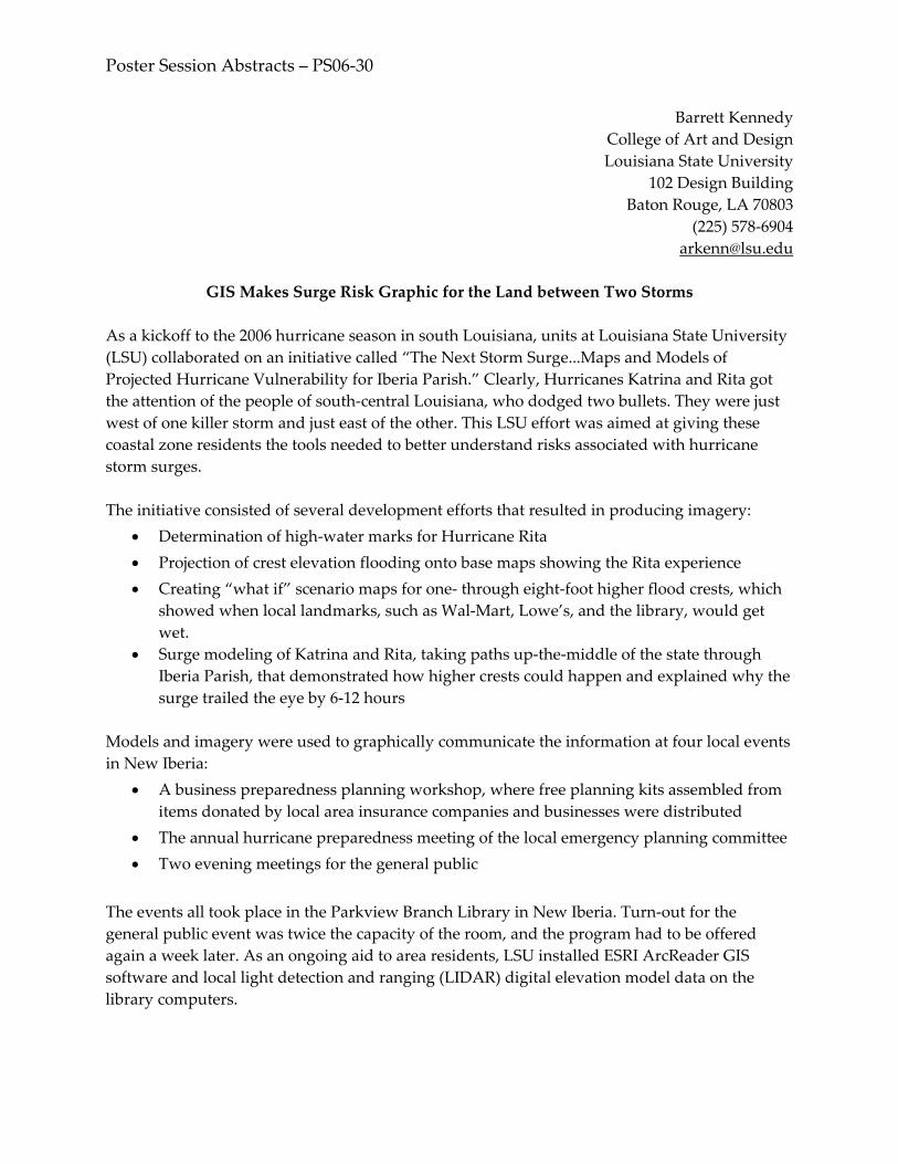
Poster Session Abstracts – PS06‐30
Barrett Kennedy College of Art and Design Louisiana State University
102 Design Building Baton Rouge, LA 70803
(225) 578‐6904 [email protected]
GIS Makes Surge Risk Graphic for the Land between Two Storms
As a kickoff to the 2006 hurricane season in south Louisiana, units at Louisiana State University (LSU) collaborated on an initiative called “The Next Storm Surge...Maps and Models of Projected Hurricane Vulnerability for Iberia Parish.” Clearly, Hurricanes Katrina and Rita got the attention of the people of south‐central Louisiana, who dodged two bullets. They were just west of one killer storm and just east of the other. This LSU effort was aimed at giving these coastal zone residents the tools needed to better understand risks associated with hurricane storm surges. The initiative consisted of several development efforts that resulted in producing imagery:
• Determination of high‐water marks for Hurricane Rita • Projection of crest elevation flooding onto base maps showing the Rita experience • Creating “what if” scenario maps for one‐ through eight‐foot higher flood crests, which
showed when local landmarks, such as Wal‐Mart, Lowe’s, and the library, would get wet.
• Surge modeling of Katrina and Rita, taking paths up‐the‐middle of the state through Iberia Parish, that demonstrated how higher crests could happen and explained why the surge trailed the eye by 6‐12 hours
Models and imagery were used to graphically communicate the information at four local events in New Iberia:
• A business preparedness planning workshop, where free planning kits assembled from items donated by local area insurance companies and businesses were distributed
• The annual hurricane preparedness meeting of the local emergency planning committee • Two evening meetings for the general public
The events all took place in the Parkview Branch Library in New Iberia. Turn‐out for the general public event was twice the capacity of the room, and the program had to be offered again a week later. As an ongoing aid to area residents, LSU installed ESRI ArcReader GIS software and local light detection and ranging (LIDAR) digital elevation model data on the library computers.

Poster Session Abstracts – PS06‐30
The events also provided an opportunity to distribute LSU AgCenter information on hurricane preparedness, hazard‐resistant residential construction, and onsite flood protection methods. The posters and educational materials will remain on display in the library through September 30, 2006. Similar events are being planned for Vermilion and St. Mary parishes, which were hit by Katrina and Rita, but not as catastrophically as the far eastern and western parishes of Louisiana. LSU is organizing the meetings and producing the modeling and flood graphics that will be relevant for each of these coastal parishes. LSU contributors to this educational effort include: Thomas Hymel, LSU AgCenter Watershed Specialist and Sea Grant agent in Iberia Parish; Hassan Mashriqui, engineer for the LSU Hurricane Center; Paul Kemp and Dane Dartez, also with the Hurricane Center; Barrett Kennedy, John Pine, Jackie Mills, Stephanie Pedro, and Jasemine James of the CADGIS Research Lab.

Poster Session Abstracts – PS06‐31
Jamie Brown Kruse Center for Natural Hazards Research
East Carolina University Greenville, NC 27858
(252) 328‐5718 [email protected]
www.ecu.edu/hazards/
The Center for Natural Hazards Research at East Carolina University The Center for Natural Hazards Research (CNHR) in the Thomas Harriot College of Arts and Sciences at East Carolina University (ECU) was established in 2004 to foster a multidisciplinary research community that seeks to understand and, thereby, improve our ability to withstand and recover from adverse events caused by the natural processes. In keeping with its mission, “To promote research and analysis that ultimately reduces the harm caused by forces of nature to life, business, and the environment,” the CNHR has 14 core faculty and faculty associates and 3 graduate students at ECU. New projects for the year include the following:
• Collection of Economic Impact Data: Implications for Disaster Area and Receiving Regions. This research will examine the economic impact of Hurricane Katrina upon both the metropolitan regions that were directly struck by the hurricane and the metropolitan regions that served as host regions for the thousands of evacuees who left New Orleans and the Gulf Coast region. National Science Foundation #0553108. 2005‐2006. Principal investigator: J. Kruse (ECU); senior investigators: B. Ewing (Texas Tech University), F. Malik (University of Southern Mississippi‐Gulfport), and M. Thompson (Stephen F. Austin University).
• The New New Orleans: Evaluating Preferences for Rebuilding Plans after Hurricane
Katrina. This study will elicit local and national valuation of the historic and cultural attributes that make New Orleans unique. The study will also elicit public valuation of mitigation that can harden the city against future hurricanes and tropical storms. National Science Foundation #0554987. 2006‐2008. Principal investigator: J. Kruse (ECU); coinvestigators: C. Landry (ECU‐economics), O. Bin (ECU‐economics), K. Wilson (ECU‐sociology), and H. Stone (ECU‐planning); senior investigator: J. Whitehead (Appalachian State University).
• Spatial, Environmental, and Behavioral Determinants of Coastal Erosion Risk. This
project is designed to examine how the public perceives the risk in conjunction with the amenities that make coastal property markets unique. A geographic information system (GIS) will be used to generate variables describing spatial, environmental, and market characteristics of coastal properties. Viewshed, based on light detection and ranging LIDAR, will be constructed for each property in the sample in order to provide an objective measure of the amenity ocean view. Surveys of property owners will be used

Poster Session Abstracts – PS06‐31
to understand attitudes and perception of coastal risk. ECU Research Development Grant. Principal investigator: J. Kruse (ECU); coinvestigators: O. Bin (ECU‐economics), C. Landry (ECU‐economics), and T. Crawford (ECU‐geography).
• Natural Disasters and Bank Performance. In this study, we examine the time series
behavior of regional bank performance in response to severe wind storm events. Our analysis utilizes event study methodology that allows for the possibility that changes in measures of bank performance may be significantly affected by a severe wind storm. Our analysis relies on three bank ratios: nonperforming loans to total loans, net chargeoffs to total loans, and return on assets. Our goal is to identify the impact of a wind disaster on both large and small banks. Federal Deposit Insurance Corporation. Coinvestigators, J. Kruse (ECU), B. Ewing (Texas Tech University), and S. Hein (Texas Tech University).

Poster Session Abstracts – PS06‐32
Feng‐Tyan Lin Graduate Institute of Building and Planning
National Taiwan University Taipei, Taiwan 106 [email protected]
Pai‐Hui Hsu Wen‐Ray Su
National Science and Technology Center for Disaster Reduction, Information Divsion Sindian City, Taipei County, Taiwan 231
[email protected] [email protected]
The Experience of Establishing Disaster Management Information System in Taiwan
Due to its particular geographical location and geological conditions, Taiwan suffers from many natural hazards, including typhoons, flooding, landslides, land debris, and earthquakes, which often cause serious property damages and even loss of life. To reduce the damages and losses caused by natural hazards, an integrated and complete disaster management information system (DMIS) is necessary. An ideal DMIS should integrate geographic information systems (GIS) tools, internet technology, dynamic hazard models, and graphical user interfaces and cover the operations through the four phases of mitigation, preparedness, response, and recovery. In the past, the relevant research fields for disaster prevention involving earthquakes, floods, debris flows, and hazards response systems have been successfully studied in Taiwan. However, to better and faster manifest the results of those research fields to real practice, an integrated information system is needed. Disaster management is an interagency and interdisciplinary task. Many organizations, including fire, weather, water, and soil agencies, in different levels of governments in Taiwan, have had their own emergency information management systems. In particular, due to the nature of different kinds of disasters, the content and process of management information systems for different disasters in different phases may vary. In other words, the broad concept of a disaster management system can be further classified into subsystems or modules. According to this framework, the National Science and Technology Center for Disaster Reduction is prompting development of an integrated DMIS, which will coordinate agencies and departments of different levels of government in a smooth way during disaster. Information systems are an essential component for disaster reduction and emergency management. The next step for having an integrated DMIS is to work closely with the

Poster Session Abstracts – PS06‐32 National GIS (NGIS) program, team‐up the information divisions of associate research centers, establish a data warehouse as a common platform with XML/GML‐based data exchange standards, and join international cooperative projects. In the future, the DMIS will be upgraded to a real decision support system, where more intelligent reasoning and prediction models are installed together. It is highly expected that we will have a more successful emergency response and disaster reduction system if we are able to fully employ the powerful capabilities of computer systems, Web‐based technology, and telecommunications devices.

Poster Session Abstracts – PS06‐33
Yi‐Sz Lin Hazard Reduction and Recovery Center
Texas A&M University 3137 TAMU
College Station, TX 77840‐3137 [email protected]
Using Remotely Sensed Data to Map Urban Development in Hazard‐Prone Areas:
A Case Study of Galveston County, Texas
The prevention of development in hazard‐prone areas is considered one of the most sustainable ways to reduce casualties and property damage in natural disasters. However, development in hazard‐prone areas has always been excluded from the control of zoning regulations for achieving sustainability (Berke et al. 1993). In addition, locations with attractive amenities, such as waterfronts, also may be accompanied by the presence of storm surge or flood hazards. The perception of amenities, rather than of hazard risk, often has a greater influence on people, resulting in uncontrolled urban development in hazard‐prone areas. Land use and building construction practices are means of hazards mitigation adopted at the preimpact stage to prevent development in hazard‐prone areas or decrease the vulnerability of structures in hazard‐prone areas (Lindell and Prater 2003). Even though zoning and structural regulations are present, losses and casualties caused by natural hazards in the United States appear to increase every year (Alexander 1994). The zoning regulations seem to be ineffective in governing urban development and protecting residents from natural hazards. Furthermore, the awareness of the presence of natural hazards does not prevent urban development from locating in the hazard‐prone areas. As a result, a study analyzing urban development in hazard‐prone areas to examine people’s risk perception of natural hazards and effectiveness of zoning regulations is necessary. This study proposes to use remotely sensed data to map the trend of urban development in Galveston County, Texas, at different temporal contexts and analyze the influence of people’s risk perception and land use practices on regulating urban development in hazard‐prone areas.

Poster Session Abstracts – PS06‐34
Jing‐Chein Lu Hazard Reduction and Recovery Center
Texas A&M University 3137 TAMU
College Station, TX 77843 (979) 575‐2453 [email protected]
Multifamily Housing Recovery in South Miami‐Dade County, Florida, after
Hurricane Andrew, 1992 Postdisaster housing is one of the most important issues after a devastating disaster. Although there has been some research on postdisaster housing issues, there is limited research in multifamily housing recovery issues, especially using a systematic research approach. It is critical to understand multifamily housing recovery, because multifamily housing constitutes a great proportion of housing in most metropolitan areas. In addition, multifamily housing is often the residency type of vulnerable populations, who have greater difficulty in reestablishing postdisaster housing (Bolin 1993; Peacock et al. 1997). This poster uses the multifamily housing recovery experience in south Miami‐Dade County, Florida, after Hurricane Andrew in 1992, to explore the housing recovery trajectories of different multifamily types, including duplex, apartment, cluster home, condominium, and townhouse. Social vulnerability factors, such as income, race, age, and homeownership, are also examined to compare their influences on the progress of multifamily housing recovery.

Poster Session Abstracts – PS06‐35
Kathy Lynn Resource Innovations University of Oregon Eugene, OR 97403
(541) 346‐0687 [email protected]
http://ri.uoregon.edu
Arleen A. Hill Department of Earth Sciences
University of Memphis Memphis, TN 38152
(901) 678‐2589 [email protected]
Wildfire Resilience in Rural Communities of the Pacific Northwest
Many communities in the Pacific Northwest face serious and growing risks from wildfires. The Illinois Valley in Josephine County, Oregon, is one area facing this growing risk. The Illinois Valley Fire District protects over 17,000 residents in an area of 140 square miles. Residents of the Illinois Valley are quite familiar with wildfire, including the 2002 Biscuit fire, which threatened over 3,400 homes and put thousands of residents on evacuation notice. Two plans, the Josephine County Integrated Fire Plan, adopted in November 2004, and the Illinois Valley Fire Plan adopted in March 2005, both illustrate the high risk to wildfire in the Illinois Valley and identify community priorities for reducing wildfire risk. In August 2005, the Illinois Valley was threatened by the Deer Creek fire, which burned over 1,600 acres on public and private land, including over a dozen homes and outbuildings. The purpose of this study was to document individual and household experiences associated with the Deer Creek fire, explore the resilience of communities to wildfire, and to support strategies to reduce risk to future wildfire events. A face‐to‐face survey of residents was used to document, describe, and assess the perception, experiences, preparedness, and evacuation behavior of residents impacted by the 2005 Deer Creek fire. Findings of this quick response study establish a baseline for preparedness and education efforts and suggest that rural communities have foundations for resilience that balance vulnerabilities associated with culture and economics.
Poster Session Abstracts – PS06‐36
Bill Massey Hurricane and Emergency Management Programs
Dewberry (678) 530‐0022
Dennis Kwiatkowski Federal Programs
Dewberry (828) 670‐6563
[email protected] Utilizing the National Hurricane Center’s Forecast of Inland Wind Fields in Conjunction with FEMA’s Descriptive Reference Guide (DRG) to Estimate Potential Wind Damages
Case Study: Hurricanes Katrina and Rita (FEMA HMTAP 2000‐CO‐0247 URS Corp, Dewberry JV) Background: The National Hurricane Center advisories provide estimated and forecasted wind fields for 34 knots (kt), 50kt, and 64kt at six hour timeframes for all tropical cyclones of 34kt winds or greater. The HURREVAC program graphically displays these wind fields as a three‐color graphic along the projected path of the storm. The Federal Emergency Management Agency (FEMA), other federal agencies, and the state and local emergency management community use this graphic to alert and prepare citizens in the path of storms. The purpose of this case study is to evaluate the accuracy of this graphic to determine if it can be used to estimate potential inland wind damages. For the purpose of this case study, “inland winds” are considered to be at least 10 miles inland of the immediate coast. Methodology: Four teams of engineers, planners, and emergency managers visited and documented “representative” wind damage sites throughout the areas affected by Hurricanes Katrina and Rita in Alabama, Mississippi, Louisiana, and Texas to assess and document observed inland wind damages caused by these two storms. Each team was assigned areas within the path of Hurricanes Katrina and Rita and, at random, selected, photographed, and observed damages on representative damage locations and types. The data was then recorded and filed in Microsoft Access. Each site was assigned a Descriptive Reference Guide (DRG) value (developed by FEMA in the aftermath of Hurricanes Opal and Bertha) that corresponded to the DRG scale for the type of wind damage observed. Observed wind graphics are generally developed and published by the National Oceanic and Atmospheric Administration and other entities well after the storms have made landfall and caused their damage and destruction. For emergency response organizations to be able to respond more quickly to these events, they need a tool to better estimate the types and amount of inland wind damages. Results: More than 300 damage locations were visited and documented for each storm. These sites were geocoded and overlaid over the HURREVAC wind swath to determine the distribution of the DRG numbers.

Poster Session Abstracts – PS06‐37
Sandra Menke Mid‐America Earthquake Center
University of Illinois at Urbana‐Champaign 1239B Newmark Laboratory 205 North Mathews Avenue
Urbana, IL 61801 (217) 244‐8297
[email protected] http://mae.cee.uiuc.edu/
Mid‐America Earthquake (MAE) Center:
Reducing Earthquake Losses through Research and Education
The MAE Center is a National Science Foundation earthquake engineering research center that has become a world leader in assessing and mitigating the effects of low‐probability/high‐consequence earthquakes and other natural disasters. The series of earthquakes in 1811 and 1812, referred to as the New Madrid earthquakes, shook most of the central and eastern United States and were felt as far as Washington, DC. A repeat of those events today would cause losses significantly larger than those caused by Hurricane Katrina and would have enormous impacts throughout the US and even the global economy. High‐impact natural disasters are so infrequent that there is no consensus on how to mitigate their anticipated effects. They require an approach capable of influencing many types of organizations and addressing the needs of a complex society. The MAE Center has pioneered the development, articulation, and application of Consequences‐Based Risk Management (CRM), whereby engineering and consequential social and economic impacts, alongside mitigation options, are assessed in an integrated fashion and presented through high‐end information technology platforms to decision and policy makers. The CRM framework also serves to develop educational and outreach activities that address the complex needs of vulnerable regions and lead to higher risk awareness and preparedness. The novel integrated approach of the MAE Center is also producing a new type of risk management professional who is capable of dealing with engineering, social, and economic issues and their interactions. Through the MAE Center’s highly interdisciplinary CRM framework, risk is assessed in the central and eastern United States and similar regions around the world, and suitable plans and prioritization of mitigation actions are developed to protect communities vulnerable to natural disasters.

Poster Session Abstracts – PS06‐38
Seth McGinnis Institute for the Study of Society and Environment
National Center for Atmospheric Research PO Box 3000
Boulder, CO 80307‐3000 (303) 497‐8139
Disaster Dynamics: The Hurricane Landfall Game The goal of the National Center for Atmospheric Research’s Disaster Dynamics project is to develop experiential learning products that teach players about the unique challenges posed by weather‐ and climate‐related hazards, extreme events, and natural disasters. The Hurricane Landfall game is a four‐player, computer role‐playing/strategy game about the interaction between natural hazards and urban planning. Undergraduates who play the game learn about hazards management through role‐playing, negotiation, and experiencing the sometimes unanticipated consequences of their decisions. The game focuses on urban development and land use planning in a coastal community exposed to hurricanes and other storm hazards. Each player takes on a role that defines what she wants to accomplish and how she can reach that goal. Play consists of proposing, negotiating, and voting on projects and policies that influence the growth of the urban landscape. Various metrics of urban development reflect how the city’s conditions match up with the goals of the different roles. Each turn begins in the aftermath of an extreme event, some of which may become disasters, depending on the city’s response. Teaching points addressed by the game include: the precautionary principle, decision making under uncertainty, making unpopular investments, long‐term effects of choices, problem solving and negotiation, managing limited resources, interactions between growth and hazards, the difficulties of gauging success in hazards mitigation, and infinite games, among many others. This poster will include a demonstration. Free copies of the software will be available. For more information, visit the game’s Web site at www.dd.ucar.edu.

Poster Session Abstracts – PS06‐39
S.T. McManus Department of Civil Engineering
University of Canterbury Christchurch, New Zealand
E.P. Seville Department of Civil Engineering
University of Canterbury Christchurch, New Zealand
[email protected] www.resorgs.org.nz
Resilient Organisations: A New Zealand Perspective
Resilient Organisations is an innovative and ambitious research project investigating how New Zealand organizations may improve their resilience to hazard events. Over a six year period Resilient Organisations is investigating the planning, prioritization and deployment, and legal issues faced by New Zealand organizations in relation to hazard events. The project has three separate but interconnected objectives. Objective One explores how and why organizations plan for hazard events and investigates how investment is prioritized, both within organizations and from a wider perspective, by identifying critical industries. Additionally, Objective One also explores ways to improve internal strategies for organizational planning and to link resilience to crises with day‐to‐day operations. Finally, Objective One looks at ways to provide a platform for interorganizational hazards planning both within and across industry boundaries. Objective Two looks at the prioritization and deployment of physical and human resources for recovery after a hazard event. The aim is to develop a support tool that will assist in decision making for physical response and recovery in a network, namely the road network in New Zealand. Road infrastructure has been selected because of its role as a key lifeline service in the aftermath of many physical hazard events. This objective critically evaluates how communications function in a crisis situation and how resource prioritization decisions are made, particularly between different organizations. Objective Three investigates the legal and contractual environment in New Zealand with a view to establishing a comprehensive procurement framework and program management plan for reconstruction in the event of a national disaster. There is a concern that the current normal legal and contractual arrangements will not adequately function following a large scale physical crisis in New Zealand and may actually hamper the speed and effectiveness of the recovery effort. This objective seeks to better understand the governing legislation and how it may operate in a crisis concentrating on the physical recovery. Therefore, the focus is on the construction industry and its interconnectedness with other organizations. New Zealand is a small country in terms of its geographic size, population, and economy. However, New Zealand’s physical environment is highly dynamic. Therefore, there is an

Poster Session Abstracts – PS06‐39
increasing need for research that focuses on organizations and their systems in New Zealand. Organizations manage, maintain, and operate our infrastructure, create our economy, and contribute to our society. The ability of organizations to respond effectively following a hazard event has a large influence on the length of time that essential services are unavailable. Therefore, enhancing organizational resilience is a critical step toward creating more resilient communities.

Poster Session Abstracts – PS06‐40
Krista Mitchell
Oregon Natural Hazards Workgroup University of Oregon
1209 University of Oregon Eugene, OR 97403‐1209
(541) 346‐3588 [email protected]
Holistic Approach to Community Risk Reduction
Throughout Oregon’s history, it has been subject to a range of natural hazards that have taken lives and caused major property damage and economic loss. In 1973, the Oregon legislature passed Senate Bill 100, which enacted a statewide land use planning program. The foundation of the program is a set of planning goals that each Oregon community must address in its comprehensive plan. One of the 19 statewide goals (Goal 7) requires communities to address natural hazards in their comprehensive land use plans. Specifically, the goal is to “protect life and property from natural hazards.” In 2000, 27 years after enactment of the statewide planning system, all Oregon communities have addressed Goal 7 with varied degrees of success. Often communities lack the capacity to plan for and/or coordinate sound multiobjective natural hazards mitigation planning. Many long‐term planning and mitigation activities require financial and human resources that far exceed local government and organizational means. Thus, statewide policy is not enough; communities need coordinated, multiobjective planning resources, tools, and strategies to help build capacity to reduce their risk from natural hazards. This suggests a need for a statewide multiobjective planning process to address the natural hazard risks in communities. By establishing a land use planning process and policy framework, Oregon can ensure that all regions of the state are adequately addressing the needs for preservation of open space, protection of coastal shore lands, as well as mitigation, response, recovery, and preparedness. By planning for and managing land use, negative effects of disasters can often be significantly reduced. Land use plans enable local governments to gather and analyze information about the suitability of land for development so that limitations on the development of hazard‐prone areas can be implemented. Specific examples of programs include local, state, and national programs, such as the National Flood Insurance Program’s Community Rating System, Fire Suppression Rating, and the Building Code Effectiveness Grading Schedule. Previous assessments of land use and mitigation planning for hazards have revealed a lack of understanding and capacity at the local level in incorporating hazards information into community plans. Such catastrophic events strain taxpayers’ and communities’ abilities to pay for losses, as well as governmental and nonprofit relief agencies’ abilities to respond. In addition, these events weaken the core of any community—its businesses and its population. Often, the sole burden of
Poster Session Abstracts – PS06‐40
developing and implementing risk reduction strategies (i.e., mitigation planning, policies, and program implementation) falls on the local jurisdiction. This sole burden can be partially alleviated by improving the four Cs: Coordination, Communication, Collaboration, and Capacity. Oregon is working to address this through the Partners for Disaster Resistance & Resilience (the Partnership). The Partnership, coordinated by the Oregon Natural Hazards Workgroup at the University of Oregon, focuses on bringing together individuals from businesses, agencies, and organizations that have authority and accountability to make a difference in hazards protection, risk, and loss reduction.

Poster Session Abstracts – PS06‐41
David M. Neal Department of Political Science
514 B Math‐Science Oklahoma State University
Stillwater, OK 74078 (405) 612‐4741
Gary Webb Department of Sociology 006 Classroom Building
Oklahoma State University Stillwater, OK 74078
(405) 744‐6127 [email protected]
First Year Activities of the Center for the Study of Disasters and Extreme Events (CSDEE)
at Oklahoma State University Dean Peter Sherwood of the College of Arts and Sciences at Oklahoma State University (OSU) established the Center for the Study of Disasters and Extreme Events (CSDEE) in July 2005. Since that brief time, CSDEE faculty members have received six different grants and contracts (e.g., National Science Foundation (NSF), Oklahoma State Office of Homeland Security). Projects include the following:
• Using the Incident Command System (ICS) and the National Incident Management System (NIMS) following Hurricane Katrina (NSF and University of Colorado Natural Hazards Center Quick Response program)
• Sheltering Victims following Hurricane Katrina (NSF) • Managing Mass Casualties following Hurricane Katrina (NSF through Millersville
University‐sponsored project) • Managing Mass Casualties in India following the Tsunami (NSF through Millersville
University and the OSU Office of International Studies‐sponsored project) • Assisting the State of Oklahoma with homeland security preparedness
Some key findings from the NIMS/ICS study were that:
• Many local, state, and federal organizations did not use ICS and NIMS during the response to Hurricane Katrina and
• Structural barriers (e.g., lack of training, primarily fire departments aware of ICS/NIMS process) inhibited the use of ICS and NIMS.
Some initial findings from the emergency time shelter study were that:
• Faith‐based organizations provided a significant contribution to providing emergency shelters following Hurricane Katrina and

Poster Session Abstracts – PS06‐41
• Representatives of faith‐based organizations had positive experiences and will open shelters in the future with or without the American Red Cross.
Initial findings from the mass casualty tsunami in India study were that:
• Perception of a massive health problem, stench and decomposition of the bodies, and the need to take care of the living generally lead to about 10,000 bodies recovered and buried within three days after the impact and
• Prior training and experience (e.g., Bhuj Earthquake, Orissa Supercyclone, Bhopal) assisted with rapid mass casualty management.
CSDEE faulty have drawn upon 16 undergraduate and graduate students to assist with the various projects, representing a wide range of disciplines including, sociology, geography, political science, and fire and emergency management.

Poster Session Abstracts – PS06‐42
Amarah Niazi Sudha Arlikatti
Kathy Lynn Lori Peek
Elaine Enarson Gender and Disaster Network
www.gdnonline.org/
The Gender and Disaster Network The Gender and Disaster Network (GDN) is an educational project initiated by people who have an interest in disasters and their impact on gender relations. It was founded during the July 1997 Hazards Research and Applications Workshop in Denver, Colorado. Understanding that communication technology is not fully accessible and that we work in many languages and contexts, we hope to utilize the Internet to bring together a global network of researchers and practitioners. Our goals are to:
• Document and analyze women’s and men’s experiences before, during, and after disaster, situating gender relations in broad political, economic, historical, and cultural context
• Work across disciplinary and organizational boundaries in support of collaborative research and applied projects
• Foster information sharing and resource building among network members
• Build and sustain an active international community of scholars and activists The GDN has grown as an international forum for discussion, networking, and information exchange. The Northumbria University Division of Geography and Environmental Management maintains the GDN site and the content generated by network members. There is also a discussion list managed by Texas A&M University, which can be subscribed to by registering at www.gdnonline.org/register.htm. The GDN poster display describes the goals and history of GDN and highlights the 2006 winner of the Mary Fran Myers Award. It also illustrates recent publications, projects, and research efforts being undertaken by GDN members. For more information on the GDN, visit www.gdnonline.org/. An exciting highlight of the GDN this year is the Gender and Disaster Sourcebook, which is a one‐stop, user‐friendly electronic guide to help others answer the question “Gender and disaster—what’s the connection?” You can visit and contribute to the sourcebook at www.gdnonline.org/sourcebook.htm.

Poster Session Abstracts – PS06‐43
John E. Ogren National Oceanic and Atmospheric Administration
National Weather Service 6900 West Hanna Avenue
Indianapolis, IN 46241 (317) 856‐0360 x642
NOAA’s National Weather Service Polygon Warnings: What They Mean to You For decades, county borders have been used to delineate the coverage of National Weather (NWS) Service short‐fuse convective warnings. With the advancement of technology, it is now possible to issue warnings for areas smaller than a county or for areas that cross county boundaries. Issued by latitude and longitude points, these subcounty “polygon” warnings provide additional information that can be easily ingested by geographic information system (GIS) applications. This polygon information has been included with NWS warnings for several years, but until now the polygon data has not been exploited by the agency. The advantages to GIS users are greater than simply providing more detailed warning information. Such a step forward brings an added ability to query the types of structures and demographic information impacted by the warning. This enables emergency management and other disaster response agencies to use the current warning polygons with other GIS shapefiles to make rapid life and property decisions and improve vital recovery operations. Advantages also include economic and societal benefits. Local NWS studies have shown a reduction in warning size of up to 70 percent. Daniel S. Sutter, an economics professor at the University of Oklahoma, estimated that polygon warnings would save the U.S. economy $50 million dollars per year, and reducing the size of tornado warnings by 75 percent would have the same value as reducing the false alarm rate to 0 percent! Encouraging meteorologists to warn using polygons rather than counties is only the first step for the Polygon Warning Team. To fully adopt this paradigm shift, several other areas must be addressed. First of all, a new verification mechanism will be required. This would verify warnings based on weather occurring within the polygon rather than within county boundaries. Verification statistics, such as probability of detection and false alarm ratio, would be quite different for this new approach, and a new baseline of performance would likely be required based on the new values. One advantage of changing to a polygon verification system is that verification results could be delivered almost immediately using automated GIS techniques. The Polygon Warning Team will be looking at ways to transition to this new method of verification. Another impacted area is dissemination. In the future, the National Oceanic and Atmospheric Administration Weather Radio system could be modified to allow targeted areas by polygon

Poster Session Abstracts – PS06‐43
rather than counties. This could lead to a reduction in the size of areas warned and, therefore, provide better service. Dissemination systems can include newer technologies that are becoming available, such as cellular phone alerts, pagers, and Web‐enabled personal data assistants.

Poster Session Abstracts – PS06‐44
John Pine Louisiana State University
Department of Geography and Anthropology (225) 578‐1075 [email protected]
Jacqueline W. Mills
Louisiana State University LSU GIS Clearinghouse Cooperative
(225) 578‐5861 [email protected]
LSU GIS Clearinghouse Cooperative
The Louisiana State University (LSU) Geographic Information Systems (GIS) Clearinghouse Cooperative was established in the aftermath of Hurricane Katrina as a central repository of geospatial data related to the disaster for affected areas of Louisiana. We soon expanded to maintain perishable data from Rita and Wilma, as well. Initiated through collaboration between the Federal Emergency Management Agency (FEMA) and LSU, the clearinghouse facilitates many of the data access and distribution needs of FEMA, state, and local efforts. With 20 terabytes of storage capacity and download ability through the clearinghouse’s Web site, www.katrina.lsu.edu/, this resource helps meet the needs of the mitigation and long‐term planning aspects of rebuilding Louisiana. In addition to the downloadable data available through the Web site, the clearinghouse stores information that is not for public release and provides secure access for appropriate agencies. Faculty, research associates, and graduate students at LSU manage the data and data requests. These personnel comprise a vast range of research, technical, and managerial skills necessary for effective geospatial decision support. Data can be accessed in several ways, depending on information needs. Publicly accessible data is available for download through our Web site. In addition to geospatial data, this site also provides contact information, sponsor information, photo galleries, and related links, such as www.atlas.lsu.edu/, which provides extensive geospatial data for Louisiana. GIS‐Store is our 20TB storage location, which provides the data for the Web site, but most importantly serves as the clearinghouse for geospatial data related to Louisiana and Katrina, Rita, and Wilma. GIS‐Store is password protected and available only to designated government and academic personnel involved in the recovery efforts. Contact Farrell Jones ([email protected]) or Ramesh Ramani ([email protected]) with requests for access to GIS‐Store. In addition, due to our extensive collection of pre‐ and posthurricane imagery, we are in the process of providing online access to other imagery through the raster server Web site, www.rasterserver.lsu.edu/. This will assist users in downloading available data in different projections and file formats for a selected area of interest. Finally, we also provide Terrashare, an image database and management tool that allows for spatial display of images within Windows Explorer—no GIS software required! Currently, this tool is only available only to LSU researchers.

Poster Session Abstracts – PS06‐45
Patrick S. Roberts Center for International Security and Cooperation
Stanford University 616 Serra Street C237 Stanford, CA 94305
(202) 549‐4987 [email protected]
Center for Public Administration and Policy
Virginia Tech Blacksburg, VA
FEMA after Katrina
Following a devastating hurricane, the Federal Emergency Management Agency (FEMA) is in crisis. Should it be abolished? Should emergency management responsibilities be given to the military? Returned to the states? Before issuing more cries for radical change at FEMA, reformers should look to the lessons of the agency’s reorganization in the 1990s, which focused its tasks on natural disasters rather than national security. The turbulent history reveals an agency that can marshal resources for natural disasters and build relationships with states and localities, but one that lacks sufficient resources to take on too many tasks. Today, FEMA faces a protean terrorist threat and an increasing array of technological hazards. To address contemporary threats, the agency must hone its natural disaster expertise and delegate authority for disaster response to states and localities. Delegation, however, runs the risk of returning to the days of ad hoc disaster preparedness when government poured money into recovery without reducing vulnerability to disasters. Nevertheless, further decentralizing response functions is the best way to prepare for an increasingly complex array of disasters, because of political uncertainty, and because the risks and strategies for recovery for different kinds of disasters vary so dramatically from region to region.

Poster Session Abstracts – PS06‐46
Havidán Rodríguez Disaster Research Center University of Delaware
87 East Main Street Newark, DE 19716
(302) 831‐6618 [email protected]
Walter Díaz
Center for Applied Social Research University of Puerto Rico‐Mayagüez
Jenniffer Santos William Donner
Daniel Marks Disaster Research Center University of Delaware
Collaborative Adaptive Sensing of the Atmosphere: Integrating the End‐User Community
Project: Engineering Research Center (ERC), Center for Collaborative Adaptive Sensing of the Atmosphere (CASA) Funding Agency: National Science Foundation (NSF) Summary: Social scientists at the Disaster Research Center and the Center for Applied Social Research are contributing to the research efforts of CASA by exploring the social and human dimensions of severe weather forecasts and warnings. CASA is a recently established ERC within NSF’s Directorate for Engineering that focuses on the development of revolutionary sensing technology that will enable earlier and more accurate forecasts of severe weather events. CASA’s technology is expected to increase the warning time for tornadoes, flash floods, and other severe weather events, providing greater accuracy than existing (Next Generation Radar—NEXRAD) systems.
The aim of the recently funded ERC is to establish the necessary infrastructure to sense, analyze, and predict lower atmospheric events and to respond to potentially hazardous phenomena in order to significantly reduce their impact on society. More accurate and reliable weather forecasts and warning systems (based on the technology proposed by CASA researchers) may lead to improved disaster mitigation, preparedness, and response initiatives. However, improving weather forecasts and increasing lead times is only part of the equation in determining the ultimate effectiveness of organizational and individual preparedness and response to natural hazards.

Poster Session Abstracts – PS06‐46
Social scientists in the CASA project are focusing their research efforts on examining how improved forecasting can reduce the exposure and vulnerability of individuals and property to everyday and extreme weather events. Specifically, through the use of survey methodology and in‐depth interviews, we are examining how the end‐user community accesses, utilizes, and responds to weather forecasts. We also seek to explore their knowledge, interests, and perceptions concerning weather forecasting issues, attitudes towards climatological information, and their needs and interests in relation to the use of meteorological information. We aim to answer a variety of questions, including: who has access to climatological information and weather forecasts?; what are the primary sources of weather information used by emergency management agencies and the general public?; how much confidence do these end users have on this type of information?; according to the end users, how reliable are weather forecasts and warnings?; and how does climatological information affect the decision‐making processes of this community of end users? We have already initiated the data collection process in the state of Oklahoma; we will then collect similar types of data in Texas and Puerto Rico.

Poster Session Abstracts – PS06‐47
Jenniffer M. Santos Havidán Rodríguez
Disaster Research Center University of Delaware
87 East Main Street Newark, DE 19716
(302) 831‐6618 [email protected]
Unequal Access, Unequal Opportunities: Vulnerability to Disasters in Puerto Rico’s West Coast
Technological advances aimed at mitigating disasters often ignore the social context in which those tools will be implemented. Cannon (1994) points out that technology is not socially neutral and that its implementation should not take place ignoring the cultural, demographic, and socioeconomic characteristics of the population and the potential differential impact that it may have on the different population sectors. Implementing new technologies while overlooking the social characteristics of a population could have the potential of exacerbating vulnerability (intrasocietal vulnerability) among certain structural groups. Given Puerto Rico’s geographic location and its climatological characteristics, extreme weather events, such as earthquakes, tropical storms, hurricanes, floods, tsunamis, and landslides, are very probable events. Nevertheless, the literature on disasters rejects a causal relationship between extreme weather events and disasters. A disaster is “a process/event involving the combination of a potentially destructive agent (s) from the natural, modified, and/or constructed environment and a population in a socially and economically produced condition of vulnerability, resulting in a perceived disruption of the customary relative satisfaction of individual and social needs for physical survival, social order, and meaning” (Oliver‐Smith, 1998). Wisner et al. (2004) assert that changing social, political, and economic factors are contributing to an increasing gap between high‐ and low‐income countries (intersocietal vulnerability). Although Puerto Rico has been a territory of the United States since 1898, the island’s social and economic characteristics place the island at a considerable economic disadvantage relative to other states in the U.S. Rodriguez (2001) claims that Puerto Rico has a variety of intersecting social, political, and economic characteristics, such as the island’s geographic location, a large number of households located in high‐risk zones, high population density, aging population, high poverty levels, high levels of illiteracy, and lack of disaster mitigation initiatives. These characteristics could be potential ‘social vulnerability boosters’ when threatened by a weather event because of their impact on agency and, consequently, on the protective measures that the individual, group, or community might be able to take according to their location within the social structure. Furthermore, due to changing social, economic, and demographic patterns and the comodification of the coastal regions, there has been an increasing concentration of residents in high‐risk areas. It is precisely the transformation of the coastal areas that brings about a more

Poster Session Abstracts – PS06‐47
complex disaster scenario, particularly, due to the fact that many poor communities are located in those areas, and they lack the necessary resources to adequately prepare, cope, respond, and recover from extreme weather events. The primary goal of this project is to develop a quantitative model grounded in contemporary social theory to assess vulnerability to disasters in the context of Puerto Rico. Using Giddens’ Structuration Theory (The Constitution of Society 1987) as part of the theoretical framework, we analyze the dialectic relation between agency and vulnerability to disasters in the context of Puerto Rico. Special attention will be given to the individual agent and the risks that they may take either intentionally or unintentionally according to his/her location within the social structure. This will improve our understanding of how social, political, economic, geographic, and demographic factors contribute to the vulnerability of the population living within these areas.

Poster Session Abstracts – PS06‐48
Mathew C. Schmidtlein Hazards Research Lab
Department of Geography University of South Carolina
Columbia, SC 29208 (803) 777‐1699
Multi‐Hazard Vulnerability Assessments for the United States Research and legislation in the United States over the last few years has increasingly emphasized the importance of multihazard mitigation plans in efforts to reduce the impact of hazard events. A critical element of these plans is an assessment of the vulnerability stemming from hazard events that affect local areas or communities. The majority of existing approaches consider hazard event types individually, and those that actually include multiple event types typically do so only as a listing or inventory of hazards. Important questions remain in the development of truly multihazard vulnerability assessments, including the relative influence of events with varying intensities and probabilities of occurrence as well as the development of methods appropriate for comparing the vulnerability stemming from different hazard event types (e.g., hurricanes and tornadoes). My research is focused on developing a methodology for assessing multihazard vulnerability as a dynamic interaction between causal agents (e.g., tornadoes, floods, hurricanes) and their characteristics (e.g., frequency, magnitude, duration). This methodology will be applied as a test case to the southeastern United States. The primary question driving this research is: what is the distribution of multihazard vulnerability within the southeastern United States? The framework developed to answer this question will be based on conceptual descriptions of hazard events (e.g., magnitude, aerial extent, frequency), and will consider three of the major natural hazard events that occur in this region: tornadoes, hurricanes, and earthquakes. These events were chosen because of their spatial variability within the study area, because they represent diverse driving mechanisms, and because of the availability of data for these events. Biophysical vulnerability, concerned with “the distribution of hazardous conditions,” (Hill and Cutter 2001) will be conceptually useful in creating this multihazard characterization. A biophysical vulnerability surface will be created as a function of the conceptual description of these three hazards types. This research will expand conceptual understandings of hazards characteristics so that they may be used as inputs into a multi‐hazard model of biophysical vulnerability to support vulnerability assessments and mitigation planning. This will improve our ability to more readily identify areas where biophysical and social vulnerability intersect to create the greatest potential for disasters in our nation. References Hill, Arleen A., and Susan L. Cutter. 2001. Methods for determining disaster proneness. In American hazardscapes, ed. S.L. Cutter. Washington, DC: Joseph Henry Press.
Poster Session Abstracts – PS06‐49
William E. Scott Cynthia A. Gardner
U.S. Geological Survey Cascades Volcano Observatory
1300 SE Cardinal Court Vancouver, WA 98683
(360) 993‐8942 [email protected]
Interagency Workgroups Plan for Potential Volcanic Crises in the Cascade Range
During the past decade, U.S. Geological Survey (USGS) scientists have joined with representatives from local, state, provincial, tribal, and federal agencies to establish workgroups that address hazards and risk mitigation strategies at Cascade volcanoes. Each workgroup first assembled a variously titled response, communication, or coordination plan that defines agency roles and responsibilities during future crises at one or more volcanic centers. The 1980‐1986 eruption of Mount St. Helens required an interagency plan that was revised several times. This experience provided a blueprint for contingency planning at the other 12 Cascade volcanic centers of concern. Five plans have been completed or are underway that cover 9 of the 13 Cascade centers: Mount Rainier; Mount Baker and Glacier Peak; Mount Hood; 3 centers in central Oregon—Mount Jefferson, Three Sisters, and Newberry Volcano; and the latest effort to revise the St. Helens plan and include nearby Mount Adams. Future efforts will be aimed at northern California—Mount Shasta, Lassen Peak, and Medicine Lake volcano—and Crater Lake, Oregon. Membership of work groups varies but typically includes major tribes (two of whom, the Yakama Nation and the Confederated Tribes of Warm Springs, own eastern halves of Mount Adams and Mount Jefferson, respectively); federal land managers (U.S. Department of Agriculture Forest Service and (or) National Park Service); Federal Emergency Management Agency; state emergency management and geologic agencies; and county emergency management agencies. Local cities, fire districts, and school districts are active in some groups, as are local chapters of the American Red Cross, a state veterans’ home, and various citizen groups. Workgroups meet as often as four times per year to discuss issues of mutual interest and, perhaps more importantly, to provide a means for developing and strengthening personal and agency contacts among those who would have to respond to future volcanic crises. Beneficial outgrowths of workgroups include coordination of hazards education, as well as focus on local mitigation issues such as creation of emergency call‐down lists, training and protocols for public‐information officers, school and community evacuation plans, and a local lahar warning system in one particularly hazardous valley. The workgroups also provide volcano hazards perspectives in land use planning and zoning debates. Some workgroups have ongoing

Poster Session Abstracts – PS06‐49
collaborations with social scientists who are assessing community awareness of volcano hazards and risk. Key parts of each plan include a list of member agencies, purpose of plan, summary of potential hazards, USGS notification system for volcanic events, organization and responsibilities during crisis response, concept of operations under the Incident Command System, legal authorities, purpose and structure of a joint information center, and sources of additional and supporting information. Plans are considered living documents to be updated as needed. For example, the 1999 plan for Mount Rainier is undergoing revision this year. Some plans have been tested in table‐top exercises as well as in more rigorous simulations. The Mount St. Helens plan, which was last revised in 2002, was severely tested during the start of the current eruption in 2004. Several shortcomings were identified, which provided impetus for the new effort at Mount St. Helens and Mount Adams.

Poster Session Abstracts – PS06‐50
Susannah Sheldon Southeast Coastal Ocean Observing Regional Association
The Center for a Hazard Resilient Coast 113 Calhoun Street
Charleston, SC 29401 (843) 727‐6497
[email protected] www.secoora.org
The Southeast Coastal Ocean Observing Regional Association (SECOORA): Applications of Sub‐Regional Coastal Ocean Observing Systems to Hazard Prediction and Mitigation
The Southeast Coastal Ocean Observing Regional Association (SECOORA) is one of eleven regional associations of the Integrated Ocean Observing System (IOOS). The IOOS is a coordinated national network of observations, data management, and analyses that systematically acquires and disseminates data and information on past, present, and future states of the oceans and the nation’s Exclusive Economic Zone. The mission of SECOORA is to facilitate the use of the various coastal and ocean observing systems in North Carolina, South Carolina, Georgia, and Florida as well as the data these systems produce. Ultimately, SECOORA strives to establish a sustainable ocean information cooperative that can meet the specific needs of stakeholders in the region. A major stakeholder sector within SECOORA is public safety. There are several subsets of stakeholders that could benefit from information and products, including weather forecasting, search and rescue, disaster response, hazards planning, climate prediction, disaster mitigation, public preparedness, and coastal development. Coastal ocean observing systems offer not only data and information to more fully understand coastal natural hazards, such as storm surge, but also assist with the development of information and products for emergency and resource managers to more accurately predict and mitigate the effects of these hazards.

Poster Session Abstracts – PS06‐51
Pat Skinner LSU AgCenter and Sea Grant – Extension
Louisiana State University 104 E.B. Doran Hall
Baton Rouge, LA 70803 (225) 578‐2910
EDEN – Disaster Education Programs for Local Delivery History shows that when a disaster occurs, county‐level educators are called upon for information ranging from repairing buildings to returning to a normal lifestyle. The Cooperative Extension Service has a network of county‐based educators, supported by research and program development efforts at state land grant universities. The national Extension Disaster Education Network (EDEN) puts disaster education materials in the hands of these county‐based educators. EDEN enables states to share resources nationwide so that those less experienced in a particular subject can quickly obtain credible resources from those with more experience. In addition, it eliminates the need to duplicate efforts. During the last couple of years, EDEN has had the ability to provide subcontracts to member institutions to develop course materials and online learning opportunities to help educate targeted audiences about disaster topics, such as:
• Plant biosecurity management • Food protection and defense • U.S. Department of Agriculture’s (USDA) role in the National Response Plan • Disaster preparedness for businesses • Pandemic preparedness for businesses
Although these resources are developed for delivery by and through cooperative extension educators, they are available to others who wish to adapt and use them. Since 1994, and especially during the last couple of years with natural and agricultural disasters, EDEN has proven itself as a well‐functioning national network that benefits the extension professionals who rely upon it for much‐needed resources and benefits the communities who gain reliable knowledge from their local extension educators and agents. From this poster, participants will be able to 1) learn about EDEN and its educational resources, 2) identify the EDEN contact person(s) in their state, and 3) learn more about the homeland security educational initiative funded by the USDA.
Poster Session Abstracts – PS06‐52
Shawn D. Smith Emergency Visions
2110 Spring Hill Court Smyrna, GA 30080
(770) 436‐2474 [email protected]
National Emergency Management Network: Building a National Network for
Community Emergency Response and Recovery Hurricane Katrina and September 11 demonstrated how easily catastrophic events can overwhelm local and state emergency responders. Local authorities often need outside help to effectively respond to and recover from these and other more common events, such as winter storms or flooding. The human and physical resources required to respond to such events can be available not only from within the jurisdiction, but from other local governments, volunteer organizations, and/or the private sector. The key is knowledge and communication: what resources are available, who has them, and how can they be mobilized? The National Emergency Management Network (NEMN) responds to this crucial need. Local authorities can benefit from this effective, yet easy‐to‐use, solution to identify, track, and manage all emergency response and recovery/remediation assets required in catastrophic disasters, routine incidents, special events planning, and simulation and drill exercises. NEMN offers a two‐part solution. First and foremost, NEMN is a nationwide network of participants. NEMN’s sponsors, the Public Entity Risk Institute (PERI) and the International City/County Management Association (ICMA), are working nationwide to build a network with participating communities, businesses, and nonprofit organizations that are willing to share resources with stricken areas. Many of these entities are already generously sharing their resources, but without the support of a consistent nationwide network to identify, request, mobilize, track, and receive reimbursement for these assets. Second, NEMN is supported by a technology platform consisting of a comprehensive database of human and physical resources available for emergency response and recovery efforts (“ResponseVision” from Emergency Visions); a geo‐mapping and situational awareness tool to identify, select, activate, track, and manage response and recovery assets (“GTVC” from the Georgia Tech Research Institute); and training on interagency emergency collaboration and other emergency management topics. NEMN is a cost‐effective, holistic approach to incident and catastrophic event management developed by and for emergency managers and first responders, not as an application for any one specific discipline, but rather to foster cooperation and coordination among all response agencies for daily emergency incidents, trainings and drills, and large‐scale, all‐hazards emergency situations. The NEMN is offered by the ICMA and PERI. Access to the network is available to communities, counties, and authorized private sector organizations on an annual subscription basis. To participate in the NEMN, contact Barbara Yuhas of ICMA at (202) 962‐3539 or [email protected].

Poster Session Abstracts – PS06‐53
Delta Sousa e Silva National Laboratory of Civil Engineering
Building Department, Social Ecology Division Av. do Brasil, nº101
1700‐066 Lisbon, Portugal +351.21.8443887
Risk Management and Governance: The Case of Earthquake Risk
Portugal lacks systematic knowledge about the way it deals with natural hazards. The place and weight of risk reduction on land use policy and management is hardly known. Both predisaster preparedness and response to disasters need to be highlighted and conveniently assessed. Besides, it is important to know the extent to which postdisaster recovery is really taken as an opportunity for change and the reduction of vulnerabilities. The research project underlying this poster aims to help minimize the above‐mentioned knowledge gap through the systematic analysis of policies, patterns of management, and dynamics underlying the four components of the hazards cycle: mitigation, preparedness, response, and recovery. Our ultimate goal is the conception of a tool designed to support periodic assessments of risk management strategy and underlying activities. The high amplitude of the research subject conducted us to an exercise of subject delimitation. Given this, we chose to select a risk, earthquake risk, and an area where such risk was prominent, Azores archipelago. The institutional framework underlying land use policy and governance, as well as risk and civil protection management, play a key role in this research. Institutions, along with the dynamic they generate, are irreplaceable enhancers of any risk policy and management strategy. This research project is composed of three interrelated work packages, as follows:
• Work Package 1 (WP1): Risk mitigation, land use planning, and development • Work Package 2 (WP2): Predisaster preparedness—format and underlying dynamic • Work Package 3 (WP3): Tool for periodic risk management assessments
Thus, the components of risk mitigation and predisaster preparedness are central for two reasons. Analysis of mitigation policy and underlying dynamic will imply the analysis of past disaster processes of recovery, due to its potential for the introduction of risk reduction measures. On the other hand, diagnosis of predisaster preparedness will allow us to prospect the nature and efficacy of response, in case of future emergency situations. This research project is presently under its first year of development. The first year is mostly devoted to the construction of the theoretical framework and preparation for fieldwork, mainly regarding WP 1 and 2. These will imply the mobilization of several data collection techniques, which will be pursued through two field approaches: a pilot study of a few preselected areas of the Azores archipelago and a second approach where fieldwork and data collection will be extended to a wider area. Information and research produced under both WP1 and 2 are intended to serve as a crucial basis for the design of the risk management assessment tool described in WP3.

Poster Session Abstracts – PS06‐54
Zhenghong Tang Hazard Reduction and Recovery Center
Texas A&M University College Station, TX 77843
(979) 862‐9070 [email protected]
Measuring Tsunami Planning Capacity in the U.S. Pacific Coast
The U.S. Pacific coastal states—Alaska, California, Hawaii, Oregon, and Washington—are at risk both from distantly and locally generated tsunamis. Many tsunamis have hit Pacific coastal jurisdictions; however, few empirical studies have been conducted to determine how local jurisdictions have incorporated tsunami hazards management into local planning frameworks. This paper analyzes 43 U.S. Pacific coastal counties’ tsunami planning quality and capacity. A plan evaluation protocol defined by five components and 37 indicators was developed to measure the quality of local jurisdictions’ plans for tsunami hazards management. The results of the analysis indicate that most Pacific Coast counties have not prepared well for potential tsunamis in their local planning processes. The evaluation of these plans for tsunami risk management suggests the critical need to enhance public awareness for tsunami risks; link the science, technology, and policy; and systematically integrate tsunami hazards management with other hazards. Keywords: tsunami, Pacific Coast, hazards plan, plan quality

Poster Session Abstracts – PS06‐55
Koko Warner United Nations University Institute of Environment and Human Security
Görresstr. 15, D‐53133 Bonn, Germany 49 228 422 855 06
Úrsula Oswald‐SpringUniversidad Nacional Autónoma de México, Mexico
Hans‐Georg Bohle
University of Bonn, Germany
Anthony Oliver‐SmithUniversity of Florida, USA
Thomas E. Downing
Stockholm Environment Institute, United Kingdom
Social Vulnerability Research
Social vulnerability covers a complex field of research. How do people from different cultures assess the risks of natural catastrophes? Given their economic situations, what preventive measures do they and can they take? Can a uniform, global risk prevention strategy bring long‐term success? The object of social vulnerability research is to educate international PhDs in catastrophe management and prevention. In turn, these graduate students will put this knowledge to practical use in their home countries. Chair on Social Vulnerability. The United Nations University Institute for Environment and Human Security (UNU‐EHS) will present current work in social vulnerability research and capacity building in developing countries. The poster session will provide an overview of the recently established MunichRe Foundation Chair on Social Vulnerability. The chair was established to further explore research agendas related to social vulnerability, and to provide a platform for dialogue about social vulnerability research for PhDs. The chair was established by the MunichRe Foundation and the UNU‐EHS and focuses on three thematic areas: 1) cultural and socioeconomic dimensions of social vulnerability; 2) comparative cultural perception of social vulnerabilities; and 3) culturally‐sensitive, bottom‐up approaches to enhance social resilience, especially in developing countries. The chairs will help build capacity among PhDs working on research related to social vulnerability and expand the research agenda of disaster risk reduction to include cultural and social aspects of vulnerability The chair is occupied on a rotating basis by outstanding international scientists who will build up a research network. Thus, it will be possible to pursue a long‐term research objective. The following research fellows will occupy the chair for a period of one academic year:

Poster Session Abstracts – PS06‐55
1. Úrsula Oswald‐Spring, Universidad Nacional Autónoma de México, psychologist and politician, 2005/2006
2. Hans‐Georg Bohle, University of Bonn, Germany, geographer and expert on poverty in India, 2006/2007
3. Anthony Oliver‐Smith, University of Florida, USA, anthropologist on Central America specializing in migration and displaced persons, 2007/2008
4. Thomas E. Downing, Stockholm Environment Institute, United Kingdom, climate and environmental scientist, 2008/2009
The UNU‐EHS, where the foundation’s chair is located, was inaugurated in Bonn in 2004. Its director is hydrologist and professor, Janos J. Bogardi, who was previously the head of Sustainable Water Resources Development and Management at the United Nations Educational, Scientific and Cultural Organization (UNESCO). Starting in 2006, the UNU‐EHS and the Munich Re Foundation will organize an annual summer academy. At that forum, outstanding PhD candidates will have an opportunity to discuss their field of social vulnerability research and the results with high‐ranking scientists and international experts. The first summer academy will be held from July 23‐29, 2006, at Schloss Hohenkammer on the topic of “Global Water Hotspots: Water‐Related Social Vulnerabilities and Resilience‐Building.” The program and more information about the summer academy can be found online at www.ehs.unu.edu and www.munichre‐foundation.org. For more information about the MunichRe Chair on Social Vulnerability or about the Summer Academy, please contact Koko Warner at [email protected].

Poster Session Abstracts – PS06‐56
J. Arn Womble Wind Engineering Consultant
ImageCat, Inc. [email protected]
Beverley J. Adams
ImageCat, Inc., European Operations 246 Barnett Wood Lane
Ashtead, Surrey, KT21 2BY United Kingdom +44 (0) 1372 278777
Shubharoop Ghosh ImageCat, Inc., USA
400 Oceangate, Suite 1050 Long Beach, CA 90802 USA
(562) 628‐1675 [email protected]
Rapid Damage Mapping for Hurricane Katrina
(Using Remote Sensing for Insurance and Emergency Management) Hurricane Katrina (August 29, 2005) brought unparalleled damage from multiple hazards, including: wind pressure, storm surge, low‐velocity flooding, and levee breach. The timing of Hurricane Katrina was significant because it marked the first opportunity to examine and preserve multiple hazards damage conditions via the “eyes in the sky” (high‐resolution satellite and airborne remote‐sensing platforms). The rapid and widespread assessment of damage immediately following a natural disaster is important for insurance claims and loss estimation, for emergency management operations, and also for the guidance of detailed ground‐truthing surveys. Rapid preservation of the damage scene is also important for future studies of storm damage and for research into the automated assessment of damage using change‐detection studies of before and after imagery.
In the immediate wake of Hurricane Katrina, researchers at ImageCat, Inc. provided critical and timely information for the re/insurance catastrophe modeling company Risk Management Solutions (RMS) Inc. The ImageCat team employed the Post‐Disaster Damage Verification (PDV) program (georeferenced, high‐definition video imagery), optical satellite images (Landsat 5, QuickBird), and aerial images (National Oceanic and Atmospheric Administration) to map storm surge and wind pressure damage along the Mississippi Coast as well as flood inundation and high‐velocity flooding damage in New Orleans. Working with the Multidisciplinary Center for Earthquake Engineering Research (MCEER), ImageCat teams also performed strategic field reconnaissance studies in Mississippi and New Orleans to further quantify damage using ImageCat’s VIEWS™ (Visualizing Effects of Earthquakes with Satellites)

Poster Session Abstracts – PS06‐56
program. The remote sensing‐based damage maps served as guides for these field studies. Results of the VIEWS™ field reconnaissance studies have been made available through the Google Earth and Virtual Earth online applications.
Full details of the Hurricane Katrina field deployments are noted in volume two of the MCEER Special Report Series: Advanced Damage Detection for Hurricane Katrina: Integrating Remote Sensing and VIEWS™ Field Reconnaissance. This report provides recommendations for optimal field deployment strategies using remote‐sensing technologies. Further information regarding access to the report may be found at http://mceer.buffalo.edu/publications/Katrina/default.asp.

Poster Session Abstracts – PS06‐57
Ivor van Heerden Louisiana State University Suite 3221 CEBA Building
Baton Rouge, LA 70803 (225) 578‐5974
Hurricane Katrina: Storm Surges, Levees, and the Pathway Forward Hurricane Katrina made landfall in Louisiana as a fast‐moving category 3 storm that tracked north almost 30 miles east at its closest approach to downtown New Orleans. Following the storm, 85 percent of greater New Orleans was flooded. Although most families had heeded evacuation orders and left the city, over 1,200 lives were lost and approximately 100,000 families left homeless. The hurricane protection system that New Orleans residents depended upon—their security from storm surge flooding—failed catastrophically with over 50 breachings or breaks. U.S. Army Corps of Engineers’ reports indicated that 169 miles of the 350 miles of levees around greater New Orleans were either damaged or destroyed. An independent scientific investigation conducted in the wake of the storm resulted in a preliminary assessment of the New Orleans flooding event. There were two separate flooding events, distinct in time, space, and intensity. A surge event originating in Lake Borgne challenged levees and floodwalls along the Mississippi River Gulf Outlet, Gulf Intracoastal Waterway, and Inner Harbor Navigation Canal, all elements of the “surge funnel.” Meanwhile, a second, slightly later and less‐intense surge event was associated with Lake Pontchartrain. Both events caused overtopping of intact levees and floodwalls as well as breaching that resulted in flow under and through levees and floodwalls. In some cases, overtopping preceded or led to breaching, while in other places breaches opened before surge levels rose high enough to cause overtopping. We have estimated that about 84 percent of the volume of water that entered the greater New Orleans flood defense perimeter came through breaches, suggesting that the flooding of New Orleans was more of a “weather‐related engineering disaster” than an “act of God.” Authors: Ivor van Heerden, G. Paul Kemp, Hassan Mashriqui, Wes Shrum, Ezra Boyd, S. Ahmet Binselam, and Kate Streva, Louisiana State University Hurricane Public Health Center.