Part 2 Local Plan for Corby Mapping Booklet Mapping Booklet.pdf · Part 2 Local Plan for Corby...
67
Part 2 Local Plan for Corby Mapping Booklet
Transcript of Part 2 Local Plan for Corby Mapping Booklet Mapping Booklet.pdf · Part 2 Local Plan for Corby...

Part 2 Local Plan for Corby
Mapping Booklet

Table of Contents
Corby Borough Context Map 1
Green Infrastructure Corridors 2
Proposed Non-Strategic Employment Allocations and Long Term Reserve 3
Proposed Non-Strategic Employment Allocation: E1- Land off Courier Road 4
Proposed Non-Strategic Employment Allocation: Site E2 – Land at Pearson Training Academy 5
Proposed Non-Strategic Employment Allocation: Site E3 Princewood Road 6
Proposed Non-Strategic Employment Allocation: Site E4 – St Luke’s Road, St James Industrial Estate
7
Proposed Long Term Reserve: Site E5 - Tripark 8
Proposed Long Term Reserve: Site E6 – Saxon 26 9
Existing Industrial Estates 10
Existing Established Industrial Estate: Earlstrees Industrial Estate 11
Existing Established Industrial Estate: Eurohub 12
Existing Established Industrial Estate: Oakley Hay Industrial Estate 13
Existing Established Industrial Estate: Phoenix Parkway Industrial Estate 14
Existing Established Industrial Estate: St James Industrial Estate 15
Existing Established Industrial Estate: Weldon North Industrial Estate 16
Existing Established Industrial Estate: Weldon South Industrial Estate 17
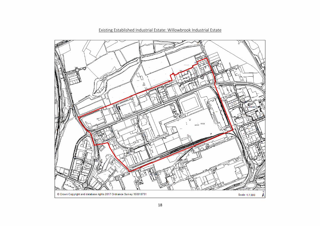
Existing Established Industrial Estate: Willowbrook Industrial Estate 18
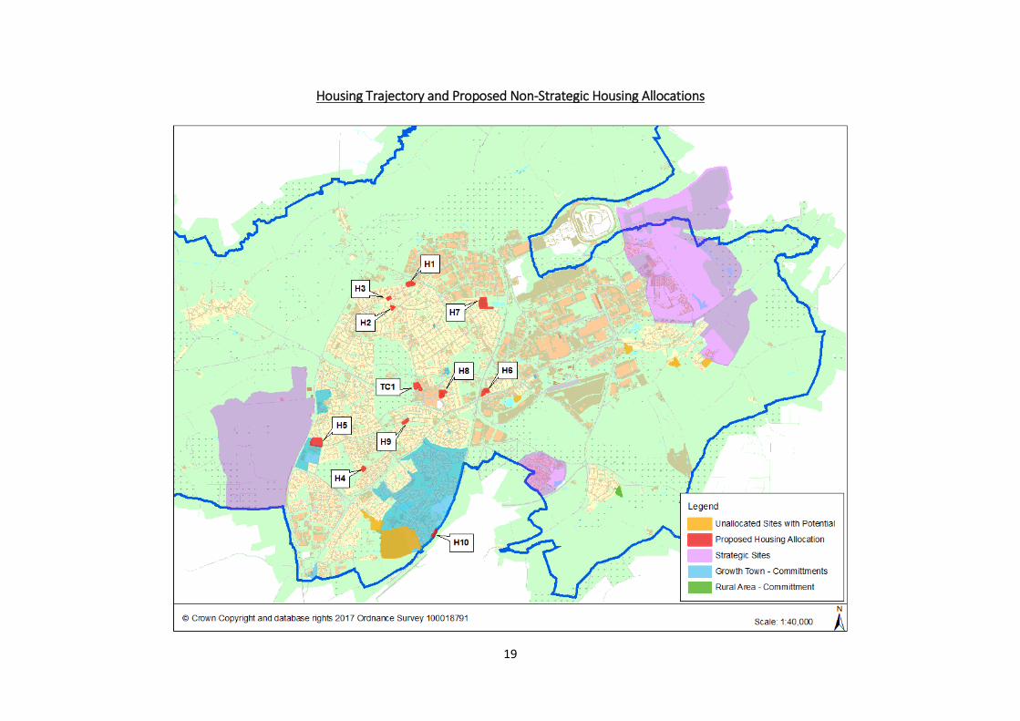
Proposed Non-Strategic Housing Trajectory and Allocations 19
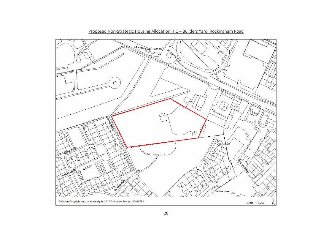
Proposed Non-Strategic Housing Allocation: H1 – Builders Yard, Rockingham Road 20
Proposed Non-Strategic Housing Allocation: H2 – Garage Court, Lindisfarne Road 21
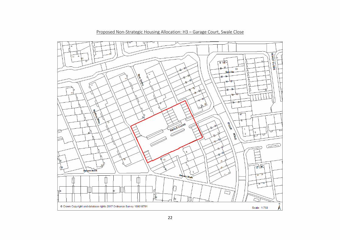
Proposed Non-Strategic Housing Allocation: H3 – Garage Court, Swale Close 22
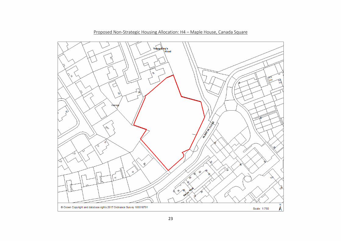
Proposed Non-Strategic Housing Allocation: H4 – Maple House, Canada Square 23
Proposed Non-Strategic Housing Allocation: H5 – Former Our Lady Pope John School, Tower Hill Road
24
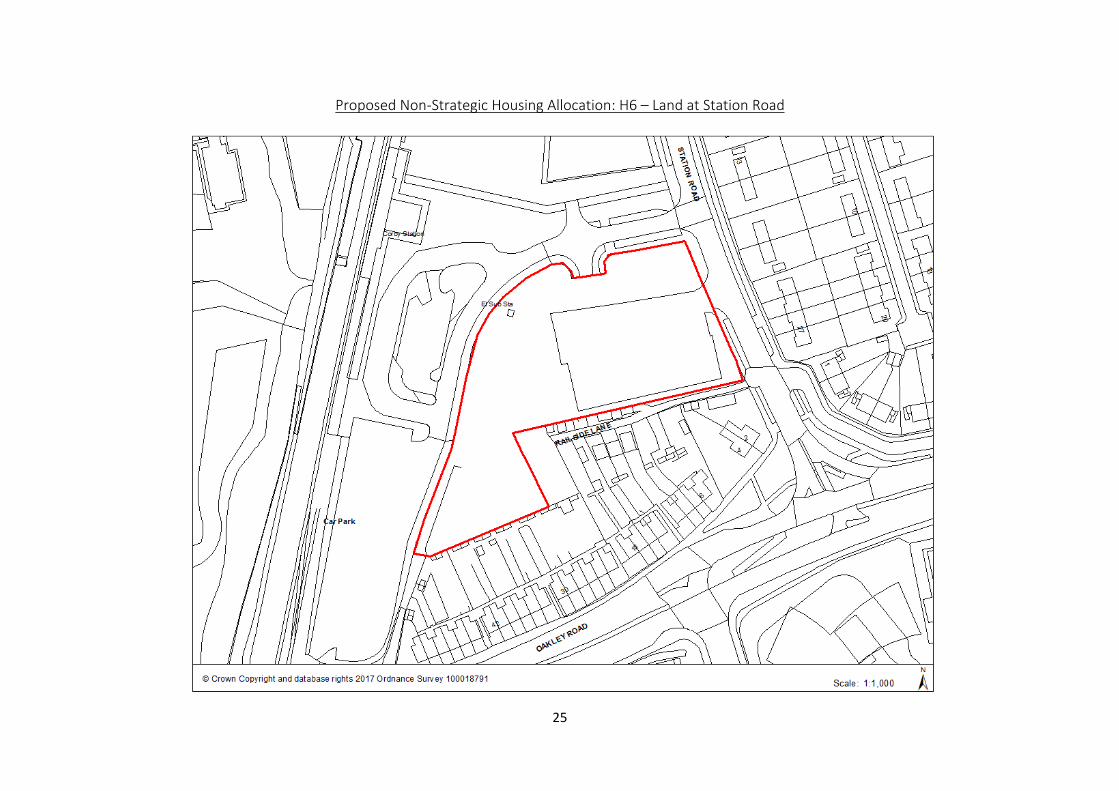
Proposed Non-Strategic Housing Allocation: H6 – Land at Station Road 25
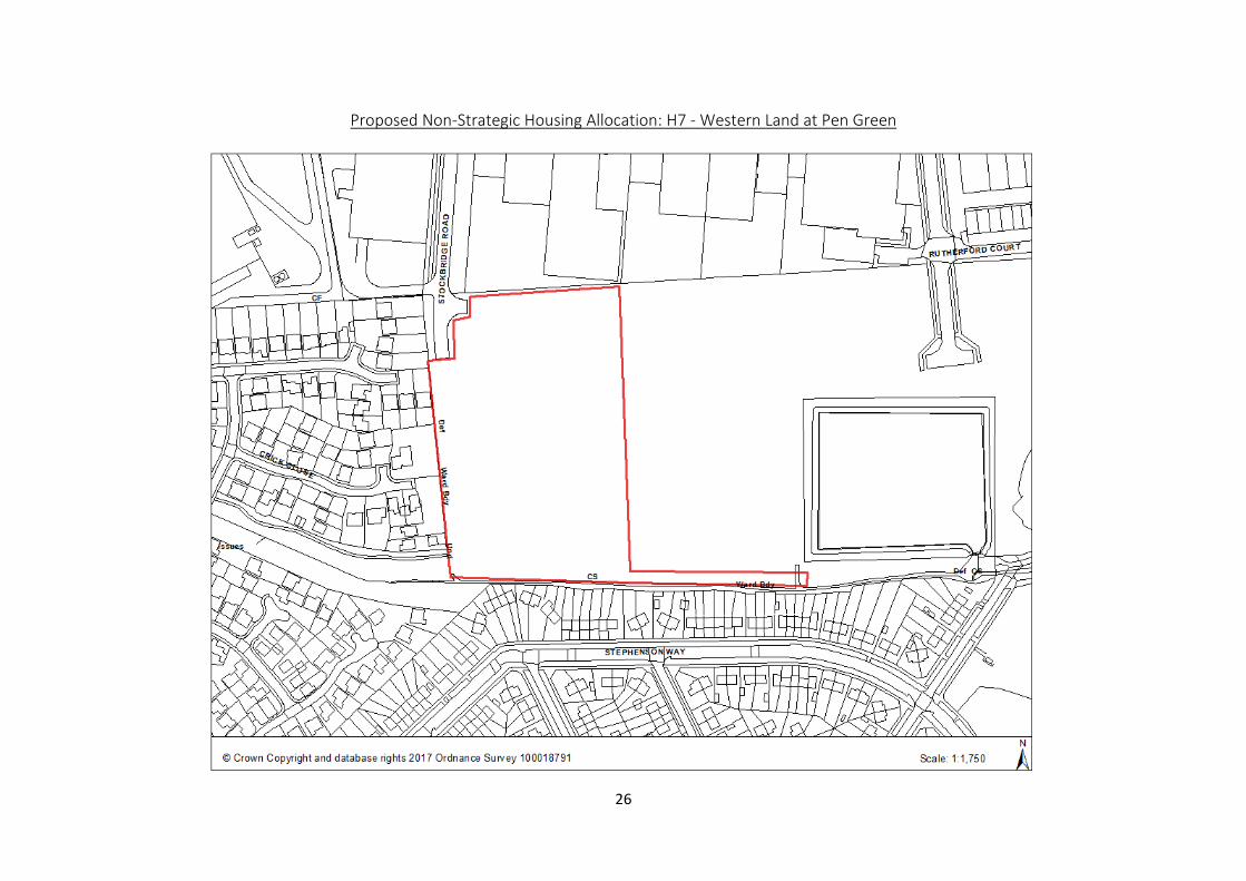
Proposed Non-Strategic Housing Allocation: H7 – Western Land at Pen Green 26
Proposed Non-Strategic Housing Allocation: H8 – Land off Elizabeth Street 27
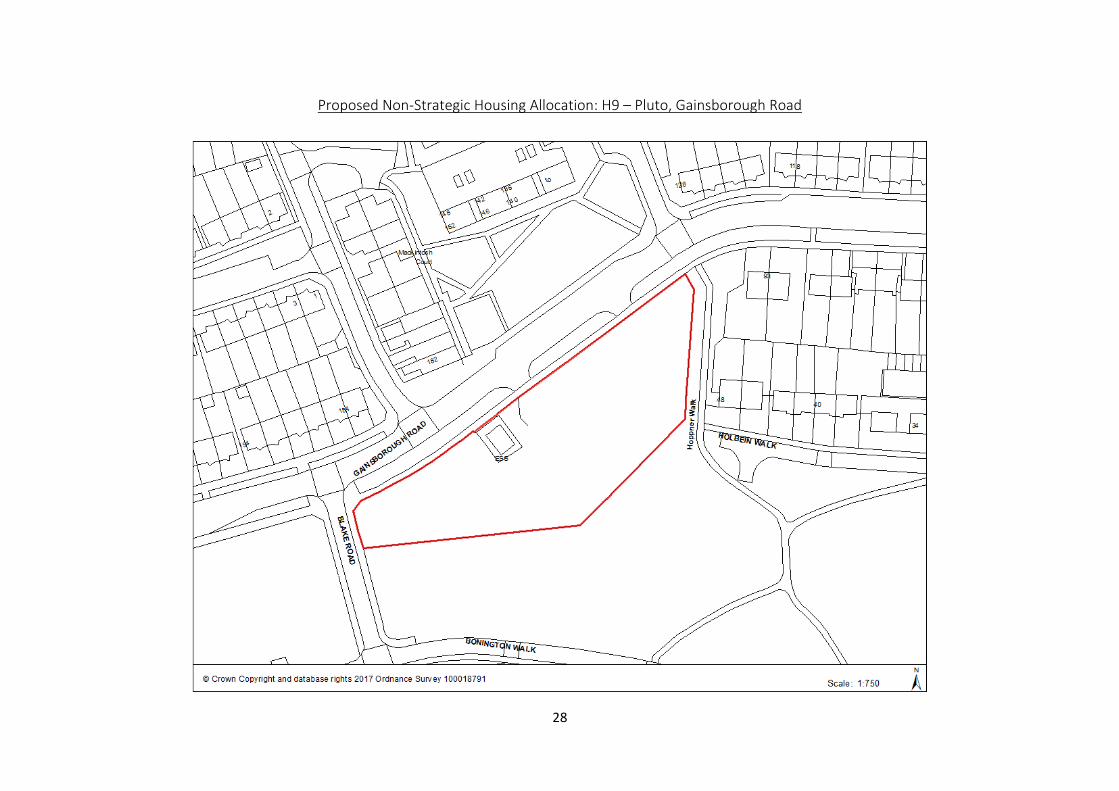
Proposed Non-Strategic Housing Allocation: H9 – Pluto, Gainsborough Road 28
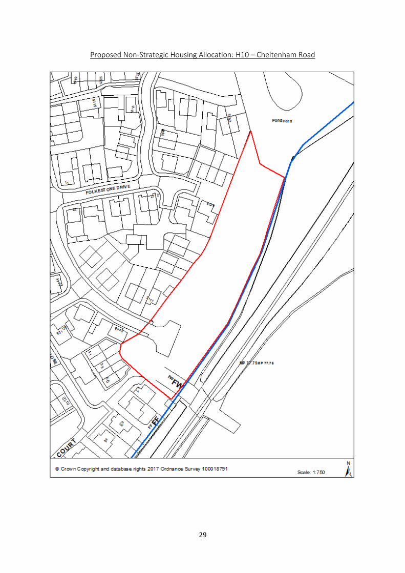
Proposed Non-Strategic Housing Allocation: H10 – Cheltenham Road 29
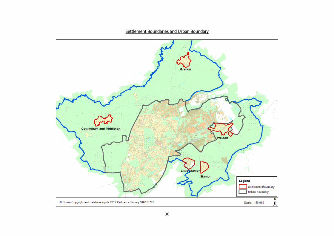
Settlement Boundaries and Urban Boundary 30
Urban Boundary 31
Settlement Boundary - Little Stanion 32
Settlement Boundary – Gretton 33
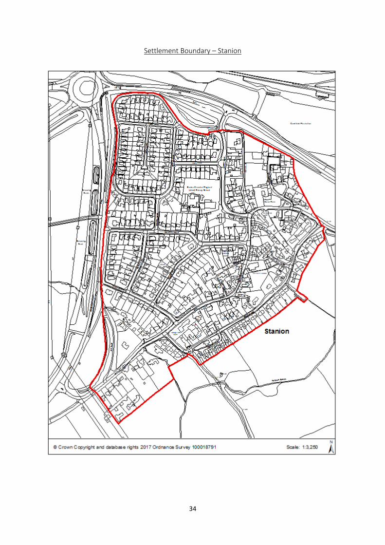
Settlement Boundary – Stanion 34
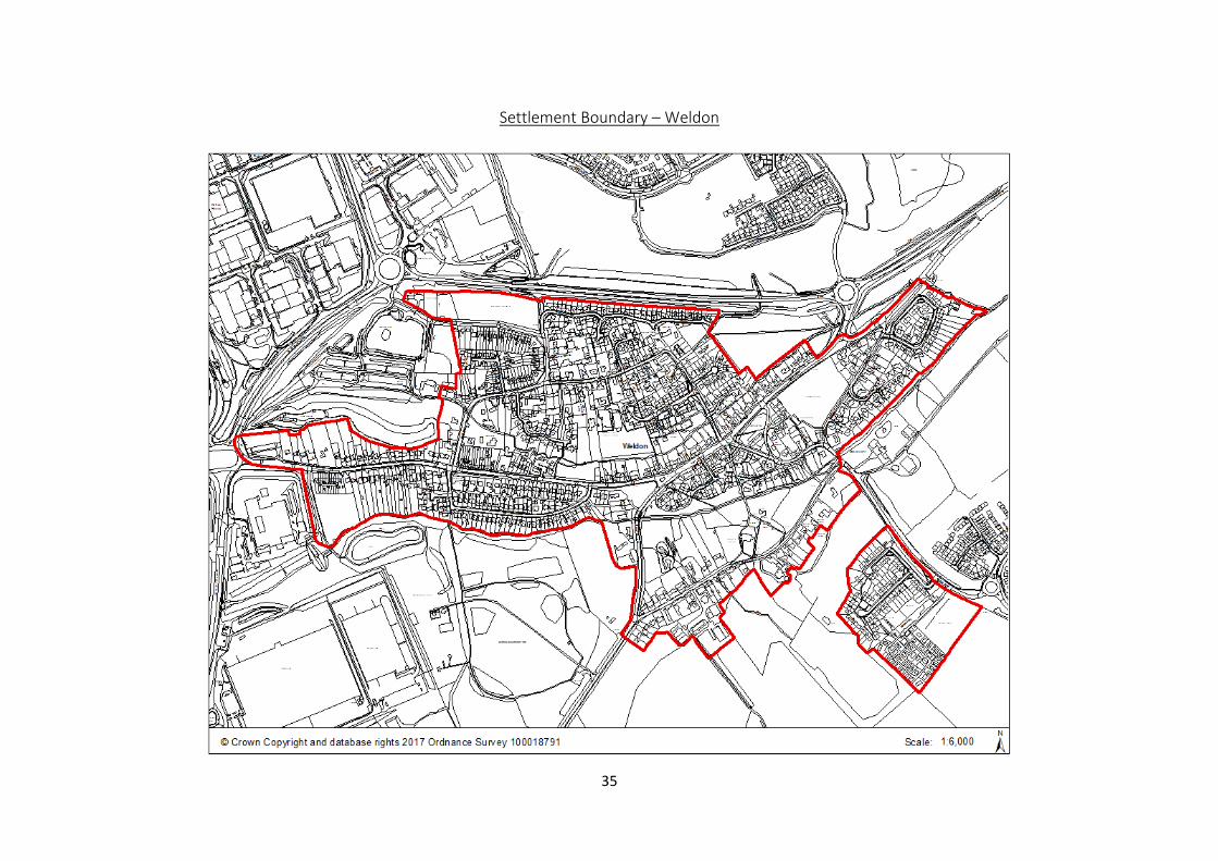
Settlement Boundary – Weldon 35
Settlement Boundary – Cottingham and Middleton 36
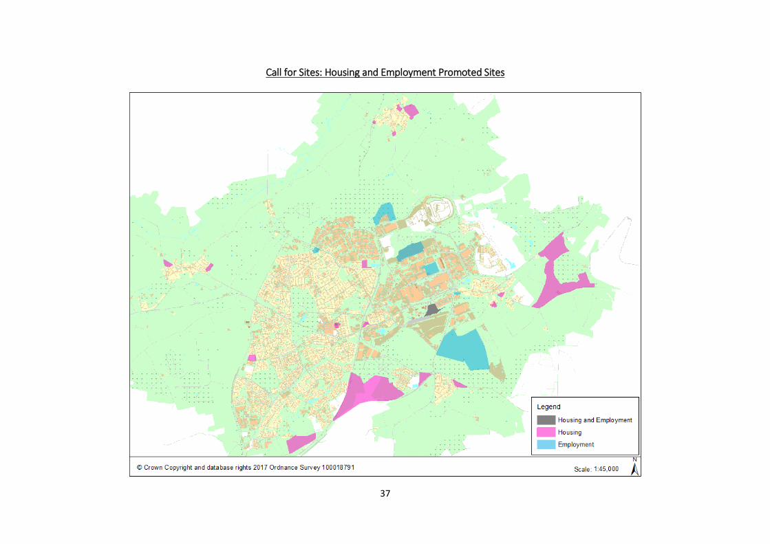
Call for Sites: Housing and Employment Promoted Sites 37
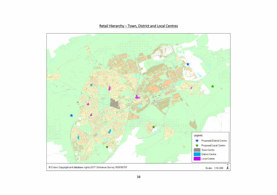
Retail Hierarchy – Town, District and Local Centres 38
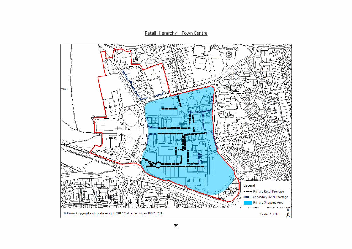
Town Centre 39
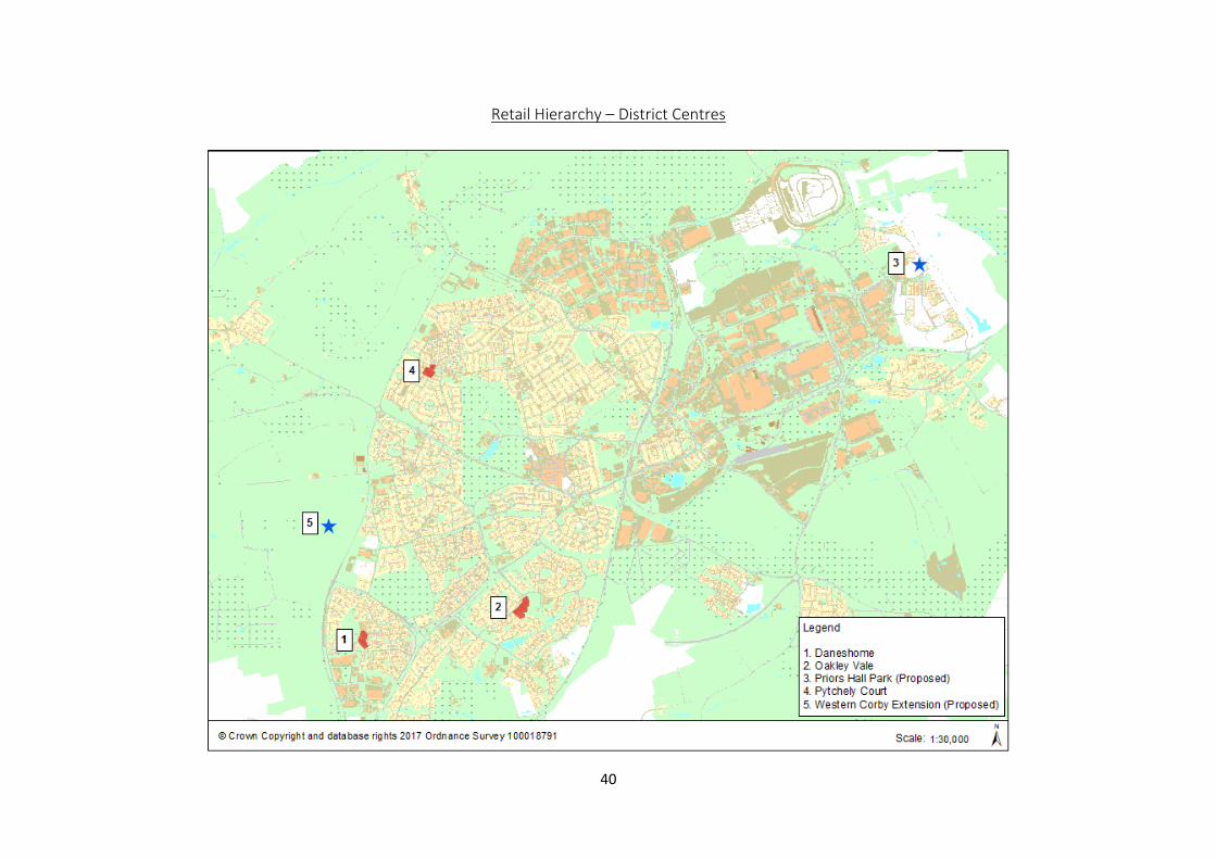
Retail Hierarchy - Retail Hierarchy – District Centres 40
District Centre – Danesholme 41
District Centre – Oakley Vale 42
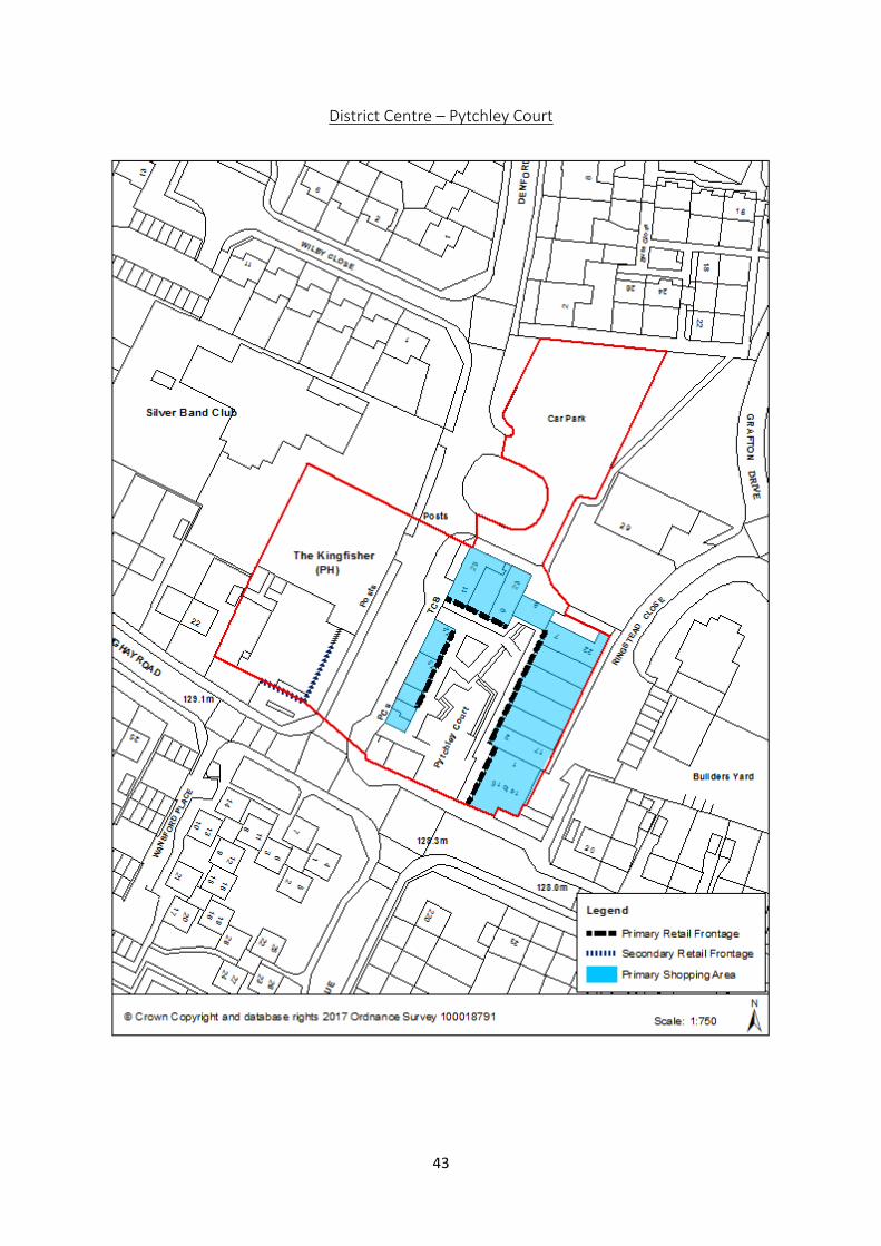
District Centre – Pytchley Court 43
Retail Hierarchy - Retail Hierarchy – Local Centres 44
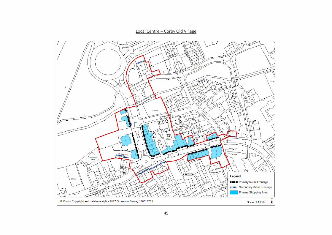
Local Centre – Corby Old Village 45
Local Centre – Farmstead Road 46
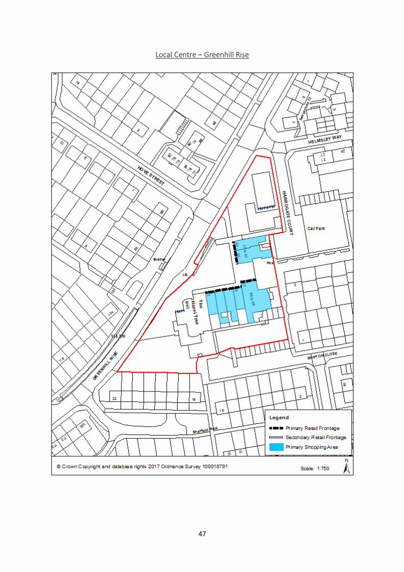
Local Centre – Greenhill Rise 47
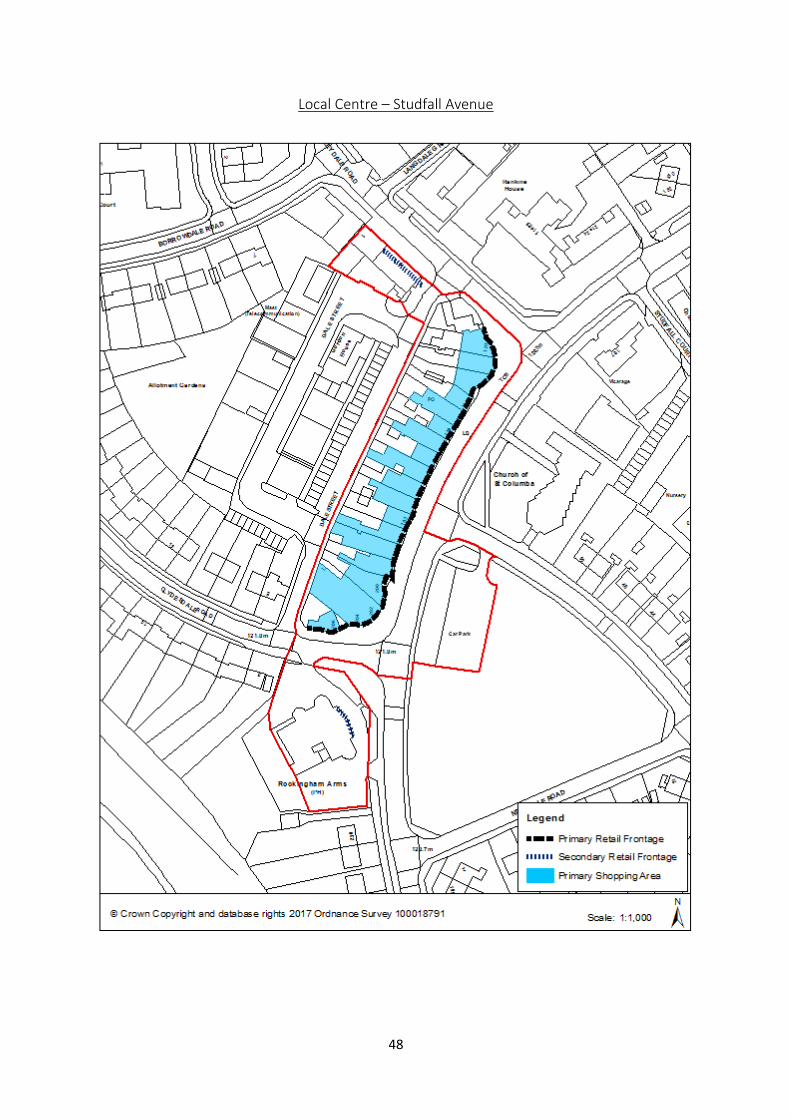
Local Centre – Studfall Avenue 48
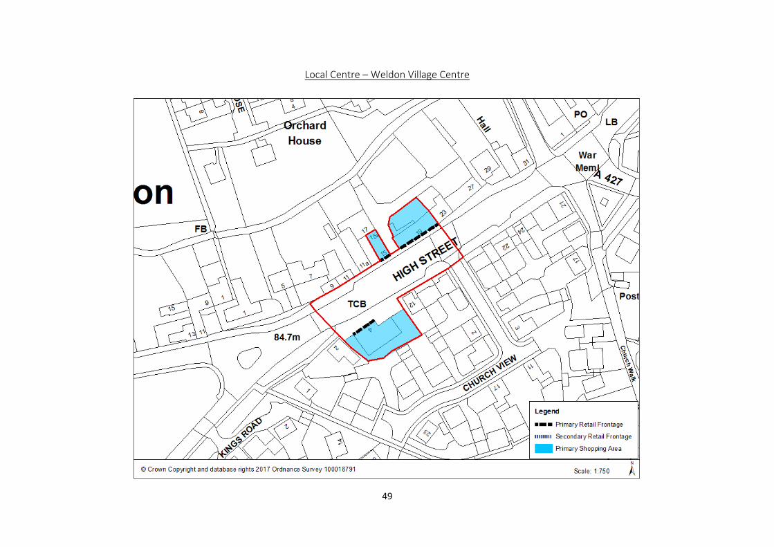
Local Centre – Weldon Village Centre 49
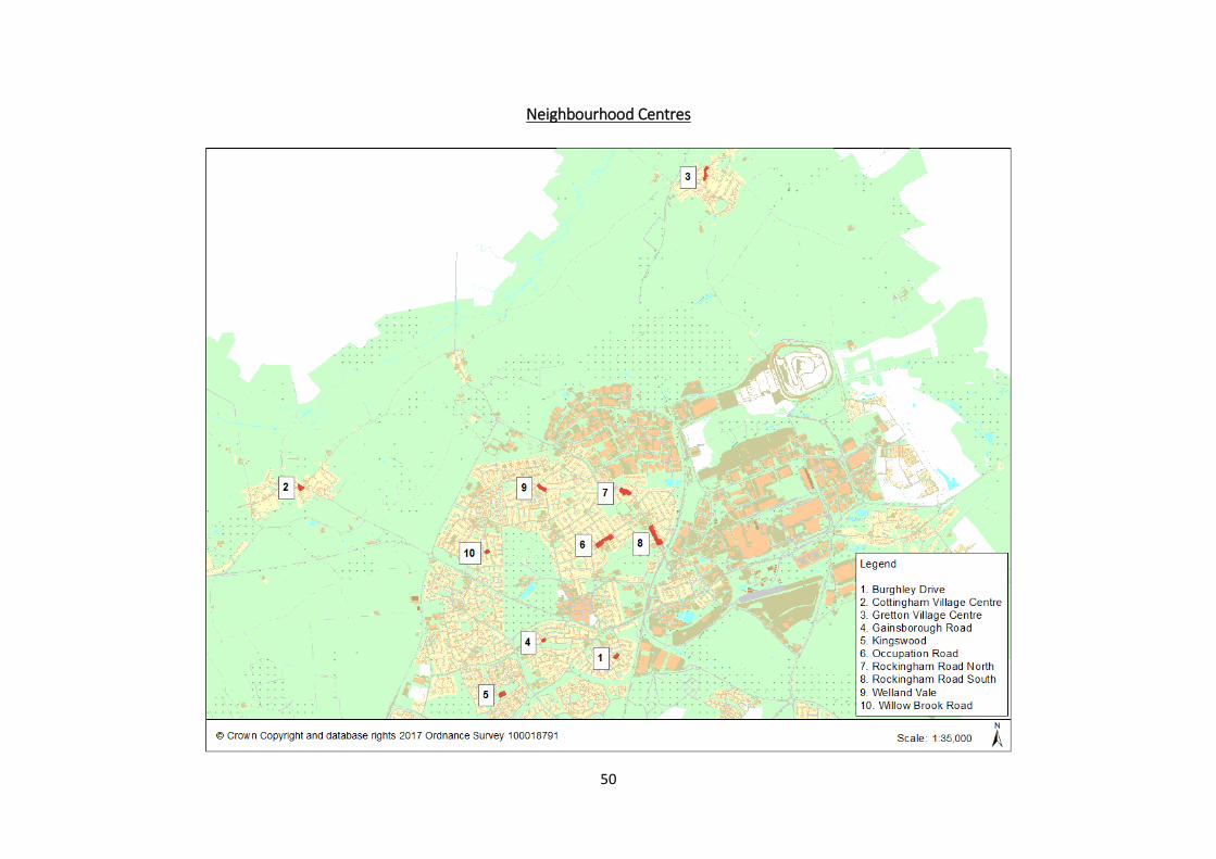
Neighbourhood Centres 50
Neighbourhood Centre – Burghley Drive 51
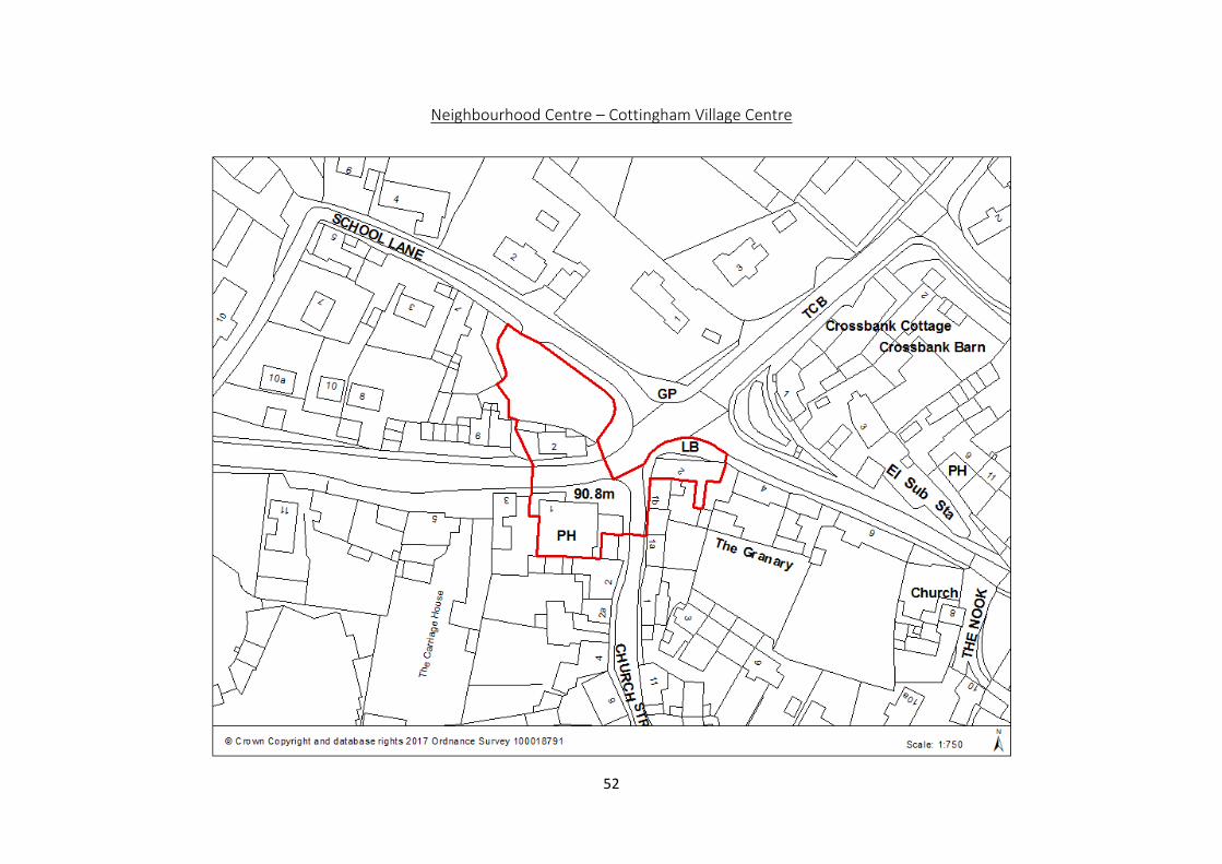
Neighbourhood Centre – Cottingham Village Centre 52
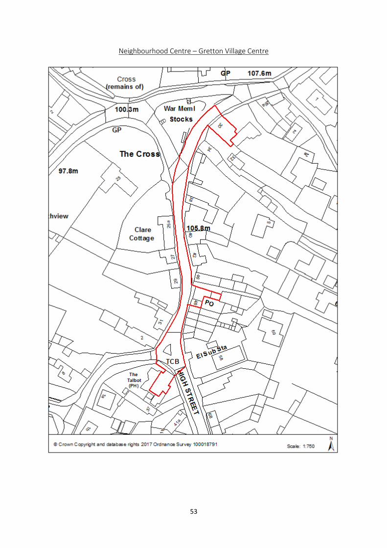
Neighbourhood Centre – Gretton Village Centre 53
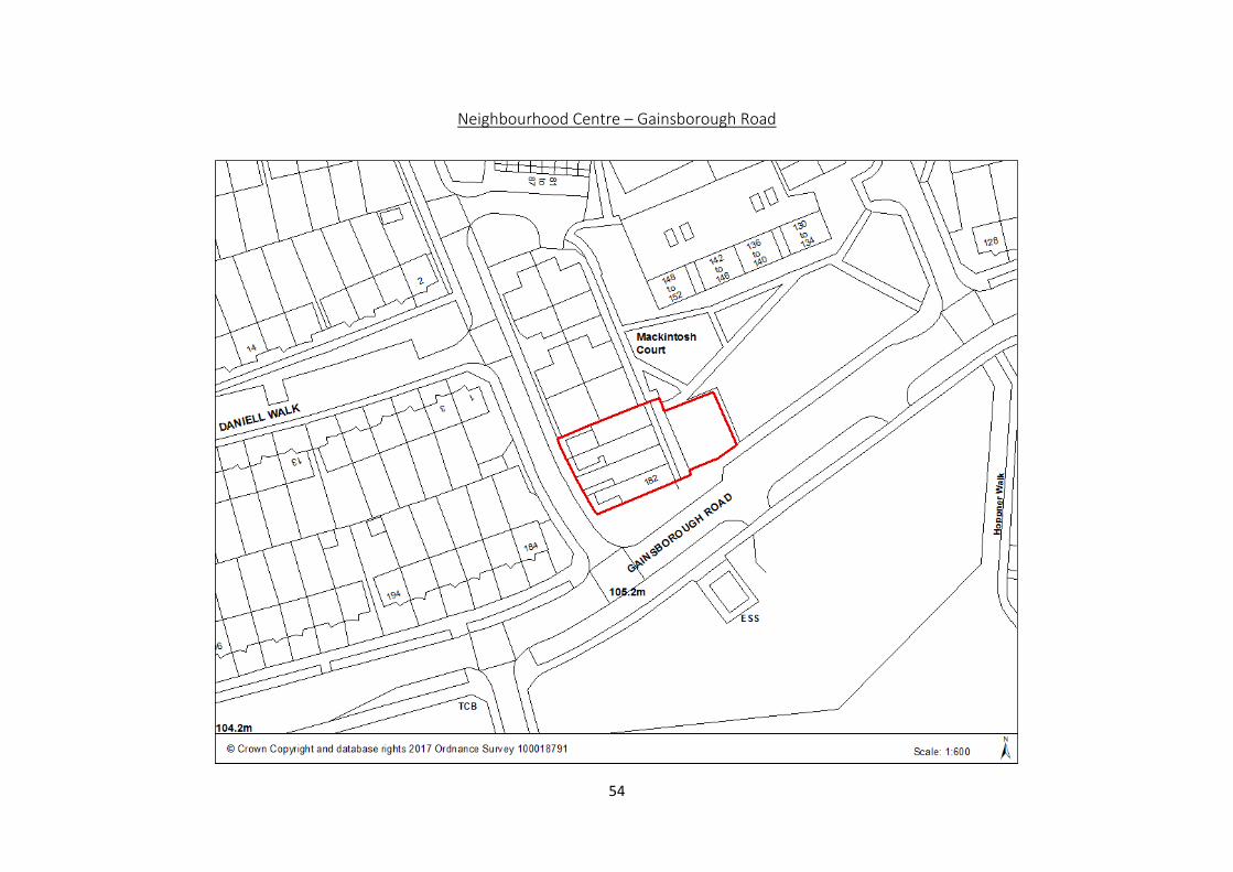
Neighbourhood Centre – Gainsborough Road 54
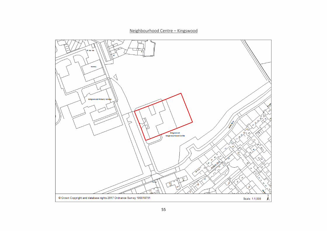
Neighbourhood Centre – Kingswood 55
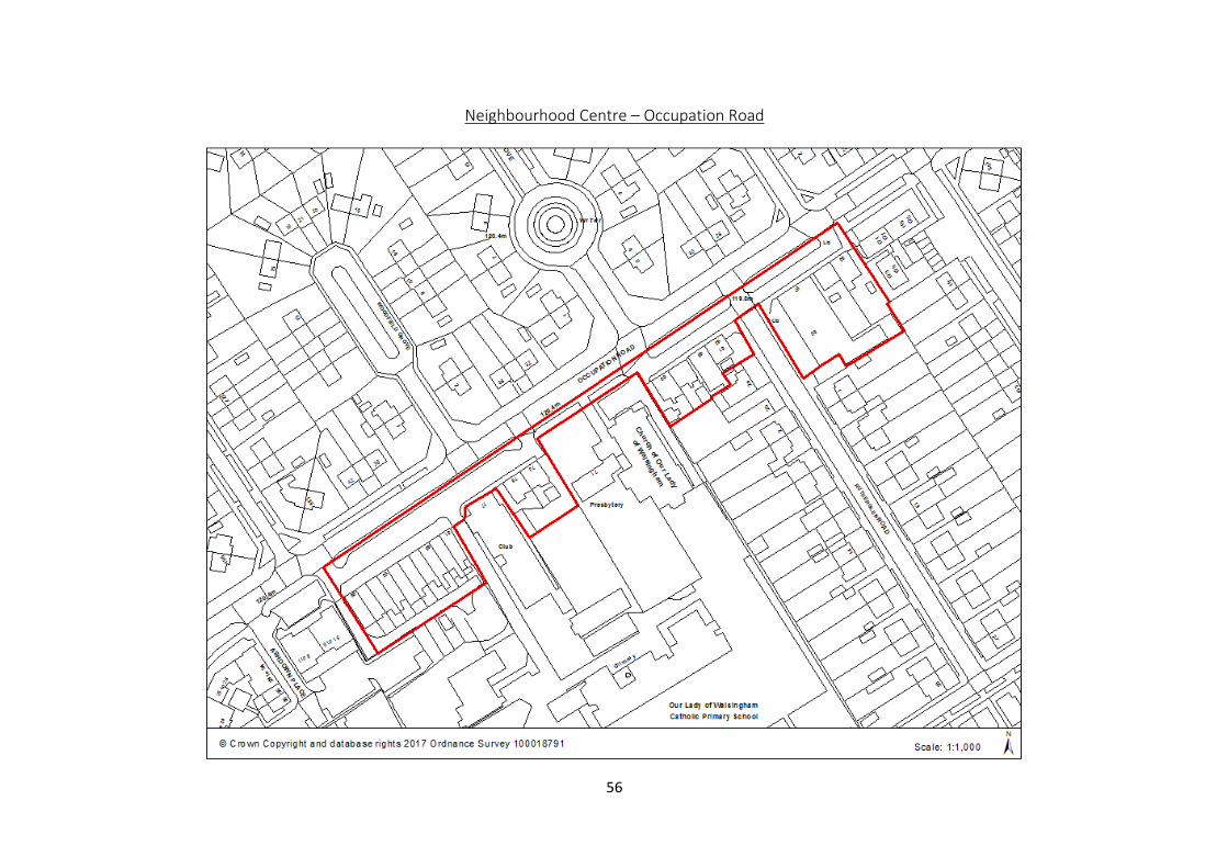
Neighbourhood Centre – Occupation Road 56
Neighbourhood Centre – Rockingham Road North 57
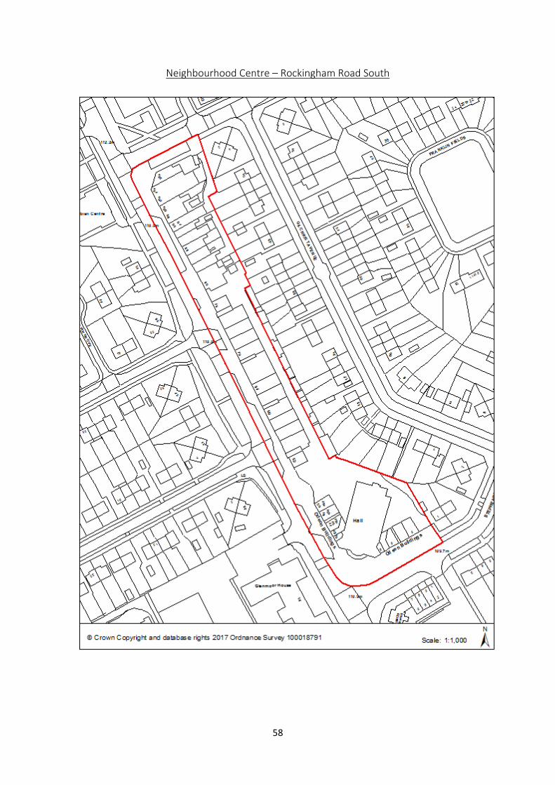
Neighbourhood Centre – Rockingham Road South 58
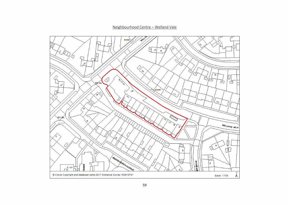
Neighbourhood Centre – Welland Vale 59
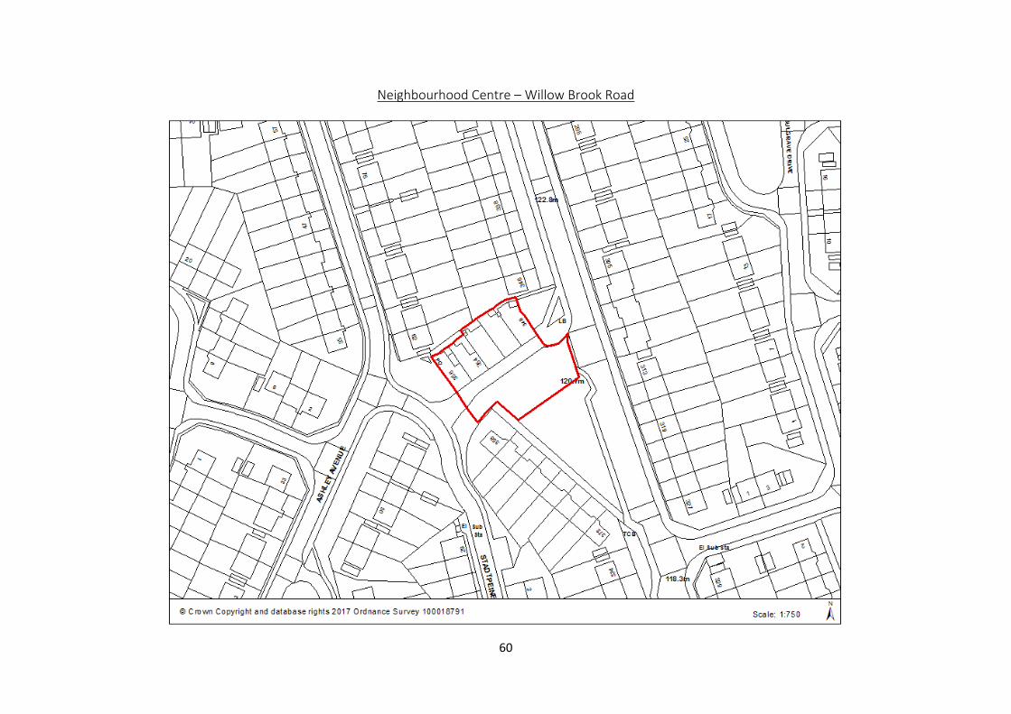
Neighbourhood Centre – Willow Brook Road 60
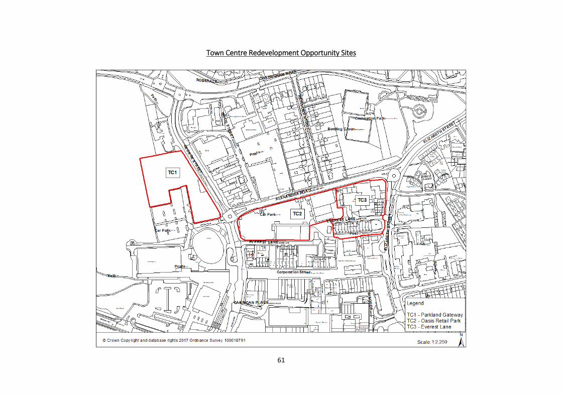
Town Centre Redevelopment Opportunity Sites
61
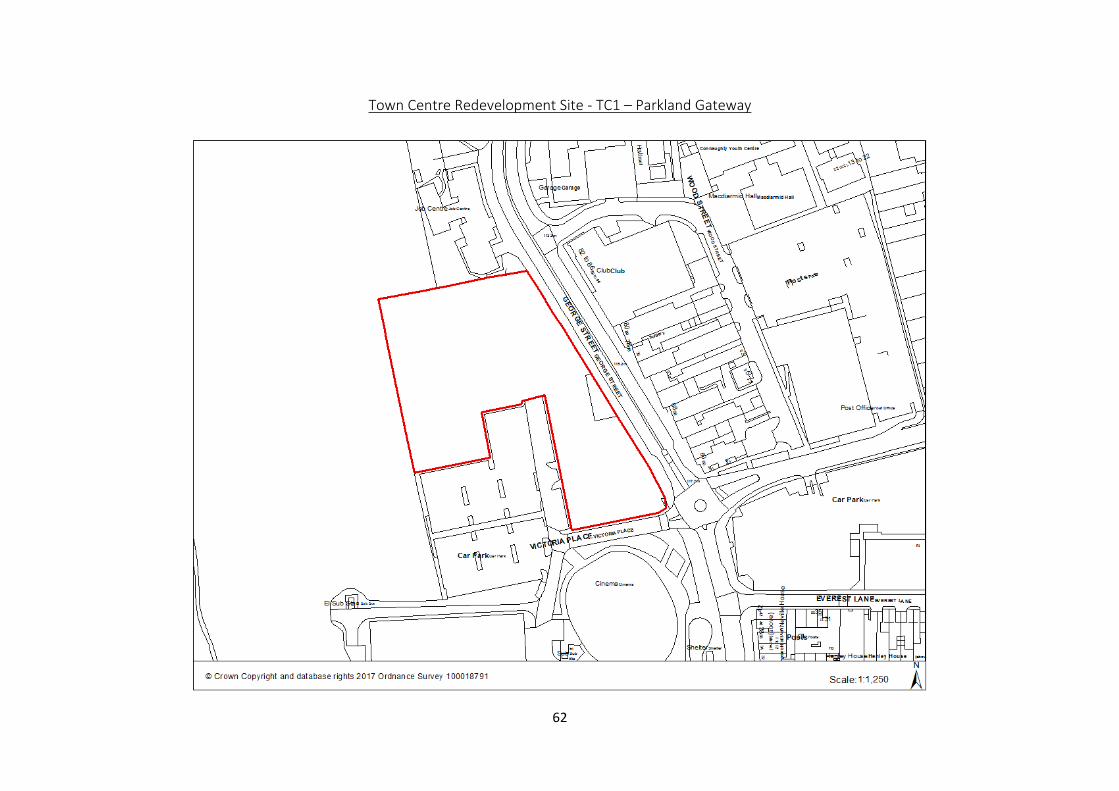
Town Centre Redevelopment Site - TC1 – Parkland Gateway 62
Town Centre Redevelopment Site – TC2 – Oasis Retail Park 63
Town Centre Redevelopment Site – TC3 – Everest Lane 64
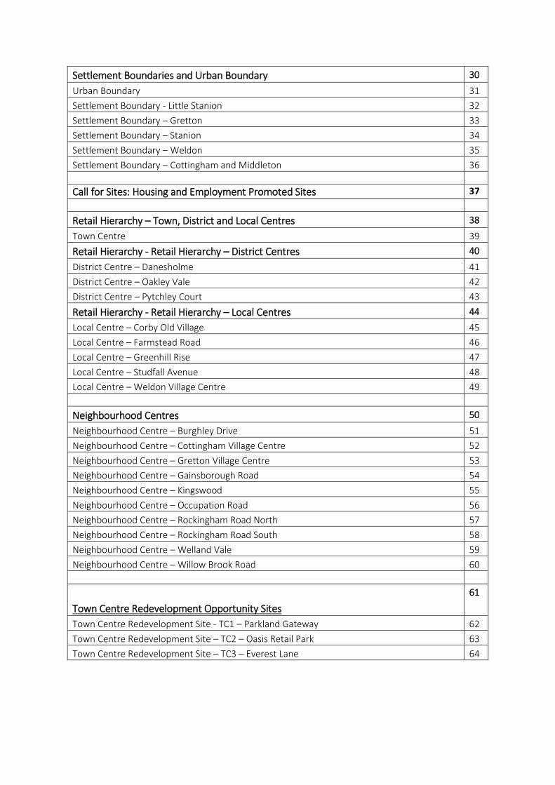
1
Corby Borough Context Map
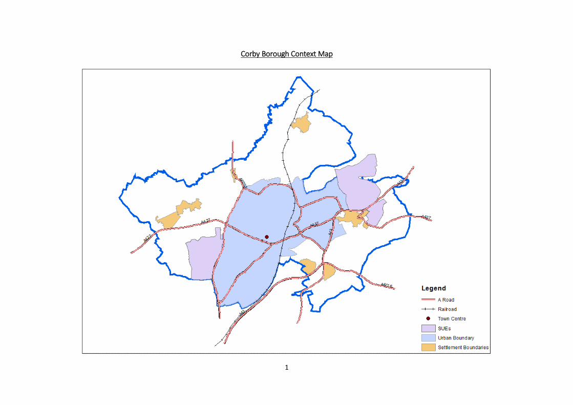
2
Green Infrastructure Corridors
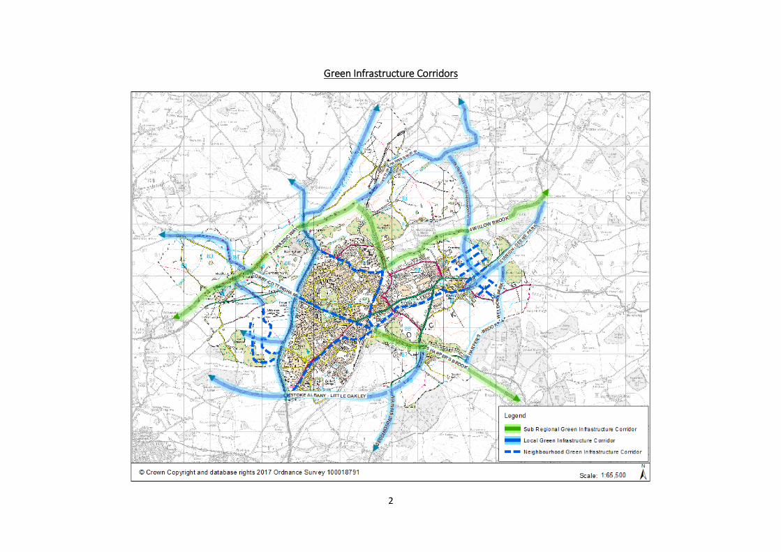
3
Proposed Non-Strategic Employment Allocations and Long Term Reserve
4
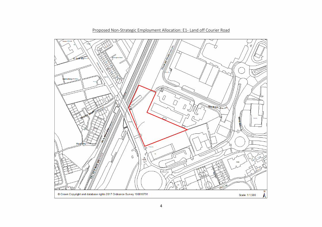
Proposed Non-Strategic Employment Allocation: E1- Land off Courier Road
5
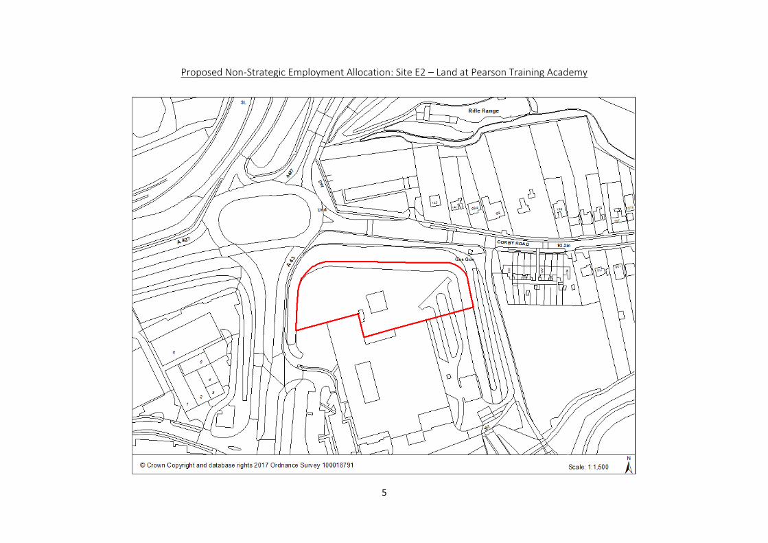
Proposed Non-Strategic Employment Allocation: Site E2 – Land at Pearson Training Academy
6
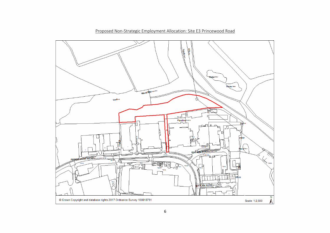
Proposed Non-Strategic Employment Allocation: Site E3 Princewood Road
7
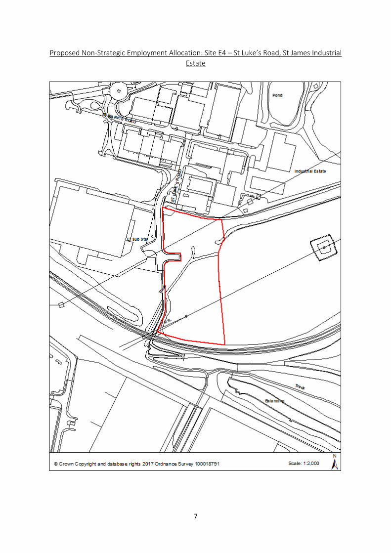
Proposed Non-Strategic Employment Allocation: Site E4 – St Luke’s Road, St James Industrial
Estate
8
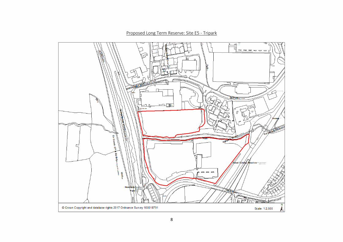
Proposed Long Term Reserve: Site E5 - Tripark
9
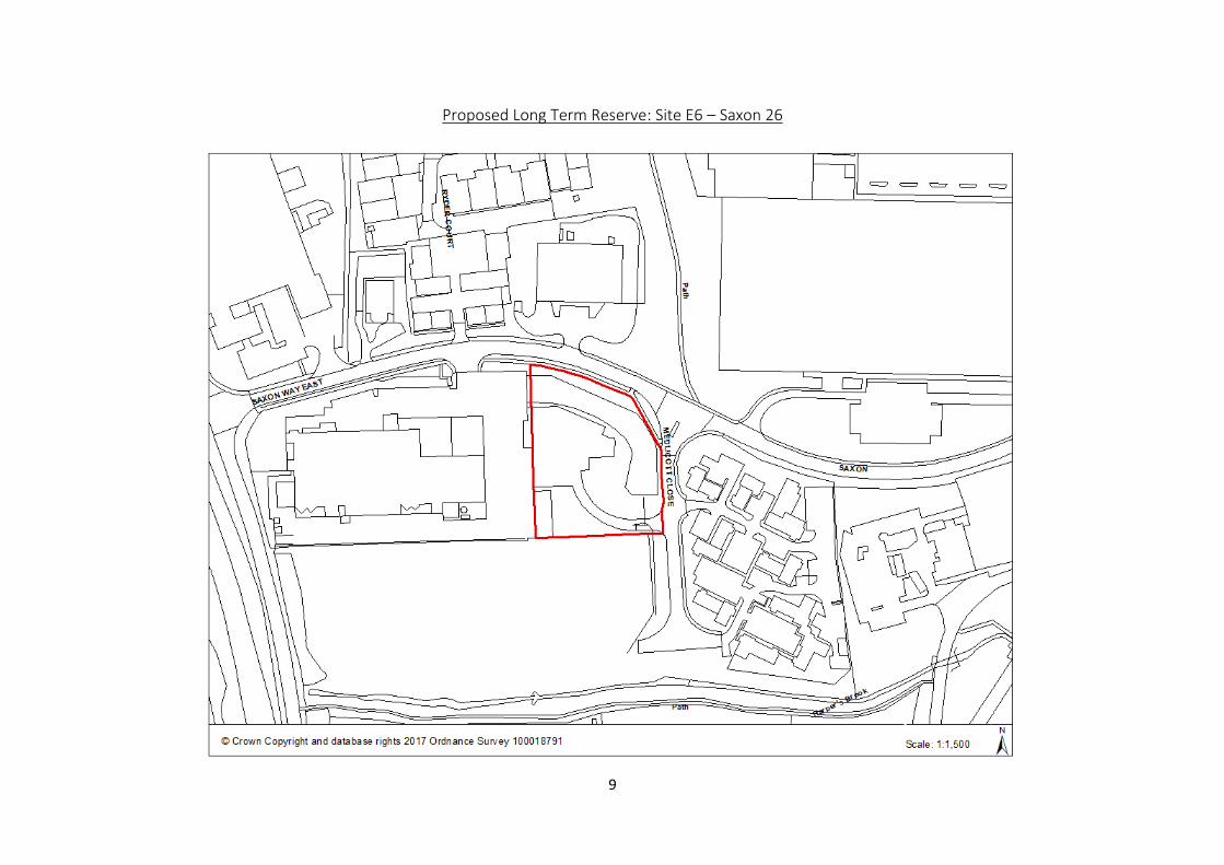
Proposed Long Term Reserve: Site E6 – Saxon 26

10
Existing Established Industrial Estates
11
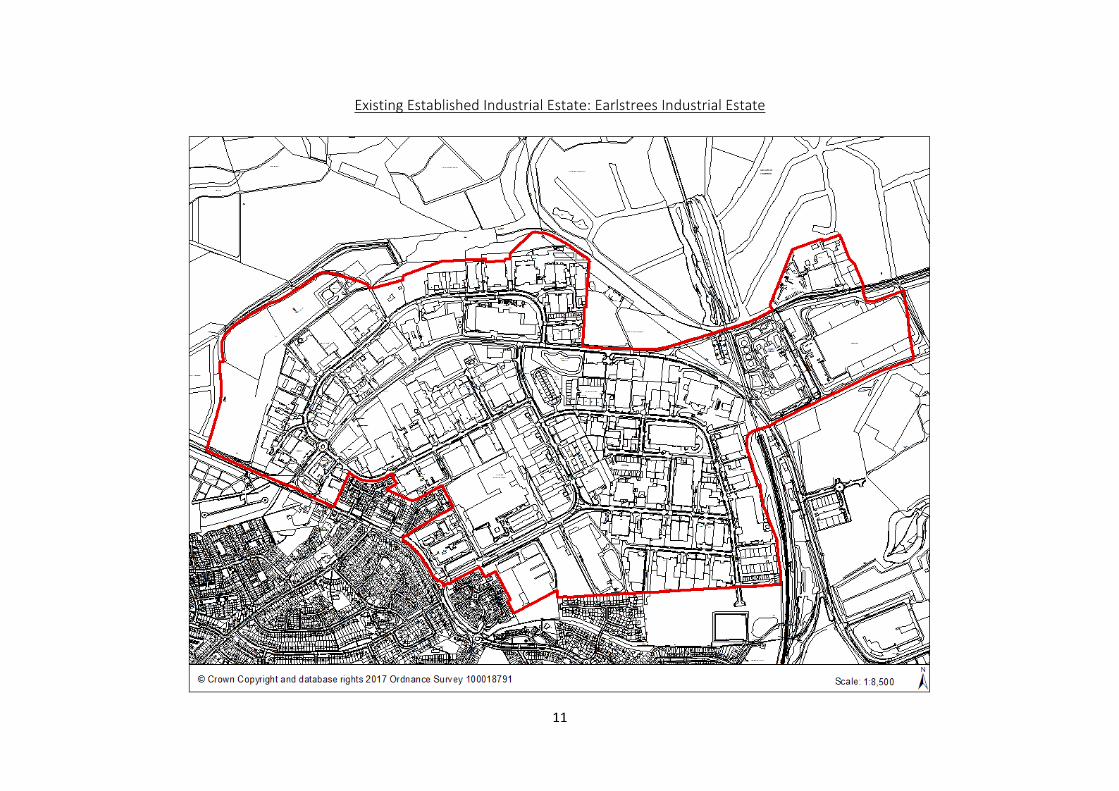
Existing Established Industrial Estate: Earlstrees Industrial Estate
12
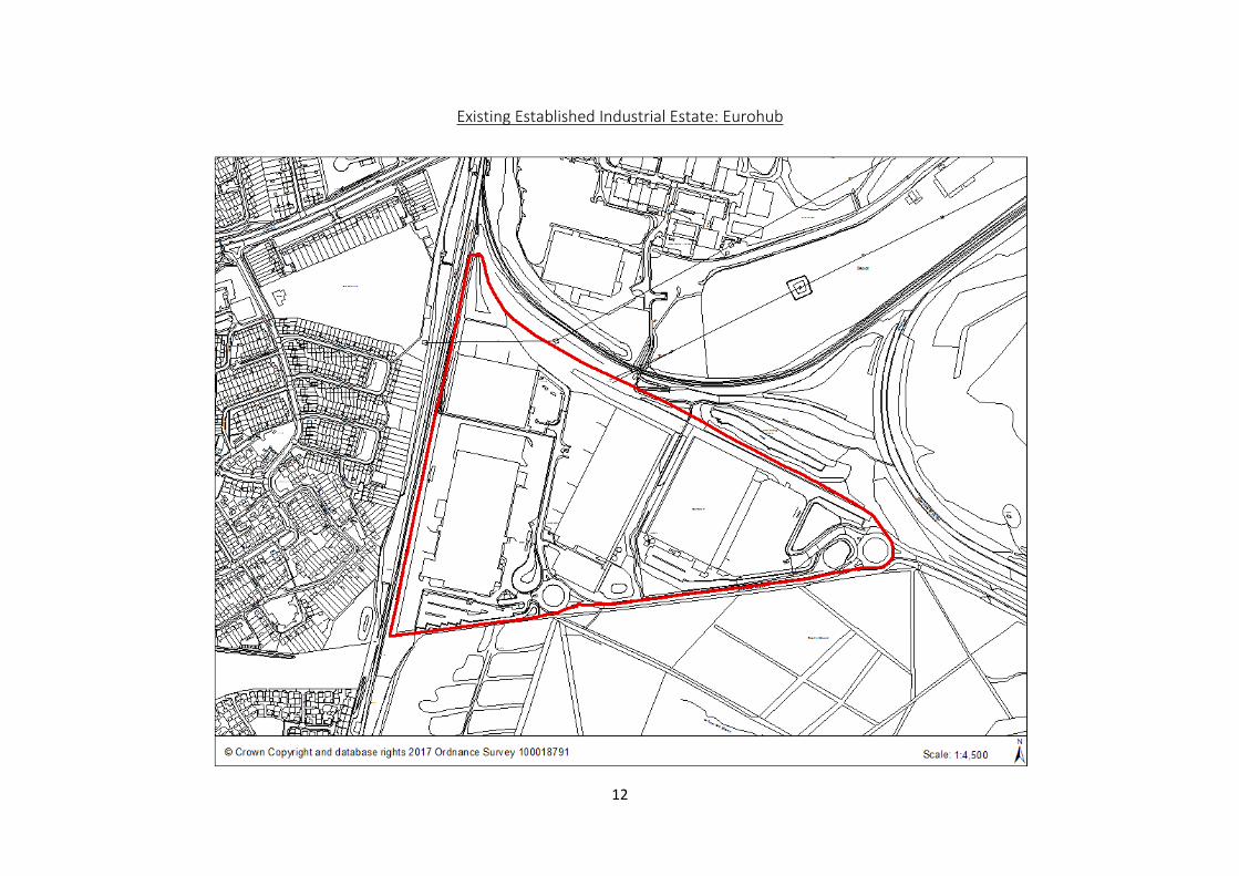
Existing Established Industrial Estate: Eurohub

13
Existing Established Industrial Estate: Oakley Hay Industrial Estate
14
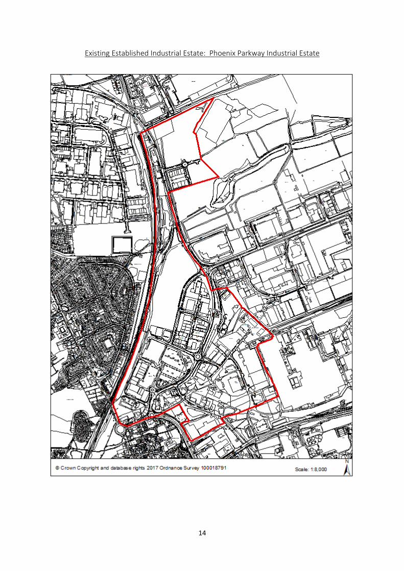
Existing Established Industrial Estate: Phoenix Parkway Industrial Estate
15
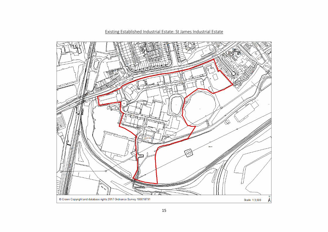
Existing Established Industrial Estate: St James Industrial Estate
16
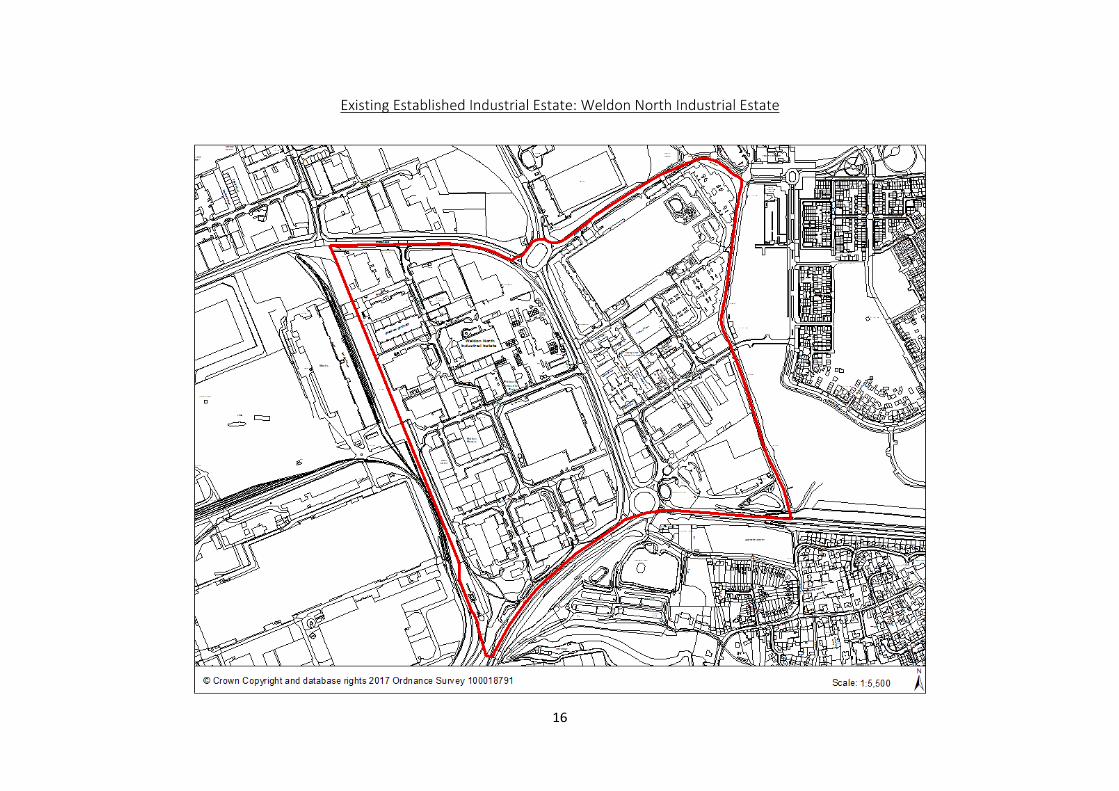
Existing Established Industrial Estate: Weldon North Industrial Estate
17
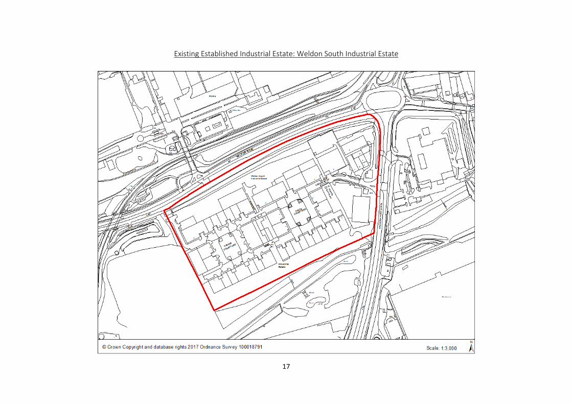
Existing Established Industrial Estate: Weldon South Industrial Estate
18
Existing Established Industrial Estate: Willowbrook Industrial Estate
19
Housing Trajectory and Proposed Non-Strategic Housing Allocations
20
Proposed Non-Strategic Housing Allocation: H1 – Builders Yard, Rockingham Road

21
Proposed Non-Strategic Housing Allocation: H2 – Garage Court, Lindisfarne Road
22
Proposed Non-Strategic Housing Allocation: H3 – Garage Court, Swale Close
23
Proposed Non-Strategic Housing Allocation: H4 – Maple House, Canada Square

24
Proposed Non-Strategic Housing Allocation: H5 – Former Our Lady Pope John School, Tower Hill Road
25
Proposed Non-Strategic Housing Allocation: H6 – Land at Station Road
26
Proposed Non-Strategic Housing Allocation: H7 - Western Land at Pen Green

27
Proposed Non-Strategic Housing Allocation: H8 – Land off Elizabeth Street
28
Proposed Non-Strategic Housing Allocation: H9 – Pluto, Gainsborough Road
29
Proposed Non-Strategic Housing Allocation: H10 – Cheltenham Road
30
Settlement Boundaries and Urban Boundary

31
Urban Boundary

32
Settlement Boundary – Little Stanion

33
Settlement Boundary – Gretton
34
Settlement Boundary – Stanion
35
Settlement Boundary – Weldon

36
Settlement Boundary – Cottingham and Middleton
37
Call for Sites: Housing and Employment Promoted Sites
38
Retail Hierarchy – Town, District and Local Centres
39
Retail Hierarchy – Town Centre
40
Retail Hierarchy – District Centres

41
District Centre – Danesholme

42
District Centre – Oakley Vale
43
District Centre – Pytchley Court

44
Retail Hierarchy – Local Centres
45
Local Centre – Corby Old Village

46
Local Centre – Farmstead Road
47
Local Centre – Greenhill Rise
48
Local Centre – Studfall Avenue
49
Local Centre – Weldon Village Centre
50
Neighbourhood Centres

51
Neighbourhood Centre – Burghley Drive
52
Neighbourhood Centre – Cottingham Village Centre
53
Neighbourhood Centre – Gretton Village Centre
54
Neighbourhood Centre – Gainsborough Road
55
Neighbourhood Centre – Kingswood
56
Neighbourhood Centre – Occupation Road

57
Neighbourhood Centre - Rockingham Road North
58
Neighbourhood Centre – Rockingham Road South
59
Neighbourhood Centre – Welland Vale
60
Neighbourhood Centre – Willow Brook Road
61
Town Centre Redevelopment Opportunity Sites
62
Town Centre Redevelopment Site - TC1 – Parkland Gateway

63
Town Centre Redevelopment Site – TC2 – Oasis Retail Park

64
Town Centre Redevelopment Site – TC3 – Everest Lane