Optimizing Environmental Permitting Utilizing Readily ...€¦ · Optimizing Environmental...
51
Optimizing Environmental Permitting Utilizing Readily Available Datasets Richard Fontenot, Spirit Environmental, LLC
Transcript of Optimizing Environmental Permitting Utilizing Readily ...€¦ · Optimizing Environmental...
Optimizing Environmental Permitting Utilizing Readily Available
Datasets
Richard Fontenot, Spirit Environmental, LLC
Objectives
• To utilize existing datasets for project planning• To efficiently evaluate environmental business
risk• To identify potential environmental features• Identify required regulatory permits
GIS Applications in Environmental Route Studies
• Geographic information systems (GIS) allow environmental planners to:– Gain knowledge of known features– Evaluate the potential for unknown features
• GIS Can provide support to on-the-ground surveys by providing geographic location information and data management capabilities
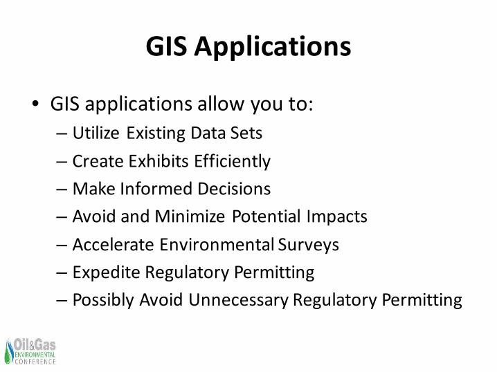
GIS Applications
• GIS applications allow you to:– Utilize Existing Data Sets– Create Exhibits Efficiently– Make Informed Decisions– Avoid and Minimize Potential Impacts– Accelerate Environmental Surveys– Expedite Regulatory Permitting– Possibly Avoid Unnecessary Regulatory Permitting
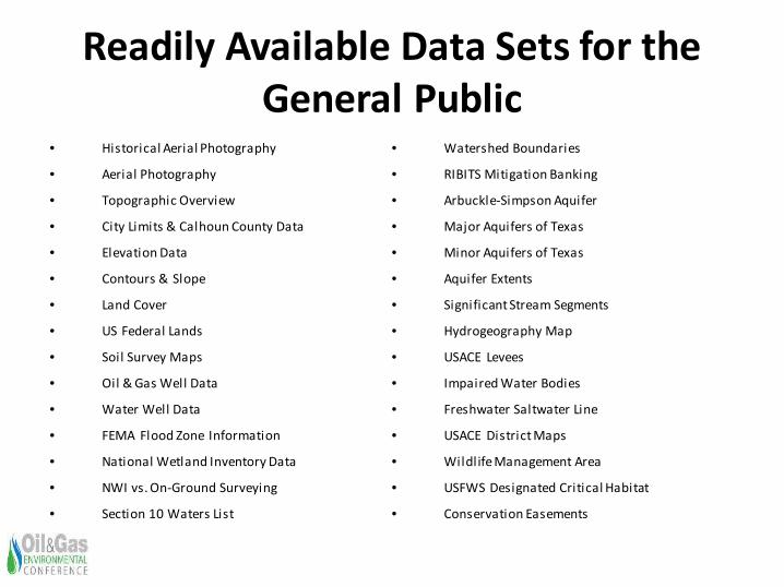
Readily Available Data Sets for the General Public
• Historical Aerial Photography
• Aerial Photography
• Topographic Overview
• City Limits & Calhoun County Data
• Elevation Data
• Contours & Slope
• Land Cover
• US Federal Lands
• Soil Survey Maps
• Oil & Gas Well Data
• Water Well Data
• FEMA Flood Zone Information
• National Wetland Inventory Data
• NWI vs. On-Ground Surveying
• Section 10 Waters List
• Watershed Boundaries
• RIBITS Mitigation Banking
• Arbuckle-Simpson Aquifer
• Major Aquifers of Texas
• Minor Aquifers of Texas
• Aquifer Extents
• Significant Stream Segments
• Hydrogeography Map
• USACE Levees
• Impaired Water Bodies
• Freshwater Saltwater Line
• USACE District Maps
• Wildlife Management Area
• USFWS Designated Critical Habitat
• Conservation Easements
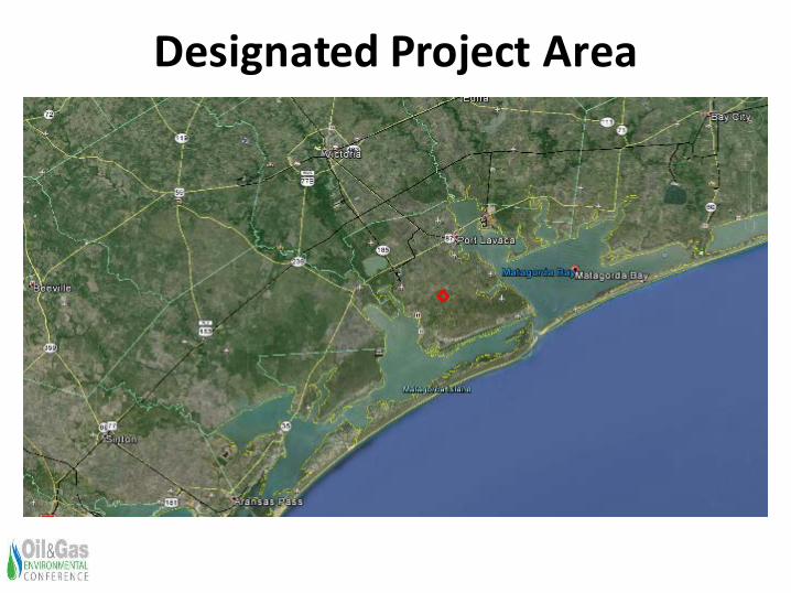
Designated Project Area
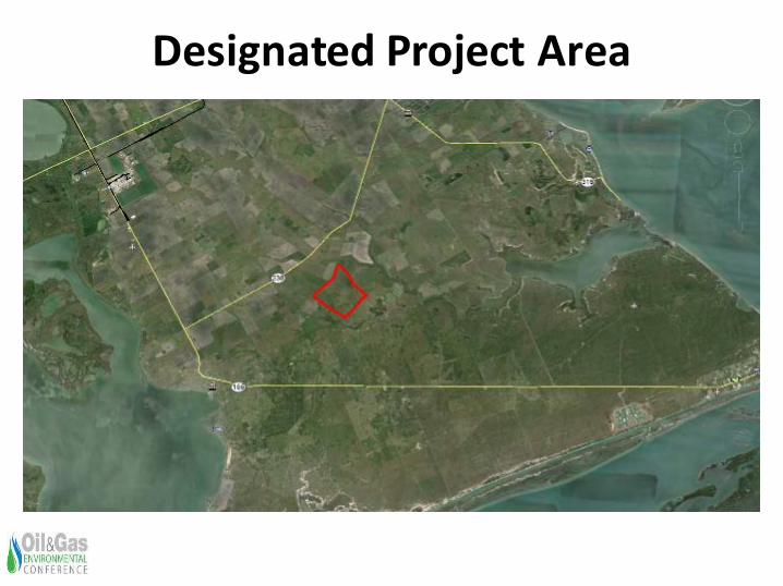
Designated Project Area
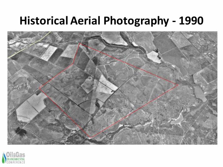
Historical Aerial Photography - 1990
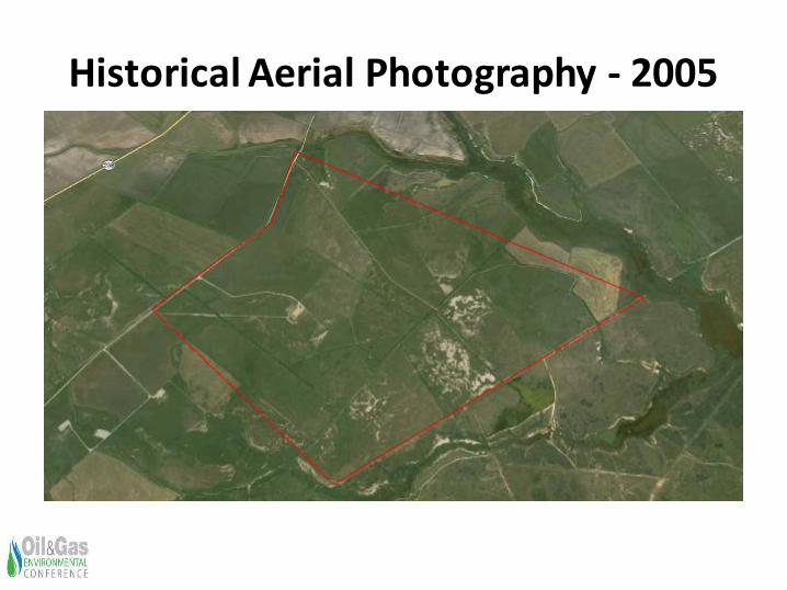
Historical Aerial Photography - 2005
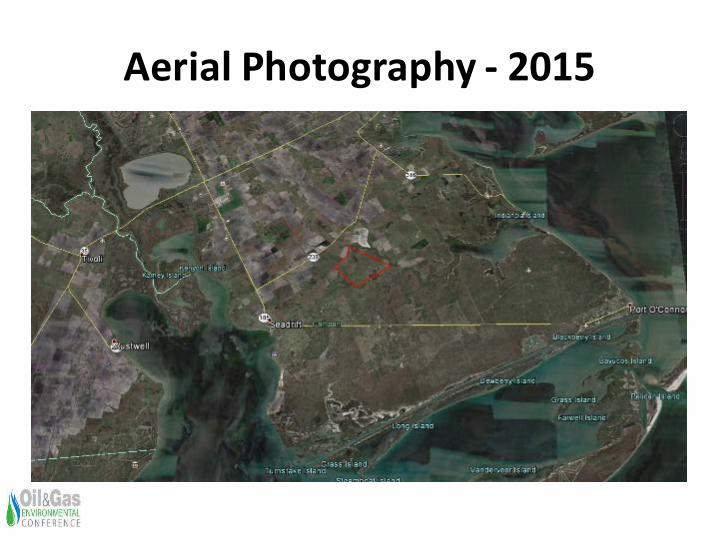
Aerial Photography - 2015
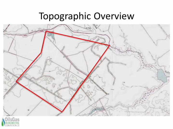
Topographic Overview
11
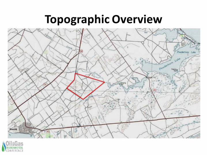
Topographic Overview
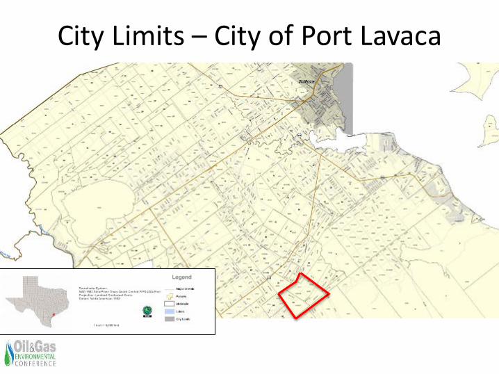
City Limits – City of Port Lavaca
13
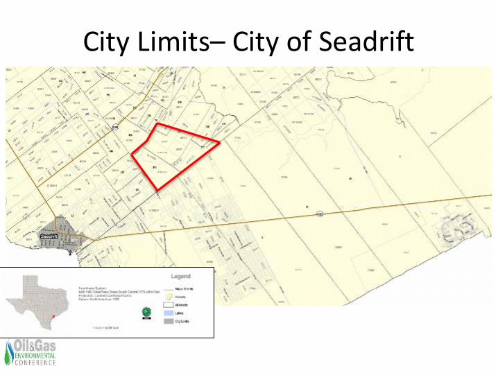
City Limits– City of Seadrift
14
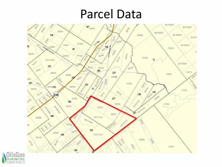
Parcel Data
15
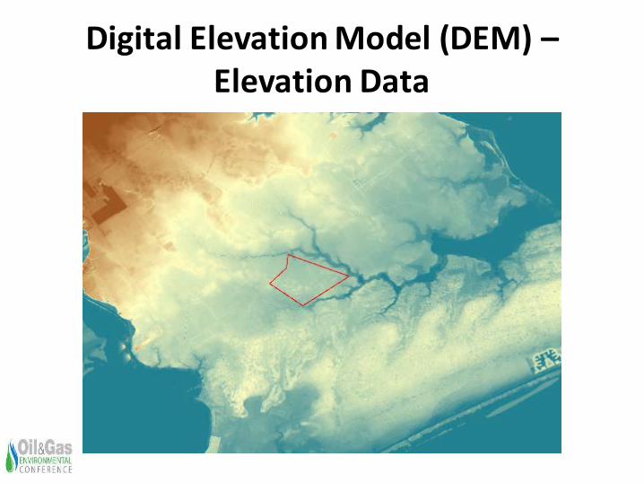
Digital Elevation Model (DEM) –Elevation Data
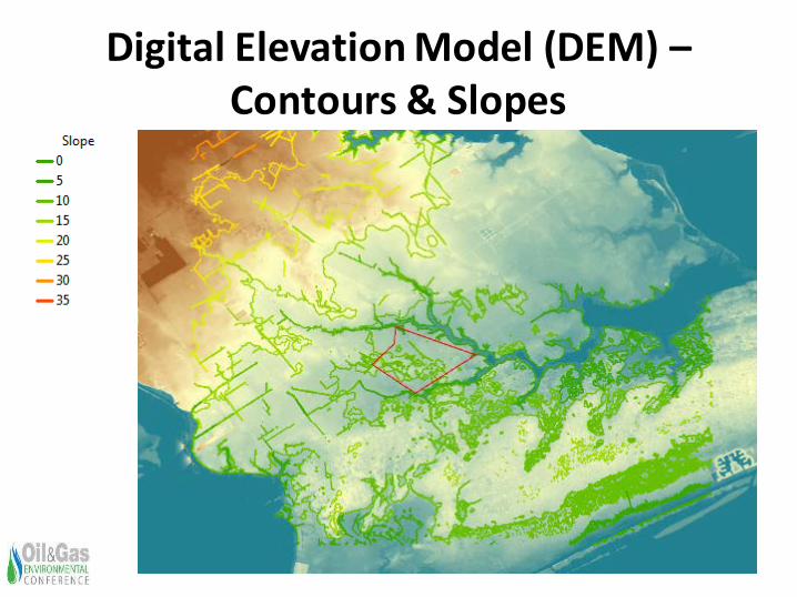
Digital Elevation Model (DEM) –Contours & Slopes
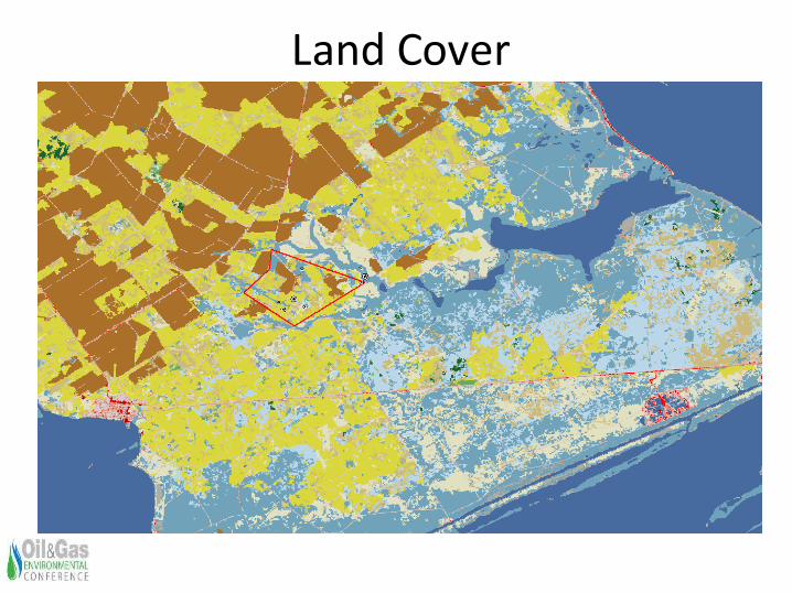
Land Cover
18
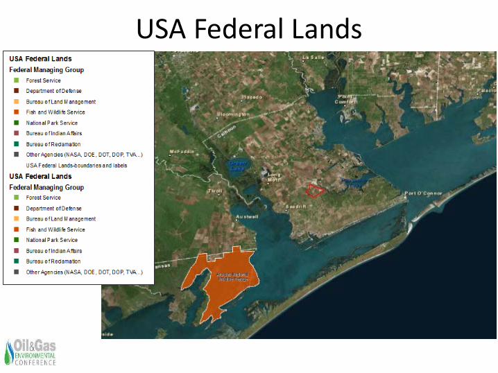
USA Federal Lands
19
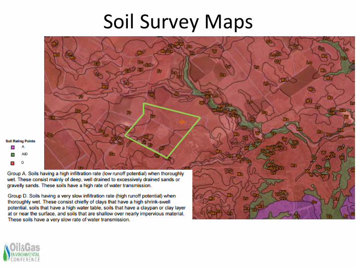
Soil Survey Maps
20
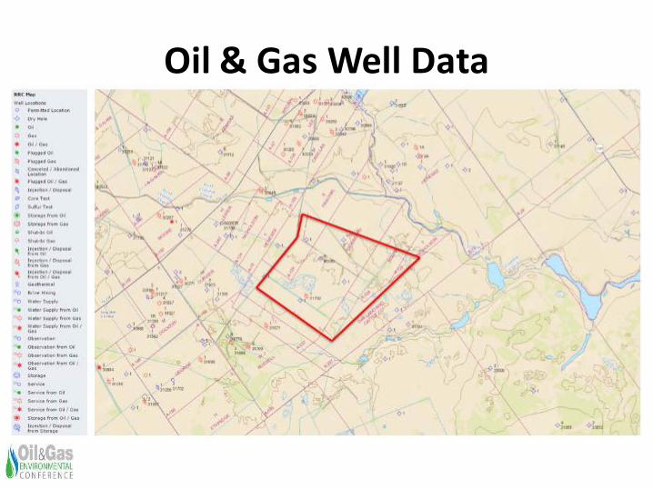
Oil & Gas Well Data
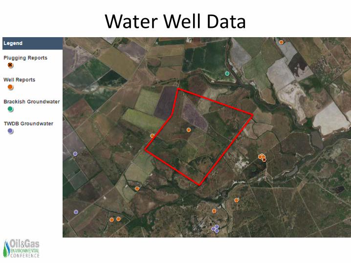
Water Well Data
22
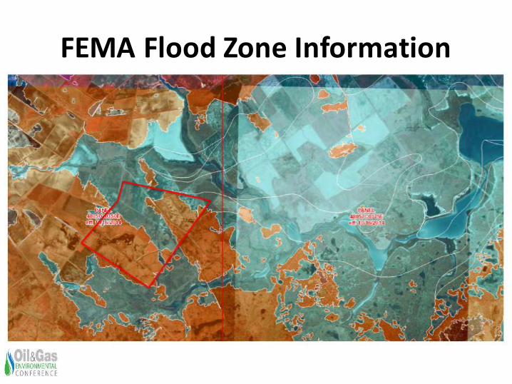
FEMA Flood Zone Information
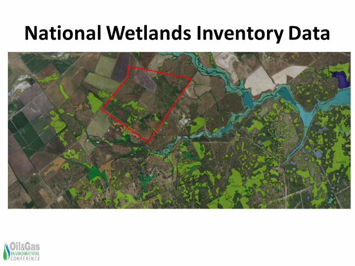
National Wetlands Inventory Data
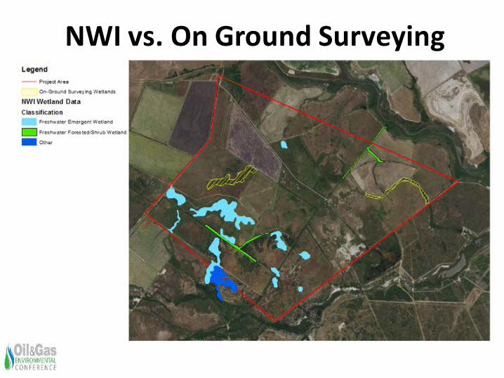
NWI vs. On Ground Surveying
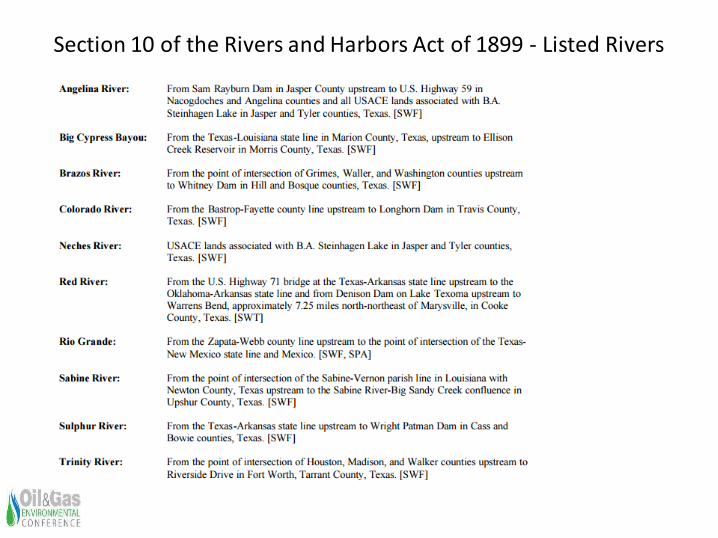
Section 10 of the Rivers and Harbors Act of 1899 - Listed Rivers
26
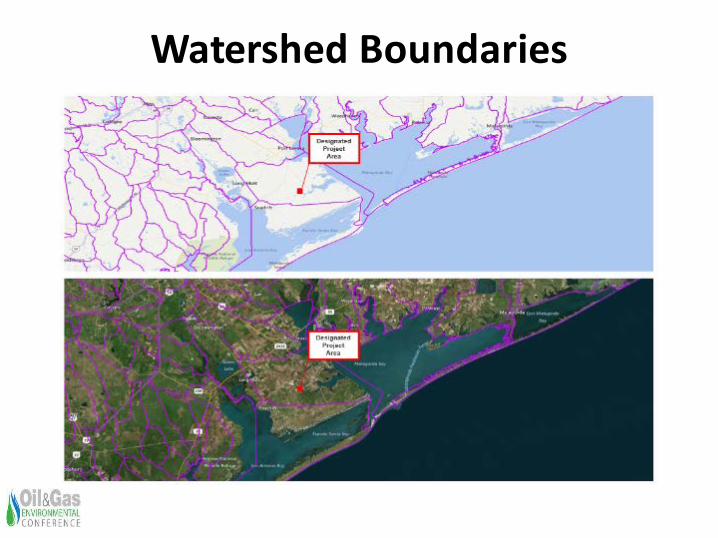
Watershed Boundaries
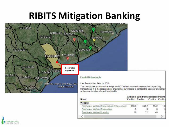
RIBITS Mitigation Banking
Designated Project Area
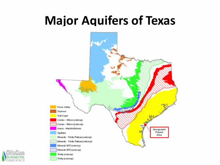
Major Aquifers of Texas
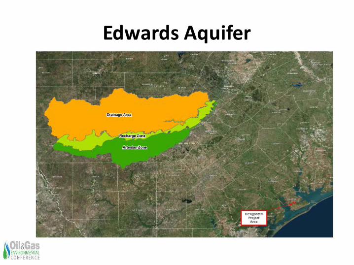
Edwards Aquifer
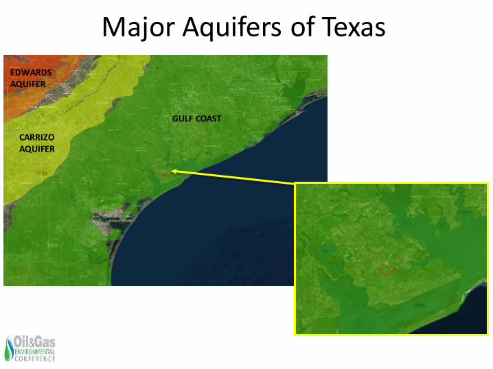
Major Aquifers of Texas
31
CARRIZO AQUIFER
GULF COAST
EDWARDS AQUIFER
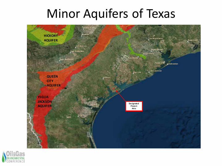
Minor Aquifers of Texas
32
Designated Project
Area
YEGUAJACKSON AQUIFER
QUEEN CITY AQUIFER
HICKORY AQUIFER
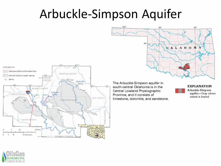
Arbuckle-Simpson Aquifer
33
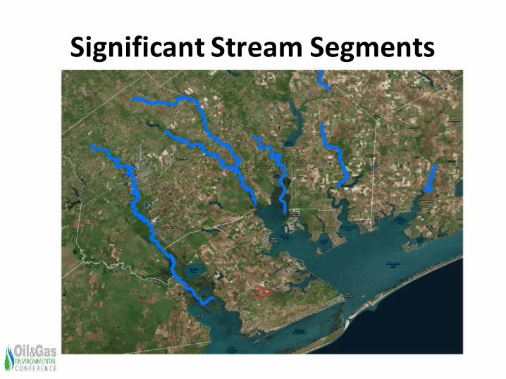
Significant Stream Segments
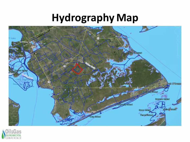
Hydrography Map
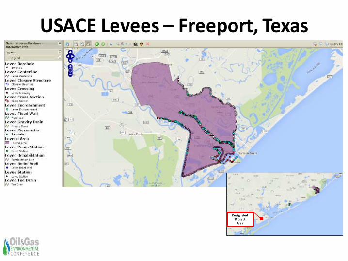
USACE Levees – Freeport, Texas
36
Designated Project
Area
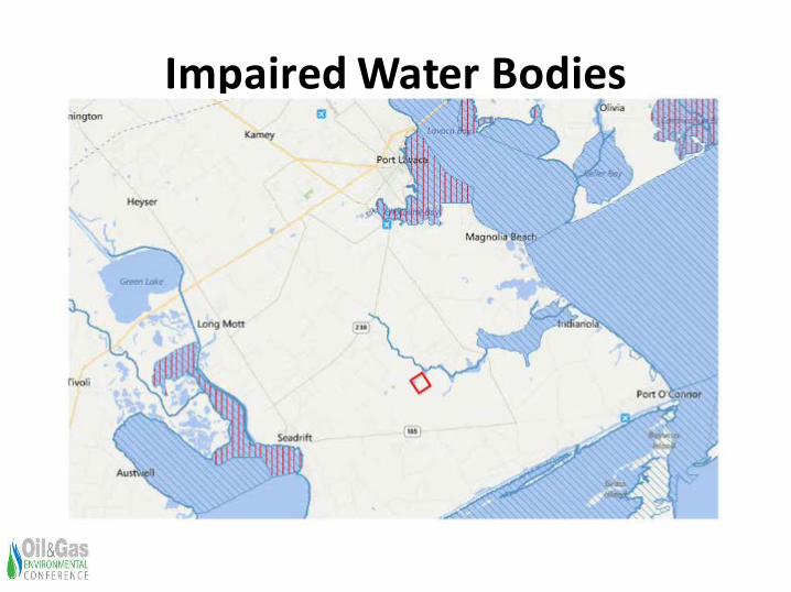
Impaired Water Bodies
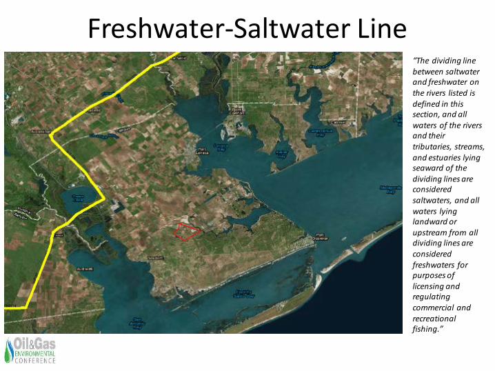
Freshwater-Saltwater Line
38
“The dividing line between saltwater and freshwater on the rivers listed is defined in this section, and all waters of the rivers and their tributaries, streams, and estuaries lying seaward of the dividing lines are considered saltwaters, and all waters lying landward or upstream from all dividing lines are considered freshwaters for purposes of licensing and regulating commercial and recreational fishing.”
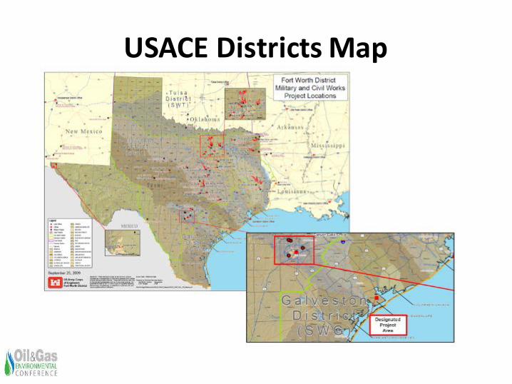
USACE Districts Map
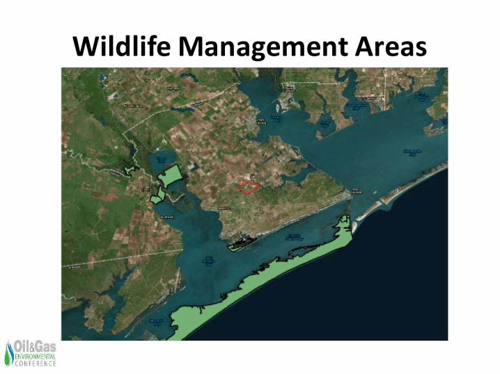
Wildlife Management Areas
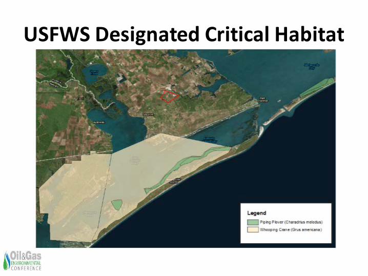
USFWS Designated Critical Habitat
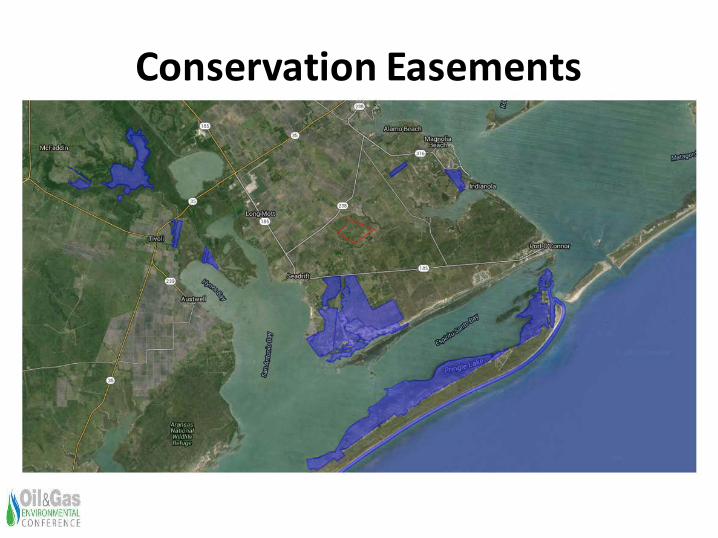
Conservation Easements
Available Data Sets for Oil and Gas, Biological, and Cultural Professionals
• Existing Pipeline Locations
• Known Threatened and Endangered Species Occurrences
• Known Significant Cultural Resources Locations
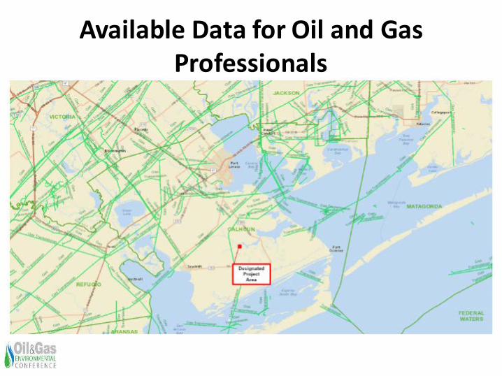
Available Data for Oil and Gas Professionals
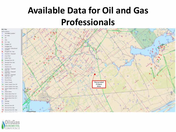
Available Data for Oil and Gas Professionals
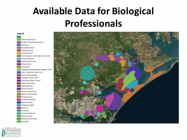
Available Data for Biological Professionals
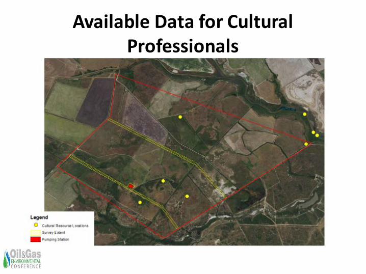
Available Data for Cultural Professionals
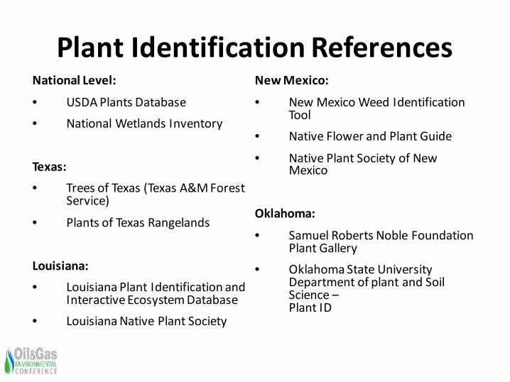
Plant Identification ReferencesNational Level:
• USDA Plants Database• National Wetlands Inventory
Texas:• Trees of Texas (Texas A&M Forest
Service)
• Plants of Texas Rangelands
Louisiana:• Louisiana Plant Identification and
Interactive Ecosystem Database• Louisiana Native Plant Society
New Mexico:
• New Mexico Weed Identification Tool
• Native Flower and Plant Guide
• Native Plant Society of New Mexico
Oklahoma:
• Samuel Roberts Noble Foundation Plant Gallery
• Oklahoma State University Department of plant and Soil Science –Plant ID
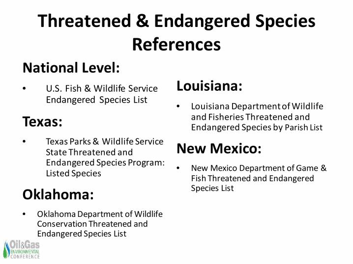
Threatened & Endangered Species References
National Level:• U.S. Fish & Wildlife Service
Endangered Species List
Texas:• Texas Parks & Wildlife Service
State Threatened and Endangered Species Program: Listed Species
Oklahoma:• Oklahoma Department of Wildlife
Conservation Threatened and Endangered Species List
Louisiana:• Louisiana Department of Wildlife
and Fisheries Threatened and Endangered Species by Parish List
New Mexico:• New Mexico Department of Game &
Fish Threatened and Endangered Species List
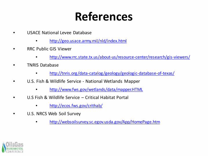
References• USACE National Levee Database
• http://geo.usace.army.mil/nld/index.html
• RRC Public GIS Viewer
• http://www.rrc.state.tx.us/about-us/resource-center/research/gis-viewers/
• TNRIS Database
• http://tnris.org/data-catalog/geology/geologic-database-of-texas/
• U.S. Fish & Wildlife Service - National Wetlands Mapper
• http://www.fws.gov/wetlands/data/mapper.HTML
• U.S Fish & Wildlife Service – Critical Habitat Portal
• http://ecos.fws.gov/crithab/
• U.S. NRCS Web Soil Survey
• http://websoilsurvey.sc.egov.usda.gov/App/HomePage.htm

Conference participants are eligible for up to 13 contact hours 1.3 CEUs. Forms will be available after lunch on Wednesday at
the registration are.
Return completed forms at the conclusion of the conference.
Please remember to fill out the conference survey. This will be sent to you by email.
https://www.surveymonkey.com/r/2015OGENV