OPPORTUNITIES FOR PEOPLE, SCIENCE, CITIES AND BUSINESS ...
108
DELTAS IN TIMES OF CLIMATE CHANGE II INTERNATIONAL CONFERENCE OPPORTUNITIES FOR PEOPLE, SCIENCE, CITIES AND BUSINESS ROTTERDAM, THE NETHERLANDS 24 – 26 SEPTEMBER 2014 Meeting report
Transcript of OPPORTUNITIES FOR PEOPLE, SCIENCE, CITIES AND BUSINESS ...

DELTAS IN TIMES OF CLIMATE CHANGE II
INTERNATIONAL CONFERENCE
OPPORTUNITIES FOR PEOPLE, SCIENCE, CITIES AND BUSINESS
ROTTERDAM, THE NETHERLANDS 24 – 26 SEPTEMBER 2014
Meeting report

DELTAS IN TIMES OF CLIMATE CHANGE II
OPPORTUNITIES FOR PEOPLE, SCIENCE, CITIES AND BUSINESS
Meeting reportDeltas in Times of Climate Change
24 – 26 September 2014
Rotterdam, the Netherlands

4
COLOPHON
5
CONTENTS
Editors Florrie de Pater, Ottelien van Steenis, Knowledge for Climate With contributions from Christina Boomsma, Netherlands Water Partnership (Delta Sessions) Willemijn Ruell, City of Rotterdam (Deltas in Practice sessions) Maartje Smeets, Synergis communicatie (plenaries) Photo’s © Maartje Strijbis / Floor Fortunati Layout www.lijnontwerp.nl
Contact Organising CommitteeProgramme Office Knowledge for ClimateThe Netherlands+31 317 48 [email protected]
www.climatedeltaconference2014.org
10 Plenaries10 Plenary Wednesday “The ‘soft’ side of adaptation”14 Plenary Thursday “Adapting now: Necessity as the Mother of Investment”17 Plenary Friday “Transformative change in the making”
20 Deltas in Depth Theme 1. Climate projections and extremes 20 DD 1.1 Climate change scenarios21 DD 1.2 Sea level rise and impacts23 DD 1.3 Changing weather and impacts (continues 1.4)25 DD 1.4 Changing weather and impacts
27 Deltas in Depth Theme 2. Flood risk management27 DD 2.1 Analyses and mitigation of social disruption28 DD 2.2 Making room for water30 DD 2.3 Improved decision support in flood risk management32 DD 2.4 Novel flood damage mitigation and precautionary measures 33 DD 2.5 Innovations in flood risk analyses35 DD 2.6 Flood risk management challenges in national policies
37 Deltas in Depth Theme 3. Fresh water management 37 DD 3.1 Surface water quantity and quality39 DD 3.2 Salinity, drinking water, adaptation practices40 DD 3.3 Groundwater, salinity intrusion42 DD 3.4 Agriculture-water quantity, salinity, adaptation44 DD 3.5 Adaptation policy and practices
46 Deltas in Depth Theme 4. Coastal systems and wetlands 46 DD 4.1 Sustainable management of delta’s – a tour around a changing world47 DD 4.2 Climate change and delta ecosystem functioning49 DD 4.3 Sustainable deltas 2015 (SD2015) initiative52 DD 4.4 Sediment supply, loss and accumulation53 DD 4.5 Building with nature55 DD 4.6 Ecosystem values and the coupling of human and natural dynamics57 DD 4.7 Wetlands as natural flood protection58 DD 4.8 Coasts between conservation and realignment
60 Deltas in Depth Theme 5. Urban adaptation to climate change 60 DD 5.1 Urban adaptation to climate change: introduction and keynotes62 DD 5.2 Urban adaptation tools and strategies64 DD 5.3 Approaches to urban resilience65 DD 5.4 Economics of urban adaptation 67 DD 5.5 Managing urban water under changing climate conditions68 DD 5.6 Lessons from cities in developing countries
24 – 26 SEPTEMBER 2014 ROTTERDAM, THE NETHERLANDSDELTAS IN TIMES OF CLIMATE CHANGE II

76
CONTENTS CONTENTS
119 Deltas in Practice Theme 2. Adaptation strategies119 DP 2.1 Migration as an adaptation to climate change: The best option for deltas?122 DP 2.2 Regional adaptation strategies: Tips and tricks from three inspiring delta regions124 DP 2.3 Learning from the practical experiences in the science policy interface in Delta Cities 126 DP 2.4 Creating and managing subsurface water buffers as a solution for fresh water shortage in coastal areas128 DP 2.5 Resilient cities talk: Best practices and remaining challenges on creating resilient urban waterfronts130 DP 2.6 Towards an integrated estuarine management: Examples of innovative approaches133 DP 2.7 Weathering the storms135 DP 2.8 Extreme weather impacts on critical infrastructures: International lessons to improve analysis137 DP 2.9 Decision making in an uncertain world
139 Deltas in Practice Theme 3. Urban design and infrastructure139 DP 3.1 Developing multipurpose infrastructure for climate resiliency141 DP 3.2 Creating floating cities: A dream or a new perspective for the future of the planet?144 DP 3.3 Room for the River presents: Learning from flood resilient cities Nijmegen and Mainz, combining flood management and urban development146 DP 3.4 Brisbane watershed design charrette148 DP 3.5 Multifunctional water storage: Eendragtspolder
150 Deltas in Practice Theme 4. Green adaptation / building with nature 150 DP 4.1 How to find the balance between economic and natural sustainability – 5 WWF delta cases152 DP 4.2 Making the business case for building with nature154 DP 4.3 Green solutions for resilient cities
156 Deltas in Practice Theme 5. Food security and the rural landscape156 DP 5.1 Towards a climate adaptive integrated approach of the food chain
158 Deltas in Practice Theme 6. Awareness, capacity building and community resilience158 DP 6.1 Resilient adaptation: How to practice what is preached160 DP 6.2 Water & Heritage: Protecting deltas, heritage helps161 DP 6.3 Science-to-Action: Aligning science with stakeholder and community needs in the Mekong and other delta systems165 DP 6.4 Deltas en estuaries in peril: Towards a global “Community of Practice” on the ecosystem-based-management of deltas under global and climate change167 DP 6.5 Landscape level planning to reduce disaster risk and enhance community resilience in delta areas
70 Deltas in Depth Theme 6. Rural development and food security 70 DD 6.1 Opportunities for socio-ecological landscape development72 DD 6.2 Strategies to increase food security73 DD 6.3 Strategies to increase food security (6.2 continued)
75 Deltas in Depth Theme 7. Port development and infrastructure 75 DD 7.1 Systems of systems approach for climate resilient multi-infrastructure76 DD 7.2 Extreme weather impacts on critical infrastructures: international lessons to improve analysis
79 Deltas in Depth Theme 8. Disaster reduction and emergencies 79 DD 8.1 Disaster reduction and emergencies, regional perspectives81 DD 8.2 Positive, reality based approaches to regional and global resilience
83 Deltas in depth Theme 9. Governance of adaptation 83 DD 9.1 Adaptation governance in comparative context85 DD 9.2 Governing adaptation in the city86 DD 9.3 Knowledge and policy for governing adaptation in coastal regions88 DD 9.4 Innovation and experimentation in governing adaptation89 DD 9.5 Actors and agendas in the governing adaptation91 DD 9.6 Engaging the public in adaptation governance93 DD 9.7 Multilevel governance of adaptation in the Netherlands
96 Deltas in Depth Theme 10. Economics and finance of adaptation96 DD 10.1 Financing adaptation 97 DD 10.2 Economic impacts of climate risks98 DD 10.3 Evaluation of adaptation tools
101 Deltas in Depth Theme 11. Decision support tools and risk assessment101 DD 11.1 Risk assessment and management103 DD 11.2 Pathways for adaptation to an uncertain future104 DD 11.3 Decision support and risk assessment in Asian deltas106 DD 11.4 Decision support tools and risk assessment in the Netherlands108 DD 11.5 Decision analysis and support110 DD 11.6 Visualisation and mapping
113 Deltas in Practice Theme 1. Risk assessment 113 DP 1.1 Future weather: A new instrument for policymakers and risk analysts115 DP 1.2 Extreme weather impacts on critical infrastructures: international lessons to improve analysis117 DP 1.3 How the world’s largest deltas are learning to learn from each other
24 – 26 SEPTEMBER 2014 ROTTERDAM, THE NETHERLANDSDELTAS IN TIMES OF CLIMATE CHANGE II

8 9
169 Deltas in Practice Theme 7. Governance and finance169 DP 7.1 In search of new (public-private) partnerships for resilient delta cities: practices in Rotterdam and New York: Unique or ‘a few of many?’ 171 DP 7.2 Mainstreaming flood resilience and green infrastructure with investment and renewal programmes: Best practices and challenges form vanguards cities across the globe174 DP 7.3 Economic assessment of inner-city climate adaptation strategy176 DP 7.4 How sustainable is your city water management?177 DP 7.5 Cross sector collaborations: Using strength in partnerships and design to catalyse change179 DP 7.6 Feasibility of long-term adaptation measures: How to develop a strategy that is cost-effective and reflective of stakeholder values 181 DP 7.7 Centuries of experience taking care of the future: What regional water authorities do to help making cities resilient to climate change
183 Deltas in Practice Theme 8. Post disaster preparedness and recovery183 DP 8.1 Exercising decision-making during flood disasters by the use of ‘Flood Simulators’184 DP 8.2 How to mobilise humanitarian funding based on flood risk
187 Delta Sessions187 DS 1 Mozambique: Integrated approach: the city of Beira188 DS 2 USA: Developing resilient communities190 DS 3 Indonesia: NCICD, from planning to implementation191 DS 4 The Netherlands193 DS 5 Bangladesh delta plan 2100195 DS 6 Vietnam: Shared framework for development196 DS 7 Colombia: Room for the river, implementation in the Cauca Valley and other regions197 DS 8 Egypt: Integrated coastal zone management198 DS 9 Myanmar: Developing an integrated water management plan in Myanmar
201 Urbanising Deltas of the World201 UDW 1 How research and practice meet and feed each other to develop new delta management approaches 203 UDW 2 Urbanising deltas of the world: Launch second call for proposals
205 Round Tables205 RT 1 If mayors ruled the world206 RT 2 Adaptation finance208 RT 3 Community based adaptation: Bridging of local and global actions, linking of scales
210 International Climate Adaptation Business Challenge 2014
CONTENTS
24 – 26 SEPTEMBER 2014 ROTTERDAM, THE NETHERLANDSDELTAS IN TIMES OF CLIMATE CHANGE II

MEETING REPORT
10 11
Plenary Wednesday
“The ‘soft’ side of adaptation”
Adapting to climate change means much more than building dikes and dams and other infrastructure. That was the message on the first day of the second Deltas in Times of Climate Change conference. The conference, which took place at Rotterdam’s Beurs World Trade Center, brought together more than 1,250 scientists, policymakers and practitioners. Over the three days of the conference, they shared their knowledge and experience in round table discussions, sessions on understanding climate change, practical workshops, and of course the plenaries.
Speaker after speaker at the first day’s plenary made the case, in various ways, for investment now – and not just in material infrastructure, but also in strengthening communities, in building with nature, in developing new technologies such as carbon storage – and in communication.
Ahmed Aboutaleb, Mayor of Rotterdam, the Netherlands: Honesty only communication strategyThe need for effective communication featured, indeed, in the welcoming remarks by Rotterdam Mayor Ahmed Aboutaleb. Honesty, he told those gathered, is the only communications strategy. “We have to explain to the public that we cannot guarantee their safety. We will always lose out if we try to fight against Mother Nature. All we can do is create the best possible defence system. Members of the public must realise that they are part of that defence system and that they too have a responsibility for their own safety.”
Mayor Aboutaleb also called for cooperation among delta cities. “Rotterdam is a leader in innovation when it comes to adaptation, and indeed it can be a role model for other cities. But there are a lot of areas where other cities are out in front, where we can learn from them, in developing the most effective evacuation plans, for instance. It’s a two-way street – so we all benefit from cooperation.”
Aboutaleb concluded his welcoming remarks with a reminder of the urgency of the situation, and called for immediate action on a number of fronts.
PLENARIES
Minister Schultz van Haegen: The worlds of science and practice have to work together in order to achieve smart deltasIn her remarks on the first day’s plenary, Dutch Minister of Infrastructure and Environment Melanie Schultz van Haegen began by echoing Mayor Aboutaleb’s call to immediate action. She noted that, since the first Deltas in Times of Climate Change, Hurricane Sandy had ravaged New York, Bangkok had been flooded, and the Philippines had suffered a devastating hurricane – not to mention major flooding in climate zones as different in other ways as Sweden’s and Pakistan’s. “The response to such disasters has been to try and rebuild everything exactly as it was before”, she noted.But we have to think of new solutions, based on smart land design, to increase resilience. The Netherlands are not only investing in steel and concrete, but in smart land planning for all weather extremes. The worlds of science and practice have to come together in order to achieve smart deltas.”
Yolanda Kakabadse (Ecuador), WWF International President: No excuse for inactionWorking with rather than against nature was the major theme in the speech by World Wildlife Fund International president Yolanda Kakabadse, who argued for a holistic, eco-system-based approach: “Ecosystem-based adaptation and community-based adaptation are important ways of protecting both humans and the habitats of animals in deltas. But in order to make natural structures work, all stakeholders have to be on board – and that means that we need a different way of thinking and working, rather than just building dams and dikes. Dams and dikes prevent deltas to evolve with the sea level rise. To quote Ban Ki Moon: there is no plan B, because there is no planet B.”
BBC correspondent and conference moderator Roger Harrabin took a moment between speeches to remind all those gathered that “politics is creeping along, whereas scientists say, we need to be racing forward in order to adapt to and mitigate climate change.”
Ahmed Aboutaleb
Melanie Schultz van Haegen
Yolanda Kakabadse

1312
are developing green strategies and structures themselves. There is money to be earned in soft engineering as well.” In the panel with Parmet, Tineke Huizinga of the Delta Alliance said: “Delta’s have to learn from each other when it comes to adaptive Delta management. To facilitate this learning the Delta Alliance has created an adaptation toolbox that is now online.”
The importance of exchanging knowledge was made very clear by the fourth participant of the panel Cynthia Villar, Senator of the Republic of the Philippines, where she is Chair of the Senate Committee on Agriculture and Food. Her sense of urgency will come as no surprise to those who know that the Philippines are already being impacted quite heavily by climate change. As Senator Villar put it, “For us there is no choice but to build with nature. We don’t have the money for expensive dikes and dams.” The 7100 islands of the Philippines are threatened by ever more and ever extremer typhoons, hurricanes, floods and storms. “And it’s the poor people that populate the most vulnerable areas. The process of changing their mind set of adapting to climate change is a long and painstaking one. In order to become more resilient to extreme weather events, we need community and stakeholder involvement.”
Chris Rapley, University College London, United Kingdom: We fail to bring the message acrossFrom this clear and sound plea to invest in technology and knowledge, the focus shifted to communication and awareness to keep climate adaptation and mitigation right up there on the agendas of all those with a stake in climate change – that is, everyone. Chris Rapley of University College of London spoke about bridging the gap between organising on the one hand and, on the other, communicating climate resilience. “We are facing the challenge of explaining as complex a system as climate change in the simplest possible way, but no simpler than is necessary! And we are failing to bring the message across, to the public and politicians alike.” The only way to tell the story of climate change is through dialogue, he insisted: “There has to be a genuine effort to communicate climate science in ways similar to how people communicate in their daily lives, in order to get the story across.”
Myles Allen, University of Oxford, United Kingdom: Climate change makes a bad day worseHarrabin’s point was underscored by Myles Allen, Head of the Climate Dynamics Group at the University of Oxford’s Atmospheric, Oceanic and Planetary Physics Department: “We are seeing impacts on all continents in natural and social systems, in ecosystems, and in human health. Coastal systems and low-lying areas will increasingly experience adverse impacts. Bad weather will get worse. Or, as a Californian firefighter once said: Climate change makes a bad day worse.”
Allen made impassioned pleas for investment in carbon storage, and for the inclusion of developing countries. “It is plain and simple: the more carbon you emit into the atmosphere, the warmer it gets. Now we need to get to zero by the end of the century – but we cannot ask people in India or China to simply stop using their coal. So the only option is to offset these effects by investing heavily in carbon storage. The Netherlands could take a major lead on this score, since it is already doing this in the Rotterdam harbour area, for instance.”
PanelBart Parmet, Staff Delta Programme Commissioner, the NetherlandsTineke Huizinga, Delta Alliance, the NetherlandsHumberto Delgado Rosa, DG Climate Action, European Commission, BelgiumCynthia Villar, Senator of the Republic of the PhilippinesIn a panel of four, Humberto Delgado Rosa, Director-General for Climate Action at the European Commission, stressed that adaptation is now fully on the European Union’s policy radar. He noted that all EU member states are in the process of drawing up an adaptation strategy that must be ready by 2017. “Seventeen members now have a National Adaptation Strategy. The EU strategy aims at nature-based adaptation. We want to make sure that, in these strategies, cross-border effects are being taken into account.”
Bart Parmet of the Staff Delta Programme Commissioner mentioned the Dutch approach of anticipating and being prepared for a possible disaster, rather than dealing with the consequences. Building with nature is an important part of that strategy. “This is not bad news for big building companies. In fact, these companies
PLENARIESPLENARIES
Myles Allen
Bart Parmet Humberto Delgado RosaTineke Huizinga Cynthia Villar Roger Harrabin
Chris Rapley

1514
“It’s important to get this right, and to target our investments accordingly. In developing countries, adaptation is not about making adjustments to what is there, but about building something new from scratch that is robust to start with. It is not only about preventing the effects of future disasters, but also, and crucially, about improving the here and now for people. And for that, we need strong, effective leaders, people who are prepared to make the tough choices and who can lead by example, inspiring others in the process.”Stéphane also threw down a challenge to those gathered. He contended that, in order to make adaptation work in practice, we need an entirely new narrative – a new way of conceiving of adaptation: “Policymakers need another story than, ‘We need to prevent a disaster!’ The real story of adaptation is that it leads to improvements. We have to help people recognise the benefits.”
Stephan Ritter, CEO ARCADIS Europe: When you are investing in material infrastructure, a wait-and-see approach just won’t cut itHallegatte’s remarks were echoed by Stephan Ritter, CEO of ARCADIS Europe, who also talked up the benefits of adaptation, as well as the opportunities it creates – climate-proofing deltas being just one example. Ritter sees this as not just a necessity but as an opportunity for investors. “Investing in adaptation is about creating a future-proof investment environment. We have to do more than design for, and make decisions about today’s situation. We must think long-term, and decide on long-term investments, taking uncertainties about climate change into account. When you’re investing in material infrastructure, a wait-and-see approach just won’t cut it. Adaptation also means you have to be flexible enough to adapt to the unexpected.”But how to get investors interested? Point to the growing number of cases where investments have paid off, says Ritter. “Take the Rotterdam Dry-Dock Company in the old harbour area of the city, where the neighbourhood is being revitalised with innovative, flood-proof houses. Or Copenhagen, which has successfully rebranded itself as a green city by doing a lot of climate-proofing with more water storage, more trees, and more parks. And let’s not forget Hamburg, which is creating an attractive, high-profile area, HafenCity. The initiative has already brought in EUR 2 billion just from the sale of parcels of land. Spotting and taking advantage of watershed moments, such as developments on the scale of HafenCity, can make things happen that you were perhaps not expecting. And think about it: if you can get big institutional investors in on the ground floor, then you can be more ambitious and increase your revenue streams accordingly. And that’s our job: to talk up these kinds of revenue opportunities, to convince investors and the financial sector generally, to invest in, and plan for resilience. And we’ve found that, once the value and the benefits become clear to them, they are more than willing to step up to the plate. In my view, involving the investment community in these ways will lead to much bigger and bolder steps and further opportunities to reap significant benefits.”Climate Adaptation Business Challenge
Plenary Thursday
“Adapting now: Necessity as the Mother of Investment”
The plenary session on the second day of the Deltas in Times of Climate Change II conference was focussed on the economic and business side of adaptation – seeing necessity as the mother of investment, to adapt a phrase.
Rising to the ChallengeProceedings kicked off with two plenary speeches. Adaptation, necessity, and investment were right up there as themes in both talks: Stéphane Hallegatte of The World Bank spoke passionately and compellingly about the effects of climate change on the poor, and the urgent need to invest now in robust solutions for a shared future, while ARCADIS Europe CEO Stefan Ritter spoke about how this need to adapt has already created specific opportunities that are making great sense as investments.
Stéphane Hallegatte, The World Bank: It is the poor, not the rich, who are the most heavily impacted by climate change“There are not many conferences like this, where policymakers and scientists come together to talk about, and work together on adaptation”, says Stéphane Hallegatte, Senior Economist in the Climate Change Group at the World Bank. “This interdisciplinary cooperation is exactly what we need in order to start taking steps towards adaptation.”For Hallegatte, the question is not what needs to be done, but how we’re going to do it. “After a flood, there is generally a study that results in recommendations about what needs to be done. And the conclusions are always similar: better drainage, better use of land, better water storage. So we know what needs to be done. The question is: How do we make that happen, not after one or another flood, but as a general matter, and on a large scale, so that we can prevent, or forestall the effects of floods and other disasters in the future. And this is what making adaptation happen is all about.”Hallegatte then turns to the financial costs of disasters. “The losses are often measured in millions or billions of dollars, and those numbers are important. But what we sometimes overlook is the differential effects that the same disaster can have on the rich and the poor. For instance, if a poor family in the developing world loses “only” USD 200 as a result of a flood that could in fact mean a year’s income or the family’s life savings wiped out in one fell swoop.”“So that’s the numbers. But it gets worse, because the poor are also more likely to be exposed to floods, storms, and other disasters related to climate change. Now, if we look only at the numbers, then it looks as though the poor are bearing a small proportion of the costs. But if we look at the actual human impacts, then it’s clear: It is the poor, not the rich, who are the most heavily impacted by climate change. The poor are really taking it on the chin – and this can, and has to change. Developing countries have a lot of opportunities to adapt in a robust way from the start, so they can be prepared for the changes that lie ahead.”
PLENARIESPLENARIES
Stephan Ritter
Stéphane Hallegatte
24 – 26 SEPTEMBER 2014 ROTTERDAM, THE NETHERLANDSDELTAS IN TIMES OF CLIMATE CHANGE II

1716
Plenary Friday
“Transformative change in the making”
“Change is in the air. Today’s Climate Summit has shown an entirely new, cooperative global approach to climate change….Today shows that the world is finally waking up to the economic and social opportunities of taking action on climate change.” That was United Nations Secretary-General Ban-Ki Moon reflecting on the outcomes of the UN Climate Summit that took place in New York on 23 September – and his positive message can only have served to encourage participants in the Deltas in Times of Climate Change II Conference, as they came to the Rotterdam’s World Trade Centre the next morning to kick off the third and final day of workshops and sessions.
Henk Ovink, Hurricane, Sandy Rebuilding Task Force / US Department of Housing and Urban Development, USA: The transformative capacity of adaptationThe first speaker to address the closing plenary session was Henk Ovink, Senior Advisor to the Hurricane Sandy Rebuilding Taskforce. Picking up on a theme from the Conference’s second plenary, Ovink stressed that adaptation opens up a whole range of possibilities for improving the quality of the spaces we live in while reducing their vulnerability. He gave two examples of this potential for transformation, both from right here in the Netherlands: the Room for the River Programme, which is increasing the discharge capacity of the Rhine while improving the overall environmental quality of the region; and the Delta Programme, which is ensuring both that the Netherlands remains safe and attractive, and that it will have enough freshwater in the years to come. Ovink also had a few pointers based on his experience with the Rebuilding Taskforce, noting in particular that “resiliency should not just be about bouncing back, but about bouncing back differently, better, instead of a copy-paste of what was there before.”
Prof.dr. Frans Berkhout (Chair Scientific Committee), King’s College, United Kingdom / Future Earth Programme, France: Award ceremony Best Young Delta Scientist (presentation and poster)The next speaker to take the podium was Frans Berkhout, Professor of Environment, Society and Climate at Kings College London. Berkhout was on hand to announce the winners of the Young Scientist Awards in two categories: best presentation and best poster. The winner of the first award was Brenda Walles for her presentation “The Role of Biogenic Reefs for Coastal Adaptation and Conservation”, which research she did together with Aad Smaal, Bram van Prooijen and Tom Ysebaert of Wageningen UR the Netherlands. The price for the best poster was awarded to Ana Genua-Olmedo for her poster “Modelling the Impacts of Relative Sea-Level Rise on Deltaic Rice Fields”. This research was carried out by her, Carles Alcaraz, Carles Ibáñez, and Nuno Caiola of the Institute of Agro-Food Research and Technology, Spain. Each award carries a prize of EUR 1,000.
After these speeches Rens de Jong of BNR Radio presented the winners of the Climate Adaptation Business Challenge. The challenge aims to stimulate business opportunities in climate adaptation. Seven finalists were selected out of competing ideas from 28 countries. Priska Prasetya and Jelmer van Veen of the Dutch start-up AQGRI+ were named the first price winners for their cutting-edge project idea, which is all about getting value from treated wastewater for agricultural use, such as on coffee plantations in Vietnam. The prize of 25.000 euro’s enables them go to Vietnam to continue building relationships with partners and potential customers, and pursue their five-year business plan, which calls for the creation of up to 20 AQCRI+ stations across the country.
PLENARIESPLENARIES
Henk Ovink
Frans Berkhout
Rens de Jong
24 – 26 SEPTEMBER 2014 ROTTERDAM, THE NETHERLANDSDELTAS IN TIMES OF CLIMATE CHANGE II

P
18 19
Paula Verhoeven, City of RotterdamIt then fell to Paula Verhoeven, Session Chair and Director, Sustainability and Climate Change with the City of Rotterdam as well as Chair of the Rotterdam Climate Proof Recommendations Committee, to thank the Organising Committee for what she rightly called an “amazing and inspiring conference.”
Prof. Pier Vellinga, Knowledge for Climate, Chair of the Conference: Closure of the conferenceNext up was Professor Pier Vellinga, Director of the Knowledge for Climate Programme and Chair of the Conference, who highlighted some of its outcomes. In remarks that resonated with a point Stéphane Hallegatte made at the second day’s plenary – “We need an entirely new narrative, a new way of conceiving of adaptation” – Vellinga highlighted a number of such shifts: away from a focus on statistics and towards new narratives and an openness to learning from best practices, from damage control to value creation, from climate-proofing to future-proofing and from awareness-raising to pilot projects. At the same time, Vellinga drew attention to some sobering statistics: of the larger European cities, 8% have no adaptation plans or strategies at all, 68% are planning on having plans at some point but have nothing in place at the moment, and 16% are actively working on a plan. That leaves a mere 8% with plans in place. Vellinga expressed the hope that these numbers will have changed markedly by the time the PROVIA International Adaptation Future Conference takes place in Rotterdam in 2016.
In closing the session and the Conference as a whole, Vellinga had the following words to the wise for participants to take home with them: “It’s not that technology’s some bottleneck that’s stifling adaptation”, he said. “What we need, rather, is the courage to work together to test new solutions and strike out in new directions.”
Paula Verhoeven
Pier Vellinga
MEETING REPORT
DELTAS IN TIMES OF CLIMATE CHANGE II

20 2124 – 26 SEPTEMBER 2014 ROTTERDAM, THE NETHERLANDSDELTAS IN TIMES OF CLIMATE CHANGE II
Deltas in Depth Theme 1. Climate projections and extremes
DD 1.1 Climate change scenarios
Chair Prof.dr. Wilco Hazeleger, Royal Netherlands Meteorological Institute, the Netherlands
Rapporteur Emma Daniels, Wageningen UR, the Netherlands
Presentations Prof. Bart van den Hurk, KNMI, the Netherlands Dr. Andreas Sterl, KNMI, the Netherlands
The first presentation by Bart van den Hurk, “KNMI’14: New climate change scenarios for the Netherlands”, introduces the new KNMI’14 scenarios. The Dutch climate change scenarios build further on a tradition, starting with the first release in 2006. The 2006 scenarios were based on a lot of statistical scaling. The new KNMI’14 scenarios contain more physical processes and are based on a selection of climate fields (downscaled EC-Earth runs with RACMO), which allows for derivation of spatial patterns. This was used to create “westerly” and “easterly” or “wet” and “dry” scenarios. The new scenarios are made because of needs/requests of policy makers and water managers, and new scientific knowledge and analyses. The new scenarios, like the 2006 ones, span two variables: the worldwide rise in temperature and changes in circulation. The new scenarios, for example, have regional differences, different quantiles and are presented with probabilities. Sea level change in the scenarios is based on the global mean temperature and (uncertain components of) the glacier mass balances. There is no high-end (previously called “Veerman”) scenario for sea level rise.
Important notions:• Mean summer drying in 2006 scenarios was too strong• Drying in the Rhine basin is different from that in the Netherlands• Range of sea level rise slightly wider than in the 2006 scenarios
Main points in the 2014 scenarios:• Winter temperature continues to rise• Winter precipitation increases (largely dependent on westerly circulation)• Change of summer precipitation is uncertain
Although weather is not captured in the scenarios, some ‘future weather’ analogues are included. These analogues use current day weather and put these in the context of the future climate. Future weather examples make climate change more lively and are easy to engage the public.
The second presentation by Andreas Sterl, “The KNMI’14 climate change scenarios: The wind chapter”, gives detailed information about changes in wind and a ‘weather’. To give an example: Geostrophic wind over the North Sea does not show a trend, but shows large variability over the last 140 years. A large body of literature doesn’t show significant changes of either side of the North Sea. Using EC-Earth gives negative changes (0.1), which are statistically not significant for mean wind (9). Also there are no trends in annual maximum winds or
1/100 year events and in days per month with low (<5 m/s) winds. However, extreme wind direction might be more from the S/W. For the Netherlands changes in wind from the north are the most dangerous, but these are not predicted to increase. However, using a high-resolution (25 km) uncoupled EC-Earth run, there is an increase in early fall extremes. These storms originate near the West-African coast under the high sea surface temperature in future climate (this might be unrealistic because SST is prescribed). If the results are true, the storm season would also start earlier. The pole ward movement of storm tracks, generally observed, is not seen over the Atlantic.
Practitioners are quite interested in these ‘surprises’ in scientific work. Someone from the audience remarks that storms similar to the high-resolution EC-Earth run, are also seen in warm paleo-climate states, although these are not resolved in the utilized models.
DD 1.2 Sea level rise and impacts
Chair Prof. Eelco Rohling, Australian National University, Australia
Rapporteur Brenden Jongman, VU University Amsterdam, the Netherlands
Presentations Dr. John Church FAA, FTSE, CSIRO Fellow, Centre for Australian Weather and Climate Research, Australia Prof. Eelco J.Rohling, Research School of Earth Sciences, The Australian National University, Australia Dr. Hylke de Vries, KNMI, the Netherlands Dr. Cynthia Rosenzweig, NASA GISS/Columbia University, USA Prof. Rezaur Rahman, Bangladesh University of Engineering and Technology, Bangladesh
Eelco Rohling introduces this session by highlighting the various high-level speakers from a range of countries who will present their work. This session will encompass some of the latest and most innovative advances in the study of sea level rise and its impacts. Rohling hands over to ‘Mr Sea Level’, John Church.
In this keynote contribution, “News from the IPCC chapter on Observations, Understanding and Projections of Sea Level Change”, Church presents the main findings of Chapter 13 (Sea Level Rise) of the IPCC report ‘Climate Change 2013’. This report once again emphasises that understanding of the past is crucial for projecting future changes. In the last interglacial (129.000 – 116.000 bc) sea level was more than 5m higher than present. The melting of Greenland contributed significantly to this.
Between 1901 and 1990, the rate of sea level rise (SLR) averaged 1.3 - 1.7 mm per year. In the period 1993 – 2010, this rate was substantially higher at 2.8 – 3.6 mm per year. This increase in the rate of SLR is found consistently in many studies. The main reasons for SLR are thermal expansion of ocean water; change in mass of glaciers and ice sheets; and changes in liquid water storage on land. Recent research shows that we can now skilfully understand and model these individual components, and produce reliable estimates of global SLR. Projections show that 21st century annual SLR rates will exceed those of 1971 – 2010, under all emission scenarios. A large source of uncertainty in these projections is the potential breaking off of marine parts of the Antarctic ice sheets, which could potentially lead to significantly higher rates of SLR.
MEETING REPORTMEETING REPORT

MEETING REPORT MEETING REPORT
2322
in Bangladesh and that several parts of the country face an absolute population decline. This is often caused by environmental degradation, such as salinity and drainage congestion, as well as the destruction by the two major cyclones. It is concluded that long term planning is needed to re-establish the habitability and resilience of coastal Bangladesh, especially in the face of a changing climate.
DD 1.3 Changing weather and impacts (continues 1.4)
Chair Dr. Daniela Jacob, Climate Service Center2.0, Hamburg, Germany
Rapporteur Roos van Glabbeek, Knowledge for Climate, the Netherlands
Presentations Dr. Kathleen McInnes, CSIRO, Australia Dr. Rein Haarsma, KNMI, the Netherlands Dr. Reinout Boers, KNMI, the Netherlands Dr. Geert Lenderink, KNMI, the Netherlands Ronald van Haren, KNMI, the Netherlands
There are many contributing factors for extreme sea levels, states Kathleen McInnes in the presentation “Modelling extreme sea levels due to tropical cyclones: Examples for Fiji and Samoa”. Especially in small islands, extreme sea levels cause challenges. First, tide gauge records are short in time and spatially sparse. They rarely measure the occurrence of extreme sea levels, because they are typically located where waves effects are minimal. Therefore reliance on tide gauges for risk analysis may under-represent an important cause of inundation in small islands. Second, wind waves and swell can be a significant cause of extreme sea level inundation for steep shelved islands. Also, extreme waves are not necessarily caused by local storms. The last challenge is that wave extremes are rarely captured by tide gauges. In the context of tropical cyclone storm surges, we need methods to generate long records of extreme sea levels to estimate risks and the effect of climate variability and change. This can be achieved by synthetic cyclone generation consisting of analytic cyclone models and hydrodynamic models. Synthetic cyclones are used for estimating storm tide risk from tropical cyclones and are used to investigate the role of ENSO on extreme sea level risk on the Fiji islands and Samoa and used for assessing design heights for coastal infrastructure to resist storm tides, waves and rising sea levels.
Rein Haarsma presents his research “Dynamics of extra-tropical transition of tropical cyclones hitting Western Europe in a warmer climate”. How will extreme winds in NW Europe change in the future? Future weather simulations try to simulate severe autumn storms. They show that there will be more storms of more than 11 Bft in Western Europe in the future. Fully developed hurricanes with a full warm core will only increase in the long future, but the weak tropical systems with a shallow warm core will already be enhanced in the near future. All extreme autumn storms have a similar development and form warm seclusions. Those storms can make the extra-tropical transition. There will also be integrated vapor transport via the so-called atmospheric rivers. The smaller eastern tropical Atlantic warming reduces the amount of fully developed hurricanes that reach Europe. However, the weak tropical systems are not affected. Global warming can thus lead to an increase of severe storms in Western Europe. They have a tropical origin and intensify when entering the baroclinic zone.
The main question for the Netherlands is how do we keep our feet dry in the 21st century? Reinout Boers helps answering this question in his presentation “High resolution modelling improves the simulation of extreme
Compared to the previous presentation, Eelco Rohling focuses with his presentation “A geological perspective of sea-level change” on SLR over a much longer time scale of hundreds of thousands of years. Rohling shows the latest findings based on a unique data set from the Red Sea, going back 520.000 years. The results show that there is a clear match between Antarctic temperature and SLR. It is shown that ice sheets respond slowly to temperature changes, but that there is an eventual balance between atmospheric CO2 and sea level; for example, it is shown that a concentration of 400ppm tends to be related to a sea level 9-31 m above currently (68% probability interval; modal value at 24 m). The maximum changes in sea level follow changes in Antarctic temperature within a few centuries. The rates of SLR depend highly on the amount of ice that is available globally – after ice ages, there is more to melt and rates of rise are higher. For the last interglacial, in which global temperatures were about 2 degrees warmer than today, the mean sea level was 4-6 meters above the present level, with peaked up to 8 or 9 m. At ice volumes close to the present value, the paleo-date suggests rates of SLR of 1 to 1.5 m per century. These paleo-climatological results were used to put current trends in perspective, and show that recently observed SLR is within (but toward the high end of) the 68% probability envelope of ‘natural’ changes from the last 500,000 years. A key observation is that, once started, sea level rise due to adjustment to the current climate state would continue for centuries.
Hylke de Vries presents the latest work on developing specific SLR scenarios for the Netherlands in his presentation “The KNMI’14 scenarios for sea-level rise along the North Sea coast”. A large portion of the Netherlands is located below sea level. SLR can cause this portion to become even larger and, additionally, cause rivers to flood more frequently. Improved SLR scenarios can help inform adaptation programmes needed to deal with SLR along the Dutch coast. The research team used two scenarios: average and warm. For those two scenarios, the pathways of temperature and other driving forces were computed. Then, a regionalisation exercise was conducted to specify SLR for the Dutch coast, based for example on mass changes of the Greenland and Antarctica ice sheets. Results show that the model outcomes are well in line with measured sea level changes. De Vries emphasises that this approach can easily be reproduced to assess SLR at other locations around the world.
Cynthia Rosenzweig researched the effects of Hurricane Sandy and talks about “Preparing for Sea Level Rise in New York City”. Sandy caused the highest water levels on record and had an enormous impact in New York City (NYC). It resulted in an increased interest in location-specific SLR projections and other climate risk information, which was then produced within the framework of the Special Initiative for Rebuilding and Resilience. The research used an innovative multi-component approach to develop probabilistic SLR projections for the region, based on CMIP5 data. Results showed that SLR in NYC has been around double the global average since 1900, which is partly caused by land subsidence in the region. By 2100, the sea level is expected to be 38cm (10th percentile) to 191cm (90th percentile) higher than currently. These estimates were then used to produce coastal flood risk maps for future time periods. One of the main challenges in adaptation to increasing risks is the fact that risks spread across multiple levels of jurisdiction, with each level (local, state and national) playing a role in regulations. There is a clear need for federal coordination that recognises local and state initiatives as well as public-private partnerships.
Bangladesh is a heavily flood-prone country, suffering from flash floods, river flooding and coastal surges. Many adaptation measures have been taken over the centuries, including coastal polders and levees. The coastal polders have suffered from lack of maintenance, siltation, and disastrous effects of the 2007 (Sidr; 3,363 fatalities) and 2009 (Ailia; 190 fatalities) cyclones.
Rezaur Rahman presents ongoing work of the ESPA study in his presentation “Natural hazards and migration in the coastal region of Bangladesh”. Interestingly, results from this study show that population growth is slowing

24 – 26 SEPTEMBER 2014 ROTTERDAM, THE NETHERLANDSDELTAS IN TIMES OF CLIMATE CHANGE II24 25
MEETING REPORT MEETING REPORT
winds in the coastal zone”. For this he used the WTI, the Statutory Testing Framework for dyke protection. This is a periodic assessment of safety levels which is required by law. Extreme wind climatology is needed to drive the hydrodynamic models. A novel method is being developed using high-resolution NWP (Numerical Weather Prediction) data. The most recent model Harmonie has a higher resolution than the older ERA-interim, and therefore shows differences in the land-sea mask. High resolution modelling affects a larger region than just the coastal zone. Hydraulic load is a problem, at the coast as well as around Lake Ijssel. There is also a bias between the modelled wind speed and the observations, but the cause is unknown. For a given atmospheric reference, there is a higher/lower SST yields and higher/lower winds than the reference. The ratio sea/land of wind speed depends on stability over sea, which therefore affects the strength of storms. Extreme wind speeds over land are underestimated, but the cause is still unknown. All this contributes to the conclusion that a downscaled high-resolution model is better than the ERA-interim, but this is dependent on the location. The model is a suitable tool to generate a 30-year wind climatology.
Geert Lenderink talks about results from a model: “Response of hourly precipitation extremes to climate perturbations: results from a mesoscale model”. In recent years, the Netherlands experienced extreme precipitation. The relation between extremes and observed warming explains the increase in hourly extremes of +15% in the Netherlands. These extremes are caused by organised mesoscale convective systems. They are underestimated and unresolved, or at best partly resolved, in present-day climate models. That’s one reason why climate models underestimate the relation between precipitation intensity and moisture. The latest revolution in weather prediction mesoscale models is that they have a 2-3 km resolution. They use non-hydrostatic dynamics and resolve the largest convective motions in the atmosphere. By perturbing a mesoscale model we can successfully create future analogues, which will answer the question: how much rain would fall if the same event (same meteorological conditions) would occur in a warmer (or cooler) climate? From this perturbation we get about a 12% increase in hourly extreme precipitation per degree warming on average over 12 cases, yet with a large inter-case spread.
Ronald van Haren presents “Resolution dependence of European winter precipitation in an atmospheric general circulation model”. EC-Earth has high and medium resolution models. Both models are compared, looking at the spatial distribution of precipitation, evaporation and moisture convergence. It shows a more accurate representation of moisture convergence in most of the central and northern part of continental Europe in the high resolution model. There is no clear improvement for the southern part of Europe. In fact, in highland areas the agreement with ERA-Interim is in general worse because the orography in this model is more comparable with the orography in the medium resolution model. In order to better understand the difference in moisture convergence we consider the moisture transport. The main differences in wind, moisture and transport are found over the Atlantic. This is the storm track region where extra-tropical cyclones form. These regions are associated with increased precipitation and winds and are subject to extreme weather events. Weather in Europe is heavily influenced by the storm track over the North Atlantic. The model calculates the storm track which appears to be too zonal in the medium resolution model. This is a common problem in the coarse resolution GCM’s. In agreement with previous studies, the location of the storm track in the high resolution model is more realistic. It has fewer and/or less intense storms pass over central Europe. The high resolution model gives a more accurate representation of northern and central European winter precipitation. The medium resolution model has a larger positive bias in precipitation in most of the northern half of Europe. The synoptic systems are better simulated in the high resolution model, providing for a more accurate horizontal moisture transport and moisture convergence. The smaller precipitation bias in the high resolution model is largely unrelated to a difference in vertical velocity distribution. It is in agreement with less moisture transport over this area in the high resolution model. In areas with orography, the difference in vertical velocity distribution is more important.
DD 1.4 Changing weather and impacts
Chair Dr. John Church FAA, FTSE, CSIRO Fellow, Centre for Australian Weather and Climate Research, Australia
Rapporteur Annette van Loosen, Hogeschool Rotterdam, the Netherlands
Presentations Dr. James Young, ARCADIS SENES Canada Inc., Canada Prof. Efi Foufoula-Georgiou, University of Minnesota, USA Dr. Maminul Haque Sarker, CEGIS, Bangladesh
James Young presents his study “Climate modelling – the needs and realities of cities”. Many Canadians live in the city. Cities are important to live in and a good infrastructure is the key to a city that functions well. Global and regional climate models provide information on future extremes and on averages, yet these projections do not go into detail. When municipalities have to replace aging infrastructure, future climate projections should be taken into account. But replacements are normally very costly, so you would like the decisions on the investments to include calculations about the climate of the future, that are quite precise. When replacement of the infrastructure is not adapted to future climate predictions, costs of the impacts will incur higher.This study examines a combined global and regional climate model and weather forecast model, to created time period related, future hourly averaged data and the amount of weather extremes. This data is applied on a dynamically downscaled grid of 1 by 1 kilometre over the Greater Toronto Area. The time period used runs from 2040 till 2049. If you compare future projections with weather extremes and maxima from 2000-2009, you will see the clear differences in the amount of storms and intensity. It has been concluded that within the last 10 years (2000-2009), almost every year there has been a record achieved in Toronto’s weather events.This study points out that in 2040-2049 the amount of storms will decrease by 23% throughout the year and in summer by 57%. However the intensity of these storms will increase. For example, the comparison of 2000-2009 and 2040-2049 shows that the intensity of hourly rainfall with a return period of 10 years can increase from 20,2 mm/hour to 39,0 mm/hour. Also the amount of days with a temp of 30 degrees will increase by roughly 300%. The study’s summary points to the importance of these expected impacts to municipalities. It can be used to inform decision makers on more accurate investments in infrastructure.
Damages caused by flooding, hazards, cyclones and rising sea-level make flooding typical for Asian deltas, states Efi Foufoula-Georgiou in het presentation “Satellite rainfall retrieval over coastal zones”. Because these deltas don’t have enough knowledge and capacities to protect themselves against such disasters and to recuperate, these disasters can after years still cause problems to inhabitants and nature. Accurate estimations of precipitation on a smaller scale in the delta areas are lacking due to shortage of ground radars and rain gauges. The most reliable information is offered by satellites. This information is important for predictions on flooding, sediment and nutrient transport, hazard control, but also for climate studies. Although satellites give the most reliable information, accurate land-water interfaces will still be a laborious estimation with microwave satellites, such as TRMM(Tropical Rainfall Measuring Mission). In February 2014 a constellation of GPM-satellites was launched. GPM (Global Precipitation Measuring Mission) will improve the results, also for land-water interfaces.To improve measurements/predictions of extreme storms at high spatial resolutions and rainfall retrieval over coastal zones, a new algorithm has been developed. This uses storms or elements of spectral responses of

24 – 26 SEPTEMBER 2014 ROTTERDAM, THE NETHERLANDS 27
MEETING REPORT MEETING REPORT
26
various rainfall profiles. Final improvements will be made when the new results - within the area of the Ganges, Mekong and Amazon deltas - are compared to current approaches.
Maminul Haque Sarker presents his assessment of the rate of subsidence in the Bengal delta. Over the last couple of years a lot of research was carried out assessing High Rate of Relative Sea Level Rise (RSLR). Sea level rise is a common symptom for delta’s and also for the Bengal delta.Studies of RSLR in the Bengal Delta point out a variety of 10 to 25 mmy-1 RSLR. In this particular delta the main contributor to RSLR is subsidence. The study shows that relative sea level rise has long-term implications for Bangladesh; some areas will become unsafe for inhabitants.Local people, investors, decision makers and development partners are forced to come with a solution. The question is if inhabitants have to be encouraged to migrate or invest in flood control.Rivers in the Bengal delta yearly carry 1 trillion m3 of water and 1 billion tons of sediment. Sediment makes rivers and estuaries more dynamic.In this study a lot of research was carried out into the best approach for flood control. It points out that heavy groundwater mining causes very high rates of subsidence.There are a few ways to assess the RSLR:- By studying the change of river courses and land forms- Carbon dating data - Changes in tidal water level- By looking at archaeological monumentsArchaeological monuments in the tidal plains have been taken further into consideration for assessing the subsidence.
Deltas in Depth Theme 2. Flood risk management
DD 2.1 Analyses and mitigation of social disruption
Chair Dr. Frans Klijn, Deltares, the Netherlands
Rapporteur Thomas van der Pol, Wageningen UR, the Netherlands
Presentations Wilfried ten Brinke, Blueland Consultancy, the Netherlands Joost Knoop, PBL Netherlands Environmental Assessment Agency, the Netherlands Andreas Burzel, Deltares, the Netherlands Dr. Karin de Bruijn, Deltares, the Netherlands Dr. Frans Klijn, Deltares, the Netherlands
In this parallel session the topic of social disruption due to flooding was addressed. Definitions of social disruption were introduced, as well as methods to calculate and strategies to reduce social disruption in case of flooding.Wilfried ten Brinke explained in his presentation “Social disruption by flooding, A European Perspective”, that social disruption is a complex concept that goes beyond direct monetary damages. He showed that risk analysis criteria can be used to categorise social disruption.
Joost Knoop talked about “How to avoid social disruption? Options for the Dutch FRM policy to reduce societal risk”. He introduced strategies to avoid or reduce social disruption, including spatial planning, preparation of disaster plans, and avoiding surprises. The distinction between exceedance and flood probability, and examples of addressing newly discovered failure modes of flood defences were mentioned as a means to avoid surprises. As an example of flood loss reduction the potential to not evacuate cities in case of flooding but rather to create nearby safe havens within cities was put forward.
Andreas Burzel stressed in his presentation “Is calculation of casualties from flooding in Germany desirable? Methods and case studies” the importance to include loss-of-life (value of statistical life) in a cost-benefit analysis (CBA), which is not standard everywhere in Europe. Furthermore, other aspects of social flood risk were discussed including intangible losses. The importance and sensitivities of flood risk communication were also briefly addressed. During the discussion it was argued that CBA tends to underestimate mortality risk.
Karin de Bruijn presented “Societal flood fatality risk assessments: a method and its application to the Rhine and Meuse Delta”, a study on mortality functions and flood fatality assessment with many flood scenarios (breach locations, number of breaches).
Frans Klijn closed the session with his study on “Flood hazard mapping: on the purposeful combination of individual flood characteristics in behalf of hazard zoning”, researching the making of flood hazard maps, and on the new concepts of ‘flood fatality hazard’ and ‘flood damage hazard’ to obtain a single flood hazard map with a number of flood hazard zones.

DELTAS IN TIMES OF CLIMATE CHANGE II28
MEETING REPORT MEETING REPORT
29
DD 2.2 Making room for water
Chair Dr. Luciana S. Esteves, Bournemouth University, United Kingdom
Rapporteur Marjolein van Eerd, Radboud University, the Netherlands
Presentations Dr. Jean-Marie Stam, Rijkswaterstaat Room for the River, the Netherlands Dr. Luciana S. Esteves, Bournemouth University, United Kingdom Hans-Peter Weikard, Wageningen UR, the Netherlands Dr. Anna Wesselink, University of Twente, the Netherlands
This session addresses the change from hard engineering flood risk management (FRM) to making space for water in the light of a changing climate, the need for adaptation and sustainability. Seeking for alternatives that could bring more benefits for society in comparison to traditional FRM strategies.
The first speaker, Jean-Marie Stam, shows in her presentation “Seven ALFA lessons in rural Europe: Combining flood management, farming and Forestry” how farming, forestry and flood management could be combined. She tells about her experiences within the ALFA project (Adaptive Land use for Flood Alleviation, http://alfa-project.eu/en/) aiming to create storage and discharge capacity along the rivers taking an integrated catchment approach. The project partners represent different locations in a catchment. She shows that the position in a river basin determines the type of FRM (hold, retain, discharge), e.g. in upstream regions water will often be hold as long as possible, in the middle regions water will be retained as long as possible, while downstream the water will be discharged as soon as possible. Those different approaches provide a variety of opportunities for rural areas. This clarifies also upstream-downstream interdependencies and the need for solidarity. Other lessons learnt from those cases are that every actor should benefit (e.g. multi-benefit, via compensation or improved spatial quality), that projects should be designed in collaboration with end-users and that local needs should be taken into consideration. Although improving biodiversity via FRM projects often requires some extra input, it will bring multiple and long-term benefits.
Luciana S. Esteves shows in her speech “Creating space for change: Managed realignment and flood risk reduction in low-lying coastal areas” that the paradigm shift in FRM from hard engineering to approaches where multiple uses and the creation of space for water leads to multiple benefits across sectors of society, could be addressed by the concept of management realignment (MR). So far, different and confusing terminologies of this concept are applied. Esteves defines MR as a soft engineering approach, aiming to promote sustainability of coastal erosion and FRM by creating opportunities for wider benefits provided by natural adaptive capacity that allows to respond more dynamically to environmental changes. Examples of challenges for MR across different countries are: availability, public perception, providing evidence of benefits acquired and creating long term plans. She states that to increase public uptake and acceptance, it is necessary to provide evidence of the benefits gained from existing MR projects. Lastly, Esteves focuses on the need for behavioural changes via education, the need for political willingness for long-term planning and a paradigm shift towards building with nature.
The third speaker, Hans-Peter Weikard discussed in his presentation “A compensation mechanism for flood protection services on farmland” and showed the need and possibilities for land owner’s engagement with FRM and water retention from an economic perspective. Key questions of his research were how farmland as retention area could be used and operated, and how farmers in those regions could be compensated. He tells
about a Hungarian case where damage compensation leads to expensive assessments, inefficient crop choice and potentially inefficient use of the reservoir. Weikard and colleagues developed a contract design model as compensation for flood protection services based on a hydrological aspect (river authorities must balance the avoided downstream damage against damage in the reservoir or compensation claims) and on an aspect related to the value of crops. He concludes that criteria for their simple and easily implementable compensation scheme are the voluntary participation of farmers (they should be happy to use their land as a water reservoir), an efficient crop choice (choosing a low value crop to reduce losses), efficient risk allocation when farmers are risk averse (they should be fully insured) and efficient use of the reservoir (floodgates should open when the avoided damage is higher than the variable compensation payment). Next step is to assess the scheme’s working in practice.
Lastly, Anna Wesselink showed in her presentation “Soft risk management: Impact in deltas around the world” the today’s general assumption that the focus on hard engineering measures in FRM is costly and unsustainable under changing climate conditions and that softer approaches are expected to fit better. Yet, her studies show that it is important to consider a regions’ history to understand the current situation and that each region needs other FRM strategies. Technologies applied, histories, attitudes and paradigms to FRM are different, so why do we try to learn from other regions and countries? She shows that even two cases in the Netherlands are not comparable and that technology applied should fit local conditions and cannot be directly copied. It is important, though, to be inspired by other regions and to reflect on your own practices. She mentions the striking example of hurricane Katrina, being a wake-up call for the Netherlands leading to reflections concerning the Dutch trust in engineers and technology.
Point for discussion is the importance of the application of a river basin management approach, which is stimulated by river basin commissions and EU legislation, yet this could be improved. Also the importance of farmers’ engagement in FRM projects in river basins was discussed. Based on the new types of FRM, a division of responsibilities is a point for discussion as well. Besides, the audience agreed upon that Dutch knowledge cannot be applicable to other countries without consideration of local situations. Public awareness about climate change and FRM and the different levels societies’ preparedness to extreme weather and flooding was discussed. It became clear that awareness and preparedness are also related to the frequency in which the public is affected by flood events. Challenging issues are the trans-boundary aspect, the historical traditions of FRM and its socio-economic and cultural aspects.

24 – 26 SEPTEMBER 2014 ROTTERDAM, THE NETHERLANDSDELTAS IN TIMES OF CLIMATE CHANGE II30 31
MEETING REPORT MEETING REPORT
DD 2.3 Improved decision support in flood risk management
Chair Prof. Zbigniew Kundzewicz, Polish Academy of Sciences, Poland
Rapporteur Marjolein Mens, Deltares, the Netherlands
Presentations Dr. Heidi Kreibich, German Research Centre for Geosciences, Germany Marjolein Mens, Deltares, the Netherlands Peter Zwaneveld, CPB, the Netherlands Prof. Carlo Giupponi, Ca’ Foscari University of Venice, Italy
This session on improved decision support in flood risk management discussed a variety of methods to support decisions: cost-benefit analysis, robustness analysis, integrated cost assessment and robust decision making.
Heidi Kreibich started off with her presentation “Costing natural hazards”, presenting a new view on how to assess costs of natural hazards. This integrated method has been developed in the European FP7 project CONHAZ. This research project was motivated by the fact that it is difficult to detect and project climate change and its effect on the increasing losses from natural hazards. In order to produce more meaningful projections it is necessary to improve assessment of costs of observed floods and costs related to adaptation, including estimates of avoided damage. Therefore, risk management should be a continuous effort and also follow a cyclic process. Dr. Kreibich proposed and explained a new framework for cost assessment that is closely connected to the risk management cycle (see figure).
Marjolein Mens presented “Robust flood risk management against acceptable costs: How the choice of criteria affects the ranking of strategies”. She showed a comparison between different decision criteria in flood risk management. Using results from an application on the Meuse River valley (Netherlands) she demonstrated that depending on the criteria selected, strategies for flood risk reduction are likely to rank differently. Two of the criteria were benefit-cost-ratio and total societal cost. The first is commonly used throughout Europe, while the latter is favored in the Netherlands. Mens asked the audience to discuss why they think this is the case. Furthermore, she showed benefits of a robustness criterion, taking into account the potentially large losses of low-probability flood events. The robustness criterion helps scoring measures on how they contribute to the task of avoiding large, unacceptable flood losses.
Peter Zwanenveld presented a new method Diqe-Opt for finding economically optimal safety standards, with an application on the Ijssel Lake in the Netherlands in his presentation “Economical optimal water safety in a multi-level system: a new method applied to the Ijsselmeer regon”. This method aims to find a protection standard for embankments based on the lowest total costs, and is based on work by Van Dantzig and Eijgenraam, two Dutch economists who are responsible for the economic reasoning behind the Delta Works (in the sixties) and the recently adopted new protection standards for the Netherlands. Zwanenveld showed different results depending on assumptions on how the system is functioning (e.g. what if the Afsluitdijk fails during a storm). The results show that pumping is the cheapest option.
The final presentation was by Carlo Giupponi on “Robust management of flood risk under deep uncertainty: An application to Dhaka city”. He showed an application of the method Robust Decision Making (RDM) developed by the RAND corporation (Robert Lempert et al) for a case in Bangladesh. The method aims to take into account the many uncertainties involved with long-term decision making in an uncertain world. The method starts with identifying the most relevant uncertainties, for example in calculating the change in flood risk. Next, many scenarios are run with a range of assumptions for the uncertain variables. Each scenario represents one possible future. The performance is measured as the percentage of runs that meet the decision target, for example flood risk below a predefined level. The challenge is to make a large amount of data available for the decision making process. For that purpose, Giupponi demonstrated the use of data mining.
The session ended with a lively discussion on two topics. The first topic was applicability of methodologies - when to use which method? A variety of methods has been developed to support decision making, but they all take a lot of time to apply on a specific problem. While some people suggested applying several methods and discussing the differences, others felt that in practice there is often no sufficient time and no adequate funding to perform such broad, and demanding, analyses. This shows a clear need for guidance on when to use which method. Simpler (hence less accurate) methods that are less time-consuming may be preferable in some situations.
The second discussion topic was the possibility to prepare for unexpected events (sometimes called “Black Swans”). Some discussers found that awareness of unexpected events is more important than actually planning for them. Others took a more skeptical stance, doubting our ability to consider and to plan for things that have never happened before and hence are difficult to imagine, even possibly unthinkable.
Figure with Ms Kreibich’s presentation

24 – 26 SEPTEMBER 2014 ROTTERDAM, THE NETHERLANDSDELTAS IN TIMES OF CLIMATE CHANGE II32 33
MEETING REPORT MEETING REPORT
DD 2.4 Novel flood damage mitigation and precautionary measures Chair Dr. Heidi Kreibich, German Research Centre for Geosciences, Germany
Rapporteur Chantal Dupuis, Hogeschool Rotterdam, the Netherlands
Presentations Dr. Swenja Surminski, Grantham Research Institute on Climate Change and the Environment, United Kingdom Dr. Philip Ward, VU University Amsterdam, Institute for Environmental Studies, the Netherlands Dr.Jantsje van Loon-Steensma, Wageningen UR, the Netherlands
The number one of natural disasters in the United Kingdom is flooding, tells Swenja Surminiski in her presentation “Flood Insurance in England - assessment of the current and proposed insurance schemes in context of rising flood risk”. Therefore it is important to reduce the impact and the damages caused by flooding’s. Many inhabitants in the UK do not have a good insurance, some have none and others are only half insured. But first we have to define the word “insurance”, since there are many different interpretations. Insurance is a mechanism were risk or parts of a risk are transferred from the insured to the insurer in return for a premium payment.Fifty percent of all households are insured. Many of those are insured, because they have a mortgage meaning that they are obligated to take an insurance. But households without a mortgage have to decide for themselves whether they want an insurance or not. Many people don’t see the need for it. We are entering a new phase, where we have to deal with a lot more rain. That is why insurers are more often surprised than before. Increasingly, areas with a low chance of flooding previously are now getting flooded. Insurers are surprised by the increase of the damage. Therefore they would like the system to change. People are afraid that the insurance fees will rise after a flooding occurs. Costumers are concerned that the insurances will become unaffordable.
The big question is, how to design a new flood insurance while keeping it affordable. The Netherlands is a good example. Everybody is obligated to pay, even though they don’t live in a flood prawn area. But the problem is that many people are not willing to pay for other people. Only people in flood prawn areas are willing to pay for an insurance. However, it’s not always clear which areas are at risk are which are not.
In the four years that the Philip Wards project, “Jakarta climate adaptation tools”, is running, already two major floods occurred in Jakarta. This proves that adaptation is needed. The project JCAT (Jakarta climate adaptation tools) was designed to improve methods and tools for assisting in decision making of flood risk adaptation. This tool makes it possible to create maps that show the risk and possible damages by a flood in a certain area. It is possible to see the difference before adaptation measures are taken and after. This shows how effective adaptive measures can be. This makes it possible to choose the most effective methods to prevent floods and damages.
Jantsje van Loon-Steensma talks about “The potential of wide green dikes along the Dollard”. The mainland along the Dollard is protected by dikes. Along the Dutch and the German side different dike designs are used. Steep dikes in the Netherlands, covered with asphalt and big stones at the toe of the dike to protect the dike against wave action. In Germany the seaward face of the dikes are shallow and wide and
covered with grass. They grade into the adjacent salt marshes. Not all dikes on the Dutch side meet the current standards. Some have to be reinforced. The key question is, whether the Dutch dikes could be built like the German ones. So dikes with slopes less steep and covered with grass. This implies that the dike has to be extended seaward on the expensive of some salt marsh area. However, the Dollard salt marshes are protected, which may form a constraint. Further research is planned to explore the feasibility.
DD 2.5 Innovations in flood risk analyses
Chair Dr. Philip Ward, VU University, the Netherlands (replaced prof.dr. Jeroen Aerts, VU University, Institute for Environmental Studies, the Netherlands)
Rapporteur Brenden Jongman, Wageningen UR, the Netherlands
Presentations Zachary Tessler, CUNY Environmental CrossRoads Initiative, USA Nathalie Asselman, Deltares, the Netherlands Jeffrey Czajkowski, Wharton Risk Management Center, USA Ferdinand Diermanse, Deltares, the Netherlands Dr.-Ing. Kai Schröter, GFZ German Research Centre for Geosciences, Section Hydrology, Germany
Philip Ward kicks off the session by emphasising the importance of flood risk analysis for effective adaptation. It is made clear that innovative risk assessment techniques could assist the development of effective and robust risk management strategies.
Zachary Tessler’s presentation about “Spatial and temporal patterns of rainfall and inundation in the Amazon, Ganges and Mekong deltas” focuses on the modelling of inundation – by both rainfall and river flooding – of the world’s deltas. By using the Amazon, Ganges and Mekong delta as illustrative examples, Tessler discusses a modelling scheme and the implications of results. The quick summary of this work, as Tessler puts it himself, is: “when it rains, it gets wet”.Tessler explains that the SSWAMPS Surface Inundation Model is used for the computations in these example basins. The SSWAMS model is based on a microwave signal, which is used to detect water coverage on the land surface. In addition, information on precipitation, river discharge and waves is used to assess the inundation potential in the selected deltas. The results demonstrate that it is possible to assess the temporal and spatial harmonization of each of the driving forces of flooding. In that way, one can answer questions such as ‘what is the period of influence of rainfall, discharge and waves on surface inundation?’ This could help identify seasonal influence and support developing detailed modelling tools.
“How to obtain information on the effectiveness of potential flood risk management measures in only a few minutes?” is the title of Nathalie Asselmans’ presentation. Flood risk management in the Netherlands traditionally had a strong tendency towards structural protection. In recent years, however, the concept of ‘multi-layer safety’ (i.e. a risk management approach combining physical protection; exposure and vulnerability reduction; and improved flood response) is becoming increasingly emphasised. So far, the implementation of multi-layered safety approach has been limited by the fact that little evidence exists on the effectiveness, costs and benefits of various risk management options.

24 – 26 SEPTEMBER 2014 ROTTERDAM, THE NETHERLANDSDELTAS IN TIMES OF CLIMATE CHANGE II34 35
MEETING REPORT MEETING REPORT
DD 2.6 Flood risk management challenges in national policies
Chair Dr. Frans Klijn, Deltares, the Netherlands
Rapporteur Elco Koks, VU University Amsterdam, the Netherlands
Presentations Dr. Cees Veerman, Ministry of Foreign Affairs, the Netherlands Dr. Frans Klijn, Deltares, the Netherlands Dr. Sebastiaan van Herk, Bax & Willems, Spain Dr. Dries Hegger, Utrecht University, the Netherlands Derek Hoeferlin, Washington University in St. Louis, USA
Cees Veerman opens this session with his keynote presentation “Developing long-term views on water-related issues in Myanmar, the Netherlands and Vietnam”. In the Netherlands, there is a long history in flood risk management. How can the lessons we have learnt in the Netherlands be translated to ideas abroad? The Mekong river delta (Vietnam) and the Ayeyarwady (Myanmar) are two deltas which are similar in size and population compared to the Rhine delta in the Netherlands. However, in contrast with the Netherlands, these deltas have a high probability of flooding, but with relative low consequences. Moreover, while the Netherlands is a highly industrial based delta, the two Asian deltas are much more agricultural based. Cees Veerman noted that each socioeconomic stage of a country requires a different approach and gives different opportunities for adaptation and prevention. An important lesson we can learn from the presentation is that we should exchange ideas, not applying solutions. We should not try to directly translate our approaches in the Netherlands to other deltas. First, we should analyze the situation and formulate the exact aims. Should we focus on flood safety, fresh water supply, facilitate shipping or maybe more on nature conservation? As such, the goal of the Dutch delegations to Vietnam and Myanmar was to deliver building blocks, focusing on data collection, expertise building and the generation of ideas. The most important thing is capacity building among the local population. The second presentation was by Frans Klijn, who focused on “reconciling different flood risk concepts on behalf of adaptive flood risk management planning”. Planning for long-term management is important, albeit that the uncertainty is high. The key issue in developing flood risk management plans are the measures to choose and which strategies to adopt. However, before talking about management plans, everyone involved in the process should have the same idea of what constitutes flood risk. This thinking in the past resulted in the, now commonly adopted, constitution of hazard, exposure and vulnerability. The most important conclusion of the presentation is that a comprehensive adaptation strategy for the future is most favorable. Sebastiaan van Herk talked about the evaluation of large-scale risk reduction projects in the Netherlands and how we can learn from previous projects. His presentation was titled “From policy concepts to delivery of integrated flood risk management”. Similar to Cees Veerman, Van Herk also stated that previous learning experiences should help generate ideas, and should not jump directly to solutions. As such, he suggests, to get a specific team within the project for learning lessons and to improve current and future approaches. For instance, one important lesson learnt from the Room for the River project is that the future maintenance and operation costs were sometimes forgotten and should be taken more seriously into account in future projects. He ends with an important remark that thinking ahead is important. Know what to expect and know what the boundaries are. Be flexible and learn.
Dries Hegger, who gave a presentation on “Improving flood risk governance: exploring the opportunities and
In this presentation, Asselman shows a methodology for assessing the costs and benefits of a range of options, including dykes, stilts, mounds, floating houses and wetproofing. By combining information on flood protection standards and a flood damage and fatalities assessment model of risk quantification (HIS-SSM) with the different management options, it is demonstrated that the multi-layer safety strategy has a great potential for risk reduction in various locations across The Netherlands. The outcomes of the study include maps of the cost effectiveness (i.e. will you earn your investment back?) for different measures.
It is concluded that the cost effectiveness of secondary risk management options is increased by climate change induced intensification of flood hazard, and reduced by the amplified investments in physical protection measures that is recently agreed upon under the new Delta Plan.
Jeffrey Czajkowski’s presentation is called “Hazard to loss: Modelling of inland flooding and associated economic losses in the Delaware river basin”. Effective risk management for increasing flood risks requires a timely characterization of the hazard and its consequences. According to Czajkowski, methods for producing detailed maps of inundated areas and depths across large areas are still unavailable. In response to this, he presents a calibration-free multi-scale hydrological model, able to simulate stream-flow across the entire river network. The result of this is a normalized flood index called the Flood peak Ratio (FPR), used as a proxy for flood intensity.The research team had access to the entire portfolio of the National Flood Insurance Program (NFIP) for validation purposes. Comparison with empirical results for four large flood events in the Delaware basin showed that the FPR has a significant and positive relationship with flood claims, and that this model can therefore be applied successfully for predicting insurance claims from floods.
The 2011 Queensland floods caused severe damages across large parts of eastern Australia and the Brisbane metropolitan area in particular. Ferdinand Diermanse did the “Brisbane river catchment flood study”. The Wivenhoe dam reservoir reached its limits and spillways needed to be opened, which resulted in extensive inundation downstream. After the floods, the Big Flood Inquiry was started, which comprised a study of hydrology and hydraulics, and the development of flood management plans. Diermanse explained the background and progress of this study.The team of Diermanse estimated the probabilities of flood discharges and volumes, and analysed flood frequencies following the design event approach. Using a large number of synthetic events and a Monte Carlo analysis, the team quantified how often flood levels are exceeded in the current and future climate. The research applied a full probabilistic method, using probabilities of all input factors as well as the correlations between the different inputs. The results are not yet available for dissemination purposes.
The main question motivating the research presented by Kai Schröter, “Flood damage frequency estimation for flood risk analysis”, is to what extent probability of flood peak discharge can be used a suitable proxy for flood damage. To answer this question, Schröter and colleagues developed a coupled modelling scheme – consisting of a weather generator, rainfall model, network routing, inundation mapping and flood loss estimation – for the Mulde catchment in Germany.The team simulated 2,000 inundation events over a model period of 10,000 years, whereby flood risk for residential buildings was instantly computed for all model runs. The result clearly shows that one single probability level can have multiple simulated damages as well as the other way around, and the region-wide results therefore contain a lot of noise. The sub-basin level results are more consistent and on this level, a good regression can be constructed between river discharge and model damage. Schröter concludes that probability of discharge is of limited value for explaining flood risk. He suggests that more attention should be placed on including information on dike breach mechanisms and flood protection standards.

24 – 26 SEPTEMBER 2014 ROTTERDAM, THE NETHERLANDS 37
MEETING REPORT MEETING REPORT
barriers in six European countries”. He presented the results of an extensive project researching the most appropriate and resilient flood risk governance to deal with flood risks in vulnerable urban regions. This is done in the context of the current debate regarding the need to diversify Flood Risk Management Strategies and considering prominent policy initiatives (e.g. EU Floods Directive). He stated that we need to link together and align strategies. Again, it was stated that good practices cannot uncritically be transferred from one context to another (provide ideas, not solutions). He states that successful diversification seems to require at least: bridging mechanisms, relevant decision making frameworks/tools, recovery mechanisms and country-specific implementation of the floods directive.
Derek Hoeferlin gave the last presentation “Living with the great rivers, climate adaptation strategies in the Midwest river basins”. He focused specifically on St. Louis city. In the past the region around St. Louis suffered multiple extreme weather events, including the most destructive and most costly floods in US history. To anticipate on potentially increasing exposure due to climate change, Hoeferlin and his team started to develop possible adaptation strategies to reduce the risk in and around St. Louis. They are doing this in Dutch-American collaboration by organizing multi-stakeholders workshops. Again, important to note is that the lessons from the Netherlands can be used as ideas, not for solutions. In the future, they will continue to develop improved flood risk management strategies and increase participation among local stakeholders. Finally, Hoeferlin suggests building a multi-disciplinary international “think tank” dedicated to the research and practice of long-term integrative water-based planning.
36
Deltas in Depth Theme 3. Fresh water management
DD 3.1 Surface water quantity and quality
Chair Dr. Gualbert Oude Essink, Deltares, the Netherlands
Rapporteur Jos Baars, Wageningen UR, the Netherlands
Presentations Prof. Paul Whitehead, University of Oxford, United Kingdom Zahirul Haque Khan, Institute of Water Modelling, Bangladesh André Marques Arsénio, Delft University of Technology, the Netherlands Dr. Cor Jacobs, Wageningen UR, the Netherlands Ali Shafquat Akanda, University of Rhode Island, USA
Gualbert Oude Essink opens the meeting stressing the urge of good freshwater management, because available liquid fresh water is but a small portion of the total water mass on the surface.
Paul Whitehead, working in the ESPA project (Ecosystems Services for Poverty Alleviation), presents “Modelling impacts of climate change and socio economic pathways on extremes of Hydrology and water quality in the Ganges-Brahmaputra-Meghna Delta of Bangladesh”, a study on the alterations of nutrient flow due to climate change in the Ganges-Brahmaputra-Meghna (GBM) Delta. By using the INCA (Integrated Catchment) model he analyzed various Shared Socio-economical Pathways (SSP) to indicate future trends. Results are that these SSPs will most probably not change peak flow in the Ganges very much, except when agricultural production will increase. Nutrient affluent discharge can be controlled when the National Ganga River Master plan is put to power. The discussion focused around the calibration of the model and the used scenarios. The calibration was done up to catchment level. Sub catchments were not calibrated individually due to the size of the entire catchment. The models are based on the A1B scenarios of the IPCC.
Zahirul Haque Khan presents “Salinity intrusion and water availability under changing climate in the Coastal Ganges Delta in Bangladesh”. Sea level rise due to climate change impacts the Bangladesh coastal zone, but salt intrusion is mainly caused by the decreased outflow from the Indian Farakka Barrage. In many areas, during the dry season, the salt concentration threshold (1ppt for drinking water, 2 for agriculture) is exceeded. In the medium saline zone the salt concentration can reach up to 8 ppt, in the high saline zone (Sathkira) it peaks up to 20ppt and even more in the dry season, but does not move to under threshold levels year round. Models show that, by constructing a barrage downstream from the Ganges to divert water in to the Gorai River, the salinity problems might be solved for the high saline region, without increasing salinity problems in the low affected area. The discussion was centred around the question how legislation on transboundary conflicts evolved in Europe and to what extent the Asian rivers can be compared with European rivers. The difference between Europe and Bangladesh is that in Europe you will have political and economic leverage to take action once treaties are not kept. India does not benefit from the lower Ganges and can therefore not be punished economically. According to the Minister of Water of Bangladesh who attended the session, the only solution will be the construction of the Ganges Barrage.

MEETING REPORT MEETING REPORT
24 – 26 SEPTEMBER 2014 ROTTERDAM, THE NETHERLANDS 3938
DD 3.2 Salinity, drinking water, adaptation practices
Chair Dr. Holly Michael, University of Delaware, USA
Rapporteur Anne Martens, Knowledge for Climate, the Netherlands
Presentations Mahmoud Abdel Wahed, Lappeenranta University of Technology, Laboratory of Green Chemistry, Finland Dr. Rob Uittenbogaard, Deltares, the Netherlands Dr. Yann Friocourt, Deltares, the Netherlands Joachim Hunink, Deltares, the Netherlands
Holly Michael points out the importance of fresh water research and monitoring. With the words “What lessons are learnt and what is still need to know?” she opens the session.
One of the biggest issues in Egypt is water quality, says Mahmoud Abdel Wahed in his presentation “Water quality of Fayoum service water”. Due to sea level rise the most fertile lands in Egypt will inundate and groundwater will be contaminated with salt. Huge populations live there and will have to migrate and reclaim new land elsewhere.Abdel Wahed examined the drinking and irrigation water quality of the Fayoum Province. He shows some pictures of irrigation canals filled with garbage and waste of animals, and tells that he collected 43 water samples from irrigation canals, drains and Lake Qarun. He tested the samples on their electrical conductivity, oxygen and heavy metals. The results show that these surface waters contain high levels of microbiological contaminations from human excrements. The risk for people drinking it is high. This is a problem, because many inhabitants don’t have access to tap water. Lake Qarun is a reservoir filled with drain water, but it contains a relatively low level of heavy metals, compared to the other water samples. The sediments on the bottom of the lake seem to have absorbed the metal elements. He ends his talk with an urge for awareness among locals and laws for environmental protection: Egypt needs every drop of clean water!
Rob Uittenbogaard gives his presentation about “Water-air bubble screens reduce salt intrusion through ship locks”. Ship locks are important in deltas, but they import salt water into the fresh water system. This troubles the demand for more and longer storage of fresh water in times of low discharge. Therefore bubble screens were invented in the 1960’s. It works as follows: on the sea side of a ship lock a perforated pipe releases a thick curtain of air bubbles and, due to the buoyancy effect, these bubbles prevent salt water from entering the system. Deltares tried to improve this bubble screen. They made air regulators to improve the screen and added a fresh water screen adjacent and parallel to the bubble screen. They tested both screens in a ship lock in the north of the Netherlands in which oil tankers pass, and measured salinity, density and depth. The water-air bubble screen yields the lowest salt-leak ratio of 0-15%, in comparison to the 50% salt-leak radio of the traditional bubble screen from the 1960’s.
Yann Friocourt continues with an analysis of air bubbles in his speech “Air bubbles against salt intrusion, promises and misconceptions”. In the 1960’s, experiments were done in estuaries to reduce salt intrusions. 175 m3 air per second was needed for a reduction of salt water intrusion over 1,5 km length. That was not cost-effective enough, so the plan was abandoned. Deltares tries to find out if water-air bubble screens are
André Marques Arsénio’s presentation was titled “Centralized and de-centralized wastewater treatment in Maputo; sustainable water supply in urbanising Maputo, Mozambique”. Maputo suffers from fresh water shortages, improper sanitation, limited access to drinking water, and reuse of untreated waste water. By studying the centralized and decentralized water systems in the city, an integrated approach can be developed on improvements of social and technical aspects. Wastewater use for irrigation is a potential solution to the water shortages. It contains nutrients and is available where needed. Yet there are still ways to improve the system. A question from the audience was raised about the contamination rate in the wastewater. Although the contaminant rate is to high according to the norms, it is still useable, yet improvements must be installed to reduce the contamination in the near future.
Cor Jacobs presented “Assessment of evaporative water loss from Dutch Cities”, in which he told the audience that in Dutch cities heat islands can increase the temperature up to 7 to 10 degrees centigrade. This temperature can be lowered by evaporation. Evaporation is the link between the energy and water budgets, heat mitigation and water management. It is crucial for ground water management and contributes some specific problems. The rate of evaporation is unknown for most Dutch cities. Through two methods the rate of evaporation in Rotterdam and Arnhem was measured. Goal was to assess the possibilities of converting the crop factor into a city factor; unfortunately there is no relation with the reference evaporation. An important role is expected of open water bodies and water storage on flat rooftops to enlarge the evaporation rate, but further research must be done to create hard evidence.
Ali Shafquat Akanda talked about “Population Vulnerability to seasonal Freshwater Fluxes and Diarrheal Diseases in the Bengal Delta”. Large areas of Bangladesh are at risk of endemic and epidemic cholera outbreaks. In the flood prone area these outbreaks occur in spring, while in the drought prone areas they occur in fall. This bi-annual behavior of cholera outbreaks and the scale of calamities are underestimated and should be included in the public health response system.
One of the conclusions of the session was that the applicability of science is very important, creating information that can be used by practitioners and scientists creates added value.

24 – 26 SEPTEMBER 2014 ROTTERDAM, THE NETHERLANDSDELTAS IN TIMES OF CLIMATE CHANGE II40 41
MEETING REPORT MEETING REPORT
the answer to prevent salt intrusions in the Rhine River. After testing the new water-air bubble screen in scale models, experimental tanks and real shipping locks, they measured that only 30% of the air is needed of what was needed in the 1960’s. Still, it’s unlikely that the screens will be implemented in the Rhine, because it is not effective in all conditions and it is still very costly due to the power needed to get the acquired air pressure.
Joachim Hunink brings up questions such as: Why coping with droughts and water scarcity in such a water rich country like the Netherlands? How come we have a water shortage? In his presentation “Upscaling detailed process study to regional effectiveness on water supply: Bubble plumes in the Rotterdam Waterway” he explains. The problem is to get water of the right quality, at the right place, at the right time. In the Netherlands there are two resources of fresh water: water from the rivers Rhine and Meuse and from precipitation. The main bottlenecks for water supply are: 1) enough water in the IJssel Lake, a lake in which fresh water is stored, 2) low river discharge, 3) salt water intrusion from the sea and groundwater, 4) low ground water level, and 5) a combination of factors 3 en 4.To keep the Netherlands safe, the government started the Dutch Delta programme five years ago. The Delta Programme investigated how fresh water supply can be safeguarded. As part of this programme, Deltares has been investigating whether bubble plumes could effectively be used to limit salt intrusion in the Rhine and Meuse estuary during times of low river discharge, and how they can improve regional water supply. Therefore Deltares compared different bubble-plumes. They conclude that small bubble plumes are not effective, but that the big variant diminishes fresh water shortage. This research will be followed by a cost-benefit analysis.
DD 3.3 Groundwater, salinity intrusion
Chair Prof.dr. Shah Alam Khan, Bangladesh University of Engineering and Technology, Bangladesh
Rapporteur Jos Baars, Wageningen UR, the Netherlands
Presentations Dr. Perry de Louw, Deltares, the Netherlands Dr. Holly Michael, University of Delaware, USA Marloes van Ginkel, Delft University of Technology & Royal HaskoningDHV, the Netherlands Koen Zuurbier, KWR Watercycle Research Institute, the Netherlands
Perry de Louw starts the session with his presentation “Saline Seepage in deltaic areas: from problem to solution”. Groundwater seepage is a problem in many coastal areas. It leads to the salinisation of surface water, shallow groundwater and sometimes of the root zone. Seepage comes in three forms: paleochannel seepage, diffuse seepage, and boil seepage. Boils are the dominant salinisation sources in deep polders. It is due to “upconing” of the salt groundwater; salt water being pushed up from a low-lying aquifer, into the land or water surface, creating the effect of boiling water. By mapping the boils, salinisation can be monitored and protective actions can be taken, such as increasing the water level to minimise head difference and/or operational salt water management. Horizontal wells are not a solution, the research team thinks about possible solutions but it is complicated to find one.
“Vulnerability of groundwater to salinisation and the case of the Bengal Delta” is the title of Holly Michael’s presentation. Three major mechanisms that cause groundwater salinisation are: Reduced groundwater recharge, sea level rise (vertical and lateral intrusion), and storm surges (increased frequency and intensity). Various factors determine the vulnerability of a system; how these factors interact and affect the vulnerability is the main research question, followed by a possible classification of these factors to determine the vulnerability of coastal systems. Two coastal systems can be classified: topography-limited and recharge-limited. These classes form a first indicator of coastal vulnerability. Deltas are generally topography-limited, and highly populated. The Bengal delta is a good example of a topography limited system: the soil isn’t nicely layered. This geology determines the pattern of lateral intrusion. Human influences accelerate lateral salinisation, but according to the 2D models used for this study, it does not dominate. Vertical infiltration has a large impact.The effects of these local system characteristics and the developed indicators can be used by managers working on vulnerability assessments to create site-scale impact assessments. It also can be used for the management of pumping to minimise the effects of salinisation.
To the question: ‘Are you stating that climate change and sea level rise is not as important for salt intrusion in the delta?’ Michael answers: ‘For the lateral groundwater intrusion this might be the case, but the frequency of storm surges might increase as well with climate change, leading to more vertical intrusion’.
Marloes van Ginkel gives “Guiding principles for fresh water lens development: Exploitation and maintenance in artificial islands”. Underground water storage, such as ASR (aquifer storage recovery) and MAR (Managed Aquifer Recharge) are more and more being used worldwide in the past decades. It requires minimal land surface, does not attract mosquitos and water does not come in contact with sunlight or algae. Artificial islands can benefit from these techniques; they are constructed of sand, designed from scratch and have low fresh water availability. Designing the perfect conditions for water storage might solve fresh water issues on artificial islands. Two systems were analysed; a closed system and a partly open system, each with respective cons and pros. Artificial islands provide opportunities for water storage. The system is already in use for decades, but its practical application and optimisation for artificial islands is not yet tested. Modelling of the layering construction is not yet done, but this presentation was mainly to show that this is a system that might work, optimisation is still an important part of further research.
Koen Zuurbier focuses in his presentation “Sophisticated well configurations to enable aquifer storage and recovery in coastal aquifers” on the Freshmaker. One of the problems with ASR is that fresh water floats on salt water. When recovering the fresh water, in an earlier stage infiltrated in the aquifer, the borders will be mixed with the salt water, and the freshwater lens will have moved towards the surface. Horizontal drilling can prove a solution but never a 100% recovery will be achieved due to buoyancy and mixing. The Freshmaker is a system of two horizontal drilled wells; a shallow well for infiltration and recovery of freshwater surpluses and a deeper well to remove salt water and prevent upconing. Other ways to increase fresh water recovery is the ASR coastal system that uses wells at different depths. The future of these systems depends on further valorisation, optimisation, replication, automation, regulation, and sharing knowledge.Multiple vertical wells can be installed in one borehole. That, formerly, was an important constraint during the design of this system. For vertical wells the regional flow is very important. When choosing for such a system you should always aim for stagnant flow areas. Lateral drift will have a large influence. Impermeable clay layers can affect the system, but that can be prevented by installing two or three wells. It is important no not lose the flexibility of the system.To the question where the water comes form, Zuurbier answers that in green house areas rain water from the rooftops can be injected. The Freshmaker uses the winter flush of the system.

24 – 26 SEPTEMBER 2014 ROTTERDAM, THE NETHERLANDSDELTAS IN TIMES OF CLIMATE CHANGE II42 43
MEETING REPORT MEETING REPORT
functions are old-fashioned for several reasons and therefore need to be reassessed. The goal of his study was to develop new salt tolerance functions using a predictions approach. To do this successfully, all freshwater water and salt water fluxes in the crop’s root zone should be implemented. Then, the effect of erratic weather conditions (several scenarios) need to be assessed. Unfortunately data on crop responses to drought and salinity is limited available. If Van der Zee gets the funding, the follow-up study can be quickly finished, perhaps in two or three years time.
“Low salinity levels in Dutch lowland fresh-water fens” is the title of Siva Stolberg’s presentation. In the Netherlands, fen landscapes are a result of peat mining. Floating root mats appear after a couple of decades on the surface water. The vegetation on the root mats is special and rare. Differences in the vegetation exist due to the susceptibility to ground water dynamics and water quality; especially the edges are vulnerable. To maintain these areas, water levels need to be high and constant and salinity levels need to be in control. The goal of this study is to determine the salt exposure and sensitivity of root mat species. In the literature there is a lot of uncertainty and practically no experimental data available. To determine the exposure to saline circumstances the electric conductivity is measured in several root mats in the Nieuwkoopse plassen. A link is found between the hydraulic conductivity and the degree of decomposition of the root mat. Areas with low composition, at the edge, are more conductive. The sensitivity of the various species is investigated in several greenhouse experiments with hydroponics setup and different salt treatments. The time exposure was 7 weeks. Several species have been selected that grow on the root mat edge. Overall growth of total biomass declines with increasing salt concentration, crops are sensitive. It would have been nice to look at the effects on nutrients and to combine the results to see the whole picture. Stolberg didn’t do that.
Climate change causes higher crop yield variability in the Czech Republic, Usti region, says Eliska Lorencova in he presentation “Water availability: Climate change adaptation in the agricultural sector in the Czech Republic”. It is an area with traditional agriculture and considered to be the driest area of the country. With climate change, a decline of 7 -10 % in agricultural production is expected. This study aims to investigate farmers’ perceptions towards climate change and suitable adaptation strategies using a questionnaire (N=50). 65 % of the farmers state that climate change is actually occurring and 75% of the farmers have experienced more extreme events. The majority of farmers think the governments should be responsible to protect their farms from climate change related risks. Financial constraints, uncertainty about the occurrence of climate change and farming regulations are seen as barriers to climate change adaptation. In a second study the impact of several climate change scenarios on carbon sequestration and erosion control is investigated using the inVEST model. A combination of approaches (scenarios/modelling) allows for a spatially specific analysis of LULC long-term development and supply of ecosystem services in the Czech Republic. The scenarios show a wide range of possible future LULC developments. The analysed Ecosystem Services, carbon sequestration and erosion control, are closely associated with these LULC changes.
Finally Joost Delman explains his study on “Investigating summer flow paths in a Dutch agricultural field using high frequency direct measurements”. The goal of this study is to determine what controls the dynamics of surface water salinity at the field level and to formulate policy implications.The water fluxes and salinity levels were measured in an agricultural ditch. Measurements focused on the summer period and were taken during two measurement periods: May 2012 - November 2012, and April 2013 - October 2013. The year 2012 was wet, 2013 was quite dry up to September. This is reflected in the ground water levels and in the discharge: a large peak in 2012 and a low discharge in 2013. In 2013 there is an intake flux. The observed processes mimic normal drainage theory in which the tile drains show a non-linear response and the ditch discharge is linear. A second question that was addressed was the origin of the water in the ditch which can be determined by the level of salinity. Results of a precipitation event were differentiated per flow path. In the drain both shallow and deep groundwater can be found whereas in the ditch, first a peak of the
In the discussion after the presentations a few questions were raised. The first had to do with chemical clogging. In both systems there is no problem of mechanical clogging due to filters. The ASR coastal has no microbial clogging because the rain water is relatively fresh. The Freshmaker uses surface water, containing more organic carbon and microbial contents which could lead to more contamination. Michael answers the second question: Which deltas would have a higher vulnerability? She says that she didn’t mean that lateral intrusion is not important. In Bangladesh the top of the lower aquifer is close enough to the surface to make hand wells possible. A motivator was the question how long people can be drinking the deep tube freshwater. Which delta is more vulnerable than the other is something that cannot be concluded from this research. Shrimp farming is increasing regional salinity and introducing salt water into the groundwater, which could look a lot like vertical salt intrusion due to storm surges.
DD 3.4 Agriculture-water quantity, salinity, adaptation
Chair Dr. Ad Jeuken, Deltares, the Netherlands
Rapporteur Rianne van Duinen, Deltares, the Netherlands
Presentations Rianne Van Duinen, Deltares, the Netherlands Prof. Sjoerd van der Zee, Wageningen UR, the Netherlands Sija Stofberg, Wageningen UR, the Netherlands Eliska Lorencova, Global Change Research Centre, Czech Republic Joost Delsman, Deltares, the Netherlands
The main goal of this session is to increase the understanding of local small-scale fresh water supply issues for agriculture and farmers’ perceptions of risks and solutions.
The goal of the study “Farmers’ drought risk perceptions in the Netherlands: an agent-based approach” carried out by Rianne van Duinen, is to explore how the adaptive behaviour of farmers at the micro level affects the vulnerability of the agricultural sector to climate-induced uncertainty regarding water availability using an agent-based model. The case study area is the southwest of the Netherlands. The agent-based model contains a crop-growth sub-model to calculate agricultural production. Agents (farmers) observe the production of their farm and determine their income. Farmers take adaptive decisions depending on their behavioural rules, which are formulated based on the Consumer approach. The model produces several emergent outcomes based on which the vulnerability of the sector can be judged. These are: changes in regional income (loss), the rate of adoption and water demand. Future model exercises included experiments with different climate scenarios and behavioural rules. A few questions were raised, the first being: “Is the model applicable abroad?”. Van Duinen answered that the conceptual model is applicable to other case study areas, but that the model needs to be parameterized to local conditions (land use and behavioural rules). The answer to the second question, “What is your definition of potential income?” was that the potential income is defined as a farmer’s maximum income under perfect meteorological conditions.
Sjoerd van der Zee talked about “Dealing with the unpredictable: anticipation of drought and salinity stress to crops under erratic weather condition”. Functions to correctly estimate yield response to drought and salinity are key to predict sustainable agriculture under changing climate and erratic weather. However, current yield

DELTAS IN TIMES OF CLIMATE CHANGE II44
MEETING REPORT MEETING REPORT
45
in the region. The Delta Water Board has managed to decrease the water use, while GDP increased enormously during the last decade (2000 – 2010). Further research includes an analysis of the threshold in more detail. The threshold is an important matter of communication and has proven to be more accessible than maps. How the money is allocated and where it comes from depend on the sector. Money to improve water supply systems is mostly supplied by the official government; it might be made up of different sources. The water company, however, charges fees on district level. For the industrial sector, it is a more diverse pattern. For farmers there is no fee, since they only lease land for a short period of time, including irrigation supply. Any revenues go back to the state.
Golam Rabbani tells about “Pond ecosystems: An effective resource base for community based adaptation to climate change”. Pond ecosystems are underappreciated by the scientific community as a means of adaptation, while in rural Bangladesh they are the sources for all domestic water needs. With increasing cyclonic events and storm surges these ponds are under threat. During pre-monsoon season, both the quantity and the quality of the ponds are deteriorating. The average household income per pond has been deteriorating as well. Due to waterborne diseases, many households say that they lose working hours due to illness. Existing adaptation options to protect the ponds are the construction of embankments, rainwater harvesting, re-excavation of the pond, and annually cleaning the pond. The ecological functioning of these ponds is an area that scientists and politics are neglecting. Not a lot of research into this is done. The local governmental department of civil engineering are responsible for cleaning the ponds after the cyclones Ayla, but it has never been done. The poorest of the poor still rely heavily on these ponds.
Hans Korving’s presentation is called “Risk based determination of service levels for fresh water supply in the Netherlands”. The Netherlands is facing water shortage in the future due to climate change. A weather extreme at this moment might be an average weather pattern in the future. The purpose of this research was to model future fresh water availability in the Netherland to make a better assessment on risk allocation. The model output shows results of expected water demand and deficit. A calculation of average deficit times shows that the maximum demand would lead in every scenario into return periods of <1000 years, which does not correspondent with the experience of the farmers.There might be a difference in the definition of a shortage situation between farmers and the researchers. The definition used here was when demand is higher than supply for a period of 10 days. This might very well be different from the feeling that farmers have.
deep ground water occurs and after that a shallow peak. This might be explained by different flow paths due to different pressures. In 2012 (wet year) there was a large contribution of the drain and in 2013 more contribution of the ditch. From this it can be concluded that, when it starts raining, you need to flush more than during dry events to maintain salinity levels. When the waterboard heard about the results, they were very surprised.
DD 3.5 Adaptation policy and practices
Chair Prof.dr. Shah Alam Khan, Bangladesh University of Engineering and Technology, Bangladesh
Rapporteur Jos Baars, Wageningen UR, the Netherlands
Presentations Dr. Ad Jeuken, Deltares, the Netherlands Stijn Reinhard, Wageningen UR, the Netherlands Dr. Saskia Werners, Wageningen UR, the Netherlands Golam Rabbani, Bangladesh Centre of Advanced Studies, Bangladesh Hans Korving, Witteveen + Bos, the Netherlands
Ad Jeuken starts off this session by his keynote “Local to regional solutions for fresh water management, under what conditions are they attractive?”. He speaks about the achievements of Knowledge for Climate in relation to fresh water management. Climate and global change are large problems and local solutions are tiny compared by it. But when local solutions are combined or up-scaled, they could make a difference. Understanding the system, both biophysical, and social factors that interact with the system, is important for effective management.A sense of urgency, also being perceived by the main actors, a shared knowledge base, a shared perspective on solutions and upscaling are needed to build the big resilient fish.
Stijn Reinhard talks about a hierarchy of water use in his speech “Implementing optimal fresh water service levels in times of climate change”. Water shortage is a mismatch between water demand and water supply. The first step to overcome this mismatch is to reduce water demand; when that step is not sufficient the supply can be increased. This will stimulate innovation. But prioritizing water demands has not yet been done on a national scale. The waste hierarchy of the EU waste directive inspired the proposed water hierarchy. The water hierarchy prioritizes the saving of water, substitute, re-use of wastewater, storage by water users, storage regionally, and as a last measure the supply from other regions. Further research will be done before the hierarchy can be implemented. The hierarchy should be applicable for all of the Netherlands. Making a distinction between different regions does not enhance innovation.
“Temporary water shortages and salinisation in the Pearl River Delta” is the title of Saskia Werners’ presentation. Zooming in on water related problems does not always give solutions; sometimes you have to zoom out to see and understand the entire system. Different climate scenarios give different results in potential runoff. This research tries to focus on events of water scarcity and on situations that are policy relevant. The study uses the level of concern as an indication of when to act and react on potential climate change. This level of concern is referred to as the threshold. Threshold determined with the Delta Water Board indicates that 125 days a year excedence would become problematic. The 125 days is based on the capacity of reservoirs that the study area, the Pearl River Delta (PRD), has available at this moment. The Pearl River is one of the biggest water sources

24 – 26 SEPTEMBER 2014 ROTTERDAM, THE NETHERLANDSDELTAS IN TIMES OF CLIMATE CHANGE II46 47
MEETING REPORT MEETING REPORT
sustainability is unachievable. Sound forecasts based on robust statistical methods can play an important role in ensuring that long-term consequences are adequately considered.
Carol Wilson demonstrated in her study “The importance of scale in defining vulnerability of the Ganges-Brahmaputra river delta to environmental change” that there are many hazards associated with living in the Ganges-Brahmaputra River Delta such as earthquakes, storms, regular widespread flooding and elevation loss due to tectonic deformation. You cannot say that 5 meter sea level rise will mean that the mean water level will be 5 meter higher. It is not that simple. It has to do with river dynamics and waves and tides. Human activities and responses also have a lot of influence on the situation. For example, in the recent decades in the Ganges-Brahmaputra River Delta, 15000 km2 of coastal islands have been embanked (‘poldered’) for flood protection and agricultural development, resulting in a sediment starvation and a loss of elevation (>1m) relative to natural tidal landscapes. Recent ongoing anthropogenic modifications of the land surface and their impact could be comparable to, if not larger then, increasing sea level rise. There is a water and sediment authority that looks into sediment management approaches but it is difficult. Not all sediment is the same. Sometimes farmers welcome the extra sediment on their land and sometimes they scrape it off because they, for example, need a really fine grained soil for their rice.
DD 4.2 Climate change and delta ecosystem functioning
Chair Prof.dr. Peter Herman, Netherlands Institute of Ecology / Royal Academy of Sciences, the Netherlands
Rapporteur Roos van Glabbeek, Knowledge for Climate, the Netherlands
Presentations Dr. Hans Paerl, University of North Carolina at Chapel Hill, USA Golam Rabbani, Bangladesh Centre for Advanced Studies, Bangladesh Dr. Jose A. Fernandes, Plymouth Marine Laboratory, United Kingdom Karlijn Brouns, Utrecht University, the Netherlands Dr. Francesc Montserrat, Netherlands Institute for Sea Research (NIOZ), the Netherlands
Hans Paerl starts the session with his presentation “Coastal eutrophication dynamics and controls in a culturally and climatically stressed world”. Humans have been over-enriching the coastal waterways and deltas with nutrients for a long time. People think that the primary production is controlled by P availability in freshwaters and by N in marine ecosystems. However, by accelerating anthropogenic N and P loading, nutrient limitation and eutrophication dynamics were altered. This caused human-impacted systems to reveal a complex picture and a challenge to nutrient management. Estuarine and coastal systems show that the Nixon paradigm is still correct: a higher DIN input causes an increase in primary production. However, both an enrichment in N and P is often more stimulatory. So excessive anthropogenic N loading has led to conditions in spring where P is limiting and this controls the spring bloom. N limitation still persists in summer. A management option to control eutrophication and hypoxia is to reduce both N and P input. This was done in a fjord in Sweden, where they tried to manage the nutrient load and phytoplankton growth by developing an N loading-bloom threshold. In China, research is done on the contemporaneous effects of damming and nutrient enrichment. The nutrient ratios change by damming and cause an increase in N loading and a lowering of the sedimentation rate which causes eutrophication. The diatom dominated area changes to one that is dominated by toxic blue-green
Deltas in Depth Theme 4. Coastal systems and wetlands
DD 4.1 Sustainable management of delta’s – a tour around a changing world
Chair Dr. Hans Paerl, University of North Carolina at Chapel Hill, USA
Rapporteur Marit Heinen, Knowledge for Climate, the Netherlands
Presentations Prof. John Day, Louisiana State University, Baton Rouge, Louisiana, USA Paul Kemp, Louisiana State University, USA Carol Wilson, Vanderbilt University, USA
John Day, the keynote speaker, started his presentation “Sustainable management of deltas in a climate challenged, energy scarce world” with the notion that sustainable management should be based on system functioning. We should work with delta dynamics as much as possible. On the temporal scale, pulsing events in deltaic systems are very important. A river switches every 1000 years, major river floods occur every 50 to 100 years, major storms happen every 5 to 20 year and a average river flood happens once a year. John Day explained that sediment deposition can be very different in different situations. For example, during a flood in the Mississippi delta in 1927, 30 cm of sediment was deposited in 3 months time while only 55 cm was deposited over the timeframe 1927 to 2002. According to Day only areas with riverine input will survive the protected sea level rise with an average surface elevation of 7.8 mm/yr. Marine influenced and impounded areas will only elevate on average 2.6 mm/yr and 1.2 mm/yr. Delta management is energy intensive and very expensive. Day believes that highly engineered, energy intensive approaches such as exist in the Netherlands and the Mississippi Delta, will likely not be sustainable. Energy scarcity will limit options for the economy and environmental management. Eco-technology, and more specifically ecological engineering and self-design, are appropriate bases for sustainable management.
In the discussion it turns out that it will be a difficult process to go to former forms of the delta. For example: how would you deal with the huge population? And who is going to pay? Day doesn’t have all the answers, but we need to start thinking now. In his opinion sustainable management with ecological engineering will be the only possible long term solution. How do you involve adaptation in current planning? It will be difficult. For example, in New Orleans, 90% of the buildings have been rebuilt below sea level. You might think that after hurricane Katrina people would know better, but that is not the case.
Paul Kemp was the second speaker of this session discussing “Impacts of changing climate projections on restoration of the Missisipi river delta”. If we know how a delta will respond hydraulically to sea level rise and changes in flow regime, then we can ‘guide’ it. That’s ‘adaptation’ not control. Someone in the audience asked if the sediment input is affected by climate change. That is probably the case. Sand distribution stays more or less the same but the finer materials can fluctuate up till a third of the original amount present. The magnitude of the changes they propose makes that the decision makers will not get there by consensus. Proposed restoration projects will necessarily involve controversial trade-offs in the short-term, without which long-term

24 – 26 SEPTEMBER 2014 ROTTERDAM, THE NETHERLANDSDELTAS IN TIMES OF CLIMATE CHANGE II48 49
MEETING REPORT MEETING REPORT
The first steps have been made but there is still much to do. Olivine dissolution in seawater indicated that nickel is a better proxy than silicate. Mg is controlling the alkalinity in seawater, so increased weathering increases alkalinity. Also the stoichiometry is affected by Ca/Mg carbonate precipitation. The bioturbators show a strong dissolution effect, but the pattern of the grain surface may also be local weathering. Finally, the ecosystem effects are still unclear and thus many more questions need to be answered.
DD 4.3 Sustainable deltas 2015 (SD2015) initiative
Chair Dr. Hartwig Kremer, The UNEP GEMS/Water Programme (UNEP Headquarters), Division of Early Warning and Assessment, DEWA, Nairobi, Kenia
Rapporteur Ian Harrison, Belmont Forum DELTAS project, the Netherlands
Presentations Dr. Irina Overeem, Community Surface Dynamics Modeling System, University of Colorado at Boulder, USA Prof. Efi Foufoula-Georgiou, University of Minnesota, USA Renske Peters, Director of Delta Alliance, the Netherlands R. Ramachandran, Chair LOICZ, Germany
Irina Overeem discussed in her presentation “The State of deltas in times of climate change: Challenges and opportunities in data collection and integrated delta modeling” challenges for delta models, associated with obtaining data (present and historical) of suitable quality that can be integrated and be run at different temporal scales. She discussed the iRODS system for sharing data and the CSDMS web modelling tool (http://csdms.colorado.edu/wiki/WMT_portal) that was developed to fill the needs for a tool that is transparent, sufficiently complex, but useable. (University of Minnesota provides training in a summer school for using the web modelling tool). She noted that there should be feedback between the data domain and policy/users on what data should be input to models.
Efi Foufoula-Georgiou presented the Belmont Forum Deltas Project (BF-DELTAS) - to sustain the resilience of deltas. Deltas are complex: delta studies require integration of many sciences, as well as socio-economic and policy data. The key questions being addressed by the Belmont Forum deltas project (http://delta.umn.edu/) are focused on assessing delta vulnerability. The major work packages are (i) advancing science on resilience and sustainability of deltas; (ii) developing a framework for risk assessment and decision support; (iii) building a repository of data sets including physical, and socio-economic data; (iv) developing Global Delta Vulnerability Indices (v) implementing studies in selected deltas with local partners. The project has several highlights, focusing on (i) delta network analysis and vulnerability; (ii) physical and analytical models; (iii) Historical trends in demographic and bio-physical data; (iv) climate-human-landscape coupling; (v) global vulnerability indices; stakeholder partnership. SD2015 will provide a statement of the urgency for global awareness (thinking big and influencing funding). It will (i) provide a mechanism to bring people together and support collaboration; (ii) contribute to developing a central repository for data; (iii) sponsor lectures and run science museum exhibits and public meetings.
algae. In the Neuse river estuary the importance of tropical cyclones is clearly visible: immediately after a major hurricane or tropical storm, the chlorophyll A peaks. And freshwater discharge affects the location of algal production and blooms.
The objective of Golam Rabbani’s study “Cyclone induced salinity intrusion causes loss and damage in rice fields in the coast of Bangladesh” is to gain a better understanding of the interactions of salinity intrusion and rice production and how the salinity intrusion might change in the coming decades as the impacts of climatic variability and climate change are changing. Better insight might decrease loss and damage by the impacts of climate change in Bangladesh. Several factors are related to climate change and affect the rice production: increase in temperature (especially in early spring), salinity in agricultural areas, shifting of the rainfall pattern, cyclones and storm surges, drought and water logging. Salinity intrusion has increased in soil and water, which causes a reduction of rice production in the study areas. However, in some areas this was not the case, due to improved farming technology. The changes in rice production caused food crises in the villages in the study area. The most extreme one was between 2009 and 2011 after cyclone Aila which had an influence on the salinity. Salinity intrusion as well as the lack of rainfall in the critical months for rice growth, were identified as the major reasons for the declining rice production. There are some field and non-field based adaptation measures, including temporary migration for work, switching to non-agricultural activities and taking loans. A minority, 39%, adopted saline tolerant varieties. The loss of rice production accounted for almost two million dollars. Still some major questions need to be answered.
The aim of Jose A. Fernandes’ project “Projecting fish production in Bangladesh under climate change” was to provide Bangladesh policy makers with the knowledge and tools that enable them to evaluate the effects of policy decisions on peoples’ livelihoods. The project is strongly based on modelling and collaboration. All models project decreases on potential fish catches, when present and future are compared. Warming and OAE are not encountered in the models. The two main species decrease between 27 to 48% and the total productivity decreases 3.5 to 5%. However, in a more sustainable scenario, catches will be higher on average in species up to 50%, and total productivity up to almost 5%. Thus, it can be concluded that climate change has a negative impact on the Bangladesh fisheries, but good management can mitigate potential catches lost due to climate change. This does not imply that there cannot be additional side effects of climate change.
Karlijn Brouns talks about “Peatlands in a changing climate, summer droughts and salinisation”. Peatlands cover a few percent of the earth’s land surface and act as a carbon sink when they are undisturbed. However, this is a vulnerable sink and sensitive to disturbances. Dutch peat areas are subsiding and cause damage to buildings and infrastructure, and are expensive to sustain. Peat decomposition occurs in two ways, aerobic and anoxic. The first one is faster and consumes O2, the second one uses NO3, Fe3+ and SO4. The hydrolytic and oxidative enzymes that are used in peat decomposition are produced by soil microorganisms. More oxygen in the soil increases the decomposition rate. However, because upwelling is local, when salinity increases in oxygenated peat, there is less decomposition visible and so decomposition can play a more important role in anoxic conditions. Deeper parts of the peat are mostly anoxic and thus play a role in subsidence. Dry summers have both a direct and long-term stimulating effect on the decomposition of normally anoxic peat.
Francesc Montserrat talks about “Enhanced olivine dissolution: creating a coastal CO2 sink”. There have to be negative emissions to meet the climate and carbon goals. Geo-engineering might give new ideas and possible solutions to this problem. For example: we can try to reverse the carbon imbalance of the planet by creating peninsulas which take up CO2 just by the use of natural resources. We can make use of enhanced weathering, which causes mineral dissolution by CO2 and are a natural global climate control. Olivine can be used as such a mineral, which is a fast-weathering silicate mineral and widely abundant. For the idea illustrated in the picture, there is however no experimental evidence. A lot of variables have to be taken into account.

DELTAS IN TIMES OF CLIMATE CHANGE II50
MEETING REPORT MEETING REPORT
51
• SD2015 should provide the scientific basis to help policy decisions that are most effective. We must provide the science to inform the right decisions based on the different available scenarios
• People have discussed the “cost for sustainability” but we must realise that sustainability is an investment; sustainability should be cost effective, otherwise it is not ‘sustainable’ (WWF Spain). Hartwig Kremer responded that the transition to green economies does have a cost; but it is the same as investment
3) How do we link up with partners?• It is important to create a scientific basis for our decisions; translating this knowledge into action is critical.
We should not think of SD2015 as only a network of people; it is a process of providing data to inform decisions (Cees van de Guchte)
• SD2015 must avoid duplicating existing efforts. There is also an absence of people doing natural science on the ground (John Day). Efi Foufoula-Georgiou responded that while people are doing work on deltas, this is regional and in a non-integrated way. There is a need to integrate these into a global analysis that can achieve complementary methods and comparable data
4) What are we going to assess? • What are the biophysical boundaries in terms of food and water etc. that define deltas in time and space and
how are they being affected/changed?• Sustainability of deltas must be based on practical assessment of the effects of sea level rise (John Day)• Studies need to include complex population changes that accurately represent the complexities of the future
for make delta management• SD 2015 delta studies must be coordinated with whole basin strategies to account for upstream effects
(WWF Spain)• We need scientific evidence to inform best socio-economic decisions (Hartwig Kremer). SD2015 should give
the information to allow stakeholders to make the best solutions (Ian Harrison)
Renske Peters explains the Delta Alliance - for the resilience of deltas worldwide. Delta Alliance (DA; www.delta-alliance.org) contributes to sharing knowledge. DA can (i) reduce overlap and build capacity; (ii) find solutions to delta vulnerability; (iii) ascertain how to improve resilience using data collected by partners. DA has global partnerships and brings together the private sector and government. Its three main activities are (i) brokering between partners; (ii) compiling information and making it accessible for different users around the world; (iii) network development. Outputs include knowledge sharing by publications; identification of knowledge gaps; development of a toolbox for adaptive delta management. Questions from DA for the SD2015 are: how do we launch SD2015 and build momentum? What are our outputs and audience?
“Land-Ocean Interactions in the Coastal Zone (LOICZ) – A Focus on the resilience of deltas worldwide” is explained by R. Ramachandran. Deltas are economically important, environmentally vulnerable and highly impacted. LOICZ (http://www.loicz.org/) is studying several deltas, with analyses including: nutrient budget models (200 sites in the LOICZ database), ecohydrology based management, high energy systems and declines in large scale sediment inputs, land use change in deltas, human impact and subsistence impacts and storm surges and floods. LOICZ’s possible role in SD2015 would be in developing global partnerships and linkages.
Recommendations for SD2015 based on the discussion:1) What are our objectives for 2015/2016? • What is our vision – to find solutions for sustaining all deltas, or identify where we need to adapt? Do we
preserve all delta areas regardless of status, or do we do triage and develop policies focused on preserving areas only where we have a high capacity of success (Efi Foufoula-Georgiou)? SD2015 should help us focus on priorities so we can increase resilience
• We must accept inevitable change and be ready to adapt to it rather than try to change it. E.g. it would be better to plan democratic shifts in behavior to adapt to unavoidable coastline change (John Day). However, behavioral shifts can be difficult (Cees van de Guchte)
• Important to think at local and national levels. How do we address large drivers of change? How do we develop plans/governance for the future, to ensure people are not affected in 20-50 years? (Diop, Senegal)
• Important to think carefully about how to interpret the results from our models and make recommendations that encompass adaptation to changes in populations and land use (Irina Overeem). SD2015 should do adaptive planning for objectives 10 years ahead (Renske Peters)
• SD2015 should still look at how to restore deltas when possible, and create action for their sustainability (Ramesh Ramachandran)
• Draw lessons from success stories about deltas, written by people who know the place/issues well. E.g. Global Environmental Outlook for Small Island States asked questions about looking to the future, connection nature, successful solutions, and lessons learnt. “People responded well to the published results” (Hartwig Kremer)
• SD2015 can provide decision-makers with the information they need for effective delta management. For example, UN organisations need delta practitioners to advise them on delta management, so they can apply this information to management decisions for their own deltas
• A key objective is how we present information and solutions meaningfully and usefully to policy makers
2) How do we integrate with Sustainable Development Goals (SDG)? • Most of the existing 17 SDGs are, in some way, applicable to managing deltas. We must ask: ‘are deltas
sustainable in the long run or are they not?’ Some deltas may not be sustainable; so we must think carefully about recommendations for effective delta management (Hartwig Kremer)
• SD2015 must identify metrics for measuring progress towards SDGs (Ian Harrison)• Scientific analyses of the environment must be put into the context of human development

24 – 26 SEPTEMBER 2014 ROTTERDAM, THE NETHERLANDSDELTAS IN TIMES OF CLIMATE CHANGE II52 53
MEETING REPORT MEETING REPORT
natural areas, the average sedimentation rate was 1.1±0.9 cm y-1 and in the human induced areas, the regional vertical accretion was found to be 2.3±0.9 cm y-1. A more extensive fieldwork dataset is needed as input for modelling and to search for adaptation strategies
The overall conclusion of the session is that more research is needed to gain insight in the sedimentation and subsidence rate of the deltas. So far, it is not clear if the discussed deltas are able to cope with sea level rise and subsidence. First of all, exploring the factors of influence on (local) sedimentation rates is of high importance according to Mark. In order to do this properly, an extensive observation network is needed as comparison for physic-based models such as Delta3D. In order to increase the resilience of coastal systems, one should focus on the possibilities to work “with” nature and not against it. The challenge to integrate local livelihoods was the main point of discussion.
DD 4.5 Building with nature
Chair Prof.dr. Peter Herman, Netherlands Institute of Ecology / Royal Academy of Sciences, the Netherlands
Rapporteur Belinda McFagden, VU University Amsterdam, the Netherlands
Presentations Tom Ysebaert, Royal Netherlands Institute for Sea Research (NIOZ), the Netherlands Brenda Walles, Wageningen UR, the Netherlands Prof.dr. Johan C. Winterwerp, Deltares, the Netherlands Dr. M. Shahadat, Hossain Institute of Marine Sciences and Fisheries, University of Chittagong, Bangladesh Mindert de Vries, Deltares, HZ U. of Applied Sciences, the Netherlands
This scientific session focused on the use of natural processes in interventions aimed at managing coastal systems and wetlands. We enjoyed five presentations and lively discussions followed each one. The research settings included the Netherlands, Indonesia, and Bangladesh.
Tom Ysebaert started the session in Zeeland, the Netherlands, with his presentation “Ecomorphological effects of human interferences in estuaries and their consequences for management”. Ysebaert describes the impacts of human action on two estuaries that have experienced very different changes over the last thirty years. The Eastern Scheldt estuary was partly closed off by a storm surge barrier that caused a significant loss of intertidal flats. In contrast, the Western Scheldt has been deepened for navigation, which has caused an increase in height of the intertidal flats. Tom presented results of habitat modelling of macro-benthic (bottom-dwelling) animals in both estuaries. Changes and feedback mechanisms between hydrodynamics, sediment dynamics, and ecological processes were highlighted, linking management to consequences for the local animals and plants. Maintaining the intertidal flats is vital because they sustain coastal food webs and dampen wave action on dikes. Some innovative approaches to management are relocating dredged material, sand nourishments, and living reefs. Challenges to the future management of the area include the following questions: on what scale do we manage the estuaries? How can we reach maximum benefit for minimal interference? A greater understanding of the systems is needed. Discussion included clarification that his calculated erosion rates included climate change considerations.
DD 4.4 Sediment supply, loss and accumulation
Chair Prof.dr. Johan Winterwerp, Deltares, the Netherlands
Rapporteur Melle Nikkels, VU University Amsterdam, the Netherlands
Presentations Dr. Mark Scheurch, University of Kiel, Germany Prof. Agustin Sanchez-Arcilla, Universitat Poltitecnica de Catalunya, Spain Dr. Irina Overeem, University of Colorado, USA
In this session, the sedimentation patterns of three deltas were examined. First, Mark Scheurch from the University of Kiel explained his research on the factors of influence in the Rio de la Plata estuary in Argentina. Then, prof. Agustin Sanchez-Arcilla from the University of Catalunya showed adaptation strategies for the Elbre Delta in Spain. Subsidence and sea level rise needs to be tackled and increased sedimentation with controlled flooding might be a successful strategy to cope with these challenges. The last speaker, PhD Irina Overeem from the University of Colorado showed the results of field data and physic based models on the sedimentation rates in the Ganges-Brahmaputra Delta in Bangladesh.
Mark Scheurch’s research “Development of deltaic and estuarine wetlands under decadal and long term variations” focusses around the drivers that influence deposition rates in the estuary. The depicted drivers are tidal effects, wave exposure and river discharge. The river discharge is largely influenced by El Niño, but long term climate variations are taken into account as well.By analysis of 15 core samples, annual differences in sedimentation rates were shown for the estuary. El Niño variations are believed to cause most of the difference in sedimentation between years, but only in the south side, not in the northern part of the estuary. It is therefore important to look at local sedimentation rates. Extrapolation might be misleading to the local drivers that are of influence.
Agustin Sanchez-Arcilla spoke about “The role of natural accretion mechanisms in deltaic sustainability: the case of the Ebre Delta”. In order to increase the resilience of the Ebre Delta, an integrated approach is explored by enhancing natural accretion to offset subsidence. In the past years, subsidence rates increased due to decreased water supply. Building dams to provide water for agricultural uses led to the lower runoff. This leads to less flooding. The central research question to cope with these challenges in a sustainable way is: How can one work with natural processes, and not against it. Downscaled scenario’s that take into account local wave directions and storm surges show that allowing local floods to increase sedimentation can be efficient in the outer part of the Ebre delta but it comes with the cost of siltation. Siltation does not lead to direct problems as no agriculture takes place. Also, this land is not privately owned, so erosion and changing land shapes are allowed.
The last speaker, Irina Overeem, focused in her presentation “Sedimentation in the Ganges- Brahmaputra Delta: Natural mangrove forest and embanked polders” on the Ganges Brahmaputra delta system. On a yearly basis, 1.1 giga tons of sediment is carried to the coast. 10% of this sediment is believed to flush back to end up in the mangrove forests, but (local) sedimentation patterns are uncertain. Besides mangrove forest with natural tides, polders with embankments are located near the coastline of Bangladesh. Here farmers grow crops and protect their lands, but this leads to increased subsidence and reduces sedimentation rates. It is unclear how these polders can keep up with subsidence and sea-level rise. Irina showed results from local sediment traps that were put in place in both mangrove areas and in polders that were opened to let water and sediment in. In the

24 – 26 SEPTEMBER 2014 ROTTERDAM, THE NETHERLANDSDELTAS IN TIMES OF CLIMATE CHANGE II54 55
MEETING REPORT MEETING REPORT
DD 4.6 Ecosystem values and the coupling of human and natural dynamics
Chair Prof.dr. Peter Herman, Netherlands Institute of Ecology / Royal Academy of Sciences, the Netherlands
Rapporteur Belinda McFagden, VU University Amsterdam, the Netherlands
Presentations Prof.dr. Nina Lam, Louisiana State University, USA Dr. Christian Ferrarin, CNR-ISMAR, Italy Dr. Carles Ibanez, IRTA, Aquatic Ecosystems Program, Spain Prof. Mashfiqus Salehin, Bangladesh University of Engineering and Technology (BUET), Bangladesh Dr. Igino Emmer, Silvestrum, the Netherlands
This session focused on the use of modelling practices to understand the relationship between natural processes and human actions when managing coastal systems and wetlands. We enjoyed five presentations and subsequent discussion. The research settings included the United States, Italy, Spain, Bangladesh, and the Netherlands.
First up was American researcher Nina Lam, with her presentation “Coupled Natural-Human Dynamics in the Mississippi Delta”. Her research tried to answer the question of how to plan and maintain sustainability in Delta regions, areas threatened by global warming? Her research involves conducting resilience and sustainability assessments that combine natural and human dynamics, to understand the processes that drive threats to the Mississippi Delta, in particular Louisiana. Louisiana is a very important region economically but it is increasingly vulnerable. Lam models land change processes and delineates rules that explain the change from one land use to another. Then model simulations can answer questions like: is there significant migration from the south to the north?
Next stop- Italy, with Christian Ferrarin, presenting findings on how climate change will impact Mediterranean lagoons in her presentation “Towards homogenization of Mediterranean lagoons under climate change”. Lagoons are bodies of water separated from the sea by a reef or other barrier. They are interesting, because they are responding acutely to environmental fluctuations, are highly productive, and have fundamental economic, ecological, and cultural relevance. They have different characteristics: size, number of inlets, depth, ecosystems, and presence of tidal flats. Using models and experiments, Ferrarin examined nine lagoons from all over the Mediterranean, assessing them for changes in sea water temperature, level, and salinity, and explains the reduction of intra- and inter lagoon variability. The conclusions are that these systems are on their way to “marinisation”- taking on more of an ocean state, losing “hydro-diversity” (diversity in hydrographic conditions). Like the canary in a cage, lagoons are most sensitive to changes in sea level rise and temperature and enlighten us about the impending effects of climate change.
Our third speaker was Carles Ibáñez, from Spain, with his presentation “Management options to adapt to high-end scenarios of sea-level rise: implications for deltaic coastal wetlands”, presenting research looking at management options for scenarios of high-end sea level rise. High-end scenarios are those that assume warming higher than 20C and a sea level rise of around 1 m by the end of the century. In particular, Carles models the impacts of sea level rise on rice fields and wetlands in the Ebro Delta, Spain, with and without
Next up is Brenda Walles, who studies the effects of ecosystem engineers. Walles’ presentation, “The role of biogenic reefs for coastal adaptation and conservation”, followed logically Tom’s, by looking in more depth at the use of oyster reefs to maintain intertidal flats in the Eastern Scheldt estuary, south-west Netherlands. Ecosystem engineers are organisms that change the physical structure of their habitat, with consequences for their own and other species’ fitness. For instance, benefits of oyster reefs include the shoring up of sand (thereby boosting the intertidal flats), providing a habitat for benthic species, retaining their structure (no need for maintenance), and sequestering carbon in the oyster life cycle. Brenda’s research tested the extent of these effects, and findings included notable sedimentation of sand behind the oyster reefs and reduced hydrodynamic stress; evidence of a self-sustaining structure with oysters settling on the structure (a “recruitment event”); and burial of CaCO3 (as shell waste) under a natural reef. The third finding is particularly interesting for climate adaptation, as it contributes to carbon sequestration. Questions revolved around whether the reefs caused erosion elsewhere (they did, a little around the reef); whether they had introduced sub-tidal oysters into an intertidal area (yes, but they were dead sub-tidal oysters); and what considerations are important if someone wants to set up a reef (ensure oysters are suited to conditions, able to feed, and understand sediment dynamics).
The third speaker was Han Winterwerp, presenting “Restoring eroding coasts by stimulating sediment trapping”, research into sediment trapping that he conducted in Indonesia. Winterwerp started by explaining how conventional erosion prevention along coastlines has failed, and he produced some rather damning photo evidence of examples in Suriname, British Guyana, and Thailand- we’re talking up to 30m/year! In order to achieve successful coastal restoration, it must be understood that on mangrove-mud coasts, hard structures (such as dikes etc.) amplify the problem, not solve it. An alternative approach is to understand the system and let nature do the work. As well as noticing the erosion, it is also important to recognise the role of sedimentation and how little of the sediment that is pulled up to the shore remains there. The solution is to try and retain more sediment using structures that mimic mangroves, salt marshes, or brushwood (a tested method in the Netherlands). Discussion revolved around whether oysters can be used (no) and how they hold up against storm events (not very well, unsurprisingly).
Next up was Shahadat Hossain from Bangladesh with his presentation “Oyster reefs for coastal defence and food production: Experience from Bangladesh”. He presented results of a project that tested the use of oyster beds as a proper sustainable solution that simultaneously meets both social and ecological objectives. Substrates are built that will attract oyster spat, which will in turn attach, grow, and maintain a structure that shores up sediment along the coast. The team is measuring sediment deposition behind the reef using tools they developed. Added benefits of this research are that oyster production provides the local community with extra income, and biodiversity measurements contribute to scientific knowledge. During a conference at the end of the year the final findings will be presented, which assess the impacts of the project and how workable it is as a solution for climate adaptation.
The final speaker was Mindert de Vries, bringing us back to the Netherlands with his presentation “Integration of ecology and engineering in cost-effective nature-based flood defences”, with examples of how ecology and engineering can be integrated as nature-based flood defences that can be effective from both a functional and cost perspective. Some examples include sand nourishments, oyster reefs, reed beds, and willow trees. These building-with-nature solutions have three advantages over traditional flood defence: 1. they are adaptable- in that they are self-sustaining and function despite rising sea-level; 2. they reduce costs- e.g. compared to traditional hard structures construction costs are lower; however, maintenance costs are somewhat higher although over time they grow self-sustaining; and 3. they provide ecosystem services- such as carbon sequestration, breeding grounds, increased biodiversity, and water retention.

24 – 26 SEPTEMBER 2014 ROTTERDAM, THE NETHERLANDS 57
MEETING REPORT MEETING REPORT
56
DD 4.7 Wetlands as natural flood protection
Chair Prof. Hans Pearl, University of North Carolina, Morehead City, North Carolina, USA, on behalf of prof. John Day, Louisiana State University, Baton Rouge, Louisiana, USA
Rapporteur Yasmijn van der Knap, VU University Amsterdam, the Netherlands
Presentations Prof.dr. Stijn Temmerman, University of Antwerp, Belgium Prof.dr. Stijn Temmerman, on behalf of Chen Wang, University of Antwerp, Belgium Prof.dr. Peter Herman, Netherlands Institute of Ecology/Royal Academy of Sciences, the Netherlands - cancelled
The first presentation of Stijn Temmerman “On the flood protection value of estuarine and deltaic wetlands” focuses on the potential of ecosystem-based approaches to reduce flood risks. The researchers did field work and took a modelling approach to study the effect of marsh vegetation on flood attenuation in coastal estuaries. The field data show that flood attenuation by marshes occurs under normal flooding conditions, but not under storm conditions. This is attributed to the lack of friction from the vegetation. Floods that overtop marsh vegetation are thereby less attenuated due to this lack of friction. The model results indicate that marshes are important for reducing inland flooding. The potentials for this approach are applicable to large deltas and estuaries where there is a lot of space between the coast and the urban areas for the development of these marshlands. In the discussion, the effects of flood reduction in estuaries vs. deltas are discussed (the larger the system, the higher the flood attenuation). Additionally, it is likely that flood attenuation effects are large in micro deltas (with small channels) compared to macro deltas, because of the increase in friction. Furthermore, deepening of the river may lead to a decrease in flood attenuation, although these effects are difficult to study.
The second presentation of Chen Wang “Biogeomorphic shifts and stable states in intertidal flats and marshes” is presented by Stijn Temmerman. It focuses on two alternative stable states in estuaries: an elevated vegetated state and a low and bare mud flat state. Although several models indicate the existence of tipping points, switching the system in either of the two states but not in a transient state, there is no empirical data available. Analyses on aerial photographs and digital elevation models suggest the existence of two stable states and an unstable transient state. The switch from a bare mud flat to a vegetated state seems to depend on the elevation of the bare mud flat. The elevation of the mud flat is then used to predict the shift to a vegetation state and to search for a threshold that triggers this shift. Ultimately, the model results show a reasonably good match with historical field data.
The discussion starts off with a question about the slope of the elevation and whether that influences vegetation establishment. Although this was not part of the study, the slopes are probably gentle in the transient state but increase when vegetation develops. Next, the human interference on the system and the concomitant effects on the estuary are discussed, which indeed affects factors such as the sedimentation and erosion processes. This calls for a follow-up research in a pristine environment. Nevertheless, also in this human influenced system there are two distinct stable states. The audience asks for a clarification of the threshold elevation at which vegetation establishes, which is around 0.5 to 1 meter below the mean high water level. The geomorphology of the system plays a crucial role in creating a suitable environment where the plants can
adaptation measures. He makes the point that Deltas naturally respond to sea level rise with feedback mechanisms, but how do Deltas with human interference respond? One feedback mechanism is sediment trapping using salt marshes. Modelling this shows a rise in trapping as sea level rises. Another strategy to cope with sea level rise is the protection strategy- building dikes to keep the water out, as currently employed in the Netherlands. Based on the modelling, dikes can keep out a rise of 5-6m (which is a high-end level) as long as the economy can afford to keep building dikes. In conclusion, the research suggests allowing a Delta to naturally accrete sediment; for instance, with a sediment bypass system that works around dam structures.
Mashfiqus Salehin comes to us from Bangladesh, to present results of the study “Spatial variation in soil salinity in relation to hydro-climatic factors in southwest coastal Bangladesh”, which looks at how ecosystems and poverty interact under different scenarios, focusing particularly on what hydro-climatic factors affect soil salinity in coastal Bangladesh. Soil salinity limits cultivation and thus lowers agricultural productivity compared to the national average, causing poverty. Soil salinity is increased by a reduction in freshwater from the River Ganges, and sea level rise will exacerbate the situation. Another factor causing a rise in salinity is shrimp farming, with farmers diverting seawater inland through canals (although this trend appears to be abating with farmers wanting to return to agriculture). Scenario modelling shows that soil salinity is correlated with river salinity, with rivers on the east side of the Delta flushing out salt more than in the west side. Projected future salinity shows no significant trends for groundwater level, so the main factor will be sea level rise.
The final speaker was Ilion Emmer, bringing us back to the Netherlands with his presentation “New carbon market procedures recognizing the value of delta wetland”, to discuss new carbon market procedures that encourage carbon sequestration. Coastal wetlands are highly organic carbon soils that when converted to another use, lose 450 million tonnes of CO2 per year. That’s a lot! As a mitigation response we can assign value to the services that wetlands provide, thus bringing them into the carbon markets. Wetland restoration can be seen as an adaptation response, performing a coastal protection function. Ilion presented some guidance on how to calculate for a project how much carbon is sequestered; considering spatial and temporal dimensions, direct measurements, and proxy measurements (e.g. water level, salinity) as well as a baseline analysis. Modelling scenarios are used to understand the fate of carbon in inundated and eroding wetlands- this is not the same as forest sequestration, here you must consider impermanence and sea level rise.

DELTAS IN TIMES OF CLIMATE CHANGE II58
MEETING REPORT MEETING REPORT
59
Jantsje van Loon-Steensma points in her presentation “Conservation and development of Wadden Sea salt marshes as a long-term adaptation strategy” to the potential of salt marshes for enhancing long-term flood protection. With climate change and long-term safety in mind, the Dutch Delta Committee recommended to raise the flood safety level in the Wadden area. As the Wadden are a protected nature area, a synthesis is sought between flood protection and ecological values.Originally, salt marshes were not considered in the Dutch coastal safety plans. Only recently the potential of salt marshes for improving flood protection has been appreciated. On the basis of a modelling study, Van Loon and colleagues show that salt marshes are able to considerably dampen waves during storm events, even under extreme conditions. In addition, these marshes have prominent ecological and recreational values. Hence, salt marshes are a valuable addition to existing defence structures to promote both flood safety level and nature quality. Two case studies on the Dutch barrier islands demonstrate that natural expansion of these marshes is promoted by other erosion protection measures, such as stone dams. As a long-term adaptation strategy, Van Loon proposes several salt marsh designs, each with different wave-damping properties and ecological potential. Now it is clear why Dutch governments are now seriously evaluating salt-marsh development as an option in their flood-protection plans.
establish themselves. Vice versa, when vegetation establishes it influences the geomorphology of the system. The discussion also focused on the time span of the shift from one state to the other, which occurs in a couple of decades in this system, although this might take longer in other systems where there is lower sedimentation rate.
The last presentation by prof.dr. Peter Herman was cancelled.
DD 4.8 Coasts between conservation and realignment
Chair Prof.dr. Stijn Temmerman, University of Antwerp, Belgium
Rapporteur Joep Keijsers, Wageningen UR, the Netherlands
Presentations Joep Keijsers, Wageningen UR, the Netherlands Dr. Luciana S. Esteves, Bournemouth University, United Kingdom Dr. Jantsje van Loon-Steensma, Wageningen UR, the Netherlands
Joep Keijsers presents in the presentation “Modelling climate-change effects on coastal dunes” his efforts on modelling the evolution of coastal dunes in the Netherlands between 2000 and 2050. Dunes are the primary flood protection along large parts of the Dutch coast. Climate-change scenarios indicate a continuation of sea-level rise, higher temperatures and reduced summer precipitation. While we know that such trends have an impact on coastal dunes, their exact effects on dune dynamics and thus flood safety levels are uncertain.After extending an existing model to a coastal setting, Keijsers and his colleagues found good agreement between modelled and observed trends in coastal dunes. An application to the 2000-2050 period with a ‘no change’ and a ‘climate change’ scenario show clear climate-change effects on the dunes. First, dune growth slows down relative to the current rates. Second, after an initial equilibrium, the dunes gradually retreat landward at a rate equal to the transgression. Both effects are largely due to sea-level rise. The immediacy of these effects is site specific: effects can be instantaneous on already narrow sites, whereas dunes on accreting sites may continue to grow for several decades. With such a site-specific understanding of dune evolution, dune management can be made more effective.
Luciana Esteves questions the sustainability of managed realignment as a coastal management strategy in her presentation “Managed realignment: a sustainable approach to restore coastal habitats and manage flood risk?”. She argues that ‘Managed realignment’ is a popular yet nebulous terminology to describe the strategy of establishing a new flood defence line at some distance from the original line. Its aim is to improve long-term flood safety by creating space for water storage and flood regulation. At the same time, this additional space can be used to enhance ecological values, for example by creating habitat.Many cases of managed realignment have been carried out in Western Europe and many are planned in the near future. Although the multiple benefits are attractive, relatively little is known of the long-term evolution of realigned sites: what type of habitat is going to develop? What are the effects on flood risk? Esteves stresses the need for better research and monitoring programs, so we can improve our understanding of the long-term effects of managed realignment. With proper datasets, we can also provide evidence of the strategy’s benefits, which is crucial for creating a balanced public perception of realignment. With better public perception and long-term knowledge, the sustainability of the realignment approach can be greatly improved.

DELTAS IN TIMES OF CLIMATE CHANGE II60
MEETING REPORT MEETING REPORT
61
isolated buildings. Surface waters function as energy storages. In local climate adaptation attempts synergy can be realised by combining adaptation with mitigation. Measures can be included in public works in cities. Actors can and maybe should mainstream it in their regular policies. There are attempts for more cooperation between banks and private estate sector.
The last presentation is by Stelios Grafakos. He talks about “Guidelines for developing climate change strategies”, resulting from a UCCRN assessment report. He states that the literature for barriers on adaptation and mitigation is increasing. There is more attention for climate adaptation now. It is important to integrate urban agenda’s. Stelios introduces the theoretical framework of scales to study the differences between adaptation and mitigation. The energy and water sector can cooperate more in order to realise climate adaptation. Based on international case studies some conclusions can be drawn. Temporal horizons diverse between adaptation and mitigation. Understanding the scales is important in understanding the dynamics of climate adaptation.
As appetiser for the discussion a video about the UCCRN network is showed about the vulnerability of cities due to climate change. The goal of the UCCRN network is to build coherent intellectual force. Whereas the IPCC is more on the national level, the UCCRN focusses more on the city level.
The discussion focusses on the notion of reflexive adaptation. It is a notion everybody agrees with. But how do we know we are doing the right thing? Indeed, turning it into practice is difficult. It also has to do with justice. And justice in a practical sense is difficult. After a crisis people mostly focus on getting back to life. Building a reflexive practice is really difficult. The example of New York is mentioned. Former mayor Bloomberg was seen as a real leader. But his policy was mere top-down. After Bloomberg, De Blasio came. Environment was not his top priority. But, the climate summit last week helped De Blasio to come forward with climate change adaptation. The example shows that climate adaptation is about an interaction between bottom-up and top-down initiatives. Another part of the discussion is about the concept of inclusion. It is a nice principle but in practice really difficult. For example the slums in cities. Climate disasters are affecting mostly these areas. How to include these inhabitants in making policies? According to the participants it is important to bring your agenda in other peoples cultures. Empathy is needed for policy makers.
Deltas in Depth Theme 5. Urban adaptation to climate change
DD 5.1 Urban adaptation to climate change: Introduction and keynotes
Chair Dr. Cynthia Rosenzweig, Columbia University, USA
Rapporteur Corniel van Leeuwen, Erasmus University Rotterdam, the Netherlands
Presentations Prof. Bruce Glavovic, Massey University, New Zealand Peter Bosch, TNO, the Netherlands Stelios Grafakos, Institute for Housing and Urban Development Studies, Erasmus University Rotterdam, the Netherlands
Cynthia Rosenzweig opens the session. She starts with the notion that cities are now in the picture of the United Nations. In the last Climate Summit held in New York, climate adaptation in cities received much attention. Rosenzweig asks attention for the Urban Climate Change Research Network (UCCRW). All visitors are invited to join this network. This session consists of a key note and two presentations. The main goal is to find out whether we are going in the right direction with cities which have to deal with climate change. For this reason, the discussion is important.
Bruce Glavovic starts with his key note speech “Towards reflexive adaptation and resilient coastal communities” dealing with the question what is required to build adaptive capacity, resilience and sustainability of coastal communities in the Anthropocene. Insights are drawn from case studies in a forthcoming book, Climate Change and the Coast: Building Resilient Communities (CRC Press). These case studies show that adaptation at the coast needs to be responsive, deliberative, transformative, holistic, integrative, inclusive, equitable and empowering. These characteristics are developed into a conceptual framework that is termed “reflexive adaptation” that will help communities to better understand and address distinctive features of the challenges presented by climate change. Reflexive adaptation is about more progressive planning, step by step, constantly monitoring and reflecting on current circumstances. For this reason processes should be inclusive and meaningful. Priority actions are outlined to help guide coastal communities translate this concept of reflexive adaptation into practical reality. Glavovic emphasises the importance of the process. Sometimes rules of engagement have to be redefined. And of course leadership is important. In New Zealand after the earth quake in St. Paul’s Church the role of the mayor was very important. But this was a case of the emergency. In times of rebuilding maybe another type of leadership is needed.
Peter Bosch presents “How Dutch cities can prepare themselves for climate change impacts”. He bases his presentation Knowledge for Climate. After 4 years of investigation the consortium is able to present some conclusions. Peter states that all cities are vulnerable. Urban heat in combination with agglomeration can cause problems. For the city of Rotterdam; a vulnerability-map is made. Adaptation in cities in the Netherlands results in an accumulation of local effects of small scale measures. A huge variety of adaptation options are available (green roofs, water storages). Green roofs in the Netherlands are not that effective due to the well

24 – 26 SEPTEMBER 2014 ROTTERDAM, THE NETHERLANDSDELTAS IN TIMES OF CLIMATE CHANGE II62 63
MEETING REPORT MEETING REPORT
Hitoshi Nakamura presented his “Re-evaluation of high standard levees along the Arakawa River as upland evacuation areas in the lowlands of Tokyo”. The development of the super levee started in 1997 and implementation became possible in 2011 by a new planning policy. Two evacuation areas are appointed and six super levees, which will house many additional facilities next to the predominant park function. The levees provide evacuation space
for the rest of the city. The soil for construction are included in the calculations. In case of an evacuation to the super levee, people may stay there for several weeks, after that food and water become scarce. There is more space for evacuations reserved down and upstream the river.
Leon Valkenburg and Reinder Brolsma presented the climate adaptation app “providing feasible climate adaptation measures”. The climate app’s objections: - Quick and reliable selection of feasible measures- Link measures to adaptation target- Facilitate discussion- Stimulate creativity during design phase- Provide insight in local climate climate change
The 110 measures included are linked to the adaptation target, a description, co-benefits, construction costs and maintenance costs. When applied in Ho Chi Minh City, people got more active and involved.It is not possible to include migration processes or economic and strategic planning. The app only addresses technical solutions, social solutions were initially part of the plan, but were finally left out. Although that is the case, the app makes the process more participatory. It also widens the scope of measures and prevents people choosing only what they already know. Finally, it stimulates making an integrated plan, because different disciplines start working together.
Frans van de Ven presents another tool, “The Adaptation Support Tool for climate resilient urban design & planning”. This support tool shows the effects and spatial implication of adaptation measures. It is available for all places in the world and aims to involve designers throughout the whole process to improve creativity. The touch table is an important ingredient in the use of the support tool in the design process. The engineering is part of the process, but the dialogue is leading. In the discussion the question was raised how to cope with
different levels of education. The app is still in construction to be able to switch to different levels of expertise. The education purpose of the tool is more important than the decision making process. To the question ‘The effect of measures is also translated in a temperature effect in degrees, where is this based on?’ Van der Ven answers: ‘Only the effect of greening measures are considered in the tool, based on a general formula.’
DD 5.2 Urban adaptation tools and strategies
Chair Prof. Bruce Glavovic, Massey University, New Zealand
Rapporteur Laura Kleerekoper, Delft University of Technology, the Netherlands
Presentations Dr. Joern Birkmann, United Nations University, Institute for Environment and Human Security, Germany Barbara Dal Bo Zanon, University of Potsdam, Germany Dr. Hitoshi Nakamura, Shibaura Institute of Technology, Japan Dr. Frans van de Ven, Deltares, the Netherlands Leon Valkenburg, Witteveen+Bos, the Netherlands Elke Kruse, HafenCity University Hamburg, Germany
Joern Birkmann starts the session with his presentation “New challenges for adaptive urban governance in highly dynamic environments: Revisiting tools and strategies”. There are two main differences between Indonesia and Vietnam: The first has a decentralized governance system where responses are often not reported nor communicated and where local perceptions are often in conflict with scientific knowledge. The latter country has a centralized system where the multiple planning lines often mismatch. For example: new housing areas are appointed in flood risk areas and new housing is too luxurious for migrants from rural areas to cities. In Vietnam the only focus is on the amount of houses to be built.
Necessary changes: from one-dimensional planning towards considering scenarios and uncertainties, the focus on the physical output needs to change. Therefore, both the spatial/urban planning and the governance framework/culture need to change.In the discussion is was pointed out that also in the Netherlands and Germany careers depend more on physical output rather than soft planning achievements. A balance must be found between cost-efficiency versus flexibility and adaptability.
Barbara Dal Bo Zanon gave her presentation the title “Preliminary study for an environmental impact assessment of floating cities”. The floating pavilion is a first step of development on water. More harbours in Rotterdam will become available for housing: what will be the environmental impact of development on water versus on land? Development on land has more environmental impact than on water. On water the impact on the marine ecosystem is currently researched with an underwater drone.In the discussion the question was raised how much material and space is needed for development of low buildings in comparison to
high-rise. High-rise is more costly in material and energy use than low-rise (8-9 floors is cheapest). The consequences of filling water bodies with buildings on social aspects was not part of the study.

24 – 26 SEPTEMBER 2014 ROTTERDAM, THE NETHERLANDSDELTAS IN TIMES OF CLIMATE CHANGE II64 65
MEETING REPORT MEETING REPORT
resilience, and in particular the Dutch delta. This method provides interventions for different scales. Whereas in specific place a dike enlargement suffices, in other places self reliance is the key to success. Worth mentioning is the cost benefit aspect, that optimises the design of the solutions. In the end, the three methods provide an interesting view to create resilient cities. Unfortunately the methods cannot yet be used in daily practice. However, they are good approaches to start the discussion with the policymakers and to determine the necessity for resilience. The gap between the worlds of science and practice becomes smaller. Hopefully, in time both worlds will bridge this gap and will invest in resilient relationships.
DD 5.4 Economics of urban adaptation Chair Prof.dr. Chris Zevenbergen, UNESCO-IHE, the Netherlands
Rapporteur Sonja Döpp, Knowledge for Climate, the Netherlands
Presentations Bart Roeffen, DeltaSync, the Netherlands Dr. Swenja Surminski, Grantham Research Institute on Climate Change and the Environment LSE, United Kingdom Dr. Hans de Moel, VU University Amsterdam, Institute for Environmental Studies, the Netherlands Laura Kleerekoper, Delft University of Technology, the Netherlands Mindert de Vries, Deltares - HZ U. of Applied Sciences, the Netherlands
Bart Roeffen starts of the session with his presentation “The potential of floating urban development and food production for coastal delta cities”. Delta cities face rapid urbanisation, rising food demand, land degradation and increasing biofuel demand which will put pressure on the available land. At the same time, these cities are threatened by extreme events and the effects of climate change. Blue Revolution is providing an alternative perspective to deal with these challenges, that includes the use of water as an alternative for land use. Floating urban expansion and floating food production can contribute to a solution for global land shortage.
In order to achieve this, a radical change of ideas about urban systems is needed; a shift from conventional to cyclical urban metabolism. The concept of floating developments, where the city expands into the water and reuses industrial waste as nutrients for the city, was evaluated for the city of Rotterdam. The next step in implementation of the concept is small scale pilots in order to test the ideas. Swenja Surminski addressed “The role of public-private partnerships to address climate risks: case of the London Climate Change Partnership”. As climate risks continue to mount it is increasingly clear that managing these cross-cutting risks cannot be addressed successfully at any single institutional or spatial scale or by any one category of actor. As such, private sector, government and other sectors of society need to cooperate and develop well-functioning partnership approaches for supporting climate risk reduction and adaptation. The London Climate Change Partnership (LCCP) is used as a case study for understanding the effectiveness of public-private partnerships to address climate risks, specifically flood risk in the delta city of London. The case study forms part of the large EU-funded research project ENHANCE, that aims to develop and analyse new ways to enhance society’s resilience to catastrophic natural hazard impacts and develop supportive multi-sector partnerships (MSPs).
“Planning tools and design strategies for integrated storm water management” is presented by Elke Kruse. The aim of planning tools and design strategies is to improve public space along with the implementation of adaptation measures. For example in Singapore the need for drinking water posed a problem. Renaturated river sections function as delay of discharge and cleansing of water and at the same time provide a natural recreation environment for inhabitants.
The government view on the way plans have been done was not part of study.
DD 5.3 Approaches to urban resilience
Chair Prof. Edward Ng, Chinese Univeristy of Hong Kong, China
Rapporteur Tim van de Staaij, Hogeschool Rotterdam, the Netherlands
Presentations Hung-Chinh Hung, National Taipei University, Taiwan Prof.dr. Han Meyer, Delft University of Technology, the Netherlands Anne Loes Nillesen, Delft University of Technology, the Netherlands
The main focus of the session Urban Resilience is to draw out several methods to determine urban resilience. The scientists present three different methods:• Making urbanised deltas adaptive• Mainstreaming social participation into assessing resilience to climate hazards for land use management in
Taiwan• Improving the allocation of flood risk interventions from an urban and landscape design perspective
The chairman, Edward Ng, kicks off with an introduction. Han Meyer visualises in his presentation “Making urbanised deltas adaptive – a method” resilience as the rhythms of a delta, an ever changing and flowing system. Within this rhythm there might be a contradiction: how to be adaptive and resilient towards climate change and simultaneous thrive a vivid and prosperous socio economy. This scenario building method combines several processes (e.g. climate change, urbanisation, etc.) to transform a delta into a multiple adaptive system and thus creates a framework of robust zones in combination with adaptive solutions. This method creates a vision for projects, through understanding the history of the delta, the current physical state and the desired future.
The next speaker is Hung-Chih Hung, who talks about “Mainstreaming social participation into assessing resilience to climate hazards for land use management in Taiwan.” His method uses socio- economic data to determine whether an area is resilient. Combining data from different socio-economic aspects (e.g. number of fire departments, educational level, etc.) with physical data (e.g. elevation, climate hazards, etc.) delivers a bulk of information. Out of this new bundle of data conclusions can be drawn to determine the resilience of specific areas in a city.
Last but not least, Anne Loes Nillesen starts her presentation on “Improving the allocation of flood risk interventions from an urban and landscape design perspective”. Her method focuses on the regional scale of

24 – 26 SEPTEMBER 2014 ROTTERDAM, THE NETHERLANDSDELTAS IN TIMES OF CLIMATE CHANGE II66 67
MEETING REPORT MEETING REPORT
economic and societal growth (the Meadowband). Within the protected areas, substantial fresh-water basins will absorb rainwater, substantially reducing the storm water runoff into sewer pipes, almost eliminating local flooding from sewer overflow. Outside the berm, nature will flourish and provide additional services to increase flood safety and ecosystem quality. The cost-benefit analysis for this project, that is quite important for the decision makers in the area, yields a factor of 2 against a business as usual scenario.
DD 5.5 Managing urban water under changing climate conditions
Chair Dr. Cynthia Rosenzweig, Colombia University/NASA, USA
Rapporteur Emma Daniels, VU University Amsterdam, the Netherlands
Presentations Dr. Cynthia Rosenzweig, Columbia University, USA Edgar Westerhof, ARCADIS U.S. Inc, USA Claudia Agudelo-Vera, KWR Watercycle Research Institute, the Netherlands Dr. Rutger de Graaf, DeltaSync/Hogeschool Rotterdam, the Netherlands Kalliopi Ntanou, INTRAS, France
“Cities are the nexus between both scientists and businesses, and governments and citizens.”
Cynthia Rosenzweig presents the Urban Climate Change Research Network (UCCRN) and the book they have published lately. One thing UCCRN does is to provide detailed consistent downscaled predictions for all cities around the world. All cities are projected to see temperature increases between 1 to 4 degrees C; in addition some cities will be subjected to drought, extreme precipitation and sea level rise. Cynthia invites everyone in the audience to become part of the UCCRN network.
Edgar Westerhof presents “Flood protection and water resiliency for critical facilities in the New York Region”. After hurricane Sandy the Mayor of New York (NY) launched plaNYC, an agenda with 275 measures to make NY more resistant. ARCADIS made flood model maps of the city with and without measures. Several (individual stakeholder) measures are presented, for example: removable flood walls, berms and levies, open green space and swing gates. During the discussion is it made clear that hurricane Sandy was a “gear shifter” of climate adaptation measures in NY.
Claudia Agudelo presents her study “Climate change impacts on the on drinking water distribution network temperature”. There is a guideline that drinking water cannot be distributed when the temperature is over 25oC. This threshold might be surpassed more often under climate change. Temperatures in urban centres are higher because of heat storage, anthropogenic sources of heat and relatively high sand content in urban soils. KWR in the Netherlands developed a soil temperature model and predicts drinking water temperature in the future. The number of days at which drinking water will be over 25oC increases from 0 to 7 on average and can be over 80 days in hot-spots. Adaptation measures are for example: deeper drinking water pipes and treatment of the water at the customers’ location. Health danger because of salmonella growth is only proven in water over 28oC for more than 7 days.
The next presentation “Spatial cost-benefit analysis of flood-proofing buildings in New York City” is by Hans de Moel. In order to cope with flood risk caused by storms like Sandy, there are conceptually two options: preventing flood waters from reaching the buildings (using surge barriers, levees, etc.) and/or minimizing flood damage by adjusting the buildings (i.e. flood proofing). Currently, NYC has little coastal defence structures to keep flood waters out, making building codes an important part of flood risk management. In order to test the feasibility of water-proofing buildings in NYC
a spatial cost-benefit analysis was performed, at the census-block level for three types of measures. A hazard and a risk modelling framework consisting of 549 storms were used, resulting in water levels and damages with different return periods to estimate flood risk and the benefit of the measures. Recommendations based on this study include: • Currently it is cost effective to elevate all new buildings 4-6 ft• Flood proofing existing buildings in combination with ongoing retrofitting could be worthwhile• Delay investments in surge barriers; depending how climate change unfolds Results show that even when applying a measure throughout the city, it is not cost-efficient; it can be efficient in specific areas. The type of measure to apply differs spatially and a substantial amount of risk can be reduced through an optimal mix of damage-reducing measure at building level.
Laura Kleerekoper talks about “Urban adaptation to climate change in Rotterdam: from city to neighbourhood”. Climate change is predicted to increase heat stress in cities and action is required to improve the quality of life of citizens, both in new and existing urban areas. To choose for certain climate adaptation measures, a better understanding is needed of the options to intertwine measures with a specific urban structure. Measures have local or widespread effects, therefore an important question is: where do you need a cooling effect? Spatial implications that climate adaptation measures have for various neighbourhood typologies
were studied in case studies of Rotterdam and The Hague. First, analyses were done with the use of satellite imagery to identify areas where urban heat is accumulating. In the second step the selection of case study neighbourhoods is described based on their vulnerability to heat stress. The third step contains an analysis of the type of land use which adds facades as an urban surface. For each neighbourhood typology the potential gains in thermal comfort were described based on the urban surface analyses and the building typology. Different measures were modelled, and as a result a mixture of different measures was found to be most effective. There are many different effective measures for climate adaptation in urban areas, but it is very important to look at the context of the location.
Finally Mindert de Vries takes the floor with his presentation “Towards a cost-effective restoration of a vital community in a safe delta, design of the ‘New Meadowlands’, New Jersey”. The Meadowlands were hit hard by Sandy with high damage to infrastructure, economic activities and society. Sandy also exposed many vulnerabilities in the area combining flood risk with social vulnerability, vital network vulnerability, pollution risk. In a transatlantic consortium centred around MIT-CAU + ZUS + De Urbanisten, the ‘New Meadowlands’ design was developed. It articulates an integrated vision for protecting, connecting, and growing this critical asset to both New Jersey and the metropolitan area of New York. Firstly, primary protection against flooding is realised by a green multi-purpose berm that will protect against flooding from storm surges and which will safely connect the various economic and urban centres and provide new public space structure for mediating
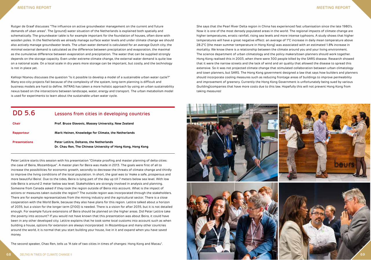
DELTAS IN TIMES OF CLIMATE CHANGE II68
MEETING REPORT MEETING REPORT
69
She says that the Pearl River Delta region in China has experienced fast urbanisation since the late 1980’s. Now it is one of the most densely populated areas in the world. The regional impacts of climate change are higher temperatures, erratic rainfall, rising sea levels and more intense typhoons. A study shows that higher temperatures will have a great negative effect: an average of 1°C increase in daily mean temperature above 28.2°C (the mean summer temperature in Hong Kong) was associated with an estimated 1.8% increase in mortality. We know there is a relationship between the climate around you and your living environment. The science department of urban climatology and the policy makers/town planners should work together. Hong Kong realised this in 2003, when there were 300 people killed by the SARS disease. Research showed that it were the narrow streets and the lack of wind and air quality that allowed the disease to spread this extensive. So it was not projected climate change that stimulated collaboration between urban climatology and town planners, but SARS. The Hong Kong government designed a law that says how builders and planners should incorporate cooling measures such as reducing frontage areas of buildings to improve permeability and improvement of greenery. Currently the Hong Kong Government is unfortunately being sued by various (building)companies that have more costs due to this law. Hopefully this will not prevent Hong Kong from taking measures!
Rutger de Graaf discusses “The influence on active groundwater management on the current and future demands of uban areas”. The (ground) water situation of the Netherlands is explained both spatially and schematically. The groundwater table is for example important for the foundation of houses, often done with wooden poles. In the Netherlands we already manage surface water levels and under climate change we should also actively manage groundwater levels. The urban water demand is calculated for an average Dutch city, the minimal external demand is calculated as the difference between precipitation and evaporation, the maximal as the cumulative difference between evaporation and precipitation. The water that can be supplied strongly depends on the storage capacity. Even under extreme climate change, the external water demand is quite low on a national scale. On a local scale in dry years more storage can be important, but costly, and the technology is not in place yet.
Kalliopi Ntanou discusses the question “Is it possible to develop a model of a sustainable urban water cycle?” Many eco-city projects fail because of the complexity of the system, long-term planning is difficult and business models are hard to define. INTRAS has taken a more holistic approach by using an urban sustainability nexus based on the interactions between landscape, water, energy and transport. The urban metabolism model is used for experiments to learn about the sustainable urban water cycle.
DD 5.6 Lessons from cities in developing countries
Chair Prof. Bruce Glavovic, Massey University, New Zealand
Rapporteur Marit Heinen, Knowledge for Climate, the Netherlands
Presentations Peter Letitre, Deltares, the Netherlands Dr. Chau Ren, The Chinese University of Hong Kong, Hong Kong
Peter Letitre starts this session with his presentation “Climate proofing and master planning of delta cities: the case of Beira, Mozambique”. A master plan for Beira was made in 2013. The goals were first of all to increase the possibilities for economic growth, secondly to decrease the threats of climate change and thirdly to improve the living conditions of the local population. In short, the goal was to ‘make a safe, prosperous and more beautiful Beira’. Due to the tides, Beira is lying part of the day up till 7 meters below sea level. With low tide Beira is around 2 meter below sea level. Stakeholders are strongly involved in analysis and planning. Someone from Canada asked if they took the region outside of Beira into account. What is the impact of actions or measures taken outside the region? The outside region was incorporated through the stakeholders. There are for example representatives from the mining industry and the agricultural sector. There is a close cooperation with the World Bank, because they also have plans for this region. Letitre talked about a horizon of 2035, but a vision for the longer term (2100) is needed. There is a vision for after 2035, but it is not detailed enough. For example future extensions of Beira should be planned on the higher areas. Did Peter Letitre take the poverty into account? If you would not have known that this presentation was about Beira, it could have been in any other developed city. Letitre explains that he took some local customs into account such as when building a house, options for extension are always incorporated. In Mozambique and many other countries around the world, it is normal that you start building your house, live in it and expand when you have saved money.
The second speaker, Chao Ren, tells us “A tale of two cities in times of changes: Hong Kong and Macau”.

24 – 26 SEPTEMBER 2014 ROTTERDAM, THE NETHERLANDSDELTAS IN TIMES OF CLIMATE CHANGE II70 71
MEETING REPORT MEETING REPORT
land. The wet parcels are least suitable for farming and are most desired by nature organisations. Under drier climate conditions, land prices will be higher. The model shows that in the case study area the NEN targets are not feasible. The land mobility is not enough to buy the necessary parcels. Nature organisations are picky in the parcels they buy. Preferably the wet parcels close to existing nature areas. Nature organisations have a limited budget and lose the competition over land with farmers. Under wetter conditions this competition gets somewhat less.
Nico Polman applies in his study “Collective implementation of agri-environment climate measures with a spacially explicit agent-based model” a similar type of model, a spatial explicit ABM, to explore green agricultural water policy scenarios. The land market is also central in this model. In the Common Agricultural Policy (CAP) 2014-2020 of the European Commission, collective implementation of Ecological Focus Areas (EFA) are included as a means to improve environment, climate and biodiversity on farms. The model gives insight in the spatial, ecological and economic impact of farmers’ cooperative decision making under different scenarios. An example shows the effectiveness of water conservation measures taken by farmers individually in comparison to a collective conservation scheme. The presented model is a promising approach to explore the impact of environmental cooperative decision making in rural areas. It is still work in progress and more factors can be included in the model.
Two presentations discuss studies about coastal environments of Bangladesh. Helen Adams and Dilruba Begum share their preliminary results of the study “Drivers, constraints and dynamics of wellbeing from ecosystem services (ESS) in the deltaic environments of Bangladesh”. The study addresses the question why delta areas – that are highly productive environments – harbour some of the poorest populations. A framework was developed that shows mechanisms that link ESS and wellbeing. In the framework, five dynamic factors determine the wellbeing outcome of the ecosystem service use in a socio-ecological system: climate variability and seasonality, mobility, social relations, nature and strength of property rights and productivity. Seven socio-ecological systems were identified in the study area. The dependency on ESS in all seven socio-ecological systems is high. All five dynamic factors in the framework are important in relation to wellbeing. However, the importance of each factor varies across the socio-ecological systems. An important preliminary finding is that to reduce poverty one should not focus on the ESS themselves but on improving the access to as well as decreasing the dependency on ESS. Boris Braun and Amelie Bernzen show the findings of a preliminary fieldwork in six coastal districts in Bangladesh about the social and economic processes leading to land use change, land degradation and salinisation. The study, “Economic and social drivers of land use change in coastal Bangladesh”, takes an economic geography perspective. The study shows that changes in the land use pattern are visible, both in terms of the intensity of land use (multiple harvests a year) and the type of crops. The pressure on the land and the demand on water resources is growing. In other areas the land is less intensely used due to salinisation. Local land use change is connected to national and global developments. For instance the increase of salt water shrimp farming in some areas. There is an economic driver: a growing market for shrimps. However, it is not known what the driving factor for this change is. Are farmers making this shift because of the salinisation of the land, or because of the growing market for shrimps? Will this economic driver lead to the displacement of traditional farmers? The research is to be continued.
Deltas in Depth Theme 6. Rural development and food security
DD 6.1 Opportunities for socio-ecological landscape development
Chair Prof.dr. Frank Berendse, Wageningen UR, the Netherlands
Rapporteur Dr. Monique Slegers, Knowledge for Climate, the Netherlands
Presentations Dr. Ruud Bartholomeus, KWR Watercycle Research Institute, the Netherlands Martha Bakker, Wageningen UR, the Netherlands Helen Adams, University of Exeter, United Kingdom Dilruba Begum, ICDDR, Bangladesh Dr. Nico Polman, Wageningen UR, the Netherlands Prof.dr. Boris Braun, University of Cologne, Institute of Geography, Germany PhD Amelie Bernzen, University of Cologne, Institute of Geography, Germany
In this session on opportunities for socio-ecological landscape development, five studies are presented and discussed. Three of the presentations deal with nature development under changing climatic conditions in the Netherlands. Both on the European as on the national level, laws and regulations on nature conservation are in place, e.g. the European Habitat Directive and the National Ecological Network (NEN). How effective are these under the influence of climate change? Are targeted nature areas still suitable in the future?
Ruud Bartholomeus shows in his presentation “Predicting vegetation patterns under future climate conditions with a processed based eco-hydrological model” how the probability of vegetation types can be predicted by using the eco-hydrological model, PROBE, which focusses on atmosphere-soil-plant processes. It models habitat factors in the root zone, such as oxygen, nutrient and water availability and acidity, which directly influence plant life. Water management and climate change scenarios are included as input. Output of the model are vegetation maps showing the probability of occurrence of a certain vegetation type. The model helps policy makers and nature managers to analyse the feasibility of nature targets, to define adaptation measures and to select hotspot areas of biodiversity. The model works very fast and at the moment work is in progress to build a user friendly interface.
To safeguard and promote biodiversity, the Netherlands is dedicated to the implementation of the NEN. Most of the land that is to become part of the NEN is currently agricultural land. To evaluate the effects of climate change and socio-economic development on the acquisition of land for the NEN, a spatial explicit Agent based Model (ABM) has been developed. Martha Bakker explains in her presentation “Implementing an ecological network in a densely populated area under conditions of global change” how this model works and shows the outcomes of a case study (Baakse Beek area). The ABM uses actual farmers’ characteristics and census data as input. The model simulates land exchange between farmers and with nature organisations. The model shows which parcels farmers want to sell and at what price and estimates how much nature organisations are willing to pay. Some farmers want to expand and compete with nature organisations. The highest bidder will get the

24 – 26 SEPTEMBER 2014 ROTTERDAM, THE NETHERLANDSDELTAS IN TIMES OF CLIMATE CHANGE II72 73
MEETING REPORT MEETING REPORT
supply in the future. The predictions made were mostly rather negative about the future. The study concludes that climate change is likely to reduce crop yields for most crops in most of the areas in the Lower Mekong Basin.
Diana Katschnig talked about “Salt-tolerance mechanisms in halophytes”. Halophytes are salty plants that can handle a relatively big amount of salt. Most plants can’t handle an amount of salt higher than 50 mM NaCL. Normal plants are salt sensitive because of three reasons: the water uptake inside the plant is hampered by soils limit, the salt causes deficiencies of essential nutrients in the plant an when the salt get into the plants, they accumulate within the plant to toxic levels. To make plants more salt tolerant they need to be able to accumulate and compartmentalize the ions. In a leaf cell there are several components, one of them being a storage facility, in which the plant can put the ions. But there is also an osmotic problem within the leaf cell, so there needs to be something else to balance the water potential in the cell. Also the plant needs to regulate the amount of salt that gets into the plant. The last thing to make a plant salt tolerant is to still pick up all the essential nutrients. There are a few strategies to develop salt-tolerant crops: domestication of halophytes, classical or marker-assisted breeding of conventional crops and genetic engineering. The researchers did several experiments with different sorts of crops. They still need to identify the key processes and to confirm the possible salt tolerant genes.
The last speaker, Sylvia Szabo, gave her presentation on “Rural development and food insecurity in the Ganges Brahmaputra Delta: Challenges and prospects”. The study focused on the coastal district of Bangladesh and investigated two things: the association between salinity intrusion and household food security and the association between households socio-economic characteristics and food security. The researchers got many statistics about food security. One being the percentages of households, who are food insecure. The percentage based on expenditure on food is 44,7%, the percentage based on calorie availability is 33,2%. The results of the unadjusted models show that salinity intrusion has a significant effect on household food insecurity. However, this impact becomes statistically insignificant when household’s wealth is taken into account. Education, household size and remittances are all significant predictors of food insecurity in the study area.
DD 6.3 Strategies to increase food security (6.2 continued)
Chair Prof.dr. Adri van den Brink, Wageningen UR, the Netherlands
Rapporteur Dr. Monique Slegers, Knowledge for Climate, the Netherlands
Presentations Dr. Sally Brown, University of Southampton, United Kingdom Judith de Bruijne, Euroconsult Mott MacDonald, the Netherlands Masud Iqbal Md Shameem, University of Newcastle, Australia
All studies presented in this session deal with the deltaic areas of Bangladesh. Some general conclusions that can be drawn from these three presentations are that the deltaic region is a complex socio-ecological system and when looking at climatic stresses, vulnerability and coping strategies, it is important to take on a broad perspective. Understand the drivers of change as well as the impacts; do not look at an isolated area, but consider external factors that influence local processes; and lastly be aware of the time frame in which
DD 6.2 Strategies to increase food security
Chair Catharien Terwisscha van Scheltinga, Wageningen UR, the Netherlands
Rapporteur Zoë de Gruijter, Hogeschool Rotterdam, the Netherlands
Presentations Dr. Ruud Bartholomeus, KWR Watercycle Research Institute, the Netherlands Johannes E. Hunink, FutureWater, the Netherlands Diana Katschnig, VU University Amsterdam, the Netherlands Sylvia Szabo, University of Southampton, United Kingdom
Ruud Bartholomeus kicks off the session with his presentation “Optimal crop production supported by climate-adaptive water management”. In future we will be confronted with more extreme precipitation, longer dry periods and higher temperatures. In order to cope with these threats KWR wanted to anticipate these new extremes, using dynamic water management. FutureWater developed the concept of climate adaptive drainage. This is a drainage system different from existing systems. Conventional drainage systems have individual drain tubes with the groundwater level at the same level as the drain tubes. In a climate adaptive drainage system none of the individual drain tubes end in a ditch, but they are brought together in a drain, connected to the collecting pit. The groundwater level for optimal crop growth depends on the availability of water and oxygen in the root zone. Different crops need different amounts of oxygen and water for optimal growth; these amounts are determined by the transpiration- and respiration rates of the specific plant. The project focusses on an optimally working drainage system, which will take the natural processes into account. Knowledge of the interaction between the type of crop, soil and atmosphere is vital to create a modern drainage system. For the programme TKI-Watertechnology, KWR started a project aimed at creating a process-based steering algorithm for climate adaptive drainage, which makes it possible to anticipate a 10 day weather forecast, future moisture conditions and the potential oxygen stress and drought stress in the root zone. They will be able to supply the farmer with an advice to lower or to raise his water level. To be able to make this happen KWR uses the soil-water-atmosphere-plant model (SWAP), a detailed model of the unsaturated zone which describes all the interacting processes in the soil plant and the atmosphere. SWAP has been used to simulate oxygen stress and drought stress. The method showed that both oxygen stress and drought stress affect the transpiration rate of the plant.
Johannes Hunink presented “Future trends in crop production and food demand and supply in the Lower Mekong Basin”. The Mekong River Commission coordinates trans-boundary issues in de Lower Mekong Basin. FutureWater did research on food security. In the period from 1961 to 2011 food security has definitely improved with regards to the food supply (Kcal), protein supply and the fat supply. Also import rates and export rates have increased. Lastly, FutureWater predicted an increase of precipitation in the region. The study was conducted in 15 sub-areas in the Lower Mekong Basin and with 5 crop types: paddy rice, dry rice, maize, sugarcane and cassava. To predict the future food security they divided the future in four periods. To see what the future would bring for the farmers, the different crop types were all investigated per period. The study concluded that almost all crop yields will decrease, except for sugar cane, which will flourish in some areas.The next step in their analysis consisted of food balance sheets, which give a more comprehensive picture of the pattern of a country’s food supply. The method counts four categories (quantities, calories, proteins and fats) and some domains. The researchers made a food balance sheet for each subarea and for different scenarios. The results of the sheets were presented in graphs showing whether there will be enough food

24 – 26 SEPTEMBER 2014 ROTTERDAM, THE NETHERLANDSDELTAS IN TIMES OF CLIMATE CHANGE II74 75
MEETING REPORT MEETING REPORT
Deltas in Depth Theme 7. Port development and infrastructure
DD 7.1 Systems of systems approach for climate resilient multi-infrastructure
Chair Prof.dr. Lori Tavasszy, TNO and Delft University of Technology, the Netherlands
Rapporteur Nienke Maas, TNO, the Netherlands
Presentations Dr. Jonas Johansson, Lund University, Sweden Dr. Jane Mullett, Global Cities Research Institute, RMIT University, Australia Ruben Vogel, TNO, the Netherlands Dr. Raghav Pant, University of Oxford, United Kingdom
The aim of this focused session was to compare different approaches on risk assessment for interconnected infrastructures and see what can be learnt from these approaches. The researchers presented frameworks for (1) quantitative risk assessments on interconnected infrastructure, (2) information on climate change for practitioners around port infrastructures, and (3) for joint fact finding as process to gather information for multi-stakeholder planning situations. Different perspectives existed in the presentations: • Vulnerability versus risk assessment? Vulnerability is oriented at the functioning of the system, risks at the
impacts on its environment• Substantive perspective (output of tools) or process perspectives (using tools)? Risk rating of impacts by
using existing risk tables and rate them on consequences and priorities is a qualitative way to build group consensus, the exact risks calculations are important to know what to do and when
• Emphasis on technical or on sociotechnical aspects? While the pressure of climate change on the physical system is high, the pressure on governance systems (unclear responsibilities) is equally high. Can you pay attention to one aspect or do they have to be treated equally?
Lessons learnt for the development of a multi infrastructure risk assessment tool for climate change included:• A systems of systems approach is valuable, because it provides the ‘complex’ perspectives• A huge amount of data needed for quantitative research • A risk framework aims to create understanding and to inform policy makers on infrastructure safety and
security• There are methods available to do vulnerability analysis• Most methods demonstrated on small scale rather than large scale real life infrastructures• Attaining data is problematic; due to confidentiality issues a national framework is needed• Many tools are applicable to get insight in risks and vulnerability, but tools are not trusted• Information gets powerful for stakeholders when it is grounded in their own language, tools (or either their
outputs) should thus be sector specific• Joint fact finding is needed to get the results of risks assessment into the decision making process, because
of institutional stickiness, siloed work and information usability gap• Risk assessment tools can help to create insights in problems, but it does not solve them
processes take place. Changes do not happen overnight. To understand changes and the impacts of adaptation strategies it is important to have a wide time horizon.
Sally Brown discussed the issue of “Subsidence and development in the Ganges-Brahmaputra-Meghna delta”. What is the rate of land subsidence and how does it influence development? There is no uniform rate of land subsidence. There are multiple causes of subsidence, natural as well as anthropogenic, it can occur locally as well as on a larger scale. To make it more complex, in some areas there are ongoing processes of land uplifting (sedimentation and tectonics) or both of uplifting and subsidence. There are multiple causes for this ‘net subsidence’ and these affect food security in different ways. A desk study shows that no consistent, good quality, well distributed measurements have been taken in the past. The quality of data in papers varies. It is difficult to balance the relevance and no clear spatial pattern shows from the figures. There is no understanding of possible future land subsidence changes. Furthermore, the potential climatic threats challenge local development and can have implications for food security, e.g. salinisation. Decision making needs to consider the long-term outlook and wider development issues.
Judith de Bruijne studied “Controlled flooding to adapt to climate change: lessons learnt from compartmentalisation in Bangladesh” that was performed in the 1990s. In the Compartmentalisation Pilot Project (CPP) a system of compartmentalisation with inlet and outlet structures in Tangail Sandar Upazilla was put in place to regulate flood water levels. For flood prone agricultural systems this might be an interesting climate adaptation measure. To know the longer term impacts on the area, Judith performed a post-evaluation of this CPP by looking at how land use, agriculture, aquaculture and livelihoods have changed. The results show that overall, many changes have occurred. However, can these changes be attributed to the CPP? Agricultural production and pond fish production have increased, but also the use of fertilisers and high yielding varieties has increased. The embanked areas protect inhabitants and their houses from uncontrolled seasonal floods. The population density has increased in these areas, and so did land prices. About a third of the systems is currently out of use. The construction of a bridge has reduced the amount of incoming flood water. Only a quarter of the water management committees in the sub-compartments is still involved in the decision making. Compartmentalisation serves as a flood protection measure, however it is costly and the impact on the area are not straightforward. Success is area and time specific. Cross-sectorial spatial planning of infrastructural developments and resilient solutions are vital. The impacts of controlled flooding should be carefully assessed and the wider context, both spatially and in terms of other developmental interventions, should be taken into account.
The coastal areas in the southwest of Bangladesh are vulnerable for hydro-climatic stress, e.g. cyclones hit the area almost every year and in the dry season about 60-70 % of the land is affected by salinisation. Many poor people live in this area. The population growth in this area is relatively low because people move to other parts of the country. Masud Iqbal Md Shameen addressed in his presentation “Changing livelihood strategies: Adapting to hydro-climatic change in the Southwest coastal region in Bangladesh” the questions how households adapt their livelihood strategies in response to climate variability and change, and, more specifically, how shrimp farmers cope with short-term climatic disturbances. One of his key findings is that households diversify their sources of income to spread climate risk depending on their land size. The poor tend to depend on wage labour, while households with big land holdings change to shrimp ponds. In commercial aquaculture new shrimp species are introduced that are more salt tolerant. Shrimps are a good export product. Food security is affected by this current shift. The poor farmers sell their land to the big farmers. These farmers have the means to transform their livelihood strategies according to the environmental changes, such as salinisation. This leaves clear winners and losers of adaptation strategies. To overcome this, adaptation strategies should be combined with strategies that address the causes of the vulnerability.

24 – 26 SEPTEMBER 2014 ROTTERDAM, THE NETHERLANDSDELTAS IN TIMES OF CLIMATE CHANGE II76 77
MEETING REPORT MEETING REPORT
Andrew Bollinger presents his study “Multi-level vulnerability analysis of the Dutch electricity infrastructure to extreme weather events” as part of the Infrastructure Networks Climate Adaptation and Hotspots (INCAH) research programme. He describes the development and results of a computational model for assessing measures to support the resilience of the Dutch electricity infrastructure system with respect to extreme weather events. His research focuses on two types of extreme weather events, floods and heat waves. Andrew Bollinger stresses the fact that the Dutch electricity infrastructure system is in fact the most reliable system in Europe with a 0.6 % of total interruptions. Nevertheless, the results of his study suggest that there is some vulnerability to both flood and heat waves with less vulnerability to heat waves than flood. The main impacts for the system are related to power interruptions due to the flooding of medium and low voltage substations and the cascading effects that those events can have for other infrastructures such as the traffic system. In order to reduce the vulnerability to those events, he suggests adaptation measures that include providing back-up power to traffic signals and assessing the flood protection of the substations. “We don’t know the protection heights of the substations” he says. Investing on small scale electricity generation will also be beneficial. “With relative small investments we can have a large positive impact and achieve high resilience” Bollinger concludes.
Tara Geerdink presents a project which also was a part of the Infrastructure Networks Climate Adaptation and Hotspots (INCAH) research programme. The project ”Climate adaptation strategies for infrastructure networks – connecting science and policy” aimed to connect climate change knowledge to policy and involved several stakeholders. “There is a gap between scientists and policy makers” she says. The instruments she used to get scientist to share knowledge and insights with policy makers mainly involved role play games during interactive workshops. “It is the process that makes this impact”. The programme involved three workshops during which the relevant parties discussed interdependencies and exchanged knowledge. “During the process there was a lot of knowledge exchange” she says. According to Geerdink, the key point for achieving the necessary connection between science and policy is to have enthusiastic people and committed stakeholders. The second important thing is to focus on case studies. “Frustration is high, policy makers do not know what to do. It is important to have a plan of what to do in case of an emergency. Which scientists to call and where to get the data and info”. And language is very important, she adds. Often policy makers and scientists do not communicate effectively. Ideas and insights, cooperation and applicable results start with a connection. “We are not there yet but we are one step further” she concludes.
Judith Klostermann talks about her assessment of the Eemshaven port area to flood and sea level rise risk in her talk “Resilience of harbour companies to flood risk”. In this region there are 25 companies located outside the dyke. Climate change and especially the sea level rise might pose a threat to the facilities of those companies. Her study aimed to identify which companies are aware of their position relatively to the dyke. For that reason, she conducted interviews within 11 companies that are located in all different areas of the port (inside and outside of the dyke). “We tried not to influence their answers” she says. “We didn’t tell them if they were outside of the dyke”. The results of the study showed that 6 companies were aware that they were outside of the dyke and 2 were assuming that they were inside. Klostermann explains the reason behind the confusion. “The location of the dyke has changed over the years and the local government has not informed the companies about their position relevant to the dyke”. The study results suggest that only three companies have flood strategies, although none of the companies is insured against flooding. The companies that do have a strategy and are aware of their position are concerned and act on their own. In general their adaptive capacity is low. The role of the government in terms of providing protection for the companies outside the dyke is also not clear to the companies.
Bas Wols from KWR concludes the session. He starts his presentation by mentioning that water companies want to reduce failures of their piping systems in the future. Therefore, his study “Impact of climate on pipe failure: Predictions of failures for drinking water distribution systems” aimed to estimate the future pipe failure
• Iterations are needed to learn and improve insights• Using scenario’s will provide insights for robust adaptation options• Often nobody feels responsible for these interconnected risks or wants to know about the vulnerability of
this system of infrastructures. Might it be that the owner of a framework for interconnected risks does not exist?
An important conclusion from this session was that current frameworks are still one-sided (quantitative or qualitative, substance or process, past, present or future – often one of these at a time), that perspectives are complementary and that more work is needed to arrive at a systems-of-systems approach.
DD 7.2 Extreme weather impacts on critical infrastructures: International lessons to improve analysis
Chair Prof.dr. Tiedo Vellinga, Port of Rotterdam / Delft University of Technology, the Netherlands
Rapporteur Maria Karamerou, Delft University of Technology, the Netherlands
Presentations Dr. Jane Mullett, Global Cities Research Institute, RMIT University, Australia Dr. L. Andrew Bollinger, Delft University of Technology, the Netherlands Tara Geerdink, TNO, the Netherlands Dr. Judith E.M. Klostermann, Wageningen UR, the Netherlands Bas Wols, KWR Watercycle Research Institute, the Netherlands
The session focuses on the impacts of extreme weather on critical infrastructures and the policy that can address those impacts.
Jane Mullet describes in her presentation “Enhancing the resilience of Australian seaports to a changing climate” the institute case studies for assessing the climate change impacts on ports in Australia and the Pacific. The results of the assessment suggest that the climate impacts on ports vary spatially and include both extreme events and long term climate change. What is more, the impacts influence a wide range of port activities from the navigation to the supply chain. In particular, Mullet refers to specific threats that the ports face. “Sea level rise seems not to be a problem for the big ports. Big ports are clear about the sea rise and dealing with that. Smaller ports are struggling” she says. Ports can also be vulnerable to extreme events such as cyclones. For smaller ports ‘climate change is a risk multiplier’ to already existing problems. Big ports on the other hand, are dealing with extreme events, ‘they are OK’. They incrementally increase the health and safety levels of security for their workforce in the case of extreme events. In addition to dealing with the direct impacts, Mullet stresses the impacts on the supply chain due to extreme climatic events even in other parts of the world. As an example, she refers to the impacts that the massive flood in Thailand had for the port of Kembla. “The port of Kembla has a significant throughput of cars from Thailand. Due to the flood in Thailand, the port lost months’ worth of business”. For all the afore mentioned reasons, the research group created an interactive online tool which provides a visual representation of an extreme event that port authorities and stakeholders can use to discuss and make decisions. The research group engaged port authorities to interactive workshops to test the tool.

24 – 26 SEPTEMBER 2014 ROTTERDAM, THE NETHERLANDS 79
MEETING REPORT MEETING REPORT
78
Deltas in Depth Theme 8. Disaster reduction and emergencies
DD 8.1 Disaster reduction and emergencies, regional perspectives
Chair Ed Thomas, Natural Hazard Mitigation Association, USA
Rapporteur Andrew Bollinger, Delft University of Technology, the Netherlands
Presentations Dr. Michelle Lim, Centre for Water Law, Policy and Science, University of Dundee, United Kingdom Hannelore Mees, Antwerp University, Belgium Keming Hu, Royal HaskoningDHV, United Kingdom
This session covered disaster reduction and emergencies, and stressed the importance of those measures that can be employed before a disaster takes place – planning, preparation, etc.
The session began with a presentation by Michelle Lim on the “Disaster management governance framework of Bangladesh: a model of good practice?”. The Bangladesh case shows that law and regulatory frameworks are key elements in disaster management, though with certain limitations. Bangladesh is one of the most disaster prone areas in the world. Recent decades have seen a number of powerful cyclones – in 1970, 1991, 2007, 2009 and 2013. Despite the severity of all of these cyclones, they have resulted in progressively fewer deaths over time – a phenomenon which may largely be attributed to the regulatory framework for disaster management in Bangladesh.The current disaster management framework in Bangladesh is composed of four pillars – Standing Orders, the Disaster Management Plan, the Disaster Management Act and Disaster Management Regulations. The Standing Orders – which define roles and procedures to be followed in the case of a disaster – are largely responsible for the progressive reduction in loss of life caused by cyclones. Despite a very polarized political contact, the Disaster Management Act came into force in 2012 and incited the development of a national level ministry for disaster management. While the Disaster Management Act has been successful, it does not overcome certain systemic governance problems and it has not incited the development of partnerships as suggested on paper. The Act can be improved by enhanced oversight and monitoring, and perhaps a link with the climate change strategy and action plan. Use of zoning could also help to improve the Act, though this may be challenging in the Bangladesh context. Bangladesh’s Disaster Management Framework offers some potentially transferrable lessons in terms of bringing together people from different sectors. Similar frameworks may be applicable to the management of manmade disasters and of ecosystems.
The session continued with a presentation by Hannelore Mees on the topic of “Crisis management in Flanders, Waterproof?”. This research is part of the STAR-FLOOD project, which focuses on six different European countries. In Belgium, each of the regions - Wallonia, Flanders and Brussels – has its own policy on flood management, while crisis management is a national level activity. The methodology for the presented study
frequency under the effects of climate change. According to Bas Wols, temperature is the most influencing climate variable, therefore the analysis focuses on the effect of temperature on pipe failure. The study applied a statistical analysis on failure registrations to investigate the effect of ambient air temperature while also accounting for the evolution of replacement and aging of the pipes over the years. The study results suggest that different materials are affected in a different way. Nevertheless, “the effect of climate change is quite small in the Netherlands as a whole. The largest variations in pipe failure are related to ageing of the pipes” he says.

24 – 26 SEPTEMBER 2014 ROTTERDAM, THE NETHERLANDS 81
MEETING REPORT MEETING REPORT
80
DD 8.2 Positive, reality based approaches to regional and global resilience
Chair Prof.dr. Dorothea Hilhorst, Wageningen UR, the Netherlands
Rapporteur Melle Nikkels, VU University Amsterdam, the Netherlands
Presentations Dr. Swenja Surminski, London School of Economics, United Kingdom Dr. Fabrice Renaud, United Nations University - Institute for Environment and Human Security, Germany Dr. Rezaur Rahman, Bangladesh University of Engineering and Technology, Bangladesh
In this session three presentations were given on diverse topics around increasing resilience of deltaic areas. First, Swenja Surminski explained the importance to show co-benefits of disaster risk management (DRM). Fabrice Renaud talked about his efforts to compare the vulnerability of deltas and Rezaur Rahman shared experiences of a flood rotation project in Bangladesh.
In her speech “Economic benefits of disaster reduction – what can we learn from adaptation?”, Surminski tells that investments to reduce the risk on disasters are mostly focused on the prevented losses. However, these investments might have co-benefits/externalities like macro-economic growth, social cohesion and an improved regional investment climate. Surminski showed multiple challenges to capture all these benefits. The first important challenge is found to be the method. There are various methods available, such as multi-criteria analysis, but is not clear how to choose the optimal method. Besides the method, the scale is also very important. When looking at a local level, some co-benefits might not be visible, but the national level is more prone to substitution effects. Despite the challenges, DRM is believed to be put higher on national agendas when the co-benefits are clear. Case studies are needed to gain experience and to convince decision makers to focus more on disaster prevention than on disaster recovery. The discussion focused on the linkages between development and DRM.
Fabrice Renaud explained about the “Global delta vulnerability indicator development” project, which is part of the Belmont Forum DELTAS Project 2013-2016. He works on developing a unified framework with a broad set of indicators in order to compare deltas and part of deltas around the world.The vulnerability indicators are based on a literature review and consultation with stakeholders. Input from both literature and local stakeholders are needed because stakeholders can provide additional (local) information. Comparison of deltas, based on a set of vulnerability indicators is very challenging. Renaud is currently working on data gathering and explores the options to substitute indicators that are correlated. In the GIS application which is available next year, users should be able to select indicators and do multiple comparisons between deltas. The point is stressed that this project focusses on the vulnerability of deltas and not on their resilience. However, insights of comparisons can be used as input for adaptation strategies towards more resiliency.
Rezaur Rahman showed a project around the “Restoration of coastal resilience through tidal river management in Bangladesh”. In the project area, 123 polders are located. In the past years, two major cyclone events led to severe damages. A challenge in rehabilitation is lack of labour to maintain the old polder embankments; another challenge being changing riverbeds. In order to increase the resilience of the system, polders are now used as overflow areas. This reduces the stress on embankments of other polders and leads to sedimentation in the
entailed conducting interviews at the national and Flemish level, and comparing two urban cases – Antwerp and Geraardsbergen. The results identify several bottlenecks. The first of these has to do with coordination. In particular, there is a challenge of coordination between water and crisis management at the Flemish level and the national level. Furthermore, there is a problem of communication between Wallonia and Flanders, which is a particular issue for Geraardsbergen, located close to Wallonia. A second bottleneck is a lack of community resilience, which relates to citizen engagement in flood management. Traditionally, flood management has been viewed in Belgium as being the responsibility of the government. However, policy makers are now shifting some of the responsibility to citizens. Interestingly, citizens groups tend to have exactly the opposite perspective. A third bottleneck is a lack of resources. In recent years, there has been a reduction in army support in disaster situations, and many municipalities find it financially difficult to support a professional fire brigade. This has made some places more reliant on a volunteer force, and has increased requirements on the training and engagement of volunteers.A key conclusion is that the population may not be ready for a discourse of self-reliance. In this context, it is an open question to what degree citizens can compensate for a lack of resources in crisis management.
The session concluded with a presentation by Kenming Hu on the “Firths of Forth and Tay Flood Warning System and the stroms of 2012-2014”. The Scottish Environment Protection Agency (SEPA) launched a new flood warning system in December 2012. The objective of this system is to provide reliable and timely flood warnings via enhanced flood forecasting through better understanding coastal flooding processes. By better understanding coastal processes, it is possible to forecast flood depths, and thus to better determine when to issue flood warnings.Coastal flood warning began with efforts to measure water levels at key stations, for instance in the Leith in Forth and Tay area. Nowadays, offshore measurements are ultimately used to forecast wave overtopping and inundation depth. The TRITON system, which is the core of the new warning system, is a data display platform, data processor and data manipulator that translates Met Office forecasts on waves, tides and surges to the warning site. The new system: (1) transforms tidal surge forecasts from Leith to 28 warning sites along the Firth of Forth and Tay, (2) transforms offshore wave forecasts to inshore locations, and (3) transforms inshore wave forecasts to mean wave overtopping forecasts. The system enabled better flooding response during the storm of December 2012 and that of December/January 2013/14, and it has also led to enhanced awareness of coastal flooding issues. The next step is to be able to forecast actual flood levels in different areas.
Discussion following the presentations addressed the fact that, fundamentally, we need to find ways to effectively reward good behaviour and discourage bad behaviour. For this, we need laws, standards, financial/economic incentives, etc. In the Netherlands, people expect the government to be responsible for floods. In Bangladesh, people often have dikes around their houses and boats outside - they prepare themselves. A key question is: How can you make people capable of adapting/preparing themselves?

24 – 26 SEPTEMBER 2014 ROTTERDAM, THE NETHERLANDS 83
MEETING REPORT MEETING REPORT
82
Deltas in depth Theme 9. Governance of adaptation
DD 9.1 Adaptation governance in comparative context
Chair Prof.dr. Katrien Termeer, Wageningen UR, the Netherlands
Rapporteur Marjolein van Eerd, Radboud University, the Netherlands
Presentations Prof. Simin Davoudi, Newcastle University, United Kingdom Eric Massey, VU University Amsterdam, the Netherlands Dr. Suraje Dessai, Sustainability Research Institute, School of Earth & Environment, Leeds University, United Kingdom Mark Zandvoort, Wageningen UR, the Netherlands
The session about adaptation governance provided us interesting insights into the governing of climate adaptation. A general outcome was that adaptation governance is mainly approached via a technical risk perspective and that there is little discussion on other issues related to climate change, such as fairness, social and ecological transformation and justice.
The first speaker, Simin Davoudi, positions the issue of climate change in relation to the securitisation of nature in het presentation “Climate change and securitisation of nature” as we are living in the age of man and climate change (caused by humans), and she unravels the inescapable interdependencies between human and nature. She tells that the meanings of nature have changed over time: from a mechanical view (uncovering the secrets of nature by science and the desire to exploit nature via technology), to the limits of growth idea (exploitation of nature with no consequences was contested), towards the concept of sustainability (nature was seen as finite asset, which should be safeguarded for future generations). And currently the dominating discourse based on the changing climate is that nature is seen as a risk and is framed as a safety and security issue. Yet, she states that there is a fundamental difference with pre-modern times, as today’s risks are caused by humans ‘environmental disasters should be called developmental disasters’. Seeing nature as a risk has implications, such as the perceived calculability and controllability, perceiving nature as a threat and national security issue. A shift is visible from environmental politics towards politics of securitization, leading to ignorance of opportunities that might arise from climate change.
After that, Eric Massey spoke about differences and similarities with regard to “Handling adaptation governance choices in the Sweden, Germany, the UK and the Netherlands”, based on the governance choices and dilemmas framework of Jordan and Huitema. With regards to framing, it is interesting that all countries view adaptation as a technocratic problem, it is largely about managing risks and there is little discussion on issues of fairness, justice, equity, etc. A difference is the framing perspective, for instance the Dutch view adaptation mainly as water management issue and also the UK takes water management as an entry point, while Sweden approaches adaptation via spatial planning. Climate adaptation in Sweden is decentralized, while the UK has central steering mechanisms to oversee adaptation and Germany has both (federal government provides financial and scientific support because the Länder were asking for leadership). It is striking that all countries state that no
flooded areas. A rotation system is proposed to divide the nuisance of landowners. Besides, landowners should be compensated for losses when it is their turn to open up their polder to reduce the water stress of others. During the discussion, this project was linked with the co-benefits of DRM of Swenja Surminski. When the broader benefits are clear, the chances of success for larger scale rotation projects would increase.

24 – 26 SEPTEMBER 2014 ROTTERDAM, THE NETHERLANDSDELTAS IN TIMES OF CLIMATE CHANGE II84 85
MEETING REPORT MEETING REPORT
DD 9.2 Governing adaptation in the city
Chair Prof. Simin Davoudi, Newcastle University, United Kingdom
Rapporteur Dr. Heleen Mees, Utrecht University, the Netherlands
Presentations Dr. Heleen Mees, Utrecht University, the Netherlands Liz Root, Radboud University, the Netherlands Dr. Hens Runhaar, Utrecht University, the Netherlands Merel van der Wal, Open University, the Netherlands
Simin Davoudi opens the session by explaining the aim of the session, namely adaptation to climate change in the city. The session consists of four presentations.
Heleen Mees’ presentation is titled “Who governs urban climate adaptation? A comparative analysis of governance arrangements in urban areas”. Mees works in the Knowledge for Climate programme. She has studied governance arrangements between public and private actors for different urban issues. Her PhD research is finalised, and she presents some of the overall conclusions of her work. She asserts that responsibilities for urban adaptation are primarily taken on by local public authorities. This dominance of public responsibilities tends to raise the effectiveness, legitimacy and fairness of the subsequent governance arrangements. Nevertheless, decisions on responsibility divisions are not very informed, and are often taken routinely. She argues that a more deliberate and deliberative process of allocation of responsibilities could lead to alternatives such as network arrangements in which responsibilities are shared among public and private actors.
“Test driving a financing instrument for climate adaptation: Analyzing institutional dynamics using simulation gaming” is the title of Liz Root’s presentation. Like Mees, Root is part of the Knowledge for Climate programme and also studies governance at the local urban level, in particular how market-based mechanisms can facilitate adaptation investments. In this presentation she focuses on tax increment financing, a fiscal tool that earmarks the future tax value increment to fund public investments. However, this tool is limited due to scepticism that investments in adaptation will add value. She played a simulation game with city planners, and found out that, although the planners were mildly positive about the tool in general, they saw severe issues with adaptation. The planners also thought that the municipality is responsible for adaptation investments. Key dilemmas she unravelled are values uncertainty, the out of sync planning horizon, and lack of direct benefits.
Hens Runhaar presented research done by Caroline Uittenbroek “Stimuli for climate adaptation in cities: Insights form Philadelphia, an early adapter”. Also Caroline is part of the Knowledge for Climate programme. She studies barriers and stimuli for the mainstreaming of adaptation at the local urban level. Municipalities can choose a mainstreaming approach, i.e. integration into related policy domains, or a dedicated approach, i.e. with specific attention, resources and budgets for adaptation policy. The presentation is about stimuli that influence the approach taken through a study of two adaptation programmes, one dedicated and one mainstreamed, in the frontrunner city of Philadelphia. It is concluded that there is not one stimulus, but a combination of stimuli which triggers a certain approach, and that the two different approaches can co-exist, as Philadelphia has shown.
new governance modes or instruments are required for climate adaptation, yet in practice new regulations can be found. Eric tells that there is no one size fits all approach and that for all extremes (e.g. decentralization vs. centralization and a sectorial or integrated adaptation governance approach) disadvantages and advantages could be found. Questionable is if the existing mainstreaming approach will be enough.
Suraje Dessai provided us more insights into England’s climate adaptation governance in his presentation “Governing adaptation to climate change: an analysis of Englands’ national Adaptation Programme”. The UK is perceived as a leader in the climate adaptation field, yet do they still fulfil this role? Climate adaptation at the beginning was mainly a government’s concern (hands-on approach). That has shifted due to an economic recession and changes in government to a hands-off approach. Adaptation in England is now a devolved issue. Climate adaptation in England contains a mix of policies, actions and actors, which should occur naturally and without government’s interventions in case of private interests. Two trends are visible; from adaptation to resilience and the perceiving of adaptation as big business. Dessai tells that too much faith is put on private autonomous adaptation, since in practice, individuals – in this study UK households – often struggle to build long-term adaptive capacity and their reactive coping responses are less effective. More permanent physical measures, behaviour changes, etc. are unlikely to happen autonomously without further financial or government support, while the national adaptation plan lacks a transparent allocation of responsibilities and substantive and concrete policies, measures and solutions. This plan could be seen as missed opportunity to reassert the UK as leader in adaptation policy.
Lastly, Mark Zandvoort gave a speech about “Tackling climate change uncertainty with planning approaches for water management”. He tells there is a diffused understanding about uncertainties, yet three dimensions in literature could be distinguished (nature of uncertainty, locations and level of uncertainty). Mark analysed adaptive delta management and water diplomacy with regards to how they deal with uncertainties. Both aim to address many long term uncertainties, yet in practice they mainly focus on physical uncertainties and the conceptualization of uncertainty. This mismatch between intentions (holistic uncertainty management) and practice could possible lead to maladaptation, leading to a mismatch in adaptation approaches and possibly under- or overinvestments. This mismatch could be solved by integrating ex ante assessments to determine which planning approach would find the problem at hand best.
The panel and audience together thought about lessons for practitioners considering the four interesting and inspiring speeches. One insight was that thinking in terms of governance is more sophisticated in comparison to dealing with tricky terms of adaptation and uncertainty management. A conclusion was that we should make fair decisions that do not focus too much on risks and surrender. We should consider a country’s or regions’ traditions and history for adaptation governance, for instance Australia strives for a resilient strategy, while most European countries frame this as adaptation governance. Climate adaptation strategies can’t be copied, yet lessons can be learnt from other countries. Climate change is a global issue that needs a collective response. Besides, in some countries (e.g. UK) a trend towards a retreating government is visible and collective responsibility is needed. And for some, climate change adaptation is simply not the first priority, as they are dealing with more urgent issues. Also the degree of public awareness about climate change was discussed, related to the concept of windows of opportunities often created by events and disasters.

24 – 26 SEPTEMBER 2014 ROTTERDAM, THE NETHERLANDSDELTAS IN TIMES OF CLIMATE CHANGE II86 87
MEETING REPORT MEETING REPORT
Chris Seijger’s presentation is on “Organising interactive knowledge development in multifunctional coastal projects”. We are applying a lot of monofunctional engineering solutions at the coast. We should not only use engineering knowledge, but also include practical experience of stakeholders, since all stakeholders have their own knowledge and make their own decisions (different norms). For his research, he analysed three case areas, Waddenzee, Francisco bay and Delfzijl. To analyse practices of interactive knowledge development he separated actors in a project- and a knowledge arrangement. Within the two arrangements, there are four important issues: actors, resources, discourses and rules. For data collection for the three cases he used different methods: interviewing, project meetings and field trips. The key results of the study into interactive knowledge development is that sharing responsibilities at the project level supports interaction rules for interactive knowledge development. The feasibility of solutions improves through interactive knowledge development.
Christo Fabricus focuses on “Understanding and learning from (mal) adaptations in coastal areas”. Adaptation is seen as a good thing, but the question is: ‘What constitutes effectives adaptation?’. There are a lot of wicked problems in relation to coastal adaptation. The effects of climate change, but also the vulnerability of other systems. So often we designed mal-adaptation: ‘actions taken to avoid or reduce vulnerability to climate change, but in reality they impact adversely on, or increases the vulnerability of other systems, sectors or social groups’. For his research, he used three cases, South-Africa, France and United Kingdom. The methods used are interviews, dialogues, participatory action research, mapping development of models, feedback learning and participation planning. The framework used is the connecting and disconnecting of social elements. Other frameworks are focused on human adaptation strategies and the resilience framework. To test maladaption, the framework is divided in four categories: robust undesirable, robust desirable, fragile undesirable and fragile desirable. Testing the three cases lead to ‘ensnaring’ maladaptations, ‘stagnating’ maladaptations, ‘disruptive’ maladaptations and ‘blinkered’ maladaptations. The conclusion is that adaptation can be dangerous, but the pathways can better be understood by using a multi-scale SES lens and participatory methods, coupled with models. This combination has the potential to simulate smart adaptations.
Xiong Liang talked about “River & urban system governance in Pearl River Delta: 1920-2013”. The China Pearl River Delta is the area with the fastest population growth. For this research, Liang designed a triangle with three corners: river dominated, tide dominated and wave dominated. For the analysis, he first looked at the history of the delta area in different layers, water, buildings and infrastructure. He analysed this for the years 1279, 1644, 1911 and 2010. The next step was to look at the big events that happened in the area in 1920-1970 (large scale dike integration & land ownership change) and in 1980-2013 (sand dredging and fast urbanisation). The central government started to integrate the large dikes projects, but only three of them were successful, because the central and provincial governments were not working together very well. The first change of land ownership was towards collective farmland. The positive thing of this change is that people better cooperate together and it is positive for the urban expenses. A problem is that the riverbed has decreased in the last 25 years. In the last 80 years ownership and land management are changed, meaning that also water management has changed. So there is a need to change the governance system.
Finally, Matthias Garschagen gives his presentation about “Bridging state and non-state divides in Vietnam’s transforming adaptation governance: Lessons from the Mekong”, a study into how to facilitate effective adaptation governance in one of the most hazard-exposed deltas globally. The research is about how responsibilities and capacities for risk reduction and adaptation are negotiated and shared in selected urban risk hot-spots of the Mekong Delta, focusing in particular on the shifting riles of state vs. non-state actors within Vietnam’s changing political economy. The case study has about 450.000 residents, a rapidly growing economy and flood risk is increasing. The risk of flooding on a daily base is one of the dynamic factors. So Garschagen looked at elements such as global change influences, vulnerability, adaptive capacity, governmental risk, national legislation and influences of discourses. Methods used are interviews, participation observation,
Merel van der Wal talks about the “Role of climate models as tools for climate adaptation”. In contrast to the other presentations, this study focuses on local rural adaptation. Her research is about the role of models in changing the perspectives of stakeholders. She presents the results of a regional case study of the creation of an adaptation plan in the Netherlands, where she observed four stakeholder meetings in three years’ time. For the analysis of perspectives, she uses cultural theory classifications (hierarchist, individualist, egalitarian, fatalist). Her results indeed show a change in stakeholders’ perspectives, but instead of the expected convergence, the perspectives grew apart. The models were subject of discussion and provided a safe and neutral platform for including local knowledge in the workshops.
Simin Davoudi opens the floor for a very brief discussion, given the time left. She states that the lessons to be drawn for the policy practice are quite obvious in these presentations. This is then followed by a small discussion on the fact that adaptation is often thought of in a hard infrastructural way, instead of working with soft green infrastructure. This is related to how we see and value nature, and the benefit we get from it, often expressed in cost-benefit analyses. This may have to do with the instrumental value of nature versus the intrinsic value (nature for nature’s sake).
DD 9.3 Knowledge and policy for governing adaptation in coastal regions
Chair Prof.dr. Joyeeta Gupta, University of Amsterdam, the Netherlands
Rapporteur Rosemarie van Ham, Hogeschool Rotterdam, the Netherlands
Presentations Camille Manning-Broome, Center for Planning Excellence, USA Chris Seijger, University of Twente, the Netherlands Prof. Christo Fabricius, Nelson Mandela Metropolitan University, South Africa Liang Xiong, Department of Urbanism, Delft University of technology, the Netherlands Matthias Garschagen, United Nations University Institute for Environment and Human Security, Germany
Camille Manning-Broome presents a “Local perspective and policy recommendations on ‘non-structural’ flood-risk reduction in south Louisiana”. After hurricane Katrina a recovery project plan is made for 21.000 participants, whose homes were flooded. The plan is a 50 year guide for growth and development; 81% of the people wanted to change the land use. To manage the system Manning-Broome designed the 2012 coastal master plan. The master plan included structural protection, bank stabilization, oyster barrier reefs, ridge restoration, shoreline protection, marsh creation, sediment diversion and hydrological restoration. The research is based on the Dutch DNA (Dutch National Approach). This is different than is used in the USA. The planners looked at how people were living and how and were they buildings were constructed. Industries were located nearby the waterfront. In designing a new plan for the coast, educational workshops with experts were held and stakeholders were motivated to participate. Also a coastal toolkit was created. By using this toolkit it could be concluded that by 2050 about 3,5 million people would be at risk from flooding. This project is about the people and economics.

24 – 26 SEPTEMBER 2014 ROTTERDAM, THE NETHERLANDSDELTAS IN TIMES OF CLIMATE CHANGE II88 89
MEETING REPORT MEETING REPORT
other side of the border. Mutual understanding is really important. A condition for this is that both parties see the benefit of cooperation. This can be realised by linking climate change adaptation to ongoing streams of policies. Marjolein stresses the importance of a timely start with cross-border cooperation. Involve actors from the start. Involving actors too late can lead to larger conflicts. Another lesson learnt is: make the context simple and easy to communicate.
“Water (without) borders. The horizontal collaboration on climate change adaptation in North Denmark” is the title of Anja Weijs’ presentation. Anja starts her presentation by explaining the institutional changes in recent history. Denmark had many changes in recent years which influenced the implementation of climate change policies. In Denmark, a lot of climate adaptation plans are in the mapping phase. Implementation difficult at this moment. In Denmark the utility companies sometimes refrain from cooperation around the implementation of climate adaptation measures. That is why the plans are sometimes hard to implement. Utility companies associate climate adaptation measures too much with extra costs. The question is how to bring all the relevant stakeholders into collaboration. Anja concludes that there is a lot of fragmentation, rural areas have difficulties to accommodate. More regulation can help to accelerate the implementation of climate adaptation. In Denmark people are used to the fact that institutions do the job.
Heleen Mees opens the discussion. She states that the need for cooperation was stressed by all speakers. She asks why this still does not always occur? Do some actors have an interest in not cooperating? One of the attendees brings in that more knowledge is more power. For this reason, cooperation is not always obvious. Another argument is that institutions are fighting for their position. They want to show their capacity to deal with the problems. They also would like to have work for the future. Another participant stresses the importance of an independent project manager. This project manager does not have a stake to defend and can function as greaser between actors. He can bring in actors when needed. Some others are doubting this solution. They state that the weakness of governance is too much deliberation, too little action. Every actor still has the right to make his/her own decision. Legislation is about forcing others. In a good cooperation, both parties see added value in working together. Making people conscious of climate change is seen as the key.
DD 9.5 Actors and agendas in the governing adaptation
Chair Eric Massey, VU University Amsterdam, the Netherlands
Rapporteur Marijn Faling, Wageningen UR, the Netherlands
Presentations Prof. Katrien Termeer, Wageningen UR, the Netherlands Gusti Ayu Ketut Surtiaru, Indonesian Institute of Sciences, Indonesia Dr. Michelle Lim, Centre for Water Law, Policy and Science, University of Dundee, United Kingdom Dr. Diego Sepúlveda Carmona, Technical University of Technology, the Netherlands
In addition to the multiple technical challenges in dealing with climate change, various social, political and normative challenges impede the governance of climate adaptation. This is what is discussed in this session. The different presentations cover actors and agendas in the governance of adaptation. They all acknowledge the difficulties in relation to governance arrangements and the inclusion of different actors and stakeholders.
discussions experts, workshops, statistical data and literature analysis. State measures in the case study are flood protection, climate change adaptation and climate change institutional changes. Then he looked at household level, where different measures are possible. For testing the method he used the best five measures, 1. house elevation, 2. alley elevation, 3. participating in vocational training class, 4. building small flood barrier and 5. moving to another area. He tested the measures by risk ranking: before and after resettlement.
DD 9.4 Innovation and experimentation in governing adaptation
Chair Dr. Heleen Mees, Utrecht University, the Netherlands
Rapporteur Corniel van Leeuwen, Erasmus University Rotterdam, the Netherlands
Presentations Belinda McFagden, VU University Amsterdam, Institute for Environmental Studies, the Netherlands Marjolein van Eerd, Radboud University Nijmegen, the Netherlands Anja Wejs, Aalborg University, Denmark
Heleen Mees opens the session by explaining the aim of the session, finding out innovations and elaborating the role of experimentation in governing climate adaptation. The session consists of three presentations and a discussion.
Belinda McFadgen kicks off this session with her presentation “Learning by experiment. How the institutional design of a policy experiment can influence policy learning”. McFadgen works in the Knowledge for Climate programme on the theme adaptive governance. She studies flexibility in policy processes. In her research she studies the role of different experimentations and to what kind of learning this leads. Belinda defines three types of learning: cognitive, normative and relational policy learning. Next to this, for Belinda there are three types of experiments: technocratic, advocacy and boundary experiments. Based on her research several correlations can be found between the types of experiments and the types of learning. The methodology of regression analysis is a good way of measuring to what extent actors have learnt. The cases used are not very controversial or urgent. For this reason the relation between experiments and learning should be studied in a broader context. A few questions are ask, the first being whether there is a relation between social aspects of actors and policy learning? Mc Fadgen thinks this may influence the relation between learning and experimentation. She adds that the context of actors is really important. Context is always more important than these two variables. It may be true that social learning shows up in the next experiment. Individuals can learn later on. There are many examples of experiments. In the Netherlands the example of learning alliances has been practiced. Often, the option of failure in real situations is not available for practitioners. The question is whether failure is a disadvantage in an experiment? McFadgen thinks that failure can in practice lead to learning.
Marjolein van Eerd talks about “Possibilities and restrictions for transboundary climate adaptation governance for the Netherlands”. Marjolein studied the possibilities and restrictions for transboundary climate adaptation governance for the Netherlands. In her presentations she stresses the need for cooperation. There are many opportunities for working across borders. The role of the EU is important. Based on her research Marjolein can present some lessons learnt. Sometimes practitioners do not know what other actors are doing on the

24 – 26 SEPTEMBER 2014 ROTTERDAM, THE NETHERLANDSDELTAS IN TIMES OF CLIMATE CHANGE II90 91
MEETING REPORT MEETING REPORT
DD 9.6 Engaging the public in adaptation governance
Chair Prof.dr. Peter Driessen, Knowledge for Climate / Utrecht University, the Netherlands
Rapporteur Matthijs van Vliet, Wageningen UR, the Netherlands
Presentations Dries Hegger, Utrecht University, the Netherlands Dr. Andrea Keessen, Utrecht University, the Netherlands Omer Chouinard, Université de Moncton, Canada Phuong Thi Hong Le, Wageningen UR, the Netherlands
This session gave an overview of various projects that either studied the role of the public in adaptation governance, or explicitly aimed to include the public.
Dries Hegger presented the results of a literature study, “Roles and responsibilities of residents in the governance of climate change adaptation”, aimed to explore the hidden potential of what residents can do to adapt their houses and surroundings to climate change. Residents are important as they are key actors for the success or failure (e.g. via protests) of adaptation projects. So far, there is no explicit overview of all their potential roles. Via a literature review Hegger et al. identified three forms of commitment of residents: citizen vis-à-vis governments; consumer on the market; and member of civil society. For each of these forms the default option and the unexploited potential were studied. The biggest opportunities seem to lie in the second and third form of commitment. For citizens as consumers the default option focusses on financial incentives for consumers. The unexploited potential lies in looking for win-win situations between adaptation options and consumers’ lifestyle choices (e.g. social distinction; mainstreaming of adaptation in ‘normal’ consumer practices). The default option for the member of civil society focusses on the (limited) role of NGOs, but there is potential for more explicit and pro-active focus on climate change adaptation by groups of residents, for instance eco-villages initiated by residents and community level flood preparedness (e.g. Flutschutzgemeinschaften in Hamburg). The discussion pointed out that more research is needed, for instance to make the impact of citizen action versus public action explicit and study actual best/worst practices. What is necessary to exploit the potential is likely to differ locally due to cultural differences. Also willingness to be active in long-term horizon adaptation solutions (which might have limited direct benefits) needs to be studied, as there was little to be found on this in the literature.
Andrea Keessen addressed the issue of solidarity in her presentation “The role of solidarity in Dutch Adaptation Strategies”. Solidarity is a normative principle that underlines many climate adaptation projects. This is especially the case in the Netherlands, where adaptation often equals water management. Water management in the Netherlands depends on collective and public arrangements and is explicitly linked to solidarity. This solidarity can also be seen in the current Delta Program. In flood management it is institutionalised. In fresh water supply the solidarity between regions is weaker, which leads to local solidarity (e.g. Tholen, where land owners/right holders and water board cooperate to improve fresh water supply, paid for by special tax on ‘users’). But in flood management solidarity also seems to shift: as from this year water authorities need to pay 10% of the costs of primary embankments (which used to be funded completely by the state, now the division is state 50%, 40% shared with water authorities, 10% solely by the water authority). In regional flood management in Groningen solidarity is also affected by recent changes to focus more on the consequences of a flood. This leads to differences in protection level. Yet inhabitants and companies from each area need
The session kicks off with a presentation by Katrien Termeer, who presents the results of the ‘Knowledge for Climate’ study “Design principles for governance arrangements for climate adaptation”. By providing a structured overview of conditions for success, the presentation provides an interesting background to the other presentations. Successful governance arrangements, Termeer discusses, need to be effective, legitimate and resilient. By acknowledging the role of politics, Termeer identifies the importance of dynamic and mixed arrangements. In these ideal arrangements, the roles and responsibilities between different actors (government, private, community) are well-defined and there is room for informal networks and multiple leaders with various styles. She furthermore argues that mainstreaming, an often suggested measure, may actually block innovative solutions. Instead, she argues for a more ad-hoc and strategic way of linking various policy domains with adaptation solutions.
The second presentation by Gusti Ayu Ketut Surtiari, “Flood governance of Jakarta: identifying societal and political processes in climate change adaptation”, discusses multi-level governance in the context of flood adaptation measures in Jakarta. By studying political and social processes, this study attempts to assess the implementation process of relocation as adaptation measure to growing flood risk. In her presentation, Surtiari reveals that the success of relocation is partly due to individual attempts in support of the adaptation measures. Moreover, building on existing policy measures, and the collaboration between national and provincial level are prerequisites for success. Involvement of various stakeholders (including community) and transparency regarding the process, enlarge fitness and leverage for the relocation policies. However, the speaker questions the sustainability of the success, since government resources are limited, and support and inclusion can be expected to be of limited duration.
In her discussion on “Multi-scale governance of ecosystems services and poverty in the GBM delta – The resilience challenge”, Michelle Lim explores participatory methods for policy development to address future climate-related uncertainties. The resulting ‘decision-support tool’ will help governments maximize positive aspects of possible future scenarios. This tool combines both biophysical elements with social governance elements. In her presentation, Lim acknowledges the importance of informal structures, and the interaction with formal structures. For governance arrangements in a multidisciplinary context, she advices governments to look at successful interdisciplinary cases and use them as an example.
As touched upon in the other presentations, there are many possible linkages between adaptation strategies and other policy domains. The presentation by Diego Carmona discusses a research framework on how adaptation can be linked with development perspectives in the urban Lower Parana Delta in Argentina, as to create dynamic adaptation strategies for developing countries.He starts from the assumption that there is non-integration of goals and rules at diverse governance levels, and power deviation at municipal level causing competitiveness and diminishing longer-term actions. Moreover, he acknowledges power imbalances between different stakeholders involved. His study is both normative and explorative. With the results an innovative tool for supporting decision-making processes and improving citizen participation will be created.
Although the four presentations are of a different nature, they share the focus on the challenges regarding the multi-disciplinary and multi-layered governance of climate adaptation. Whereas the second presentation dealt with an empirical exploration of governance arrangements, the other three speakers attempt to address the normative question, by providing guidelines or tools for successful governance arrangements.

24 – 26 SEPTEMBER 2014 ROTTERDAM, THE NETHERLANDS 93
MEETING REPORT MEETING REPORT
92
DD 9.7 Multilevel governance of adaptation in the Netherlands
Chair Prof.dr. Dave Huitema, VU University Amsterdam, Institute for Environmental Studies, the Netherlands
Rapporteur Marjolein van Eerd, Radboud University, the Netherlands
Presentations Dr. Arwin van Buuren, Erasmus University, the Netherlands Carel Dieperink, Utrecht University, the Netherlands Mathijs van Vliet, Wageningen UR, the Netherlands Rutger van den Brugge, Deltares, the Netherlands Dr. Jeroen Rijke, UNESCO-IHE, the Netherlands
The session about multi-level governance of climate change adaptation in the Netherlands provided interesting insights into the need for governance changes in the perspective of a changing climate. Over arching was that all speakers describe the Dutch historical focus on flood prevention. They asses the need for changes in governance from different perspectives. Even though the session started from a Dutch perspective, many lessons could be learnt for adaptive climate adaptation governance on a global level as well.
The first speaker, Arwin van Buuren, shows that water governance and climate adaptation are complex multi-level challenges and that those multiple levels should ideologically reinforce each other. His presentation, titled “Governance capacity for multi-level water governance: Can programme approaches enable multi-level collaboration?”, describes the concept of governance capacity and the role of program management. Based on his and Teisman’s evaluation of the Dutch Delta Programme (DP) (2014), he provides some positive conclusions about this programme, such as the long term focus, the emphasis on the national character (regional processes) as the inclusive dialogue creates mutual understanding, the combination of top-down and bottom-up governance, and the boundary role of the Delta Commissioner. Besides, he points to positive aspects of the process (e.g. joint exploration of strategies and increased political attention). Some critical comments also pass by, focussing on the upcoming implementation phase and the possibilities for multi-level governance, the fact that program management was successful in the preparing phase, but is it also helpful in the implementation phase? And the fact that the programme provided a temporal vehicle and structure, but could this be a fail factor for the implementation? For the DP, conclusion is that program management is successful for fostering governance capacity between governmental levels, yet consolidation is difficult.
Carel Dieperink also addresses in his presentation “An exploration of the conditions for a successful diversification of flood risk management strategies” the need for changes in governance in the light of a changing climate, however he focusses on the debate on diversification of Flood Risk Management Strategies (FRMS). Stressing that there should not be a focus on structural measures alone, yet that there is a need for diversification of FRMS. He provides five examples of FRMS (defence, retention, prevention, mitigation, preparation and recovery) and states that an intensification of each type will lead to different steps and challenges. Overlap in challenges could be found in the fact that there is no one size fits all solution and that FRMS should be tailor made, that coordination is necessary due to upstream and downstream interdependencies, that we need boundary agents and policy entrepreneurs to bridge concepts and of course appropriate scientific backing. Also societal awareness and support is seen as significant. For the Dutch case, it appears that a diversification of FRMS is visible (e.g. via the Multi-Layer Safety concept (MLS)), yet flood
to pay the same tax, but get different levels of protection (which depends on economic value). These kind of developments show that solidarity cannot be taken for granted. This might lead to changing roles and responsibilities. Discussion on solidarity is currently mainly among experts, perhaps due to a lack of awareness by the public. The recommendation is to be more explicit on values, costs and benefits and prepare for a more open discussion on solidarity.
Omer Chouinard presented “An eco-bio-social approach to coastal zone for a better governance adaptation in the gulf of St. Lawrence, Canada”, a project that takes a trans-disciplinary, eco-bio-social approach to coastal zone adaptation, called ARTISTICC. The project focusses on local communities, as they are the ones that need to take local action. A trans-disciplinary approach is taken that combines natural and social sciences and humanities. The project conducts a scientific enquiry into the conditions under which genuine evidence-based, community-centred policy-making may occur. It focusses on aspects like capacity building, partnership and trust, and collaboration. It builds upon a long standing relationship with community leaders. Omar sketched the problems of the Pays de Cocagne in Canada, a poor region with no rural planning. The project helps with conducting research. By linking to the local culture and arts the research results will be translated in policy briefs that are aware of the local circumstances. In the discussion, it was emphasised that it is important to have a good network; share research tools and build trust are important aspects of good collaboration between scientists and the public.
Le Thi Hong Phuong presented on “The use of indigenous knowledge (IK) in developing climate change adaptation strategies”. Use of IK is useful to embed adaptation strategies in the local culture. A literature review showed that IK is currently often wider interpreted than historically. IK is especially used in areas with low capacity of society and a weak economic system. IK is used in CCA to support the policy making process, by providing information on the past and present practices, climate, etc. It can be used to increase community engagement and as guiding principle for sustainable development. An important limitation is that IK is not always ‘right’ or sustainable, for instance when farmers do not use animal manure as they find it dirty and bad for the soil. On other occasions it can be helpful to adapt, for instance when farmers keep fish in flooded rice areas, which provides them with extra income, and the manure of the fish increases soil fertility. Even though IK has its limitations, it is valuable to use it in policy making and research projects. Future research should study ways to combine scientific (model) knowledge with IK. An important question that was raised is whether climate change won’t cause such big changes that IK might not be useful anymore in the future. This might be true in some respect, but still IK can help to put adaptation in the right cultural context, and local farmers might develop their own adaptation strategies too.

DELTAS IN TIMES OF CLIMATE CHANGE II94
MEETING REPORT MEETING REPORT
95
short term investment decisions for climate adaptation governance, yet solutions are not radically different. Besides, ADM helps to think about uncertainty and beyond the water domain. Tipping points could be seen as subjective and bring less than expected in ADM. And there are limited options to link investment agendas of sectors, perhaps this should be done at the tactical level.
The discussion afterwards revealed various points, such as: is climate change adaptation markedly different than other policy problems? Another interesting point of discussion is related to the missing normative discussion on FRM in the Netherlands. In this session the trend from top-down water management in the Netherlands towards multi-level governance was clearly presented, yet do we need and want this? It seems that those new approaches (such as MLS) institutionalize on top of the old institutions, yet how do they interact? Is it beneficial for the common benefit when FRM becomes a responsibility of residents, private actors or a mixture of actors? Also the implementation of climate change adaptation governance was discussed, for instance how to connect top-down and bottom-up challenges, just as private and public actors? Also the point was made that cost-effectiveness seems to drive FRM in the Netherlands, but that other criteria are relevant as well (e.g. equity, predictability, solidarity). In contrast to the Netherlands, the discussion also shows that less developed countries face more immediate problems and are less able to think about the long term adaptation strategies. In conclusion, multilevel governance of adaptation provides plenty of opportunities and issues to continue this discussion.
prevention remains the corner stone. Central for discussion is the question whether diversification is the best option to deal with FRM, or is the focus on one strategy better in some cases?
Mathijs van Vliet elaborates further on the governance implications of integrated FRM by studying how the Dutch move from a probability to a flood risk management approach. His presentation is called “From flood prevention to multi-layer safety in the Dutch delta: Governance implication”. It appears that the first layer of MLS (flood prevention) stays dominant in the DP just as the striving for cost-effectiveness, while the second (damage reduction via spatial planning) and the third layer (crisis management) are of less importance. Via an analytical framework of Termeer (2011) he studies FRM and MLS in the Netherlands on four themes. He addresses the challenges of reallocating responsibilities when shifting from the first (water, public and central government dominated sector with clear boundaries) towards the second and third layer. As spatial planners and safety regions become co-responsible, the role of the private sector changes, as do funding mechanisms. Besides it appears that the second and third layer deal with different – often softer - types of knowledge in comparison to the hard norms of the water sector. So far, FRM was addressed via a cost-effectiveness approach, yet MLS is asking for more trade-offs. MLS also requires the rethinking of the underlying normative principles of climate adaptation governance, such as solidarity and resilience. Mathijs states that MLS needs more than new rules and regulations, there should be attention to frames, processes, bridges between sectors and smart solutions.
After that, Rutger van der Brugge takes us a step further through his speech about “A typology of governance arrangements for the challenges of climate adaptation policies”, a tool for thinking about and setting up government arrangements for the implementation of adaptation strategies. Those government arrangements should be able to deal with the specific characteristics of the climate change issue (e.g. long term impacts, irreducible uncertainty and the need for an adaptive and responsive strategy). He clarifies the importance of prospective tools that incorporate thinking about implementation already during the development stage. The study of Deltares focuses on three levels; the strategic, tactical and operational. For the first, the adaptation pathways approach is used to explore possibilities for adaptation paths. Van der Brugge shows that next to ordinary evaluation methods, also the governance complexity of an adaptation path should be assessed, including socio-cultural conditions. On the tactical level, climate adaptation governance should be secured in policy documents. And for the operational level Deltares has developed an implementation canvas tool to facilitate discussion between participants with regard to measures and critical factors for implementation. We could learn that governance issues should be considered from the start, easy tools could support people for thinking about implementation and that the most significant barriers for implementation are often institutional, socio-cultural and governance related and not so much technical.
Lastly, Jeroen Rijke spoke about the emergence and application of Adaptive Delta Management (ADM) in the Netherlands by showing his evaluation of the DP’s adaptive management. In his presentation, called “Emergence and application of adaptive delta management in the Netherlands”, Rijke considers ADM as a way of thinking for strategic planning where long term changes are incorporated in short term planning. ADM evolves in four key principles: long term change in short term decision-making, flexible management (keeping options open), adaptation pathways instead of end-goals and the linking of investment agendas. Rijke tells us that the DP selection process was less open-ended than planned. Yet, actors were stimulated to think further and the connection of long and short term and the increased awareness about future uncertainties were considered positively. The DP enhanced flexibility in the future, yet only a limited number of options are open, showing that keeping options open is politically challenging. For the third principle, also steps in an adaptation path are difficult, only for fresh water and salinity problems the idea of tipping points was valuable. His analysis also clarifies that linking the water investment agenda to investments agendas of other sectors is complex due to mismatches between planning programmes. Rijke concludes that ADM provides a better explanation for

24 – 26 SEPTEMBER 2014 ROTTERDAM, THE NETHERLANDSDELTAS IN TIMES OF CLIMATE CHANGE II96 97
MEETING REPORT MEETING REPORT
Another challenge often faced in financing adaptation projects is the need to overcome the common notion that these projects need to be of huge scale in order to attract financers. But as stated before, investing in adaptation projects is yet very unclear for financing institutions. In such case, it is probably easier to invest in small projects that can show quick results and increase the confidence in such projects, concludes Jeroen Rijke in his presentation “A comparison of financial arrangements for realising adaptation projects”. Some of these projects include urban re-development schemes such as renting school roofs for solar panels, which can help schools to gain additional income that can be put to better use in other areas; greening of public open spaces to create better drainage system and therefore to increase the living standards in the neighbourhoods, which can in turn encourage small scale business investments in that area that can help recover upfront costs for recovering the costs of redevelopment. Both cases are examples of revolving funds for adaptation projects. These are some of the many innovative ideas being implemented by small companies in collaboration with research institutes in Netherlands. These projects are small in scale and people are able to see the benefits, and when peoples’ expectations are met, it encourages a cycle of investments -public private partnerships, in similar projects and thus putting adaptation on a fast lane.
DD 10.2 Economic impacts of climate risks
Chair Dr. Stéphane Hallegatte, The World Bank, USA
Rapporteur Rosemarie van Ham, Hogeschool Rotterdam, the Netherlands
Presentations Elco Koks, Institute for Environmental Studies, VU University of Amsterdam, the Netherlands Sanne Muis, Institute for Environmental Studies, VU University of Amsterdam, the Netherlands Brenden Jongman, Institute for Environmental Studies, VU University of Amsterdam, the Netherlands
Elco Koks starts the session with his presentation on “The economy wide consequences of natural hazards: an application of a European interregional input-output model”. Before Koks started working on his model, he looked at the damages resulting from each disaster in Europe. The main question was what the total economic consequences of natural hazards in the European Union were? To answer the question he created an IRIA-model. The model has five characteristics, coupling to biophysical model, supply and use framework, interregional, dynamic recovery modelling path and combining linear programming with input-output modelling. He created the IRIA-model, since the static models miss something what the ‘step dynamic recovery modelling path’ can offer. Koks started applying the model in Rotterdam asking himself what the impacts for the rest of Europe would be if the Rotterdam harbour would be struck by a disaster. The first risk refers to transport sector 1 - road and rail. Second risk is the carpenter sector 2 - little transport. When a flood in the harbour gets even higher and extremer, it affects Europe considerably. The model can distinguish between effects of flooding scenarios for Rotterdam and the effects for countries in Europe. So what means flooding in region A for region B. So working together is needed to come to a clear solution. This model can be used for other hazards and other types of disasters.
Sanne Muis presented “Future trends in flood risk in Indonesia. A probabilistic approach”. Her research is to understand which factors drive increases in risk potential by using global scale models that assess flood risk in
Deltas in Depth Theme 10. Economics and finance of adaptation
DD 10.1 Financing adaptation Chair Dr. Swenja Surminski, London School of Economics, United Kingdom
Rapporteur Srirama Bhamidipati, Delft University of Technology, the Netherlands
Presentations Pieter Pauw, Deutsches Institut für Entwicklungspolitik (DIE), Germany Dr. Monica Alejandra Altamirano, Deltares, the Netherlands Dr. Jeroen Rijke, UNESCO-IHE, the Netherlands
The session is kicked off by Pieter Pauw with his presentation on “99 case studies of the UNFCCC Private Sector Initiative: Can the private sector finance adaptation”. The perennial dilemma of public private partnership projects of policy makers, engineers, scientists and financers continues into climate change adaptation initiatives. While engineers want to build the most robust infrastructure to minimise damage, financers want to minimise the risk of return. Financing adaptation projects is like shooting in the dark, because there is no clear understanding of what actually is considered adaptation. So, in such an unclear environment for investment, should government institutions take the risk of funding? Contrary to the common perception, most of the funding in climate adaptation (about 80%) comes from private institutions. In a review of about 99 privately funded adaptation projects worldwide, it was hard for many projects to be categorized as genuine adaptation projects. Projects are classified based on the 10 criteria underlined by UNFCC for getting finance for projects related to adaptation. However, these criteria and the indicators for those are defined vaguely, leaving room for negotiation between the funding institution and the recipient. These negotiations often play into the corporate and political interests ignoring the requirements of public at large. This lack of clarity in criteria probably explains why many of the projects reviewed did not qualify as adaptation projects even based on the criteria per se. The biggest question then is whether private funding is matching the public ambition?
A small step closer to matching public ambition can be to follow a collaborative approach to local peoples knowledge and the capacity of local ecosystems to adapt to climate change. Monica Alejandra Altamirano did that in her study “Financing green adaptation strategies to climate change: The potential of public private partnerships (PPP)”. Every adaptation project is different, and can have a peculiar geographic characteristic associated to it. An interesting concept within adaptation is green adaptation. It is about using the natural capacity of a local ecosystem to mitigate the threat from climate change. Mangrove dikes in Indonesia to break storm surges are a good example. Regular and traditional dikes need more upfront investment but still cause erosion over time. Mangrove dikes partly supported by traditional dikes (hybrid dikes) need less investment upfront and also cause less erosion, as they are more adaptive. However, when funding such ‘green’ adaptation projects, that match public ambitions, there is an urgent need for different kind of PPP models as working with nature takes a long time and therefore these projects cannot be evaluated on the same yardsticks for investments in grey or ‘non-green’ projects.

24 – 26 SEPTEMBER 2014 ROTTERDAM, THE NETHERLANDSDELTAS IN TIMES OF CLIMATE CHANGE II98 99
MEETING REPORT MEETING REPORT
framework that can handle uncertainly of long term adaptation strategies. Frameworks tend to focus on shorter timeframes and to deal with quite diverse situations. How do we design assessment frameworks that can grasp diversity, uncertainty and long-term horizons? Two examples of programs to develop assessment frameworks: (1) Rhine delta and (2) Hurricane Sandy in US; focused on water, floods, sea-level rise, salt intrusion, etc.1) Rhine delta. The Dutch government asked for an assessment framework to be devised that could be used
to assess the Dutch delta program and could be used by different groups of people. The assessment framework should answer two main questions for the program design: (i) does the project include the goals for safety and freshwater supply?, (ii) is the project flexible? The assessment framework uses different data characteristics to evaluate the program; these data characteristics must be scored within a criteria matrix. Scoring must be done over specific time horizons. Several criteria were set for the model: safety against flooding; freshwater supply; impacts on opportunities for other functions; implementation, and financial feasibility. Lessons learnt include: the model must be flexible; it is important to define spatial scales and reference situations; it is important to include a checklist of criteria, but to avoid using too many criteria otherwise the model becomes unwieldy
2) ‘Rebuild by design’ (RbD) to rebuild areas in US impacted by Hurricane Sandy. This was a multi-stage design competition to develop innovative, implementable proposals to promote resilience
An important question was, how do we evaluate the effectiveness of these models (developed in this competition) over time? The objective of the competition was to stimulate and support design teams to think about the beneficial aspects of their project, project evaluation and implementation. The teams needed to identify a reference situation of the area under analysis, and identify stakeholders. Some example criteria that were used in the models were: life cycle costs, flood protection, environmental value, social value, economic value.Lessons learnt: it was helpful to force the design teams to think about project alternatives; it forced the teams to think, early on, about the most promising and feasible solutions; the framework must be flexible for use by different stakeholders. Discussion addressed how the frameworks help decision-makers deal with uncertainty? Different scenarios were used, though this was not done correctly in several instances. It is hard to pick climate and socio-economic scenarios that are accepted by different types of users.There is a risk in the scoring process, so how do you evaluate what is ‘promising’ or not? Regional perspectives may show particular features that coincide with other perspectives. When local solutions are combined with results from other policy domains then they can work well.
Maaike van Aalst talked about “Comparing economic tools for evaluation of adaptation pathways to support climate adaptation”. The economic evaluation of adaptation pathways is complex. It can be very difficult to decide how to invest for an unpredictable future, when to do this, and how much to invest. A water management strategy should be robust and flexible – this will lead to a sustainable strategy. Marjolein Haasnoot designed a new policy approach of dynamic adaptive policy pathways with adaptation tipping points and pathway choices designed to deal with uncertainty.Van Aalst presented a hypothetical approach for the Waas, at different river discharges and how to adapt to continue to allow shipping. The model used a process of ranking of pathways (A, B, C, D, etc.) through cost-effectiveness, for different uncertainties (climate, ecological side effects etc.), discount rates and time periods. In this example, policy models for managing river discharge that allow for shipping must not exceed a certain acceptance level (ie a tipping point) of river discharge. One can assess the different economic costs and benefits for different prescribed tipping points.When one policy becomes unsustainable, you shift to a different pathway. You can assess the success and effectiveness of different pathways over long periods of time. Tipping points for different scenarios may occur at different times, and have different periods of uncertainty.
data scarce regions. The case study is flooding in North-Sumatra, Indonesia. She describes flood risks in three categories: 1 hazard, 2 exposure and 3 vulnerability. The three categories lead to a damage model which can project annual damage. Muis focuses on Jakarta and assumes that the results are comparable with other cities in Indonesia. Java’s flood risk increases by 80%. The scenarios, she uses, include flood risk, but also damages in dollars. Climate change influences urban expansion, responses of the river systems, coastal flood risk, urban damages and urban planning. So Java is one of the hotspots for flooding. She looked at two adaptation measures, urban planning and urban adaptation. The effects of urban planning will be primarily to protect against flooding. So adaptation strategies can effectively reduce risks.
Brenden Jongman looked at datasets of rainfall and river discharges in his study “Increasing stress on disaster risk finance due to large floods”. Hee sees a pattern; if flooding occurs in one country, also other countries will flood. In this way we can understand the dynamics of river flooding. For a river basin we modelled flood damages in asset values. Flood risk across countries is correlated due to atmospheric patterns and river systems. To make a good damage model it is important to first compare the protection levels of the area. After that flood insurance data can be used. All this information can then be linked together. To reduce the risk, Jongman used physical flood protection measures, insurance and compensation. Physical protection measures, insurance schemes and public solidarity funding are complementary measures and should be optimised in harmony. But the question is who pays and who benefits in the future? Risk correlations should be taken into account in international risk reduction and risk financing initiatives. In short, it is important to know who is making the money and who is paying the damage.
DD 10.3 Evaluation of adaptation tools
Chair Dr. Paul Watkiss, University of Oxford, United Kingdom
Rapporteur Ian Harrison, Belmont Forum DELTAS project, the Netherlands
Presentations Pini Wijayanti, Wageningen UR, the Netherlands Dr. Marcel Marchand, Deltares, the Netherlands Maaike van Aalst, Deltares, the Netherlands Pauline Brémond, IRSTEA, France
Pini Wijayanti presents his study “Economic modelling for selection of flood protection measures in Jakarta: An optimisation approach”. Jakarta is flooded by excessive river flows and by coastal flooding. A combination of structural and non-structural flood measures are required. However, there is a limited budget to implement flood adaptation measures, so economic consideration is required for all flood adaptation measures.Wijayanti reviewed an analytical model to minimise the costs of flood adaptation. The model can be applied to multiple areas and includes a temporal dimension, so that different flood adaptation measures can be constructed and used under different time periods.Further studies are needed to integrate ecological and hydrological analyses. The model initially focused on infrastructure costs, but socio-economic costs should also be included.
“Design of assessment frameworks for delta adaptations – experiences from the Netherlands and the USA” was presented by Marcel Marchand. Building resilience towards climate change requires a long term vision on how to adapt for climate change and socio-economic development. But little knowledge exists on how to design a

24 – 26 SEPTEMBER 2014 ROTTERDAM, THE NETHERLANDS 101
MEETING REPORT MEETING REPORT
100
Deltas in Depth Theme 11. Decision support tools and risk assessment
DD 11.1 Risk assessment and management
Chair Prof.dr. Richard Klein, Stockholm Environment Institute, Sweden
Rapporteur Marjolein Mens, Deltares, the Netherlands
Presentations Arno Bouwman, PBL Netherlands Environmental Assessment Agency, the Netherlands Dr. Marloes Bakker, Utrecht University, the Netherlands Prof. Robert Nicholls, University of Southampton, United Kingdom Marten Hillen, Royal HaskoningDHV, Singapore Per Wikman-Svahn, Rock Ethics Institute, Pennsylvania State University, USA
This session on decision support tools and risk assessment covered a large variety of methods and experiences related to decision support for climate change adaptation. From quantifying changes in flood risk on a global scale to modelling changes in ecosystem services in Bangladesh and from the role of communication in flood risk plan design to the role of water management organisations in avoiding transboundary water conflicts.
Arno Bouwman started off with a talk on global trends in flood risk, summarising preliminary results of a project for UN HABITAT, “Exploring changes and challenges: Global trends in flood risks towards 2050 in an urbanising world”. The study was motivated by the global population increase in flood prone areas and the need to obtain insight into the most vulnerable areas. The method starts with a global hydrological/hydraulic model that calculates river flows worldwide. This information is downscaled with a regional inundation model to obtain inundation maps. These maps are then overlaid with population and GDP maps. A key assumption is that protection levels are equal everywhere, which is not the case in practice. Recently, actual protection levels on a European scale have become available, but on the global scale a first inventory has only just started. Bouwman demonstrated how the method can assist in ranking cities on how vulnerable they are for future flooding.
Marloes Bakker presented “Hydrological variability, transboundary floods and institutions: Are we prepared for tomorrows problems?”, in which she explored a method combining the global results of the first presentation with a measure of institutional capacity to assess vulnerability of transboundary river basins. According to Bakker, water is especially a source of conflict when countries lack institutional capacity to organise water management. The institutional capacity was measured by counting the number of water management organisations, treaties, and international river basin commissions. One participant suggested to also take into account whether these organisations are active or not, because the existence of an organisation does not necessarily mean it is effective.
Robert Nicholls provided a summary of the ESPA delta project “Assessing health, livelihoods, eco-system services and poverty alleviation in populous deltas”. This project aims to assess the relationship between ecosystem services and livelihood/poverty in delta’s exposed to climate change, with a focus on coastal
It is possible to examine the economic robustness of different pathways, and the transfer costs for switching from one pathway to another (pathways that tend to be ones that are most favoured for first responses tend to be the ones that are economically most effective initially?). Decision-makers think in terms of ‘what would be my best first decision, based on the overall long term outcome?’In the discussion it came up it would be good to include a measure of ‘regret’ in the calculation; i.e a measure of what would have been the preferred pathway given certain changes in conditions. For example, would it have been better to follow pathway C rather than pathway A given some change in climate, and how does one measure the cost of not following that better pathway.
Pauline Brémond presented “Interest of agent-based vs macroscopic approach to evaluate adaptation measures of private sectors to flooding”. Why assess adaptation, how do we assess it, and what type of adaptation are we interested in? Bremond discussed adaptation of economic activities to deal with flood risk before it occurs, and our responses to flooding after it occurred. What are the consequences of individual adaptation on damage; what is the distribution of costs and benefits for the adaptation?Types of damage include (i) direct damage, which is measured either directly or by modelling; (ii) indirect damage measured by ‘agent based modelling’ (ABM). Macro approaches are advantageous because they account for the economy as a whole, they reflect intersectorial linkages, produce aggregate values and data are available. But they do not account for links between direct damage and productivity, and they do not provide a measure of firm behaviour.ABM tends to address all the points macro approaches do not, but are not based on full data or well calibrated, and do not take account of the whole economy.In the discussion a few issues came up. The researchers said they will try to develop a local case study to validate the model. AGM can be challenging; it is best not to try to model economy as a whole, but focus on specific sectors. The main issue of uncertainty is the estimation of the costs and uncertainties. But this already starts with the volumes. There is a large cloud of uncertainties that go well beyond the simple costs that are usually considered; and uncertainties increase over time.We often pick our tools post facto simply to justify the choices we already made. We must remember that the tools can help us make the analysis, but they don’t make the choices for us.

24 – 26 SEPTEMBER 2014 ROTTERDAM, THE NETHERLANDSDELTAS IN TIMES OF CLIMATE CHANGE II102 103
MEETING REPORT MEETING REPORT
Bangladesh. He showed that deltas are dynamic systems, not only in terms of physical processes, but also in terms of socio-economics as well as their interactions with the physical system: ‘there is more going on than just sea level rise.’ The project tries to model the different connected systems in order to understand the change in ecosystem services (such as agricultural production from fisheries). Nicholls pointed out that the process of model development, together with people from different disciplines and background, allowed a better conceptualization of the problem. This may be a more valuable outcome of the project than just having a model built. He believes that the assessment approach developed in this ESPA project could be used in other deltas as well (reference to presentation by Attila Lazar in DD 11.3, on the specifics of the model).
Marten Hillen demonstrated the importance of flood risk communication in order to engage the community in flood risk management plan design. In his presentation “Increase resiliency with a new approach to communicate flood risk to flood prone communitues”, he showed one of the winning plans for the ‘Rebuild by Design’ competition following the hurricane Sandy flood event in New York/New Jersey. Hillen experienced that their plan based on monetised flood risk was not sufficient to receive funds. Apparently, a good plan is not enough in the United States, if the community is not involved. To cope with this problem, they decided to invest in a communication plan that focused on explained the risk in simple terms to the public. This yielded a lot of engagement by the local community and finally a plan that convinced the government to invest. Hillen believes this way of getting the public involved could be a model for other high-density urban areas.
The final presentation by Per Wikman-Svahn, “Coupled ethical-epistemic issues in assessing and managing risks from sea level rise”, discussed the role of value judgements in planning for sea level rise. Uncertainty in climate change projections does not only originate from epistemic (knowledge) uncertainty, but also from non-epistemic assumptions due to social and ethical differences between scientists. He demonstrated the effect of these uncertainties by comparing worst-case projections of global mean sea level rise (see figure) from a large range of literature. According to Mr Wikman-Svahn, the distinction between epistemic and non-epistemic sources of uncertainty helps understanding reasons for different climate change projections. A comment from the audience: we could learn from other fields such as nuclear power and medical science.
All presentations covered some form of decision support and therefore Richard Klein initiated the discussion by questioning the value of decision support tools: do they support decisions or do they provoke discussion? Some find that the benefit is in the discussion that arises from developing and applying the decision support tools, while others state that the tools are only as good as the person who uses it. On the other hand, one participant noted, we must realise that climate science is much more accurate than any other science (economics, social science). It was concluded that tools are meant to stimulate discussion and create awareness. We all know that urgency to take decisions is only felt after a climate-related event has really occurred.
DD 11.2 Pathways for adaptation to an uncertain future
Chair Dr. Ad Jeuken, Deltares, the Netherlands
Rapporteur Dr. Marjolijn Haasnoot, Deltares, the Netherlands
Presentations Dr. Marjolijn Haasnoot, Deltares, the Netherlands Katharina Hölscher, Dutch Research Institute for Transitions (DRIFT), the Netherlands Prof. Agustín Sánchez-Arcilla, Lab. d’Enginyeria Marítima (LIM/UPC), Universitat Politècnica de Catalunya (UPC), Spain
Exploring adaptation pathways is an emerging concept for supporting climate adaptation and mitigation decisions. Adaptation pathways describe a sequence of policy actions or investments in institutions and infrastructure over time to achieve a set of pre-specified objectives under uncertain changing conditions, and are part of a policy and planning framework (e.g. Dynamic Adaptive Policy Pathways) that ensures evaluation of costs and benefits and monitoring to track both implementation and changing conditions.
This session aimed to bring together and exchange knowledge between four EU FP7 research programs (BASE, RISES, IMPRESSIONS and URBES) that all elaborate on the adaptation pathways concept to support climate adaptation and mitigation decisions but from different angles. While BASE and URBES have been ongoing for some time, RISES and IMPRESSIONS just started. The BASE project (Bottom-up Adaptation Strategies Europe) focuses on upscaling and identification of generic pathways, and also on the economic evaluation of adaptation pathways. IMPRESSION (Impacts and Risks from High-End Scenarios: Strategies for Innovative Solutions) relates the pathways to resilience and transition thinking and to address the governance of adaptation pathways. The RISES-AM project (Responses to coastal climate change: Innovative Strategies for high End Scenarios -Adaptation and Mitigation-) follows a model-based approach of impacts strategies and scenarios to identify flexible eco-engineering strategies for coastal zones. The URBES addressed how cities could include green actions and how historical context influences future adaptation pathways.
Marjolijn Haasnoot (Deltares) presented an approach and example to upscale pathways and develop generic pathways at European scale. She used different modelling results to identify a range of use-by dates – the moment of an adaptation tipping point of actions – that represents uncertainties in scenarios and models. As pathways are only relevant if they are related to goals and not necessarily different sectors or scales, Rob Swart (Alterra) suggested to relate the European scale pathways to goals at European level such as the European Directives.
Prof. Agustín Sánchez-Arcilla presented the RISES model-based approach to rank policy actions and develop adaptation pathways. He highlighted the importance of sediment and the use of natural dynamic to identify flexible actions. He gave an example of adaptation tipping points for the Ebro delta. Katharina Hölscher introduced a conceptual foundation to inform decision-making on pathways. She integrates resilience and transitions thinking, that both starts from the notion of complex adaptive systems and explore change in such systems, acknowledge possible tipping points and backlash effects. She argued that ‘sustainability’ as normative end-goal gives the strategic direction for governance of system change and that ‘resilience’ and ‘vulnerability’ provide as non-normative system properties the context and orientation for striving towards sustainability. While governance needs to fit the appropriate scale, cross-scale and cross-time dynamics create
Figure with Mr Wikman-Svahn‘s presentation

DELTAS IN TIMES OF CLIMATE CHANGE II104
MEETING REPORT MEETING REPORT
105
He computed probability flooding maps to get insights in the potential water levels and future flooding of the area. One meter of flooding is the maximum for the flooding scenario. At this moment there are no dikes constructed in the area. He designed and tested the design dikes level for the future. He used the medium scenario for sea level rise and simulated this scenario with storm surges in past 60 years to get to know the return period. Several influences, such as design level dike, storm surge scenario and population growth are taken into account. After that he used different formulas and statistic analyses. The outcomes were used to map and graph the return periods of floods on the coast line. It also shows the vulnerability to flooding of the area where the population lives. Based on the literature and the scenarios, he designed an assessment map with various time scales. The big unknown with regards to the impacts of the design level 1/50 is the population growth.
In his “Evaluation of adaptation to water-related risk in the Mekong Delta: A multi-criteria analysis of response decisions” Matthias Garschagen designed an adaptation approach in five steps: 1. understanding risk x vulnerability, 2. identifying potential adaptation strategies, 3. identifing criteria that determine success/failure of strategies that need to be considered to ensure sustainability, 4. evaluating selected adaptation strategies based on criteria and 5. comparing MCA results with vulnerability implications of selected strategies. To apply the five steps he uses the Mekong Delta as a case study. The Mekong Delta consists of coastal and urban areas. Both areas have different social-economic vulnerabilities, which should be analysed first. The analysis must take into account the direct and indirect influences. It is important to distinguish between rural and urban areas. After that, he defined the criteria for household-level adaptation decision-making. The next step is to collect data in the area and apply these criteria. A multi-criteria analysis provides a profound basis to assess local priority setting and acceptance of MCA.
Craig Jenkins’ presentation is called “BanD-AID: Mitigating Bangladesh Delta coastal vulnerability due to sea-level rise, & integrated natural & social framework”. The study aims to develop a stronger, social sided assessment for flooding. The key question of the research is: Does flooding reduce village resilience? How do villages adapt to flooding risks? And is migration an adaptation measure to reduce climate risk? To answer those questions it is important to use the satellite data. The next steps are to refine regression analysis, interviewing villagers and integrate all this in a scenario analysis. Jenkins looked during the research at the relationship between flooding and population: what is already known and do they know what the future brings. In this research the scenarios focus on flood risk, but even more on the movements of the population and population growth, during and after flooding.
Atilla N. Lazara talks about the ESPA delta project (2012-2016) “Integration of bio-physical and livelihood dynamics for analysis of poverty in coastal Bangladesh”. The research looks at how rural population can deliver ecosystem services. The project wants to develop something for national decisions makers. The study looks at different scales, different river basins, Bay of Bengal, exogenous drivers and governance. Also it looks at the social aspects.
shocks, trade-offs and windows of opportunity. Thus, intervention points have to be sought between scales.
In addition to the presentations there were poster pitches illustrating cases on adaptation pathways. André Vizinho (FFCUL) presented adaptation pathways that were developed in a participatory setting using multicriteria for a coastal region in Portugal. They managed to converge different perspectives of stakeholders into adaptation actions. Eliska Lorencova (CzechGlobe) showed a first analysis of adaptation pathways for heat island in Prague. The pathways mapped showed that additional actions need to be explored to get acceptable conditions.
Both scientists and practitioners that were involved pathways applications contributed to the lively discussion. Participants saw the concept as an approach that can be used at different scales without too much cost to identify problems and adaptation options, not only for moderate futures but also high-end futures.
DD 11.3 Decision support and risk assessment in Asian deltas
Chair Prof.dr. Richard Klein, Stockholm Environment Institute, Sweden
Rapporteur Rosemarie van Ham, Hogeschool Rotterdam, the Netherlands
Presentations Thang T.X. Nguyen, School of Earth and Environment Sciences, GeoQuest University of Wollongong, Australia Dr. Hisamichi Nobuoka, Ibaraki University, Japan Matthias Garschagen, United Nations University Institute for Environment and Human Security, Germany Dr. J. Craig Jenkins, Ohio State University, USA Dr. Atilla Lazar, University of Southampton, United Kingdom
More than the half of Vietnam is vulnerable for flooding. For his research, “Coastal assessment vulnerability a case study of the Mekong river delta in Vietnam”, Thang T.X Nguyen focused on the local scale in Kien Giang, coastal province, Vietnam. First she focused on the biocal aspects to know the potential impacts. The potential impacts are based on the exposure, sensitivity and adaptive capacity. The first step of the method is the shoreline analysis from the year 1973 till 2003, which shows the influence of the movement of the shoreline. The second step is to use the geographic information system. Both steps finally lead to the exposure map, consisting of three maps: Flood, Shoreline change and seawater intrusion. The exposure maps and the sensitivity map show the potential impacts for the area. The map ‘adaptive capacity’ is based on nine variables: Income, education, health, poverty, irrigation, electricity, house, road and telephone. The variables are combined in three sub-components: socio-economic, technological and infrastructure. In short, the exposure-, sensitivity- and adaptive capacity maps will lead to the final exposure map. For the case study they found that on the local scale vulnerability maps differ little from the potential map. The research needs more detailed study at finer scale, focusing on predicted vulnerable hotspots.
Hisamichi Nobuoka did an “Assessment of adaptation scenarios of coastal protections under global warming, in case of Mekong Delta” to draw lessons from the tsunami disasters in Japan. The research question was: ‘’How and when should we construct dikes to adapt to higher impact and to reduce hazards of the coastal flooding?’’.

DELTAS IN TIMES OF CLIMATE CHANGE II106
MEETING REPORT MEETING REPORT
107
Marjolijn Haasnoot talks about “Anticipating change by exploring adaptation pathways for the Rhine delta”. Exploring adaptation pathways offers the possibility to evaluate the performance of a policy choice in the course of time, and under changing conditions. The Dynamic Adaptive Policy Pathways (DAPP) method is presented as an approach to support the development of adaptive strategies that can cope with changing, uncertain future conditions. The recently developed DAPP approach was tested in the Delta Programme and was used to simulate policy planning in the Dutch Rhine delta and to analyse how it is applied in practice. Pathways were explored across multiple scenarios, using an ensemble of possible climate realisations, and promising pathways were checked for consistency for multiple policy objectives. This case study demonstrated that the approach can be applied to a real-world decision making problem. Parts of DAPP have already been used in practice. The DAPP approach inspired the Dutch government in the development and application of the concept of Adaptive Delta Management (ADM), a key strategy in the Delta Programme.
“Monitoring & evaluation framework to support the new National climate change adaptation strategy in the Netherlands” is presented by Jelle van Minnen. In 2016 the new National Adaptation Strategy will be launched in the Netherlands. Good adaptive management requires a robust approach to monitoring and evaluating (M&E) the effectiveness of this National Adaptation Strategy and the policies, measures and actions upon which these are based. A monitoring and evaluation system that is currently being developed focuses on two central questions: 1) “are we doing the right things?” referring to (long-term) strategic policy decisions and their consequences; 2) “are we doing the things right?” referring to the implementation of these policies and subsequent actions. The framework focuses mostly on the ‘processes’ associated with the development of adaptation policies for multiple sectors and actors. A follow up will take into account the ‘outcomes’ of adaptation actions at successive stages in the adaptive management cycle. The framework is now being designed for use in the Dutch Delta Programme, where it encompasses the domains of flood protection, fresh water supply and the urban environment. In the next phase it will be developed further for use in other domains relevant to the National Adaptation Strategy (e.g. agriculture, biodiversity, energy, health, transport and infrastructure, and ICT).
Bart Rijken gives his presentation on “Simulating urban land use change to explore sustainable urban renewal strategies in the context of flood risk”. He focusses on the reduction of potential flood damage to houses, particularly through ‘flood proof urban (re)development’. The potential damage reduction that could be attained by minimising (regional) chances of flooding or by adaptation to its potential (local) effects is very uncertain, especially on the local scale. It depends on a wide range of interrelated processes, most importantly those driving future urbanisation. A land use model framework is presented which is able to simulate urbanisation on a 100 x 100 meter scale, including residential density changes occurring within urban areas. The specific policy instruments which’ effects can be explored are, amongst others, regional urban intensification targets and local zoning. The application of the model framework is demonstrated by zooming into the city level of the Drechtsteden. It is shown that the model framework provides a useful toolset to help planners explore where, to what extent, and under which specific circumstances (scenario’s, policy packages) potential flood damage to housing could be reduced.
DD 11.4 Decision support tools and risk assessment in the Netherlands
Chair Dr. Rob Swart, Wageningen UR, the Netherlands
Rapporteur Sonja Döpp, Knowledge for Climate, the Netherlands
Presentations Ed Dammers, PBL Netherlands Environmental Assessment Agency, the Netherlands Gerard Verweij, CPB, the Netherlands Marjolijn Haasnoot, Deltares, the Netherlands Jelle van Minnen, PBL Netherlands Environmental Assessment Agency, the Netherlands Bart Rijken, PBL Netherlands Environmental Assessment Agency, the Netherlands
In this session, an overview is presented of the latest tools and methods for climate adaptation decision support that are being developed and tested in the Netherlands. The tools and methods are mostly focusing on the planning phase. An overall conclusion that can be drawn from this session is that most of the presented methods seem to be complementary to each other, and efforts should be made to learn from each other and work together.
Ed Dammers presents the Dutch Delta Scenarios which were built for the Dutch Delta Programme in order to support taking strategic decisions. The scenarios explore possible futures regarding climate change and socio-economic developments together with their impacts on various land-uses and the challenges this may generate for water safety and the provision of freshwater in the Netherlands. The four scenarios ‘Busy’, ‘Steam’, ‘Rest’ and ‘Warm’ were presented in words (story-lines) as well as images (sketched maps, artists impressions) and figures (GIS-maps, databases). The Delta Scenarios play an important role in the Delta Programme; the subprograms were obliged to use them. Also outside the Delta Programme the scenarios were used in various ways. The scenarios raised awareness among policymakers for the long term and they facilitate communication among policymakers. They inspire strategy development related to water management and land-use planning and they help to test alternative strategies on their robustness and flexibility for future developments.
The second speaker, Gerard Verwey, discussed “Safe dike heights at minimal costs – an integer programming approach”. Optimal dike heights are of crucial importance to the Netherlands as almost 60% of its surface is under threat of flooding from sea, lakes, or rivers. The dunes and dikes require substantial annual investments of more than 1 billion euro. A new method Diqe-Opt is presented for finding economical optimal safety standards, with an application on the Ijssel Lake in the Netherlands. This method aims to find a protection standard for embankments based on the lowest total costs, and is based on work by Van Dantzig and Eijgenraam, two Dutch economists who are responsible for the economic reasoning behind the Delta Works (in the sixties) and the recently adopted new protection standards for the Netherlands. The most important advantages of this model include:- Simplicity: the model is easy to implement with the use of standard software- Flexible: it can be adopted to all kinds of data that is available) - Optimality: proven optimal solutions are found for all problem instances

24 – 26 SEPTEMBER 2014 ROTTERDAM, THE NETHERLANDSDELTAS IN TIMES OF CLIMATE CHANGE II108 109
MEETING REPORT MEETING REPORT
risks? And are they cost-effective? The presented approach uses the probability of drought related to their consequences. For the case study Gouda the salinity risk was determined. The impact of four measures was compared to the reference situation including investment costs. The costs are lower than the risk reduction benefits. Objective for the future is to apply this to the whole of the Netherlands and to a delta in California.The audience asked how risk based approaches compare to RDM. Probability and consequences should be the basis of adaptation pathways to include uncertainties. Jan Kwakkel adds that he also looked at the Gouda case. He compared consequences of potential future runoff and salt intrusion. Also models are used to determine future impacts. Rob Swart asks how this approach can take into account multiple risks at different levels. Reducing drought risk can induce higher risks in other areas.
Arend Kolhoff presented “Towards implementation of the delta approach: Added value of strategic environmental assessment (SEA)”. SEA aims at improving government planning and decision making: it integrates environmental considerations including climate change with economic and social considerations and facilitates debate on these issues. Key elements are dialogue, information, and decision-making. Three examples were shown where SEA was applied:1. Example Giang in Vietnam: Here a national obligation existed to apply SEA to a Master plan that was linked to the climate change action plan. Public was not involved2. Ajara region, Georgia: Vulnerability to climate change was low in this region 3. Tana Delta, Kenia: Vulnerable to climate change, discharge decreased about 50%, and conflicts between groups were importantConclusions indicate that SEA supported agenda setting, integrating climate change issues, taking a long term planning horizon, achieving climate change objectives, identifying alternative options, building stakeholder commitment and preventing conflicts.In response, because of the large benefits, Rob Swart asks why climate change is not integrated thoroughly in all SEAs everywhere. Not the lack of data, but lack of ownership can makes it less successful. The public asked whether climate change is well incorporated in SEA and EIA in the Netherlands? This was estimated to be about 33%. What if there is no scenario for certain areas? Most important is that the possibility of effects is included in planning instead of detailed scenarios.
Andres Payo talked about “Coastal state indicators interdependencies”. Aim of the presented method is to develop tools that minimise interpretations and maximize use of facts. First, coastal state indicators were explained and shown. Indicators are hierarchical but also scale dependent and ecosystem service dependent. A raster was developed to compare model and system structure. The take home message was: modeller-stakeholder interactions should minimise different interpretations and trade-offs between different coastal services (with associated interdependent indicators, and maximise the use of facts, but the structural validity and boundary adequacy test of the methodology are still embryonic.
The overall discussion was started by asking: If you think of the five presentations, what are the lessons you learnt? Uncertainty is framed by knowledge on outcomes and probabilities. If we know both, a risk based approach is useful. But how effective are the presented approaches in a situation with little knowledge? Not all in the public are convinced or certain about which approach is best to help decision makers in which situations. Different frameworks and approaches are relevant for different questions. Sometimes risk is not the best way to address particular questions. In general, in terms of preferred approaches a change is observed from ‘predict than act’ to ‘explore and adapt’. Are tipping points and probabilities really needed by decision makers? Often this is not asked for! It is proposed to address climate change adaptation by developing a road map that starts from the worst scenario and derives actions that are promising anyhow (no/low regret) or have them available when needed. And costs and benefits are not the only criteria to take into account: ‘for a new bathroom, often also no cost benefit analysis is done’.
DD 11.5 Decision analysis and support
Chair Dr. Rob Swart, Wageningen UR, the Netherlands
Rapporteur Tessa Eikelboom, VU University Amsterdam, the Netherlands
Presentations Dr. Jan Kwakkel, Delft University of Technology, the Netherlands Wenhui Zhang, AGT International, Germany Saskia van Vuren, HKV Consultants & Delft University of Technology, the Netherlands Arend Kolhoff, Netherlands Commission of Environmental Assessment, the Netherlands Dr. Andres Payo, Environmental Change Institute/Oxford University, Oxford, United Kingdom
Jan Kwakkel started off the session with his presentation “Comparing robust decision making and adaptation pathways for supporting climate adaptation”. Robust decision making (RDM) was compared with adaptation pathways (DAPP). Both approaches were applied to the Waas case, which is inspired by a real area around the river Waal in the Netherlands. Both approaches were compared looking at their performance in terms of the outcomes casualties, flood damage and costs. Multi-objective robust optimisation was used by Kwakkel et al. (2014) to generate outcomes with adaptation pathways. The RDM resulted in three possible policies and user preferences should determine the final plan. Main difference between RDM and DAPP is RDM analyses many scenarios highlighting those under which problems occur. DAPP focuses on flexibility in selecting preferred option pathways, whereas RDM enhances the understanding of vulnerabilities. Both methods are effective ways to support policy design and were considered complementary. The public asked whether the models were validated. For outcome this was not possible as future designs were produced. Next, it was questioned how to combine the methods. Plans do not yet exist to apply the approaches jointly with stakeholders and simplifications are needed for this purpose.
Wenhui Zhang gave his presentation on “Using data and technology for decision support and risk management”. The underlying approach of the product ReadyMind was demonstrated. The bases for this product are the 5 p’s: prevention, preparation, precaution, prediction, protection. These are needed to proactively prevent floods as this requires different types of expertise that are currently mostly isolated. Integrated water resource management (IWRM) solutions are needed to combine ‘the internet of things’, data modelling and analytics with operations and crisis management. The solution shows the flow from data to a decision support tool in order to get the right information to the right user. An early warning application of the product was presented that included an innovative user interface approach that can provide real time, continuous predictions of, for instance, water level in 24 hours. The solution brings together expertise, a water resource management platform and collaboration with users. Examples demonstrated that the tool was, among others, used by 15 water agencies and 76 provinces.The audience wondered how people were built into the system as for instance early warning systems only work when people listen. The product has to be tailored to needs of stakeholders.
“Decision making in times of water scarcity” was presented by Saskia van Vuuren. Water deficits will become worse in the future in delta societies. More water is needed for various functions. There is a need for a methodology to support fresh water allocation. How well do measures reduce (drought/water scarcity)

24 – 26 SEPTEMBER 2014 ROTTERDAM, THE NETHERLANDSDELTAS IN TIMES OF CLIMATE CHANGE II110 111
MEETING REPORT MEETING REPORT
The study of Van Ledden aimed to propose an alternative concept for storm surge forecasting with a pilot application to the North Sea. The objective is to have quick but still reasonably accurate storm surge predictions for 10-day ensemble weather forecasts. Information from coastal stations in the North Sea is combined with a weather forecast database of long period seasonal forecasts. Current data is compared with a database to find best analogue and predict storm surges.The product of the study is a web application. The team wants to proceed with more validation of the forecasts with real time storms, reduce uncertainties and to refine the operationalization to the end user needs (public and private sector, e.g. water board, Rijkswaterstaat).In the discussion Van Ledden explained that current uncertainty is about 50 cm for a 1:100 years storm surge. This storm atlas aims to be more accurate.
Tessa Eikelboom presents her research “Geo-design tools for regional adaptation planning”, aimed at combining stakeholder interests with physiological relations to support interactive spatial planning at a regional level in adaptation processes. A touch table is the platform of communication; in an ArcGis+Community Viz environment. The effects of spatial adaptation measures can be explored by comparing traffic lights which reflect the scores for different objectives. Doing so, adaptation options can be identified and appraised. The latest development concerns an algorithm to calculate the optimal use of measures, according to the objectives defined by the stakeholders. This optimum can be used for inspiration and as a starting point for the design of the adaption measures.The results of stakeholder workshops in the province of Friesland are used as an example. Participants were very enthusiastic and new adaptations measures and scenarios were built. These tools stimulate discussion amongst stakeholders. By inviting local stakeholders, local knowledge is being used in addition to physiological relations.In the discussion it became clear that once GIS data is available and physiological relations are available, this method can be applied in different kind of areas, both in rural and in urban regions. Not all adaptation measures can be visualised in maps, however, notes and drawings can be made. Agreement on the objectives is needed for optimisation. In the current phase of development, the participants can give weights to the objectives. This approach is quite close to serious gaming.
Finally Hasse Goossen talks about “Climate adaptation services for the Netherlands: the power of visualization”. The amount of climate data is exploding, but the relevant and directly usable information for policy making regarding climate adaptation is limited. Adaptation services can bridge the gap between climate data and the spatial planning community.Goossens project is aiming to produce a climate adaptation atlas, per relevant aspect of climate change, one map is produced for each climate scenario. For the municipality of The Hague a heat events map was produced. This map is tested with local people to explore ways of visualisation. Already it is clear that using a small amount of maps and commonly used tools instead of new tools result in the best understanding of the maps.In the discussion the trade of between presenting uncertainties and ´keeping it simple´ is discussed. Furthermore, downscaling of the maps is discussed; a housing association in Rotterdam questions whether the maps can be used at a local scale. Hasse Goossen responds that the maps only give an order of magnitude instead of small-scale changes. After the presentation, Hasse Goossen demonstrates the touch table they use. No separate computer is needed, that is incorporated in the screen (windows 8, GIS data on a server). They use web-mapping services instead. The software Phoenix has been developed to use in workshops with local stakeholders. A case study in Bangladesh is presented; current flood maps and future projections are displayed so one can for example see if urbanisation occurs in flood prone areas. The web viewer can be found at www.ruimtelijkeadaptatie.nl
DD 11.6 Visualisation and mapping
Chair Prof. Carlo Giupponi, Ca’ Foscari University of Venice, Italy
Rapporteur Karlijn Brouns, Utrecht University, the Netherlands
Presentations Dr. Heidi Kreibich, German Research Centre for Geosciences, Germany Prof. Efi Foufoula-Georgiou, University of Minnesota, USA Dr. Mathijs van Ledden, Royal HaskoningDHV, the Netherlands Tessa Eikelboom, VU University Amsterdam, Institute for Environmental Studies, the Netherlands Dr. Hasse Goossen, Wageningen UR, the Netherlands
Heidi Kreibich presents her research on “Flood damage modelling on basis of urban structure mapping using high-resolution remote sensing data”. The research aims to produce flood damage maps for residential areas, thereby focussing on the susceptibility to flooding, taking into account the building use, location, type, material used, basement presence, etc. IKONOS and LiDAR data were used to classify land use, after that the urban structure type was mapped and flood losses were modelled. One of the outcomes are Flood loss estimations (in €). The Elbe flood of 2003 is used to check the model. The presented model slightly underestimates the flood damage, however, the spatial distribution of the damage was accurately modelled.Kreibich concluded that remote sensing methods have a high potential to further improve flood damage modelling and risk assessments. It is discussed that models based on remote sensing data are especially useful in areas without detailed GIS data. So, after modelling floods in Dresden, flood damage in the Mekong Delta will be modelled. So far, the model uses flood height and doesn’t take into account flow velocity. Kreibich explains that in Dresden river water rises slowly, in other areas flow velocity could be useful as well.
Efi Foufoula-Georgiou presents her study on “Constructing vulnerability maps of material and energy pathways in deltas” aiming to provide insight in the structure of delta areas. To maintain a desired socio-ecological state of a delta, material and energy fluxes must be delivered to its body and to its coastal zone in a way that ‘malnourishment’ is avoided. Deltas are pathways of energy and can be reflected in a matrix. Such a matrix can be used to model the effect of a dam or other construction on the outlet sediment charge.Pristine deltas (e.g. Niger delta) and deltas with a larger anthropogenic influence (e.g. Wax Lake delta) are modelled looking at geomorphological complexity. Vulnerability Signature maps are being built to various scenarios of development. The research concluded that the model provides a framework that allows for an efficient study of delta systems as ‘graphs’ in order to systematically compute the distribution of fluxes and define sub-networks, nourishment networks, contributing networks and evaluate scenarios of change. After the presentation, the applicability of this model for inland deltas is discussed, as well as the possibility of improving the model by including meandering instead of linear length between junctions. Furthermore the possibility is discussed of including the weighting of a flux; currently the width of the channels is used as a proxy for the size of the flux, however, this method seems to estimate rather accurately the load of a river. Mathijs van Ledden shows his “North sea storm atlas”. Large-scale flood disasters in low-lying deltas around the world occur frequently. Currently, modelling storm surges is a slow and computer intensive process with low flexibility, short forecast horizon and limited in scenario exploration.

24 – 26 SEPTEMBER 2014 ROTTERDAM, THE NETHERLANDS 113
MEETING REPORT
112
Deltas in Practice Theme 1. Risk assessment
DP 1.1 Future weather: A new instrument for policymakers and risk analysts
Chair Prof.dr. Wilco Hazeleger, KNMI, the Netherlands
Organised by Bernadet Overbeek, KNMI, the Netherlands
Rapporteur Marianne Snoo, City of Rotterdam, the Netherlands
Presentations Dr. David Stainforth, London School of Economics, United Kingdom Prof.dr. Bart van de Hurk, KNMI, the Netherlands Prof. Sten Bergström, SMHI, Sweden
Co referents Hans Waals, Regional Water Authority Hollandse Delta, the Netherlands Pieter Bloemen, Staf Deltacommissaris, the Netherlands
Session topic Future Weather generates realistic time series of high-impact weather events, which can be used to explore their impacts on e.g. infrastructure and water management
Objective of the session The presentations focus on Future Weather in the international context of climate services (like climate scenarios and probability distributions) and on its practical applicability. The implications of working with Future Weather for robustness tests, as well as the use of Future Weather to determine tipping points for adaptation paths are discussed. The aim of the session is to further elaborate on the applicability of Future Weather
Main conclusions and lessons learnt from the presentationsDavid Stainforth points out the problem that, while global climate change predictions seem to be quite accurate, predictions on a local scale are highly unreliable, even though they are presented on maps with great detail. Besides, they do not provide a clear picture of real future weather conditions that is useful for local decision makers and communities. If local authorities base their adaptation strategies on these detailed predictions (often expressed as probabilities), they might take the wrong decision, resulting in over- or underinvestment. Stainforth argues that Future Weather, an approach that outlines plausible possibilities of future weather conditions, is much more useful than climate predictions or scenarios to determine impacts of climate change on a local scale.
Bart van den Hurk shows a Future Weather case on a real event in a watershed area in the north of the Netherlands. The model system takes into account that two variables (coastal storm surge and precipitation/high inland water levels) do not occur independently, but are correlated. Which is logical, since they are both

24 – 26 SEPTEMBER 2014 ROTTERDAM, THE NETHERLANDS 115
MEETING REPORT
114
MEETING REPORT
Most exciting insight(s) or outcome of the session• Climate is for scientists, weather is for everybody• Tipping points change when the focus is changed from climate to weather• Economics are not predictable, as we have seen in recent years. Why demand certainty of predictions for
climate change?• Trust applies to people, not models or numbers. It matters who communicates on climate change and how.
Trust arises in direct/informal contacts and in collaboration• Contrary to descriptions of trends, descriptions of events convey a much greater sense of urgency: it could
happen tomorrow• Changes in the geometry of the system, often difficult to reverse, influence events much more than boundary
situations• Present regulations sometimes prevent the implementation of adaptation measures• You don’t trust forecasts you cannot imagine. It is very important though, that extreme scenarios are
seriously considered – Fukushima is an example where they did not
DP 1.2 Extreme weather impacts on critical infrastructures: International lessons to improve analysis
Chair Nienke Maas, TNO, the Netherlands
Organised by Nienke Maas, Rene Willems, Ruben Vogel, TNO, the Netherlands
Rapporteur Lisa de Rooij, City of Rotterdam, the Netherlands
Presentations Andrew Tagg, HR Wallingford, United Kingdom Jos Streng, City of Rotterdam, the Netherlands Dr. William Hynes, Future Analytics Consulting, Ireland
Session topic The combination of infrastructure and network interconnectedness with climate change and extreme weather events asks for better ways of assessing risks and determining policy and adaptation options in practice
Objective of the session Inspiration and lessons learnt from international cases for the analysis of extreme weather impacts on critical infrastructure Collaboratively identifying steps forward for research and analysis of interconnected risks on critical infrastructures
Main conclusions and lessons learnt from the presentationsAndrew Tagg starts the session with a talk about the UK 2013/14 winter floods and gives examples of effects of adverse weather:- A good flood defense will contribute a lot to reducing risks of damaged infrastructure by inundation- New models are developed for making better weather and wave predictions- Main improvements in flood risk management are to be found in: flood forecasting and warning, collaboration
between organisations, understanding of risk components, improved flood modelling & mapping, management of flood response system, analysis of and adaptation to new flood events
related to wind patterns. Since disasters are often the result of two or more simultaneous events, it is important to develop models that take these compounding effects into account. Since compounding events are space and time scale dependent, such complex models must be tailored to local situations. The prediction of the impacts of future events is equally important as predicting future weather phenomena, the latter being far more important than climate statistics.
Sten Bergström illustrates the practical difficulties of implementing climate adaptation measures for a concrete project in Stockholm: the rebuilding of the sluices between Lake Mälaren and the Baltic Sea. There are many conflicting interests, such as water supply for Stockholm, water safety, agriculture, navigation, etc. Adding to the problem are urban development pressures on the waterfront. Climate change adds on to all these issues. Instead of being paralysed by uncertainties concerning probabilities, Stockholm uses scenarios to determine possible effects and necessary measures, but these are highly contested.
Co referents’ reactionHans Waals states that climate change uncertainties are a political issue. Water boards need to take measures now for the next decade. Plausible future weather situations are more important for deciding which measures to take.
Pieter Bloemen tells that the Dutch Delta Decision which has just passed parliament, proposes € 20 billion on water safety measures based on climate scenarios. He would like to know whether compound effects of two medium events are likely to be more dramatic than extremes of one event. The strategies proposed in the Delta Decision are flexible, so differences in approaches (future weather instead of climate predictions, compound event modelling instead of stochastic modelling) can most likely be accommodated.
Main conclusions of the discussionDo ‘plausible possibilities’ tell us anything useful for making climate adaptation decisions? Stainforth argues that changes in the probability of the occurrence of events might be less important than plausible pictures of extreme future weather events.There are seductive relations between science and politics, the latter demanding absolute certainties from the former. This runs counter to the plea for not focussing on probability-based predictions. The truth is that we have learnt a lot, but the uncertainties have also increased. And the real problem is the uncertainties we don’t know about. That means that even with built-in safety margins, we need to stay alert.
Another useful strategy may be to determine the tipping point, for example at what amount of sea level rise should we stop protecting a flood prone area? The danger is that this might negatively influence the value of property in the area. The best we can do is to invest in resilience and adaptive management. However, when the variability is too large, such as in the river system, the adaptive approach does not work well. The tipping point cannot be forecasted by monitoring the system. In that case, a robust approach is more suitable.
Main result or conclusion of the sessionThere is definitely support for event thinking instead of probability thinking. And that is what the Future Weather concept implies: a plausible description of a recognisable event, projected to the future. The great advantage of this method – above using climate scenarios alone – is the high detail of weather information, both in time and in space, which is necessary for robustness tests of water and infrastructure systems at a local scale. Also the combination of circumstances can be studied, which is often the cause of high impact events.Future Weather seems to be less useful for determining tipping points for adaptation, because the latter are based on probabilities; these cannot be given for a future weather event.

24 – 26 SEPTEMBER 2014 ROTTERDAM, THE NETHERLANDS 117
MEETING REPORT MEETING REPORT
116
Jos Streng of Rotterdam presents a simulation on the inundation (through a dam burst) of a part of the Rotterdam Region. This area has a lot of crucial infrastructure: national highway, high speed rail track, airport, and residential area. This provides a joint interest in interdependencies between these networks. Most important conclusions:- There is an increase of effects due to interconnectedness- Connections between different networks forces agents from network managers to coordinate their asset
management, unexpected events plans, maintenance, and investment strategies- The combination of data systems for different networks opens new perspectives- Asset managers from different industries have to be physically brought together. Until now, it still happens
that they obstruct each other’s functioning without knowing it. Trust is important for sharing information on critical parts
The South-West region of Ireland is annually exposed to extreme weather patterns, tells William Hynes. Since 2009, there have been four large scale flooding events. The flooding can be pluvial, fluvial or coastal. - Policy making on flooding has only just started in this area, as they are still in a catch-up mode - There is still a disconnection between flood mapping and meteorological data, those databases need to be
integrated
Main conclusions of the discussion- Industries tend to look after their own interest- Today, the focus is still on responding after an emergency, resilience is about reducing the risks by adapting
the system- There is a security problem when doing research on the interconnectedness of infrastructures. When the
geographical data of the interconnectedness of infrastructures falls into the wrong hands, a nation shows its most vulnerable spots. This is a problem when doing research on this topic
- We need data of what happened exactly during a disaster, the focus now is only on the recovery- More simulations need to be run- All different stakeholders need to be involved
Main result or conclusion of the sessionFor better insights on interconnected risks of critical infrastructures we need:- Data and scenario’s- To bring the asset managers physically together. Then they can start to think about problems that are in their
influence. They will also trigger each other to do better
Most exciting insights or outcomes• Interconnectivity is a big challenge; there is still a tendency of working in silos• You have to bring the asset managers physically together!• We need to collect more data and to run more simulations
DP 1.3 How the world’s largest deltas are learning to learn from each other
Chair Renske Peters, Delta Alliance, the Netherlands
Organised by Dr. Judith Klostermann, Wageningen UR, the Netherlands
Rapporteur Marianne Snoo, City of Rotterdam, the Netherlands
Presentations Wim van Driel, Wageningen UR, the Netherlands Tom Bucx, Deltares, the Netherlands Daniel Blanco, Wetlands International, Argentina Dr. Marcel Marchand, Deltares, the Netherlands Dr. Ho Long Phi, Vietnam National University, Vietnam Fokke de Jong, Wageningen UR, the Netherlands
Session topic Vulnerability assessment of large deltas and appraisal of tools for adaptive delta management
Objective of the session To share an assessment of a number of deltas concerning the accommodation of economic progress and ecological quality under future uncertainties such as climate change, global fluctuating markets, and socio-cultural dynamics. And to launch and discuss a new Toolbox for water system analysis, stakeholder organisation, and the development of new designs
Main conclusions and lessons learnt from the presentationsWim van Driel explains the methodology for a global comparative assessment of the vulnerability of deltas, as part of the Transboundary Water Assessment Programme (TWAP). The vulnerability indicators are relative sea level rise, wetlands/ecosystem value, population pressure, and delta governance. The assessment shows that many deltas are vulnerable, especially in Asia. The method does not show spatial variability within deltas.
Tom Bucx presents a different assessment method, which combines drivers of change, pressures & potential problems, and governance in a ‘delta score card’. Each delta is rated on its resilience and sustainability under different scenarios of change, based on expert judgement. Most of the deltas in this study are currently not resilient and sustainable enough.
Daniel Blanco shows the particular threats of the Parana Delta: economic development and, as a result, changes in land and water use, topography, and hydrology. Terrestrialisation of former wetlands is an important change in the ecosystem. Governance poses challenges because of the large number of authorities and civil society organisations involved.
Marcel Marchand explains a new way of managing large delta systems: Adaptive Delta Management. He points out that in the past, adaptation was mostly a reaction to disasters; today adaptation means anticipating uncertain changes. Ways to deal with uncertainties are working with scenarios, tipping points, and adaptation pathways. The three approaches can be combined.

24 – 26 SEPTEMBER 2014 ROTTERDAM, THE NETHERLANDSDELTAS IN TIMES OF CLIMATE CHANGE II118 119
MEETING REPORT MEETING REPORT
Ho Long Phi perceives a gap between the expected and actual changes in the Mekong Delta, not only relating to climate, but also in occupation and networks. Adaptive management consists of affordable small steps towards a long-term vision, learning with each step and, where necessary, adjusting the measures in the next step.
Fokke de Jong shows the Toolbox for Adaptive Delta Management that the Delta Alliance has put together. The toolbox can be found on the website www.delta-alliance.org/toolbox.
Main conclusions of the discussionDelta Alliance is a knowledge network that aims to make the results of scientific research available to policy makers and practitioners. It addresses deltas from a large scale perspective (even transboundary issues) as well as smaller scales. Organisations from deltas not yet included can join the Delta Alliance. The network aims to build a community of knowledge. It has a LinkedIn group for discussion and sharing knowledge. It also organises capacity building workshops where deltas find solutions together.
Connecting Delta Cities is a policy-driven network in which coastal and delta cities around the world share knowledge and best practices on water management and climate adaptation.
If the vulnerability assessments are repeated regularly, changes can be monitored. It would also be helpful to indicate what strategies or measures can diminish the risks. Making the assessment more quantitative could be another improvement.
The tools are defined quite broadly; they consist of models, workshop setups, games, and maps. More tools are needed for the implementation phase.
The examples on the website show application of tools to particular deltas, but the tools and the website in general can be used for all deltas. The Toolbox contains 26 tools. People are invited to contribute tools; a template for this purpose will be available soon.
Main result or conclusion of the sessionThe assessments show that many deltas worldwide are vulnerable to climate change, but also to economic development and population pressures. We are at a crossroads now: do we invest more in hard infrastructure, or do we accommodate changes in our occupation patterns in response to changes in the base layer? There is not one solution and dynamic delta systems will always require new adaptations. The assessments provide a starting point for discussion and learning together. The Toolbox needs to be expanded in order to assess the value of the implementation of measures. The Delta Alliance welcomes feedback and dialogue.
Most exciting insights or outcomes • ‘Adaptive delta management’ formalises what we used to do informally in dealing with uncertainties. Science
structures the knowledge and makes it transferable to other deltas• The process of learning in a complex adaptive system is never finished. It is important for adaptive delta
management to build a local and regional knowledge infrastructure• Learning is also about meeting each other. The assessments are a starting point for international dialogue
Deltas in Practice Theme 2. Adaptation strategies
DP 2.1 Migration as an adaptation to climate change: The best option for deltas?
Chair Dr. Emma Tompkins, University of Southampton, United Kingdom
Organised by Jon Lawn, University of Southampton, United Kingdom
Rapporteur Yolanda Koelemij, City of Rotterdam, the Netherlands
Presentations Dr. Michele Leone, International Development Research Council, Kenya Prof. Robert Nicholls, University of Southampton, United Kingdom Dr. Belal El Leithy, Ministry of Agriculture, Egypt
Panel Prof. Munsur Rahman, Bangladesh University of Engineering and Technology, Bangladesh Dr. Tuhin Ghosh, Jadavpur University, India Dr. Belal El Leithy, Ministry of Agriculture, Egypt Dr. Kwasi Appeaning-Addo, University of Ghana, Ghana
Session topic The session participants discuss about whether and how migration can be a possible climate adaptation strategy, the vulnerabilities of the poorest and the necessary collaboration between science and policymakers
Main conclusions and lessons learnt from the presentationsMichele Leones presentation gives information on the CARIAA project explaining the goals, consortia- structure and programme architecture, focussing on different hotspots, the importance of DECCMA and its four focus deltas, addressing the socio-economic aspects of migration and stipulating the necessity of collaboration with other consortia, to mutually learn from different experiences and solutions. For which not only on migration in deltas but also other climate adaptation issues can be considered.
Robert Nichols talks about the DECCMA project. It offers historical insight into the problems in the four deltas and the increasing quantity (> 100 million) of the people it concerns. It pays attention to wider delta issues, environmental challenges and human processes. The aim of DECCMA is to investigate what we can learn from different deltas and other adaptive strategies. They consider using the adaptive pathway approach, because there are different solutions and the circumstances keep changing. Besides the two very big deltas (GBM and Nile) we discuss in this session, there are smaller deltas all around the world dealing with the same problems of climate change.

DELTAS IN TIMES OF CLIMATE CHANGE II120
MEETING REPORT MEETING REPORT
121
To warm up the discussion Robert Nichols and Helen Adams involve in a dialogue about her actual experiences in the delta regions. Often climate change is approached from a technological point of view. Helen is a social-scientist and studies the impact of migration on people in the deltas. She points out the different kinds of migration and the different levels of vulnerability. Depending on the causes of migration people look for different solutions. Question is what policy tactics are used. A rational cost-benefit strategy may result in the denial of help to the areas, but that violates the human rights of the people living there. Should the governments get involved and if so, to what extend? It can be interesting to think of different ways to organise migration and what conditions we have to provide. Or to consider that migrants have to create their own optimal circumstances.
After discussions at different delta-tables, feedback is given on the introductions and the dialogue:• Bangladesh: This table states that there are different kinds of migration: internal and international migration,
(in)voluntary migration, temporary and permanent migration. It is therefore important to understand how migration takes place and that the DECCMA project investigates the possibility to draw global conclusions. It is also important to discover if there are already tools available to study and analyse different types of migration. Also the project should think about which policies are to be considered in negotiations in international political context
• Egypt: The discussion at the ‘Egypt-table’ emphasises that land erosion is a problem in the Egyptian delta. The Egyptian government starts relocation programs. These are long-term projects (the scale of it, housing, infrastructure), with very high impact on the migrants and the regions that will receive migrants. Migration often leads to overpopulation (and accompanying problems) in urban areas
• Ghana: In Ghana there are different kinds of migration, such as migration from coastal to inland areas (climate driven) and the other way around (economy driven). It is important to create understanding with the national and local government for the delta problems. Promoting understanding with policymakers proceeds very slowly, because the Delta is not necessarily economically the most important region of the country
• India: This table agrees with a lot of issues pointed out in other groups. There has to be differentiation between forced (climate) and voluntary (economic) motivated migration. DECCMA should (hopefully) find answers to the question whether migration can be a successful adaptation strategy. And therefore continuation of the studies is important
After the table discussions, three films are shown on the Bangladesh, India and Ghana Deltas, demonstrating similarities and differences between the deltas concerning the consequences and coping mechanisms. Also the films reveal the human and social aspects of the theme concerned.
Belal El Leithy demonstrates the challenges of the Nile Delta and what Egyptian government plans to change. Egyptian government plans migration in the future (policymaking!!). The operation is an enormous and long-term plan.
Feedback and discussion• India: Two country - governments (Egypt and Bangladesh) seem to be acting, (probably) because of the
economic importance of the deltas• Ghana: We notice some similarity between the four regions. Question is how to get policymakers to take
action. A lot has to do with the short term vision of government. And this problem very much needs a long term vision. It is therefore important that people have knowledge of the issues involved. And we have to make the message clear with facts and figures (also by involving other participants such as foreign companies and journalism, and friends of government-officials)
• Egypt: What should happen if migrants do not have opportunities to return to their home? Is there a choice? It can be unavoidable to move people. But it is hard to decide on a good moment to move them. If we do it
now, no one will go, if we wait too long, it is too late. And on a different level the question exists whether it is an option to refrain from action. What is the cost of doing nothing? Will this possibly lead to a regional or international crisis?
• Bangladesh: The main issues are different. The lack of water resource is the biggest problem in Egypt and Ghana. For India and Bangladesh the problems are land loss and damages and also livelihood is a very important issue. People already involved realise there is a gap between science and policy, but DECCMA has a chance to change that. And it should constantly send information into the world
There are a lot of issues to be concerned, besides the realisation of moving people, such as:- The formal and informal functionality in cities, cities are not prepared for large numbers of migrants- Climate change is one among other reasons to migrate- It is more constructive to enter into a dialogue instead of a debate, but how is it done- In for example Ghana there is a huge debate on migration taking place, but there needs to be more
communication between researchers and policymakers- There needs to be attention to the issue of loss and damage claims
Main result/conclusion of the sessionMigration can be an adaptation strategy, but only if we understand it very well. We need to study the issues more profoundly and on a wider scale. CARIAA and DECCMA are very important programs in this perspective. Science, private partners and policymaking institutions need to interconnect if this problem is to be tackled.

24 – 26 SEPTEMBER 2014 ROTTERDAM, THE NETHERLANDSDELTAS IN TIMES OF CLIMATE CHANGE II122 123
MEETING REPORT MEETING REPORT
DP 2.2 Regional adaptation strategies: Tips and tricks from three inspiring delta regions
Chair Dr. Kim van Nieuwaal, Knowledge for Climate, Utrecht University, the Netherlands
Rapporteur Eveline Bronsdijk, City of Rotterdam, the Netherlands
Organised by Dr. Kim van Nieuwaal, Knowledge for Climate, Utrecht University, the Netherlands
Presentations Dr. Kim van Nieuwaal, Knowledge for Climate, Utrecht University, the Netherlands Lissy Nijhuis, Rotterdam City Region, the Netherlands Juliette Daniels, Climate UK, United Kingdom Dr. Tran Hong Thai, Ministry of Natural Resources and Environment, Vietnam
Panel Lissy Nijhuis, Rotterdam City Region, the Netherlands Juliette Daniels, Climate UK, United Kingdom Tim Reeder FCIWEM, Environment Agency, United Kingdom Dr. Tran Hong Thai, Ministry of Natural Resources and Environment, Vietnam
Session topic Climate change is a global issue. In practice however, adaptation to climate change is generally accomplished at the regional level and one of the major drivers is integral system’s approach
Objective of the session Based on various experiences from around the world, this workshop aims to identify and discuss the most useful critical success factors for setting up and putting regional adaptation strategies in deltas of the world into practice. The latest and most valuable lessons learnt will be exchanged
Main conclusions and lessons learnt from the presentationsIn November 2013, the city region of Rotterdam launched the ‘Building blocks for climate adaptation strategies in the region of Rotterdam.’ These building blocks are to form the basis for specific adaptation strategies for communities within the Rotterdam city region. Lissy Nijhuis shows in her presentation the importance of motivated individuals and peer pressure as well as the need for clear images and some luck (http://deltacities.com/cities/rotterdam/climate-change-adaptation.)
The presentation of Juliette Daniels is on “Preparing London for extreme weather and climate change”, drawing out where London has been successful and where there have been - and continue to be - barriers for action. The need for identification and prioritisation of a long term strategy for cities has been put forward and adaptive plans were put in place. Questions are posed how the uncertainties around longer term climate change can be addressed. This needs to be set in the context of perceived economic stress and how we can present the issue as an opportunity for the economy as well as a threat (www.climatelondon.org.uk).
Tran Hong Thai presents “The Mekong Delta Plan: regional strategy for the sustainable long-term development of the Vietnamese Mekong delta”. The Mekong Delta Plan provides recommendations for a sustainable long-term development of the Vietnamese Mekong Delta, with special attention to water management and climate change. The presentation provides insight in the challenges the Vietnamese Mekong delta faces (both the result of anthropogenic factors like upstream development and socio-economic pressures, and climate related factors) and how a strategy built to maintain or increase resilience towards these challenges can help provide a sustainable future. Implementing the key recommendations requires buy in from both Vietnamese and international partners and addressing institutional arrangements (www.mekongdeltaplan.com).
Main conclusions of the discussion The way the national level relates to the regional level is important when creating an adaptation strategy. If you look at Rotterdam and Copenhagen, both cities are ahead of national government. They went from city level to global level without a national level in between. Copenhagen currently pushes for a national strategy. In London the adaptation reporting is on national level. Additionally, they have a contract for local delivery and outreach. Vietnam treats climate adaptation like an investment strategy - that is integrated into the social economy - and structured on national and provincial level with a steering committee. The Vietnamese government consulted scientists on the impact of climate change and made assessments on how to invest and why. They publish national guidelines to control the budget flow.
Stakeholder participation is important when you want to roll out your strategy. So how do you involve the stakeholders? And how do you get an integrated acceptation throughout the different themes? Vietnam made a law to involve the private sector (and will create a new law on environment). The Rotterdam city region invests in marketing and facilitates the use of the building blocks by the surrounding communities, to get an integrated result. The London Climate Change Partnership (since 2001) has led to key actions to develop plans and actions for the city to be prepared for the impacts of climate change. These include the Thames Estuary 2100 plan for protecting the city, the Mayor’s Adaptation strategy, the London Plan and strategic plans for key partners such as Thames Water, the financial district (the City) and Transport for London.
Main result or conclusion of the sessionCritical success factors for setting up and putting regional adaptation strategies into practice:- One key actor- Incorporating science and practice- Political willingness- Re-labeling existing plans/initiatives- Focus on frontrunners
Most exciting insights or outcomes• “Climate change is a global issue. Knowledge exchange is more important than ranking.” Lissy Nijhuis• “Don’t talk too much; treat it like an investment strategy.” Dr. Tran Hong Thai

DELTAS IN TIMES OF CLIMATE CHANGE II124
MEETING REPORT MEETING REPORT
125
DP 2.3 Learning from the practical experiences in the science policy interface in Delta Cities Chair Piet Dircke, ARCADIS, the Netherlands
Rappporteur Jos Streng, City of Rotterdam, the Netherlands
Organised by Ralph Lasage, VU University Amsterdam, the Netherlands
Presentations Prof.dr. Jeroen Aerts, VU University Amsterdam, the Netherlands Jesse Keenan, Columbia University, USA Prof. Ho Long Phi, Centre of Water Management and Climate Change HCMC, Vietnam Augustin Sánchez-Arcilla, UPC, Spain Peter van Veelen, City of Rotterdam and Delft University of Technology, the Netherlands
Session topic The Connecting Delta Cities network (CDC) aims to extend the collaboration from government-to-government (G2G) to knowledge-to-knowledge (K2K) in the C40 cities. This session explores how research can support policy making in, for example, developing climate adaptation strategies
Objective of the session The objective is to explore if and how a K2K network might be organised between delta cities. The desired outcome is (1) commitment of researchers and knowledge centres in coastal cities to share knowledge and potentially join the K2K network of CDC, and (2) building blocks for CDC K2K research agenda
Main conclusions and lessons learnt from the presentationsKnowledge does not always reach the policy domain, tells Jeroen Aerts. Within the CDC initiative, Rotterdam has taken the initiative uniting a delta city, a private company (providing climate adaptation solutions developing projects) and a university. Using the existing CDC network, they made books and a documentary with best practices in climate proof delta city management and development. From incidental cooperation, a productive network for knowledge exchange is now on the rise, with a growing number of cities joining the CDC network and more and more interaction (workshops, website, bilateral actions, etc.) taking place.
A large number of New York City reports on climate adaptation and urban development strategies are presented, highlighting various forms of cooperation between the academic realm and the public and private sector in climate proof urban real estate development. Lessons and challenges are summarised by Jesse Keenan.
Ho Long Phi says that, in climate proofing itself, Ho Chi Minh City takes a balanced instead of an adaptive approach (too expensive for Vietnam). Developments are unpredictable in the dynamic urban environment, and inhabitants do not accept interference. Both climatic and non-climatic impacts on rainfall/flooding pattern. Not only technical and financial feasibility are required, but also social and institutional supportability. These “cannot be imported”: the build-up may take 30 years. 20 are years required to get a base level of flood
protection, to be provided by government. Then, a credible appeal can be made to the city to adapt to climatic developments during the construction period.
A European project on coastal protection is presented by Augustin Sánchez-Arcilla. Mass media and economic impact have been used to mobilise a sense of urgency. Tourism is affected when the beaches are eroded at a higher rate, due to climate change. Systematic assessment of coastal vulnerability to sea level rise. Presented to scientific community and to the public.
Peter van Veelen tells a personal story of what happened in the 5 years of his PhD research, bridging the gap between science and politics. When a learning by doing opportunity arises, you should grab it as a researcher, but at the same time you should not neglect or postpone the development of fundamental knowledge. The next case study could not build on experience from the first case study.Everybody should have their Eureka moment in research (several times).
Main conclusions of the discussion- Arnoud Molenaar (Rotterdam): Delta cities often need short term solutions from consultants or knowledge
institutes. For the long term you need a scientific basis- According to Peter van Veelen, delta cities need to become living labs- Community to community knowledge exchange is required as well- Juliet Daniels (London Climate Change Partnership): there sometimes is a terminology problem which
hampers connectivity, we mean different things by saying the same words- Cees van der Guchte (Deltares): Known examples exist (UNEP, Delta Alliance), but those address national
policies. Urban systems have different actors and different entry points.- Jaime Stein (Pratt Institute NYC): Interconnectivity: communities and universities should be brought
together, so they can advocate to their policy makers- Bert Hooijer (Rotterdam University of Applied Sciences/RDM Campus): Key elements are vision and being
open to coincidence (meeting the right people), invest and show stamina, stick to it, students can be very important and bring people together
- It’s an all-in challenge connecting people
Main result or conclusion of the sessionA general conclusion was not reached but an overall understanding that adaptivity in mental attitude and enduring commitment is required for sustaining a CDC G2G network and extend it successfully into a K2K network was generally agreed upon. Elements of relevant knowledge for climate proof delta development are found in science, business and communities. Bringing these together is already a challenge at local level, although best practices are present. No common vision exists yet on how to fully develop the knowledge aspect in the next level of cooperation (internationally).

DELTAS IN TIMES OF CLIMATE CHANGE II126
MEETING REPORT MEETING REPORT
127
DP 2.4 Creating and managing subsurface water buffers as a solution for fresh water shortage in coastal areas
Chair Paul C. van Koppen, the Netherlands
Rapporteur Geertrui Goyens, Royal HaskoningDHV, the Netherlands
Organised by Waterbuffer foundation, Aqua for All, Acacia Water, MetaMeta, Rain Foundation, KWR Water Cycle Research, Deltares, the Netherlands
Presentations Dr. Arjen de Vries, Acacia Water, the Netherlands Pere Camprovin, CETaqua Water Technology Centre, Spain Prof.dr. Kazi Matin Ahmed, Dhaka university, Bangladesh
Session topic Creating and managing subsurface water buffers
Objective of the session The small-scale benefits of water buffers are proven but we want to up-scale the benefits to the landscape and regional level to apply the concept of water buffers more widely
Main conclusions and lessons learnt from the presentationsArjen de Vries tells about innovative aquifer recharge in the Netherlands and gives some worldwide examples of fresh water buffering. Numerous successful pilot projects exist with specific technologies for different kinds of users. We have to combine these forms on a landscape level and have to do pilots on that level with detailed business cases. We need an integrated approach within a common sense of urgency
Pere Camprovin studies aquifer recharge for securing water resources in the Llobregat river delta (Barcelona). It concerns a complex system of 5 mountain reservoirs and 12 wells for pumping and recharging. They use a treatment plant to turn river water into potable water for recharging. There are numerous barriers for up-scaling this system.
Kazi Matin Ahmed focusses on creating fresh water bubbles in brackish aquifer in Khulna Satkhira districts (Bangladesh). It uses small scale infrastructure to provide water for approximately 50 households (i.e. 250 persons), mainly in the dry season. The site selection procedure for pilot projects and monitoring is based on both technical and social criteria. It is a cheaper system than conventional systems, but it can still improve. There are challenges for up scaling.
Main conclusions of the group session:According to the audience a roadmap for upscaling these techniques should at least consist the following issues:Cost-benefit:- More attention to technological improvement in order to reduce costs- More pilot projects and showcases to proof ecological and social co-benefits- Capacity building to convince investors and policy makers- To attract investors quick wins should be connected to long term ambitions
Technological:- Take the sub-surface into account- Develop quick scans and location-specific criteria for quick-scan feasibility- Bring it to the market with easy to sell ICTGovernance and communication:- Clear up roles and responsibilities- Search for the right financial mix (private-public)- Overall process management- Strong promotion and marketing of Waterbuffering techniques
Main result or conclusion of the sessionUpscaling small scale water buffers is possible if it is done in an integrated way, considering site-specificity, and environmental and social criteria. Additionally, you have to search actively for collaboration and need good demonstration projects/showcases.
Most exciting insights or outcomes• The government can be an important facilitator• Water benefits need to be translated into other sectors via ecosystem services• We need successful pilot projects to motivate

DELTAS IN TIMES OF CLIMATE CHANGE II128
MEETING REPORT MEETING REPORT
129
DP 2.5 Resilient cities talk: Best practices and remaining challenges on creating resilient urban waterfronts
Chair Camiel van Drimmelen, City of Amsterdam, the Netherlands
Rapporteur Martijn Steenstra, Grontmij, the Netherlands
Organised by Peter van Veelen, City of Rotterdam and Delft University of Technology, the Netherlands Martijn Steenstra, Grontmij and STAR-FLOOD project, the Netherlands
Presentations Martijn Steenstra, Grontmij and STAR-FLOOD project, the Netherlands Alex Nickson, Greater London Authority, United Kingdom Peter van Veelen, City of Rotterdam, the Netherlands Jan-Moritz Müller, City of Hamburg, Germany Ulf Moback, Gothenburg City Planning Authority, Sweden
Panel Dries Hegger, Utrecht University, the Netherlands Prof. Zbigniew Kundzewicz, Polish Academy of Sciences, Poland
Session topic Best practices and remaining challenges on creating resilient urban waterfronts
Objective of the session To discuss challenges that coastal water front cities face when making their cities resilient. The question is how to respond to the urbanised floodplains that are becoming increasingly vulnerable
Main conclusions and lessons learnt from the presentationsThe ‘resilient cities talk’ focused on challenges coastal cities face when making their cities more resilient. Martijn Steenstra showed that in the EU funded research programme Starflood, five strategies are identified to deal with floods ranging from spatial planning to flood recovery. Starflood studies the related governance challenges.
Alex Nickson shows that London is well protected against floods from the sea, but the city’s drainage system is reaching its maximum capacity. Is a transition towards a new strategy, based on more infiltration possible? A main challenge is how to mainstream incremental improvements to the system into urban development. This is related to the question how to value increased storm water run-off. Can we put a price on ‘producers’ of storm water to incentivise smart local solutions to retain or store storm water? A barrier that needs to be overcome is that pricing storm water results into small extra costs.
The Netherlands strive to broaden their flood risk management strategy, says Peter van Veelen, based on three examples in which multiple layers of defence (prevention, mitigation and disaster management) are balanced in Amsterdam, Dordrecht and Rotterdam. Especially in unbanked areas close to the rivers, opportunities exist to base flood risk management on measures to be taken by individuals rather than on dikes. Peter van Veelen explains that this entails involving new stakeholders and convincing them to take measures themselves. The main issue is that costs of extra protection are unevenly distributed among stakeholders, which is at odds with the Dutch centralised flood risk management system.
The city of Hamburg is protected by dikes, except for the new HafenCity area. Here, a combination of elevated access pathways and water proof buildings provide a local solution for storm surges. Private parties have more responsibilities in flood protection. Changes in flood standards proved a problem for the oldest parts of the Hafencity. Jan-Moritz Müller explained that the designs lacks flexibility: due to new standards more protection is needed but adapting the buildings is difficult. Also this form of building level protection needs a high level of regular building maintenance.
Gothenburg has a large waterfront area that is flood prone and still lacks protection. Many options for protecting the city are still open. The city is evaluating the possibilities of protecting the city using large scale barriers, local protection walls or object protection. Ulf Moback describes that the current challenge is to provide an integrated analysis/framework to decide on local or regional solutions and to communicate about this decision.
Main conclusions of the discussionThe discussion focussed on new possibilities to fund new strategies. Should London create a ‘concrete tax’ to pay for more green areas? How can Rotterdam involve the private sector to pay for measures? Should people pay taxes or insurance according to the risk they live at?
An insight from the session is that most cities undertake a cost-benefit analysis of the proposed measures. However, it is usually the impact on spatial quality that is most important when choosing a solution in city centres. Hamburg choose the solution in HafenCity not because it was the cheapest or easiest, but merely because it added most to the spatial quality.
A member of the audience mentioned that in some cities specific flood safety strategies have become impossible. For example, keeping the population out of flood prone areas has become impossible in many cities. This situation can be described as a technical lock-in, in which systems are locked in a pathway, which makes it very expensive to change over to another strategy.
In the Starflood programme the question arose whether diversifying the strategy regarding flood safety will lead to more resilient cities. Although not answered during the session, the discussion showed that many solutions exist, but changing ones strategy is not easy. Lock-in situations, in which changing strategies becomes difficult and expensive, are hard to avoid, but flexibility should be the core of any new flood risk strategy such as currently is being developed for Bangladesh and many large cities in developing countries.
Main result or conclusion of the sessionDiscussing the topic of resilience with European cities with comparable situations has proven to be beneficial. Conclusion of the session is that this discussion needs in depth follow-up.

24 – 26 SEPTEMBER 2014 ROTTERDAM, THE NETHERLANDSDELTAS IN TIMES OF CLIMATE CHANGE II130 131
MEETING REPORT MEETING REPORT
DP 2.6 Towards an integrated estuarine management: Examples of innovative approaches
Chair Prof. Dr. Patrick Meire, University of Antwerp, Belgium
Rapporteur Sander van Rooij, Grontmij, the Netherlands
Organised by Prof.dr. Patrick Meire, University of Antwerp, Belgium
Presentations Tom Maris, University of Antwerp, Belgium Yves Plancke, Antwerp Port Authority, Belgium Stefaan Ides, Flanders Hydraulic Research, Belgium Prof.dr. Patrick Meire, University of Antwerp, Belgium Wim Dauwe, Flemish Waterway Administration, Belgium Youri Meersschaut, Maritime Access, Belgium Lieven Nachtergaele, Nature and Forest administration, Belgium Prof.dr. Stijn Temmerman, University of Antwerp, Belgium Prof.dr. Mike Elliot, Hull University, United Kingdom Dr. Kirsten Wolfstein, Hamburg Port Authority, Germany Manfred Meine, Hamburg Port Authority, Germany Dr. Jean-Paul Ducrotoy, Seine Aval, France and University of Hull, IECS, United Kingdom Prof.dr. Tom Ysebaert, NIOZ and IMARES, the Netherlands Dr. Zhengbing Wang, Deltares and SKLEC, the Netherlands/China Prof.dr. M. Shahadat Hossain, University of Chittagong, Bangladesh
Session topic The session consists of very short presentations delivering key messages estuarine managements. The messages consist of crucial scientific insights, management options, practical experiences and lessons learnt
Objective of the session The objective of this session is to discuss large scale management options to adapt towards increasing flood risks (rising sea levels, increased storm intensity, etc.) and human pressures (deepening, shipping, pollution, etc.), while maintaining a good ecological status. Experiences from the Scheldt estuary will be compared in an international context with approaches from Germany, France, United Kingdom, China and Bangladesh, where several estuaries face similar problems
Main conclusions and lessons learnt from the presentationsChanges in fresh water inflow and nutrient influx due to climate change result in changes in primary production. When the balance between respiration and production gets disturbed, a regime shift can occur from a heterotrophic to autotrophic system. In the Scheldt Estuary the Sigma plan aims at improving “blue and green”. The plan developed from a former plan to reduce flood risk. The new plan concerns adaptation to climate change and multi-functional use of space combined with flood safety. An important part of the plan is the stakeholder management and participation. Some of the key elements mentioned are local ownership and taking into account emotional involvement of people.
In the western Scheldt, tidal range has increased due to changes in morphology. Opposing factors are de-poldering and reduced flow resistance due to dredging. Management should aim at maintaining tidal range. To reduce an increasing tidal range, the entrance to estuaries can be modified by constructing islands to give increased flow resistance.
An ecosystem (ES) approach provides a framework for the services the system delivers and functions as a communication tool. The demand in a system is often clear, whereas the supply is not. The ES approach can demonstrate how loss of one habitat can result in the loss of a bundle of ecosystem services. ES based adaptation focuses on a longer term than traditional engineering. Key methods are creating wetland and relocating the sea defence. There is a lot of potential for the ES approach for cities more than 50 km from the coastline.
Approaches in the UK. Challenges in Deltas are the same everywhere: to protect the natural system, and to meet the demands of people. Problems usually have one of three causes: too much is taken away, too much is being put in or the system itself changes due to climate change. A holistic approach is preferred. This means one has to deal with a lot of legislation on different levels.
The Elbe estuary has problems with the sediment transport. Tidal pumping occurs bringing sediment upstream. Solutions to reduce dredging and improve water quality involve a holistic plan incorporating state managed stretches as well as harbour controlled stretches. To minimise conflicts stakeholder management and public involvement are integral part of the approach.
The measures to improve the Seine estuary are local. Some ‘lessons learnt’ are:- Put research into practice. Work on time scales from 100s to 1000s of years. Involve discharge and surface
area, but also tide, wave and river characteristics and sediment fluxes- There is an ecological and sociological continuum from local to global. A reference situation might be hard to
define. Rather focus on trends than on thresholds- A patrimonial view of the estuarine ecosystem. Focus on the ecosystem, not on species to reduce the risk of
‘fossilised’ habitats. EU legislation sometimes conflicts by protecting habitats. We should allow species to adapt
The Yangtze and Western Scheldt show large interaction between human influences and ecology and changing morphology. Both estuaries are pushed out of their natural equilibrium by human interventions. The results are not always the same, e.g. in the Western Scheldt marshes are increasing in height, whereas in the Yangtze marshes are eroding. Strategies need to be reviewed in the light of climate change.
The Bangladesh case shows ICZM on a local scale. Recovering from regular occurring cyclones involves increasing the resilience among local fishing villages due to their importance for the local economy. Villages are classified based on the presence of mangrove forests and embankments. Improvements focus on cyclone proof housing and infrastructure, making and repairing embankments, reforestation and local support to the community by providing fishing tools. Adaptation measures involve local training both on-farm and off- farm.
Main conclusions of the discussionConservational legislation is not well adapted to the expected (climate) changes in the future. The situation of the past is not coming back. Estuaries are not the primary target of nature conservation laws; they do not work well here because of the dynamic character of estuaries. Improvement of estuarine quality depends largely on the resources available to the authorities. Along with legislation, there should also be modern techniques to make new developments possible. The integration of

24 – 26 SEPTEMBER 2014 ROTTERDAM, THE NETHERLANDS 133
MEETING REPORT MEETING REPORT
132
knowledge and new insights into policy requires leadership and involvement of local communities. Measures are related to economic momentum, population pressure and land use. A changing economic situation, such as the rise of bio fuels, increases the demand for land and makes land unavailable for estuarine development.
Main result or conclusion of the sessionThe occurring ‘problems’ in estuaries are often problems for humans, not for the estuary. The challenges are often the same. The approach depends on, among others, the availability of resources. New insights lead to a more holistic approach in estuarine management incorporating long term effects and local stakeholder involvement.
The integration of knowledge and new insights into policy requires leadership and involvement of local communities.
Most exciting insights or outcomes• What works now, might not work in the future. Measures are related to economic momentum, population
pressure and land use• It is not always clear if a measure is good for ecology or for the ecologist• It does not work to forbid someone to catch shrimp if he is hungry
DP 2.7 Weathering the storms
Chair Alex Nickson, Greater London Authority, United Kingdom Lykke Leonardsen, Copenhagen City Council, Denmark
Rapporteur Thuy Do, City of Rotterdam, the Netherlands
Organised by Alex Nickson, Greater London Authority, United Kingdom Lykke Leonardsen, Copenhagen City Council, Denmark Paulien Hartog, Amsterdam Rainproof, the Netherlands Elke Kruse, HafenCity University Hamburg, Germany
Presentations Alex Nickson, Greater London Authority, United Kingdom Paulien Hartog, Amsterdam Rainproof, the Netherlands Elke Kruse, HafenCity University Hamburg, Germany Lykke Leonardsen, Copenhagen City Council, Denmark
Panel Jes Clauson-Kaas, HOFSOR, Denmark Daniel Goedbloed, Amsterdam Rainproof, the Netherlands Jeroen Kluck, University of Applied Sciences Amsterdam, the Netherlands Wolfgang Dickhaut, HafenCity University Hamburg, Germany
Session topic Four delta cities in Europe highlight their plans and approaches on how to manage the increasing storm water to protect their cities and residents from the unpredictable long term effects of climate change
Objective of the session Sharing the different approaches the cities face with increasing en intensive rainfall as a consequence of climate change, and learning from each other’s experiences and practices. The focus is not only on technical measures but also on other aspects such as legislation, policies, taxes and the communication to and participation of the community
Main conclusions and lessons learnt from the presentationsAlex Nickson says that the London Sustainable Drainage action plan focuses on the transition of the current sewerage system. The challenges London is facing are the rapid growth of the population, the loss of permeable area, climate change and increasing operational costs. Besides the transition of the sewerage system, London will work on increasing the green/permeable areas in the city. An important step is mapping the opportunities for mainstreaming in each sector (such as transport, housing and schools). A question London is investigating is whether it is possible to charge for surface water runoff.
Amsterdam chose a network approach applied by a dedicated team outside of existing government structures. Paulien Hartog focusses on the Rainproof platform, that connects and facilitates all involved stakeholders (like citizens, government, entrepreneurs), makes them part of the plan, and connects them with local initiatives. They try to balance between urgency (damage control) and creating value out of rain. By improving the knowledge of vulnerability assessment and developing tools, Amsterdam wants to keep its citizens and entrepreneurs connected and inspired to work towards shared future targets.

24 – 26 SEPTEMBER 2014 ROTTERDAM, THE NETHERLANDS 135
MEETING REPORT MEETING REPORT
134
In its integrated storm water management, Hamburg focused too little on awareness and the necessity to consider climate change in urban and spatial planning and traffic management, concluded Elke Kruse. Hamburg has a rainwater oriented tax legislation. The ‘rainwater fee’ is based on the discharge that runs off the paved areas of the owners and gives the government the opportunity to stimulate private owners to take measures on their own properties. There is a need for a centralised administration of water management with improved expertise.
Driven by the extreme cloudburst events in the last four years, Copenhagen made a cloudburst adaptation plan to adapt the city to climate change. Lykke Leonardsen tells about the approach, which is to prioritise the projects in the city’s catchment areas and to schedule them in a time plan. The plan will be implemented in close cooperation with the Copenhagen City Council and the Greater Water Utility. The overall plan for the city integrates solutions for each catchment area, from underground to surface. The action plan turns special attention to the investment statements. All projects are financed by the government through water fees in corporation with neighbouring municipalities.
Main conclusions of the discussionEach city has a different approach to adaptation strategies but there is some common ground:- Mapping the city to find weaknesses and strong points of the infrastructure, and to mark and prioritise
measures. Solutions need to fit local needs and characteristics- Collaboration between governments, private companies and citizens can make a change in urban design- A good communication plan is needed to raise awareness and knowledge of citizens, politicians and
corporations about climate change- Combining storm water management and urban planning/design can realise measures at a lower cost. For
example the multiple usage of urban areas or unpaved/greening the city.- Until now all costs for adaptation measures were paid by the government. Who will pay the costs of making
cities resilient in the future? - Implementing only technical solutions will not be enough, also financial, legal and social measures are needed
Main result or conclusion of the sessionTo weather the storms, building more specific infrastructure in a crowded city will not be enough. Cities need to be creative and inventive. Their integrated strategies should include all aspects ranging from technical measures to urban design, legislation, financing and communication. Collaboration is key.
Most exciting insights or outcomes• Making climate change and urban design common sense and not just the responsibility of water management• Being flexible on the long term is the way towards resilience
DP 2.8 Extreme weather impacts on critical infrastructures: International lessons to improve analysis
Chair Jaap Flikweert, Royal HaskoningDHV, United Kingdom
Rapporteur Marieke Bakker, Royal HaskoningDHV, the Netherlands
Organised by Jaap Flikweert, Royal HaskoningDHV, United Kingdom
Presentations Craig Woolhouse, Environment Agency, United Kingdom Jan-Moritz Müller, City of Hamburg, Germany Michaël De Beukelaer-Dossche, Ministry for Mobility and Public Works, Flanders, Belgium Bart Vonk, Rijkswaterstaat, the Netherlands
Panel Lisette Heuer, Royal HaskoningDHV, the Netherlands
Session topic The December 2013 tidal event had a similar intensity across the North Sea. This makes it an excellent case study to compare and contrast how different countries manage coastal flood risk and to identify opportunities to learn from each other and support adaptation to climate change
Objective of the session The goal is to collect four stories of four different countries, the Netherlands, Germany, United Kingdom and Belgium, and how they experienced and dealt with the same December storm
The audience was asked to pay attention to find differences and similarities, lessons learnt and good practices to one of the three topics below: • Understanding the risk (Sources, Pathways, Receptors) • Mitigation and preparedness (Policies, Procedures, Structures) • Response (Forecasting, Warning, Incident management, Recovery)
Main conclusions and lessons learnt from the presentationsCraig Woolhouse starts the session with his presentation on a series floods, England experienced during the last 15 years. They put much emphasis on the response side. During the December storm the highest sea levels were recorded on the east coast of England; a significant coastal surge with a return period of about 100 years. In many places the storm coincided with high tide, but there were limited waves. A lot of breaches occurred, most of them at places that were already known as weak spots. The early warning was effective through social media and direct messages. The Thames Barrier closed and flooding in London was prevented. Though a lot of homes were flooded, due to the investment in flood defenses of the last decades also a lot of homes were prevented from flooding. Recovery works are now ongoing, 322 projects in total.
Jan-Moritz Müller presents the case of the Elbe. The river Elbe is influenced by tides and storm surges causing high water levels along the Elbe in Hamburg. After a flood in 1962 the sea dikes of the Elbe were raised to 8m above mean sea level. The December storm surge was the highest since 1750 and water levels were measured of +6.09m above mean sea level. Hamburg provided extensive risk communication. You could register for the

24 – 26 SEPTEMBER 2014 ROTTERDAM, THE NETHERLANDSDELTAS IN TIMES OF CLIMATE CHANGE II136 137
MEETING REPORT MEETING REPORT
sms texting warning service and several warnings were given; gun shots, radio warnings and sub-titles on TV channels. The flood protection facilities were in a good state. There was only financial damage by removal of pollution on dikes, flooded areas and streets.
After a flood event in 1976, the Sigma plan was developed to protect the Sea Scheldt for a 1/10.000 storm. Michaël De Beukelaer-Dossche says that In 2005 Sigma 2.0 was developed with a ‘room for the river approach’; amongst others Flood Controlled Areas (FCA). Also a coastal safety master plan was developed; the main protection measure was beach nourishment. The predicted water level of the December 2013 storm corresponded with a 50 year storm flood; the highest water level recorded since 1953. Predictions turned out to be good and reliable, three days in advance the water height was known. The flood control areas came into action and proved their necessity. A lot of actions were taken before and during the storm. One of the weakest points of the coastline is the harbor area, but no major problems occurred. The main damage was essentially loss of sand and sand cliffs on the beaches.
Bart Vonk presents the Netherland case. After the big storm in 1953 with severe flooding the Delta works were built. Nowadays the safety standards consist of a probability of exceedance per dike ring. The Netherlands must be prepared, both for coastal flooding and for flooding caused by a high river discharge. In case of a flood threat the National Coordination committee for Flood threats (LCO) comes into action to give early warning information and to give advice at a national level. The forecast of the December storm surge showed quite some developments due to the colliding of two storms and the effect of a local depression. Eventually a water level was measured of 1 cm under the highest ever measured level at Delfzijl; a one in 50 year event. As expected, there was relatively little damage to the coastal defences (dunes and levees).
Main conclusions of the discussion
Understanding the risk (Sources, Pathways, Receptors)
Differences and similaritiesIn all countries closing the gates was an important element. Though the organisational aspect (who is leading) was different.
Lessons learnt and good practicesThe uncertainty how to handle a risk and how to predict it, is still significant. Expert judgement is still needed. For example how to interpret varying forecasts of local depressions.Adequate use of social media is important.
Mitigation and preparedness (Policies, Procedures, Structures)
Differences and similarities- Historically seen, in each country there was a flood first and then a plan to prevent future flooding - Every country learnt from their experiences- The countries used different strategies: BE used a soft approach for example- All countries have different standards and approaches
Lessons learnt and good practicesFocussing on people to people communication, internally as well as to the wider public
Response (Forecasting, Warning, Incident management, Recovery)
Differences and similarities- In all countries flood experts’ knowledge was present, every country used forecasting- The awareness was very different: in DE there was high awareness, in UK there was medium awareness and in NL and BE there was little awareness
Lessons learnt and good practices- It is good to raise awareness: before and after the storm- To prevent failure at a twin storm: take care of damage before the next one hits- Take into account cybercrime for your flood system
Main result or conclusion of the sessionWhen a storm of this size happens, it becomes a common problem. It started the conversation between four countries. There are a lot of differences between the countries. In the UK flood events have occurred regularly; there is more acceptance of the risk and there is more focus on the response side. In the Netherlands flood prevention is the standard. In Germany a lot of attention is paid on the awareness of the inhabitants to prevent
damage. In Belgium no flooding occurred. Probably because the storm was only a 1:50 year’s storm, mainly offshore and next to this controlled flooding measures and beach nourishment came into action.
Most exciting insights or outcomes• UK: Erosion occurred which normally would take 10-15 years• UK: The flood went totally off the media, due to the death of Nelson Mandela• DE: Sub-titles on TV channels warned for the storm and also mentioned to check on your neighbours!• BE: People in the crisis team were getting too tired! In the future more people are needed and more periods
need to be taken into account• BE: The Sigma plan came into action during the storm; 10 out of 12 controlled flooding areas showed off!• NL: The right forecast was known on Friday afternoon (the storm started Friday night), due to a sudden
change in wind direction• NL: There was no anxiety among people in the Netherlands, other than: will the train still ride?
DP 2.9 Decision making in an uncertain world
Chair Dr. Stéphane Hallegatte, The World Bank, USA
Rapporteur Elwin Leusink, Grontmij, the Netherlands
Organised by Dr. Stéphane Hallegatte, The World Bank, USA Dr. Maarten van Aalst, Line van Kesteren, Red Cross Climate Centre, the Netherlands
Presentations Dr. Stéphane Hallegatte, The World Bank, USA Dr. Maarten van Aalst, Red Cross Climate Centre, the Netherlands
Session topic Robust decision making under deep uncertainty
Objective of the session Experience the influence of uncertainty in decision-making, with the use of a serious game
Main conclusions and lessons learnt from the presentationsIn the game, played in this session, every participant plays a governor of his own province. Groups of three provinces form a nation. Governors have to decide whether to put the limited amount of money (beans) on flood defence, economic investments or drought protection. On national level three governors have to decide together on the same issue. A roll of the dice determines what happens: 1 means there is a drought, 6 means there is a floodg and 2, 3, 4 and 5 mean economic investments will work out fine. With every drought or flooding 1 protection measure (bean) is lost, as soon as there is no defence left the governor loses all his economic investments.
The rules change during the game. The introduction of a new dice means that the odds change. Investments based on the earlier odds won’t work out as expected. The ‘robust option’ is introduced: an investment with a relatively low pay-out, but this investment won’t be harmed by droughts or floods. This option becomes more popular, as the chances for a drought or flood increase. The game ends with the introduction of a cone as

24 – 26 SEPTEMBER 2014 ROTTERDAM, THE NETHERLANDS 139
MEETING REPORT MEETING REPORT
138
method to decide whether there will be a flood, drought or economic prosperity. After participants discuss the odds, Maarten van Aalst concludes that we cannot predict on which side this cone will fall similar to the fact that we don’t know how climate change will impact investments.
Main conclusions of the discussionThe discussion after the game showed that many people got aware of the role of uncertainties in the decisions they make. When Stéphane Hallegatte asked ‘what did you base your choice on?’, one participant admits that she used the outcome of the first round to determine the investments in the second round. Stéphane explained that he sees this more often, and it means that you look back in time to determine your investments. Another participant tells that she evened out the beans, because she figured that all outcomes were equally unsure. Stéphane noticed that employees of the World bank were constantly calculating the odds to determine their investments, but this became more difficult once uncertainty increased. People use different strategies when they must cope with uncertainty.
One participant asked what The World Bank considers a robust option. Stéphane replies that this game is not about the opinion of The World Bank. The game is meant to start a discussion between local stakeholders to decide on the best mix of investments, taking climate change and other uncertainties in consideration. Uncertainties depend on the location, and stakeholders decide how to cope with these uncertainties.
Main result or conclusion of the sessionUncertainties play an important role in decision making. Decision-makers are not always aware of these uncertainties and the different strategies others use to cope with these uncertainties. Serious gaming can start a discussion between stakeholders, which helps to formulate a better decision.
Most exciting insights or outcomes• Climate change creates more uncertainty in all decision-making• Different strategies are used to cope with uncertainty• We are not always aware of all possible strategies to cope with uncertainty• Serious gaming helps to show the possible different strategies
Deltas in Practice Theme 3. Urban design and infrastructure
DP 3.1 Developing multipurpose infrastructure for climate resiliency
Chair Dr. Jurgen van der Heijden, AT Osborne, the Netherlands
Rapporteur William Schutte, City of Rotterdam, the Netherlands
Organised by Dr. Jurgen van der Heijden, AT Osborne, the Netherlands
Presentations Dr. Jurgen van der Heijden, AT Osborne, the Netherlands Arjan Hijdra, Rijkswaterstaat, the Netherlands Rosalie Franssen, Deltares, the Netherlands
Session topic The development of multipurpose infrastructure for climate resiliency to creatively expand narrow infrastructure planning to incorporate benefits from multiple related projects
Objective of the session To enable practitioners to create multipurpose delta infrastructure solutions in their own context, whether international or domestic. It creates business cases for funding from multiple private and public sources, attracting new parties as shareholders. The resulting system of linked infrastructure and community assets offers more flexible and comprehensive solutions to climate change
Main conclusions and lessons learnt from the presentationsJurgen van der Heijden presents “Combining water infrastructures”. Multiple space use is defined as two or more functions that share the same space at the same time, or one after another. It is not just about cost reduction. It is about the creation of value, to generate income. Reduction of costs comes from buying, building and managing space together. The extra income comes from the exploitation of new possibilities. Multiple space use requires real corporation. Real cooperation is investing in the other, in order to have him benefit from the investment, and invest in a lasting relation that will benefit both parties. That is the combination of functions, and that goes further than simple ‘win – win’ wherein all take their gains and leave. Common obstacles are 1) mass production, project scope, 2) meritocracy, 3) culture, 4) protection of interests by the law and 5) split incentive.
“Value creation in capital waterways” is presented by Arjan Hijdra. An organisation has a limited mandate when it creates a product. Joint ventures allow to broaden the range. The principle to maximize joint value is to reduce transaction costs and maximize benefits for all parties involved. Three conditions must be met for all parties: 1) positive balance, 2) the joint solution must be better than the best alternative to the negotiated agreement (BATNA), and 3) good value capturing ability.

24 – 26 SEPTEMBER 2014 ROTTERDAM, THE NETHERLANDS 141
MEETING REPORT MEETING REPORT
140
Rosalie Franssen talks about “Strategic scenario planning”. Multipurpose infrastructure planning has to deal with long term strategic planning in particular. Important is to decide when to involve which stakeholder. In dealing with long term planning people prove not to think far ahead in time, this is a difficulty to overcome. Long term planning needs to be flexible. Once a base time series has been made, discussion should begin to further optimise the planning. In the base time series, stakeholders demands should already be well incorporated. Long term strategic planning should form an integral plan with the (most often readily available) short and midterm planning.
Main conclusions of the discussionThe first topic of the discussion is how to initiate joint ventures, corporations, etc. It often originates from a single person or a single group that acts as a crowbar. The presence of such an organisation or person is a common factor of all successful cooperations. This leads to the discussion whether or not there should be a special organisation to stimulate and facilitate joint ventures in infrastructural and urban planning.
Secondly, there is a discussion about changes of stakeholders over time in long term planning. It might be an idea to keep them involved by selling water safety as an insurance. An innovative solution could be to set up an insurance business case.
Thirdly, frustrating attitudes of governments are discussed. Their classical business case to make money on projects frustrates strategic and multifunctional solutions or approaches. Participants argue to give the money to society, the money will find its way back to the government one way or another.
Main result or conclusion of the sessionBuilding multipurpose infrastructures has a high potential for safety as well as for economics. A lot still has to be developed in this area although great examples can be shown already.
Most exciting insights or outcomes• For joint ventures to work, transaction benefits must be higher than transaction costs• Making combinations is the best kept secret of economy and society• Strategic scenario planning calls for proper involvement of stakeholders• Multipurpose infrastructure can improve safety and benefit society• Strategic long term planning should form an integral plan with short and midterm plans
DP 3.2 Creating floating cities: A dream or a new perspective for the future of the planet?
Chair Dr. Rutger de Graaf, Rotterdam University of Applied Sciences, the Netherlands
Rapporteur Joris Goos, City of Rotterdam, the Netherlands
Organised by Dr. Rutger de Graaf, Rotterdam University of Applied Sciences, the Netherlands
Presentations Bart Roeffen, Blue Revolution Foundation, the Netherlands Lasse Birk Olesen, Seasteading Institute, USA Floris Boogaard, Tauw, the Netherlands Leander Ernst, Rotterdam University of Applied Sciences, the Netherlands Kunlé Adeyemi, NLÉ Architects, Lagos, Nigeria
Panel Rick Heikoop, Rotterdam University of Applied Sciences, the Netherlands Gerard van Zomeren, Arcadis, the Netherlands Jan Willem Roël, FlexBase, the Netherlands Corazon Dee, Institute for Housing and Urban Development Studies, the Philippines
Co-reference Mark van Ommen, Floatbase, United Kingdom
Session topic Floating cities: several initiatives and projects from all over the world are presented, compared and discussed
Objective of the session The objective of this session is to share different visions of floating cities and to compare initiatives and projects, highlighting their potential
Main conclusions and lessons learnt from the presentationsBart Roeffen presents the “Blue Revolution: Floating cities and their potential for coastal cities”. Cities’ major challenges nowadays are: they have to cope with urbanisation and flood risk/climate change. Since we will need land for food and bio fuel in the future, we may well lack land about the size of North-America in 2050. The blue revolution aims to make better use of 2/3s of the earth surface: its water. The thought is that we can be more efficient in production, e.g. since water as a source is right there. Roeffen also introduces the concept of cyclicity: recycling urban waste emissions as resource. A case study in Rotterdam shows that by properly using algae the city could create 32% of its fuel need, 66% of its need for vegetables and 63% of its need for animal proteins such as fish with the waste of the city. The potential is huge. An idea would be to use the older smaller harbours for this purpose, starting by building small pilots and scale up in the future, perhaps even moving towards the ocean.A participant from Jakarta reflects that this method could perhaps also create new land with less effect on the environment. Copenhagen wants to inspire the participants to think out-of-the-box and work with urban planners, e.g. on the question how to connect old and new towns.
Lasse Birk Olesen explains in his presentation “Floating Cities: Opening Humanities Next Frontier” how building floating cities could bring political change”. Technology takes many steps towards a sustainable

24 – 26 SEPTEMBER 2014 ROTTERDAM, THE NETHERLANDSDELTAS IN TIMES OF CLIMATE CHANGE II142 143
MEETING REPORT MEETING REPORT
future, but politics’ last innovation was perhaps establishing the US… He explains the need to change incentives and have political innovation. Inventions usually or perhaps always come from experiments, not from scientific discoveries. The main reasons for the lack of political innovation are the differences between industry and government related to customer lock-in and barrier-to-entry. His idea is to experiment with politics by creating new empty (floating) land in the oceans, first near-by the coast, then outward in international waters. This would be an incredibly exciting possibility for us to innovate. He explains that floating cities would not necessarily have to be completely self-sufficient and uses examples to show floating cities are a real possibility. The Seasteading institute does research and is now working on the first floating city (with a relation to its host country much like Hong Kong has with china). Several thousands of people have already shown interest in living on it. Birk Olesen responds to questions from the audience by explaining that the Seasteading institute does not have political ideas, but merely wants to make experiments possible. An inland floating city could be a step towards the final goal of cities in international waters.
Floris Boogaard tells about his research “The effects of floating urbanisation on ecology and water quality”, that has just started. His research question relates to what the negative and positive impacts of floating urban development on water quality and ecology are. Using a remote controlled drone submarine with several sensors (nitrate, ammonium and oxygen, temperature, pressure and conductivity), he has conducted case studies in several Dutch cities. Results show that the sensors pick-up variations but no large differences between water quality under and next to floating structures. The research will be extended to bigger structures in the future. The research shows a footprint of aquatic life, which is a good indicator of ecology. It has also resulted in an online tool www.climatescan.nl to share knowledge on the potential environmental effects among stakeholders all over the world.
Leander Ernst describes in his presentation “Floating Urban Development and Area Development 3.0 in Rijnhaven, Rotterdam” the different stages of the Rijnhaven development and the current tender. Rijnhaven was built around 1900 and used to be a trans-shipment port for transport up and down the river Rhine. Due to the port moving towards the west, Rijnhaven became obsolete and the surrounding area deteriorated. Other former ports faced the same problems, so the city responded with the urban waterfront development Kop van Zuid. Then, the CityPorts Programme was created, which aims at combining both urban and port functions in former city ports and focuses on innovation and sustainability. The original plan for Rijnhaven was to create high-end apartments, offices, design stores and a park next to the water, and on it temporary floating events.
After the successful realisation of the Floating Pavilion the city wanted to take floating developments a step further and added 80-100 floating homes to the Rijnhaven plans. However, due to the crisis the land-based developments were cancelled. The city then introduced a tender for a sustainable urban transition of Rijnhaven, but remarkably left out the floating housing. Leander explains that this tender shows characteristics of a re-constellation of a transition in urban area development on a niche-regime level, which may be advancing towards the acceleration phase of this transition. He is interested in discussing the floating houses development being left out of the tender. His question to the audience is therefore: are floating developments means to accomplish sustainable urban areas or are they a goal in themselves?
Mark van Ommen, who has a similar experience in London, comments that stakeholders should be made more important, that building on the boundary of water and land makes a difference and should be taken into account, and that only tendering the use for 30 years means investors stay clear and will not be sufficiently interested. He inspires to think big but start small, so you can experiment and learn by doing. Van Ommen definitely thinks floating houses are beautiful opportunities and not a goal on themselves.
Kunlé Adeyem explains in his talk “Makoko Floating School: An innovative approach to address social and physical community needs in view of the impact of climate change”, that in the future 70% of all people will live in cities, all being located near water. Cities are our greatest invention but could become our deadliest one. A large area of the African continent is at risk or high-risk of climate change and flooding. During his research together with students at Cornell University, he has looked at African countries using the seven DESIMER factors, which are believed to be the key drivers of development of cities (demographics, economy, socio-politics, infrastructure, morphology, environment and resources). With his office NLÉ, he has created the African Water Cities project, which identifies the top 20 African Cities most impacted by the challenges and opportunities of rapid urbanisation and climate change. The city of Makoko shows people living on the water. He has designed a floating school and also a radio station: they are public buildings for everybody to visit, from either the land or the water.
Main conclusions of the discussionWhat can floating cities offer for low cost floating housing in the Philippines and also in e.g. Nigeria?Rick Heikoop starts the discussion with a short presentation on a proposed project in Manilla, the Philippines. Manila experiences extreme population growth, climate change and also many typhoons. Moving e.g. 800.000 people away from the vulnerable flood plains, which was a reported recommendation in the Manila delta plan, is not a feasible option. The idea of the project is to see whether vulnerability of these 800.000, mostly poor people can be reduced by using low-cost floating buildings and demonstrate the effectiveness of this method compared to conventional relocation projects. This includes sustainability and environmental issues. The idea is to create self-supporting floating houses with basic installations that are commercially feasible and add floating sanitation units.
Main result or conclusion of the sessionBased on Ricks statement conclusions are drawn:• The main obstacle for the implementation of floating houses is the need for an integrated approach (which
includes ecological, socio-economic and institutional factors)• This project could become a showcase for how these problems in the Philippines can be solved; a showcase
not only for the Philippines but also for other Asian countries • Floating cities could fit in the local culture, but this local culture is, obviously, always different. The audience
explains that e.g. in Jakarta, many resettlement programs are unsuccessful because local culture is not taken into account. Senator Villar of the Philippines responds that the idea of floating houses is not new, but that this project approach is a more planned approach including e.g. waste management. She explains we need to do these projects at a small scale just to see whether they can be successful
• Jan Willem Roell mentions that people living on floating structures in the Netherlands are the rich part of society, whereas in Asia the targeted people are the poor. His company is therefore trying to build floating houses that have a mix of people (both poor and rich)
Most exciting insights or outcomes• Wubbo Ockels: We are all astronauts of spaceship earth• Bart Roeffen: The potential is huge• Cynthia Villar: We should do these project at a small-scale just to see if they work• Kunlé Adeyemi: Cities are our greatest inventions but could become our deadliest inventions

DELTAS IN TIMES OF CLIMATE CHANGE II144
MEETING REPORT MEETING REPORT
145
DP 3.3 Room for the River presents: Learning from flood resilient cities Nijmegen and Mainz, combining flood management and urban development
Chair Jan van der Grift, Room for the River, the Netherlands
Rapporteur William Schutte, City of Rotterdam, the Netherlands
Organised by Jan van der Grift, Room for the River, the Netherlands
Presentations Matthieu Schouten, Room for the River, the Netherlands Heinrich Webler, City of Mainz, Germany
Panel Craig Woolhouse, Environment Agency, United Kingdom
Session topic The workshop focusses on two examples of combining flood management and urban development: Nijmegen and Mainz. It was shown that water safety measures and spatial quality can reinforce one another
Objective of the session To create a mindset for collaborative thinking between engineers and spatial designers, to gain a new sense of thinking in technical adaptation strategies and urban design
Main conclusions and lessons learnt from the presentationsThe ‘Room for the River’ project deals with 34 different locations in the Dutch river deltas. Its goal is to improve water safety for 4 million people and spatial quality. Matthieu Schouten tells about the project, that is being carried out under responsibility of the Dutch Ministry of Infrastructure and the Environment. The relevance of the program is illustrated by an attendee from India who stated that India has suffered seven disasters in the last 30 days as a consequence of depletion of room for the river.
The old approach of raising dikes is not sufficient anymore, room for the river needs to be created. Nijmegen lies at a bottle neck of the Waal. Water safety is incorporated in urban development. The project goal was therefore a dual goal: turning a threat into an opportunity. The city of Nijmegen made the design of ‘Nijmegen embraces the river Waal’. The project was part of the national ‘Room for the river program’. A lot of effort was invested in getting different parties to participate as well as inhabitants. The design itself was dictated by the natural flow of the river. Main success factors where the dual focus, the cooperation between national and local governments, international inspiring cooperation, early consultation with stakeholders and a transparent planning process.
The aim of the project “Zollhafen, the new city quarter of Mainz”, explained by Heinrich Webler, was to develop a new city quarter in the Zollhafen after relocation of the harbour activities. With this project the old harbour structure was made visible again. The urban planners and water safety engineers entered into cooperation and mutual respect and friendship arose. The new city quarter was adapted to flooding. Special guidelines regulate investment and the way buildings are designed. German law does provide for building in flood areas, therefore a special verifying team was formed by the City of Mainz. Without their approval, a building permit will not be given. The development of the Zollhafen has proven to be successful.
Main conclusions of the discussion
The discussion was based on three statements:1. Designers are not part of the technical planning, they are there for aesthetic purposeDisagreed. Many disciplines are needed to achieve an integral design. Urban planners are needed to get a design accepted by the public. Spatial design is also about communication with everyone involved, including the general public. In the end it is all about the whole design with all its layers and aspects. There is a need for someone to keep an overview of the design.
2. Designers only add to the expensesDisagreed. There must be a balance between time, money and quality. Dialogue during the design process is needed in order to stay within budget. Input of designers becomes an expense when they are involved too late in the process.
3. In the end, safety is all that mattersDisagreed. Money is finite, therefore we have to deal with acceptable risks. Safety is often a driver for change. The lack of safety is what initiated the projects, spatial quality is what the project thrives towards its end.
Main result or conclusion of the sessionSince old techniques are not sufficient anymore, water safety projects have changes for urban development as a consequence. Rivers in delta areas need more space. This can be done without making concessions to urban quality. On the contrary, it can strengthen urban spatial quality. In order to accomplish this, all stakeholders need to be involved and disciplines need to be combined. This requires a new process. Involved parties should give each other space and allow for one another to fully contribute.
Most exciting insights or outcomes• Intensive contact between stakeholders is crucial• From isolated design to integral design• Change water safety threats into opportunities for urban development• There is a need for someone to keep an overview of the design• An open mind set is required from all involved parties

DELTAS IN TIMES OF CLIMATE CHANGE II146
MEETING REPORT MEETING REPORT
147
DP 3.4 Brisbane watershed design charrette
Chair Stijn Koole, Bosch Slabbers Landscape + Urban Design, the Netherlands
Rapporteur Stijn Koole, Bosch Slabbers Landscape + Urban Design, the Netherlands
Organised by Stijn Koole, Bosch Slabbers Landscape + Urban Design, the Netherlands
Presentations Stijn Koole, Bosch Slabbers Landscape + Urban Design, the Netherlands James Davidson, James Davidson Architect, Australia Dr. John Hoal, RA(SA), AICP, Urban Design, Washington University and H3 Studio, St. Louis, USA Derek Hoeferlin RA, Washington University and James Hoeferlin Architect, St. Louis, USA
Session topic A comprehensive workshop with conceptual interactions and connections between different experts sketching together a possible future for the Brisbane watershed in dealing with both flooding and drought
Objective of the session The first goal is to offer participants insight into how to create, produce and be part of an interactive design charrette. The second goal is to give the local Brisbane community and architect (Davidson) a head start in building towards an ecologically resilient watershed capable of adapting to the effects of climate change and related extremes, whether flood, drought and cyclones
Main conclusions and lessons learnt from the presentationsThe presentations give an overview of the issues, challenges and opportunities of the Brisbane watershed. It is stressed that the catchment system should be considered as a whole and that flash floods (summer) should be the driver to think about water and the Wivenhoe Dam. Below the dam there could be a series of strategies for different conditions. There is a need for an overarching authority/management system. Investment should come from growth. In Brisbane, money (infrastructure, economy etc.) gets priority in protection over people!
It is stated that the Wivenhoe Dam should prevent both situations of drought and flood. The growing population increases pressure on water resources. Brisbane already suffers from water crises in times of drought. Moreover, water quality is an issue.
Main conclusions of the discussionFlood acceptance in Brisbane is different than in the Netherlands: Why? The participants see a need for a different kind of city planning for Brisbane to tackle this; design a city that can absorb water (flood without disaster) (failure system).
For that, four topics are identified:1. Overall Strategies:
- Adaptive living/housing- Major recreational link between zones
- Recharging the aquifer2. Bay City vs River City: a city that is part of a system
- Sediment Control- Opportunity for development- Release/Create Valuable Land- Eco-bay City- Room for the Creeks- The “Emergency Exit”: There are no new water exits from the catchment
3. Financial/Policy/Planning/Insurance Concessions for Resilient Design4. Different Design Criteria for each area/layer/condition etc.
Main conclusion Not just flood protection, but specially the linkage with drought & economy bring a sustainable future for Brisbane. This will raise the call for new design solutions to address the multiple challenges that Brisbane is facing.
Main result or conclusion of the sessionUsing drawing as a kind of Esperanto to better understand each other (cross cultural and cross disciplinary) makes it an experience. It gives participants a greater understanding, better focus and more energy for future collaboration and comprehensive planning. Working at multiple scales at the same time is essential. Understanding the issues and finding solutions on the larger scale are better underpinned when they are tested against the smaller local scale. This workshop provided significant information about the future of the watershed that is brought back home to Australia. It is a valuable start to the process of encouraging local authorities and communities to consider implementing smart design approaches.
Most exciting insights or outcomes• Deltas and watersheds should never be seen as separate entities, they are inevitably related and connected
to each other• Climate change is not a threat, it is an opportunity• We see a need to make a city that can absorb and live with water• Floods and drought are two sides of the same coin, which should be both taken into account when designing
the future of Brisbane’s watershed

DELTAS IN TIMES OF CLIMATE CHANGE II148
MEETING REPORT MEETING REPORT
149
DP 3.5 Multifunctional water storage: Eendragtspolder
Chair Toon van der Klugt, Regional Water Authority Schieland en de Krimpenerwaard, the Netherlands
Rapporteur Pieter de Greef, City of Rotterdam, the Netherlands
Organised by Marc den Ouden, Regional Water Authority Schieland en de Krimpenerwaard, the Netherlands
Presentations Johan Helmer, Regional Water Authority Schieland en de Krimpenerwaard, the Netherlands Hans Sytsema, Regional Recreation Authority Rottemeren, the Netherlands
Panel Johan Helmer, Regional Water Authority Schieland en de Krimpenerwaard, the Netherlands Monique Melger, Province of South Holland, the Netherlands Arjan de Vries, Municipality of Zuidplas, the Netherlands B.J.B. van Gaell, City of Rotterdam, the Netherlands Hans Sytsema, Regional Recreation Authority Rottemeren, the Netherlands
Session topic The multifunctional water storage facility in the Eendragtspolder, the largest in the Netherlands, prevents the Rotterdam area from flooding during heavy rainfall
Objective of the session What can we learn from the multifunctional water storage facility in the Eendragtspolder? Not just from the technical challenges of this project but also from the process of collaboration
Main conclusions and lessons learnt from the presentationsThe multifunctional water storage Eendragtspolder prevents flooding during heavy rainfall in the Rotterdam area. Furthermore, it is a new recreational area in this densely populated region. It houses a brand new rowing course that meets the Olympic standards. The Eendragtspolder is a typical Dutch peat polder, which subsides 1cm each year, in other words 1 meter in 100 years. The multifunctional water storage takes the influences of climate change into account, but a shortage in water storage capacity already existed. Therefore an additional water retention of 3 million m3 had to be created. But as a result of tidal movement of the sea, the emergency retention should even be larger: 4 million m3.
The plan to create additional water storage was combined with another societal need: a study in 2003 pointed out that the integration of 4 million m3 water storage was possible within a recreational territory. In 2005 the City of Rotterdam joined the programme in order to develop an international rowing course in the area. This led towards a successful collaboration between the province of South Holland, the cities of Zuidplas and Rotterdam, Recreational Authority Rottermeren and the district Water Authority. The final design was a combination of two major components: the rowing course with possibilities for an overflow (3 million m3) and marshes (1. Million m3). The water that will be temporarily stored, is pumped back into the Rotte.
In the beginning water quality was a big issue. The concentration of phosphorus in the Rotte canal system was too high, but also ground water delivery of phosphorus was high due to the agricultural past of the area. The phosphorus was removed from the water stored and limitations for birds to forage were put in place. Additionally, the top layers of the area were removed. Now the water is clear and the water storage has already been used in three occasions.
Main conclusions of the discussionAll organisations involved are proud of the collaboration. If each organisation had tried to achieve the goals on its own, no one would have been successful. For example, the Regional Recreation Authority wanted to expand the recreational area, but it didn’t have money to do so and there was no urgency. Only because the partners wanted to collaborate, they achieved their own goals.
Main result or conclusion of the session- Collaboration is essential for achieving goals- Although you don’t get exactly what you planned, the result is good; In this case: 1 + 1 = 3- Agreements help to collaborate- Combining different money flows is very successful- The collaboration is still going on now the project is finished. People know how to find and help each other
Most exciting insights or outcomes• Very proud of the successful collaboration• When we would have done it on our own, we would not have achieved this result

DELTAS IN TIMES OF CLIMATE CHANGE II150
MEETING REPORT MEETING REPORT
151
Deltas in Practice Theme 4. Green adaptation / building with nature
DP 4.1 How to find the balance between economic and natural sustainability – 5 WWF delta cases
Chair Esther Blom, WWF NL, the Netherlands
Rapporteur Michiel Boelhouwer, City of Rotterdam, the Netherlands
Organised by Bas Roels, WWF NL, the Netherlands
Presentations Dr. Ruan Renliang, Deputy Chief Engineering of Shanghai Water Authority, China Dr. Yong Yi, WWF China, China Anurag Danda, WWF India, India Viet Hoang, WWF Vietnam, Vietnam Bas Roels, WWF NL, the Netherlands Eva Hernández, WWF Spain, Spain
Session topic Upstream developments in the basin all have an impact on water quality, water quantity, timing and sediment distribution in deltas. This makes deltas the health indicators of river basins. The economic and political powers in deltaic areas may have an influence to mitigate or even stop destructive activities upstream
Objective of the session This workshop aims to summarise successful cases and lessons learnt in five world’s representative deltas. It provides valuable and tangible references for all relevant stakeholders to take a serious consideration on their delta’s future development
Main conclusions and lessons learnt from the presentationsIn Ruan Renliangs’ presentation “Yangtze delta, ‘from vision to action” several actions that have been successful in restoring the ecosystem are discussed: coastal wetland conservation, urban river ecosystem restoration, land subsidence control, etc. All these measures also resulted in better environments for people.
In his presentation “Sundarbans delta, ‘vulnerability, vision and beyond” Anurag Danda discussed three developments: improvement of the quality of life of the human population, restoration of mangrove forests and systematic outmigration by 2050. With a growing population pressure of about 1000 persons/km2 not all problems can be solved when all inhabitants will stay in the area in the future. Therefore, it is important to get support for changing residence to other, less vulnerable regions. Nature protection and development will go hand in hand.
Viet Hoang talks about “the Mekong Delta in Vietnam”. Vietnam is one of the countries most vulnerable to climate change. This insight results in the recognition that adaptation measures are more important than ever before for the development of the Mekong area. However, there is still a lack of knowledge and information on how to adapt and the effects of adaptation. Climate-smart agriculture, mangrove production and restoration, and capacity-building, are examples of specific measures that are already taken. Also a cost-effectiveness equation was presented for ‘grey’ and ‘green’ measures.
Bas Roels presentation touches the “Netherlands, a delta closed from the sea”. The Dutch delta area was more or less closed after the 1953 flooding by a programme called ‘de Deltawerken’. Nowadays re-opening the delta is a debated issue. Re-opening the delta would be better for nature, safety and tourism. To realise this it is necessary to find strategic partners like the Port of Rotterdam and the city of Dordrecht.
Finally, Eva Hernández focusses on the “Guadalquivir, excess of nutrients”. The Guadalquivir area in Spain is confronted with increasing problems: excess of nutrients, high CO2 emissions, asymmetrical estuary, and loss of tidal flats (less curves in the river), toxicity events and coast erosion. Land use has changed over the last 50 years: more forest, less water and more built up. Until some years ago there was no overall vision, this is now much better.
Main result of or conclusion from the session- View the river system as a whole: especially the upstream parts are crucial for the (water) quality and
quantity of the downstream parts. The overall conclusion can be drawn that strategic partners are important in but also outside the delta
- Inhabitants of the delta areas should support the developments. Their livelihood is important- Strong partnerships between governmental organisations and companies are necessary to solve the
challenges- Of all the problems mentioned sea level rise is not the biggest one

24 – 26 SEPTEMBER 2014 ROTTERDAM, THE NETHERLANDSDELTAS IN TIMES OF CLIMATE CHANGE II152 153
MEETING REPORT MEETING REPORT
DP 4.2 Making the business case for building with nature
Chair Jane Madgwick, Wetlands International, the Netherlands
Rapporteur Erica Koning, City of Rotterdam, the Netherlands
Organised by Pieter van Eijk, Wetlands International, the Netherlands
Presentations Mark van Koningsveld, Van Oord, the Netherlands Femke Tonneijck, Wetlands International, the Netherlands
Panel Eric Schellekens, Arcadis, the Netherlands Mark van Koningsveld, Van Oord, the Netherlands Femke Tonneijck, Wetlands International, the Netherlands
Session topic Making the business case for Building with Nature (BwN)
Objective of the session What is needed to compile a convincing business case for BwN, bringing together perspectives from the finance sector, government representatives and corporate end-users of building with nature solutions
Main conclusions and lessons learnt from the presentationsMark van Koningsveld states that spatial development mainly focuses on minimising negative effects for nature and the environment. Van Oord made a shift in the last years: they focus on ‘optimising the positive effects’. They developed a new design methodology for this. Step 1: Analyse what is there. Step 2: Fit in your development. Step 3: Try to involve local people and companies (instead of just informing). Van Oord decided to make things happen and started a local breeding complex of coral as a side project of a coastal development programme in Australia.They are now evaluating this with questions, such as:- Can it be achieved in the margin or should it be a business case of its own?- Are the initial restoration costs a bottleneck in a bankable business case?
Femke Tonneijk tells about the “Indonesian Delta coastline: near Semarang City”. In the 1980’s and 1990’s local people moved from rice farming to aquaculture. But the Tsunami and high sea levels don’t allow for this. The coastline is destroyed and the mangroves vegetation is ruined. People are losing their identity: what should we do now, who can we be? Wetlands International started a low technique project to restore the mud balance so that the mangroves will come back. One of the techniques was making permeable handmade dams from branches between poles. A technique used by the Dutch in shore protection. It is a success. People are regaining their trust and pride.Important questions are:- What is a mangrove based economy? Where does the cash flow come from? Answer: Timber, Fuel, Wood,
Fisheries, Aquaculture, Tourism, Seaweed, Boats- What are mutual benefits? Carbon sequestration, Coastal protection, Biodiversity, Water purification- Who are the stakeholders? Local and regional government, local people, local companies
- On what scale do we need to focus? Regional scale for spatial planning, but this is very difficult to realise (how to combine all the projects and measurements), and local scale for projects and research, but it may take too long to protect the coastline in total for climate change
Business case ideas:- Certification for shrimps- Premium payments for shrimps and rehabilitation measures- Government tax to restore land- Co-management
Main conclusions of the discussionThe main conclusions of this session are:- Nature hasn’t got an economic value in itself. Everyone benefits- A business case on a large scale is not possible- The Dutch made landscape into an economic asset by reclaiming land from the sea and selling it. This is also
possible in Indonesia- The USA gained 60 billion dollar out of tourism last year- On a landscape level there are too many stakeholders involved, this makes it too complex- On a local scale you can ask all stakeholders to put money in a community fund, but that will not generate
enough money to finance big progress- Additional financing for this kind of projects can come from banks and investment companies - Government and politicians have to be the initiators for a business case on landscape level- Developing with Communal ownership: everyone is responsible- Involvement of NGO’s can make it more sustainable: values and economics can go hand in hand
Main result or conclusion of the sessionThe most likely solution is perhaps:- The regional or national government finances a kick start for a pilot project: Kick Start- Investment companies get interested in a successful project and wants to join: Step in- Get local farmers involved to maintain for the long run: Maintain- Get local companies involved in kind (no money but mutual gains); Community/ Platform building- Build a new line of products gained or made up by/in the new area: An attractive line up- Make a master plan for the higher/landscape level and start more projects: Scale up- Knowledge sharing and creating awareness alongside the projects: Growing Ink spot - Make benefits clear (not diffusive): co-benefits make it diffusive, private sector asks for clear rules: Clear
benefits- Build concrete cases: everyone understands what it is about: Concrete cases
Most exciting insights or outcomes• Financing for this kind of projects can come from banks and investment companies • The government and politicians have to be the initiators for a business case on the landscape level• Start with a pilot project: it is specific and will make investors enthusiastic and secures commitment from
and pride of local people• Make benefits clear and make a line-up of products that are gained or made in the area• Communal ownership is a key factor for success

24 – 26 SEPTEMBER 2014 ROTTERDAM, THE NETHERLANDSDELTAS IN TIMES OF CLIMATE CHANGE II154 155
MEETING REPORT MEETING REPORT
DP 4.3 Green solutions for resilient cities Co-Chairs Arnoud Molenaar, City of Rotterdam, the Netherlands Jane Madgwick, Wetlands International, the Netherlands
Rapporteur Joep van Leeuwen, City of Rotterdam, the Netherlands
Organised by Dr. Chris Baker, Wetlands International, the Netherland
Presentations Jane Madgwick, Wetlands International, the Netherlands Bregje Wesenbreeck, Deltares, the Netherlands Pieter de Greef, City of Rotterdam, the Netherlands Ibrahim Thiam, Wetlands International David Waggoner, Waggoner and Ball Architects, USA
Session topic Besides traditional grey solutions in deltas, green solutions can cope with climate change aspects, such as intensive rainfall, drought and increasing water levels in sea or rivers
Objective of the session To share best practices on planning and the realisation of green infrastructure and to determine an agenda for developing green infrastructure in both rural and urban situations. This agenda has to include solutions and conditions for their practical realisation
Main conclusions and lessons learnt from the presentationsJane Madgwick starts the session by explaining the aim and programme of the session. She emphasises the challenges of Building with Nature in cities. She would like the session to result in the development of an agenda that can help to build capacity for incorporating green infrastructure solutions.
Bregje Wesenbreek presents “How cities adapt to climate change by using green infrastructure”. Flooding occurs due to pluvial, fluvial and coastal flooding. A graph shows the relation between available space and occurring risks for both grey and green infrastructure. When space is available, green infrastructure appears to be the most effective option. Many small scale green solutions in cities achieve great results. Bregje advises to involve multiple stakeholders and include green infrastructure in developing integrated plans. An app has been developed with green solutions (http://v-web001.deltares.nl/bgd/bgd/site/index.php/map/show).
Pieter de Greef emphasises the importance of cooperation in realising Green Infrastructure in his presentation “Case study, urban greening for a resilient Rotterdam and improved quality of life”. In Rotterdam, a coalition of willing stakeholders shares knowledge and budget to develop green water fronts. A combination of benefits such as water quality improvement, biodiversity, growing food, recreation and liveability, stimulates cooperation and co-funding. The Green Port project starts in October 2014 and plans are being made for green water fronts in the near future.
Ibrahima Thiam presents “The case of Saint Louis in Senegal: Planning for a sustainable city”. This delta is important for ecology and agriculture, but is threatened due to erosion, flooding and competition for water. A major breach has occurred for which solutions are urgently needed. There is little capacity in the city to
handle this currently. Ibrahima presents the cooperative plans for restoration of 35 hectares of mangroves as a pilot. The plans include commitment of the community, prevention of costs of hard infrastructure, an increase of benefits and a sustainable development.
David Waggoner presents the “Lessons learnt from coastal defence” in the city of New Orleans in relation to water management. Problems with flooding, land subsidence and critical water assets occur. Integration of green infrastructure with public space and infrastructure gives interesting benefits using innovative landscape planning and design. Green infrastructure can store/detain excess rainfall.
Main conclusions of the discussionGreen Infrastructure competes with hard, traditional infrastructure solutions and creates diverse opportunities. The discussion sets up an agenda for promoting Green Infrastructure (GI):• Improve awareness of decision makers, planners and politicians e.g. by developing a tool to help visualise the
benefits of green infrastructure • Communicate co-benefits and cost efficiency of GI• Communicate GI’s long term maintenance approach and costs• Share knowledge and best/worst practices, e.g. the Copenhagen model of 300 GI projects• Analyse and communicate the development of business cases; including how to derive life cycle costs,
benefits and value creation• Specify design and engineering principles to underpin development of tailor made solutions • Make master plans in which GI and spatial planning are integrated• Stimulate students in order to create a new generation of architects, engineers and ecologists• Work with major engineering firms and consortia such as Building with Nature to develop the case for GI /
Stimulate partnerships of engineers, architects and ecologists• Determine chances for GI with new contracts• Link GI to prevention of land subsidence• Stimulate a Green Infrastructure network for advocacy• Arrange exchanges and study tours for politicians and city administrators to inspire them
Main result or conclusion of the sessionGI offers multiple advantages for climate adaptation in cities, compared to traditional hard civil engineering solutions, including cost-effectiveness and multiple societal benefits. It needs strong and active promotion to become mainstream. A green city is attractive for everyone making co-creation and co-funding feasible. Integration of green infrastructure in new or reconstructed public space projects, makes cities adaptive to pluvial, fluvial and/or coastal flooding and drought. Architects, civil engineers, citizens, companies, contractors, administrators, decision makers and other stakeholders have to cooperate in developing knowledge of cost-benefits-value analyses, risks, business cases, technical and ecological performances and sharing best practices.
Most exciting insights or outcomes• Life cycle costs could be reduced using Green Infrastructure• Civil Engineers have to support Green Infrastructure• Several cities are already convinced and willing to share knowledge• Green Infrastructure provides ecosystem services and revenues • The session (topic) was very popular and the audience was diverse in terms of sectors, expertise and
geographies

24 – 26 SEPTEMBER 2014 ROTTERDAM, THE NETHERLANDSDELTAS IN TIMES OF CLIMATE CHANGE II156 157
MEETING REPORT MEETING REPORT
Deltas in Practice Theme 5. Food security and the rural landscape
DP 5.1 Towards a climate adaptive integrated approach of the food chain
Chair Rob Bonte, Royal HaskoningDHV
Rapporteur Lissy Nijhuis, City of Rotterdam, the Netherlands
Organised by Hilde van Duijn, Royal HaskoningDHV
Presentations Frank Mechielsen, Oxfam Novib, the Netherlands Dr. Eddy Moors, Wageningen UR, the Netherlands Jan Burger, Coca Cola North West Europe and Nordics, the Netherlands
Session topic A large part of the world’s food comes from deltas influenced by climate change. How do multinational companies maintain their position as the preferred food supplier and guarantee food quality and availability?
Objective of the session The challenge for multinational companies lies in the whole food chain. Leaders from industries, NGOs and the scientific sector discuss the transition towards a climate adaptive integrated food supply chain. They exchange ideas, best practices and identify barriers to make sure people in vulnerable areas will have access to enough, qualitative and affordable food in the future
Main conclusions and lessons learnt from the presentationsOxfam Novib launches a campaign: “Behind the brands: change the way the food companies that make your favourite brands do business”. The aim is to show what ‘lies beneath the iceberg’. Frank Mechielsen tells that Oxfam Novib makes consumers and multinationals aware of the way products are produced, using a scorecard with 7 themes (transparency, women, land, climate, farmers, workers and water) and 300 indicators. Its goal is to enable consumers to change the way the top 10 multinational food companies (like Coca Cola, Kellogs, Nestlé) do business. Focus on naming, shaming and faming.
Eddy Moors illustrates that climate change is threatening the security of water and food supply based on the situation in India. More than 20% of agricultural production remains unsustainable without further improvements. This leads to higher food prices and changing living conditions for humans and animals. In order to adapt to the growing number of extreme weather events, a system innovation is needed using newly developed concepts, focusing on water storage, efficient water use, reduced vulnerability, improved use of rain fed agriculture and water demand management.
Coca Cola’s climate goal is to reduce the carbon footprint of the drink in your hand with 25%, says Jan Burger. For Coca Cola water, energy and food are at the heart of its sustainability challenge and agriculture is critically
linked to all three of them. Since Coca Cola is producing locally, the continuity of its supply chain is under growing stress, especially in areas with increasing water shortages (needed for both the production process in the plants as well as for growing crops). Coca cola has launched a sustainable agriculture programme using sustainable agriculture guiding principles. A successful case story on making supply chains more resilient is the growing of strawberries in Spain for the brand Innocence. A 40 % reduction in water use was realised with slightly higher yields.
Main conclusions of the discussion• Companies, government and NGO’s/society form a ‘golden triangle’. The Climate adaptation debate often
focuses on flood prevention. More attention in the public debate should be given to long term availability of fresh water for agriculture in times of water shortages
• Consumers favour brands, produced in a sustainable way, but they are reluctant to pay for it• To multinational companies, protecting their brand is important, but more important is securing the supply
chain. Sustainable sourcing is the key for business continuity and expansion. The sustainability ambitions of Coca Cola are not part of a separate department but embedded in the procurement function.
• Companies focus on earning money. Society focuses on creating jobs. The challenge is to merge those ambitions
• In order to implement climate smart agriculture, the entire food chain plus the government need to be involved. Transparency is required from all parties involved in these discussions. Solutions need to fit local requirements, discussions and piloting on local scale is crucial
• Multinational companies should start a number of pilot projects. Show farmers how to use water more efficiently, show the government what kind of action is needed from them and show the public what you are doing (transparency)
Main result or conclusion of the sessionThe discussion on how to make the food chain more climate resilient has started and actions are being taken by multinational food companies. All parties should participate actively in the debate and take action: multinational companies, NGO’s, government and local farmers. Case studies and pilot projects show promising results. It takes time to realise an actual transition, but we have started and a lot of applicable measures are available for implementation. The discussion between the different parties involved is fruitful, and needs to be continued.
Most exciting insights or outcomes• Securing the supply chain is essential: Coca Cola spends more money on agricultural ingredients than on
marketing. The sustainability ambitions of Coca Cola are embedded in its procurement activities• In order to implement climate smart agriculture, addressing food security, adaptation and mitigation,
investors, farmers, the private sector and the government need to be aligned. Solutions that meet the local requirements need to be identified
• The focus in discussions on climate change often lies on flood prevention, the importance of fresh water supply is an underestimated issue. This discussion needs to be placed on the agenda, involving the food production and processing industry

24 – 26 SEPTEMBER 2014 ROTTERDAM, THE NETHERLANDSDELTAS IN TIMES OF CLIMATE CHANGE II158 159
MEETING REPORT MEETING REPORT
Deltas in Practice Theme 6. Awareness, capacity building and community resilience
DP 6.1 Resilient adaptation: How to practice what is preached
Chair Kim Anema, Unesco-IHE and Netherlands Red Cross, the Netherlands
Rapporteur Marianne Snoo, City of Rotterdam, the Netherlands
Organised by Kim Anema, Unesco-IHE and Netherlands Red Cross, the Netherlands
Panel Beth McLachlan, City of Melbourne, Australia Erwin Meijboom, Regional Water Authority Delfland, the Netherlands Cathal O’Donovan, Skibbereen Floods Committee, Ireland
Session topic The support and understanding of climate adaptation strategies and measures from the perspective of communities
Objective of the session Climate change is a global issue, but affects local communities. What do global climate projections mean for local adaptation strategies and measures? How do the larger time and space scales of scientific knowledge translate to the urgency for communities to act ‘here and now’? This session aims to identify the crucial elements and actions for creating a community that is inherently resilient
Main conclusions and lessons learnt from the panel discussionCathal O’Donovan starts off the session by saying that the Skibberdeen community lives in a tidal floodplain and has experienced more intensive rain over the past decades. We cannot ignore the risks. We organised ourselves 20 years ago and decided to be resilient. It works: authorities are listening to us, but we have to continuously knock on their door, or else they forget about us. It has become much easier to interact with state agents than 30 years ago. The increased receptiveness of the state is a great improvement.
Beth McLachlan talks about Melbourne. In Melbourne flooding is not the main problem; heat and drought are. There is no ‘flood memory’, which makes it hard to involve the community in this topic, whereas they are engaged in heat and drought problems. Combining the conversations on heat, drought, and flooding is necessary in order to get attention to flooding. And it leads to better, integral solutions, because retained water after heavy rainfall can be used during droughts. The municipality communicates to the communities that the government is not going to prevent all disasters, but that living in a flood prone area implies that one needs to be prepared for floods. This alone does not motivate people to take action though; through social research we try to find out what factors determine people’s willingness to act.
Erwin Meijboom speaks for his water board in the Netherlands. The water board reserved a considerable amount of money to invest in water storage and discharge measures. These were difficult to implement without engagement of companies and individuals, since they possess a large part of the land needed. Involving the community clearly yielded results: they came up with surprisingly effective and cheap flood prevention measures that the water board had not even thought of, saving millions of euros. A model that simulates flooding resulting from heavy rainfall 3-dimensionally turned out to be a strong communication tool.
Main conclusions from the discussion with the audienceCommunities focus on problems that are already happening. Climate change is too far away, and predictions too difficult to obtain for local situations (not reliable because of microclimates). Therefore they do not really work with predictions on climate change; they assume things will get worse than they already are, just adding to the urgency of the need to act now. For state authorities climate change is part of risk management and decision making processes.The different relations between experts and the public have changed in time. Communities consider the authorities to be the experts and to solve their problems. At the same time, communities’ perception of the problem sometimes leads to solutions that are more cost-effective than those devised by the authorities.
Strategies for informing and involving the public include: social media; education; translations of experts’ information into laymen’s words; forums, blogs, surveys, websites; and social research to find out what the level of knowledge and the level of preparedness for disasters is. It is important to be active on social media to engage in the conversation. The Regional Water Authority Delfland specifically focuses on the youth for education and tries to integrate educational aspects in concrete projects.
It is difficult to find a new balance between responsibilities of the government and individuals. Authorities find it hard to give up control and their assessment frameworks often inhibit approval of innovative solutions that individuals propose.
Main result or conclusion of the sessionCommunities are dealing with the problems of extreme weather, whether or not this is caused by climate change. The historic relationship between government and society is changing, as is the value of water; responsibilities as well as costs and benefits are shifting. Engaging communities is one of the key challenges in climate adaptation, but also one of the key solutions. Knowledge about climate change projections is important, but for the implementation of measures community commitment is too; that cannot be won by communicating models or projections. New communication tools, like social media, allow authorities to engage with individuals directly.
Most exciting insights or outcome of the session• Communities need to activate themselves, not wait and complain• As it is the citizens who are ultimately affected by climate change, it is only logical that they should be part
of the solution• People don’t understand uncertainties they cannot handle psychologically (e.g. 1/10.000 chance), not even
experts – then how can we expect the general public to understand?• When you are not looking at challenges in isolation anymore, but in an integrated way, you cannot always
achieve the optimal solution for one issue, but you will find the best solution over the whole range of issues taken together
• Local knowledge is as important as expert knowledge; without both, knowledge is incomplete. Information provided by experts should always be looked at in the context of the local community

24 – 26 SEPTEMBER 2014 ROTTERDAM, THE NETHERLANDSDELTAS IN TIMES OF CLIMATE CHANGE II160 161
MEETING REPORT MEETING REPORT
DP 6.2 Water & Heritage: Protecting deltas, heritage helps
Chair Prof. Rohit Jigyasu, ICOMOS International Committee on Risk Preparedness (ICORP), Japan
Rapporteur Erik Luijendijk, International Council on Monuments and Sites (ICOMOS-NL) and ICOMOS International Committee on Risk Preparedness, the Netherlands
Organised by Erik Luijendijk, International Council on Monuments and Sites (ICOMOS-NL) and ICOMOS International Committee on Risk Preparedness (ICORP), the Netherlands
Presentations Prof. Rohit Jigyasu, ICOMOS International Committee on Risk Preparedness (ICORP), Japan Hatthaya Siriphattanakun, Ministry of Culture, Thailand Rombout Jongejans, Friesland Water Authority, the Netherlands
Session topic The role of heritage in the protection of deltas
Objective of the session To raise national and international awareness of and share ideas on the mutual interests of water management and heritage management in creating future perspectives for the urbanising deltas of the world
Main conclusions and lessons learnt from the presentationsThe session starts with an introduction on the theme of Water and Heritage by dr. Rohit Jigyasu. He highlights the critical relationship between water and heritage and the challenges due to climate change, urbanisation and lack of cooperation between water and heritage sectors. This is followed by the launch of a special short movie prepared by ICOMOS Netherlands on the international importance of water and heritage cooperation: risks and opportunities.
MA Hattaya Siriphatthanakun highlights the relationship between heritage and water management in the history of Ayutthaya through several examples of cultural heritage in Thailand. Her presentation also touches upon current challenges and resilience strategy.
Rombout Jongjans deliberates on the role of the continuing use of the World Heritage Site of Wouda Pumping Station. The presentation emphasises the sustainability aspects of this unique industrial heritage and the importance of linking the past and the future to address the growing challenge of climate change.
Main conclusions from the discussionThe Ayutthaya case shows the importance of restoring canals and floating houses in order to utilise the traditional water systems. This requires cooperation between heritage experts and water managers. However, one should test the applicability of traditional management systems under new ground and climate conditions. It is also stressed that sustainability of traditional water management will necessitate linking culture and tourism. Therefore it is important to work out a sustainable economic model that enables restoration of the canal system as well as its maintenance through cooperation between various stakeholders such as the Fine Arts Department (Ministry of Culture) and the Municipality in the case of Ayutthaya.
The Wouda pumping station, a UNESCO World Heritage Site, is hailed as a stand-alone system with very high educational value. In fact, a new pumping station is proposed to be built on the same principles, highlighting the significance of this heritage property not just as a relic of the past but also as a source of knowledge and inspiration for the future. This case shows that reusing heritage is financially sustainable because there is no depreciation of its value over time. Whether it is about maintenance in-house or repairing of machine parts, this heritage needs to be kept alive. It is also important to consider how tourists can contribute financially to the maintenance and management of such heritage properties.
Main result or conclusionWe must find ways to integrate the cultural approach in planning. At the moment it is voluntary, limited and largely dependent on political decision-making. However, there is a need to increase awareness about the contribution of cultural heritage to climate resilience and disaster risk reduction. Heritage is not elitist but is intimately connected to the lives of the people and is a source of knowledge that has evolved over time. For example, underwater harvesting system of canals in Morocco has been recognized and reused again after years of neglect. Therefore raising awareness of the importance of water related heritage among communities as well as decision makers is very important.
DP 6.3 Science-to-Action: Aligning science with stakeholder and community needs in the Mekong and other delta systems
Chair Prof. Robert J. Nicholls, University of Southampton, USA
Rapporteur Erica Koning, City of Rotterdam, the Netherlands
Organised by Dr. Zachary D. Tessler, CUNY Environmental Crossroads Initiative, USA
Presentations Dr. Marcel Marchand, Deltares, the Netherlands Dr. Irina Overeem, University of Colorado, USA Dr. Zita Sebesvari, United Nations University, Germany
Session topic Trends in the delta’s physical and biological environment, community health, local and regional economies, and other factors of importance On what information do stakeholders base their assessments? What is the knowledge base upon which actionable decision-support modelling tools and sustainable development strategies could be formulated?
Objective of the session The session aims to define the areas of greatest research needs and to make recommendations for future work
Main conclusions and lessons learnt from the presentationsMarcel Marchand tells about the Mekong Delta (70 million people, 1.9 ha flooding average / year, farmland, economically low end) in his presentation called “Water management challenges in the Mekong Delta in a changing climate”. In the 20th century, the area transformed from swampy low land in a drained area which was sophisticated and prosperous. However, the mangrove habitat declined and sulphated soils cause problems

24 – 26 SEPTEMBER 2014 ROTTERDAM, THE NETHERLANDSDELTAS IN TIMES OF CLIMATE CHANGE II162 163
MEETING REPORT MEETING REPORT
now for agriculture, but the local people manage very well to cope. So nowadays there is a strong believe in human mastery. But sadly this goes together with an underestimation of the complexity and integrated nature of ecology and livelihoods. The government thinks that with full flood control and upstream measures they can manage the climate change problems. Deltares tries to change these believes and assumptions and started to develop a resistance strategy on different scales by using the multi layered framework. They analysed the delta system and all urban and farmers’ needs in the area. Main communal problem is that all people, especially those who live in the cities, need fresh water.
Scientist Irina Overeem presents “Modelling of delta processes: a web-based tool”. She built a modelling tool to analyse the interrelations between physical processes and socio-economical processes. Derived associated relationships and the correlation of variables are tested in delta systems throughout the world. The name of the tool is: CSDMS Web Modelling Tool. It is web-based and to make the modelling process publicly accessible, all models are made public and ultimately useable for scientists and policy-makers worldwide.Relevant models are:- River basin water and sediment- River / marine sediment plumes- Coastline evolution- Sediment failuresTo run the tool you choose one model as main model. All other models give their information within the framework of the chosen main model. You can also choose a subject and ask for data around this subject from the opened models. You can run ‘WHAT IF scenario’s’, e.g. ‘what if it is going to rain more’. The modelling tool provides movies of data showing what can happen.
Zachary Tessler says that Irina’s talk stressed the power of simple models that can be coupled to represent more complex processes. Their tool is aimed at allowing people a very straightforward way of accessing these models. This should be very useful for both education and research, and hopefully scenario building in the future.
Zita Sebesvari also shows a scientific model for deltas, developed for the sub-delta level. The model is based on indicators from the ecosystem and social system. It is also based on publicly available data. The Mekong Delta is used as a pilot area. The area was divided in three zones so that data were more readily available. Regional data are not available or not available in open source. The scientists put a lot of effort in making a unified framework and select quantifiable indicators and indicators for all of the elements that are important for delta regions.
Lessons learnt- The bigger the area, the more complex it is to collect data- Scientists work on a more regional scale, while stakeholders want information on a more local scale- Stakeholders do not really want data, they just want good advice- There is a timing difference between science and decision making: collecting data costs a lot of time. Climate
decision making cannot wait too long- A longer term time scale asks for involvement of governmental organisations
Main conclusions of the discussion- The main problem in the Mekong Delta is grabber mining of sand and gravel upstream (10-20 M ton/year),
which causes more intrusion of water, more salt problems and bank erosions. So not only the rising of the sealevel is a threat
- Stakeholders and scientists jointly identify knowledge or data gaps that hinder progress:o Data are difficult to collect due to the magnitude of the delta
o The existing models are underachieving with regards to ecological data o The models/frameworks which are available, are not good enough to function as a standard for all deltas. It
is expected this will be possible in the future: a general data-model framework together with more specific models for each delta is necessary
o For scientist, it is not clear which information stakeholders find useful for their decisions on climate adaptation in delta areas
o Scientists mainly work on a project levelo Sometimes you have all the data, but you cannot find the right solution
- Stakeholders base their decisions/actions/involvement on the following information:o Stakeholders want data on a regional level to make their decisionso Stakeholders ask for full scale analysis and directly interpretable solutions for projects. Scientists cannot
deliver these right away. o Decision makers feel locked up in historically based decisionso The Dutch experience in the Rhine Delta cannot directly be ‘exported’ to Asian or African deltas because,
the Rhine is a much smaller-scale river. Also, the Rhine Delta has a wealthy population that can bear relatively high costs for engineering methods to protect land and inhabitants
Main result or conclusion of the sessionData- Scale and scope of data do not have the right focus yet- Look from a more ecological and integrated perspective to the deltas in Asia and Africa- There is a need for a multiple approach and for quantifying ecosystem functioning- Protect the data you already have- A comparative study of the main deltas can provide good insight for building a standard framework- Vietnam and India have good university systems, that is not the reason for non-availability of data- When something is a huge economic or political issue, it is more easy to collect data (like dependence on off
stream river water from the Ganges from India to Bangladesh)- Start working on a small scale. We have enough data to start projects. So start and do not wait until the best
framework on a bigger scale is developed
Stakeholders- Stakeholders do not need data, they need clear advise from scientists based on the data- Many mitigation and no regret measures are possible right now- Projects in the West are insufficiently ecologically based- The government has to stimulate and showcase an economically interesting line up of products/spring offs
gained from climate adaptive management- Social data show that the private sector at a local level has important stakeholders for decision making and
maintenance of climate adaptation
General- Think in different options with different end results to deal with uncertainties- Sometimes there are many different technical solutions, but they don’t fit in the socio-economic context (for
instance in Bangladesh there are little alternatives for jobs)- Organise community discussions to formulate the right questions, broaden and deepen problem analysing
and find low costs solutions - Gain more respect for an exploring approach instead of an engineering approach

24 – 26 SEPTEMBER 2014 ROTTERDAM, THE NETHERLANDS 165
MEETING REPORT MEETING REPORT
164
Most exciting insights or outcomes• For scientist it is not clear which information stakeholders find useful for their decisions on climate
adaptation in delta areas• Scale and scope of data do not have the right focus yet• A comparative study of the main delta areas can provide good insight for building a standard framework• Organise community discussions to formulate the right questions, broaden and deepen problem analyses and
find low costs solutions • Projects in the West are insufficiently ecologically based
DP 6.4 Deltas en estuaries in peril: Towards a global “Community of Practice” on the ecosystem-based- management of deltas under global and climate change
Chair Dr. Hartwig Kremer, UNEP, Kenya Cees van de Guchte, Deltares/Delta Alliance, the Netherlands
Rapporteur Peter Arnts, City of Rotterdam, the Netherlands
Organised by Dr. Hartwig Kremer, UNEP, Kenya Cees van de Guchte, Deltares/Delta Alliance, the Netherlands
Presentations Prof. John W. Day, Louisiana State University, USA Dr. Ramachandran Ramesh, National Centre for Sustainable Coastal Management, India Salif Diop, Cheikh Anta Diop University, Senegal Arnoud Molenaar, City of Rotterdam, the Netherlands
Panel Prof.dr. Efi Foufoula-Georgiou , University of Minnesota, USA Renske Peters, Delta Alliance, the Netherlands Prof.dr. Robert Nicholls, University of Southampton, United Kingdom
Session topic In order to fill in the information gaps and to stimulate countries to build capacity and develop sustainable delta strategies and policies, UNEP seeks to establish a “Community of Practice” (CoP) on the sustainability and ecosystem based management of global deltas
Objective of the session A CoP could bring together best practices, scientific innovations and policy in the area of ‘Climate change adaptation’ and addresses key drivers of ecosystem degradation and global megatrends as well as developments of democratisation of and open access policies for data and information. As supporting infrastructure for the CoP, UNEP operates the data and knowledge management platform UNEP Live (www.uneplive.org)
Main conclusions and lessons learnt from the presentationsJohn Day presents in “Deltaic sustainability” the complexity of deltas and estuary systems. The two examples of increasing population and industrialization in India and the dependency on deltas and estuaries in West and Central Africa clarify this. In order to maintain the ecosystems in deltas and estuaries there is a need for ecosystem based management keeping the complex system of ecology, human developments and economic values in mind. Both case studies in India and West and Central Africa show the fragile relation between human activities and the condition of deltas and estuaries. Each can have a major effect on the other. The fact that nearly half of the human population will be living in deltas in the coming future underlines the need for a sustainable management of these environments.

24 – 26 SEPTEMBER 2014 ROTTERDAM, THE NETHERLANDS 167
MEETING REPORT MEETING REPORT
166
Climate change even enlarges the challenges deltas are facing. The livelihood of a large part of the world’s population is under pressure. Therefore, a new approach to maintaining and managing deltas and estuaries needs to focus on the holistic approach incorporating all the different needs and stakeholders into the process.
The City of Rotterdam’s’ presentation focuses on integrating the delta into the city and making it part of the city’s fabric. The examples show how to work with nature in the city. Instead of fighting water and climate change, Rotterdam chooses to adapt itself to them. This approach enhances the livelihood of the city and its inhabitants, while it actively searches for potential solutions to incorporate the core values of the delta into the city.
Main conclusions of the discussionThe discussion focuses on the need for sustainable management of deltas and estuaries. Questions like ‘what is real sustainability in deltas’ and ‘how to focus on long term instead of short term projects’ are discussed. A possible solution could be a more accessible network of data and best-practice examples. In the process of connecting all the different sources of knowledge, the focus should be on enabling the use of the data. The scientific world produces lots of data and society should be able to use it. Additionally, stories of best practices should be told in an appealing way. Therefore, a shift in the presentation and accessibility of data should be considered.
Main result or conclusion of the sessionThere was a positive response to the call for joining a UNEP CoP. The CoP should reach out to and actively invite policy makers and show national, regional, and international best practices and examples in an appealing way. Search for new forms of output in order to make it more useful and accessible for society. A CoP supports the commitment of many countries to make their knowledge and data available and accessible and ensures the democratization of data.
Most exciting insights or outcomes• There is a need for an ambassador of deltas and estuaries • The best stories are told along camp fires where knowledge is spread to different people• Include the new generation, now!
DP 6.5 Landscape level planning to reduce disaster risk and enhance community resilience in delta areas
Chair Prof. Thea Hilhorst, Wageningen UR, the Netherlands
Rapporteur Lisa de Rooij, City of Rotterdam, the Netherlands
Organised by Marie-Jose Vervest, Wetlands International , the Netherlands
Presentations Jane Madgwick, Wetlands International, the Netherlands Dr. Ritesh Kumar, Wetlands International South Asia, India Eddy Wymenga, Altenburg & Wymenga, Ecological Consultants, the Netherlands Bruno Haghebaert, Netherlands Red Cross, the Netherlands
Session topic Integration of best practices from Disaster Risk Reduction, climate adaptation and ecosystem-based approaches at various levels from the community to the landscape level and across the risk reduction cycle
Objective of the session The aim of this workshop is to explore and identify opportunities and challenges for integrated disaster risk reduction and enhanced community resilience in delta environments more broadly. Policy makers, scientists, engineers, and civil society organisations working on disaster management share their experiences and present the case for more integrated approaches to reduce disaster risk. Focus is on making use of wetlands ecosystem services
Main conclusions and lessons learnt from the presentationsJane Madgwick tells about the “Challenges and need for an inter-disciplinary approach towards Disaster Risk Reduction”. The great majority of disasters are water related. And many of them do not have to do with climate change but more with ill-informed development, embankments and fragmentation of river systems. We messed up our wetlands, many of these are considered ‘waste lands’ and are drained to provide space for urban infrastructure with sometimes dramatic floods as a result (example: New Orleans & hurricane Katrina). We have to tackle the root causes of disaster risk to save lives and livelihoods. Therefore we have to work at different scales. It is also about partnerships. Communities can play a big part when they are enabled to do so by their government. The solutions have to be nature based and people centred.
The film ‘Camel Caravan in Waso Nyero River Basin, Kenya’ shows how in Kenya indigenous people organised a Camel Caravan to get the attention for water availability problems downstream the river.
Ritesh Kumar’s presentation is on “Landscape level planning & restoration of river systems to reduce vulnerability in Mahanadi Delta”. People in Mahanadi Delta had traditional ways to live with floods, considered beneficial as these provided rich sediments for farming and fisheries. The socio-ecological river system in the delta used to be in a good balance. However, in the 70’s British engineers started building embankments and dams in the rivers for irrigated agriculture and hydropower. This ‘hydrological fragmentation’ of the delta system resulted in large scale water logging, detrimental floods and serious droughts. Local farmers and fishermen do no longer benefit but increasingly suffer from floods affecting their livelihoods and assets. The delta, which

24 – 26 SEPTEMBER 2014 ROTTERDAM, THE NETHERLANDSDELTAS IN TIMES OF CLIMATE CHANGE II168 169
MEETING REPORT MEETING REPORT
previously was synchronised with the floods, now has become vulnerable to flooding. We have to take a step back to understand the Delta again. We lose vision of the landscape as we focus on households; we need to scale up to coastal management. Together with Partners for Resilience, Wetlands International India has been implementing a 5 year programme to support local communities improving their livelihoods and being better prepared for these hazards, restore ecosystems, intervene at the landscape level to open up embankments and river mouths, strengthen dikes and influence policy makers at the river basin and delta level.
Eddy Wymenga presents “Holding back drought by influencing large scale irrigation programme investments and community interventions in Inner Niger Delta Mali”. In the Inner Niger Delta in Mali, people (farmers, fishermen, herders) are living with the annual flood pulse of the Niger River, when the rains start in upstream Guinea. Climate change (resulting in less rainfall) and upstream interventions, such as some large scale dams for irrigation and hydropower, are leading to less predictable flooding and reduced volumes of water downstream. This leads to increased vulnerability of communities and the ecosystem.The focus of interventions of Wetlands International and partners in the past decades:- Long term commitment (starting in 1998)- Working on (inter)national, regional and local scales- Involving and informing communities IND- Acquisition of key data and analysis of:
o Hydrological upstream – downstream relationshipso Relation flooding – natural resources – Ecosystem Services – livelihoods
- Report and present to policy makers & water boards Mali- Involving and informing communities INDThe aim of the programme was to reduce the impact of natural hazards on the livelihoods of vulnerable communities. For this purpose, a partnership was established between humanitarian (Red Cross, Cordaid, CARE), climate (Climate Centre) and environment (Wetlands International) organisations. Partners for Resilience have been implementing a joint program in 9 countries for the last 3,5 years. Some of the lessons from this collaboration were presented. Key challenges were to change ‘mindscapes’ of the staff and management of the partners so that they are open to work interdisciplinary.
Main conclusions of the discussion• We think ‘development’ is the answer but often it is the cause of problems. Climate change is often ‘blamed’
for causing hazards such as detrimental floods and droughts while ill-informed development projects such as hydropower dams or embankments are causing the problems
• Communities have to be given a voice. As was clearly shown in the film on the Camel Caravan in Kenya, local communities know exactly what is going on and what is causing their problems, but don’t know how to address this. NGOs can provide them with some key facts & figures and facilitate dialogue with local/national policy and decision makers. Politicians respond to risks, if a risk is made clear to them they might be more willing to take action
Main result or conclusion of the sessionWe need to take care of wetlands because as a ‘natural infrastructure’ these ecosystem can help reducing disaster risk. People living downstream need to be given a voice.
Most exciting insights or outcomes• Climate change is often thought to be the cause of a problem, when actually it is mismanagement of natural
resources or ill-informed development• We messed up our wetlands and we have to tackle the root causes to save lives and livelihoods• Locals have to be empowered
Deltas in Practice Theme 7. Governance and finance
DP 7.1 In search of new (public-private) partnerships for resilient delta cities: Practices in Rotterdam and New York: Unique or ‘a few of many?’ Chair Martin van der Does de Bye, Rebel Group, the Netherlands
Rapporteur Nick van Barneveld, City of Rotterdam, the Netherlands
Organised by Martin van der Does de Bye, Rebel Group, the Netherlands
Presentations Luc de Vries, Ministry of Infrastructure and the Environment, the Netherlands Henk Ovink, Department of Housing and Urban Development, USA
Session topic Providing adequate flood protection and safeguarding freshwater provision will require huge investments. Government funding and programmes alone are not sufficient. New public-private partnerships are needed
Objective of the session The aim is to bring together a wide range of stakeholders who will be challenged to share their experiences and views on risks and opportunities, leading to a set of practical guidelines to combine resilience projects with other functions and benefits
Main conclusions and lessons learnt from the presentationsThe Dutch and New York delta areas searched for new opportunities to develop and raise support for resilient, innovative solutions for flood risk management and (urban) landscape development, driven by a new public-private approach.
Experiences from the Dutch delta The second Delta Programme represents a multileveled governmental organisation. It focuses on development of pre-disaster integral adaptation strategies towards the year 2100. To involve the private sector in the development of the strategy, a multiplatform of public and private actors was launched to make business models around different cases (themes).
Lessons learnt• Sharing knowledge and specifying information leads to better and mutual understanding. Use practical cases• An integral, multifunctional approach creates value (not just economical), e.g. by combining functions that
incorporate different goals like flood protection and urban or landscape quality/ecology/energy• Involvement of private sector at an early stage leads to synergy• Adaptive delta management: create a long term vision together, and develop a stepwise and flexible approach
to realise this vision

24 – 26 SEPTEMBER 2014 ROTTERDAM, THE NETHERLANDSDELTAS IN TIMES OF CLIMATE CHANGE II170 171
MEETING REPORT MEETING REPORT
Experiences from New YorkHurricane Sandy brought disaster and despair to NY. Rebuilding was not an option. Lessons learnt: • The process of climate change is too slow and too diffuse to create urgency and collective action. Emotion
(caused by the consequences of Sandy) is one of the biggest drivers for action• There is an interdependency between different problems. But interdependency of challenges also leads to
many opportunities to solve problems• Delta life comes with (manageable) risks but also with many benefits (otherwise people wouldn’t live there)• All issues (social, economic, cultural, ecological) have a spatial impact• Invest in thinking, research and design: innovate together to create a resilient region• NY challenged talented teams from all over the world to come up with solutions that increase flood resilience
and improve other urban challenges like sustainability, urban decline, economic development, etc.
Main conclusions of the discussion• It is difficult to define nationwide risk levels, because nations and even people have different perceptions of
risk• A bottom up process and attitude is needed • Do not come up with solutions at the beginning of the process, investigate first! • Specify problems/challenges on the local scale• Climate change is a community issue, not just a government issue• Involve the financial sector at an early stage • Stress the benefits of the plan, and who it concerns. It is rather difficult to define the soft benefits, but do
address or quantify them• Design connects people and knowledge at all levels. It makes a strategy tangible• It is difficult for the public sector to arrange private financing in the design phase. This becomes easier when
projects start. Profit is an important requirement for the private sector
Main result or conclusion of the sessionSet of practical guidelines:• Research by design to work out challenges and solutions. This leads to better understanding, collaboration
and innovation• The basis of working together is knowing and trusting each other. The process is key for this trust• Facilitate joint fact finding from all different perspectives. Use science and data for understanding
interdependencies and vulnerabilities regardless of political boundaries• Deadlines, ambitions, visions, sustained leadership and partnerships are needed and are critical at all
levels. The development of reasonable goals with measurable outcomes and targets and a clear way to operationalise them is essential
• Cultures and laws are important determinants of the outcome. Be aware that implementation of innovative concepts may need new or adjusted governance
• Funds for the design process must be proportional and appropriate. Non-governmental funding can catalyse a multitude of governmental funding and vice versa
• Identify key opportunities and icons that stand out as examples (to pave the way)
Most exciting insights or outcomes• It’s not only about making a plan. It’s also about changing a culture. Therefore it is about ‘us’
DP 7.2 Mainstreaming flood resilience and green infrastruc- ture with investment and renewal programmes: Best practices and challenges form vanguards cities across the globe
Chair Prof. Chris Zevenbergen, UNESCO-IHE and Delft University of Technology, the Netherlands Prof. Gin-Rong Liu, NCU, Taiwan (co-chair) Dr. Peter van der Keur, GEUS, Denmark (co-chair) Dr. Beth McLachlan, City of Melbourne, Australia (co-chair)
Rapporteur Wijnand Dassen, City of Rotterdam, the Netherlands
Organised by Prof. Chris Zevenbergen, UNESCO-IHE and Delft University of Technology, the Netherlands
Presentations Mayor Ching-Te Lai, Tainan City - represented by dr Yi-Chang Chiang, CCU, Taiwan Beth McLachlan, City of Melbourne, Australia Tan Nguan Sen , PUB, the national water agency, Singapore Jan Rasmussen, City of Copenhagen, Denmark Ellen Kelder, City of Dordrecht, the Netherlands
Panel Prof. Lee Ho Ching, NCU, Taiwan Dr. Peter van der Keur, GEUS, Denmark Prof. Nigel Tapper, Monash University, Australia Dr. Sebastiaan van Herk, UNESCO IHE, the Netherlands John Jacobs, City of Rotterdam, the Netherlands Ellen Kelder, City of Dordrecht, the Netherlands
Session topic Discovering strategies for the incorporation of cost-effective measures to make cities more resilient to climate change
Objective of the session To explore, successful institutional, planning, policy and business practices for mainstreaming adaptation and greening, and opportunities for knowledge exchange
Main conclusions and lessons learnt from the presentationsTainan CityTainan has been expanding rapidly over the last years and faces the challenge of transforming from mitigation measures into an adaptation concept with a focus on flush flooding, heavy rainfall, heat stress and carbon reduction. Climate adaptation focuses on the planning, preparing, building and managing of green infrastructure: Rain gardens, permeable pavements, greening of the canals, multifunctional parks (recreation and discharge), connecting and amplifying ponds, rebuilding and connecting flood discharge channels, regenerating wetlands en green lands. The first experiences with involvement of local communities are promising. Damages to the existing infrastructure caused by extreme weather events give possibilities to implement green infrastructure.

DELTAS IN TIMES OF CLIMATE CHANGE II172
MEETING REPORT MEETING REPORT
173
MelbourneClimate adaptation focuses on water scarcity, drought, heat, storms and flooding. Both extreme bushfires and urban flooding boosted the public support for action. Greening the city is planned by increasing the canopy cover, urban forest diversity and improving vegetation health. A system of storm water harvesting, water catchment and redistribution to dry areas is being developed. A GIS based model is being built, based on monitoring data and climate scenario’s in order to carry out simulations to identify which measures are most effective. Both citizens and the private sector are taking initiatives, since climate change will affect the safety and value of their own property.
SingaporeSingapore faces flooding and drought. In order to catch every drop of rain, 2/3 of the land is water catchment. The strategy is based on slowing down and retaining the flow. Singapore’s ABC (active, beautiful, clean) Water Program comprises a holistic approach of storm water management by making buildings and parks more resilient and using a soft/green redesign of hard infrastructure to avoid run off of water. Learning from lessons drawn from projects within this program is actively stimulated through monitoring and evaluation. The city encourages community ownership by involving residents, school children, NGO’s in designing. The private sector is stimulated by receiving a certificate when having an adaption plan which increases the value of property.
CopenhagenIn 2012 the city of Copenhagen launched the cloudburst management plan. The extreme cloudburst of July 2nd in 2011 acted as game changer mobilising high political support for this plan, changes in legislation and new financial mechanisms. The plan has adopted a more stringent standard of exceedance probability of 1 in 100 year event. The city is divided into 7 catchment areas which are broken down into 300 projects containing plans for new green and blue infrastructure. A detailed cost-benefit analysis was carried out based on investment costs, estimated damage, value of green infrastructure and avoided costs for not expanding the sewer system.
Main conclusions from the discussion• Climate adaptation should be replaced by the word: “climate resilience” since we have to shift from
mitigation towards an approach in which adaptation measures are integrated into the long term urban transformation process directed to provide safe and high quality urban environments
• We have to send a strong and clear message to the public and businesses to create a sufficient sense of urgency: there is no time to waste
• Although a multi-level government approach is needed, the city is the most appropriate level when it comes to the development and implementation of integral resilience measures
• It is important that cities collect enough data to know which areas or subjects are at risk in order to be able to take most cost-effective (small scale) measures
• We need a combination of “hardware” and “software” measures: technology/engineering in combination with managing natural processes for the benefit of cities (building with nature)
• Disasters are game-changers and provide an opportunity, since they demonstrate the necessity and urgency to become resilient
• Autonomous urban transformation processes provide an opportunity to adapt cities to climate change through mainstreaming adaptation into urban regeneration (development) projects
• Economic and social valuation of the problems and the revenues from measures are needed, e.g. a reduction of 1 or 2 centigrade will save hundreds of lives
• We have to rely more on community based initiatives, money from the central government should be distributed to the municipalities. Citizens as well as businesses are interested in participating in planning and exploitation of green infrastructure
• The cities, who presented their cases, are executing a large number of projects representing a great source of experience from which we can learn over the next few years and enabling us to discover which strategies will work
• We need a stress test for measuring the resilience of cities • Citizens should know that there is no 100% safety• Engineering curricula should not only comprise “hard” technology but also more “soft” green solutions
Main result of or conclusion from the sessionCities are affected by climate change (flooding, heat, and drought) and can become more resilient by integrating green infrastructure solutions into their long term transformation process. This requires 1) a programmatic approach based on risk assessments, 2) knowledge of future urban developments, 3) combing relevant mainstream programmes with budgets and 4) participation of the local community and the private sector.
Most exciting insights or outcomes• Front runner cities have the will and strategy; they are implementing appealing adaptation projects. However
this is definitely not mainstreamed in their planning and project development policies yet• The process of autonomous transformation will take decades to result in climate adaptive Cities; this is too
slow, according to scientists like Nigel Tapper, Peter van de Keur c.s. No time to waste• Extreme events are game changers. However, the City of Dordrecht shows that awareness and change can
also be established by leadership and citizen engagement• Instead of implementing adaptation measures when necessary, the strategy should focus on taking measures
when possible, along with the regular transformation process; so extra costs can be avoided and budgets can be clustered. It requires reframing to a wider, more integrated scope (cq. resilience)
• Resilience is a complicated concept for stakeholders: what is an alternative? This is an issue to be solved. A stress test would be helpful
• Not climate adaptation but climate resilience

DELTAS IN TIMES OF CLIMATE CHANGE II174
MEETING REPORT MEETING REPORT
175
DP 7.3 Economic assessment of inner-city climate adaptation strategy
Chair Sigrid Schenk, Rebel, the Netherlands
Organised by Irene Pohl, Rebel, the Netherlands
Rapporteur Lissy Nijhuis, City of Rotterdam, the Netherlands
Presentations Sigrid Schenk, Rebel, the Netherlands Irene Pohl, Rebel, the Netherlands Annebeth Loois, Tygron, the Netherlands Lykke Leonardsen, City of Copenhagen, Denmark
Session topic “The essence of strategy is choosing what not to do” (Michael Porter) Economic assessments can provide input for decision making, taking into account as many effects as possible
Objective of the session A cost benefit analysis (CBA) attempts to value not only the investment costs, but also life cycle costs, risks and benefits. The workshop demonstrated different approaches to economic assessment of climate adaptation in an inner- city area. Besides acquiring a broad understanding of a CBA with regard to climate adaptation, participants gain insight and exchange ideas on dealing with limited data quality and stakeholder participation
Main conclusions and lessons learnt from the presentationsSigrid Schenk anmd Irene Pohl explain a methodology developed by Rebel for a CBA, consisting of 8 steps: 1) Define the problem, 2) Define minimum cost alternative, 3) define feasible alternatives, 4) Assess tangible and intangible benefits, 5) Quantify cost and benefits, 6) Assess risk, 7) Assess distribution, and 8) Present the results. The information the CBA should give the policymaker, should focus on efficiency (best value for money) and distribution (who is better off?). Some questions a CBA does not answer, such as financial (can we afford it?), technical (does it work?), legal (which actors are liable?) and social/ethical (is the solution fair across income groups?).
Climate adaptation in inner-cities is a whole new sector. Challenges include dealing with uncertainty, very area specific data and the allocation of costs and benefits.
Rebel has applied their CBA in two inner-city areas. The case studies show that outcomes are very case specific; there is a gap between scientific data and the practical need for assumptions, the CBA offers a good basis for a conversation among stakeholders.
Lykke Leonardsen informs the audience of a CBA, used in Copenhagen to compare the costs of a new storm water infrastructure (1.3 billion euro) to the costs of expanding the existing system (double the price) (see figure). The CBA based adaptation is a good investment for the city and the comparison with other urban development is very positive (no-regrets solutions).
Tygron built a serious game in order to discuss various adaptation options. The game directly shows the results of the input, giving insight in causal relations in a very direct and easy-to-understand way. The game enables experts to exchange ideas and turns out to be very useful in supporting capacity building.
Main conclusions from the discussion• CBA can be a very helpful tool in estimating costs and benefits of adaptation• CBA is a general instrument. Specific cases lead to different results• The CBA that Rebel developed also takes into account different scenario’s• The alternative in the Copenhagen study is defined as “taking the usual measures (like extending the sewer
system’s capacity). The alternative in the Rebel study is defined as “behaving in the usual way”, which in this case means “doing nothing”
• A computer based instrument like a serious game turns out to work very well in a non-western country like Myanmar. Experts sometimes find it hard to express what they know, but there is an excellent ICT infrastructure
Main result of or conclusion from the session• Try to find a balance between wanting to know every detail (like science) and using acceptable assumptions
(practice). In the end a CBA provides the basis for a more detailed discussion with stakeholders, it’s not the final conclusion!
• Adaptation measures are: 1) a good business case, 2) improving the quality of public space and 3) beneficial for city branding
Most exciting insights or outcomes• Social economic figures are like birds on a roof: You can look at them, but you can’t take them in your hands• Synergy with other projects is the key• A CBA forms the basis for a more detailed discussion. In the end the politicians decide what is being done.
Suppose there is one specific neighbourhood where there is no business case. Would you exclude this area when adaptive measures are taken?

24 – 26 SEPTEMBER 2014 ROTTERDAM, THE NETHERLANDSDELTAS IN TIMES OF CLIMATE CHANGE II176 177
MEETING REPORT MEETING REPORT
DP 7.4 How sustainable is your city water management?
Chair Stelios Grafakos, Institute for Housing and Urban Development Studies, the Netherlands
Rapporteur Jorg Pieneman, City of Rotterdam, the Netherlands
Organised by K.A. Haans, Witteveen+Bos, the Netherlands
Presentations Jos Frijns, KWR Watercycle Research Institute, the Netherlands Dr. Elisabeth Ruijgrok, Witteveen+Bos, the Netherlands Herman Mondeel, Witteveen+Bos, the Netherlands
Session topic The City Blue Print: a new method to compare cities on how sustainable their city water management is
Objective of the session How to make a baseline assessment of the sustainability of urban water services. Using cost benefit analyses to select the most desirable measures for climate adaptation and start a dialogue between stakeholders
Main conclusions and lessons learnt from the presentationsThe City Blue Print is a baseline assessment of the sustainability of urban water services. It measures the level of sustainability of a city’s present water management. It visualises the sustainability by presenting a spider web diagram scoring 24 different indicators divided over eight broad categories. It also traces the possible future measures that cities can take to improve their water management. It can be used as a quick scan and communicative instrument to compare cities and start a dialogue between stakeholders on where they want to improve. Already 30 cities have had an assessment. To learn from best practices a City Blueprints Action Group for benchmarking and collaboration has been formed by the European Innovation Partnership on Water.
The comparison between similar cities is not very strong in a City Blue Print. It is a jungle of sustainability parameters. Sometimes suggested measures influence a sustainability indicator greatly or even reduce others. To be able to properly value benefits, an economic perspective should be used. The use of cost benefit analyses (CBA) is suggested. A CBA assesses costs and benefits of investments for a sustainable urban water management system. There are more cost related indicators in this method so the assessment is done by comparing costs and benefits. A city sustainability model has been constructed that does not just look at the effects of a single measure, but takes a whole range of measures into consideration and employs a dynamic calculation model used for a more strategic planning.
The CBA method has been used to assess (qualitatively) how sustainable Jakarta’s water management is. It gave an insight on the right priorities to improve the water system of Jakarta. For instance the indicators related to ecology are 0. You cannot further reduce it so a small measure on green riverbanks and creating fish habitats would already greatly improve city’s urban water system sustainability.
Main conclusions of the discussion- The City Blueprint scores the current situation and does not take into account future scenarios. However, you
can score well with today’s climate, but not with the future climate, although measures might be taken. It is
important to realize which are the tipping points of your cities Blue print. City Blue print indicators are like a black box. The definition of a parameter does determine the scoring
- An indicator’s score does not state if something is wrong, but addresses which measures to take. A good score does not mean you are ready either, but it is not your first priority
- The City Blue print can be enhanced with an indicator related to cost efficiency of sustainability measures- The CBA might be more interesting for companies than for governments. Large companies can use it to
investigate whether a city is a suitable location for building a factory. For instance Heineken which needs large amounts of fresh water. It can decide whether to build in Jakarta or another city
Main result or conclusion of the sessionBoth approaches are good and workable, but there are many assumptions in the scoring. This can start a discussion instead of a dialogue. The City Blueprint is mainly an instrument for dialogue between stakeholders as a starting point to improve urban water services.
DP 7.5 Cross sector collaborations: Using strength in partnerships and design to catalyse change
Chair Henk Ovink, Rebuild by Design, Housing and Urban Development, USA
Rapporteur Peter van Veelen, City of Rotterdam, the Netherlands
Organised by Henk Ovink, Rebuild by Design, Housing and Urban Development, USA
Presentations Henk Ovink, Rebuild by Design, Housing and Urban Development, USA Mary Rowe, Municipal Art Society, USA Marion McFadden, Department of Housing and Urban Development, USA David Waggonner, Waggonner and Ball Architects, USA Bart Parmet, Ministry of Infrastructure and the Environment, the Netherlands
Panel Nancy Kete, Rockefeller Foundation, USA
Session topic This session explores the Rebuild by Design process for delivering regional, interdisciplinary and design-driven solutions
Objective of the session To discuss the unique structure of the Rebuild by Design process for delivering regional, interdisciplinary and design-driven solutions and the applicability of this setup for other multi-faceted problems
Main conclusions and lessons learnt from the presentationsMary Rowe argues for a shift in focus from physical resilience and rebuilding to community resilience. We tend to forget that cities are for and made by people. Enhancing the strength of local communities to deal with changing circumstances is an essential part of resilience planning. Also resilience planning is mainly dominated by experts who tend to neglect the intelligent local knowledge that is present. It is crucial to make room for local improvisation and granular innovation. Rebuild by Design is grounded in combining world class experts with local communities. This has enriched the design process and developed many new local coalitions that continue to this date.

24 – 26 SEPTEMBER 2014 ROTTERDAM, THE NETHERLANDSDELTAS IN TIMES OF CLIMATE CHANGE II178 179
MEETING REPORT MEETING REPORT
Marion McFadden introduces the Department of Housing and Urban Development (HUD) approach in disaster recovery and post-Sandy rebuilding. The HUD disaster recovery framework is based on coupling long-term recovery measures with short-term rebuilding actions. Crucial in this approach is to put expectations and needs of local communities centre stage and build on local commitment of the political landscape. This is challenging for HUD because as a federal authority they do not have the authority to develop local recovery plans. The RBD process, a partnership between Federal, state, and local government, philanthropies, universities, and community groups, filled the gap by providing the best available science and data to the region and creating a forum for collaboration to define the region’s risks and vulnerabilities and propose measures to address them. The infusion of community members most impacted by the storm with a cross-sectoral group of design professionals (including urban planners, architects, and landscape architects)resulted in development of designs that will serve essential flood protection functions during bad weather but also will benefit the communities during good weather, offering incalculable physical and social benefits.Marion also stresses the importance of the language you use in building coalitions. To reach the largest group of supporters, be flexible about the words you use. Many terms are political and can be contested; whereas some may balk at discussions of climate change and managed retreat, they may be comfortable with the notions of mitigating financial risk and protecting critical assets from identifiable threats. A second lesson of RBD is to formalize the goals and roles and responsibilities of new coalitions.
David Wagonner introduces the comprehensive water plan approach of New Orleans (NO) as an example that informed and shaped the RBD process. Key aspects of the NO water plan is that it is integral, adaptable, flexible and continuously seeking to combine water management measures with improving quality of life. The NO Water plan needed to adopt a new perspective in which the natural landscape is the point of departure for interventions in the water system. This also requires to think in a broad systematic way. Finally it all comes down to place identity. Where do you want to be? By putting this question at the heart of the NO Water plan many opportunities were found that all have support from local communities.
Bart Parmet also highlighted the paradigm shift from a reactive to a proactive flood risk management strategy that formed the starting point of the Dutch Delta Programme. This paradigm shift is institutionalised by law and thus has a firm legal base and national funding. This unique situation has contributed to a successful 4 year process based on multi-level governance and active involvement of stakeholders. Bart also stresses the importance of joint-fact finding and developing a common language or semantics.
Main conclusions of the discussionThe panel discussion focussed on the question whether institutionalisation is a step forward in the USA. A proactive approach would request a big change in the US institutional landscape and is probably not expected to happen. However, it is more important to institutionalise on the local level. The question is how to enforce local community groups to put pressure on local authorities.
The discussion then focussed on the question what elements of the US and Dutch approach could be complementary. There is a transition in the Netherlands towards local responsibilities and a growing attention for community engagement. The cultural part of a society is the main driver behind the flood risk approach and is very hard to change. A common challenge is that we have to spend time to teach the new generation about the risks and about living with water.
Main result or conclusion of the sessionBringing together the best minds and world-class experts with local community knowledge is key when developing innovative and successful strategies.
Most exciting insights or outcomes• Developing a common language is essential within multi-level and multi-sector collaborations• Institutionalise coalitions, make them official once they are formed• Define your limitations but do not accept limitations of others as your own
DP 7.6 Feasibility of long-term adaptation measures: How to develop a strategy that is cost-effective and reflective of stakeholder values Chair Bert Satijn, Water Governance Centre, the Netherlands
Rapporteur Dr. Tom Raadgever, Grontmij, the Netherlands
Organised by Dr. Aline te Linde, Twynstra Gudde Consultants and Managers, the Netherlands
Presentations Zahir-up Haque Khan, Institute for Water Modelling, Bangladesh Karen Langbehn, University of South Florida and Patel School of Global Sustainability, USA Dr. Aline te linde, Twynstra Gudde Consultants and Managers, the Netherlands Jos van Alphen, Staff Delta Commissioner, the Netherlands
Panel Jaap de Heer, Twynstra Gudde Consultants and Managers, the Netherlands Dr. Ytsen Deelstra, Erasmus University Rotterdam and Wing, the Netherlands
Session topic This workshop is about how alternative approaches to water management policy are feasible in developed and developing countries
Objective of the session The workshop aims to explore the financial tradeoffs that are necessary for implementation of adaptive measures; thus providing long term strategies that are cost-effective and reflective of stakeholder values about modes of adaptation to the consequences of climate change. It compares lessons learnt from Bangladesh, Florida (USA) and the Netherlands
Main conclusions and lessons learnt from the presentationsZahir-up Haque Khan starts the session with his presentation about Tidal River Management (TRM) in Bangladesh. The Bangladesh delta faces many typical delta issues like land subsidence, flooding and salt intrusion. TRM is introduced to allow tidal movement and sedimentation (counteracting subsidence) in parts of coastal polders. This increases sedimentation and creates discharge capacity in rivers. Farmers receive crop compensation when their land is inundated. Remaining challenges, related to this promising approach, lie in revising existing policies and institutional setup, better coordination between authorities, and faster payment of compensation.
Karen Langbehn talks about South Florida’s approach to water governance. Florida is USA’s most vulnerable state in relation to flooding and climate change. The regional counties organised themselves in the “Counties compact” and developed a “Climate Action Plan” to respond to climate change. Small scale pilots “Adaptation
24 – 26 SEPTEMBER 2014 ROTTERDAM, THE NETHERLANDSDELTAS IN TIMES OF CLIMATE CHANGE II180 181
MEETING REPORT MEETING REPORT
Action Areas” have been set up. They are funded by a P5 arrangement including public (multi-level), private, non-profit and philanthropic organisations and people. Remaining challenges include finding more, long term funding and encouraging private insurers and citizens insurance.
The Dutch Delta Programme is explained by Jos van Alphen. The programme is meant to keep the Netherlands a good, safe and attractive place to live and work in now and in the future. Basic values are solidarity, flexibility and sustainability. The Dutch use multi-level governance, joint fact finding and strategy development to collect creative and innovative ideas, develop synergies with local developments and build social acceptance. The programme is institutionally embedded in the Delta commissioner, Delta Fund, Delta Act, Delta Program and Delta Decisions. The Delta Programme Commissioner fosters cooperation and formulates advice for formal decision-making. Examples of what happens in the Delta Program are pilots for climate resilient design and waterproof urban (re)construction. These are typical long-term adaptation measures that also have short term benefits, such as improved urban spatial quality.
Main conclusions of the discussionTRM is a promising approach for Bangladesh, but it needs to be integrated in a holistic concept, paying attention to local socio-economic impacts besides technical impacts. It can be implemented fast as part of the Delta Plan, starting with a pilot and then scaling it up. Close cooperation with local villages is needed, as well as an improved institutional set-up.
The bottom up “Counties compact” to deal with climate change is revolutionary in the USA. The political culture is normally more top-down. However, at Federal and State level, many politicians regard climate change as a “left wing conspiracy”. But the question remains whether this partnership will be able to fund and implement increased protection levels. And how many Katrina’s have to happen before the US national government will take action on a large scale?
The Dutch Delta Programme is successful as a collaborative planning programme. Still, it will take a huge effort to implement the spatial adaptation plans that reduce flood risk. As the Dutch have high protection levels, there are few incentives for municipalities to come into action, and adjust building codes for example. There is no legal instrument yet to enforce spatial adaptation.
Main result or conclusion of the sessionIn order to enable climate change adaptation, you need an appealing encompassing plan: a step by step approach with short term and long term benefits. Although there is no one size fits all approach, Bangladesh, USA and the Netherlands can learn from each other!
Most exciting insights or outcomes• “If you want to go fast, go alone. If you want to go far, go together.” Presentation of Karen Langbehn• “Common ground among stakeholders is required for joint implementation of climate adaptation. Stewardship
about future generations may be an appealing common ground for climate adaptation in different cultures. Let’s start promoting this!” Mr. Thomas, lawyer, USA
DP 7.7 Centuries of experience taking care of the future: What regional water authorities do to help making cities resilient to climate change
Chair Jan Geluk, Regional Water Authority Hollandse Delta, the Netherlands
Rapporteur Arend van Woerden, Grontmij, the Netherlands
Organised by Marc den Ouden, Regional Water Authority Schieland en de Krimpenerwaard, the Netherlands
Presentations Jan Geluk, Regional Water Authority Hollandse Delta, the Netherlands Soet Huijbregts, Regional Water Authority Delfland, the Netherlands Hans Waals, Regional Water Authority Hollandse Delta, the Netherlands Jurgen Bals, Regional Water Authority Schieland and the Krimpenerwaard, the Netherlands
Session topic The inclusion of stakeholder participation in the decision making process of the Water Authorities surrounding Rotterdam City
Objective of the session The objective of the session is to share and discuss lessons learnt by Water Authorities surrounding the city of Rotterdam on how to stimulate stakeholder participation and to close the awareness-gap
Main conclusions and lessons learnt from the presentationsWater Authorities have been responsible for the maintenance of the dike system, flood protection and the local drainage system for many centuries. In time and as a result of the fusion of smaller Authorities, the importance of the Water Authorities grew. For the future, climate change, sea level rise, flood protection and heat stress become more important issues for the Water Authorities. Although the Water Authority Delfland has an excellent track record when it comes to the technical aspects of water management, the OECD concluded that public awareness and public engagement requires improvement.
Stakeholders were included in a dike improvement project in the Delfland area at the beginning of the project. Including stakeholders in the decision making process creates a sense of ownership and understanding and raises awareness of the problem and possible solutions. This has resulted in a positive attitude towards the project. Stakeholder participation results in cheaper solutions, taking different interests into account and results in more awareness and satisfaction.
The goal of the Blue Connection project is to bring the water into the city. This creates opportunities for recreation, nature and open spaces. Experience gained in this project is that large projects should be executed in small steps instead of one giant leap.
The Water Square was built in collaboration with many stakeholders (designers, the municipality, the Water Authority and users of the surrounding buildings). It resulted in a multifunctional square which is used for recreational purposes, whilst mainly functioning as a water retention basin for storm water collected from the

24 – 26 SEPTEMBER 2014 ROTTERDAM, THE NETHERLANDS 183
MEETING REPORT MEETING REPORT
182
hardened surfaces and rooftops. The involvement of stakeholders is identified as a strength, whilst adjustment of the planning is seen as a weakness.
Main conclusions of the discussionStakeholder participation Stakeholders need to be included at the beginning of the decision making process and this process should start with the problem instead of the solution. In the beginning of the process, stakeholders get the opportunity to develop their own ideas. This step introduces the priorities of the stakeholders. After the brainstorming session, limitations and boundary conditions (it needs to solve the problem) are introduced. This allows the stakeholders to evaluate their ideas. In the participation process it becomes possible to combine multiple projects, stakeholders and problems. Integration will help to solve multiple issues and create co-benefits. The Water Authorities evaluate the success of the process after it is implemented.
ScaleStakeholder participation is applicable to projects of various sizes. A stakeholder analysis indicates which stakeholders need to be included.
TricksStakeholders have priorities that might not directly be linked to the problem statement as formulated by the Water Authorities (e.g. Wifi for the water square or a quay along the dike). These priorities however should be taken into account as they smoothen the decision making process. Especially in areas that are publically owned, it is important that the structure not only protects but can also be enjoyed by the public.
Main result or conclusion of the sessionStakeholder participation results in cheaper solutions, takes different interests into account and results in more awareness and satisfaction amongst the stakeholders. Using participatory tools and taking priorities of stakeholders into account streamlines the participatory process. Stakeholder participation works well on various scales and integration with other projects and issues should be considered to maximise the return on the efforts.
Most exciting insights or outcomes• Jan Geluk: “Water Authorities might be the oldest authority in the Netherlands, but at the same time it is also
the most modern”• Soet Huijbregts: “Even though it has nothing to do with the project, they make the people happy and agree
with the project more easily”• Jan Geluk: “The notion of first addressing the problem and after that trying to find a solution together, marks
a paradigm shift for technicians” • Hans Waals: “If everything looks well, you have overlooked something” (Murphy’s law)
Deltas in Practice Theme 8. Post disaster preparedness and recovery
DP 8.1 Exercising decision-making during flood disasters by the use of ‘Flood Simulators’Chair Dr. Elgard van Leeuwen, Deltares, the Netherlands
Rapporteur Ruben Ardesch, Grontmij, the Netherlands
Organised by MSc Johannes Leskens, Nelen&Schuurmans, the Netherlands
Session topic Practicing decision-making during flood disasters by the use of ‘Flood Simulators’
Objective of the session To demonstrate how flood simulators, such as 3Di, can aid decision-making during flood disasters
Main conclusions and lessons learnt from the presentationsThe aim of the simulator is, among others, to communicate flood risk and to assist in choosing solutions. As a flood risk management tool, the simulator needs to run fast, desirably in real time. Therefore, the model’s speed is optimised without losing necessary details. The result is an interactive, cloud based simulator that can run, nearly, in real time. The interactivity is achieved by an intuitive graphic user interface that lets the user place discharge points (dam breach), rain areas, elevation changes (dam heightening), etc. at random places at the highly detailed digital elevation map with a resolution of 50 cm. The tool is thus very attractive for flood risk managers.
Main conclusions of the discussionThe objective of the workshop was to assess which quarters of a Dutch low-lying city should be evacuated first before a major storm would cause a high risk of a dam breach. The group was split into two groups. One group used the interactive 3Di simulator to assess the best evacuation plan and the other group used six maps of possible dam breach scenarios, these indicated the spread and depth of the inundation. Both groups reached a similar result, but the group that used the “old-school” maps came to a conclusion slightly quicker. However the group that used the simulator could possible predict risk more accurate.
Main result or conclusion of the sessionThe main result of the session was that the simulator works well, is very intuitive, looks realistic and can bring people from different professional backgrounds together to quickly come to a multidisciplinary and well thought through solution to flood risks.
Most exciting insights or outcomes• The social interaction in the decision making process is almost as important as the simulator itself• The 3Di simulator is very fast, intuitive tool that looks realistic

DELTAS IN TIMES OF CLIMATE CHANGE II184
MEETING REPORT
185
DP 8.2 How to mobilise humanitarian funding based on flood risk
Chair Dr. Maarten van Aalst, International Red Cross Red Crescent Climate Centre, the Netherlands
Rapporteur Maarten Duijvestijn, City of Rotterdam, the Netherlands
Organised by Erin Coughlan de Perez, International Red Cross Red Crescent Climate Centre, USA Maarten van Aalst, International Red Cross Red Crescent Climate Centre, the Netherlands
Session topic How to allocate humanitarian funding based on climate risk information
Objective of the session Through a hands-on experiment in the game “Paying for Predictions”, scientists, policy makers and practitioners can experience decision-making based on probabilistic information and changing risks
Highlights of the gameDifferent strategies on spending funds can have either (very) good or (very) bad results. An interactive game “Paying for Predictions” brought the very delicate debate on spending humanitarian funding to everyone’s mind without actually having a discussion. Funding strategies and tactics were explored and explained through this game, bringing immediate intuitive understanding to a wide range of players. The game is used in practice from small villages in Africa to senior global policy for a. For more information, see www.climatecentre.org/games.
Main result or conclusion of the sessionGames can help advance decision-making under uncertainty, and illustrate trade-offs between various options for climate risk management. Early action based on climate information pays off, but rising risks bring additional challenges.

24 – 26 SEPTEMBER 2014 ROTTERDAM, THE NETHERLANDS 187
MEETING REPORT
186
Delta Sessions
DS 1 Mozambique: Integrated approach: the city of Beira
Chair David Schaub-Jones, SeeSaw Group, South Africa Paul van Koppen, NWP, the Netherlands
Rapporteurs Adriaan van Hooijdonk and Esther Rasenberg, Waterforum
Presentations Mario Guina, Beira Master Plan, Mozambique Maria Alice Mangore and João Mabote, Mozambique Port and Railway Company CFM, Mozambique Maarten Gischler, Ministry of Foreign Affairs, the Netherlands
“The Mayor of Beira, the city council and the staff are committed to have the Master Plan Beira 2035 in full implementation by 2018 in order to make Beira a resilient, prosperous and beautiful city”
In a completely packed room, with a good mix of participants from different nationalities, the discussion about the Beira Master Plan took place.
Beira is a fast growing city, both in terms of economy and population. But the city suffers from flooding and coastal erosion. This was the inspiration for the Beira Master Plan, a partnership between the Netherlands and the city of Beira.
First, the mayor of Beira, Daviz Simango, outlined the most important points of the Beira Master Plan in a video message. He stressed the importance of stakeholder management and expressed his enthusiasm for the Master Plan. After this message, Mario Guina explained the Master Plan. A new lagune, coastal protection and land development are important parts of the plan. Asked how he would ensure continuity of the plan with elections coming, Guina stated that the multi-stakeholder approach, involving the whole community, was a guarantee for continuity in any political climate. Maarten Gischler, Ministry of Foreign Affairs, the Netherlands, outlined the Dutch cooperation in Deltas worldwide, and zoomed in on the partnership between Mozambique and the Netherlands.
‘We are the only port and railway company in the world’ Joao Mabote of the Mozambique Port and Railway Company CFM, Mozambique stated. He explained how the volumes of transport in and out of Beira are growing and how the infrastructure suffers from flooding. The numbers are impressive, but the port is also vulnerable to climate change; Beira has suffered a far larger number of cyclones in the last decades. A huge investment is necessary to counter the effects of climate change.This is also where the difficulty in Beira lies: the plan is there, the support is there, but finances are missing. This is why an international donor conference is planned at the end of this year.
Building Blocks for a delta approach This session is part of nine sessions, where the ‘Delta Approach’ in nine deltas was discussed. The twelve ‘Building Blocks’ for a delta approach were introduced; preconditions for sustainable delta management. The

24 – 26 SEPTEMBER 2014 ROTTERDAM, THE NETHERLANDSDELTAS IN TIMES OF CLIMATE CHANGE II188
MEETING REPORT MEETING REPORT
189
study to address the flood risks of vulnerable coastal populations in areas that were affected by Sandy will be completed by Jan 2015. Goals are to provide a Risk Reduction Framework, consistent with USACE-NOAA Rebuilding Principles and to support Resilient Coastal Communities and robust, sustainable coastal landscape systems. “Prevention pays”, was the main message.
According to David Wagonner ‘it’s ‘all about architecture’. He was inspired by the so-called ‘Dutch Dialogues’ where together with US parties Dutch water experts conducted surveys on opportunities to protect US cities against the effects of climate change and weather disasters. He talked about his visits to several projects in the Netherlands and stated that the USA could learn a lot from the Dutch approach. At the same time he emphasised the need to have an open design process to maximise learning and integrating architecture with engineering.
Charles Iceland elaborated about different tools that his organisation has made to identify for example the water stress in different countries of the world. The tool is highly appreciated by companies and universities who are using it more and more. Aqueduct uses the IPPC scenarios to predict how supply and demand of water will determine the (local) water risks. He also talked about a new tool: a flood risk analyser which has been developed by the World Resources Institute and four leading Dutch research organizations, supported by the Government of the Netherlands. The Aqueduct Flood Analyser will be a first-of-its-kind freely available, open source analytical tool that will reveal the potential human and economic impacts of current and future flood risks worldwide. The initiative will offer world-class information to help decision makers respond to this profound and growing risk, which disproportionately affects the world’s poorest communities, according to Iceland.
Building blocks for a delta approachThis session is part of nine sessions, where the ‘Delta Approach’ in nine deltas was discussed. The twelve ‘Building Blocks’ for a delta approach were introduced; preconditions for sustainable delta management. The building blocks are essential for a delta approach and can be applied in all deltas. For the twelve building blocks, and the online magazine and video ‘The Delta Approach’ see www.dutchwatersector.com/delta.
building blocks are essential for a delta approach and can be applied in all deltas. For the twelve building blocks and the online magazine and video ‘The Delta Approach’ see www.dutchwatersector.com/delta.
The building blocks most discussed in this session were:1. Governance2. Finance
DS 2 USA: Developing resilient communities
Chair David Schaub-Jones, SeeSaw Group, South Africa Paul van Koppen, NWP, the Netherlands
Rapporteurs Adriaan van Hooijdonk and Esther Rasenberg, Waterforum
Presentations Jan Peelen, Royal Netherlands Embassy, Washington D.C., the Netherlands David Waggonner, Waggonner & Ball Architects, USA Roselle E. Henn, US Army Corps of Engineers, USA Charles Iceland, World Resources Institute, USA
Panel discussion with panel of presenters, additional experts and the audience about the presented topics
“Prevention Pays”
The USA session revolved around the experiences in the USA with the ‘Rebuild by design’ approach, a very innovative concept with a lot of attention for the role of design and integral development that includes social aspects next to water safety requirements. The approach was applied in the Sandy-affected region to protect people from future climate events while strengthening everyday resilience within communities. Other interesting developments in the US that will be highlighted in this session are innovations in data analysis in climate adaptation efforts.
Jan Peelen, Royal Netherlands Embassy USA, kicked off and emphasised in his presentation that climate change is a clear and present danger in the USA. The USA coasts houses 39 % of all Americans and counts for 45 % of the US GPD. 50 % of the population is vulnerable to sea level rise. He also stated that drought is potentially an even greater threat to the USA. The USA economy has lost billions of dollars due to extreme weather disasters in 2011-2012.
Industrial companies worry about the effects. but the big question is: are we paying now or later? Fortunately there are several federal efforts to rebuild a resilient USA and the federal government allocated billions of dollars for projects, like the Climate Action Plan and the Hurricane Sandy Rebuilding Taskforce. Jan Peelen also talked bout climate resilience projects in Louisiana, New York and Miami and emphasised that the majority of the projects are driven by local interests.Roselle Henn, Deputy Director USA National Planning Center for Coastal Storm Risk Management U.S. Army Corps of Engineers, mentioned the immense damage from hurricane Sandy. A special law has been adapted to restore the damage and the government has allocated 5.1 billion dollar. Henn expects that a comprehensive

24 – 26 SEPTEMBER 2014 ROTTERDAM, THE NETHERLANDSDELTAS IN TIMES OF CLIMATE CHANGE II190 191
MEETING REPORT MEETING REPORT
DS 3 Indonesia: NCICD, from planning to implementation
Chair David Schaub-Jones, SeeSaw Group, South Africa Paul van Koppen, NWP, the Netherlands
Rapporteurs Adriaan van Hooijdonk and Esther Rasenberg, Waterforum
Presentations Sutanto Soedodho, deputy Governor Jakarta, Indonesia Victor Coenen, Master Plan NCICD, Witteveen + Bos, the Netherlands Ad Sannen, Jakarta Integrated Coastal Development Project Management Unit Support, Royal HaskoningDHV, the Netherlands Robert Purba Sianipar, Coordinating Ministry of Economic Affairs, Indonesia
“Going offshore: The Great Garuda and the coast of Jakarta”
The Water Partnership between Indonesia and the Netherlands goes back many years. The last decade, it has become apparent that Jakarta is facing a number of urgent water challenges: subsidence and climate change, combined with the challenges of a fast growing metropolis. The partnership between Indonesia and the Netherlands has led to a new master plan for Jakarta (NCICD), which was the main focus for this presentation. Compared to other deltas discussed in the different sessions during the delta conference, the sheer size and scale of the project in Indonesia is striking.
Sutanto Soedodho, deputy Governor of Jakarta, outlined the cities challenges and the urgency to act. Leading up to the NCICD master plan (National Capital Integrated Coastal Development plan) were two projects where the Netherlands and Indonesia collaborated: Jakarta Flood management and the Jakarta Coastal Defence Strategy. Sutanto Soedodho stressed the need for an integrated approach for Jakarta; flood safety, economic growth, urban development and ecological balance.
Victor Coenen, teamleader master plan NCICD, (Witteveen & Bos) explained the three possible solutions for Jakarta:1. Abandon North Jakarta and relocate 4 million people2. Large storage lakes in the city, with high dykes in the city and on the coast3. Go offshore, with a large outer sea wall with pumping stations, new land created off shore
The third option is the option that was chosen for the Master plan. It offers opportunities for Jakarta and a solution for water challenges. Victor Coenen outlined the stages in the project, from urgent, quick win measures to the ultimate ambition: an iconic coastal project for Jakarta, in the shape of the ‘Great Garuda’, attracting investors, residents, providing space for recreation and traffic.
Ad Sannen explained the governance and planning behind the project: the many stakeholders form a formidable challenge. The management of the NCICD has been set up carefully: from the steering committee (ministers, strategic direction) the implementing body (regulation, government representatives) to the NCICD Development company (State Owned, realisation).
Robert Purba Sianipar, from the coordinating Ministry of economic affairs, explained some key decisions:1. Declaring emergency status for the National Capital’s coastal zone 2. Declaring NCICD as a priority program of National strategic importance 3. Establishing the single organization to govern and implement the programme4. Accelerate water quality improvement and piped water supply 5. Developing the required capacities and resources for programme implementation
Throughout the whole session and panel discussion, two main issues were discussed:1. Finance and investment: How to combine public and private investments, how to organise funding, how to
combine commercial viable and non-viable parts of the project2. Governance: How to include the many stakeholders, how to ensure continuity from the central government to
local stakeholders, etc. For both issues the main conclusion was that a paradigm shift is needed
Building blocks for a delta approachThis session is part of nine sessions, where the ‘Delta Approach’ in nine deltas was discussed. The twelve ‘Building Blocks’ for a delta approach were introduced; preconditions for sustainable delta management. The building blocks are essential for a delta approach and can be applied in all deltas. For the twelve building blocks, and the online magazine and video ‘The Delta Approach’ see www.dutchwatersector.com/delta.
The building blocks most discussed in this session were:1. Finance2. Governance
DS 4 The Netherlands
Chair Bart Parmet, Staff Delta Programme Commissioner, the Netherlands
Rapporteurs Adriaan van Hooijdonk and Esther Rasenberg, Waterforum
Presentations Bert Naarding, Programme Water Safety, the Netherlands Ans van de Bosch, Programme Fresh water supply, the Netherlands David van Zelm van Eldik, Programme Spatial Adaptation, the Netherlands Herbert Bos, Programme Lake IJssel region, the Netherlands
“In almost all the areas we reached consensus”
Bart Parmet was chairman of the Delta Session the Netherlands. He introduced the new approach of the Netherlands briefly. ‘Instead of reacting on a disaster we are now anticipating.’ The New Deltaplan foresees in a strategy to keep the Netherlands safe in the long term (2100). It not only aims to protect the Netherlands against flooding but also to ensure an adequate fresh water supply. Four different speakers focused on different aspects of the New Deltaplan. Bert Naarding talked about the new protection standards. ‘Nowadays, we can better determine the strength of dikes and the consequences of flooding. Because of that we can ensure better protection to all people (individual risk of 1: 100.000 per annum) and we can better prevent problematic economic consequences.’

24 – 26 SEPTEMBER 2014 ROTTERDAM, THE NETHERLANDSDELTAS IN TIMES OF CLIMATE CHANGE II192 193
MEETING REPORT MEETING REPORT
Thus, the Netherlands are introducing new norms at a national level. In order to achieve consensus the national organization worked intensively together with the regions. With success. ‘In almost all the areas we reached consensus.’ Naarding uses maps of the Netherlands to show the differences between the old and the new approach. In the blink of an eye it becomes clear that the norms will make the Netherlands safer for people.
Also the diminished economic risks become clear in a specific damage risk map. The economic risk reduces by a factor 20 if the new approach is implemented.
A participant from Washington asks how The Delta Programme succeeded in ‘selling’ the concept to all the regions, whilst the concept implies differentiation of norms. Parmet answers this question: ‘Through dialogue in understanding and accepting the basic principles. That the risk of drowning has a base level that is the same everywhere in the Netherlands really helped. The height of this base level, 1:100.000 was a political decision.’
Lilian van Aarsen, Programme director Rivers Delta Programme talked about the new policy on fresh water supply. Climate change signifies more periods of drought and salinisation. The Netherlands want to take no regret-measures and wants to know the supply level under normal and dry consequences. ‘We cannot safeguard all demands’. In order to prevent problems the Netherlands are investing in a robust water system and innovative solutions for economic use of water.
David Zelm van Eldik, Programme Manager Spatial Adaptation presented the new policy framework for climate and water proof land use. Van Eldik started with the four threats for urban planning; (1) Flooding, (2) Drought (3) Heat and (4) Intense Rainfall. We expect the costs of climate change will be huge, for example expected costs for intense rainfall in 2050 are 29 billion euro. Expected costs for drought are 42 billion euro, because of problems with the foundation of houses. Despite the new flood risk policy it remains necessary to protect vital functions, like hospitals and energy plants. With spatial planning we can introduce water basins in the city, green roofs and make old neighbourhoods climate proof.
Herbert Bos told the audience that the biggest freshwater lake (IJsselmeer) in Holland is preparing for Climate Change. In order to have enough freshwater for periods of drought the national Delta Commission proposed years ago to raise the level of the lake with 1,5 meters. For safety reasons stakeholders did not want that and got involved in finding a better solution. Flexible management of the water level creates a much larger waterstorage and with the installation of pumps the water level can be lowered if needed. In order to anticipate on climate change on the long term the water storage can be increased according to the needs in decades to come. Also economic water use is an issue that will be tackled.
DS 5 Bangladesh delta plan 2100
Chair David Schaub-Jones, SeeSaw Group, South Africa Paul van Koppen, NWP, the Netherlands
Rapporteurs Adriaan van Hooijdonk and Esther Rasenberg, Waterforum
Presentations Giasuddin Chowdhury, Bangladesh, Jaap de Heer, Twynstra Gudde, the Netherlands Mafidul Islam, GED, Planning Commission, Bangladesh Dr. Dang Kim Son, Ministry of Agriculture and Rural Development, Vietnam Jos van Alphen, Staff Delta Commissioner, the Netherlands Discussion with panel of presenters and audience: What lessons can Vietnam and the Netherlands share with Bangladesh (and vice versa)?
“Everyone wants to have their own airport”
Mafidul Islam kicked off, introducing the Bangladesh delta and its main problems. In the delta, three rivers Ganges, Brahmaputra en Manga, are meandering to the sea. The dense populated country (156 million inhabitants) consists for 80 per cent of flood plains. Due to climate change water safety and food are threatened. To avoid natural calamities good water governance is needed. Together with the Dutch government a comprehensive, integrated long-tem plan is being developed. Scenario’s based on thematic studies, will lead to an information portal which will be the basis for a new delta plan.
Jaap de Heernis developing together with local people, the framework for the new delta plan. He tells they are approaching the delta from a different perspective and uses an aerial to illustrate this. “Normally people just think of the Dhaka area, but we are dividing the land in five hotspots with different geographical characteristics. We are now working on scenarios and strategies for each of them. We want to finalise the new delta plan in 2016 see www.bandudeltas.org.

24 – 26 SEPTEMBER 2014 ROTTERDAM, THE NETHERLANDSDELTAS IN TIMES OF CLIMATE CHANGE II194 195
MEETING REPORT MEETING REPORT
Giasuddin Chowdhury from Bangladesh continues the session. He is focusing on the challenges. Population growth, decreasing land, the uncertainty about the amount of water coming from neighbouring countries, melting of Himalaya glaciers, cyclones, storm surge and river bank erosion are mentioned.
From Bangladesh we switch to Vietnam. Dang Kim Son talked about long term delta planning in the Mekong river basin. In Vietnam a new delta plan is being implemented (top-down), but failing to gain regional consensus. “Everyone wants to have their own airport. Therefore, only a part of the Mekong is following the Deltaplan.” Royal HaskoningDHV is now helping Vietnam with a long term delta plan that should include more regional and international interaction.
Jos van Alphen concludes that there are many similarities between the Netherlands, Vietnam and Bangladesh. In all the densely populated countries a lot of authorities are involved. Van Alphen tells how the Netherlands developed their new delta plan and explains more about the multilevel governance and the role of the Delta Commissioner.
During the discussion the question comes up whether Bangladesh needs a Delta Commissioner, someone who has the bigger picture and is able to connect the different stakeholders. A lot of participants agree.
Building blocks for a delta approachThis session is part of nine sessions, where the ‘Delta Approach’ in nine deltas was discussed. The twelve ‘Building Blocks’ for a delta approach were introduced; preconditions for sustainable delta management. The building blocks are essential for a delta approach and can be applied in all deltas. For the twelve building blocks, and the online magazine and video ‘The Delta Approach’ see www.dutchwatersector.com/delta.
The building blocks most discussed in this session were:1. Integrated approach2. Long term approach versus short term measures
DS 6 Vietnam: Shared framework for development
Chair Prof.dr. Stefan Kuks, Water Authority Vechtstromen, Institute for Innovation and Governance Studies, University of Twente, the Netherlands Nguyen Thai Lai, Vietnam (Co-chair)
Rapporteurs Adriaan van Hooijdonk and Esther Rasenberg, Waterforum
Presentations Dr. Tran Hong Thai, Ministry of Natural Resources and Environment, Vietnam Dr. Gerardo van Halsema, Wageningen UR, the Netherlands Victoria Kwakwa, The World Bank, Vietnam Arthur Gleijm, Rebel Group, the Netherlands
“Cooperation, coordination, leadership. It is all easily said, but hard to do”
In this session, a sustainable delta approach for the Mekong Delta takes centre stage.
Tran Hong Thai from the Ministry of Natural Resources and Environment Vietnam starts the session by explaining the Mekong Delta is under pressure. The agricultural river basin is suffering from floodings and salinisation. This area is delivering 18 per cent of the national GDP an 80 per cent of the national rice production. Vietnam also is exporting rice to countries all over the world. If the sea level rises with 1 meter Vietnam will lose her rice-barn.
Gerardo van Halsema from Wageningen UR, is working on a sustainable framework for a future Mekong Delta. Together with local people he investigated different growth scenarios and on the basis of this research they developed a roadmap for agro-industrialisation. This should prevent people from leaving the area and offering them enough perspective to earn a living. In order to achieve this, they intend to start cooperations and agro business hubs.
Victoria Kwakwa emphasises that Vietnamese rice production signifies food security for the whole globe. Thus, she wants the whole world to act. “We need more cooperation and more coordination.” The World Bank is prepared to invest in resilience but the investment of the Vietnamese government is always going to be larger, states Kwakwa. She praises the partnership between the Netherlands and Vietnam in which the Dutch are helping the Vietnamese. “This is about leadership.”
Arthur Gleijm states private-public partnerships are essential to finance climate resilience projects. Dams or dikes are hard to get funded, but combined projects might be interesting for private investors. He adds that public partners often look in the wrong way to investors. “Most of them look only at the wallet, but that is not the way to approach private partners. They want to know if the investment can be paid back.” He advises to act on a national level combining investments in sound economic costs and benefits. There is still good and cheap (low interest) money in Vietnam but it is spent on the wrong things.
Vice-minister Lai ends the session with the following words. “Cooperation, coordination, leadership. It is all easily said, but hard to do.”

24 – 26 SEPTEMBER 2014 ROTTERDAM, THE NETHERLANDSDELTAS IN TIMES OF CLIMATE CHANGE II196 197
MEETING REPORT MEETING REPORT
Building Blocks for a delta approachThis session is part of nine sessions, where the ‘Delta Approach’ in nine deltas was discussed. The twelve ‘Building Blocks’ for a delta approach were introduced; preconditions for sustainable delta management. The building blocks are essential for a delta approach and can be applied in all deltas. For the twelve building blocks, and the online magazine and video ‘The Delta Approach’ see www.dutchwatersector.com/delta.
The building blocks most discussed in this session were:1. Cooperation with other government levels and stakeholders2. Finance and implementation
DS 7 Colombia: Room for the river, implementation in the Cauca Valley and other regions
Chair David Schaub-Jones, SeeSaw Group, South Africa Paul van Koppen, NWP, the Netherlands
Rapporteurs Adriaan van Hooijdonk and Esther Rasenberg, Waterforum
Presentations Álvaro Gutierrez Botero, Minister Plenipotentiary, Embassy of Colombia Maria Clemencia Sandoval, Director Corporacion Autonoma Regional del Valle del Cauca, Colombia Klaas de Groot, ARCADIS Watermanagement and Business Development, the Netherlands
“A new river for a new Colombia”
The Colombia case is different from other delta cases. Here, the threat does not come from sea and rivers, but mainly from the rivers. After a number of flooding’s the government of Colombia started a partnership with the Netherlands, mainly in the Cauca area. This partnership, and the approach that it entails, took centre stage during the session.
During the first presentation, challenges and solutions were presented by Álvaro Gutierrez Botero. The Natural disasters caused by La Nina in 2010-2011 were the strongest in Colombia’s history. After the facts, Colombia came together; public and private enterprises donated money and reconstruction begun. Four large projects were started: in La Mojana, The Canal Del Dique, Jarillon de Cali, and Gramalote.The government invited the Dutch government to help and the Colombia Netherlands Water Partnership was founded. This is not without challenges: cooperation, legislation and conflicting interests are sometimes difficult to manage. An MOU was signed for the development of a long term integral plan for management of the Magdalena and Cauca river basins. Results of this MOU were a.o. the reactivation of the Canal del Dique by a consortium of a Dutch and Colombian company, and Early warning systems for Cauca and Upper Bogota, Multi-stakeholder governance, research on coastal erosion (ministry of environment with Deltares) , and master plans for flood risk management of the Cauca River (with ARCADIS) and Coastal Protection. The minister closed with the ambition to strengthen Colombia’s resilience to climate change, a.o. by investing in the restoration of nature such as the River-Wetland-Floodplain: ‘A new river for a new Colombia’!
In the second presentation, the success factors and lessons learnt of the Room for the Rivers approach in the Netherlands and in Colombia (Rhine and Rio Cauca) were discussed. Klaas de Groot (ARCADIS) showed the participants a roadmap: from the decision making process, identifying possible measures, analysing the effects and then making a shortlist, and then developing the preferred strategy. De Groot stated the Water Governance consists of three layers: Content (knowledge, experience), institutional and relational. The presentation offered an insight into multi-stakeholder management.
Building Blocks for a delta approach This session is part of nine sessions, where the ‘Delta Approach’ in nine deltas was discussed. The twelve ‘Building Blocks’ for a delta approach were introduced; preconditions for sustainable delta management. The building blocks are essential for a delta approach and can be applied in all deltas. For the twelve building blocks, and the online magazine and video ‘The Delta Approach’ see www.dutchwatersector.com/delta.
The building blocks most discussed in this session were:1. Governance and cooperation with stakeholders2. Finance
DS 8 Egypt: Integrated coastal zone management
Chair David Schaub-Jones, SeeSaw Group, South Africa Paul van Koppen, NWP, the Netherlands
Rapporteurs Adriaan van Hooijdonk, Esther Rasenberg, Waterforum
Presentations Prof. Job Dronkers, Advisor Coast and Sea, the Netherlands Dr. Essam Khalifa, Ministry of Water Resources and Irrigation, Egypt Dr. Mohamed Ahmed, MWRI, Shore Protection Authority, GEF, Egypt Dr. Yasser Raslan, Coastal Research Institute Alexandria, Egypt
“Water availability will fall by half in 2050”
The presentations zoomed in from a worldwide view to specific solutions for a specific problem in Egypt. Job Dronkers showed the Nile Delta in a world perspective. In 2050, as much as 1 million people could be displaced as a result of climate change in deltas. While all deltas are vulnerable, the Nile Delta is one of the most vulnerable because:
• It is among the most populated deltas• It has the highest reduction of sediment discharge• Subsidence enhances effective sea-level rise (uncertainty of estimates)• It is among the most vulnerable deltas: flooding risk and economic losses
The ‘Mena Region’ (Middle East and Northern Africa) is one of the regions most affected by water scarcity. In 2050, the amount of available water per person is half of what it is now. Essam Kalifa explained that Egypt wants to adapt, but faces many challenges. The Nile runs through several countries, some with an unstable political climate. Due to climate change, salination takes place, crops and livestock are under pressure. How

DELTAS IN TIMES OF CLIMATE CHANGE II198
MEETING REPORT MEETING REPORT
199
can Egypt adapt? Essam Kalifa mentioned a number of strategies, such as reinjecting wastewater to decrease salination.
Egypt’s coastal zone is subject to erosion. Yasser Raslan discussed the possible solutions and the advantages and disadvantages of ‘hard’ and ‘soft’ engineering.
Mohamed Ahmed presented the outline for a study on the Shoreline Master Plan for the Northern Egyptian Coastal Zone, which will cover all activities directly impacting on or influenced by the coastal regime. The objectives of the study are “Develop an Integrated Coastal Zone Management Implementation Strategy and a Master Plan for the Egyptian Mediterranean Coast shoreline”. The invitation to tender has been sent, the contract will commence in January 2015.
Building Blocks for a delta approach Building blocks for a delta approachThis session is part of nine sessions, where the ‘Delta Approach’ in nine deltas was discussed. The twelve ‘Building Blocks’ for a delta approach were introduced; preconditions for sustainable delta management. The building blocks are essential for a delta approach and can be applied in all deltas. For the twelve building blocks, and the online magazine and video ‘The Delta Approach’ see www.dutchwatersector.com/delta.
DS 9 Myanmar: Developing an integrated water management plan in Myanmar
Chair David Schaub-Jones, SeeSaw Group, South Africa Paul van Koppen, NWP, the Netherlands Cees Veerman, the Netherlands (co chair)
Rapporteurs Adriaan van Hooijdonk and Esther Rasenberg, Waterforum
Presentations U San Win, Myanmar Ministry of Environmental Conservation and Forestry, Myanmar U Aung Kyaw Hmuu, Myanmar Ministry of Transport, Myanmar, and Paul van Meel, Royal HaskoningDHV, the Netherlands Tjitte Nauta, Deltares, the Netherlands, and U Kyaw Myint Hlaing, Myanmar Ministry of Agriculture and Irrigation, Myanmar
“Lack of reliable data is a challenge”
Former Dutch minister Cees Veerman, asked by the Government of Myanmar to assist in drafting an Integrated Water Resource Management Plan for the country, emphasised in his opening speech that the lack of reliable data is a big challenge. He also stated the importance of capacity building and learning by doing, central theme in all the presentations.
U San Win from the Ministry of Environmental Conservation and Forestry drew a picture of a country that is vulnerable to the effects of climate change due to geographical factors, like the long coastal line, population growth, deforestation and a high dependency on natural resources. According to San Win, the agricultural sector is the biggest user of water for irrigation. To ensure that there is enough water available in the future the
government established a National Water Resource Committee which represents amongst others 13 different ministries. Communication between all these parties is a big challenge, was one of the main messages.
Tjitte Nauta talked about his several missions to Myanmar to help the country to develop an integrated water management plan. The past two years Deltares has developed multiple decision support tools which make it possible to make the calculations needed to study measures and scenarios for the management of coastal zones and rivers. He emphasized the need of good monitoring programmes and the sharing of data. Due to the limited availability of reliable local data, Deltares used international data from several resources to develop the decision tools. Leapfrogging to the latest technology is the way to go and capacity building is crucial and needs urgent attention, according to Nauta. Training is also a crucial element for a successful implementation of the integrated water management plan.
During the session two case studies were presented. One by Aung Kyaw Hmuu, who talked about a project to quantify the impact of rainfall and land-use change on the future stream flows to the Inle Lake. The other case study was presented by Zaw Lwin Tun. Main objectives of the project to restore the PanHlaing River are to achieve the original channel morphology of PanHlaing River especially in the manner of drainage purpose and navigation and to supply the fresh water for agricultural development scheme and Industrial zone. Furthermore the project focuses on the prevention of sea water intrusion (saline water).
Building blocks for a delta approachThis session is part of nine sessions, where the ‘Delta Approach’ in nine deltas was discussed. The twelve ‘Building Blocks’ for a delta approach were introduced; preconditions for sustainable delta management. The building blocks are essential for a delta approach and can be applied in all deltas. For the twelve building blocks, and the online magazine and video ‘The Delta Approach’ see www.dutchwatersector.com/delta.

24 – 26 SEPTEMBER 2014 ROTTERDAM, THE NETHERLANDS 201
MEETING REPORT
200
Urbanising Deltas of the World
UDW 1 How research and practice meet and feed each other to develop new delta management approaches Chair Dr. Huub Savenije, Chair UDW Steering Committee, Delft University of Technology, the Netherlands
Rapporteur Kim de Vries, NWO, the Netherlands
Presentations Introduction & Conclusion: dr. Huub Savenije Mekong Delta - Issues, collaboration and research needs: • Case & Research Perspective: dr. Hieu Trung Nguyen, Can Tho University, Vietnam • Policy Perspective: dr. Dang Kim Son, Institute of Policy and Strategy for Agriculture and Rural Development, Vietnam • Research/Business Perspective: dr. Gerardo van Halsema, Wageningen UR, the Netherlands The Netherlands Delta - Issues, collaboration and research needs: • Case & Business Perspective: dr. Ralph Schielen, Ministry of Infrastructure and Environment-Rijkswaterstaat, RiverCare research programme, the Netherlands • Research perspective: Dr Ho Long Phi, Vietnam National University Ho Chi Minh City, Center for Water Management and Climate Change, Vietnam • Policy perspective: MSc Willem Ligtvoet, PBL Netherlands Environmental Assessment Agency, the Netherlands The Bangladesh Delta - Issues, collaboration and research needs: • Case & Business perspective: dr. Jaap de Heer, Twynstra Gudde, the Netherlands • Research perspective: dr. M. Shah Alam Khan, Bangladesh University of Engineering Technology (BUET), Bangladesh • Policy perspective: Mayor Moniruzzaman Moni, Khulna City Corporation, Bangladesh
Panel discussion Mediator: BSc Corné Nijburg, Water Governance Centre, the Netherlands • Dr. Bui Tran Vuong, Division of Water Resources Planning and Investigation for the South of Vietnam, Vietnam • Dr. Nelson Matsinhe, Universidade Eduaordo Mondlane (UEM), Mozambique • Dr. Poulomi Banerjee, SaciWATERS, India • MSc Arjen Zegwaard, Wageningen UR, the Netherlands • MA Renske Peters, Delta Alliance international, the Netherlands
This session aimed to present the UDW programme and to investigate delta planning processes with experts from UDW and related projects, by rethinking alignments and configurations across sectors and actors.

24 – 26 SEPTEMBER 2014 ROTTERDAM, THE NETHERLANDSDELTAS IN TIMES OF CLIMATE CHANGE II202 203
MEETING REPORT MEETING REPORT
Huub Savenije introduced the UDW programme (http://www.nwo.nl/en/research-and-results/programmes/Urbanising+Deltas+of+the+World), and the seven recently started projects that resulted from the first call for proposals. They cover a variety of issues, namely: strategic delta planning, adaptive delta management, groundwater security and sustainable water supply, reuse of waste water, and flood risk and resilience. Different countries are involved - Bangladesh, Vietnam, Indonesia, India, Mozambique, and the Netherlands - and most projects follow a comparative approach.
Nine experts from different backgrounds (research, policy and business) presented their views on the Mekong, Netherlands and Bangladesh deltas, followed by a discussion with a panel and the audience to make comparisons and draw general conclusions. The following key points were made:
Main issues and future challenges • The resilience of people living in deltas is affected by a combination of both rapidly increasing natural and
social uncertainties• While natural factors have long been incorporated in delta management and planning, more emphasis needs
to be put on social and economic factors (including the informal economy and migration)• Specifically governance requires attention, for instance with regard to institutional arrangements in rapid
growing peri-urban communities• The complex natural and social reality of deltas calls for holistic and adaptive planning processes• Planning should be inclusive and not only focus on long term but also on short term resilience
Collaboration between different stakeholders• Much can be learnt from international cooperation. For instance, Dutch experience is used in drawing up the
Mekong and Bangladesh Delta plans, while the Dutch can also learn a lot from experiences (such as flood awareness) in Bangladesh and the Mekong for adaptation based management
• Innovative solutions for delta development requires new mechanisms for interaction between research and practice. The current mismatch relates to different languages, time frames, and results aimed for. This mismatch also causes a gap between vision and implementation of a delta plan
• Within the policy domain there is need for increased cooperation between regional and national government departments
• Local communities should be involved in planning processes from the start, not just in the implementation phase
Implications for research• Research should take a holistic approach to studying deltas, and preferably learn from experiences in other
deltas • Researchers should play a role in building capacity of practitioners and enhancing resilience of the poor• A shift in focus towards the implementation of delta management is needed• Research should come up with ideas on how science-policy-development linkages can be made practical and
effective• Main issues for research are: adaptive delta management, effective governance frameworks, short-long term
impact, inclusive and participatory planning
The session was concluded by Huub Savenije, who underlined the need for researchers to actively feed their socio-technological knowledge into policy making processes and the implementation of strategic-delta planning. UDW has been designed for this type of exchange, and it is now up to the projects to bring this into practice. The projects can be followed on the UDW website (http://www.nwo.nl/en/research-and-results/programmes/Urbanising+Deltas+of+the+World).
UDW 2 Urbanising deltas of the world: launch second call for proposals
Chair Dr. Huub Savenije, Chair UDW Steering Committee, Delft University of Technology, the Netherlands
Rapporteur Kim de Vries, NWO, the Netherlands
Presentations Dr. Huub Savenije, Chair UDW Steering Committee, Delft University of Technology, the Netherlands Maarten Gischler, Ministry of Foreign Affairs, the Netherlands Dr. Kees Slingerland, Export & Promotion Core Team Topsector Water, the Netherlands
Huub Savenije opens the session and explains that the Urbanising Deltas of the World (UDW) Programme is going to organise a bottom up process to formulate its second call for proposals (€ 4,5M), which is to be launched in December 2014. UDW-2 will focus specifically on the private sector. The focus is on business challenges in deltas in developing countries. Parties are invited to express their interest and suggestions for ways to realise their business challenges. Based on these Expressions of Interest, UDW will organise roadshows: meetings on location with the double purpose of developing ideas with potential partners and specifying the call for proposals.
Maarten Gischler, UDW steering group member, on behalf of the Ministry of Foreign Affairs of the Netherlands, underlines the need for the involvement of business partners to face the many challenges of rapidly urbanising deltas in developing countries. This corresponds with the development agenda that combines aid and trade. Urban deltas in developing countries provide an interesting space for innovation. People living in these areas are vulnerable to many autonomous developments, and there is an urgent need to get grip. UDW-2 projects should focus on partner countries of Dutch development cooperation, but other countries are not excluded. Opportunities for the private sector could focus on maintaining drainage systems, flood prevention or secondary industries such as ship demolition.
Kees Slingerland, member of the Export and Promotion team of the Topsector Water, states that water is an economic force and therefore means business. UDW is aligned to the Topsector Water, a policy of the Dutch government to strengthen strong sectors of the Dutch economy. He stresses that cooperation between research, business and policy (the golden triangle) is needed to come up with innovative solutions in the water sector. The main challenge for UDW-2 will be to attract new companies. Although there are not that many business representatives present in the session, he hopes that they will grab this opportunity to influence the design of this UDW-2 call.
In the discussion that followed, the audience shared useful tips for the call formulation, which will be explored in more details over the next two months.
More information about the Invitation for Expressions of interest is found on the UDW website: www.nwo.nl/udw-eoi.

24 – 26 SEPTEMBER 2014 ROTTERDAM, THE NETHERLANDS 205
MEETING REPORT
204
Round Tables
RT 1 If mayors ruled the world
Moderator Dr. Benjamin Barber, USA
Rapporteur Tinca Postma, City of Rotterdam, the Netherlands
Panel Ahmed Aboutaleb, Mayor of Rotterdam, the Netherlands Raisa Banfield, Deputy Mayor of Panama City, Panama Cedric S. Grant, Deputy Mayor of New Orleans, USA Dao Anh Kiet, Director of the Department of Natural Resources and Environment, Ho Chi Minh City, Vietnam Sutanto Soehodho, Deputy Governor of Jakarta, Indonesia Cynthia Villar, Senator of the Republic of the Philippines, the Philippines
The Round Table ‘If mayors ruled the world’ puts the spotlight on the power of cities and climate adaptation in deltas and how they can work together to act on and fight the challenges due to climate change.
Benjamin Barber, author of the book ‘If mayors ruled the world’ and founder and organiser of the Global Parliament of Mayors starts with a lecture on the necessity of adaptation by cities: national governments are not up to it and international organisations like the UN do not take the lead. Cities can take steps on their own with the help from other cities. Nations talk about their differences, cities talk about similarities.
City leaders from Ho Chi Minh City, Jakarta, Manila, New Orleans, Panama City and Rotterdam share their views on their responsibilities and how to act accordingly. All participants stress that we live in a world with interdependent or even common challenges so cities should join forces to fight these. Despite the differences, there are a lot of similarities between the challenges representatives have to deal with. There is an urge for strong leadership to do it differently. As Mayor Aboutaleb puts it: ‘the stone age did not end because of a lack of stones, but because there was a need to do it completely different”.
All attendees agree on the importance of working together and learning from each other. Mr. Anh Kiet from Ho Chi Minh City gives an example of international cooperation and the exchange of knowledge with Rotterdam. Deputy Mayor Grant of New Orleans provides an example of regional collaboration: after Katrina the Water board built a completely new infrastructure. But in order to make it profitable, it engaged in partnerships with the cities in the region on all sorts of levels.
The mayors and representatives from the cities know what needs to be done, because they are ‘homeboys (and –girls)’. They know what measures to take and what responsibilities they have to claim even if they do not have the resources (yet) or if legislation is failing. Especially then it is important to set goals and take the first step. Even if the public is against it or if it requires a legal battle as is the case in Manila, where Senator Villar is fighting against a reclamation project that will aggravate flooding in the concerned areas.

24 – 26 SEPTEMBER 2014 ROTTERDAM, THE NETHERLANDSDELTAS IN TIMES OF CLIMATE CHANGE II206 207
MEETING REPORT MEETING REPORT
According to Deputy Mayor Banfield, the Panama City Council also takes responsibility by integrating sustainability, preservation and protection against water into urban planning, despite the fact that this is not an important issue for the public yet. Deputy Governor Soehodho experiences something similar in Jakarta where they are working on new settlements and vertical building, to avoid encroachment of riverbanks and subsequent increased flooding during rainy days. Although the government knows what has to be done, it is not enough to tell it, people have to experience it. So all agree on the importance of acting and the necessity of taking the first step. Because every journey starts with the first step.
RT 2 Adaptation finance
Moderator Nanno Kleiterp, FMO Dutch Development Bank, the Netherlands
Rapporteur Pieter Pauw, German Development Institute, Germany
Presentation Pieter Pauw, Deutsches Institut für Entwicklungspolitik, Germany
Panel members Patrick van Dijk, Royal HaskoningDHV, the Netherlands Arthur Gleijm, Rebel Group, the Netherlands Dr. Stéphane Hallegatte, The World Bank, USA Marieke Lely, Boskalis, the Netherlands Andreas Prystav, Swiss RE, Switzerland Willem Stitselaar, Macquarie Capital, the Netherlands Willemijn Verdegaal, Ministry of Foreign Affairs, UNFCC standing Committee on Climate Finance, the Netherlands
IntroductionThe round table was introduced by Pieter Pauw. The IPCC defines adaptation as ‘The process of adjustment to actual or expected climate and its effects’. Global costs of adaptation are estimated to be at least tens of millions US Dollars per year, much of which is needed in developing countries. Ban Ki-moon’s High-level Advisory Group on Climate Change Finance concluded that international private sector flows are essential for the transition towards a climate-resilient future. Yet private and public perspectives on adaptation are dissonant. The public sector has a ‘cost narrative’: adaptation is a secondary response to climate change (after mitigation) with public good characteristics. The private sector, however, has a revenue narrative. They want relatively quick and predictable returns on investment, at acceptable risks. Here, adaptation is not an end in itself, but a means to an end: either to deal with climate risks, or to capitalise on new business opportunities.
Several barriers for private engagement in adaptation were presented. First, the public good characteristics of adaptation mean that private financing of adaptation might have public benefits that cannot be monetized. Second, adaptation has a high (perceived) risk profile, caused by the uncertainty of climate change impacts, foreign exchange, legal and policy frameworks, untested technology, etc. Third, the benefits of adaptation are often delayed, but the investments are mostly capital intensive and up-front. Good examples of this are the large-scale flood protection projects and programmes, such as ‘MOSE’ in Venice, the ‘Delta Programme 2015’ in the Netherlands, and the NCICD coastal development programme in Jakarta. Finally, such adaptation projects are unique and tailor-made. This causes high transaction costs: the projects require actor constellations, knowledge, financing constructions and adaption plans that cannot just be copied elsewhere.
Some factors enable more private engagement in adaptation. First and foremost, credible public partners are required. For example, investors want stable policies, transparency, risk-sharing mechanisms, and sound funding agreements. Second, the transaction costs of adaptation engagement should be minimised, for example through standardization and harmonization of products and procedures (e.g. water quality demands, building codes). Third, next to such robust prerequisites, flexibility is required when it comes to frameworks and deployment of financial instruments for project development and implementation. Carving these in stone would reduce the ability to be innovative. Finally, in order to move beyond Corporate Social Responsibility to work towards private financing of adaptation that is relatively independent from public support, innovative public-private arrangements need to be created that allow for cash flow generation.
Panel discussionFor a more focused discussion, a hypothetical case study was presented to the panel members and the audience, in which a predominantly urban area was impacted sea level rise, land subsidence and salinisation.
The panel members concluded that it is complex but possible to engage the private sector in financing of adaptation. As Arthur Gleijn stated, the private sector only pre-finances projects, and want to earn their investment back. Yet the lack of revenue generation from adaptation projects hinders attraction of private sector investors or investors in general, as reiterated by Andreas Prystav. However, he also pointed out that this dilemma can be overcome by monetising the future cost savings due to climate adaptation infrastructure. In this scenario, the state or the beneficiaries of the infrastructure compensate private investors for financing of the infrastructure. A win-win situation in case future cost savings exceeds total investment costs. Stéphane Hallegatte repeatedly referred to infrastructure financing. According to him, the challenges of infrastructure and adaptation financing are similar, as both face large needs which the public sector is unable to provide. Hallegatte stated that the World Bank invests a lot in infrastructure, and that well-designed investments also have adaptation benefits. Other panellists mentioned some examples. For instance, Marieke Lely mentioned how newly created real-estate islands help to reduce flood risks. Patrick van Dijk added an example where revenues are generated through toll roads or recreation at hydropower dams that help to reduce flood risks.
According to Willemijn Verdegaal, public budgets are negligible compared to the financial requirements for adaptation. Willem Stitselaar stated that there is a lot of private money looking for good projects, and there is potential for private financing of adaptation. The panellists mentioned a number of points on how to unlock more private financing of adaptation:• Standardization of products and procedures• Public provision of better information on climate change impacts• Development of a project pipeline. Governments and development banks can step in here• Target risks: governments and development banks can take the most risky parts of investments which
pension funds or institutional investors are not willing to take, for example through export credits or green bonds
• Micromanagement from politicians should be prevented. Innovative institutional frameworks could be really useful, but should not increase red tape
To conclude: the panellists seemed to agree that adaptation works best as an add-on to existing ambitions. The challenge is to find financial resources for this additional bit, which seems particularly difficult in developing countries. What panellists disagreed about is the size and inclusiveness adaptation projects should have. Some pointed at the option to integrate adaptation in large, long-term integrated programmes. Others stated that it is difficult to put such integrated programmes on the market, and made a case for small and concrete projects instead – at least for a start.

DELTAS IN TIMES OF CLIMATE CHANGE II208
MEETING REPORT MEETING REPORT
209
RT 3 Community based adaptation: Bridging of local and global actions, linking of scales
Moderator Dr. Maarten van Aalst, International Red Cross Red Crescent Climate Centre, the Netherlands
Rapporteurs Annelieke Douma, Leonie Wezendonk, BothENDS
Presentations Munish Kaushik, Cordaid India Anju Sharma, Oxford Climate Policy/IIED, United Kingdom
Other Panellists Yolanda Kakabadse, WWF International President, Ecuador Michel Rentenaar, Netherlands climate envoy, the Netherlands Atiq Rahman, Bangladesh Centre for Advanced Studies, Bangladesh
Munish Kaushik sets the scene of this CBA Roundtable by presenting key challenges and the need for bridging multiple knowledge systems, based on his experience in a coastal village in India: Tandahar. While this village is affected by floods, droughts and cyclones, the main problem as perceived by the villagers is salination of agricultural land caused by a lack of freshwater influx and seepage of salt water. Adaptation measures include salt resistant crops, rejuvenation of freshwater bodies, prawn cultivation (for benefit of the rich only), and embankments.
An important question he raises is the limitation of adaptation: will the village still exist in 5 years time? Do we need to keep investing in adaptation, or help them relocate? Other issues he stressed are the importance of a landscape approach to problem definition; the integration of adaptation in development plans; up-scaling lessons to other coastal villages in India; and the connection between local action and climate finance.
Anju Sharma in turn put CBA on the ground in the broader policy and financial context. In Maldha village, in West Bengal, also in India, the vulnerability of communities is not mainly related to climate change, which is not their key concern. They lack land rights and access to government services and credits. Anju calls for a rethinking of adaptation as current adaptation solutions are too often technocratic, not taking the social and cultural dimension into account. This regularly leads to maladaptation. Climate change is not just an environmental problem, but a developmental problem.
Anju stresses the importance of using existing systems and structures of development and government systems to mainstream climate change and ensure up-scaling. She also argues, instead of community-based adaptation we rather talk about community-driven adaptation, allowing communities to plan for themselves and control the way money is spent. This requires flexibility, capacity building at the local level and access to finance. Direct Access in the Adaptation Fund and in the Green Climate Fund now being set up, aims to allow countries to decide on their own priorities. But also in-country devolution to the local level is needed.
Yolanda Kakabadse adds the need for communication and dialogue, for example between upper and lower watershed communities to understand the importance of ecosystem management upstream. Climate change is not new, communities have been adapting for centuries. The speed of change however is changing. On up-scaling, she notes each community is different, but organisations like WWF can draw lessons and share a menu of options with national or local decisions makers.
Michel Rentenaar emphasises that while adaptation is certainly needed for good development, in the context of the UNFCCC it is highly political, and we should not forget that the 2015 climate agreement is first of all about mitigation. The claim of historical responsibility (Western countries need to pay the bill) does not help international negotiations and does not create bridges. Instead we should make the case that financing adaptation in developing countries can also simply be good development investments, and help solve risks that also have an effect on developed countries, for instance through trade, eventually visible in terms of prices in our supermarkets. Furthermore, it is important to recognize that the Green Climate Fund is only a piece of the puzzle. The Dutch contribution will likely be of the order of €100 million, but this is just a fraction of the €340 million per year we already spend on climate change. Finally, he stresses the importance of the link to private sector finance - governments will not be able to address this on their own.
Atiq Rahman points to the fact that climate change creates an additional problem to many development problems. Many global conflicts will happen due to climate change. Important notion is that the IPCC shows that human beings are going to be affected through extreme events mostly, not the mean average change. Planned adaptation is thus crucial. For example, the mortality rates during cyclones proved much lower in Bangladesh than in Myanmar as a result of improved housing.
DiscussionA rich discussion covered the role of CBA in adaptation, and the need for up-scaling and access to finance. Some of the key points:• Linking CBA to academic knowledge can help in strengthening and up-scaling CBA by making communities
aware of long term changes and by integrating local knowledge into adaptation planning• We need to get away from the doom and gloom, and emphasise that everybody needs to participate, both
in the North and the South, - the private sector, local government, urban cities, industrial sector, CSOs and people. In New York for instance, hurricane Sandy created strong momentum for action, bridging scales from local to federal planning, and using partnerships of communities, government, private sector and academia
• The distinction between Ecosystem-based Adaptation and Community-based Adaptation is artificial, given the strong connection between the climate risks facing local communities and the local environment
• It is crucial to support CBA but at the same time prevent maladaptation. Investments should benefit the most vulnerable people, not decrease their adaptive capacities. It is about accountability from top to bottom – local communities should have information, a choice, and a redress mechanism to hold governments or companies accountable when things go wrong. In particular, the private sector is being persuaded to invest in climate change, but their investments can come at the expense of poor people, who do not always benefit and may even be left worse off
• Specifically, it is essential that the most vulnerable have a say in decision-making on sectoral policies and climate finance, to ensure their needs and solutions are taken into account and maladaptation can be avoided at an early stage

DELTAS IN TIMES OF CLIMATE CHANGE II210
MEETING REPORT MEETING REPORT
211
International Climate Adaptation Business Challenge 2014Chair Rens de Jong, BNR newsradio, the Netherlands
Rapporteur Anne Martens, Knowledge for Climate, the Netherlands
Presentations SWAPP – salt water app, Marta Faneca Sànchez AdBank, Elena Lopez-Gunn FOURCE - farm water salinity reducer, Lodewijk Stuyt SaltFarm Texel, Arjen de Vos RESILIENCE climate service, Melanie Davis Hydroalgae Power, Kaushik Rangarajan and Vishak Ramachandran AQGRI+, Priska Prasetya and Jelmer van Veen HGF Climate Vulnerability Reduction Credits, Karl Schultz and Maria Lasa Aresti
“Some people say that adaptation is ‘throwing the towel in the ring’” says Pier Vellinga, director of the Dutch research programme Knowledge for Climate. “I am frustrated that we didn’t reduce emissions in the last 30 years, so we should make the best of it and therefore I think we should innovate.” With these words the International Climate Adaptation Business Challenge is opened.
Presenter Rens de Jong (BNR Newsradio) introduces the jury and asks them what their main scope is while watching the finalists of this business challenge pitching their business plans. Pier Vellinga: “I have an eye for innovations that create climate adaptation.”Frans Nauta (Climate-KIC): “At Climate-KIC we see many idealistic entrepreneurs. But it can be a pitfall if you want to safe the planet.”Rutger de Graaf (Delta Sync): “I pay attention to societal impact and to the ownership of ideas.” And at last Lisette Heuer (Royal HaskoningDHV): “I will focus on the questions: Is there a client? And what can you offer the client?”
Rens de Jong explains the rules for the pitching: every finalist gets five minutes to pitch his/her idea and the jury will have five minutes to ask questions.
Marta Faneca Sànchez (Deltares) is the first pitcher. She presents ‘SWAPP, the Salt Water App’. Due to climate change deltas and coastal zones will get more salinisation problems, resulting in smaller crops. With a salinity sensor attached to a smartphone it’s possible for farmers to measure the salinisation of their land. All data will be visible on a map online. This saves a lot of time and money for governments and water boards who use expensive divers to measure the salinity.
Elena Lopez-Gunn presents the idea to launch the ‘Adbank’. “Water is to adaptation like CO2 is to mitigation,” she says. “Large economic losses from extreme water events will be expected.” Therefore she thinks that reducing water risks is the most important climate adaptation measure. First they will diagnose the location, environment and water availability of a company, then calculate how much water it needs and how much water it can save in times of water abundance. “We want to make a credit system that rewards saving water,” Elena says.
Lodewijk Stuyt (Wageningen UR) has a new way to desalinate water for farmers. “Fresh water is not always available for farmers. In the Netherlands water authorities can supply 70% of the necessary volume. The rest should be taken care of by the farmer,” says Lodewijk. Therefore he has a new way to desalinate salty ground water. In a container as big as a shower cabin he puts carbon electrodes with voltage from solar- and wind power. This removes most of the salt from the water.
As a break, the winner of last years Business Challenge, Arjen de Vos (SaltFarm Texel, Netherlands), tells how life has been since last year’s prize. While passing around pieces of salty potatoes he tells: “Winning last year’s prize was a recognition for our work. Since then we scaled our experiments up. And even king Willem-Alexander came by to see what we do.” His organisation experiments with using brackish water to grow potatoes and 120 other species. This year he produced 50.000 kg potatoes. In the coming weeks he will start a new project in Pakistan, where 40 million hectares of salinized soil is waiting for salt resistant crops.
Melanie Davis wants to start a ‘Resilience climate service’ that delivers near time climate predictions for energy companies. Pier Vellinga asks how it differs from other meteorological predictions. “We model future climate, based on the current weather state. Others look to the weather from the past and use that to predict future. That makes us unique,” Melanie answers.
Kaushik Rangarajan tells how he wants to make ‘hydroalgae power’ in plastic containers on the sea surface. “The algae use solar energy and grow on sea water, while they produce hydrogen.” After that he wants to use the algae as fertilizer. The jury comments that they miss a working prototype to prove the value of their ideas.

24 – 26 SEPTEMBER 2014 ROTTERDAM, THE NETHERLANDS
MEETING REPORT MEETING REPORT
213212
Priska Prasetya & Jelmer van Veen make quite a comic duo while presenting their AQGRI+ plans. “Waste water is a cool thing. It’s loaded with nutrients. We see it as a resource for coffee plantations in Vietnam,” tells Priska. “We turn waste water into three valuable products: compost, irrigation water and fish”. Frans Nauta remarks: “People don’t like to eat their own waste. How is that in Vietnam?” “People in Vietnam are used to eating lower quality fish. We work with the standards of the World Health Organisation to ensure safety,” answers Jelmer.
The last pitch is held by Karl Schultz and Maria Lasa Aresti. They initiate ‘Climate Vulnerability Reduction Credits’. “Governments, corporations and international development agencies have budgets for adaptation projects, but we don’t see results of their work. Therefore we want to turn climate adaptation into an asset. Organisations can buy credits for 50 euro, a currency to compare, prioritize, and credit measures that reduce vulnerability to climate change.”
After these seven pitches, the participants move to a plenary meeting, where Rens de Jong and Frans Nauta present the winners. The first prize, an amount of 25.000 euro, goes to Priska Prasetya & Jelmer van Veen with AQGRI+. Lodewijk Stuyt wins the second prize, 15.000 euro, to start experimenting with water desalination. The third prize, a voucher of 25.000 euro goes to Marta Faneca Sànchez and Eric Lammertsma with their Salt Water App. The fourth prize, a voucher of 15.000 euro, goes to Melanie Davis for the ‘Resilience climate forecasting’ project.

214
MEETING REPORT
www.climatedeltaconference2014.org
SPONSORS
HOSTS
Ministry of Infrastructure and the EnvironmentMinistry of Foreign Affairs