Open enterprise geospatial - Astun Technology€¦ · Open enterprise geospatial ... iSHARE Spatial...
4
Open enterprise geospatial... ...delivering geographic intelligence to your organisation and beyond
Transcript of Open enterprise geospatial - Astun Technology€¦ · Open enterprise geospatial ... iSHARE Spatial...

Open enterprise geospatial...
...delivering geographic intelligence to your organisation and beyond

Super User
Administrator
QGis Desktop
ASTUN CLOUD
SERVICES
PublicInternet
Solution Overview
LoB Databases
PostGISDatabases
data.gov.uk
INSPIRE SERVICES
iShare Studio
GeoNETWORK
Map Styling & Settings,Database Roles and permissions
Lite User Super User
PARTNER
Citizen
CouncilMember
Internal
iSHARE Spatial Data Warehouse
iSHARE GIS Inranet Map Browser
INSPIRE METADATA
INSPIRE METADATA
iSHARE Maps Council website
IP Restriction and/or
VPN–Active Directory
Federation Service
Firewall
Firewall
Firewall
Astun Cloud ServicesHostingMany of our customers operate and maintain their systems and data on their own servers however an increasing number are opting to take advantage of our cloud services to host their iShare solution.
DataAstun can also provide access to national cover of MasterMap via OGC web services with attractive cartographic styles. Astun also offers OpenData syndication services such as Edubase and NHS Choices.
Complete Enterprise GISAt the heart of iShare is a Spatial Data Warehouse based on PostGIS and iShare Studio.
iShare caters for professional GIS ‘Super Users’ using your current desktop software or QGIS and ‘Lite Users’ across an intranet using iShare GIS, a browser based application.
Public internet services are delivered with iShare Maps as a map portal supporting full integration of spatial information into an organisation’s website.
PublisherPublisher allows citizens to make simple or complex searches on planning, licensing, hygiene assessments and building control data.
Get INSPIREdAstun offers a complete, Discover, View and Download solution for INSPIRE which can be on site or hosted by Astun in the Cloud. The hosted solution is available to purchase from the G-Cloud.
QGIS - Professional desktop GISWhile some organisations may wish to continue using their current desktop GIS with iShare, many are realising the financial and other benefits of switching to QGIS, a fully featured Open Source alternative.
iShare GISiShare GIS is an easy to use intranet GIS solution which can be deployed across an enterprise. It enables staff to use the power of geographic information with powerful search, viewing, query, annotation, measuring, scale printing, full editing and thematics capabilities with unlimited map layers.

Super User
Administrator
QGis Desktop
ASTUN CLOUD
SERVICES
PublicInternet
Solution Overview
LoB Databases
PostGISDatabases
data.gov.uk
INSPIRE SERVICES
iShare Studio
GeoNETWORK
Map Styling & Settings,Database Roles and permissions
Lite User Super User
PARTNER
Citizen
CouncilMember
Internal
iSHARE Spatial Data Warehouse
iSHARE GIS Inranet Map Browser
INSPIRE METADATA
INSPIRE METADATA
iSHARE Maps Council website
IP Restriction and/or
VPN–Active Directory
Federation Service
Firewall
Firewall
Firewall
My AlertsEnables citizens to sign up for a fully automated email alert service. Typical alerts might be: a change in refuse collection dates, a new planning application nearby, or upcoming road works.
Spatial Data WarehouseThe iShare SDW sits at the heart of an enterprise Geographic Information System bringing all spatial (and spatialised) data together in a single repository, managing access rights for all clients and feeding spatial data to other back office systems.
LoggerLogger enables fault and incident logging via a map. Citizen reports of broken street lights, abandoned cars, fly tipping, graffiti or potholes can be logged and passed directly to backend service systems. Logger has also been used successfully for public consultation on planning proposals.
iShare MapsMore than 50 organisations have implemented iShare Maps enabling citizens to self-serve generating substantial savings through channel shift.
My House: a comprehensive display of information based upon a citizen’s address
My Nearest: find the nearest facilities to your location
My Maps: a simple map portal to find service and facility locations
Embedded maps and data: a developer toolkit to embed maps and local information within a web page providing a more user centric experience.
iShare StudioStudio enables administrators to take control of their own iShare deployment managing data, users, roles and automated processes. Administrators can build and schedule advanced workflows to extract, transform and load data from (or to) external sources including back office systems, external web services and feeds.
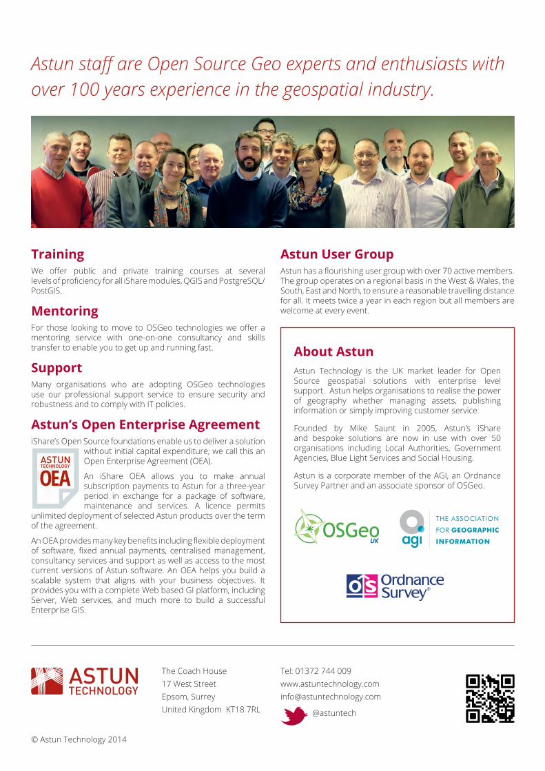
TrainingWe offer public and private training courses at several levels of proficiency for all iShare modules, QGIS and PostgreSQL/PostGIS.
MentoringFor those looking to move to OSGeo technologies we offer a mentoring service with one-on-one consultancy and skills transfer to enable you to get up and running fast.
SupportMany organisations who are adopting OSGeo technologies use our professional support service to ensure security and robustness and to comply with IT policies.
Astun’s Open Enterprise AgreementiShare’s Open Source foundations enable us to deliver a solution
without initial capital expenditure; we call this an Open Enterprise Agreement (OEA).
An iShare OEA allows you to make annual subscription payments to Astun for a three-year period in exchange for a package of software, maintenance and services. A licence permits
unlimited deployment of selected Astun products over the term of the agreement.
An OEA provides many key benefits including flexible deployment of software, fixed annual payments, centralised management, consultancy services and support as well as access to the most current versions of Astun software. An OEA helps you build a scalable system that aligns with your business objectives. It provides you with a complete Web based GI platform, including Server, Web services, and much more to build a successful Enterprise GIS.
Astun User GroupAstun has a flourishing user group with over 70 active members. The group operates on a regional basis in the West & Wales, the South, East and North, to ensure a reasonable travelling distance for all. It meets twice a year in each region but all members are welcome at every event.
About AstunAstun Technology is the UK market leader for Open Source geospatial solutions with enterprise level support. Astun helps organisations to realise the power of geography whether managing assets, publishing information or simply improving customer service.
Founded by Mike Saunt in 2005, Astun’s iShare and bespoke solutions are now in use with over 50 organisations including Local Authorities, Government Agencies, Blue Light Services and Social Housing.
Astun is a corporate member of the AGI, an Ordnance Survey Partner and an associate sponsor of OSGeo.
The Coach House17 West StreetEpsom, SurreyUnited Kingdom KT18 7RL
Tel: 01372 744 [email protected]
@astuntech
© Astun Technology 2014
Astun staff are Open Source Geo experts and enthusiasts with over 100 years experience in the geospatial industry.