Olympus Aerial Surveys Welcome. n Aerial Photography n Photogrammetric Engineering n Topography n...
40
Olympus Aerial Surveys Olympus Aerial Surveys Welcome Welcome
Transcript of Olympus Aerial Surveys Welcome. n Aerial Photography n Photogrammetric Engineering n Topography n...
Olympus Aerial SurveysOlympus Aerial Surveys
Welcome Welcome

OlympusOlympus Aerial SurveysAerial Surveys
Aerial PhotographyAerial Photography Photogrammetric EngineeringPhotogrammetric Engineering TopographyTopography OrthophotographyOrthophotography GIS DatabasesGIS Databases Oblique ViewsOblique Views Digital ProductsDigital Products Volume ComputationsVolume Computations
HistoryHistory
Olympus has been in business since 1965, performing photogrammetric surveying and consulting engineering for private companies and government agencies on the federal, state and local levels. Olympus has earned a reputation as a quality driven organization, which provides state of the art products and services.
History, History, cont.cont.
In the 1970’s Olympus was a pioneer in orthophoto products. Our Zeiss aerial camera was the first in use in the Intermountain area by a private organization. In the 1980’s we were the first to offer digital mapping. By the 1990’s Olympus had purchased the first Softcopy workstation and was providing digital orthophotos to accompany our digital mapping products.
History, History, cont.cont.
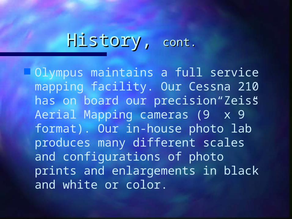
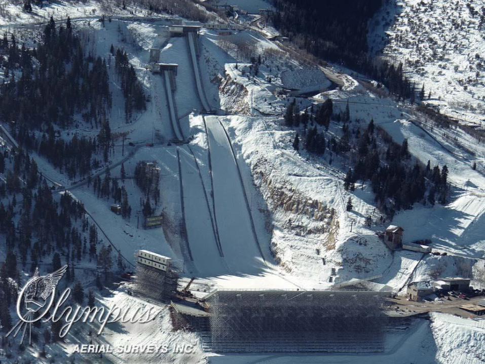
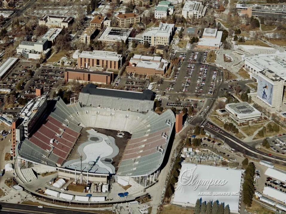
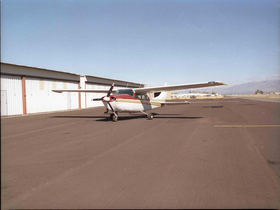
Olympus maintains a full service mapping facility. Our Cessna 210 has on board our precision Zeiss Aerial Mapping cameras (9” x 9” format). Our in-house photo lab produces many different scales and configurations of photo prints and enlargements in black and white or color.
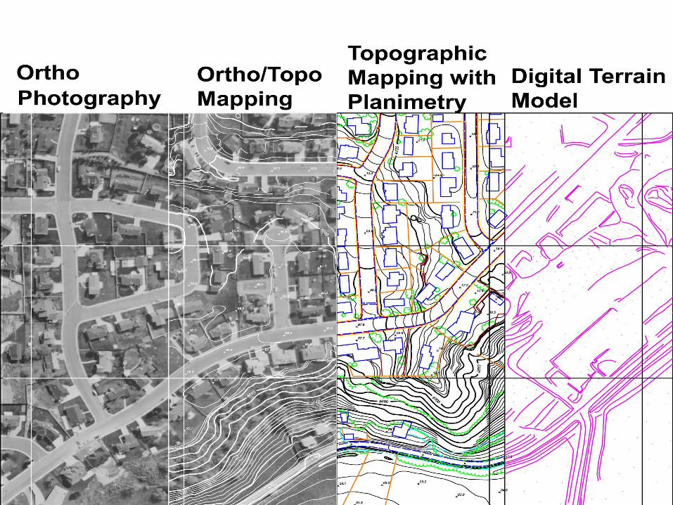
Map ProductionMap Production
Mapping is compiled on our first order Kern stereo plotters. We generate orthophotography using our Z/I Imaging softcopy workstation.
Map Production, Map Production, cont.cont.
Editing of our mapping products is accomplished using high-powered workstations and state of the art software like AutoCAD 2002. Most important are our experienced personnel averaging over 20 years in the mapping industry. They are committed to producing high quality, accurate mapping and photographic products.
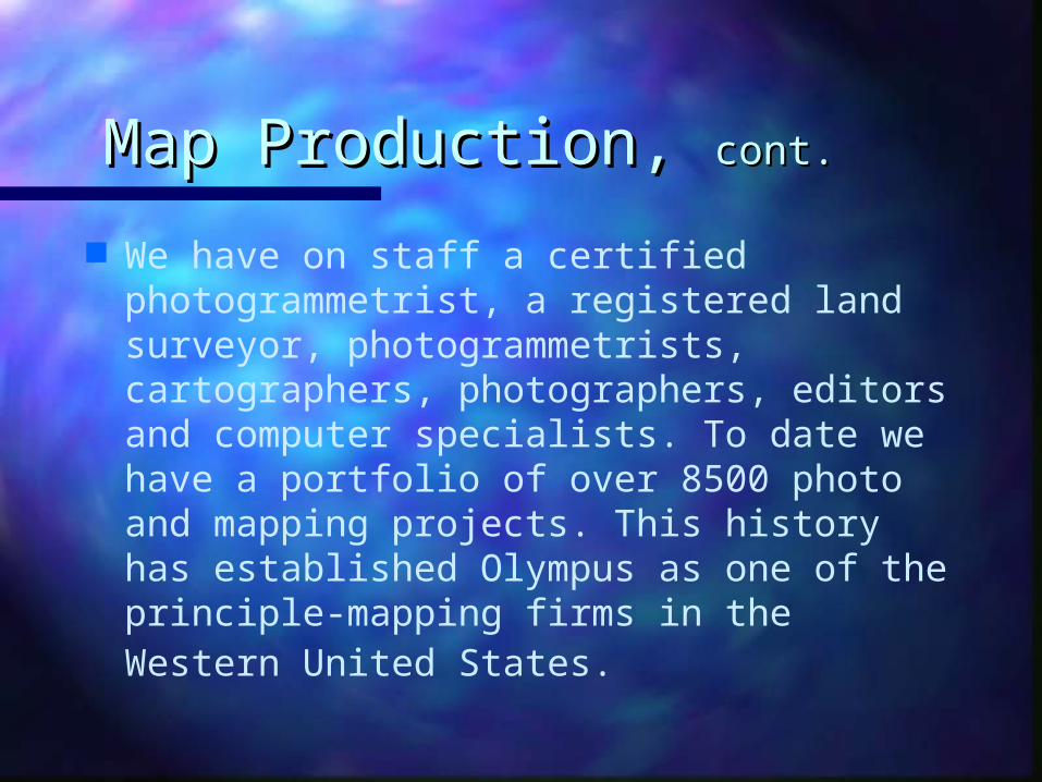
Map Production, Map Production, cont.cont.
We have on staff a certified photogrammetrist, a registered land surveyor, photogrammetrists, cartographers, photographers, editors and computer specialists. To date we have a portfolio of over 8500 photo and mapping projects. This history has established Olympus as one of the principle-mapping firms in the Western United States.
Mapping Products and Mapping Products and ServicesServices
Reconnaissance mapping Software conversions Digital topographic mapping Large-scale mapping Datum conversions
Mapping Products and Mapping Products and Services, Services, cont.cont.
Planimetric mapsPlanimetric maps GIS base mapsGIS base maps Subsidence mapsSubsidence maps Digitizing of hardcopy mapsDigitizing of hardcopy maps Digital orthophoto mapsDigital orthophoto maps Volume computationsVolume computations
Mapping Products and Mapping Products and Services, Services, cont.cont.
Our mapping is custom tailored to Our mapping is custom tailored to our client’s specific project our client’s specific project requirements.requirements.
Mapping is not made available to Mapping is not made available to anyone except the original client anyone except the original client without the express written without the express written authorization of said client.authorization of said client.
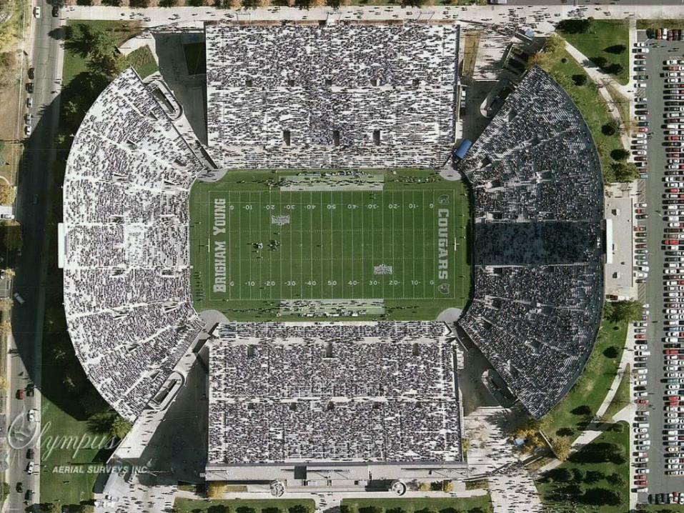
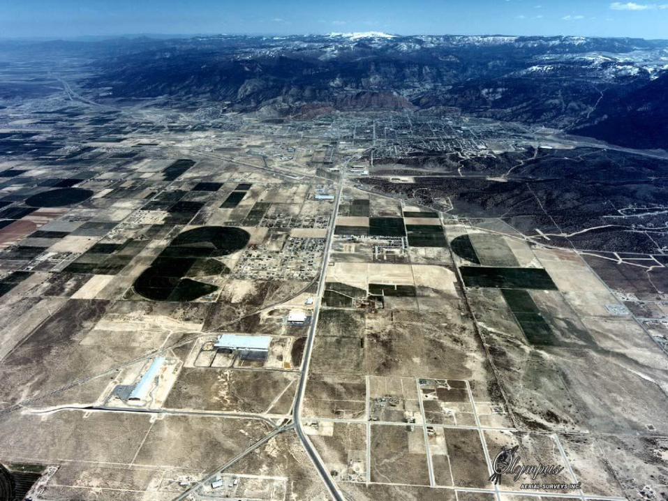
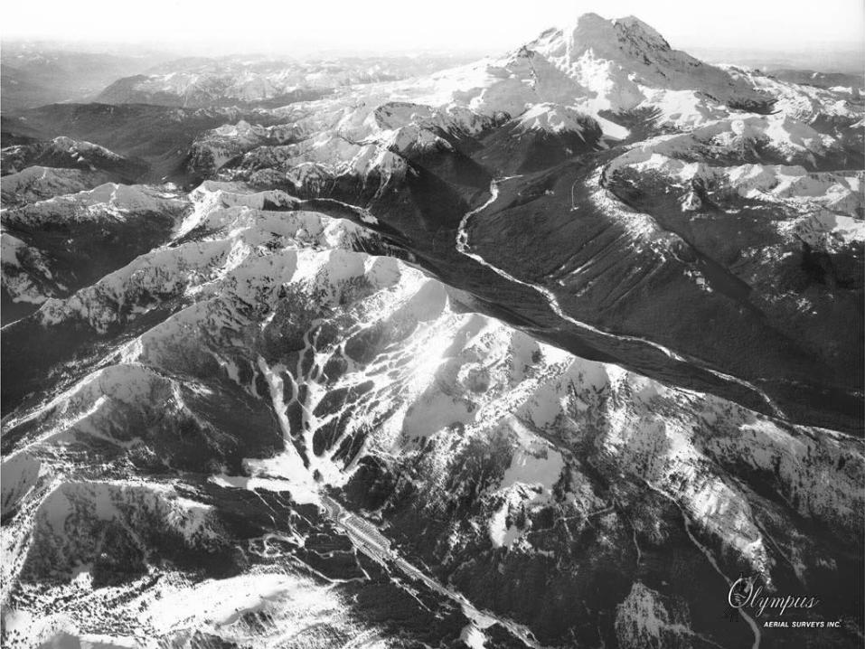
Aerial Photography and Aerial Photography and Photographic ProductsPhotographic Products
Vertical photographyVertical photography Oblique photographyOblique photography Black & white, color and color Black & white, color and color
infraredinfrared EnlargementsEnlargements Contact printsContact prints ScanningScanning
Aerial Products and Aerial Products and Photographic Products, Photographic Products, cont.cont.
Digital mosaicsDigital mosaics Scales from 1:2000-1:50,000Scales from 1:2000-1:50,000 RectificationRectification MosaicsMosaics Digital rectificationDigital rectification
Aerial Photography and Aerial Photography and Photographic Products, Photographic Products, cont.cont.
Whether you require digital Whether you require digital products or beautiful color products or beautiful color enlargements our experienced enlargements our experienced personnel will develop the personnel will develop the photography products you need in photography products you need in our in-house photo lab or on our our in-house photo lab or on our digital workstations.digital workstations.
Aerial Photography and Aerial Photography and Photographic Products, Photographic Products, cont.cont.
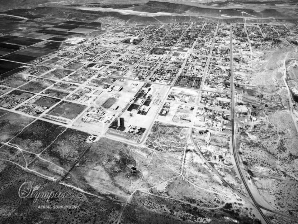
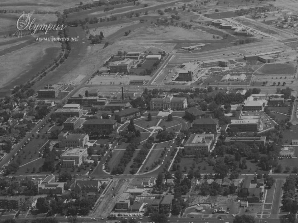
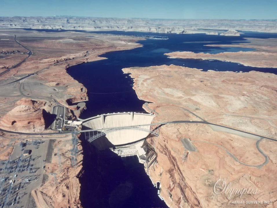
Our aerial photography can be cropped to your specific project requirements. We fly speculation photography for our mosaics, areas of significant growth and other areas of interest to add to our vast historical photo library. This speculation photography is available to the general public in both hard copy and digital formats, in sizes and scales appropriate to your needs.

Aerial Photography and Aerial Photography and Photographic Products, Photographic Products, cont.cont.
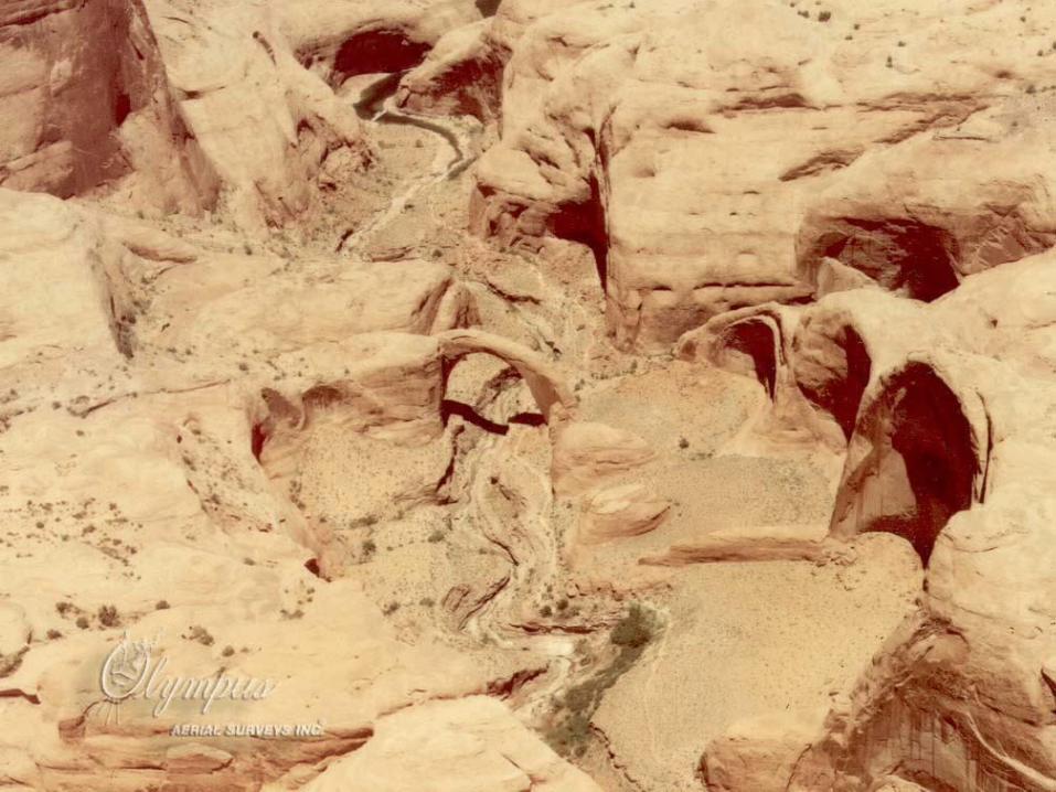
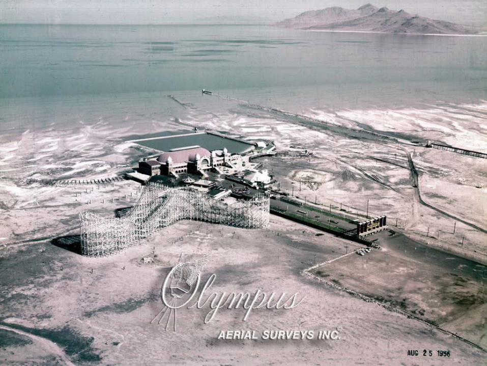
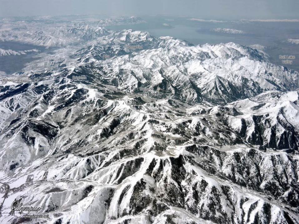
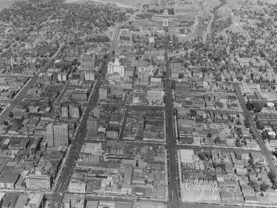
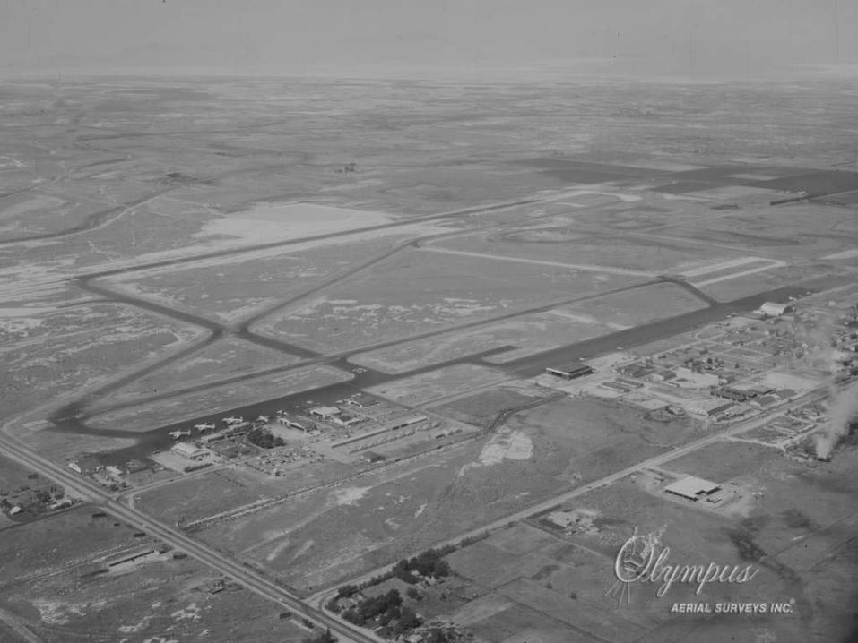
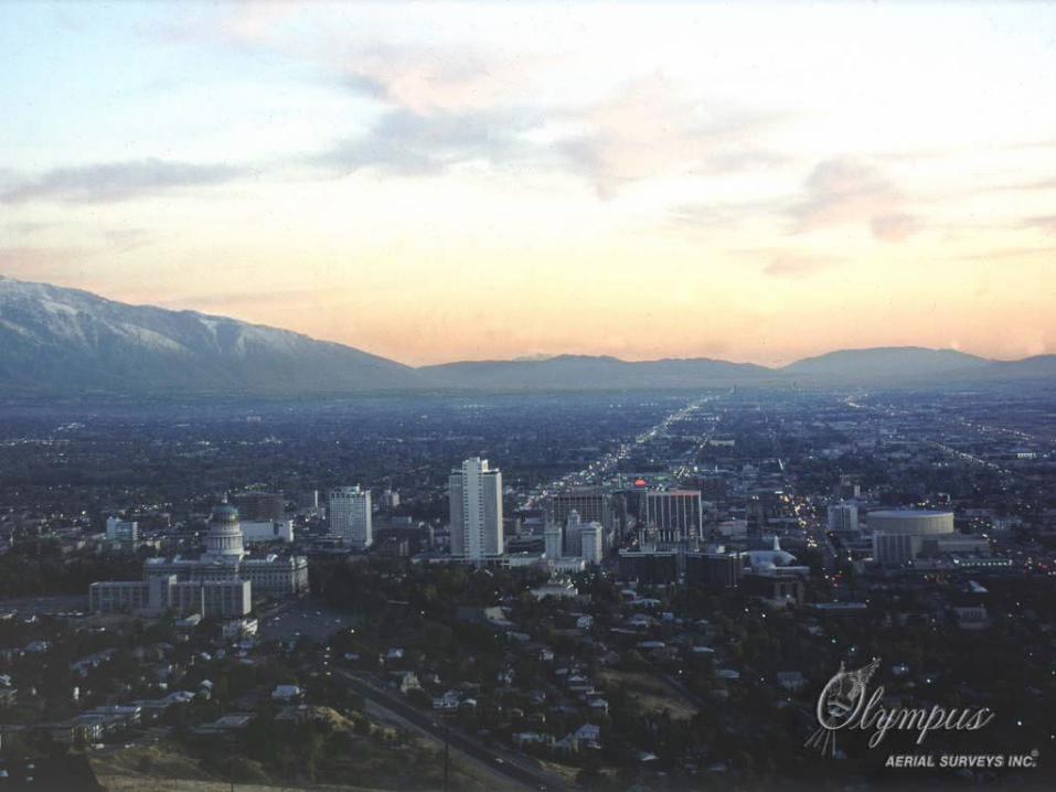
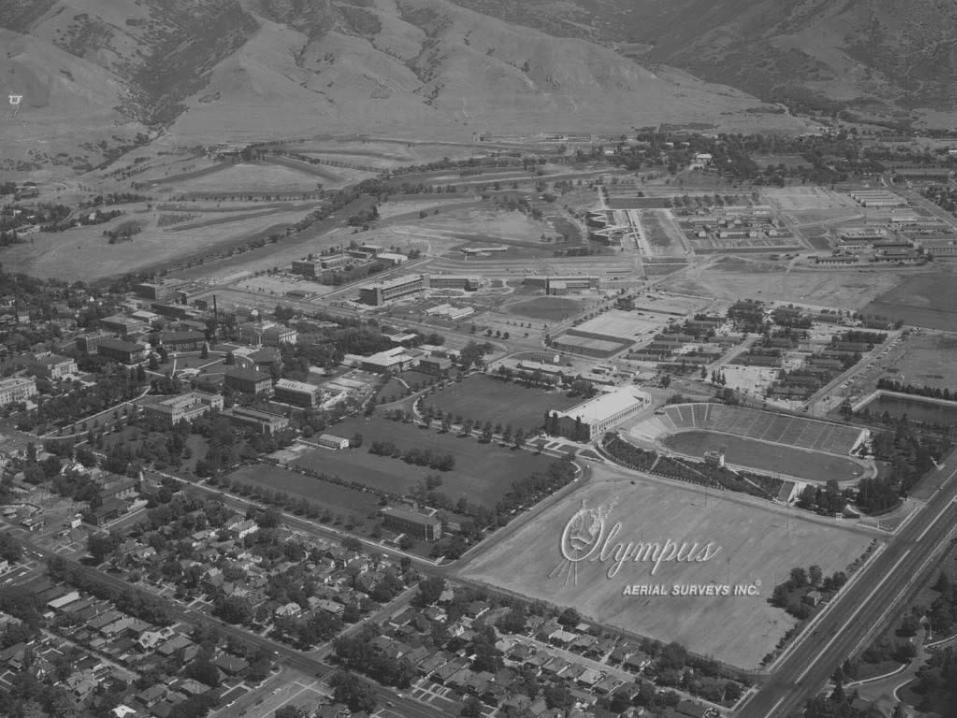
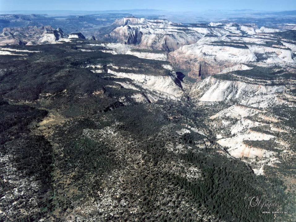
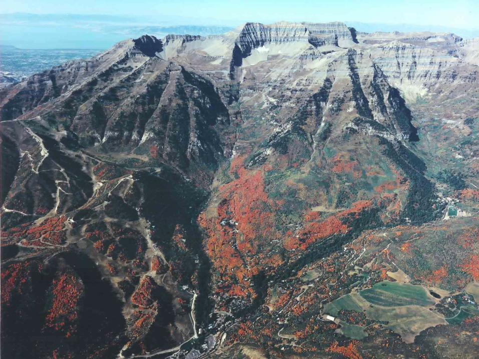
Our aerial photo library has photography we have secured since 1965 and other photography we have purchased from the U.S. Government taken in the 1950’s and earlier years. This historical photography covers the Wasatch Front and most cities and towns in the Intermountain area. These photos are used for land use information.
Values of Aerial Values of Aerial PhotographyPhotography
Conservation PracticesConservation Practices Urban development and planningUrban development and planning Tax assessmentTax assessment Pollution studiesPollution studies Drainage programsDrainage programs Boundary determinationsBoundary determinations Road location and highway Road location and highway
developmentdevelopment
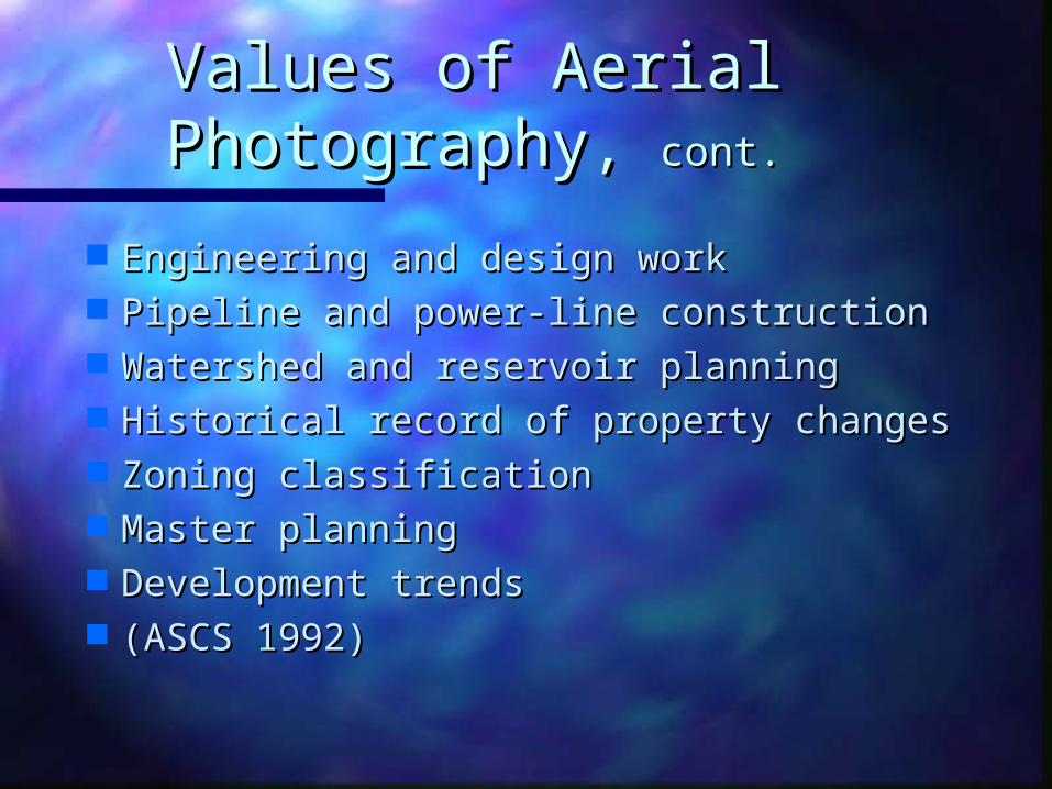
Values of Aerial Values of Aerial PhotographyPhotography, , cont.cont.
Engineering and design workEngineering and design work Pipeline and power-line constructionPipeline and power-line construction Watershed and reservoir planningWatershed and reservoir planning Historical record of property changesHistorical record of property changes Zoning classificationZoning classification Master planningMaster planning Development trendsDevelopment trends (ASCS 1992)(ASCS 1992)
Values of Aerial Values of Aerial Photography,Photography, cont.cont.
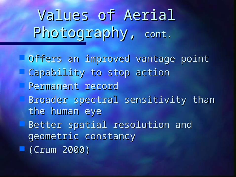
Offers an improved vantage pointOffers an improved vantage point Capability to stop actionCapability to stop action Permanent recordPermanent record Broader spectral sensitivity than the Broader spectral sensitivity than the
human eyehuman eye Better spatial resolution and Better spatial resolution and
geometric constancygeometric constancy (Crum 2000)(Crum 2000)
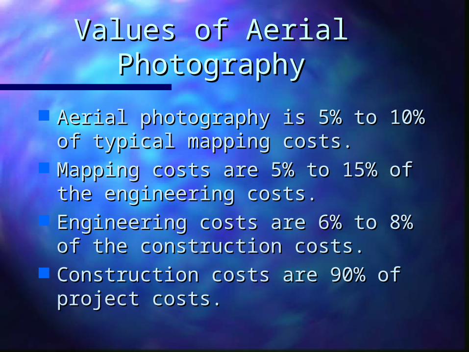
Values of Aerial Values of Aerial PhotographyPhotography
Aerial photography is 5% to 10% of Aerial photography is 5% to 10% of typical mapping costs.typical mapping costs.
Mapping costs are 5% to 15% of the Mapping costs are 5% to 15% of the engineering costs.engineering costs.
Engineering costs are 6% to 8% of Engineering costs are 6% to 8% of the construction costs.the construction costs.
Construction costs are 90% of Construction costs are 90% of project costs.project costs.
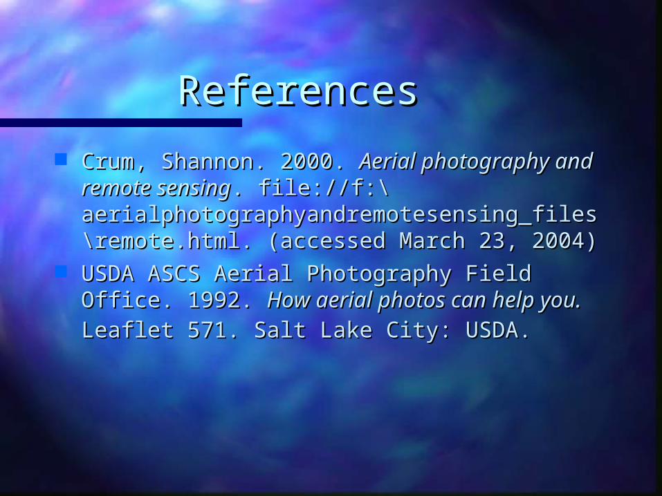
ReferencesReferences
Crum, Shannon. 2000. Crum, Shannon. 2000. Aerial photography and Aerial photography and remote sensingremote sensing. file://f:\. file://f:\aerialphotographyandremotesensing_files\aerialphotographyandremotesensing_files\remote.html. (accessed March 23, 2004)remote.html. (accessed March 23, 2004)
USDA ASCS Aerial Photography Field Office. USDA ASCS Aerial Photography Field Office. 1992. 1992. How aerial photos can help you.How aerial photos can help you. Leaflet Leaflet 571. Salt Lake City: USDA.571. Salt Lake City: USDA.