
Old Cartographic · PDF fileGIS Group and the Design Group have ... Map Curators Group...
11
BCS Symposium 2 & 20 Fellows Evening 15 Atlantic Quiz 10-11 Spring 2009 Old Cartographic Tools
Transcript of Old Cartographic · PDF fileGIS Group and the Design Group have ... Map Curators Group...

BCS Symposium 2 & 20
Fellows Evening 15
Atlantic Quiz10-11
Spring 2009Old Cartographic Tools
Harben House, Newport Pagnell,Wednesday 17 June to Saturday 20June. See page 20 for further details.
This is a new time of year for theSymposium, brought about to avoidthe perennial clashes with a very busy conference season in September. TheProgramme is close to being finalised;highlights include a variety of inspiringpresentation sessions, a wide range ofhands on workshops, the AnnualAwards ceremony, and we are delighted to announce that BarbaraBond, a Past President of the BCS, willbe delivering this year’s Helen WallisMemorial Lecture titledCommunicating with maps: did themessage get through?
The programme will begin on theWednesday afternoon with a series ofevents being run by individual SpecialInterest Groups, the Exhibition opening and networking activities. TheGIS Group and the Design Group havealready confirmed that they will be running sessions and we hope thatthe Historical Military Mapping Groupwill be in a position to confirm theirsession by mid-April. Full details willbe available soon on the website. Thursday 18th June will open with asession entitled New Horizons and will
include a presentation from Bob Lilley,BCS President, entitled The BritishCartographic Society: A Fresh Vision,based on work that has been takingplace at Executive and Council level.We are pleased to announce that BillCartwright, the current President ofthe International CartographicAssociation (ICA) will also present within this session.
All of the presentation sessionsinclude a wide range of speakers froma variety of academic, governmentand commercial backgrounds coveringthe topics of Mapping theEnvironment, Mapping on the Weband Symbology and Representation.These reflect some of the topics of keyimportance to cartography today. TheWorkshop programme is designed foryou to gain practical experiencethrough exercises, discussions anddemonstrations. The topics are widereaching and hopefully there will besomething for everyone.
The Programme Committee looks forward to welcoming you back toHarben House.
Peter Jones & Fiona Cocks
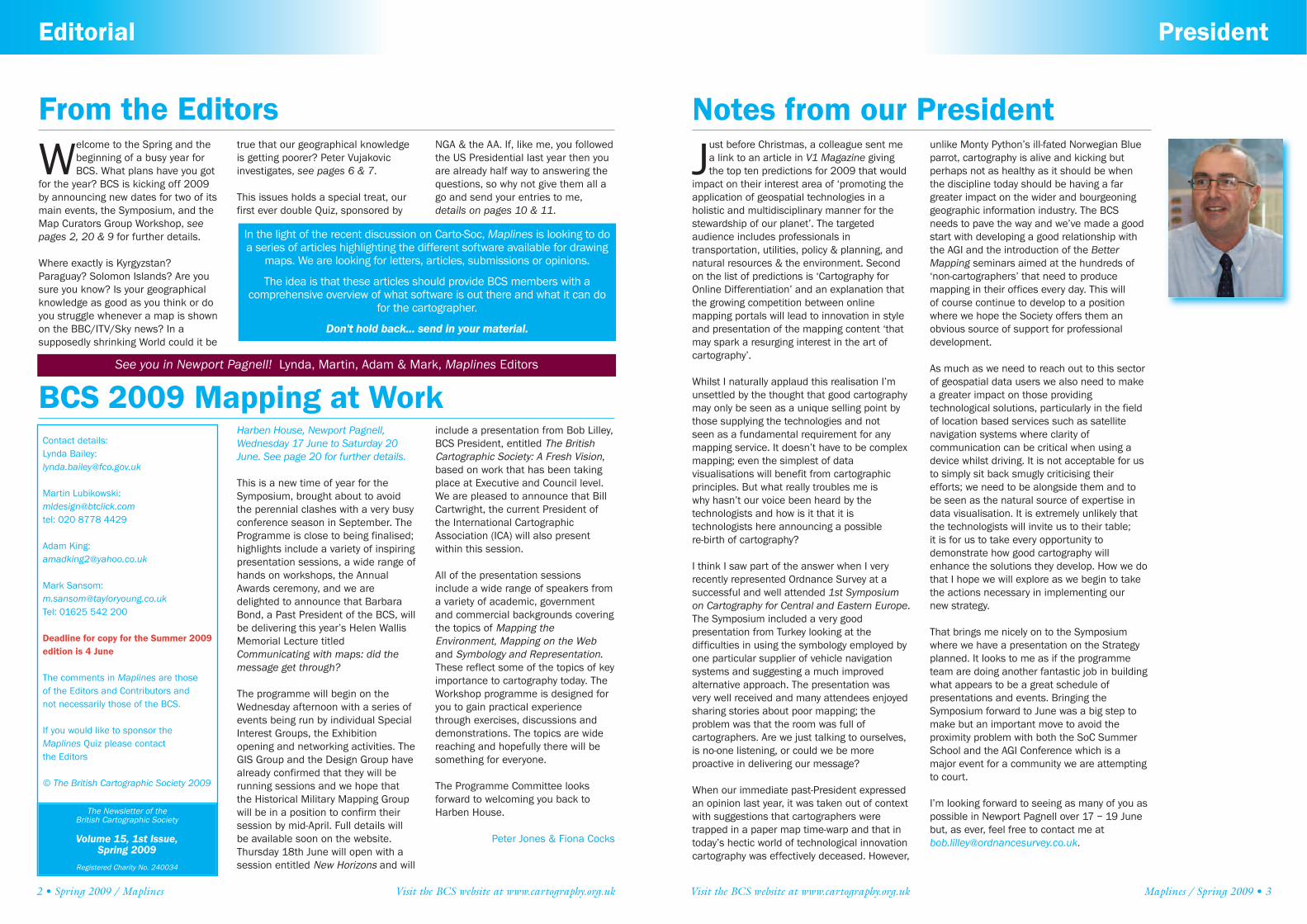
Welcome to the Spring and thebeginning of a busy year forBCS. What plans have you got
for the year? BCS is kicking off 2009by announcing new dates for two of itsmain events, the Symposium, and theMap Curators Group Workshop, seepages 2, 20 & 9 for further details.
Where exactly is Kyrgyzstan?Paraguay? Solomon Islands? Are yousure you know? Is your geographicalknowledge as good as you think or doyou struggle whenever a map is shownon the BBC/ITV/Sky news? In a supposedly shrinking World could it be
true that our geographical knowledgeis getting poorer? Peter Vujakovicinvestigates, see pages 6 & 7.
This issues holds a special treat, ourfirst ever double Quiz, sponsored by
NGA & the AA. If, like me, you followedthe US Presidential last year then youare already half way to answering thequestions, so why not give them all ago and send your entries to me,details on pages 10 & 11.
2 • Spring 2009 / Maplines Visit the BCS website at www.cartography.org.uk
Editorial
From the Editors
Contact details:Lynda Bailey: [email protected]
Martin Lubikowski:[email protected]: 020 8778 4429
Adam King: [email protected]
Mark Sansom: [email protected]: 01625 542 200
Deadline for copy for the Summer 2009edition is 4 June
The comments in Maplines are those of the Editors and Contributors and not necessarily those of the BCS.
If you would like to sponsor theMaplines Quiz please contact the Editors
© The British Cartographic Society 2009
The Newsletter of the British Cartographic Society
Volume 15, 1st Issue, Spring 2009
Registered Charity No. 240034
BCS 2009 Mapping at Work
In the light of the recent discussion on Carto-Soc, Maplines is looking to doa series of articles highlighting the different software available for drawing
maps. We are looking for letters, articles, submissions or opinions.
The idea is that these articles should provide BCS members with a comprehensive overview of what software is out there and what it can do
for the cartographer.
Don't hold back... send in your material.
See you in Newport Pagnell! Lynda, Martin, Adam & Mark, Maplines Editors
Visit the BCS website at www.cartography.org.uk Maplines / Spring 2009 • 3
President
Notes from our President
Just before Christmas, a colleague sent mea link to an article in V1 Magazine givingthe top ten predictions for 2009 that would
impact on their interest area of ‘promoting theapplication of geospatial technologies in a holistic and multidisciplinary manner for thestewardship of our planet’. The targeted audience includes professionals in transportation, utilities, policy & planning, andnatural resources & the environment. Secondon the list of predictions is ‘Cartography forOnline Differentiation’ and an explanation thatthe growing competition between online mapping portals will lead to innovation in styleand presentation of the mapping content ‘thatmay spark a resurging interest in the art of cartography’.
Whilst I naturally applaud this realisation I’munsettled by the thought that good cartographymay only be seen as a unique selling point bythose supplying the technologies and not seen as a fundamental requirement for anymapping service. It doesn’t have to be complexmapping; even the simplest of data visualisations will benefit from cartographicprinciples. But what really troubles me is why hasn’t our voice been heard by the technologists and how is it that it istechnologists here announcing a possible re-birth of cartography?
I think I saw part of the answer when I veryrecently represented Ordnance Survey at a successful and well attended 1st Symposium on Cartography for Central and Eastern Europe.The Symposium included a very good presentation from Turkey looking at the difficulties in using the symbology employed byone particular supplier of vehicle navigation systems and suggesting a much improved alternative approach. The presentation wasvery well received and many attendees enjoyed sharing stories about poor mapping; the problem was that the room was full of cartographers. Are we just talking to ourselves,is no-one listening, or could we be more proactive in delivering our message?
When our immediate past-President expressedan opinion last year, it was taken out of contextwith suggestions that cartographers weretrapped in a paper map time-warp and that intoday’s hectic world of technological innovationcartography was effectively deceased. However,
unlike Monty Python’s ill-fated Norwegian Blueparrot, cartography is alive and kicking but perhaps not as healthy as it should be whenthe discipline today should be having a fargreater impact on the wider and bourgeoninggeographic information industry. The BCSneeds to pave the way and we’ve made a goodstart with developing a good relationship withthe AGI and the introduction of the BetterMapping seminars aimed at the hundreds of‘non-cartographers’ that need to produce mapping in their offices every day. This will of course continue to develop to a position where we hope the Society offers them an obvious source of support for professionaldevelopment.
As much as we need to reach out to this sectorof geospatial data users we also need to makea greater impact on those providing technological solutions, particularly in the fieldof location based services such as satellite navigation systems where clarity of communication can be critical when using adevice whilst driving. It is not acceptable for usto simply sit back smugly criticising theirefforts; we need to be alongside them and tobe seen as the natural source of expertise indata visualisation. It is extremely unlikely thatthe technologists will invite us to their table; it is for us to take every opportunity to demonstrate how good cartography willenhance the solutions they develop. How we dothat I hope we will explore as we begin to takethe actions necessary in implementing our new strategy.
That brings me nicely on to the Symposiumwhere we have a presentation on the Strategyplanned. It looks to me as if the programmeteam are doing another fantastic job in buildingwhat appears to be a great schedule of presentations and events. Bringing theSymposium forward to June was a big step tomake but an important move to avoid the proximity problem with both the SoC SummerSchool and the AGI Conference which is amajor event for a community we are attemptingto court.
I’m looking forward to seeing as many of you aspossible in Newport Pagnell over 17 – 19 Junebut, as ever, feel free to contact me at [email protected].

4 • Spring 2009 / Maplines Visit the BCS website at www.cartography.org.uk
Letter to the Editors
Cartography is more than just a map
In an industry that was dominated bythe paper map, the common view of a cartographer was of a person whomade maps. At its simplest this meant a mere draughtsman. This view cameabout because traditionally a largepart of a cartographer’s daily activitywas involved in the complex task ofphysically creating the artwork fromwhich a map would finally be printed.This required considerable patienceand manipulative skills that wereunique, but in most circles these activities were seen as those of a glorified handyman. This wasn't truebut it is how it was perceived.
You might ask a handyman to build you a garden shed but you wouldn’t ask him to make your dining roomtable. For that you need at least a joiner. Who would think of
commissioning a local joiner to makea veneered writing desk? You need a cabinet-maker for that. Each is necessary in the woodworking industry, their different knowledge and skills accepted and utilised appropriately, but this paradigm doesnot seem to have been translated intothe appreciation of the cartographer’sworld. Cartography too involves notjust one skills base, but many.
Missing from this view was that thework of a cartographer encompasses a whole series of knowledge and skillsbases, not just the one that is seen onthe surface. The cartographer addsvalue at many levels to the raw material he or she works with. Like thelayers of an onion, just under the skinof many of these 'draughtsmen' wasthe map-maker as artisan designer
(joiner) and within that there was thecartographer as an authority on maps;how they succeed and how they fail,how to create maps that maintain cartographic credibility. Cartographeras cabinet-maker. And in rareinstances there was one more level. Atthe very centre was the appreciationof the ancient honour given to mapsof exceptional aesthetic quality; cartographer as artist. In woodworkingterms, the sculptor or woodcarver.Each of these aspects of the cartographer correlates with the levelsof the cartographic pyramid. These arethe base, the outer shell or periphery,the core that runs through the centreand at the top, the art.
THE BASE Things that are purely functional, to serve the work at hand. Typically, these are unskilled
What is it a Cartographer does?
As a professional cartographer Iwould like to comment on theproposals made by the BCS
Strategic Review Committee. There aremany administrative suggestions thatare long overdue, but equally there aresome disturbing trends and proposalsthat have severe implications for thecontinuing existence of the BCS in theform in which it was conceived andhas developed. Changes are being introduced without the agreement oflarge sections of the membership andwithout fully appreciating the consequences. An example of which isthe change of the Symposium datefrom September to June, which thereport says was forced upon BCS bythe timing of the much larger AGI conference. We have not been forcedto move by the timing of the AGI event,but by the trend towards making theBCS a GIS technical support body,ground already occupied by otherorganisations. Even if the reason forthe move were to be valid, which it isnot, not enough thought was given tothe consequences. The Map Curators did not agree to this change, and havechosen to retain their Workshop in
September. For legal reasons our AGMhas to be held in the Autumn. So it toohas to be split off from theSymposium. Where will it be held?Probably at the AGI conference. And if that isn't enough the report also suggests that the Awards ceremonytoo could take place separately. You'veguessed it, at the AGI conference!! Wecannot afford this fragmentation ofour core activities. With theSymposium already farmed out to aprivate company and the BetterMapping sessions held under the wingof the AGI, it seems that we are incapable of running our own Societythese days. If such is the case, it is difficult to see how the BCS canremain independent for much longer.
The question to ask is how the compilers of this report come to findthat such fragmentation is beneficialto the Society. None is more curiousthan the suggestion to change thename to The British Mapping Society.The change is not the issue, but theethos under which it was made. Evenif the name remains the same, thethrust of the report is not just a
re-branding of the BCS, but the formation of a different society. It isthe suggested change of name thatreveals the thinking behind these proposals. The idea of dropping theword 'cartographic' from the Society'stitle and replacing it with the word'mapping' – because some peoplethink the name is a bit archaic andnot broad enough to cover the geo-information industry – is like changing the name of the The RoyalPhotographic Society to The RoyalPicture-Taking Society because of theadvent of the digital camera. And arewe now to share an acronym with theBritish Menopausal Society? This proposal is so strange that one mustask why it was ever contemplated inthe first place. I think the crux of thematter lies in the view of cartographytaken by the Review. Two particularreferences in the report highlight whatI am talking about.
The first, on page 9, is that ’cartography is viewed differently frommap making, the former being focusedon the creation of traditional printedmaps, the latter being more about
maps created from GIS based activities’. Who on earth would saythat GIS is map making and cartography is not? Only someonewithout a full understanding of whatcartography is all about. I believe thatthe reason such a remark has foundits way into the report is quite simple.The Review Committee, eminentthough its members may be in theirown fields, did not include a singleprofessional cartographer. The secondillustration of the myopic view of theSociety, on page 16, is ‘there was a general view that the word cartography did not sit well in a GISfocussed information industry’. Thismay well be true, but the remark itselfreveals a blinkered view of the breadthand depth of cartography as a professional occupation. The GISindustry is vast and eminently beneficial to all, not least of all to cartographers, but it is not the onlybranch of cartography. There are farmore people making maps in thegraphics world than there will ever bein the GIS world. It is just that none ofthem have ever heard of the BCS.Sadly, the Design Group's MapDesigners’ seminars From GIS to MapArt, aimed at this vast pool of potential members in the graphics industry and which received
worldwide acclaim, were unceremoniously dropped from theBCS programme because they did notfit in with this new perceived role ofthe Society.
I want to make it absolutely clear thatI would not for a single moment wishto limit the effort to give the BCS more relevance to the GIS industry and Iapplaud the success that this movehas had. God knows it is long overdue.Enlarge cartographic involvement inGIS by all means, support GIS practitioners and organisations intheir geo-information tasks, but alwayskeep in mind that cartography, farfrom being narrow, is too wide to beconfined to such a limited definitionas that proposed in this Review.Cartography is more than just a map.The BCS should be promoting an idea,not a product.
I believe that many of the proposals inthe Strategic Review have made the fundamental mistake of focussing ona single branch of the mapping industry, not surprising when theReview Committee comprises two GIS specialists, an academic and a librarian. What is most damaging isthe apparent retreat from the highground of professional cartography in
favour of creating a support organisation within an already oversubscribed section of the industry.I am content for the BCS to change itsethos but this must be on validgrounds, and not on the basis of theassumptions and misunderstandingsoutlined in this report. The GIS worldwill swallow the BCS whole unless we identify a role that is not already adequately fulfilled elsewhere.
I joined the BCS, SOC and AGI becauseeach is distinctly different and eachcaters for different interests of mine,but if these proposals are implementedthey will seriously weaken the identityof the BCS and in consequence its relevance to what I do.
Alan Collinson FRGS FBCart.S.
Editors’ note:As a postscript to his letter Alan madeus an offer...‘a group of us would liketo take a little space in Maplines toexplain to the Society what cartography means and what a cartographer actually does’.
We gladly accepted.....
Visit the BCS website at www.cartography.org.uk Maplines / Spring 2009 • 5
Cartography
activities, merely operating a group ofprocedures. The cartographer asHANDYMAN. This aspect has nowalmost completely transferred to DTPand GIS. The handyman works with automated activities, pre-selectedstyles, colour ramps and symbols.Sometimes deselecting the defaults toalter the line-widths and styles but generally working within a proscribed system. Digital solutions bring a host ofnew possibilities, saving an awful lot oftime and effort, but to a cartographer,the digital is a means, not an end.
Today if you want a garden shed youorder one that arrives on a palette. Youfix it together over a weekend. Youcurse over it not quite being straight,but think it just about does the job. You
just wanted somewhere to put the lawnmower but before long it is just a leakyspace for storing rubbish. In hindsightyou wished you’d asked someone, butat the time you thought that just aboutanyone could make a shed. It is thinking like this that leads to so manyunreadable maps, and which keeps thebusiness of selling flat pack sheds onpalettes so lucrative. But sometimes ahandyman is not quite enough. A littlemore skill and know-how is required.
THE OUTER SHELL Important but peripheral to the core, needing askilled artisan. The cartographer asJOINER. Establishing a logical hierarchy depending on the purpose ofthe map, more important, less important, figure ground relationships,
legends. balance, harmony, elementaldesign, letter spacing, layout, readability, colour. This involves notjust knowing how to turn off the defaultselection, but knowing what would be better in its place given the task in hand.
THE CORE Things that are essential,and needing a highly-skilled professional, capable of authoritativecartographic judgements. The cartographer as CABINET-MAKER.Evaluation and verification of sources,degrees of reliability and completeness, contextual design, visualising alternative outcomes, consistency, cartographic credibility,graphic problem solving, and bringingContinued on page 6...
© www.worldmapper.org

Too often the acquisition of basic geographical knowledge (where countries are on the map, the names ofstate capitals, etc) is treated as nothingmore than a ‘trivial pursuit’. This wouldbe fair if this knowledge had no directbearing on real world issues, howeveras David Lambert of the GeographicalAssociation points out, it is not trivial,but helps us ‘make sense of the Worldand face vital issues such as climatechange, energy, food production, the'war on terror', water and poverty’.David’s point was quoted in relation toa recent survey that showed that a thirdof British adults believe that Mt Everestis in Europe. This and other anecdotalevidence suggests that the public arebecoming less geographically literate. A National Geographic study in 2006showed that many young Americans(18-24) have poor geographical knowledge. Only 37% could find Iraq ona map, despite the fact that U.S. troops
have been there since2003, while
20% placedSudan inAsia. Shouldwe be worried? Acomparison of two small-scale studies I conducted about a decade apart suggests that geographical knowledgeof young British students might actuallybe improving, but that large gaps anderrors still exist.
The surveys, part of my news mediamap research, were carried out with firstyear undergraduates (most also hadtaken A Level Geography) at CanterburyChrist Church University. Students wereasked to name countries ona map of central and EasternEurope (extended to includeareas of the Middle Eastand southern Asia in thesecond survey). In bothcases familiar states borderingthe regions of interest wereincluded to provide context (e.g. Italy,Germany, and India in the later survey).Both studies were aimed at understanding geographical knowledge
of geopolitically significant areas in thenews. The first survey, involving 47 students, took place in late 1999, following NATO intervention inYugoslavia. During the first seven
months of 1999,25% of all themaps publishedin the UK qualitypress were
related to the Kosovo crisisand Balkan region. The sec-
ond survey, involving 31 students, followed Russian interventionin Georgia (South Ossetia crisis), andduring reporting of British military operations in Iraq and Afghanistan. InAugust 2008 just under a quarter of allnews maps in the UK quality press related to Russia’s activities in Georgiaor its geopolitical relationship withPoland and the Ukraine. While manystudents admit that they did not regularly read the quality press, similarlevels of coverage were provided by television news, which most studentsquote as their main source for information on international affairs.
The 1999 survey showed that the students have a very limited understanding of the geography of theBalkans despite major news coverage,but it also showed their general understanding of the geography ofEurope was limited. While Germanyreceived a reasonably high recognitionscore at 87%, other important states,such as Russia, Greece, and Turkey,were incorrectly identified or left blankby nearly a third of students. Ex-Sovietstates fared very poorly, ranging from, at best, 17% for Estonia to none forMoldova. In Eastern Europe, Polandfared best, but was still only recognised by half the students. In
the Balkans only four students(9%) correctly identified bothSerbia and Bosnia, although
Croatia, with its more distinctiveshape scored better (15%). This contrasts with the more recent survey.Student’s recognition of key states isimproved in all cases; Germany 94%,Russia 97%, Greece 74% and Turkey81%. The Balkans generally remain
6 • Spring 2009 / Maplines Visit the BCS website at www.cartography.org.uk
Geography
Blanks on the map......continued from page 5out the message hidden within theraw material. Purposefully focussingand multi-focussing the reader’sattention. Creativity, research, dataanalysis. Resolving reference system conflicts. Realising thatthere is much more to cartographythan merely producing a map.
THE ART Cartography as artistry.Doing something well for it’s ownsake. Working out the process. The aesthetic standard. The cartographer as SCULPTOR. Simplefunctions are necessary for cartographic clarity, but there aremany other attributes of the art ofcartography, the ability to createpieces of lasting worth which will beappreciated long after the original reason for drawing the map hasbeen forgotten. There are goodmaps and there are bad maps, andbad maps fail. Cartographers makesuccessful maps because they combine their skills at whateverlevel is required. Handyman, joiner,cabinet-maker and sculptor.Draughtsman, designer artisan,skilled editor, and artist. Theyassess the potential of each pieceof timber (data) for the intendedpurpose, and then realise thatpotential by selecting and joiningthe best bits to create the optimumfinished piece of work. Indeed amap will always be a piece of work,not a by-product or a quick fix. Amap is not the swarf on the floorbut the crafted remainder. LikeMichaelangelo who saw his ‘David’within the block of marble at thequarry, so the experienced cartographer sees the map withinthe database.
Alan Collinson, David Barbour,Danny Dorling and Susie Jones
confused, with Serbia 6% and Bosnia7% doing marginally less well than previously, although Albania rises from6% in 1999 to 26%. The 2008 cohortsknowledge of central and EasternEurope was certainly better than tenyears previously; Poland 84%, Estonia45% and Moldova at 10%.
The 2008 survey involved a slightly larger geographical area to cover statesthat had recently received major newscoverage related to geopolitical issues.The results for UK students for two keystates, Iraq 55% and Iran 32%, showsomewhat better results for the UK students, than for the US youngadults, Iraq, 37%, Iran 26%, but somecaution should be applied in making a comparison between the results asthe National Geographic Society studywas much larger (510) and included a wider educational range of respondents and reflects conditions twoyears earlier. Interestingly only 25% ofboth UK and US respondents couldidentify Israel. The UK recognition factorfor Afghanistan was 35%. These resultsare less positive given the fact that UKtroops have been actively engaged inIraq and Afghanistan for over half adecade and the region is regularly covered in the news. While a few students muddledIran andIraq, etc., thiswas not a major issue –many simply did not label these stateson the map.
Some potentially interesting cartographic issues arise from theseresults. Israel is often in the news and maps abound showing the disputed territories, but it has a poor recognition factor in both the UK andUS surveys. It may well be that its smallsize on the base map confuses somestudents. Israel is perceived as a strongregional power, but is less than a tenthof the UK’s land area, and 3% of Texas!If it were shown within its local regionalsetting its recognition factor mightincrease. There may be a range of othersuch factors that affect recognition, for
example, the quality of the locator mapsthat accompanies the main map inmany news papers – these can often beof very limited size and quality. There isclearly some interesting research to beundertaken regarding the design qualityof many mediamaps in thiscontext.
While the surveys werelinked to awareness of geopolitical regions in the news, there isno sense in which the news media areseen as the only influence on geographical knowledge. A range ofother cultural factors will be involved.When, for example, I noted with somesurprise that Kazakhstan received a relatively high recognition rate in the2008 survey (29%), especiallywhen compared, for examplewith Israel (25%), my twenty-one year old son suggested the ‘Borat factor’ – that manyyoung people will be aware ofKazakhstan through exposure toBorat(!) Cultural Learnings of Americafor Make Benefit Glorious Nation ofKazakhstan, a 2006 ‘mockumentary’film starring Sacha Baron Cohen, well-known for his Ali G character.Whether this is true or not, it does
point to the potential complexities in trying to understand the role of newsmedia maps, and maps and atlases ingeneral, in generating geographicalawareness.
The results as a whole must be treated with a little care, as the intention was simply to provide somebackground information for a detailedstudy of news media maps. It does,however, provide an interesting pictureof student’s geographic knowledge andsuggests that a more systematic surveywould be rewarding and of interest tothose of us who teach geography or produce maps. Cartography certainlymatters, but we need to know moreabout the role maps play in understanding our views of the world.
Peter VujakovicProfessor of Geography,
Dept. of Geographical andLife Sciences
Canterbury Christ Church University
Visit the BCS website at www.cartography.org.uk Maplines / Spring 2009 • 7
Geography
is geographical knowledge in decline?

Once met, Roger was someoneyou did not forget for he was alarger than life character. He
epitomised the solid virtues so oftenused to describe those from the northern Pennine fringes for he was a Lancashire lad and proud of it. Healso became the quintessential andcomplete map specialist.
Roger’s father was a surveyor so hisliking for maps came from early stimulus. After attending MorecambeGrammar School he read Geographyat Fitzwilliam College Cambridgebefore doing the then obligatory twoyear’s National Service. He took up a professional career in librarianshipin 1957, starting north of the Borderin Glasgow University Library butquickly moved on to CambridgeUniversity Library in 1958. He soonmade his mark in the map world. Hisfast-growing expertise in the often convoluted details of map cataloguingand his knowledge of early maps,series mapping both British and foreign produced and of mapmakingprocesses made him a formidableexponent and opponent.
Idiosyncrasies, like his early practiceof having all incoming OS large scaleplans received in Cambridge UniversityLibrary mounted and dissected, raisedeyebrows in other legal depositlibraries where such a practice wouldnot have been allowed, but Rogerdidn’t turn a hair, continuing thisprocess for many years until finallypersuaded it had to stop. As a pragmatist he had considered it thebest solution given the storage typeand space at his disposal - and historymay well bear him out.
He had a strong personality, occasionally displaying tenaciousobstinacy, though always in whatseemed to him a just cause. But hewas also a shrewd tactician with muchastuteness, never better displayedthan at national twice-yearly meetingsof BRICMICS (British and IrishCommittee for Map Information andCataloguing Systems) which he sat on
in both its pre-BRICMICS andBRICMICS state for 20 years. Also atthe associated meetings withOrdnance Survey in Southampton,where from around 1977 at the annual OS Small Scale and OS LargeScale Conferences and then atBRICMICS/OS meetings, he never hesitated to speak up or cross examine if he thought woolly thinkinghad been demonstrated or where hefelt matters were unclear. No one gotaway with subterfuge when Roger waspresent. To see him arrive at such
meetings with Helen Wallis, thendoyenne of the British Library MapRoom and Peter Clark, then ChiefMapping Research Officer in theMapping and Charting EstablishmentRE, meant those of us present fromother Copyright Libraries and institutions knew no one was going toget away with anything where theymight otherwise have thought to doso, not even the formidable OS seniormanagement team, then dominantlymilitary men, sitting in a row at a longtable facing us.
While Roger’s publications list was notlarge, he made up for it. He built upthe early collections in CambridgeUniversity Library with much skill,always able to wangle money from
appropriate coffers, though sometimes involving what might betermed ‘a territorial gain with borderdispute’. In this context it is not forgotten in the National Library ofScotland that Roger beat his oppositenumber there (principally because hewas able to lay his hands on moremoney) to the acquisition of the manuscript version of George Taylorand Andrew Skinner’s Survey andMaps of the Roads of North Britain orScotland, which NLS had only in laterpublished editions from 1776. Butsome 15 years later when he tried afurther territorial gain over NLS interms of the acquisition of a rareScottish estate plan – with this writerthen his opponent – he got his nosebloodied and had to climb down!
Roger’s professional initiation into the map world coincided with the realisation by map curators that morepower and influence would come fromacting together, and he was always anactive protagonist on the subject ofcurators stretching their official libraryremit to take a keen interest and overtpart in the wider field of cartography.It wasn’t enough for Roger to curatemaps only from a library standpoint:he felt keenly that curators must knowabout the processes and history ofmap and chart making, including thesurveying process, design, execution, production, communication and politics of the cartographic process aswell as knowing or knowing about themapmakers personally. He also movedreadily into the electronic era. To havesomeone around with Roger’sredoubtable qualities and of his calibre, knowledge base and expertisewas key to the better integration ofmap curators into a much broadercommunity. We have lost a great proponent of cartography and a manof much personal warmth.
Margaret Wilkes
8 • Spring 2009 / Maplines Visit the BCS website at www.cartography.org.uk
Obituary
Roger FaircloughIn the second of our spotlights on theBCS Special Interest Groups, we talkto the Map Curators...
The Map Curators’ Group was founded in 1966 as an integral part ofthe British Cartographic Society to promote the professional development of map curatorship. In 1982 the Group became an organisation in liaison with the LibraryAssociation, now CILIP: The CharteredInstitute of Library and InformationProfessionals, through which it isrecognised as the authoritative bodyon map librarianship in the UK.
The Map Curators’ Group takes anactive part in LIBER (Ligue desBibliothèques Européennes deRecherche), Groupe desCartothécaires de LIBER. It is the contact for IFLA (InternationalFederation of Library Associations)and BRICMICS (British Committee on Map Information and CataloguingSystems) and used to be one of thefive Ordnance Survey ConsultativeCommittees (since disbanded).However, BRICMICS, supported fromthe British Library Map Library, continues to provide a bi-annual forumfor map librarians from many UnitedKingdom Institutions which hold anddeal with maps.
The Group organises training programmes in map librarianship from time to time, the next event is detailed below. They also run anannual Workshop, formerly in conjunction with the BCS AnnualSymposium each September, at which members can attend lectures,discuss mutual problems, and consider future activities. Since theBCS Symposium is moving to June2009, the MCG Workshop will be heldon 9 – 10th September in Edinburgh,see page 19. A technical visit to amap collection is arranged for participants at the Workshop.
The Group produces a newsletter,Cartographiti, which contains news,interesting short articles, brings
serious matters to the attention ofreaders and provides a little whimsy. It is distributed free to members of the British Cartographic Society whoexpress an interest in receiving it. Thisin effect defines the membership ofthe Map Curators’ Group. There is noprerequisite to be a professional mapcurator or map librarian to join theGroup. Participation in the MapCurators’ Group activities is open to all BCS members and any other interested parties.
If you are not already a member andthink the MCG sounds interesting andfun, contact Ken Atherton, BCSAdministrator. For full contact details,see page 18.
The Map Curators’ Group welcomesnew members.
Ann Sutherland FBCart.S.Convener
Visit the BCS website at www.cartography.org.uk Maplines / Spring 2009 • 9
Spotlight
Bring on the Map Curators
The Map Curators’ GroupWorkshop
Preliminary detailsNational Library of Scotland MapLibrary, Causewayside Building,
Edinburgh9 – 10 September 2009
Putting graphic indexesand maps on the web
Six speakers both from this countryand Europe will address the subjecton the Wednesday. This will be followed by the annual businessmeeting of the group, a receptionand an opportunity to view theBartholomew archive. Thursdaymorning there will be a scanningdemonstration; afternoon technical
visits to various sites aroundEdinburgh; in the evening,
a group meal.
It is hoped to run a coach trip onFriday 11 September.
The Charles Close Society will joinus and will arrange a programme for
Saturday 12 September.
When finalised the full programmeand booking forms will be put onthe BCS website. It will also beadvertised on various lists.
For booking details see page 19
Map Cataloguingfor the Terrified
23rd and 24th April 2009,University of Liverpool, UK
Course tutors include April Carlucci(Kings College London), Debbie Hall(Map Cataloguer, Bodleian Library,
Oxford University), Rose Mitchell (MapArchivist, The National Archives) andPaula Williams (Map Cataloguer,National Library of Scotland Map
Library)
For booking details see page 19 or visitour web site:
www.cartography.org.uk
This is a repeat of the course held inJanuary 2007
10 • Spring 2009 / Maplines Visit the BCS website at www.cartography.org.uk
Atlantic Quiz
How to Welcome to our Cross-Atlantic Quiz generously sponsored by National Ge individually or you can enter both. The prizes will be drawn and awarde
Send your answers to Lynda Bailey, Maplines Quiz, WH1.233, FCO Closing date is
Good
Congratulations to our December issue’s winner, Paula Williams
United States QuizOur Quiz challenges the reader’s knowledge of American political geography.
The questions highlight the 2008 Presidential Election in the United States. Once you have completed the questions, align the answers to see if you can find the clue that leads to the name of a famous political place. Millions have seen the map of this place, and this famous place-name labels features from Antarctica to Mars. Send the eight answers and the clue to be entered into the draw. Our winner will receive the new National Geographic Visual Atlas of the World.
www.natgeomaps.com/mapawards
1. Name the last state in the United States todeclare a winner of its electoral votes in the 2008Presidential Election.
2. Only one state split its electoral vote in the2008 election, due to the minority vote in thisstate’s largest city. Name the city.
4. One of the biggest campaign events forObama did not occur in the United States, but onanother continent. Here a July 2008 rally of morethan 200,000 people invoked the memories of aformer Democratic President’s visit. Name the city.
3. One of the candidates in the 2008Presidential election helped Barack Obama to victory by endorsing him in March 2008 and delivering his state of New Mexico in theNovember elections. Name the candidate.
5. Barack Obama’s 2008 victory is reminiscentof another Presidential campaign, where anobscure Georgia governor became the firstPresident from the Deep South since 1848. Namethe year and name the governor.
7. Barack Obama’s strategy was to winMidwestern states. He turned this state (borderingIllinois) from one that has voted Republican since1964 to one that cast its electoral votes for him.Name this state and list the number of electoralvotes cast here.
6. The state with the highest number of electoralvotes went to Obama, even though this state’s governor is a Republican known as ‘theGovernator’ (a blend of Governor and Terminator).Name the state and what was the number of electoral votes?
8. The electoral vote got him elected, but howmany millions of votes did Barack Obama get?
Visit the BCS website at www.cartography.org.uk Maplines / Spring 2009 • 11
© Geo-Innovations 2009
Atlantic Quiz
o Enter ographic Maps and the Automobile Association. Each quiz can be entered
ed separately so you all have twice the chance of winning a great prize. O, King Charles Street, London SW1A 2AH. [email protected]
s 4 June 2009.
Luck!
s, who correctly answered the crossword anagram as King Arthur
1. According to a recent study, which city has themost polluted air in the UK: Glasgow, Oxford orBlackpool?
2. London is the city in the UK most visited bytourists. What city is number two?
3. What is 73 miles long and stretches fromSolway Firth to Wallsend on Tyne?
4. Which UK city has a main street called UnionStreet and is reached by the A90 and is the birthplace of singer Annie Lennox?
5. Which British city has the highest concentration of Grade 1 listed buildings:Birmingham, Bath or Belfast?
7. Which city gave birth to a pop revolution in acavern and was also a key port in the Battle of theAtlantic in WW2?
6. Which of these is the most common streetname in Britain: High Street, Church Street or Park Road?
8. Within 10 miles, what is the furthest distanceyou can get from the sea in the UK?
United Kingdom QuizOur Quiz challenges the reader’s knowledge of UK places and roads.
Simply answer the eight UK-based road and travel questions below to win the new AA Driver's Atlas:Britain & Ireland, the perfect companion to keep you on the move in Britain and Ireland – whether you'retouring or simply planning a day out.
www.theAA.com

EARTH - UK Launch -Education Day
The World's largest atlas, Earth, all580 pages and 30Kg of it, waslaunched in Brackley, over four days,in November, beginning with an invitation-only Media Day. The botanistand environmentalist David Bellamy,having written the foreword for Earth,was keen to attend. A nicer personyou couldn't wish to meet! The secondand third days were open for the public to attend; on the Friday we heldan Education Day.
Five Brackley schools attended, withten students from each school havinga one-hour workshop on how to produce a map. Each was given an A3aerial photograph of Brackley plus asheet of tracing paper and a selectionof coloured pencils. Global Mapping'sMary Spence MBE explained how toidentify features on the map and thentrace them, starting with roads beforeadding other features such asdrainage in appropriate colours. Weasked them to identify their school,then their house to help them understand what they were looking at.Chloe Smith, 7, BCS Junior Map Maker2008 explained how she drew her winning map; by using her imagination, she took a map based onher favourite place, Centre Parcs, andturned it into what she would like tosee there.
We took this theme and asked thepupils to add on the map things thatthey would like to see in Brackley. This brought in some brilliant ideas
including ski slopes, toy Shops,Cadbury World, zoos/wildlife parks,karting and BMX tracks, F1 racing circuit (to rival neighbouringSilverstone presumably!), the sea andbeach (coming anyway with the risingsea level as was explained!),McDonalds, Pyramids and many more!
Global Mapping's Alan Smith andMary Spence then judged each of the schools giving emphasis to thecartographic element rather than theimagination of the children, awardinga first and second place. The winnerwas given a globe and the runner-up abox magnifying glass. The remainingchildren all received a magnifyingglass and a certificate. All the entrieswere put on public display in Brackley
Town Hall. Brackley Mayor, Councillor Kevin Dixon, was asked tojudge the 5 winning maps giving theemphasis to imagination over cartography. This was a very toughdecision but finally by the narrowest ofmargins Hannah Baker from WaynfleteInfants School was adjudged the overall winner and winning a globe forher school and an atlas and certificatefor herself. These were presented ather school assembly.
The whole event was a great successwith all children really showing a greatinterest in cartography and focusinghard on producing their maps. Addedexcitement came with the arrival ofthe BBC TV film crew to record theevent, making stars of some of thechildren! Teachers from every school,without exception, said how quiet thechildren were - a sign that they wereengrossed in the activity. Certainly,from Global Mapping's point of view,we all enjoyed the day immensely. Itreally was very rewarding and we arelooking to repeating the exercise inthe future.
Alan SmithGlobal Mapping
12 • Spring 2009 / Maplines Visit the BCS website at www.cartography.org.uk
Page 12 Corporate NewsPeople •• Companies •• Products
I am delighted to welcome twonew Corporate Members to theSociety. First, and in no particular order, Tom Goodliffewho works for Anglia LandSurveys Ltd which is based inHalesworth, Suffolk and second,Robin Woods, who works forCommunicarta Ltd based inEastleigh, Hampshire. This bringsthe total number of CorporateMembers up to 59. We do hope you both will be able to join us atour Annual Symposium whichwill be held in Newport Pagnell, 17 – 19 June.
We are in the process of puttingtogether a sponsorship packagefor Corporate Members but it isearly days yet. But in broadterms, the package will relate tosponsorship opportunities at theAnnual Symposium and theopportunity to provide ‘marketingmaterial’ for the Symposium delegate bags. However, as soonas the details have been workedout I’ll let you all know.
If there are any issues you wish me to raise with the BCSCouncil please do not hesitate to contact me.
Peter JollyCorporate Liaison Officer
London Coach Parking Map 2009
The 11th of March saw the launch ofthe 2009 edition of the London CoachParking Map published by theConfederation of Passenger Transportand Transport for London. ML Designhas been producing this map annuallyfor over 10 years and is proud of itscontinuing involvement in this important project for London.
Each year the map has a differenttheme. This year’s is Royal London.ML Design takes the photographsused on the map to illustrate thetheme, creates and updates the mapping and organises the printingand distribution.
In line with this year’s theme the maplaunch was hosted at the Tower ofLondon by Historic Royal Palaces.
Visit the BCS website at www.cartography.org.uk Maplines / Spring 2009 • 13
New digital Earth imagery database
PlanetObserver, one of the leading suppliers of satellite imagery data,announces the creation of a new seamless global digital Earth imagerydatabase in natural true colours witha resolution of 15m/pixel.
Here are a few figures about thisnew Earth observation tool: 8,600scenes collected from the civil observation satellite Landsat 7ETM+, a 10-terabyte dataset splitinto 16,200 tiles of 600 Mb each. This dataset was carefully developedto offer an outstanding visual quality,which is PlanetObserver’s area of expertise, while presenting technicalfeatures similar to other existingglobal mosaics (georeferenced and orthorectified data).
It is constructed using true colourinput imagery, i.e. the 3 bands of the satellite sensor visible to human eyes. Colours match perfectlythe true beauty of planet Earth, bothon land areas and on coastlines, andare processed in a seamless andhomogenous way.
This new Earth dataset is truly globaland includes Antarctica and allislands. The imagery provides anextensive discovery of the planet,
both in 2D and in 3D thanks to a90m resolution Digital ElevationModel, originating from the NASAShuttle Radar Topographic Mission(SRTM) data enhanced byPlanetObserver.
PlanetObserver global Earth imageryconstitutes the perfect resource forIT applications, 2D and 3D navigation and simulation solutions,webmapping, museographic applications (large format prints,interactive animations, thematicexhibitions), media, etc.
PlanetObserver data are alreadyonline in www.viamichelin.fr and www.geoportail.fr.
Contact : Marie-Pierre Boutin PlanetObserverTel. +33 (0) 4 73 44 19 00Email:[email protected]: www.planetobserver.com
UK Contact : Alan GrimwadeCosmographics LimitedTel: +44 (0) 1923 210909Email: [email protected]: www.cosmographics.co.uk
LPS Wins Prestigious Mapping Award
Land & Property Services (LPS) cameup trumps at the International MapTrader Association Dinner in February.The Lough Erne Activity Map, produced by LPS, won internationalrecognition by receiving a Gold Awardat the International Map TraderAssociation Dinner in February.
The ‘Best Folded Map’ Gold Awardwas presented to LPS for the mapwhich caters for outdoor enthusiastsvisiting this region of Fermanagh.
The Gala Dinner in Belfast marked theend of the first International MapTraders Association’s Conference andTrade Show to be held in Belfast.Visitors from across the world wereattracted by the event which was hosted by LPS, the agency responsiblefor mapping and geographic information (GI) in Northern Ireland.The Lough Erne Activity Map is one of a series of five activity maps produced under the banner ‘OrdnanceSurvey of Northern Ireland’. Othermaps in the series are Glens ofAntrim, the Sperrins, Strangford Loughand the Mournes.
London Coach Parking map launch, l-r: David Brown – MD Surface Transport, Transport forLondon; Major General Keith Cima – Tower of London; Steve Whiteway – Senior VicePresident, Confederation of Passenger Transport

How many draughtsmen/cartographers out there canremember the old days when
everything was drawn by hand?
Do you remember the large heavyplastic girded sheets that you used inconjunction with an ordinary matt plastic sheet for plotting the base mapfrom a Geodetic Spheroid tablesbook? The plastic was then cleanedwith acetate to get rid of any greaseand finger prints. Once the outline latitude and longitude crosses were plotted, then hyperbolic curves and astraight edge were used to draw inpencil the actual lat & long line base map.
Now to really test your memory. Handsup who remembers ruling pens?Similar to the ink attachment on somecompasses, they were the most awkward thing to use; I hated them.They had to be sharpened and youusually ended up with ink all over your fingers trying to get the ink flowing.
The ruling pen was the next stage ofmaking a base map. You would tracethe pencil lines in ink. In a series ofmaps, you needed to make sure theyall butted together before the final ink work was done and make anyminor adjustment.
Scribe coat or cut and strip were usedfor making printer plates for colourcoastline or any areas which needed
colour. Trim around the areas andthen strip the excess coating off. Agreat deal of static electricity built upwhile stripping the coating and avoiding touching anything metal forfear of getting an electric shock washalf the challenge!
Thank goodness for the invention ofthe Graphos pen which had a reservoirwhich could be filled with ink; alternatively, you could just fill the nibfor small work. These pens brought anew dimension to draughting.Because they came in different sizednibs it meant no adjustment to the old ruling pen for different size lines.They also came in different styles; ‘A’was for drawing lines, ‘O’ was for writing text and ‘T’ was similar to a calligraphy nib.
Only a few cartographers were luckyenough to be in on the beginning ofthe computer-drawn maps; I happenedto be one. Can you remember punchcards? We had to write out the latitude and longitude coordinatesthen get sometimes hundreds of cardspunched just to produce a single map.There were multi-stack 18” diskswhich went into the computers. Thesecomputers had enormous tape drivesand a flatbed plotter the size of asmall room (10’ x 8’) that used to produce colour maps.
Anyone who used to work in the oilindustry who is old enough, shouldremember drawing contours using
a Cartograph which was a contour tripod which used graphos nibs. Wealso used a drop bow/pump compassto draw small circles for seismic positions on a map.
The next big step in the pen revolution, and probably easier toremember, was the Rotring pen. Thesecame in different sizes with a largerreservoir for ink. With this inventioncame another equally exciting drawingaid, the Leroy Lettering Set, whichmade drawing text to a standard sizeand thickness easy.
The next milestone in my cartographiccareer was with a Twin HeadedMicrostation workstation with a verylarge digitising table. Microstation in various editions took me through to the end of my career as an old cartographer.
If anyone out there, like me, is gettingon in years and remembers handdrawing maps, or anything mentionedin this article, please share your experiences and write to Maplines.Perhaps this will became a regularfeature for the oldies but goodies.
Richard Elliott, FBCart.S.
Editors’ note – We absolutely agreewith Richard. Send us your memories,
descriptions, share your skills. See page 2 for contact details.
14 • Spring 2009 / Maplines Visit the BCS website at www.cartography.org.uk
Article
Memories of an old Cartographer
How do you ensure the quality of aWorld atlas? How do you choosewhich places to show, not to raise
problems surrounding local and international rivalries and sensitivities?Do people buy atlases to look at theareas they know or the ones they don’t?
Mick Ashworth, Consultant Editor to theTimes Atlas of the World, led us throughthe intriguing, complex process, guidedand illustrated by the letters received bythe Atlas’s Editors over the decades.
Today’s Times atlases are the productof a long association between theTimes and Bartholomew, beginning inthe 1920’s. In the 1950’s, Timesatlases set the standard for how Worldatlases should look. However, the overlapping geographies of the five volume format made them very difficultto maintain. Morphing the atlases intothe now famous single volumeComprehensive, improved the situation.
The Bartholomew Archive at theNational Library of Scotland, providesan insight into the world of people’sgeographical concerns, often longhandamusing, varied letters, imparting a veryserious perspective on maps. The errorsdetailed are many and varied, coveringthemes including geographical rivalry,content errors, ownership and placenames. Rivalry is seen between missingand existing atlas places; it is essentialthat local rivalries be documented accurately so as to avoid bias.
Mistakes can put the Editors in thenews. In 2003, the Atlas showedJerusalem as the capital of Israeli ‘outraging Muslims around the World’.This appeared on the home page of theAl Jazeera website causing an influx of250 emails. Pacification byHarperCollins on the subject simplyresulted in more emails from theEmbassy of Israel disputing the changeof stance while Al Jazeera marked thechange of stance as a U-turn!
Sometimes policies are needed to pacify situations, as with the Sea ofJapan/East Sea question, where dual
naming and common usage are recognised with East Sea in smallertype next to the Sea of Japan title.
The status of Jammu & Kashmir in the1960’s, the impossibility of verifyinginformation accurately and accommodating all the sensitivities inmapping; the same questions are stillvalid today. On one occasion the Editorsreceived an eight-page email detailingobjections to the depiction of the area.The Indian government will not allowimportation of mapping showing depictions differing from the approvedversion, impounding a whole consignment of the Atlases which did not comply.
One correspondent was so disappointednot to find Sorrento, Italy, the venue forher 50th birthday trip, marked in theAtlas. Sorrento, usually listed in the topsix Italian towns, omitted by the TimesAtlas! Why? Should heads roll?
Even the World’s capitals can also goastray. Omitting the Benin capital PortoNovo may well have led to a nose-dive inthe sales in Benin!
Place names are a highly sensitive subject; names can change over timebecause of local usage or new transliteration scheme choices. Tenlocal variants may exist for a place. Howdo you account for these? If you choosehow do you justify it?
Occasionally impossible questions areposed such as ‘How many milesbetween Germany & France andGermany & England? or ‘How highwould you have to fly to see the Worldas you see it in your map?’ The Editors’answer in this last case was based onfocal length of human eye and lot of blinding with science.
So long as the Editors receive correspondence there will be answersto give and decisions to make regarding content. And as long as this happensthe Times World Atlas will remain thepre-eminent atlas.
Lynda Bailey FBCart.S.
Visit the BCS website at www.cartography.org.uk Maplines / Spring 2009 • 15
Fellows
Fellows at the RAF Club

The future is bright . . .Back in October last year a messagewas posted on the BCS website by amum asking for help for her son. Herwords were ‘He has a great fascination for maps and recentlydirected me to Kent from Ludlow usingthe Road Atlas. He has a great awareness for the world around himand knows where places are which isunusual for a boy of his age. He wouldvery much like to spend some timewith a cartographer as he would loveto see how maps are made.’
This was a job for the ‘A-team’...I contacted the lady, Clare Reader, andarranged for her son Ben, to spendthe afternoon in my office. Now, wehave all heard stories about childrenwho love maps and I was prepared tospend an afternoon with an enthusiastic little boy tracing over anaerial photograph or something of thatilk, drawing some pictures and addinga few place names. But my plans forthe day were soon abandoned whenBen proudly produced several of hisown hand drawn maps which were asgood as any that I have seen enteredfor the BCS’s own Junior MapmakerAward or the Barbara Petchenik Awardsponsored by the InternationalCartographic Association. But whatwas more remarkable was that theauthor of the maps before me was thesix year old standing beside me. Quickfast forward to an alternative to the tracing that I had in mind...
A few minutes later I was sitting at myMac with Ben by my side, explaining the rudiments of Illustratorand how maps are constructed in
layers and after a two second demonstration of digitising he wasaway! I would set up a layer and,according to Ben’s instructions, create a graphic style – then he woulddraw his imaginary detail. He knew hewanted blue roads, green roads etcand built up areas with smaller towns.And beaches. And tunnels to an imaginary mainland.
So I did what I was told and the resultis what you see in the picture. Whenthe island was completed I asked himif there was anything else he needed –‘yes please, there should be a key’.Yes! A born cartographer! I added thata title and scale were also necessaryand he was happy to let me add thoseto finish the map in style. A full threeand a half hours after we began, heleft with several prints of his own map,eager to show his teacher next day.
In her thank you letter Clare said ‘Benhad a wonderful time this afternoonand still really wants to be a cartographer when he grows up’. I toohad the most fabulous afternoon and Ilook forward to hearing from Benagain in the future. Meanwhile, let usall take cheer from the enthusiasm ofone little boy for our discipline, and dowhat we can to encourage others likehim.
Mary Spence MBEBCS Immediate Past President
16 • Spring 2009 / Maplines Visit the BCS website at www.cartography.org.uk
Omnium Gatheruma miscellaneous collection of people or things
Great minds of the past grapple with the big issues of today: #5 Albert Einstein
Einstein adopts a dynamic solution to the 'four colour mapproblem' by applying a liberal dollop of 'Uncle Albert's
Patent Gravitational Red Shift'.
2 for 1 from Black DogBlack Dog Publishing is currently offering a 'buy one get one free' offer onMapping London: Making Sense of theCity and Mapping England.
These two lavishly illustrated hardbackbooks, from acclaimed author SimonFoxell, offer a glorious sense of place,time and history and are both perfectfor gifts and for all those serious aboutmaps and cartography.
Mapping London: Making Sense of theCity is a beautiful anthology of over sixcenturies of London maps, tracing theevolution of the city through its cartography – including over 200 mapsalongside essays exploring the historyof the maps and how they have beenused for social, political and commercialpurposes.
In Mapping England, Foxell turns hisattention to the country as a whole. It is a beautiful cartographic journeythrough maps from the origins of cartography right up to present day withancient hand-drawn maps to the latesttechnology in computer generation/3-Dmodelling. Through a comprehensivecollection of compelling maps, both historic and contemporary, this bookreveals how England has scrutiniseditself, been regarded by others and howits ever-changing identity has beenrecorded.
If you would like to take advantage ofthis offer then contact Jessica Atkins onthe following email: [email protected]
By the Rivers of Babylon...On a recent visit to the Babylon exhibition at the British Museum I wasinterested to come across an earlyexample of our craft. On a small claytablet was what is described as theoldest world map. On this MappaMundi Babylon is shown as the centreof the universe and all other knownplaces, both real and mythical areshown to radiate from it.
This is a clear example of how ourancient profession is vital to visualising the world we live in. I wonder what the archaeologists of the
future would make of any remains ofearly 21st century cartography if theywere to survive for as long!
The photograph bottom left is the claytablet as it is today and the diagrambelow right is the interpretation of themap.
Martin Lubikowski FBCart.S.
These images are reproduced by kindpermission of the British Museum.Photograph © The Trustees of theBritish Museum. The diagram createdby Paul Goodhead, © The Trustees ofthe British Museum
Visit the BCS website at www.cartography.org.uk Maplines / Spring 2009 • 17
The Lost Rivers of London #3CCoouunntteerr’’ss CCrreeeekk:: arising in KensalGreen and flowing south through LittleWormwood Scrubs, Olympia and EarlsCourt to Sands End, where it flowsinto the Thames, Counter’s Creek can still sometimes be spotted bycommuters on the westbound platform of West Brompton tube station, but only after heavy rainfall.Its tidal mouth is known as ChelseaCreek. Chelsea FC’s football groundsis known erroneously as StamfordBridge because of confusion betweenCounter’s Creek and Stamford Brook.
Courtesy of www.strangemaps.wordpress.com
'He does smile his face into morelines than are in the new map withthe augmentation of the Indies.
William ShakespeareTwelfth Night, Act 3 Scene 4 (circa 1600).
David Irvine – Travelling CartographerAs some of you know, I have recently escaped the clutches of AA Publishing totake a 24-month career break and travel the world. For a little more detail and
to follow my progress see http://davetreks.blogspot.com (still under construction). I may stop at a few places en-route, for a week or two, and have a “little” holiday! Best wishes to all at BCS [email protected]

Subscriptions for 2009Subscriptions are now due!Corporate Member £180.00Small Corporate Member £75.00(Contact BCS Administration for details)Fellow £50.00Ordinary Member £35.00Associate Member £15.00Optional airmail supplementfor Overseas members £15.00
Members have a choice of four methodsof payment:• On-line at www.cartography.org.uk.
Click on ‘About the Society’ and follow the links ‘Join the Society’ and‘Join now’. Select your membershipcategory, click on ‘Renew membership’ and follow the instructions.
• Personal cheque payable to TheBritish Cartographic Society (Or foroverseas members a Sterling Draftpayable in London).
• Visa/Mastercard/Delta credit card.You can do this over the phone to theAdmin Office.
• Standing Order (UK bank accountholders only).
In May reminder letters will be sent to allthose members whose subscriptions arestill outstanding and, if payment has notbeen received by 1 July 2009, theirnames will be removed from the mailinglists for The Cartographic Journal andMaplines. Receipts will be sent out asusual but please note that your membership card will only be replaced ifit has been lost or damaged. Pleasemake a note of your membership number. You will need it to enter theMembers’ Area on the Society’s website.
Membership: At the end of 2008 ourmembership figures stood at (figures for31 December 2007 in italics):Corporate Members 59 52Honorary Fellows 9 9Fellows (incl Overseas) 112 114UK Members 299 279Overseas Members 59 65Associate Members 41 36Making a total of 579 555
During 2008 we had 75 new members,19 resignations and 3 deaths. At the end
of the year 45 members were removedfrom our mailing list for not paying theirfull subscriptions and we lost contactwith 11 members who changed addresses. At the time of writing (earlyMarch) 15 of the 45 suspended members have paid in full and since 1 January 2009 we have welcomed 17 new members.
New members: The Society welcomesthe following new members who havejoined since the Winter 2008 edition ofMaplines in December.
Corporate Members: Anglia LandSurveys Ltd, Communicarta Ltd, JARIC – The National ImageryExploitation Centre.
UK Members:Mr R Burchfield, Mr P G Clayton, Mr G Driver, Mr S Eglinton, Ms E Faunce, Mr T Fendley, Miss L V Glanfield, Mr S F Gleeson, Mr T J W Goodliffe, Ms B J Haley, Mr W Headington, Mr J Jacyno, Miss A Kacprzyk, Mr M Khanal, Mr S J Knox, Mr H P A Macnair, Ms J Palmer, Mr A Parlouer, Mr B J F Pucknus, Mr J B Wood, Mrs S Wright.UK Associate Members:Miss A R Darnell, Mr B D Hennig.
Fellows:At its meeting in February, Council waspleased to award Fellowship status toMiss L Bailey, FBCart.S and Mr P Sinclair,FBCart.S. As reported on page 15, a successfulFellowship Evening was held at the RAFClub, London, on Wednesday 4 February.Thirty-two Fellows and guests enjoyed aconvivial Reception followed by a fascinating presentation by MickAshworth, Ashworth Maps andInterpretation Ltd, and Consultant Editorto Times Atlases. The evening was rounded off with a superb dinner.
BCS Council: You will find enclosed in this issue ofMaplines a form for nominating members to the BCS Council. Council isthe Society’s governing body and it is
vital for the Society that it consists of afair representation of the membership sothat it can clearly reflect the diversity ofthe Society. The Society’s ExecutiveCommittee are keen to get new Councilmembers on board to help achieve thestrategic objectives and to strengthen theSociety. Please consider carefully whatrole you could play within the Society andwhether you would wish to stand for election to Council this year. Meetingsare held three times a year in Londonwith an additional meeting at eachSymposium. Expenses are paid for attendance at meetings and to coverother costs resulting directly from Societybusiness. The next election will takeplace at the AGM in September.
If you wish to stand, please find twomembers who are willing to propose andsecond you and ensure the enclosedform is completed and returned to theaddress on the form by 1 July 2009.Forms can be mailed or faxed. If youwant more information about what itmight involve please contact me at BCSAdministration.
And finally….You will see that this issue of Maplinescarries a notice inviting tenders for thecontract of Administrative Consultant toThe British Cartographic Society, the postI have held for the past eight years. Eighthappy, stimulating and rewarding years.But all good things must come to an endand after long and careful thought I havedecided not to tender for the contractagain. It really is time I eased back andpassed the administrative reins on to anew pair of hands. My contract ends inSeptember but after that I hope to beable to serve the Society as a member ofCouncil – just to keep an eye on things.Now where is that nomination form…….?
Ken AthertonBCS Administration,
12 Elworthy Drive, Wellington,Somerset, TA21 9AT, England, UK.
Tel/Fax: 01823 665775,Mobile: 07917 274747,
Email: [email protected]
18 • Spring 2009 / Maplines Visit the BCS website at www.cartography.org.uk
Admin Report
BCS Administration Report23 – 24 April 2009Map Cataloguing for the TerrifiedBCS Map Curators’ Group, Universityof Liverpool, UK. A training event formap librarians, curators, archivists,cataloguers and all those charged withcaring for or cataloguing cartographicmaterials. £95 for BCS members and£115 for non-members. For furtherinfo and booking form including online booking see www.cartography.org.uk
1 June 2009Mapping Dangerous SpacesBritish Library Conference Centre,London, UK. A one-day interdisciplinary symposium for postgraduate students and newresearchers. For further informationcontact Laura [email protected] and Dr. Sarah [email protected]
17 – 19 June 2009British Cartographic Society 46th Annual SymposiumPresentations, workshops and socialevents. Harben House, NewportPagnell, UK. For more info contactBCS [email protected]
20 June 2009Maps and Surveys 2009The Defence Surveyors’ Associationseminar. Royal School of MilitarySurvey, Hermitage, Newbury, UK. £15.For more information contact Mike [email protected]
29 June – 1 July 2009Perm, Russia3 July – 6 July 2009Ghent, Belgium15th INTERCARTO–INTERGIS Held intwo cities. This yearly event includes presentation sessions and workshopsunder the umbrella of theInternational Cartographic Association(ICA). For more info see www.intercartogis.org
8 – 10 July 2009First International Open SourceGeospatial Research SymposiumEcole Centrale de Nantes, FranceFor more info see www.ogrs2009.org
September 2009Society of Cartographers 45th AnnualSummer School, University of Reading,UK. For further info seewww.soc.org.uk
2 – 4 September 20096th International Symposium on LBS & TeleCartographyCentre for Geospatial Science,University of Nottingham, UK.For further information seewww.lbs2009.org
9 – 10 September 2008Map Curators’ Workshop, EdinburghFor more info contact [email protected]
23 – 24 September 2009AGI GeoCommunity Conference2008 Realising the Value of Place.Residential conference and exhibition,The Holiday Inn, Stratford upon Avon,UK. For further details please visitwww.agi.org.uk
Visit the BCS website at www.cartography.org.uk Maplines / Spring 2009 • 19
Calendar
Calendar
Have you considered applying tobecome a Fellow of the BritishCartographic Society? Visit our website or contact BCSAdministration for further information
'MAPS AND SOCIETY'
The Warburg InstituteEighteenth Series 2008 – 2009
Lectures in the history of cartographyconvened by Catherine Delano Smith(Institute of Historical Research),Tony Campbell (formerly Map Library,British Library), and Alessandro Scafi(Warburg Institute).
Meetings are held on selectedThursdays at The Warburg Institute,University of London, Woburn Square,London WC1H OAB at 5.00 pm.
Admission is free.
Meetings are followed by refreshments.
All are most welcome. Enquiries: +44(0) 20 8346 5112 (Dr Delano Smith) or [email protected]
23 April 2009Portraying the Mediterranean:Sixteenth-century Books of Islands(Isolarii) and the Venetian MaritimeEmpire Eva Stamoulou (Art Historyand Visual Studies, University of Manchester)
14 May 2009‘The greatest map ever published’:The American Geographical Society and the Map of HispanicAmerica at 1:1 Million Scale, 1922-1945 Dr Alastair Pearson(Department of Geography,University of Portsmouth)
For further details and a map see:www.maphistory.info/warburgprog.html
Cambridge Seminars in the Historyof Cartography 19 May 2009'Beautiful maps and attractivefields': a surveyor's view of ancientItaly. Brian Campbell, Queen'sUniversity, Belfast For more info contact: Sarah Bendall [email protected]
Oxford Seminars in Cartography21 May 2009Maps, Modernity and the NewSoviet Man: Cartographic Culturein the USSR, 1917-1953. NickBaron, University of Nottingham.Seminar runs from 5.00pm to6.30pm in the Board Room,University of Oxford Centre for theEnvironment, South Parks Road. For further details contact NickMillea, Map Librarian, BodleianLibrary, Broad Street, Oxford, OX13BG; Tel: 01865 287119

Mapping at Work17 – 19 JuneHarben House, Newport Pagnell, UKHighlights from the draft programmeFull details and a booking form will be circulated and available on the website from early April
17 Wednesday June From 1pm onwards• Special Interest Group Sessions
18 Thursday JuneTalks Session 1: New Horizons
• The BCS: A Fresh Vision, Bob Lilley, BCS President• Interactive Integrated Media and Visualising Geography:
Reflecting on Lessons Learnt• New Directions in Mapping Place
Talks Session 2: Mapping the Environment• Geo-Enabling Local Communities in Brazil• Atlas of the Island of Ireland• Modelling, Mapping and Data Creation in a Web 2.0 World
Workshop Session 1:• Generating effective softcopy output from ESRI ARCGIS
GeoPDF and ESRI PMF • Better Mapping for the Terrified! • Making the Most of OS MasterMap®• 3D Geological Mapping
Helen Wallis Memorial Lecture• Communicating with maps: did the message get through?
Gala Dinner and Annual Awards Ceremony
19 Friday JuneTalks Session 3: Mapping on the Web
• Virtual Worlds: Maps, Territories and National Identities• Tom Tom Route Planner from Sat Nav to the Web and
back again• An Evaluation of Publicly Accessible Geographic
Information WebsitesWorkshop Session 2:
• Making the Most of OS MasterMap®• What’s Hot? What’s Not? Using Thermal Mapping• We the People – Getting Stuck into the People’s Map• 3D Geological Mapping
Talks Session 4: Symbology and Representation• Maps of the Underworld – a case for Aesthetic Design• Designing for Multiple Outputs – the process and obstacles• The Design and Application of the ‘Stop-Specific’ Bus Map
20 Saturday June• Optional visit, information to be confirmed
SSeeee yyoouu tthheerree!!
20 • Spring 2009/ Maplines Visit the BCS website at www.cartography.org.uk
BCS Symposium 2009


