October 28 - 30, 2015 Grand Traverse Resort and Spa, Acme ...
52
9 th Biennial State of Lake Michigan/ 15 th Annual Great Lakes Beach Association October 28 - 30, 2015 Grand Traverse Resort and Spa, Acme, MI Speaker Biographies and Abstracts PLENARY & GUEST SPEAKERS WELCOME: Jon W. Allan, Director, Michigan Office of the Great Lakes Jon Allan comes to the Office of the Great Lakes with a strong background in fisheries and wildlife and in the aquatic sciences. With nearly three decades of experience in environmental and energy policy, he has taught courses in biology, ecology, environmental impact assessment, and marine biology and island ecology at Michigan State University and other institutions. His research on wetlands, stream ecology, impact assessment and water policy has been published in journals in Canada and the U.S. Time and again, organizations and individuals have called on Director Allan to participate in and lead environmental planning in Michigan and the Great Lakes region. Prior to joining the State of Michigan, he served in a number of executive management positions in the private sector. He has served as advisor to the Great Lakes Compact negotiations, co-chaired Michigan's Groundwater Conservation Advisory Council and the Water Resources Advisory Council that was tasked with formulating the state's implementation of the Great Lakes Compact, was appointed to the Michigan Climate Action Council and to the Midwest Governors' Greenhouse Gas Reduction Accord Advisory Group, served on the Environmental Advisory Council for the Michigan Department of Environmental Quality and as co-chair of the Governor's Blue Ribbon Panel on State Parks and Recreation. He also chaired the Michigan Chamber of Commerce's Environmental Quality Committee and the Global Climate Change Committee at Edison Electric Institute. He currently serves as Chair of the Great Lakes Commission and is an advisor to numerous other regional organizations including the Great Ships Initiative, the Great Lakes Integrated Science and Assessment Center, the Great Lakes Executive Committee, Michigan Sea Grant, and is on the Executive Committee for the Council of Great Lakes Governors and the Conference of Great Lakes and St. Lawrence Governors and Premiers. KEYNOTE: John Wathen, U.S. Environmental Protection Agency, Office of Water John Wathen is now senior scientist for fish and beach programs in the Standards and Health Protection Division of the Office of Science and Technology in the U.S. Environmental Protection Agency’s (U.S. EPA’s) Office of Water. He served as assistant or acting chief of the Fish, Shellfish, Beaches and Outreach Branch (FSBOB) since coming to the U.S. EPA, until it was combined recently with the National Standards Branch. Mr. Wathen received his B.A. in Geology from Northeastern University and an M.S. in Earth Sciences from the University of New Hampshire. He worked as a consulting hydrogeologist for 15 years, primarily in northern New England, and served as Southern Maine Regional Director of the Maine Department of Environmental Protection 2000- 2005 before joining the U.S. EPA. He provides technical support to the BEACH Act monitoring and advisory program, National Fish Advisory Program, and OW’s fish tissue contaminant studies, focusing on human health implications. Mr. Wathen is a Maine Certified Geologist, a Registered Geologist in Kentucky, and a Certified Ground Water Professional.
Transcript of October 28 - 30, 2015 Grand Traverse Resort and Spa, Acme ...

9th Biennial State of Lake Michigan/15th Annual Great Lakes Beach Association
October 28 - 30, 2015Grand Traverse Resort and Spa, Acme, MI
Speaker Biographies and Abstracts
PLENARY & GUEST SPEAKERS
WELCOME: Jon W. Allan, Director, Michigan Office of the Great Lakes
Jon Allan comes to the Office of the Great Lakes with a strong background in fisheries and wildlifeand in the aquatic sciences. With nearly three decades of experience in environmental and energypolicy, he has taught courses in biology, ecology, environmental impact assessment, and marinebiology and island ecology at Michigan State University and other institutions. His research onwetlands, stream ecology, impact assessment and water policy has been published in journals inCanada and the U.S. Time and again, organizations and individuals have called on Director Allanto participate in and lead environmental planning in Michigan and the Great Lakes region. Prior tojoining the State of Michigan, he served in a number of executive management positions in theprivate sector.
He has served as advisor to the Great Lakes Compact negotiations, co-chaired Michigan's Groundwater Conservation AdvisoryCouncil and the Water Resources Advisory Council that was tasked with formulating the state's implementation of the GreatLakes Compact, was appointed to the Michigan Climate Action Council and to the Midwest Governors' Greenhouse GasReduction Accord Advisory Group, served on the Environmental Advisory Council for the Michigan Department ofEnvironmental Quality and as co-chair of the Governor's Blue Ribbon Panel on State Parks and Recreation. He also chaired theMichigan Chamber of Commerce's Environmental Quality Committee and the Global Climate Change Committee at EdisonElectric Institute.
He currently serves as Chair of the Great Lakes Commission and is an advisor to numerous other regional organizationsincluding the Great Ships Initiative, the Great Lakes Integrated Science and Assessment Center, the Great Lakes ExecutiveCommittee, Michigan Sea Grant, and is on the Executive Committee for the Council of Great Lakes Governors and theConference of Great Lakes and St. Lawrence Governors and Premiers.
KEYNOTE: John Wathen, U.S. Environmental Protection Agency, Office of Water
John Wathen is now senior scientist for fish and beach programs in the Standards andHealth Protection Division of the Office of Science and Technology in the U.S.Environmental Protection Agency’s (U.S. EPA’s) Office of Water. He served as assistant oracting chief of the Fish, Shellfish, Beaches and Outreach Branch (FSBOB) since coming tothe U.S. EPA, until it was combined recently with the National Standards Branch.Mr. Wathen received his B.A. in Geology from Northeastern University and an M.S. inEarth Sciences from the University of New Hampshire. He worked as a consultinghydrogeologist for 15 years, primarily in northern New England, and served as SouthernMaine Regional Director of the Maine Department of Environmental Protection 2000-2005 before joining the U.S. EPA. He provides technical support to the BEACH Act
monitoring and advisory program, National Fish Advisory Program, and OW’s fish tissue contaminant studies, focusing on
human health implications. Mr. Wathen is a Maine Certified Geologist, a Registered Geologist in Kentucky, and aCertified Ground Water Professional.

9th Biennial State of Lake Michigan/15th Annual Great Lakes Beach Association Joint Conference
2
SPECIAL GUEST SPEAKERS: Mary Catterlin and Amy LukasAmy Lukas graduated from Valparaiso University in 2011 with a BS in Biology,minors in Chemistry and Humanities. Mary Catterlin graduated from IndianaUniversity in 2011 with a BA in Fine Art.
When Mary started hand carving a cottonwood tree into a dugout canoe, Amy knewthey were in for an adventure. Spurred by their love of Lake Michigan and a desirefor a challenge, they dreamed big.
Both Amy and Mary were relatively (okay, completely) new to long distanceexpeditions when they set off on their 1200 mile journey around Lake Michiganaboard their handmade dugout sailing canoe in the summer of 2012. Amy and Maryare both relatively (okay, completely) new to the realm of book & film, but theythoroughly enjoyed the process of telling a story they love. Their 93 day adventurehas recently taken the form of a published illustrated journal and a full lengthdocumentary detailing the ins and outs of their dream coming to life. They hope toinspire others to follow their dreams, no matter how ridiculous.
Lake Michigan in a Dugout: The Documentary: This is a film following the story of two women chasing their ridiculousdream: to journey around Lake Michigan aboard their handmade dugout sailing canoe, an adventure that would ultimatelytake them over 1200 miles in 93 days. Told in part through the friendly banter between the two and the friends they madealong the way, the documentary explores the search for everyday adventure and the power of our imaginations to pushdreams into reality.
SPECIAL TRIBUTE
JUDY BECKThe Lake Michigan Forum, Lake Michigan Watershed Academy, Lake MichiganMonitoring Coordination Council, affiliated Lake Michigan basin agencies andpartner organizations, the Great Lakes Beach Association, and othersrecognize Judy Beck for nearly two decades of dedicated and effectiveleadership in coordinating Lake Michigan management and restoration. JudyBeck was the Lake Michigan Manager in the Great Lakes National ProgramOffice, USEPA from 1995-2014. She chaired the multi-agency Lake MichiganLakewide Action and Management Plan (LAMP) process called for in the GreatLakes Water Quality Agreement. She skillfully guided the work of the Lake
Michigan Forum and was instrumental in the formation of the Lake Michigan Monitoring Coordination Council and the LakeMichigan Watershed Academy. She provided inspiration for the first and each succeeding State of Lake Michigan Conferenceand organized the first major Great Lakes beach conference which led to formation of the Beach Association. Judy alsovolunteers her time to the League of Women Voters and their Lake Michigan organization, serving on their Board before andafter her position at USEPA. Judy also served as an elected Commissioner of the Glenview Park District for 32 years and as apresident of the Illinois Association of Park Districts. She now has a park named in her honor. We heartily thank Judy for allshe has done to bring diverse groups together and facilitate multi-agency and stakeholder engagement in restoring andsustaining the health of Lake Michigan.

9th Biennial State of Lake Michigan/15th Annual Great Lakes Beach Association Joint Conference
3
SESSION SPEAKERS
ABOOD, SINAN, Spatial Analyst-Research Fellow, USDA Forest ServiceSinan A. Abood holds a PhD in Environmental Engineering-GIS & Remote Sensing Applications, 2011at the School of Forest Resources & Environmental Science-Michigan Technological University. Hisfirst postdoctoral assignment was with the Institute of Terrestrial Ecosystems at the Swiss FederalInstitute of Technology ETH Zurich, Switzerland (2011-2013) as a Research Fellow working onestimating the role of land extracting industries (oil palm plantation, acacia/pulp, and logging) onnatural habitats loss and measuring the impacts of land cover change on tropical biodiversity inSoutheast Asia. Currently, Mr. Abood is performing his second postdoctoral assignment as a SpatialAnalyst-Research Fellow with the Watershed, Fish, Wildlife, Air, and Rare Plants (WFWARP)
program, Washington Office USDA Forest Service. His research focuses on two main objectives: developing riparian areasinventory/monitoring system for National Forest and Rangelands utilizing the Riparian mapping tool (RBDM), andincorporating the use of Unmanned Aerial Systems (UAS) applications in forest monitoring, wildlife applications, illegallogging, surveying and ecosystem monitoring and managements.
Riparian Inventory: A GIS ApproachRiparian areas are complex, dynamic and diverse zones along aquatic ecosystems. The location of riparian areas betweenupland and aquatic systems is becoming increasingly important for watershed management and serving as ecologicalreserves and biological corridors. Delineating riparian areas is a challenge for resource managers and decision-makers due tovariation in the definition of a riparian area. There are widely varying interpretations across federal and state agencies andbetween academic disciplines. Previous approaches to riparian area delineation have utilized fixed width buffers, but thismethodology has proven to be inadequate. Here we present a cost effective robust model to consistently map thegeographic extent and composition of riparian areas utilizing the geospatial capabilities of ArcGIS 10.2 and open source data.This approach recognizes the dynamic and transitional natures of riparian areas by accounting for hydrologic, geomorphicand vegetation data as inputs into the delineation process, and the results would suggest incorporating functional variablewidth riparian mapping within watershed management planning to improve protection and restoration of valuable riparianfunctionality and biodiversity.
ADAMS, MARY STEWART, Program Director, Headlands International Dark Sky ParkMary Stewart Adams led the initiative that resulted in Emmet County's Headlands propertyachieving designation as one of the world's few internationally-protected dark sky parks in 2011. Shehas received numerous awards for her work, and speaks to audiences locally, nationally, andinternationally about the role of stewarding natural darkness to enhance cultural consciousness andfor the protection of natural habitat.
Great Lakes, Dark Skies: Effects of Artificial Light in Coastal AreasLet's talk about how light creates the mood of our environments and that, whether it's natural or
artificial, the role of light in our shoreline communities is critical for recreation, habitat, and aesthetics. New lightingtechnology such as LED can answer the energy and convenience concerns, but there is much to be done with regard to thelevel of 'light pollution' caused by such lights, and the ways they are used. So what's available? What's recommended by theInternational Dark Skies and Astronomy researchers? How can artificial light at night in our shoreline communities enhancevisibility while also protecting habitat and providing non-invasive safety? In this session, we'll consider current avenues forcreating lighting management plans, while providing information about the best light at night for specific environments,based on research from the 2015 Artificial Light at Night Conference held recently in Quebec, Canada.

9th Biennial State of Lake Michigan/15th Annual Great Lakes Beach Association Joint Conference
4
ARBOGAST, ALAN, Dr., Department of Geography, Michigan State UniversityAlan is a Professor and Chairperson in the Department of Geography at Michigan State University.He is a geomorphologist who focuses primarily on the evolution of coastal sand dunes along LakeMichigan. Along with his collaborators, his research has shown that these landforms have acomplex history of growth and stability that spans the past ~5,500 years. He has authored or co-authored numerous peer-review publications on this topic and his work has been discussed in avariety of media outlets. Alan recently served on the Advisory Committee of a project to reassessand advance the science associated with coastal dune management in Michigan. This project wasco-sponsored by the Michigan Department of Environmental Quality, the Michigan Environmental
Council, the Office of the Great Lakes, and the National Oceanic and Atmospheric Administration.
Hemispheric ENSO Cycling and Lake Michigan Coastal Dune Evolution: A Relationship?Co-authors: Dr. G. William Monaghan, Indiana Geological Survey; Dr. William A. Lovis, Department of Anthropology,Michigan State UniversityThe chronology of coastal dune evolution along Lake Michigan has been the focus of intensive research for the past 20 years.Although early studies associated episodes of dune growth to high lake stages, this relationship remains unclear, as do thepotential roles of storminess and hemispheric atmospheric circulatory processes. We refined the record and association withpotential forcing variables through a statistical synthesis of the > 250 14C and optical dates reported thus far. A probabilitydensity distribution (PDD) demonstrates that seven major cycles of dune growth occurred in the past 5,500 years. Fiveperiods of dune growth transpired during lake transgressions, whereas two occurred during lake regressions. Intervals ofdune growth may also be related to hemispheric atmospheric circulatory patterns associated with the reconstructed historyof ENSO (El Niño/La Niña) cycling in the Galapagos Islands. Episodic growth of dunes between about 4,500 and 2,000 yearsago correlates well with the highly variable frequency and amplitude of El Niño and La Niña events, respectively. Extendedcoastal dune stability between 2,000 and 1,000 years ago is closely associated with a significant decrease in ENSO activity.These associations suggest a linkage between lake-level fluctuations and sand supply and storminess. Our model is supportedby 1) the dominant temporal correlation of dune activation with transgressive lake phases associated with higher basin inputand 2) the dominant southwest orientation of over 1,200 parabolic dunes, suggesting their primary mobilization in the lateautumn and early winter when the strongest modern winds occur in association with deep cyclones lifting out of the south-central Great Plains. These findings suggest that dominant intervals of coastal dune building in the Great Lakes region arenot related to any single factor, but rather the cyclic convergence of several forcing variables, some of which are hemisphericin nature.
BEACH, MICHAEL J., PhD, Associate Director for Health Water, Center for Disease Control andPreventionMichael J. Beach, PhD is Associate Director for Healthy Water in the Center for Disease Control andPrevention’s (CDC’s) National Center for Emerging and Zoonotic Infectious Diseases and Chief of theWaterborne Disease Prevention Branch. He oversees the Center’s waterborne disease preventionactivities including waterborne disease outbreak investigations and national surveillance forwaterborne disease outbreaks, giardiasis, cryptosporidiosis, and free-living amebae. He createdCDC’s Healthy Swimming Program and was the CDC representative on the U.S. EnvironmentalProtection Agency National Epidemiological and Environmental Assessment of Recreational (NEEAR)
Water beach water quality study. He has been involved with U.S. Environmental Protection Agency’s Great Lakes RestorationInitiative for several years and is a member of the International Joint Commission’s Health Professionals Advisory Board(HPAB).
Emerging and Climate-Sensitive Pathogens in Ambient Water SettingsCo-authors: Jonathan Yoder, CDC ; Jennifer Cope, CDC; Virginia Roberts, CDC; Michele Hlavsa, CDCThe U.S. Centers for Disease Control and Prevention (CDC) partners with state public health departments to monitor theoccurrence and geographic distribution of individual cases and outbreaks of disease associated with fresh water exposures,including illnesses caused by pathogens that might be affected by temperature increases or other factors related to climatechange. Recent data suggest that there is an increasing northward geographic distribution of primary amebicmeningoencephalitis caused by Naegleria fowleri. Historically, cases were geographically limited to fresh water exposures insouthern-tier states. Minnesota reported its first two cases in 2010 and 2012; Indiana reported its first in 2012. Health data

9th Biennial State of Lake Michigan/15th Annual Great Lakes Beach Association Joint Conference
5
from CDC’s Vibrio surveillance and environmental data sources confirm that pathogenic Vibrio species are now establishedon the west coast to Alaska and on the east coast to the Chesapeake Bay in Virginia. The increasing occurrence and severityof harmful algal blooms (HABs) in ambient water, including the Great Lakes, and the documented health impacts of suchblooms are a public health concern for those who use lakes for recreation, drinking water, or industrially. Successful publichealth disease and outbreak tracking and prevention and control of disease caused by climate-sensitive waterbornepathogens will require additional expertise, resources, and partnerships with environmental health professionals (e.g.,inspectors) and beach managers. CDC is collaborating with state and federal partners to support this work by expanding itsonline drinking water advisory communications toolkit to include HAB events, creating pathogen-specific educational content(e.g., HAB and Naegleria websites), and building overall waterborne disease and prevention capacity in the Great Lakesstates.
BECK, JUDY, Illinois Board Member, League of Women Voters Lake Michigan RegionJudy Beck was the Lake Michigan Manager in the Great Lakes National Program Office, U.S.Environmental Protection Agency from 1995-2014. She was also involved in the League of WomenVoters and their Lake Michigan Organization serving on the Board before and after her position atthe U.S. Environmental Protection Agency. She combines 32 years of federal experience with 32years of locally elected public office and non-governmental experience for a view on successfulstakeholder involvement.
A Sustainable Lake Michigan Requires a Sustainable Framework for Literate, Engaged StakeholdersSince 1987, when the Great Lakes Water Quality Agreement called for stakeholder involvement in the governance of theGreat Lakes, many different approaches and funding scenarios have been tried in the attempt to meet the goal. The goal wasnot clearly defined nor how success would be measured. The funding and general description of success changed withmanagement and/or funds available. Each of the five lake basins organically developed a framework suited to the uniquebasin needs. This approach has provided a history of experiences and lessons learned which can be built upon. If we combinethat history with a suite of new tools and new needs, we can develop a new framework that works for now but is alsosustainable. We need a framework that "fits" in its basin but also avoids duplication of effort and the wasted energy ofreinvention. A stakeholder framework should have the flexibility to evolve over time and remain sustainable.
BEYER, AMY, Director, Conservation Resource AllianceAmy Beyer is the Director for the Conservation Resource Alliance (CRA) in Traverse City, Michigan.The CRA is a private, non-profit organization that assists communities with the protection,restoration, and responsible development of northern Michigan’s lands and waters. Ms. Beyer hasMaster and Bachelor of Science degrees in chemical and environmental engineering from MichiganTechnological University. She was responsible for developing CRA’s innovative River Care and WildLink programs; both are regional initiatives for involving landowners, local business, corporate,government, municipal, and foundation partners in proactive, large-scale habitat conservationprojects. Ms. Beyer worked in the environmental consulting field as a business manager and projectengineer for eight years prior to joining the Conservation Resource Alliance in 1992.
Boardman River Reborn - Community Lessons in Dam Removal, OverviewCo-authors and presenters: Troy Naperala, AECOM/URS - project technical lead; Marty Melchior, Regional Director,, Inter-Fluve; Becky Ewing, Rotary Charities of Traverse City; Kathy Huschke, Oleson FoundationThe Boardman Dam removal project – the largest dam removal in Michigan’s history - is delivering real, on the ground
results, with removal of the first barrier completed in 2013, and the second planned for 2017. When completed, the projectwill result in removal of 3 dams, modification of a 4th to provide fish passage from the Great Lakes, creation of 4 new miles ofhigh-quality stream, elimination of warming caused by impoundments, and restoration of fish passage and connectivity in160 miles of Blue Ribbon cold water fishery for the first time in over 100 years. The unprecedented community partnershipprocess provides a template for decision-making, design and financing for other dam removal projects nationwide. Lessonsand insights are accruing rapidly on this first-of-its-kind project, one of the most widely recognized and publicized damremoval projects in the country. Presenters will share insights, tools and lessons learned in the following areas:

9th Biennial State of Lake Michigan/15th Annual Great Lakes Beach Association Joint Conference
6
• A collaborative process worth emulating – advanced techniques and materials for building and maintaining aneffective partnership over time to make projects better and get more out of every dollar invested.
• When something goes wrong – opportunities for excellence and building community support in the face ofunexpected problems.
• Jobs and economic impacts – metrics and how to relate them to the public, illustrating the real significance of habitatrestoration work on the ground.
• Innovation in natural system restoration design – putting wood back in rivers, depth of refusal to locate relicchannels, and what happens when we re-start the sediment moving “machine” are all generating wide ranginginterest and opinions.
• Prosperity planning – a new look at the concept of watershed planning beyond dam removal, comprehensivelyframing recreation, transportation, and economic development in conjunction with restoration and protection ofprecious water and land resources.
View from the Field - Connecting Streams in Northern MichiganThe Conservation Resources Alliance, in partnership with The Nature Conservancy and Huron Pines, intends to restoreconnectivity of 600 miles of streams in the upper Great Lakes and improve habitat in over 5000 miles of streams. ThroughGreat Lakes Fish and Wildlife Restoration Act funding, CRA with its partners were able to address high priority river barrierswith the best science, while leveraging resources from numerous sources, creating greater efficiencies and broader impact.This 34-project initiative led to reconnection of 245 miles of stream and significant reductions in sediment loading in threeyears. This type of regional initiative is very instructive to developing a shared vision for what a regional connectivitycollaborative should and could provide. We will address how we were able to create this joint initiative, called River Care,what allowed for development of shared priorities, and lessons learned. We will also present our strategy and needs for thenext phase of work, which includes finishing restoration in small and medium sized watersheds, developing new tools forassessment, prioritization and quantifying benefits, expanding regional efforts to take advantage of efficiencies from carryingout multiple projects on a large scale, and tracking progress towards restoration benchmarks. Finally, we will discuss theimportance of addressing lowest barriers to accomplish the full reconnection of Great Lakes tributaries.
BURCH, TUCKER R., Research Hydrologist, U.S. Geological Survey, Wisconsin Water Science Center,Laboratory for Infectious Disease and the EnvironmentTucker Burch is a Research Hydrologist for the U.S. Geological Survey’s (USGS’) Wisconsin WaterScience Center in the Laboratory for Infectious Disease and the Environment (LIDE), which is aninteragency laboratory supported by the Wisconsin Water Science Center and the U.S. Departmentof Agriculture (USDA) – Agricultural Research Service. Tucker is responsible for developing theLIDE’s quantitative microbial risk assessment program, which links the abundance and distributionof pathogens in the environment to human health risks. The two general goals of his work are to 1)estimate the risk of human exposure, infection, and illness to pathogens in air, water, and soil and 2)provide decision-support data to resource managers and policy-makers interested in mitigating the
transmission of infectious disease through the environment. Tucker studied environmental science at the University ofWisconsin – Green Bay, received a B.S. in Civil Engineering from Marquette University, and completed a Ph.D. in CivilEngineering at the University of Minnesota.
Quantitative Microbial Risk Assessment for Recreational Waters at Three Lake Michigan BeachesCo-authors: Steven R. Corsi, Research Hydrologist, USGS, Wisconsin Water Science Center; Susan K. Spencer, Microbiologist,USDA; Rebecca B. Carvin, Physical Scientist, USGS, Wisconsin Water Science Center; Mark A. Borchardt, ResearchMicrobiologist, USDAQuantitative microbial risk assessment (QMRA) was used to estimate distributions of infection and illness risks for individualswimming events during the 2010 swimming season at three Lake Michigan beaches in Wisconsin and to investigate factorsthat influence those risk estimates. The results demonstrate the utility of QMRA for understanding site-specific risks ofgastrointestinal infection and illness in recreational waters at Great Lakes beaches and for guiding risk mitigation efforts.

9th Biennial State of Lake Michigan/15th Annual Great Lakes Beach Association Joint Conference
7
DONALD C. CARPENTER, Lawrence Technological UniversityDonald D. Carpenter, PhD, PE, LEED AP and co-presenter, is a professor of Civil Engineering atLawrence Technological University where he teaches courses on ethics, professionalism and waterresources. Dr. Carpenter received his PhD from the University of Michigan in 2001 and is theprincipal investigator on the integrated assessment.
Sustainable Small Harbor Management – Building a StrategyCo-authors: Amy Samples, Catherine Riseng, and Mark Breederland, Michigan Sea Grant; Robert
Pettit, Environmental Consulting & Technology (ECT) Inc.; Nathan Christie, ECT Inc.; Sanjiv K. Sinha, ECT, Inc.; Matt Bingham,Veritas Economic Consulting, LLC; and David Knight, David Larkin Knight, LLCThe Sustainable Small Harbor Management Strategy Project is focused at an exploration of opportunities and best practicesto build an overall strategy for financial, social, and environmental management and sustainability for Michigan’s smallharbors. The effort reflects a broad partnership of planners, regulatory agency staff, and local stakeholders engaged indeveloping planning resources for Michigan’s harbor communities. The project is supported and guided by advisors atMichigan Department of Natural Resources - Waterways Commission, Michigan Sea Grant, Michigan Department ofEnvironmental Quality - Office of the Great Lakes, and Michigan State Housing Development Authority. The project team firstcompiled and developed social, economic, environmental, infrastructure, and recreational information for four Michigancommunities. Community visioning occurred in a series of three public meetings per community, including a three-day publiccharrette, where local stakeholders shared their visions and ideas for their waterfront in a structured set of planningexercises. Then, using this focused community visioning process, the team plans to explore a range of opportunities forrevenue generation and cost savings and best management practices to support long-term sustainability. The eventual smallharbor management strategy will be developed using the existing information, field observations, and input from a multi-disciplinary advisory board, waterfront stakeholders, and the research team. The research team also plans to develop atoolkit that can be used by coastal communities to help develop strategies for resilience and sustainability to economic,social, and environmental change. The toolkit will include an economic analysis tool that coastal communities can use toassess the financial viability of their harbors. The team will share the toolkit with two additional communities in early 2016to gauge the transferability of the toolkit to other waterfront communities. Anticipated findings are expected to help informboth the development and content of management plans for harbor communities in building physical and economicresilience.
CAVALIERI, VINCENT, Wildlife Biologist, U.S. Fish and Wildlife ServiceVincent is a Wildlife Biologist for the U.S. Fish and Wildlife Service (USFWS) where he has been theGreat Lakes Piping Plover Recovery Coordinator for five years. Vincent’s primary interest is in theecology and conservation of birds and has worked on many research projects with other rare birdspecies, including Cerulean Warbler, Mountain Plover, Kirtland's Warbler and Trumpeter Swan. Hehas a bachelor's degree in Fisheries and Wildlife from Michigan State University and a master'sdegree in Wildlife Ecology from Oklahoma State University. Prior to working for the USFWS,Vincent worked for the Oklahoma Cooperative Fish and Wildlife Research Unit on a project in theLower Rio Grande Valley of Texas.
Great Lakes Piping Plover - Status of the Population and Recovery EffortCo-author: Christie Deloria, Great Lakes Coastal Program Coordinator, U.S. Fish and Wildlife ServiceThe Great Lakes Piping Plover is one of the most critically endangered species in the region. When put on the EndangeredSpecies List in 1986, there were fewer than 20 pairs of plovers left in the entire Great Lakes Basin and these were limited to afew scattered locations in northern Michigan on Lakes Michigan and Superior. After nearly three decades of recovery efforts,the species is slowly making a comeback with 70 pairs in the basin in 2014. Piping Plovers have returned to breed inWisconsin and Ontario, Canada and to Lakes Huron and Ontario. This presentation will detail the status of the species todayand the future direction of the Great Lakes Piping Plover Recovery Program.

9th Biennial State of Lake Michigan/15th Annual Great Lakes Beach Association Joint Conference
8
CLARK, GENE, Coastal Engineering Specialist, Wisconsin Sea Grant InstituteGene Clark, Coastal Engineering Specialist with Wisconsin Sea Grant Institute, is based at the LakeSuperior National Estuarine Research Reserve in Superior, Wisconsin. As one of the few full-time SeaGrant Coastal Engineering specialists in the country, Gene provides coastal engineering expertise, aswell as port, harbor and marina engineering assistance to Wisconsin’s state and local governmentofficials, contractors, and lakeshore property owners along Lake Michigan and throughout the state.Gene is involved in leading water safety efforts, in collaboration with Wisconsin’s CoastalManagement program. He holds a B.S. degree from Texas A&M University in Ocean Engineering, aM.S. degree from the University of Florida in Coastal Engineering and a second M.S. degree from theUniversity of Wisconsin in Civil and Environmental Engineering.
Be Current Smart: Targeting Parents and Teens to Improve Water SafetyCo-authors and presenters: Elizabeth LaPorte, University of Michigan, Graham Sustainability Institute; Brent Schleck,Minnesota Sea GrantLaunched in May 2015, the Be Current Smart water safety campaign (CurrentSmart.org) is a collaboration of the NationalOceanic and Atmospheric Administration’s (NOAA) Sea Grant and Coastal Zone Management programs. The campaign isfocused on information about new water safety and rescue equipment, primarily targeting young men and parents. Thisregional campaign focuses on 1) outreach materials like video animations, news releases, and social media resources; and 2)water safety and rescue equipment (e.g., life jackets, throw rings, and rescue boards) deployed at Great Lakes beaches. Theproject team has distributed nearly 2000 pieces of equipment to communities and beaches in Minnesota, Wisconsin,Michigan, Indiana, and Illinois. Many of the beaches receiving equipment are not guarded; therefore, there is no safetyequipment and rescues are often dependent on First Responder response times. Having equipment at these beaches couldturn a potential drowning into a successful rescue. Additionally, the CurrentSmart.org website hosts outreach materialsinformed by social science research conducted through the Michigan Department of Environmental Quality, Office of theGreat Lakes - Coastal Management Program and the NOAA Coastal Storms Program.
Through this session, attendees will learn about current and future water safety efforts conducted. Additionally, attendeeswill hear lessons learned from project leaders about the first phase of implementation, such as best practices for engaginglocal water safety working groups in six states; safety and rescue equipment distribution and maintenance; the initial analysisof social media strategies for the Be Current Smart campaign; and ideas for sustaining a regional water safety network,including Sea Grant, university experts, first responders, non-governmental organizations, as well as state, local and federalgovernment agencies. The project is led by Illinois-Indiana, Michigan, and Wisconsin Sea Grant programs, in partnership withfive Coastal Management programs, and Minnesota and Ohio Sea Grant programs. The NOAA Coastal Storms Program issupporting this project.
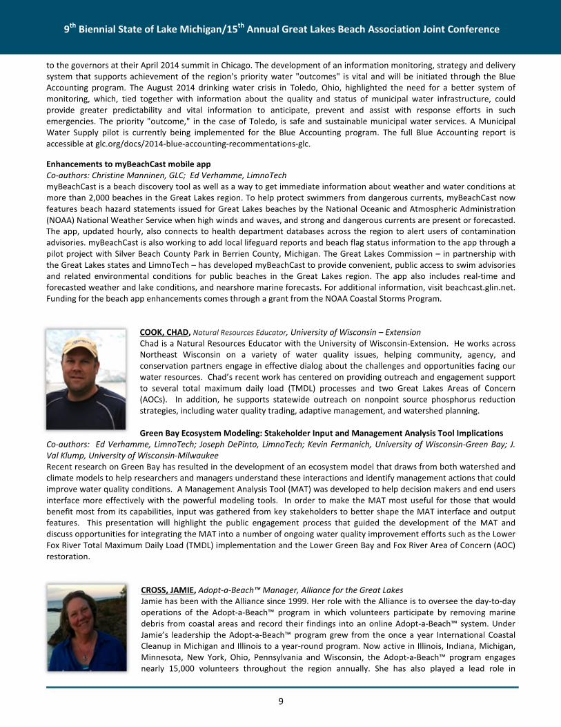
COLE, STEVE, Chief Information Officer, Great Lakes CommissionMr. Cole serves as Chief Information Officer of the Great Lakes Commission (GLC). As a member ofthe GLC’s senior management team, Mr. Cole leads the development and implementation of astrategic vision for converting data on the Great Lakes economy and environment into accessibleinformation: actionable knowledge that better supports decision-making for the future of the GreatLakes including environmental management, economic development, and social and cultural value.Refining and implementing this strategic vision is a collaborative process involving leaders andstakeholders from the private sector, government, academia, the non-governmental community andothers. It builds upon the report, “Great Lakes Blue Accounting: Empowering Decisions to RealizeRegional Water Values,” presented to the Great Lakes governors in April 2014
(http://glc.org/docs/2014-blue-accounting-recommendations-glc/). Prior to joining the GLC, Mr. Cole enjoyed a series ofsuccessful executive positions in the private sector creating and managing information services and technology businessesfrom start-up to market leadership.
Great Lakes Blue Accounting: Empowering Decisions to Realize Regional Water ValuesCo-authors: Kathy Buckner, Council of Great Lakes Industries; Tim Eder, GLC; Christine Manninen, GLC; Jennifer Read,University of Michigan Water Center; Paul Seelbach, U.S. Geological Survey, Great Lakes Science CenterIn 2013, the Great Lakes governors and premiers called for a comprehensive approach to monitoring Great Lakes waterresources. In response, the GLC convened a binational workgroup with broad expertise from the government, industry,academic and NGO sectors. Building on their collective wisdom, the GLC proposed adoption of Great Lakes Blue Accounting
9th Biennial State of Lake Michigan/15th Annual Great Lakes Beach Association Joint Conference
9
to the governors at their April 2014 summit in Chicago. The development of an information monitoring, strategy and deliverysystem that supports achievement of the region's priority water "outcomes" is vital and will be initiated through the BlueAccounting program. The August 2014 drinking water crisis in Toledo, Ohio, highlighted the need for a better system ofmonitoring, which, tied together with information about the quality and status of municipal water infrastructure, couldprovide greater predictability and vital information to anticipate, prevent and assist with response efforts in suchemergencies. The priority "outcome," in the case of Toledo, is safe and sustainable municipal water services. A MunicipalWater Supply pilot is currently being implemented for the Blue Accounting program. The full Blue Accounting report isaccessible at glc.org/docs/2014-blue-accounting-recommentations-glc.
Enhancements to myBeachCast mobile appCo-authors: Christine Manninen, GLC; Ed Verhamme, LimnoTechmyBeachCast is a beach discovery tool as well as a way to get immediate information about weather and water conditions atmore than 2,000 beaches in the Great Lakes region. To help protect swimmers from dangerous currents, myBeachCast nowfeatures beach hazard statements issued for Great Lakes beaches by the National Oceanic and Atmospheric Administration(NOAA) National Weather Service when high winds and waves, and strong and dangerous currents are present or forecasted.The app, updated hourly, also connects to health department databases across the region to alert users of contaminationadvisories. myBeachCast is also working to add local lifeguard reports and beach flag status information to the app through apilot project with Silver Beach County Park in Berrien County, Michigan. The Great Lakes Commission – in partnership withthe Great Lakes states and LimnoTech – has developed myBeachCast to provide convenient, public access to swim advisoriesand related environmental conditions for public beaches in the Great Lakes region. The app also includes real-time andforecasted weather and lake conditions, and nearshore marine forecasts. For additional information, visit beachcast.glin.net.Funding for the beach app enhancements comes through a grant from the NOAA Coastal Storms Program.
COOK, CHAD, Natural Resources Educator, University of Wisconsin – ExtensionChad is a Natural Resources Educator with the University of Wisconsin-Extension. He works acrossNortheast Wisconsin on a variety of water quality issues, helping community, agency, andconservation partners engage in effective dialog about the challenges and opportunities facing ourwater resources. Chad’s recent work has centered on providing outreach and engagement supportto several total maximum daily load (TMDL) processes and two Great Lakes Areas of Concern(AOCs). In addition, he supports statewide outreach on nonpoint source phosphorus reductionstrategies, including water quality trading, adaptive management, and watershed planning.
Green Bay Ecosystem Modeling: Stakeholder Input and Management Analysis Tool ImplicationsCo-authors: Ed Verhamme, LimnoTech; Joseph DePinto, LimnoTech; Kevin Fermanich, University of Wisconsin-Green Bay; J.Val Klump, University of Wisconsin-MilwaukeeRecent research on Green Bay has resulted in the development of an ecosystem model that draws from both watershed andclimate models to help researchers and managers understand these interactions and identify management actions that couldimprove water quality conditions. A Management Analysis Tool (MAT) was developed to help decision makers and end usersinterface more effectively with the powerful modeling tools. In order to make the MAT most useful for those that wouldbenefit most from its capabilities, input was gathered from key stakeholders to better shape the MAT interface and outputfeatures. This presentation will highlight the public engagement process that guided the development of the MAT anddiscuss opportunities for integrating the MAT into a number of ongoing water quality improvement efforts such as the LowerFox River Total Maximum Daily Load (TMDL) implementation and the Lower Green Bay and Fox River Area of Concern (AOC)restoration.
CROSS, JAMIE, Adopt-a-Beach™ Manager, Alliance for the Great LakesJamie has been with the Alliance since 1999. Her role with the Alliance is to oversee the day-to-dayoperations of the Adopt-a-Beach™ program in which volunteers participate by removing marinedebris from coastal areas and record their findings into an online Adopt-a-Beach™ system. UnderJamie’s leadership the Adopt-a-Beach™ program grew from the once a year International CoastalCleanup in Michigan and Illinois to a year-round program. Now active in Illinois, Indiana, Michigan,Minnesota, New York, Ohio, Pennsylvania and Wisconsin, the Adopt-a-Beach™ program engagesnearly 15,000 volunteers throughout the region annually. She has also played a lead role in

9th Biennial State of Lake Michigan/15th Annual Great Lakes Beach Association Joint Conference
10
development of the Great Lakes Marine Debris Action Plan by working in partnership with the National Oceanic andAtmospheric Administration to convene stakeholders and facilitate the development of the action plan.
Abundance and environmental drivers of anthropogenic litter on 5 Lake Michigan beachesCo-authors: Timothy J. Hoellein, Department of Biology, Loyola University; Meagan Westhoven, Department of Biology,Loyola University; Olga Lyandres, Alliance for the Great LakesThe abundance and environmental drivers of anthropogenic litter (i.e., trash; AL) in marine habitats is well studied, butfreshwater research lags behind. The Adopt-a-Beach™ (AAB) program, administered by the Alliance for the Great Lakes,directed volunteer litter collection on Great Lakes beaches since 1991. Our first study analyzed AAB records for five LakeMichigan beaches that span a population gradient to quantify AL density, infer AL sources, and characterize seasonality.Human population density was positively related to AL density. Over 72% of AL was smoking and food-related, indicatingmost AL originated from activities occurring on or near the beaches. AL was most abundant in fall, suggesting beachmaintenance might reduce AL in summer.
Our second project analyzed AAB data at 214 Lake Michigan beaches to examine relationships between AL and river mouthproximity, fishing activity, and population density. Unexpectedly, AL abundance was unrelated to river mouth proximity andnear-shore fishing activity. Like our first assessment, data showed AL increased with county population density, and consistedmostly of food and smoking-related items from beach visitors. This supports our initial analysis related to five Lake Michiganbeaches: the majority of AL originates directly on or adjacent to the beaches.
We can assume higher populations in counties surrounding beaches lead to more beach visitors, leading to more AL.Measurements of beach visitor population would be more useful than population density, but are unavailable. Results fromthe analyses will guide refinement of protocols for AL removal and prevention on Great Lakes beaches and elsewhere. Littermitigation should focus on beach-goer behavior which generates food- and smoking-related AL.
DAVID, SOLOMON, Postdoctoral Research Associate, Shedd AquariumDr. Solomon David joined Shedd in 2012 as a postdoctoral research associate in the Daniel P.Haerther Center for Conservation and Research. His work focuses on migratory patterns ofnearshore fishes in Lake Michigan and the importance these migrations play in Great Lakesecosystems. Dr. David’s work is part of a joint position between Shedd and the University ofWisconsin, Madison Center for Limnology. He comes to Shedd from a postdoctoral researchfellowship at the University of Michigan School of Natural Resources & Environment, where hestudied aquatic conservation ecology and sustainable aquaculture. Dr. David holds a master'sdegree and doctorate from the University of Michigan, where he studied conservation ecology of
Great Lakes fishes, including projects focused on lake trout, Chinook salmon and the spotted gar.
Characterizing Great Lakes Migratory Fish Species: Basin-wide Patterns and New DiscoveriesCo-authors: Matthew Herbert, Mary Khoury, Patrick Doran, and Eugene Yacobson, The Nature Conservancy; Ashley Moerke;Lake Superior State University; Peter McIntyre, University of Wisconsin – Madison Center for LimnologyThe Laurentian Great Lakes are comprised of a variety of aquatic habitats and diversity of fishes, nearly 200 species, many ofwhich make seasonal spawning migrations connecting ecosystems. Aside from game species, many Great Lakes migratoryfishes are understudied, nor are their distributions and life history traits comprehensively documented. To categorize the lifehistory variation among native and exotic migratory fishes of the Great Lakes, we surveyed literature, field reports, andpolled Great Lakes fishes experts to generate a comprehensive list of 55 species, focusing only on spawning migrants. Wethen created a “trait matrix” of 25 life history characteristics (e.g. iteroparous versus semelparous, facultative versus obligatemigrants) classifying Great Lakes migratory species. To better understand the distribution of Great Lakes migratory species,we developed a presence-absence map of migratory species by coastal watershed for the entire Great Lakes region. Finally,we focused on several “migratory hotspots” in the Great Lakes region to compare and describe localized biodiversity,phenology, and habitats. We will also highlight findings from our field sampling for migratory Lake Whitefish and impacts ofbarrier removal on Northern Pike in the Green Bay watershed. Our study provides a comprehensive overview of the diversity,life history, and distribution of Great Lakes migratory fishes. Because these species traverse and connect a variety of aquatichabitats, they can serve as environmental indicators of ecosystem health; therefore, understanding their life history anddistribution are important components of conserving biodiversity in the largest surface freshwater system on Earth.

9th Biennial State of Lake Michigan/15th Annual Great Lakes Beach Association Joint Conference
11
DODSON, MEGAN, Meteorologist, National Oceanic and Atmospheric Administration, NationalWeather ServiceMegan Dodson is a Meteorologist from the National Weather Service, passionately involved inwater safety efforts across the Great Lakes. Dodson managed the beach hazards program at theMarquette, Michigan, Forecast Office through 2014, and then joined the Beach Hazards Program atthe Northern Indiana Office. She maintains the Great Lakes Current Incident Database, a record ofcurrent-related fatalities and rescues across the region, and uses this data to improve forecasting,outreach, and education related to dangerous currents and waves. Dodson was awarded the 2014Van Snider award for exemplary partnership with Michigan Sea Grant. As part of severalcollaborative projects, she used the database to help Sea Grant develop new outreach materials
and provide support for water safety efforts and funding across the Great Lakes. Her passion is educating people aboutweather and water safety, and working with key decision makers in the community to protect life and property.
Applications from the Great Lakes Current Incident Database: Beach Safety & ForecastsEach summer there are an average of 11 fatalities and 25 rescues due to dangerous currents on the Great Lakes. The NationalWeather Service maintains the Great Lakes Current Incident Database, a 14 year archive of current-related incidents. Casestudies were completed on over 450 current related incidents to learn about where and when dangerous currents form inorder to improve National Weather Service beach hazards forecasts and statements. Victim demographics were alsocollected to improve beach safety outreach and education efforts. The Great Lakes see millions of visitors each year at StateParks alone, most within a 3-4 month period in the summer. The key to keeping these beachgoers safe is knowledge. Beachmanagers and others in the water safety community need to understand where, when, and why dangerous currents form sothat they can consistently communicate the risk to the public and designate safe places and best practices for swimming attheir local parks. This presentation will give an overview of the Great Lakes Current Incident Database statistics, and coverNational Weather Service decision making tools such as beach forecasts, statements, and webpages.
DURIS, JOSEPH W., Water Quality Specialist, U.S. Geological Survey (USGS), Michigan-Ohio WaterScience CenterJoe Duris received his MS in Biological Science from Western Michigan University. He has workedfor the USGS at the Michigan Water Science Center in Lansing, Michigan, for the past 13 years. In2011, he became the Center’s Water Quality Specialist and now oversees study design, dataquality, and reporting for USGS water-quality studies around the state and region. Joe’s researchinterests include understanding how human practices, including agriculture and urbanization,affect the occurrence, distribution, fate and transport of nutrients, sediment, trace organiccompounds, and bacteria in surface water. Joe also leads a USGS team that is researching how
contaminants delivered to the Great Lakes impact the formation and cessation of harmful algal blooms.
Chemicals of Emerging Concern: Findings from Monitoring of Tributaries of Lake MichiganCo-authors: Steven R. Corsi; Peter L. Lenaker; Austin K. Baldwin; Angela K. Brennan; Brett A. HayhurstMany tributaries to Lake Michigan have a history of contamination from legacy contaminants (heavy metals, polychlorinatedbiphenyls [PCBs]); however, additional “contaminants of emerging concern” are present in these tributaries as well(wastewater contaminants, organic carbon, pathogens). From 2010 through 2014, the USGS, as part of the Great LakesRestoration Initiative, sampled 17 tributaries to Lake Michigan. All sites were sampled in 2010 and again in 2014 using passivesampling devices, including polar organic chemical integrative sampler (POCIS) samplers that monitor potentially-toxichydrophilic contaminants and semi-permeable membrane devices (SPMDs) designed to mimic biological membranes, such asfish gills. Additional samples were collected at a sub-set of sites monthly during base-flow and high-flow conditions andanalyzed for chemicals of emerging concern.
In 2010, passive sediment traps were installed at seven Lake Michigan Areas of Concern (AOCs). The sediments were analyzedfor over 150 constituents, including polycyclic aromatic hydrocarbons (PAHs) and total PCBs. Findings from these USGSmonitoring programs will be summarized and presented for sites draining to Lake Michigan, and put in context with the other42 tributaries that were monitored in the Great Lakes basin. Variability in chemistry and in pathogen occurrence appears tobe related to land-use and river discharge, but in some cases chemical variability is unique to individual sites. Initial findingsindicate that there are multiple classes of contaminants present in Lake Michigan tributaries at levels of concern includingPAHs, pharmaceuticals, and pesticides. The information collected, as a part of the Great Lakes Restoration Initiative, may beused by water managers to focus restoration goals and act as a measure to overall efforts of restoration in Lake Michigan.
9th Biennial State of Lake Michigan/15th Annual Great Lakes Beach Association Joint Conference
12
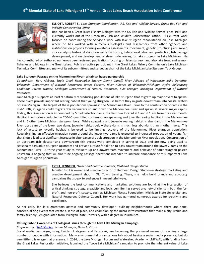
ELLIOTT, ROBERT F., Lake Sturgeon Coordinator, U.S. Fish and Wildlife Service, Green Bay Fish andWildlife Conservation OfficeRob has been a Great lakes Fishery Biologist with the US Fish and Wildlife Service since 1993 andcurrently works out of the Green Bay Fish and Wildlife Conservation Office. His current workfocuses on coordinating the Service’s work with lake sturgeon rehabilitation on Lake Michiganwhere he has worked with numerous biologists and researchers from other agencies andinstitutions on projects focusing on status assessments, movement, genetic structuring and mixedstock analysis, historic distribution, early life history, habitat evaluation and protection, fish passagedevelopment, and on development of streamside rearing for lake sturgeon in Lake Michigan. He
has co-authored or authored numerous peer reviewed publications focusing on lake sturgeon and also lake trout and salmonfisheries and biology in the Great Lakes. Rob is an active participant in the Great Lakes Fishery Commission’s Lake MichiganTechnical Committee and many of its subcommittees and served as chair of the Lake Michigan Lake Sturgeon Task Group.
Lake Sturgeon Passage on the Menominee River - a habitat based partnershipCo-authors: Rory Alsberg, Eagle Creek Renewable Energy; Denny Caneff, River Alliance of Wisconsin; Mike Donofrio,Wisconsin Department of Natural Resources; James Fossum, River Alliance of Wisconsin/Michigan Hydro RelicensingCoalition; Darren Kramer, Michigan Department of Natural Resources; Kyle Krueger, Michigan Department of NaturalResourcesLake Michigan supports at least 9 naturally reproducing populations of lake sturgeon that migrate up major rivers to spawn.These rivers provide important rearing habitat that young sturgeon use before they migrate downstream into coastal watersof Lake Michigan. The largest of these populations spawns in the Menominee River. Prior to the construction of dams in themid-1800s, sturgeon could migrate 132 kilometers up and down the Menominee River and spawn at several major rapids.Today, this river section is impounded by 5 hydroelectric dams, the first two located 4.3 and 6.1 Km from the river mouth.Habitat inventories conducted in 2004-5 quantified contemporary spawning and juvenile rearing habitat in the Menomineeand in 5 other Lake Michigan sturgeon rivers. While spawning and juvenile rearing habitat is abundant in the MenomineeRiver upstream of the lower two dams, juvenile habitat below these dams is much less abundant than in other rivers. Thislack of access to juvenile habitat is believed to be limiting recovery of the Menominee River sturgeon population.Reestablishing an effective migration route around the lower two dams is expected to increased production of young fishthat should lead to a significant increase in abundance of adult sturgeon in the Menominee River population. Construction ofan upstream fish elevator and downstream fish bypass were completed in spring of 2015 and are now being used toseasonally pass adult sturgeon upstream and provide a route for all fish to pass downstream around the lower 2 dams on theMenominee River. A three year study to evaluate up and downstream movement and behavior of adult sturgeon passedupstream is ongoing that will fine tune ongoing passage operations intended to increase abundance of this important LakeMichigan sturgeon population.
ESTILL, JENNFIER, Owner and Creative Director, Redhead Design StudioJennifer Estill is owner and creative director of Redhead Design Studio—a strategy, marketing andcreative development shop in Old Town, Lansing. There, she helps build brands and advocacycampaigns that speak to audiences in meaningful ways.
She believes the best communications and marketing solutions are found at the intersection ofcritical thinking, strategy, creativity and logic. Jennifer has served a variety of clients in both the for-profit and non-profit sectors, such as Michigan Fitness Foundation, Michigan State University, andNatural Resources Defense Council. Her work has garnered numerous awards for creativity andexcellence.
At her core, Jen is a grassroots activist and community developer—building neighborhoods where there are none,conceptualizing events that create a sense of place, and championing the micro-infrastructures that make a city livable andfamily-friendly. Jen graduated from Michigan State University with a degree in Journalism.
Raising Public Awareness of Ecological Issues through the Love Lake Michigan CampaignCo-presenter: Todd Parker, Senior Manager, Delta InstituteSocial media campaigns, using Twitter, Instagram and Facebook, are becoming the preferred means of reaching a largenumber of people with information. Many environmental organizations talk about having a social media presence, but dovery little to leverage that presence. In 2014, the Lake Michigan Forum and Watershed Academy (LMFWA), with funding fromthe Great Lakes Restoration Initiative, launched the “Love Lake Michigan” campaign to promote the inherent value of Lake

9th Biennial State of Lake Michigan/15th Annual Great Lakes Beach Association Joint Conference
13
Michigan. This social media focused, public engagement campaign encourages individual and collective action towardimplementation of Lake Michigan Lakewide Action and Management Plan (LAMP) priorities. Key elements of this campaignare the #LoveLakeMichigan hashtag and the Love Lake Michigan (www.lovelakemichigan.org) web site. This site is theprimary entry point for citizen engagement. Through social media, marketing materials, and personal outreach at localevents, the LMFWA is driving citizens to this site, where they can view the Lake Michigan 101 training modules, volunteer forcommunity events, provide feedback to EPA on Lake Michigan LAMP priorities, and take the “I Love Lake Michigan” pledgefor Lake Michigan stewardship. This campaign continues to increase public awareness of issues related to the water qualityof Lake Michigan, expand the range of opportunities for Great Lakes stakeholders and citizens to provide input to thegovernments and participate in Great Lakes issues and concerns and catalyze individual and collective action towardecosystem stewardship. In this workshop, the Lake Michigan Forum will discuss the creation, branding, management,implementation and impact of this social media campaign. We will present a variety of media and discuss how we have beenable effectively harness the power of social media to increase awareness of the inherent value of Lake Michigan. We will alsodiscuss how organizations can creatively and effectively brand their outreach campaigns for maximum exposure.
EWERT, DAVE, Senior Conservation Scientist, The Nature Conservancy
Lake Michigan islands: A biodiversity and conservation overviewThe 32,000 islands of the Great Lakes are the largest collection of freshwater islands in the world.The Great Lakes islands are outstanding in biological diversity, including the 726 islands in LakeMichigan. They are important areas for colonial nesting waterbirds, harbor unique assemblages ofplants and animals, and provide stopover sites for migrating birds. They make a significant
contribution to the physical and biological diversity of the Great Lakes and surrounding basin. These islands are biologicallyunique, and by their very nature, isolated and sensitive to change and also buffered from some threats on the mainland,including some pathogens and invasive species and perhaps climate change.
We established criteria for ranking biodiversity values and evaluated threats to Great Lakes islands. These criteria includedtracked species, coastal habitats, and island complexity. We then ranked islands of the Great Lakes and connecting watersbasin-wide and by coastal segment. We present a synopsis of our results for Lake Michigan, which appear in Islands of Life,and provide examples how this ranking system can be and has been used by Lake Michigan conservation practitioners toprotect these islands.
EWING, BECKY, Associate Director, Rotary Charities of Traverse City
Prosperity planning – a new look at the concept of watershed planning beyond dam removal:Boardman River Reborn - Community Lessons in Dam Removal
FEDORA, MARK, Supervisory Hydrologist, Ottawa National ForestMark Fedora has worked on road-stream crossing issues and aquatic connectivity for nearly twentyyears. He has helped to conduct over a dozen workshops on inventory, assessment, prioritization,design, and construction of road-stream crossings. Mark has been a hydrologist for the U.S. ForestService for 26 years, with a MS from Oregon State University and a BS from the University ofMinnesota.
Mapping watershed infrastructure vulnerability in the western Upper Peninsula of MichiganCo-authors: Chris Kovala, Environmental Coordinator, Ottawa National Forest; Colin Brooks, Senior
Research Scientist, and David Banach, Assistant Research Scientist, Michigan Tech Research InstituteWe used road density and weighted hydrologic soil groups to map the relative vulnerability of infrastructure in 6th levelwatersheds of the western Upper Peninsula. We developed a road data set from National Forest data and the Michigan StateFramework. Watersheds were assigned a relative vulnerability rating in five categories from very low to very high.

9th Biennial State of Lake Michigan/15th Annual Great Lakes Beach Association Joint Conference
14
Watersheds with deep sandy soils and low road densities received a very low risk rating, while watersheds with clay soils orshallow to bedrock soils and high road densities received a very high risk rating. The geographic analysis will assist us inprioritizing infrastructure inventories and “right size” road/stream crossings in watersheds with high vulnerability ratings.Our findings showed that watersheds on National Forest lands generally had a higher risk, due to higher road densities. Uponexamination of aerial imagery, we observed numerous miles of unmapped roads on other ownerships. We have sincemapped 8,000 miles of previously unmapped roads, with an additional 3,300 road-stream crossings, and plan to repeat ourwatershed infrastructure vulnerability mapping effort to see how the patterns across the landscape may change.Infrastructure vulnerability mapping is an effective tool to help managers prioritize replacement of road-stream crossings in achanging climate while restoring tributary connectivity.
FERMANICH, KEVIN, Professor, Environmental Science and Geoscience, Natural and Applied Science, University of Wisconsin-Green BayKevin Fermanich is Professor of Environmental Science and Geoscience at the University of Wisconsin (UW)-Green Bay, wherehe holds the Barbara Hauxhurst Cofrin Professorship of Natural Sciences. Since 2003, Dr. Fermanich has been Director of theLower Fox River Watershed Monitoring Program, a program involving local, state, federal, and university scientists andmanagers to assess impairments, sources, and management of runoff pollution. He served on the Lower Fox River TotalMaximum Daily Load (TMDL) technical advisory committee and currently serves on the LFR Demo Farms Project advisoryteam and NEW Water’s Silver Creek Adaptive Management Project advisory committee. Dr. Fermanich received his BSdegree in soil science from the University of Wisconsin-Stevens Point and MS and PhD degrees in soil science (waterresources emphasis) from UW-Madison.
Nutrient Export to Green Bay under Various Watershed Management and Climate ScenariosCo-authors: Paul Baumgart and Alexis Heim, UW-Green Bay; David Lorenz, UW–Madison; J. Val Klump, UW – MilwaukeeThe Fox-Wolf River watershed supplies more than two-thirds of the total P and sediment load to Green Bay. Phosphorusexport from Lake Winnebago to the Lower Fox River is equivalent to more than half (~60%) of the annual export to the lowerbay. Point source P discharges represent <20% of the total P load. Similar to many Lake Michigan tributaries, Fox Rivernutrient loads are closely linked to agricultural land-use intensity and management. In this study, we simulated alternativewatershed management pathways under current and projected mid-century climate conditions using linked Soil WaterAssessment Tool (SWAT) models for the Wolf River, Upper Fox River, Lake Winnebago, Plum Creek, and Lower Fox Riverwatersheds. More than 15 flow, concentration, and load monitoring stations were used to calibrate and validate the models.Watershed stakeholders provided guidance on various future agricultural management options for the watersheds. Wesimulated the impact of multiple levels of crop tillage/residue, cover crop, perennial vegetation (including grazing), andnutrient management strategies on sediment and phosphorus export to Green Bay. Nutrient management strategies thatstabilize and reduce soil phosphorus levels appear to have the largest impact on overall tributary P export (>20% reductions).Widespread implementation of minimum tillage practices and increased perennial cropping are potential strategies that willgreatly reduce (>25%) overall sediment loads. Various SWAT modeling scenario outputs were incorporated into a decisionsupport tool to inform end users and assist decision makers in watershed and AOC management efforts. Under both currentand future climate scenarios, field and watershed-wide management systems that reduce the vulnerability of the landscapeto nutrient losses during intense precipitation and runoff events are critical to meeting restoration goals for the Green Bayecosystem.
FONTENELLE, SAMANTHA, Lieutenant Commander, U.S. Environmental Protection AgencyLieutenant Commander Samantha Fontenelle is an Environmental Protection Specialist with theU.S. Environmental Protection Agency (U.S. EPA), Office of Water, Office of Science andTechnology. Her current duties include supporting the U.S. EPA’s fish and beach programs. Prior tojoining the U.S. EPA, Lieutenant Commander Fontenelle worked in the private sector as acontractor to the U.S. Department of Energy. Lieutenant Commander Fontenelle has a Masters ofPublic Health from The Johns Hopkins University and a Masters of Arts in Environmental Studiesfrom the University of Illinois at Springfield.

9th Biennial State of Lake Michigan/15th Annual Great Lakes Beach Association Joint Conference
15
Six Key Steps for Developing and Using Predictive Tools at Your BeachCo-author and presenter: Dr. Joanna Mott, Professor of Biology and Chair of Life Sciences Department, Texas A&M University– Corpus ChristiTo reduce exposure to waterborne pathogens at bathing beaches, beach managers need tools that can provide a quick,reliable indication of water quality conditions. The U.S. EPA encourages the use of predictive tools to make timely beachnotification decisions and to deliver same-day notifications. To help states and tribes with developing and implementingpredictive tools at the beaches, the U.S. EPA developed a simple “How To” Guide based on input from seven beach managerswho have successfully implemented a predictive model at their beaches. The beach managers were interviewed tounderstand the process that each used in developing his/her model. The draft guidance was pilot tested by the Texas BeachWatch Program to assess the utility of the guidance. While predictive tools have been shown to work well at some beaches,the development and implementation of predictive tools for use at coastal beaches remains a challenge for most beachprograms.
FRANCY, DONNA, Hydrologist, U.S. Geological SurveyDonna Francy is the water-quality specialist with the U.S. Geological Survey (USGS) Ohio WaterScience Center in Columbus, Ohio. She received a Bachelor's degree in Biology from IndianaUniversity and a Master's degree in Environmental Science from Rice University, Houston, Texas. Shehas over 20 years’ experience in environmental microbiology with prior experience as a clinicalmicrobiologist. At the USGS, she has been serving as project chief on studies that address developingand implementing predictive models for nowcasting recreational water-quality advisories at inlandand coastal beaches. Recently, she has focused research efforts on understanding what triggers toxinproduction from cyanobacterial harmful algal blooms (cyanoHABs) in recreational and source waters
and determining what factors and tools can be used to help support predictive capabilities for cyanoHABs.
Factors Related to Microcystin Concentrations at Ohio Recreational LakesCo-authors: Jennifer Graham, Erin Stelzer, Christopher Ecker, Keith Loftin, and Amie Brady, USGS; and Pamela Struffolino,University of ToledoCyanobacterial harmful algal blooms (cyanoHABs) and associated toxins, such as microcystin, are a major global water-qualityissue. CyanoHAB prediction is complicated and site-specific because of the many factors affecting toxin production, but it isan important goal for public health protection. Monitoring and evaluation of environmental factors that affect thecyanobacterial community may be used to predict the occurrence of cyanoHABs. Samples were collected at Ohiorecreational lakes during May–November in 2013–14. Physical parameters were measured at the time of sampling, andcomposite samples collected from the swimming area were analyzed for nutrients, toxins, phytoplankton abundance andbiovolume, and cyanobacterial genes. Weather, hydrologic, and water-quality data were evaluated for use as factors in dailyand long-term predictive models. Continuously-measured factors and available environmental data are used for dailypredictions of elevated toxin concentrations that do not require a site visit. Results from samples collected and analyzed in alaboratory along with daily factors are used for long-term (a few days to several weeks) predictions. Throughout eachseason, the cyanobacterial community and the dominant taxa associated with peak microcystin concentrations were uniqueto individual lakes. Statistically significant correlations between microcystin concentrations and factors for daily predictionsincluded phycocyanin, turbidity, pH, discharge from a nearby river, and Secchi depth. The cyanobacterial genes that weremost significantly correlated to microcystin concentrations were different among the lakes sampled. For long-termpredictions, concentrations of several nutrients were significantly correlated to microcystin concentrations. The results ofthis study showed that environmental factors are promising for use in site-specific daily or long-term predictive models forcyanoHABs at recreational areas. Future studies should focus on collecting more frequent data on 3-4 consecutive days eachweek and applying a statistical method, such as multiple-linear regression, to develop models to nowcast or forecast toxinconcentrations.
9th Biennial State of Lake Michigan/15th Annual Great Lakes Beach Association Joint Conference
16
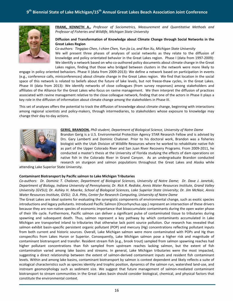
FRANK, KENNETH A., Professor of Sociometrics, Measurement and Quantitative Methods andProfessor of Fisheries and Wildlife, Michigan State University
Diffusion and Transformation of Knowledge about Climate Change through Social Networks in theGreat Lakes RegionCo-authors: Tingqiao Chen, I-chien Chen, Yun-jia Lo, and Ran Xu, Michigan State UniversityWe will present three phases of analyses of social networks as they relate to the diffusion ofknowledge and policy orientated behavior in the Great Lakes region. Phase I (data from 1997-2009):We identify a network based on who co-authored policy documents about climate change in the GreatLakes region, finding that those who bridged between clusters in the network were more likely to
engage in policy oriented behaviors. Phase II (data from 2009-2013): We define a network based on participation in events(e.g., conference calls, miniconferences) about climate change in the Great Lakes region. We find that location in the socialspace of this network is related to beliefs about the future of lake levels, but not freeze-thaw cycles, in the Great Lakes.Phase III (data from 2013): We identify networks of close colleagues (from survey responses) among stakeholders andaffiliates of the Alliance for the Great Lakes who focus on ravine management. We then interpret the diffusion of practicesassociated with ravine management relative to the close colleague network, finding that one of the actors in Phase II plays akey role in the diffusion of information about climate change among the stakeholders in Phase III.
This set of analyses offers the potential to track the diffusion of knowledge about climate change, beginning with interactionsamong regional scientists and policy-makers, through intermediaries, to stakeholders whose exposure to knowledge maychange their day-to-day actions.
GERIG, BRANDON, PhD student, Department of Biological Science, University of Notre DameBrandon Gerig is a U.S. Environmental Protection Agency STAR Research Fellow and is advised byDrs. Gary Lamberti and Dominic Chaloner. Prior to his doctoral work, Brandon was a fisheriesbiologist with the Utah Division of Wildlife Resources where he worked to rehabilitate native fishas part of the Upper Colorado River and San Juan River Recovery Programs. From 2009-2011, heconducted a master's thesis at the University of Florida studying the effects of dam operations onnative fish in the Colorado River in Grand Canyon. As an undergraduate Brandon conductedresearch on sturgeon and salmon populations throughout the Great Lakes and Alaska while
attending Lake Superior State University.
Contaminant Biotransport by Pacific salmon to Lake Michigan TributariesCo-authors: Dr. Dominic T. Chaloner, Department of Biological Sciences, University of Notre Dame; Dr. Dave J. Janetski,Department of Biology, Indiana University of Pennsylvania; Dr. Rick R. Rediske, Annis Water Resources Institute, Grand ValleyUniversity (GVSU); Dr. Ashley H. Moerke, School of Biological Sciences, Lake Superior State University; Dr. Jim McNair, AnnisWater Resources Institute, GVSU; D.A. Pitts, Center for Research Computing, University of Notre DameThe Great Lakes are ideal systems for evaluating the synergistic components of environmental change, such as exotic speciesintroductions and legacy pollutants. Introduced Pacific Salmon (Oncorhynchus spp.) represent an intersection of these driversbecause they are non-native species of economic importance that bioaccumulate contaminants during the open water phaseof their life cycle. Furthermore, Pacific salmon can deliver a significant pulse of contaminated tissue to tributaries duringspawning and subsequent death. Thus, salmon represent a key pathway by which contaminants accumulated in LakeMichigan are transported inland to tributaries that otherwise lack point source pollution. Our research has revealed thatsalmon exhibit basin-specific persistent organic pollutant (POP) and mercury (Hg) concentrations reflecting pollutant inputsfrom both current and historic sources. Overall, Lake Michigan salmon were more contaminated with POPs and Hg thanconspecifics from Lakes Huron or Superior. Consequently, Lake Michigan salmon pose a higher risk and magnitude ofcontaminant biotransport and transfer. Resident stream fish (e.g., brook trout) sampled from salmon spawning reaches hadhigher pollutant concentrations than fish sampled from upstream reaches lacking salmon, but the extent of fishcontamination varied among lake basins and streams. In general, Lake Michigan tributaries were the most impacted,suggesting a direct relationship between the extent of salmon-derived contaminant inputs and resident fish contaminantlevels. Within and among lake basins, contaminant biotransport by salmon is context dependent and likely reflects a suite ofecological characteristics such as species identity and trophic position, dynamics of the salmon run, watershed land-use, andinstream geomorphology such as sediment size. We suggest that future management of salmon-mediated contaminantbiotransport to stream communities in the Great Lakes basin should consider biological, chemical, and physical factors thatconstitute the environmental context.

9th Biennial State of Lake Michigan/15th Annual Great Lakes Beach Association Joint Conference
17
GIBBONS, ELIZABETH, Director, University of Michigan Climate Center and Program Manager, GreatLakes Integrated Sciences + Assessments (GLISA)Beth Gibbons is the director of the University of Michigan’s Climate Center and the ProgramManager of GLISA, National Oceanic and Atmospheric Administration’s Great Lakes regional center.In both roles, her core responsibilities include fostering the transfer of information on climatechange and resilience from the research community to stakeholders throughout the region andsharing best practices across practitioner communities. Beth holds a graduate degree in Urban andRegional Planning from the University of Michigan and has worked in the U.S. and Africa on a varietynatural resource management, community, and economic development initiatives.
Climate Data Localization and Resources for Great Lakes CommunitiesCo-authors: William Baule, Daniel Brown, and Laura Briley, GLISAGLISA, a cooperative effort between the University of Michigan and Michigan State University, functions as a bridge betweenclimate science researchers and boundary organizations in the Great Lakes region, with the goal of contributing to the long-term sustainability of the region in face of a changing climate and to facilitate smart decision-making backed by soundscientific knowledge. From a community/regional standpoint, making climate information relevant at the local level is key tostakeholders and decisions makers. This process is not trivial, as climate information in its raw form is often above the localscale. The process to localize the information for each community/region is an iterative process between GLISA staff andpractitioners in the boundary organization that identifies the unique interests of each group and tailors a summary to suittheir specific needs. This presentation will detail the process for the localization of climate data for two past GLISA-supportedprojects. The first community is the Sault Ste. Marie Band of Chippewa Indians. The second is an area of ravines alongwestern shore of Lake Michigan between Chicago and Milwaukee. Also to be presented will be the University of MichiganClimate Center's Cities Impacts and Adaptation Tool (CIAT) and how this tool can be used to access localized information. TheCIAT allows decision makers at the city level to access information such as: demographics, socioeconomic data, and historicaland projected climate information and trends. Using this information, decision-makers are able to identify a network ofclimate peers whose current climate reflects the projected climate for the specified location. Decision-makers, through theCIAT, also have access to a database of existing climate action plans from across the country to incorporate existingknowledge in their own operations.
GOWARD, KELLY, Macatawa Watershed Project Manager, Macatawa Area Coordinating CouncilKelly Goward has been the Macatawa Watershed Project Manager and the Macatawa AreaCoordinating Council since August 2012. Kelly works with numerous local partners to plan andcoordinate the implementation of best management practices and outreach and education effortsin the Macatawa Watershed, as well as provide stormwater permit assistance to six local entities.She spent 8 years prior to 2012 working for the Ottawa and Allegan Conservation Districts as aforest and wildlife resource professional and later transitioned into watershed project management.Kelly has a B.S. in Biology from Grand Valley State University and an M.S. in Natural ResourcesManagement from Ball State University. Kelly is actively involved with the Michigan Chapter of theSoil and Water Conservation Society and Michigan Envirothon.
Agricultural Collaboration in the Macatawa WatershedThe Macatawa Watershed is a small watershed in southwest Michigan plagued by excess sediment and phosphorus. Thewatershed contains numerous streams and ditches that originate in agricultural areas and make their way through theurbanized heart of the watershed and into the Macatawa River. The river opens up into Lake Macatawa, a drowned rivermouth that enters Lake Michigan near Holland. The Macatawa Watershed Project was formed at the Macatawa AreaCoordinating Council in 1999 to address the development and implementation of a phosphorus reduction plan per a U.S.Environmental Protection Agency approved phosphorus total maximum daily load (TMDL). Over the years, numerous“random acts of conservation” were implemented in both the urban and agricultural areas of the watershed; however, theTMDL remains in effect today. An aggressive research project was initiated in 2010 to study the sources of sediment andphosphorus in the watershed in order to better target implementation efforts. The results of the research led to a private-public initiative titled Project Clarity that aims to raise funds and target implementation projects in areas of the watershedthat need it most. A major component of Project Clarity was the establishment of an Agricultural Advisory Committeecomprised of local producers and representatives of agribusiness. This group reviews proposed agricultural projects andmakes funding decisions. The group is advised by staff at the Macatawa Area Coordinating Council, the entity in charge of the

9th Biennial State of Lake Michigan/15th Annual Great Lakes Beach Association Joint Conference
18
phosphorus TMDL implementation plan, and the Outdoor Discovery Center Macatawa Greenway, who serves as the fiduciaryfor Project Clarity. This collaborative effort has brought together the agricultural community with private and public partnersin a unique way that has created a synergy that is unprecedented in the history of the watershed project. This presentationwill briefly outline the Macatawa Watershed Project and discuss our current efforts within the agricultural community.
GRIMM AMANDA, Assistant Research Scientist, Michigan Technological University – Michigan TechResearch InstituteAmanda Grimm is an Assistant Research Scientist at Michigan Tech Research Institute (MTRI),Michigan Technological University. She is a spatial ecologist interested in applying remote sensingand spatial analysis techniques to complex environmental questions. Amanda received an MS inNatural Resources & Environment from the University of Michigan, where she was part of the SNREEnvironmental Spatial Analysis Lab, and is a graduate of Michigan State University, where sheearned a BS in Environmental Zoology. Current research interests include remote sensing ofnearshore aquatic habitats and especially aquatic invasive species, ocean color remote sensing, andGreat Lakes coastal change.
Remote Sensing for Great Lakes Mapping and MonitoringCo-authors: Robert Shuchman, Michael Sayers, Colin Brooks, Laura Bourgeau-Chavez, Michigan Tech – MTRIRemote sensing provides a method to accurately assess and monitor many aspects of water quality, ice cover, habitat, andcoastal change for large lakes such as Lake Michigan. Satellites and aerial vehicles with optical, thermal, and microwavesensors collect data that span large geographic areas and have been in operation for over a decade and sometimes muchlonger. These long-term data sets, once processed and classified into products, allow the analysis of time series data todetermine how water quality and ecosystem conditions have changed, particularly in the light of a changing climate. Thispresentation reviews a variety of methods/products produced by Michigan Tech Research Institute that aid in environmentalmonitoring of the Great Lakes, including assessment of water quality, harmful algal blooms, lake temperature, ice cover,nearshore bathymetry, invasive species distributions, and shallow aquatic habitats. Access to these datasets will also bediscussed. MTRI is active in developing and applying user-friendly web portals for sharing Great Lakes remote sensing dataand derived products.
Mapping Submerged Aquatic Vegetation in the Great Lakes Using Satellite ImageryCo-authors: Colin Brooks, Robert Shuchman, Michael Sayers, Amanda Grimm, Michigan Tech – MTRI; Martin Auer, MichiganTechUnder U.S. Environmental Protection Agency GLRI funding, the Michigan Tech team has developed and verified a remotesensing algorithm to map the extent of Cladophora and other submerged aquatic vegetation (SAV) in the nearshore zone ofthe Great Lakes using an index that corrects for the effect of water depth. With this algorithm, maps of SAV were generatedfrom recent Landsat satellite imagery for all areas of the lower four Great Lakes that are shallow enough to detect the lakebottom. The area mapped varies depending on water clarity, with maximum mapping depth ranging from >20 m in LakeMichigan to 7 m in Lake Erie. The maps show that 28%, 15%, 30%, and 40% of the visible bottom of Lakes Michigan, Huron,Erie and Ontario, respectively, are colonized by SAV. The total mapped area of SAV is estimated to represent between130,000 and 260,000 metric tons dry weight based on published biomass density measurements. This new mapping approachwas validated using field data for an overall map accuracy of 83%. The archive of Landsat imagery, dating back to 1973, wasalso utilized to document historic changes in SAV extent and water clarity, showing increases in SAV extent in most areasfollowing the introduction of invasive mussels. The time series analyses also captured the observed increases in water clarityin all four lakes. Overall, the effects of invasive zebra and quagga mussels on water clarity and phosphorus availability in theLakes are enabling benthic vegetation to grow more densely and in deeper water than was previously possible, resulting innuisance blooms even in areas without strong point sources of nutrients. These new maps will support Cladophoramanagement efforts and help to prioritize areas for nutrient abatement programs.

9th Biennial State of Lake Michigan/15th Annual Great Lakes Beach Association Joint Conference
19
HAKALA, CINDY, Beach Program Coordinator, Minnesota Department of HealthCindy Hakala is the Beach Program Coordinator for the Minnesota Lake Superior Beach Monitoringand Notification Program at the Minnesota Department of Health. Cindy recently received herMasters of Environmental Education from the University of Minnesota Duluth. The informationpresented here was part of her thesis work, which she defended in March 2015.
Evaluating the Notification and Outreach Efforts of the Minnesota Beach ProgramThe Minnesota Lake Superior Beach Monitoring and Notification Program (Beach Program) strives to
give people the knowledge and skills necessary to recreate safely in water and practice beach stewardship. A formativeevaluation was conducted to assess to what degree the Beach Program has fulfilled its responsibility to notify the public ofthe services it provides and to make water recreation information available for the protection of human health andenvironmental health. Surveys were conducted at three Duluth, Minnesota, beaches in August 2014. Beachgoers were askedquestions about their knowledge, perceptions regarding risk, preferences for outreach methods and information, and waysthat they had received beach advisory notifications in the past.
Seventy surveys were conducted. Less than half of respondents said they had heard of the Beach Program or of beachadvisories. Frequent visitors to Lake Superior beaches were significantly more aware of a state water quality monitoringprogram and beach advisories than first time visitors (p<.01). Of participants who had heard of beach advisories for bacteria,the majority had learned of advisories from either TV/news or from signs at the beach. All respondents but one perceived thelevel of risk of getting sick from swimming in Lake Superior to be low. Over 90% of beachgoers asked for specific informationon the “types of illness associated with bacteria.” Other popular areas of information desired were “sources of bacteria” and“age-group specific information.” Results will be used to improve Beach Program outreach.
HAMIDI, SAJAD AHMAD, Research Associate, University of Wisconsin-MilwaukeeDr. Hamidi is a research associate in the civil and environmental engineering department, University ofWisconsin-Milwaukee. His current research is on hydrodynamic and biogeochemical modeling, studyof pollutants in lakes and coastal regions, and watershed management. He has been working forseveral years on developing hydrodynamic modeling framework for Lake Michigan to study thepollution transportation, bacteria, and hypoxia in several parts of the lake especially Green Bay.
Monitoring Spatial-Temporal Variations of Fox River Plume using MODIS Remote Sensing ImageryCo-authors: Hossein Hosseiny; Nima Ekhtari; Hector Bravo, University of Wisconsin-MilwaukeeRiver plumes are a major source of pollutants, nutrients, and sediment into coastal areas. Southern Green Bay supplies onethird of the total nutrient loading to Lake Michigan and has been designated as Area of Concern by the U.S. EnvironmentalProtection Agency. The Fox River is the main source of land-based pollutants into southern Green Bay. Identifying the coastalarea influenced by polluted river inflows is essential in any management plans and restoration efforts. The evaluation ofwater quality status is normally based on time-consuming and expensive in situ measurements. Remotely sensed data is anefficient alternative for river plume monitoring because of its spatial and temporal resolution. This study is a first attempt todevelop an empirical relationship between in situ measurement of turbidity and suspended sediment, and atmosphericallycorrected water surface reflectance values obtained from the Moderate Resolution Imaging Spectroradiometer (MODIS)aboard the Aqua satellite. The proposed method shows a reliable performance (R2=0.87) in estimation of turbidity andsuspended matter in southern Green Bay. The results are used to determine the spatial and temporal variability of Fox Riverplume. Spatial-temporal variability of river plume is correlated with the Fox River discharge. Cloud contamination of remotelysensed data imposes restrictions on the applicability of the proposed method, especially during floods. Nevertheless,remotely sensed data can be used to produce seasonal maps for distinct water quality parameter concentrations. Collectionof new in situ data, especially at the same time of remotely sensed data, will be useful in further validation of the proposedmethod. This study will improve our knowledge about the spatial-temporal variations of Fox River turbid plume and showsthe potential of moderate resolution images in monitoring and assessment of water quality in Great Lakes coastal areas.

9th Biennial State of Lake Michigan/15th Annual Great Lakes Beach Association Joint Conference
20
HARTZELL, CHRISTOPHER S., Technical Lead, Collins Engineers, Inc.Chris Hartzell is a licensed surveyor in the State of Wisconsin and currently the technical lead for 3Ddata acquisition systems at Collins Engineers, Inc. He has been working in the Surveying field since1994 with an extensive background in Land Surveying, 2D and 3D Acoustic Imaging andHydrographic Surveying. Chris has recently been involved in pioneering field operations and dataprocessing techniques for detailed underwater scanning of structures, from bridge piers toshipwrecks. He has experience with traditional total stations, robotic total stations, GPS systems,stationary and mobile Lidar systems, 2D, 3D and Multi-beam sonars, Coda motion referencesystems, AutoCAD, Civil 3D, SketchUp, Leica Cyclone, Trimble Real Works, CloudCompare, Hypackand many others. Chris is currently a member of the Wisconsin Society of Land Surveyors, the
National Society of Professional Surveyors, and The Hydrographic Society of America.
Managing Historic Shipwrecks in Lake Michigan with Mobile Sonar and 3D ModelingCo-authors: Dr. Kira E. Kaufmann, Commonwealth Cultural Resources Group; Roy A. Forsyth, Collins Engineers, Inc.In 2015, newer applications of remote sensing technology were employed to better define four archaeological shipwrecksites within Indiana’s territorial waters of Lake Michigan. For the first time in the Great Lakes region, a mobile 3D sonarsurvey was conducted at four shipwreck sites. Additionally, a diver-directed 3D sonar survey was conducted of the interior ofone shipwreck, the Material Service, which has substantial superstructure. The Material Service is one of the few, andperhaps the first, historic shipwrecks in the region that has been surveyed using side-scan sonar, diver-directed 3D sonar, andmobile 3D sonar. The historic shipwrecks in this study were investigated using a new application of mobile sonar technology.
Previous archaeological applications of mobile sonar technology have employed remotely operated vehicles (ROV’s) todeploy the sonar equipment at stationary locations. Because of the dynamic nature of the southern Lake Michigan basin, thissonar survey was based from a completely mobile platform – a moving vessel – in a manner similar to towed side-scansurveys. However, the sonar head was not towed. Instead, the equipment was mounted directly to the survey vessel.Locational accuracy was maintained using a GPS base station on shore that was connected to the vessel sonar equipmentthrough high frequency antennas.The resulting three-dimensional data was compiled in two different computer modeling platforms: sonar-generated pointclouds and animated web-based 3D computer models. A sonar-generated point cloud model produced accurate andmeasurable representations of the sites, whereas the animated models provide public access to exam these shipwrecks in acompletely innovative way. The resulting compilation of remote sensing technology and computer modeling provides newinformation about previously unrecognized site limits, site conditions and existing artifacts. These new perspectives allow forbetter assessment of site conditions as part of a regular management program.
HOFFMAN, LAUREN, Landscape Ecologist, Environmental Consulting & Technology, Inc.Lauren Hoffman is a Landscape Ecologist with Master’s degrees in Terrestrial Ecosystems andLandscape Architecture with 5 years of experience specializing in habitat restoration, biologicalassessments, sustainable stormwater management, threatened and endangered species surveys, andinvasive species management. Certified Floodplain Manager by the Michigan Stormwater-FloodplainAssociation and Certified Natural Shoreline Professional by the Michigan Natural ShorelinePartnership.
Chrysler Beach Restoration: Stormwater Improvements in an Urban AreaCo-authors: Annette DeMaria, Environmental Consulting & Technology, Inc.; Barry Kreiner, City of MarysvilleIn December 2014, the City of Marysville completed stormwater improvements along the St. Clair River shoreline in order toimprove the water quality at Chrysler Beach. Since 2001, the beach had elevated E. coli levels and was subject to periodicclosures due to public health concerns. Using a $500,000 grant from the Great Lakes Restoration Initiative (GLRI) with anadditional $80,000 in matching effort from staff, the City installed rain gardens and bioswales to filter stormwater runofffrom 2.5 acres, reduced the amount of impervious surfaces by 0.7 acres, and added 17,300 square feet of planting beds todeter geese from congregating on the beach. It is expected that these improvements will result in lower E. coli levels in 2015and beyond.
This project spurred an additional $500,000 in renovations at Chrysler Beach. Concurrent with the stormwaterimprovements, the City removed a deteriorated fence, seawall and docks that were no longer functional, and outdatedoutdoor light poles. The City also widened the boat ramp and installed a boat dock to improve usage by boaters. In 2015, theCity will install additional recreation amenities funded by a $239,900 grant from the Michigan Natural Resources Trust Fund

9th Biennial State of Lake Michigan/15th Annual Great Lakes Beach Association Joint Conference
21
and City funds. These amenities include a new bathroom and concession stand, fish cleaning station, umbrellas, picnic tables,and a play scape. In 2015, outdoor lighting and a kayak launch will be reinstalled at the site. Finally, in 2016 the City plans toinstall a new fishing pier at the site.
This presentation will discuss the design criteria for the green infrastructure, construction challenges, and lessons learnedthat may be applicable to other beach restoration projects. In addition, the broader vision for the site will be discussed as anexample of how GLRI funding is spurring redevelopment in urban areas.
HORTNESS, JON, Chief, Northern Illinois Field Office, U.S. Geological SurveyJon Hortness is the U.S. Geological Survey (USGS) Liaison to the U.S. Environmental ProtectionAgency (U.S. EPA), Great Lakes National Program Office (GLNPO) and in that role helps to manageand coordinate all USGS activities funded under the Great Lakes Restoration Initiative (GLRI). Jonworks closely with U.S. EPA/GLNPO and other Federal Agency staff to identify areas where USGScan support restoration activities by providing relevant scientific information.
Jon received his Bachelor’s degree in Civil Engineering and Master’s degree in Water ResourcesEngineering from the South Dakota School of Mines and Technology. He is a Registered
Professional Engineer and he began working for the USGS in 1996. Before moving to Illinois, Jon spent 9 years in the IdahoWater Science Center performing various surface water investigations related to river and watershed modeling, surface-water/ground-water interactions, flood and drought analyses, and in-stream flow criteria.
USGS Nutrient Monitoring in Major Tributaries to the Great LakesExcessive nutrient and sediment concentrations and loads have been documented in many tributaries to the Great Lakes.This has resulted in a few of the tributaries in Wisconsin being listed as exceeding phosphorus criteria (Wisconsin is the onlystate with phosphorus criteria), many of the bays and estuaries being listed as Areas of Concern (AOCs) for eutrophicationissues, and large areas of the Great Lakes, especially Lake Erie, having Harmful Algal Blooms (HABs). Many efforts have beenmade during the first 5 years of GLRI to reduce nutrient and sediment concentrations in streams and rivers that drainwatersheds that are dominantly affected by nutrient and sediment sources throughout the Great Lakes Basin, and theseefforts will continue during Phase II of GLRI. In order to determine the success of these efforts at improving water quality, it isimportant to document in a systematic manner the water quality and loading from key tributaries to the Great Lakes. Resultsof this work will describe the water quality of these tributaries, quantify Key Indicators of GLRI success defined by the U.S.Environmental Protection Agency (changes in phosphorus loading), provide nutrient and sediment data for other GLRI efforts(Areas of Concern and nearshore impact studies) and other non-GLRI scientific studies, and provide data to support LakewideAction and Management Plans (LAMPs), Remedial Action Plans (RAPs), and State management plans. Consistent datacollection techniques are needed to properly document inter-annual variability and evaluate long-term trends in waterquality in these tributaries and loading to the Great Lakes.
The objectives of this project are to document streamflow and water quality in key tributaries to the Great Lakes and tocalculate the nutrient and sediment loading from these sites. The specific objectives of this study are to: 1) document waterquality (nutrients: total and dissolved phosphorus, nitrate plus nitrite, Kjeldahl nitrogen, and suspended sediment) in each ofthe key tributaries; 2) collect continuous (15-minute) water-quality data (turbidity, temperature, dissolved oxygen, pH, andconductivity) in each of the tributaries; 3) quantify total and dissolved phosphorus, nitrogen, and sediment loading from eachtributary using methods defined as part of previous GLRI studies; and 4) provide the water-quality concentrations and loadsto other scientists and the public on a continuous basis on the Web.
HORVATIN, PAUL J., Chief, Monitoring Indicators and Reporting Branch, U.S. Environmental ProtectionAgency (U.S. EPA) – Great Lakes National Program OfficePaul Horvatin is the Monitoring, Indicators, and Reporting Branch Chief for the U.S. EPA Great LakesNational Program Office (GLNPO). Paul has been with the EPA for over 30 years. He received his MSfrom the University of Illinois-Urbana in Environmental Engineering and his BS from University ofIllinois-Urbana in Biology. Paul is responsible for indicator development and monitoring programs forU.S. EPA in the Great Lakes including: open lakes monitoring, Integrated Atmospheric DepositionNetwork (IADN), contaminated fish monitoring, biological monitoring (phytoplankton, zooplanktonand benthic), U.S. EPA Research Vessel Lake Guardian management, and health and safety
management for GLNPO. He is also the U.S. Co-Chair for the GLWQA Science Annex (Annex 10).
9th Biennial State of Lake Michigan/15th Annual Great Lakes Beach Association Joint Conference
22
Lake Michigan 2015 Cooperative Science and Monitoring Initiative (CSMI) Field Year OverviewCo-authors: Glenn Warren, Todd Nettesheim, Elizabeth Murphy, Eric Osantowski, and Elizabeth Hinchey Malloy, U.S. EPAGreat Lakes National Program Office; Paris Collingsworth, Illinois-Indiana Sea Grant, Purdue UniversityThe Cooperative Science and Monitoring Initiative (CSMI) was created as the result of a need to coordinate science in supportof management of the Great Lakes. The process includes enhanced monitoring and science field activities which areconducted in one lake per year, tied to the needs of the Lakewide Action and Management Plan (LAMP). Lake-specificactivities in the other four years are: sample analysis, data interpretation, reporting, LAMP information needs identificationand prioritization vetted through the Lake Partnerships, CSMI monitoring and research workplan development, and planningand logistics for the next field year. The 2015 Lake Michigan CSMI implemented an investigations by federal agencies andpartners to address key knowledge gaps in: the distribution, abundance and movement of nutrients and biota (e.g.,invertebrates and fish) across a nearshore to offshore gradient; status of the lower food web as a detection for ecologicalchange, which included mapping of Dreisennid mussel, Diporeia, and total benthos populations; an assessment of organiccontaminants in water, pelagic micro-fauna, and benthic invertebrates to understand how these concentrations relate tothose measured in Lake Trout; quantification of PCB, mercury, and flame retardant loads for five Lake Michigan tributaries;and an assessment of atrazine concentrations in the open waters to compare with projections made by the Lake MichiganMass Balance model. The results of the 2015 CSMI field year will be communicated to stakeholders in 2016 and 2017 throughGLWQA Annex 10 (Science Annex) and Annex 2 (Lakewide Management) proceedings and reports; this presentation willprovide an overview of research highlights from the 2015 field season.
HOWARD, SHAUN, Eastern Lake Michigan Project Manager, The Nature ConservancyShaun Howard is The Nature Conservancy’s Eastern Lake Michigan Project Manager. Utilizing theMichigan Dune Alliance partnership framework, he coordinates the restoration of dunes andassociated coastal ecosystems along 500 miles of Eastern Lake Michigan shoreline. Shaun is alsoactive in statewide ecosystem restoration efforts, primarily through his work with CooperativeInvasive Species Management Areas and the Michigan Invasive Species Coalition. A Michigan native,Shaun earned a B.S. in Zoology through the Lyman Briggs College at Michigan State University andjoined TNC in 2010 to implement invasive plant species control in the parabolic and perched dunesystems throughout the Northwest Lower Peninsula.
The Michigan Dune Alliance: Collaborating to Restore Eastern Lake Michigan Coastal EcosystemsThe Great Lakes contain the world's largest freshwater dune system, totaling 275,000 acres of perched, parabolic, and lineardunes with the majority of these ecosystems located throughout Eastern Lake Michigan. The nearshore dunal area providescritical habitat to nearly 10% of Michigan’s species of concern, while also playing a key role in Michigan's growing eco-tourismeconomy through the numerous recreation and quality of life benefits it offers. Unfortunately, Eastern Lake Michigan alsofaces the ongoing threat of habitat degradation, with one of the largest factors being the introduction and proliferation ofterrestrial invasive plant species. Since 2007 the Michigan Dune Alliance has utilized a multi-partner collaborative frameworkto implement landscape-scale invasive plant control across over 500 miles of Eastern Lake Michigan shoreline. Thesemanagement efforts have resulted in the suppression, control, and eradication of invasive species populations across 50,000acres of public, private, and conserved coastal land in Eastern Lake Michigan. Future efforts include creating a healthy set of"semi-contiguous" natural areas, incorporating Lake Michigan Island management, and exporting lessons learned to otherGreat Lakes coastlines.
HUMMER, JOHN, Project Manager/Contractor, Great Lakes CommissionJohn Hummer joined the Great Lakes Commission staff in 2001 and now serves as the projectmanager/contractor for the Lake Michigan Monitoring Coordination Council (LMMCC). He hasmanaged two ecosystem monitoring coordination projects, including the Great Lakes CoastalWetlands Consortium (2006-2009) and the LMMCC for past 10 years. John holds a Master's degree inResource Development from Michigan State University and a bachelor's degree from Central MichiganUniversity. In his spare time, John enjoys sports, outdoor activities, travel, photography, and spendingtime with his family.

9th Biennial State of Lake Michigan/15th Annual Great Lakes Beach Association Joint Conference
23
What does the 2015 Lake Michigan Monitoring Inventory tell us?Monitoring is a key component of the Lake Michigan LAMP; however, monitoring efforts can be enhanced to be morecomprehensive and efficient. The LAMP explicitly states “…Current monitoring challenges in the Lake Michigan basin include:incomplete inventories of federal, state/provincial and municipal observation and monitoring.” This presentation willsummarize key highlights from a recently completed Lake Michigan monitoring survey and a resulting inventory ofmonitoring information and metadata conducted by the Lake Michigan Monitoring Coordination Council. An assessment ofthe results of the inventory and this presentation will identify gaps and make recommendations for improving efficienciesand collaborative monitoring opportunities throughout the basin. The inventory and this presentation will also promote amore effective use of Lake Michigan monitoring data that will result in more informed management decisions and strategies,increased identification and implementation of priority restoration and protection projects, and more cohesive managementof monitoring programs and resources. Collectively, our goal is to advance a more effective and efficient monitoring regimeand use of monitoring data to help address the Lake Michigan LAMP’s goals and objectives.
HUSCHKE, KATHY, Executive Director, Oleson FoundationKathryn Wise Huschke is the current Executive Director for The Oleson Foundation in Traverse City,Michigan. The Oleson Foundation is a private foundation instituted in 1962, and serves the areas ofTraverse City, Petoskey, Charlevoix, and Manistee, where the Oleson Food Stores are located. Anative of Traverse City, Ms. Huschke graduated from Traverse City Central High School, and receiveda B.A. in Communications from Michigan State University. She previously held the position of VicePresident Program at the Fremont Area Community Foundation in Fremont, Michigan. Ms. Huschkehas participated in many non-profit boards and committees, state and national foundation councilcommittees, and is currently serves on the Grand Vision Leadership Team, Boardman RiverProsperity Team, and many other task forces and committees. She and her husband John reside inFremont and Leland, Michigan. They have two grown children: Kate Huschke Glancy is an attorney
in Manistee and Griffin is an international policy advisor in Washington D.C.
Funder’s collaborative at workBoardman River Reborn - Community Lessons in Dam Removal
HUTTON, MARGARET, Graduate student, Purdue UniversityMargaret Hutton has her B.S. in Marine Biology from the University of New England, Biddeford,ME. After working with the US Fish and Wildlife on native species restoration in Lake Huron andLake St. Clair, Margaret decided to return to school to work towards her graduate degree. She isnow working closely with the U.S, Environmental Protection Agency (U.S. EPA), National Oceanicand Atmospheric Administration, and other universities to observe shifts in lower trophic levelsthroughout Lake Michigan with an emphasis on changes in nearshore locations.
Long-Term Trends in Nearshore Chlorophyll Concentrations throughout Lake MichiganCo-authors: Paris Collingsworth, Illinois-Indiana SeaGrant Program, Purdue University, U.S. EPA – Great Lakes NationalProgram Office; Tomas Höök, Purdue University, Illinois-Indiana SeaGrant Program; Barry Lesht: University of Illinois-Chicago,CSC and Department of Earth and Environmental SciencesLong-term monitoring throughout Lake Michigan has indicated declines in chlorophyll a concentrations in offshore locations(>30 m in depth) due to invasive Dreissenid mussels. By filtering phytoplankton and sequestering nutrients nearshore,Dreissenid mussels have disrupted the transport of nutrients to offshore locations. However, coincident responses inchlorophyll a concentrations in nearshore habitats may not mirror offshore patterns. Previously, monitoring chlorophyll aconcentrations in nearshore locations (<30 m depth) was not possible due to logistics in sampling large, dynamic ecosystems.Also, limitations in remote sensing algorithms produced unreliable chlorophyll a concentrations in nearshore areas. Recently,a new algorithm was developed with the ability to estimate chlorophyll a concentrations from images captured by theSeaWiFS and MODIS satellites from 1998 to 2013 for both offshore and very nearshore locations. Estimated chlorophyll aconcentrations were compared across specific bathymetric contours along a nearshore to offshore gradient. Due to variationsin habitat around Lake Michigan along with seasonal variations, concentrations were averaged seasonally and for fivedifferent regions around Lake Michigan. Overall trends in nearshore chlorophyll a concentrations do not mirror the declinesoffshore and may have increased slightly. Nearshore trends also show variations between seasons and across regions.

9th Biennial State of Lake Michigan/15th Annual Great Lakes Beach Association Joint Conference
24
KARNER, CLAIRE, Community Planner, Land Information Access AssociationClaire is a Community Planner at LIAA (Land Information Access Association), a non-profitcommunity planning organization based in Traverse City, Michigan. Claire shares theresponsibilities of developing and implementing LIAA’s community planning projects across thestate of Michigan, with a focus on community resilience. She joined LIAA in 2013 and holds a B.A. inEnvironmental Studies from the University of Michigan and a Masters of Community and RegionalPlanning from the University of Oregon.
Building Community Resilience in Coastal CommunitiesCo-author: Harry Burkholder, Planning Director, LIAAExplore how Great Lakes coastal communities are integrating regional climate data into local planning efforts. This sessionwill highlight LIAA's land use planning program - Planning for Resilient Coastal Communities - and provide tools for engagingcommunities to identify vulnerabilities and appropriate adaptation strategies. This presentation will discuss unique issuesfaced by coastal communities, effective planning in various political landscapes, and ideas for addressing community goalsthrough adaptation planning.
KHOURY, MARY, Aquatic Ecologist and Conservation Planner, The Nature ConservancyMary started with The Nature Conservancy in 1995 and initially worked for the Great Lakes Programand then the organization-wide Freshwater Initiative. Currently, Mary is a member of the Michiganchapter’s science team and manages the Aquatic Connectivity strategy for the Conservancy’s GreatLakes Project. Her projects include developing a Great Lakes conservation information website(Great Lakes Information Management and Delivery System), stream connectivity decision tool, andco-leading planning and assessment work for the chapter. Mary is a graduate of Yale Universitywhere she majored in History and Studies in the Environment, and holds a M.S. from the Universityof Michigan’s School of Natural Resources and Environment.
Targeting Barrier Removal to Benefit Migratory Fish Species in the Great LakesCo-authors: Matthew Herbert and Eugene Yacobson, The Nature Conservancy; Thomas Neeson, University of Oklahoma;Peter McIntyre, University of Wisconsin – Madison Center; Patrick Doran; Matthew Diebel, Wisconsin Department of NaturalResourcesFish migration into tributaries is critical for Great Lakes fish population/community structure, fisheries production, importantnutrient exchanges, and other services. These migratory populations have been highly impacted by an extensive system ofbarriers in the region, as well as other impacts on spawning habitat. While of benefit to migratory fish to remove barriers,pressures to keep barriers in place, including control of key invasive species like Sea Lamprey, affect progress towardconnectivity restoration for Great Lakes migratory fish. To date, the region has lacked a systematic method to compare thecosts and benefits of barrier removal. Spatial data on migratory fish priorities is a critical to evaluate the benefits of barrierremoval within the model. Recently, The Nature Conservancy compiled data on distribution and abundance for a suite ofover 40 migratory species in the Great Lakes basin. We will discuss the selection of species, sources of data, and analysis toprioritize tributaries important to Great Lakes migratory fish. We are collaborating with researchers who have developed abasin-scale mathematical optimization model to prioritize barriers for repair or removal based on benefit-cost comparisons.We will also describe our progress toward incorporating beneficiary species into the optimization model.
KLUMP, VAL J., University of Wisconsin – Milwaukee, School of Freshwater SciencesJ. Val Klump is a Professor and Associate Dean of Research in the School of Freshwater Sciences atthe Great Lakes WATER Institute at the University of Wisconsin-Milwaukee. Building on 30 years ofresearch, and as part of an interdisciplinary team of scientists, Klump and colleagues have beenstudying the dynamics of hypoxia in Green Bay for the last several years in an attempt to linkwatershed processes, climate, hydrodynamics and biogeochemistry into a comprehensive view ofthe controls on hypoxia and the possible solutions for improving water quality in the future.
9th Biennial State of Lake Michigan/15th Annual Great Lakes Beach Association Joint Conference
25
Green Bay hypoxia, eutrophication and climate change - an overviewCo-authors: Kevin Fermanich and Paul Baumgart, University of Wisconsin – Green Bay; Hector Bravo and Shelby LaBuhn,University of Wisconsin-Milwaukee; Ed Verhamme and Joseph V. DePinto, LimnoTechGreen Bay has likely experienced hypoxia for as long as eutrophic conditions have existed in the bay, a period extending wellback into the last century, but data on the extent and duration of hypoxia have only been acquired in the last few years.Accelerated nutrient loading from the Fox River watershed (~30% of the total P load to Lake Michigan), has led to persistenthyper-eutrophic conditions and excessive algal production in the southern bay for decades. Because of its morphology andrestricted water mass exchange with Lake Michigan, the bay is a very efficient nutrient and sediment trap, sequestering up to70% or more of these annual inputs in rapidly accumulating, organic rich sediments which reach organic carbon content of upto 10%. High rates of deposition of labile algal detritus fuel sediment oxygen demand sufficient to deplete bottom waters ofoxygen throughout large portions of the relatively shallow southern bay during the summer stratified period. Thispresentation will provide an overview of the dynamics controlling hypoxia in the bay and the potential impacts of changingclimate. Restoration of water quality in the area of concern and the bay at large will require significant reductions in nutrientloading approaching 40-50%. In order to develop management strategies that can improve water quality, models are beingdeveloped to assess the magnitude of nutrient reductions necessary to attenuate hypoxia under a range of current andfuture watershed and climate scenarios.
Contribution of advective heat transport to stratification in Green Bay, Lake MichiganCo-authors: Hector R. Bravo, Sajad A Hamidi, and James T Waples, University of Wisconsin-MilwaukeeSummer bottom water hypoxia is a frequent water quality problem in Green Bay. The nutrient loading has been quiteconstant, yet the magnitude and duration of summer hypoxia is highly variable. The bay’s morphology with high riverineinflow and restricted mixing at the southern end, combined with large water mass exchange with Lake Michigan at thenorthern end, causes changes in the hydrodynamic structure that play a key role in the set up and persistence ofstratification. The onset of hypoxia is related to thermal stratification, which results from both direct meteorological forcingand from indirect meteorological forcing that drives southerly incursion of cooler bottom waters onto highly reducing organicrich sediments. The circulation pattern can stratify the water column within hours, and can set up stable stratification thatpersist for days to weeks during which time sediment oxygen demand rates are sufficient to deplete hypolimnetic oxygen.Previous field measurements showed two layers of flow moving through the mouth of the bay in opposite directions duringthe stratified season. A 3D hydrodynamic model, supported by field measurements, demonstrated the onset of stratificationby the combined effect of surface heat flux and near bottom cold water transported southerly. The surface heat fluxcomponents are short-wave radiation from the sun, sensible heat flux, latent heat flux and longwave radiation, with short-wave radiation being the largest component. The net surface heat flux is positive between mid-June and September. Modeland new field data showed layered flow, with near-bottom cold water transported into the bay, and near surface warmerwater transported out of the bay. The hydrodynamic model was used to calculate and visualize the contribution of advectiveheat transport to stratification. Calculations showed that advective heat transport is as important as surface heat flux in theonset of stratification.
KORNIS, MATTHEW S., Fish Biologist/Data Analyst, U.S. Fish and Wildlife Service, Great Lakes FishTag and Recovery LabMatt Kornis is an aquatic ecologist with nine years of experience in fisheries, including six in theGreat Lakes. He has worked as a fish biologist and data analyst with the U.S. Fish and WildlifeService since May 2014. Specifically, Matt works with the Great Lakes Mass Marking Program, acomprehensive, coordinated fish tagging and recovery program involving state, federal, tribal andprovincial agencies. His current research includes analyzing coded-wire tag return data to evaluatepost-release survival, movement patterns, and wild recruitment of stocked lake trout and Chinooksalmon. Matt is also involved in several stable isotopes studies seeking to improve understanding ofGreat Lakes food webs and competition among salmonines. Matt earned a B.A. from LawrenceUniversity, and M.S. and Ph.D. degrees from the University of Wisconsin-Madison. Prior to joining
the Fish and Wildlife Service, Matt spent 3 years working as a post-doctoral scientist with the Smithsonian EnvironmentalResearch Center.

9th Biennial State of Lake Michigan/15th Annual Great Lakes Beach Association Joint Conference
26
Post-stocking survival and spatial spread of lake trout stocked in Lake MichiganCo-authors: Ted Treska, Dale Hanson, Mark Holey, and Charles Bronte, U.S. Fish and Wildlife Service; Charles Madenjian, U.S.Geological Survey, Great Lakes Science Center; David Boyarski, Wisconsin Department of Natural Resources; Erik Olsen, GrandTraverse Band of Ottawa and Chippewa Indians; Kevin Donner, Little Traverse Bay Band of Odawa Indians; Barry Weldon,Little River Band of Ottawa IndiansLake trout (Salvelinus namaycush) was historically the dominant piscivore in the Laurentian Great Lakes, but was nearlyextirpated from all but Lake Superior by the 1960s due to overfishing and predation by invasive sea lamprey (Petromyzonmarinus). Rehabilitating Great Lakes lake trout to self-sustainability through an extensive stocking program has been a majorpriority since their collapse, with millions of yearling fish stocked annually. Here, we examine lake trout recovered from1998-present by annual gill net assessment surveys to elucidate factors related to post-stocking survival as estimated byreturn rates (corrected for number of fish stocked and for sampling effort) from various coded-wire tag (CWT) lots. CWTshave been used in a fraction of stocked lake trout since the 1970s and in all lake trout since 2010 to provide information onyear class, stocking location, genetic strain, hatchery of origin, and size and condition of fish at stocking. Each of these factorsis a potential predictor of post-stocking survival. Early findings suggest stocking location played the largest role in post-stocking survival, as CWT fish are stocked in several refuges that vary in mortality associated with sea lamprey andcommercial fishing. Recoveries were greatest for fish stocked in at Julian’s reef, which is of interest in context of mountingevidence of wild lake trout recruitment in Southern Lake Michigan. For fish stocked at locations with relatively low mortality,recoveries were positively related to length at stocking, and were highest from genetic strains of remnant Lake Michiganpopulations. Finally, lake trout stocked at offshore areas, especially the Southern Refuge and Julian’s Reef, are commonlyrecaptured nearshore, where they are accessible to the recreational fishery and have increased length-at-age relative tooffshore-recovered fish. Our results will enhance understanding of how stocking practices affect the lake trout rehabilitationeffort in Lake Michigan fisheries.
KOWALZEK-ADRIANS, ANGELA, Natural Resources Planner, Bay-Lake Regional Planning CommissionAngela Kowalzek-Adrians is a Natural Resources Planner for Bay-Lake Regional Planning Commission(RPC) in Green Bay, Wisconsin. She is responsible for management of the environmental, coastal,and hazard mitigation programs at Bay-Lake RPC. For the past 14 years, Ms. Kowalzek-Adrians hasworked with local governments, and state and federal agencies to promote sustainable planningand smart growth initiatives in northeast Wisconsin. Ms. Kowalzek-Adrians holds a Master’s degreein Environmental Science and Policy with an emphasis in Environmental Planning from theUniversity of Wisconsin - Green Bay.
A Coastal City with No Beach: Restoring an Abandoned Beach in Green Bay, WisconsinA 3-year project was initiated in 2012 to explore the potential to restore swimming to Bay Beach in Green Bay, Wisconsin, anabandoned beach that has been closed to swimming for nearly 75 years due to pollution. The beach is located along LakeMichigan within the Lower Green Bay and Fox River Area of Concern (AOC) in northeast Wisconsin. Even without a beach, BayBeach is a regional tourist attraction as a municipal amusement park offering nearly 20 carnival rides with no admissioncharge and affordable 25-cent ride tickets. Bay Beach’s history dates back to 1892 when it was established as an amenity-richprivate beach resort. Swimming was incredibly popular at Bay Beach in the early 1900’s. But it began experiencing frequentclosings in the 1930’s due to pollution, and by 1943, it was forced to permanently close to swimming. Surveys conducted in1988 revealed that restoring swimming to Bay Beach was a major change the public hoped would result from AOC restorationwork. Many in the community have desired restoring Bay Beach for a long time. But an evaluation of what that would entailhad not been undertaken before this project. U.S. Environmental Protection Agency funding was secured to develop arestoration action plan for the beach based on water quality monitoring, historic data, and site assessments. Projectobjectives included determining the health and safety of the beach for swimming, evaluating restoration potential,developing mitigation actions, and garnering community support for restoration. To this end, samples were collected toidentify E. coli and microcystin levels, and data was gathered on PCB levels near the beach. Recommendations on bestmanagement practices, and a redesign concept plan were developed.

9th Biennial State of Lake Michigan/15th Annual Great Lakes Beach Association Joint Conference
27
KREIS JR., RUSSELL G. , Station Director and Branch Chief, U.S. Environmental Protection Agency,Office of Research and DevelopmentRuss is with the U.S. Environmental Protection Agency’s (U.S. EPA’s) Office of Research andDevelopment (ORD) and has worked for the U.S. EPA for 29 years. For the last 20 years he has servedas Station Director and Branch Chief of the Large Lakes Research Station at Grosse Ile, Michigan. Russreceived both his Bachelors and Master’s degrees from Eastern Michigan University and his Ph.D.from the University of Michigan. Russ has worked on the Great Lakes for over 40 years and hasauthored or co-authored over 70 publications and reports. He has worked on the Straits of Mackinac,Fox River/Green Bay Mass Balance, and the Lake Michigan Mass Balance Study in Lake Michigan. He
is a past Secretary of the International Association for Great Lakes Research, Co-Director of the Lake Erie MillenniumNetwork, and has received U.S. EPA Bronze Medals for his Great Lakes research.
Lake Michigan Lake Trout PCB Model Forecast Post AuditCo-authors: Xiaomi Zhang, Trinity Engineering Associates; Elizabeth W. Murphy, USEPA-GLNPO; Kenneth R. Rygwelski,USEPA-ORD; Glenn Warren, USEPA-GLNPO; Paul J. Horvatin, USEPA-GLNPO; Wilson Melendez, Computer Sciences CorpScenario forecasts for total PCBs in Lake Michigan (LM) lake trout were conducted using the linked LM2-Toxics and LM FoodChain models, supported by a suite of additional LM models. Efforts were conducted under the Lake Michigan Mass BalanceStudy and the post audit represents an approximate 20-year period since the conclusion of the study. Forecasts of 5 to 6-year old lake trout indicate that total PCB concentrations will continue to decrease and the Sports Fish Advisory Task Force’sgoal for unrestricted consumption could be achieved in coming years, during the mid-2030s. Compared to PCB data for laketrout from the Great Lakes Fish Monitoring Program, the model forecasts and data exhibit good agreement, suggest that themodel forecasts are reasonable, and that concentrations should continue to decline. Results are consistent with long-termdecreases in other media and together indicate a considerable weight of evidence for continued decreases andimprovements in the ecosystem from various actions. Variability and uncertainty are anticipated, subject to environmentalchanges, and we will present some information on the food web that may accelerate or exacerbate the anticipated future.This abstract does not necessarily reflect U.S. EPA policy.
LAFRANCOIS, BRENDA MORASKA, Midwest Region Aquatic Biologist, National Park ServiceBrenda has served as the Midwest Regional aquatic ecologist for the National Park Service since2002, providing technical support to nine parks in the upper Great Lakes area. Brenda's workaddresses a variety of water resource issues, ranging from water quality and contaminants toinvasive species and ecosystem change. She loves tiny rock pools and big lakes equally, but hasbeen preoccupied with Lake Michigan since 2006 and the Great Lakes Restoration Initiative since2010. Brenda lives with her husband and daughter in northern Wisconsin, where she enjoys skiingover lunch break and taking dips in another of the world's greatest lakes.
A decade of nearshore ecosystem change: observations from Sleeping Bear DunesCo-authors: Harvey Bootsma band Emily Tyner, University of Wisconsin (UW)-Milwaukee School of Freshwater Science;Sue Jennings, Sleeping Bear Dunes National Lakeshore; Dan Ray, Sleeping Bear Dunes National Lakeshore; Jay Glase, NationalPark Service, Water Resources Division; Chris Otto, Sleeping Bear Dunes National LakeshoreThe past decade has brought unprecedented ecological changes to Lake Michigan, with disruptive species invasions, boomingbenthic algal growth, shifts in fishery structure, and marked fluctuations in climate and lake levels. Here we presentobservations and perspectives from a decade of intensive nearshore research and monitoring at Sleeping Bear DunesNational Lakeshore. Major changes from 2006-2015 include the expansion of quagga mussels throughout the park’s LakeMichigan waters; invasion by the round goby with resulting changes in nearshore food webs and dreissenid size structure;development and discovery of anoxic nearshore depositional areas; the resurgence (and potential abatement) of avianbotulism outbreaks; and large climatic and hydrologic fluctuations with implications for many aspects of nearshore andcoastal ecology. Much of our work has emphasized continuous measurements and/or direct observation through the use ofremotely-operated vehicle and multi-beam sonar technologies, SCUBA, and time lapse photographic imagery. Collectivelythis work has yielded important long term data on nearshore conditions and has generated unique visual perspectives onnearshore ecosystems during a period of significant ecological upheaval. Local citizens have made invaluable contributions tobotulism beach monitoring at Sleeping Bear Dunes, and are poised to help sustain this nearshore monitoring effort into thefuture. Sleeping Bear Dunes has become an important 'natural laboratory' for Lake Michigan nearshore monitoring andresearch.
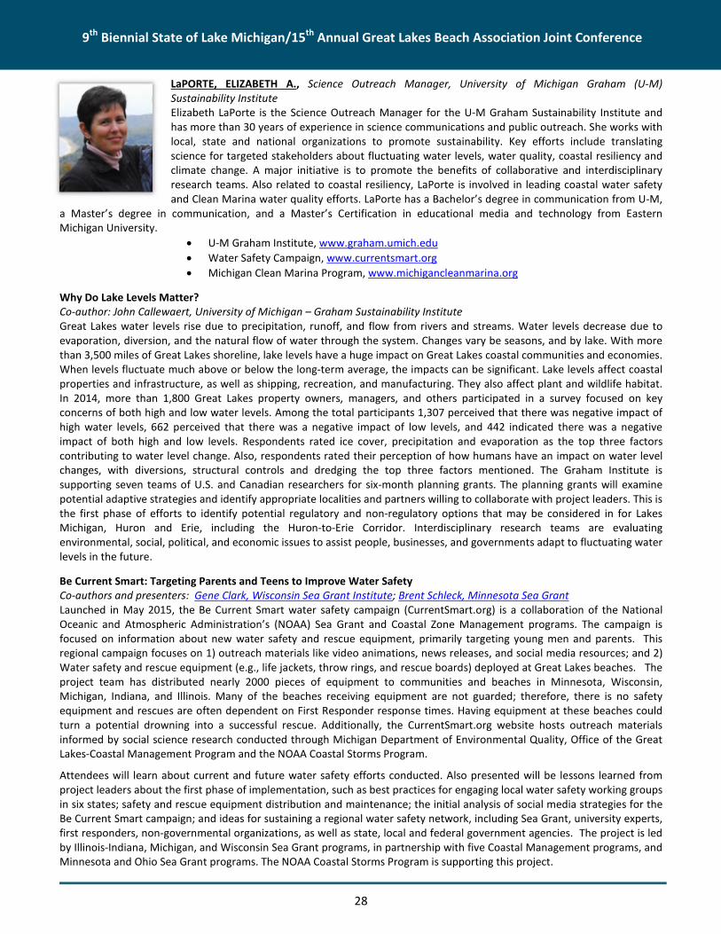
9th Biennial State of Lake Michigan/15th Annual Great Lakes Beach Association Joint Conference
28
LaPORTE, ELIZABETH A., Science Outreach Manager, University of Michigan Graham (U-M)Sustainability InstituteElizabeth LaPorte is the Science Outreach Manager for the U-M Graham Sustainability Institute andhas more than 30 years of experience in science communications and public outreach. She works withlocal, state and national organizations to promote sustainability. Key efforts include translatingscience for targeted stakeholders about fluctuating water levels, water quality, coastal resiliency andclimate change. A major initiative is to promote the benefits of collaborative and interdisciplinaryresearch teams. Also related to coastal resiliency, LaPorte is involved in leading coastal water safetyand Clean Marina water quality efforts. LaPorte has a Bachelor’s degree in communication from U-M,
a Master’s degree in communication, and a Master’s Certification in educational media and technology from EasternMichigan University.
U-M Graham Institute, www.graham.umich.edu
Water Safety Campaign, www.currentsmart.org
Michigan Clean Marina Program, www.michigancleanmarina.org
Why Do Lake Levels Matter?Co-author: John Callewaert, University of Michigan – Graham Sustainability InstituteGreat Lakes water levels rise due to precipitation, runoff, and flow from rivers and streams. Water levels decrease due toevaporation, diversion, and the natural flow of water through the system. Changes vary be seasons, and by lake. With morethan 3,500 miles of Great Lakes shoreline, lake levels have a huge impact on Great Lakes coastal communities and economies.When levels fluctuate much above or below the long-term average, the impacts can be significant. Lake levels affect coastalproperties and infrastructure, as well as shipping, recreation, and manufacturing. They also affect plant and wildlife habitat.In 2014, more than 1,800 Great Lakes property owners, managers, and others participated in a survey focused on keyconcerns of both high and low water levels. Among the total participants 1,307 perceived that there was negative impact ofhigh water levels, 662 perceived that there was a negative impact of low levels, and 442 indicated there was a negativeimpact of both high and low levels. Respondents rated ice cover, precipitation and evaporation as the top three factorscontributing to water level change. Also, respondents rated their perception of how humans have an impact on water levelchanges, with diversions, structural controls and dredging the top three factors mentioned. The Graham Institute issupporting seven teams of U.S. and Canadian researchers for six-month planning grants. The planning grants will examinepotential adaptive strategies and identify appropriate localities and partners willing to collaborate with project leaders. This isthe first phase of efforts to identify potential regulatory and non-regulatory options that may be considered in for LakesMichigan, Huron and Erie, including the Huron-to-Erie Corridor. Interdisciplinary research teams are evaluatingenvironmental, social, political, and economic issues to assist people, businesses, and governments adapt to fluctuating waterlevels in the future.
Be Current Smart: Targeting Parents and Teens to Improve Water SafetyCo-authors and presenters: Gene Clark, Wisconsin Sea Grant Institute; Brent Schleck, Minnesota Sea GrantLaunched in May 2015, the Be Current Smart water safety campaign (CurrentSmart.org) is a collaboration of the NationalOceanic and Atmospheric Administration’s (NOAA) Sea Grant and Coastal Zone Management programs. The campaign isfocused on information about new water safety and rescue equipment, primarily targeting young men and parents. Thisregional campaign focuses on 1) outreach materials like video animations, news releases, and social media resources; and 2)Water safety and rescue equipment (e.g., life jackets, throw rings, and rescue boards) deployed at Great Lakes beaches. Theproject team has distributed nearly 2000 pieces of equipment to communities and beaches in Minnesota, Wisconsin,Michigan, Indiana, and Illinois. Many of the beaches receiving equipment are not guarded; therefore, there is no safetyequipment and rescues are often dependent on First Responder response times. Having equipment at these beaches couldturn a potential drowning into a successful rescue. Additionally, the CurrentSmart.org website hosts outreach materialsinformed by social science research conducted through Michigan Department of Environmental Quality, Office of the GreatLakes-Coastal Management Program and the NOAA Coastal Storms Program.
Attendees will learn about current and future water safety efforts conducted. Also presented will be lessons learned fromproject leaders about the first phase of implementation, such as best practices for engaging local water safety working groupsin six states; safety and rescue equipment distribution and maintenance; the initial analysis of social media strategies for theBe Current Smart campaign; and ideas for sustaining a regional water safety network, including Sea Grant, university experts,first responders, non-governmental organizations, as well as state, local and federal government agencies. The project is ledby Illinois-Indiana, Michigan, and Wisconsin Sea Grant programs, in partnership with five Coastal Management programs, andMinnesota and Ohio Sea Grant programs. The NOAA Coastal Storms Program is supporting this project.

9th Biennial State of Lake Michigan/15th Annual Great Lakes Beach Association Joint Conference
29
LEDERLE, PAT, Planning and Adaptation Section Supervisor, Wildlife Division, Michigan Departmentof Natural ResourcesPat Lederle has been a Wildlife Planning Supervisor (4 years), Research Supervisor (8 years) withMichigan Department of Natural Resources (MDNR), Wildlife Division. He served as AdjunctAssociate Professor with the Department of Fisheries and Wildlife, Michigan State University, and isPast-President of North Central Section of the Wildlife Society. A certified Wildlife Biologist with aBS and PhD from Michigan State University and a MS from the University of Minnesota, Pat isresponsible for managing collaborative statewide wildlife planning program on both game and non-game species. He is the co-leader of the Wildlife Division’s strategic planning efforts. Previously, he
served eight years as the Research Supervisor and three years as the State Endangered Species Coordinator. Prior to workingfor the MDNR, Pat was involved with research on ecological impacts from Department of Energy’s Yucca Mountain Project, aproposed nuclear waste repository. He also spent more than ten years in Michigan’s Upper Peninsula running acomprehensive research project evaluating the impacts of extremely low frequency electromagnetic fields on birds andmammals.Collaborative Approach for Management of State Lands on Northern Lake Michigan IslandsCo-authors: Keith Kintigh, Jennifer Kleitch, Jennifer Olson, and Brian Mastenbrook, MDNR, Wildlife DivisionThe Wildlife Division of the MDNR administers approximately 26,000 acres of land in the Beaver Island and Fox Islandarchipelagos. Most of this land came into state ownership in the past 75 years, and in 1967 these properties were designatedas the Beaver Island Wildlife Research Area. Management initially focused on game species introductions and research onthe impacts of hunting. In recent decades, active management has decreased and there was an increased recognition of theunique qualities of island properties. Because of recent community-based planning efforts on Beaver Island anddevelopment of the MDNR’s Managed Public Land Strategy, the Division began to develop a management plan for state-owned land in the archipelagos using a collaborative approach. This talk will provide an introduction to these uniqueproperties and an overview of the collaborative management planning process. Our planning efforts were guided by theDepartment’s emphasis on resource conservation, recreational opportunities, and natural-resource based economies, andthe obvious links between the unique natural resources on the islands and the interests of island residents and visitors.Discussions and meetings with county and township officials, tribal governments, Central Michigan University, interestedgroups, and local residents provided substantive input leading to collaborative development of management goals andobjectives focused on required partnerships, protection of ecological and cultural resources, and promotion of sustainableisland-appropriate recreational and economic opportunities. Because of the unique qualities of island properties andlogistical challenges posed by access, the most important factor in successful implementation of this plan is the strength ofthe partnerships developed and maintained by the groups and individuals involved.
Lenters, John D., PhD, Senior Scientist, LimnoTechA recognized expert in observation networks, lakes, watersheds, and climate science, Dr. Lenters has been involved in avariety of research projects related to the impacts of climate on lakes, particularly in Alaska, Nebraska, and the Great Lakesregion. He has been leading a global initiative to study the long-term warming of lakes worldwide, and s also working with anumber of institutions to establish a coordinated observation network for Great Lakes evaporation. Dr. Lenters is a memberof the International Association for Great Lakes Research, American Geophysical Union, American Meteorological Society,and the Global Lake Ecological Observatory Network. His work has been featured in the Journal of Great Lakes Research,Water Resources Research, and Journal of Climate, as well as popular literature such as Smithsonian Magazine and NationalGeographic's "Water Currents." Before joining LimnoTech, Dr. Lenters was an associate professor in the School of NaturalResources at the University of Nebraska-Lincoln (UNL). He has also worked at Lake Superior State University, the University ofWisconsin-Madison, and Cornell University, where he received his Ph.D. in atmospheric science.
Great Lakes Evaporation - Abstract Pending

9th Biennial State of Lake Michigan/15th Annual Great Lakes Beach Association Joint Conference
30
LEWANDOWSKI, TONYA, Senior Engineer, Environmental Consulting & Technology, Inc. (ECT)Tonya Lewandowski, is a Senior Engineer with more than ten years in construction and consultingengineering experience out of ECT’s Traverse City office. Ms. Lewandowski graduated from MichiganTechnological University in 1999 with a Bachelor of Science in Civil Engineering, minor inEnvironmental Engineering. Ms. Lewandowski is passionate about her work in natural resources,where her expertise is low impact development (LID) stormwater management, site layout,development, and design. Her engineering background is strong in design, specification preparation,and construction oversight capabilities, but project management and client interaction remain herfavorite tasks. Other areas of expertise include: Stormwater Management, LID StormwaterManagement, Construction Engineering, Construction Document Preparation, Construction
Oversight, Retaining Wall Design, Site Layout, Site Development and Design, Water Main and Sewer Engineering, WastewaterTreatment Plant Design Engineering, and Permit Application Preparation.
Sherman Park Beach Restoration: BMP Design, Partnerships, and Planning for the FutureCo-authors: Christine Daly, Chippewa County Health Department; Annette DeMaria, Project Manager, ECTIn 2014, Sherman Park Beach was restored to address water quality and erosion issues. Located between Lakes Superior andHuron along the St. Mary’s River AOC, Sherman Park Beach has experienced periodic closures due to elevated levels of E. colifrom stormwater runoff. Conditions at this site included: parking lot runoff flows on to the beach via newly constructedsidewalks, trapped stormwater runoff from the beach between two jetties, a low profile beach resulting in saturated sandmore likely to harbor bacteria (as compared to drier sand), and poorly maintained and degraded dunes. Restoration effortsincluded the installation of four rain gardens to filter stormwater, removal of a jetty to improve water circulation, andconstruction of a sand dune to deter gulls from loafing at the beach and improve runoff water quality. This project wasfunded by a Great Lakes Restoration Initiative grant awarded to the Michigan Department of Environmental Quality andChippewa County Health Department with matching effort provided by the City of Sault Ste. Marie. Complete restorationwould not have been possible without in-kind efforts by project partners including: Health Department (Owner), City,Contractor, Engineer and numerous community volunteer groups.
During the design phase, a second beach site was considered for restoration. However, site conditions limited the number ofavailable best management practices that would be effective in improving water quality, especially considering the effects ofclimate change and water levels within the Great Lakes. Therefore, the site was dropped from the scope of work.
This presentation will discuss design considerations, speed bumps that were encountered, and lessons learned which will beapplicable to others undertaking beach restoration projects. We will also discuss how preparing a beach nourishment andmaintenance plan, and a community outreach volunteer program, will ensure the improvements and healthy beachconditions are around for years to come.
LUPI, FRANK, Professor of Agricultural, Food, & Resource Economics and Fisheries & Wildlife,Michigan State UniversityFrank Lupi is a professor at Michigan State University with joint appointments in Agricultural, Food,& Resource Economics and Fisheries & Wildlife. He is an environmental and natural resourceeconomist whose research includes demand and valuation of Great Lakes fisheries and beaches.
Valuing the impact of harmful algal blooms on Lake Erie beachesCo-author: Leah H. Palm-Forster, Applied Economics and Statistics, University of DelawareFueled by agricultural phosphorus runoff, harmful algal blooms (HABs) in Lake Erie have
contaminated drinking water, damaged ecosystem health, and affected valuable fisheries, lake front property, and recreationsites. An influx of funds supporting policies reducing nutrient runoff has spurred demand for timely information about thepotential value of these programs. Here, we estimate how the recreational value of Lake Erie beaches is affected by harmfulalgal blooms. We also show how beach values can be estimated when limited time and funding inhibit studies involvingprimary data collection.
We use a valuation approach called benefit transfer that involves using previous research on Great Lakes beach values toestimate damages caused by beach closures in Lake Erie. We transfer beach values and a model from an original study thatvalued Great Lakes beaches in Michigan (Chen, 2013). That study provides a model that accounts for individual decisions totake a beach trip and the choice of which beach site to visit. The ability of the model to predict trips is essential for our study

9th Biennial State of Lake Michigan/15th Annual Great Lakes Beach Association Joint Conference
31
because beach visits are not reported for many Lake Erie beaches. We use census data for Ohio, Michigan, and Indiana toupdate the model and estimate how many single-day trips are taken to each beach when HABs are not present.
We simulate beach closures on 67 Lake Erie beaches in Ohio and Michigan and then calculate how much recreational value islost because of the closure. Results suggest that, on average, visitors are willing to pay $8.51 per person to avoid losing a daytrip to a given beach. A day-long closure of a single beach results in average losses of $10,200. Losses increase non-linearly asmore beaches are affected. Closing down six beaches in Western Lake Erie results in daily losses of $139,000.
Chen, M. 2013. Valuation of public Great Lakes beaches in Michigan. Ph.D. East Lansing: Michigan State University. Availableat: http://web2.msue.msu.edu/afreTheses/fulltext/Min%20Chen%20Dissertation.pdf [Accessed 5/31/2015].
MAGUIRE, ANDREA, Program Coordinator, Great Lakes Observing SystemAndrea Maguire is a program coordinator at the Great Lakes Observing System (GLOS). With abackground in ecology and policy, her work is focused on making science and data accessible todecision-makers in the Great Lakes. Andrea's experience includes working as a fellow at the U.S.Environmental Protection Agency and the US Global Change Research Program. Her projects includedclimate change impacts research, indicators, and scientific and economic assessments. Previously, shedid ecological research at field stations across Michigan, Florida and Costa Rica. She has a MS inEcology from Michigan State University, and a BS in Biology and in the Program in the Environmentfrom the University of Michigan.
The Great Lakes Observing System: Serving up data to support beach management in the Great LakesCo-authors: Kellie Paige, GLOS; Tad Slawecki, LimnoTechThe Great Lakes Observing System (GLOS) is a bi-national nonprofit organization established to advance the coordination ofthe extensive network of people, processes and technology that work together to maximize access to critical, real-time andhistorical data and information in the region. GLOS takes a user-oriented approach to its work, engaging stakeholders,managers, researchers, policy makers, and educators to ensure that the services it provides meet the specific needs of thesedata user groups.
A key objective for GLOS is to deliver data in a variety of ways, with the goal of developing easy-to-access data and decisionsupport products. GLOS-supported products have applications in guiding spill response, aiding search and rescue efforts,recreation, and more. Examples of GLOS-supported products and services relevant to beach management include:
• Great Lakes Coastal Forecasting System (GLCFS) Point Query tool – providing quick access to National Oceanic andAtmospheric Administration GLCFS input data and model output for a given location and time period.
• Huron to Erie Connecting Waterways Forecasting System (HECWFS) – providing nowcasts and forecasts for currents andwater level.
• myBeachCast – The Great Lakes Commission’s website and mobile app that deliver critical information about beachadvisories and related human health information.
• Virtual Beach/ USGS EnDDat – a collaborative effort between EPA, USGS, Wisconsin Sea Grant, and WI DNR, GLOS dataservices enable the development and implementation of daily water-quality "nowcasts" at coastal beaches throughoutthe Great Lakes.
• GLOS Data Portal – our web mapping portal that aggregates, displays and provides download access to near-real-time andarchived observations and to model forecasts.
• Great Lakes Nearshore Buoy Network – providing real-time physical, bio-chemical, and remote sensing data around LakeMichigan and the Great Lakes.
As GLOS continues to build partnerships across the Great Lakes region, we seek ideas and feedback from stakeholders onways that GLOS can better support management in the region.
McCauley, Dennis, President, Great Lakes Environmental Center, Inc.Dennis McCauley is the President and a Principal Research Scientist at Great Lakes Environmental Center, Inc. (GLEC) inTraverse City, Michigan. At GLEC, Dennis manages and collaborates with professional and technical staff to plan and conductcomplex field and laboratory studies which assess the impact of habitat changes, complex effluents, contaminated sediment,storm water, and single chemicals on aquatic biota, and participates as a principal investigator and/or technical advisor in

9th Biennial State of Lake Michigan/15th Annual Great Lakes Beach Association Joint Conference
32
multiple field and laboratory studies. Since 2004, Dennis has lead every National Aquatic Resource Assessment workassignment and task order for GLEC, including the 2010 and 2015 National Coastal Condition Assessments. Dennis has both aBachelor and Masters degrees from the University of Wisconsin. Dennis has been employed by GLEC for the past 26+ yearsand previously worked for the Wisconsin Department of Natural Resources and the Center for Lake Superior EnvironmentalStudies at the University of Wisconsin-Superior.
2015 National Coastal Condition Assessment Update (Lake Michigan)Abstract Pending
McCOMBS, JOHN, Senior Remote Sensing Specialist, The Baldwin Group at the National Oceanicand Atmospheric Administration (NOAA) Office for Coastal ManagementMr. McCombs has been the contract lead for the NOAA Coastal Change Analysis Program for thepast 12 years. In that time he has overseen the completion of four dates (1996, 2001, 2006, 2010)of nationwide coastal land cover and change, along with additional dates in other geographies.Prior to NOAA, Mr. McCombs has performed land cover mapping for the Mississippi and VirginiaGap Analysis Programs, and has performed research using lidar for forest inventories.
Coastal Land Cover Change and Analysis in the Great LakesCo-authors: Nate Herold, NOAA Office for Coastal ManagementLand use and land cover play a significant role as drivers of environmental change. Information on the location and what landcovers are changing is essential to improving our understanding of past management practices, and in effectively respondingto those environmental and human induced changes. NOAA’s Coastal Change Analysis Program (C-CAP) produces nationallystandardized land cover and land change for the coastal regions of the U.S. These products provide inventories of coastalintertidal areas, wetlands, and adjacent uplands (using documented, repeatable procedures) with the goal of monitoringthese habitats every five years. Information on what land covers are changing and where those changes are occurring isessential to improving our understanding of past management practices, and in effectively responding to thoseenvironmental and human induced changes now and in the future. Within the Great Lakes region, six dates of C-CAP landcover exist from 1975 to 2010. Funds from the Great Lakes Restoration Initiative has been instrumental in the completion ofthese data and are a primary driver behind the 2015 update (soon be underway) which will allow for a 40-year examinationof land cover and land cover change. This presentation will summarize C-CAP methods and accuracy, discuss the availabilityof C-CAP data and how that data can be accessed via NOAA’s Digital Coast, and highlights several tools that make use of thesedata in a user-friendly format.
MEADOWS, GUY A., Director, Great Lakes Research Center, Michigan Technical UniversityUpon graduation from Purdue University in 1977, Guy Meadows joined the faculty of the Universityof Michigan, College of Engineering, where he served as Professor of Physical Oceanography for 35years within the departments of Atmospheric, Oceanic and Space Sciences and Naval Architectureand Marine Engineering. During his tenure, he served the College and University as Director of theOcean Engineering Laboratory, Director of the Cooperative Institute for Limnology and EcosystemsResearch (National Oceanic and Atmospheric Administration [NOAA], Joint Institute), Director of theMarine Hydrodynamics Laboratories and founding Academic Director of the M-STEM Academy. Hejoined Michigan Tech in June of 2012, to help establish the new Great Lakes Research Center as itsfounding director. His primary goal, to blend scientific understanding and technological
advancements into environmentally sound engineering solutions for the marine environment, has led to a distinguishedcareer of teaching, research and service.
Dangerous Great Lakes Nearshore Waves and Currents: Field and Satellite ObservationsCo-author: Amanda Grimm, Michigan Technological University – Michigan Tech Research InstituteBetween 2002 and 2013, there were a total of 434 reported incidents (drowning or rescues of swimmers) related todangerous nearshore currents (DNCs) in the Great Lakes, with an average of approximately 12 drowning deaths per year(NOAA 2014). An analysis of reported rip current fatalities from 1994-2007 found Michigan to have the fourth deadliestcoastline in the U.S., led only by Florida, California, and North Carolina. Within the Great Lakes Basin, the majority of current-

9th Biennial State of Lake Michigan/15th Annual Great Lakes Beach Association Joint Conference
33
related incidents have occurred in Lake Michigan. Improved prediction, mapping, and modeling of DNCs are critical to savinglives. Additionally, monitoring and sustaining beach safety is critical to many local coastline economies dependent on tourismand local beach users. Efforts to understand the mechanisms that produce dangerous nearshore conditions in the GreatLakes and develop reliable forecasting methods to educate the public are dramatically lagging the ocean coasts. Althoughthe Great Lakes are similar to the ocean in many ways, the Great Lakes experience variable water levels (on many time scales)that affect the location and movement of near shore sandbars, in turn affecting the location and formation of rip currentchannels. Water level measurements coincident with the rip current related drowning of four men at Nickel Plate Beach onLake Erie in July 2002 and seven people at Warren Dunes State Park on Lake Michigan in July 2003 show dramatic evidence ofseiching in both cases (Guenther 2003, Meadows et al. 2011). These conditions must be considered for the formulation of acomprehensive rip current forecasting method for the Great Lakes. Results of three field data collection efforts along theLake Michigan coastline, and a massive, high-resolution, satellite based, remote sensing data collection will be discussed.These combined efforts were funded by Michigan Department of Environmental Quality to provide enhanced, data driven,guidance to beach and nearshore managers.
MEDNICK, ADAM, Wisconsin Sea Grant InstituteAdam Mednick is a post-doctoral fellow with the University of Wisconsin Sea Grant Institute and aboard member of the Great Lakes Beach Association. Adam's cooperative extension work on behalf ofboth the developers and users of the "Virtual Beach" software system, and other decision tools,provides support to the Wisconsin Department of Natural Resources and other state, local, andfederal agencies, academic institutions, and NGO's around the Great Lakes.
Implementing Predictive Models: Practical Advice and New ToolsPublic agencies charged with managing beach water quality are typically faced with a narrow set of
imperfect options. Whether the decision is to post an advisory on a given day, or how to mitigate chronic pollution at aparticular site, managers and decision-makers at all levels have limited time, resources, and/or information with which towork. Beach-related R&D (e.g., source-tracking, sanitary surveys, predictive models, and visitor surveys) can informmanagement decisions; however, they don’t always improve (or even influence) them. This presentation will providemanagers and researchers with some of the basics of ‘decision science’ and the field of cooperative extension, using theresults of a 2013 survey to illustrate key points. The aim is to get beach managers and beach scientists thinking (and hopefullytalking) about how best to bridge the gap between research and the ‘real-world’ – in the hopes of improving both.
MELCHIOR, MARTY, Regional Director, Inter-FluveMarty Melchior is the Eastern Region Director for Inter-Fluve, a river restoration design firm. Martyhas over 20 years of experience in the assessment and design of river restoration projects, includingnatural channel design, dam removal, and habitat restoration. He lives near Madison, Wisconsin.
Advances in Design and Restoration Techniques Part 2Boardman River Reborn - Community Lessons in Dam Removal
MIFSUD, DAVID, Herpetologist, Herpetological Resource and Management, LLCDavid A. Mifsud is a Certified Wildlife Biologist, Certified Professional Ecologist, and a ProfessionalWetland Scientist. He has been working for twenty years in wildlife biology, wetland ecology, andhabitat conservation and management with expertise in Michigan amphibians and reptiles. Mifsud isthe Michigan Herpetological Atlas Administrator, Co-Chair of the State of Michigan Amphibian andReptile Technical Advisory Board, and serves as an expert on Great Lakes Turtles for theInternational Union for Conservation of Nature (IUCN) Tortoise and Freshwater Turtle SpecialistGroup. In 2014, he completed the Michigan Amphibian & Reptile Best Management PracticesManual and is currently working on a revision as co-author to the Amphibians and Reptiles of the
Great Lakes Region due out in 2016.

9th Biennial State of Lake Michigan/15th Annual Great Lakes Beach Association Joint Conference
34
Amphibians and Reptiles of the Lake Michigan Basin: Status and ConservationAmphibians and reptiles are recognized as key biological indicators. Their presence, density, and distribution are important inassessing the health and quality of a landscape. The Lake Michigan basin has the greatest diversity of amphibians and reptilesin the state. This presentation will discuss what species occur in the basin, reasons for the richness present in this area,threats these species face, and ways to protect and improve conditions for amphibians and reptiles. The presentation willalso focus on ways participants can get involved in the MI Herp Atlas program and help document observation of thesespecies throughout Michigan.
Michigan’s Emerald Isle: Amphibians and Reptiles of the Beaver Island ArchipelagoThe Beaver Island Archipelago is one of Michigan’s lesser known ecological gems. This region has a rich geological, cultural,and ecological history. Situated in Lake Michigan these islands have evolved a unique assemblage of wildlife adapted tonorthern Michigan and island life. Until recently, work conducted on the archipelago targeting amphibians and reptiles wasfocused around the Central Michigan University (CMU) Biological Station. In 2013, Herpetological Resource and Management(HRM) was contracted by Conservation Resource Alliance (CRA) to establish baseline herpetological diversity within theArchipelago to monitor restoration activities associated with invasive species removal and identify opportunities for potentialfuture restoration. This herpetological work built on the efforts of CMU staff and students, and others who have conductedresearch on the islands. With the help of the Beaver Island Association and CRA staff, HRM has been able to document thespatial distribution and habitat use of herpetofauna on the islands. In addition, this work has resulted in the discovery of newspecies records for multiple islands, and an overall better understanding of the unique nature of this region. Density andoverall richness of amphibians and reptiles in the Archipelago provides a critical reference point for comparison of Michigan’samphibians and reptiles and what much of the mainland once contained 50-75 years ago. The diversity and abundance ofthese biological indicators is a testament to the unique and high quality landscapes of this region and the importance ofprotecting the area.
MOLNAR, MIKE, Director, Lake Michigan Coastal Program, Indiana Department of NaturalResourcesMike Molnar is the program manager of the Indiana Lake Michigan Coastal Program, and has servedin that capacity for twelve years. He oversees the day to day functions of the Coastal Program andhas served as manager on multiple program projects. Past projects include public access needsassessment, coastal and estuarine land conservation plan, and underwater archaeological resourceplan. Born and raised along the shores of Lake Erie, Mike learned first-hand the environmentalimpacts of pollution on the Great Lakes and how combined efforts can result in success. He is agraduate of Miami University of Oxford, Ohio and Indiana University, Bloomington. He holds abachelor's degree in secondary education - biological science and a master's degree in public
administration from the School of Public and Environmental Affairs.
Building a Regional Partnership to Address Septic System Impacts to Lake MichiganCo-author and presenter: David Ortel, Indiana State Department of Health; Co-authors: Doreen Carey, Indiana Department ofNatural Resources Lake Michigan Coastal Program, Natalie Johnson, Northwest Indiana Urban Waters Partnership, and JoeExl, Northwest Indiana Regional Planning CommissionAlthough failing septic systems have long been identified as a potential contributor to water quality impairments in NWIndiana, there is limited public awareness of the problem and the associated health, recreation, and economic impacts. AllIndiana Lake Michigan tributaries are impacted by E.coli and although the contribution from failing septic systems is not well-documented, many existing systems are decades old and a large percentage of soils in the Lake Michigan watershed areidentified as unsuitable for septic systems.
Since 2013, the Indiana Lake Michigan Coastal Nonpoint Pollution Control Program has facilitated the Septic SystemCoordination Work Group (SSCWG). The group meets bi-monthly to addresses the issue of septic system failures in theCoastal Region, the potential impacts on health and water quality, and what can be done to improve the situation. TheSSCWG includes state and local Health Departments, local, state and federal environmental agencies, NGOs, and localmunicipal and community representatives. The group partners presently participate in the annual U.S. EnvironmentalProtection Agency SepticSmart Week and widely distribute SepticSmart educational information that includes septic systemoperation and maintenance tips for the homeowner. Group member Urban Waters Federal Partnership is conducting Septic

9th Biennial State of Lake Michigan/15th Annual Great Lakes Beach Association Joint Conference
35
System focus groups throughout the region designed to determine septic system user knowledge of proper operation andmaintenance. LaPorte County Health Department has adopted a Septic System Operation and Inspection Permit that is beingphased in to address all septic systems in the county. This ordinance provides a model program for inspection andmaintenance that will begin to address the lack of data regarding the potential health and water quality impacts of failedseptic systems in the Lake Michigan watershed.
The session will review the work and accomplishments of the SSCWG and will be led by the Indiana Lake Michigan CoastalProgram Special Projects Coordinator with presentations by key SSCWG partners.
MOTT, JOANNE, Professor of Biology and Chair of Life Sciences Department, Texas A&M University – Corpus Christi
Six Key Steps for Developing and Using Predictive Tools at Your BeachCo-author and presenter: Samantha Fontenelle, U.S. EPATo reduce exposure to waterborne pathogens at bathing beaches, beach managers need tools that can provide a quick,reliable indication of water quality conditions. The U.S. EPA encourages the use of predictive tools to make timely beachnotification decisions and to deliver same-day notifications. To help states and tribes with developing and implementingpredictive tools at the beaches, the U.S. EPA developed a simple “How To” Guide based on input from seven beach managerswho have successfully implemented a predictive model at their beaches. The beach managers were interviewed tounderstand the process that each used in developing his/her model. The draft guidance was pilot tested by the Texas BeachWatch Program to assess the utility of the guidance. While predictive tools have been shown to work well at some beaches,the development and implementation of predictive tools for use at coastal beaches remains a challenge for most beachprograms.
MURPHY, ELIZABETH, Great Lakes Fish Monitoring and Surveillance Program Manager, U.S.Environmental Protection Agency, Great Lakes National Program OfficeElizabeth (Beth) Murphy is the program manager for the Great Lakes Fish Monitoring andSurveillance Program (GLFMSP) in the U.S. Environmental Protection Agency's (U.S. EPA’s)Great Lakes National Program Office. As program manager for a 30 year + program, Beth isresponsible for monitoring and surveillance of historical and emerging contaminants in GreatLakes fish over time and determining the presence of new chemicals in fish tissue. She worksvery closely with the Great Lakes Consortium for Fish Consumption Advisories, Lakewide Action
and Management Plans, Partner Agencies and Programs, and the Environment Canada National Fish Contaminant Monitoringand Surveillance Program to ensure that high quality data is used in decision making and reporting. Beth received her B.S. inenvironmental science from North Carolina State University and her M.P.H. in environmental public health from theUniversity of Illinois at Chicago.
Current (2008-12) distribution and body burden of monitored contaminants in Lake Trout and Walleye in the Great LakesCo-author: Daryl McGoldrick, Environment CanadaFormal biomonitoring programs for chemicals of concern in fish have been operated by the governments of Canada and theUnited States in the Great Lakes since the 1970’s. In the beginning, monitoring was focused on the so-called “dirty dozen”POPs listed on the Stockholm convention and mercury. These chemicals are well known in the public sphere and are thesubject of many scientific publications based in the Great Lakes Basin. In the last decade, initiatives in both Canada under theChemicals Management Plan (CMP) and the Great Lakes Restoration Initiative (GLRI) in the United States have allowed anexpansion of the list of chemicals being monitored to include additional contaminants which have emerged or are ofemerging concern in terms of potential harmful impacts to the environment. Examples of these compounds includepolybrominated diphenylethers (PBDEs), perfluorinated compounds (PFCs), and many other chemicals used in a variety ofconsumer goods and personal care products. In this review, we have summarized all data contained in the fish contaminantdatabases of Environment Canada and the U.S. EPA for chemicals measured from 2008 to 2012 from each of the five GreatLakes to provide an integrated picture of the current status of contaminant burden of upper trophic level fish.

9th Biennial State of Lake Michigan/15th Annual Great Lakes Beach Association Joint Conference
36
Shifts in Age of Great Lakes Lake Trout; an interlaboratory comparisonCo-authors: Wellenkamp. W and He, J., MDNR; Landon, M.E. , CSC; Holsen, T.M., Crimmins, B.S., and Hopke, P.K. - ClarksonUniversity; Pagano, J.J., SUNY Oswego; Milligan, M.S., SUNY Fredonia; Downey, P., Aquatec Biological Sciences.The Great Lakes Fish Monitoring and Surveillance Program and the Michigan Department of Natural Resources (MDNR),Alpena Field Station, are employing a new aging technique that may be better able to determine age quickly and accuratelyusing the maxillary bone of lake trout. This new method is being compared to traditional methods, otolith and coded wiretags, in a blind comparison study between two laboratories to gauge accuracy, refine aging rules and techniques, and to allowfor compositing of GLFMSP samples around a known age. Fish age is used to help explain the changes in fish tissueconcentration for some legacy contaminants, like PCBs, in lake trout collected as part of the long term GLFMSP. Results ofthis collaboration may alter the standard collection procedures for the GLFMSP to better reflect the environmental condition.
NAPERALA, TROY, P.E., Michigan Water Business Line Leader, AECOMTroy Naperala has Environmental and Civil Engineering degrees from Michigan TechnologicalUniversity and the University of Virginia. He is a registered professional engineer in Michigan. Hispractice focuses on watershed restoration and includes BMP planning, design and monitoring; riverand wetland restoration design; and water quality studies. He is fortunate to have projects in theseareas in Michigan, Texas, Wisconsin, Minnesota, Maryland, Virginia and North Carolina and enjoysseeing and understanding the different design requirements posed by the climate and geology ofthese diverse locations.
Advances in Design and Restoration Techniques Part 1Boardman River Reborn - Community Lessons in Dam Removal
NEWCOMB, TAMMY, Senior Water Policy Advisor, Michigan Department of Natural Resources,Executive DivisionDr. Tammy J. Newcomb serves as a Senior Water Policy Advisor for the Michigan Department ofNatural Resources (MDNR). In her current role, she leads statewide issues for the Department suchas groundwater withdrawal management, preventing Asian carp from entering the Great Lakes, andcoordination of issues regarding management and research on Great Lakes Fisheries. She receivedher Bachelors of Science degree and Ph.D. in Fisheries and Wildlife from Michigan State Universityand her M.S. from West Virginia University in Forestry. Prior to her current appointment she servedas the MDNR Fisheries Division Research Program Manager and earlier as the Lake Huron BasinCoordinator. Before she began service with the MDNR, Dr. Newcomb was an Assistant Professor atVirginia Polytechnic Institute and State University with a research program focused on managementof regulated rivers.
Status of Information and Issues Regarding Commercial Net Pen Aquaculture in the Great LakesCo-author: Michigan Department of Natural Resources, Fisheries DivisionNet-pen aquaculture is named for floating enclosures in open water that are capable of raising large numbers of fish. Theseoperations take small fish from a hatchery and raise them to a harvestable size for the consumer food market. Currently, theonly commercial aquaculture net pens in the Great Lakes are located in the Ontario waters of Lake Huron in the NorthChannel and in Georgian Bay.
The Michigan Departments of Agriculture and Rural Development, Environmental Quality, and Natural Resources have sharedauthorities over this newly proposed activity. While the regulatory framework addresses water quality, fish stocking,construction and use of bottomlands, and aquaculture facility registration, there are additional aspects to consider whencontemplating this issue. The Departments are using an ecosystem management approach to frame the ecological, economic,regulatory, and social basis for developing state policy on this issue. In May, a multi-disciplinary science panel was convenedto address specific issues pertaining to the ecological and environmental issues pertaining to the operation of net pens in theGreat Lakes.

9th Biennial State of Lake Michigan/15th Annual Great Lakes Beach Association Joint Conference
37
NORTON, RICHARD K., Professor and Chair, Urban and Regional Planning Program, University ofMichiganRichard K. Norton is professor and chair of the Urban and Regional Planning Program at the Universityof Michigan. Dr. Norton, an urban planner and lawyer, studies the planning, policy, and legal aspectsof coastal area management along Great Lakes shorelines.
What Makes a Great Lakes Community “Coastal”?Co-authors: Guy A. Meadows, Michigan Technological University; Catherine M. Riseng, University ofMichiganNumerous efforts are under way to promote the adoption of state and local plans and policiesdesigned to help make Great Lakes coastal communities more resilient. In order to promote coastal
resiliency, it would be helpful to understand both what makes a community “coastal” as well as makes it “resilient,”especially along a Great Lakes shore. Much attention has been given to defining “resiliency,” but little attention has beengiven to determining what makes a Great Lakes community “coastal.” Specifically, how far inland from a Great Lakes shorealong connecting lakes and rivers constitutes coastal? One way to approach this question might be to consider physicalconditions, such as the amount of riverine area subject to wave run-up during storms given different lake stillwater levels.Another would be to consider ecological conditions, such as the reach of spawning habitat for Great Lakes fishes. Yet anotherwould be to consider the reach of Great Lakes water-dependent commercial and industrial activities, such as marinas. Each ofthese various ways of defining coastal may have implications in terms of contemplating what would make a communityresilient, more broadly, and in terms of the applicability of various regulatory, public expenditure, and other programmaticplans and policies, more specifically. This session will assess these various ways of characterizing a Great Lakes community as“coastal” and discuss the key planning and policy implications for each, particularly in the context of promoting coastalresiliency.
ORTEL, DAVID, Indiana State Department of Health
Building a Regional Partnership to Address Septic System Impacts to Lake MichiganCo-author and presenter: Mike Molnar, Indiana Lake Michigan Coastal Program; Co-authors: Doreen Carey, IndianaDepartment of Natural Resources Lake Michigan Coastal Program, Natalie Johnson, Northwest Indiana Urban WatersPartnership, and Joe Exl, Northwest Indiana Regional Planning Commission
Although failing septic systems have long been identified as a potential contributor to water quality impairments in NWIndiana, there is limited public awareness of the problem and the associated health, recreation, and economic impacts. AllIndiana Lake Michigan tributaries are impacted by E.coli and although the contribution from failing septic systems is not well-documented, many existing systems are decades old and a large percentage of soils in the Lake Michigan watershed areidentified as unsuitable for septic systems.
Since 2013, the Indiana Lake Michigan Coastal Nonpoint Pollution Control Program has facilitated the Septic SystemCoordination Work Group (SSCWG). The group meets bi-monthly to address the issue of septic system failures in the CoastalRegion, the potential impacts on health and water quality, and what can be done to improve the situation. The SSCWGincludes state and local Health Departments, local, state and federal environmental agencies, NGOs, and local municipal andcommunity representatives. The group partners presently participate in the annual EPA SepticSmart Week and widelydistribute SepticSmart educational information that includes septic system operation and maintenance tips for thehomeowner. Group member Urban Waters Federal Partnership is conducting Septic System focus groups throughout theregion designed to determine septic system user knowledge of proper operation and maintenance. LaPorte County HealthDepartment has adopted a Septic System Operation and Inspection Permit that is being phased in to address all septicsystems in the county. This ordinance provides a model program for inspection and maintenance that will begin to addressthe lack of data regarding the potential health and water quality impacts of failed septic systems in the Lake Michiganwatershed.
The session will review the work and accomplishments of the SSCWG and will be led by the Indiana Lake Michigan CoastalProgram Special Projects Coordinator with presentations by key SSCWG partners.

9th Biennial State of Lake Michigan/15th Annual Great Lakes Beach Association Joint Conference
38
PARKER, TODD, Senior Manager, Delta InstituteTodd Parker manages projects in the areas of ecosystem services, energy efficiency and pollutionprevention, and facilitates the Lake Michigan Forum. A native of Ohio, Todd studied forestry atMichigan State University. After trudging around the forests of Alaska, Mississippi and Michigan andlearning how legislation is crafted in the Michigan Senate, he attended the Vermont Law School,where he earned a Master’s degree in Environmental Law. Now in his ninth year at Delta, Todd iscontinually reminded of the value of his work whenever he looks into the eyes of his daughter.There is no nobler profession than one that strives to make the world a better place for the childrenof tomorrow.
Raising Public Awareness of Ecological Issues through the Love Lake Michigan CampaignCo-presenter: Jennifer Estill, Redhead Design StudioSocial media campaigns, using Twitter, Instagram and Facebook, are becoming the preferred means of reaching a largenumber of people with information. Many environmental organizations talk about having a social media presence, but dovery little to leverage that presence. In 2014, the Lake Michigan Forum and Watershed Academy (LMFWA), with funding fromthe Great Lakes Restoration Initiative, launched the “Love Lake Michigan” campaign to promote the inherent value of LakeMichigan. This social media focused, public engagement campaign encourages individual and collective action towardimplementation of Lake Michigan Lakewide Action and Management Plan (LAMP) priorities. Key elements of this campaignare the #LoveLakeMichigan hashtag and the Love Lake Michigan (www.lovelakemichigan.org) web site. This site is theprimary entry point for citizen engagement. Through social media, marketing materials, and personal outreach at localevents, the LMFWA is driving citizens to this site, where they can view the Lake Michigan 101 training modules, volunteer forcommunity events, provide feedback to EPA on Lake Michigan LAMP priorities, and take the “I Love Lake Michigan” pledgefor Lake Michigan stewardship. This campaign continues to increase public awareness of issues related to the water qualityof Lake Michigan, expand the range of opportunities for Great Lakes stakeholders and citizens to provide input to thegovernments and participate in Great Lakes issues and concerns and catalyze individual and collective action towardecosystem stewardship. In this workshop, the Lake Michigan Forum will discuss the creation, branding, management,implementation and impact of this social media campaign. We will present a variety of media and discuss how we have beenable effectively harness the power of social media to increase awareness of the inherent value of Lake Michigan. We will alsodiscuss how organizations can creatively and effectively brand their outreach campaigns for maximum exposure.
PELLER, JULIE, Associate Professor of Chemistry, Valparaiso UniversityDr. Peller is an Associate Professor of Chemistry at Valparaiso University. Her research as anEnvironmental Organic Chemist is mostly in the area of organic water contaminants. A significantportion of her work is performed at the University of Notre Dame's Radiation Laboratory, where sheholds a Visiting Scholar appointment. Dr. Peller's research also includes work with the U.S. GeologicalSurvey, Lake Michigan Ecological Research Station in Porter, Indiana, investigating challenges tosurface waters and Lake Michigan, including water quality effects of decaying Cladophora. Dr. Pelleris active in local school and community environment and watershed awareness projects andinitiatives. She is vice president of the Hoosier Environmental Council (HEC) board.
Integrated watershed monitoring programs for the protection of Northwest Indiana surface watersCo-authors: Laurie Eberhardt, Valparaiso University; Erin Argyilan and Dan Kelly, Indiana University NorthwestLake Michigan and its watershed constitute significant sources of fresh ground and surface water in Northwest Indiana.Stressors of the fresh water bodies range from industry, for which the lakeshore was populated, to urbanization andagriculture. In order to adequately monitor the health of the extensive watershed tributaries that flow into Lake Michigan,customized observations (surveys) and basic water quality parameters, both chemical and biological, can be collected,analyzed and stored. The information can lead to an understanding of the type and extent of water pollution sources, as wellas engaging the local community to work towards solutions to problems, especially when the monitoring is consistent andlong-term. However, this approach requires many committed and interactive organizations. Current Northwest Indianawatershed monitoring programs, such as GLISTEN (The Great Lakes Innovative Stewardship Through Education Network),utilize local resources for the collection of datasets by science teachers, students and interested community organizations incollaboration with scientists from the local universities, community college and government labs. Over the past year, surfacewater chemistry data from the Coffee Creek and Salt Creek watersheds in Northwest, Indiana have been collected, analyzed
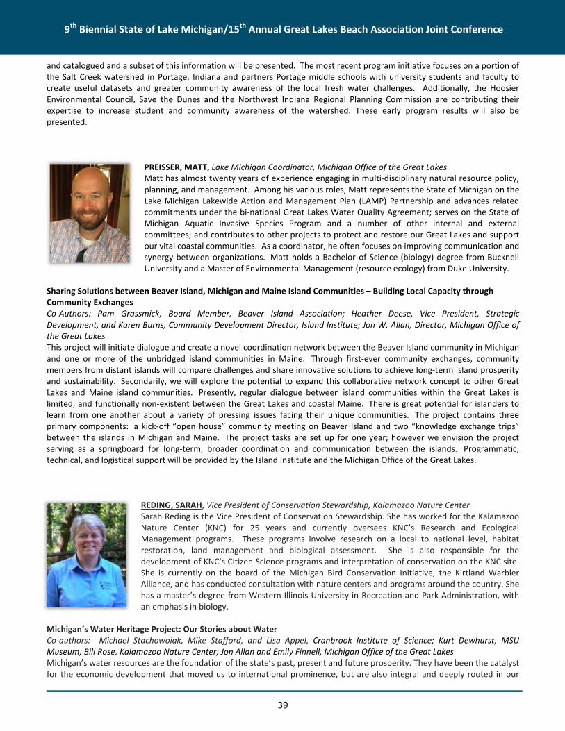
9th Biennial State of Lake Michigan/15th Annual Great Lakes Beach Association Joint Conference
39
and catalogued and a subset of this information will be presented. The most recent program initiative focuses on a portion ofthe Salt Creek watershed in Portage, Indiana and partners Portage middle schools with university students and faculty tocreate useful datasets and greater community awareness of the local fresh water challenges. Additionally, the HoosierEnvironmental Council, Save the Dunes and the Northwest Indiana Regional Planning Commission are contributing theirexpertise to increase student and community awareness of the watershed. These early program results will also bepresented.
PREISSER, MATT, Lake Michigan Coordinator, Michigan Office of the Great LakesMatt has almost twenty years of experience engaging in multi-disciplinary natural resource policy,planning, and management. Among his various roles, Matt represents the State of Michigan on theLake Michigan Lakewide Action and Management Plan (LAMP) Partnership and advances relatedcommitments under the bi-national Great Lakes Water Quality Agreement; serves on the State ofMichigan Aquatic Invasive Species Program and a number of other internal and externalcommittees; and contributes to other projects to protect and restore our Great Lakes and supportour vital coastal communities. As a coordinator, he often focuses on improving communication andsynergy between organizations. Matt holds a Bachelor of Science (biology) degree from BucknellUniversity and a Master of Environmental Management (resource ecology) from Duke University.
Sharing Solutions between Beaver Island, Michigan and Maine Island Communities – Building Local Capacity throughCommunity ExchangesCo-Authors: Pam Grassmick, Board Member, Beaver Island Association; Heather Deese, Vice President, StrategicDevelopment, and Karen Burns, Community Development Director, Island Institute; Jon W. Allan, Director, Michigan Office ofthe Great LakesThis project will initiate dialogue and create a novel coordination network between the Beaver Island community in Michiganand one or more of the unbridged island communities in Maine. Through first-ever community exchanges, communitymembers from distant islands will compare challenges and share innovative solutions to achieve long-term island prosperityand sustainability. Secondarily, we will explore the potential to expand this collaborative network concept to other GreatLakes and Maine island communities. Presently, regular dialogue between island communities within the Great Lakes islimited, and functionally non-existent between the Great Lakes and coastal Maine. There is great potential for islanders tolearn from one another about a variety of pressing issues facing their unique communities. The project contains threeprimary components: a kick-off “open house” community meeting on Beaver Island and two “knowledge exchange trips”between the islands in Michigan and Maine. The project tasks are set up for one year; however we envision the projectserving as a springboard for long-term, broader coordination and communication between the islands. Programmatic,technical, and logistical support will be provided by the Island Institute and the Michigan Office of the Great Lakes.
REDING, SARAH, Vice President of Conservation Stewardship, Kalamazoo Nature CenterSarah Reding is the Vice President of Conservation Stewardship. She has worked for the KalamazooNature Center (KNC) for 25 years and currently oversees KNC’s Research and EcologicalManagement programs. These programs involve research on a local to national level, habitatrestoration, land management and biological assessment. She is also responsible for thedevelopment of KNC’s Citizen Science programs and interpretation of conservation on the KNC site.She is currently on the board of the Michigan Bird Conservation Initiative, the Kirtland WarblerAlliance, and has conducted consultation with nature centers and programs around the country. Shehas a master’s degree from Western Illinois University in Recreation and Park Administration, withan emphasis in biology.
Michigan’s Water Heritage Project: Our Stories about WaterCo-authors: Michael Stachowoiak, Mike Stafford, and Lisa Appel, Cranbrook Institute of Science; Kurt Dewhurst, MSUMuseum; Bill Rose, Kalamazoo Nature Center; Jon Allan and Emily Finnell, Michigan Office of the Great LakesMichigan’s water resources are the foundation of the state’s past, present and future prosperity. They have been the catalystfor the economic development that moved us to international prominence, but are also integral and deeply rooted in our

9th Biennial State of Lake Michigan/15th Annual Great Lakes Beach Association Joint Conference
40
quality of life. Policy and decision makers at all levels of governance continue to face tremendous challenges around wateruse and water quality such as non-point source pollution, invasive species introductions, competing demands for groundwater, and impacts from changes in weather patterns. Water conflicts are already arising in parts of Michigan andgenerations are becoming disconnected from nature and government decision making resulting in a need for capacity at thecommunity level in order to address and resolve these conflicts. For this reason, the Michigan Office of the Great Lakesimplemented an innovative Water Heritage project in collaboration with Cranbrook Institute of Science; Kalamazoo NatureCenter; and the Michigan State University (MSU) Museum with MSU’s Office of University Outreach and Engagementsupported by the Erb Family Foundation. The project focus is to increase the ability of individuals to engage in influencingand informing water resource policy, and improving government’s ability at all levels to communicate, engage, and listen toindividuals tell their story about why water matters to them personally by building support and capacity for sharedgovernance. These partners believe that human experience, things like engagement and citizenship, our affinity to eachother, and to our love of water and place can be used as a catalyst for public dialogue about water resources, and that sharedcultural experiences contribute to a sense of place and communal identity.
RISENG, CATHERINE, Assistant Research Scientist, University of MichiganDr. Catherine Riseng is an Assistant Research Scientist at the University of Michigan, School ofNatural Resources and Environment, and Research Program manager at Michigan Sea Grant. She iscurrently the PI of the Great Lakes Aquatic Habitat Framework (GLAHF) project along with tworelated projects to develop web-based Decision Support tools and a coastal condition assessment.She has extensive field experience in with benthic communities in both the Great Lakes and itstributary watersheds. She has conducted regional assessments of river ecosystems in the GreatLakes region and currently manages several large research projects.
A geospatial framework and spatially referenced decision tools for Great Lakes managementCo-author and presenter: Kevin Wehrly, Michigan Department of Natural Resources, Institute of Fisheries ResearchCo-authors: Rob Goodspeed, University of Michigan, Urban Planning; Ed Rutherford, NOAA-GLERL; Li Wang, IJC; Lacey Mason,University of Michigan, SNRE; Ben Schoenfeldt, University of Michigan, SNREThe GLAHF is a spatial framework and database of physical, chemical and biological data covering the entire Great Lakesbasin. These data are georeferenced to a common spatial grid, the framework, which facilitates lake-wide and basin-widemanagement activities. Great Lakes agencies, managers, and researchers commonly express a need for publically accessibleconsistent habitat data and decision support tools that can be applied to the multitude of problems that face aquaticecosystems throughout the basin. The GLAHF project team has developed a number of web-accessible tools to assist withhabitat monitoring, assessment, and prioritization for protection and restoration including: a scalable habitat classificationframework; a GIS data viewer and server; and, a web-based decision support system to facilitate research and managementactivities in the Great Lakes. These spatially structured tools have been developed based on feedback from managers andexperts directly involved with making management decisions in the basin and address their specific information needs.GLAHF and theses decision tools could be used to develop lake-wide management plans, prioritize locations for funding andspecific management actions, and to conduct research for science-based decision making.
ROBERTS, VIRGINIA A., MSPH, Epidemiologist, Centers for Disease Control and Prevention (CDC)Virginia A. Roberts, MSPH is an Epidemiologist in the Waterborne Disease Prevention Branch withinCDC’s National Center for Emerging and Zoonotic Infectious Diseases. She coordinates a CDC GreatLakes Restoration Initiative project with a focus on waterborne disease prevention capacity in GreatLakes states. She manages the waterborne disease outbreak module of the National OutbreakReporting System (NORS) and collaborates with state health departments and federal partners onrelated outbreak health surveillance and reporting activities.
One Health Surveillance of Harmful Algal Bloom-related Illnesses – A Reporting System PilotCo-authors: Joana Yu, Karna LLC; Irina Pyrkh, Northrop Grumman Corporation; Lorraine Backer,
CDC; Kathleen Fullerton, CDC; Jonathan Yoder, CDC; Michael Beach, CDCWaterborne disease outbreaks are reported to the U.S. CDC by state health departments via the web-based NationalOutbreak Reporting System (NORS). Human outbreaks associated with exposure to harmful algal blooms (HABs) may be

9th Biennial State of Lake Michigan/15th Annual Great Lakes Beach Association Joint Conference
41
reported. However, these outbreaks do not include individual-level data needed to improve case definitions or to prioritizeother HAB-related activities. In 2013, CDC was funded by the Great Lakes Restoration Initiative (GLRI) to build waterbornedisease prevention capacity in Great Lakes states and improve surveillance of HAB-related illness. CDC established a workinggroup of state and federal partners with expertise in harmful algal blooms and illness surveillance to develop an electronicreporting system for HAB-related illnesses linked to NORS. The system will utilize a one health approach—receiving andlinking reports of single cases of human illness, animal illness, and HABs. During 2014 and early 2015, the HAB working groupdrafted reporting forms for cases of human illness, animal illness, and HABs; and initial case and HAB definitions. A reportingsystem pilot will be initiated with the working group in summer, 2015. A full launch in 2016 and maintenance of the systemwill require ongoing efforts to support state activities and to demonstrate the value of the data through improved reportingdefinitions and data use. This presentation will provide background on this project and demonstrate pilot reporting sitefeatures.
SCHLEIZER, BILL, Managing Director, Delta InstituteBill Schleizer serves as Managing Director, overseeing project management, finance,administrative and development of strategy across the organization. He leads several projectareas, including those related to climate, agriculture, water and ecosystems and also providesexpertise and technical assistance directly related to Delta’s strategic priority areas. He holds aB.S. in Ecology, Evolution, and Organismal Biology and Environmental Studies from TulaneUniversity and a M.S. in Environmental Analysis and Decision Making from Rice University.
Incorporating Green Infrastructure into Local Decision Making in Michigan City, IndianaDelta Institute is partnering with Michigan City and its Redevelopment Commission, Haas andAssociates Engineers, and The Alliance for the Great Lakes on Michigan City’s Wabash Street
Green Infrastructure Project. This project will result in the installation of stormwater Best Management Practices, includingrain gardens and bioswales. Other improvements include the addition of sidewalks and crosswalks, as well as safetymodifications to intersections. Landscaping, streetscaping, and LED lighting will also be added to create an aesthetically-pleasing environment. Delta will be developing green infrastructure templates and decision support tools that will guide theimplementation of core green infrastructure components both for this project and for future projects in Michigan City. Grantsfrom the U.S. Environmental Protection Agency, Donnelley Foundation, and the Indiana Lake Michigan Coastal Program havemade the Green Infrastructure project possible.
SCHLECK, BRENT, Coastal Storms Outreach Coordinator, Minnesota Sea GrantBrent Schleck is an Extension Educator with Minnesota Sea Grant, helping to coordinate theNational Oceanic and Atmospheric Administration’s (NOAA’s) Coastal Storms Program in the GreatLakes region. The Coastal Storms Program is a regional effort working to improve communityresiliency to coastal storm hazards. Brent’s work focuses on municipal climate-change adaptationstrategies, beach-goer safety, and improving community resiliency to storm impacts. Brent has aMaster of Urban Planning degree from the University of Michigan and has experience working withcommunities around the Great Lakes region.
Be Current Smart: Targeting Parents and Teens to Improve Water SafetyCo-authors and presenters: Gene Clark, Wisconsin Sea Grant Institute; Elizabeth LaPorte, University of MichiganLaunched in May 2015, the Be Current Smart water safety campaign (CurrentSmart.org) is a collaboration of the NOAA SeaGrant and Coastal Zone Management programs. The campaign is focused on information about new water safety and rescueequipment, primarily targeting young men and parents. This regional campaign focuses on 1) outreach materials like videoanimations, news releases, and social media resources; and 2) water safety and rescue equipment (e.g., life jackets, throwrings, and rescue boards) deployed at Great Lakes beaches. The project team has distributed nearly 2000 pieces ofequipment to communities and beaches in Minnesota, Wisconsin, Michigan, Indiana, and Illinois. Many of the beachesreceiving equipment are not guarded; therefore, there is no safety equipment and rescues are often dependent on First

9th Biennial State of Lake Michigan/15th Annual Great Lakes Beach Association Joint Conference
42
Responder response times. Having equipment at these beaches could turn a potential drowning into a successful rescue.Additionally, the CurrentSmart.org website hosts outreach materials informed by social science research conducted throughMDEQ-OGL-Coastal Management Program and the NOAA Coastal Storms Program.
Through this session, attendees will learn about current and future water safety efforts conducted. Additionally, attendeeswill hear lessons learned from project leaders about the first phase of implementation, such as best practices for engaginglocal water safety working groups in six states; safety and rescue equipment distribution and maintenance; the initial analysisof social media strategies for the Be Current Smart campaign; and ideas for sustaining a regional water safety network,including Sea Grant, university experts, first responders, non-governmental organizations, as well as state, local and federalgovernment agencies. The project is led by Illinois-Indiana, Michigan, and Wisconsin Sea Grant programs, in partnership withfive Coastal Management programs, and Minnesota and Ohio Sea Grant programs. The NOAA Coastal Storms Program issupporting this project.
SHIVELY, DAWN, Research Assistant, U.S. Geological Survey, Lake Michigan Ecological ResearchStationDawn Shively is a research assistant with U.S. Geological Survey (USGS), Lake Michigan EcologicalResearch Station (LMERS) contracted through Michigan State University. She obtained a Bachelor ofScience degree in Biology at Indiana University northwest campus in 2001, with a concentration inecology and microbiology. She has over 17 years of microbiology experience, and has worked withthe USGS for the past 15 years. She was involved in the conception of the microbiological programat LMERS and is currently the microbiology laboratory manager. Her research interests includemicrobial ecology, molecular microbiology, and recreational water quality and public health. She
has co-authored/authored numerous articles published in refereed scientific journals and investigative reports related torecreational water quality in the Great Lakes basin. Other interests are statistical analysis and empirical predictive modelingfor bacteria concentrations at recreational beaches.
QPCR: A rapid method to monitor water quality at a National ParkNovel, genetic techniques, such as quantitative polymerase chain reaction (qPCR), are increasingly used in water qualitymonitoring programs. To evaluate qPCR as a viable, alternate method for monitoring beach water quality, the USGS, incollaboration with National Park Service at Sleeping Bear Dunes National Lakeshore, compared qPCR side-by-side with aculture-based method using enterococci as the indicator bacteria. Individual water samples were collected at three sites fromtwo beaches [Platte Point Bay (PP) and Esch Rd (ER)] and their adjacent streams [Platte River outlet (PR) and Otter Creekbeach (OC)] between August and September 2014. Samples were analyzed for culturable (colony-forming units, CFU)enterococci (ENT) and their corresponding calibrator cell equivalents (CCE) by qPCR methods. Enterococci CCE weresignificantly correlated with CFU at all locations, except ER. Likewise, ENT CCE were significantly higher (p<0. 001) than theircorresponding CFU at all locations, except ER. Power analysis of intensive sampling results– five replicates each at ER and OClocations on nine occasions – revealed that at least 2 and 24 samples (ER) and 1 and 4 samples (OC) would be required toattain a 70% precision for CFU and CCE results, respectively. Using closures/advisories for safe swimming, there would befewer exceedances with qPCR results (3/99than with CFU results (17/98), with all exceedances occurring at OC. To ourknowledge, Sleeping Bear Dunes National Lakeshore is the first national park in the Midwest to evaluate qPCR as a viable,alternate method for monitoring its beaches. With same-day results, qPCR technology could potentially prevent unnecessarybeach closures and better protect the public from exposure to contaminated waters. Other potential applications includesurveillance of C. botulinum – the causal agent of botulism – that remain a threat causing extensive mortalities in shorelinebirds in the lower Great Lakes.

9th Biennial State of Lake Michigan/15th Annual Great Lakes Beach Association Joint Conference
43
SNYDER, ASHLEY, RAP and LAMP Program Coordinator, Indiana Department of EnvironmentalManagementAshley Snyder is the Grand Calumet River Area of Concern Remedial Action Plan Coordinator and theLake Michigan Lakewide Action and Management Plan Coordinator with the Indiana Department ofEnvironmental Management (IDEM). Ashley has been in her current position since 2011 and hasprevious work experience as a Solid Waste and Confined Feeding Operations Compliance Inspectorwith IDEM, an Environmental Manager in a large steel mill on the southern tip of Lake Michigan, andas a wet chemistry lab coordinator for a private environmental laboratory in Illinois. Ashley is a2007 graduate of Valparaiso University with a B.S. in Chemistry.
Indiana’s Clean Marina Program Implementation and CollaborationCo-authors: Dorreen Carey, Indiana Department of Natural Resources Lake Michigan Coastal ProgramThe Indiana Clean Marina Program was developed in an effort to protect our state’s inland and coastal waterways byreducing the potential environmental impacts associated with marinas and recreational boating. The Indiana Clean MarinaProgram provides information, technical assistance, and guidance to marinas and recreational boaters. By participating in thisvoluntary program, marinas, boatyards, yacht clubs, and recreational boaters are recognized for their environmentalstewardship. The Indiana Clean Marina Program is a collaborative effort by the IIDEM, the Indiana Department of NaturalResources, marinas, boatyards, yacht clubs, and recreational boaters. Development of the Indiana Clean Marina Program wasmade possible with financial assistance awarded to the Lake Michigan Coastal Program by the Office of Ocean and CoastalResource Management, National Oceanic and Atmospheric Administration (NOAA) under a Section 310 grant. The IndianaClean Marina Program was piloted in the Lake Michigan Coastal Program area in May of 2008. Due to the success of theprogram, it has been approved for a statewide expansion. This presentation will focus on the highlights of Indiana’s programas well as the collaboration between State agencies and with the Great Lakes Clean Marina Network.
STEIN, SARAH, R., Purdue University, Department of Forestry and Natural ResourcesSarah Stein is a PhD candidate in Purdue University’s Department of Forestry and Natural Resources.Her dissertation research investigates the influences of river plumes and rivermouths on fishrecruitment and food webs in southern Lake Michigan. She is interested in how physical and chemicalprocesses affect fish population dynamics and trophic interactions. Additionally, Sarah is interested inutilizing adaptive natural resource management to restore altered aquatic ecosystems. Both duringand prior to her PhD, Sarah has been involved in outreach activities with diverse stakeholder groups.
Resource Subsidies for Young Fish in Southern Lake Michigan RivermouthsCo-authors: Gabriel J. Bowen, University of Utah, Department of Geology and Geophysics; Cary D. Troy, Purdue University,School of Civil Engineering; Tomas O. Höök, Purdue University, Department of Forestry and Natural ResourcesRivermouth consumers derive energy from spatially diverse habitats. Trophic linkages between tributaries and coastal zonescan facilitate complex food webs, where fish benefit from subsidies that originate in adjacent systems. In southern LakeMichigan, tributaries deliver seasonally warmer, nutrient enriched water into the relatively cool, oligotrophic lake. Throughtheir unique physical and chemical processes, rivermouth mixing zones may provide important nursery habitat for fish.Despite burgeoning interest in the nearshore Lake Michigan food web, energy dynamics and nutrient transfers in rivermouthsare understudied. To explore resource utilization by fish in three southern Lake Michigan rivermouths, we characterizedtrophic interactions among young round goby, yellow perch, alewife, and their prey. We selected these species because theyutilize nearshore habitat in Lake Michigan, and they have different life-history strategies. Fishes were analyzed for gutcontents and stable isotopes of carbon, nitrogen, hydrogen, and oxygen of tissue. To further explore trophic linkages, wequantified fatty acid signatures of fish tissue and prey. Our characterization of rivermouth food webs indicates that youngfishes are utilizing a variety of tributary and nearshore lake resources. Fishes consumed similar prey types across habitats;however, isotope and fatty acid results suggest that round goby and yellow perch exhibited resource specialization whilealewife were subsidized by external resources. Additionally, Lake Michigan may contribute more to rivermouth productionthan the tributaries supplement lake production. Overall, rivermouth subsidies were highly variable across species andsystems. These transitional habitats may facilitate early-life growth and survival of Lake Michigan fish. Our investigation likelyhas broader implications for the recruitment of these ecologically and economically important fishes throughout theLaurentian Great Lakes.

9th Biennial State of Lake Michigan/15th Annual Great Lakes Beach Association Joint Conference
44
STRUFFOLINO, PAMELA, Operations & Research Facilitator, University of ToledoPamela Struffolino received her MS degree at the University of Toledo where her area of focus wasrecreational health. After graduation, she continued working at the University as a lab technicianfor Dr. Dwyer. She has worked in the area of beach health for the past 13 years and continuesbeach monitoring and constructing the predictive module used at the Maumee Bay State Park lakeside beach.
Improving Water Quality for Maumee Bay State Park: Restoring Ecosystems for HealthCo-authors: Ryan, Jackwood; Daryl F. DwyerMaumee Bay State Park (MBSP) issues swim advisories for beaches during the recreational season (May to September) due toexcessive amounts of Escherichia coli and algae present in Lake Erie water. Water and bed-sediment samples were collectedfrom 24 locations with potential influence on MBSP beaches in the Maumee Bay region including: Toledo shipping channel,Maumee River, and nearby drainage ditches. The Wolf Creek watershed (39.9 km2) which discharges into Lake Erie on MBSPproperty was identified as a proximal source of contamination to the beaches. GLRI funding was used to restore a riparianhabitat and a wetland along the Wolf Creek watershed to reduce loadings of E. coli, sediment, and nutrients. The riparianrestoration consisted of a broadening and deepening of the creek channel to slow water flow and remove both suspendedand rolling bed sediment. The restored wetland was designed for subsurface flow to promote adsorption and filtration ofnutrients and bacteria. Post-construction findings indicate reductions of 85 % for E. coli, 50% for sediment and 50% forphosphorus after treatment from the riparian habitat (only data from riparian habitat is currently available). The riparianhabitat and wetland are prototypes that will be fully operational in spring 2015 and can be used throughout the Great Lakes’watersheds as viable restoration options that reduce nonpoint source contamination. Water quality monitoring will continuewithin the Wolf Creek watershed and MBSP beaches throughout the 2015 recreational season and beyond. Preliminaryresults indicate a significant decrease of E. coli loadings from the Wolf Creek watershed, which we anticipate to improvebeach health and decrease swim advisories in the coming years.
U’REN, SARAH, Program Director, The Watershed Center Grand Traverse BaySarah U’Ren has served as Program Director for The Watershed Center Grand Traverse Bay since2002. She authored the Grand Traverse Bay Watershed Protection Plan, administers The WatershedCenter’s many grant-related programs, and directs The Watershed Center’s beach monitoringprogram. Sarah holds a B.S. in Science from Alma College and a Master’s in Environmental Sciencefrom the University of Maryland and specializes in beach and stormwater runoff management.
Utilizing Partnerships and Green Infrastructure to Restore Kids CreekThe Watershed Center Grand Traverse Bay is a nonprofit organization based in Traverse City, Michigan whose mission is toadvocate for clean water in Grand Traverse Bay and protect and preserve the Bay's watershed. This presentation will focuson the key partnerships that were formed by The Watershed Center as part of our efforts to reduce stormwater andsediment inputs to Kids Creek, an impaired waterbody in the Grand Traverse Bay watershed. One of the focuses of theongoing Kids Creek Restoration Project is installing green infrastructure and low impact development techniques in the urbanareas of Traverse City that drain to Kids Creek. Key partnerships were formed with a local hospital, senior center, and otherlarge landholders that enabled large-scale projects to be initiated and grant funding to be obtained to complete variousprojects including: daylighting 900 feet of the creek contained in underground culverts; eliminating 72,000 square-feet ofimpervious surfaces; and installing green roofs, underground infiltration trenches, rain gardens, pervious pavement andmore. So far, project funding totals over $3.4 million from Federal and State grants, as well as local match and privatefunding.

9th Biennial State of Lake Michigan/15th Annual Great Lakes Beach Association Joint Conference
45
VAIL, JANET, Research Scientist, Annis Water Resources Institute, Grand Valley State UniversityDr. Janet Vail, research scientist, heads up the vessel-based outreach and education program at theGrand Valley State University (GVSU) Annis Water Resources Institute. That program provides hand-on science experiences for over 5,000 students and others per year. Dr. Vail serves as co-chair ofthe Lake Michigan Forum and was the chairperson of the first three State of Lake MichiganConferences.
Making Lake Michigan Great: An Onboard Outreach and Education ProjectCo-authors: Shirley McIntire and Michele Smith, GVSU Annis Water Resources Institute
Since 1998, GVSU’s Annis Water Resources Institute has conducted Making Lake Michigan Great tours using its research andeducation vessels, the W.G. Jackson and the D.J. Angus. Throughout the years, 33 ports of call have been reached in the LakeMichigan basin. The purpose of these yearly tours has been to spread the word about the Lake Michigan Lakewide Actionand Management Plan, the Lake Michigan Forum, and the Great Lakes Restoration Initiative as well as to highlight localstewardship efforts. This is done through a variety of activities such as onboard water sampling and analysis, open houses,and educator workshops. At each port, local hosts arrange the logistics and they share the results of their stewardship effortsin their port and watershed with the participants. The U.S. Environmental Protection Agency’s Great Lakes National ProgramOffice has supported the tours since 1998. Recently, other entities such as the Sanitary District of Michigan City have fundedvessel visits. Participants in Making Lake Michigan Great events develop greater awareness of the importance of LakeMichigan and how federal, state, local and individual efforts make a difference.
VERHAMME, ED, Project Engineer, LimnoTechMr. Verhamme is a Project Engineer with LimnoTech and has been involved on a variety of GreatLakes projects, including hydrodynamic modeling and application of water quality models, sincejoining the firm in June 2005. This includes the Saginaw Bay Multiple Stressors project, LakeChamplain phosphorus mass balance, and other Great Lakes modeling projects on the Buffalo River,Niagara River, Maumee Bay, Sandusky Bay, western Lake Erie, southern Lake Michigan, and westernLake Superior. In addition to modeling, Mr. Verhamme has been involved with several projects,including the development of smartphone applications and working to deliver real-timeobservations to Great Lakes Communities through a public buoy network, and on projects with the
Great Lakes Observing System.
Green Bay Nutrient, Hypoxia, and HABs Model: Development, Application, and Management ImplicationsCo-authors: Joseph V. DePinto, LimnoTech; Shelby LaBuhn, University of Wisconsin-Milwaukee; J. Val Klump, University ofWisconsin-Milwaukee; Hector Bravo, University of Wisconsin-MilwaukeeRecent research on Green Bay has highlighted the complex connections between physical, nutrient, and biological drivers inthe bay that contribute to hypoxia and eutrophication issues. A state-of-the-science ecosystem model, termed the AdvancedAquatic Ecosystem Model (A2EM), was recently applied to the Green Bay system to help researchers and managersunderstand these interactions and identify management actions that could improve water quality conditions. The model usesa fine-scale, three-dimensional grid to dynamically simulate bay circulation, temperature, nutrient loading from tributariesand internal sediment release, dissolved oxygen, phytoplankton (including blue greens), and zooplankton. The model wascalibrated and applied to the years 2011 and 2012. A series of scenarios, which were informed with watershed BMPimplementation guidelines, were run to create a Management Analysis Tool (MAT). The MAT will assist decision makers inchoosing appropriate and cost effective watershed actions to improve bay water quality. The presentation will highlight thedevelopment, calibration, and application of the model as well as discuss the MAT tool and how it will be used locally to helptransfer research findings to managers.

9th Biennial State of Lake Michigan/15th Annual Great Lakes Beach Association Joint Conference
46
VOGEL, LAURA, PhD Candidate, University of Western OntarioLaura completed her Undergraduate and Master's degrees in Environmental Engineering and CivilEngineering, respectively at the University of Miami. She is currently a PhD candidate at the Universityof Western Ontario in the Civil and Environmental Engineering department where she is focusing onmicrobial water quality at recreational beaches.
Methods to sample E. coli in foreshore sand and pore waterCo-authors: Denis M. O’Carroll, University of Western Ontario; Thomas A. Edge, Environment Canada;Clare E. Robinson, University of Western Ontario
In recent years, a number of studies have shown microbial contaminants, including fecal indicator bacteria (FIB) such as E.coli, accumulate in sand and porewater close to the shoreline at beaches. This reservoir of bacteria can act as a non-pointsource resulting in elevated microbial levels in adjacent surface waters. While, surface waters at many recreational beachesare routinely monitored by health units following recommended sampling guidelines, there is no widely-accepted method tocollect sand/sediment or porewater samples for FIB enumeration. The attachment efficiency of FIB to different types of sandgrains and under different moisture conditions adds additional uncertainty to characterizing the abundance of E. coli in theforeshore reservoir. Some studies have quantified the abundance of E.coli in the foreshore reservoir by collectingunsaturated surface sand samples, while other studies sample the pore water and disturbed saturated sand samples. Theutility of the different sampling strategies in providing quantifiable information related to the abundance of FIB in theforeshore reservoir and associated risk is not well understood. Field sampling was conducted to evaluate techniques forcharacterizing the abundance of E. coli in the foreshore reservoir. Sampling was performed at a range of beaches withdifferent sand types including fine grain (0.125<d50<0.250 mm), medium grain (0.251<d50<0.500 mm), and coarse grain sand(0.501<d50<1.00 mm). Multiple techniques were used to sample the foreshore reservoir, including collection of porewatersamples (drive point, shovel, and careful excavation) and saturated sand samples (sediment core, shovel, and carefulexcavation). This data will help determine the optimal sampling strategy for characterizing FIB abundance in the foreshorereservoir. This understanding is critical to work toward developing a standard recommended method for quantifying theabundance of FIB in the foreshore reservoir as required to ultimately evaluate the associated water quality impairment andpublic health risk.
WATHEN, JOHN, Senior Scientist, U.S. Environmental Protection Agency, Office of WaterJohn Wathen is now senior scientist for fish and beach programs in the Standards and HealthProtection Division of the Office of Science and Technology in the U.S. Environmental ProtectionAgency’s (U.S. EPA’s) Office of Water. He served as assistant or acting chief of the Fish, Shellfish,Beaches and Outreach Branch (FSBOB) since coming to the U.S. EPA, until it was combined recentlywith the National Standards Branch. Mr. Wathen received his B.A. in Geology from NortheasternUniversity and an M.S. in Earth Sciences from the University of New Hampshire. He worked as aconsulting hydrogeologist for 15 years, primarily in northern New England, and served as Southern
Maine Regional Director of the Maine Department of Environmental Protection 2000-2005, before joining the U.S. EPA. Heprovides technical support to the BEACH Act monitoring and advisory program, National Fish Advisory Program, and OW’sfish tissue contaminant studies, focusing on human health implications. Mr. Wathen is a Maine Certified Geologist, aRegistered Geologist in Kentucky, and a Certified Ground Water Professional.
EPA’s Beach Program- Looking forward to 2016The U.S. EPA’s Beach Monitoring and Advisory Program operated in a normal manner in 2015 despite a climate of uncertaintythat will continue to affect the future of the program for the foreseeable future. In a way, the uncertainty of funding hascaused the program to streamline itself and the way business is carried out: grants, data processing, reporting, and relationswith the regions and with the states. Changes to the program associated with the 2012 Recreational Water Quality Criteria(RWQC) and 2014 Beach Guidance and Required Performance Criteria for Grants have stimulated the entire beachcommunity to revisit public health protection thresholds and re-think the beach health protection paradigm, incorporatingsanitary surveys to a greater extent, as well as predictive models and qPCR. In the spring of 2016, the Beach Program willhold its first conference since 2011. The theme of the conference will be the changes to beach monitoring, water quality, and

9th Biennial State of Lake Michigan/15th Annual Great Lakes Beach Association Joint Conference
47
public health protection that have taken place since the release of the 2012 RWQC. Discussions will include how states areimplementing the new criteria and what the future of the program holds at the state, great water body, and federal levels.This presentation will provide a glimpse forward to the U.S. EPA conference, will serve as a forum for input to the conference,and provide a means for the Great Lakes beach community to have a say in the tenor, tone, and content of the conference.
WATSON, NICOLE, Graduate Research Assistant, Central Michigan UniversityNicole Watson is a graduate student at Central Michigan University studying juvenile steelhead incollaboration with Michigan Department of Natural Resources. Nicole is an avid traditional archer,hunter, and fly fisher. She loves working with cold-water fish species both in the streams and in thedeep waters of the Great Lakes. She has most recently worked with USGS at the Great LakesScience Center participating in a broad array of field studies investigating the ecology of the GreatLakes and their fish populations. Her graduate research is focused on steelhead and how streamswith unique water chemistry result in unique chemical signatures in fish otoliths. Her work willprovide valuable insight into the early life history and habitat preferences of steelhead prior tomigration to the Great Lakes.
Lake Michigan Steelhead: Where were you hatched?Co-authors: Steven Hummel; Jory Jonas; James Student; Kevin PangleLake Michigan steelheads, Oncorhynchus mykiss, are a mix of hatchery-produced and wild fish, the latter originating frommany different natal tributaries within the lake basin. Mixed stock populations can complicate conservation and managementdue to unequal contributions from various stocks, thus making it necessary to understand the natal origins of suchpopulations. We evaluated the use of otolith chemistry as an approach to identify the natal origin of Lake Michigansteelhead. Using laser-ablation inductively coupled plasma mass spectrometry, we analyzed the otoliths of juvenile steelheadcollected in 2013 and 2014 from 46 Michigan and Wisconsin tributaries of Lake Michigan. We found distinct chemicalsignatures occurring between fish from different natal streams and hatcheries that could be used to predict natal origin witha high degree of accuracy. Strontium was found to be the most important trace element for discrimination, with highestnatural values occurring in the Manistee River. Our results clearly demonstrate the utility of otolith chemistry and pave theway for future studies to determine the natal origins of adult steelhead, thus benefiting the management of both steelheadand their natal habitats.
WATSON, SUE, Dr., Watershed Hydrology and Ecology Research Division, Environment Canada
Beach Bloom Risk Management: Development and Implementation of On-Site Response ToolsCo-authors: G.L. Boyer, State University of New York College of Environmental Science and Forestry; E. Mathews, HamiltonPublic Health Services; Arthur Zastepa and Thomas Edge, Environment CanadaCyanobacteria Harmful Algal Blooms (cHABs) threaten drinking and recreational water aesthetics and safety, and increasingly,are a major cause of beach postings and closures. Some, but not all of these blooms produce toxins, notably microcystins(MCs), which are not only accumulated in the cells but can persist for several weeks after bloom decay. Beach monitoring andmanagement for bacterial levels is well established across much of Canada and the US, but there are relatively fewcomparable programmes for cHABs, although recreational guidelines are in place for safe MC exposure levels in manyjurisdictions. Recreational/health agencies and managers need reliable, cost-effective and rapid methods to assess bloommaterial and toxins, which cannot be met by most lab turnaround times. cHABs blooms are often unpredictable and wind-blown shoreline material can contain toxin levels ranging over an order of magnitude. In this talk we describe the successfuldevelopment and implementation of a cHAB beach Bloom Risk Management Programme (BRMP) for Hamilton Harbour, aneutrophic embayment in Lake Ontario where cHAB-related beach closures are a common problem. This involved a rigorousassessment of commercial MC field test kits, the development of a tiered BRMP and their incorporation into the existingbacterial beach monitoring programme carried out by the local health agency.

9th Biennial State of Lake Michigan/15th Annual Great Lakes Beach Association Joint Conference
48
WEHRLY, KEVIN, Research Biologist, Michigan Department of Natural Resources, Institute forFisheries Research
A geospatial framework and spatially referenced decision tools for Great Lakes managementCo-author and presenter: Catherine Riseng, University of Michigan (U-M)Co-authors: Rob Goodspeed, University of Michigan, Urban Planning; Ed Rutherford, NOAA-GLERL;Li Wang, IJC; Lacey Mason, University of Michigan, SNRE; Ben Schoenfeldt, U-M, SNREThe Great Lakes Aquatic Habitat Framework is a spatial framework and database of physical,
chemical and biological data covering the entire Great Lakes basin. These data are georeferenced to a common spatial grid,the framework, which facilitates lake-wide and basin-wide management activities. Great Lakes agencies, managers, andresearchers commonly express a need for publically accessible consistent habitat data and decision support tools that can beapplied to the multitude of problems that face aquatic ecosystems throughout the basin. The GLAHF project team hasdeveloped a number of web-accessible tools to assist with habitat monitoring, assessment, and prioritization for protectionand restoration including: a scalable habitat classification framework; a GIS data viewer and server; and, a web-baseddecision support system to facilitate research and management activities in the Great Lakes. These spatially structured toolshave been developed based on feedback from managers and experts directly involved with making management decisions inthe basin and address their specific information needs. GLAHF and theses decision tools could be used to develop lake-widemanagement plans, prioritize locations for funding and specific management actions, and to conduct research for science-based decision making.
WHITMAN, RICHARD, PhD., Beach Scientist, U.S. Geological Survey, Great Lakes Science CenterAfter working for NASA as a spacecraft sanitarian for the Skylab mission, Richard returned to hisgraduate studies at Texas A&M University where he received his Ph.D. in Wildlife and FisheriesSciences in 1979. The following year he took an appointment at Indiana University NW where hetaught ecology. In 1989 he was hired as the Indiana Dunes National Lakeshore's Chief Scientisttransferring to the U.S. Geological Survey (USGS) in 1993. Dr. Whitman has published more than 100scholarly papers that have generated over 3000 journal citations and is an internationally recognizedexpert in beach sciences. He retired last year and now splits his time between Florida and Chestertonremaining active in investigating and resolving beach problems.
Evaluate immediate and long-term BMP effectiveness of GLRI restoration efforts at urban beach and nearshore sites ofSouthern and Western Lake MichiganCo-authors: Paul Buszka, USGS, Indiana Water Science Center; Muruleedhara Byappanahalli, USGS, Great Lakes ScienceCenter; Steve Corsi, USGS, Wisconsin Water Science Center; Jim Duncker, USGS, Illinois Water Science Center; Ryan Jackson,USGS, Illinois Water Science Center; Julie Kinzelman, City of Racine WI, Department of Health; Meredith Nevers, USGS, GreatLakes Science CenterThe USGS and Racine Health Department will evaluate data that indicate the effectiveness of beach restoration activities thatare intended to improve contact recreational water quality at three beach sites: North Beach, Racine, WI; 63rd St. Beach,Chicago, IL; and Jeorse Park Beach, East Chicago, IN. Evaluation of these activities is directed to assess whether beachrestoration goals are being achieved and to identify developing unforeseen consequences. Projections and potentialchallenges associated with climate change impacts on restoration resiliency will also be assessed. Two of the three sites toreceive evaluation are among the most highly contaminated beaches in the United States (NRDC 2014); restoration bestmanagement practices that have been attempted or are planned at the three sites could benefit urban beaches andnearshore areas throughout the Great Lakes. These include modification of shoreline structures, dune restoration, gulldeterrence, and regrading. Data used for evaluation will include continuous monitoring and synoptic mapping of nearshorecurrents, bathymetry, and water quality to examine nearshore transport under a variety of conditions. Biological evaluationswill rely upon daily indicator bacteria monitoring, shorebird surveys, recreational usage, and other ancillary water qualitydata, as well as microbial community composition and their spatio-temporal differences (weekly). The pre- and post-restoration datasets comprised of these physical, chemical, and biological data will allow restoration success to be evaluatedusing a science-based approach with quantifiable measures of progress. Evaluation of effectiveness of restoration efforts andresiliency to climate change at urban beaches will provide vital information on the success of restoration efforts and identifypotential pitfalls that will help maximize success of future nearshore restoration projects elsewhere.

9th Biennial State of Lake Michigan/15th Annual Great Lakes Beach Association Joint Conference
49
WIEGERT, ERIC J., MPH, Principal Sanitarian, New York State Department of HealthEric Wiegert of the New York State Department of Health has worked in environmental healthprotection for 20 years. He holds a Master’s in Public Health and specializes in recreational watertopics such as drowning, injury and illness prevention and water quality. He has co-authored reportspublished by Center for Disease Control, including a recent article on novel risk factors associatedwith unintentional drownings. Eric currently serves on the Great Lakes Beach Association AdvisoryBoard.
Reducing Drownings Using the Haddon Matrix and NYSDOH’s Epidemiological Drowning DataCo-author: Francesco A. Pia, PhD, New York State Department of HealthOver the past few decades epidemiologists, state health departments, and researchers have demonstrated that aquaticinjuries occur in predictable patterns with multiple recognized risk factors. Understanding the interaction between thesepredictable patterns and risk factors will enable participants to understand how these factors predispose children and adultsto unintentional drownings and catastrophic headfirst diving spinal cord injuries. In 1972 Dr. William Haddon, Jr developed arange of injury prevention strategies known as the Haddon Matrix. His countermeasures identify, weaken or sever the links inthe pre-event, event, and post event circumstances that lead to unintentional drowning and headfirst diving injuries. TheHaddon Matrix will enable participants to categorize the contributing causes to from epidemiological and developmentalperspectives and identify those injury prevention countermeasures that can reduce the likelihood of drowning and divingrelated spinal cord injuries.
Since 1983 the New York State Department of Health (NYSDOH) has collected and analyzed data regarding swimming relatedfatalities and serious injuries at New York State regulated aquatic facilities. This data enabled the NYSDOH to make importantrecommendations and regulatory code changes that have greatly reduced the incidence of serious injuries and fatalities atregulated aquatic facilities. Mr. Wiegert and Dr. Pia will discuss a strategy for developing a Haddon matrix based state healthdepartment compliant investigation tool that will guide participants in analyzing the pre-event, event, and post-eventcontributing factors to drownings and serious injuries within the session participants’ states. The presenters believe if thisapproach is implemented that over time it will lead to a sharp reduction of drownings and serious injuries at the sessionparticipants regulated facilities.
WU, CHIN, Professor, University of Wisconsin – MadisonChin Wu is a Professor in the Civil & Environmental Engineering Department at the University of Wisconsin(UW)-Madison where he is also the director of the Environmental Fluid Mechanics & Coastal Sustainability Program. Hisresearch focuses on sustainability themes, including coastal processes and sustainable coastal development,physical-chemical-biological interactions in lakes related to sustainable remediation of contaminate sediments, integratedmonitoring/modeling technology development and sustainable water resources management; and sustainable lake andwetland restoration. Dr. Wu has experience in developing several nowcast and forecastsystems in predicting extreme waves (http://infosapostles.cee.wisc.edu/index.html) and dangerous currents
(http://infosportwashington.cee.wisc.edu/index.html).
Integrated Nowcast-Forecast Operational System (INFOS) for Rip Current Observation, Prediction, and Warning in LakeMichiganCo-authors: Yuli Liu; Prashansa Shrivastava; Gene Clark, Wisconsin Sea Grant Institute; Todd Breiby; Jesse SchombergRip currents are strong, narrow, offshore directed flows in a surf zone. They represent a major hazard contributing tohundreds of deaths annually. An outstanding 38% of water related deaths in the Great Lakes are caused by rip currents. LakeMichigan has a huge number of rip current incidents, which is responsible for 82% of the recorded incidents in the GreatLakes. 8 lives were lost due to rip currents in Lake Michigan on July 4, 2003. In this talk, an Integrated Nowcast-ForecastOperational System (INFOS) for rip current forecasting in Lake Michigan will be presented. A mechanistic process-basedwave-current interaction hydrodynamic model is developed to resolve fine scale and intermittent rip currents. First, a lowresolution model of Lake Michigan is taken and National Oceanic and Atmospheric Administration wind fields are used asinput to drive the model. Then, the wave and current information around the areas of interest is taken from the coarse gridand applied as boundary conditions for the high resolution model to resolve the rip currents at areas of interest. This two-step process enables to capture rip currents while keeping the computational cost relatively low. Video imaging techniques

9th Biennial State of Lake Michigan/15th Annual Great Lakes Beach Association Joint Conference
50
are developed to detect and characterize rip currents at areas of interest. Both modeling and observations improve ourunderstanding of the formation and features of rip currents. INFOS will help improve the risk communication about rips andaddress beach hazards. Enhanced forecasts and public outreach and education will lead to safer beaches.

October 28-30, 2015 | Grand Traverse Resort and Spa | Acme, Michigan 4
CONFERENCE PARTNERS
LUNCH SPONSOR DAY 2Little Traverse Bay Bands of Odawa Indians
BREAKFAST SPONSOR DAY 2
EXHIBITORS
THANK YOU TO OURGENEROUS SPONSORS
STATE OF MICHIGAN
DEPARTMENT OF ENVIRONMENTAL QUALITY
Grand Valley State University, Robert B. Annis Water Resources Institute
National Park Service, Sleeping Bear Dunes
Herpetological Resource & Management (HRM)
U.S. Geological Survey
University of Michigan, Graham Sustainability Institute
Great Lakes Environmental Center (GLEC)
TriMatrix Laboratories, Inc.
Delta Institute
MDEQ Aquatic Invasive Species Program
Great Lakes Fishery Commission
Michigan State University Press
Thermo Fisher Scientific

31 9th Biennial State of Lake Michigan/15th Annual Great Lakes Beach Association Joint Conference October 28-30, 2015 | Grand Traverse Resort and Spa | Acme, Michigan
www.michigan.gov/deqworkshops
Presentations will be available for viewing after the Conference at: www.michigan.gov/deqogl
STATE OF MICHIGAN
DEPARTMENT OF ENVIRONMENTAL QUALITY