Prof. Martin Lettau 1 Option Pricing Theory and Real Option Applications Prof. Martin Lettau.

Objective Method for Estimating Surface Roughness Length for
Industrial Facilities
Ronald L. Petersen
Cermak Peterka Petersen, Inc.
1415 Blue Spruce Drive
Fort Collins, CO 80524
Douglas K. Parce
ENSR Consulting and Engineering
1716 Heath Parkway
Fort Collins, CO 80524
Chris Rabideau
Texaco R & D
P.O. Box 1608
Port Arther, Texas 77641
INTRODUCTION
Accurate and objective surface roughness length estimates are needed by the petroleum and chemical industries
for dispersion modeling applications. Dispersion models for neutrally buoyant, buoyant and heavier-than-air plumes
require a direct or indirect surface roughness length input, and the resulting ground level concentration estimates are
sensitive to the value that is selected. Presently, many of the toxic gas models1 allow for a direct surface roughness
length input. Petersen and Ratcliff2 conducted wind tunnel tests that showed that maximum ground-level
concentrations for heavier-than-air vapor clouds (of toxic gas) decrease by a factor of 2 to 4.5 with a factor of 10
increase in surface roughness length (zo from 0.03 m to 0.50 m). They further showed that two frequently used toxic
gas models predicted the expected decrease due to increased surface roughness length. These results have
subsequently been confirmed by Roberts3. EPA1 tends to agree that this effect is real, but suggests that the surface
roughness length should not exceed 0.01 m for model input unless more studies are conducted to further confirm
the validity of the models for larger surface roughness lengths.
Most EPA models currently used for new source permitting have an indirect surface roughness length input (i.e.,
urban or rural site classification). Once this classification is made, different dispersion coefficients are used
depending upon the classification. To determine the site classification, EPA4 suggests using either a land use
classification scheme5 or population density to establish whether a site has urban or rural roughness. The EPA4
states that the land use classification method is the preferred method. Neither of these methods rely on building
dimensions or spacings, and neither method provides a direct surface roughness length estimate. Future model
developments for EPA approved models will most likely include the addition of surface roughness length as a direct
model input. This conclusion is based on Weil6, who summarized the objectives of AERMIC (AMS/EPA
Regulatory Model Improvement Committee) with regard to updating the ISC model. In addition, the new fugitive
dust model7 which has been approved for regulatory applications does utilize the surface roughness length.
Clearly, the present state-of-the-art in regulatory modeling does not allow much flexibility in specifying or even using
an appropriate surface roughness length. However, as more sophisticated models are approved for routine
regulatory use or when industry wants to use advanced unapproved models, an objective, accurate method for
estimating surface roughness length will be needed. Various researchers8,9 have provided simple methods for
estimating surface roughness length based on a visual inspection of a site, but these methods are not objective or

Ashz
*
05.0=
reproducible. Wieringa9 and EPA10 also discuss methods where the surface roughness length can be estimated from
on site measurements. These methods require field measurements, and even with these measurements large errors
in the surface roughness length estimate can still occur.
Hence, the overall objective of the study discussed in this paper was to develop and test three objective,
reproducible, analytical methods for estimating surface roughness as a function of wind direction at refineries (or
other areas of interest). The estimation techniques use physical dimensions and spacings of the structures at
refineries or other built up sites and are referred to as the Lettau11, Counihan12 and Simplified Counihan methods.
The three methods are statistically evaluated in this paper by comparing their predictions against surface roughness
length estimates obtained from wind speed measurements over scale models of three refineries and two uniform
roughness configurations. The Lettau method has been verified against field observations for a homogeneous
roughness configuration; however, Wieringa9 concludes that the Lettau method is limited to moderately
inhomogeneous situations. The Counihan12 methods have only been tested against homogeneous roughness
configurations in a wind tunnel. This paper will show whether the methods can be extended to moderately
inhomogeneous situations like a refinery based measurements in scale model refineries. The paper also discusses
the future validation of the wind tunnel results through an upcoming field evaluation.
METHODOLOGY FOR ESTIMATING SURFACE ROUGHNESS FROM DIMENSIONS AND
SPACINGS OF STRUCTURES
Lettau11 and Counihan12 have provided analytical methods whereby the surface roughness can be estimated directly
based on the dimensions and spacings of the structures at a site. Lettau11 presents the following equation for
estimating surface roughness length, zo:
(1)
where
h* = the average obstacle height,s = the total silhouette area of all obstacles in the area A, measured in vertical-crosswind plane (m2),A = the area over which zo is to be estimated (m2),0.5 = an average drag coefficient for the obstacles.
−+= 08.008.12.8
**
0 AA
fh
hz r
−= 08.008.1*
0 AA
hz r
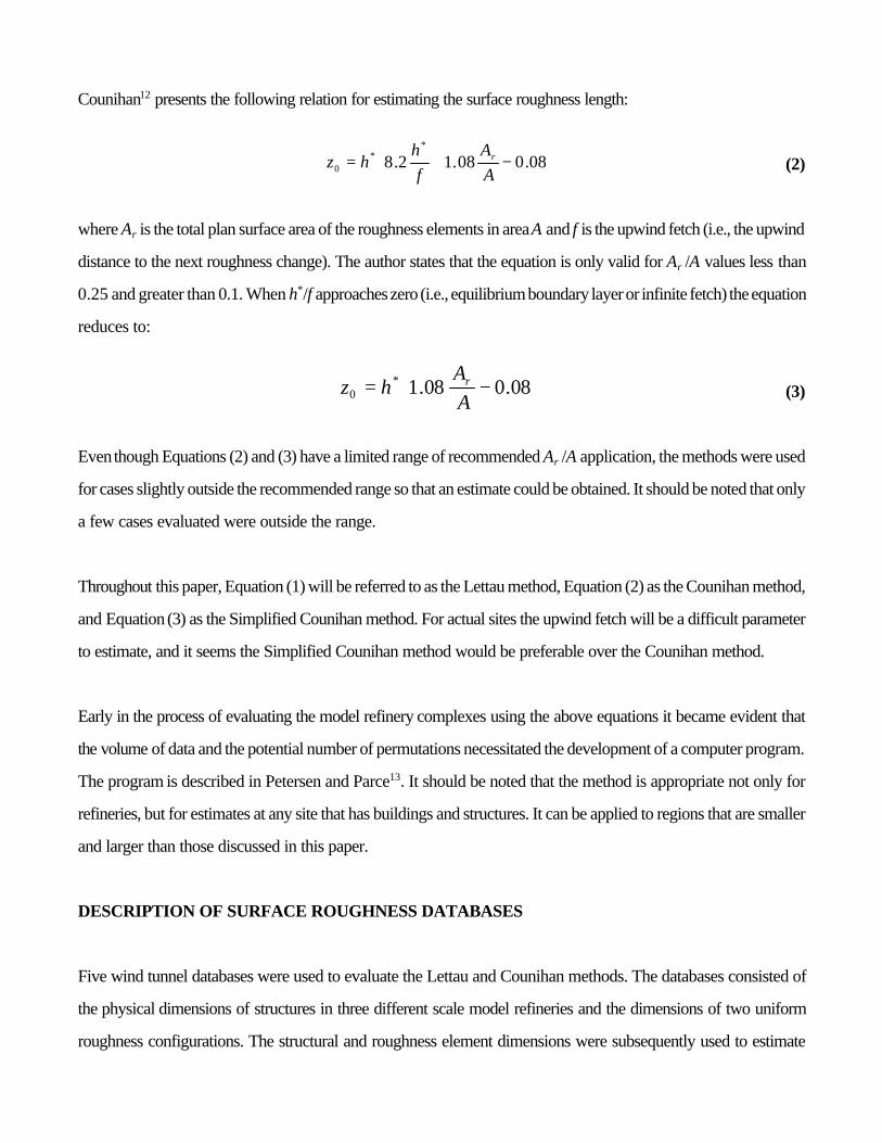
Counihan12 presents the following relation for estimating the surface roughness length:
(2)
where Ar is the total plan surface area of the roughness elements in area A and f is the upwind fetch (i.e., the upwind
distance to the next roughness change). The author states that the equation is only valid for Ar /A values less than
0.25 and greater than 0.1. When h*/f approaches zero (i.e., equilibrium boundary layer or infinite fetch) the equation
reduces to:
(3)
Even though Equations (2) and (3) have a limited range of recommended Ar /A application, the methods were used
for cases slightly outside the recommended range so that an estimate could be obtained. It should be noted that only
a few cases evaluated were outside the range.
Throughout this paper, Equation (1) will be referred to as the Lettau method, Equation (2) as the Counihan method,
and Equation (3) as the Simplified Counihan method. For actual sites the upwind fetch will be a difficult parameter
to estimate, and it seems the Simplified Counihan method would be preferable over the Counihan method.
Early in the process of evaluating the model refinery complexes using the above equations it became evident that
the volume of data and the potential number of permutations necessitated the development of a computer program.
The program is described in Petersen and Parce13. It should be noted that the method is appropriate not only for
refineries, but for estimates at any site that has buildings and structures. It can be applied to regions that are smaller
and larger than those discussed in this paper.
DESCRIPTION OF SURFACE ROUGHNESS DATABASES
Five wind tunnel databases were used to evaluate the Lettau and Counihan methods. The databases consisted of
the physical dimensions of structures in three different scale model refineries and the dimensions of two uniform
roughness configurations. The structural and roughness element dimensions were subsequently used to estimate
surface roughness length using the Lettau and Counihan methods as described previously. Along with the
dimensions of the structural or roughness elements, wind profile measurements were obtained at various locations
over the models so that the actual surface roughness length could be established.
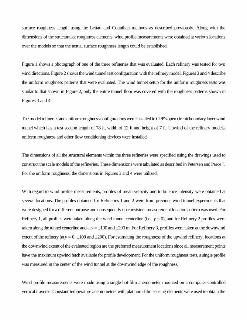
Figure 1 shows a photograph of one of the three refineries that was evaluated. Each refinery was tested for two
wind directions. Figure 2 shows the wind tunnel test configuration with the refinery model. Figures 3 and 4 describe
the uniform roughness patterns that were evaluated. The wind tunnel setup for the uniform roughness tests was
similar to that shown in Figure 2, only the entire tunnel floor was covered with the roughness patterns shown in
Figures 3 and 4.
The model refineries and uniform roughness configurations were installed in CPP's open circuit boundary layer wind
tunnel which has a test section length of 78 ft, width of 12 ft and height of 7 ft. Upwind of the refinery models,
uniform roughness and other flow conditioning devices were installed.
The dimensions of all the structural elements within the three refineries were specified using the drawings used to
construct the scale models of the refineries. These dimensions were tabulated as described in Petersen and Parce13.
For the uniform roughness, the dimensions in Figures 3 and 4 were utilized.
With regard to wind profile measurements, profiles of mean velocity and turbulence intensity were obtained at
several locations. The profiles obtained for Refineries 1 and 2 were from previous wind tunnel experiments that
were designed for a different purpose and consequently no consistent measurement location pattern was used. For
Refinery 1, all profiles were taken along the wind tunnel centerline (i.e., y = 0), and for Refinery 2 profiles were
taken along the tunnel centerline and at y = ±100 and ±200 m. For Refinery 3, profiles were taken at the downwind
extent of the refinery (at y = 0, ±100 and ±200). For estimating the roughness of the upwind refinery, locations at
the downwind extent of the evaluated region are the preferred measurement locations since all measurement points
have the maximum upwind fetch available for profile development. For the uniform roughness tests, a single profile
was measured in the center of the wind tunnel at the downwind edge of the roughness.
Wind profile measurements were made using a single hot-film anemometer mounted on a computer-controlled
vertical traverse. Constant-temperature anemometers with platinum-film sensing elements were used to obtain the

velocity measurements. A PC based computer system equipped with an A/D interface was used to monitor and
control the position of the hot-film probe as well as to convert the anemometer output into useful velocity
measurements and store the test results.
SURFACE ROUGHNESS ESTIMATES FROM WIND PROFILES
Wieringa9 presents a comprehensive summary of surface roughness length estimation methods and site surface
roughness classifications. He points out that surface roughness length estimates obtained from wind profile analysis
can have large errors resulting from the analysis method, best fit errors, and measurement errors. He further states
that reliable profiles should meet the following criteria: 1) observations should be made on a slender mast with boom
extensions such that mast interference effects are negligible; 2) well calibrated anemometers should be used and
measurements should be averaged over at least 10 minutes; 3) analysis should be limited to situations that are
neutral, or temperature profiles should be collected; 4) non-stationery situations should be avoided; 5) several cases
should be obtained; 6) the appropriate height range should be utilized; 7) at least three height levels should be
monitored in high roughness, four levels in moderate roughness, and five levels in smooth roughness for the
measured zo to be within a factor of 2 of the actual zo. The profiles collected and analyzed in the wind tunnel met
these criteria.
Seven different methods were used to estimate the surface roughness from the wind profiles measured over the
various model refineries and roughness patterns. Different methods were used to determine the range of values that
could be estimated using commonly accepted methods for estimating surface roughness length. Along with surface
roughness length, the displacement height (d) was also estimated. Definitions for surface roughness length and
displacement height can be found in Petersen and Parce13, which also describes in detail the methods utilized to
estimate surface roughness length and displacement height from the velocity profile measurements and includes a
detailed discussion of the calculated results.
Based on the analysis in Petersen and Parce13, one method was selected as the “ground truth” method. The “ground
truth” method was then used as the basis for evaluating the Lettau and Counihan methods, which is covered in
Section 6. The “ground truth” method selected was Method 6. This method is based on the following equation
recommended in the EPA On-Site Meteorological Program Guidance10:

′
=
uu
zz
exp0
(4)
where z is the measurement height, uN is the root mean square velocity in the longitudinal direction, and u is the mean
velocity.
The guideline states that measurement heights between 20 zo and 100 zo should be used in the analysis. This height
range, however, produced unrealistic results and did not make practical sense. For example, for a 1 m surface
roughness, the EPA guidance would suggest using data between 20 and 100 m. For a refinery situation with a
limited fetch, the internal boundary would not most likely be developed up to 100 m at any location within or
immediately downwind of the refinery. Wieringa9 reports that additional equilibrium fetch is required for turbulence
profiles to establish the characteristics of the upwind fetch. For this reason, the average zo value was calculated
using the turbulence measurements between 10 and 40 m.
This method was selected because it was found to be the most objective of all the methods analyzed, the least
sensitive to measurement errors, required no best fit analysis, would be the easiest to implement in the field, and
is consistent with the EPA10 recommended approach. The statistical evaluation further suggested that this method
provides estimates that are similar to several other valid methods that use best fits to the velocity profiles. Table 1
provides a summary of the surface roughness length estimates obtained using this method.
LETTAU AND COUNIHAN SURFACE ROUGHNESS LENGTH ESTIMATES
Surface roughness lengths were estimated using the Lettau and Counihan methods described previously for the three
refineries and two uniform roughness configurations. This section provides documentation regarding the method for
selecting the width and length of the region to be used for obtaining these estimates, and provides information on
the sensitivity of the estimates to region width, region length and wind direction.

75.0
00
36.0
=→
zx
z
zRS i
.07.0
00 zz
xzz
SR i
′=→
Specification of Region Length
With regard to the longitudinal extent of a refinery (or other area under evaluation) that should be used to estimate
surface roughness length, consider Figure 5. The figure shows the internal boundary layer growth and the transition
region for a flow from one surface roughness to another. At x > !L, the roughness is characterized by a roughness
length which is equivalent to the refinery surface roughness. At x < !L, the roughness length is characterized by the
roughness upwind of the refinery, zoN. In Figure 5, the region from z = 0 to zi has the flow in equilibrium with the
new surface and the wind profile can be approximated using the logarithmic wind profile equation with zo and u*
as inputs. Deaves14 presents the following two equations for estimating zi, one for low to high roughness changes
(denoted S R, smooth to rough) and a second equation for high to low roughness changes (R S, rough to→ →
smooth):
(5)
(6)
For most refinery situations, the surface roughness approaching the refinery will be less than that for the refinery
(i.e., zo > zoN). Typically, the refinery roughness length will be 0.5 m or greater.
Let us assume that we want the internal boundary layer developed up to at least 30 m at the downwind extent of
the area of interest (x = L). Using Equation (5) would suggest that a distance of 457 m upwind (x = !457 m) is
required for the internal boundary layer to be developed up to the 30 m height. For a 1 m refinery surface roughness
the distance would be 358 m. For boundary layer development up to greater heights a longer upwind fetch would
be required.
Next, consider the case when the surrounding roughness is greater than that found within the refinery. For example,
let zo = 0.5 m and zoN = 2 m (i.e., a downtown area). For this case a distance of 857 m is required before the
internal boundary is developed up to 30 m. Based on these analyses, the recommended longitudinal region for both
the Lettau and Counihan methods is from the upwind edge (!L) of the refinery to be the downwind edge (+L). This

[ ].
0004.01
3.416.03.4
5.0xxW y +
=σ=
will give a total alongwind extent of 800 to 1000 m for the three refineries studied. That means at the downwind
edge of the refineries, the internal boundary layer will be developed up to a height of about 50 m.
Specification of Region Width
With regard to the lateral extent of the region, a logical approach would be to ensure that the region is wide enough
to include all obstructions that may influence plume dispersion. One method for estimating the cloud width is to run
a dispersion model and obtain the cloud width at the end of the area of interest. For illustrative purposes, assume
that the cloud width (W) is equal to 4.3 times which can be approximated from the following equation15:yσ
(6)
Equation (7) is recommended for urban conditions, neutrally buoyant plumes and D stability. For the three refineries
under evaluation, x is approximately 500 m, and W then becomes 314 m. Based on this calculation, a region width
of 400 m would be sufficient to include all structures that would affect the dispersion.
Sensitivity to Region Length and Width
To assess the sensitivity of the results to the specified region width and length, surface roughness length estimates
were obtained for the various regions (or domains). The results of this analysis (see Petersen and Parce13) showed
some variation of surface roughness length estimates with region length or width, but the variations were relatively
small.
Based on this evaluation, estimates from the Lettau and Counihan methods for comparison with observations were
obtained for a region width of 400 m (±200 m) and region length from !L to L (the entire refinery length modeled).
For the uniform roughness, region width and length will not affect the resulting calculation since the roughness
pattern is repeating.
EVALUATION OF SURFACE ROUGHNESS ESTIMATION METHODS
Table 2 shows a comparison of the Lettau and Counihan surface roughness length estimates with the observed
values computed using Method 6 as the true estimator of surface roughness length. Inspection of the table shows
that the Lettau method estimates agree well with observations for all cases while the Counihan method estimates
are generally significantly higher than observations. The Simplified Counihan method also tends to overpredict
observations, but by a lesser degree than the Counihan method. A qualitative assessment of the results in Table 2
would suggest that the Lettau method provides reasonable surface roughness length estimates and estimates that
are better than either the Counihan or Simplified Counihan methods.
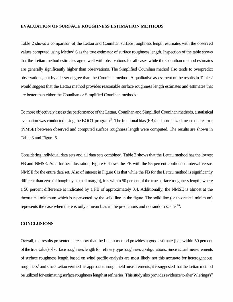
To more objectively assess the performance of the Lettau, Counihan and Simplified Counihan methods, a statistical
evaluation was conducted using the BOOT program16. The fractional bias (FB) and normalized mean square error
(NMSE) between observed and computed surface roughness length were computed. The results are shown in
Table 3 and Figure 6.
Considering individual data sets and all data sets combined, Table 3 shows that the Lettau method has the lowest
FB and NMSE. As a further illustration, Figure 6 shows the FB with the 95 percent confidence interval versus
NMSE for the entire data set. Also of interest in Figure 6 is that while the FB for the Lettau method is significantly
different than zero (although by a small margin), it is within 50 percent of the true surface roughness length, where
a 50 percent difference is indicated by a FB of approximately 0.4. Additionally, the NMSE is almost at the
theoretical minimum which is represented by the solid line in the figure. The solid line (or theoretical minimum)
represents the case when there is only a mean bias in the predictions and no random scatter16.
CONCLUSIONS
Overall, the results presented here show that the Lettau method provides a good estimate (i.e., within 50 percent
of the true value) of surface roughness length for refinery type roughness configurations. Since actual measurements
of surface roughness length based on wind profile analysis are most likely not this accurate for heterogeneous
roughness9 and since Lettau verified his approach through field measurements, it is suggested that the Lettau method
be utilized for estimating surface roughness length at refineries. This study also provides evidence to alter Wieringa's9

conclusion that the Lettau method is only applicable up to moderately inhomogeneous situations. The results
presented here extend the applicable range of the Lettau method to at least moderately inhomogeneous situations
(i.e., refineries, or other similar roughness configuration.
To provide further evidence that the Lettau method can be used for estimating surface roughness and that increased
roughness length values can be input into the models, a field measurement program is planned at the Nevada test
site in August of 1995. The field testing will included the installation of roughness elements that will be designed
to simulate the dispersion and air flow characteristics at a refinery. The roughness pattern will be designed based
on the Lettau method. Subsequent field measurements will then verify whether the Lettau roughness estimate is valid
and more importantly whether the dispersion is enhanced by the larger roughness.
In conclusion, over-conservatism in dispersion modeling may be very costly to the petroleum and chemical
industries and in turn to consumers of those products. For example, under Section 112 of the Clean Air Act,
sources throughout the industry are installing Maximum Achievable Control Technology (MACT). The need for
further controls (and expense) beyond MACT will be determined by the residual risk requirements of Section 112
(f). This residual risk is likely to be calculated inpart by a dispersion model. Therefore the need for non-
conservative, accurate dispersion model estimates is extremely important. This study will ultimately provide
additional tools so that more accurate and less conservative estimates can be obtained.
REFERENCES
1. EPA, “Guidance on the Application of Refined Dispersion Models for Air Toxics Release,” USEPA,OAQPS, Research Triangle Park, North Carolina, EPA–450/4–91–007, March 1991.
2. Petersen, R.L., and Ratcliff, M.A., “Effect of Homogeneous and Heterogeneous Surface Roughness onHeavier-Than-Air Gas Dispersion,” Volumes I and II, API Publication Nos. 4491 and 4492, American PetroleumInstitute, Washington, D.C., March 24, 1989.
3. Roberts, P.T., and Hall, D.J., “Wind-Tunnel Simulation. Boundary Layer (zo) Effects in Dense GasDispersion Experiments,” J. Loss Prev. Process Ind., Vol. 7, No. 2, 1994.
4. EPA, “Guideline on Air Quality Models (Revised),” USEPA, OAQPS, Research Triangle Park, NorthCarolina, EPA–450/2–78–027R, July 1986.

5. Auer, A.H., “Correlation of Land Use and Cover with Meteorological Anomalies,” Journal of AppliedMeteorology, Vol. 17, May 1978.
6. Weil, J.C., “Updating the ISC Model Through AERMIC,” Proceedings of the 85th Annual Meeting of theAir and Waste Management Association, Air and Waste Management Association, Pittsburgh, Pennsylvania, Paper92–100.11, 1992.
7. Winges, K.D., “User's Guide for the Fugitive Dust Model (FDM) (revised), Volume I: User's Instructions,”Region 10, U.S. Environmental Protection Agency, Seattle, Washington, EPA–910/9–88–202R, September 1992.
8. ESDU, “Characteristics of Atmospheric Turbulence Near the Ground, Part 3, Variation in Space and Timefor Strong Winds (Neutral Atmosphere),” Item 75001, 1972.
9. Wieringa, J., “Representative Roughness Parameters for Homogeneous Terrain,” Boundary LayerMeteorology, Vol. 63, pp. 323–363, 1993.
10. EPA, “On-Site Meteorological Program Guidance for Regulatory Modeling Applications,” USEPA,Research Triangle Park, North Carolina, EPA–450/4–87–013, June 1987.
11. Lettau, H., “Note on Aerodynamic Roughness-Parameter Estimation on the Basis of Roughness-ElementDescription,” Journal of Applied Meteorology, Vol. 8, 1969.
12. Counihan, J., “Wind Tunnel Determination of the Roughness Length as a Function of the Fetch andRoughness Density of Three Dimensional Roughness Elements,” Atmospheric Environment, Vol. 5, 1971.
13. Petersen, R.L., and Parce, D.K., “Development and Testing of Methods for Estimating Surface RoughnessLength at Refineries,” CPP Project 92-0890, Cermak Peterka Petersen, Inc., Fort Collins, Colorado, June 1994.
14. Deaves, D.M., “Computation of Wind Flow Over Changes in Surface Roughness,” Journal of WindEngineering and Industrial Aerodynamics, Vol. 7, 1981.
15. Hanna, S.R., Briggs, G.A., and Hosker, R.P, “Handbook on Atmospheric Diffusions,” National TechnicalInformation Service, U.S. Department of Commerce, Available as DOE/TIC–11223 (DE82002045), 1982.
16. Sigma Research Corporation, “Hazard Response Modeling Uncertainty (A Quantitative Method), VolumeI, User's Guide for Software,” American Petroleum Institute, Publication No. 4545, Washington, DC, 1992.

Table 1. Summary of surface roughness estimates from velocity profile analysis—Method 6.
Site Description
Wind Direction
(degrees)
Surface Roughness Length
(m)
Refinery 1 337.5
247.5
0.73
0.47
Refinery 2 180.0
112.5
0.53
0.27
Refinery 3 0.0
67.5
0.35
0.33
Uniform Roughness 1 NA 0.65
Uniform Roughness 2 NA 0.01
Table 2. Comparison of Lettau and Counihan estimates with velocity profile estimates (Domain !L < X L;!200 < Y < 200).
Wind
Direction
Lettau
Estimated zo
(m)
Counihan
Estimated zo
(m)
Simplified Counihan
Estimated zo
(m)
Method 6
(Log Ave) zo
(m)
Refinery 1
337.5
247.5
0.90
0.85
2.85
2.88
1.51
1.88
0.73
0.47
Refinery 2
180
112.5
0.40
0.45
1.85
2.06
1.22
1.46
0.53
0.27
Refinery 3
0
67.5
0.36
0.45
1.02
1.42
0.28
0.50
0.35
0.33
Mixed 2 and (double stacked) 4 in. cube at a 1:240 scale
NA 0.73 2.45 0.32 0.65
1/2 in. cube roughness at a 1:240 scale
NA 0.02 NA NA 0.01

Table 3. Summary of normalized mean square error and fractional bias (Domain !L < X < L; !200 < Y <200).
NMSE FB
Method 6
Refinery 1
Lettau
Counihan
Simplified Counihan
0.16
2.99
1.27
!0.37
!1.31
!0.95
Refinery 2
Lettau
Counihan
Simplified Counihan
0.14
3.11
1.73
!0.05
!1.31
!1.07
Refinery 3
Lettau
Counihan
Simplified Counihan
0.05
1.94
0.12
!0.06
!1.12
!0.13
2 in. and 4 in. cube roughness
Lettau
Counihan
Simplified Counihan
0.01
2.03
0.52
!0.12
!1.16
0.68
0.5 in. cube roughness
Lettau
Counihan
Simplified Counihan
0.50
NA
NA
!0.67
NA
NA
All surfaces
Lettau
Counihan
Simplified Counihan
0.14
2.89
1.34
!0.21
!1.25
!0.73

Figure 1. Photographs of Refinery 2: 180 degree wind direction.

Fig
ure
2. W
ind tu
nnel s
etu
p fo
r R
efin
ery
2 te
sts
at a
112.5
degre
e w
ind d
irect
ion.


Figure 3. Drawings of Uniform Roughness 1 (mixed 2 and 4 in. cubes).

Figure 4. Drawings of Uniform Roughness 2 (0.5 in. cubes).

Figure 5. Growth of internal boundary layer after a change in surface roughness.

Figure 6. Normalized mean square error (NMSE) and fractional bias (FB—with its 95 percent confidencelimits) for different surface roughness length estimation methods with Method 6 as the true estimatorof surface roughness length. Also included are the “factor of two” lines and “minimum” NMSE curve.