NOAA Observing Systems Architecture (NOSA) Eric Miller NOAA Observing Systems Architect (acting) May...
25
NOAA Observing Systems Architecture (NOSA) Eric Miller NOAA Observing Systems Architect (acting) May 12, 2004
-
date post
22-Dec-2015 -
Category
Documents
-
view
215 -
download
0
Transcript of NOAA Observing Systems Architecture (NOSA) Eric Miller NOAA Observing Systems Architect (acting) May...

NOAA Observing Systems Architecture (NOSA)
Eric Miller
NOAA Observing Systems Architect (acting) May 12, 2004

Background:Taskers and Drivers
• NOAA Program Review Team Recommendation 32– Centrally plan and integrate all observing systems
– Develop a NOAA-wide observing system architecture
• NOAA Strategic Plan– Develop integrated global environmental observation and data
management system
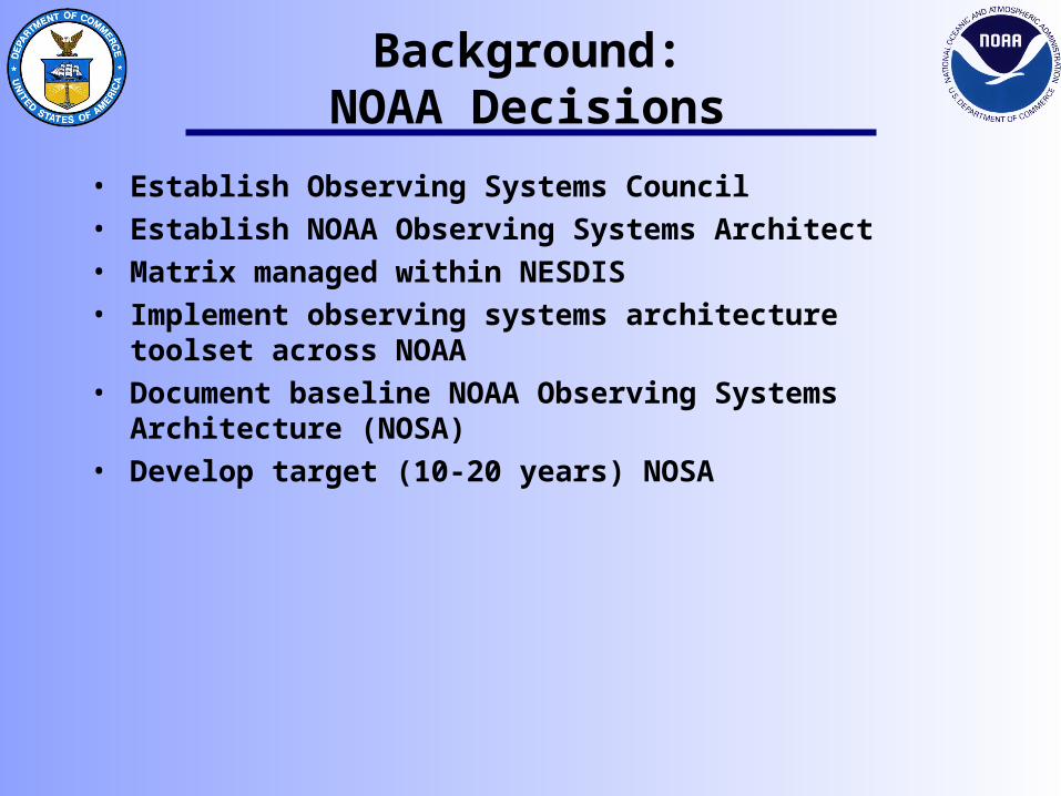
Background:NOAA Decisions
• Establish Observing Systems Council• Establish NOAA Observing Systems Architect• Matrix managed within NESDIS• Implement observing systems architecture toolset across
NOAA• Document baseline NOAA Observing Systems Architecture
(NOSA)• Develop target (10-20 years) NOSA

Mission Technology
Benefits of an Architecture
• Facilitates true alignment of mission goals and programs to technology
• Provides the information needed for informed decision making
• Provides an ability to prioritize budget initiatives/alternatives
• Provides a mission goal to technology blueprint
• Provides reliable impact analysis
• Provides ability to find cost reductions and/or realignment of resources
Architecture establishes a semantic bridge between…
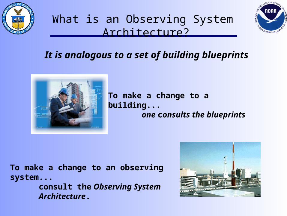
What is an Observing System Architecture?
It is analogous to a set of building blueprints
To make a change to a building... one consults the blueprints
To make a change to an observing system...consult the Observing System Architecture.

Observing System Architecture Relationship Diagram
Larger System
Observing System
Data Handling System
Human
Environmental Phenomenon
Environmental Parameter
Sensing Element
Sensor
Platform / Station
part of
senses
is a
contains
characterizes
provides data to
Observation Control System
is controlled by
Location
located at
MobileFixed
is
Space
Air
Ground
Ocean
Space
Air
Ground
Ocean
Basic Service Requirement
< drives
provides data directly to
Userprovides info to
is type of
Stake-holder
has
Operator operated by
situated on
Support
supported by
Owner
owned by
Stakeholder Requirement
< drives< drives

GOES R
• How does this system fit into the overall architecture
• Satellite Systems cut across all goals.
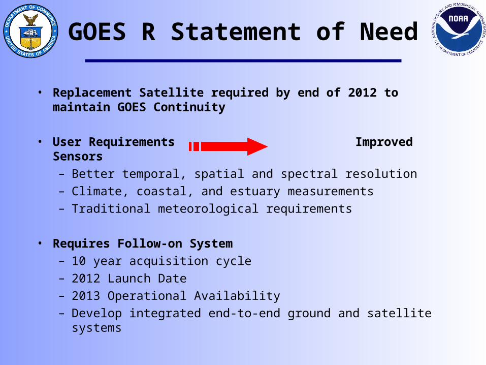
GOES R Statement of Need
• Replacement Satellite required by end of 2012 to maintain GOES Continuity
• User Requirements Improved Sensors– Better temporal, spatial and spectral resolution– Climate, coastal, and estuary measurements – Traditional meteorological requirements
• Requires Follow-on System – 10 year acquisition cycle– 2012 Launch Date– 2013 Operational Availability– Develop integrated end-to-end ground and satellite systems

• Ecosystem– Determine environmental
impacts of chaotic processes• Ocean Color• Ocean Optical Properties• Ocean Turbidity• Ocean Currents
• Climate– Provide quantitative
environmental data for use in weather and climate prediction and analysis
• Ozone Layers• CO2 Concentration• Vegetation Index
GOES R Statement of NeedSupports NOAA Strategic Goals
• Weather and Water– Real time weather data to
accurately track and analyze severe weather events and reduce loss of life and property
• Temperature Profiles• Lightening Detection• Cloud Measurement• Wind Currents
• Commerce– Uninterrupted hemispheric
observations and products for safe and efficient transportation and commerce systems
• Volcanic Ash • Solar Radiation• Ice

GOES R End-to-End Approach
• Implement process to identify and validate user requirements– Consistent with new NOAA Requirements Process– Addresses NOAA-wide requirements including climate, coastal, estuaries, etc– Considers other Federal and International requirements
• GOES-R End-to-End System includes – Space and Launch Segment – Command, Control and Communications (C3) Segment – Product Generation and Distribution Segment– Archive and Access Segment– User Interface and Assimilation Segment
• Working with NASA to develop joint process for major system acquisition approval
• Select notional architecture as baseline for budget submission and assessing future system trades
– Establish cost, schedule, performance baseline– Will re-assess upon completion of Industry System Architecture efforts and review for
compliance with NOAA Observing Systems Architecture

End-to-End Overview
Uplink & Downlink
Data Handling
Product ProductionData Distribution
Archive and Access
Spacecraft Operations
Users
Ground System Functions

NOAA Information Service Enterprise for 2020
ENGAGE, ADVISE, and INFORM
National andRegional InternationalInternational
NationalNational
Other Collectors
Other Collectors
Environmental,Space, and
Solar Phenomena
NOAA Leadership and Support Services
METHODOLOGYINNOVATION &
IMPLEMENTATION
Info Request/Discovery Tools
Communicationsand Network Mgmt
Metadata
Algorithms and
Models
Management Info Tools
ScienceApplications
NOAA Library
IV&V
MONITOR and OBSERVE
ASSESS and PREDICTUNDERSTAND and DESCRIBE

Requirements Collection to DateRequirements Collection to Date
Other Federal Federal AgenciesAgenciesUSDA
EPA
NASA
DHS
DoD
EcosystemsClimateWeather and WaterCommerce and Transportation
DOC/NOAA
Interagency RequirementsInteragency RequirementsCollection ProcessCollection Process
External RequirementsExternal RequirementsCollection ProcessCollection Process
Research and AcademicMedia and
CommercialMeteorological CentersInternational
Partners
Requirements Collected to date span:Requirements Collected to date span:Agencies
• 12 Individual Reqs Databases Created -• All NOAA Los• DoD (AF, Navy, Army)• European
Communities • Operational Weather/Water • Operational National Defense • Climate• Research
Domains• Atmosphere• Ocean• Land• Space
Scales• Geographic: Global to Local• Temporal: Decadal (Climate) to Minutes (Short Term
Warnings) Specifications
• Priority Categorized• Threshold and Objective Values
48 Req Matrices48 Req Matrices48 Req Matrices48 Req Matrices

Trade Study or Solution Analysis
Serve Society’s Needs for Weather and Water
Information
Environmental Modeling
Measure SST
Weather & Water Forecasts and Warnings
Measure Water Column Temperature
Ecosystem Modeling
Measure Wave Height
Mission Goal
Program
Capabilities
Task/Activities
Programs or Capabilities that Support Goals
SST
GOES N-P
SST
OAR TAO
SST
NWS MAN
Task/Activity
NOSA Baseline
=
=
=
=
=
=
Gap AnalysisTrade Study or
Solutions AnalysisTrade Study or
Solutions Analysis
This activity led to GOES- R

NOSA Data Flow
NOAAForge
ArchitectureTool
LO1
LO2
LON
. . .
. .
SURVEYS
GIS Tool
RequirementsTool
Requirements
System Characteristics
GIS Geospatial Information System
Geo-referenced data


Internet Maps: A View For Everyone
These maps are produced on the internet using ArcIMS, the internet map server from ESRI.

Open GIS Map Comparisons
This collection of maps was drawn using the Open GIS Consortium Web Map Server (WMS) standard. This standard allows users to request and receive maps using open non-proprietary tools.
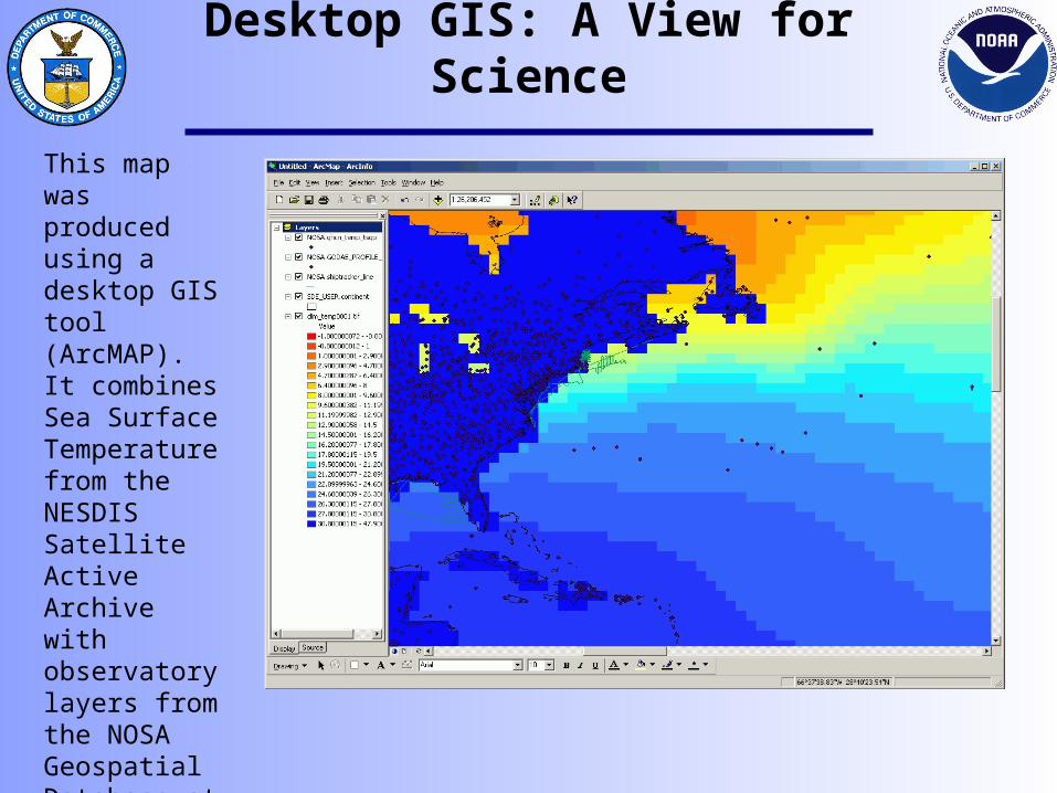
Desktop GIS: A View for Science
This map was produced using a desktop GIS tool (ArcMAP). It combines Sea Surface Temperature from the NESDIS Satellite Active Archive with observatory layers from the NOSA Geospatial Database at NGDC.
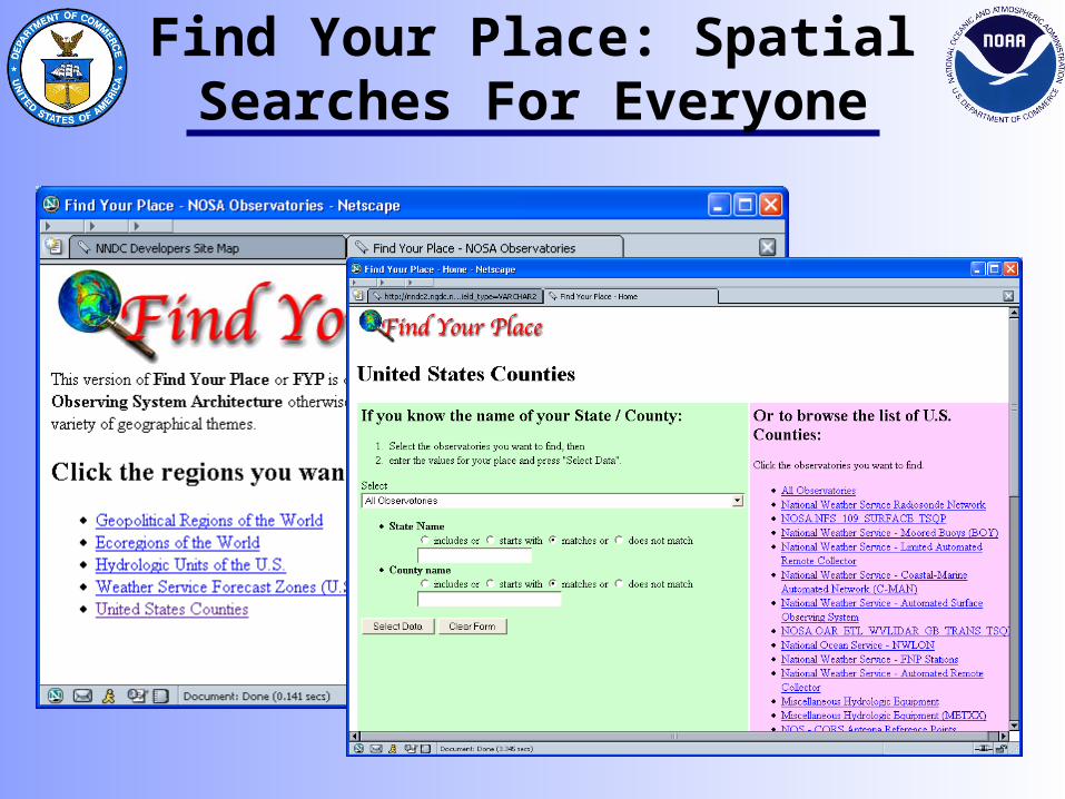
Find Your Place: Spatial Searches For Everyone
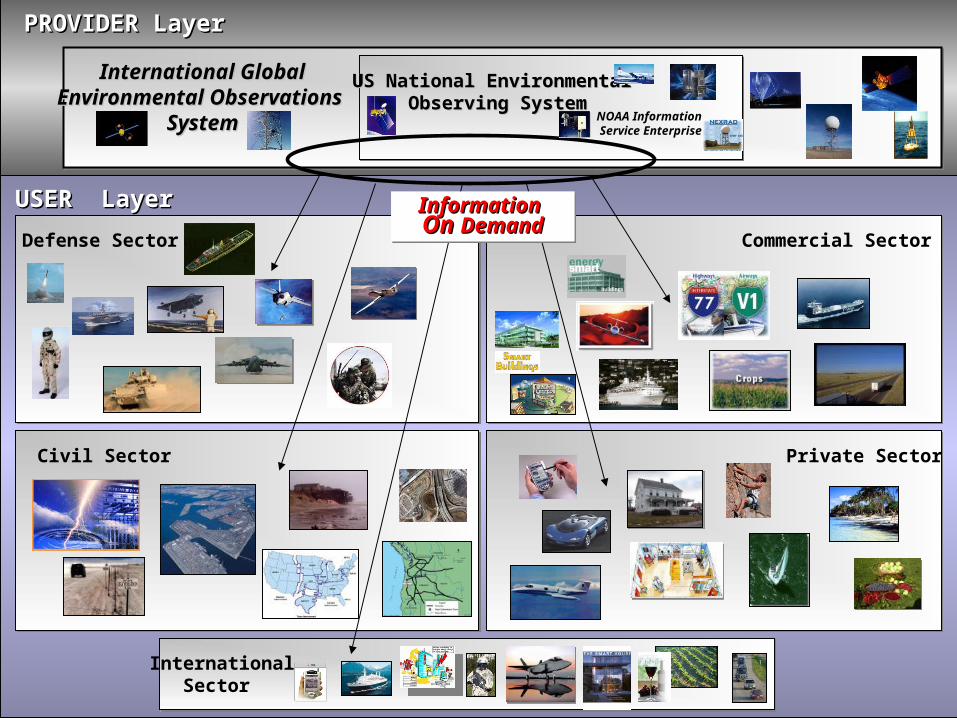
Commercial SectorDefense Sector
Civil Sector Private Sector
PROVIDER LayerPROVIDER Layer
USER LayerUSER Layer
InternationalSector
International GlobalInternational GlobalEnvironmental Observations Environmental Observations
SystemSystem
US National Environmental US National Environmental Observing SystemObserving System
NOAA Information Service Enterprise
InformationInformation On On DemandDemandInformationInformation On On DemandDemand

Backup

Integrated Planning Process for Integrated Planning Process for Target NOSA DevelopmentTarget NOSA Development
Integrated Planning Process
Mission Goal Assessment
Operational & Support Tasks
Mission Needs
Analysis
Prioritized Needs
Mission Solutions Analysis
Concepts & Technologies
Integrated Investment
Analysis
25-Year Investment Roadmap
NOSA Master
Plan
Science & Technology
Industry R&D
Requirements Management Process
NOAA Strategic Plan Goal Team Priority Lists
Future NOAA CONOPSAnnual Strategic Guidance Memo
SONMRDPRD
SONMRDPRD
Req. Docs (e.g, SON)
Program Plans
Program Plans
Program Plans

Further Benefits to NOAA
• Provides integrated view of NOAA’s observing systems linked to mission requirements
• Provide framework for future requirements & costs• Reveal how changes in funding levels for one system will
impact many others• Reveals gaps and duplication• Results in more cost-effective overall observation system• Facilitates accessibility to all NOAA observations by all NOAA
customers• Facilitate international partnering• Identify opportunities for migration of research to operations

Where we are going?
Today’s implementations of architecture, are in reality, knowledge management and decision support tools.