No. 18 - Discussion Regarding the Maximum Height of Wireless
16
SOUTHAMPTON COUNTY BOARD OF SUPERVISORS Regular Session i October 28, 2013 NO ACTION REQUIRED: Unless the Board directs otherwise, the Planning Commission is moving forward in studying this issue. 18. DISCUSSION REGARDING THE MAXIMUM HEIGHT OF WIRELESS COMMUNICATIONS TOWERS At this past month’s Planning Commission meeting, while considering issuance of a conditional use permit, the topic of the maximum height of wireless telecommunications towers arose. Currently, Section 18-427 (f) (1) limits the height of telecommunications towers to 199’ above ground level in Business, Industrial and Agricultural zoning districts. This height limitation was widely debated by the Planning Commission in September 2002 when the ordinance was first adopted. The initial draft ordinance, developed by the consultant and recommended by staff, had established 250’ as the maximum height in Agricultural zoning districts. The issue that the Planning Commission had at the time, revolved around an FAA regulation that requires towers which are 200’ or higher to be lighted, and there was concern about a proliferation of lighted towers blighting the rural landscape. Based on my understanding of the discussion at this month’s Planning Commission, there now appears to be an interest in revisiting this issue. Limiting the height of towers to 199’ is seen by some to be an obstruction to provision of wireless services in rural areas of the County. It’s my understanding that the Planning Commission has already directed Mrs. Lewis to research the issue and she’s currently working with a consultant employed by a number of wireless service providers to develop a report and recommendations. In order to amend the ordinance, public hearings will be necessary by both the Planning Commission and Board of Supervisors. Supervisor Updike has expressed an interest in placing this matter on your agenda for Board discussion.
Transcript of No. 18 - Discussion Regarding the Maximum Height of Wireless

SOUTHAMPTON COUNTY BOARD OF SUPERVISORS Regular Session i October 28, 2013
NO ACTION REQUIRED: Unless the Board directs otherwise, the Planning Commission is moving forward in studying this issue.
18. DISCUSSION REGARDING THE MAXIMUM HEIGHT OF WIRELESS COMMUNICATIONS TOWERS
At this past month’s Planning Commission meeting, while considering issuance of a conditional use permit, the topic of the maximum height of wireless telecommunications towers arose. Currently, Section 18-427 (f) (1) limits the height of telecommunications towers to 199’ above ground level in Business, Industrial and Agricultural zoning districts. This height limitation was widely debated by the Planning Commission in September 2002 when the ordinance was first adopted. The initial draft ordinance, developed by the consultant and recommended by staff, had established 250’ as the maximum height in Agricultural zoning districts. The issue that the Planning Commission had at the time, revolved around an FAA regulation that requires towers which are 200’ or higher to be lighted, and there was concern about a proliferation of lighted towers blighting the rural landscape. Based on my understanding of the discussion at this month’s Planning Commission, there now appears to be an interest in revisiting this issue. Limiting the height of towers to 199’ is seen by some to be an obstruction to provision of wireless services in rural areas of the County. It’s my understanding that the Planning Commission has already directed Mrs. Lewis to research the issue and she’s currently working with a consultant employed by a number of wireless service providers to develop a report and recommendations. In order to amend the ordinance, public hearings will be necessary by both the Planning Commission and Board of Supervisors. Supervisor Updike has expressed an interest in placing this matter on your agenda for Board discussion.

(a)
Sec. 18-427. - Wireless telecommunication facility regulations.
Wireless telecommunication facility definitions. For the purpose of this section, certain terms and words pertaining to telecommunication facilities are hereby defined. The general rules of construction contained in article I are applicable to these definitions.
Abandonment: Any component of a wireless telecommunication facility (e.g., antenna support structure, antenna, transmission cable, equipment shelter, etc.) is deemed abandoned when not utilized for the provision of wireless service for a period of twelve (12) consecutive months.
Above ground level (AGL): The distance measured from finished grade at the base of a structure to the highest point or an object on the structure.
Antenna: Any exterior electronic device used for the transmission or reception of radio frequency signals designed for telephonic, radio, satellite or television communications.
Antenna support structure: Any structure designed for the primary purpose of supporting one or more antennas including but not limited to self-supporting lattice towers, guyed towers and monopoles.
Applicant: Any entity requesting approval to construct/install wireless telecommunication facilities through the county's permitting process.
Balloon test: A technique utilizing a balloon to demonstrate the height above ground level of a proposed antenna support structure.
Co-location: The shared use of an antenna support structure by two (2) or more wireless service providers or other entities operating antennas.
Electrical engineer: An individual or firm licensed by the Commonwealth of Virginia to practice electrical engineering.
Entity: Any natural person, firm, partnership, association, corporation, company or other legal entity, private or public, whether for profit or not for profit.
Existing facility: Any existing or proposed wireless telecommunication facility for which a valid County permit has been issued.
Fall zone: An area within a radius equal to one hundred ten (100) percent of the height of the antenna support structure within which there is a potential hazard from falling debris or collapsing material. A fall zone is distinct from a setback.
Federal Aviation Administration (FAA): An agency of the federal government that regulates all activities affecting air navigation.
Federal Communications Commission (FCC): An agency of the federal government that regulates all intrastate, interstate and international wire, wireless, satellite and cable communications.
Mini/micro cell: An antenna support structure not exceeding eighty (80) feet in height.
Page 1 of 7Municode
10/23/2013http://library.municode.com/print.aspx?h=&clientID=12337&HTMRequest=http%3a%2f...

(b)
(1)
(2)
(3)
(4)
(c)
(1)
(2)
(3)
(d)
Mitigate: To reduce or eliminate adverse impacts.
Property owner: Any entity with fee simple title to any parcel of land within the county.
Secondary support structure: Any structure designed primarily for other purposes that can be utilized to support antennas including but not limited to buildings, power transmission towers, church steeples, light poles, water storage tanks, smoke stacks and silos.
Stealth technique: Any technique designed to conceal or disguise wireless telecommunication facilities, structural engineer. An individual or firm licensed by the Commonwealth of Virginia to practice structural engineering.
Tower developer: Any entity that develops structures for the purpose of leasing space to entities operating antennas.
Wireless service provider: Any entity providing commercial mobile radio services.
Wireless telecommunication facility: All infrastructure and equipment including but not limited to antenna support structures, antennas, transmission cables, equipment shelters, equipment cabinets, utility pedestals, ground systems, fencing, signage and other ancillary equipment associated with the transmission or reception of radio frequencies.
Excluded uses. The following uses are not subject to the ordinance regulating wireless telecommunication facilities:
Amateur radio. Amateur radio operations are regulated to the extent that their regulation is consistent with § 15.2-2293.1 of the Code of Virginia.
Television reception antennas. Television reception antennas that are less than thirty-five (35) feet above ground level (AGL) and used exclusively for non-commercial purposes.
Satellite earth station antennas. Ground-mounted satellite earth station antennas that are less than or equal to ten (10) feet AGL, less than or equal to six (6) feet in diameter and used exclusively for non-commercial purposes.
Public safety/service radio. County owned or operated wireless telecommunication facilities are exempt from the requirements of this article but are expected to adhere, to the extent reasonably possible, to the goals described herein.
Applications requiring conditional use permit. Except as provided below, all wireless telecommunication facilities require a conditional use permit obtained in accordance with the provisions of this section. An administrative review process as set forth will be required for applications not requiring a conditional use permit.
A conditional use permit shall not be required for:
The placement of antennas and equipment on an existing antenna support structure provided it does not result in an increase in the overall height of the structure.
The placement of antennas and equipment on a secondary support structure provided it does not result in an increase in the overall height of the structure of more than fifteen (15) feet.
The replacement in-kind of an existing antenna support structure provided it does not result in an increase in the overall height of the structure.
Administrative review process. Applications not requiring a conditional use permit shall be submitted to the director of planning for review. The director of planning shall approve all
Page 2 of 7Municode
10/23/2013http://library.municode.com/print.aspx?h=&clientID=12337&HTMRequest=http%3a%2f...

(1)
(2)
(3)
(4)
(e)
(1)
(2)
(3)
(4)
(5)
applications that meet the minimum requirements. The director of planning retains the authority to request changes to the application as a condition of approval.
The following information shall be supplied as a minimum requirement for application not requiring a conditional use permit:
Scaled drawings, signed and sealed by appropriate licensed professionals, showing the location and dimensions of all improvements, including information concerning the structure, equipment, utilities, grounding, topography, setbacks, drives, parking, fencing, landscaping, adjacent uses and other information deemed necessary to assess the proposal.
FAA Air Navigation Hazard Determination report for any proposed installation resulting in an increase in the overall height of the structure. A consultant study will not be accepted as a substitute to this requirement.
A statement from an electrical engineer attesting that the cumulative effect of all existing and proposed antennas will not result in a ground level exposure of non-ionizing electromagnetic radiation (NIER) that exceeds the lowest applicable exposure standards established by the FCC.
A statement from a structural engineer attesting that the structural capacity is sufficient to support the proposed loading in accordance with the latest revision of ANSI EIA/TIA-222.
Conditional use permit review process. Applications requiring a conditional use permit require approval by the board of supervisors in order to permit construction.
The following information shall be supplied as a minimum requirement for application not requiring a conditional use permit:
Scaled drawings, signed and sealed by appropriate licensed professionals, showing the location and dimensions of all improvements, including information concerning the structure, equipment, utilities, grounding, topography, setbacks, drives, parking, fencing, landscaping, adjacent uses and other information deemed necessary to assess the proposal.
Photographs of the site from a minimum of five (5) points surrounding the site as designated by the director of planning or his/her designee that include a simulated photographic image to scale of the proposed wireless telecommunication facility. The photograph with the simulated image shall include the foreground, mid-ground and the background of the site. A map shall be provided indicating the location and distance from the point at which the photograph was taken to the proposed site.
A statement from an electrical engineer attesting that the cumulative effect of all existing and proposed antennas will not result in a ground level exposure of non-ionizing electromagnetic radiation (NIER) that exceeds the lowest applicable exposure standards established by the FCC.
An inventory of the existing wireless telecommunication facilities owned and/or operated by the applicant and other entities associated with the application that are located within the jurisdiction of Southampton County or within five (5) miles of the border thereof, including specific information about the location and height of each antenna and/or antenna support structure.
A radio frequency technician's statement that specifically describes the coverage area objective, the "hand-off" sites, equipment specifications, methodology, assumptions, constraints and other factors used in the design. The technician's statement shall be
Page 3 of 7Municode
10/23/2013http://library.municode.com/print.aspx?h=&clientID=12337&HTMRequest=http%3a%2f...

a.
b.
c.
d.
(6)
(7)
(8)
(9)
(10)
(11)
(12)
(13)
(f)
(1)
supported by propagation maps that include a legend referencing signal strength. At a minimum, the following coverage maps shall be presented:
Existing network coverage (minimum ten-mile radius surrounding the proposed site)
Proposed coverage from the proposed site
Composite network coverage (existing and proposed coverage)
Composite network coverage (existing and proposed coverage) demonstrating the effect on coverage as the height of the proposed structure is reduced at 20-foot increments to a minimum height of eighty (80) feet AGL.
Evidence demonstrating the inadequacy or unavailability of other structures within a three-mile radius of the proposed site. In assessing the adequacy of existing structures, the applicant should consider the use of one or more existing structures or a combination of an existing structure and a new structure at a lower height than proposed as a means to achieve coverage objective.
An engineering report by a structural engineer describing the structure height, design, and capacity of the proposed antenna support structure including the number and type of antenna which could be accommodated in accordance with the requirements set forth in the latest revision to ANSI EIA/TIE 222.
Applicants proposing new structures shall include a statement regarding their co-location policy.
FAA Air Navigation Hazard Determination report. A consultant study will not be accepted as a substitute to this requirement.
FCC Environmental Compliance report identifying the impact on environmental resources, prepared in accordance with the National Environmental Policy Act of 1969 (NEPA).
Report describing the impact on historic resources prepared in accordance with Section 106 of the National Historic Preservation Act of 1966 (NHPA). This report should be accompanied by written comment by the State Historic Preservation Office (SHPO).
FCC license for each wireless service provider associated with the application.
A report prepared by a structural engineer certifying that the proposed structure is capable of supporting similar users, including the primary user, in accordance with the table below.
Structure Height (AGL) Minimum Number of Antenna Positions= 80 ft. 1> 80 ft. to < 100 ft. 2= 100 ft. to < 120 ft. 3= 120 ft. 5
This requirement shall not apply to applications to extend structures.
General standards. The following general standards shall apply to all applications proposing wireless telecommunication facilities:
Antenna support structure shall not exceed the maximum height above ground level (AGL) established in the following table:
Page 4 of 7Municode
10/23/2013http://library.municode.com/print.aspx?h=&clientID=12337&HTMRequest=http%3a%2f...

(2)
a.
b.
c.
(3)
(4)
(5)
a.
b.
c.
d.
(6)
a.
Zoning District Maximum Height AGLResidential 80 ft.Business 199 ft.Industrial 199 ft.Agricultural 199 ft.PUD 80 ft.
The following setback requirements shall apply:
All antenna support structures must be setback two hundred (200) percent of the height of the structure from the nearest residential structure, and in no case less than four hundred (400) feet.
All antenna support structures shall be setback one hundred ten (110) percent of the height of the structure from all property lines.
All wireless telecommunication facilities must satisfy the minimum zoning district setback requirements for primary structures.
Speculative structures are not permitted. Applications to construct new antenna support structures will not be considered unless evidence is presented of a legally binding commitment by at least one (1) wireless service provider agreeing to install and operate his equipment on the proposed structure upon its construction for a minimum period of one (1) year.
All antenna support structures shall be enclosed by security fencing not less than six (6) feet in height in height, equipped with an appropriate anti-climbing device.
The following requirements shall govern the landscaping surrounding wireless telecommunications facilities:
Any combination of landscaped vegetative buffers, landscaped earthen berms or preservation of existing vegetation shall be provided around the perimeter of the site of any wireless telecommunication facility to effectively screen the view of the equipment compound from adjacent parcels. The standard buffer shall consist of a mix of native trees and shrubs planted in a landscaped area at least fifteen (15) feet wide outside the perimeter of the compound.
Existing mature tree growth and natural landforms on the site shall be preserved to the maximum extent possible. In some cases the Board of Supervisors may determine that the natural growth around the perimeter may be a sufficient buffer and waive the landscape requirements.
All trees shall be preserved and protected during construction of wireless telecommunication facilities except where clearing is required to accommodate the proposed facilities and vehicular access.
The wireless telecommunication facility owner is responsible for maintaining all landscape plant material in a healthy condition. Dead plants shall be removed and replaced in-kind.
The treatment, color and lighting system for wireless telecommunication facilities shall be as follows:
Antenna support structures shall either maintain a galvanized steel finish, or subject to any applicable standards of the FAA be painted a neutral color so as
Page 5 of 7Municode
10/23/2013http://library.municode.com/print.aspx?h=&clientID=12337&HTMRequest=http%3a%2f...
MJohnson
Highlight

b.
c.
(7)
(8)
(9)
(10)
(11)
(12)
(13)
(g)
(h)
to reduce visual obtrusiveness. Antennas shall be a neutral, non-reflective color with no logos.
The design of the buildings and related structures shall to the extent possible use materials, colors, textures and screening that will blend the wireless telecommunication facility with the natural setting and the built environment.
Antenna support structures shall not be artificially lighted unless required by the FAA or other applicable authority. If lighting is required, the Board of Supervisors may review the lighting alternatives and approve the design in accordance with applicable requirements that would cause the least disturbance to the surrounding views.
Commercial advertising is not permitted on any component of the wireless telecommunication facility.
Wireless telecommunication facilities shall be designed and installed so as not to interfere with the county's public safety radio system or public safety radio systems operated in other jurisdictions. Any entity operating wireless facilities determined to interfere with the county's or another jurisdiction's public safety radio system shall take corrective action immediately upon notification.
All wireless telecommunication facilities must meet or exceed current standards and regulations of the FAA, the FCC and any other agency of the federal government with the authority to regulate their operation. If such standards and regulations are changed, then the owners of the facilities shall bring such facilities into compliance with such revised standards and regulations as required by law. Failure to comply shall constitute grounds for the removal of the facility at the owner's expense.
At such time that any component of the wireless telecommunication facility ceases to be operated for a continuous period of twelve (12) months, it shall be considered abandoned, and the owner of such facility shall remove same within ninety (90) days of receipt of notice from the department of planning of the removal requirement. The applicant shall post a bond equivalent to the cost of removal of the antenna support structure with the director of planning prior to issuance of a permit.
The owner of each antenna support structure shall have a safety inspection conducted annually by a registered professional engineer licensed by the Commonwealth of Virginia. A copy of the inspection report shall be filed annually in March with the department of planning. The report shall state the current user status of the antenna and/or support structure and the overall condition of the facility in accordance with the latest revision of ANSI EIA/TIA-222.
Any additional costs relating to additional reviews, errors, omissions, discrepancies, delays or extensions as the result of actions or requests by the applicant, shall be reimbursed by the applicant.
The owner of the antenna support structure shall provide the name and address of a contact person during the approval process and shall notify the department of planning in writing of any changes. The name and address of a registered agent for each lessee of tower space shall also be provided to the Department of Planning.
Technical review/fees. Applications for all wireless telecommunication facilities, whether tower or co-location shall require a technical review that will be conducted by consultant selected by the county. Any fees associated with performance of this review will be paid by the applicant.
Accordance with applicable regulations. This article shall be interpreted in accordance with all applicable federal, state and local statues, ordinances and regulations. In the event that a
Page 6 of 7Municode
10/23/2013http://library.municode.com/print.aspx?h=&clientID=12337&HTMRequest=http%3a%2f...

court of competent jurisdiction determines that a provision of this article is invalid, the remaining provisions of this article shall be interpreted as if such unenforceable provisions(s) were not included.
(Ord. of 9-23-02(2))
Page 7 of 7Municode
10/23/2013http://library.municode.com/print.aspx?h=&clientID=12337&HTMRequest=http%3a%2f...
At a meeting of the Southampton County Planning Commission he ld in the Board Room of the Southampton County Offi ce Center at 26022 Administration Center Drive, Court land, Virginia on September 12, 2002 at 7:30 PM
COMMISSIONERS PRESENT Dr. Alan W. Edwards, Chairman Ira H. Barham, Vice·Chainnan
Douglas A Chesson Freeman J. Harrel l
Dallas O. Jones 1. Michael Mann Oliver W. Parker Keith Tennessee
COMMISSIONERS ABSENT Benjamin 1. Bryant
OTHERS PRESENT 1. Waverly Coggsdale, Assis tant!O the County Administrator (Secretary)
Richard E. Railey, Jr. , County Attorney Susan H. Wright, Executive Secretary
Chairman Edwards called the meet ing !O order at 7:30 PM.
Secretary Coggsdale introduced Susan Wright , the new executive secretary for the SouthamplOn County Admi nis trator's Office. He announced she wou ld be attendi ng the meetings, taking notes, and transcribing the minutes hereon.
Chairman Edwards sought approval of the minutes of the June 13, 2002 meeting. He asked if anyone had any additions, dele tions, or correc tions? Comm issioner Chesson responded that on page 3, paragraph 4, sentence 2: the word shots should be shoots. Chairman Edwards asked if there was anything else? There was no response. He stated he would entertain a motion to
accept the minutes. Vice-Cbairman Barham made tb e motion, seconded by Co mmissioner J ones. All were in favor, tbu s th e moti on passed un animously and th e minutes of the Jun e 13,2002 meetin g wer e approved.
Chairman Edwards then sought approval of the minutes of the July 11, 2002 meeting. He asked if there were any additions, de letions, or correc tions? There was no response. Commiss ioner Chesson mad e a motion, seconded by Co mmissioner Harrell, th a t the minutes be approved. All we re in favor, tbu s th e moti on passed unanimously and th e minutes of the J uly 11, 2002 meeting were approved.
In regards to old business, the public hearing on the following application was he ld last month and any ac tion was deferred until the meet ing toni ghl, September 12,2002:

The applications of Anthony Scodes (applicant) and Ronald S. & Joan Y. Butler (owners) to "conditionally" rezone propeny identified as Tax Map 24 Parcel 43 from Agricultural District (A-I) to Industrial District (M-I) "Conditional" and obtain a conditional use permit in accordance with Section 18-282(49) of the Southampton County Code to permit a motorcycle-racing track. Said property is located off the south side of New Road (Route 622) approximately 1.25 miles west of its intersection with Tucker Swamp Road (Route 635). The property contains approximately 238.17 acres and is located j'n the Berlin ·lvor Magisterial District. A copy of the proffered conditions may be reviewed in Room Al2I of the Southampton County Office Center.
Via a letter from their legal council addressed to Waverly Coggsdalc on September 11, 2002, Ronald and Joan Butler, owners, and .Anthony Scodes, applicant, withdrew their application to conditionally rezone 238.17 acres and develop a motorcycle-racing track thereon. Secretary Coggsdale read the letter aloud as follows:
Dear Mr. Coggsdale:
On behalf of Ronald Butler and Joan Butler, owners and Anthony Scodes, applicant, I hereby request that their application for rezoning and conditional use pennit be withdrawn. I appreciate your help in this regard.
With kindest personal regards. I remain
Sincerely yours.
P. Daniel Crumpler, III
Pursuant to Sec. 18-544 of the Southampton County Code, applications withdrawn after first publication shall be considered denied for the purpose of the one-year limitation on reconsideration. Accordingly, this petition, or one substantially similar, may not be reconsidered any sooner than October 2003.
Chairman Edwards mentioned for those who had not attended the meetings before, that the Planning Commission would make a recommendation of everything discussed to the Board of Supervisors, who would have the final say in each matter. They welcomed the public ' S input and asked that those wishing to speak approach the podium and give their name for the record.
Chairman Edwards announced the first public hearing of the evening was to consider the following proposed ordinance:
An ordinance to amend and ordain Chapter 18 "Zoning" of the Southampton County Code to add Section 18·427 Wireless Telecommunication Facility Regulations and to amend and re·ordain various sec tions as they relate to the listing of wireless telecommunication facilities as permitted uses per Section 18-427.
2
Secretary CoggsdaJe stated they had been discussing the issue for some. time and were actually in an interim application period that was soon ending. They had entered into an agreement with Atlan tic Technology Consultants, Inc. (ATC) to review the conditional use permit applications for wireless telecommunication facilities and draft a proposed ordinance for such. He announced that Mr. Joe Vidunas of ATe was present to answer questions and address concerns regarding the proposed ordinance amendment so the Planning Commission could forward a recommendation to the Board of Supen1isors for the ir meeting later this month.
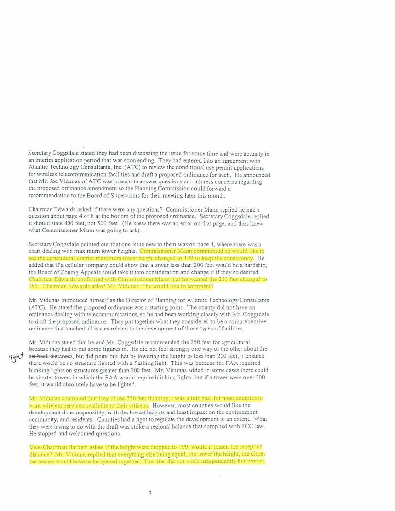
Chairman Edwards asked if there were any questions? Commissioner Mann replied he had:1 question about page 4 o[S at the bottom of the proposed ordinance. Secretary CoggsdaJe replied it should state 400 feet, not 500 feet. (He knew there was an eITor on that page, and thus knew what Commissioner Mann was going to ask).
Secretary Coggsdale pointed out that one issue new to them was on page 4, where there W2.S a chart dealing with maximum lower heights. Commissioner Mann commented he would like to see the agricultural district maximum tower height changed to 199 to keep the consistency. He added that if a cellular company could show that a tower less than 200 feet would be a hardship, the Board of Zoning Appeals could take it into consideration and change it if they so desired. Chairman Edwards confirmed with Commissioner Mann that he wanted the 250 feet changed to 199. Chaimlan Edwards asked Mr. Vidunas ifhe would like to comment?
Mr. Vidunas introduced himself as the Director of Planning for Atlantic Technology Consultants (ATe). He stated the proposed ordinance was a starting point. The county did not have an ordinance dealing with telecommunications, so he had been working closely with Mr. Coggsdale to draft the proposed ordinance. They put together what they considered to be a comprehensive ordinance that touched al! issues related to the development of those types of facilities.
Mr. Vidunas stated that he and Mr. Coggsdale recommended the 250 feet for agricultural because they had to put some figures in. He did not feel strongly one way or the other about the set Baek cli:Hances, but did point out that by lowering the height to less than 200 feel, it ensured there would be no structure lighted with a flashing light. This was because the FAA required blinking lights on structures greater than 200 feet. Mr. Vidunas added in some cases there could be shorter towers in which the FA.I\. would require blinking lights, but if a tower were over 200 feet. it would absolutely have to be lighted.
Mr. Vidunas continued that they chose 250 feet thinking it was a fair goal for most counties to want wireless services available to their citizens. However, most counties would like the development done responsibly. with the lowest heights and least impact on the environment, community, and residents. Counties had a right to regulate the development to an extent. What they \vere trying to do with the draft was strike a regional balance that complied with FCC law. He s!Opped and welcomed questions.
Vice-Chairman Barham asked if the height were dropped to 199, would it lessen the reception distance? Mr. Vidunas replied that everything else being equal, the lower the height, the closer the towers would have to be spaced together. The sites did not work independently but worked
3
MJohnson
Highlight
MJohnson
Highlight
MJohnson
Highlight
MJohnson
Highlight

by a network (linking together). Vice-Chairman Barham stated that would result in morc towers needed to get the same coverage, w it was a trade off of less height or more towers.
Commissioner Mann stated that lowering the tower height to 199 feet would make the companies look at other structures such as water towers. If antenn3.S were put on every water tower in the county, there would be coverage over the entire count) and building of towers would not be . needed. There was some discussion amongst Commissioner Mann and Vice-Chairman Barham as to where water lowers in the county were located and the distance between them.
Secretary Coggsdale advised the real issue the Planning Comm ission needed to consider was if they wanted to sel a maximum on the tower heights. Commissioner Tennessee asked how much effect would reducing the height 51 feet have on the distance between towers? Mr. Vidunas replied that generically speaking, it would reduce the radius of coverage roughly Y. of a mile.
v r
Commissioner Chesson asked what was the optimum height of an antenna 011 a tower? For example, if you had a 500-foot tower, a cellular company was not going to put a 500-foot antenna on it. Mr. Vidunas replied it depended upon the carrier, but typically antennas were not over 250 or 300 feet. By the way cellular networks were designed to operate, height was everything to a point, then it became ineffective. Commissioner Chesson asked again ifhe knew an optimum height? Mr. Vidunas replied 250 feet would be the optimum.
Mr. Vidunas stated that cellular carriers such as Verizon needed and wanted to be a little lower on the towers than PCS carriers. If you were a tower owner and wanted to maximize the number of carriers, you would want the cellular carriers lower and the pes carriers higher on the tower. Commissioner Man.T'l asked if the PCS carriers required the antennas to be closer together? Mr. Vidunas replied that pes carriers operated in the 1900 MHz band and cellular carriers in the 800 MHz band. The higher up in band and frequency, the shorter the distance waves could cover.
Mr. Vidunas mentioned that he had been talking about coverage but there was also a capacity issue. A cellular antenna could handle a certain number of simultaneous calls (he had heard about 150), and after that point, cal!s were dropped. Commissioner Mann stated the closer the antennas, the more customers they could serve. Mr. Vidunas commented the information was highly proprietary; the cellular carriers did not share their call volumes with his organization or the counties. He added his perception was that capacity was not an issue in this area, but in high volume traffic corridors such as the beltway in Washington D.C.
Mr. Vidunas pointed out that in the future, he thought there would be fewer requests for the tall 250-foot towers and more requests for the lower capacity sites to fill the gaps. The interstate network and primary routes were covered. The next step was to get oul into the countryside. When the cellular carriers could justify the capital expenditure to move out in the lower demand areas, they would do so. A lot of people were disconnecting their landline phones and going exclusively to cellular, and more would do the same if they had reliable cellular service.
Commissioner Parker stated it appeared most towers would be on Route 58 and Interstate 64. He asked if a taller tower would provide more coverage out into the small areas? He added that Southampton County had a lot of dead areas and he lived in one of them. He asked if the height
4
MJohnson
Highlight
MJohnson
Highlight
MJohnson
Highlight
MJohnson
Highlight
MJohnson
Highlight

of a tower on Route 58 was lessened, would that mean it would reach a smaller distance? Mr. Vidunas responded yes and added he and Mr. Coggsdale's thinking in devising the chart was that it was lower demand in the rural areas. To allow a carrier to maximize his return, you needed to allow him to cover as much area as possible. For example, if you placed a restriction of SO feel in rural agricultural areas, you could forget service because it would be too expensive to develop those types of sites. The figure was arbit rary and there were pros and cons on both sides.
Commissioner Mann stated he agreed with Commissioner Parker in they were in a dead zone. (He lives in same area). He did not have a cell phone because it would not do him any good. There was close enough distance between the water towers in Boykins and Newsoms to increase coverage. He had talked with an engineer that did contract work for cellular phones and was told they always ask for the tallest tower. The engineer expressed water towers worked just as good. and when they ran into restrictions. it made them look at alternate structures already there.
Mr. Vidunas stated the ordinance was intended to ensure, in their review of applications, that existing structures were looked at closely before they would ever recommend the construction of a new tower. If a type of quasi-county government authority managed the water towers, the county could gain revenue from leasing the space on the water towers to allow antennas.
Commissioner Mann made known he was not against a 250-foot tower if necessary. The county could change the maximum lOwer height to allow a taller tower ifit was required. He thought if it was left at 250, all tower companies would request it because they were reaching for the lOp.
Commissioner Jones asked would it not be better to have one 250-foot tower as opposed to three SO-foot towers, for example, in the agricultural district? Commissioner Mann replied he did not want 80-foOI towers. Commissioner Jones acknowledged that and then stated more 199-foot towers would be needed than 250-foOl towers to get the coverage. Commissioner Mann stated he thought there were enough existing structures in the county to utilize. The tower company was going 10 want 250, and if they could prove it was necessary. he would go with it. Chairman Edwards added that was what the engineering consultant was going to do anyway.
Secretary Coggsdale commented that his thought was if they set a maximum, they were bound by it. I f anyone wanted to exceed the maximum tower height, they would have to go to the Board of Zoning Appeals. He personally thought that was an extra layer to have to go through. He did not like saying the maximum height was 199 with no exceptions. Commissioner Mann stated he did not want to say that. Secretary Coggsdale stated that was what it would be saying. Chairman Edwards commented you could set 1,000 feet as the maximum. but it did not matter because the consultant was going to review it and recommend the necessary height.
Mr. y 'idunas pointed out that the section in the ordinance stated the structure should not exceed the maximum height as established in the table. However, ATe would look at the applications individually. For example, suppose Sprint had a partially developed network in the county and had a ISO-fOOL tower at one site, a 250-foot tower at another site, and wanted a tower in between to connect the three. ATC would determine the minimum height that would allow Sprint to connect. Ifit were 250 feet then so be it, but ifit were something less, they would identify it and report that their professional opinion was they could make the connection at the lower height.
5
MJohnson
Highlight
MJohnson
Highlight
MJohnson
Highlight
MJohnson
Highlight
MJohnson
Highlight

Commissioner Mann stated it would be ok with him ifit were added to the ordinance that the county des ired unlighted towers; he wanted them to disappear at night. He had heard people say that towers were light pollution to them, one of whom was a lawyer and the other a gentleman employed by the telephone company. Commissioner Harrell commented the sky was lit up with towers from Courtland to Franklin. Chainnan Edwards interjected not to get stuck on the issue.
Commissioner Edwards asked what they wanted to do? Commissioner Chesson replied he Irked the 199-foot maximum with no lights. Chairman Edwards asked if anyone else had a preference or disagreement with that? Commissioner Tennessee stated that page 5 of 8 of the ordinance addressed the lighting and that the Board of Supervisors made the final decision as to what type of lighting could be used. Commissioner Chesson stated the point was that any tower above 199 feet had to be lighted. Commissioner Tennessee explained that page 5 of8 dealt with different types of lighting such as lighting that could not be seen from the road. Commissioner Mann commented he had an engineer tell him it worked well if you lived under it, but if you were 5 miles away, you would still see the light. He asked Mr. Vidunas ifhe was right? Mr. Vidunas replied yes, there were lighting designs intended to shoot the light up and out.
Commissioner Parker stated that even if they left it al 250, ATC would advise the minimum tower height necessary. Commissioner Mann made known that if ATe advised it needed to be 250, he would be the first to make a motion to approve it. Commissioner Parker asked if they left it at 250 and ATC advised, then what was the difference? Chairman Edwards recommended a vote. Commissioner Mann stated it could be worded that the maximum height was 250 but anything over 199 would have to be recommended by a consultant. Chairman Edwards commented it was going to be anyway and that did not need to be put in the ordinance.
Commissioner Chesson stated if arguing in favor of 250 feel (which he was not), it could accommodate more camers because the cellular companies liked to keep their antennas about 10 feet apart. Mr. Vidunas commented that 10 feel apart was about the minimum. Commissioner Chesson stated they did not like to go below 150 feet, so you could not get but 3 antennas on a 199-foot antenna. Mr. Vidunas corrected him by saying you should be able to get 5 or 6. However, even though there might be adequate space for antennas, rarely were you going to find a location that worked for 5 or 6 different carriers because they all had different networks.
Commissioner Harrell commented that if the maximum tower height was set at 250 feet, and the tower company could get by with 199 feet, that was probably what they would do. Chainnan Edwards agreed they would not spend the extra money. Commissioner Harrell continued that in addition, if250 feet would get approved ifit were necessary, then you might as well leave it like it was. Commissioner Mann asked then why were the maximum tower heights for business and industrial zoning districts set at 199 and not 250? If they were going to go with 250, then why not keep them all at 250? Chainnan Edwards commented you could put whatever figures you wanted because the consultant was going to advise regardless. He advised to put it to a vote.
Co mmiss ioner Mann made a motion to keep tb e conS istency of 199 feet for the busin ess, industrial , and agricultural dist ricts, keeping in mind that if a 250-foot tower was needed, th e matter could be brought before th e boa rd for approval.
6
MJohnson
Highlight
MJohnson
Highlight

Mr. Vidunas pointed out that the networks could be designed using various heights. Demonstrating a hardship at 199 feet, saying 250 feet was needed, was impossible because the hardship could be alleviated with two shorter towers. He added the courts had determined that as long as there was a reasonable alternative, the Planning Commission as a body were not obligated to approve what was the least expensive way to go.
Chairman Edwards r eminded everyone that Commiss ioner Mann bad mad e a motion. Co mmissioner M'ann r ei tera ted tbat his moti on was to cban ge th e maximum tower height for the ag ricultura l zoning district from 250 feet to 199 fee t. Co mmissioner Harrell second ed th e motion. Tbose votin g in fav or were Chairman Edwards, Vice-C hai r man Barham, and Commissioners Ha rrell, Chesson, and Mann . Th ose opposed were Commiss ioners pa rker~. and Tenn essee. Th e vo te was 5-3 in fav or of th e motion, thu s th e motion passed. --= 5" - -;,.
Jo ,.J~
Chairman Edwards asked if there was any further discuss ion while Mr. Vidunas was present? He stated he thought the ordinance was a very thorough document. Commissioner Chesson asked if counties could require antennas on lOwers to be compressed closer than 10 feet to allow more carriers on one tower? Mr. Vidunas replied he had not seen that. Most towers were not owed by carriers, but by tower developers whose objective was to maximize the number of carriers on the lower. Commissioner Mann commented that antennas could be side by side on a lower if the tower could support them; he had seen antennas side by side on water towers and added they were painted the same color as the towers and could not be noticed. Mr. Vidunas mentioned there were numerous creative things that could and were being done. Chainnan Edwards asked if there were further questions? There was no response.
Chairman Edwa rds asked if anyone would make a moti ou? Vice-Chairman Ba r ham made a mOlion to accept th e ordimlll ce (with the chaD ge just ap proved) second ed by Commiss ioner Mann. All were in favo r, tbus th e motion passed un animously. C hairma n Ed' 't'ards advised tbey would forwa rd tb e r eco mmendatiou on to th e Board of Supe rviso rs.
Commissioner Mann thanked Mr. Vidunas and apologized for the amount of discussion. Mr. Vidunas slated he did not take it personally. He advised that as applications came in, and if they found the ordinance was not doing what it was intended to do, to revise it and continue to do so until it met the ir needs; the ordinance was a start ing point. He added it was nice meeting them :md looked forward to work ing with them in the furure. Everyone thanked Mr. Vidunas.
Movi ng on to miscellaneous issues, Secretary Coggsdale sought the Planning Commission's direction as to whether to fast track (hold the Planning Commission and Board of Supervisors' publi~ hearings in the same month) a pending application. In order to do this, tlie Planning Commission would have to be confident a recommendation would be made at the same meeting as the public hearing. Secretary Coggsdale announced he had been contacted by an individual seeking a conditional use permit for a "firewood operation" on a property located along General Thomas Highway (Route 671). The individual indicated the site would be shon-term until he could find a propeny to purchase. Chairman Edwards asked what zoning district he was in? Secretary CoggsdaJe responded Agricultural (A-l ). He stated he wanted to expedite this quickly ~o he could take
7
MJohnson
Highlight

advantage of firewood season. If it went to a 2·month process, approval would not take place until the 4lh Monday in November. Chairman Edwards asked Secretary Coggsdale ifhe could think of any controversy or reason they could not come to a decision of yes or no? Secretary Coggsda\e replied he did not see any reason. There was some discussion as to where the property was located and Secretary CoggsdaJe tried to explain by saying it was located where Cypress Bridge Road crossed 671, and if going towards Newsoms, it was past the chicken houses on the left on the other side of the railroad tracks.
Secretary Coggsdale stated they would unload Jogs. and cut and split them at the site. He reiterated the individual stated it was temporary so he must have plans to lease the property short term until he could find a property for permanent use, if it proved to be good business. Commissioner Chesson asked (jokingly) if there would be 15 chain saws and no muffler? Secretary CoggsdaJe replied he did not know but it did require a conditional use permit so conditions could be set. He stated if they chose to fast track the application, he would try to come up with some conditions. Chairman Edwards suggested to Secretary Coggsdale to do whatever he wanted; if it fell through, they could always blame him. Secretary Coggsdalc stated he would not fast track an application without asking them first.
Continuing with miscellaneous issues, Secretary Coggsdalc stated he needed to dder the Capital Improvement Plan Schedule for FY 2003·04 matter because he was still getting information. He was working with Bill Turner and seeking his guidance on how to approach it. It took so much time last year to get the capital improvement plan on board and they needed to keep following it up. He would have a schedule and maybe the start of the process ready for next month.
Proceeding to Board of Zoning Appeals (BlA) Matters, Chairman Edwards affirmed with Commissioner Chesson, who is Chairman of the BlA. that the BZA would like a recommendation on all their issues from the Planning Commission. (The Planning Commission is not required to make a recommendation to the BlA). Chairman Edwards commented in the future they would try to make a recommendation.
Ln regards to reports, Secretary Coggsdale stated they were not available.
Moving forward to public comment, Chairman Edwards stated there was no public left because they were happy with the first 3 minutes of the meeting (because the motorcycle· racing track application was withdrawn).
Being no further business to discuss, the meeting was adjourned by consensus at 8:30 PM.
1. Waverly Coggsda\e, Asst. to the County Administrator
Dr. Alan W. Edwards, Chairman
8