New osm backgrounder
23
OSM Background 1 Thursday, April 10, 14
-
Upload
nfgusedautoparts -
Category
Technology
-
view
66 -
download
0
Transcript of New osm backgrounder

OSM Background
1Thursday, April 10, 14

OpenStreetMap Background
• Open Data Project• Build a truly free map of the world• “The Wikipedia of Maps”
2Thursday, April 10, 14

OSM History
• Initiated by Steve Coast in 2005• Started in the UK• Because Ordnance Survey maps were
expensive• Rapidly grew to a worldwide project
3Thursday, April 10, 14

International Variations
• Significant differences country to country
• Europe started mostly from scratch
• US imported a base map based on Census Bureau TIGER road centerline Data in 2007
• In Canada, CANVEC imports are ongoing
4Thursday, April 10, 14

Licensing
• Originally Creative Commons• CC BY-SA was a poor fit to a fact
database• Migrated to ODbL (Open Database
License)• Migration was painful, but is now over
5Thursday, April 10, 14

OSM in the Capital District
6Thursday, April 10, 14

Differences from Wikipedia
• Wikipedia discourages original research• OSM depends on original research• Edit wars less of an issue
• easily verifiable facts make a big difference
7Thursday, April 10, 14

Differences from Google Maps
• Google Maps is “Free” only in a limited sense (read the ToS)
• Google owns all Intellectual Property• Google does not provide for
community governance
8Thursday, April 10, 14

Other Properties
• No pre-moderation• Different structure than traditional GIS• Two tier model:
• database• data consumers
9Thursday, April 10, 14

OpenCycleMap
10Thursday, April 10, 14

TopOSM
11Thursday, April 10, 14

The US & TIGER
• TIGER has problems which effectively require us to either review & correct or replace all data
• Long, slow process of Ground Surveys
12Thursday, April 10, 14
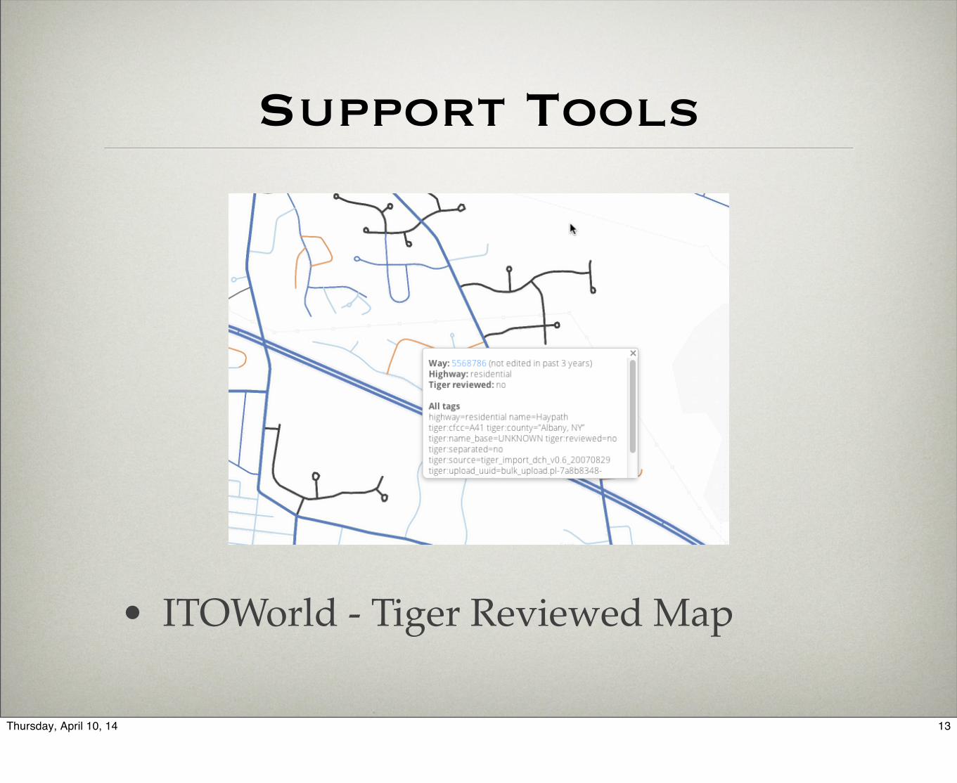
Support Tools
• ITOWorld - Tiger Reviewed Map
13Thursday, April 10, 14

Capital District
14Thursday, April 10, 14

South of Albany
15Thursday, April 10, 14

OSM Data Model
• Three basic entities
• Node - lat, long
• optional tags
• Way - list of nodes
• direction
• optional tags
• roads, boundaries, entity footprints
16Thursday, April 10, 14

OSM Data Model
• Relations• Bags of nodes, ways & relations• Entities in a relation have roles
• Tags• Key/value pairs• Names, addresses, characteristics
17Thursday, April 10, 14

Tags for Western Avenue
highway=primaryname=Western Avenueref=US 20maxspeed=30 mph
18Thursday, April 10, 14
and we use a relation to bind together all the segments that make up US 20

State of OSM Today
• Excellent Display Map• Reviewed areas generally route well• Lack much address data• POIs incomplete
19Thursday, April 10, 14
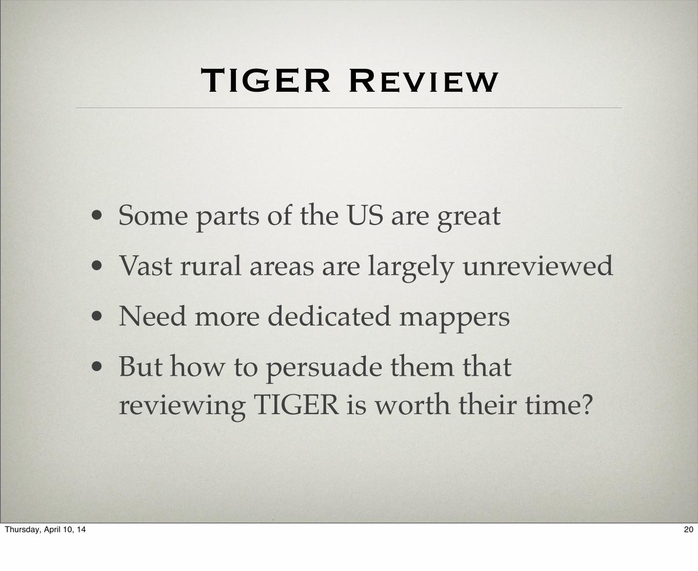
TIGER Review
• Some parts of the US are great• Vast rural areas are largely unreviewed• Need more dedicated mappers• But how to persuade them that
reviewing TIGER is worth their time?
20Thursday, April 10, 14

Addresses
• Where do we get them?• Enhanced 911?• Parcel Data?• On Foot?
21Thursday, April 10, 14

POIs
• Point of Interest databases are hard to collect and hard to keep up to date
• Small businesses open and close with some frequency
• “Enter and forget”
22Thursday, April 10, 14

Pause for General OSM Questions
23Thursday, April 10, 14