NEW ORLEANS – WHEN TECHNOLOGY DOES NOT WORK mardi gras mardi gras.
54
NEW ORLEANS – WHEN TECHNOLOGY DOES NOT WORK mardi gras
-
Upload
gerald-gallagher -
Category
Documents
-
view
226 -
download
3
Transcript of NEW ORLEANS – WHEN TECHNOLOGY DOES NOT WORK mardi gras mardi gras.
NEW ORLEANS – WHEN TECHNOLOGY DOES NOT WORK
mardi gras

• New Orleans - located in southeastern Louisiana,
• Bounded by parishes of St. Tammany (north), St. Bernard (east), Plaquemines (South)and Jefferson (south west)


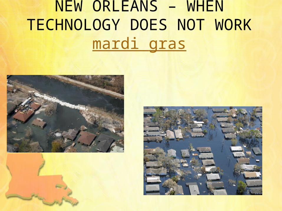
• New Orleans – AKA• Crescent City – course of Lower
Mississippi River around and through the city
• New Orleans – AKA• The Big Easy – by musicians (20th
Century – ease of finding work), during prohibition, one time cheapest city to live in US
• City that care forgot (1938) – outwardly easy-going, carefree nature of many

• La Nouvelle-Orléans founded May 7th, 1718 by French Mississippi Company
• City – named after Philippe d’Orléans (Duke of Orléans – regent of France)

Site• Mississippi River (city located on banks)• 169km up river from Gulf of Mexico• Area 902km2 (467.6 km2 – 51.55% is land)• Lake Pontchartrain (north)• Lake Borgne (east)

• Orignal city settled on natural levees or high ground along mississippi river
• Lakes, marshlands, and bayous extend from the city in all directions

• A humid, semi-tropical climate in New Orleans is kept from extremes by surrounding waters
• Average Temperatures: January, 10.7° C; July 27.7° C; annual average, 20.1° C
• Average Annual Precipitation: 1571.8 mm (wet)
• Hurricanes pose great risk


• Elevation: Ranges from 5 feet below sea level to 15 feet above; mean elevation, 1-2 feet below sea level
• 51% of city is at or above sea level• More densley populated higher
ground (more $$$ also higher)

situation• Located close to the gulf
of Mexico

situation• Mouth of
Mississippi (from Great Lakes to GOM) river

function• Trade – along trading route and
portage between Mississippi and Lake Pontchartrain (French)
• City centre of commerce during late 1700 (sugar)
• Transportation hub and distribution centre
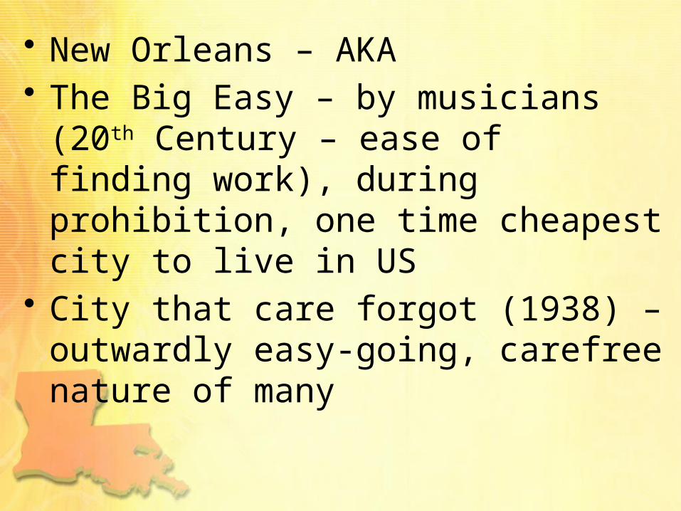
function• One of the largest and busiest ports
in the world (5th largest in US• Oil refining and petrochemical
production• White collar corporate base
(onshore/offshore petroleum and natural gas production

Technology• Turn of 20th century – drainage plan by
engineer and inventer A.Baldwin Wood Wood invented “flapgates” and other hydraulic devices (pumps)
• Wood Screw Pump (1913) and Wood Trash Pump (1915)

Technology

Technology• Designed to expand the city
(geographically) despite surrounding swamp
• Prior urban development limited to higher ground – natural river levees and bayous

Technology• Wood’s pump system drain huge
tracts of swamp and marshland• City expanded into low-lying areas• Over 20th century – rapid subsidence
(natural and human induced left new populated areas several feet below sea level

Technology• vulnerable to flooding even before the
city's city expansion into low lying areas• late 20th century, however, scientists
and New Orleans residents gradually became aware of the city's increased vulnerability

Technology• 1965 – hurricane Besty killed dozens
(most city dry)• May 8th, 1995 flood(rain)demonstrated
weakness of pumping system

Technology• After floods – measures undertaken to
dramatically upgrade pumping capacity• By 1980’s-90’s became clear extensive,
rapid and ongoing erosion of the marshland & swamps
• Gulf Outlet Canal left city more exposed to hurricane storm surges

1958
2009

Hurricane Katrina• Aug. 29th, 2005 • Winds category
3, frequent intense gusts and tidal surge

Saffir/Simpson Hurricane Scale*
Category Definition/Likely Effects
ONEWinds 75-95 mph (65-82 kts): No real damage to building structures. Damage primarily to unanchored mobile homes, shrubbery, and trees. Also, some coastal flooding and minor pier damage.
TWOWinds 96-110 mph (83-95 kts): Some roofing material, door, and window damage of buildings. Considerable damage to vegetation, mobile homes, etc. Flooding damages piers and small craft in unprotected anchorages break moorings.
THREEWinds 111-130 mph (96-113 kts): Some structural damage to small residences and utility buildings with a minor amount of curtainwall failures. Mobile homes are destroyed. Flooding near the coast destroys small structures with larger structures damaged by floating debris. Terrain may be flooded well inland.
FOURWinds 131-155 mph (114-135 kts): More extensive curtainwall failures with some complete roof structure failure on small residences. Major erosion of beach areas. Terrain may be flooded well inland.
FIVEWinds greater than 155 mph (greater than 135 kts): Complete roof failure on many residences and industrial buildings. Some complete building failures with small utility buildings blown over or away. Flooding causes major damage to lower floors of all structures near the shoreline. Massive evacuation of residential areas may be required.
Note: A "major" hurricane is one that is classified as a Category 3 or higher.
* In operational use, the scale corresponds to the one-minute average sustained wind speed as opposed to gusts which could be 20 percent higher or more.

Hurricane Katrina• Most severe portion of hurricane
missed the city• 22’ storm surge caused 53 breaches in
drainage and navigational canal levees• Worst engineering disaster in US


Hurricane Katrina• 17th street canal, industrial canal and
London Avenue Canal levee breached• Aug. 31st 2005 80% of city flooded• Some parts 15’ under water• lower 9th ward


Hurricane Katrina• 90% of city evacuated (1st mandatory
evacuation)• 10% remaining – elderly and poor• Superdome was used as shelter

Hurricane Katrina• Reasons for staying – homes would be
enough protection, lack of $$$, no transportation, protection of property
• Evacuation for Ivan resulted in many eldery sick due to long waits (6-10 hours)
• 1 million left , 100,000 stayed• 20,000 in superdome

Hurricane KatrinaDeaths by state
Alabama 2
Florida 14
Georgia 2
Kentucky 1
Louisiana 1,577*
Mississippi 238
Ohio 2
Total 1,836
Missing 135[1]
*Includes out-of-state evacueescounted by Louisiana

Rescue Efforts• Disruption of communication
infrastructure – cell phone, land line phones, internet access not working
• Local TV stations disrupted• Most roads in & out of city damaged• Only route out of city I-10 Twin Span
Bridge Collapsed

Rescue Efforts• Disruption of communication
infrastructure – cell phone, land line phones, internet access not working
• Local TV stations disrupted• Most roads in & out of city damaged• Only route out of city I-10 Twin Span
Bridge Collapsed

Rescue Efforts
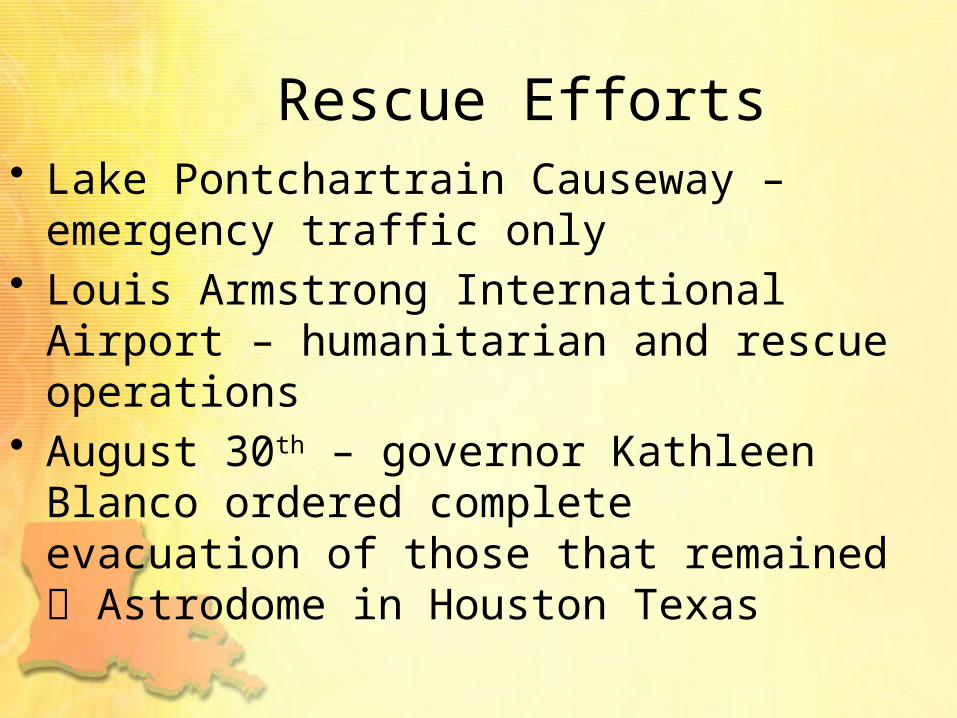
Rescue Efforts• Lake Pontchartrain Causeway –
emergency traffic only• Louis Armstrong International Airport –
humanitarian and rescue operations• August 30th – governor Kathleen Blanco
ordered complete evacuation of those that remained Astrodome in Houston Texas

Hurricane Katrina• Faulty design specifications, incomplete
sections, substandard construction of levee segments contributed to flooding
• Flooding of 2/3rd of city could have been prevented

Hurricane Katrina• Engineering failure lawsuit against US
Army Corps of Engineers (USACE) – builders and designers of levee system (Flood Control Act 1965)
• Jan. 2008 responsibility failure and flooding blamed on USACE but they could not be held financially liable due to sovereign immunity in Flood Control Act 1928

Katrina Aftermath• Looting• Gretna• Danziger Bridge

Heath Concerns• Dehydration• Food poisoning• Spread of hepatitis A, cholera,
tuberculosis, typhoid fever (contamination of food and H2O supplies)
• Sept. 6 – E. coli detected in H2O supply

Population of New Orleans

Population• Pop 2005 (pre-Katrina) – 454,865• 2010 – 60% African American, 33%
white, 2.9% Asian, 5,3% Hispanic• 20,000-14,000 illegal immigrants
(Mexico) • Migration to New Orleans – people
returning, result of global financial crisis of 2008-2009

Economic Impacts• Pre-Katrina – economy dependent on
transportation, entertainment & public services
• Labour force – loss of 70,000 jobs (service)
• Construction sector – only sector to thrive


Environmental & political