Nelson E. Rios Tulane University Museum of Natural History Geospatially Enabling Natural History...
27
Nelson E. Rios Nelson E. Rios Tulane University Museum of Tulane University Museum of Natural History Natural History Geospatially Enabling Geospatially Enabling Natural History Natural History Collections Data Collections Data
-
Upload
nathaniel-douglas -
Category
Documents
-
view
227 -
download
7
Transcript of Nelson E. Rios Tulane University Museum of Natural History Geospatially Enabling Natural History...
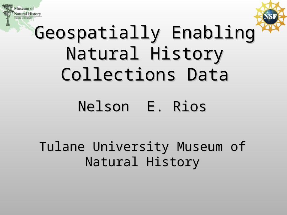
Nelson E. RiosNelson E. Rios
Tulane University Museum of Natural Tulane University Museum of Natural HistoryHistory
Geospatially Enabling Natural Geospatially Enabling Natural History Collections DataHistory Collections Data
Natural History CollectionsNatural History Collections
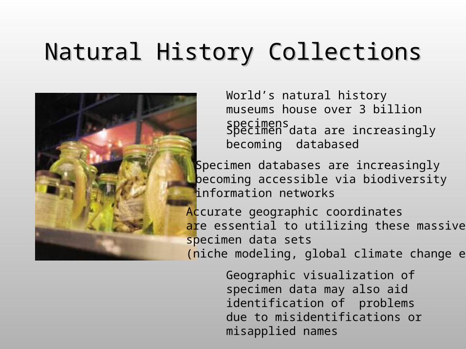
World’s natural history museums house over 3 billion specimens
Specimen data are increasingly becoming databased
Specimen databases are increasingly becoming accessible via biodiversity information networks
Accurate geographic coordinates are essential to utilizing these massive specimen data sets (niche modeling, global climate change etc.)
Geographic visualization of specimen data may also aid identification of problems due to misidentifications or misapplied names
What is Georeferencing
• As applied to natural history collection data it is the process of assigning geographic coordinates to a textually described collecting event
• Traditional approaches laborious and time consuming (3,200 worker hours to georeference TUMNH fish collection)
• Automated and collaborative processes have proven to improve efficiency

GEOLocate
Desktop application for automated georeferencing of natural history collections data
Locality description analysis, coordinate generation, batch processing, geographic visualization, data correction and error determination
Initial release in 2002
Basic Georeferencing Process
• Data Input– Data Correction– Manual or file based data entry– Community network data
• Coordinate Generation– Locality description parsing and analysis
• Coordinate Adjustment– Fine tuning the results on a visual map display
• Error Determination– Assigning a maximum possible extent for a given locality
description
Core Components
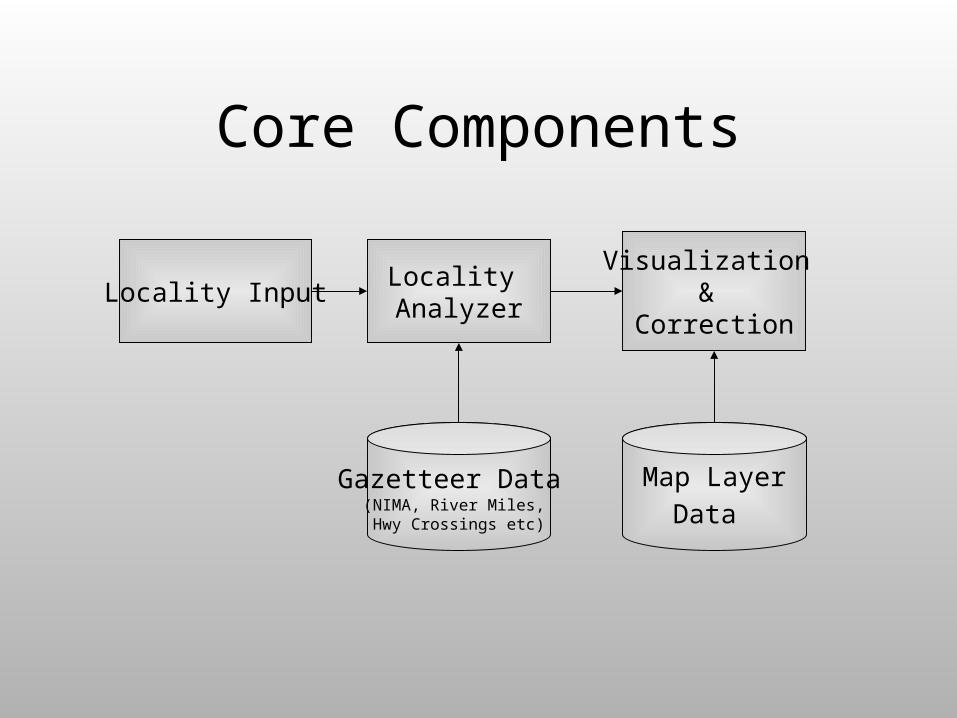
Locality Analyzer
Gazetteer Data (NIMA, River Miles, Hwy Crossings etc)
Visualization &
CorrectionLocality Input
Map Layer
Data
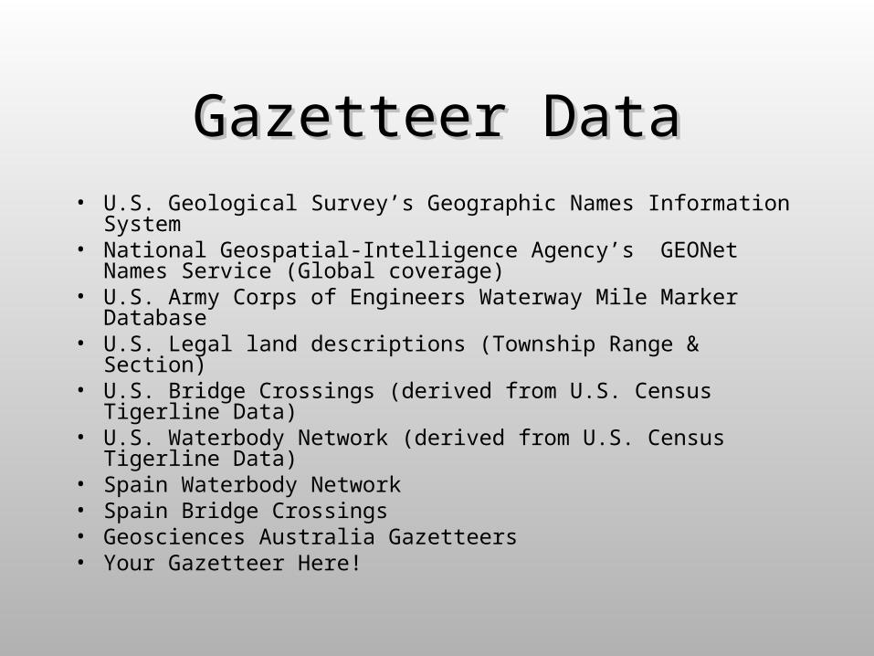
Gazetteer DataGazetteer Data• U.S. Geological Survey’s Geographic Names Information
System• National Geospatial-Intelligence Agency’s GEONet Names
Service (Global coverage)• U.S. Army Corps of Engineers Waterway Mile Marker Database • U.S. Legal land descriptions (Township Range & Section)• U.S. Bridge Crossings (derived from U.S. Census Tigerline
Data)• U.S. Waterbody Network (derived from U.S. Census Tigerline
Data)• Spain Waterbody Network • Spain Bridge Crossings • Geosciences Australia Gazetteers• Your Gazetteer Here!
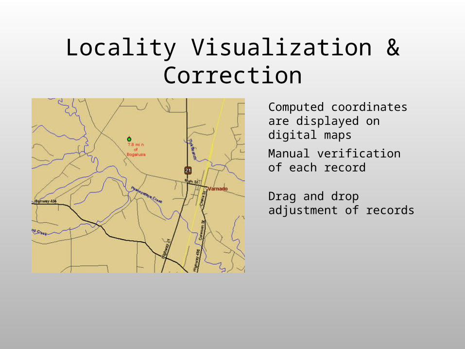
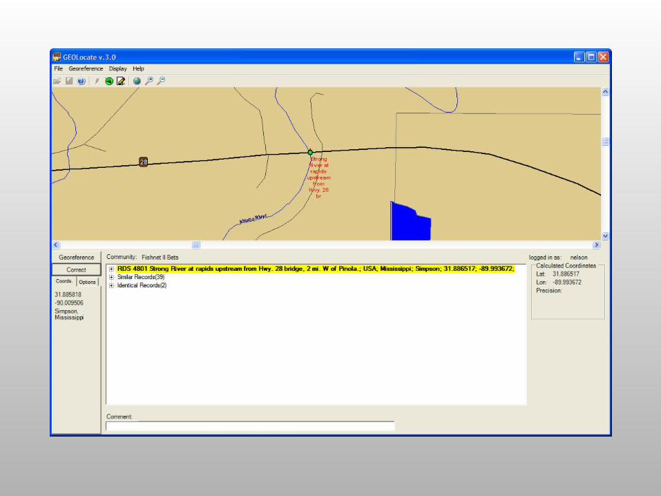
Locality Visualization & Correction
Computed coordinates are displayed on digital maps
Manual verification of each record
Drag and drop adjustment of records
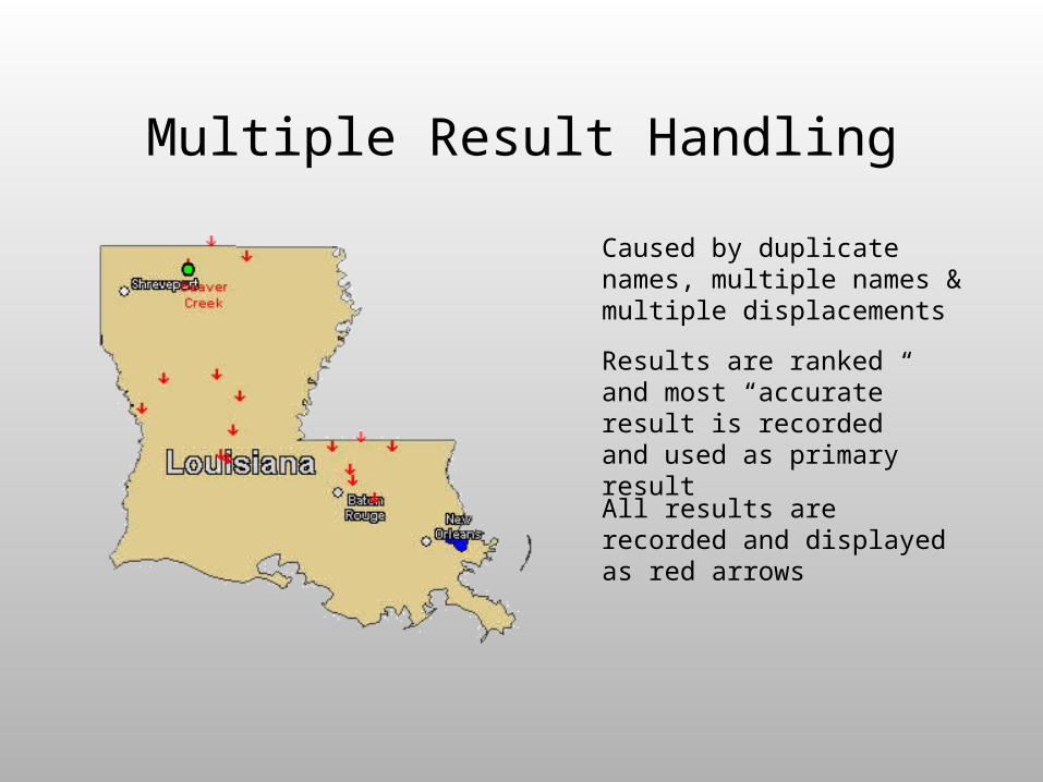
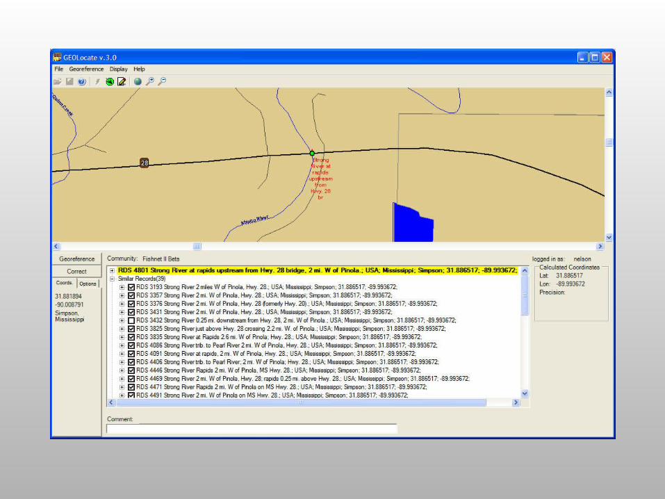
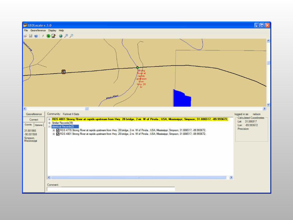
Multiple Result Handling
Caused by duplicate names, multiple names & multiple displacements
Results are ranked and most “accurate” result is recorded and used as primary result
All results are recorded and displayed as red arrows
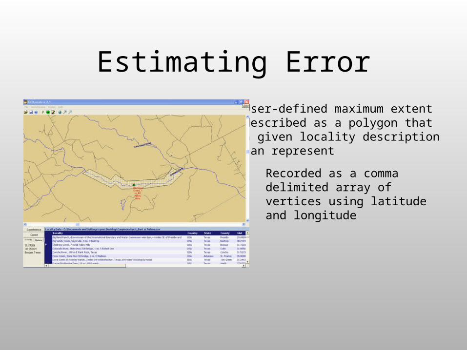
Estimating Error
User-defined maximum extent described as a polygon that a given locality description can represent
Recorded as a comma delimited array of vertices using latitude and longitude
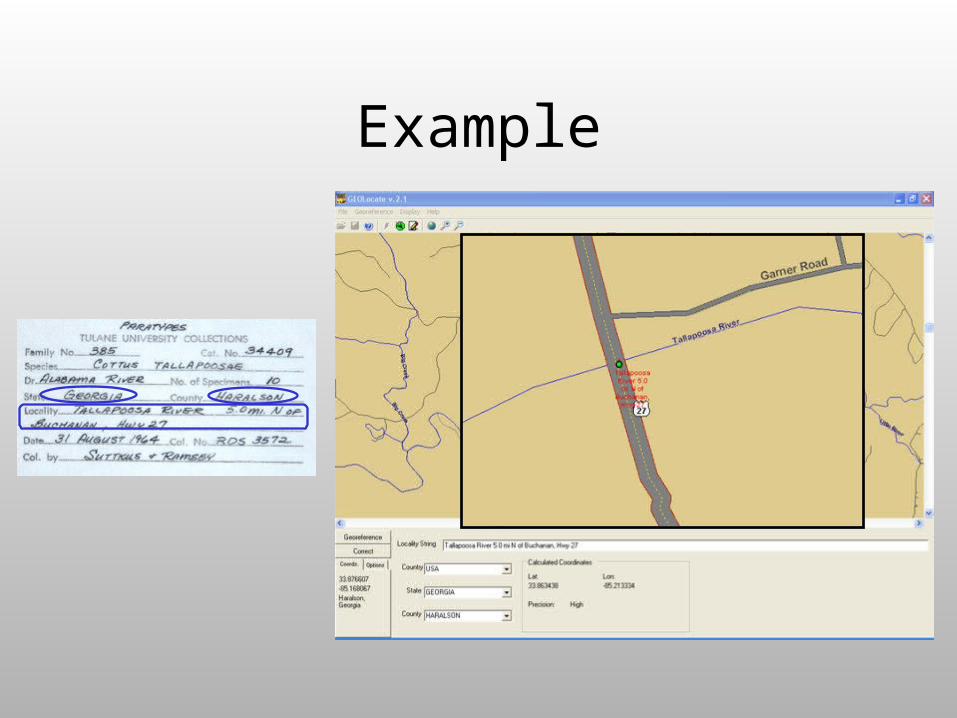
Example
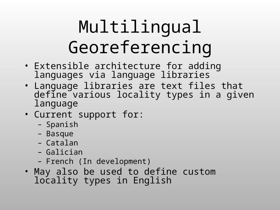
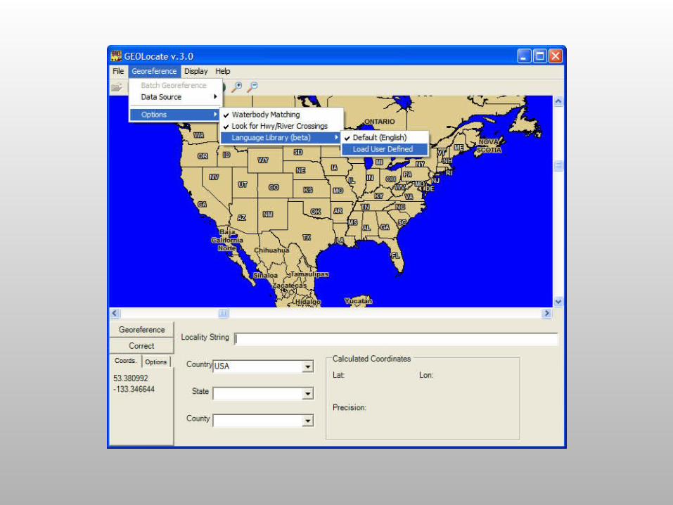
Multilingual Georeferencing
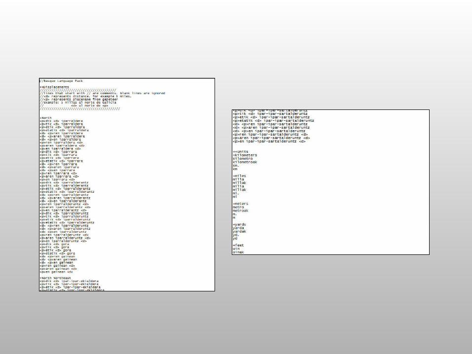
• Extensible architecture for adding languages via language libraries
• Language libraries are text files that define various locality types in a given language
• Current support for:– Spanish– Basque– Catalan– Galician– French (In development)
• May also be used to define custom locality types in English
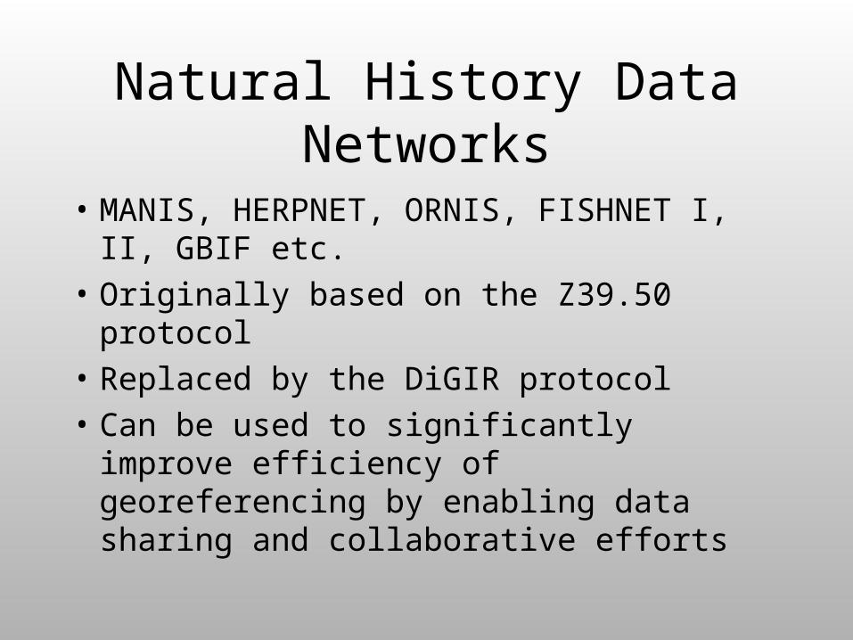
Natural History Data Networks
• MANIS, HERPNET, ORNIS, FISHNET I, II, GBIF etc.
• Originally based on the Z39.50 protocol
• Replaced by the DiGIR protocol
• Can be used to significantly improve efficiency of georeferencing by enabling data sharing and collaborative efforts
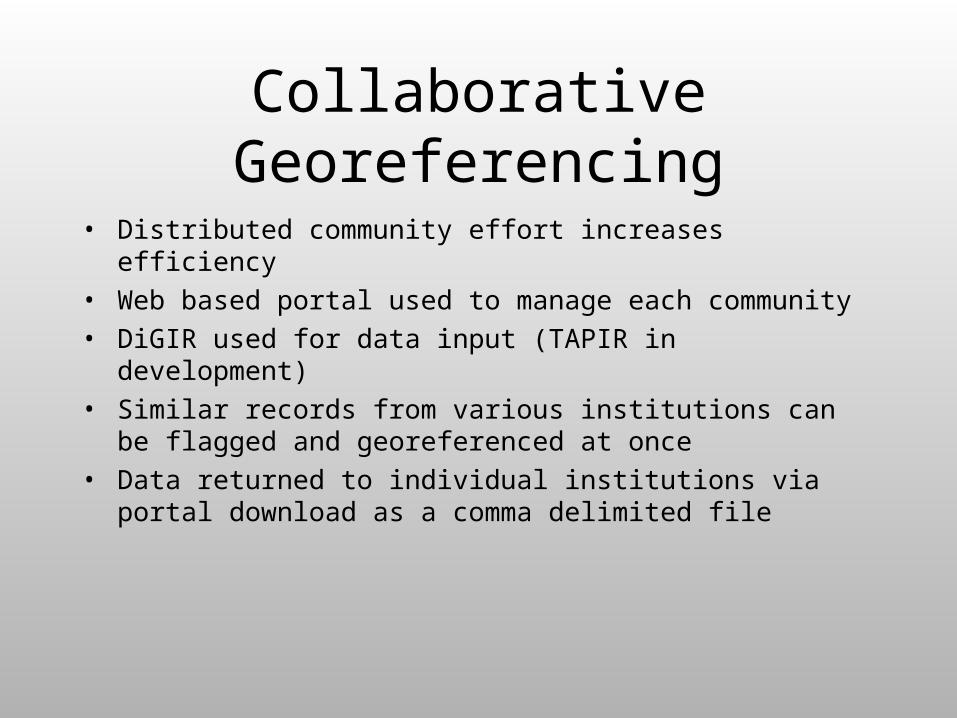
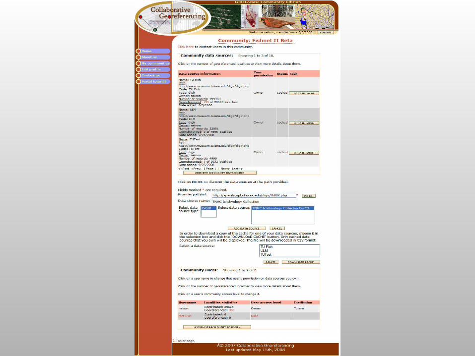
Collaborative Georeferencing
• Distributed community effort increases efficiency
• Web based portal used to manage each community
• DiGIR used for data input (TAPIR in development)
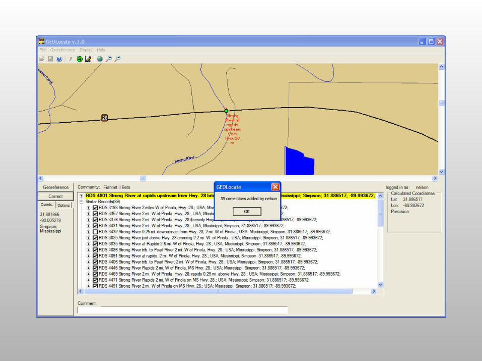
• Similar records from various institutions can be flagged and georeferenced at once
• Data returned to individual institutions via portal download as a comma delimited file

Collaborative GeoreferencingDiGIR Service
Record Processor
GEOLocate Desktop Application
Cache Update Web Service
Web Portal Application
Data Store
Georeferencing Web Service
Data Retrieval Web Service
Insert Correction Web Service
Remote Data Source


Taxonomic Footprint Validation
Taxa collected for a given locality
Uses point occurrence data from distributed museum databases to validate georeferenced data
Species A
Species B
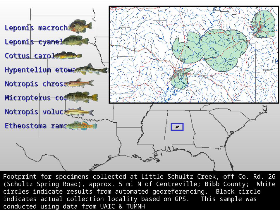
Lepomis macrochirusLepomis macrochirus
Notropis chrosomusNotropis chrosomus
Notropis volucellusNotropis volucellus
Micropterus coosaeMicropterus coosae
LepomisLepomis cyanelluscyanellus
Cottus carolinaeCottus carolinae
Hypentelium etowanumHypentelium etowanum
Etheostoma ramseyiEtheostoma ramseyi
Footprint for specimens collected at Little Schultz Creek, off Co. Rd. 26 (Schultz Spring Road), approx. 5 mi Footprint for specimens collected at Little Schultz Creek, off Co. Rd. 26 (Schultz Spring Road), approx. 5 mi N of Centreville; Bibb County; White circles indicate results from automated georeferencing. Black circle N of Centreville; Bibb County; White circles indicate results from automated georeferencing. Black circle indicates actual collection locality based on GPS. This sample was conducted using data from UAIC & indicates actual collection locality based on GPS. This sample was conducted using data from UAIC & TUMNHTUMNH
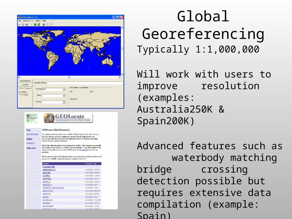
Global Georeferencing
Typically 1:1,000,000
Will work with users to improve resolution (examples: Australia250K & Spain200K)
Advanced features such as waterbody matching bridge crossing detection possible but requires extensive data compilation (example: Spain)
AcknowledgementsAcknowledgements
Hank BartHank Bart
Demin HuDemin Hu
Mikaela HowieMikaela Howie
Bjorn SchmidtBjorn Schmidt
Paul FlemonsPaul Flemons
Sheridan Hewitt-SmithSheridan Hewitt-Smith
National Science FoundationNational Science Foundation


![116 NATURAL HISTORY NOTES - dornsife.usc.edu · 116 NATURAL HISTORY NOTES Cambefort [eds.], ... jara, Carretera a Nogales Km. 15.5, ... NATURAL HISTORY NOTES 117.](https://static.fdocuments.net/doc/165x107/5b82074b7f8b9a2b6f8da250/116-natural-history-notes-116-natural-history-notes-cambefort-eds-.jpg)