Naya raipur
13
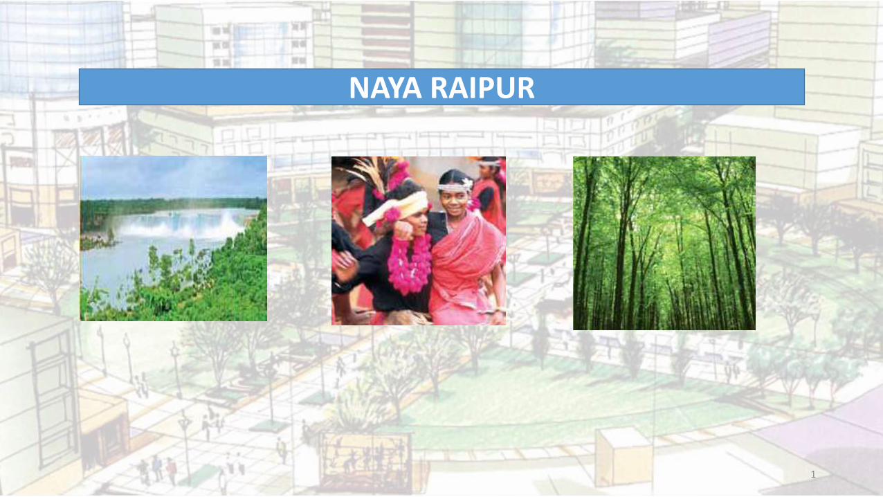
1 NAYA RAIPUR
-
Upload
farhana-farhath -
Category
Education
-
view
171 -
download
2
Transcript of Naya raipur
1
NAYA RAIPUR
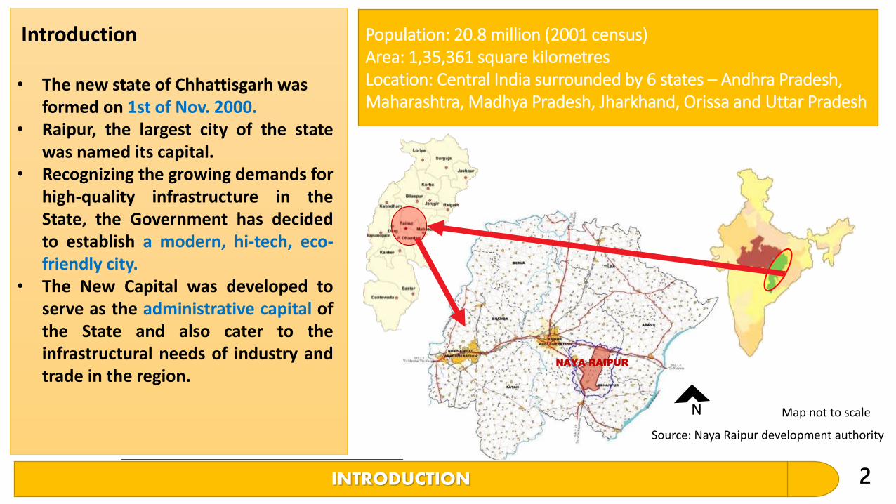
INTRODUCTION 2
• The new state of Chhattisgarh was formed on 1st of Nov. 2000.
• Raipur, the largest city of the statewas named its capital.
• Recognizing the growing demands forhigh-quality infrastructure in theState, the Government has decidedto establish a modern, hi-tech, eco-friendly city.
• The New Capital was developed toserve as the administrative capital ofthe State and also cater to theinfrastructural needs of industry andtrade in the region.
Introduction Population: 20.8 million (2001 census)Area: 1,35,361 square kilometresLocation: Central India surrounded by 6 states – Andhra Pradesh, Maharashtra, Madhya Pradesh, Jharkhand, Orissa and Uttar Pradesh
NAYA RAIPUR
Source: Naya Raipur development authority
Map not to scaleN
3
The city will strive to make animpact in the following role:
Vision and Objectives of Naya Raipur
• An agent of economic change and social transformation in the state.• An efficient engine of growth and prosperity.• A servicing hub not only in manufacturing of goods but also in
Information Technology and Bio- Technology sectors.• A financial centre of the region.• Hub of trade and hospitality sectors in Naya Raipur• Hub of cultural services which would supplement local economy.• Hub of affordable and high quality medical services.• Hub of quality educational facilities and strive to develop as a knowledge
base.
• Naya Raipur would be a planned and designed new city of the 21stcentury to be a focus of socioeconomic and cultural life of the state ofChhattisgarh having its role and recognition at national and internationallevels. The new city would be eco-friendly integrated in its inspiringexisting landscape; efficient, healthy; modern, but caring for its traditionalvalues.
Objectives of Naya Raipur
Vision
4
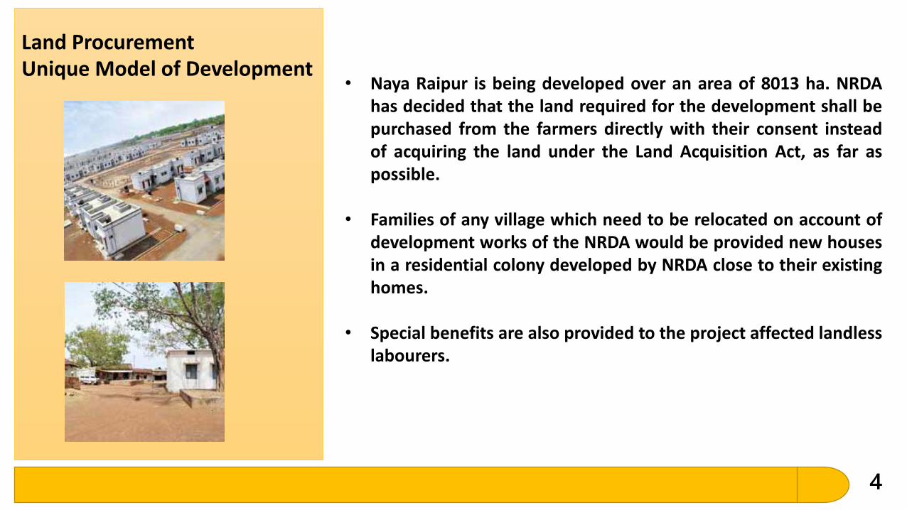
Land ProcurementUnique Model of Development
• Naya Raipur is being developed over an area of 8013 ha. NRDAhas decided that the land required for the development shall bepurchased from the farmers directly with their consent insteadof acquiring the land under the Land Acquisition Act, as far aspossible.
• Families of any village which need to be relocated on account ofdevelopment works of the NRDA would be provided new housesin a residential colony developed by NRDA close to their existinghomes.
• Special benefits are also provided to the project affected landlesslabourers.
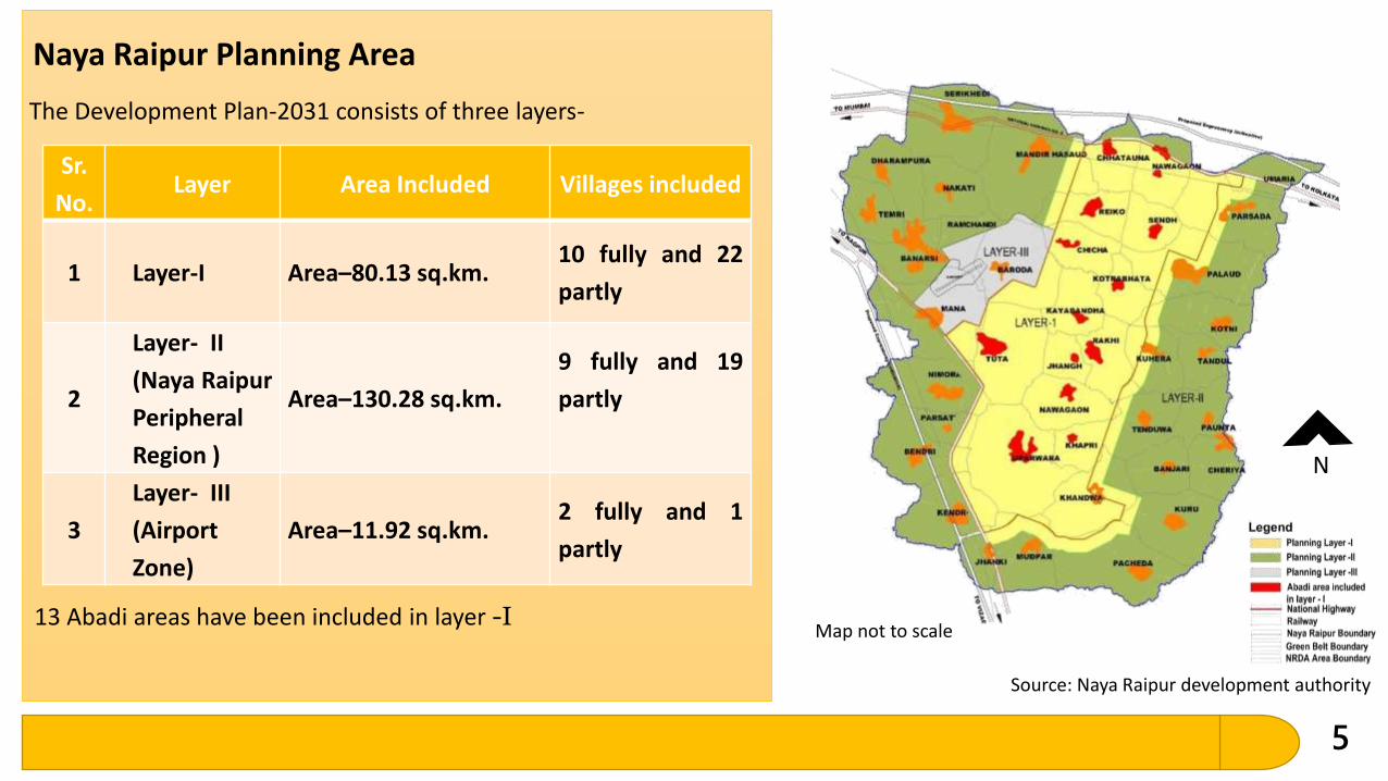
5
Naya Raipur Planning Area
Sr.
No.Layer Area Included Villages included
1 Layer-I Area–80.13 sq.km.10 fully and 22
partly
2
Layer- II
(Naya Raipur
Peripheral
Region )
Area–130.28 sq.km.
9 fully and 19
partly
3
Layer- III
(Airport
Zone)
Area–11.92 sq.km.2 fully and 1
partly
The Development Plan-2031 consists of three layers-
13 Abadi areas have been included in layer -I
Source: Naya Raipur development authority
Map not to scale
N
6
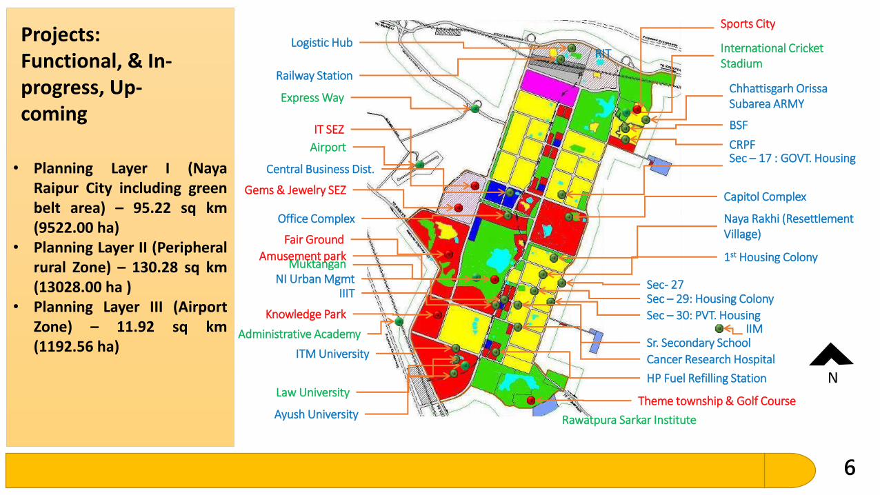
• Planning Layer I (NayaRaipur City including greenbelt area) – 95.22 sq km(9522.00 ha)
• Planning Layer II (Peripheralrural Zone) – 130.28 sq km(13028.00 ha )
• Planning Layer III (AirportZone) – 11.92 sq km(1192.56 ha)
Projects: Functional, & In-progress, Up-coming
International Cricket Stadium
Law University
Airport
Express Way
Rawatpura Sarkar Institute
Administrative Academy
Muktangan
Capitol Complex
Naya Rakhi (Resettlement Village)
1st Housing Colony
Sec- 27
Office Complex
Railway Station
Logistic Hub
Chhattisgarh Orissa Subarea ARMY
BSF
CRPFSec – 17 : GOVT. Housing
Sec – 29: Housing Colony
Sec – 30: PVT. Housing
Sr. Secondary School
Cancer Research Hospital
HP Fuel Refilling Station
Ayush University
ITM University
IIITNI Urban Mgmt
RIT
Central Business Dist.
IIM
Theme township & Golf Course
Knowledge Park
Gems & Jewelry SEZ
IT SEZ
Fair Ground
Amusement park
Sports City
N
7
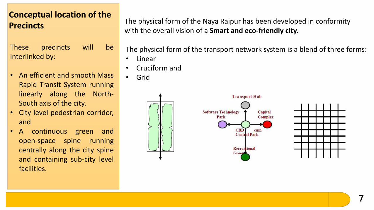
Conceptual location of the Precincts
The physical form of the Naya Raipur has been developed in conformity with the overall vision of a Smart and eco-friendly city.
The physical form of the transport network system is a blend of three forms:• Linear• Cruciform and• Grid
These precincts will beinterlinked by:
• An efficient and smooth MassRapid Transit System runninglinearly along the North-South axis of the city.
• City level pedestrian corridor,and
• A continuous green andopen-space spine runningcentrally along the city spineand containing sub-city levelfacilities.
8
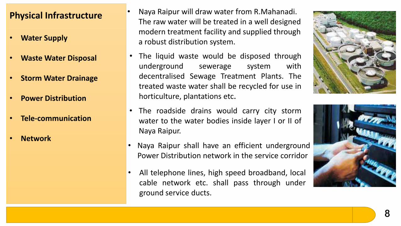
• Water Supply
• Waste Water Disposal
• Storm Water Drainage
• Power Distribution
• Tele-communication
• Network
Physical Infrastructure • Naya Raipur will draw water from R.Mahanadi. The raw water will be treated in a well designed modern treatment facility and supplied through a robust distribution system.
• The liquid waste would be disposed throughunderground sewerage system withdecentralised Sewage Treatment Plants. Thetreated waste water shall be recycled for use inhorticulture, plantations etc.
• The roadside drains would carry city stormwater to the water bodies inside layer I or II ofNaya Raipur.
• Naya Raipur shall have an efficient undergroundPower Distribution network in the service corridor
• All telephone lines, high speed broadband, localcable network etc. shall pass through underground service ducts.
9
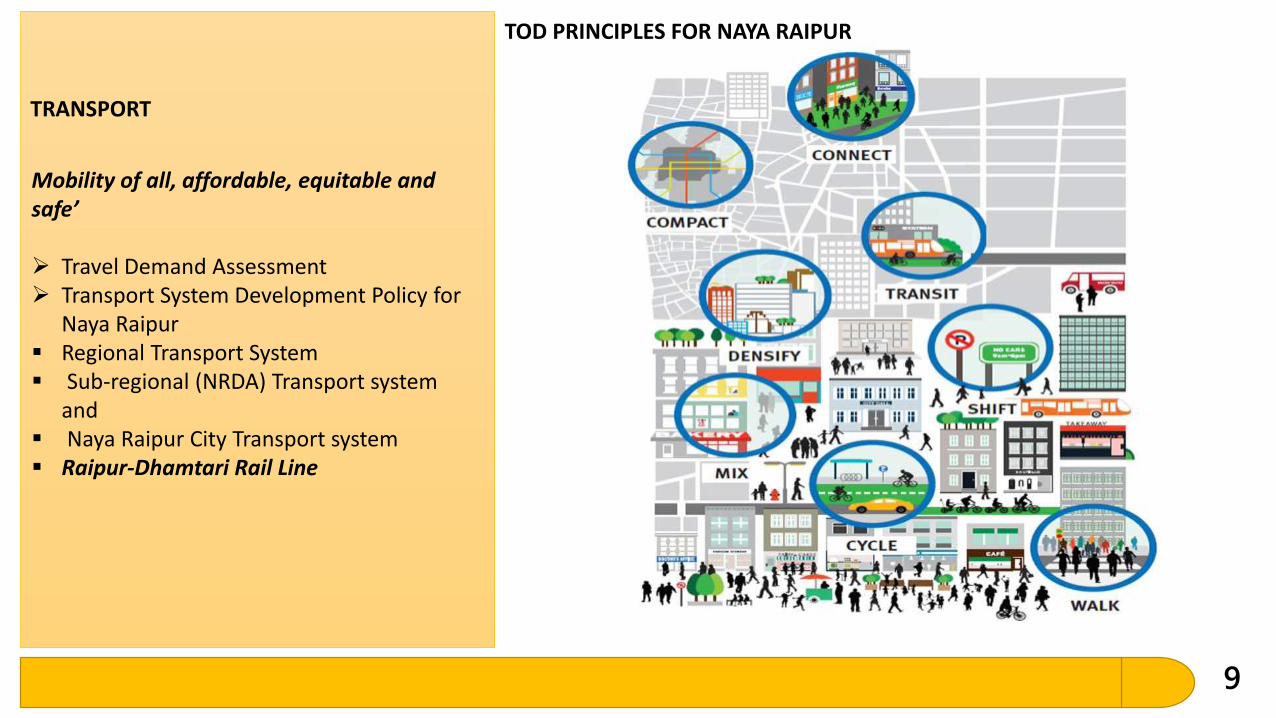
TOD PRINCIPLES FOR NAYA RAIPUR
TRANSPORT
Mobility of all, affordable, equitable and safe’
Travel Demand Assessment Transport System Development Policy for
Naya Raipur Regional Transport System Sub-regional (NRDA) Transport system
and Naya Raipur City Transport system Raipur-Dhamtari Rail Line
1
0
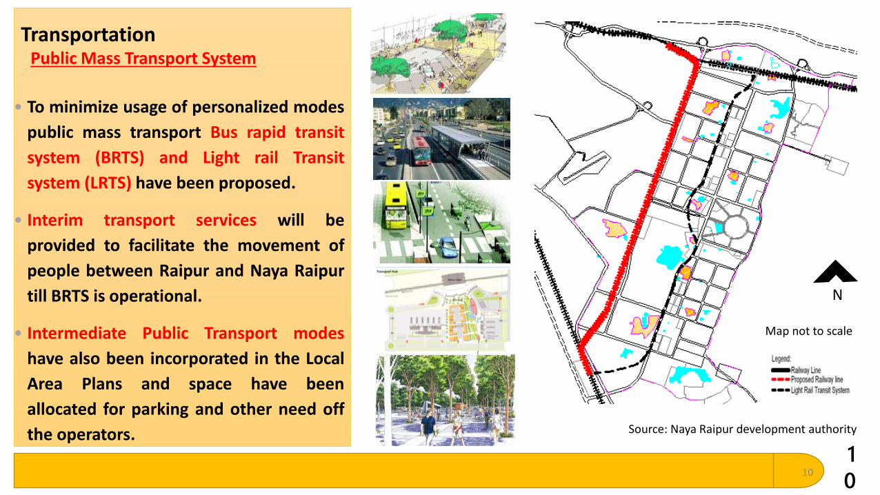
Transportation
10
Public Mass Transport System
• To minimize usage of personalized modes
public mass transport Bus rapid transit
system (BRTS) and Light rail Transit
system (LRTS) have been proposed.
• Interim transport services will be
provided to facilitate the movement of
people between Raipur and Naya Raipur
till BRTS is operational.
• Intermediate Public Transport modes
have also been incorporated in the Local
Area Plans and space have been
allocated for parking and other need off
the operators. Source: Naya Raipur development authority
Map not to scale
N
1
1
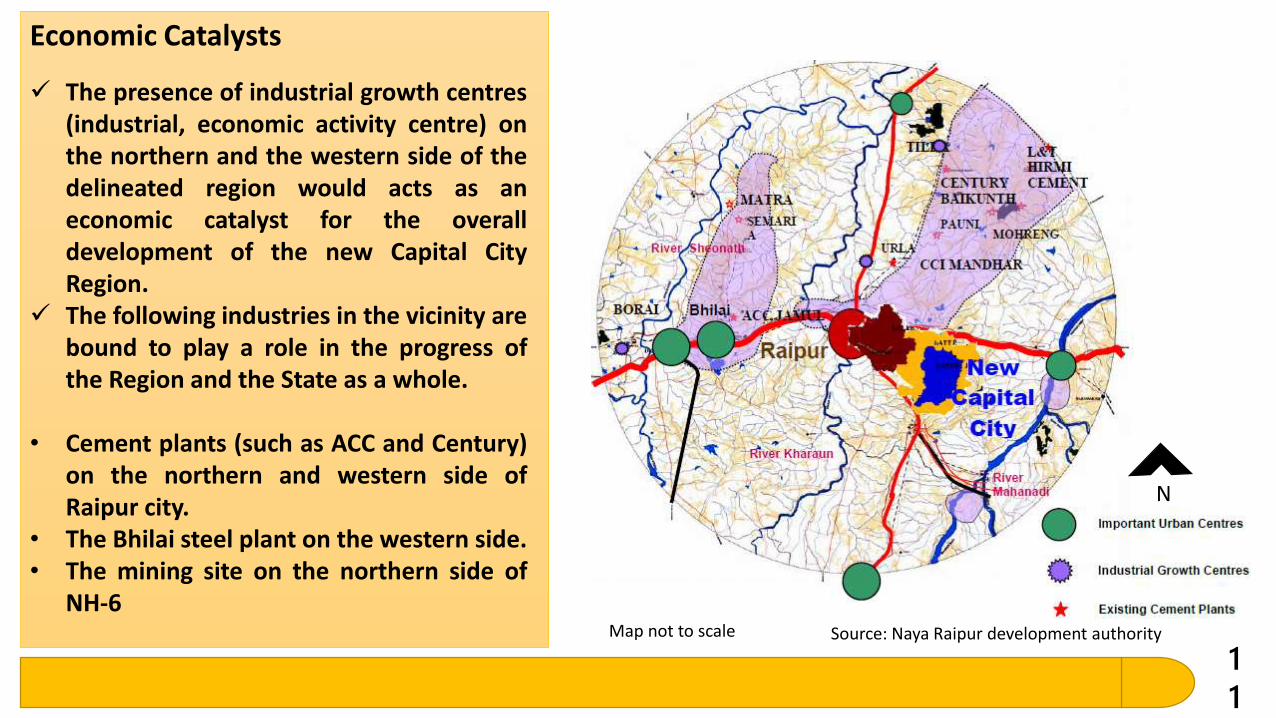
The presence of industrial growth centres(industrial, economic activity centre) onthe northern and the western side of thedelineated region would acts as aneconomic catalyst for the overalldevelopment of the new Capital CityRegion.
The following industries in the vicinity arebound to play a role in the progress ofthe Region and the State as a whole.
• Cement plants (such as ACC and Century)on the northern and western side ofRaipur city.
• The Bhilai steel plant on the western side.• The mining site on the northern side of
NH-6
Economic Catalysts
Source: Naya Raipur development authorityMap not to scale
N
1
2
ECONOMIC BASE, EMPLOYMENT AND WORK AREASThe main activity base of Naya Raipur would be the Government / State Capital functions.i. Software Technology Park
ii. Gems and Jewellery and other similar industriesiii. Business Officesiv. Health, Education and Research servicesv. Regional recreational activities
WORK AREAS Government Functions Wholesale Trade Retail Trade Proposed Hierarchy of trade and commerce areas Provision of Housing Area Centres/ Neighbourhood
Shopping Centres and Community Centres City Centre / Central Business District Light & Service Industries Composite Use Zone Special Industry Zone (Software Technology Park) Informal Sector Weekly markets and Haats

Thank You
13