Natasa Manojlovic Niloufar Behzadnia Erik Pasche …label-eu.eu/uploads/media/3_Manojlovic.pdf ·...
24
Flood risk management in Hamburg - the example of an urban water course Natasa Manojlovic Niloufar Behzadnia Erik Pasche † Hamburg University of Technology Hamburg, 15 th , June, 2011 Contents • Intro • SAWA-HH Governance Approach • Implementation of the governance approach in the SAWA Project at the Wandse Catchment Area, Germany • Lessons learned so far and conclusions
Transcript of Natasa Manojlovic Niloufar Behzadnia Erik Pasche …label-eu.eu/uploads/media/3_Manojlovic.pdf ·...

Flood risk management in Hamburg - the example of an urban water course
Natasa Manojlovic
Niloufar Behzadnia
Erik Pasche †
Hamburg University of Technology
Hamburg, 15th, June, 2011
Contents
• Intro
• SAWA-HH Governance Approach
• Implementation of the governance approach in the SAWA Project at the Wandse Catchment Area, Germany
• Lessons learned so far and conclusions
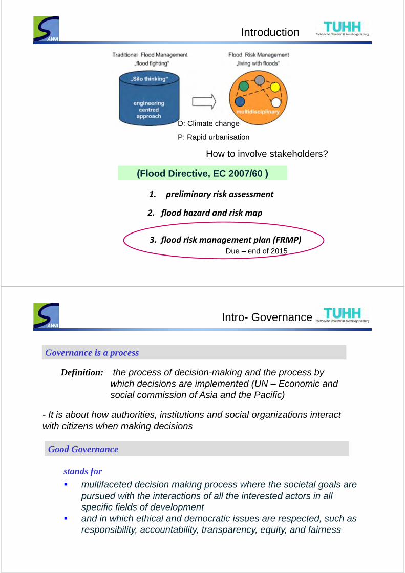
Introduction
(Flood Directive, EC 2007/60 )
1. preliminary risk assessment
2. flood hazard and risk map
3. flood risk management plan (FRMP)
How to involve stakeholders?
Due – end of 2015
D: Climate change
P: Rapid urbanisation
Definition: the process of decision-making and the process by which decisions are implemented (UN – Economic and social commission of Asia and the Pacific)
Governance is a process
Intro- Governance
- It is about how authorities, institutions and social organizations interact with citizens when making decisions
stands for
multifaceted decision making process where the societal goals are pursued with the interactions of all the interested actors in all specific fields of development
and in which ethical and democratic issues are respected, such as responsibility, accountability, transparency, equity, and fairness
Good Governance
Intro- Governance
(Article 10 (1)) : Member States shall make available to the public the preliminary flood risk assessment, the flood hazard maps, theflood risk maps and the flood risk management plans.
What says the Flood Directive EC 2007/60
(Article 10 (2)) : Member States shall encourage active involvement of interested parties in the production, review and updating of the flood risk management.
What are efficient ways of public and stakeholder participation in the planning procedure?What is the appropriate method to quantify the efficiency and effectiveness of the mitigation measures? What are adaptations of the administrative and legal system necessary?
Open Question in the context of FRMP
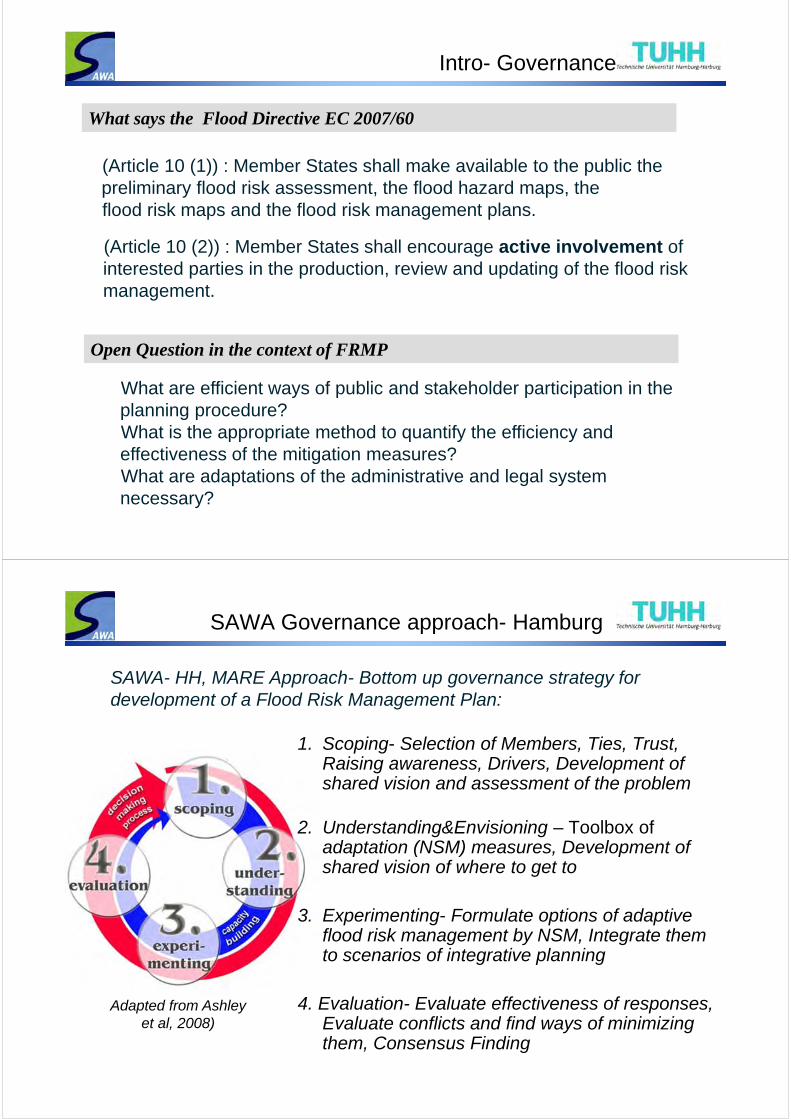
SAWA Governance approach- Hamburg
SAWA- HH, MARE Approach- Bottom up governance strategy for development of a Flood Risk Management Plan:
1. Scoping- Selection of Members, Ties, Trust, Raising awareness, Drivers, Development of shared vision and assessment of the problem
2. Understanding&Envisioning – Toolbox of adaptation (NSM) measures, Development of shared vision of where to get to
3. Experimenting- Formulate options of adaptive flood risk management by NSM, Integrate them to scenarios of integrative planning
4. Evaluation- Evaluate effectiveness of responses, Evaluate conflicts and find ways of minimizing them, Consensus Finding
Adapted from Ashley et al, 2008)
SAWA Governance approach- Hamburg
Social Competences
1. Scoping
Stakeholder Analysis
Understanding risk
2. Understanding & Envisioning
3. Experimenting
4. Evaluation
Maßnahmen Beschreibung ... ...HWRMP- M1HWRMP- M2HWRMP- M3HWRMP- M4
...
Maßnahmen Beschreibung ... ...HWRMP- M1HWRMP- M2HWRMP- M3HWRMP- M4
...
Maßnahmen Beschreibung ... ...HWRMP- M1HWRMP- M2HWRMP- M3HWRMP- M4
...
Maßnahmen Beschreibung ... ...HWRMP- M1HWRMP- M2HWRMP- M3HWRMP- M4
...
Maßnahmen Beschreibung ... ...HWRMP- M1HWRMP- M2HWRMP- M3HWRMP- M4
...
Maßnahmen Beschreibung ... ...HWRMP- M1HWRMP- M2HWRMP- M3HWRMP- M4
...
Sn, SQ Sn, kw, se
Flood Risk Management Plan
Developing planning options
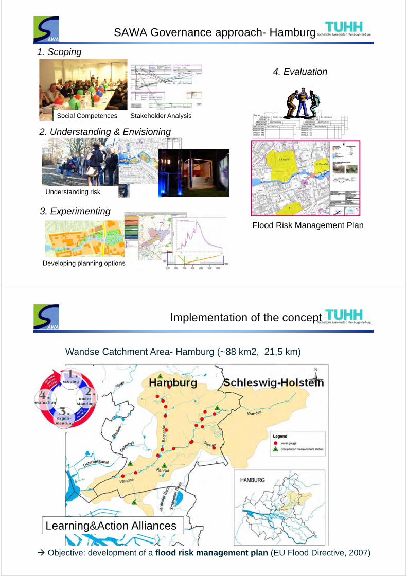
Wandse Catchment Area- Hamburg (~88 km2, 21,5 km)
Objective: development of a flood risk management plan (EU Flood Directive, 2007)
Implementation of the concept
Learning&Action Alliances
Implementation of the concept
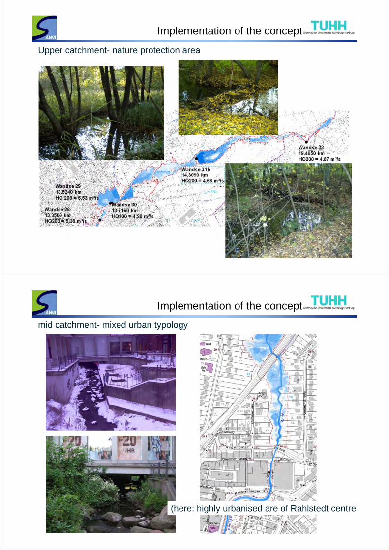
Upper catchment- nature protection area
Implementation of the concept
mid catchment- mixed urban typology
(here: highly urbanised are of Rahlstedt centre)
Implementation of the concept
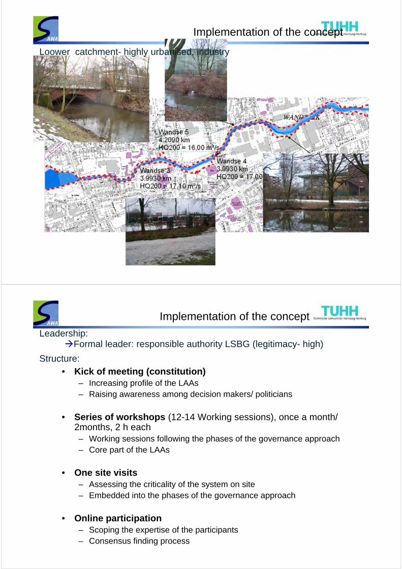
Loower catchment- highly urbanised, industry
Implementation of the concept
• Kick of meeting (constitution)– Increasing profile of the LAAs– Raising awareness among decision makers/ politicians
• Series of workshops (12-14 Working sessions), once a month/ 2months, 2 h each– Working sessions following the phases of the governance approach– Core part of the LAAs
• One site visits– Assessing the criticality of the system on site– Embedded into the phases of the governance approach
• Online participation– Scoping the expertise of the participants– Consensus finding process
Formal leader: responsible authority LSBG (legitimacy- high)
Structure:
Leadership:
Implementation of the concept
1. Scoping: Stakeholder analysis (selection and characterisation of key stakeholder groups and their interactions) Building social competences Confronting with flood risk and raising awareness Understanding the system drivers and pressures, sensitivity, response
Objective: Development of shared vision of the problem (Flood Risk)
Workshops
Qualitative analyses
Methods:
1
Implementation of the concept
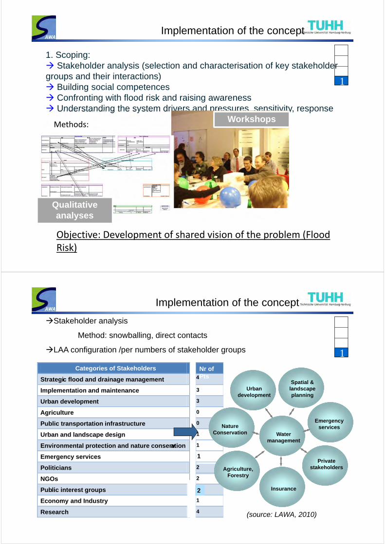
Categories of Stakeholders
Strategic flood and drainage management
Implementation and maintenance
Urban development
Agriculture
Public transportation infrastructure
Urban and landscape design
Environmental protection and nature conservation
Emergency services
Politicians
NGOs
Public interest groups
Economy and Industry
Research
Stakeholder analysis
Method: snowballing, direct contacts
LAA configuration /per numbers of stakeholder groups
3
3
0
0
1
1
0
2
2
1
1
4
4
Nr of Pts
1
2
1
(source: LAWA, 2010)
Water management
Private stakeholders
Insurance
Agriculture, Forestry
Nature Conservation
Urban development
Spatial & landscape planning
Emergency services
Implementation of the concept
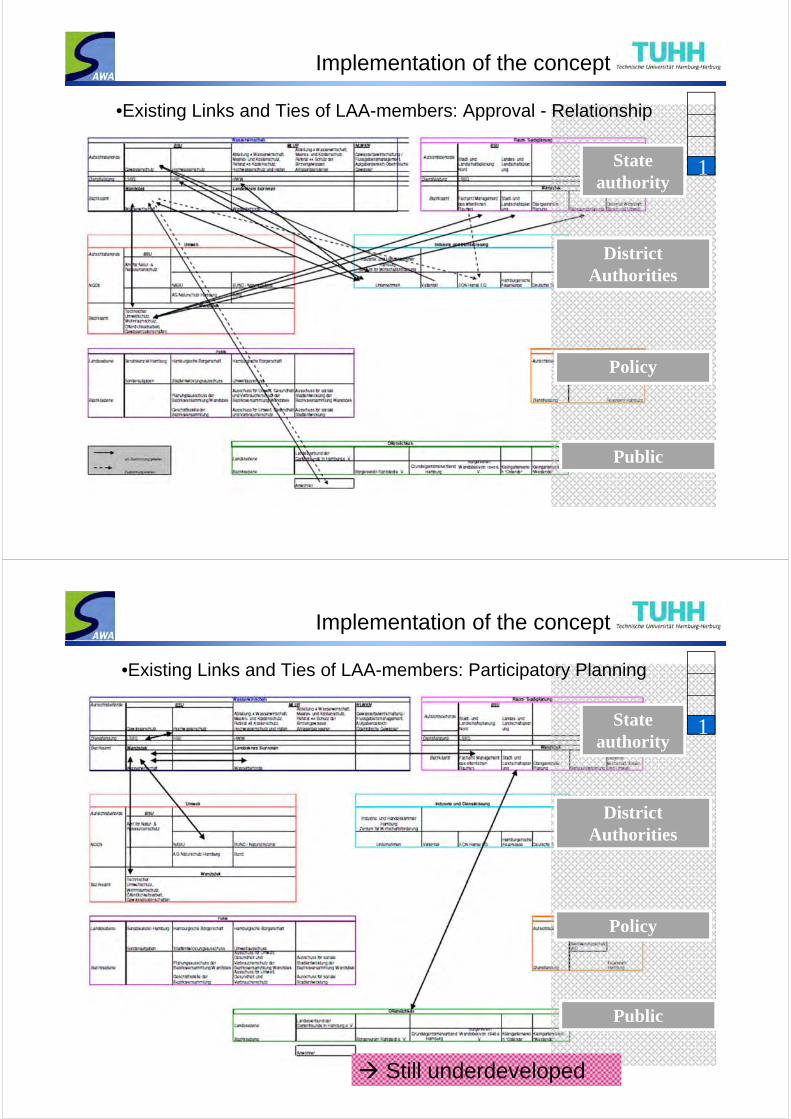
•Existing Links and Ties of LAA-members: Approval - Relationship
State authority
DistrictAuthorities
Policy
Public
1
Implementation of the concept
•Existing Links and Ties of LAA-members: Participatory Planning
State authority
DistrictAuthorities
Policy
Public
1
Still underdeveloped
Implementation of the concept
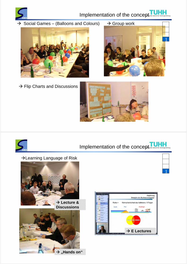
Social Games – (Balloons and Colours)
Flip Charts and Discussions
Group work
1
Implementation of the concept
Learning Language of Risk
E Lectures
Lecture & Discussions
„Hands on“
1
Implementation of the concept
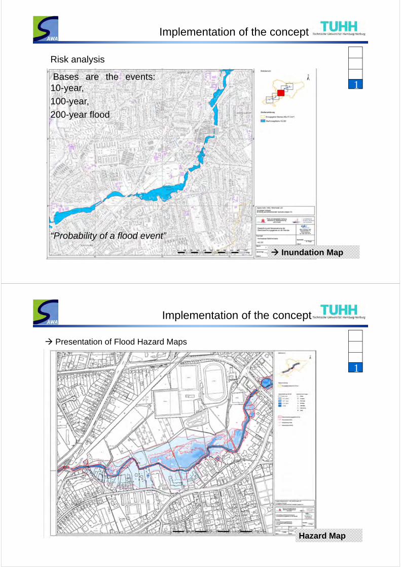
Inundation Map
Bases are the events:10-year,
100-year,
200-year flood
Risk analysis
“Probability of a flood event”
1
Implementation of the concept
Presentation of Flood Hazard Maps
Hazard Map
1
Implementation of the concept
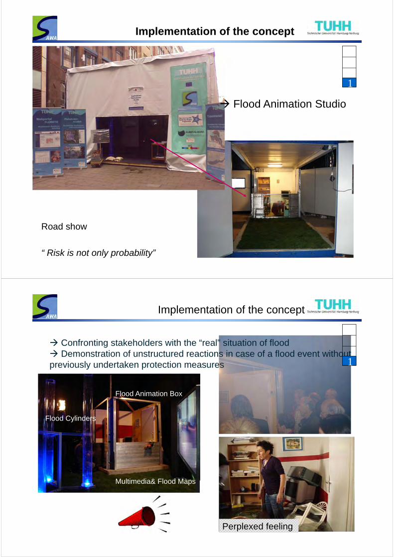
Road show
“ Risk is not only probability”
Flood Animation Studio
1
Implementation of the concept
Perplexed feeling
Confronting stakeholders with the “real” situation of flood Demonstration of unstructured reactions in case of a flood event without previously undertaken protection measures
Flood Animation Box
Flood Cylinders
Multimedia& Flood Maps
1
Implementation of the concept
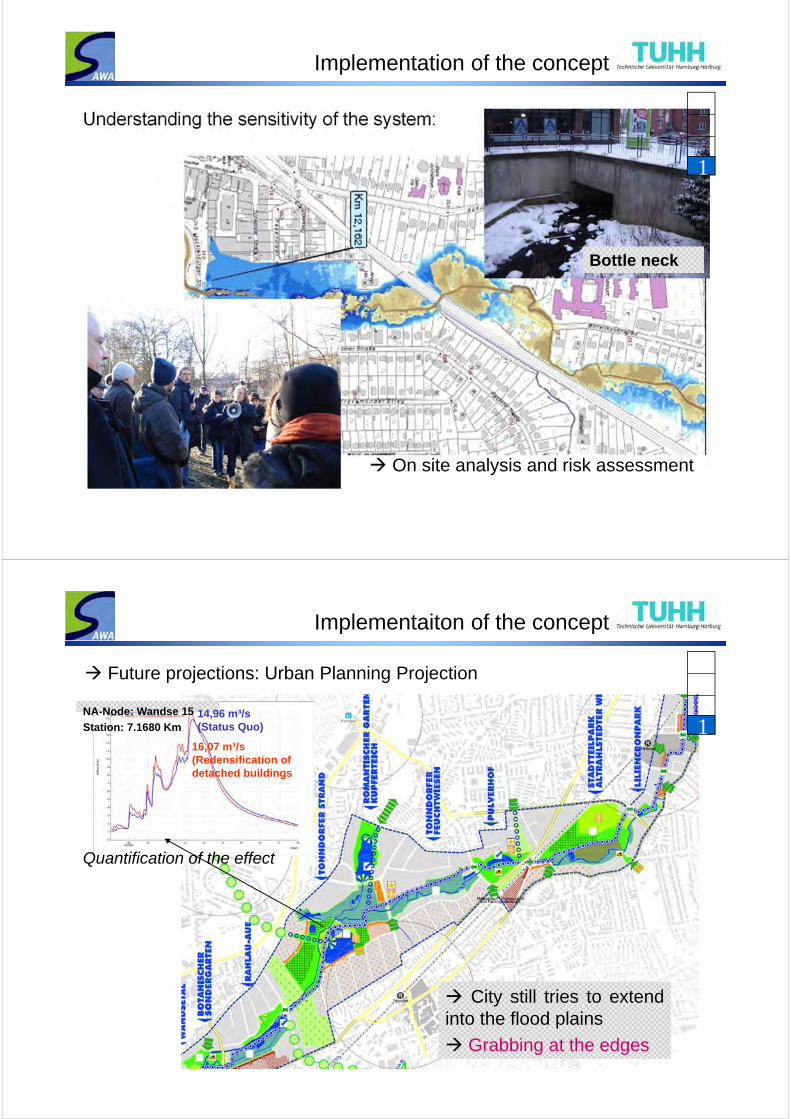
Understanding the sensitivity of the system:
Bottle neck
1
On site analysis and risk assessment
Implementaiton of the concept
Future projections: Urban Planning Projection
City still tries to extendinto the flood plains
Grabbing at the edges
16,07 m³/s (Redensification of detached buildings
NA-Node: Wandse 15
Station: 7.1680 Km14,96 m³/s (Status Quo) 1
Quantification of the effect
Implementaiton of the concept
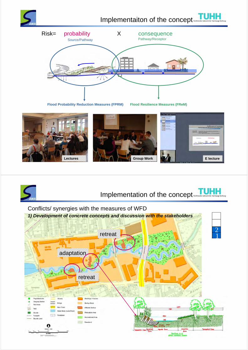
Source/Pathway Pathway/Receptor
Flood Resilience Measures (FReM)
probability X consequenceRisk=
Flood Probability Reduction Measures (FPRM)
E lectureGroup Work Lectures
Implementation of the concept
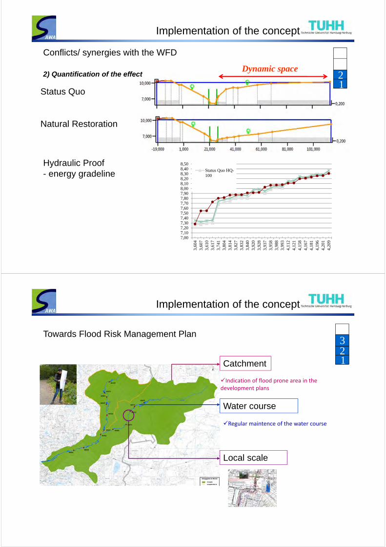
retreat
retreat
adaptation
12
Conflicts/ synergies with the measures of WFD1) Development of concrete concepts and discussion with the stakeholders
Implementation of the concept
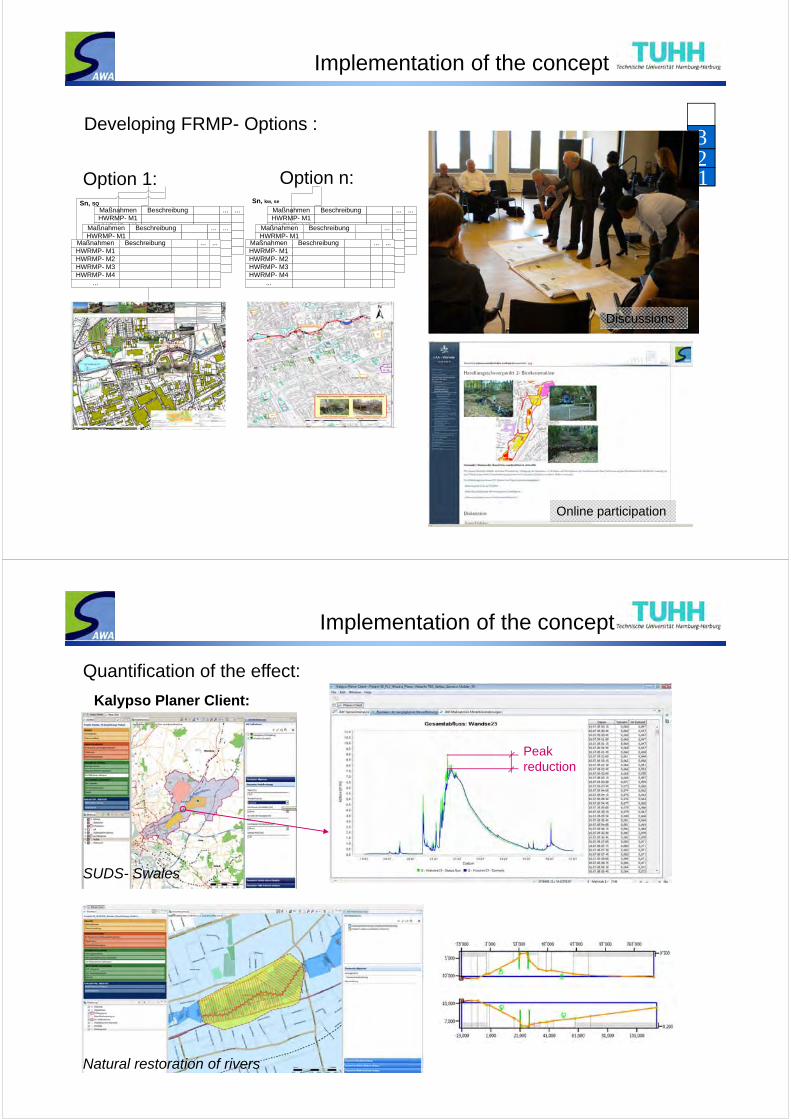
Status Quo
Natural Restoration
Dynamic space
Conflicts/ synergies with the WFD
2) Quantification of the effect
7,007,107,207,307,407,507,607,707,807,908,008,108,208,308,408,50
3,60
43,
607
3,61
03,
617
3,74
13,
804
3,81
43,
827
3,83
23,
840
3,92
03,
928
3,93
73,
958
3,98
83,
993
4,11
24,
121
4,15
84,
167
4,18
14,
196
4,20
14,
209
Status Quo HQ-100
Hydraulic Proof- energy gradeline
12
Implementation of the concept
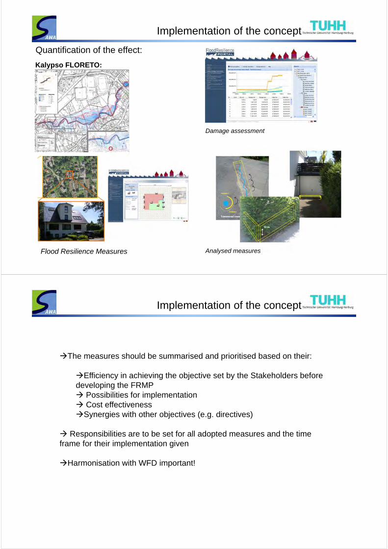
Catchment
Water course
Local scale
Towards Flood Risk Management Plan
Indication of flood prone area in the development plans
Regular maintence of the water course
123
Implementation of the concept
Developing FRMP- Options :
123
Maßnahmen Beschreibung ... ...HWRMP- M1HWRMP- M2HWRMP- M3HWRMP- M4
...
Maßnahmen Beschreibung ... ...HWRMP- M1HWRMP- M2HWRMP- M3HWRMP- M4
...
Maßnahmen Beschreibung ... ...HWRMP- M1HWRMP- M2HWRMP- M3HWRMP- M4
...
Maßnahmen Beschreibung ... ...HWRMP- M1HWRMP- M2HWRMP- M3HWRMP- M4
...
Maßnahmen Beschreibung ... ...HWRMP- M1HWRMP- M2HWRMP- M3HWRMP- M4
...
Maßnahmen Beschreibung ... ...HWRMP- M1HWRMP- M2HWRMP- M3HWRMP- M4
...
Sn, SQ Sn, kw, se
Option 1: Option n:
Online participation
Discussions
Implementation of the concept
Kalypso Planer Client:
SUDS- Swales
Natural restoration of rivers
Quantification of the effect:
Peak reduction
Implementation of the concept
Quantification of the effect:
Kalypso FLORETO:
Flood Resilience Measures
Damage assessment
Analysed measures
Implementation of the concept
The measures should be summarised and prioritised based on their:
Efficiency in achieving the objective set by the Stakeholders before developing the FRMP Possibilities for implementation Cost effectivenessSynergies with other objectives (e.g. directives)
Responsibilities are to be set for all adopted measures and the time frame for their implementation given
Harmonisation with WFD important!
Implementation of the concept
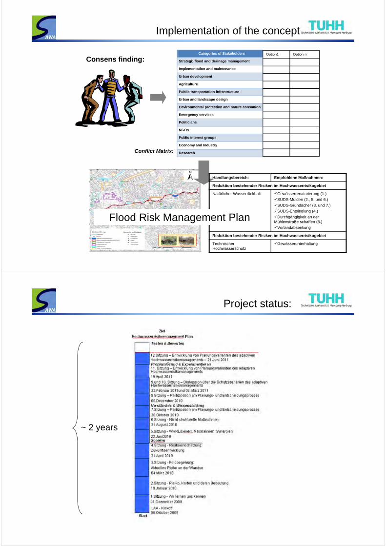
Conflict Matrix:
Handlungsbereich: Empfohlene Maßnahmen:
Reduktion bestehender Risiken im Hochwasserrisikogebiet
Natürlicher Wasserrückhalt Gewässerrenaturierung (1.)
SUDS-Mulden (2., 5. und 6.)
SUDS-Gründächer (3. und 7.)
SUDS-Entsieglung (4.)
Durchgängigkeit an der Mühlenstraße schaffen (8.)
Vorlandabsenkung
Reduktion bestehender Risiken im Hochwasserrisikogebiet
Technischer Hochwasserschutz
Gewässerunterhaltung
Flood Risk Management Plan
Consens finding:Categories of Stakeholders
Strategic flood and drainage management
Implementation and maintenance
Urban development
Agriculture
Public transportation infrastructure
Urban and landscape design
Environmental protection and nature conservation
Emergency services
Politicians
NGOs
Public interest groups
Economy and Industry
Research
Option1 Option n
Project status:
~ 2 years
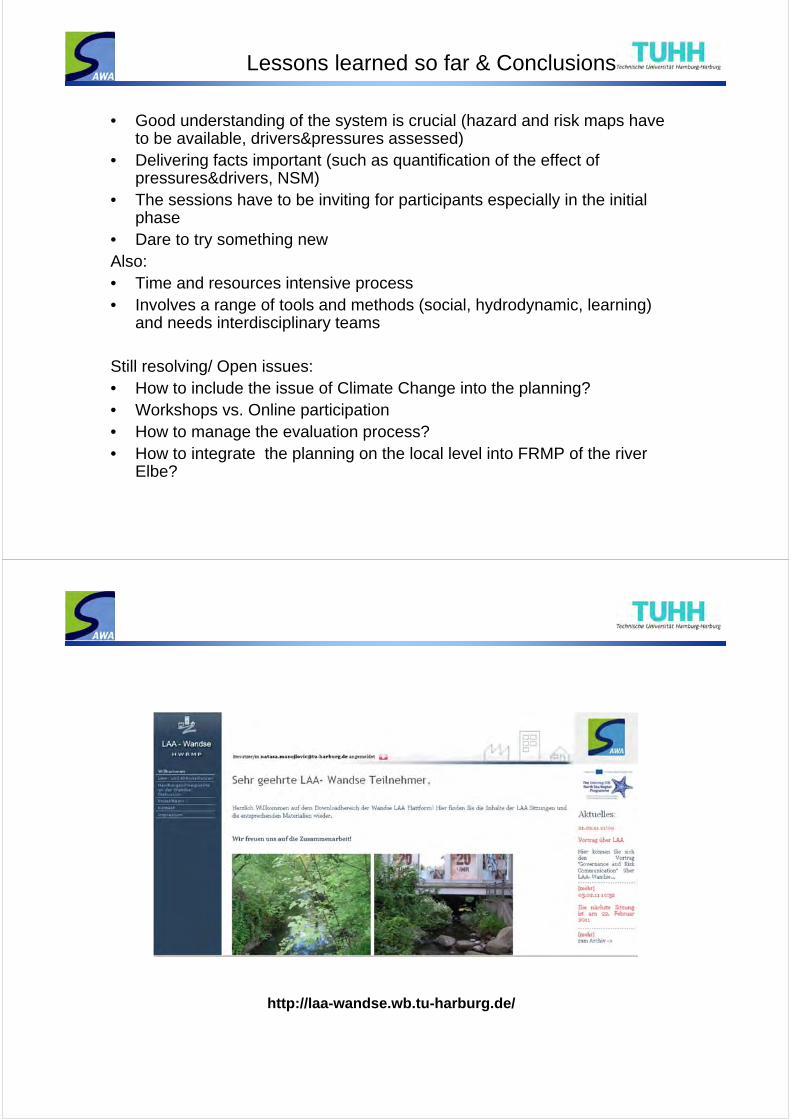
Lessons learned so far & Conclusions
• Good understanding of the system is crucial (hazard and risk maps have to be available, drivers&pressures assessed)
• Delivering facts important (such as quantification of the effect of pressures&drivers, NSM)
• The sessions have to be inviting for participants especially in the initial phase
• Dare to try something newAlso:• Time and resources intensive process• Involves a range of tools and methods (social, hydrodynamic, learning)
and needs interdisciplinary teams
Still resolving/ Open issues:• How to include the issue of Climate Change into the planning?• Workshops vs. Online participation• How to manage the evaluation process?• How to integrate the planning on the local level into FRMP of the river
Elbe?
http://laa-wandse.wb.tu-harburg.de/
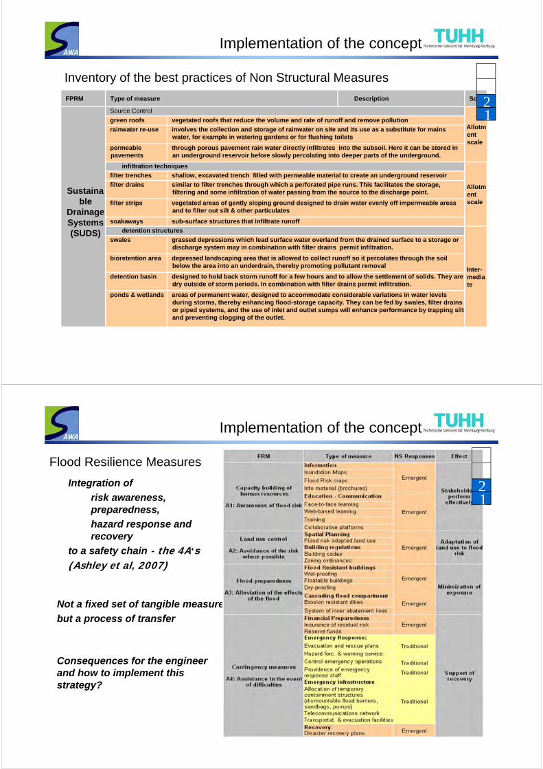
Implementation of the concept
FPRM Type of measure Description Scale
Sustainable
Drainage Systems (SUDS)
Source Control
Allotmentscale
green roofs vegetated roofs that reduce the volume and rate of runoff and remove pollution
rainwater re-use involves the collection and storage of rainwater on site and its use as a substitute for mains water, for example in watering gardens or for flushing toilets
permeable pavements
through porous pavement rain water directly infiltrates into the subsoil. Here it can be stored in an underground reservoir before slowly percolating into deeper parts of the underground.
infiltration techniques
Allotmentscale
filter trenches shallow, excavated trench filled with permeable material to create an underground reservoir
filter drains similar to filter trenches through which a perforated pipe runs. This facilitates the storage, filtering and some infiltration of water passing from the source to the discharge point.
filter strips vegetated areas of gently sloping ground designed to drain water evenly off impermeable areas and to filter out silt & other particulates
soakaways sub-surface structures that infiltrate runoff
detention structures
Inter-mediate
swales grassed depressions which lead surface water overland from the drained surface to a storage or discharge system may in combination with filter drains permit infiltration.
bioretention area depressed landscaping area that is allowed to collect runoff so it percolates through the soil below the area into an underdrain, thereby promoting pollutant removal
detention basin designed to hold back storm runoff for a few hours and to allow the settlement of solids. They are dry outside of storm periods. In combination with filter drains permit infiltration.
ponds & wetlands areas of permanent water, designed to accommodate considerable variations in water levels during storms, thereby enhancing flood-storage capacity. They can be fed by swales, filter drains or piped systems, and the use of inlet and outlet sumps will enhance performance by trapping silt and preventing clogging of the outlet.
12
Inventory of the best practices of Non Structural Measures
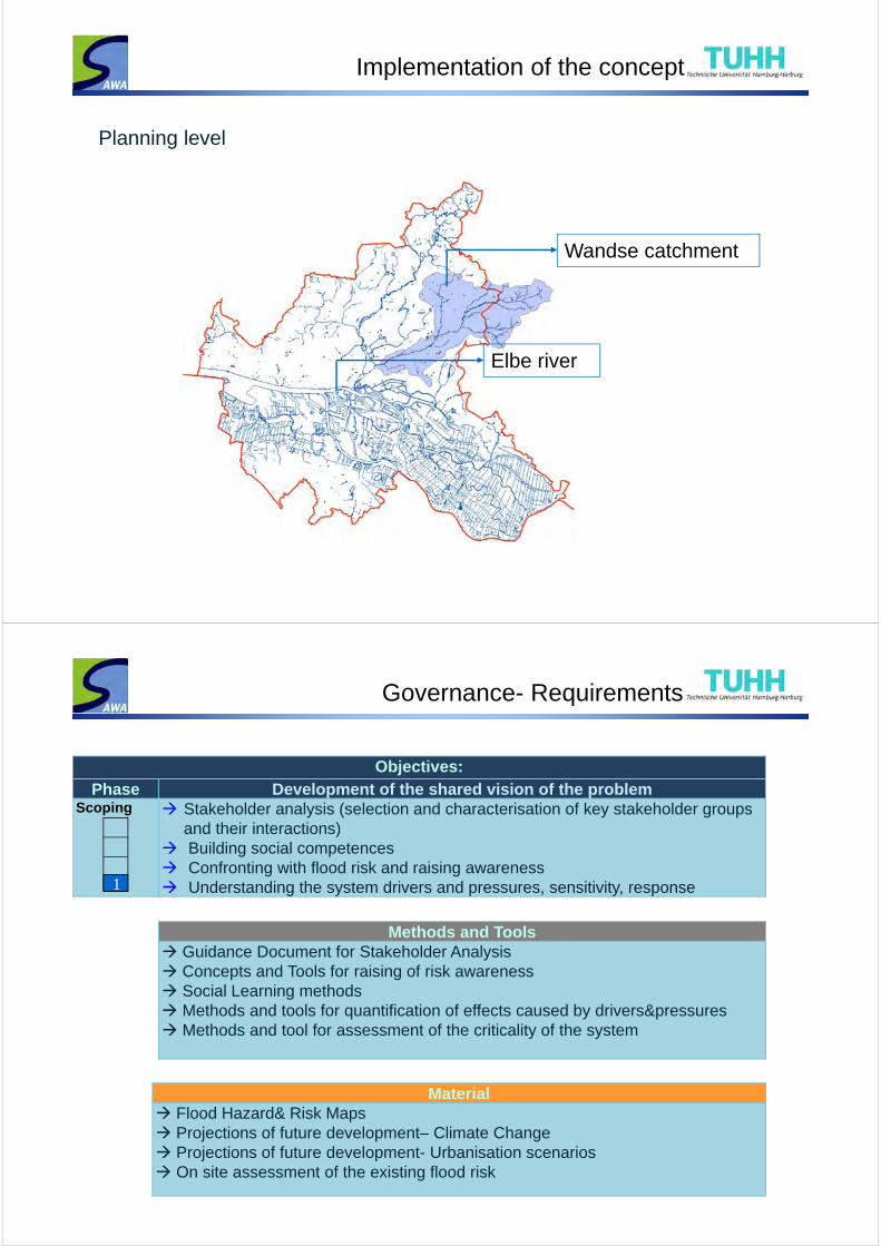
Implementation of the concept
38
Integration of
risk awareness, preparedness,
hazard response and recovery
to a safety chain - the 4A‘s(Ashley et al, 2007)
Not a fixed set of tangible measures,
but a process of transfer
Consequences for the engineer and how to implement this strategy?
12
Flood Resilience Measures
Implementation of the concept
Planning level
Wandse catchment
Elbe river
Governance- Requirements
Objectives:Phase Development of the shared vision of the problem
Scoping Stakeholder analysis (selection and characterisation of key stakeholder groups and their interactions)
Building social competences Confronting with flood risk and raising awareness Understanding the system drivers and pressures, sensitivity, response
Methods and Tools Guidance Document for Stakeholder Analysis Concepts and Tools for raising of risk awareness Social Learning methods Methods and tools for quantification of effects caused by drivers&pressures Methods and tool for assessment of the criticality of the system
Material Flood Hazard& Risk Maps Projections of future development– Climate Change Projections of future development- Urbanisation scenarios On site assessment of the existing flood risk
1
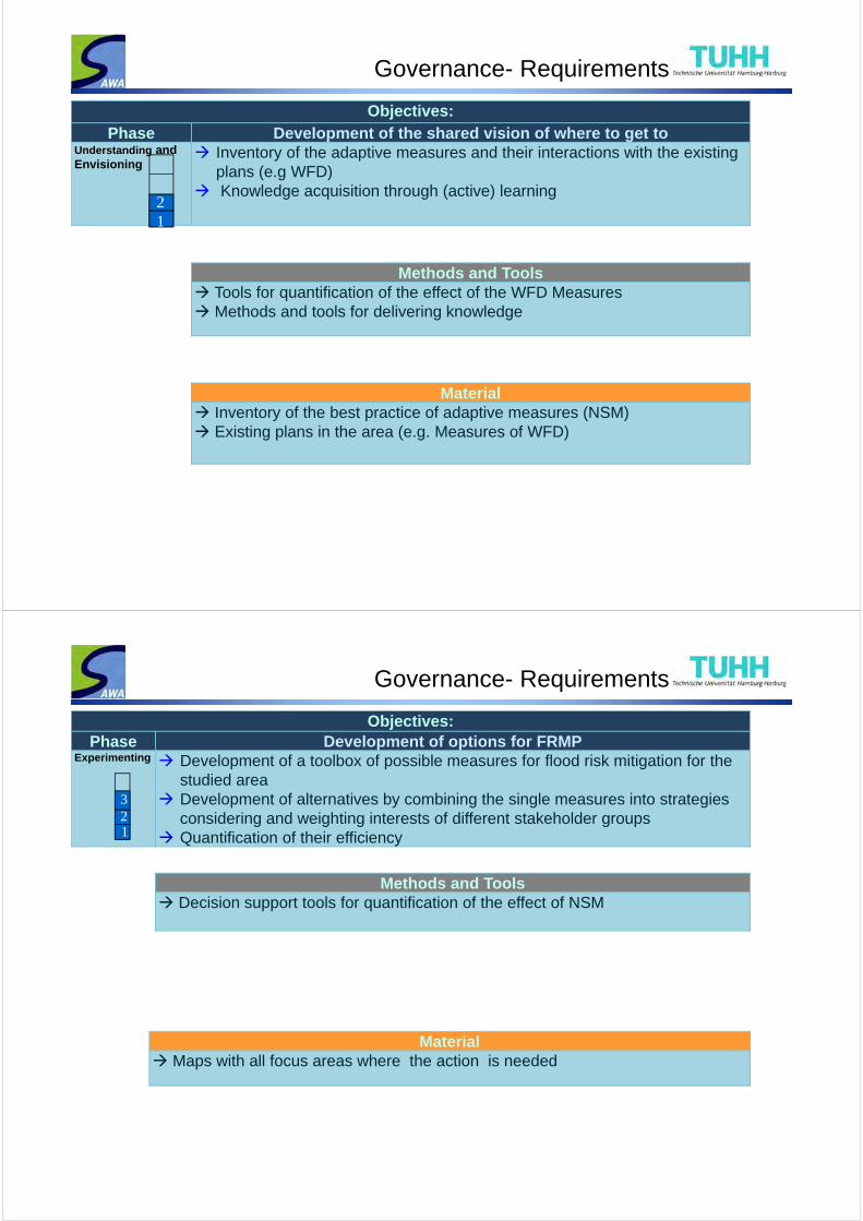
Objectives:Phase Development of the shared vision of where to get to
Understanding and Envisioning
Inventory of the adaptive measures and their interactions with the existing plans (e.g WFD)
Knowledge acquisition through (active) learning
Methods and Tools Tools for quantification of the effect of the WFD Measures Methods and tools for delivering knowledge
Material Inventory of the best practice of adaptive measures (NSM) Existing plans in the area (e.g. Measures of WFD)
Governance- Requirements
12
Objectives:Phase Development of options for FRMP
Experimenting Development of a toolbox of possible measures for flood risk mitigation for the studied area
Development of alternatives by combining the single measures into strategies considering and weighting interests of different stakeholder groups
Quantification of their efficiency
Methods and Tools Decision support tools for quantification of the effect of NSM
Material Maps with all focus areas where the action is needed
Governance- Requirements
123

Governance- Requirements
Objectives:Phase Development of options for FRMP
Testing & Evaluation
Identification and discussion on conflicts caused by different interests of stakeholder groups in the Wandse catchment
Iterative improvement of the final concept to its final state
Methods and Tools Development of Assessment Matrix for MCA Methods & Tools for participation in the assessment of conflicts
Material Different options of FRMP
1
32
4
The governance process in sustainable flood management faces the main problems summarised as:
(1) ambiguities of goals, (2) unclear means and guidelines to achieve them and (3) lack or distributed power to carry out the governance process
(Newig, 2008),
Implementaiton of the concept
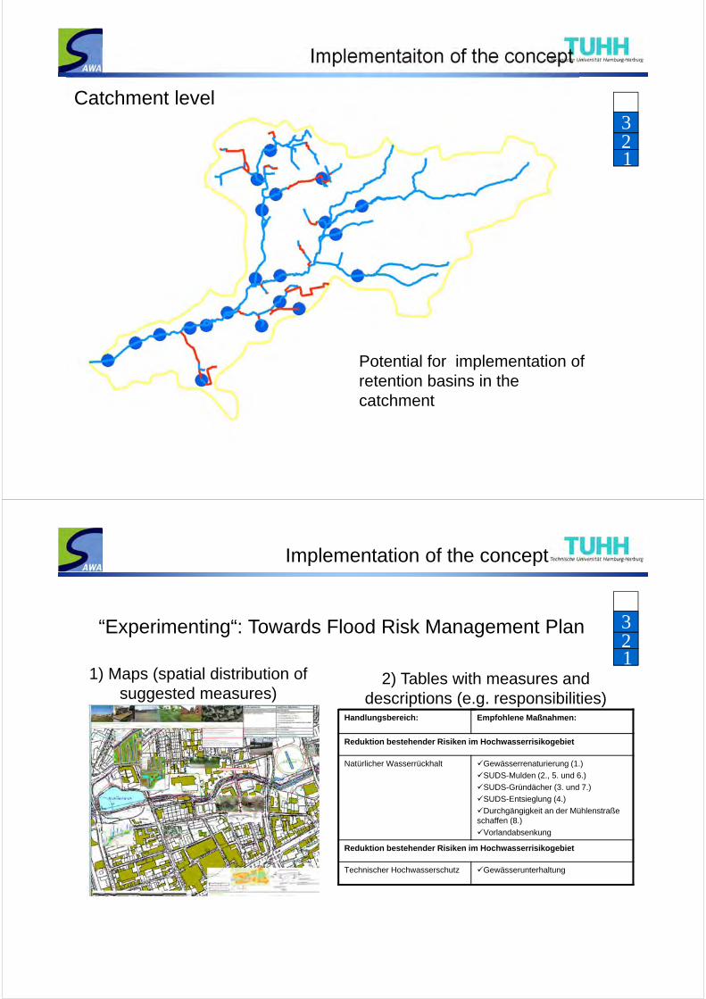
123
Catchment level
Potential for implementation of retention basins in the catchment
2) Tables with measures and descriptions (e.g. responsibilities)
1) Maps (spatial distribution of suggested measures)
“Experimenting“: Towards Flood Risk Management Plan
Handlungsbereich: Empfohlene Maßnahmen:
Reduktion bestehender Risiken im Hochwasserrisikogebiet
Natürlicher Wasserrückhalt Gewässerrenaturierung (1.)
SUDS-Mulden (2., 5. und 6.)
SUDS-Gründächer (3. und 7.)
SUDS-Entsieglung (4.)
Durchgängigkeit an der Mühlenstraße schaffen (8.)
Vorlandabsenkung
Reduktion bestehender Risiken im Hochwasserrisikogebiet
Technischer Hochwasserschutz Gewässerunterhaltung
Implementation of the concept
123

Experience so far
Legacy of the LAA
Climate Adaptation Masteplan ?
• Good understanding of the system is crucial (hazard and risk maps have to be available, drivers&pressures assessed)
• Delivering facts important (such as quantification of the effect of pressures&drivers, NSM)
• The sessions have to be inviting for participants especially in the initial phase
• Dare to try something newBut:• Time and resources intensive process• Involves a range of tools and methods (social, hydrodynamic, learning)
and needs interdisciplinary teams
Still resolving:• How to include the issue of Climate Change into the planning?• Workshops vs. Online participation• How to manage the evaluation process? Who is conducting it?
Lessons learned so far & Conclusions
• Good understanding of the system is crucial (hazard and risk maps have to be available, drivers&pressures assessed)
• Delivering facts important (such as quantification of the effect of pressures&drivers, NSM)
• The sessions have to be inviting for participants especially in the initial phase
• Dare to try something newAlso:• Time and resources intensive process• Involves a range of tools and methods (social, hydrodynamic, learning)
and needs interdisciplinary teams
Still resolving:• How to include the issue of Climate Change into the planning?• Workshops vs. Online participation• How detailed we should get when developing FRMP?• How to manage the evaluation process? Who is conducting it?
Keeping in mind: • Governance in flood risk management planning is still an emergence, the
presented SAWA/MARE approach is a pilot study


![IPv6 RIPEness and RIPE Atlas IPv6 Measurements, by Vesna Manojlovic [APRICOT 2015]](https://static.fdocuments.net/doc/165x107/55a78f141a28ab9a318b46c4/ipv6-ripeness-and-ripe-atlas-ipv6-measurements-by-vesna-manojlovic-apricot-2015.jpg)