Mt. Pinatubo
16
Mt. Pinatubo Mt. Pinatubo By: Kirsti By: Kirsti Max Max Shelby Shelby Mt. Pinatubo
-
Upload
palmer-mcfarland -
Category
Documents
-
view
84 -
download
1
description
Mt. Pinatubo. Mt. Pinatubo. By: Kirsti Max Shelby. Random Facts. Location: Luzon, Philippines Type: Stratovolcano One of the chain of composite volcanoes 1,745 meters before eruption 1,485 meters after eruption. Events Before Eruption. March 15 -small earthquakes - PowerPoint PPT Presentation
Transcript of Mt. Pinatubo

Mt. PinatuboMt. Pinatubo
By: KirstiBy: Kirsti
MaxMax
ShelbyShelby
Mt. Pinatubo
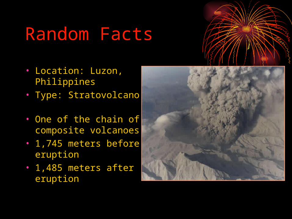
Random Facts
• Location: Luzon, Philippines
• Type: Stratovolcano • One of the chain of
composite volcanoes • 1,745 meters before
eruption• 1,485 meters after
eruption


Events Before EruptionEvents Before Eruption
• March 15 -small earthquakes• April 2 -phreatic eruptions (water and
magma interact producing violent explosions of steam and pulverized rocks)
• Volcanic activity increases throughout April and June (ashfall, sulfur dioxide emission)

• June 3-14 – first magmatic eruptions occurred
– Formation of a lava dome
– eruptions caused tephra fall, lightning, and pyroclastic flows(4 km)
– Evacuation of people started June 7th
• June 15 –main eruption

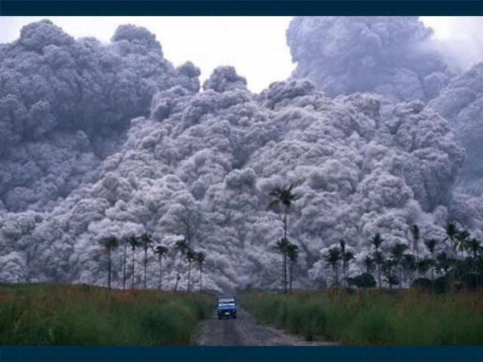
Pyroclastic flows Pyroclastic flows reaching as far as 16 kmreaching as far as 16 km
Tephra fall reaching as Tephra fall reaching as far as Vietnam, far as Vietnam, Cambodia, and MalaysiaCambodia, and Malaysia
Typhoon rains mixed Typhoon rains mixed with ash deposits with ash deposits making laharsmaking lahars
The ash cloud covered The ash cloud covered 50,000 sq. miles50,000 sq. miles
Main Eruption June 15


Before
After


•Dormant for 635 years•Second largest eruption of 20th century •Had an effect on global weather (temp. dropped .9 degrees F)•10,000 were homeless•58,000 people were evacuated•Total death toll:800
Notable Statistics

After main eruptionAfter main eruption
Volcanic activity continued till 1992Volcanic activity continued till 1992 Ash eruptions Ash eruptions
1992: 1992: Formation of Crater LakeFormation of Crater Lake Lava Dome grew in CalderaLava Dome grew in Caldera
Crater Lake partly drowned in 2001Crater Lake partly drowned in 2001

Remains of a 2 by Remains of a 2 by 3 mile caldera are 3 mile caldera are still standing todaystill standing today
Agriculture was Agriculture was destroyed by the destroyed by the pyroclastic flow pyroclastic flow and tephraand tephra