Module 12: Mars - the Red Planet
41
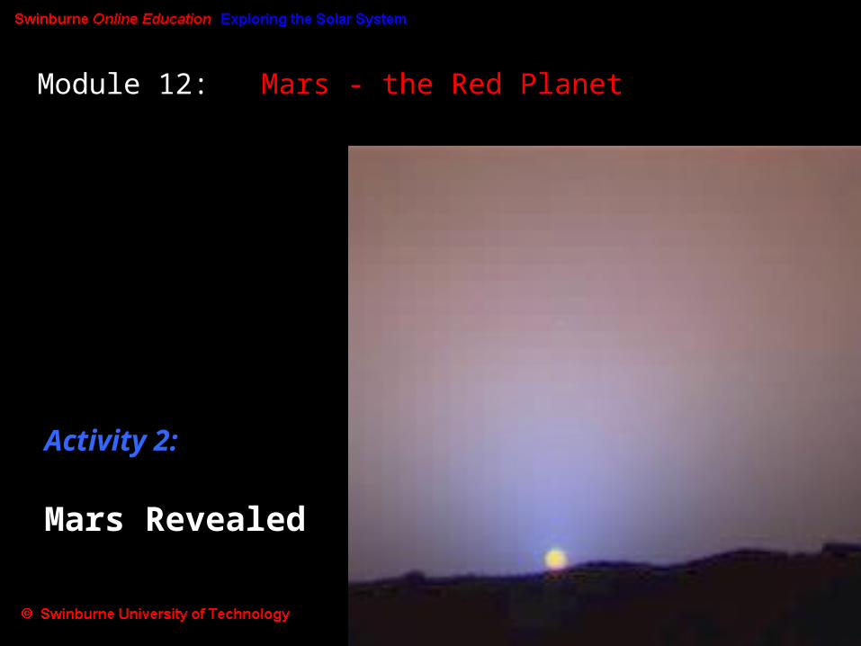
Module 12: Mars - the Red Planet Activity 2: Mars Revealed
description
Module 12: Mars - the Red Planet. Activity 2: Mars Revealed. Learning Outcomes:. In this Activity, we will investigate (a) the atmosphere of Mars, and (b) the surface of Mars - cratering, ice caps, volcanism, Martian tectonics. - PowerPoint PPT Presentation
Transcript of Module 12: Mars - the Red Planet
Module 12: Mars - the Red Planet
Activity 2: Mars Revealed
Learning Outcomes:In this Activity, we will investigate
(a) the atmosphere of Mars, and(b) the surface of Mars - cratering, ice caps, volcanism, Martian tectonics
With the renewed interest in sending space missions to Mars, the amount of information we have about it is increasing markedly - faster than the rate at which we can organize that information into a coherent understanding of the red planet!So, like many areas of astronomy at present, our knowledge and understanding of Mars is undergoing an exciting revolution, and some of the concepts we put forward here are likely to be refined, modified or even thrown out in the near future...
(a) The Atmosphere of Mars
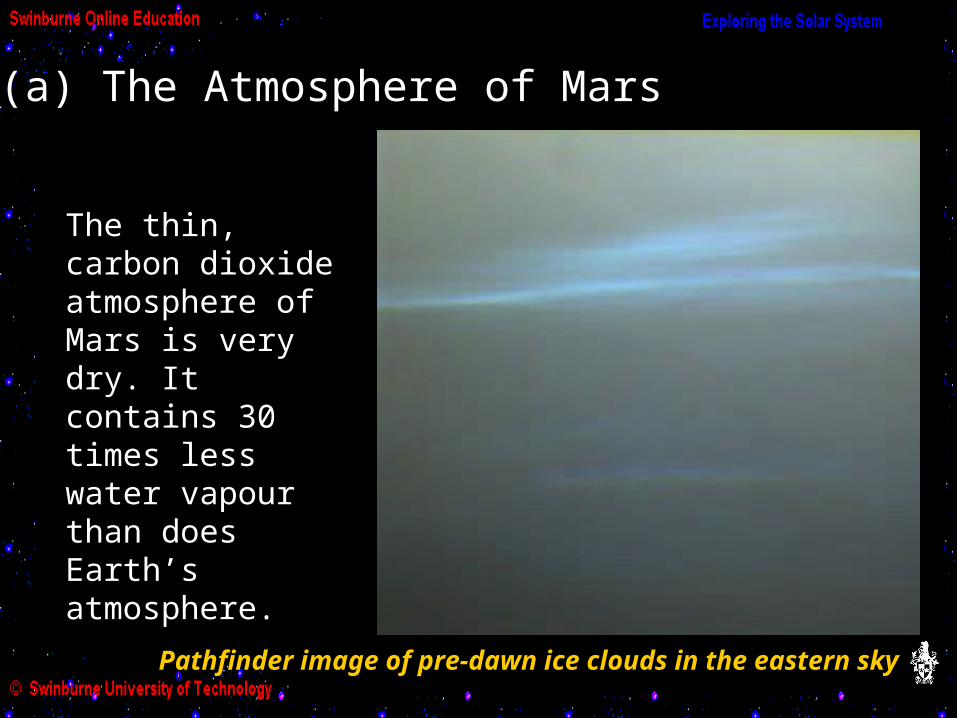
The thin, carbon dioxide atmosphere of Mars is very dry. It contains 30 times less water vapour than does Earth’s atmosphere.
Pathfinder image of pre-dawn ice clouds in the eastern sky
Mars has a low escape velocity (5 km/s, compared to 11.2 km/s for Earth) and so gas atoms can escape relatively easily.
Also, no ozone layer means no protection for water vapour molecules. Ultraviolet radiation from the Sun can break up the molecules via photodissociation - hence the dry atmosphere.
Why is the Martian atmosphere so thin and dry?
The Martian atmosphere may once have been much denser and contained water - see the next Activity.

Although very thin, the atmosphere supports weather patterns, including huge dust storms.
The following two Hubble Space Telescope images, taken about a month apart in 1996, show a dust storm near the edge of the Martian north polar cap:
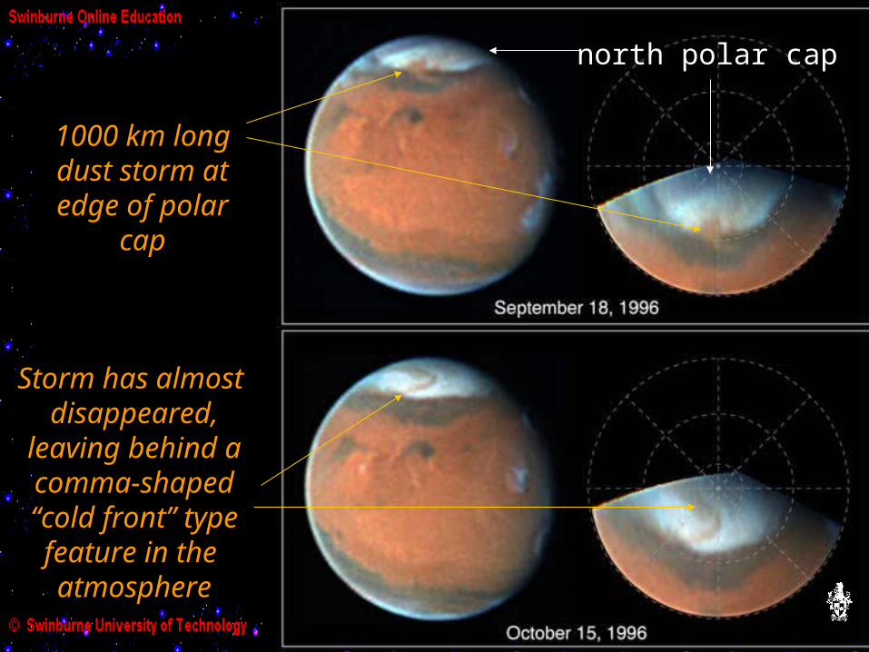
north polar cap
1000 km longdust storm atedge of polar
cap
Storm has almost disappeared,
leaving behind acomma-shaped“cold front” typefeature in the atmosphere
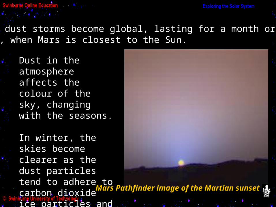
The dust storms become global, lasting for a month ortwo, when Mars is closest to the Sun.
Dust in the atmosphere affects the colour of the sky, changing with the seasons.
In winter, the skies become clearer as the dust particles tend to adhere to carbon dioxide ice particles and precipitate out.
Mars Pathfinder image of the Martian sunset

The Mars Pathfinder mission found evidence of frequent “dust devils” (or “willy willies”), which may be another way in which dust is mixed into the atmosphere.
Dust devil seen by MOC on the Mars Global Surveyor, April 2001
(b) The Surface of Mars
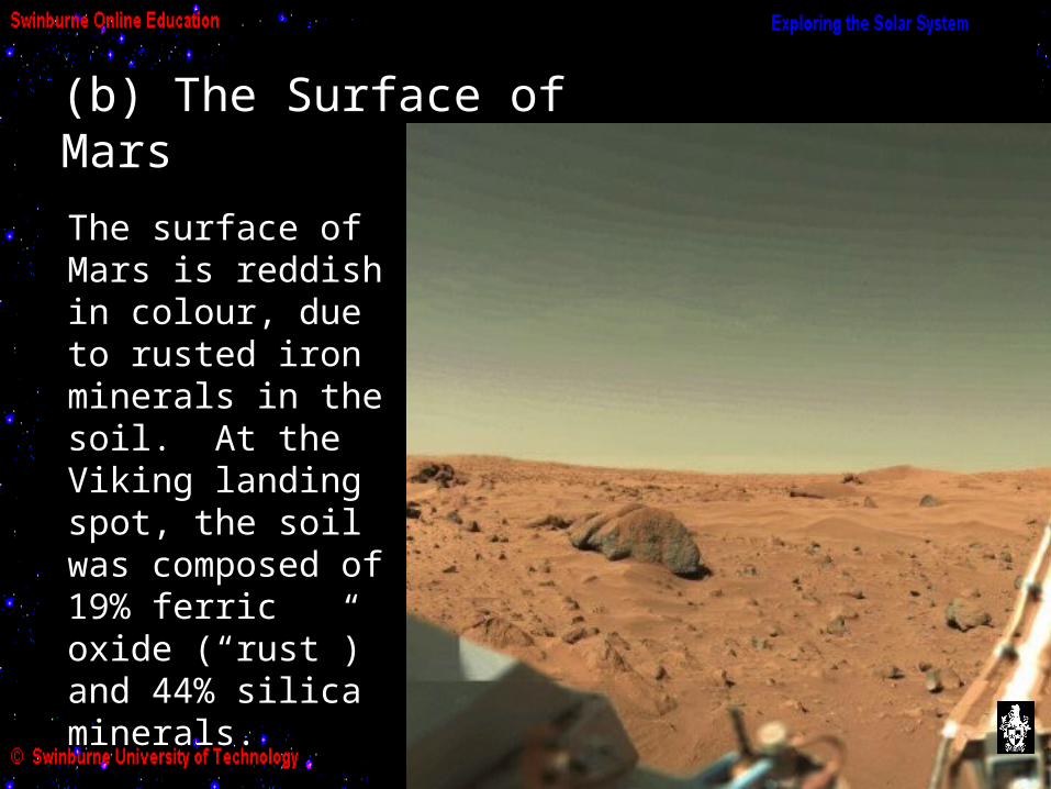
The surface of Mars is reddish in colour, due to rusted iron minerals in the soil. At the Viking landing spot, the soil was composed of 19% ferric oxide (“rust”) and 44% silica minerals.
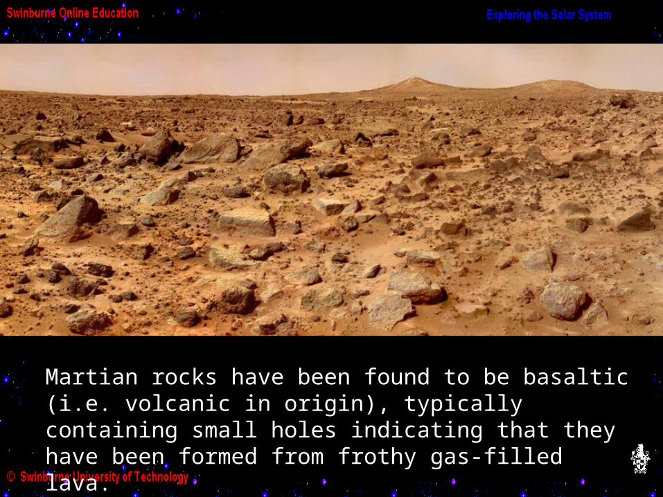
Martian rocks have been found to be basaltic (i.e. volcanic in origin), typically containing small holes indicating that they have been formed from frothy gas-filled lava.
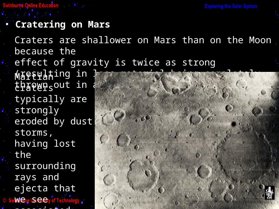
• Cratering on MarsCraters are shallower on Mars than on the Moon because the effect of gravity is twice as strong (resulting in less material being completely thrown out in an impact).Martian craters typically are strongly eroded by dust storms, having lost the surrounding rays and ejecta thatwe see associated with craters on the Moon and Mercury.
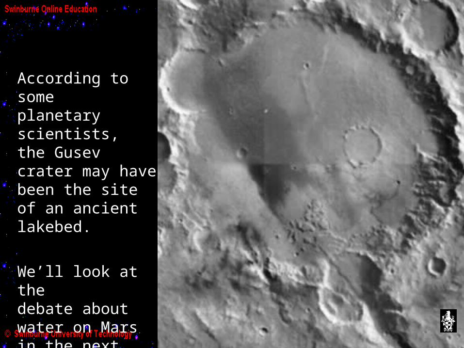
According to someplanetary scientists,the Gusev crater may have been the site of an ancient lakebed.
We’ll look at thedebate about water on Marsin the next Activity.

Southern hemisphere: old, heavily cratered surface.
Northern hemisphere: younger surface, fewer craters, repeated lava flows.
By looking at the crater count, we can get an idea of the relative ages of the Martian hemispheres.

• The Martian Polar CapsThe Martian north pole is mostly water ice, with carbon dioxide ice in its outer reaches. The carbon dioxide iceforms on top of the water ice.
At the low atmospheric pressures on Mars, water ice forms when the temperature drops to about 190°K, but carbon dioxide ice won’t form until the temperature drops to about 150°K.
The south pole is mostly carbon dioxide ice.
winter spring summer
Because of this, the size of the carbon dioxide ice component of the polar caps changes markedly from winter to summer at each pole.

The orbit of Mars around the Sun is rather eccentric (e = 0.093), and the southern winter occurs near aphelion, making it much more severe than northern winter. Therefore the carbon dioxide ice caps extend further fromthe south pole in the southern winter, than they do from the north pole in the northern winter.
Click here to see a movie of seasonal changes
in north polar ice cap of Mars:
The ice caps exhibit a layered structure with alternating layers of ice with varying concentrations of dark dust.
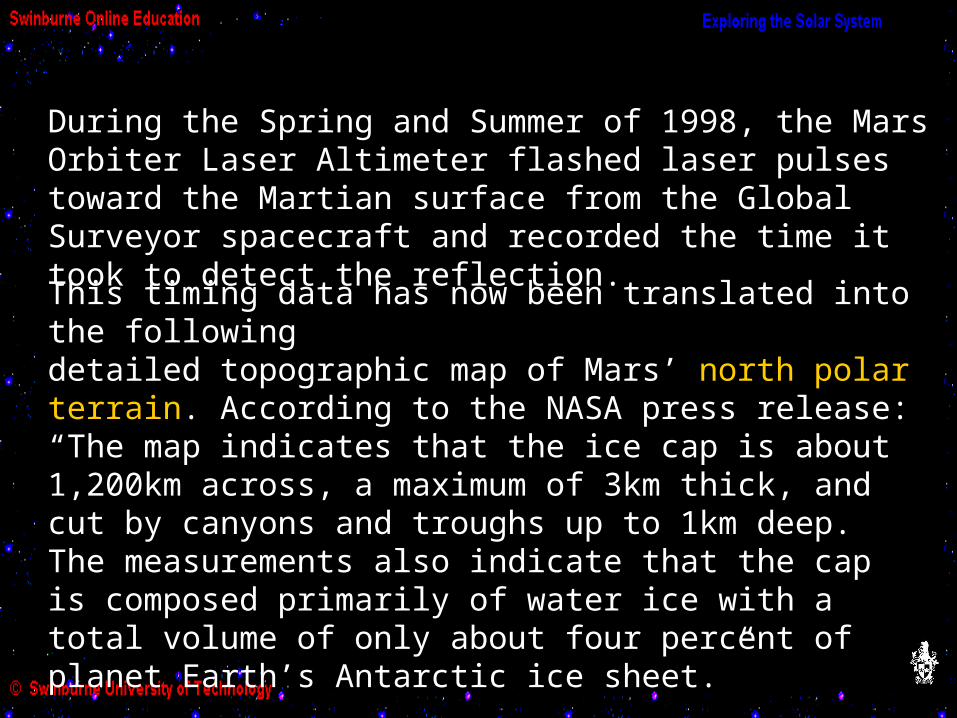
During the Spring and Summer of 1998, the Mars Orbiter Laser Altimeter flashed laser pulses toward the Martian surface from the Global Surveyor spacecraft and recorded the time it took to detect the reflection.
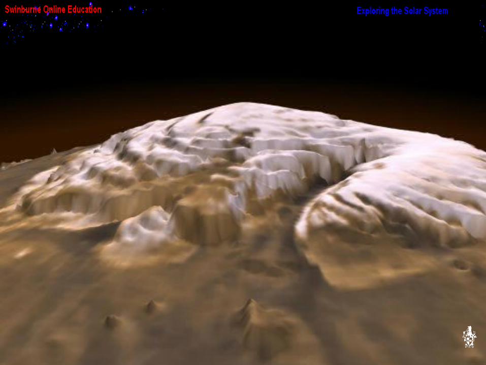
This timing data has now been translated into the following detailed topographic map of Mars’ north polar terrain. According to the NASA press release:“The map indicates that the ice cap is about 1,200km across, a maximum of 3km thick, and cut by canyons and troughs up to 1km deep. The measurements also indicate that the cap is composed primarily of water ice with a total volume of only about four percent of planet Earth’s Antarctic ice sheet.”
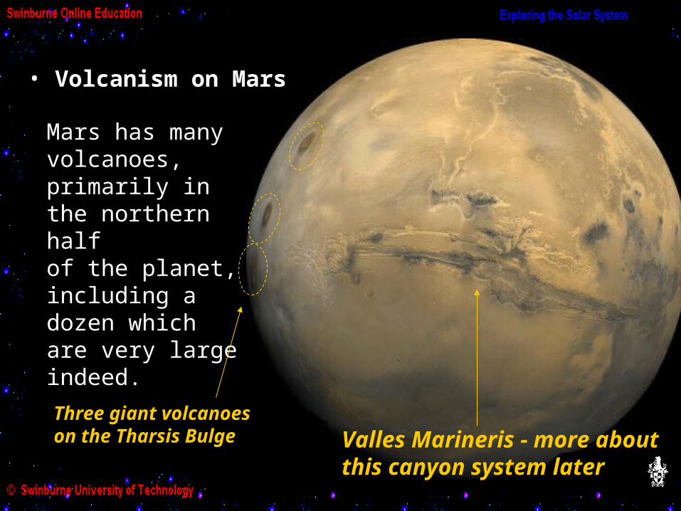
Mars has many volcanoes, primarily in the northern halfof the planet, including a dozen which are very large indeed.
• Volcanism on Mars
Three giant volcanoeson the Tharsis Bulge Valles Marineris - more about
this canyon system later
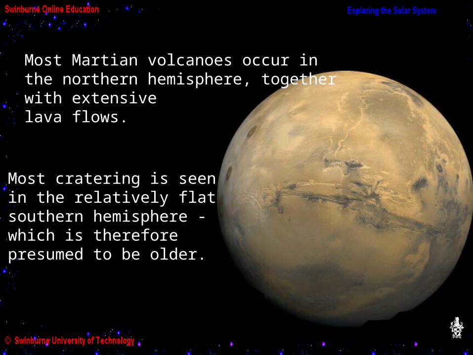
Most cratering is seen in the relatively flat southern hemisphere - which is therefore presumed to be older.
Most Martian volcanoes occur in the northern hemisphere, together with extensive lava flows.
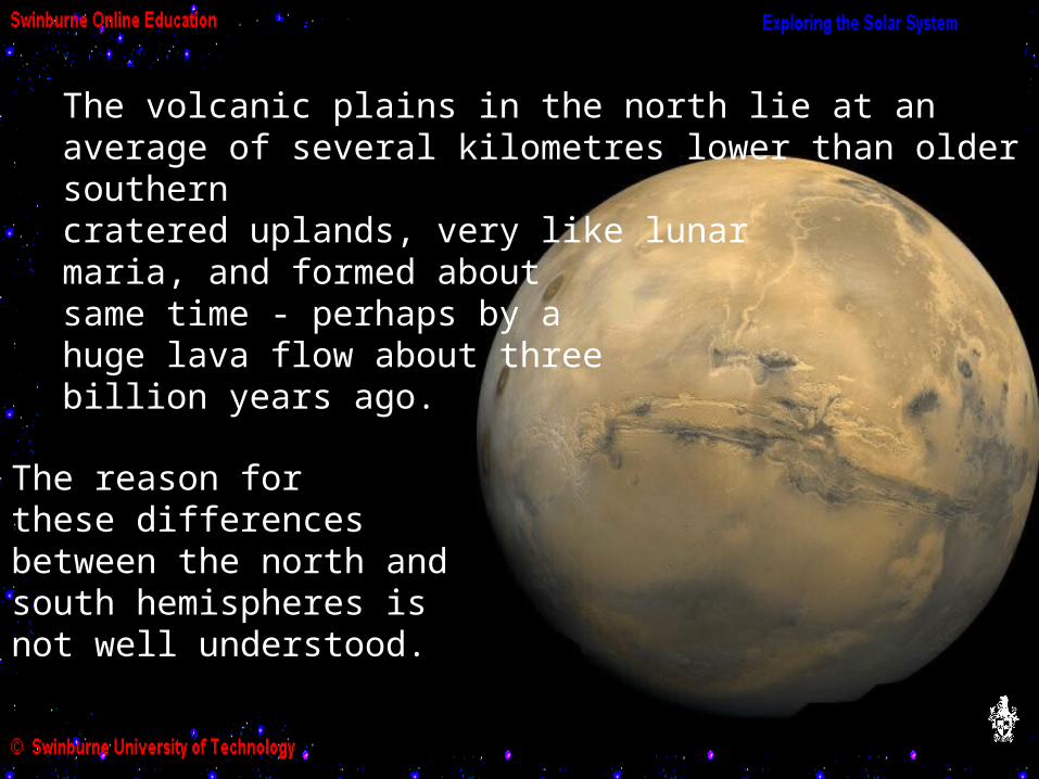
The reason forthese differencesbetween the north and south hemispheres isnot well understood.
The volcanic plains in the north lie at an average of several kilometres lower than older southern cratered uplands, very like lunar maria, and formed about same time - perhaps by a huge lava flow about three billion years ago.

The largest Martian volcano is Olympus Mons, a shield volcano rising 25 km above the surrounding terrain, with a diameter of more than 500 km.
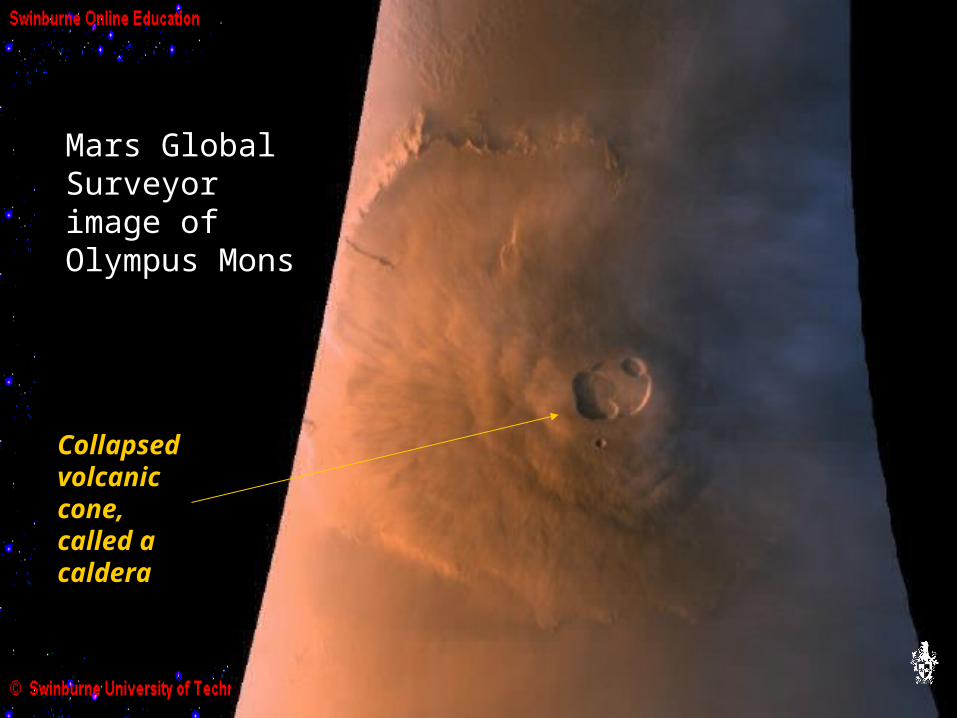
Mars Global Surveyor image of Olympus Mons
Collapsed volcanic cone, called a caldera
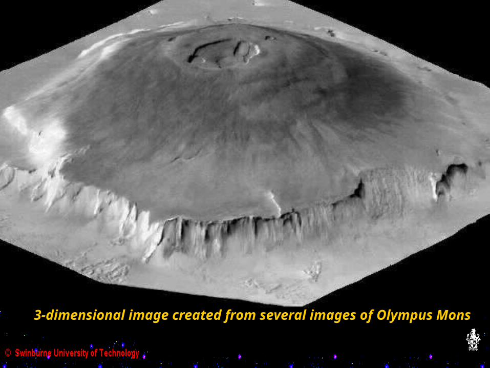
3-dimensional image created from several images of Olympus Mons
Many Martian volcanoes exhibit a number of craters, implying that they are quite old, but Olympus Mons has very few, implying that its surface cannot be more than hundred million years old and could be much younger.
It is possible that some of these great volcanoes may remain intermittently active today, but we have no evidence of this.
Olympus Mons rises 25 km above the surrounding terrain. Compare this to the highest volcano on Earth, Mauna Loa in Hawaii, which rises about 8 km above the seabed, and Mount Everest, which rises 9 km above sea level.The weight of Mauna Loa has depressed the seafloor to form an underwater moat surrounding it.As you have seen, Olympus Mons, roughly three times higher than Mauna Loa, has not formed a moat in the surrounding terrain: the Martian crust seems to be supporting it without difficulty.Planetary scientists conclude that the crust of Mars is significantly thicker than that of Earth - perhaps twice as thick.
As we have seen, Mauna Loa and the other Hawaiian volcanoes are terrestrial examples of hot-spot volcanism, a form of volcanism where magma from a particularly hot region far below the surface rises and breaks through the crust as lava, forming a volcano. As the crustal plate moves due to tectonic forces (continental drift), the volcanic outlet and accumulated cooled lava shifts aside, and the next eruption of lava breaks through as a new volcano.
In this way, gradual tectonic plate movement leads to a chain of volcanoes such as the Hawaiian-Emperor Islandchain. This island chain now extends 3800 km across the Pacific seabed.

Here the Hawaiian island chain is superimposed on animage of Olympus Mons.

The giant Martian volcanoes appear to be formed by hot-spot volcanism too, but in the case of a volcano like Olympus Mons, the magma has kept breaking throughthe one vent in the planet’s crust for millions of years.So instead of a chain of smaller volcanoes, singlegiant volcanoes have been able to form.
Planetary scientists conclude that, unlike on Earth, the crust of Mars is not separated into moving tectonic plates.
• Martian Tectonics?
The Tharsis bulge, a region approximately the same sizeas North America, rises nearly 10 km above the surroundingterrain, crowned by 4 great volcanoes which rise another 15 km.
Located on the boundary between the cratered uplands and the northern plains, the Tharsis bulge is primarily tectonic. There is evidence of extensive cracking in the crust surrounding the Tharsis area.
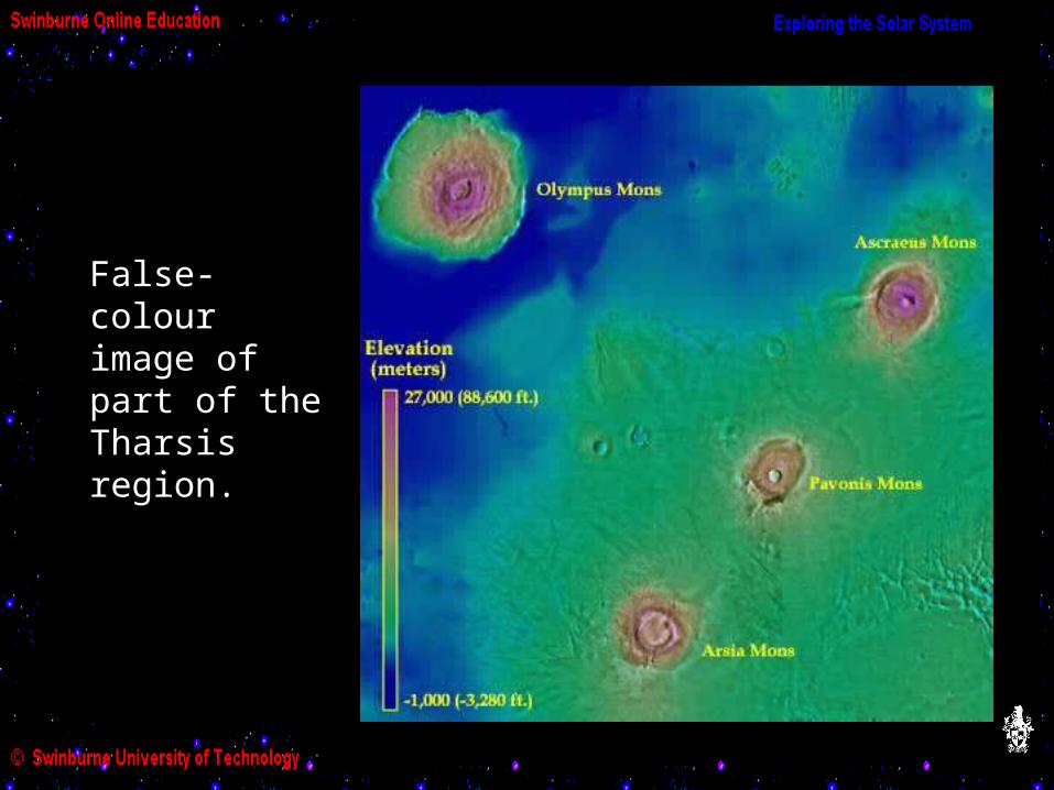
False-colour image of part of the Tharsis region.
The Elysium region is a similarly uplifted volcanic plain, almost halfway around planet from the Tharsis Bulge. The cratering record indicates that the Elysium region is the slightly older of the two.
The origin of these regions appears to be due to rising surges of thick magma in the planet’s mantle, lifting up regions of the crust rather than breaking through it as lava.On Venus, a similar phenomenon causes oval ring patternscalled coronae, but the thicker, less pliable crust on Mars may prevent coronae forming.
*
* see the Activity on Observing the Surface of Venus
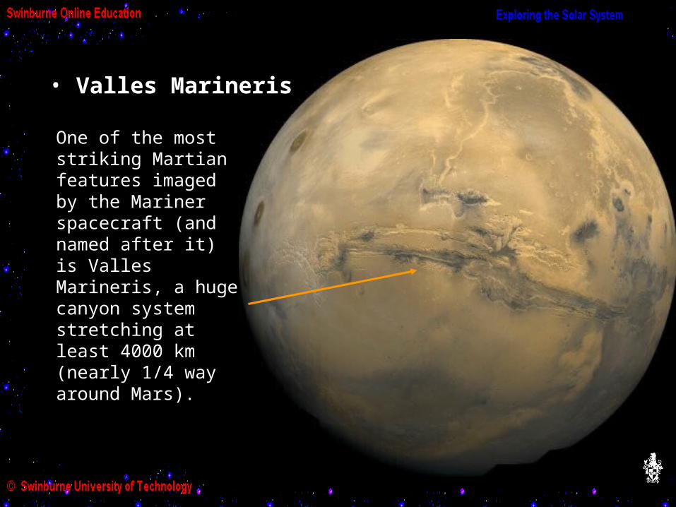
One of the most striking Martian features imaged by the Mariner spacecraft (and named after it) is Valles Marineris, a huge canyon system stretching at least 4000 km (nearly 1/4 way around Mars).
• Valles Marineris

Valles Marineris is 600 km wide in places, and 6 km deep - four times the depth of the Grand Canyon, which would fit easily into one of its side canyons.
Layered outcrop in part of the Valles Marineris.Layering of this sort is seen onEarth, caused by either volcanicor sedimentary processes.
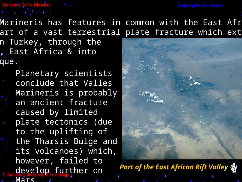
Part of the East African Rift Valley
Valles Marineris has features in common with the East African Rift, part of a vast terrestrial plate fracture which extends from southern Turkey, through the Red Sea, East Africa & into Mozambique.Planetary scientists conclude that Valles Marineris is probably an ancient fracture caused by limited plate tectonics (due to the uplifting of the Tharsis Bulge and its volcanoes) which, however, failed to develop further on Mars.

In the next Activity we will look at the search for evidence that liquid water, and perhaps life, once existed on Mars.
In the meantime, when you have finished this Activity, use the CD-ROM which accompanies the Universe textbook to view simulated fly-pasts of the Martian surface, volcanoes and Valles Marineris in the Animations & Videos section.
NASA: Pathfinder image of ice clouds in pre-dawn skyhttp://nssdc.gsfc.nasa.gov/planetary/image/marspath_clouds_s39.jpgPathfinder image of Martian Sunsethttp://nssdc.gsfc.nasa.gov/planetary/image/marspath_ss24_0.jpgHubble image of dust storm at Martian North Polehttp://nssdc.gsfc.nasa.gov/image/planetary/mars/hst_mars_dust_storm.jpgVenus globehttp://nssdc.gsfc.nasa.gov/image/planetary/venus/venusglobe.jpgEarth globehttp://pds.jpl.nasa.gov/planets/welcome/earth.htmMars globehttp://pds.jpl.nasa.gov/planets/welcome/thumb/marglobe.gifA view of the Martian surface (Viking 1)http://nssdc.gsfc.nasa.gov/image/planetary/mars/vikinglander1-1.jpg
Image Credits
NASA: Mars - Twin Peaks (Pathfinder)http://mpfwww.jpl.nasa.gov/MPF/parker/TwnPks_RkGdn_rite_sm.jpgGusev craterhttp://ic-www.arc.nasa.gov:80/ic/projects/bayes-group/Atlas/Mars/special/Gusev/Syrtis Region (Hubble)http://nssdc.gsfc.nasa.gov/image/planetary/mars/marsglobe3.jpg3D Mars North Pole (Mars Global Surveyor)http://antwrp.gsfc.nasa.gov/apod/ap981216.htmlMars South Polehttp://nssdc.gsfc.nasa.gov/image/planetary/mars/mars_so_pole.jpgValles Marinerishttp://nssdc.gsfc.nasa.gov/image/planetary/mars/marsglobe1.jpgOlympus Monshttp://nssdc.gsfc.nasa.gov/image/planetary/mars/olympus_mons.jpg
Image Credits
NASA: Cratering on Marshttp://www.anu.edu.au/Physics/nineplanets/thumb/mar6cratICON.gifEast African Rift Valley, Kenyahttp://images.jsc.nasa.gov/images/pao/STS32/10063457.gifLayered outcrop, Valles Marinerishttp://lunar.ksc.nasa.gov/mars/mgs/msss/camera/images/top102_Dec98_rel/layers/Olympus Mons, Mars-Hawaii Comparisonhttp://cass.jsc.nasa.gov/images/shaw/shaw_S01TN.gif
Image Credits

Now return to the Module 12 home page, and read more about the surface of the Mars in the Textbook Readings.
Hit the Esc key (escape) to return to the Module 12 Home Page