Maximising the value of irrigation: new technologies for ...
45
Maximising the value of irrigation: new technologies for precision management Carolyn Hedley & Pierre Roudier Wellington LINK seminar, 18 March 2014
Transcript of Maximising the value of irrigation: new technologies for ...

Maximising the value
of irrigation:
new technologies for
precision management
Carolyn Hedley & Pierre Roudier
Wellington LINK seminar, 18 March 2014

Talk overview
1. New sensor technologies = data-rich
2. The rise of information technologies
supporting high resolution sensor data
3. A precision irrigation case study
4. New opportunities (Varigate, MBIE
irrigation programme, S-map)

Sensor technologies
• Provide high resolution soil data = better
information
• We need to rethink how we handle soil
data
• An example is EM mapping (geophysical
measure responding to important soil
properties such as salinity, texture, CEC
and water content )
• Useful to assess spatial variability

Trimble Ag170
field computer
Trimble Ag214
(RTK)-GPS antenna
Polycorder 600
data logging system
GPS radio
Geonics EM38 soil
electrical conductivity
sensor
EM mapping

122.000+ points 1500+ points per ha
The EM sensor collects one georeferenced data point every second
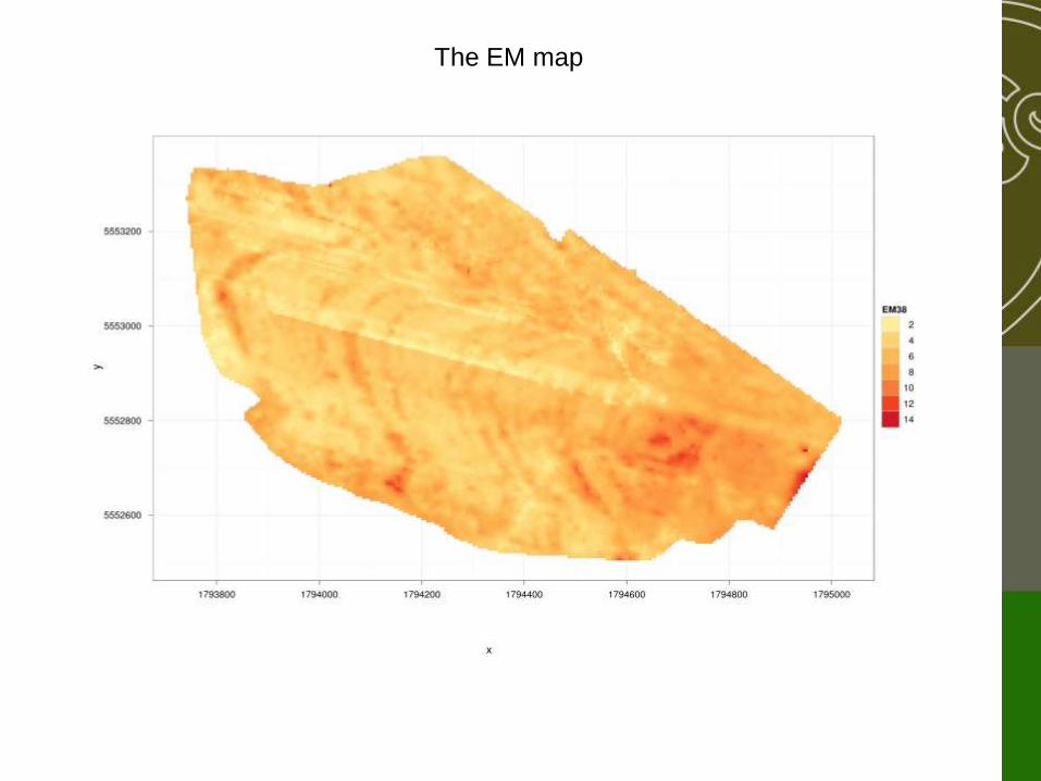
The EM map

decreasing textural fineness

Wireless sensor networks (WSNs)
• High temporal resolution
• Dynamic mapping of e.g. water tables
Real-time soil moisture monitoring
Base station:
Gateway to Internet
Self-organising nodes –
transmit/receive

Statistical analysis of datalayers to derive three management classes
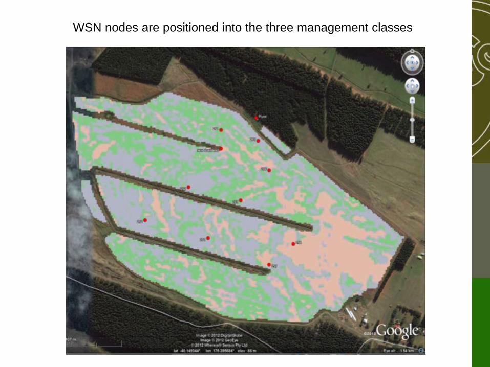
WSN nodes are positioned into the three management classes
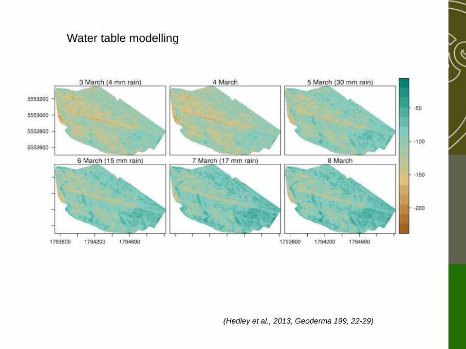
Water table modelling
(Hedley et al., 2013, Geoderma 199, 22-29)

LiDAR
ngom.usgs.gov
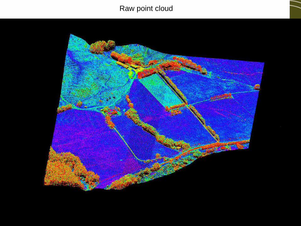
Raw point cloud
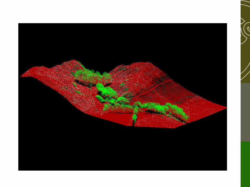

Hillshade visualisation of Massey University Tuapaka farm,
derived from the digital elevation map


The DEM compliments the legacy soil map to refine our
understanding of soil pattern
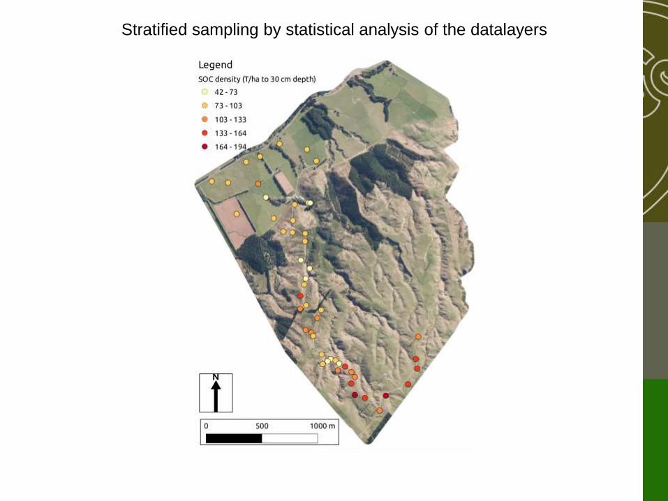
Stratified sampling by statistical analysis of the datalayers

Soil organic carbon map
(Valette, 2013)

(2) Information technologies
• Tackling the data challenge
• Performance
• Data curation
• The web is the platform

A
precision irrigation
case study

Case study – Fairlie dairy farm • 3 pivots modified for precision control,
irrigating 306 ha = $130,000
• 50 L/s water saved
• 28% of irrigation saved (17% soil zones;
11% tracks, swamps etc)
• Diverted to other areas via 3 rotorainers
• Paid back in one year

Soil EM map Plant Available Water Soil Water Status Map
PRECISION IRRIGATION
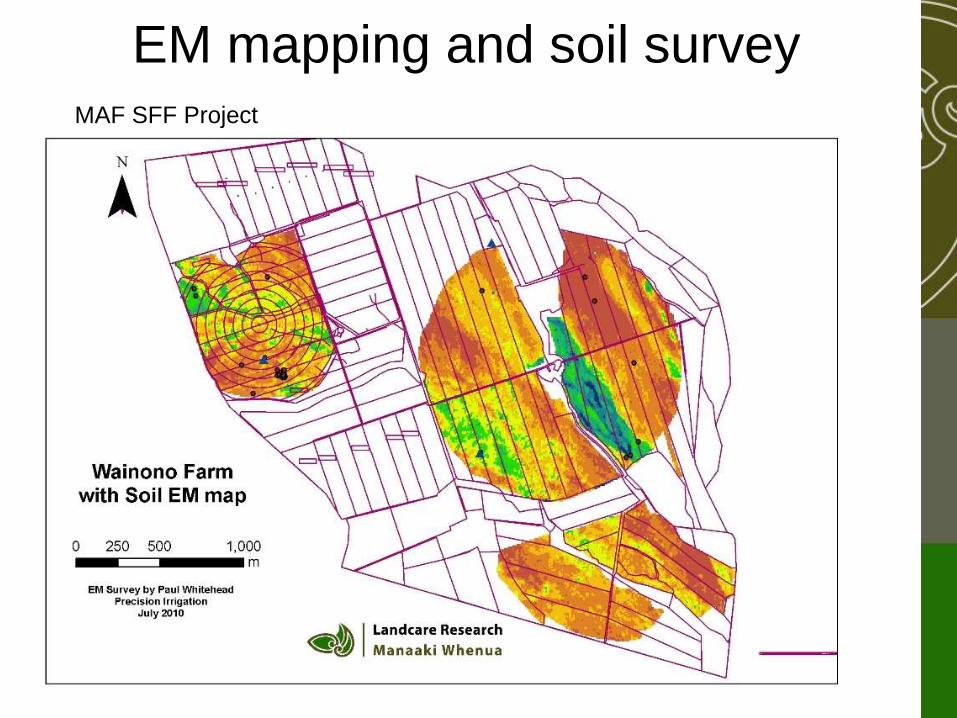
EM mapping and soil survey MAF SFF Project

Soil & EM map
AWC = H AWC = L
AWC = M
AWC = VL

EM map – 4 management zones
1 2
3
4

Soil & EM map
1 2
3
4

AWC (mm/m)AWC (mm/m)
Map of Plant Available Water
URI
URI
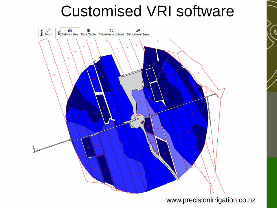
Customised VRI software
www.precisionirrigation.co.nz

Real-time monitoring
Drainage No drainage Drainage
20cm
50cm
Drainage
No drainage No drainage No drainage No drainage
stony soil
silt loam soil

Precision irrigation = modification of
the pivot + precision scheduling
• > 100 systems sold in first 2 years (www.precisionirrigation.co.nz)
• Water savings 8 - 40%, reduced drainage & nutrient loss
• Return on investment 1-5 years

Closing the automation loop
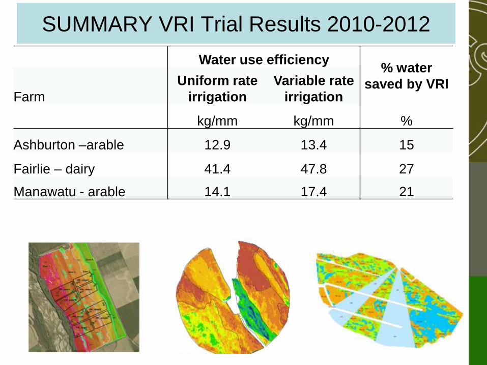
SUMMARY VRI Trial Results 2010-2012
Water use efficiency % water
saved by VRI Farm
Uniform rate
irrigation
Variable rate
irrigation
kg/mm kg/mm %
Ashburton –arable 12.9 13.4 15
Fairlie – dairy 41.4 47.8 27
Manawatu - arable 14.1 17.4 21

(4) Realising new opportunities

Varigate.co.nz (1)

The team Landcare Research
Plant & Food Research
Foundation for Arable Research
Lincoln AgriTech
Massey University
&
University of Southern Queensland
The supporters Foundation for Arable Research
Vegetable Research & innovation Board
Hawkes Bay Regional Council
Environment Canterbury
Irrigation New Zealand
(2)

• Technologies that fine-tune irrigation
water management
• Advanced control systems
• Effective audited self management
• Recommendations and demonstrations
to farmers and growers
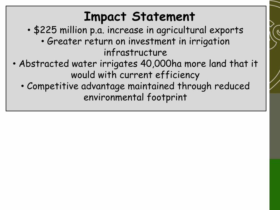
• $225 million p.a. increase in agricultural exports • Greater return on investment in irrigation
infrastructure • Abstracted water irrigates 40,000ha more land that it
would with current efficiency • Competitive advantage maintained through reduced
environmental footprint
Impact Statement

Impact Statement
• Reduced drainage and nutrient loss
• Less water applied/ha Reducing costs
• Less water stress Increased yields
On-farm Outcomes
• Simple audited self nutrient management

Impact Statement
On-farm Outcomes
New irrigation hardware
matched to farm
circumstances
Placement of irrigation where and when it is needed
Soils and crops
managed to reduce water
losses
Effective audited self management of irrigated
systems
Projects Technical Outcomes

Impact Statement
On-farm Outcomes
New irrigation hardware
matched to farm
circumstances
Placement of irrigation where and when it is needed
Soils and crops
managed to reduce water
losses
Effective audited self management of irrigated
systems
Projects Technical Outcomes
Spatial Information Soil Management Crop Monitoring
Information integration and development of tools MBIE Project
Implementation Pathway

International collaborators:
University of Southern Queensland
Infra-red sensors assess canopy temperature
Machine vision for crop stage and crop health
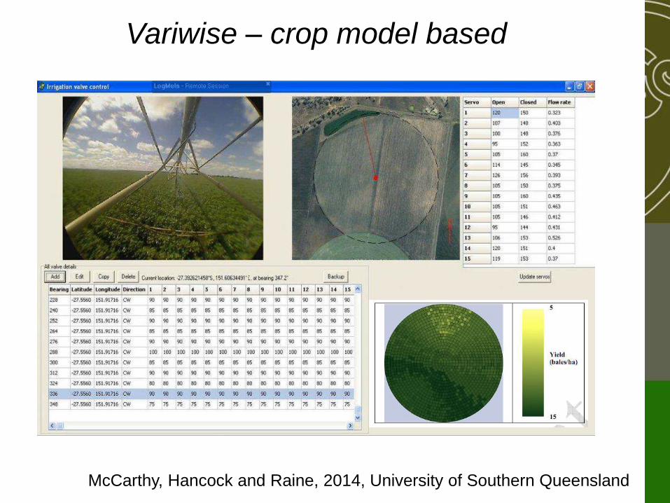
Variwise – crop model based
McCarthy, Hancock and Raine, 2014, University of Southern Queensland
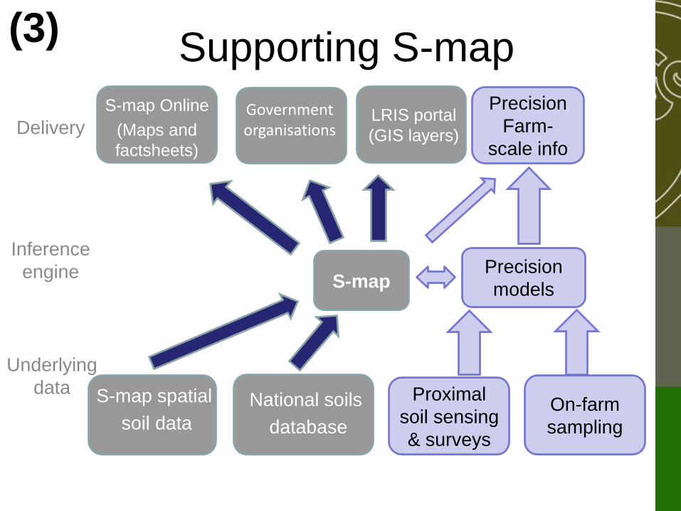
Supporting S-map (3)
S-map
National soils
database
Underlying
data
Inference
engine
Delivery
S-map spatial
soil data
S-map Online
(Maps and
factsheets)
LRIS portal
(GIS layers)
Government organisations
Precision
Farm-
scale info
Proximal
soil sensing
& surveys
On-farm
sampling
Precision
models
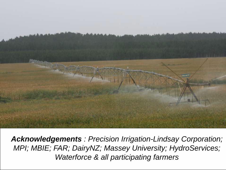
Acknowledgements : Precision Irrigation-Lindsay Corporation;
MPI; MBIE; FAR; DairyNZ; Massey University; HydroServices;
Waterforce & all participating farmers