
Masdar Overview (Web Version)Masdar Overview (Web Version) Abu Dhabi (for publication).pdf ·...
51
Masdar Overview (Web Version) Masdar Overview (Web Version) Derek Gliddon - Masdar GIS Manager
Transcript of Masdar Overview (Web Version)Masdar Overview (Web Version) Abu Dhabi (for publication).pdf ·...
Masdar Overview (Web Version)Masdar Overview (Web Version)Derek Gliddon - Masdar GIS Manager
Masdar
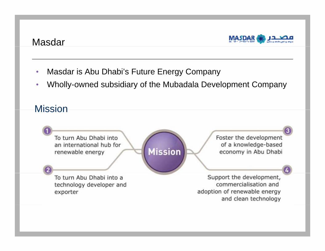
• Masdar is Abu Dhabi’s Future Energy Company
Mission
• Wholly-owned subsidiary of the Mubadala Development Company
Mission
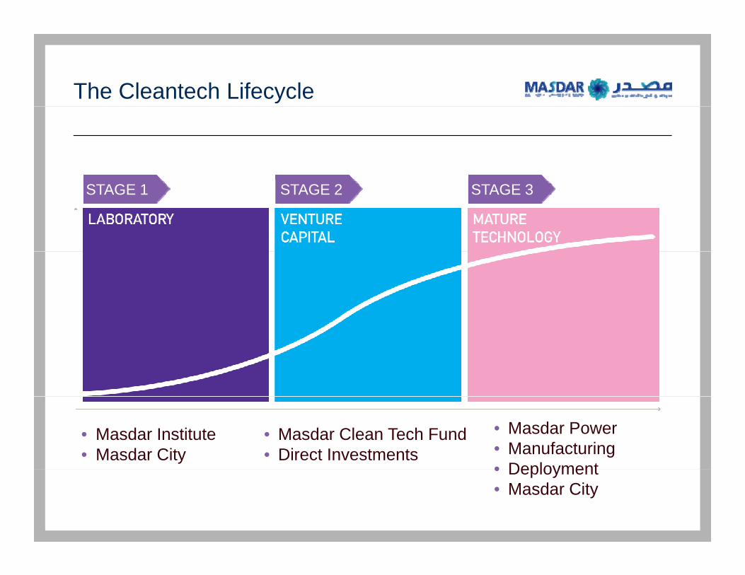
The Cleantech Lifecycle
STAGE 1 STAGE 2 STAGE 3
• Masdar Institute• Masdar City
• Masdar Clean Tech Fund• Direct Investments
• Masdar Power• Manufacturing• Deployment• Deployment• Masdar City
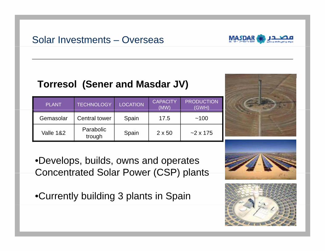
Solar Investments – Overseas
PLANT TECHNOLOGY LOCATION CAPACITY (MW)
PRODUCTION (GWH)
Torresol (Sener and Masdar JV)
( ) ( )
Gemasolar Central tower Spain 17.5 ~100
Valle 1&2 Parabolic trough Spain 2 x 50 ~2 x 175
•Develops, builds, owns and operates Concentrated Solar Power (CSP) plantsConcentrated Solar Power (CSP) plants
•Currently building 3 plants in Spain
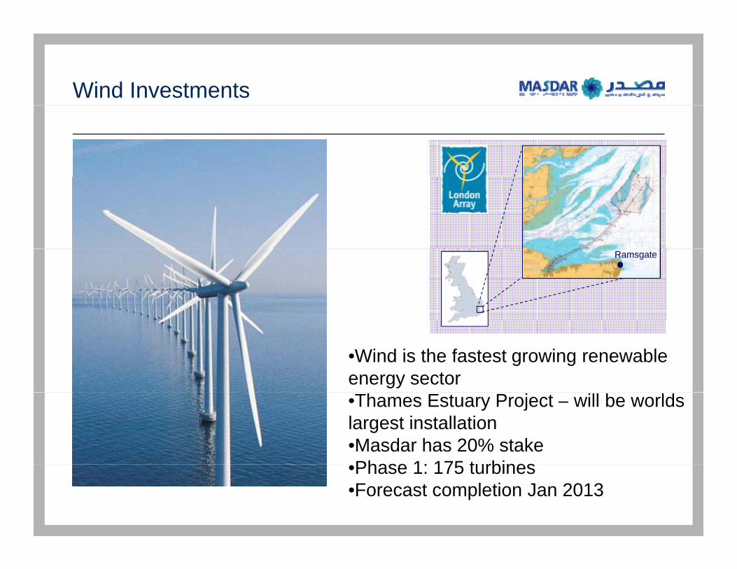
Wind Investments
Ramsgate
•Wind is the fastest growing renewable energy sector •Thames Estuary Project – will be worlds largest installation•Masdar has 20% stakePhase 1 175 t rbines•Phase 1: 175 turbines
•Forecast completion Jan 2013

Carbon Monetisation
• The Kyoto Protocol binds developed countries to reduce their GHG• The Kyoto Protocol binds developed countries to reduce their GHGemissions by an average of 5% between 2008 and 2012.
• Developing countries are involved on voluntary basis through theCl D l t M h i (CDM) f th K t P t lClean Development Mechanism (CDM) of the Kyoto Protocol.
• Under the CDM, projects reducing GHG emissions can receivetradable Carbon Credits against every ton of CO2 equivalent reduced.g y q
• A new carbon trading and finance market has emerged.

Vision of Masdar Institute
• Become a world-class graduate research d d ti i tit tiand education institution
• Provide future leaders and critical thinkers in science and technologygy
• Develop solutions in alternative energy and sustainable technologies
• Position Abu Dhabi as a knowledge hub
• Become an engine for socioeconomic growthg
• Develop human capital and become a knowledge exporter
<Graphic Removed>p
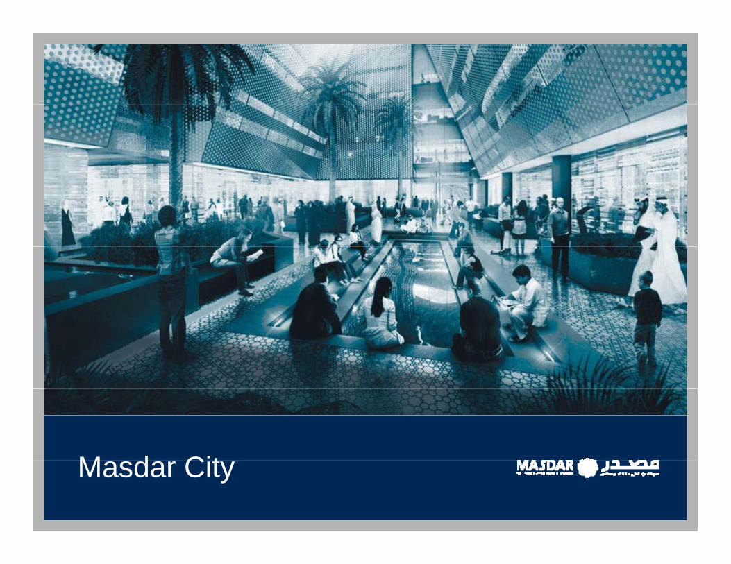
M d CitMasdar City
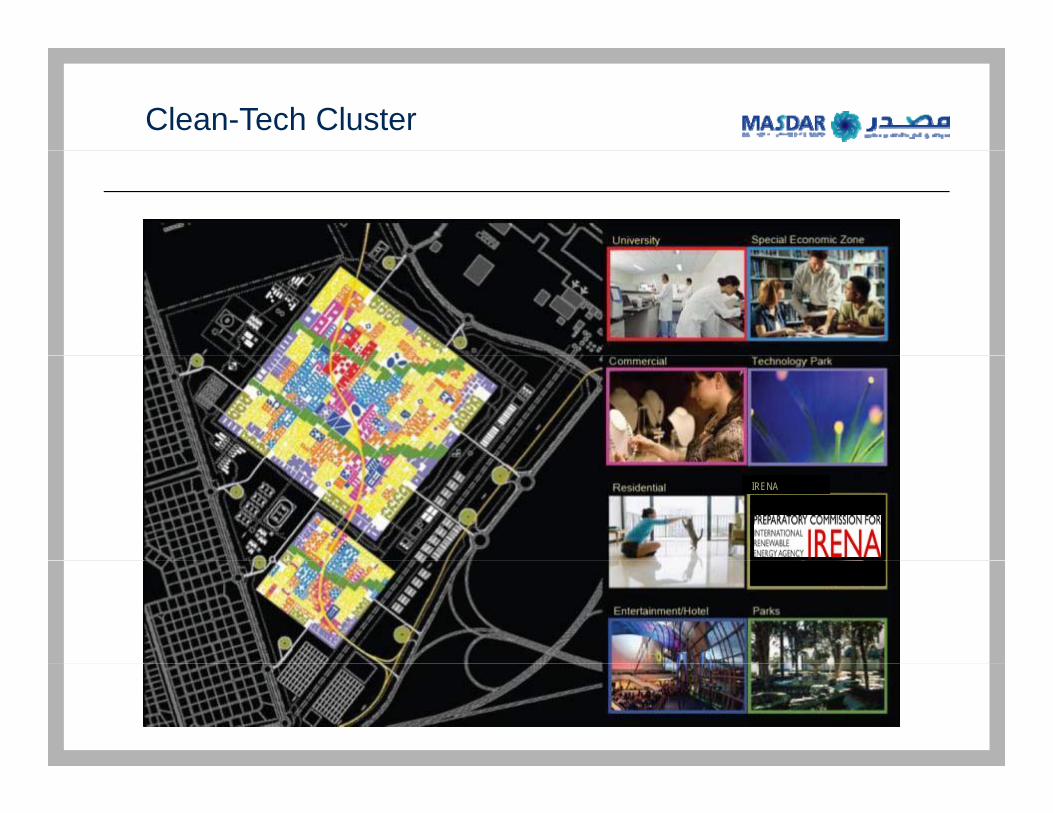
Clean-Tech Cluster
IRENA
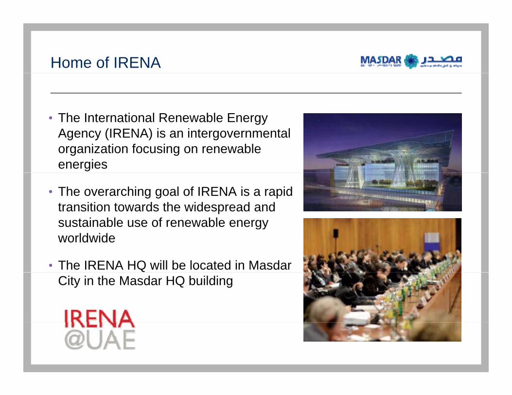
Home of IRENA
• The International Renewable Energy gyAgency (IRENA) is an intergovernmental organization focusing on renewable energies
• The overarching goal of IRENA is a rapid transition towards the widespread and sustainable use of renewable energysustainable use of renewable energy worldwide
• The IRENA HQ will be located in Masdar City in the Masdar HQ building

Masdar City – Is Under Construction
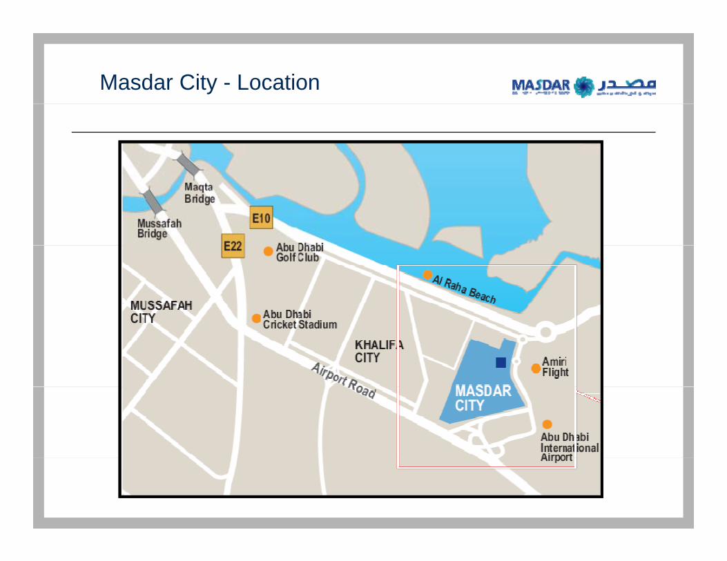
Masdar City - Location
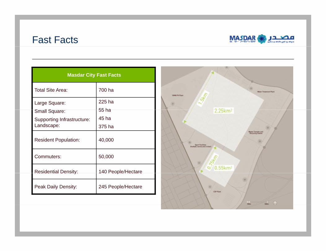
Fast Facts
Masdar City Fast Facts
Total Site Area: 700 ha
Large Square:
S ll S
225 ha
55 haSmall Square:
Supporting Infrastructure: Landscape:
55 ha
45 ha
375 ha
Resident Population: 40,000Resident Population: 40,000
Commuters: 50,000
Residential Density: 140 People/HectareResidential Density: 140 People/Hectare
Peak Daily Density: 245 People/Hectare

Masdar City Aerial View
<Graphic Removed>p
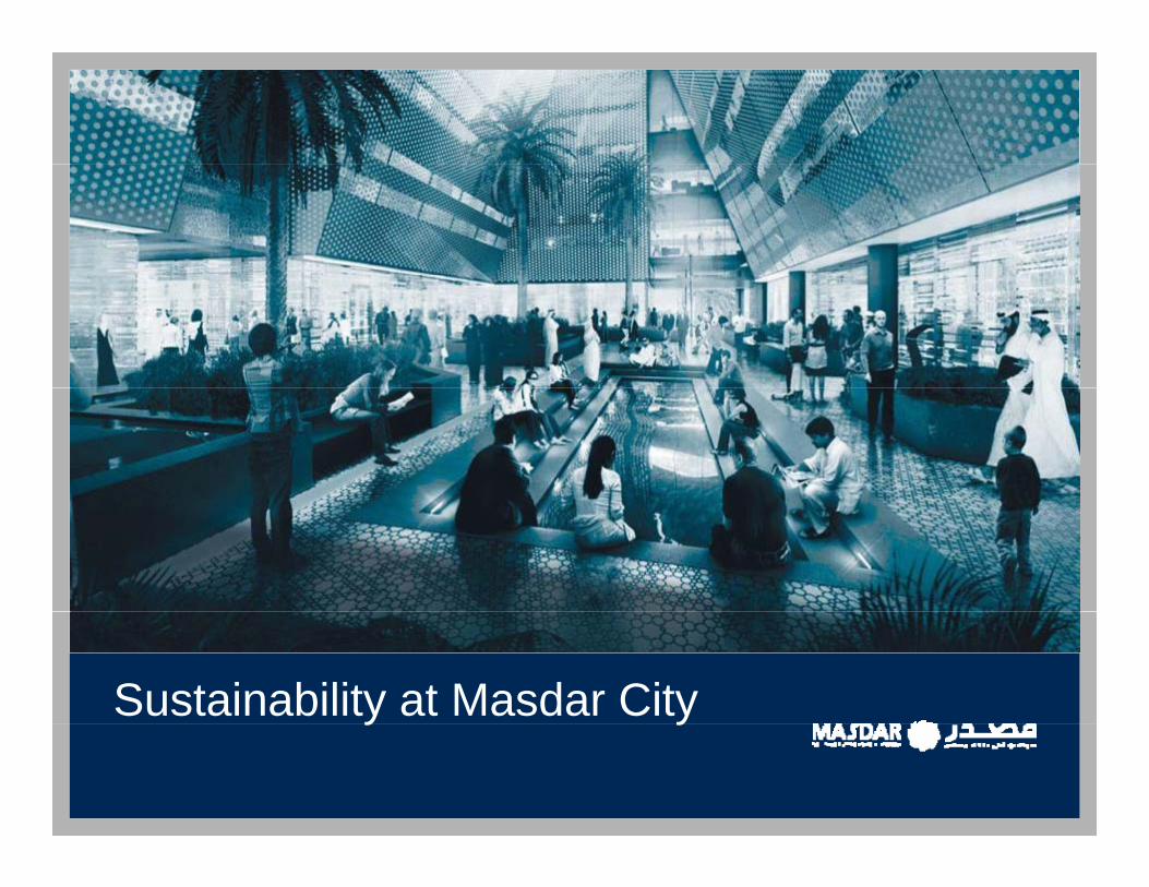
Sustainability at Masdar Cityy y

Sustainability Approach
Masdar believes in the “Triple Bottom Line” approach to S t i bl D l tSustainable Development
•Social SustainabilityIs it Livable and Desirable
•Economic SustainabilityEconomic SustainabilityIs it Cost Effective to O&M
Environmental Sustainability•Environmental SustainabilityIs It Carbon Neutral
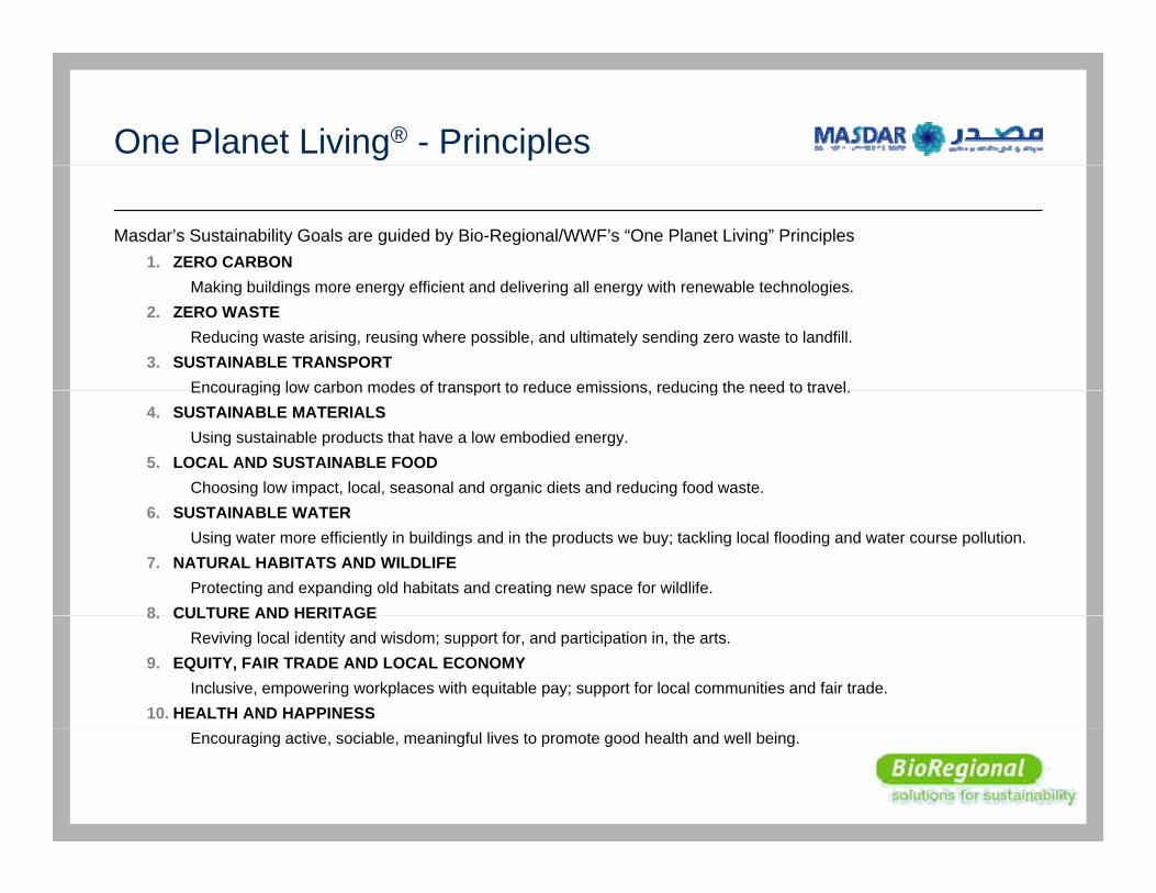
One Planet Living® - Principles
Masdar’s Sustainability Goals are guided by Bio-Regional/WWF’s “One Planet Living” Principles1. ZERO CARBON
Making buildings more energy efficient and delivering all energy with renewable technologies.2. ZERO WASTE
Reducing waste arising, reusing where possible, and ultimately sending zero waste to landfill.3. SUSTAINABLE TRANSPORT
Encouraging low carbon modes of transport to reduce emissions reducing the need to travelEncouraging low carbon modes of transport to reduce emissions, reducing the need to travel.4. SUSTAINABLE MATERIALS
Using sustainable products that have a low embodied energy.5. LOCAL AND SUSTAINABLE FOOD
Choosing low impact, local, seasonal and organic diets and reducing food waste.6. SUSTAINABLE WATER
Using water more efficiently in buildings and in the products we buy; tackling local flooding and water course pollution.7. NATURAL HABITATS AND WILDLIFE
Protecting and expanding old habitats and creating new space for wildlife.8 CULTURE AND HERITAGE8. CULTURE AND HERITAGE
Reviving local identity and wisdom; support for, and participation in, the arts.9. EQUITY, FAIR TRADE AND LOCAL ECONOMY
Inclusive, empowering workplaces with equitable pay; support for local communities and fair trade.10. HEALTH AND HAPPINESS
Encouraging active, sociable, meaningful lives to promote good health and well being.
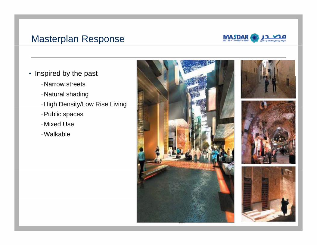
Masterplan Response
• Inspired by the pastp y p-Narrow streets-Natural shading-High Density/Low Rise Livingg y g-Public spaces-Mixed Use-Walkable
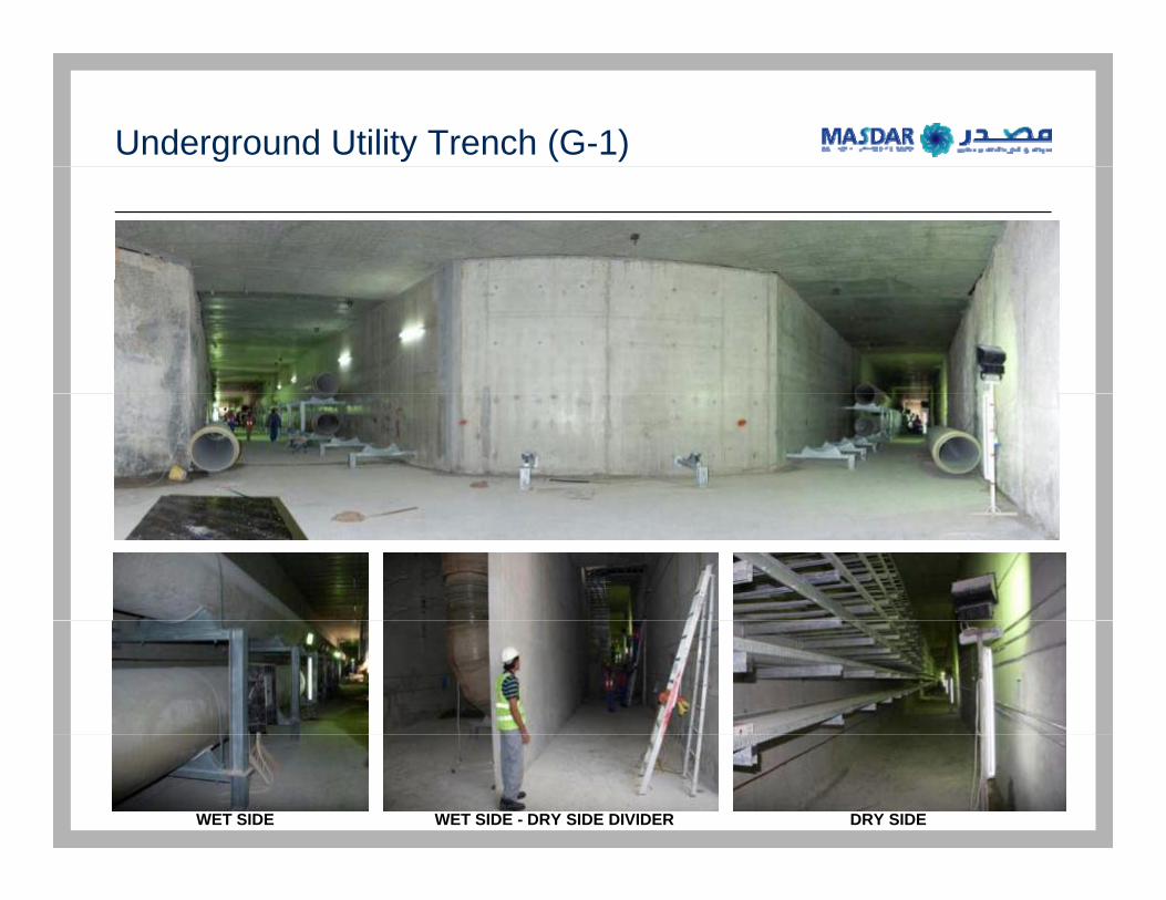
Underground Utility Trench (G-1)
WET SIDE - DRY SIDE DIVIDERWET SIDE DRY SIDE
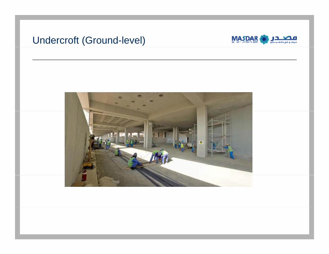
Undercroft (Ground-level)
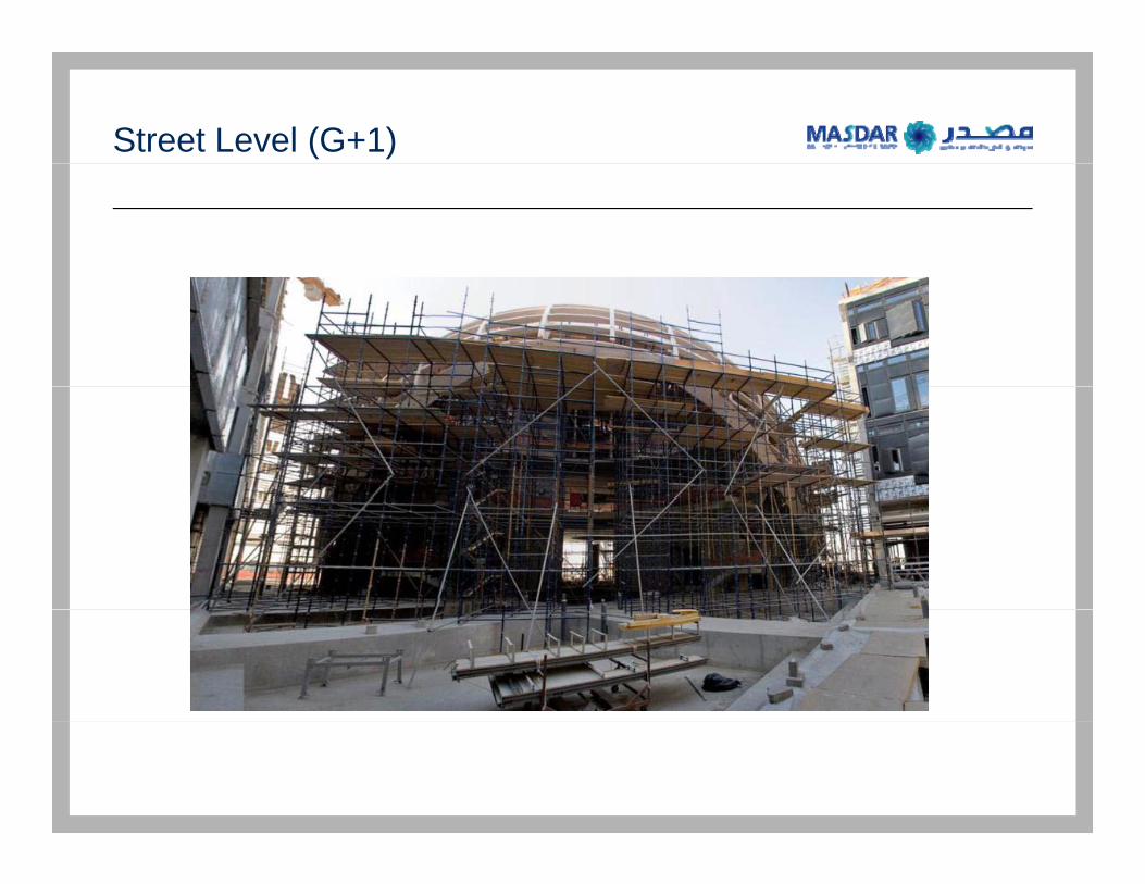
Street Level (G+1)
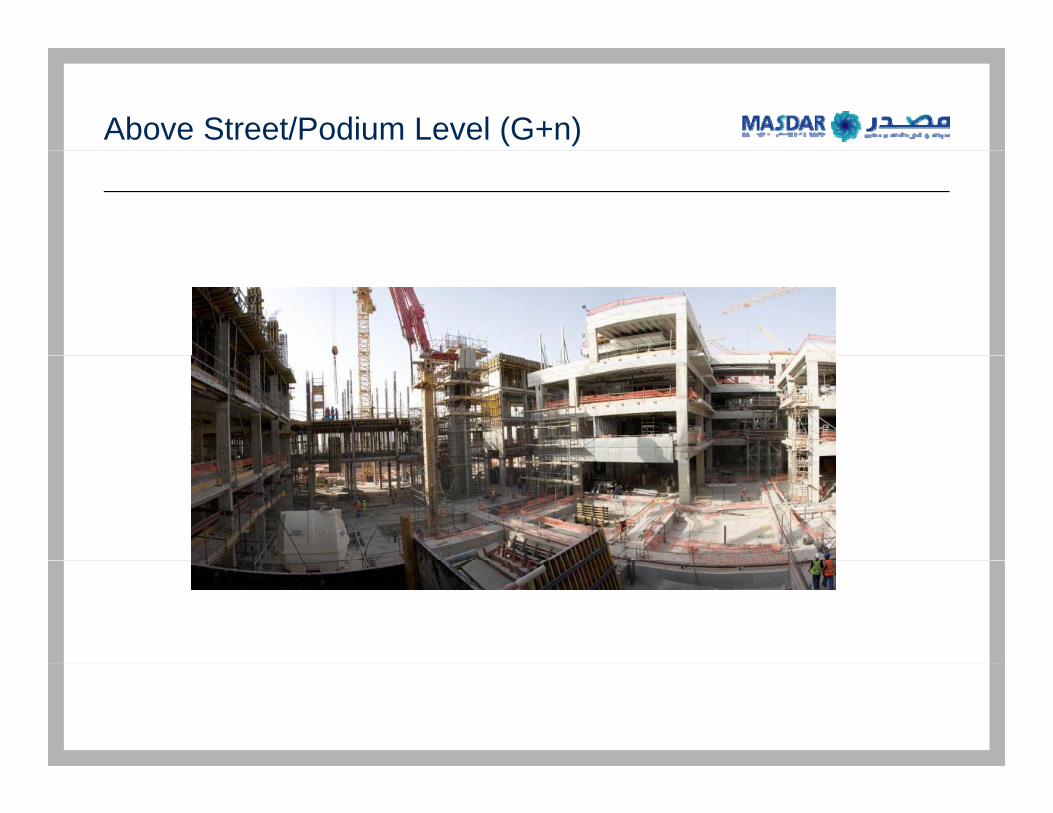
Above Street/Podium Level (G+n)

Solar Energy Roofscape
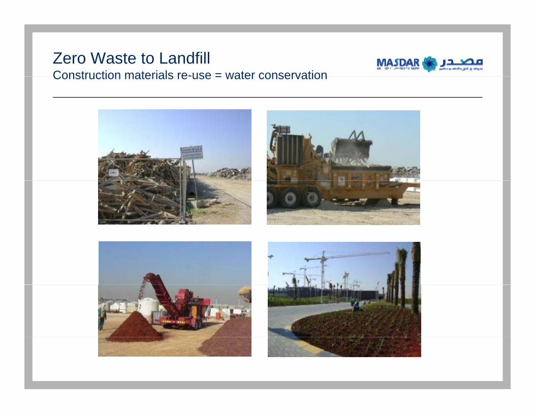
Zero Waste to Landfill Construction materials re-use = water conservationConstruction materials re-use = water conservation
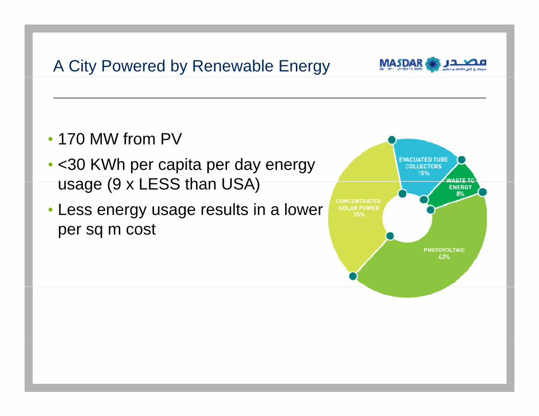
A City Powered by Renewable Energy
• 170 MW from PV• <30 KWh per capita per day energy
usage (9 x LESS than USA)usage (9 x LESS than USA)• Less energy usage results in a lower
per sq m costper sq m cost
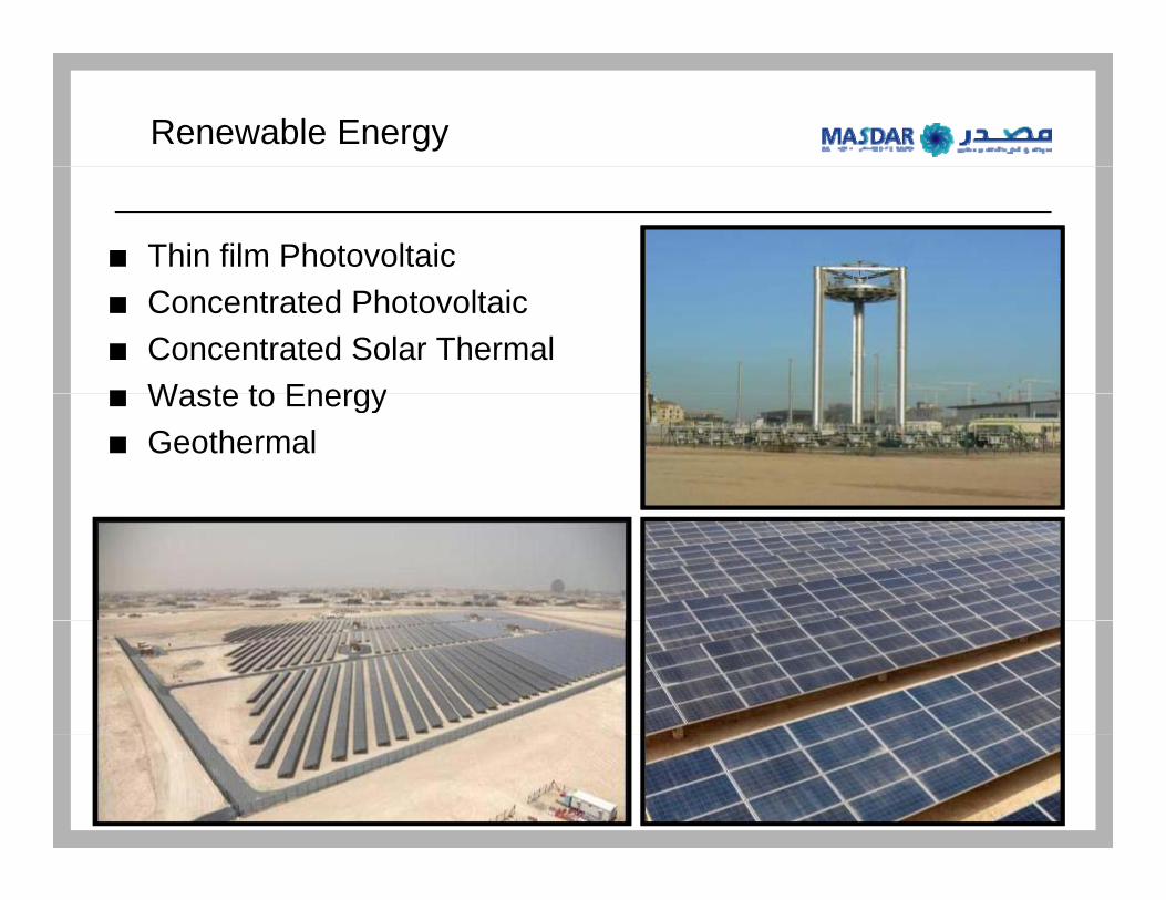
Renewable Energy
Thin film Photovoltaic Concentrated PhotovoltaicConcentrated Solar ThermalWaste to EnergyWaste to EnergyGeothermal
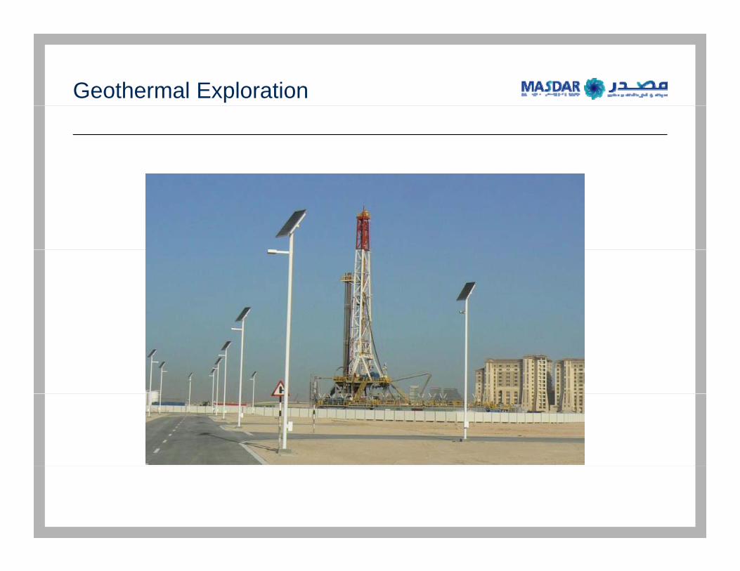
Geothermal Exploration
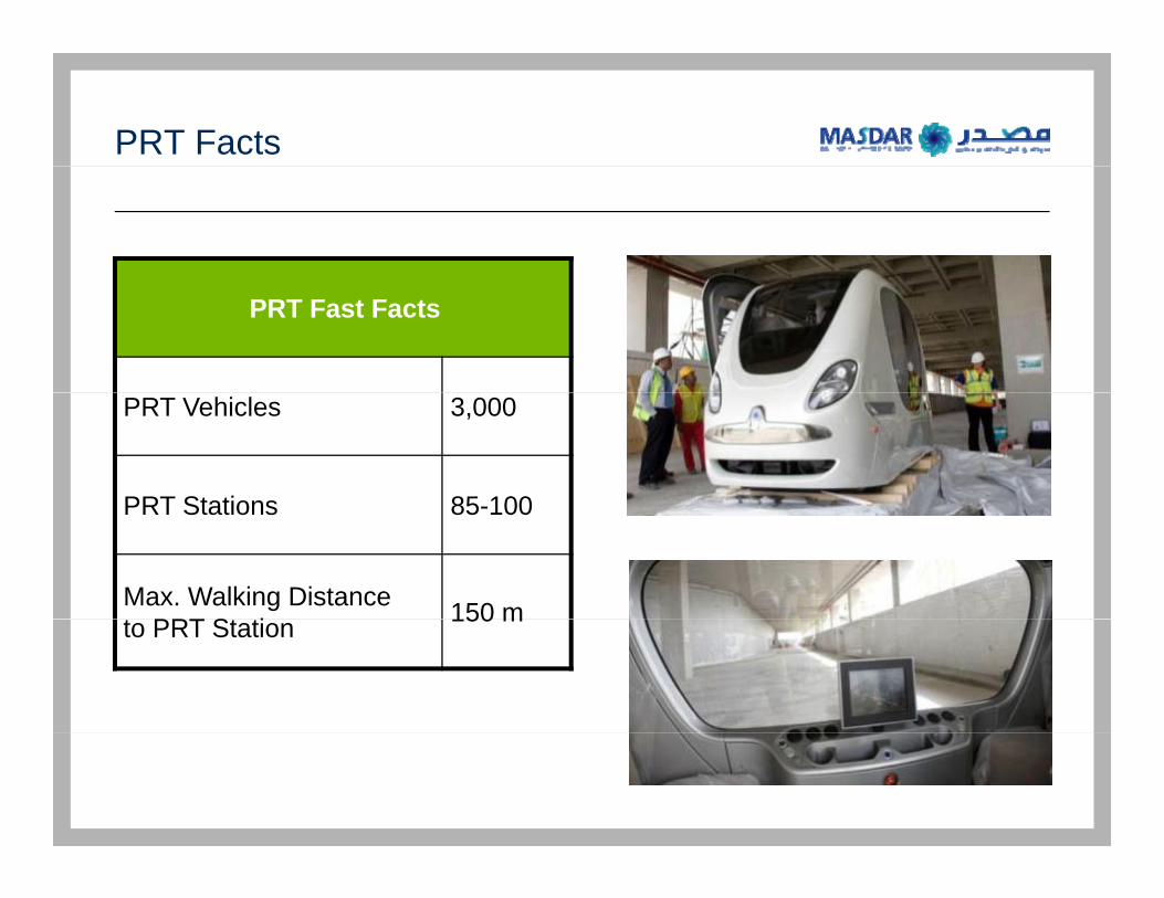
PRT Facts
PRT Fast Facts
PRT Vehicles 3,000
PRT Stations 85 100PRT Stations 85-100
Max. Walking Distance t PRT St ti 150 mto PRT Station 150 m
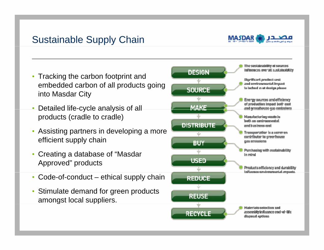
Sustainable Supply Chain
• Tracking the carbon footprint andTracking the carbon footprint and embedded carbon of all products going into Masdar City
• Detailed life-cycle analysis of allDetailed life cycle analysis of all products (cradle to cradle)
• Assisting partners in developing a more efficient supply chainefficient supply chain
• Creating a database of “Masdar Approved” products
• Code-of-conduct – ethical supply chain
• Stimulate demand for green products amongst local suppliers.g
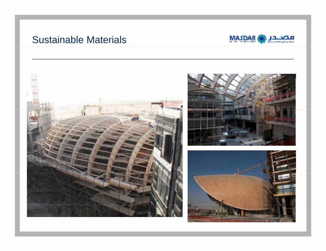
Sustainable Materials

Energy Efficient Design
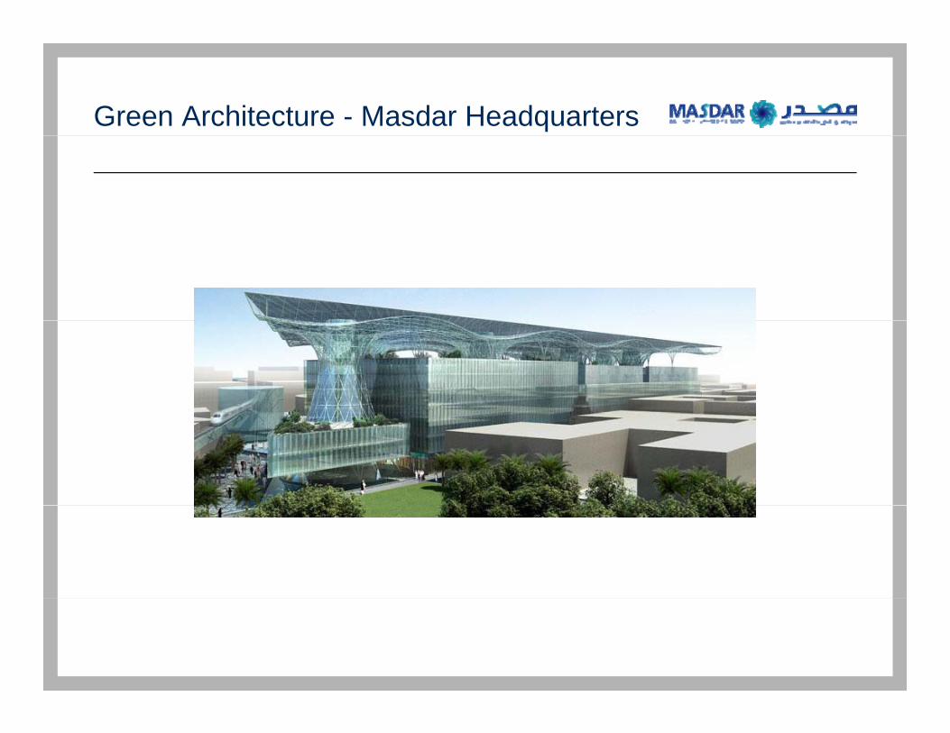
Green Architecture - Masdar Headquarters
<Graphic Removed>p
Geographic Information SystemsGeographic Information Systems
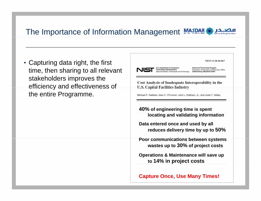
The Importance of Information Management
• Capturing data right the first• Capturing data right, the first time, then sharing to all relevant stakeholders improves the efficiency and effectiveness ofefficiency and effectiveness of the entire Programme.
40% of engineering time is spent l i d lid i i f ilocating and validating information
Data entered once and used by all reduces delivery time by up to 50%
Poor communications between systemsPoor communications between systems wastes up to 30% of project costs
Operations & Maintenance will save up to 14% in project costs
Capture Once, Use Many Times!
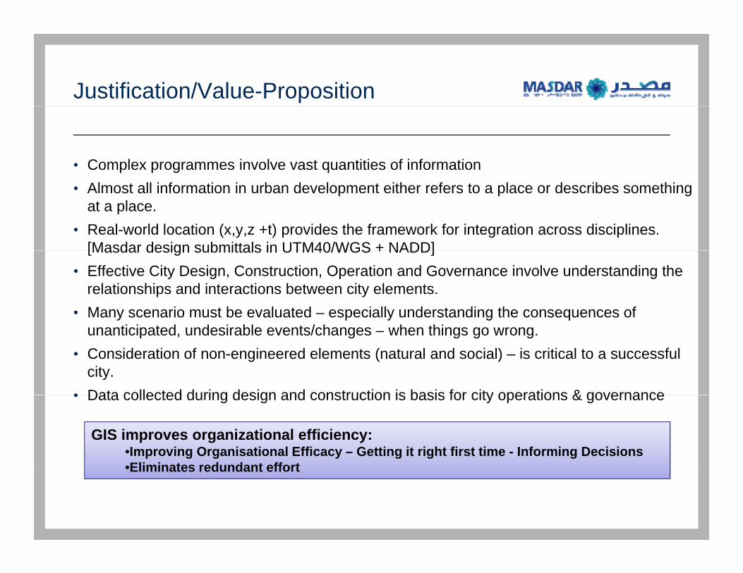
Justification/Value-Proposition
• Complex programmes involve vast quantities of information• Almost all information in urban development either refers to a place or describes something
at a place.• Real-world location (x,y,z +t) provides the framework for integration across disciplines.
[Masdar design submittals in UTM40/WGS + NADD][Masdar design submittals in UTM40/WGS + NADD]• Effective City Design, Construction, Operation and Governance involve understanding the
relationships and interactions between city elements.• Many scenario must be evaluated – especially understanding the consequences of
unanticipated, undesirable events/changes – when things go wrong.• Consideration of non-engineered elements (natural and social) – is critical to a successful
city.• Data collected during design and construction is basis for city operations & governance• Data collected during design and construction is basis for city operations & governance
GIS improves organizational efficiency:•Improving Organisational Efficacy – Getting it right first time - Informing Decisions•Eliminates redundant effort•Eliminates redundant effort
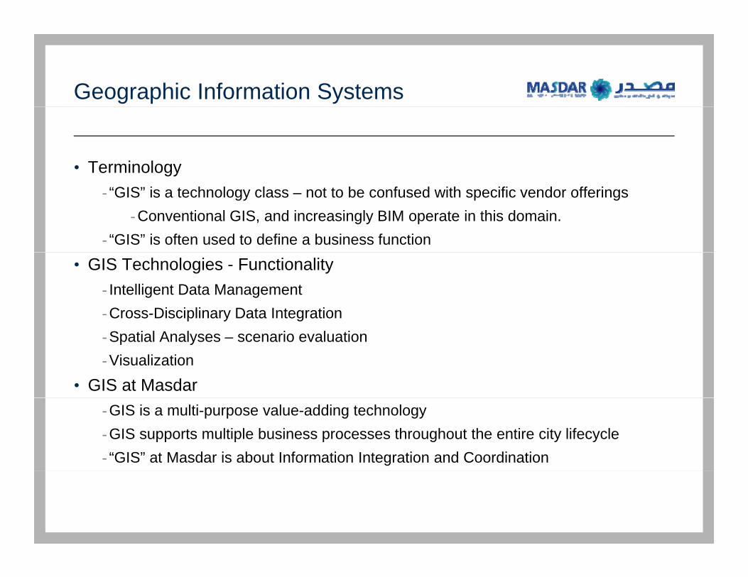
Geographic Information Systems
• Terminology- “GIS” is a technology class – not to be confused with specific vendor offerings
-Conventional GIS, and increasingly BIM operate in this domain.- “GIS” is often used to define a business function
• GIS Technologies - Functionality- Intelligent Data Management-Cross-Disciplinary Data Integration-Spatial Analyses – scenario evaluation-Visualization
• GIS at Masdar-GIS is a multi-purpose value-adding technology-GIS supports multiple business processes throughout the entire city lifecycle- “GIS” at Masdar is about Information Integration and Coordination
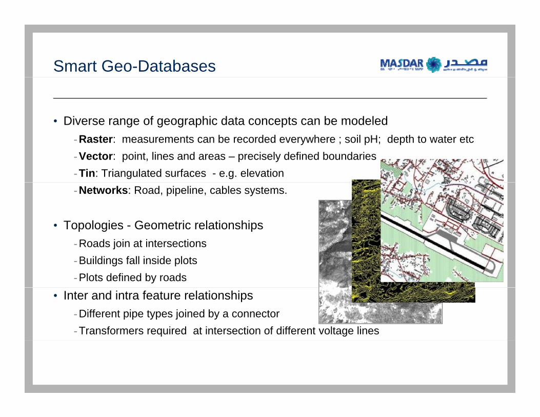
Smart Geo-Databases
• Diverse range of geographic data concepts can be modeled-Raster: measurements can be recorded everywhere ; soil pH; depth to water etc-Vector: point, lines and areas – precisely defined boundaries-Tin: Triangulated surfaces - e.g. elevation-Networks: Road, pipeline, cables systems.
• Topologies - Geometric relationships-Roads join at intersections-Buildings fall inside plots-Plots defined by roads
• Inter and intra feature relationships-Different pipe types joined by a connector-Transformers required at intersection of different voltage lines
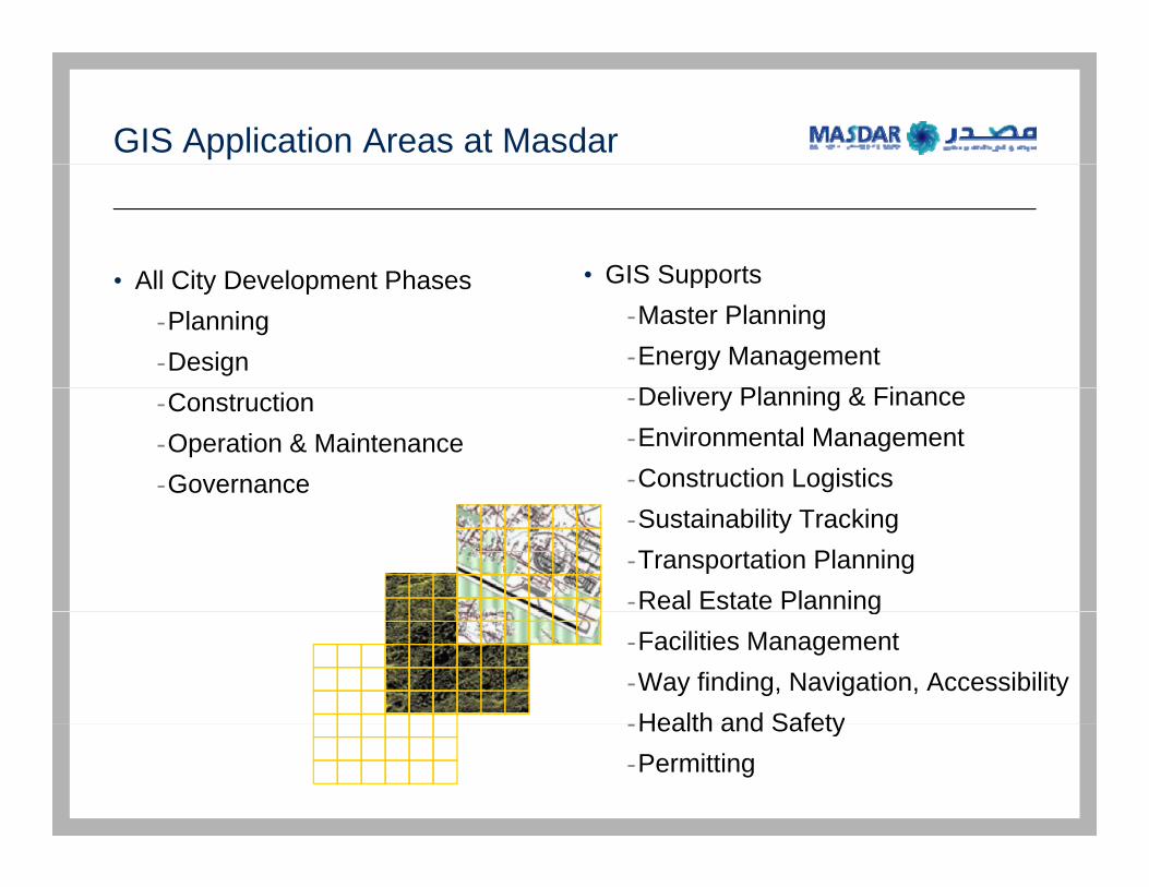
GIS Application Areas at Masdar
All City Development Phases • GIS Supports• All City Development Phases-Planning-Design
• GIS Supports-Master Planning -Energy ManagementD li Pl i & Fi-Construction
-Operation & Maintenance-Governance
-Delivery Planning & Finance-Environmental Management-Construction Logistics-Sustainability Tracking-Transportation Planning-Real Estate Planningg-Facilities Management-Way finding, Navigation, AccessibilityHealth and Safety-Health and Safety
-Permitting
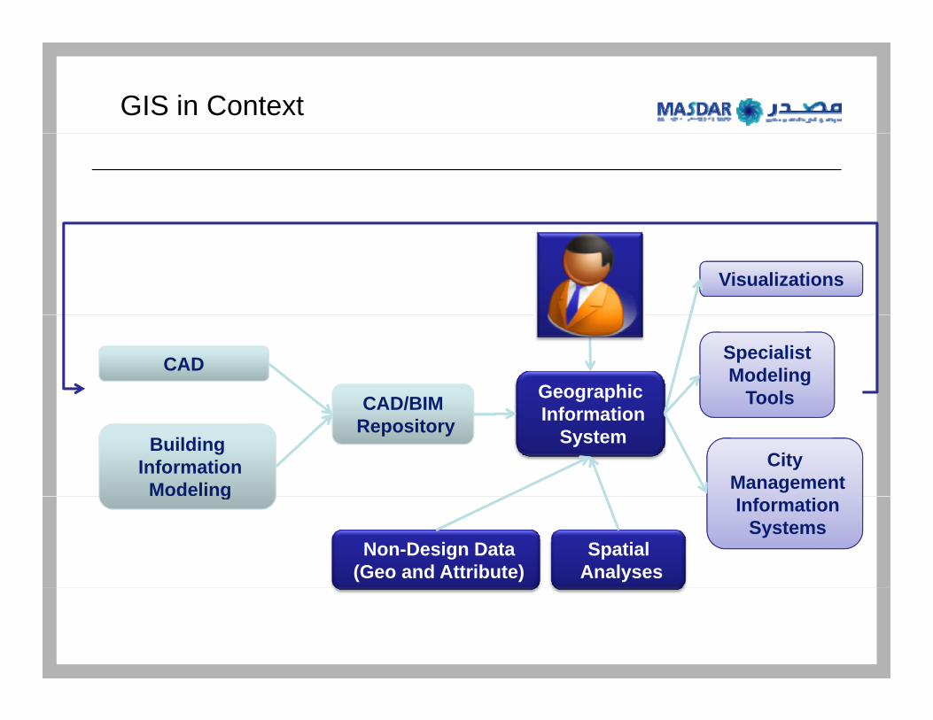
GIS in Context
Visualizations
CAD
CAD/BIM Geographic
Specialist Modeling
Tools
Building Information
Modeling
CAD/BIM Repository Information
SystemCity
Management g
Non-Design Data (Geo and Attribute)
Spatial Analyses
Information Systems
Enterprise GIS
• ENTERPRISE GEODATA STORAGE-Modern GIS store spatial data in relational databases-GIS increasingly becoming a part of organization’s core Information Infrastructure
-CRM, ERP, GIS etc-No longer an isolated technical specialization
• SERVER GIS-Modern GIS offer their data, visualization and analytical functionality to the Internet/Intranet
-Server GIS makes GIS accessible to the whole enterprise “spatially enabling” other business processes.
- “GIS” staff spend more time automating decision support processes- GIS staff spend more time automating decision support processes-Moving away from one-off, ad-hoc “make me a map”
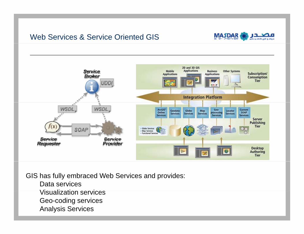
Web Services & Service Oriented GIS
GIS has fully embraced Web Services and provides:Data servicesVi li ti iVisualization servicesGeo-coding servicesAnalysis Services
GIS & CAD/BIM: Convergence or Competition?
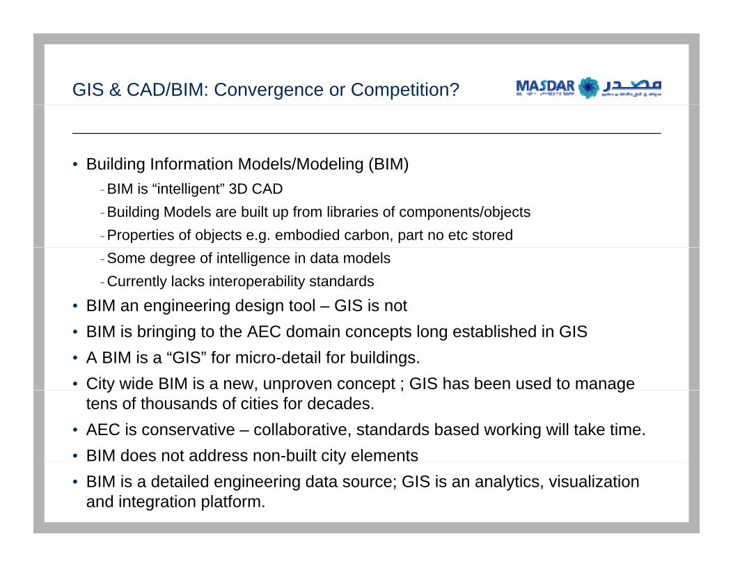
• Building Information Models/Modeling (BIM)-BIM is “intelligent” 3D CAD-Building Models are built up from libraries of components/objects-Properties of objects e.g. embodied carbon, part no etc stored -Some degree of intelligence in data models-Currently lacks interoperability standards
• BIM an engineering design tool – GIS is not• BIM is bringing to the AEC domain concepts long established in GIS • A BIM is a “GIS” for micro-detail for buildings.• City wide BIM is a new, unproven concept ; GIS has been used to manage y , p p ; g
tens of thousands of cities for decades.• AEC is conservative – collaborative, standards based working will take time.• BIM does not address non-built city elementsy• BIM is a detailed engineering data source; GIS is an analytics, visualization
and integration platform.

GIS - Critical Elements
• Commitment from the Executive to organizational information efficiency-Consideration of data re-purposing
• Information Standards • Mechanisms that enforce standards• Support all disciplines but keep a core independent GIS/Info-Management
function• Understand the difference between IT and Information Managementg• Get Information Management function in place as early as possible.• The bigger and more complex the project the greater the ROI
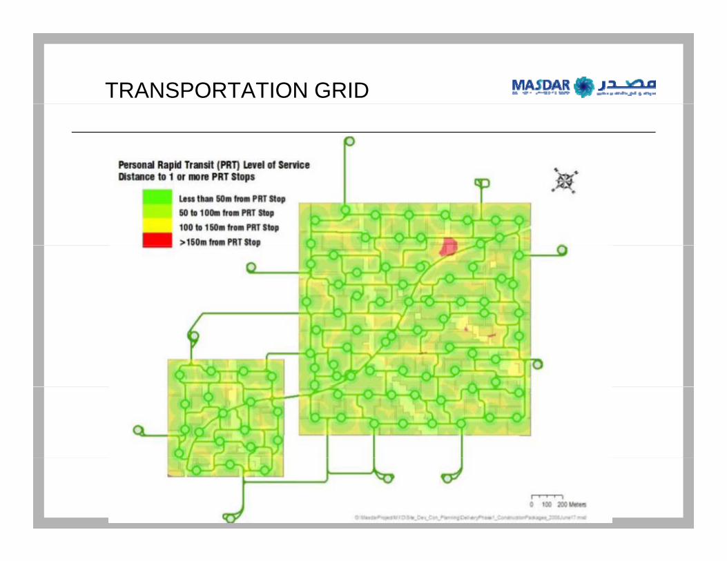
TRANSPORTATION GRID

Februarp4
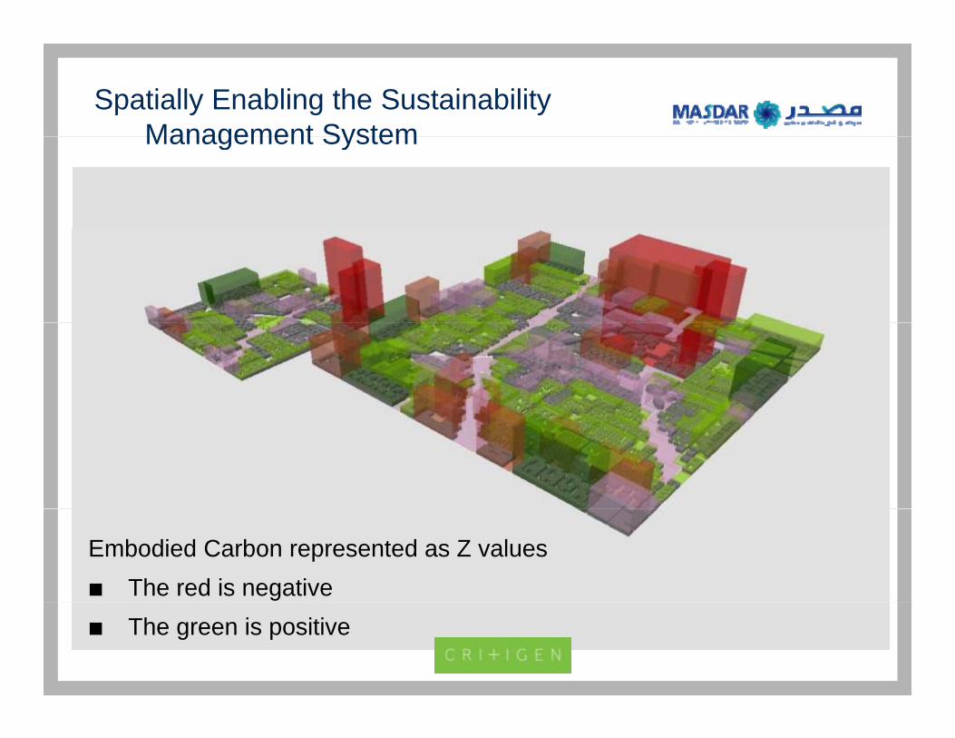
Spatially Enabling the Sustainability Management SystemManagement System
Embodied Carbon represented as Z valuesThe red is negativeThe green is positive
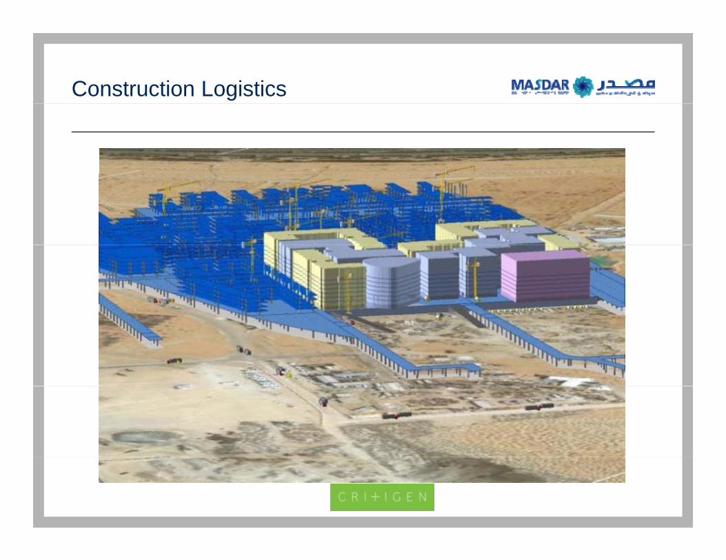
Construction Logistics
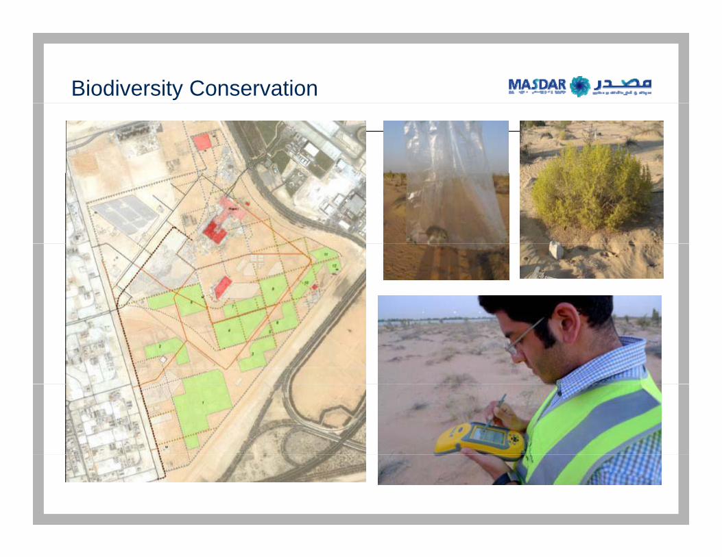
Biodiversity Conservation
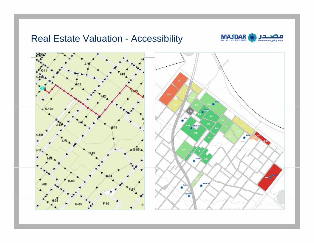
Real Estate Valuation - Accessibility
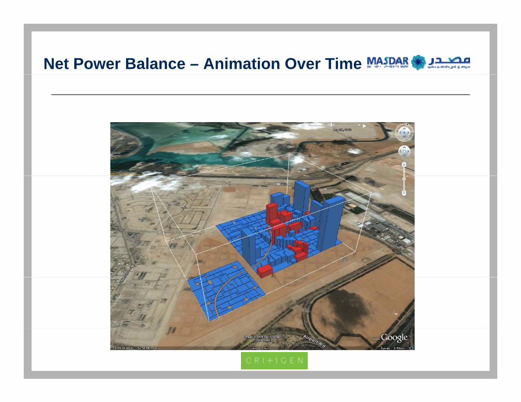
Net Power Balance – Animation Over Time


![Towards Sustainable Urban Development in Arid … › c223 › 69b2334efff254ebe...Figure 3: Masdar City, Abu Dhabi Emirate. Source [6] 3- Masdar City: an Overview Masdar City is located](https://static.fdocuments.net/doc/165x107/5f256363f44c30336f37978b/towards-sustainable-urban-development-in-arid-a-c223-a-69b2334efff254ebe.jpg)