Maryland Historical Trust Maryland Inventory of Historic ... · Historic Col Lyde Griffith Farm...
19
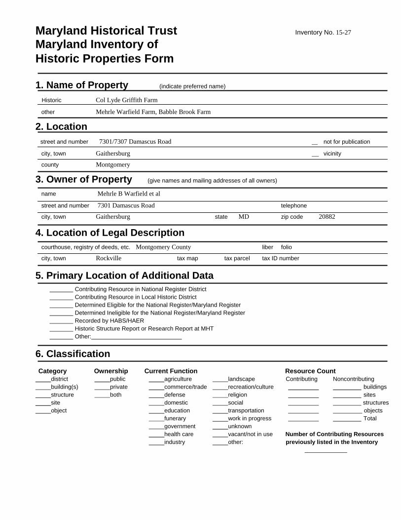
Maryland Historical Trust Inventory No. 15-27 Maryland Inventory of Historic Properties Form 1. Name of Property (indicate preferred name) Historic Col Lyde Griffith Farm other Mehrle Warfield Farm, Babble Brook Farm 2. Location street and number 7301/7307 Damascus Road not for publication city, town Gaithersburg vicinity county Montgomery 3. Owner of Property (give names and mailing addresses of all owners) name Mehrle B Warfield et al street and number 7301 Damascus Road telephone city, town Gaithersburg state MD zip code 20882 4. Location of Legal Description courthouse, registry of deeds, etc. Montgomery County liber folio city, town Rockville tax map tax parcel tax ID number 5. Primary Location of Additional Data Contributing Resource in National Register District Contributing Resource in Local Historic District Determined Eligible for the National Register/Maryland Register Determined Ineligible for the National Register/Maryland Register Recorded by HABS/HAER Historic Structure Report or Research Report at MHT Other: 6. Classification Category Ownership Current Function Resource Count district public agriculture landscape Contributing Noncontributing building(s) private commerce/trade recreation/culture buildings structure both defense religion sites site domestic social structures object education transportation objects funerary work in progress Total government unknown health care vacant/not in use Number of Contributing Resources industry other: previously listed in the Inventory
Transcript of Maryland Historical Trust Maryland Inventory of Historic ... · Historic Col Lyde Griffith Farm...
Maryland Historical Trust Inventory No. 15-27
Maryland Inventory of Historic Properties Form 1. Name of Property (indicate preferred name)
Historic Col Lyde Griffith Farm
other Mehrle Warfield Farm, Babble Brook Farm
2. Location
street and number 7301/7307 Damascus Road not for publication
city, town Gaithersburg vicinity county Montgomery
3. Owner of Property (give names and mailing addresses of all owners) name Mehrle B Warfield et al street and number 7301 Damascus Road telephone city, town Gaithersburg state MD zip code 20882
4. Location of Legal Description courthouse, registry of deeds, etc. Montgomery County liber folio city, town Rockville tax map tax parcel tax ID number
5. Primary Location of Additional Data Contributing Resource in National Register District Contributing Resource in Local Historic District Determined Eligible for the National Register/Maryland Register Determined Ineligible for the National Register/Maryland Register Recorded by HABS/HAER Historic Structure Report or Research Report at MHT Other:
6. Classification Category Ownership Current Function Resource Count district public agriculture landscape Contributing Noncontributing building(s) private commerce/trade recreation/culture buildings structure both defense religion sites site domestic social structures object education transportation objects funerary work in progress Total government unknown health care vacant/not in use Number of Contributing Resources industry other: previously listed in the Inventory
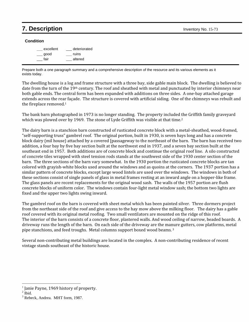
7. Description Inventory No. 15-73 Condition
excellent deteriorated good ruins fair altered
Prepare both a one paragraph summary and a comprehensive description of the resource and its various elements as it exists today. The dwelling house is a log and frame structure with a three bay, side gable main block. The dwelling is believed to date from the turn of the 19th century. The roof and sheathed with metal and punctuated by interior chimneys near both gable ends. The central form has been expanded with additions on three sides. A one‐bay attached garage extends across the rear façade. The structure is covered with artificial siding. One of the chimneys was rebuilt and the fireplace removed.1 The bank barn photographed in 1973 is no longer standing. The property included the Griffith family graveyard which was plowed over by 1969. The stone of Lyde Griffith was visible at that time.2 The dairy barn is a stanchion barn constructed of rusticated concrete block with a metal‐sheathed, wood‐framed, “self‐supporting truss” gambrel roof. The original portion, built in 1930, is seven bays long and has a concrete block dairy (mil house) attached by a covered [passageway to the northeast of the barn. The barn has received two addition, a four bay by five bay section built at the northwest end in 1937, and a seven bay section built at the southeast end in 1957. Both additions are of concrete block and continue the original roof line. A silo constructed of concrete tiles wrapped with steel tension rods stands at the southwest side of the 1930 center section of the barn. The three sections of the barn vary somewhat. In the 1930 portion the rusticated concrete blocks are tan colored with grayish‐white blocks used around the windows and as quoins at the corners. The 1937 portion has a similar pattern of concrete blocks, except large wood lintels are used over the windows. The windows in both of these sections consist of single panels of glass in metal frames resting at an inward angle on a hopper‐like frame. The glass panels are recent replacements for the original wood sash. The walls of the 1957 portion are flush concrete blocks of uniform color. The windows contain four‐light metal window sash; the bottom two lights are fixed and the upper two lights swing inward. The gambrel roof on the barn is covered with sheet metal which has been painted silver. Three dormers project from the northeast side of the roof and give access to the hay mow above the milking floor. The dairy has a gable roof covered with its original metal roofing. Two small ventilators are mounted on the ridge of this roof. The interior of the barn consists of a concrete floor, plastered walls. And wood ceiling of narrow, beaded boards. A driveway runs the length of the barn. On each side of the driveway are the manure gutters, cow platforms, metal pipe stanchions, and feed troughs. Metal columns support boxed wood beams. 3 Several non‐contributing metal buildings are located in the complex. A non‐contributing residence of recent vintage stands southeast of the historic house.
1 Janie Payne, 1969 history of property. 2 Ibid. 3 Rebeck, Andrea. MHT form, 1987.
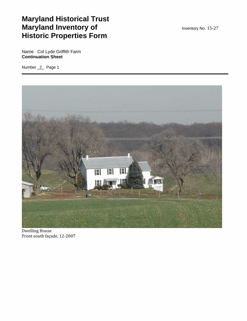
Maryland Historical Trust Maryland Inventory of Inventory No. 15-27 Historic Properties Form Name Col Lyde Griffith Farm Continuation Sheet Number 7 Page 1
Dwelling House Front south façade, 12‐2007
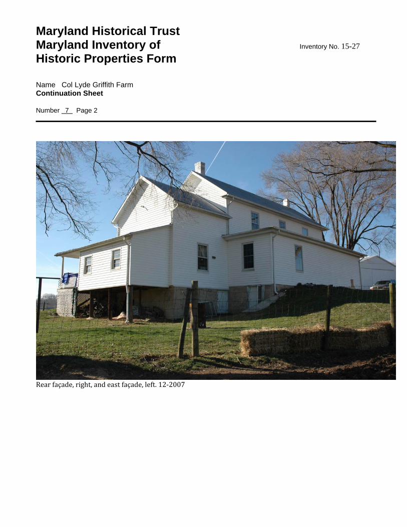
Maryland Historical Trust Maryland Inventory of Inventory No. 15-27 Historic Properties Form Name Col Lyde Griffith Farm Continuation Sheet Number 7 Page 2
Rear façade, right, and east façade, left. 12‐2007
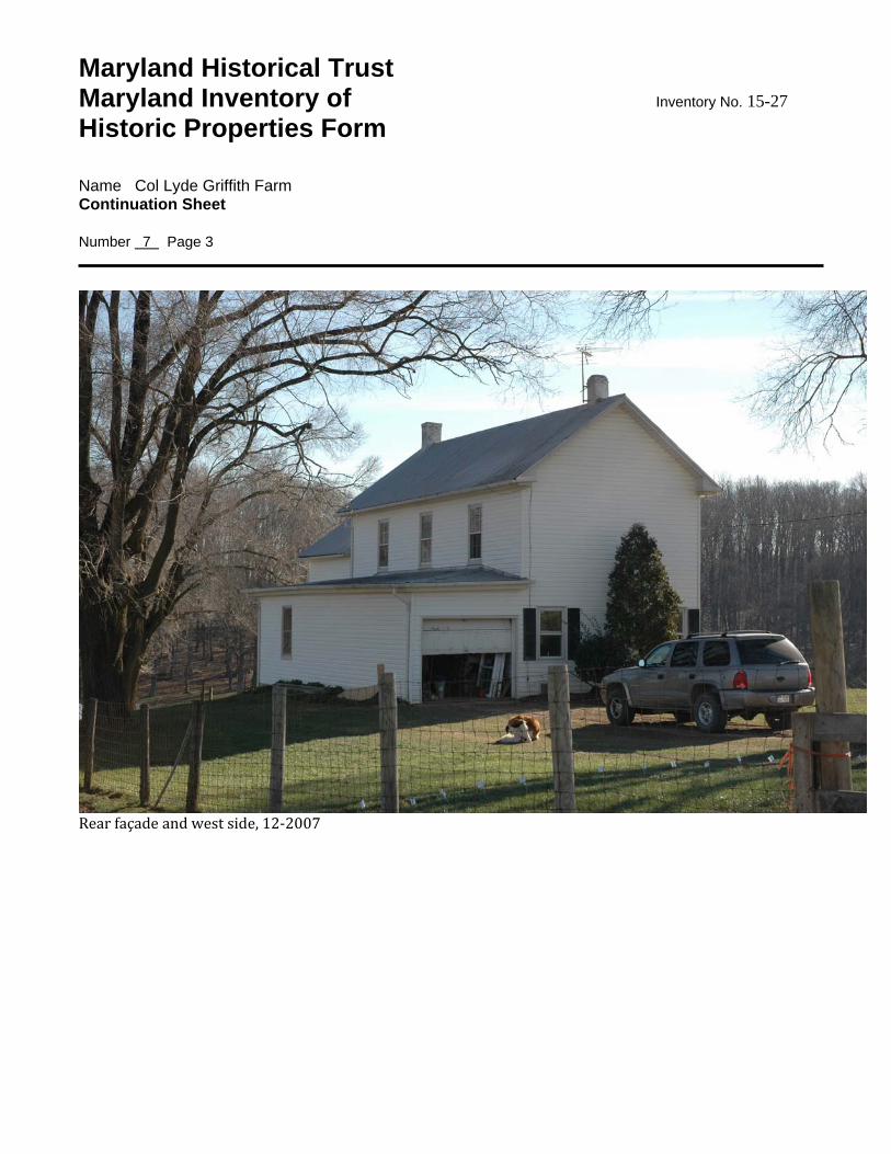
Maryland Historical Trust Maryland Inventory of Inventory No. 15-27 Historic Properties Form Name Col Lyde Griffith Farm Continuation Sheet Number 7 Page 3
Rear façade and west side, 12‐2007
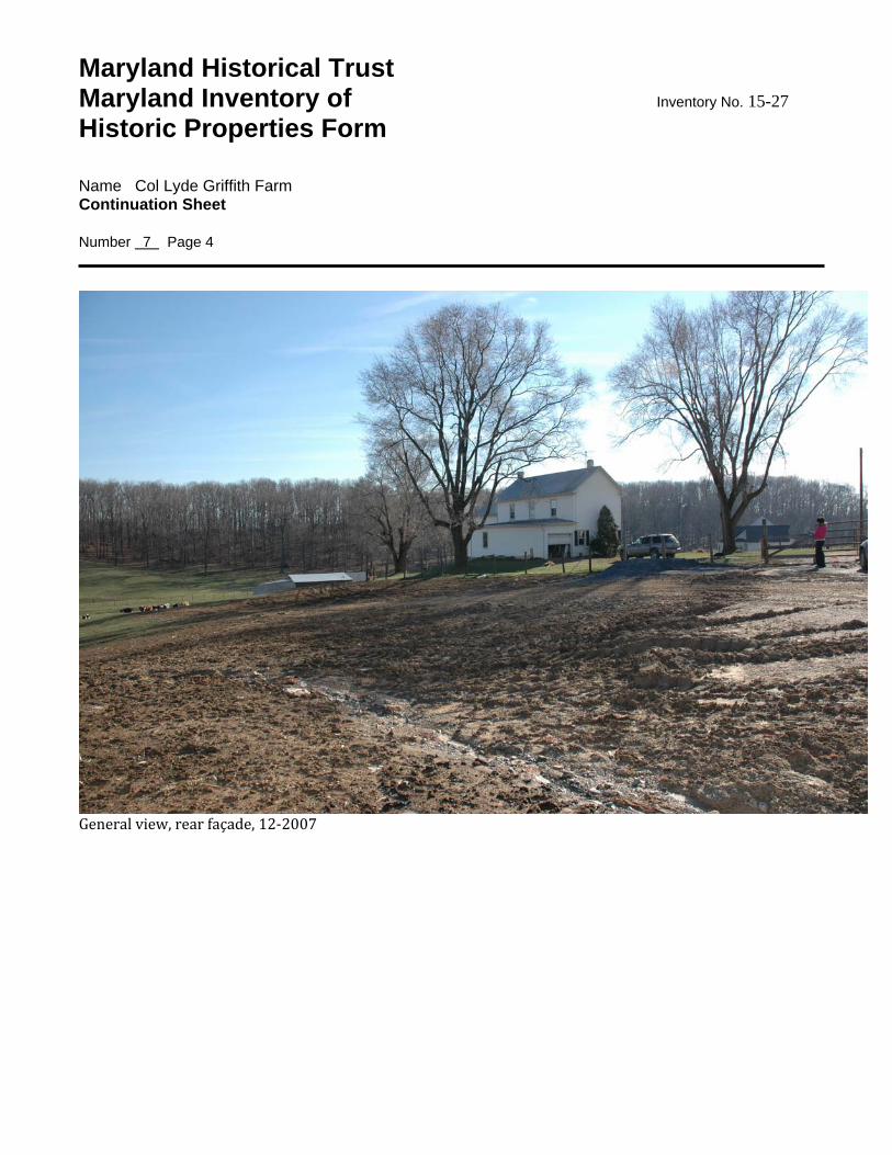
Maryland Historical Trust Maryland Inventory of Inventory No. 15-27 Historic Properties Form Name Col Lyde Griffith Farm Continuation Sheet Number 7 Page 4
General view, rear façade, 12‐2007
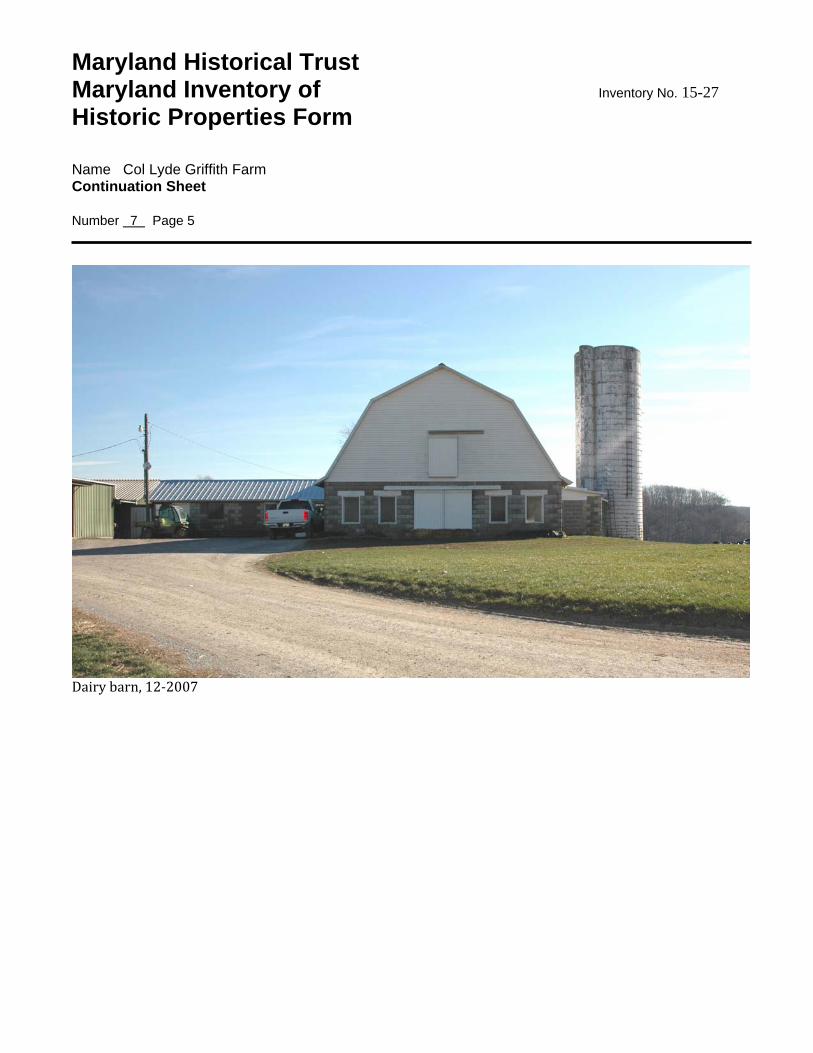
Maryland Historical Trust Maryland Inventory of Inventory No. 15-27 Historic Properties Form Name Col Lyde Griffith Farm Continuation Sheet Number 7 Page 5
Dairy barn, 12‐2007
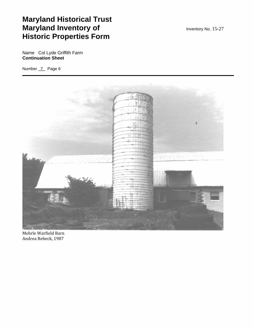
Maryland Historical Trust Maryland Inventory of Inventory No. 15-27 Historic Properties Form Name Col Lyde Griffith Farm Continuation Sheet Number 7 Page 6
Mehrle Warfield Barn Andrea Rebeck, 1987
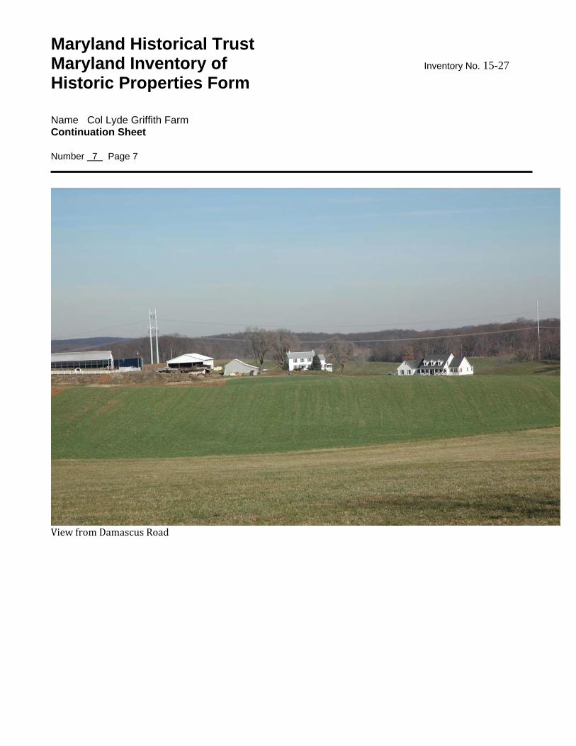
Maryland Historical Trust Maryland Inventory of Inventory No. 15-27 Historic Properties Form Name Col Lyde Griffith Farm Continuation Sheet Number 7 Page 7
View from Damascus Road
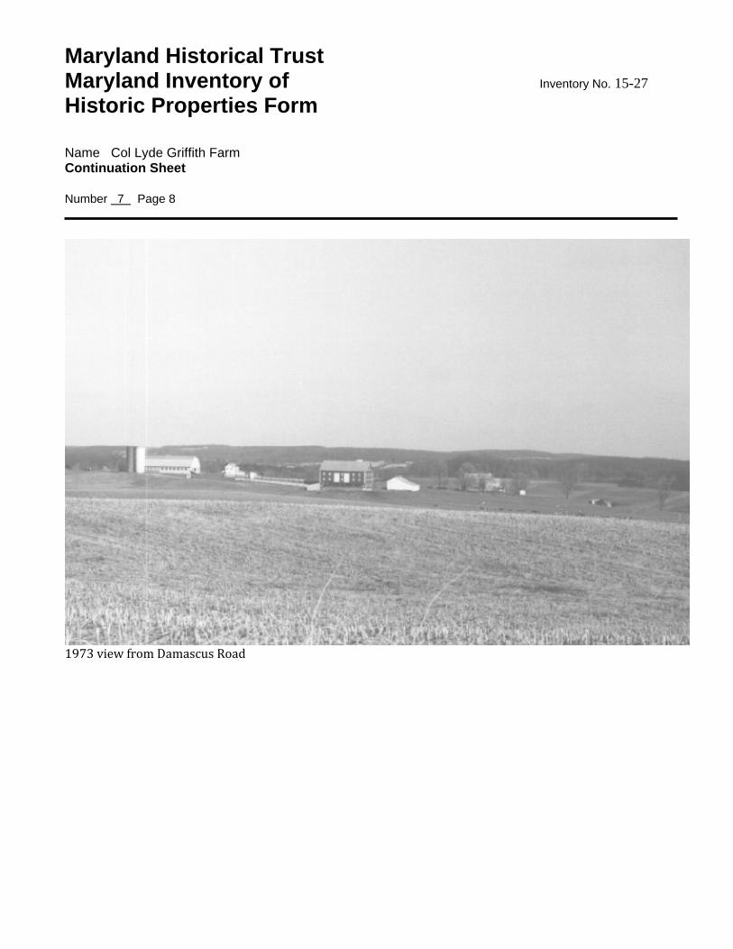
Maryland Historical Trust Maryland Inventory of Inventory No. 15-27 Historic Properties Form Name Col Lyde Griffith Farm Continuation Sheet Number 7 Page 8
1973 view from Damascus Road
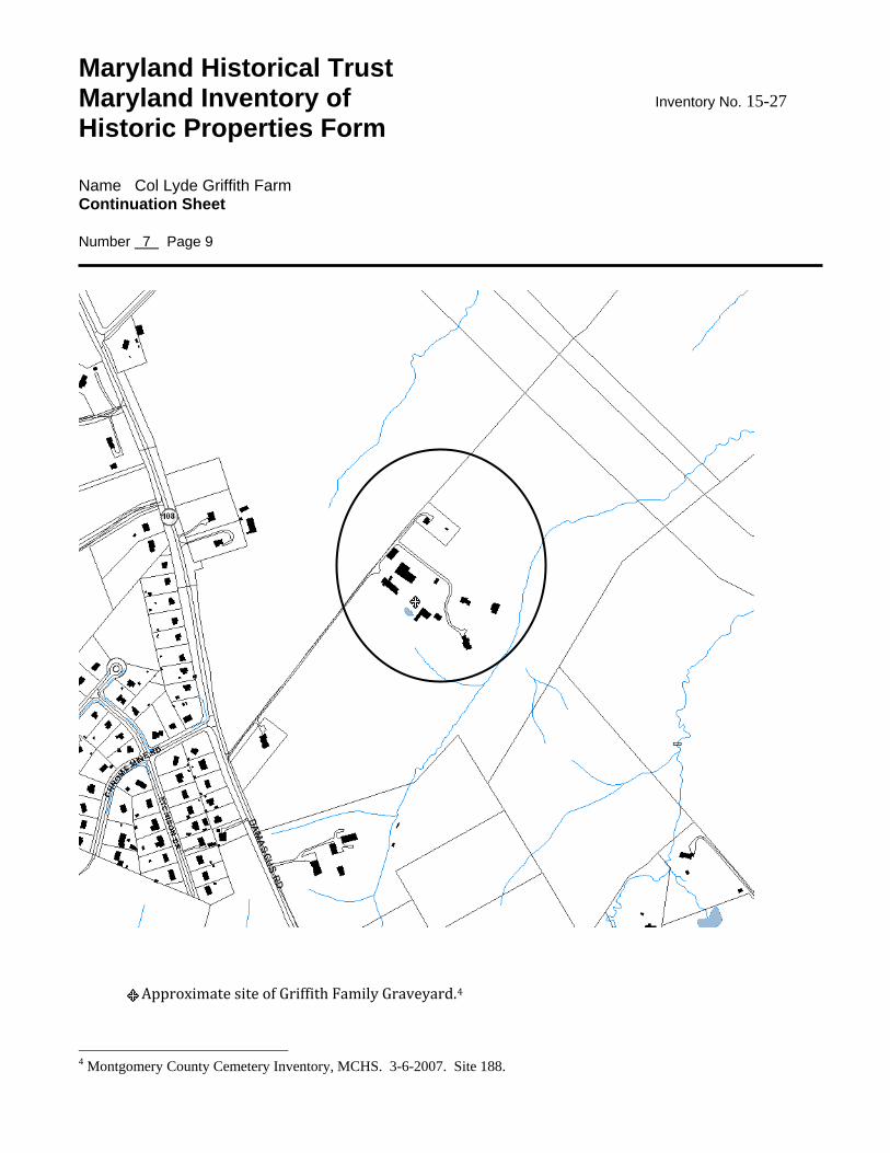
Maryland Historical Trust Maryland Inventory of Inventory No. 15-27 Historic Properties Form Name Col Lyde Griffith Farm Continuation Sheet Number 7 Page 9
Approximate site of Griffith Family Graveyard.4
4 Montgomery County Cemetery Inventory, MCHS. 3-6-2007. Site 188.
8. Significance Inventory No. 15-27
Period Areas of Significance Check and justify below 1600-1699 agriculture economics health/medicine performing arts 1700-1799 archeology education industry philosophy 1800-1899 architecture engineering invention politics/government 1900-1999 art entertainment/ landscape architecture religion 2000- commerce recreation law science communications ethnic heritage literature social history community planning exploration/ maritime history transportation conservation settlement military other: Specific dates c1797-1809; 1925 Architect/Builder Construction dates 1930, 1937, 1957 Evaluation for: National Register Maryland Register not evaluated Prepare a one-paragraph summary statement of significance addressing applicable criteria, followed by a narrative discussion of the history of the resource and its context. (For compliance projects, complete evaluation on a DOE Form – see manual.) The Col Lyde Griffith Farm has historical significance for its association with an influential citizen and early settler of the Etchison area. The farm has architectural significance for the residence which is highly representative of the first decade of the turn of the19th century. The log and frame house was likely built between 1797, the date of Col Lyde Griffith’s first marriage to Anne Poole Dorsey and 1809, when he married his second wife, Amelia Wayman. The three bay house is a traditional form that was used throughout the region in this era. The dairy barn, built in 1930 and expanded in 1937 and 1957, has additional architectural and historical significance for being highly representative of 20th century dairy farming practices and construction techniques. Col Lyde Griffith (1774‐1839) patented Griffithsburg in 1826. The tract consisted of 1,196 acres of land Griffith acquired by grant and purchase. 5 Lyde Griffith was County Commissioner, from 1813‐1819. It is not known why he was called Colonel. Perhaps he served in the War of 1812. Col Lyde was the son of Capt Samuel Griffith and grandson of patriot Henry Griffith. Capt Samuel (1752‐1833) was a Captain in the Continental Army, 1777. Col Lyde Griffith married first Anne Poole Dorsey (1773‐1808), by 1797. In 1809, he married Amelia Wayman (d1823).6 With his first wife, Anne, he had four children: Henry (b1797), Elizabeth (1800‐1860), Rachel (b1802), and Lyde Jr (1804‐1881). With second wife Amelia, he has four more children: Charles (b1810), Milcah or Milcha (b1812), Louisa (b1815), and Walter (1820‐1864).7 In the 1820 census there were at least 30 individuals associated with the farmstead, including 18 slaves. At the time of Col Lyde’s death, the farmstead consisted of 300 acres.8 The log and frame house was likely built between 1797, the date of Col Lyde Griffith’s first marriage to Anne Poole Dorsey and 1809, when he married his second wife, Amelia Wayman. The three bay house is a traditional form that was used throughout the region in this era. 5Payne, Janie. History of Col Lyde Griffith House, 1969. Griffithsburg land patent, Land Surveys and Patents, 929.3 6 Frederick Post 1833. Maryland Journal and True American, cited in Moore, Newspaper Abstracts 1831-40. Griffith family genealogy, R R Griffith, Baltimore 1892. Joshua Dorsey Warfield, The Founders of Anne Arundel and Howard Counties, 1906, p398. William Hurley, Warfield Families, p11. 7 pitard.net : Col Lyde Griffith. Sources : RR Griffith genealogy, Anne Arundel Gentry, Griffith et al ancestral studey 1939. Worldconnect.rootsweb.ancestry.com Richard Heyduck genealogy. 8 1820 census, M33 /rikk 44:155.
Maryland Historical Trust Maryland Inventory of Inventory No. 15-27 Historic Properties Form Name Col Lyde Griffith Farm Continuation Sheet Number 8 Page 1 Chrome mines were operated on Lyde Griffith’s land in the 1800s. In 1837, Lyde Griffith made an agreement with Washington Waters, allowing him to mine chrome ore on his property. By 1852, Waters mined 20,000 tons of chrome ore. The Montgomery Sentinel reported that Thompson and Oudesleys of Baltimore sunk a shaft on Col Lyde Griffith’s land in 1860. Griffith’s mine by that time had yielded 5‐600 tons of chrome ore. The Martenet and Bond map of 1865 shows Tyson’s Chrome Pits located north of Damascus Road. Mining took on the Griffith farm until the vein gave out.9 Col Lyde Griffith was buried on the subject property in the Griffith family graveyard. By 1969 the graveyard was plowed over and loose gravestones were standing nearby. A recent survey identified the gravesite as being near the bank barn site.10 The Martenet and Bond map of 1865 shows Walter Griffith Heirs owning the property. Youngest child, Walter inherited Col Lyde’s house and 300 acres of land upon his father’s death in 1839. In 1841, Walter (1820‐1864) married Mary Wilson Riggs (1819‐1898), daughter of Reuben Riggs. They had four children: Lyde (b1842), Louisa (b1843), William Henry (1847‐1923) and Mary E (b1848).11 Living in the household in 1860 were Walter and Mary, age 40, and children Lyde (18), Louisa (15), William H (13) and Mary E (12). Milcah (Milcha) married the Honorable Samuel Riggs of R. Born about 1813, she and Samuel Riggs lived at The Oaks (MP Site #23/27), and died in 1874.12 Lyde Jr. acquired a plantation of 150 acres “where he now lives” upon his father’s death in 1839. The farm may be the one shown on the 1865 map on the opposite side of Damascus Road (likely at Resource #14‐9). Lyde Griffith died at his home, in 1882, age 80 years. 13 In 1925, the Griffith family conveyed the farm to Mehrle Warfield, the son of Basil and Alice Warfield, who acquired 195.5 acres. Warfield constructed a dairy barn nearly identical to the one built by his brother Raymond Warfield at the Basil Warfield Farm at 8251 Damascus Road (Resource #15/73). Mehrle B Warfield Sr died in 1977.14 The Merhle Warfield barn is a good example of a still functioning dairy barn constructed in eastern Montgomery County during the third and fifth decades of the twentieth century. By examining the details of the three sections, 9 Maryland Court of Appeals, 1852, Vol 2. pp326+ Waters vs Griffith. Sentinel, 7-20-1860, MCHS transcript. Jane King, Chrome Mining in Etchison, Courier, 2-27-1974. 1865 Martenet and Bond map. 10 Ibid. Montgomery County Cemetery Inventory. 11 Sentinel 9-16-1898 Mary W Griffith Obituary; William H had a son Lyde Griffth who married Julia Snouffer, Sentinel 12-7-1894. Genealogical Abstracts, p158. Familytreemaker.com Dustin Lee Watson tree. 12 Sentinel, 3-6-1874 cited in Malloy and Jacobs, Genealogical Abstracts, MCHS. 13Malloy, Sween, Manuel. Abstract of Wills, 1826-1875, p66. Sentinel, 2-24-1882. A Lyde Griffith, likely Jr, was elected to the Maryland House of Delegates where he served from 1842‐44 and 1846. Likely this is the same Lyde who was nominated delegate to the State Convention of 1833, appointed to the County Orphan’s Court (1831), appointed to the Grand Jury (1831), served as Commissioner of the School Fund for Cracklin District (1831), and served as Election District Judge for District #1 (1831). Hiebert and MacMaster (1976). 14 Frederick Post, 1-26-1977.
Maryland Historical Trust Maryland Inventory of Inventory No. 15-27 Historic Properties Form Name Col Lyde Griffith Farm Continuation Sheet Number 8 Page 2 the original 1930 midsection, the 1937 addition to the north, and the 1957 addition to the south, one can see in ne building the change in design and materials that occurred over this period of time. The Merhle Warfield barn is quite typical of these changes. The 1930 section was built of high quality panel face concrete blocks, with white blocks accenting the corners and window openings against the darker tannish‐grey blocks. Window lintels were formed from the white blocks, also. The 1937 section is similar except that the window and door lintels are large wood lintels painted white. This is very typical of barns built in the late 1930s, and indicates that the quality of the design and its execution had declined somewhat during the years of the Depression. By the time the 1957 section was built, aesthetics were of even less concern, for the concrete blocks are flush, grey, rougher, and considerably less interesting to look at than their 1930s counterparts. This trend began in the 1940s and was a result of the hard economic times before the war and the scarcity of materials during and immediately after the war. The interior of the barn, as surveyed in 1987, was identified as a classic example of the modern, sanitary dairy barn decreed by the health officials who regulated milk production. Although county regulations did not go into effect until after 1934, farmers were being encouraged to construct specialized milking barns which could be kept cleaner that the older wood bank barns. This barn complies with the suggestions for greater cleanliness. Its floor is concrete and has the easier‐to‐clean manure gutter, metal stanchions, and concrete manger. The walls ate hard plaster. The ceiling consists of tight‐fitting, narrow, beaded wood boards, intended to prevent dust and hay from sifting down out of the hayloft and into the milking area. As was the practice of the time, the walls and ceiling are painted white to preserve the appearance of cleanliness. The farm of 87.6 acres continues to be owned by the Warfield family.
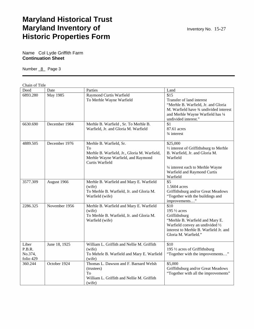
Maryland Historical Trust Maryland Inventory of Inventory No. 15-27 Historic Properties Form Name Col Lyde Griffith Farm Continuation Sheet Number 8 Page 3 Chain of Title Deed Date Parties Land 6893.280 May 1985 Raymond Curtis Warfield
To Merhle Wayne Warfield $15 Transfer of land interest “Merhle B. Warfield, Jr. and Gloria M. Warfield have ¾ undivided interest and Merhle Wayne Warfield has ¼ undivided interest.”
6630.690 December 1984 Merhle B. Warfield , Sr. To Merhle B. Warfield, Jr. and Gloria M. Warfield
$1 87.61 acres ¾ interest
4889.505 December 1976 Merhle B. Warfield, Sr. To Merhle B. Warfield, Jr., Gloria M. Warfield, Merhle Wayne Warfield, and Raymond Curtis Warfield
$25,000 ½ interest of Griffithsburg to Merhle B. Warfield, Jr. and Gloria M. Warfield ¼ interest each to Merhle Wayne Warfield and Raymond Curtis Warfield
3577.309 August 1966 Merhle B. Warfield and Mary E. Warfield (wife) To Merhle B. Warfield, Jr. and Gloria M. Warfield (wife)
$5 1.5604 acres Griffithsburg and/or Great Meadows “Together with the buildings and improvements…”
2286.325 November 1956 Merhle B. Warfield and Mary E. Warfield (wife) To Merhle B. Warfield, Jr. and Gloria M. Warfield (wife)
$10 195 ½ acres Griffithsburg “Merhle B. Warfield and Mary E. Warfield convey an undivided ½ interest to Merhle B. Warfield Jr. and Gloria M. Warfield.”
Liber P.B.R. No.374, folio 429
June 18, 1925 William L. Griffith and Nellie M. Griffith (wife) To Mehrle B. Warfield and Mary E. Warfield (wife)
$10 195 ½ acres of Griffithsburg “Together with the improvements…”
360.244 October 1924 Thomas L. Dawson and F. Barnard Welsh (trustees) To William L. Griffith and Nellie M. Griffith (wife)
$5,000 Griffithsburg and/or Great Meadows “Together with all the improvements”
Maryland Historical Trust Maryland Inventory of Inventory No. 15-27 Historic Properties Form Name Col Lyde Griffith Farm Continuation Sheet Number 8 Page 4
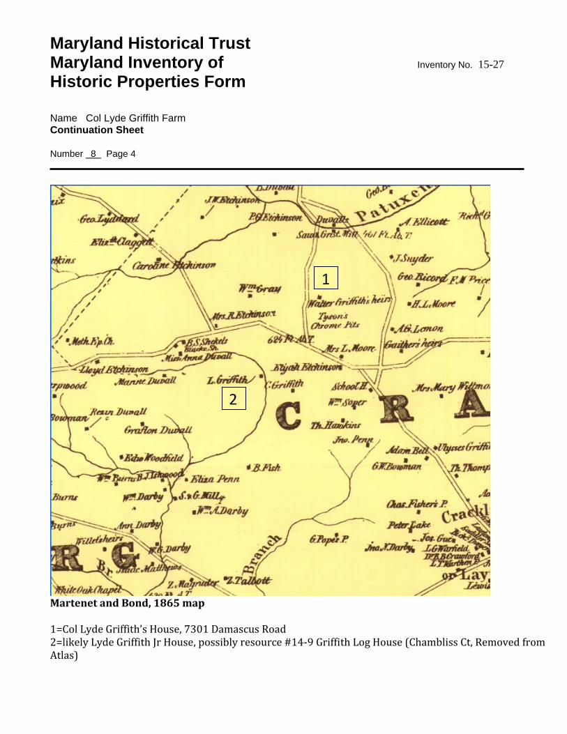
Martenet and Bond, 1865 map 1=Col Lyde Griffith’s House, 7301 Damascus Road 2=likely Lyde Griffith Jr House, possibly resource #14‐9 Griffith Log House (Chambliss Ct, Removed from Atlas)
1
2
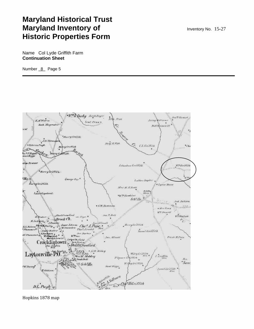
Maryland Historical Trust Maryland Inventory of Inventory No. 15-27 Historic Properties Form Name Col Lyde Griffith Farm Continuation Sheet Number 8 Page 5
Hopkins 1878 map
9. Major Bibliographical References Inventory No. 15-73 See continuation sheet.
10. Geographical Data Acreage of surveyed property 87.61 acres Acreage of historical setting Quadrangle name Quadrangle scale: Verbal boundary description and justification
11. Form Prepared by name/title Clare Lise Kelly and Lorin Farris
organization M-NCPPC date 12-2009
street & number telephone
city or town state
The Maryland Inventory of Historic Properties was officially created by an Act of the Maryland Legislature to be found in the Annotated Code of Maryland, Article 41, Section 181 KA, 1974 supplement. The survey and inventory are being prepared for information and record purposes only and do not constitute any infringement of individual property rights.
return to: Maryland Historical Trust Maryland Department of Planning 100 Community Place Crownsville, MD 21032-2023 410-514-7600
Maryland Historical Trust Maryland Inventory of Inventory No. 15-27 Historic Properties Form Name Col Lyde Griffith Farm Continuation Sheet Number 8 Page 1 BIBLIOGRAPHY Dwyer, Michael. MHT form, 1973. Frederick Post, Mehrle Warfield Sr Obituary, 1‐26‐1977. Griffith, R R. Griffith Family Genealogy, Baltimore 1892. Hiebert and MacMaster. A Grateful Remembrance, 1976. Hopkins Map, 1878. Hurley, William. The Warfield Families. Heritage Books, 2007. King, Jane. “Chrome Mining in Etchison,” Courier, 2‐27‐1974. Malloy, Mary Gordon, and Marian W Jacobs. Genealogical Abstracts 18551899. MCHS, 1986. Malloy, Sween, Manuel. Abstract of Wills, 18261875, p66. Martenet and Bond map, 1865. Montgomery County Cemetery Inventory, Lyde Griffith Family Cemetery, #188. MCHS 3‐6‐2007. Montgomery County Sentinel, 7‐20‐1860, Montgomery County Slave Statistics, 1867‐1868. MSA Vol 812, 14. Moore, Newspaper Abstracts from Frederick and Montgomery County, 1831‐1840. Payne, Janie. History of Col Lyde Griffith House, 1969 Rebeck, Andrea. MHT form, 1987 Warfield, Joshua Dorsey, The Founders of Anne Arundel and Howard Counties, 1906. Waters, Washington vs. Lyde Griffith, Maryland Court of Appeals, 1852, Vol 2. pp326+.