MARITIME BOUNDARY DISPUTES AND INTERNATIONAL LAW.
64
MARITIME BOUNDARY DISPUTES AND INTERNATIONAL LAW
-
Upload
pamela-rich -
Category
Documents
-
view
234 -
download
1
Transcript of MARITIME BOUNDARY DISPUTES AND INTERNATIONAL LAW.
MARITIME BOUNDARY DISPUTES AND INTERNATIONAL
LAW
Overview
Familiarity with international law of maritime boundary delimitation.
Provide context on maritime boundary disputes. Familiarity with some major non-Arctic disputes.
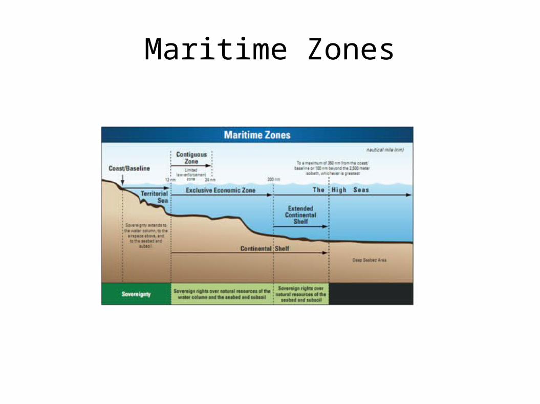
Maritime Zones
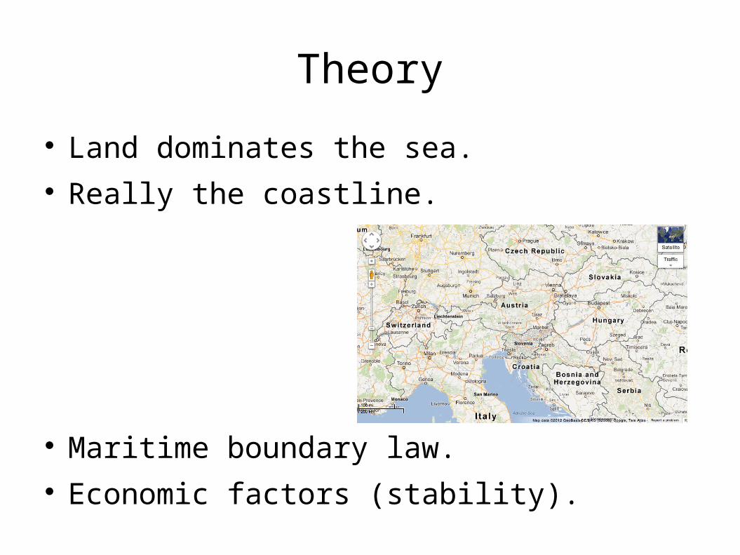
Theory
Land dominates the sea. Really the coastline.
Maritime boundary law. Economic factors (stability).
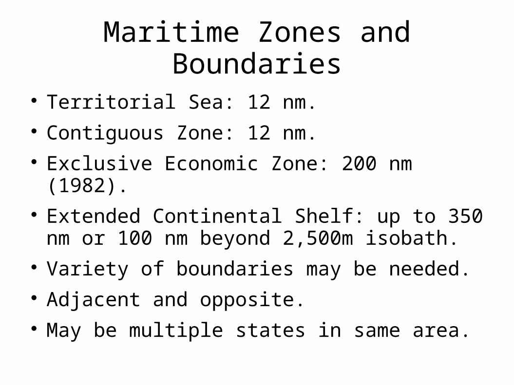
Maritime Zones and Boundaries
Territorial Sea: 12 nm. Contiguous Zone: 12 nm. Exclusive Economic Zone: 200 nm (1982). Extended Continental Shelf: up to 350 nm or
100 nm beyond 2,500m isobath. Variety of boundaries may be needed. Adjacent and opposite. May be multiple states in same area.
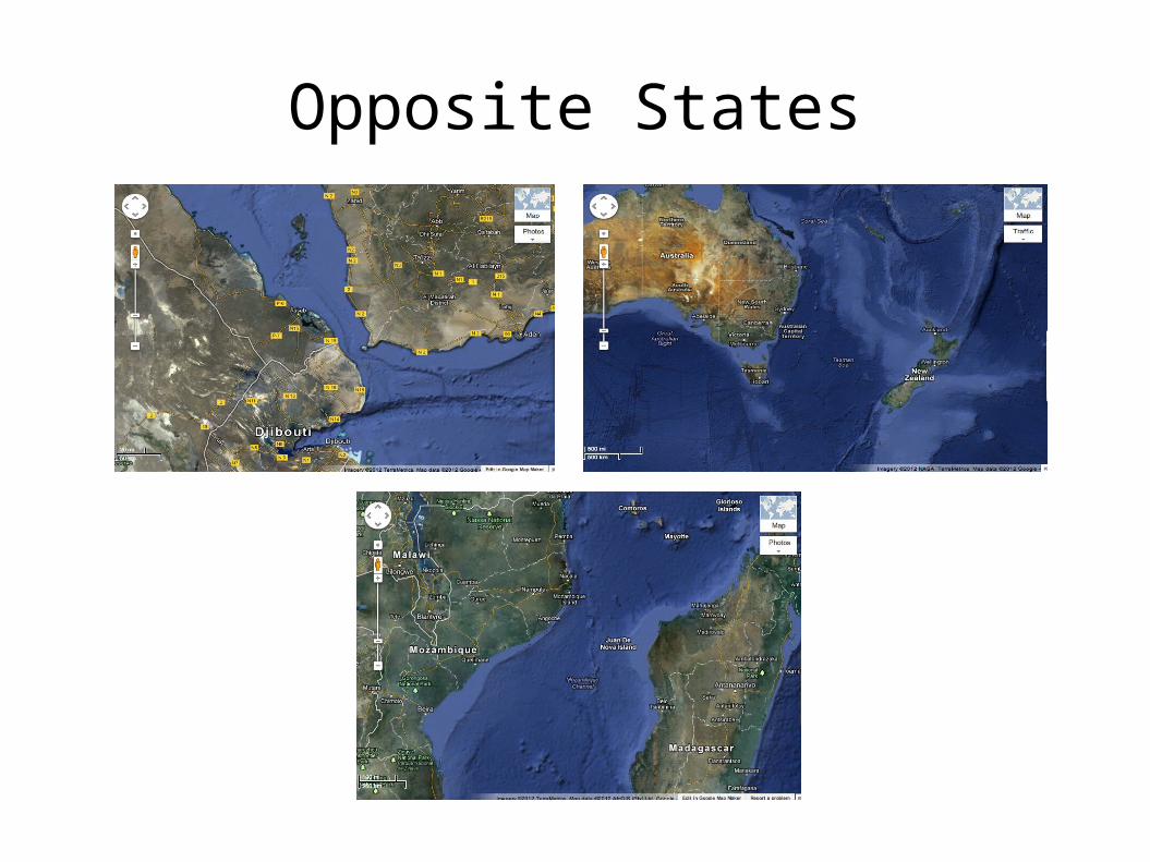
Opposite States
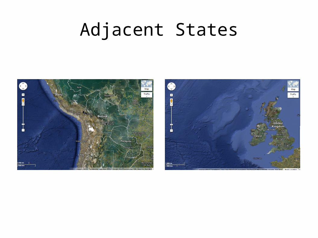
Adjacent States
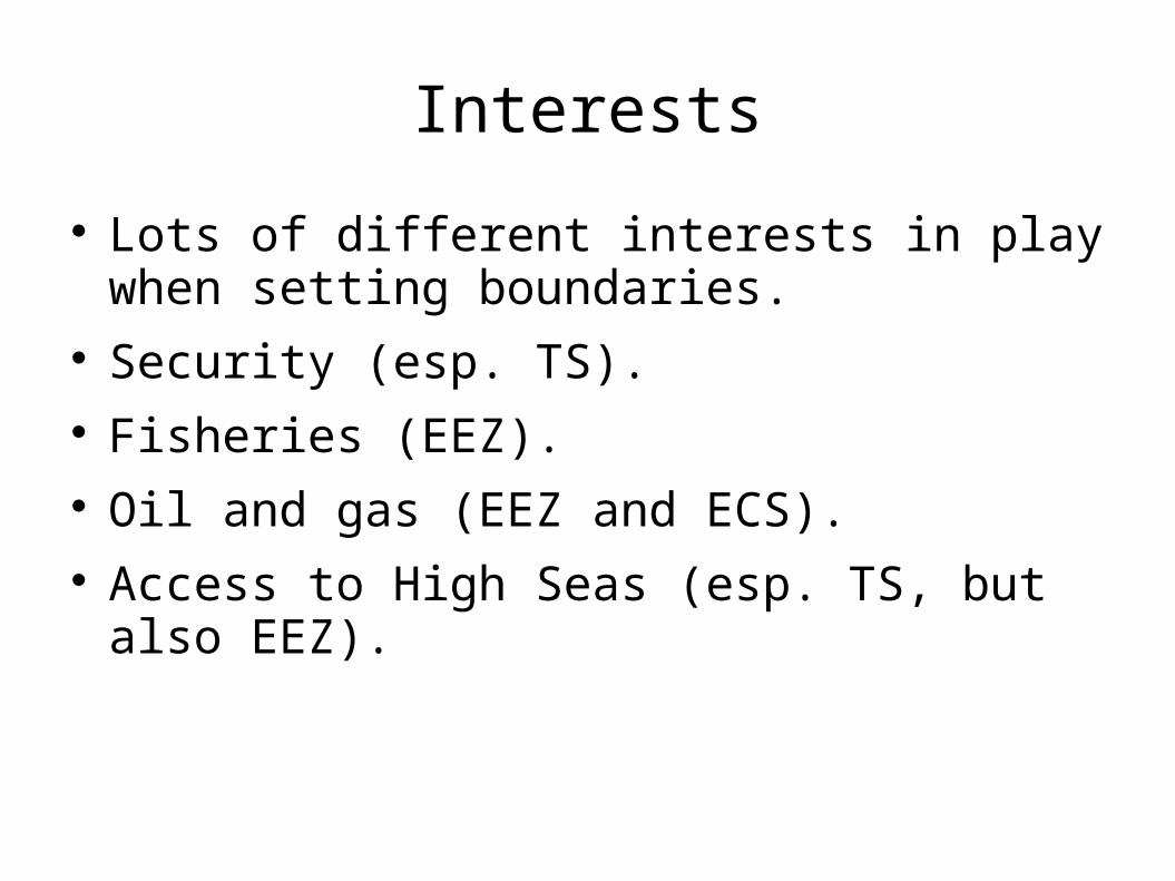
Interests
Lots of different interests in play when setting boundaries.
Security (esp. TS). Fisheries (EEZ). Oil and gas (EEZ and ECS). Access to High Seas (esp. TS, but also EEZ).
Maritime Boundaries Today and in History
Land was apportioned through use of force. Now not legal to use force to alter boundaries. Territorial integrity norm. Seems similar at sea. History at sea involved use of force. Maritime jurisdiction not created through force. Boundaries not usually violated today. Important role for international law.
Legal Means of Delimitation
Negotiation leading to treaty. Conciliation Commission. Arbitration. Adjudication at an international court or tribunal. Courts/tribunals have played a major role in
maritime delimitations. Many states avoid litigation. “Equal disappointment.”
What is Maritime Boundary Law?
Body of rules on how to delimit maritime boundaries.
Plays role in litigation, arbitration and even negotiations.
Sources of international law: custom, treaties, court decisions, opinions of academics, principles recognized by civilized nations.
Maritime boundary law is a combination of these, though primarily state practice (custom), treaties and judicial decisions.
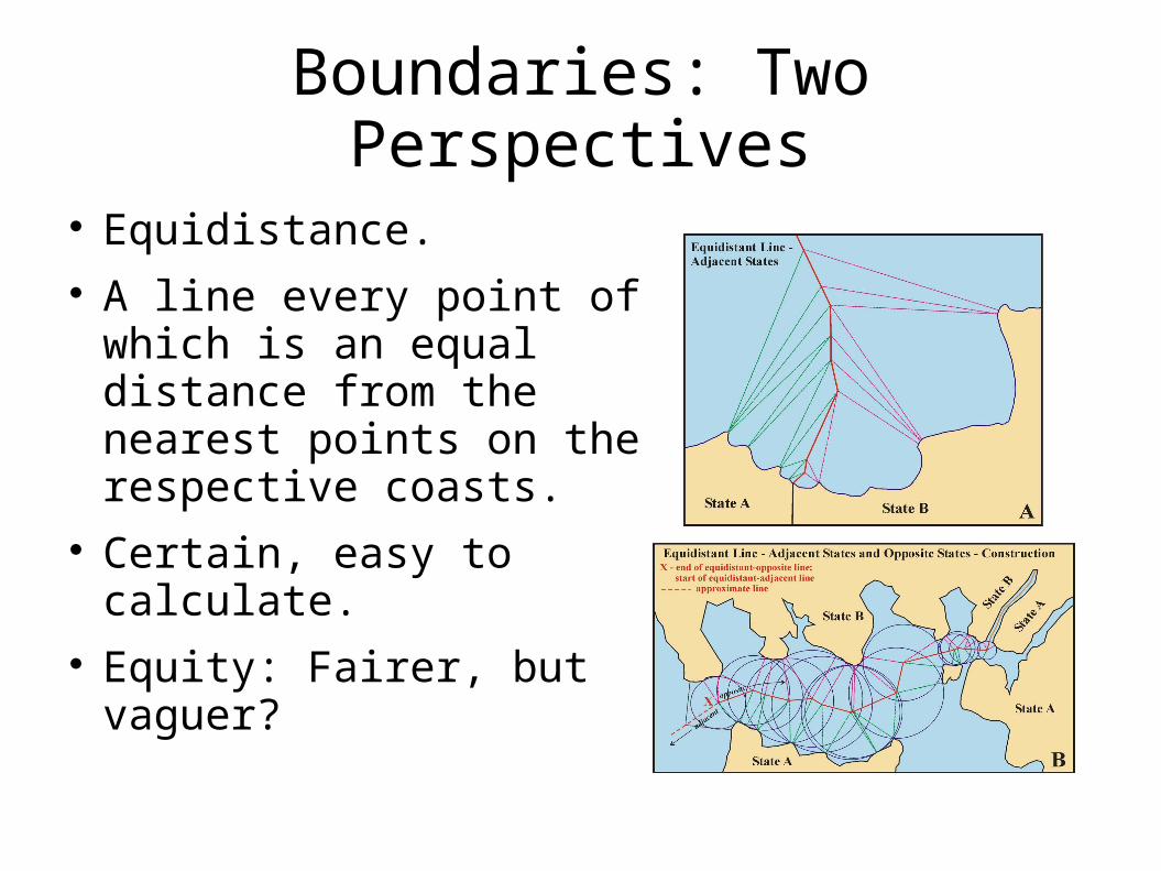
Boundaries: Two Perspectives
Equidistance. A line every point of
which is an equal distance from the nearest points on the respective coasts.
Certain, easy to calculate.
Equity: Fairer, but vaguer?
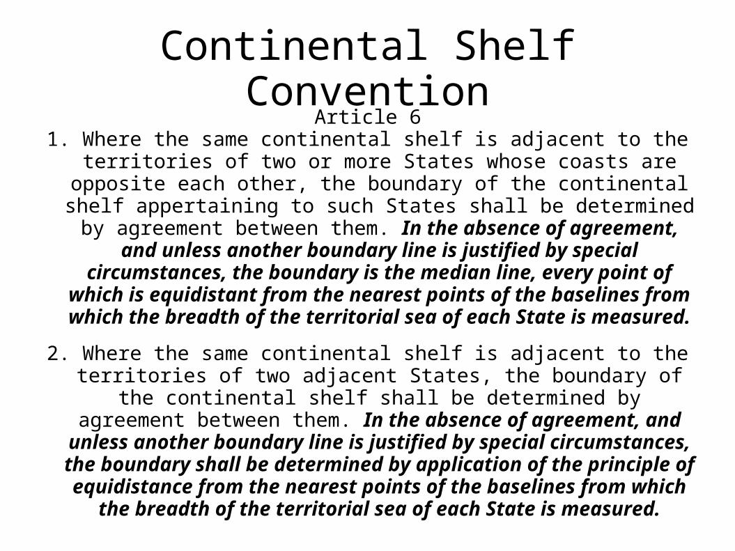
Continental Shelf ConventionArticle 6
1. Where the same continental shelf is adjacent to the territories of two or more States whose coasts are opposite each other, the boundary of the continental shelf appertaining to such States shall be determined
by agreement between them. In the absence of agreement, and unless another boundary line is justified by special
circumstances, the boundary is the median line, every point of which is equidistant from the nearest points of the baselines from which the breadth of the territorial sea of each State is
measured.
2. Where the same continental shelf is adjacent to the territories of two adjacent States, the boundary of the continental shelf shall be determined by agreement between them. In the absence of
agreement, and unless another boundary line is justified by special circumstances, the boundary shall be determined by application of the principle of equidistance from the nearest
points of the baselines from which the breadth of the territorial sea of each State is measured.
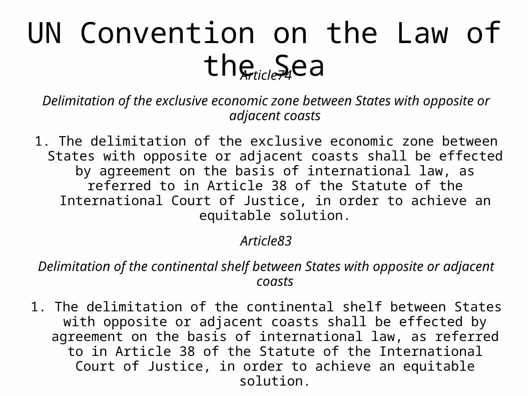
UN Convention on the Law of the SeaArticle74
Delimitation of the exclusive economic zone between States with opposite or adjacent coasts
1. The delimitation of the exclusive economic zone between States with opposite or adjacent coasts shall be effected by agreement on the basis of
international law, as referred to in Article 38 of the Statute of the International Court of Justice, in order to achieve an equitable solution.
Article83
Delimitation of the continental shelf between States with opposite or adjacent coasts
1. The delimitation of the continental shelf between States with opposite or adjacent coasts shall be effected by agreement on the basis of international
law, as referred to in Article 38 of the Statute of the International Court of Justice, in order to achieve an equitable solution.
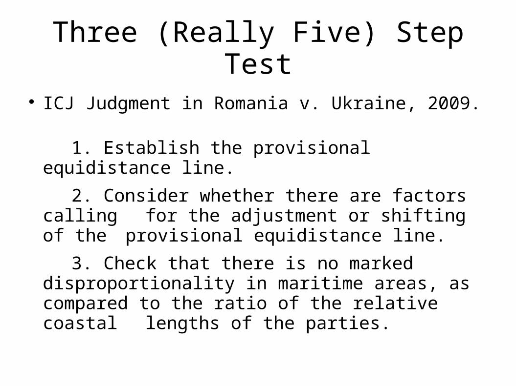
Three (Really Five) Step Test
ICJ Judgment in Romania v. Ukraine, 2009.
1. Establish the provisional equidistance line.
2. Consider whether there are factors calling for the adjustment or shifting of the
provisional equidistance line.
3. Check that there is no marked disproportionality in maritime areas, as compared to the ratio of the relative coastal lengths of the parties.
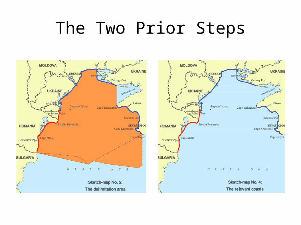
The Two Prior Steps
Precedents
Decisions of international courts only binding on those to whom addressed.
Nevertheless, play important role in jurisprudence and negotiations.
Several cases have generated a set of precedents.
May be difficult to apply.
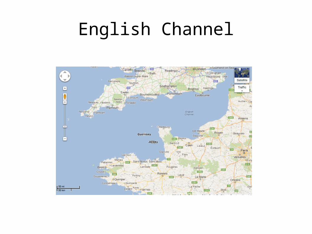
English Channel
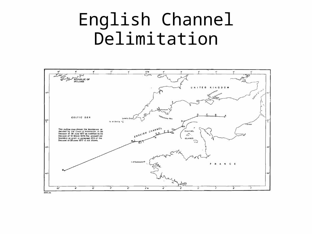
English Channel Delimitation
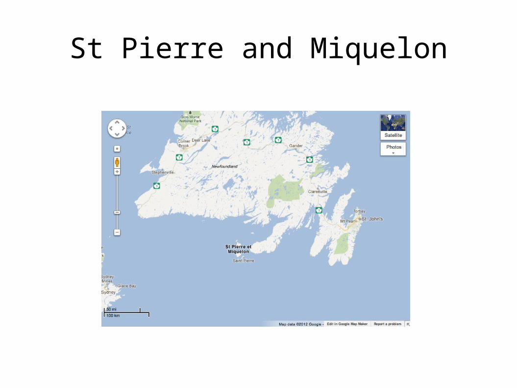
St Pierre and Miquelon
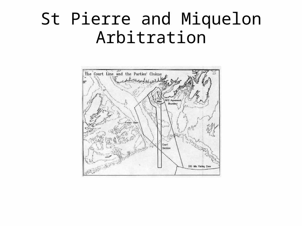
St Pierre and Miquelon Arbitration
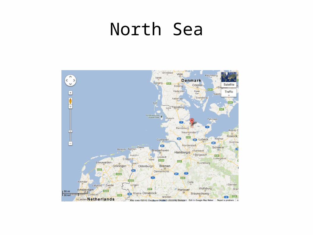
North Sea
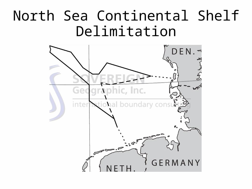
North Sea Continental Shelf Delimitation
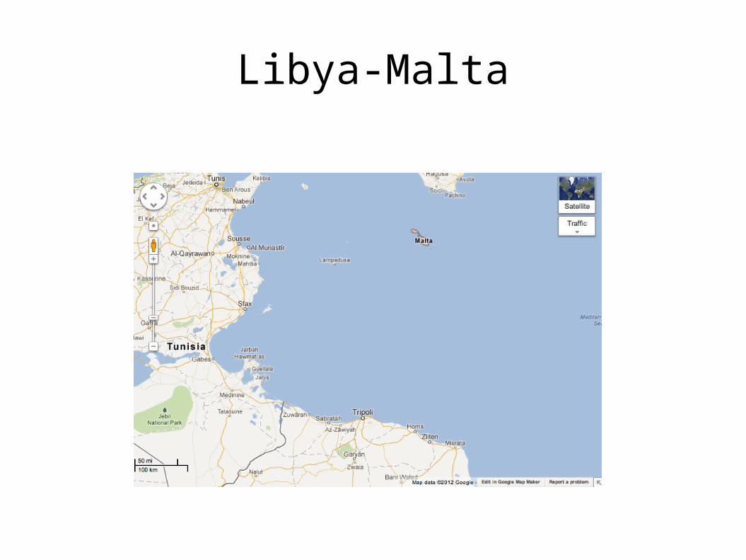
Libya-Malta
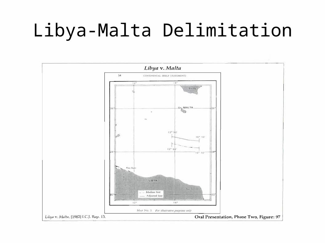
Libya-Malta Delimitation
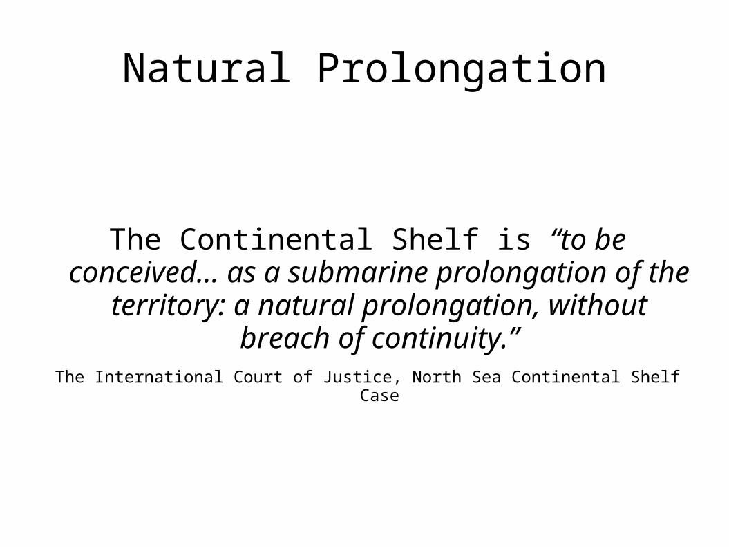
Natural Prolongation
The Continental Shelf is “to be conceived... as a submarine prolongation of the territory: a natural
prolongation, without breach of continuity.”The International Court of Justice, North Sea Continental Shelf Case
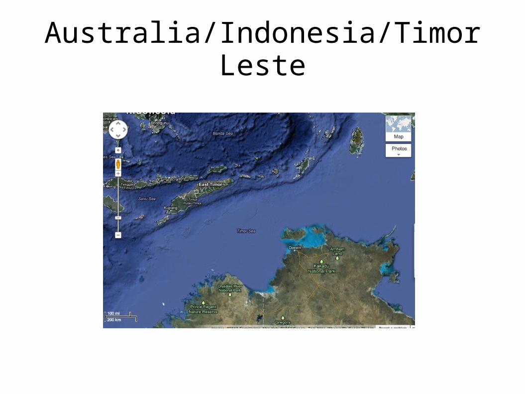
Australia/Indonesia/Timor Leste
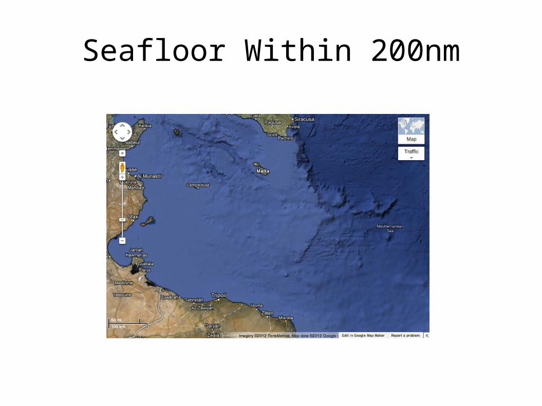
Seafloor Within 200nm

Natural Prolongation and Delimitation
Libya had argued geological principles. Court decided that distance-based zones meant
natural prolongation irrelevant within 200 nm. Did not say irrelevant beyond 200 nm. State practice has mostly treated geology as
irrelevant. Clarification in Bay of Bengal Case?
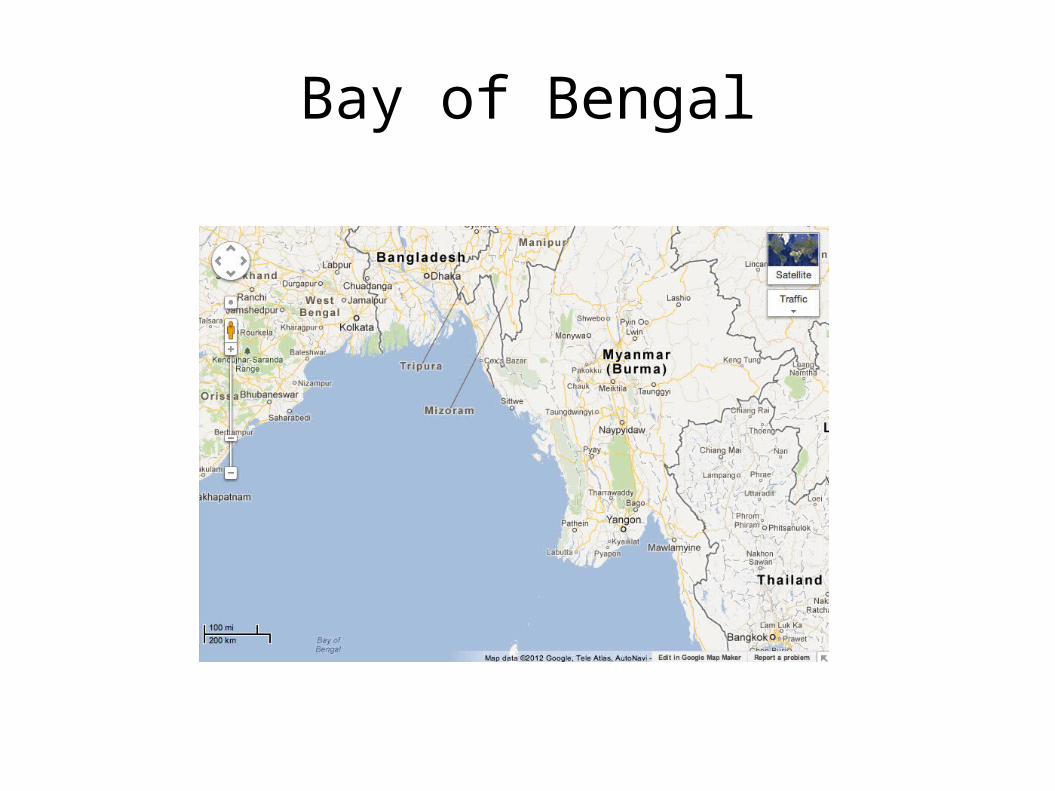
Bay of Bengal
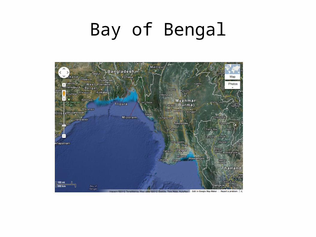
Bay of Bengal
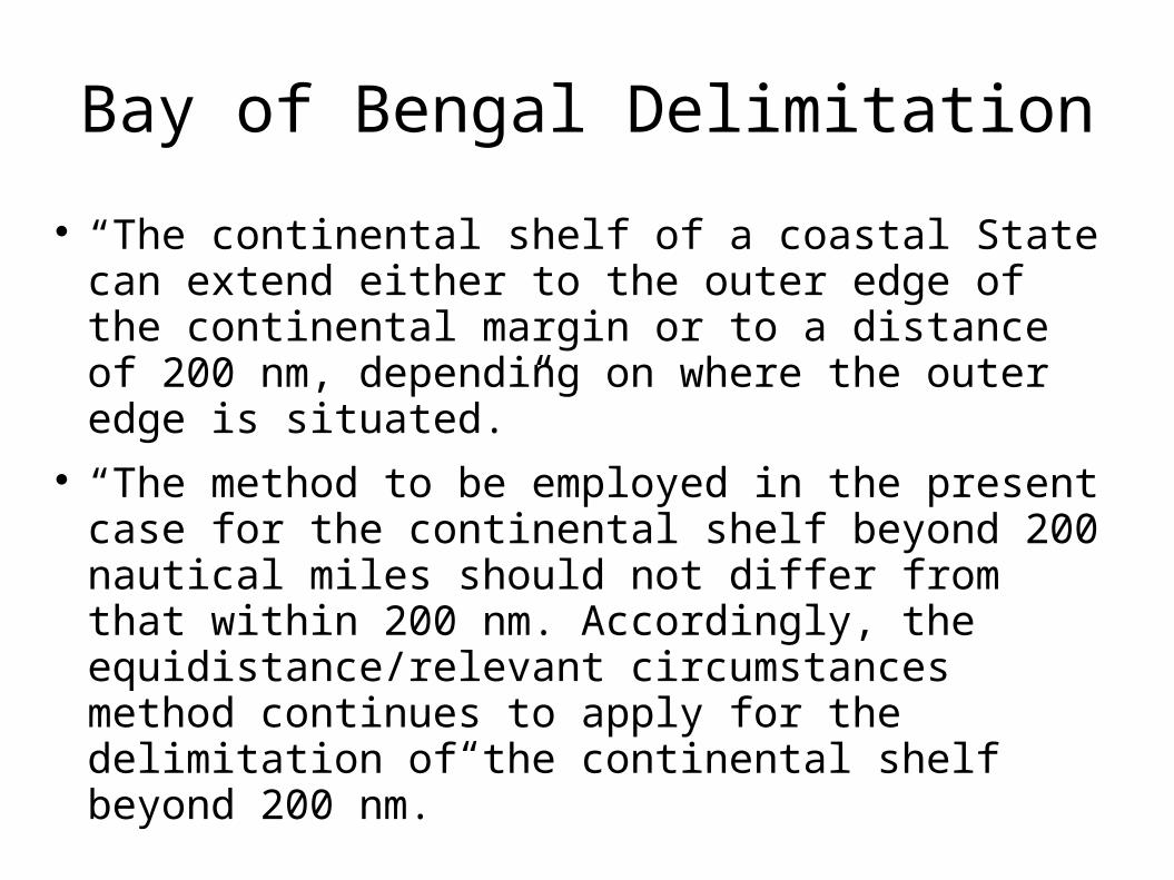
Bay of Bengal Delimitation
“The continental shelf of a coastal State can extend either to the outer edge of the continental margin or to a distance of 200 nm, depending on where the outer edge is situated.”
“The method to be employed in the present case for the continental shelf beyond 200 nautical miles should not differ from that within 200 nm. Accordingly, the equidistance/relevant circumstances method continues to apply for the delimitation of the continental shelf beyond 200 nm.”
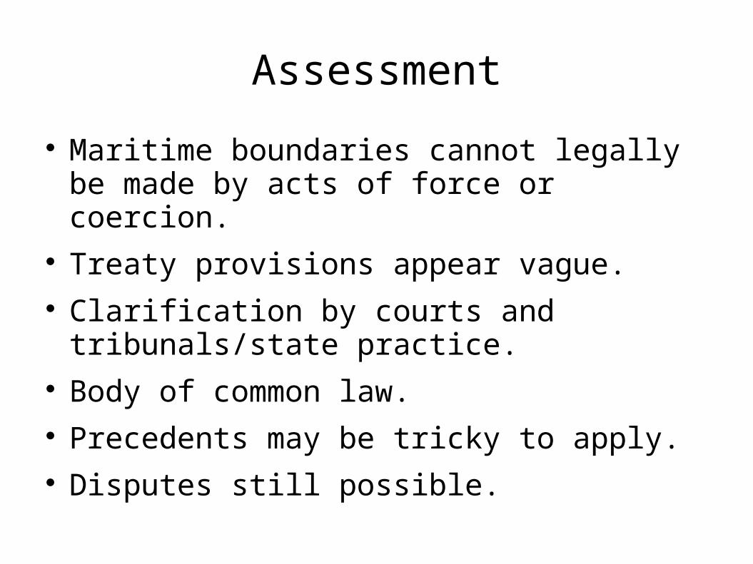
Assessment
Maritime boundaries cannot legally be made by acts of force or coercion.
Treaty provisions appear vague. Clarification by courts and tribunals/state
practice. Body of common law. Precedents may be tricky to apply. Disputes still possible.
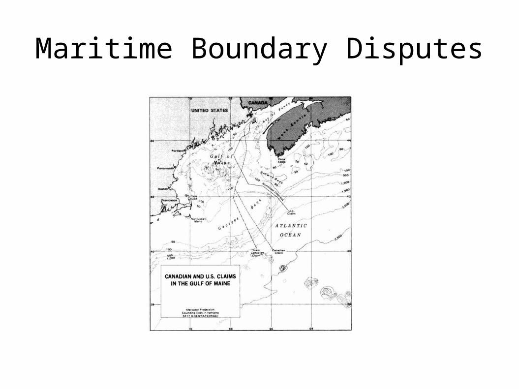
Maritime Boundary Disputes
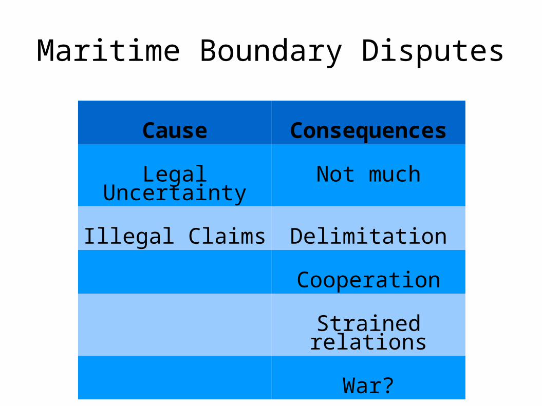
Maritime Boundary Disputes
Cause Consequences
Legal Uncertainty Not much
Illegal Claims Delimitation
Cooperation
Strained relations
War?
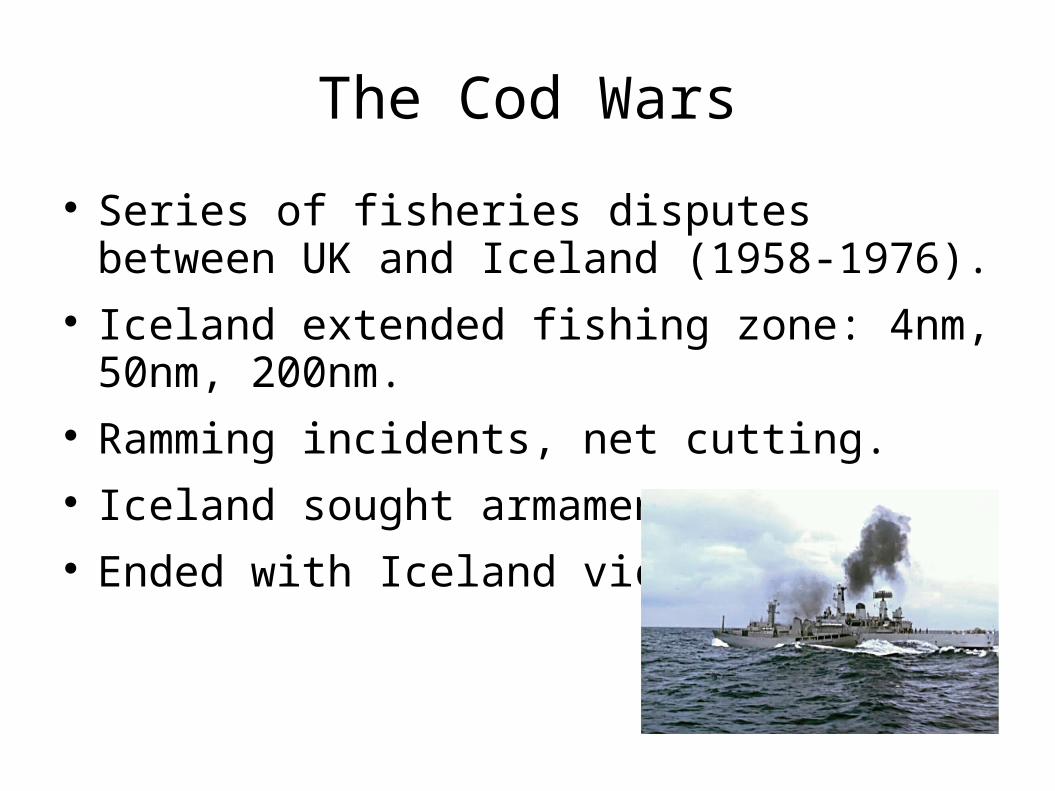
The Cod Wars
Series of fisheries disputes between UK and Iceland (1958-1976).
Iceland extended fishing zone: 4nm, 50nm, 200nm.
Ramming incidents, net cutting. Iceland sought armaments. Ended with Iceland victory.
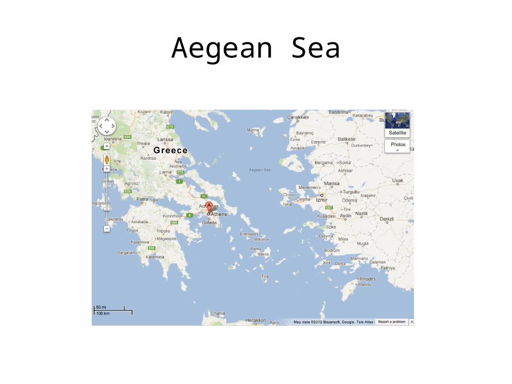
Aegean Sea
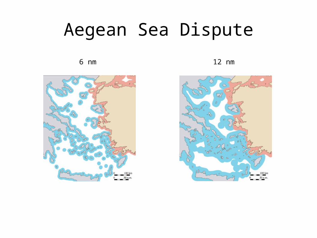
Aegean Sea Dispute
6 nm 12 nm
Aegean Sea Dispute
Currently 6 nm territorial sea. Concern that Greece could turn Aegean into
Greek Lake. Turkish Parliament: Greek extension act of war. Airspace dispute. Dogfights. Continental shelf dispute. English Channel
Case. Exploration led to military buildup in 70s and
80s.
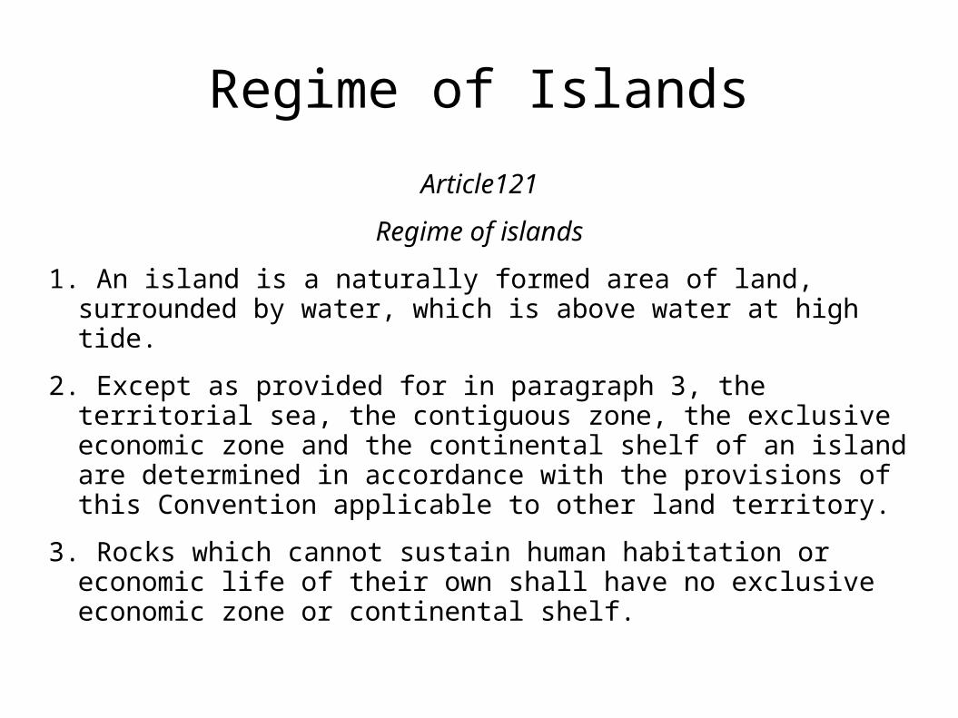
Regime of Islands
Article121
Regime of islands
1. An island is a naturally formed area of land, surrounded by water, which is above water at high tide.
2. Except as provided for in paragraph 3, the territorial sea, the contiguous zone, the exclusive economic zone and the continental shelf of an island are determined in accordance with the provisions of this Convention applicable to other land territory.
3. Rocks which cannot sustain human habitation or economic life of their own shall have no exclusive economic zone or continental shelf.
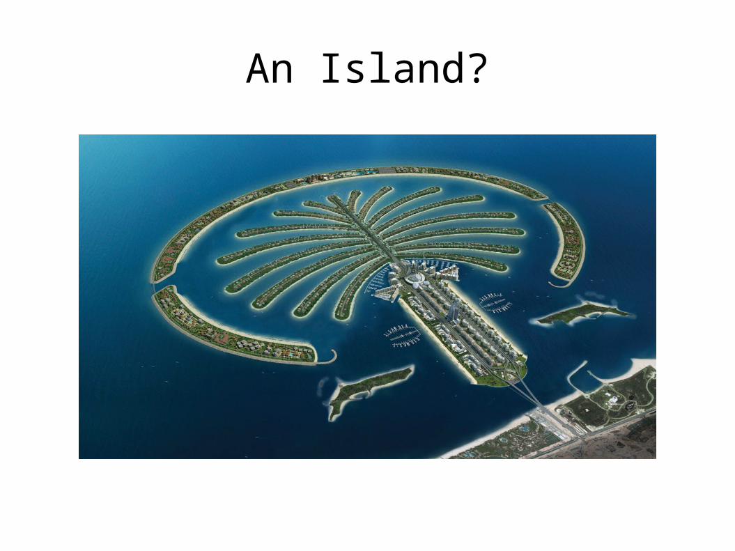
An Island?

A Rock
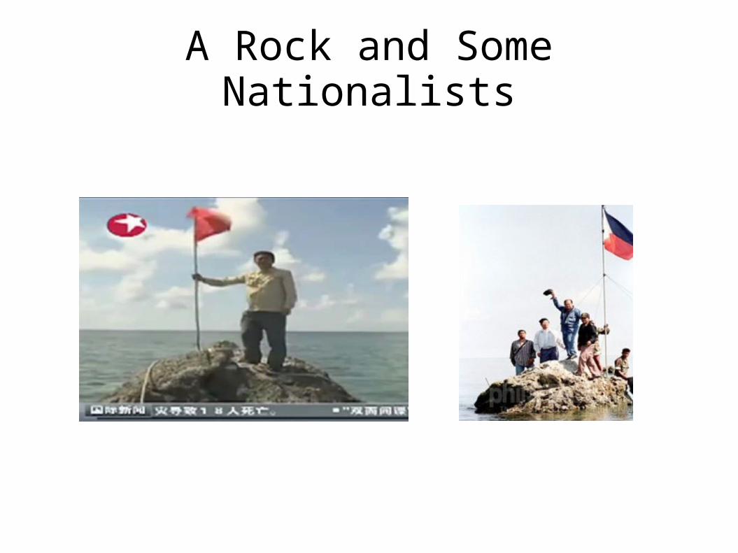
A Rock and Some Nationalists
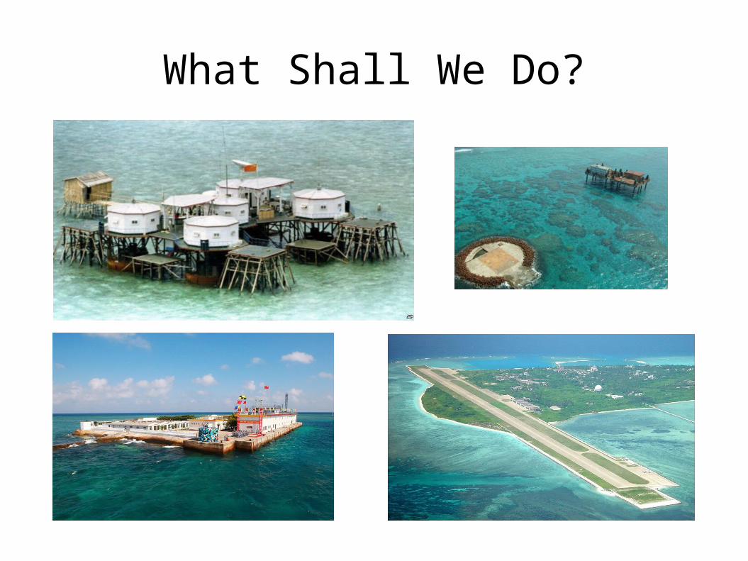
What Shall We Do?

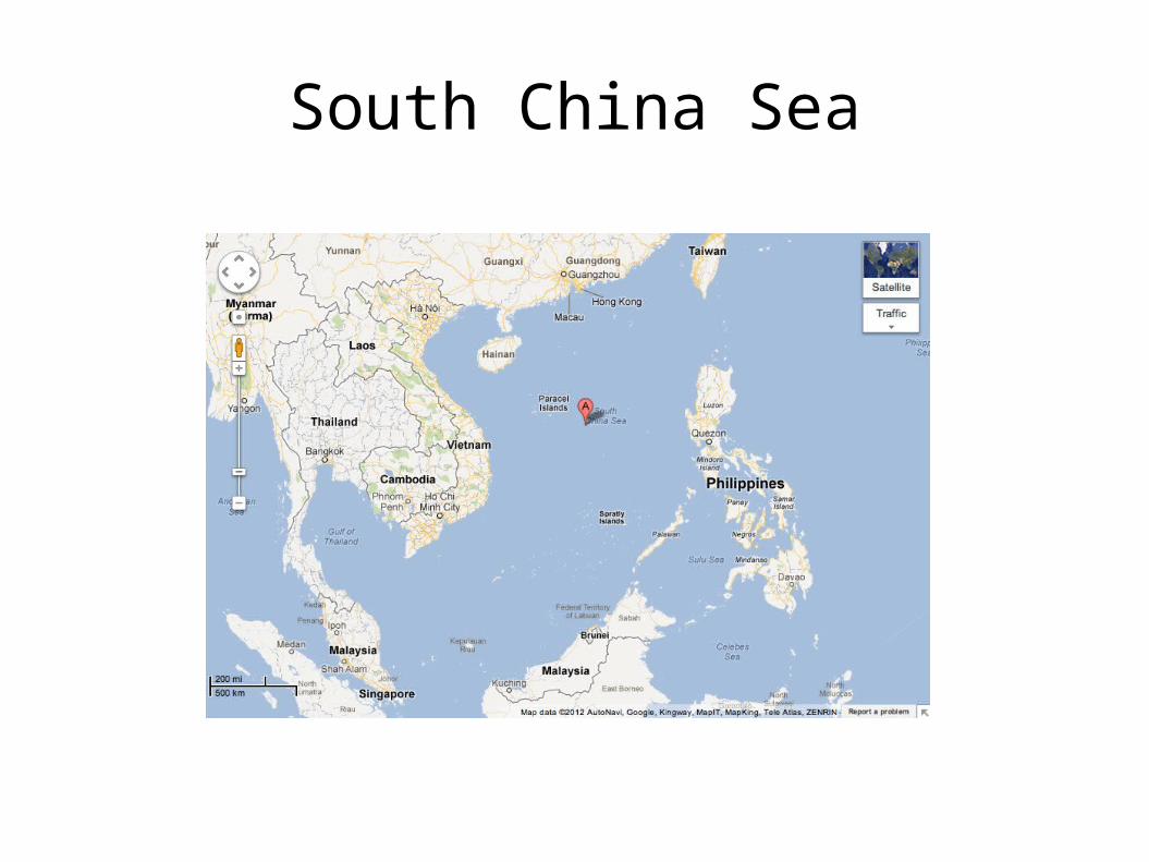
South China Sea

Coastal States and Claimants
People's Republic of China (and Taiwan). Vietnam. The Philippines. Malaysia. Brunei. Interested states: USA, Australia, Singapore,
Indonesia, India, other members of ASEAN.
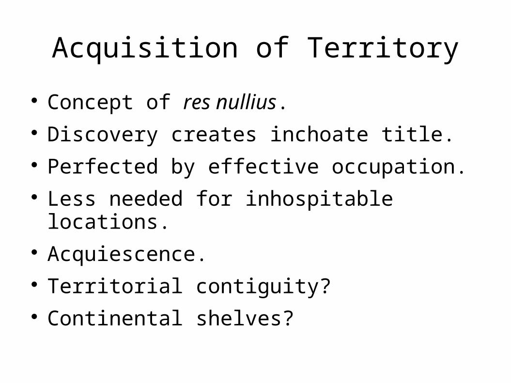
Acquisition of Territory
Concept of res nullius. Discovery creates inchoate title. Perfected by effective occupation. Less needed for inhospitable locations. Acquiescence. Territorial contiguity? Continental shelves?
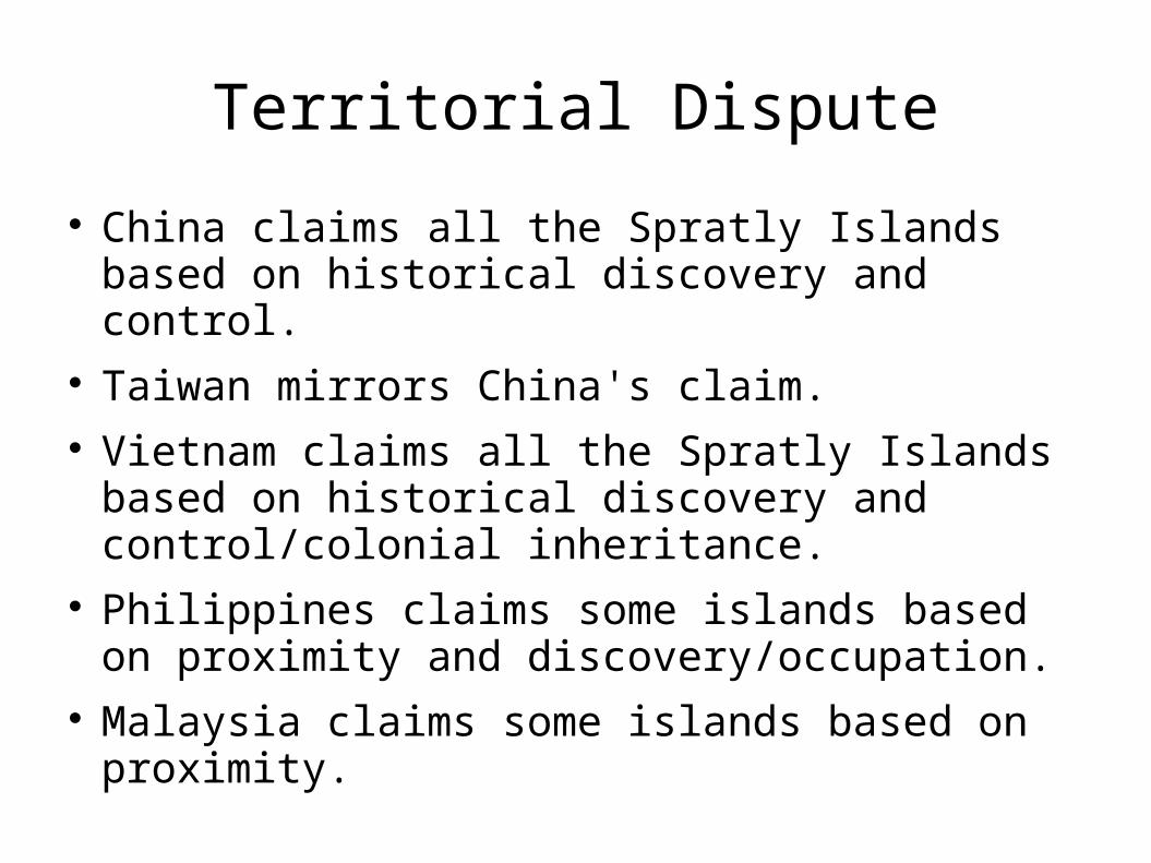
Territorial Dispute
China claims all the Spratly Islands based on historical discovery and control.
Taiwan mirrors China's claim. Vietnam claims all the Spratly Islands based on
historical discovery and control/colonial inheritance.
Philippines claims some islands based on proximity and discovery/occupation.
Malaysia claims some islands based on proximity.
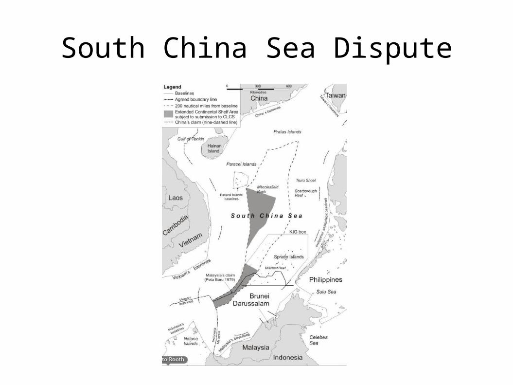
South China Sea Dispute
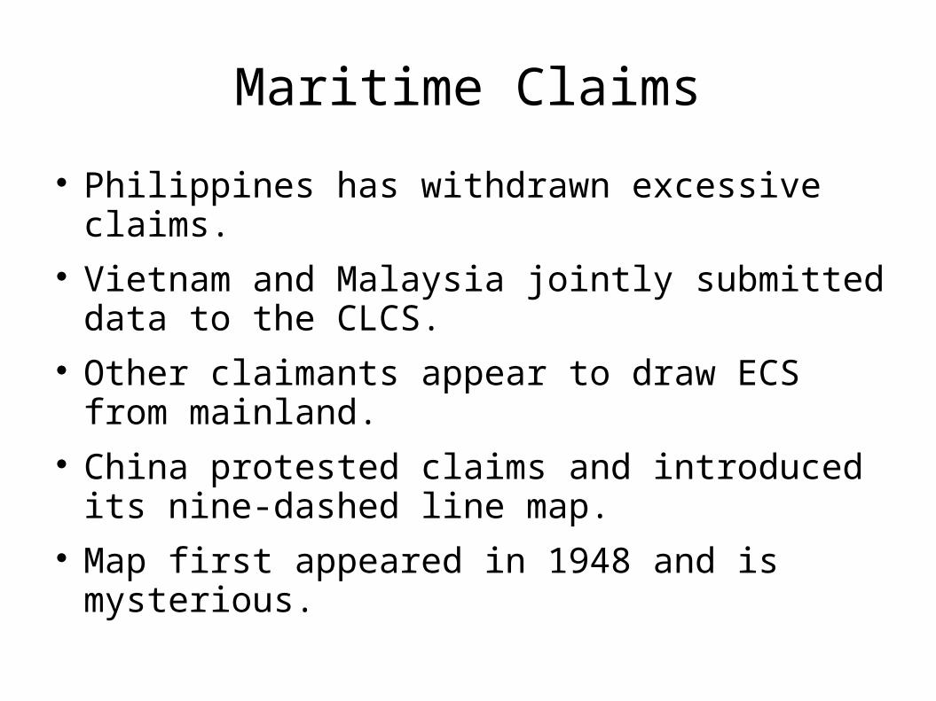
Maritime Claims
Philippines has withdrawn excessive claims. Vietnam and Malaysia jointly submitted data to
the CLCS. Other claimants appear to draw ECS from
mainland. China protested claims and introduced its nine-
dashed line map. Map first appeared in 1948 and is mysterious.
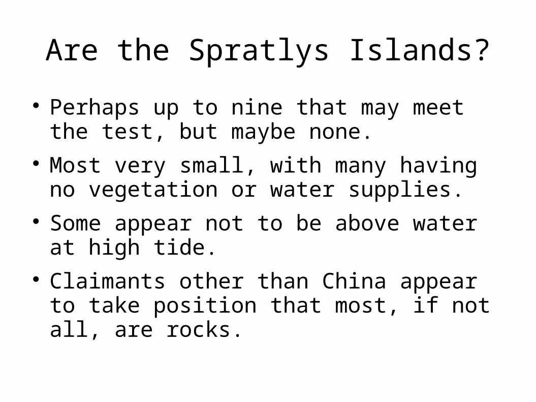
Are the Spratlys Islands?
Perhaps up to nine that may meet the test, but maybe none.
Most very small, with many having no vegetation or water supplies.
Some appear not to be above water at high tide.
Claimants other than China appear to take position that most, if not all, are rocks.
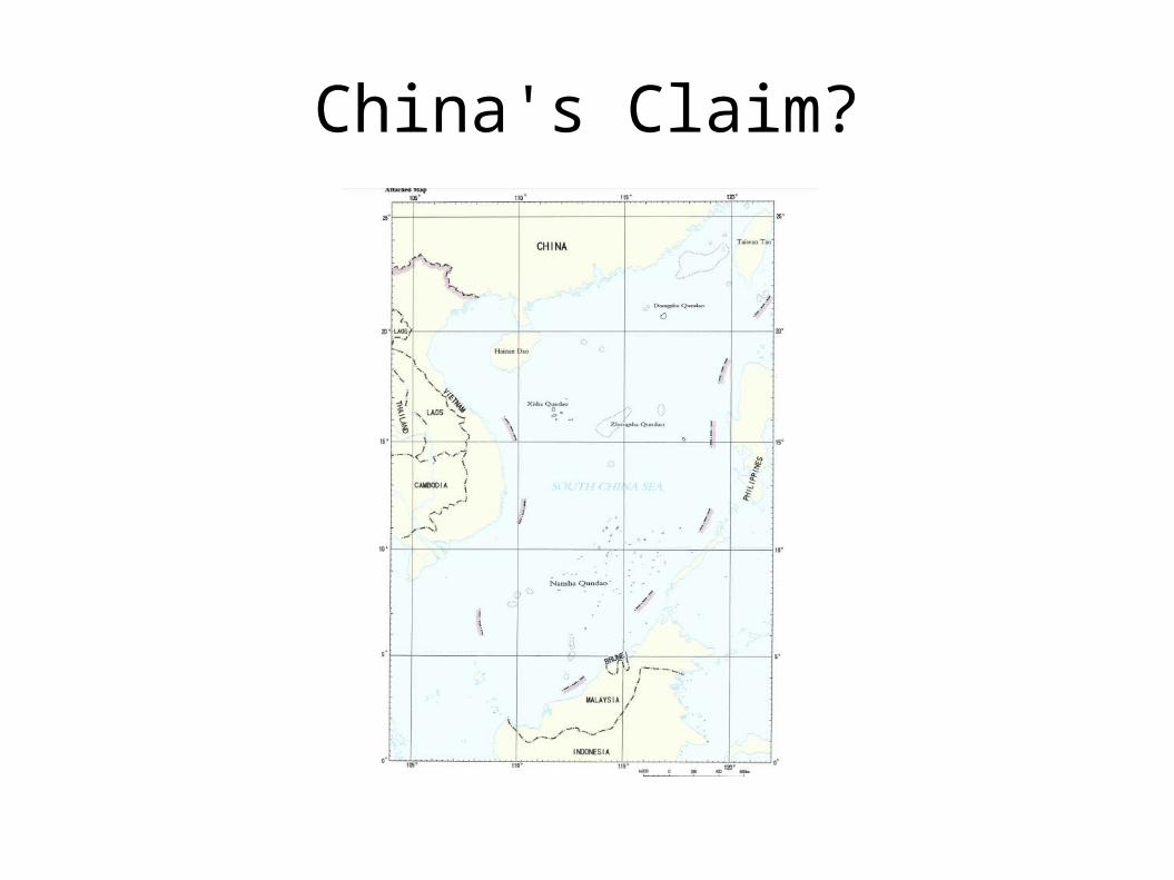
China's Claim?
China's Claim?
Historic waters? Territorial claim? Maritime boundary claim?
Taiwan's withdrawal of historic waters claim. China's ambiguous position. 2009 exchange of notes. Greater compliance with LOS from China?
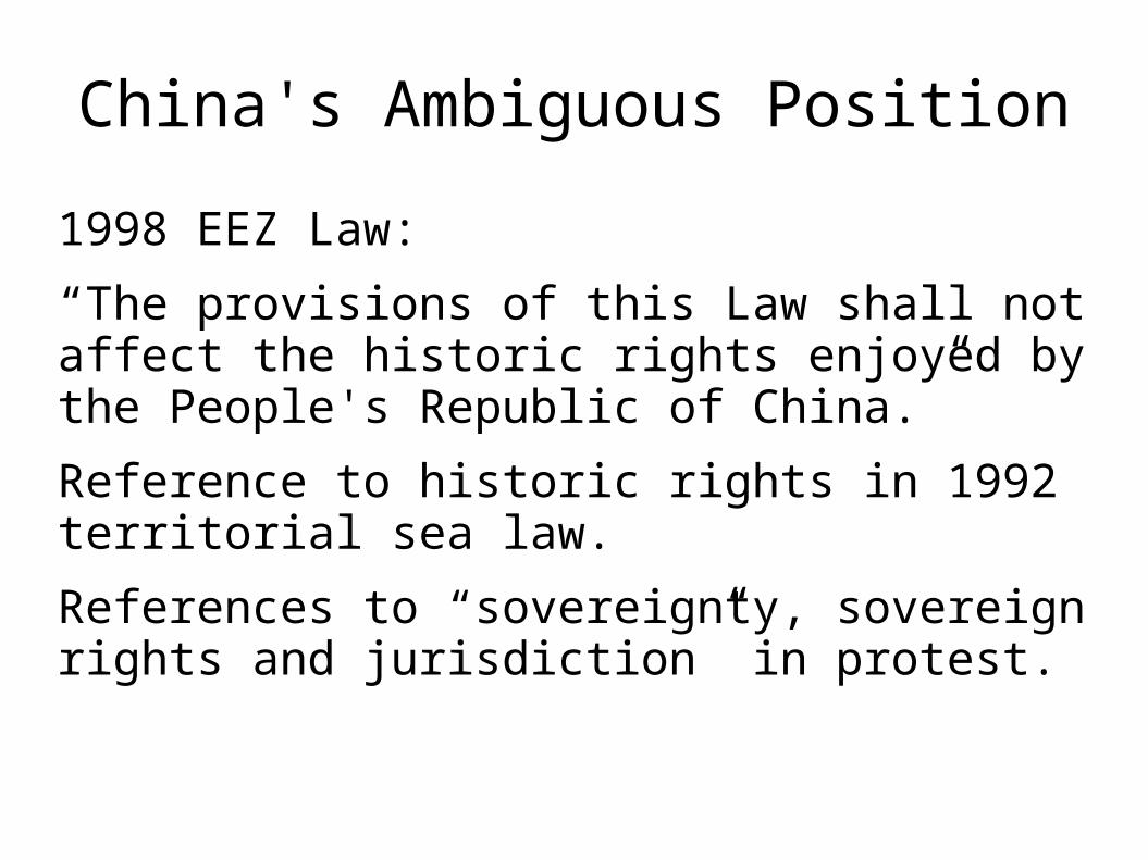
China's Ambiguous Position
1998 EEZ Law:
“The provisions of this Law shall not affect the historic rights enjoyed by the People's Republic of China.”
Reference to historic rights in 1992 territorial sea law.
References to “sovereignty, sovereign rights and jurisdiction” in protest.
China's Ambiguous Position
“Since 1930s, the Chinese Government has given publicity several times the geographical scope of China’s Nansha Islands and the names of its components. China’s Nansha Islands is therefore clearly defined. In addition, under the relevant provisions of the 1982 United Nations Convention on the Law of the Sea, as well as the Law of the People’s Republic of China on the Territorial Sea and the Contiguous Zone (1992) and the Law on the Exclusive Economic Zone and the Continental Shelf of the People’s Republic of China (1998), China’s Nansha Islands is fully entitled to Territorial Sea, Exclusive Economic Zone (EEZ) and Continental Shelf.”
(See attached map!!)
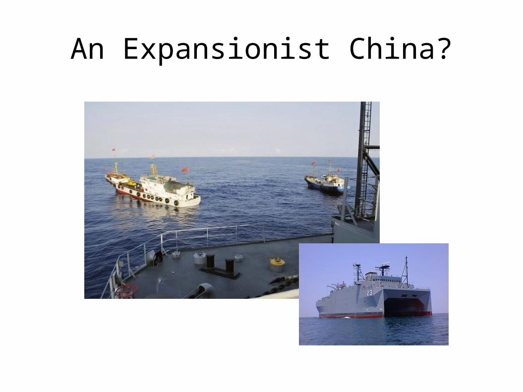
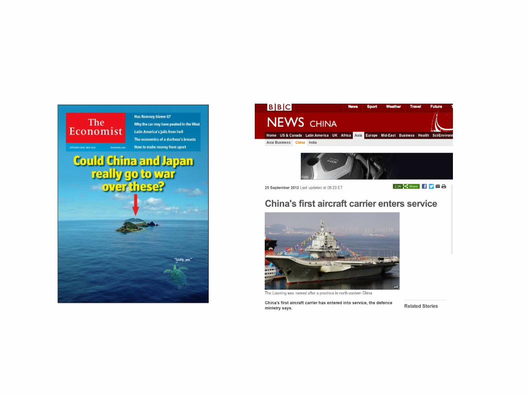
An Expansionist China?
Worrying Rhetoric?
China's Global Times stated that if “Vietnam wants to start a war, China has the confidence to destroy invading Vietnam battleships.”
Xinhua News Agency stated that China had the resolve to “protect every inch of its territories.”
PLA strategist in 2009 stated ambiguously and ominously that “boundaries of national interest,” rather than simply territorial boundaries would need to be defended to safeguard national security interests and future national development.
But MFA has taken a careful tone.
China's Assertions of Jurisdiction
Crestone Energy concession.
Promise to protect by force.
Mischief Reef incident.
2012 Scarborough Shoal Incident.
Involvement of fishing and marine surveillance vessels.
Non-involvement of PLA.
Others have made similar assertions, though.
Action-reaction dynamic.
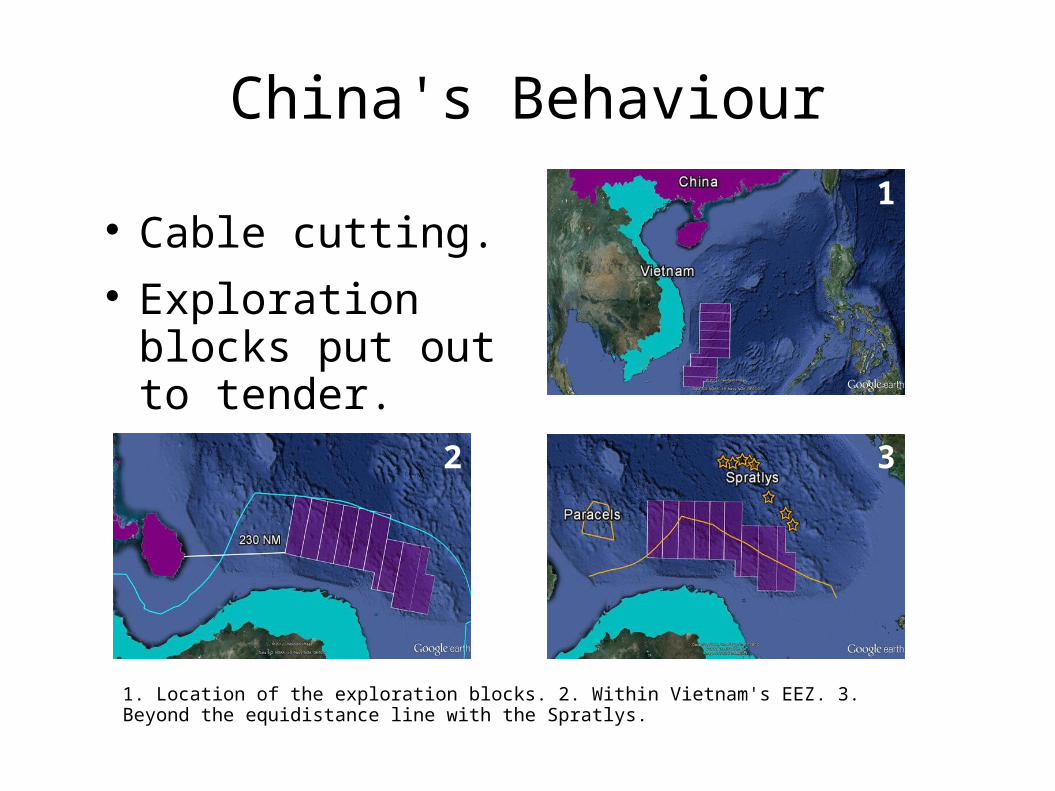
China's Behaviour
Cable cutting. Exploration blocks
put out to tender.
1
32
1. Location of the exploration blocks. 2. Within Vietnam's EEZ. 3. Beyond the equidistance line with the Spratlys.
The Strategies of the Claimants
Delegitimize China's claim. Balance within ASEAN. Draw in the United States. China's preference: negotiate bilaterally. Shelve disputes and develop resources jointly.
International Reaction
Indonesia efforts to broker a resolution. Singapore protested Chinese nine-dashed line
map. US refusal to take position on island dispute. Importance of free navigation. Demand to base rights on LOS.
Managing Disputes
Agree to disagree. Cooperate on submissions to CLCS. Litigation, arbitration or conciliation. Negotiate a delimitation. Joint development. Joint management.