ADB Settop Inst 1 - Northeast Missouri Rural Telephone Company

Mapping Rural AmericaA closer look at today’s location data
Jim Stegeman, President/CEO
June 2019

AGENDA
• Introduction• Problem• Definitions• Where we are now • Proposed solution• Timeline• Q&A
Property of CostQuest Associates. Any use without permission is prohibited 2

Founded in 1999, CostQuest Associates is internationally
recognized as the leading telecommunication network
modeling, costing and profitability expert. We deliver
comprehensive solutions to complicated business challenges.
These robust solutions reflect the highly specific needs of your
business, including the impact of financial, economic, and
regulatory environments.
CostQuest Associates Cincinnati ~ Seattle ~ Washington D.C.
GIS & MappingWe utilize Geographic Information Systems (GIS) and tools to develop geographic data, and perform spatial programming.
Data & MetricsWe develop useful and unique data sets and provide business intelligence to enable you to make informed decisions.
Economic Network ModelingOur Economic Network Modeling solutions are activity-based and are economically rational ways to measure and manage profitability.
Policy SupportOur Universal Service Models are in use around the world and our policy support cover nearly all regulatory issues facing the this industry.
Valuation & AppraisalOur valuation, appraisal, and tax support services are developed and applied in the real world and have been accepted in nearly every state.

Property of CostQuest Associates. Any use without permission is prohibited 4
• What is the truth?• Reported coverage
is not granular & is difficult to audit
• Reported covered areas aren’t served locations
• Unserved locations still unknown
• Rural information hardest to ascertain
• Where are federal funds needed most?
PROBLEM – Which Americans still need Broadband?

Property of CostQuest Associates. Any use without permission is prohibited 5
• Address: Textual reference for a location (name on a map)• CAF: Connect America Fund, one of the Universal Service Administrative Company
(USAC) initiatives• Geocoder: A tool that (usually) converts an address into a set of latitude + longitude• HUBB: High Cost Universal Broadband, the portal where CAF awardees must file their
progress (geocoded locations served, etc.)• Location: A residential or business structure • Parcel: A plot of land, with boundaries, legally owned by an individual or entity• Parcel Attributes: Qualities of a parcel such as land use, property value, etc. • Parcel Centroid: The geometric middle of a parcel
DEFINITIONS
Property of CostQuest Associates. Any use without permission is prohibited 6
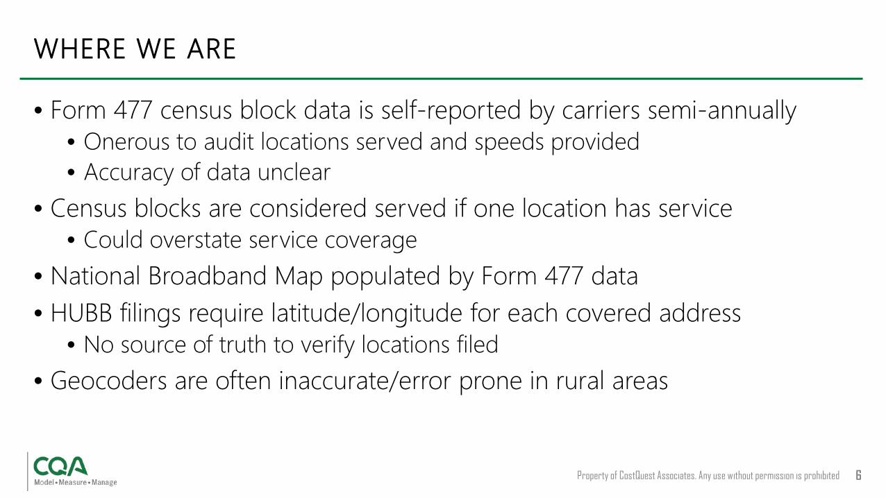
• Form 477 census block data is self-reported by carriers semi-annually• Onerous to audit locations served and speeds provided• Accuracy of data unclear
• Census blocks are considered served if one location has service• Could overstate service coverage
• National Broadband Map populated by Form 477 data• HUBB filings require latitude/longitude for each covered address
• No source of truth to verify locations filed • Geocoders are often inaccurate/error prone in rural areas
WHERE WE ARE
Property of CostQuest Associates. Any use without permission is prohibited 7
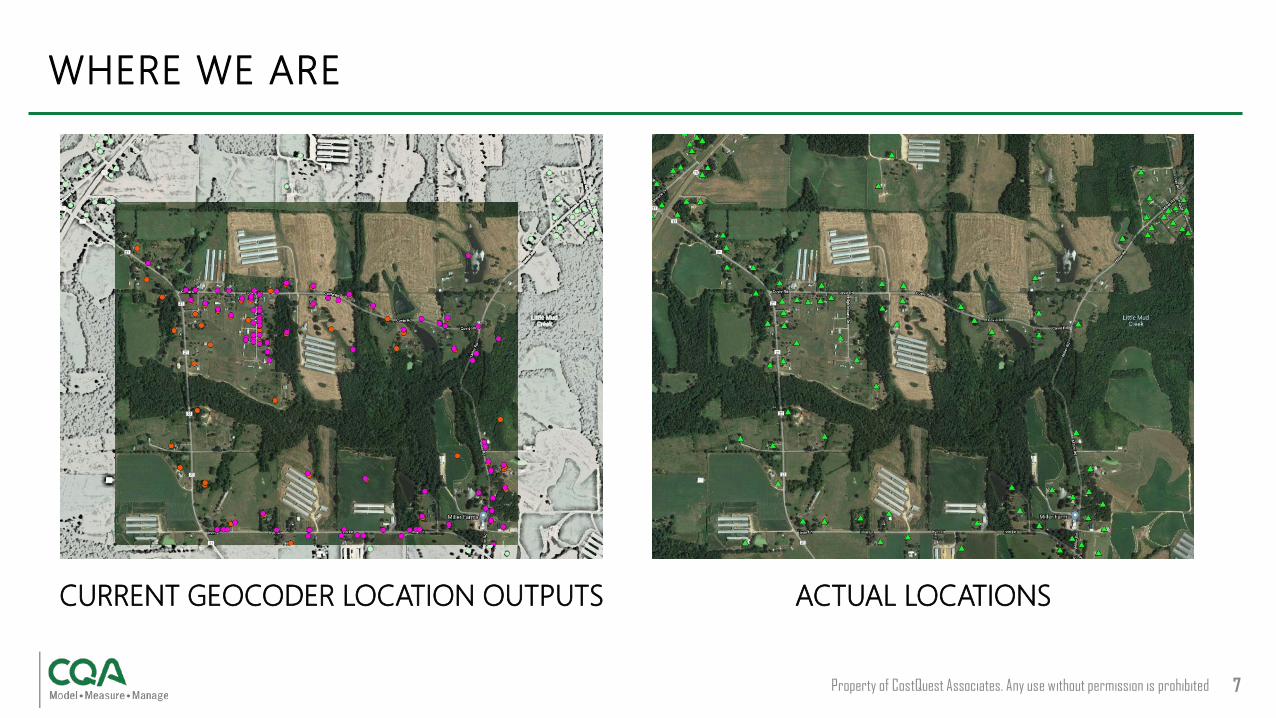
CURRENT GEOCODER LOCATION OUTPUTS
WHERE WE ARE
ACTUAL LOCATIONS

Property of CostQuest Associates. Any use without permission is prohibited. 8
• Sub Census Block – Addresses and/or Polygons• Addresses
• Carrier data often non-existent in unserved areas• Addresses can have quality issues (ex. some locations are non-addressable)• Geocoding output is non-standard, often miss non-addressable locations
• Polygons• Carriers do not always maintain polygons• Standards do not exist for the creation and interpretation• Polygons alone do not inform on served and unserved locations• Polygon creation dependent on quality network and/or address data• Polygons delink from a unit of known demand – the Census Block
Addresses and polygons both require an underlying dataset of precise Latitude and Longitude of all locations
WHERE WE ARE GOING - Issues we have heard

PROPOSED SOLUTION

Property of CostQuest Associates. Any use without permission is prohibited 10
Broadband Service Location Fabric “the Fabric”• Precise coordinates (geo-coded) for all serviceable locations• Creates visibility in rural America to drive targeted subsidy fund
allocation at a Sub Census Block level• Can support # of locations & where they are• Can support which locations are served/unserved• Enables the FCC to audit Form 477 data accuracy at granular level
PROPOSED SOLUTION
Property of CostQuest Associates. Any use without permission is prohibited 11
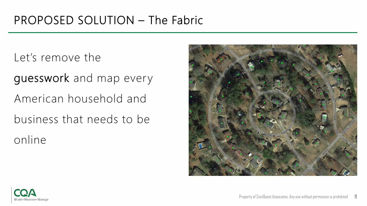
PROPOSED SOLUTION – The Fabric
Let’s remove the
guesswork and map every
American household and
business that needs to be
online

Property of CostQuest Associates. Any use without permission is prohibited 12
PROPOSED SOLUTION – The Fabric

Property of CostQuest Associates. Any use without permission is prohibited. 13
• Identifying and remedying the lack of broadband at a granular level will require information to translate what an address means
• Addresses are important, but by themselves, they are not objective locations• What about new addresses, addresses never served, addresses in areas with no
providers?• The Fabric and an Address Catalog are complimentary
• Georeferenced locations in the Fabric are needed to provide a granular view of broadband areas and gaps
• Addresses are needed to give the locations a frame of reference and bridge to other systems
PROPOSED SOLUTION – The Fabric

HOW IT WORKS

Property of CostQuest Associates. Any use without permission is prohibited 15
• Goal: Identify the structure(s) needing service
• Challenges:• Secondary structures (chicken
coops, barns, garages, etc.)• Addresses aren’t
automatically geocoded
THE FABRIC – How it works

Property of CostQuest Associates. Any use without permission is prohibited 16
• Step 1:• Overlay parcel data• Use Tax Assessor and parcel
attribute data to categorize parcels
• Are there multiple locations?• Does the land use indicate there
may be a serviceable structure?• Consider improvement value,
information on secondary structures, etc.
THE FABRIC – How it works
Property of CostQuest Associates. Any use without permission is prohibited 17
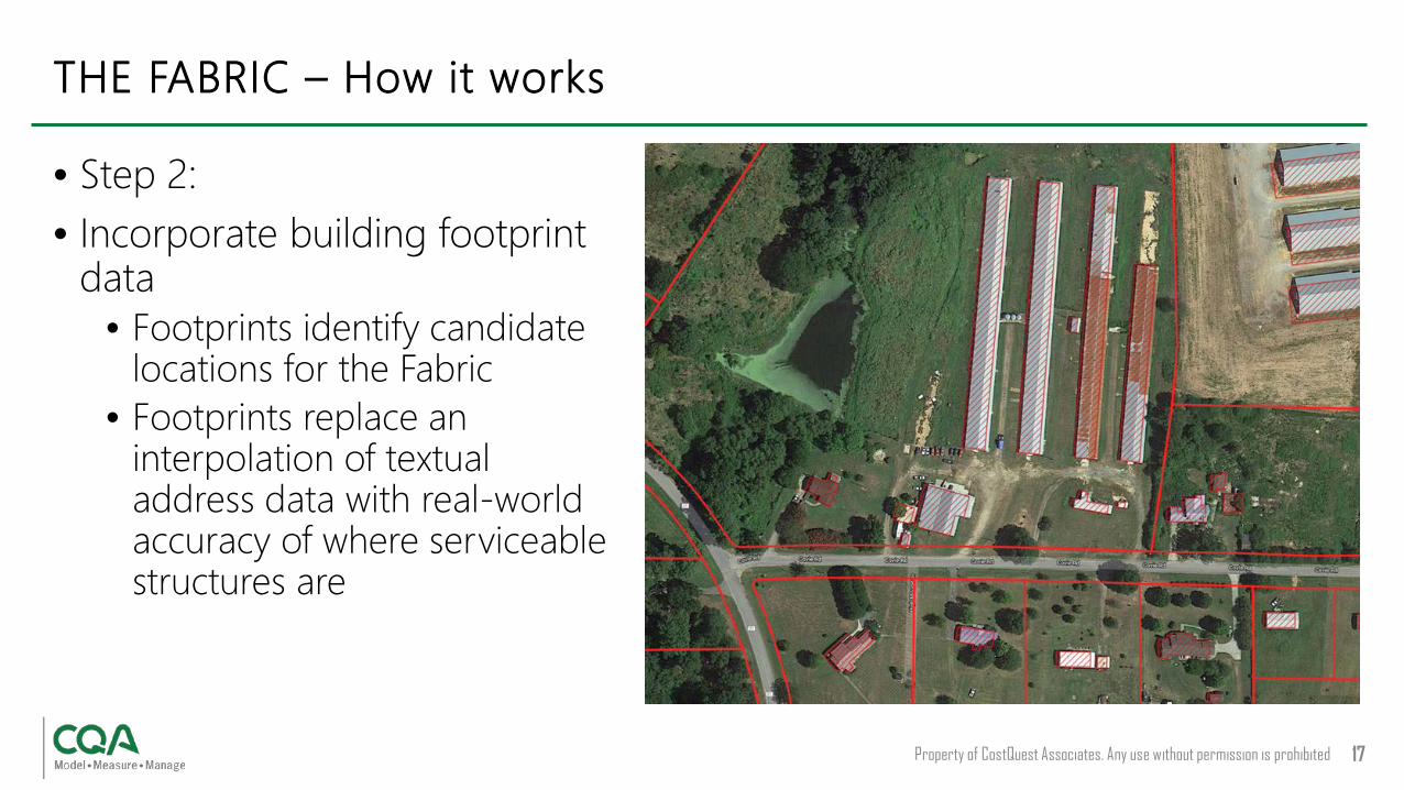
• Step 2:• Incorporate building footprint
data• Footprints identify candidate
locations for the Fabric• Footprints replace an
interpolation of textual address data with real-world accuracy of where serviceable structures are
THE FABRIC – How it works
Property of CostQuest Associates. Any use without permission is prohibited 18
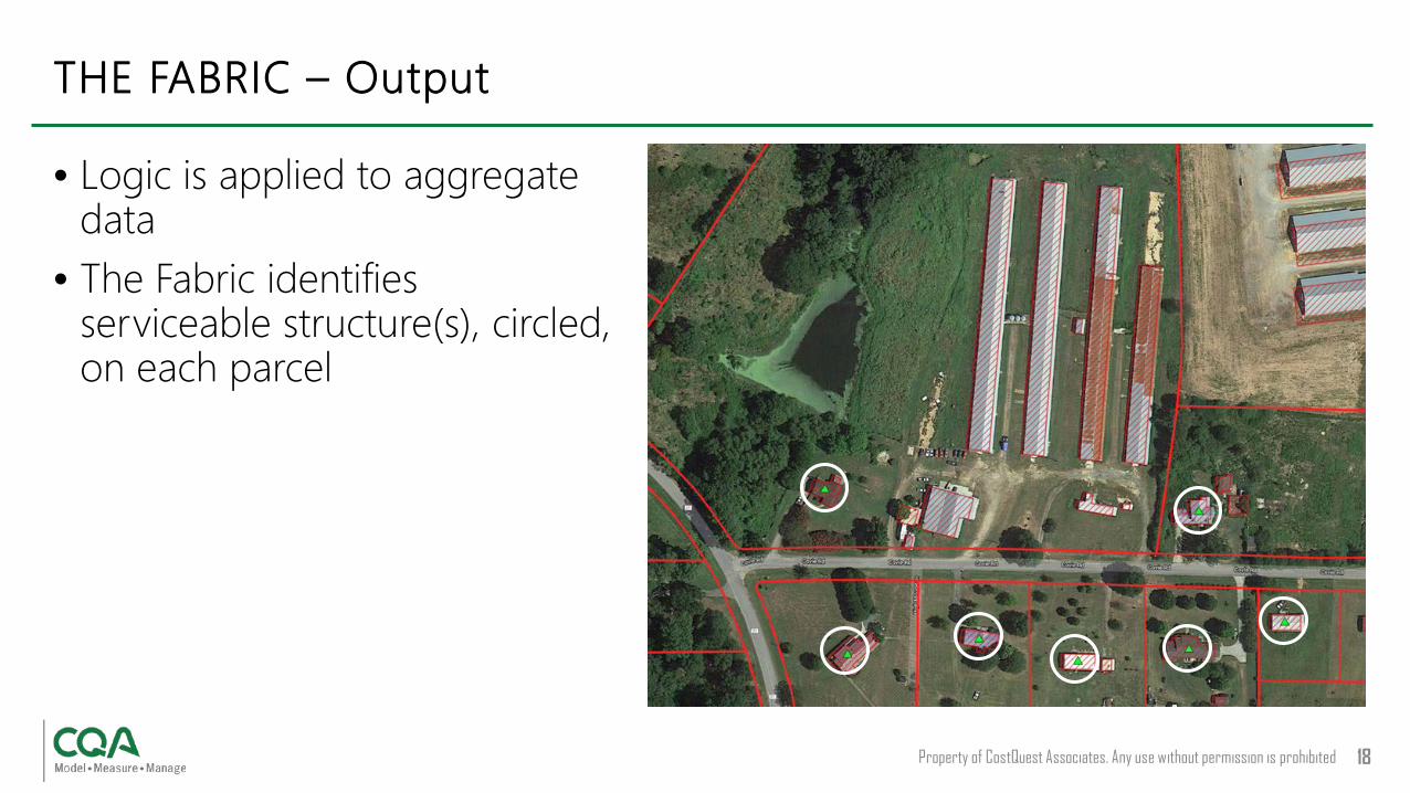
• Logic is applied to aggregate data
• The Fabric identifies serviceable structure(s), circled, on each parcel
THE FABRIC – Output
Property of CostQuest Associates. Any use without permission is prohibited 19
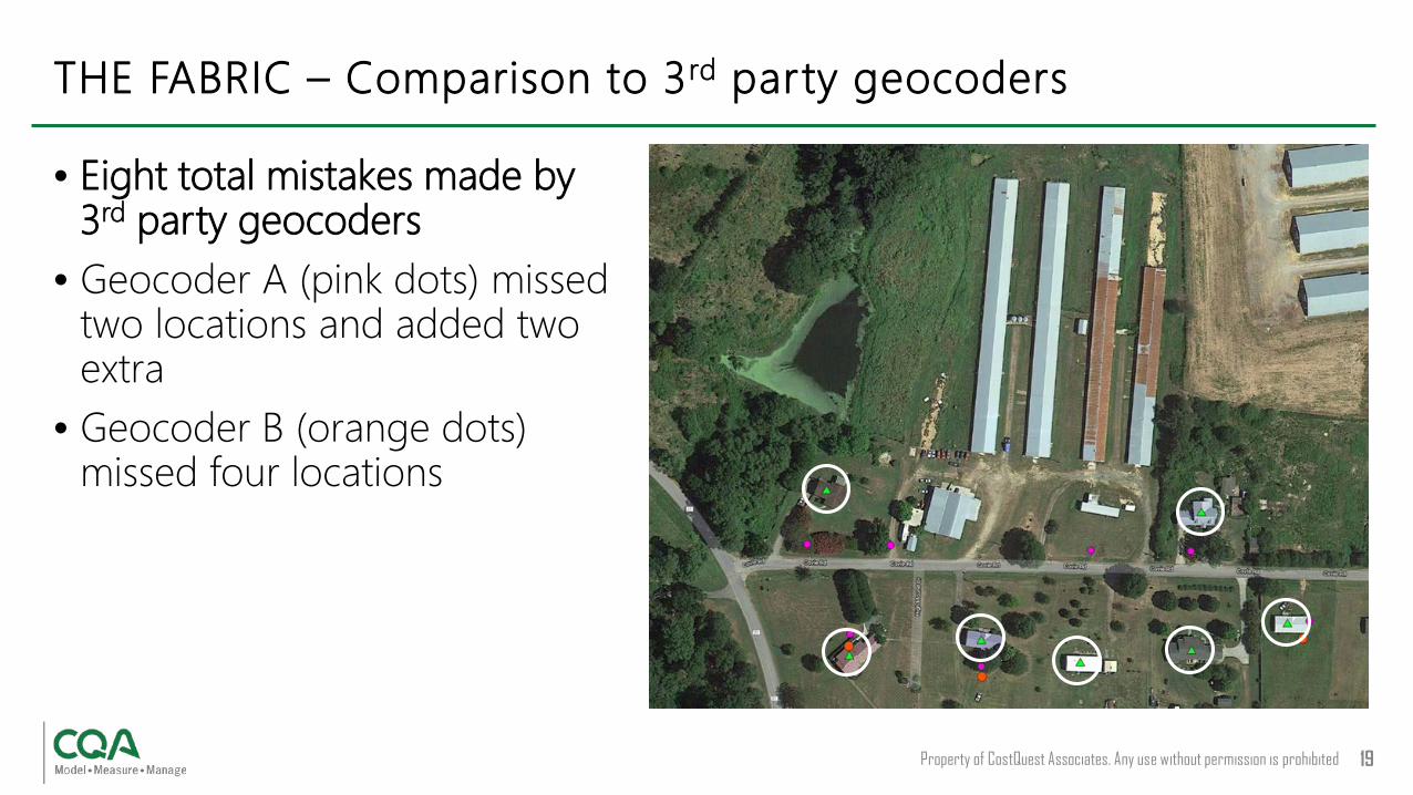
• Eight total mistakes made by 3rd party geocoders
• Geocoder A (pink dots) missed two locations and added two extra
• Geocoder B (orange dots) missed four locations
THE FABRIC – Comparison to 3rd party geocoders

TIMELINE
Property of CostQuest Associates. Any use without permission is prohibited 21
• Proof of Concept – Late Summer• Commercial Beta (Select locations) – Q1 ’20• Nationwide Commercial Launch – Q2 ‘20• Governmental Availability – Q3 '20
TIMELINE

Q&A

APPENDIX

DATA SOURCES

Property of CostQuest Associates. Any use without permission is prohibited. 26
DATA SOURCES - Single data source is not sufficient

Property of CostQuest Associates. Any use without permission is prohibited 27
Parcels (Polygons of land records)
• Sources:• Public: collection is at the county level, some free• Third-party: some nearly complete (151M plus)
• Issues:• Captures all land records, not only those
requiring service• Parcels vary in density (e.g., apt. complex)• Some locations span multiple parcels
Imagery / Commercial Footprints(Polygons of structures)
• Sources:• Public: Microsoft dataset (125M rooftops)• Third-party: some nearly complete (169M plus)
• Issues:• Captures all buildings, not only those requiring
service• May not capture address or structure type
DATA SOURCES

Property of CostQuest Associates. Any use without permission is prohibited 28
Tax Attributes(Characteristics from property tax records)
• Sources:• Public: collection is at the county level, some free• Third-party: some nearly complete (all counties)
• Issues:• Captures all taxable locations, not only those
requiring service• Key attribute is landuse, which needs to be cleaned
up
Address Datasets(Addresses, some georeferenced)
• Sources:• Public: OpenAddress (175M to date)• Carrier Submissions• Third-party sources
• Issues:• Not all addresses represent a service location• Some service locations do not have an address• Geocoding may be required
DATA SOURCES

Property of CostQuest Associates. Any use without permission is prohibited 29
Roads(Used to interpolate addresses)
• Sources:• Public: Tiger• Third-party sources
• Issues• Does not provide specific address, simply a range
DATA SOURCES
Property of CostQuest Associates. Any use without permission is prohibited. 30
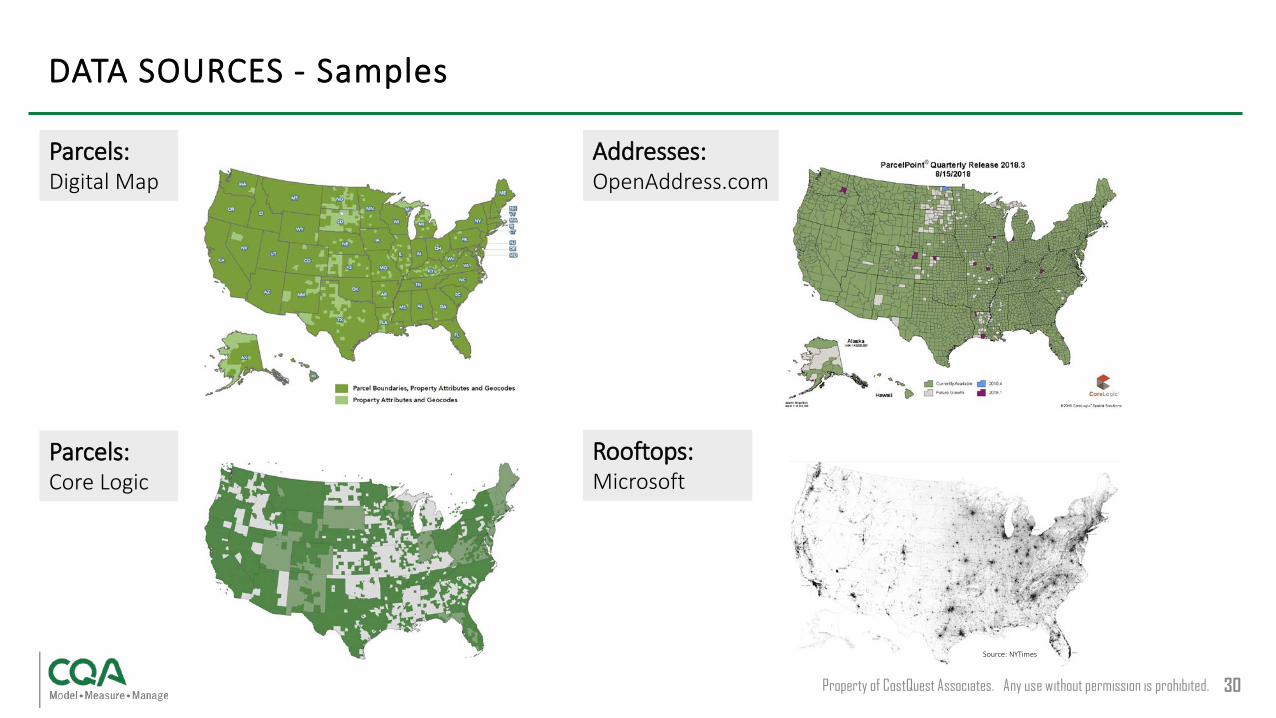
DATA SOURCES - Samples
Parcels:Digital Map
Parcels:Core Logic
Addresses:OpenAddress.com
Rooftops:Microsoft
Source: NYTimes

HOW IT WORKS
Property of CostQuest Associates. Any use without permission is prohibited. 32
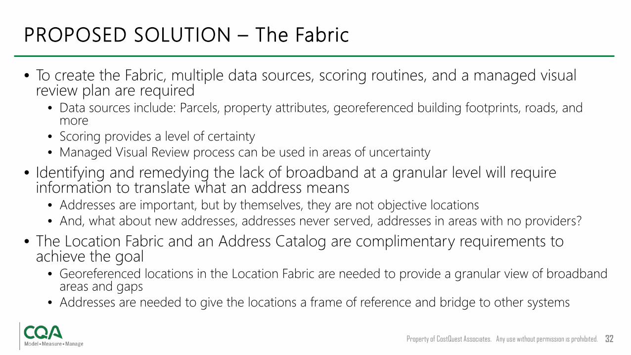
• To create the Fabric, multiple data sources, scoring routines, and a managed visual review plan are required
• Data sources include: Parcels, property attributes, georeferenced building footprints, roads, and more
• Scoring provides a level of certainty• Managed Visual Review process can be used in areas of uncertainty
• Identifying and remedying the lack of broadband at a granular level will require information to translate what an address means
• Addresses are important, but by themselves, they are not objective locations• And, what about new addresses, addresses never served, addresses in areas with no providers?
• The Location Fabric and an Address Catalog are complimentary requirements to achieve the goal
• Georeferenced locations in the Location Fabric are needed to provide a granular view of broadband areas and gaps
• Addresses are needed to give the locations a frame of reference and bridge to other systems
PROPOSED SOLUTION – The Fabric
Property of CostQuest Associates. Any use without permission is prohibited. 33
• While scoring routines against various forms of data can guarantee some certainty, there will be areas of the country that need a review by a human to provide certainty
• Our Managed Visual Review method is a crowd sourced labor approach• Managed Visual Review is a process of using various managed human resources (including crowd labor) to visually
inspect, and/or review specified data• Can be used in areas of uncertainty and provide an acceptable quality level• Can be used to test overall quality• Can be used to form the basis of machine learning• Provides an unbiased result
• Caveat: while Managed Visual Review is critical to addressing uncertainty, it needs to be weighed against potential cost
• Higher certainty pushes the need for greater review• Components of potential cost:
• 150 million: parcels in the U.S.• xx%: parcels that need review• ?? Number of uncertain grids to review• ~$0.10 - $0.25: Cost to apply Managed Visual Review of a single parcel
• Note: any manual human modification needs to result in traceable actions
PROPOSED SOLUTION – Managed visual review
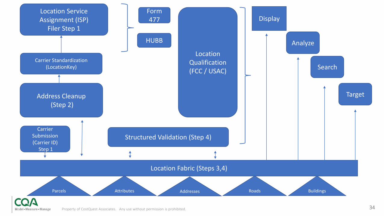
Address Cleanup(Step 2)
Location Qualification (FCC / USAC)
Display
HUBB
Form 477
Analyze
Carrier Submission (Carrier ID)
Step 1
Carrier Standardization (LocationKey)
Location Service Assignment (ISP)
Filer Step 1
Location Fabric (Steps 3,4)
Structured Validation (Step 4)
Parcels Addresses Buildings
Search
Target
Attributes Roads
34Property of CostQuest Associates. Any use without permission is prohibited.

ADDITIONAL SAMPLES

Property of CostQuest Associates. Any use without permission is prohibited 36
• Small farm with many buildings of varying sizes
• Need to correctly identify nearby primary serviceable structures
• Example: house with a pool (circled)
APPENDIX – Additional Samples
Property of CostQuest Associates. Any use without permission is prohibited 37
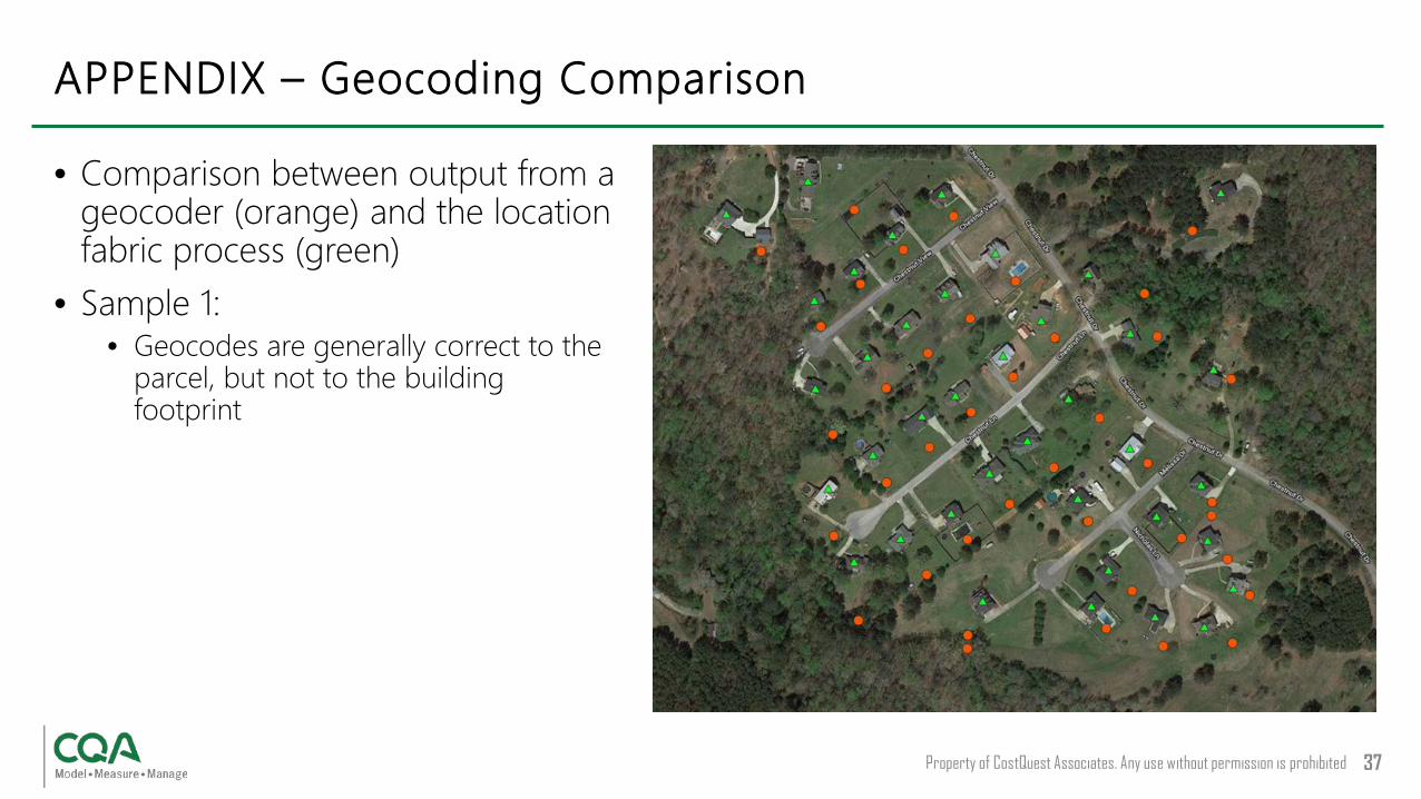
• Comparison between output from a geocoder (orange) and the location fabric process (green)
• Sample 1:• Geocodes are generally correct to the
parcel, but not to the building footprint
APPENDIX – Geocoding Comparison

Property of CostQuest Associates. Any use without permission is prohibited 38
• Comparison between output from a geocoder (orange) and the location fabric process (green)
• Sample 2:• Geocodes are in the appropriate area,
but the locations are not ideal
APPENDIX – Geocoding Comparison
Property of CostQuest Associates. Any use without permission is prohibited 39
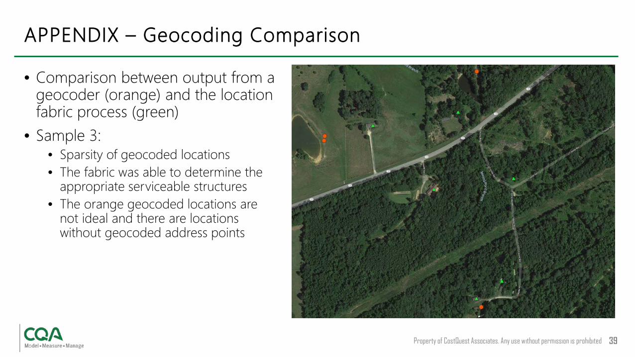
• Comparison between output from a geocoder (orange) and the location fabric process (green)
• Sample 3:• Sparsity of geocoded locations• The fabric was able to determine the
appropriate serviceable structures• The orange geocoded locations are
not ideal and there are locations without geocoded address points
APPENDIX – Geocoding Comparison

Property of CostQuest Associates. Any use without permission is prohibited 40
• Comparison between output from a geocoder (orange) and the location fabric process (green)
• Sample 4:• An extreme case• Location identified in fabric• The remote residence/road is far off
any established catalogued road
APPENDIX – Geocoding Comparison
Property of CostQuest Associates. Any use without permission is prohibited 41
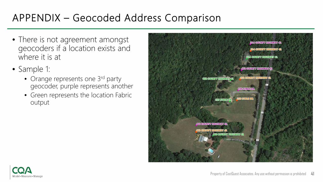
• There is not agreement amongst geocoders if a location exists and where it is at
• Sample 1:• Orange represents one 3rd party
geocoder, purple represents another• Green represents the location Fabric
output
APPENDIX – Geocoded Address Comparison