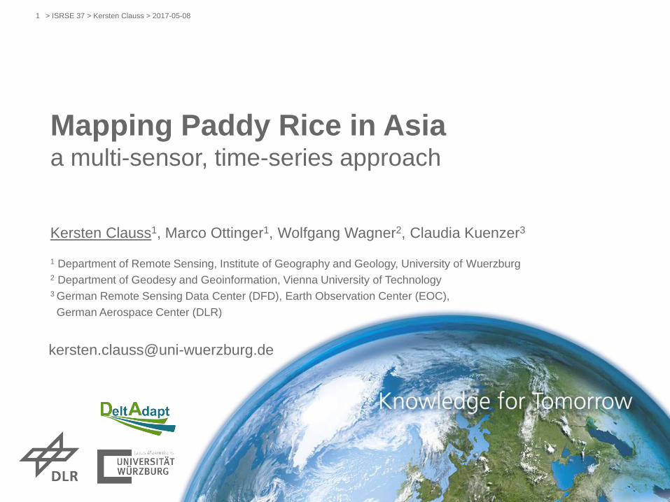
Mapping Paddy Rice in Asia
38
> ISRSE 37 > Kersten Clauss > 2017-05-08 1 Mapping Paddy Rice in Asia a multi-sensor, time-series approach Kersten Clauss 1 , Marco Ottinger 1 , Wolfgang Wagner 2 , Claudia Kuenzer 3 1 Department of Remote Sensing, Institute of Geography and Geology, University of Wuerzburg 2 Department of Geodesy and Geoinformation, Vienna University of Technology 3 German Remote Sensing Data Center (DFD), Earth Observation Center (EOC), German Aerospace Center (DLR) [email protected]
Transcript of Mapping Paddy Rice in Asia
> ISRSE 37 > Kersten Clauss > 2017-05-081
Mapping Paddy Rice in Asiaa multi-sensor, time-series approach
Kersten Clauss1, Marco Ottinger1, Wolfgang Wagner2, Claudia Kuenzer3
1 Department of Remote Sensing, Institute of Geography and Geology, University of Wuerzburg2 Department of Geodesy and Geoinformation, Vienna University of Technology3 German Remote Sensing Data Center (DFD), Earth Observation Center (EOC),
German Aerospace Center (DLR)
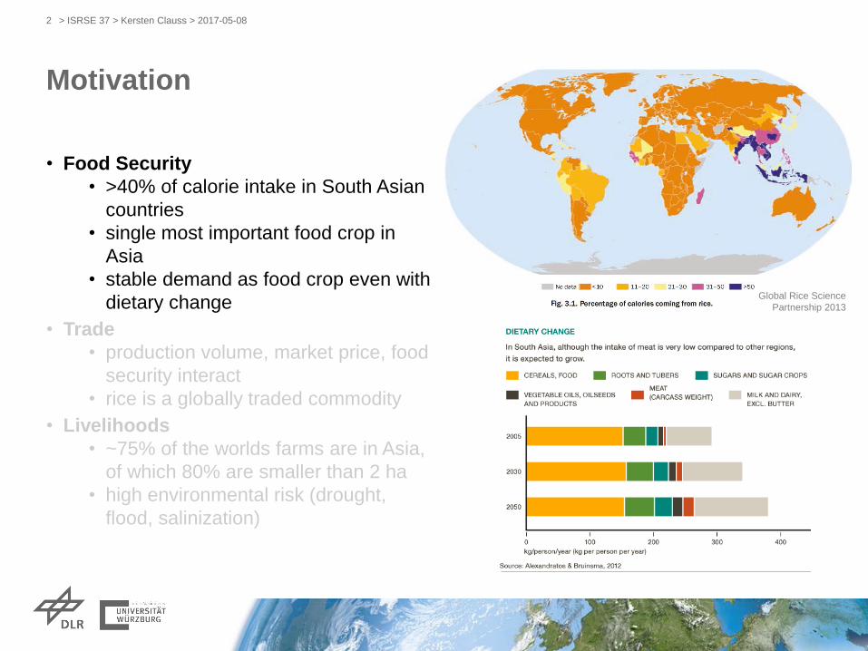
Motivation
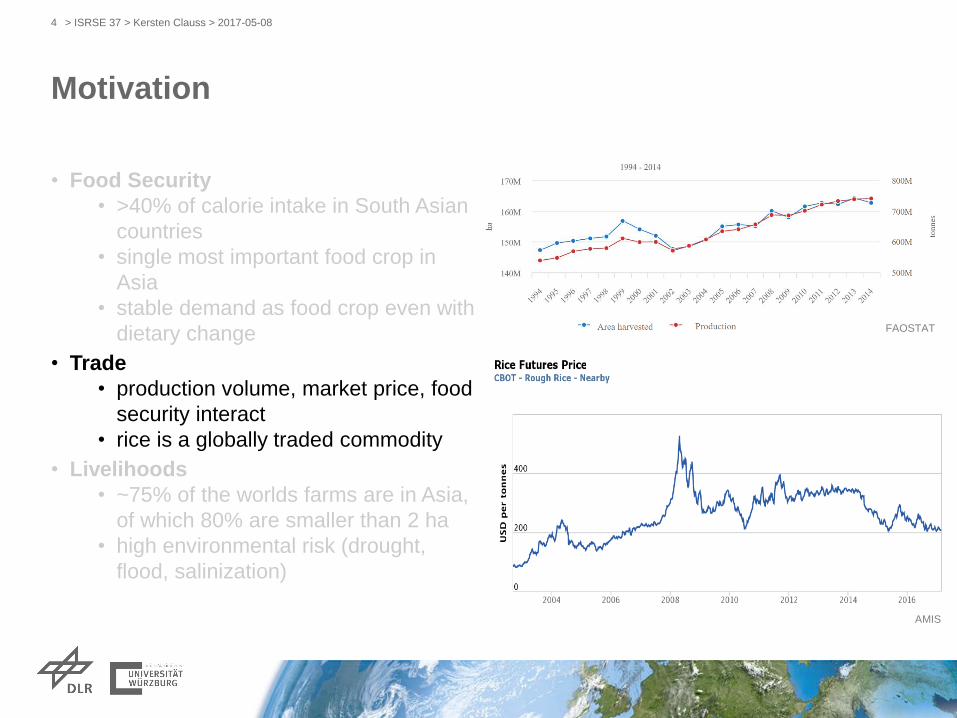
• Food Security
• >40% of calorie intake in South Asian
countries
• single most important food crop in
Asia
• stable demand as food crop even with
dietary change
• Trade
• production volume, market price, food
security interact
• rice is a globally traded commodity
• Livelihoods
• ~75% of the worlds farms are in Asia,
of which 80% are smaller than 2 ha
• high environmental risk (drought,
flood, salinization)
> ISRSE 37 > Kersten Clauss > 2017-05-082
Global Rice Science
Partnership 2013

Rice Production 2014
> ISRSE 37 > Kersten Clauss > 2017-05-083
0 >208 mio. tonnes
rice productionFAOSTAT
Motivation
• Food Security
• >40% of calorie intake in South Asian
countries
• single most important food crop in
Asia
• stable demand as food crop even with
dietary change
• Trade
• production volume, market price, food
security interact
• rice is a globally traded commodity
• Livelihoods
• ~75% of the worlds farms are in Asia,
of which 80% are smaller than 2 ha
• high environmental risk (drought,
flood, salinization)
> ISRSE 37 > Kersten Clauss > 2017-05-084
AMIS
FAOSTAT

Motivation
• Food Security
• >40% of calorie intake in South Asian
countries
• single most important food crop in
Asia
• stable demand as food crop even with
dietary change
• Trade
• production volume, market price, food
security interact
• rice is a globally traded commodity
• Livelihoods
• ~75% of the worlds farms are in Asia,
of which 80% are smaller than 2 ha
• high environmental risk (drought,
flood, salinization)
> ISRSE 37 > Kersten Clauss > 2017-05-085
DeltAdapt project
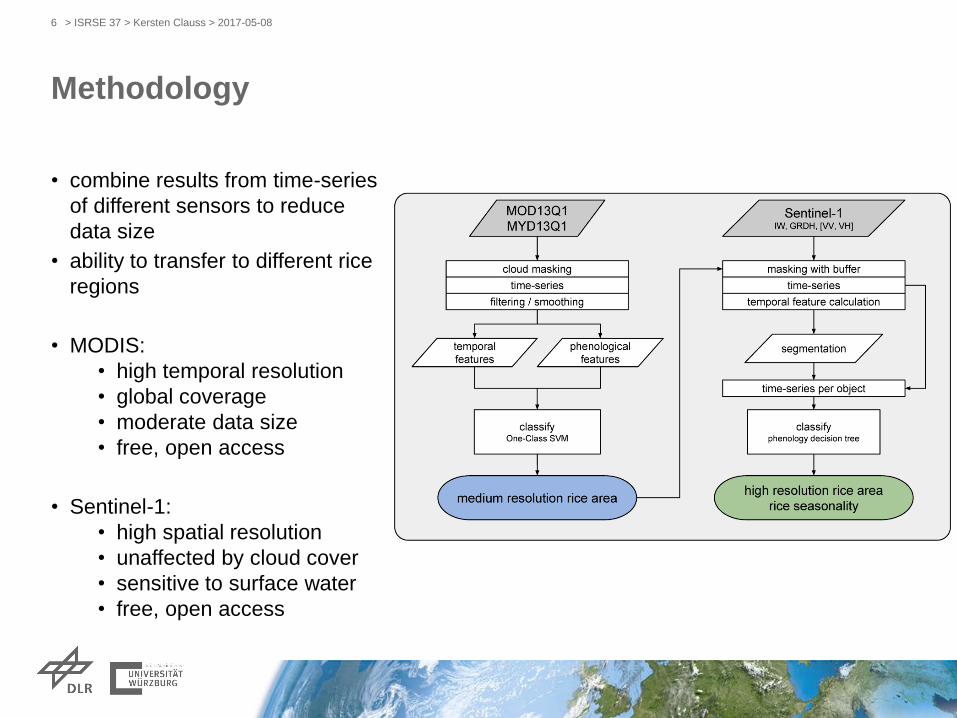
Methodology
• combine results from time-series
of different sensors to reduce
data size
• ability to transfer to different rice
regions
• MODIS:
• high temporal resolution
• global coverage
• moderate data size
• free, open access
• Sentinel-1:
• high spatial resolution
• unaffected by cloud cover
• sensitive to surface water
• free, open access
> ISRSE 37 > Kersten Clauss > 2017-05-086
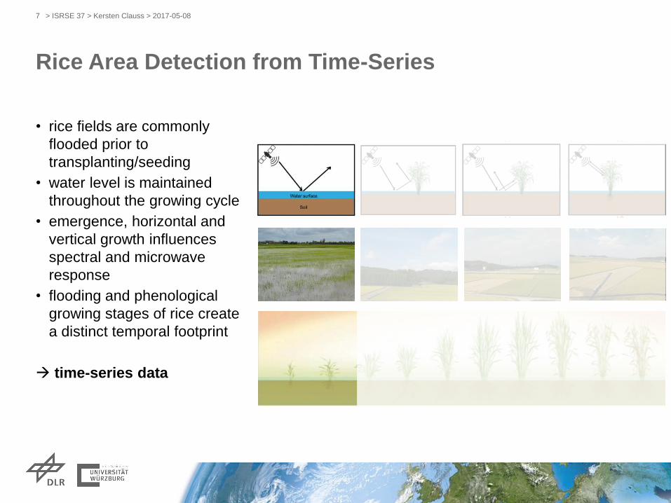
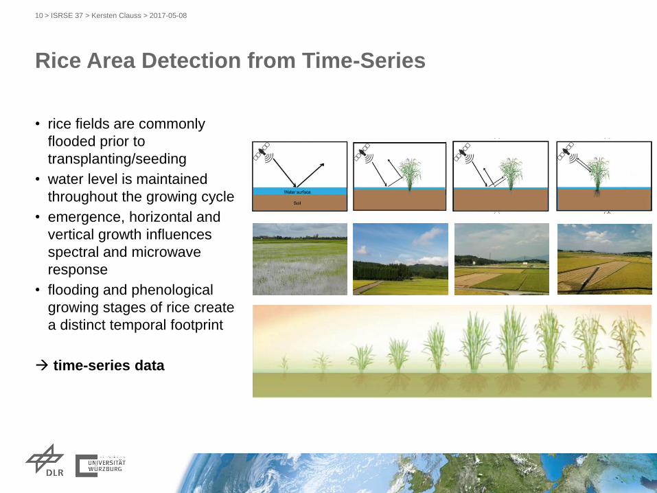
Rice Area Detection from Time-Series
• rice fields are commonly
flooded prior to
transplanting/seeding
• water level is maintained
throughout the growing cycle
• emergence, horizontal and
vertical growth influences
spectral and microwave
response
• flooding and phenological
growing stages of rice create
a distinct temporal footprint
time-series data
> ISRSE 37 > Kersten Clauss > 2017-05-087

Rice Area Detection from Time-Series
• rice fields are commonly
flooded prior to
transplanting/seeding
• water level is maintained
throughout the growing cycle
• emergence, horizontal and
vertical growth influences
spectral and microwave
response
• flooding and phenological
growing stages of rice create
a distinct temporal footprint
time-series data
> ISRSE 37 > Kersten Clauss > 2017-05-088
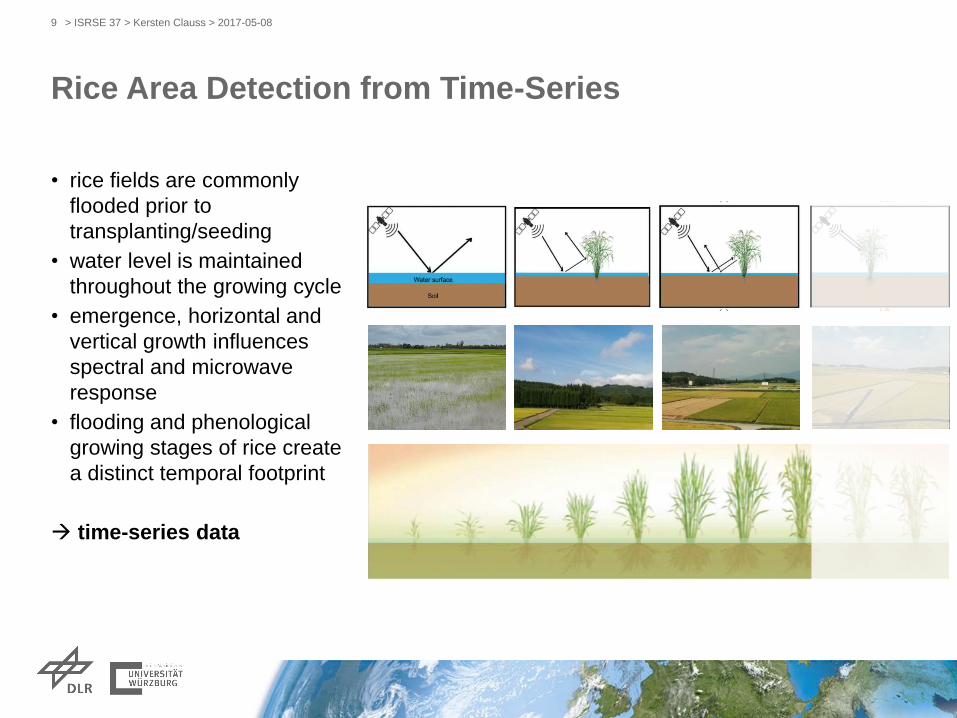
Rice Area Detection from Time-Series
• rice fields are commonly
flooded prior to
transplanting/seeding
• water level is maintained
throughout the growing cycle
• emergence, horizontal and
vertical growth influences
spectral and microwave
response
• flooding and phenological
growing stages of rice create
a distinct temporal footprint
time-series data
> ISRSE 37 > Kersten Clauss > 2017-05-089
Rice Area Detection from Time-Series
• rice fields are commonly
flooded prior to
transplanting/seeding
• water level is maintained
throughout the growing cycle
• emergence, horizontal and
vertical growth influences
spectral and microwave
response
• flooding and phenological
growing stages of rice create
a distinct temporal footprint
time-series data
> ISRSE 37 > Kersten Clauss > 2017-05-0810
Clauss, Yan, Kuenzer (2016)
doi:10.3390/rs8050434
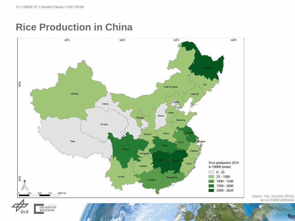
Rice Production in China
> ISRSE 37 > Kersten Clauss > 2017-05-0811
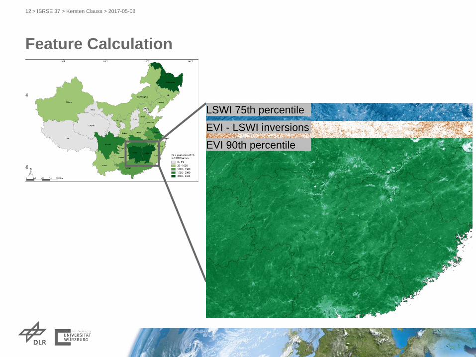
Feature Calculation
> ISRSE 37 > Kersten Clauss > 2017-05-0812
LSWI 75th percentile
EVI - LSWI inversions
EVI 90th percentile
Feature Calculation
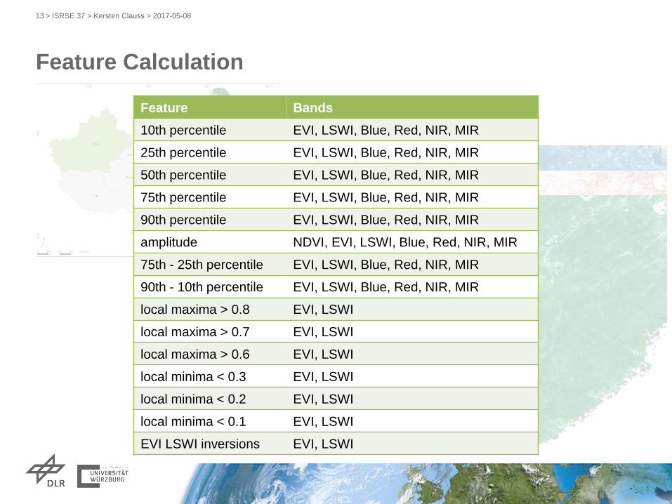
> ISRSE 37 > Kersten Clauss > 2017-05-0813
LSWI 75th percentile
EVI - LSWI inversions
EVI 90th percentile
Feature Bands
10th percentile EVI, LSWI, Blue, Red, NIR, MIR
25th percentile EVI, LSWI, Blue, Red, NIR, MIR
50th percentile EVI, LSWI, Blue, Red, NIR, MIR
75th percentile EVI, LSWI, Blue, Red, NIR, MIR
90th percentile EVI, LSWI, Blue, Red, NIR, MIR
amplitude NDVI, EVI, LSWI, Blue, Red, NIR, MIR
75th - 25th percentile EVI, LSWI, Blue, Red, NIR, MIR
90th - 10th percentile EVI, LSWI, Blue, Red, NIR, MIR
local maxima > 0.8 EVI, LSWI
local maxima > 0.7 EVI, LSWI
local maxima > 0.6 EVI, LSWI
local minima < 0.3 EVI, LSWI
local minima < 0.2 EVI, LSWI
local minima < 0.1 EVI, LSWI
EVI LSWI inversions EVI, LSWI
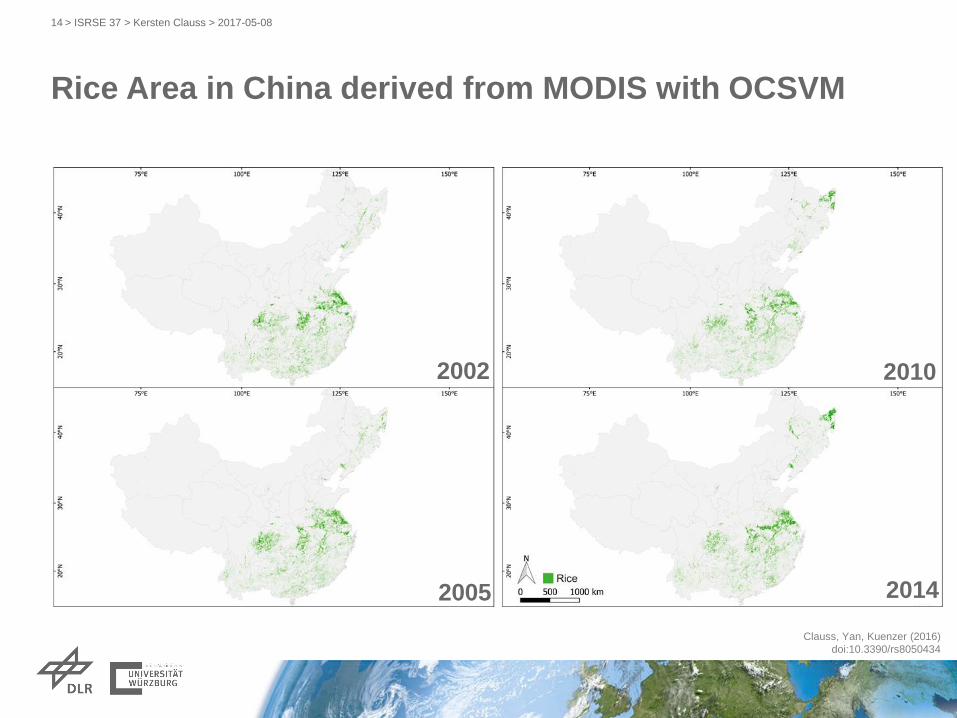
Rice Area in China derived from MODIS with OCSVM
> ISRSE 37 > Kersten Clauss > 2017-05-0814
2002
2005
2010
2014
Clauss, Yan, Kuenzer (2016)
doi:10.3390/rs8050434

2014
2010
2005
Rice Area Change - Beimin Lake
Clauss, Yan, Kuenzer (2016)
doi:10.3390/rs8050434
2002
> ISRSE 37 > Kersten Clauss > 2017-05-0815
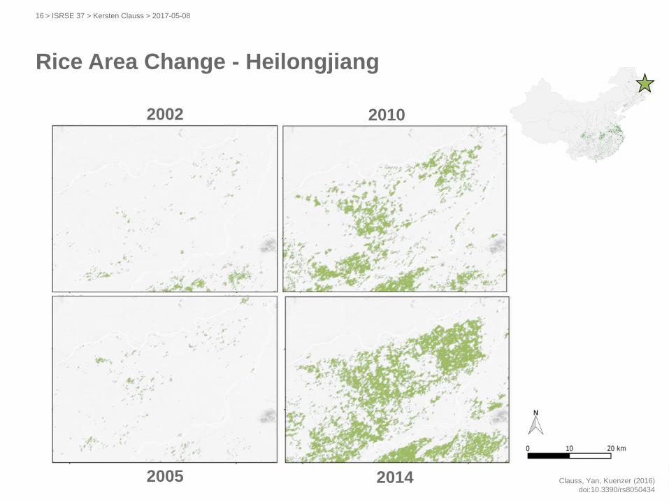
Rice Area Change - Heilongjiang
2014
2010
2005
2002
> ISRSE 37 > Kersten Clauss > 2017-05-0816
Clauss, Yan, Kuenzer (2016)
doi:10.3390/rs8050434

Accuracy Assessment
> ISRSE 37 > Kersten Clauss > 2017-05-0817
classified area compared to statistical yearbook data
Overall
Accuracy
User‘s
Accuracy
Producer‘s
Accuracy
rice no rice rice no rice
0.90 0.90 0.89 0.89 0.79
Clauss, Yan, Kuenzer (2016)
doi:10.3390/rs8050434

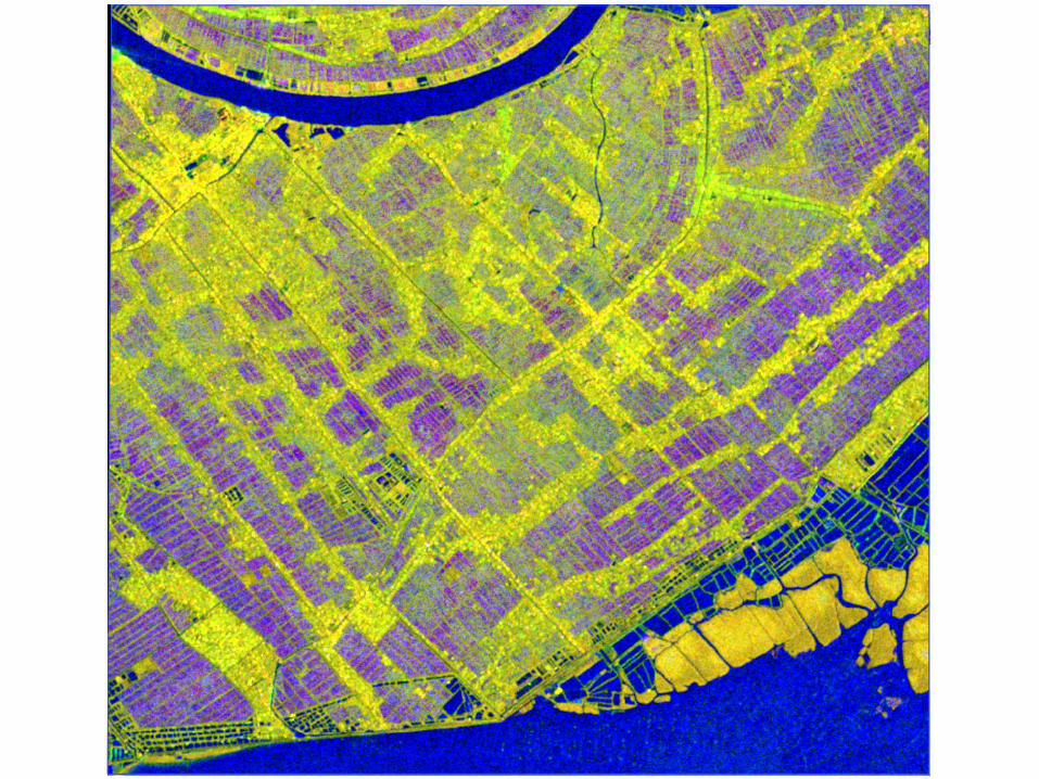
Sentinel-1 Coverage 2015
Clauss, Ottinger, Kuenzer (2017)
in review
Sentinel-1A IW DV coverage 2015
> ISRSE 37 > Kersten Clauss > 2017-05-0818
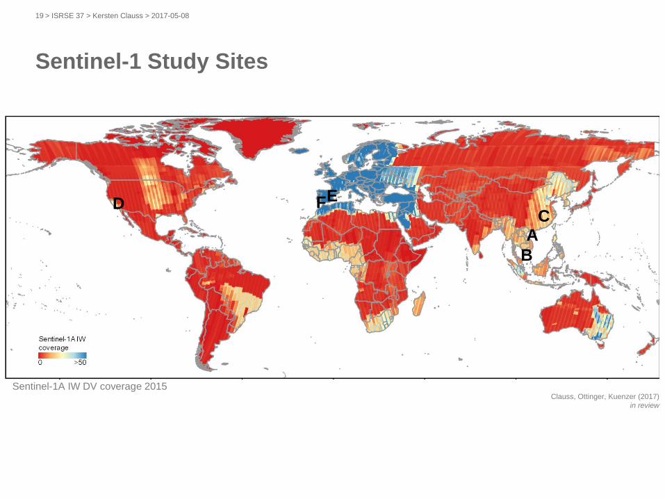
Sentinel-1 Study Sites
Clauss, Ottinger, Kuenzer (2017)
in review
Sentinel-1A IW DV coverage 2015
A
B
CFED
> ISRSE 37 > Kersten Clauss > 2017-05-0819
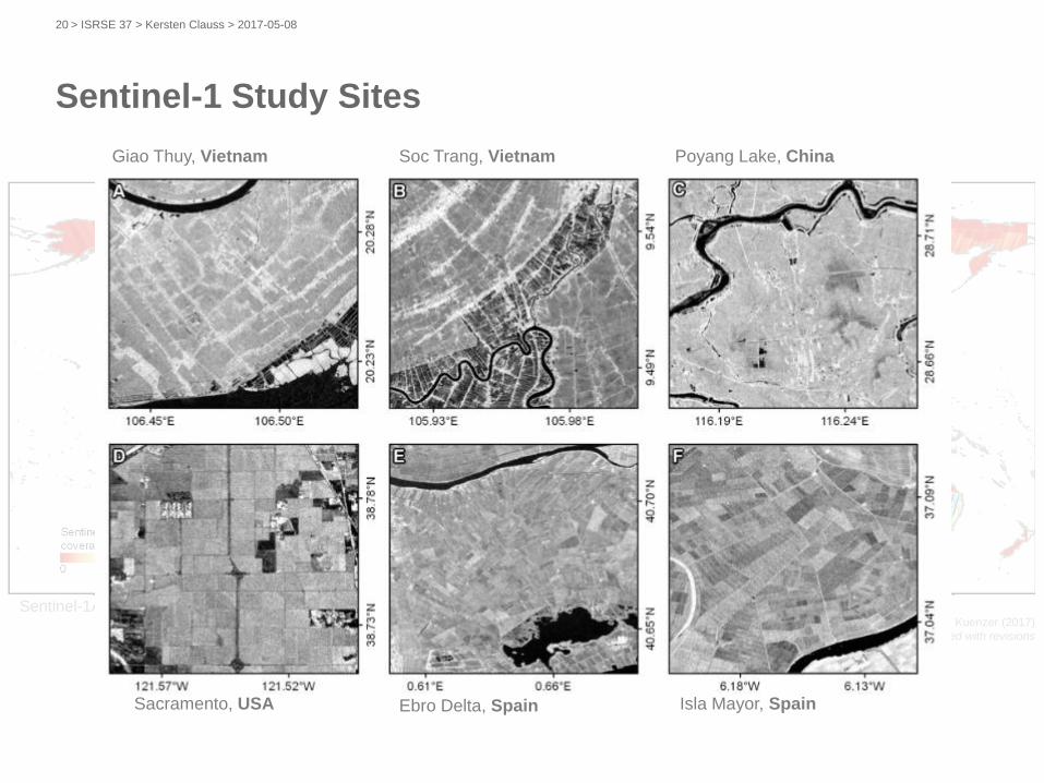
Sentinel-1 Study Sites
Clauss, Ottinger, Kuenzer (2017)
accepted with revisions
Sentinel-1A IW DV coverage 2015
A
B
CFED
Giao Thuy, Vietnam Soc Trang, Vietnam Poyang Lake, China
Sacramento, USA Ebro Delta, Spain Isla Mayor, Spain
> ISRSE 37 > Kersten Clauss > 2017-05-0820
Clauss, Ottinger, Kuenzer (2017)
in review
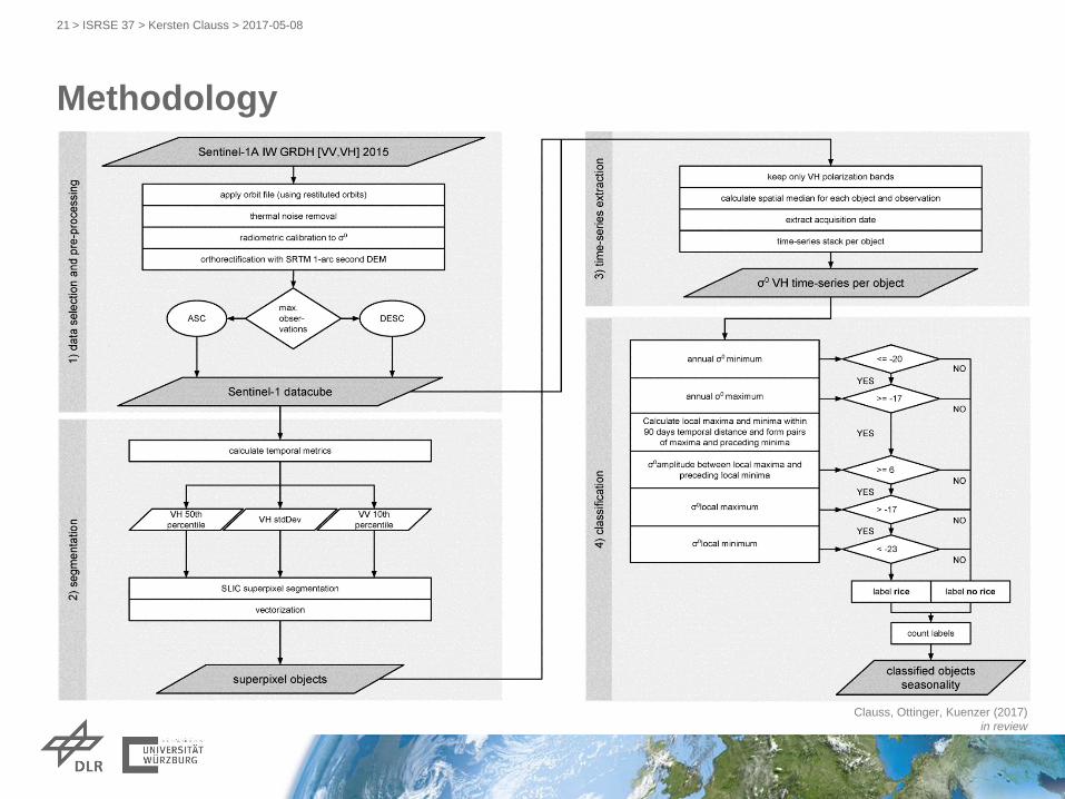
Methodology
> ISRSE 37 > Kersten Clauss > 2017-05-0821
Clauss, Ottinger, Kuenzer (2017)
in review
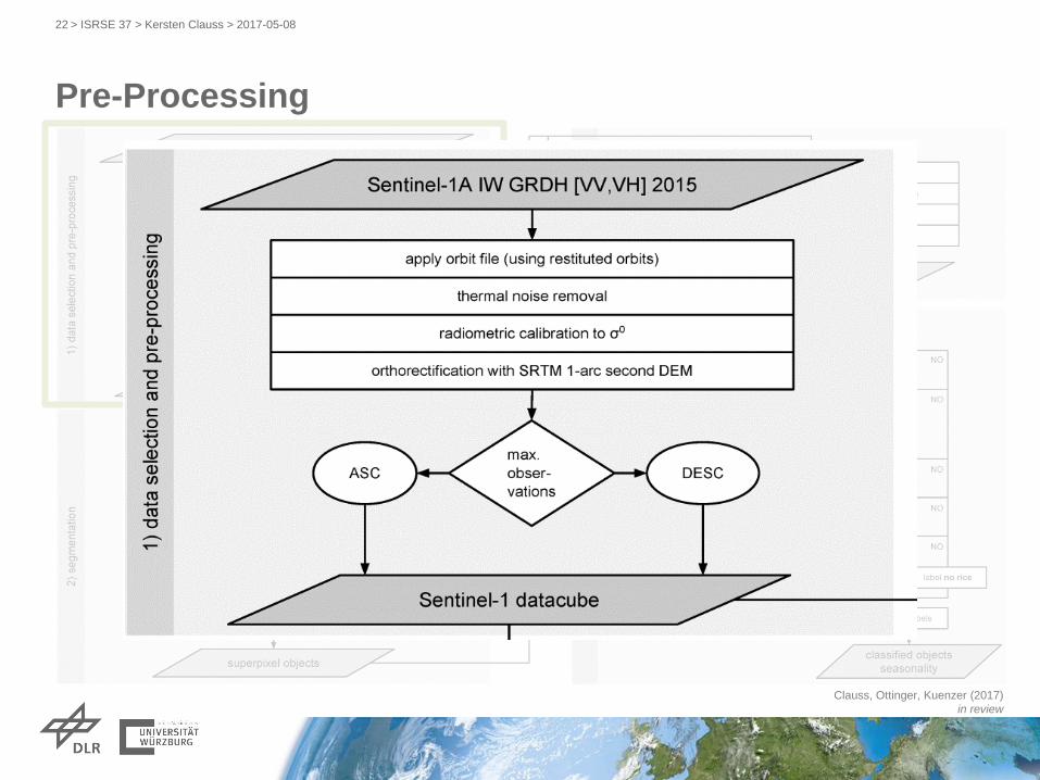
Pre-Processing
> ISRSE 37 > Kersten Clauss > 2017-05-0822
Clauss, Ottinger, Kuenzer (2017)
in review
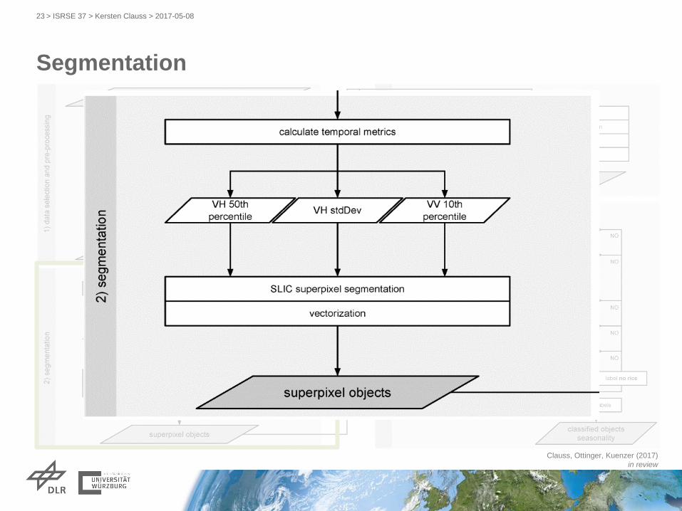
Segmentation
> ISRSE 37 > Kersten Clauss > 2017-05-0823
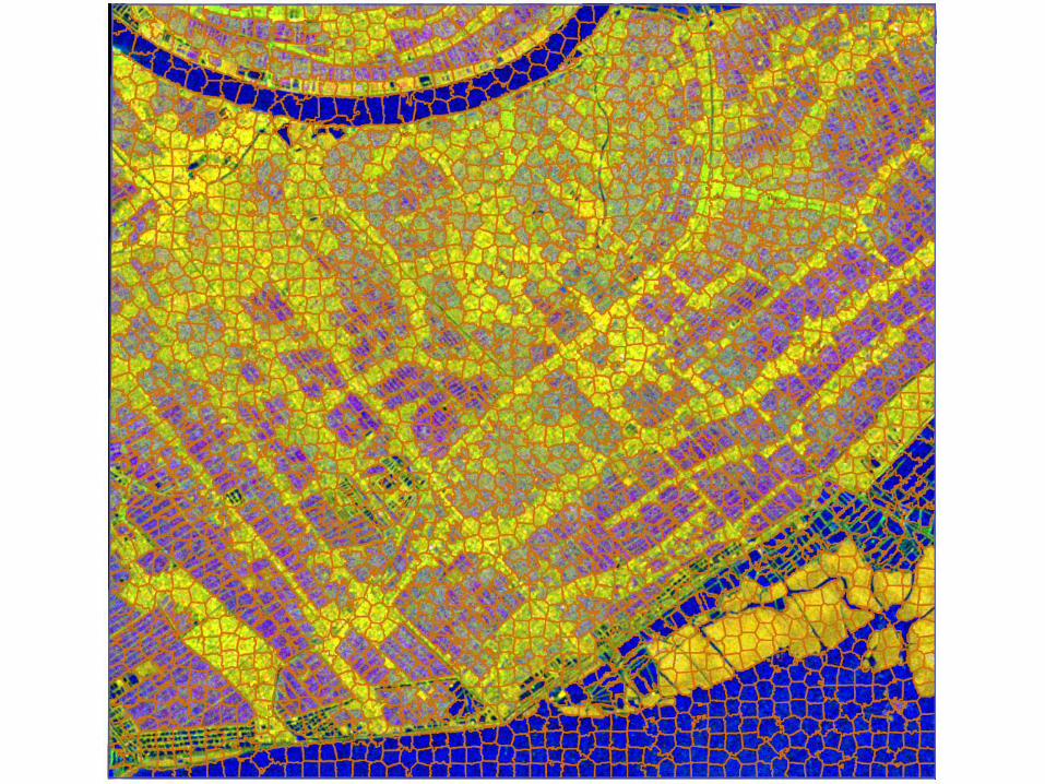

Clauss, Ottinger, Kuenzer (2017)
accepted with revisions
Time Series per Object
> ISRSE 37 > Kersten Clauss > 2017-05-0826


from time series per pixel to
time series per object
Classification
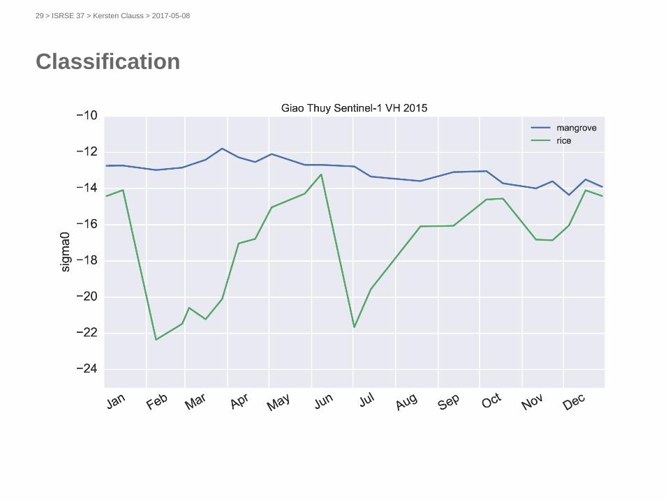
> ISRSE 37 > Kersten Clauss > 2017-05-0829
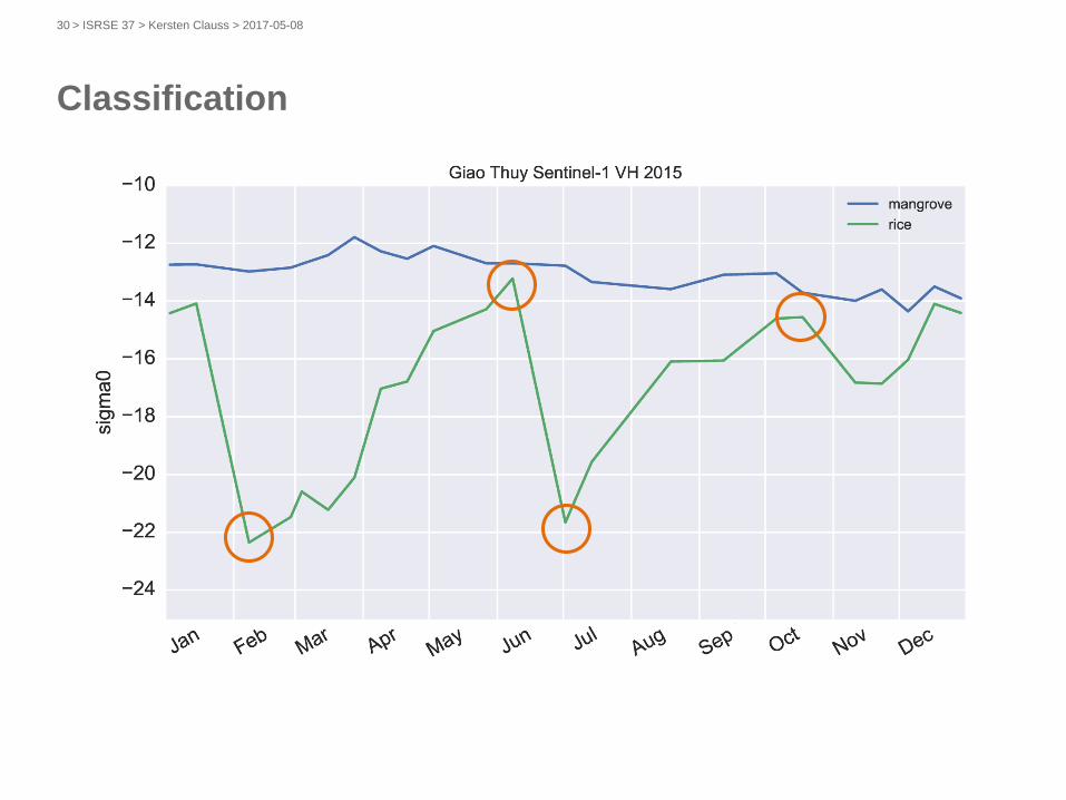
Classification
> ISRSE 37 > Kersten Clauss > 2017-05-0830
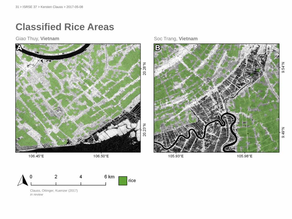
Giao Thuy, Vietnam Soc Trang, Vietnam
Classified Rice Areas
Clauss, Ottinger, Kuenzer (2017)
in review
> ISRSE 37 > Kersten Clauss > 2017-05-0831
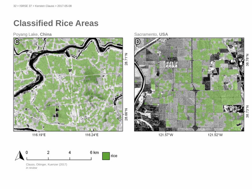
Poyang Lake, China Sacramento, USA
Classified Rice Areas
Clauss, Ottinger, Kuenzer (2017)
in review
> ISRSE 37 > Kersten Clauss > 2017-05-0832
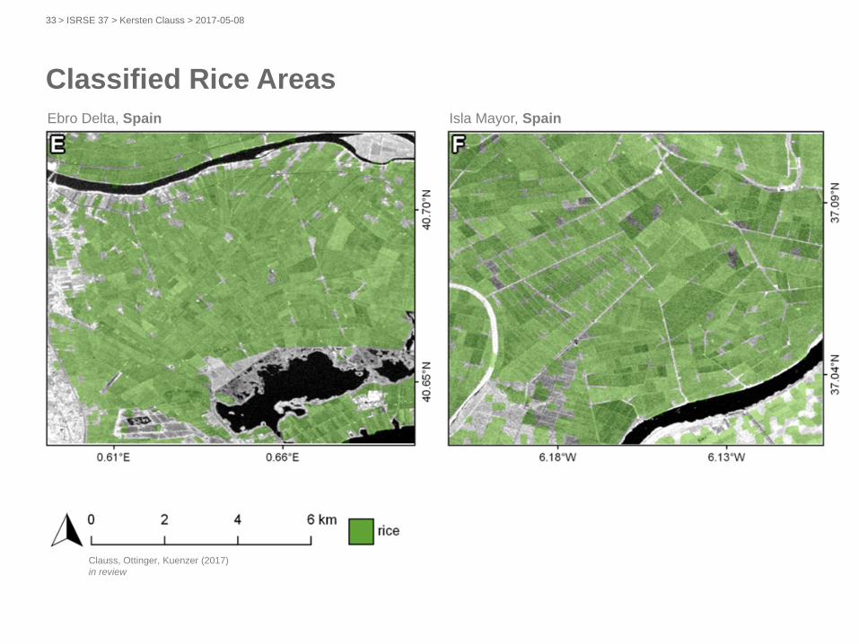
Ebro Delta, Spain Isla Mayor, Spain
Classified Rice Areas
Clauss, Ottinger, Kuenzer (2017)
in review
> ISRSE 37 > Kersten Clauss > 2017-05-0833
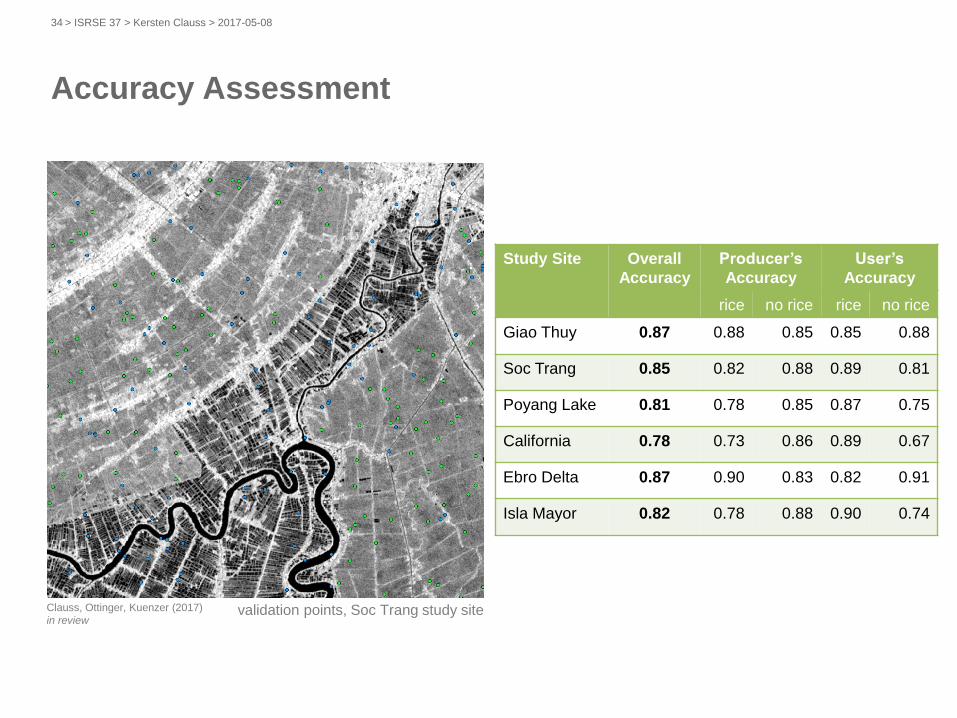
validation points, Soc Trang study site
Study Site Overall
Accuracy
Producer’s
Accuracy
User’s
Accuracy
rice no rice rice no rice
Giao Thuy 0.87 0.88 0.85 0.85 0.88
Soc Trang 0.85 0.82 0.88 0.89 0.81
Poyang Lake 0.81 0.78 0.85 0.87 0.75
California 0.78 0.73 0.86 0.89 0.67
Ebro Delta 0.87 0.90 0.83 0.82 0.91
Isla Mayor 0.82 0.78 0.88 0.90 0.74
Clauss, Ottinger, Kuenzer (2017)
in review
Accuracy Assessment
> ISRSE 37 > Kersten Clauss > 2017-05-0834
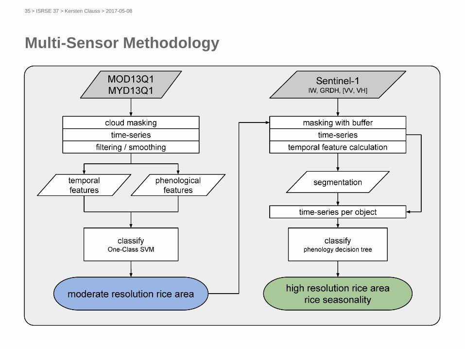
Multi-Sensor Methodology
> ISRSE 37 > Kersten Clauss > 2017-05-0835

Moderate Resolution Rice Area (MODIS)
Mekong Delta,
Vietnam
rice 2015
> ISRSE 37 > Kersten Clauss > 2017-05-0836
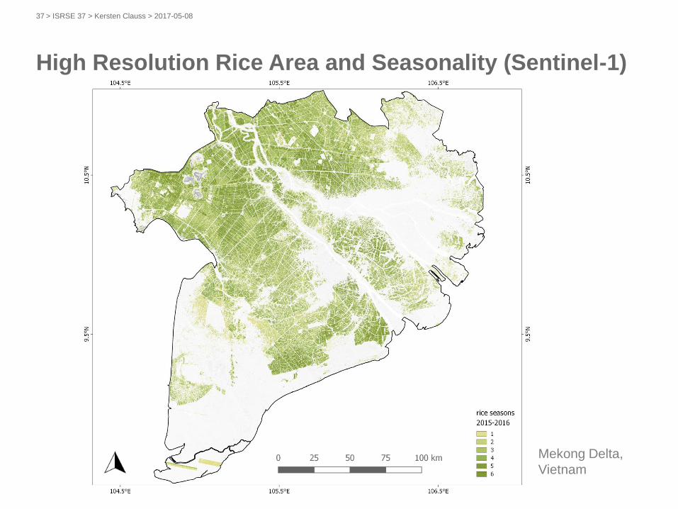
High Resolution Rice Area and Seasonality (Sentinel-1)
Mekong Delta,
Vietnam
> ISRSE 37 > Kersten Clauss > 2017-05-0837
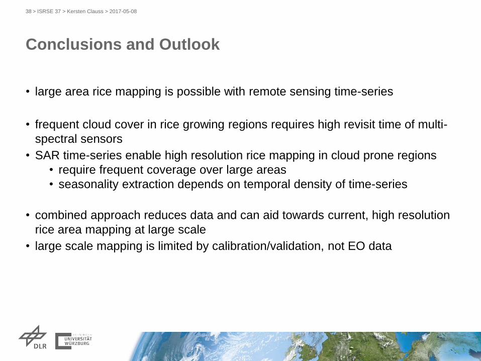
• large area rice mapping is possible with remote sensing time-series
• frequent cloud cover in rice growing regions requires high revisit time of multi-
spectral sensors
• SAR time-series enable high resolution rice mapping in cloud prone regions
• require frequent coverage over large areas
• seasonality extraction depends on temporal density of time-series
• combined approach reduces data and can aid towards current, high resolution
rice area mapping at large scale
• large scale mapping is limited by calibration/validation, not EO data
Conclusions and Outlook
> ISRSE 37 > Kersten Clauss > 2017-05-0838